
>FrescoBot m Bot: link syntax and minor changes |
m small changes |
||
| (One intermediate revision by one other user not shown) | |||
| Line 1: | Line 1: | ||
{{pp|small=yes}} | |||
{{Short description|City in West Bengal, India}} | |||
{{Redirect|Kalyani, India|other places|Kalyani (disambiguation)#Places{{!}}Kalyani § Places}} | |||
{{Multiple issues| | {{Multiple issues| | ||
{{more citations needed|date=November 2015}} | {{more citations needed|date=November 2015}} | ||
| Line 6: | Line 9: | ||
{{Use Indian English|date=December 2018}} | {{Use Indian English|date=December 2018}} | ||
{{Infobox settlement | {{Infobox settlement | ||
| name | | name = Kalyani | ||
| settlement_type = City | |||
| settlement_type | | image_skyline = Kalyani railway station main and branch, Kalyani Nadia, West Bengal 01.jpg | ||
| image_skyline | | image_caption = [[Kalyani main railway station]] | ||
| pushpin_map = India West Bengal#India | |||
| image_caption | | pushpin_label_position = right | ||
| pushpin_map | | pushpin_map_caption = Location in West Bengal, India | ||
| pushpin_label_position | | coordinates = {{coord|22|58|30|N|88|26|04|E|display=inline,title}} | ||
| subdivision_type = [[Country]] | |||
| pushpin_map_caption | | subdivision_type1 = [[States and territories of India|State]] | ||
| coordinates | | subdivision_type2 = [[Administrative divisions of West Bengal|Division]] | ||
| subdivision_type | | subdivision_type3 = [[List of subdivisions of West Bengal|Subdivision]] | ||
| subdivision_type4 = [[List of districts of West Bengal|District]] | |||
| subdivision_type1 | | subdivision_name = {{Flag|India}} | ||
| subdivision_type2 | | subdivision_name1 = {{flagicon image|Emblem of West Bengal (Banglarmukh) before 2018.png}} [[West Bengal]] | ||
| | | subdivision_name2 = [[Presidency division|Presidency]] | ||
| subdivision_name1 | | subdivision_name3 = [[Kalyani subdivision|Kalyani]] | ||
| subdivision_name2 | | subdivision_name4 = [[Nadia district|Nadia]] | ||
| subdivision_name3 | | established_title = Foundation stone laid | ||
| established_title | | established_date = 24 February 1951 | ||
| established_date | | founder = [[Bidhan Chandra Roy]] | ||
| founder | | government_type = [[Municipal Corporations in India|Municipality & BDO]] | ||
| | | governing_body = Kalyani Municipality & Kalyani BDO | ||
| | | leader_title = [[Member of the Legislative Assembly (India)|MLA]] | ||
| governing_body | | leader_name = [[Ambika Roy]] | ||
| leader_title | | leader_title1 = [[Member of Parliament, Lok Sabha|MP]] | ||
| leader_name | | leader_name1 = [[Shantanu Thakur]] | ||
| leader_title1 | | unit_pref = Metric | ||
| leader_name1 | | area_footnotes = <ref name='Kalyani City'>{{cite web|title=Kalyani City|url=https://www.sudawb.org/wbdma_oldversion/HTM/DIS/MUNI_ULB_Kalyani.htm|website=sudawb.org|access-date=25 November 2020}}</ref> | ||
| unit_pref | | area_total_km2 = 29.21 | ||
| area_footnotes | | elevation_m = 11 | ||
| area_total_km2 | | population_total = 100,620 | ||
| population_as_of = 2011 | |||
| population_footnotes = <ref name="pop"/> | |||
| elevation_m | | population_density_km2 = auto | ||
| population_total | | demographics_type1 = Languages | ||
| population_as_of | | demographics1_title1 = Official | ||
| population_footnotes | | demographics1_info1 = [[Bengali language|Bengali]]<ref>{{cite web|title=52nd Report of the Commissioner for Linguistic Minorities in India |url=http://nclm.nic.in/shared/linkimages/NCLM52ndReport.pdf|website=Nclm.nic.in|publisher=[[Ministry of Minority Affairs]]|access-date=28 August 2019|page=85|url-status=dead|archive-url=https://web.archive.org/web/20170525141614/http://nclm.nic.in/shared/linkimages/NCLM52ndReport.pdf|archive-date=25 May 2017}}</ref><ref name="wblangoff">{{cite web|title=Fact and Figures|url=https://wb.gov.in/portal/web/guest/facts-and-figures;jsessionid=JzdD9RHb7aMY5esZPtcsIVLy|website=Wb.gov.in|access-date=28 August 2019}}</ref> | ||
| population_density_km2 | | demographics1_title2 = Additional official | ||
| demographics1_info2 = [[English language|English]]<ref name="wblangoff"/> | |||
| timezone1 = [[Indian Standard Time|IST]] | |||
| demographics_type1 | | utc_offset1 = +5:30 | ||
| demographics1_title1 | | postal_code_type = [[Postal Index Number|PIN]] | ||
| demographics1_info1 | | postal_code = 741235, 741245, 741234, 741250, 741251 | ||
| demographics1_title2 | | area_code = +91 33 | ||
| demographics1_info2 | | area_code_type = Telephone code | ||
| timezone1 | | iso_code = [[ISO 3166-2:IN|IN-WB]] | ||
| utc_offset1 | | registration_plate = WB-90 & WB-89 | ||
| postal_code_type | | blank1_name_sec1 = [[Human sex ratio|Sex ratio]] | ||
| postal_code | | blank1_info_sec1 = 978 [[male|♂]]/[[female|♀]] | ||
| area_code | | website = {{URL|http://www.kalyanimunicipality.org/}} | ||
| area_code_type | | blank2_name_sec1 = [[Lok Sabha]] constituency | ||
| iso_code | | blank2_info_sec1 = [[Bangaon (Lok Sabha constituency)|Bangaon]] | ||
| registration_plate | | blank3_name_sec1 = [[Vidhan Sabha]] constituency | ||
| blank1_name_sec1 | | blank3_info_sec1 = [[Kalyani (Vidhan Sabha constituency)|Kalyani]] | ||
| blank1_info_sec1 | |||
| website | |||
| blank2_name_sec1 | |||
| blank2_info_sec1 | |||
| blank3_name_sec1 | |||
| blank3_info_sec1 | |||
}} | }} | ||
'''Kalyani''' is a city and a municipality | '''Kalyani''' is a city and a municipality & BDO in the [[Nadia district]] of the [[Indian state]] of [[West Bengal]]. It is the headquarters of [[Kalyani subdivision]] and part of the [[Presidency division]]. Kalyani is a part of the area covered by the [[Kolkata Metropolitan Development Authority]] (KMDA).<ref>{{cite web| url =http://www.cmdaonline.com/kma.html| title =Base Map of Kolkata Metropolitan area| access-date =2007-09-03| publisher =Kolkata Metropolitan Development Authority| url-status =dead| archive-url =https://web.archive.org/web/20070928000049/http://www.cmdaonline.com/kma.html| archive-date =2007-09-28}}</ref> | ||
==History== | ==History== | ||
Kalyani, located in Nadia district in the state of West Bengal, is a relatively young town. During the [[Second World War]], Kalyani, was the site of an American military airbase, formed out of | Kalyani, located in Nadia district in the state of West Bengal, is a relatively young town. During the [[Second World War]], Kalyani, was the site of an [[List of United States military bases|American military airbase]], formed out of 21 villages in the district of Nadia.<ref name=kalyanihistory>{{cite news|last1=Bhattacharya|first1=Bitan|title=সামরিক শহরের স্মৃতি নিয়ে বেড়ে উঠেছে কল্যাণী|url=http://www.anandabazar.com/district/nodia-murshidabbad/%E0%A6%B8-%E0%A6%AE%E0%A6%B0-%E0%A6%95-%E0%A6%B6%E0%A6%B9%E0%A6%B0-%E0%A6%B0-%E0%A6%B8-%E0%A6%AE-%E0%A6%A4-%E0%A6%A8-%E0%A7%9F-%E0%A6%AC-%E0%A7%9C-%E0%A6%89%E0%A6%A0-%E0%A6%9B-%E0%A6%95%E0%A6%B2-%E0%A6%AF-%E0%A6%A3-1.104947|access-date=1 August 2015|publisher=Ananda Bazar Patrika|date=13 January 2015}}</ref> | ||
The military garrison town was named after the | The military garrison town was named after the then-sitting [[President of the United States]] [[Franklin D. Roosevelt]] as "Roosevelt Town" or "Roosevelt ''Nagar''", with "nagar" meaning "town" in many [[Indo-Aryan languages]], including [[Bengali language|Bengali]]. Hangars and other reminders of the airfield are still visible in the 'A' Block and some areas around Kalyani University, whose buildings were built on or over the runways.<ref name="kalyanihistory" /> After [[World War II]], the [[United States Army Air Forces|United States Army Air Force]] left the base, and the airfield and hangars went into disuse. | ||
The development of modern Kalyani is credited to former Chief Minister of West Bengal, [[Bidhan Chandra Roy]]. After [[ | The development of modern Kalyani is credited to the former [[Chief Minister of West Bengal]], [[Bidhan Chandra Roy]]. After the [[independence of India]] in 1947, the master plan of the town was developed and the foundation stone for the town was laid by the then Governor of West Bengal, [[Kailashnath Katju]], on 24 February 1951.<ref name="kalyanihistory" /> The town was built quickly in order to host the 59th [[Indian National Congress]] meeting in 1954. In memoriam of that conference, a road of the town was named as 'Congress Road'. In 1957, the Kalyani police station was formed, and in 1979, the rail line was extended from [[Kalyani main railway station|Kalyani Central]] to [[Kalyani Simanta railway station|Kalyani Simanta station]], and also established direct connectivity to Kolkata through Kalyani Simanta local EMU trains.<ref name="kalyanihistory" /> | ||
In 1995, Kalyani Municipality was established, which has been crucial in the development of infrastructure in Kalyani.<ref name=kalyanihistory /> In 2014, Kalyani was selected as a candidate for "Smart City" project. | In 1995, the Kalyani Municipality was established, which has been crucial in the development of infrastructure in Kalyani.<ref name=kalyanihistory /> In 2014, Kalyani was selected as a candidate for a "Smart City" project. Although this project has since been abandoned by the State Government. | ||
==Geography and urban structure== | ==Geography and urban structure== | ||
Kalyani is located in the [[Nadia district]] of [[West Bengal]], within the [[Kolkata metropolitan area]]. Kalyani lies along the east bank of the [[Hooghly River]], within the upper [[Ganges Delta]]. As with most of the [[Indo-Gangetic Plain]], the soil and water are predominantly [[alluvium|alluvial]] in origin. Kalyani is located over the "Bengal basin", a pericratonic tertiary basin.<ref name="soil characterization">{{cite conference |url=http://gndec.ac.in/~igs/ldh/conf/2009/articles/T01_03.pdf |title= Characterization of soil over Kolkata municipal area|first1=Diptendra |last1= Das|first2=B.C.|last2=Chattopadhyay |date= 17–19 December 2009|conference=Indian Geotechnical Conference |conference-url= http://gndec.ac.in/~igs/ldh/conf/2009/|volume= 1 |location= Guntur, India|pages=11–12 |access-date=19 November 2012 }}</ref> According to the [[Bureau of Indian Standards]], on a scale ranging from {{nowrap|I to V}} in order of increasing susceptibility to earthquakes, the city lies inside [[Earthquake hazard zoning of India|seismic zone III]];<ref name=hazardprofile>{{cite web|url=http://www.undp.org.in/dmweb/hazardprofile.pdf|title=Hazard profiles of Indian districts|access-date=23 August 2006|work=National Capacity Building Project in Disaster Management |publisher=[[UNDP]]|archive-url=https://web.archive.org/web/20060519100611/http://www.undp.org.in/dmweb/hazardprofile.pdf|archive-date=19 May 2006}}</ref> according to a [[United Nations Development Programme]] report, its wind and cyclone zone is "very high damage risk".<ref name=hazardprofile/> | Kalyani is located in the [[Nadia district]] of [[West Bengal]], within the [[Kolkata metropolitan area]]. Kalyani lies along the east bank of the [[Hooghly River]], within the upper [[Ganges Delta]]. As with most of the [[Indo-Gangetic Plain]], the soil and water are predominantly [[alluvium|alluvial]] in origin. Kalyani is located over the "Bengal basin", a pericratonic tertiary basin.<ref name="soil characterization">{{cite conference |url=http://gndec.ac.in/~igs/ldh/conf/2009/articles/T01_03.pdf |title= Characterization of soil over Kolkata municipal area|first1=Diptendra |last1= Das|first2=B.C.|last2=Chattopadhyay |date= 17–19 December 2009|conference=Indian Geotechnical Conference |conference-url= http://gndec.ac.in/~igs/ldh/conf/2009/|volume= 1 |location= Guntur, India|pages=11–12 |access-date=19 November 2012 }}</ref> According to the [[Bureau of Indian Standards]], on a scale ranging from {{nowrap|I to V}} in order of increasing susceptibility to earthquakes, the city lies inside [[Earthquake hazard zoning of India|seismic zone III]];<ref name=hazardprofile>{{cite web|url=http://www.undp.org.in/dmweb/hazardprofile.pdf|title=Hazard profiles of Indian districts|access-date=23 August 2006|work=National Capacity Building Project in Disaster Management |publisher=[[UNDP]]|archive-url=https://web.archive.org/web/20060519100611/http://www.undp.org.in/dmweb/hazardprofile.pdf|archive-date=19 May 2006}}</ref> according to a [[United Nations Development Programme]] report, its wind and cyclone zone is "very high damage risk".<ref name=hazardprofile/> | ||
Kalyani is a planned city, having underground drainage systems, tree-lined avenues, community parks, paved roads intersecting each other at 90-degree angle. The city itself is divided into four blocks — Block A, Block B, Block C and Block D, which are further divided into sub-blocks. Block A and B are mostly residential in character with commercial markets. Main Post Office, Industrial Training Institute, Government offices and the Public Library along with offices of major Banks are situated in Block B. Whereas the Kalyani main station, State General Hospital, Medical college are situated in A Block. Block C and Block D are located to the north of Kalyani Simanta branch line. Block C is reserved for institutional use and is largely occupied by the [[Kalyani University]] and [[Kalyani Government Engineering College]]. Block D is the industrial zone, consisting of many small and medium-sized industries. | Kalyani is a planned city, having underground drainage systems, tree-lined avenues, community parks, paved roads intersecting each other at 90-degree angle. The city itself is divided into four blocks — Block A, Block B, Block C and Block D, which are further divided into sub-blocks. Block A and B are mostly residential in character with commercial markets. Main Post Office, Industrial Training Institute, Government offices and the Public Library along with offices of major Banks are situated in Block B. Whereas the Kalyani main station, State General Hospital, Medical college are situated in A Block. Block C and Block D are located to the north of Kalyani Simanta branch line. Block C is reserved for institutional use and is largely occupied by the [[Kalyani University]] and [[Kalyani Government Engineering College]]. Block D is the industrial zone, consisting of many small and medium-sized industries. | ||
In June 2015, the Government of West Bengal declared establishment of an "Analytics City" name '' | In June 2015, the Government of West Bengal declared establishment of an "Analytics City" name ''Samriddhi'' in Kalyani, besides Uditi Government Housing Project which was projected to attract investments of more than Rs 3,000 crore in next three years.<ref name="analytics city">{{cite news|title=West Bengal to develop analytics-themed city near Kalyani township|url=http://articles.economictimes.indiatimes.com/2015-06-19/news/63616930_1_bcc-state-government-52-acres|archive-url=https://web.archive.org/web/20150626124249/http://articles.economictimes.indiatimes.com/2015-06-19/news/63616930_1_bcc-state-government-52-acres|url-status=dead|archive-date=26 June 2015|access-date=25 June 2015|publisher=Economic Times|date=19 June 2015}}</ref> In the first phase, being developed over 52 acres off Kalyani Expressway, the hub will accommodate academic, residential and commercial centers apart from real estate projects.<ref name="analytics city" /> | ||
New Kalyani Block | New Kalyani Block consists of 7 Gram Panchayats: [[Saguna, Nadia|Saguna]], Madanpur - 1, Madanpur - 2, Chanduria - 2, Simurali, [[Kanchrapara]], and Sarati. | ||
==Police station== | ==Police station== | ||
| Line 105: | Line 90: | ||
==Demographics== | ==Demographics== | ||
As of 2011 India | |||
{{Historical population | |||
| source = [[Government of India]]<ref>{{cite web |title=Census Tables |url=https://censusindia.gov.in/census.website/data/census-tables |website=censusindia.gov.in |access-date=6 January 2024}}</ref> | |||
|1961 | 4616 | |||
|1971 | 18310 | |||
|1981 | 39257 | |||
|1991 | 57648 | |||
|2001 | 85503 | |||
|2011 | 100575 | |||
|align = left | |||
}} | |||
{{bar box | |||
|title=Religions in Kalyani | |||
|titlebar=#Fcd116 | |||
|left1='''Religion''' | |||
|right1='''Percent''' | |||
|float=right | |||
|bars= | |||
{{bar percent|[[Hindus]]|DarkOrange|97.80}} | |||
{{bar percent|[[Muslims]]|green|0.76}} | |||
{{bar percent|[[Christians]]|dodgerblue|0.21}} | |||
{{bar percent|[[Buddhists]]|#FFFF00|0.07}} | |||
{{bar percent|[[Sikhs]]|#FFC600|0.06}} | |||
{{bar percent|[[Jains]]|#A52A2A|0.01}} | |||
{{bar percent|Others†|black|1.09}} | |||
|caption=†<small>includes irreligious and religion not stated (~0.5%).</small> | |||
}} | |||
As of [[2011 Census of India]], Kalyani has a population of 100,620.<ref name="pop">{{cite web|title=Cities having population 1 lakh and above|url=http://censusindia.gov.in/2011-prov-results/paper2/data_files/India2/Table_2_PR_Cities_1Lakh_and_Above.pdf|publisher=Census of India, Government of India|access-date=2 November 2011}}</ref> Males constitute 50.55% of the population and females 49%. Kalyani has an average literacy rate of 88.75%, higher than the national average of 69.5%: male literacy is 92.79%, and female literacy is 84.65%.<ref name="pop"/> In Kalyani, 7.55% of the population is under 6 years of age. The sex ratio of Kalyani is 978.<ref name="pop"/> As per 2001 Census, the average household size of Kalyani is approximately 4.61. Percentage of main workers out of total population is 29%.<ref>{{cite web|url=http://www.censusindia.net/results/town.php?stad=A&state5=999|archive-url=https://web.archive.org/web/20040616075334/http://www.censusindia.net/results/town.php?stad=A&state5=999|archive-date=16 June 2004|title= Census of India 2001: Data from the 2001 Census, including cities, villages and towns (Provisional)|access-date=1 November 2008|publisher= Census Commission of India}}</ref> | |||
===Languages=== | |||
{{Pie chart | |||
|thumb = right | |||
|caption = Languages spoken in Kalyani City (2011)<ref>[https://censusindia.gov.in/2011census/C-16T/DDW-C16-TOWN-STMT-MDDS-2000.XLSX 2011 census data] censusindia.gov.in</ref> | |||
|label1 = [[Bengali language| Bengali]] | |||
|value1= 86.9 | |||
|color1 =blue | |||
|label2= [[Hindi language| Hindi]] | |||
|value2= 9.15 | |||
|color2=brown | |||
|label3 = [[ Santali language| Santali ]] | |||
|value3 = 3.13 | |||
|color3 = green | |||
|label4 = [[ Bhojpuri language| Bhojpuri ]] | |||
|value4 = 0.35 | |||
|color4 =pink | |||
|label5 = [[ Nepali language| Nepali ]] | |||
|value5= 0.24 | |||
|color5 = black | |||
|label6 = Others | |||
|value6= 0.77 | |||
|color6 = white | |||
}} | |||
==Civic administration and utility services== | ==Civic administration and utility services== | ||
The town is within the [[Bangaon (Lok Sabha constituency)|Bongaon Lok Sabha Constituency]] and elects one member to the [[Lok Sabha]] (the [[Lower House]] of the [[Indian Parliament]]). The town area is covered by one assembly constituency, [[Kalyani (Vidhan Sabha constituency)|Kalyani]] that elects one member to the [[Vidhan Sabha]], which is the [[West Bengal Legislative Assembly|West Bengal state legislative assembly]].<ref name=delimit>{{cite web | The town is within the [[Bangaon (Lok Sabha constituency)|Bongaon Lok Sabha Constituency]] and elects one member to the [[Lok Sabha]] (the [[Lower House]] of the [[Indian Parliament]]). The town area is covered by one assembly constituency, [[Kalyani (Vidhan Sabha constituency)|Kalyani]] that elects one member to the [[Vidhan Sabha]], which is the [[West Bengal Legislative Assembly|West Bengal state legislative assembly]].<ref name=delimit>{{cite web | ||
| url = http://www.wbgov.com/e-gov/English/DELIMITATION.pdf | | url = http://www.wbgov.com/e-gov/English/DELIMITATION.pdf | ||
| Line 126: | Line 160: | ||
==Transport== | ==Transport== | ||
[[Kalyani railway station]] is on the [[Sealdah-Ranaghat Line]] of the [[Kolkata Suburban Railway]]. Apart from Kalyani main station, there are three different stations on the branch line which goes deeper into the Kalyani town — [[Kalyani Silpanchal railway station|Kalyani Silpanchal]], [[Kalyani Ghoshpara railway station|Kalyani Ghoshpara]] and [[Kalyani Simanta railway station|Kalyani Simanta]]. Bandel Junction railway station is 12 kilometres from the city.Other railway stations which are near about 10 Kilometres from the city can also be accessed via the Iswar Gupta Bridge over Hooghly River. They are Adisaptagram Railway Station, Magra Railway Station on the Howrah - Barddhaman Main Line ; Tribeni and Bansbaria Railway Station on the Bandel- Katwa Line. | |||
[[Kalyani railway station]] is on the [[Sealdah-Ranaghat Line]] of the [[Kolkata Suburban Railway]]. Apart from Kalyani main station, there are three different stations on the branch line which goes deeper into the Kalyani town — [[Kalyani Silpanchal railway station|Kalyani Silpanchal]], [[Kalyani Ghoshpara railway station|Kalyani Ghoshpara]] and [[Kalyani Simanta railway station|Kalyani Simanta]]. | |||
Kalyani is connected directly with Kolkata through [[Kalyani Expressway]], which is currently being expanded to four-lanes. An extension of Kalyani Expressway connects the [[National Highway 2 (India)|National Highway 2]] near [[Bansberia]] through [[Iswar Gupta Setu]]. Kalyani is also accessible through [[National Highway 12 (India)|National Highway 12]], which is around {{convert|10|km}} away. Rickshaws, E- rickshaw and Auto-rickshaws are used for local conveyance. Intra-city buses to important cities and towns in West Bengal, including Kolkata and [[Siliguri]] are operated by both Government and private operators. [[Netaji Subhas Chandra Bose International Airport]], located around {{convert|45|km}} south, operates domestic and international flights. | Kalyani is connected directly with Kolkata through [[Kalyani Expressway]], which is currently being expanded to four-lanes. An extension of Kalyani Expressway connects the [[National Highway 2 (India)|National Highway 2]] near [[Bansberia]] through [[Iswar Gupta Setu]].Kalyani is connected directly to Magra and Tribeni Railway Stations via Public Transport and also from Bandel Junction Railway Station by Private Auto and Personal Vehicles. Kalyani is also accessible through [[National Highway 12 (India)|National Highway 12]], which is around {{convert|10|km}} away. Rickshaws, E- rickshaw and Auto-rickshaws are used for local conveyance. Intra-city buses to important cities and towns in West Bengal, including Kolkata and [[Siliguri]] are operated by both Government and private operators. [[Netaji Subhas Chandra Bose International Airport]], located around {{convert|45|km}} south, operates domestic and international flights. | ||
==Education== | ==Education== | ||
Kalyani's schools are run by the state government or private | [[File:কল্যাণী মহাবিদ্যালয়.jpg|thumb|''Golden Jubilee Gate'', University of Kalyani]] | ||
Kalyani's schools are run by the state government or private institution. [[Bengali language|Bengali]] and English are the primary languages of instruction.<ref name=educationsystem>{{cite web |title= Annual Report 2007–2008 |url= http://www.wbsed.gov.in/wbsed/readwrite/AnnualReportSchoolEducation_07-08.pdf |publisher= Department of School Education, Government of West Bengal |access-date= 10 December 2011 |page= 69 |archive-date= 7 January 2019 |archive-url= https://web.archive.org/web/20190107040131/http://www.wbsed.gov.in/wbsed/readwrite/AnnualReportSchoolEducation_07-08.pdf%20 |url-status= dead }}</ref> Schools in Kalyani follow the [[Education in India|"10+2+3" plan]]. After completing their secondary education, students typically enroll in schools that have a higher secondary facility and are affiliated with the [[West Bengal Council of Higher Secondary Education]], the [[Indian Certificate of Secondary Education|ICSE]], or the [[Central Board of Secondary Education|CBSE]].<ref name=educationsystem /> They usually choose a focus on liberal arts, business, or science. Vocational programs are also available.<ref name=educationsystem /> Among the schools in Kalyani whose mode of instruction is English include [[Julien Day School]], [[Jawahar Navodaya Vidyalaya]], Oriental Public School, Springdale High School, [[Garden High School#Garden High School, IISER Kolkata Campus|Garden High School, IISER Kolkata Campus]] (in [[Mohanpur, Nadia|Mohanpur]]); while [[Kalyani University Experimental High School]] and [[Pannalal Institution]] and a lot of other schools instructs in Bengali. | |||
[[File:Administrative Building Lawn.jpg|thumb|left|Administrative Building of Bidhan Chandra Krishi Viswavidyalaya]] | |||
Kalyani has two universities — [[University of Kalyani]] and [[Bidhan Chandra Krishi Viswavidyalaya]] (BCKV; near Mohanpur), four central institutes of higher importance – [[Indian Institute of Information Technology, Kalyani]], [[AIIMS Kalyani]], BRIC-NIBMG, three engineering colleges – [[Ideal Institute of Engineering]], [[JIS College of Engineering]] and [[Kalyani Government Engineering College]]. There are 11 colleges out of which there are 2 universities and 3 research centers, one medical college – [[College of Medicine & JNM Hospital]] and other institutes of higher education and research, including [[National Institute of Biomedical Genomics]], Eastern Regional Station of [[National Dairy Research Institute]]. [[Kalyani Mahavidyalaya]] – a general degree college under [[University of Kalyani]] and [[Snahanshu Kanta Acharya Institute of Law]] are among the other institutes of higher education. | |||
The main campus of the [[Indian Institute of Science Education and Research, Kolkata]] (IISER-K) is located close to Kalyani, in Mohanpur. The main campus of BCKV, University college of [[West Bengal University of Technology]] is also located at Mohanpur near Kalyani. Clinical training of the students of [[West Bengal University of Animal and Fishery Sciences]] are imparted at Mohanpur campus.{{citation needed|date=October 2016}} | |||
The main campus of the [[Indian Institute of Science Education and Research, Kolkata]] (IISER-K) is located close to Kalyani, in | |||
==Healthcare== | ==Healthcare== | ||
[[File:Kalyani | [[File:All India Institute of Medical Sciences, Kalyani - অখিল ভারতীয় আয়ুর্বিজ্ঞান সংস্থান, কল্যাণী ৬.jpg|thumb|400px|The campus of All India Institute of Medical Sciences, Kalyani.]] | ||
Healthcare system in Kalyani consists of both government and private healthcare facilities. The Army hospital established during WWII by the American and British alliance was the first hospital in Kalyani. Later former Chief Minister of West Bengal Dr | Healthcare system in Kalyani consists of both government and private healthcare facilities. The Army hospital established during WWII by the American and British alliance was the first hospital in Kalyani. Later former Chief Minister of West Bengal [[Bidhan Chandra Roy|Dr B C Roy]] converted it into a hospital for [[tuberculosis]] patients in the 1960s, currently known as Netaji Subhash Sanatorium. Jawaharlal Nehru Memorial Hospital, a 500-bed hospital, is one of the major hospitals in the town. A medical college, [[College of Medicine & JNM Hospital]], established in 2009, which acts as the [[University college]] of [[West Bengal University of Health Sciences]].<ref>{{cite web|title=College of Medicine & J.N.M.Hospital|url=http://www.wbuhs.ac.in/jnm/intro.html|publisher=West Bengal University of Health Sciences|access-date=10 May 2012|url-status=dead|archive-url=https://web.archive.org/web/20120523070750/http://www.wbuhs.ac.in/jnm/intro.html|archive-date=23 May 2012}}</ref> Gandhi Memorial Hospital has a dedicated cardiac surgery and cardiology department.<ref>{{cite news|title=CM shows off state's sound cardiac care|url=http://articles.timesofindia.indiatimes.com/2003-12-05/kolkata/27191827_1_cardiac-cases-cardiac-care-cardiology|archive-url=https://web.archive.org/web/20131113055445/http://articles.timesofindia.indiatimes.com/2003-12-05/kolkata/27191827_1_cardiac-cases-cardiac-care-cardiology|url-status=dead|archive-date=13 November 2013|access-date=23 May 2013|newspaper=[[The Times of India]]|date=5 December 2003}}</ref> ESI Hospital provides healthcare to workers under [[Employees' State Insurance]] MB Scheme. There is also a branch of [[National Institute of Homoeopathy]] with 25 acres herb garden which was established in 1975.{{citation needed|date=December 2018}} | ||
In June 2014, the central government gave in-principle clearance for setting up [[All India Institute of Medical Sciences, Kalyani]] at Basantapur village in the [[Saguna, Nadia|Saguna]] Panchayat in Kalyani.<ref>{{Cite news|url=http://wap.business-standard.com/article/pti-stories/centre-approves-aiims-like-project-at-kalyani-in-wb-115032500774_1.html|title=Centre approves AIIMS-like project at Kalyani in WB|date=25 March 2015|newspaper=Business Standard India|access-date=27 August 2017|agency=Press Trust of India}}</ref> This project was shifted from earlier plans of setting up the AIIMS at [[Raiganj]] because of problems in land acquisition. The project was completed in 2019.<ref>Debashis Konar. [http://timesofindia.indiatimes.com/city/kolkata/Centre-gives-nod-for-AIIMS-in-Kalyani/articleshow/36916705.cms Centre gives nod for AIIMS in Kalyani]. ''Times of India''. 21 June 2014.</ref> | |||
In June 2014, the central government gave in-principle clearance for setting up [[All India Institute of Medical Sciences, Kalyani]] at Basantapur village in the [[Saguna, Nadia|Saguna]] Panchayat in Kalyani.<ref>{{Cite news|url=http://wap.business-standard.com/article/pti-stories/centre-approves-aiims-like-project-at-kalyani-in-wb-115032500774_1.html|title=Centre approves AIIMS-like project at Kalyani in WB|date=25 March 2015|newspaper=Business Standard India|access-date=27 August 2017| | |||
==Sports== | ==Sports== | ||
[[Bengal Cricket Academy Ground]], a cricket ground, hosts national level and club level cricket matches. It is also the home ground of [[Bengal cricket team]]. [[Kalyani Stadium]] hosts national level football matches. The [[Kolkata]] clubs [[Mohun Bagan]], [[East Bengal FC]], [[Mohammedan S.C. (Kolkata)|Mohammedan S.C.]] and [[United SC]] use Kalyani Stadium as their home ground in some national level matches. A swimming pool and well-equipped gymnasium are also attached with the stadium. | |||
[[Bengal Cricket Academy Ground]], a cricket ground, hosts national level and club level cricket matches. It is also the home ground of [[Bengal cricket team]]. [[Kalyani Stadium]] hosts national level football matches. The [[Kolkata]] | |||
[[File:Kalyani Stadium 05.JPG | ==Gallery== | ||
<gallery mode="packed"> | |||
File:Kalyani Medical College and Hospital 03.jpg|College of Medicine & JNM Hospital | |||
File:Kalyani Municipality office.jpg|Kalyani Municipality | |||
File:Sealdah Bound Train At Kalyani.jpg|A [[Sealdah]] bound train at Kalyani railway station | |||
File:Kalyani Stadium 05.JPG|[[Kalyani Stadium]] | |||
File:Bengal Cricket Academy Kalyani 01.jpg|Bengal Cricket Academy Ground, Kalyani | |||
File:Ticket Counter and Entrance - Kalyani Picnic Garden - Kalyani - Nadia 2017-02-05 5201.JPG|Kalyani Picnic Garden | |||
File:A B Connector Kalyani.JPG|A-B Connector, Kalyani | |||
File:AIIMS building, Kalyani, Basantapur in Nadia district 10.jpg|AIIMS in Kalyani | |||
File:Kalyani Post Office 02.JPG|Kalyani Head Post Office | |||
File:Kalyani Court 02.JPG|Kalyani Sub Divisional Court | |||
</gallery> | |||
==References== | ==References== | ||
| Line 162: | Line 199: | ||
==External links== | ==External links== | ||
{{Commons category|Kalyani | * {{Commons category-inline|Kalyani}} | ||
* {{Wikivoyage-inline}} | * {{Wikivoyage-inline}} | ||
* [https://archive.today/20141125153317/http://www.kalyanimunicipality.com/ Kalyani Municipality Website] | * [https://archive.today/20141125153317/http://www.kalyanimunicipality.com/ Kalyani Municipality Website] | ||
| Line 173: | Line 210: | ||
[[Category:Kalyani, West Bengal| ]] | [[Category:Kalyani, West Bengal| ]] | ||
[[Category:Planned cities in India]] | [[Category:Planned cities in West Bengal]] | ||
[[Category:Planned communities in India]] | |||
[[Category:Kolkata Metropolitan Area]] | [[Category:Kolkata Metropolitan Area]] | ||
[[Category:Neighbourhoods in Kolkata]] | [[Category:Neighbourhoods in Kolkata]] | ||
[[Category:Cities and towns in Nadia district]] | [[Category:Cities and towns in Nadia district]] | ||
[[Category:Community development blocks in Nadia district]] | [[Category:Community development blocks in Nadia district]] | ||
Latest revision as of 22:50, 2 March 2026
 | This article has multiple issues. Please help improve it or discuss these issues on the talk page. (Learn how and when to remove these template messages)
|

Kalyani | |
|---|---|
City | |
 | |
Location in West Bengal, India   Kalyani Kalyani (India) | |
| Coordinates: 22°58′30″N 88°26′04″E / 22.97500°N 88.43444°E | |
| Country |  India India |
| State | _before_2018.png) West Bengal West Bengal |
| Division | Presidency |
| Subdivision | Kalyani |
| District | Nadia |
| Foundation stone laid | 24 February 1951 |
| Founded by | Bidhan Chandra Roy |
| Government | |
| • Type | Municipality & BDO |
| • Body | Kalyani Municipality & Kalyani BDO |
| • MLA | Ambika Roy |
| • MP | Shantanu Thakur |
| Area | |
| • Total | 29.21 km2 (11.28 sq mi) |
| Elevation | 11 m (36 ft) |
| Population (2011)[2] | |
| • Total | 100,620 |
| • Density | 3,400/km2 (8,900/sq mi) |
| Languages | |
| • Official | Bengali[3][4] |
| • Additional official | English[4] |
| Time zone | UTC+5:30 (IST) |
| PIN | 741235, 741245, 741234, 741250, 741251 |
| Telephone code | +91 33 |
| ISO 3166 code | IN-WB |
| Vehicle registration | WB-90 & WB-89 |
| Sex ratio | 978 ♂/♀ |
| Lok Sabha constituency | Bangaon |
| Vidhan Sabha constituency | Kalyani |
| Website | www |
Kalyani is a city and a municipality & BDO in the Nadia district of the Indian state of West Bengal. It is the headquarters of Kalyani subdivision and part of the Presidency division. Kalyani is a part of the area covered by the Kolkata Metropolitan Development Authority (KMDA).[5]
History[edit | edit source]
Kalyani, located in Nadia district in the state of West Bengal, is a relatively young town. During the Second World War, Kalyani, was the site of an American military airbase, formed out of 21 villages in the district of Nadia.[6]
The military garrison town was named after the then-sitting President of the United States Franklin D. Roosevelt as "Roosevelt Town" or "Roosevelt Nagar", with "nagar" meaning "town" in many Indo-Aryan languages, including Bengali. Hangars and other reminders of the airfield are still visible in the 'A' Block and some areas around Kalyani University, whose buildings were built on or over the runways.[6] After World War II, the United States Army Air Force left the base, and the airfield and hangars went into disuse.
The development of modern Kalyani is credited to the former Chief Minister of West Bengal, Bidhan Chandra Roy. After the independence of India in 1947, the master plan of the town was developed and the foundation stone for the town was laid by the then Governor of West Bengal, Kailashnath Katju, on 24 February 1951.[6] The town was built quickly in order to host the 59th Indian National Congress meeting in 1954. In memoriam of that conference, a road of the town was named as 'Congress Road'. In 1957, the Kalyani police station was formed, and in 1979, the rail line was extended from Kalyani Central to Kalyani Simanta station, and also established direct connectivity to Kolkata through Kalyani Simanta local EMU trains.[6]
In 1995, the Kalyani Municipality was established, which has been crucial in the development of infrastructure in Kalyani.[6] In 2014, Kalyani was selected as a candidate for a "Smart City" project. Although this project has since been abandoned by the State Government.
Geography and urban structure[edit | edit source]
Kalyani is located in the Nadia district of West Bengal, within the Kolkata metropolitan area. Kalyani lies along the east bank of the Hooghly River, within the upper Ganges Delta. As with most of the Indo-Gangetic Plain, the soil and water are predominantly alluvial in origin. Kalyani is located over the "Bengal basin", a pericratonic tertiary basin.[7] According to the Bureau of Indian Standards, on a scale ranging from I to V in order of increasing susceptibility to earthquakes, the city lies inside seismic zone III;[8] according to a United Nations Development Programme report, its wind and cyclone zone is "very high damage risk".[8]
Kalyani is a planned city, having underground drainage systems, tree-lined avenues, community parks, paved roads intersecting each other at 90-degree angle. The city itself is divided into four blocks — Block A, Block B, Block C and Block D, which are further divided into sub-blocks. Block A and B are mostly residential in character with commercial markets. Main Post Office, Industrial Training Institute, Government offices and the Public Library along with offices of major Banks are situated in Block B. Whereas the Kalyani main station, State General Hospital, Medical college are situated in A Block. Block C and Block D are located to the north of Kalyani Simanta branch line. Block C is reserved for institutional use and is largely occupied by the Kalyani University and Kalyani Government Engineering College. Block D is the industrial zone, consisting of many small and medium-sized industries.
In June 2015, the Government of West Bengal declared establishment of an "Analytics City" name Samriddhi in Kalyani, besides Uditi Government Housing Project which was projected to attract investments of more than Rs 3,000 crore in next three years.[9] In the first phase, being developed over 52 acres off Kalyani Expressway, the hub will accommodate academic, residential and commercial centers apart from real estate projects.[9]
New Kalyani Block consists of 7 Gram Panchayats: Saguna, Madanpur - 1, Madanpur - 2, Chanduria - 2, Simurali, Kanchrapara, and Sarati.
Police station[edit | edit source]
Kalyani police station under Ranaghat Police District has jurisdiction over Kalyani, Gayespur municipal towns and Saguna Panchayat areas.[10][11] The total area covered by the police station is 64 km2 and the population covered is 201,871 (2001 census).[12]
Demographics[edit | edit source]
| Year | Pop. | ±% |
|---|---|---|
| 1961 | 4,616 | — |
| 1971 | 18,310 | +296.7% |
| 1981 | 39,257 | +114.4% |
| 1991 | 57,648 | +46.8% |
| 2001 | 85,503 | +48.3% |
| 2011 | 100,575 | +17.6% |
| Source: Government of India[13] | ||
As of 2011 Census of India, Kalyani has a population of 100,620.[2] Males constitute 50.55% of the population and females 49%. Kalyani has an average literacy rate of 88.75%, higher than the national average of 69.5%: male literacy is 92.79%, and female literacy is 84.65%.[2] In Kalyani, 7.55% of the population is under 6 years of age. The sex ratio of Kalyani is 978.[2] As per 2001 Census, the average household size of Kalyani is approximately 4.61. Percentage of main workers out of total population is 29%.[14]
Languages[edit | edit source]
Civic administration and utility services[edit | edit source]
The town is within the Bongaon Lok Sabha Constituency and elects one member to the Lok Sabha (the Lower House of the Indian Parliament). The town area is covered by one assembly constituency, Kalyani that elects one member to the Vidhan Sabha, which is the West Bengal state legislative assembly.[16] Kalyani town comes under the jurisdiction of the district police (which is a part of the state police); the Superintendent of Police oversees the town's security and matters pertaining to law and order. Kalyani is also the seat of the Subdivisional Court.
Kalyani quickly registered itself as a self-sufficient township. Its gradual development continued as a notified area. In 1995, it was upgraded to a municipality.[17]
Transport[edit | edit source]
Kalyani railway station is on the Sealdah-Ranaghat Line of the Kolkata Suburban Railway. Apart from Kalyani main station, there are three different stations on the branch line which goes deeper into the Kalyani town — Kalyani Silpanchal, Kalyani Ghoshpara and Kalyani Simanta. Bandel Junction railway station is 12 kilometres from the city.Other railway stations which are near about 10 Kilometres from the city can also be accessed via the Iswar Gupta Bridge over Hooghly River. They are Adisaptagram Railway Station, Magra Railway Station on the Howrah - Barddhaman Main Line ; Tribeni and Bansbaria Railway Station on the Bandel- Katwa Line.
Kalyani is connected directly with Kolkata through Kalyani Expressway, which is currently being expanded to four-lanes. An extension of Kalyani Expressway connects the National Highway 2 near Bansberia through Iswar Gupta Setu.Kalyani is connected directly to Magra and Tribeni Railway Stations via Public Transport and also from Bandel Junction Railway Station by Private Auto and Personal Vehicles. Kalyani is also accessible through National Highway 12, which is around 10 kilometres (6.2 mi) away. Rickshaws, E- rickshaw and Auto-rickshaws are used for local conveyance. Intra-city buses to important cities and towns in West Bengal, including Kolkata and Siliguri are operated by both Government and private operators. Netaji Subhas Chandra Bose International Airport, located around 45 kilometres (28 mi) south, operates domestic and international flights.
Education[edit | edit source]
Kalyani's schools are run by the state government or private institution. Bengali and English are the primary languages of instruction.[18] Schools in Kalyani follow the "10+2+3" plan. After completing their secondary education, students typically enroll in schools that have a higher secondary facility and are affiliated with the West Bengal Council of Higher Secondary Education, the ICSE, or the CBSE.[18] They usually choose a focus on liberal arts, business, or science. Vocational programs are also available.[18] Among the schools in Kalyani whose mode of instruction is English include Julien Day School, Jawahar Navodaya Vidyalaya, Oriental Public School, Springdale High School, Garden High School, IISER Kolkata Campus (in Mohanpur); while Kalyani University Experimental High School and Pannalal Institution and a lot of other schools instructs in Bengali.
Kalyani has two universities — University of Kalyani and Bidhan Chandra Krishi Viswavidyalaya (BCKV; near Mohanpur), four central institutes of higher importance – Indian Institute of Information Technology, Kalyani, AIIMS Kalyani, BRIC-NIBMG, three engineering colleges – Ideal Institute of Engineering, JIS College of Engineering and Kalyani Government Engineering College. There are 11 colleges out of which there are 2 universities and 3 research centers, one medical college – College of Medicine & JNM Hospital and other institutes of higher education and research, including National Institute of Biomedical Genomics, Eastern Regional Station of National Dairy Research Institute. Kalyani Mahavidyalaya – a general degree college under University of Kalyani and Snahanshu Kanta Acharya Institute of Law are among the other institutes of higher education.
The main campus of the Indian Institute of Science Education and Research, Kolkata (IISER-K) is located close to Kalyani, in Mohanpur. The main campus of BCKV, University college of West Bengal University of Technology is also located at Mohanpur near Kalyani. Clinical training of the students of West Bengal University of Animal and Fishery Sciences are imparted at Mohanpur campus.[citation needed]
Healthcare[edit | edit source]
Healthcare system in Kalyani consists of both government and private healthcare facilities. The Army hospital established during WWII by the American and British alliance was the first hospital in Kalyani. Later former Chief Minister of West Bengal Dr B C Roy converted it into a hospital for tuberculosis patients in the 1960s, currently known as Netaji Subhash Sanatorium. Jawaharlal Nehru Memorial Hospital, a 500-bed hospital, is one of the major hospitals in the town. A medical college, College of Medicine & JNM Hospital, established in 2009, which acts as the University college of West Bengal University of Health Sciences.[19] Gandhi Memorial Hospital has a dedicated cardiac surgery and cardiology department.[20] ESI Hospital provides healthcare to workers under Employees' State Insurance MB Scheme. There is also a branch of National Institute of Homoeopathy with 25 acres herb garden which was established in 1975.[citation needed]
In June 2014, the central government gave in-principle clearance for setting up All India Institute of Medical Sciences, Kalyani at Basantapur village in the Saguna Panchayat in Kalyani.[21] This project was shifted from earlier plans of setting up the AIIMS at Raiganj because of problems in land acquisition. The project was completed in 2019.[22]
Sports[edit | edit source]
Bengal Cricket Academy Ground, a cricket ground, hosts national level and club level cricket matches. It is also the home ground of Bengal cricket team. Kalyani Stadium hosts national level football matches. The Kolkata clubs Mohun Bagan, East Bengal FC, Mohammedan S.C. and United SC use Kalyani Stadium as their home ground in some national level matches. A swimming pool and well-equipped gymnasium are also attached with the stadium.
Gallery[edit | edit source]
-
College of Medicine & JNM Hospital
-
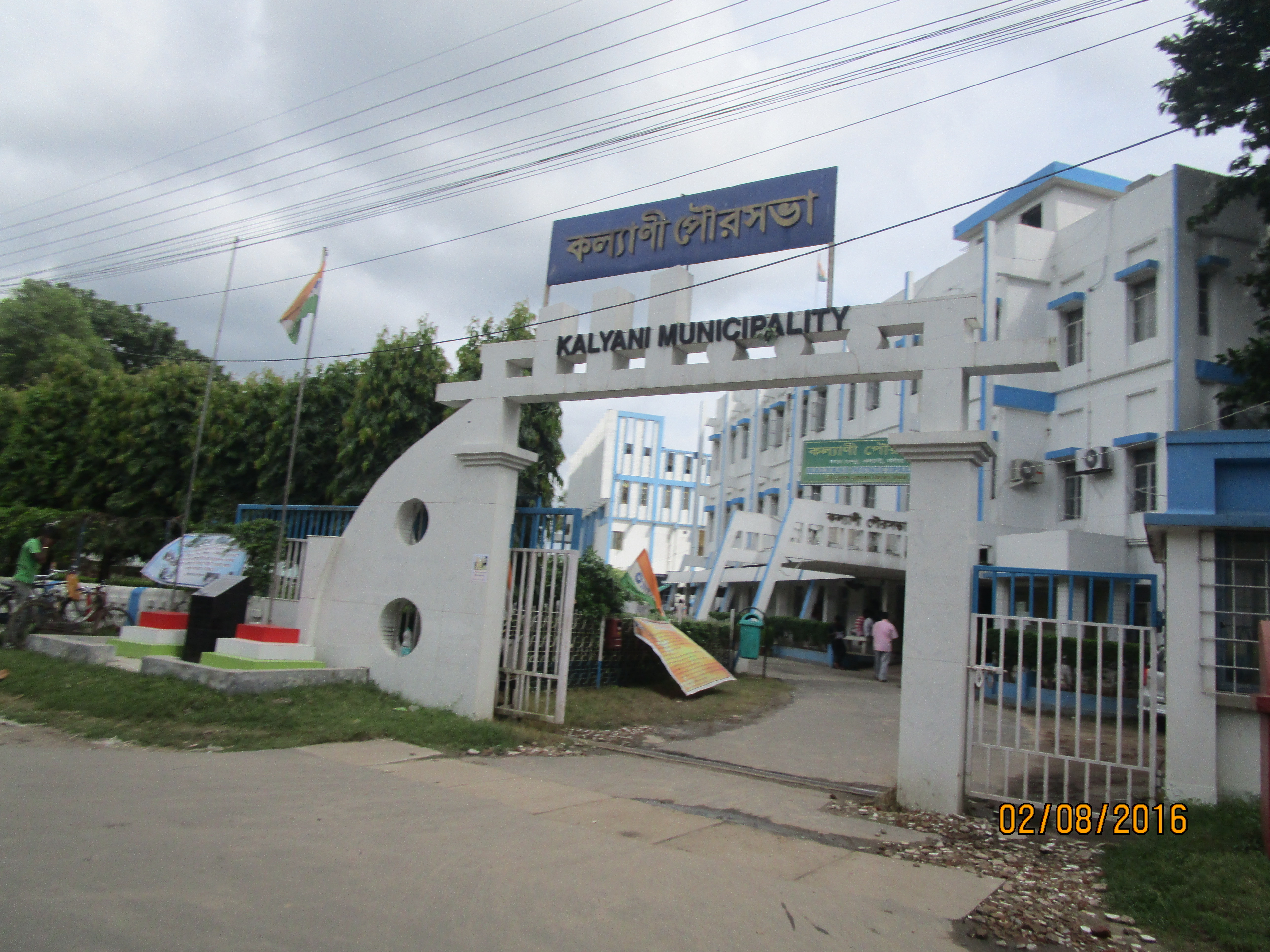 Kalyani Municipality
 -
A Sealdah bound train at Kalyani railway station
-
Bengal Cricket Academy Ground, Kalyani
-
 Kalyani Picnic Garden
 -
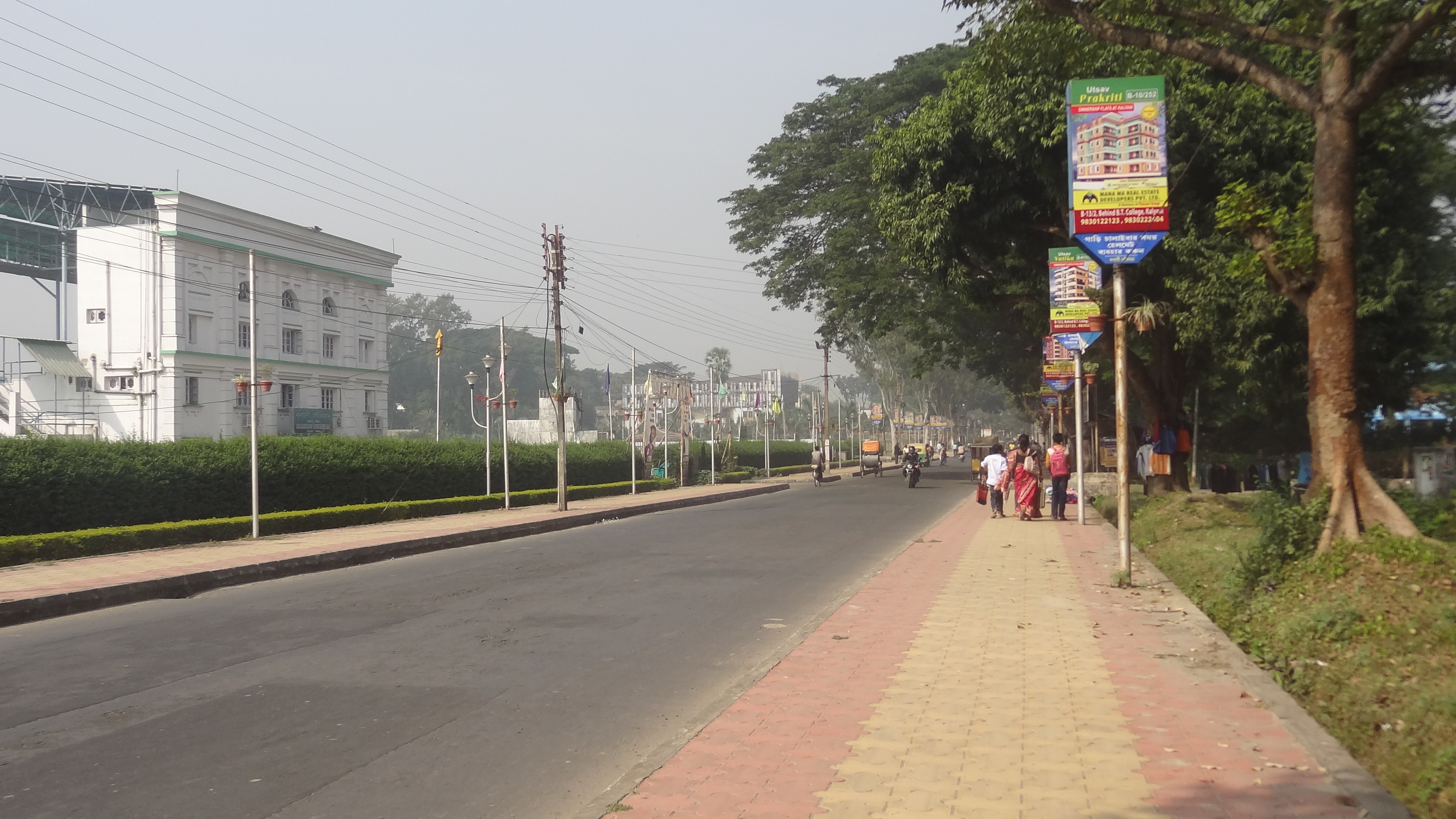 A-B Connector, Kalyani
 -
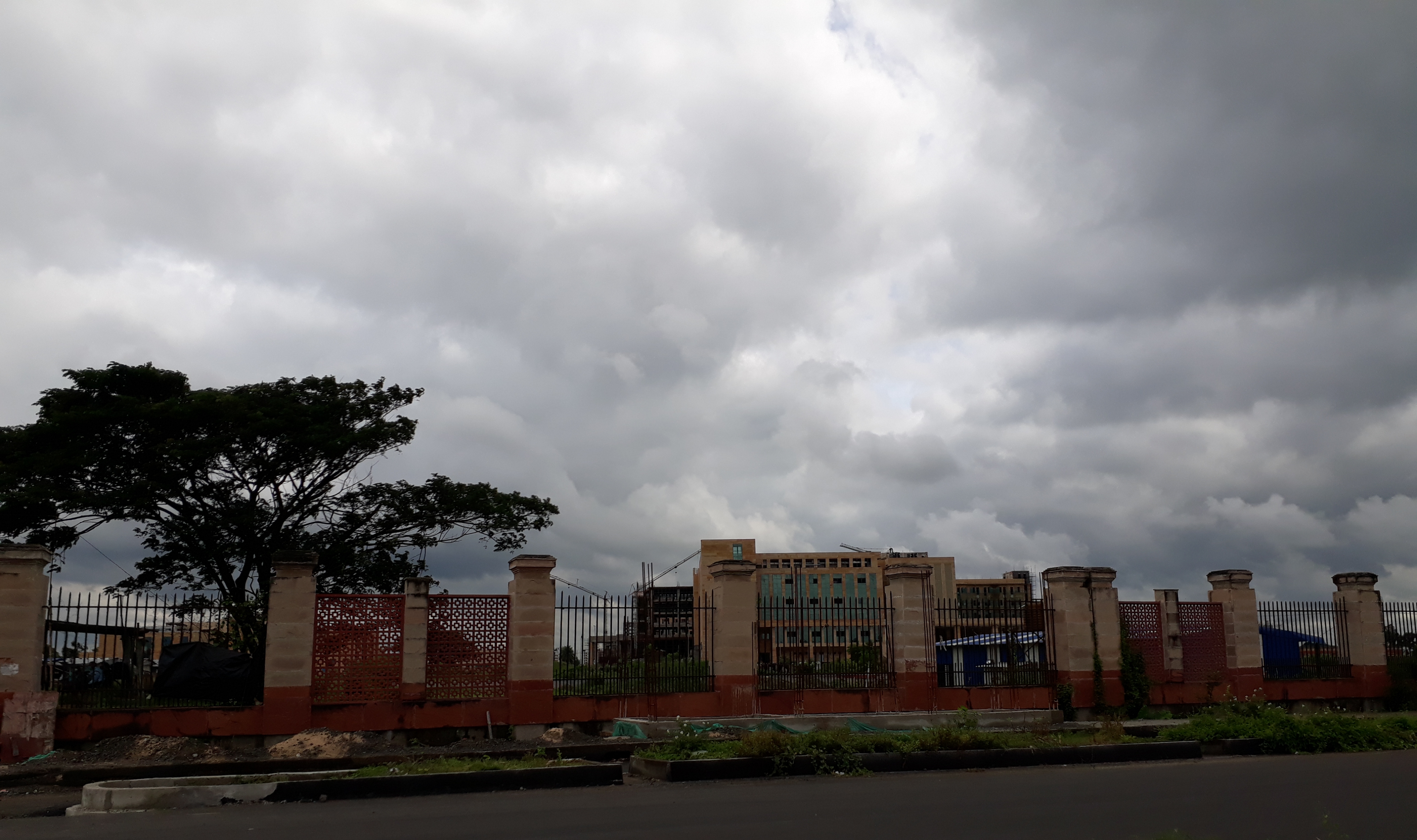 AIIMS in Kalyani
 -
Kalyani Head Post Office
-
Kalyani Sub Divisional Court


References[edit | edit source]
- ↑ "Kalyani City". sudawb.org. Retrieved 25 November 2020.
- ↑ 2.0 2.1 2.2 2.3 "Cities having population 1 lakh and above" (PDF). Census of India, Government of India. Retrieved 2 November 2011.
- ↑ "52nd Report of the Commissioner for Linguistic Minorities in India" (PDF). Nclm.nic.in. Ministry of Minority Affairs. p. 85. Archived from the original (PDF) on 25 May 2017. Retrieved 28 August 2019.
- ↑ 4.0 4.1 "Fact and Figures". Wb.gov.in. Retrieved 28 August 2019.
- ↑ "Base Map of Kolkata Metropolitan area". Kolkata Metropolitan Development Authority. Archived from the original on 28 September 2007. Retrieved 3 September 2007.
- ↑ 6.0 6.1 6.2 6.3 6.4 Bhattacharya, Bitan (13 January 2015). "সামরিক শহরের স্মৃতি নিয়ে বেড়ে উঠেছে কল্যাণী". Ananda Bazar Patrika. Retrieved 1 August 2015.
- ↑ Das, Diptendra; Chattopadhyay, B.C. (17–19 December 2009). Characterization of soil over Kolkata municipal area (PDF). Indian Geotechnical Conference. Vol. 1. Guntur, India. pp. 11–12. Retrieved 19 November 2012.
- ↑ 8.0 8.1 "Hazard profiles of Indian districts" (PDF). National Capacity Building Project in Disaster Management. UNDP. Archived from the original (PDF) on 19 May 2006. Retrieved 23 August 2006.
- ↑ 9.0 9.1 "West Bengal to develop analytics-themed city near Kalyani township". Economic Times. 19 June 2015. Archived from the original on 26 June 2015. Retrieved 25 June 2015.
- ↑ "District Statistical Handbook 2014 Nadia". Table 2.1. Department of Statistics and Programme Implementation, Government of West Bengal. Retrieved 7 October 2020.
- ↑ "Nadia District Police". Police Unit. West Bengal Police. Archived from the original on 28 May 2017. Retrieved 17 May 2017.
- ↑ "Kalyani Police Station Details". Nadia Police. Archived from the original on 29 March 2016. Retrieved 17 May 2017.
- ↑ "Census Tables". censusindia.gov.in. Retrieved 6 January 2024.
- ↑ "Census of India 2001: Data from the 2001 Census, including cities, villages and towns (Provisional)". Census Commission of India. Archived from the original on 16 June 2004. Retrieved 1 November 2008.
- ↑ 2011 census data censusindia.gov.in
- ↑ "Press Note, Delimitation Commission" (PDF). Assembly Constituencies in West Bengal. Delimitation Commission. pp. 4, 23. Retrieved 18 April 2009.
- ↑ "Category, Year of Establishment, Area, SC, ST and total population in ULBs in West Bengal" (PDF). Department of Municipal affairs, Government of West Bengal. Retrieved 1 March 2009.[permanent dead link]
- ↑ 18.0 18.1 18.2 "Annual Report 2007–2008". Department of School Education, Government of West Bengal. p. 69. Archived from the original (PDF) on 7 January 2019. Retrieved 10 December 2011.
- ↑ "College of Medicine & J.N.M.Hospital". West Bengal University of Health Sciences. Archived from the original on 23 May 2012. Retrieved 10 May 2012.
- ↑ "CM shows off state's sound cardiac care". The Times of India. 5 December 2003. Archived from the original on 13 November 2013. Retrieved 23 May 2013.
- ↑ "Centre approves AIIMS-like project at Kalyani in WB". Business Standard India. Press Trust of India. 25 March 2015. Retrieved 27 August 2017.
- ↑ Debashis Konar. Centre gives nod for AIIMS in Kalyani. Times of India. 21 June 2014.
External links[edit | edit source]
Cities, towns and locations in Nadia District | |||||||||
|---|---|---|---|---|---|---|---|---|---|
| Cities, municipal and census towns |
| ||||||||
| Locations other than cities and towns |
| ||||||||
| Related topics | |||||||||


