Asannagar | |
|---|---|
Village | |
Asannagar is located in West Bengal Asannagar Location in West Bengal, India  Asannagar Asannagar (India) | |
| Coordinates: 23°23′54″N 88°30′16″E / 23.39832°N 88.504365°E | |
| Country | |
| State | West Bengal |
| District | Nadia |
| Government | |
| • Type | Panchayat |
| • Body | Asannagar Gram Panchayat (krishnanagar 1 No. Panchayat Samiti) |
| Area | |
| • Total | 5 km2 (2 sq mi) |
| Population (2011) | |
| • Total | 12,794 |
| • Density | 2,600/km2 (6,600/sq mi) |
| Languages | |
| • Official | Bengali, English |
| Time zone | UTC+5:30 (IST) |
| PIN | 741161 (Asannagar) |
| Telephone/STD code | 03472 |
| Vehicle registration | WB51/52 |
| Lok Sabha constituency | Krishnanagar |
| Vidhan Sabha constituency | Krishnanagar Uttar |
| Website | nadia |
Asannagar is a village and a gram panchayat in NADIA CD block in the Krishnanagar Sadar subdivision of the Nadia district in the state of West Bengal, India. It was formerly under Kotwali Police Station but now it is under newly formed Bhimpur Police Station.
History[edit | edit source]
Asannagar is a very old village of the district. Leader of the Indigo revolt and peasant uprising, Biswanath Sardar alias Bishe Dakait was hanged in this village in 1808 after a show trial.[1]
Geography[edit | edit source]
Lua error in Module:OSM_Location_map at line 1984: attempt to index field 'wikibase' (a nil value).
Location[edit | edit source]
Asannanagar is located at 23°23′54″N 88°30′16″E / 23.39832°N 88.504365°E.
Area overview[edit | edit source]
Nadia district is mostly alluvial plains lying to the east of Hooghly River, locally known as Bhagirathi. The alluvial plains are cut across by such distributaries as Jalangi, Churni and Ichhamati. With these rivers getting silted up, floods are a recurring feature.[2]The Krishnanagar Sadar subdivision, presented in the map alongside, has the Bhagirathi on the west, with Purba Bardhaman district lying across the river. The long stretch along the Bhagirathi has many swamps. The area between the Bhagirathi and the Jalangi, which flows through the middle of the subdivision, is known as Kalantar, a low-lying tract of black clay soil. A big part of the subdivision forms the Krishnanagar-Santipur Plain, which occupies the central part of the district. The Jalangi, after flowing through the middle of the subdivision, turns right and joins the Bhagirathi. On the south-east, the Churni separates the Krishnanagar-Santipur Plain from the Ranaghat-Chakdaha Plain. The east forms the boundary with Bangladesh.[3]The subdivision is moderately urbanized. 20.795% of the population lives in urban areas and 79.205% lives in rural areas.[4]
Note: The map alongside presents some of the notable locations in the subdivision. All places marked in the map are linked in the larger full screen map. All the four subdivisions are presented with maps on the same scale – the size of the maps vary as per the area of the subdivision.
Demographics[edit | edit source]
According to the 2011 Census of India, Asannagar had a total population of 12,794, of which 6,500 (51%) were males and 6,294 (49%) were females. The population in the age range 0-6 years of age was 1,151. The total number of literate persons in Asannagar is 8,828 (75.82% of the population over 6 years).[5]
Transport[edit | edit source]
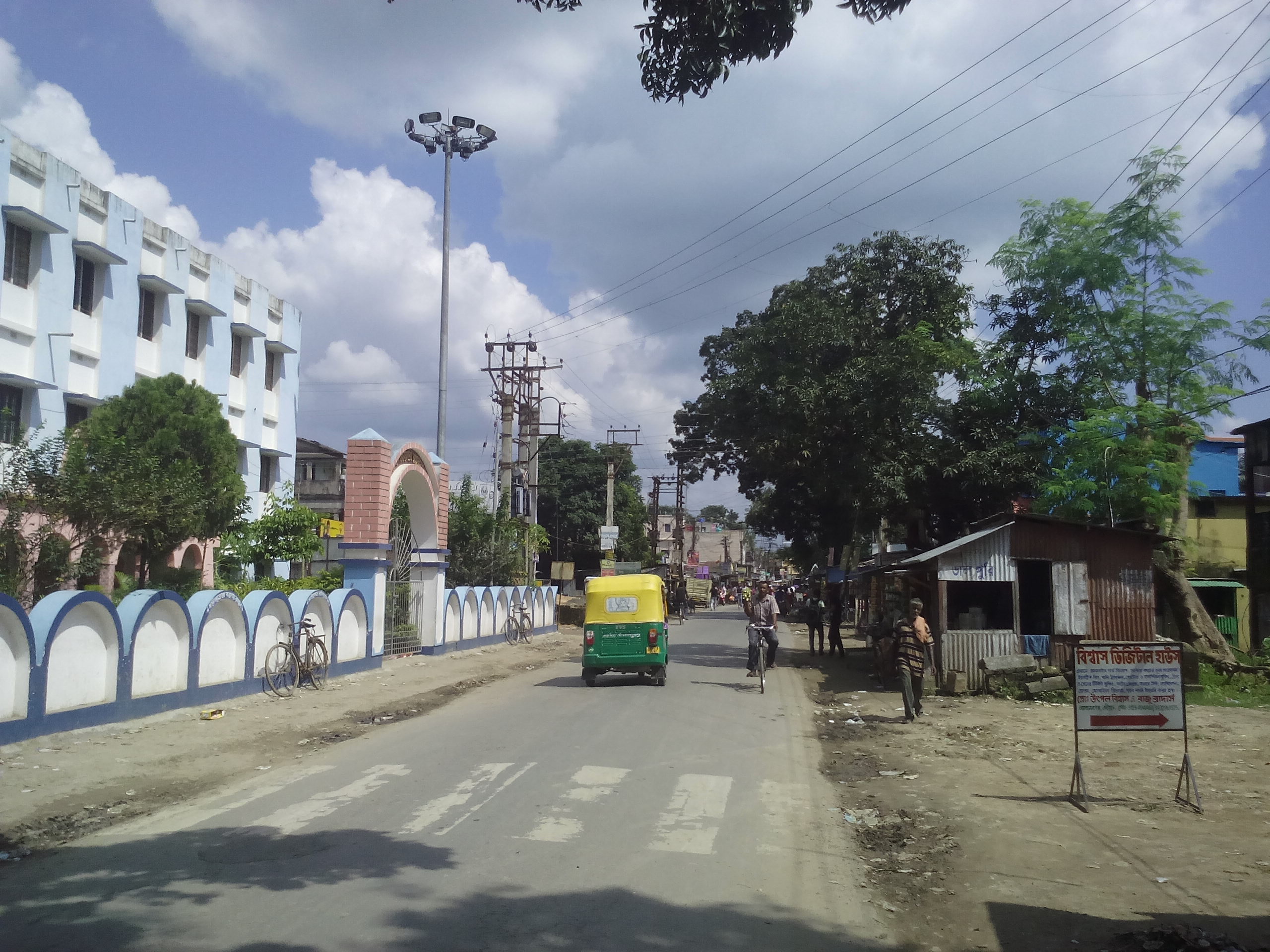
Asannagar is on State Highway 8 which originates from Santaldih and terminaes at Majhdia. Asannagar is only 13 km far from the district headquarters Krishnanagar, Nadia. The nearest railway stations are Krishnanagar City Junction and Majhdia railway station. Asannagar is easily accessible through local private buses, magic vans, e-rickshaws (toto) from both the stations. Local people also use private cars, bikes, and scooter to commute.
Education[edit | edit source]
Asannagar High School is the only high school in the area. It was established in 1954. Apart from this, there are many primary schools in this area like Tripurapara primary school, Bhimpur Sri Sri Darsanananda Vidyaniketan, Vivekananda sishu niketan, Kashipurpara primary school, Pyradangapara primary school, Chanderpole Kultala primary school, Bagdipara primary school, Naikura primary school, and Kashipur Bansberia primary school.
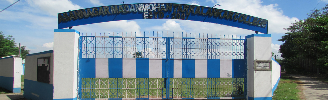
Bhimpur Mohanananda College Of Education, Asannagar Madan Mohan Tarkalankar College was established at Asannagar in 2007 affiliated with the University of Kalyani, it offers honours courses in Bengali, English, Sanskrit and history.[6]
Marketplace[edit | edit source]
Asannagar marketplace is the main business place of this area consists of many shops. Kalibabur bazar is the main market place for vegetable vendors, meat and fish shops. The marketplace consist few banks – State Bank of India, Bangiya Gramin Vikash Bank. Asannagar marketplace also consist a gas office - Maa Kali Indane Gramin Vitrak Vitrak.
Festivals[edit | edit source]
Durga Puja, Ganesh Puja, Kali Puja, Ŗáńģá MA Jagadhatri Puja, Ganga Puja are celebrated here with great rejoice. Lalon Mela is an important fair held here at nearby Kadamkhali ground with the joint co-operation of Asannagar and Bhimpur citizens. It is mainly a cultural fair about Lalon Fakir's songs. Many renowned baul singers from both India and Bangladesh serves soulful baul songs in this fair. A large number of people gather here from the local areas and also from other places too. Apart from this Rath-er Mela, Meteri Mela, Ganesh Pujo Mela, Sarada mela held in Asannagar.
Healthcare[edit | edit source]
There is a primary health centre at Asannagar, with 10 beds.[7]
Gallery[edit | edit source]
- Asannagar
-
 Asannagar High School Gate
 -
 Asannagar Bazar
 -
 Ammtc college gate
 -
 ammtc
ammtc -
 Hp petrol pump (Asannagar Puratan Bazar)
 -
 Asannagar Puratan Bazar (Tripurapara)
 -
 post office
 -
 Asannagar
 -
 asannagar high school main gate
 -
 Asannagar Post office area
 -
 Asannagar Panchayat and State Bank of India (Asannagar Branch)


.jpg)
.jpg)


.jpg)
References[edit | edit source]
- ↑ Pinaki Biswas (2014). Seisob Shahidera (Bengali). Kolkata: Atirikto Publication. p. 14. ISBN 978-81-928741-0-4.
- ↑ Gangopadhyay, Basudev, Paschimbanga Parichay, 2001, (in Bengali), p. 70, Sishu Sahitya Sansad
- ↑ "District Census Handbook, Nadia, 2011, Series 20, Part XII A" (PDF). Pages 13,14. Directorate of Census Operations, West Bengal. Retrieved 15 October 2020.
- ↑ "District Statistical Handbook 2014 Nadia". Table 2.2, 2.4(a). Department of Planning and Statistics, Government of West Bengal. Retrieved 15 October 2020.
- ↑ "2011 Census – Primary Census Abstract Data Tables". West Bengal – District-wise. Registrar General and Census Commissioner, India. Retrieved 29 May 2017.
- ↑ "Asannagar Madan Mohan Tarkalankar College". AMMTC. Retrieved 26 May 2017.
- ↑ "Health & Family Welfare Department" (PDF). Health Statistics – Primary Health Centres. Government of West Bengal. Retrieved 6 October 2020.
Cities, towns and locations in Nadia District | |||||||||
|---|---|---|---|---|---|---|---|---|---|
| Cities, municipal and census towns |
| ||||||||
| Locations other than cities and towns |
| ||||||||
| Related topics | |||||||||