










robot: Update article |
minor cleanup |
||
| (4 intermediate revisions by 3 users not shown) | |||
| Line 1: | Line 1: | ||
{{Short description|Region in the eastern Indian subcontinent}} | {{Short description|Region in the eastern Indian subcontinent}} | ||
{{other uses}} | {{other uses}} | ||
{{ | {{pp-sock|small=yes}} | ||
{{Use dmy dates|date= | {{Use British English|date=January 2026}} | ||
{{Use dmy dates|date=January 2026}} | |||
{{Infobox settlement | {{Infobox settlement | ||
| name | | name = Bengal | ||
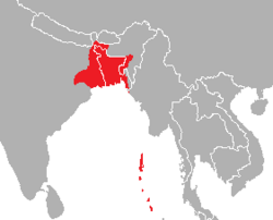
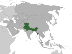
| image_map | | image_map = Bengal in Asia.jpg | ||
| map_caption | | map_caption = Bengal region in Asia | ||
| native_name | | native_name = {{unbulleted list | ||
| {{ | | {{lang|bn|বঙ্গ}} {{transliteration|bn|Bôṅgô}} | ||
| type | | {{lang|bn|বাংলা}} {{transliteration|bn|Bāṅlā}}}} | ||
| subdivision_type | | type = Region | ||
| subdivision_name | | subdivision_type = Continent | ||
| subdivision_type1 | | subdivision_name = [[Asia]] | ||
| subdivision_name1 | | subdivision_type1 = Countries | ||
| | | subdivision_name1 = {{flag|Bangladesh}} <br /> {{flag|India}} ([[West Bengal]], [[Karimganj district]] of [[Assam]]) | ||
| | | established_title = [[Iron Age India]], [[Vedic India]], [[Suhma kingdom]], [[Pundravardhana]], [[Vanga kingdom]] | ||
| established_date = 1500 – c. 500 BCE | |||
| established_title1 = [[Gangaridai]], [[Nanda Empire]] | |||
| established_date1 = 500 – c. 350 BCE | |||
| established_title2 = [[Mauryan Empire]] | |||
| established_date2 = 4th century – 2nd century BCE | |||
| established_title3 = [[Shunga Empire]], [[Gupta Empire]], [[Later Gupta dynasty]] | |||
| established_date3 = 185–75 BCE, 3rd century CE – 543 CE, 6th–7th century | |||
| established_title4 = [[Gauda Kingdom]] | |||
| established_date4 = 590–633 CE | |||
| established_title5 = [[Pala Empire]], [[Sena dynasty|Sena Empire]], [[Deva dynasty|Deva Empire]] | |||
| established_date5 = 8th–11th century, 11th–12th century, 12th–13th century | |||
| established_title6 = [[Delhi Sultanate]], [[Bengal Sultanate]] | |||
| established_date6 = 1204–1339 CE, 1338–1576 CE | |||
| established_title7 = [[Bengal Subah]] ([[Mughal Empire]]), [[Nawabs of Bengal]] | |||
| established_date7 = 1565–1717 CE, 1717–1765 CE | |||
| extinct_title = [[Bengal Presidency]] ([[British India]]) | |||
| extinct_date = 1765–1947 CE | |||
| official_name = | |||
| parts_type = Divisions | |||
| parts_style = list | |||
| p1 = {{flagicon|India}} [[Barak Valley]] | |||
| p2 = {{flagicon|Bangladesh}} [[Barisal division|Barisal]] | |||
| p3 = {{flagicon|India}} [[Burdwan division|Burdwan]] | |||
| p4 = {{flagicon|Bangladesh}} [[Chittagong Division|Chittagong]] | |||
| p5 = {{flagicon|Bangladesh}} [[Dhaka division|Dhaka]] | |||
| p6 = {{flagicon|India}} [[Jalpaiguri division|Jalpaiguri]] | |||
| p7 = {{flagicon|Bangladesh}} [[Khulna Division|Khulna]] | |||
| p8 = {{flagicon|India}} [[Malda division|Malda]] | |||
| p9 = {{flagicon|India}} [[Medinipur division|Medinipur]] | |||
| p10 = {{flagicon|Bangladesh}} [[Mymensingh Division|Mymensingh]] | |||
| p11 = {{flagicon|India}} [[Presidency division|Presidency]] | |||
| p12 = {{flagicon|Bangladesh}} [[Rajshahi Division|Rajshahi]] | |||
| p13 = {{flagicon|Bangladesh}} [[Rangpur Division|Rangpur]] | |||
| p14 = {{flagicon|Bangladesh}} [[Sylhet Division|Sylhet]] | |||
| area_total_km2 = 239021 | |||
| population_as_of = 2022 | |||
| population_total = 273,610,384 | |||
| population_density_km2 = 1144 | |||
| blank_name_sec1 = | |||
| blank_info_sec1 = | |||
| blank_name_sec2 = | |||
| blank_info_sec2 = | |||
| blank2_name_sec2 = [[Demonym|Demonym(s)]] | |||
| blank2_info_sec2 = [[Bengalis|Bengali]] | |||
| blank3_name_sec2 = Time zone | |||
| blank3_info_sec2 = [[UTC+5:30]], [[UTC+6:00]] | |||
| blank4_name_sec2 = Internet [[top-level domain|TLD]] | |||
| blank4_info_sec2 = [[.bd]], [[.in]] (English)<br />[[.বাংলা]], [[.ভারত]] (Bengali) | |||
| blank5_name_sec2 = Largest urban areas | |||
| blank5_info_sec2 = {{Collapsible list | |||
|title= [[#Urban Areas|List]] | |||
| {{flagicon|Bangladesh}} [[Dhaka]] | |||
| {{flagicon|India}} [[Kolkata]] | |||
| {{flagicon|Bangladesh}} [[Chittagong]] | |||
| {{flagicon|India}} [[Siliguri]] | |||
}} | }} | ||
}} | }} | ||
{{Contains special characters|Bengali}} | {{Contains special characters|Bengali}} | ||
{{Bengalis}} | {{Bengalis}} | ||
[[File:Geographic distribution of Bengali language.png|thumb|Geographical distribution of the Bengali language.]] | |||
'''Bengal''' ({{IPAc-en|b|ɛ|n|ˈ|ɡ|ɔː|l}} {{respell|ben|GAWL}} | '''Bengal''' ({{IPAc-en|b|ɛ|n|ˈ|ɡ|ɔː|l}} {{respell|ben|GAWL}})<ref>{{Cite book |title=The Chambers Dictionary |publisher=Chambers |year=2003 |isbn=0-550-10105-5 |edition=9th |chapter=Bengal}}</ref><ref>{{cite web |url=https://en.oxforddictionaries.com/definition/bengal |title=Oxford Dictionaries |access-date=22 February 2017 |archive-url=https://web.archive.org/web/20170829074813/https://en.oxforddictionaries.com/definition/bengal |archive-date=29 August 2017 |url-status=dead}}</ref>{{efn|{{langx|bn|বঙ্গ|Bôṅgô}}, {{IPA|bn|ˈbɔŋɡo|pron|LL-Q9610 (ben)-Titodutta-বঙ্গ.wav}} or {{langx|bn|বাংলা|Bāṅlā}}, {{IPA|bn|ˈbaŋla|pron}}}} is a [[geographical]], [[ethnolinguistic]], historically geopolitical region in [[South Asia]], located north of the [[Bay of Bengal]]. Today, it is politically divided between the sovereign state of [[Bangladesh]], the [[States and union territories of India|Indian state]] of [[West Bengal]], and [[Karimganj district]] in the Indian state of [[Assam]]. | ||
The ancient [[Vanga Kingdom]] is widely regarded as the namesake of the Bengal region.<ref>{{cite web |url=https://www.britannica.com/place/Vanga |title=Vanga {{pipe}} ancient kingdom, India |website=Encyclopædia Britannica}}</ref> The [[Bengali calendar]] dates back to the reign of [[Shashanka]] in the 7th century CE. The [[Pala Empire]] was founded in Bengal during the 8th century. The [[Sena dynasty]] and [[Deva dynasty]] ruled between the 11th and 13th centuries. By the 14th century, Bengal was absorbed by [[Muslim conquests in the Indian subcontinent]]. An independent [[Bengal Sultanate]] was formed and became the eastern frontier of the [[Islamic world]].<ref>{{cite web |url=https://publishing.cdlib.org/ucpressebooks/view?docId=ft067n99v9;brand=ucpress |title=The Rise of Islam and the Bengal Frontier, 1204–1760}}</ref><ref>{{cite web |url=https://iranicaonline.org/articles/bengal |title=Welcome to Encyclopaedia Iranica}}</ref><ref>{{cite news |url=https://www.dhakatribune.com/op-ed/2022/11/27/know-your-history |title=Know your history |work=Dhaka Tribune |date=27 November 2022}}</ref> During this period, Bengal's rule and influence spread to [[Assam]], [[Arakan]], [[Tripura]], [[Bihar]], and [[Odisha]] (formerly Orissa).<ref name="Lewis2011">David Lewis (31 October 2011). Bangladesh: Politics, Economy and Civil Society. Cambridge University Press. pp. 44–45. ISBN 978-1-139-50257-3.</ref><ref>Perween Hasan (2007). Sultans and Mosques: The Early Muslim Architecture of Bangladesh. I.B.Tauris. pp. 16–17. ISBN 978-1-84511-381-0. "[Husayn Shah pushed] its western frontier past Bihar up to Saran in Jaunpur ... when Sultan Husayn Shah Sharqi of Jaunpur fled to Bengal after being defeated in battle by Sultan Sikandar Lodhi of Delhi, the latter attacked Bengal in pursuit of the Jaunpur ruler. Unable to make any gains, Sikandar Lodhi returned home after concluding a peace treaty with the Bengal sultan."</ref> [[Bengal Subah]] later emerged as a prosperous part of the [[Mughal Empire]]. | |||
The last independent [[Nawab of Bengal]] was defeated in 1757 at the [[Battle of Plassey]] by the [[East India Company]]. The company's [[Bengal Presidency]] grew into the largest administrative unit of [[British India]] with [[Calcutta]] as the capital of both Bengal and India until 1911. As a result of the [[Partition of Bengal (1905)|first partition of Bengal]], a short-lived province called [[Eastern Bengal and Assam]] existed between 1905 and 1911 with its capital in the former Mughal capital [[Dhaka]]. Following the [[Sylhet referendum, 1947|Sylhet referendum]] and votes by the [[British Bengal Legislative Council|Bengal Legislative Council]] and [[Bengal Legislative Assembly (1937—1947)|Bengal Legislative Assembly]], the region was again [[Partition of Bengal (1947)|divided along religious lines in 1947]]. | |||
Bengali culture, particularly its [[Bengali literature|literature]], [[Bengali music|music]], [[Bangladeshi art|art]] and cinema, are well known in South Asia and beyond. The region is also notable for its economic and social scientists, which includes several [[Nobel laureate]]s. Once home to the city with the highest per capita income level in British India,<ref name="orfonline1">{{cite web |url=https://www.orfonline.org/expert-speak/looking-ahead-retrospectively-bangladeshi-perspective/ |title=Looking ahead retrospectively: A Bangladeshi perspective {{pipe}} ORF}}</ref> the region is today a leader in South Asia in terms of [[Gender Parity Index|gender parity]], the [[gender pay gap]] and other indices of [[Human Development Index|human development]].<ref>{{cite news |last1=Bhattacharya |first1=Pramit |date=25 December 2014 |title=Why West Bengal is like Canada, and Bihar like Swaziland |url=https://www.livemint.com/Politics/1rl0WtFHAUyrXy1KcwGYlK/Why-West-Bengal-is-like-Canada-and-Bihar-like-Swaziland.html |work=Mint |access-date=20 January 2025}}</ref><ref>{{cite news |url=https://www.thedailystar.net/top-news/bangladesh-ahead-india-social-indicators-amartya-3540 |title=Bangladesh ahead of India in social indicators: Amartya |work=The Daily Star |date=23 February 2015 |access-date=20 January 2025}}</ref><ref>{{cite news |last1=Grover |first1=Priyamvada |date=11 October 2018 |title=Bangladesh is better off than India, not a poor, backward neighbour anymore |url=https://theprint.in/economy/bangladesh-is-better-off-than-india-not-a-poor-backward-neighbour-anymore/132363/ |work=ThePrint |access-date=20 January 2025}}</ref><ref>{{cite web |url=https://www.undp.org/bangladesh/blog/new-directions-human-development-bangladesh |title=New directions for human development in Bangladesh}}</ref><ref>{{cite news |title=Bangladesh marches ahead of India in Global Gender Gap Index |url=https://timesofindia.indiatimes.com/travel/destinations/bangladesh-marches-ahead-of-india-in-global-gender-gap-index/articleshow/72897529.cms |work=The Times of India |date=20 December 2019 |access-date=20 January 2025}}</ref> | |||
== Etymology == | == Etymology == | ||
{{Main|Names of Bengal}} | {{Main|Names of Bengal}} | ||
The name of ''Bengal'' is derived from the ancient kingdom of [[ | |||
The name of ''Bengal'' is derived from the ancient kingdom of [[Vanga Kingdom|Vanga]] (pronounced Bôngô),<ref>{{cite book |last=Rahman |first=Urmi |date=2014 |title=Bangladesh – Culture Smart!: The Essential Guide to Customs & Culture |url=https://books.google.com/books?id=1HelAwAAQBAJ&pg=PT26 |publisher=Kuperard |pages=26– |isbn=978-1-85733-696-2}}</ref><ref name="britannica">{{cite encyclopedia |url=https://www.britannica.com/place/Vanga |encyclopedia=Encyclopædia Britannica |title=Vanga |access-date=7 January 2017 |archive-url=https://web.archive.org/web/20160730062030/https://www.britannica.com/place/Vanga |archive-date=30 July 2016 |url-status=live}}</ref> the earliest records of which date back to the ''[[Mahabharata]]'' epic in the [[first millennium BCE]].<ref name="britannica" /> The land of Vaṅga later came to be known as Vaṅgāla (''Bāṅgālā'') and its earliest reference is in the [[Comilla District|Comilla]] copperplates (720 CE) of earlier Buddhist [[Deva dynasty|Deva]] King Ananda Deva, where he was mentioned as ''Sri Vaṅgāla Mrīgānka'', meaning the moon of Bengal.<ref>{{cite book|url=https://books.google.com/books?id=TlnoMdZu40UC&dq=vangalamriganka&pg=PA462|title=Gold coins of the World|isbn=978-0-87184-308-1 |last1=Friedberg |first1=Arthur L. |last2=Friedberg |first2=Ira S. |date=12 April 2025 |publisher=Coin & Currency Institute }}</ref><ref>{{cite web|url=https://en.banglapedia.org/index.php?title=Copperplates|title=Copperplates|publisher=[[Banglapedia]]|access-date=12 April 2025}}</ref> The reference to 'Vangalam' is present in an inscription in the [[Brihadisvara Temple]] at [[Thanjavur]], which is one of the oldest references to Bengal.<ref>{{Cite book |last=Sengupta |first=Nitish K. |author-link=Nitish Sengupta |url=https://books.google.com/books?id=kVSh_TyJ0YoC |title=Land of Two Rivers: A History of Bengal from the Mahabharata to Mujib |date=2011 |publisher=Penguin Books India |page=10 |isbn=978-0-14-341678-4|quote=Also, we have the reference to 'Vangalam' in an inscription in the Vrihadeshwara temple at Tanjore in south India as one among the countries overrun by the Cholas. This is perhaps the earliest reference to Bengal as such.}}</ref> The term ''Vangaladesa'' is used to describe the region in 11th-century South Indian records.<ref>{{cite book |last=Keay |first=John |author-link=John Keay |year=2000 |title=India: A History |publisher=Atlantic Monthly Press |page=220 |isbn=978-0-87113-800-2 |quote=In C1020 ... launched Rajendra's great northern escapade ... peoples he defeated have been tentatively identified ... 'Vangala-desa where the rain water never stopped' sounds like a fair description of Bengal in the monsoon.}}</ref><ref name="Allan1934">{{cite book |last1=Allan |first1=J. |last2=Haig |first2=T. Wolseley |last3=Dodwell |first3=H. H. |year=1934 |editor-last=Dodwell |editor-first=H. H. |editor-link=H. H. Dodwell |title=The Cambridge Shorter History of India |url=https://books.google.com/books?id=9_48AAAAIAAJ&pg=PA145 |publisher=Cambridge University Press |page=145}}</ref><ref name="Sen1999">{{cite book |last=Sen |first=Sailendra Nath |year=1999 |orig-year=First published 1988 |title=Ancient Indian History and Civilization |url=https://books.google.com/books?id=Wk4_ICH_g1EC&pg=PA281 |publisher=New Age International |page=281 |isbn=978-81-224-1198-0}}</ref> In the early 12th-century Sanskrit text [[Manasollasa]], the name ''Gaudabangala'' was mentioned to denote the whole [[Bengal region]].<ref>{{cite web|url=https://archive.org/details/dli.calcutta.01172/page/n24/mode/1up|title=Itihas|author=Sukumar Sen|date=1366 |page=19}}</ref> The modern term ''Bangla'' became prominent from the 14th century, which saw the establishment of the [[Sultanate of Bengal]], whose first ruler [[Shamsuddin Ilyas Shah]] was known as the ''[[Shah]] of Bangala''.<ref>{{cite book |last=Hasan |first=Perween |author-link=Perween Hasan |date=2007 |title=Sultans and Mosques: The Early Muslim Architecture of Bangladesh |url=https://books.google.com/books?id=Uunyz4qFZwEC&pg=PA13 |publisher=I.B.Tauris |pages=13– |isbn=978-1-84511-381-0}}</ref> Arab geographers [[Ahmad ibn Majid]] and [[Sulaiman Al Mahri]] also mention the region as {{'}}''Bangala''{{'}} and the 'land of Bang'.<ref>{{Cite book |last=Siddiq |first=Mohammad Yusuf |url=https://books.google.com/books?id=nAUBCwAAQBAJ |title=Epigraphy and Islamic Culture: Inscriptions of the Early Muslim Rulers of Bengal (1205-1494) |date=19 November 2015 |publisher=Routledge |isbn=978-1-317-58745-3 |pages=29 |language=en}}</ref> The [[Portuguese Empire|Portuguese]] referred to the region as ''Bengala'' in the [[Age of Discovery]].<ref>{{cite book |last1=Lach |first1=Donald F. |author1-link=Donald F. Lach |last2=Kley |first2=Edwin J. Van |date=1998 |title=Asia in the Making of Europe, Volume III: A Century of Advance. Book 3: Southeast Asia |url=https://books.google.com/books?id=M4t8S7BfgeIC&pg=PA1124 |publisher=University of Chicago Press |pages=1124– |isbn=978-0-226-46768-9}}</ref> | |||
==History== | |||
{{Main|History of Bengal}} | |||
===Antiquity=== | |||
{{See also|Vanga Kingdom|Gauda Kingdom|Samatata|Pala Empire|Jalaluddin Muhammad Shah}} | |||
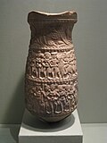
[[File:WLA lacma West Bengal Vase with Processional Scenes ca 100 BC.jpg|thumb|left|Pottery with processional scenes from the [[Chandraketugarh|Chandraketugarh region]] of West Bengal, India, c. 100 BC]] | |||
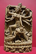
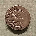
[[File:Durga Mahishasuramardini slaying the Buffalo Demon, Bengal, India, or Bangladesh, Pala dynasty, 1100s AD, phyllite - Dallas Museum of Art - DSC05056.jpg|thumb|left|Goddess Durga, Pala period, 10th century]] [[File:Delhi Sultanate Coin from Gaur, Bengal in the British Museum.jpg|thumb|Coin featuring a horseman issued by the [[Delhi Sultanate]] celebrating the Muslim conquest of [[Lakhnauti]]|left]] | |||
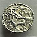
[[File:Vanga coin (400-300 BCE).jpg|thumb|upright|[[Coinage of India#Origin of currency in Indian subcontinent|Coinage]] of [[Vanga Kingdom]], 400–300 BCE]] | |||
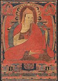
[[File:Atisha.jpg|thumb|upright|[[Atisa]] of [[Bikrampur]]]] | |||
[[Neolithic]] sites have been found in several parts of the region.<ref>{{cite web |url=https://en.banglapedia.org/index.php/Prehistory |title=Prehistory |website=Banglapedia}}</ref> In the second millennium BCE, rice-cultivating communities dotted the region. By the eleventh century BCE, people in Bengal lived in systematically aligned homes, produced copper objects, and crafted black and red pottery. Remnants of [[Copper Age]] settlements are located in the region.<ref>{{cite news |url=https://www.thedailystar.net/news-detail-50746 |title=Wari-Bateshwar: In search of origins |work=The Daily Star |date=18 August 2008}}</ref> At the advent of the [[Iron Age]], people in Bengal adopted iron-based weapons, tools and irrigation equipment.<ref>{{cite web |url=https://publishing.cdlib.org/ucpressebooks/view?docId=ft067n99v9&chunk.id=d0e788&toc.depth=100&toc.id=ch01&brand=ucpress |title=The Rise of Islam and the Bengal Frontier, 1204–1760}}</ref> From 600 BCE, the second wave of urbanisation engulfed the north Indian subcontinent as part of the [[Northern Black Polished Ware]] culture. Ancient archaeological sites and cities in [[Dihar (archaeological site)|Dihar]], [[Pandu Rajar Dhibi]], [[Mahasthangarh]], [[Chandraketugarh]] and [[Wari-Bateshwar ruins|Wari-Bateshwar]] emerged. The [[Ganges]], [[Brahmaputra]] and [[Meghna]] rivers were natural arteries for communication and transportation.<ref name="google5" /> [[Estuary|Estuaries]] on the [[Bay of Bengal]] allowed for [[maritime industry|maritime]] trade with distant lands in Southeast Asia and elsewhere.<ref name="google5" /> | |||
The ancient geopolitical divisions of Bengal included [[Varendra]], [[Suhma]], [[Anga]], [[Vanga Kingdom|Vanga]], [[Samatata]] and [[Harikela]]. These regions were often independent or under the rule of larger empires. The Mahasthan [[Brahmi]] Inscription indicates that Bengal was ruled by the [[Mauryan Empire]] in the 3rd century BCE.<ref name="auto1">{{cite web|url=https://en.banglapedia.org/index.php/Mahasthan_Brahmi_Inscription|title=Mahasthan Brahmi Inscription |website=Banglapedia}}</ref> The inscription was an administrative order instructing relief for a distressed segment of the population.<ref name="auto1"/> [[Punch-marked coins]] found in the region indicate that [[coin]]s were used as currency during the Iron Age.<ref>{{cite web|url=https://en.banglapedia.org/index.php/Punch_Marked_Coins|title=Punch Marked Coins |website=Banglapedia}}</ref><ref>{{cite web|url=https://www.bb.org.bd/museum/collections/ancient.php|title=About Taka Museum|website=bb.org.bd}}</ref> The namesake of Bengal is the ancient Vanga Kingdom which was reputed as a naval power with overseas colonies. A prince from Bengal named [[Prince Vijaya|Vijaya]] founded the first kingdom in [[Sri Lanka]]. The two most prominent pan-Indian empires of this period included the Mauryans and the [[Gupta Empire]]. The region was a centre of artistic, political, social, spiritual and scientific thinking, including the invention of [[chess]], [[Indian numerals]], and the concept of [[zero]].<ref name="Murray 1913">{{cite book |last=Murray |first=H. J. R. |author-link=H. J. R. Murray |title=A History of Chess |publisher=Benjamin Press (originally published by Oxford University Press) |year=1913 |isbn=978-0-936317-01-4 |oclc=13472872 |url=https://archive.org/details/historyofchess00murr }}</ref> | |||
The region was known to the ancient [[Ancient Greece|Greeks]] and [[Roman world|Romans]] as [[Gangaridai]].<ref name=Gangaridai>{{cite web |url=http://en.banglapedia.org/index.php?title=Gangaridai |title=Gangaridai |access-date=5 August 2015 |last=Chowdhury |first=AM |website=[[Banglapedia]] |publisher=Asiatic Society of Bangladesh |archive-url=https://web.archive.org/web/20150602094443/http://en.banglapedia.org/index.php?title=Gangaridai |archive-date=2 June 2015 |url-status=live}}</ref> The Greek ambassador [[Megasthenes]] chronicled its military strength and dominance of the [[Ganges delta]]. The invasion army of [[Alexander the Great]] was deterred by the accounts of Gangaridai's power in 325 BCE, including a [[cavalry]] of [[war elephant]]s. Later Roman accounts noted maritime trade routes with Bengal. 1st century Roman coins with images of [[Hercules]] were found in the region and point to trade links with [[Roman Egypt]] through the [[Red Sea]].<ref>{{cite magazine |url=https://www.archaeology.org/issues/112-1311/letter-from/1406-wari-bateshwar-ptolemy-sounagoura-indo-pacific-beads#art_page2 |title=A Family's Passion |magazine=Archaeology Magazine |date=November–December 2013}}</ref> The [[Wari-Bateshwar ruins]] are believed to be the emporium (trading centre) of Sounagoura mentioned by Roman geographer [[Claudius Ptolemy]].<ref>{{cite web |url=https://discovery.ucl.ac.uk/id/eprint/10081769/1/Man_and_Environment_Bangladesh_Archaeobotany_7_01_2019.pdf |title=Wari-Bateshwar and Vikrampura: 2 Successful Case Studies in Bangladesh 3 Archaeobotany |publisher=University College London |access-date=6 March 2023 |author=Mizanur Rahman |display-authors=et. al.}}</ref><ref>{{cite news |url=https://www.thedailystar.net/news-detail-28431 |title=Wari-Bateshwar one of earliest kingdoms |first1=Emran |last1=Hossain |date=19 March 2008 |work=The Daily Star}}</ref> A Roman amphora was found in [[Purba Medinipur district]] of West Bengal which was made in [[Aelana]] (present-day Aqaba, [[Jordan]]) between the 4th and 7th centuries AD.<ref>{{cite news |last1=Sarkar |first1=Sebanti |date=19 February 2018 |title=In rural Bengal, an indefatigable relic hunter has uncovered a hidden chapter of history |url=https://scroll.in/magazine/868330/in-rural-bengal-an-indefatigable-relic-hunter-has-uncovered-a-hidden-chapter-of-history |work=Scroll.in |access-date=18 February 2024}}</ref> | |||
[[File:Pañcarakṣā (Cambridge University Library MS Add.1688).jpg|thumb|Buddhist palm leaf manuscript, 10th century CE]] | |||
The first unified Bengali polity can be traced to the reign of [[Shashanka]]. The origins of the [[Bengali calendar]] can be traced to his reign. Shashanka founded the [[Gauda Kingdom]]. After Shashanka's death, Bengal experienced a period of civil war known as Matsyanyayam.<ref>{{cite web |url=https://en.banglapedia.org/index.php/Matsyanyayam | title=Matsyanyayam |website=Banglapedia}}</ref> The ancient city of [[Gauda (city)|Gauda]] later gave birth to the [[Pala Empire]]. The first Pala emperor [[Gopala I]] was chosen by an assembly of chieftains in Gauda. The Pala kingdom grew into one of the largest empires in the Indian subcontinent. The Pala period saw advances in linguistics, sculpture, painting, and education. The empire achieved its greatest territorial extent under [[Dharmapala (emperor)|Dharmapala]] and [[Devapala (Pala dynasty)|Devapala]]. The Palas vied for control of [[Kannauj]] with the rival [[Gurjara-Pratihara]] and [[Rashtrakuta]] dynasties. Pala influence also extended to [[Tibet]] and [[Sumatra]] due to the travels and preachings of [[Atisa]]. The university of [[Nalanda]] was established by the Palas. They also built the [[Somapura Mahavihara]], which was the largest monastic institution in the subcontinent. The rule of the Palas eventually disintegrated. The [[Chandra dynasty]] ruled southeastern Bengal and [[Arakan]]. The [[Varman dynasty]] ruled parts of northeastern Bengal and [[Assam]]. The [[Sena dynasty]] emerged as the main successor of the Palas by the 11th century. The Senas were a resurgent Hindu dynasty which ruled much of Bengal. The smaller [[Deva dynasty]] also ruled parts of the region. Ancient Chinese visitors like [[Xuanzang]] provided elaborate accounts of Bengal's cities and monastic institutions.<ref>{{cite web |url=https://en.banglapedia.org/index.php/Hiuen-Tsang | title=Hiuen-Tsang |website=Banglapedia}}</ref> | |||
Muslim trade with Bengal flourished after the fall of the [[Sasanian Empire]] and the [[Arab]] takeover of Persian trade routes. Much of this trade occurred with southeastern Bengal in areas east of the [[Meghna River]]. Bengal was probably used as a transit route to China by the earliest Muslims. [[Abbasid]] coins have been discovered in the archaeological ruins of [[Somapura Mahavihara|Paharpur]] and [[Mainamati]].<ref>{{cite web|url=https://en.banglapedia.org/index.php/Coins|title=Coins |website=Banglapedia}}</ref> A collection of Sasanian, [[Umayyad]] and Abbasid coins are preserved in the [[Bangladesh National Museum]].<ref>{{cite web|url=https://www.asiaticsociety.org.bd/journal/H_DEC_2017/4_H_Shariful%20%20&%20Monir.pdf |archive-url=https://ghostarchive.org/archive/20221009/https://www.asiaticsociety.org.bd/journal/H_DEC_2017/4_H_Shariful%20%20&%20Monir.pdf |archive-date=9 October 2022 |url-status=live |title=Microsoft Word – 4_H_942 Revised_ Monir m.doc |access-date=6 February 2022}}</ref> | |||
===Sultanate period=== | |||
{{See also|Bengal Sultanate}} | |||
[[File:Tribute Giraffe with Attendant.jpg|thumb|Chinese manuscript showing an African giraffe gifted to China by the [[Sultan of Bengal]] in 1414]] | |||
In 1204, the [[Ghurid Empire|Ghurid]] general [[Muhammad bin Bakhtiyar Khalji]] began the Islamic conquest of Bengal.<ref>{{cite book |last=Eaton |first=Richard M. |title=The Rise of Islam and the Bengal Frontier, 1204–1760 |url=https://publishing.cdlib.org/ucpressebooks/view?docId=ft067n99v9&chunk.id=ch02&toc.depth=1&toc.id=ch02&brand=ucpress |year=1993 |publisher=University of California Press |quote=By the time Muhammad Bakhtiyar conquered northwestern Bengal in 1204}}</ref> The fall of Lakhnauti was recounted by historians circa 1243. Lakhnauti was the capital of the Sena dynasty. According to historical accounts, Ghurid cavalry swept across the Gangetic plains towards Bengal. They entered the Bengali capital disguised as horse traders. Once inside the royal compound, Bakhtiyar and his horsemen swiftly overpowered the guards of the Sena king who had just sat down to eat a meal. The king then hastily fled to the forest with his followers.<ref name="Eaton1993">{{cite web |url=https://publishing.cdlib.org/ucpressebooks/view?docId=ft067n99v9&chunk.id=intro&toc.depth=1&toc.id=intro&brand=ucpress | title=The Rise of Islam and the Bengal Frontier, 1204–1760 }}</ref> The overthrow of the Sena king has been described as a coup d'état, which "inaugurated an era, lasting over five centuries, during which most of Bengal was dominated by rulers professing the Islamic faith. In itself this was not exceptional, since from about this time until the eighteenth century, Muslim sovereigns ruled over most of the Indian subcontinent. What was exceptional, however, was that among India's interior provinces only in Bengal—a region approximately the size of England and Scotland combined—did a majority of the indigenous population adopt the religion of the ruling class, Islam".<ref name="Eaton1993"/> Bengal became a province of the [[Delhi Sultanate]]. A coin featuring a horseman was issued to celebrate the Muslim conquest of Lakhnauti with inscriptions in Sanskrit and Arabic. An abortive [[Islamic invasion of Tibet]] was also mounted by Bakhtiyar. Bengal was under the formal rule of the Delhi Sultanate for approximately 150 years. Delhi struggled to consolidate control over Bengal. Rebel governors often sought to assert autonomy or independence. Sultan [[Iltutmish]] re-established control over Bengal in 1225 after suppressing the rebels. Due to the considerable overland distance, Delhi's authority in Bengal was relatively weak. It was left to local governors to expand territory and bring new areas under Muslim rule, such as through the [[Conquest of Sylhet]] in 1303. | |||
In 1338, new rebellions sprung up in Bengal's three main towns. Governors in Lakhnauti, [[Satgaon]] and [[Sonargaon]] declared independence from Delhi. This allowed the ruler of Sonargaon, [[Fakhruddin Mubarak Shah]], to annexe [[Chittagong]] to the Islamic administration. By 1352, the ruler of Satgaon, [[Shamsuddin Ilyas Shah]], unified the region into an independent state. Ilyas Shah established his capital in [[Pandua, Malda|Pandua]].<ref>{{cite web |url=https://en.banglapedia.org/index.php/Iliyas_Shah | title=Iliyas Shah |website=Banglapedia}}</ref> The new breakaway state emerged as the [[Bengal Sultanate]], which developed into a territorial, mercantile and maritime empire. At the time, the [[Islamic world]] stretched from [[Muslim Spain]] in the west to Bengal in the east. | |||
The initial raids of Ilyas Shah saw the first Muslim army enter [[Nepal]] and stretched from [[Varanasi]] in the west to [[Orissa]] in the south to [[Assam]] in the east.<ref>{{cite web |url=https://en.banglapedia.org/index.php?title=Iliyas_Shah | title=Iliyas Shah |website=Banglapedia}}</ref> The Delhi army continued to fend off the new Bengali army. The [[Bengal Sultanate-Delhi Sultanate War|Bengal-Delhi War]] ended in 1359 when Delhi recognised the independence of Bengal. Ilyas Shah's son [[Sikandar Shah]] defeated Delhi Sultan [[Firuz Shah Tughluq]] during the Siege of Ekdala Fort. A subsequent peace treaty recognised Bengal's independence and Sikandar Shah was gifted a golden crown by the Sultan of Delhi.<ref>Nitish K. Sengupta (2011). Land of Two Rivers: A History of Bengal from the Mahabharata to Mujib. Penguin Books India. p. 73. {{ISBN|978-0-14-341678-4}}.</ref> The ruler of [[Arakan]] sought refuge in Bengal during the reign of [[Ghiyasuddin Azam Shah]]. [[Jalaluddin Muhammad Shah]] later helped the Arakanese king to regain control of his throne in exchange for becoming a [[tributary state]] of the Bengal Sultanate. Bengali influence in Arakan persisted for 300 years.<ref>{{Cite book|url=https://books.google.com/books?id=rohuAAAAMAAJ|title=Bengal-Arakan Relations, 1430–1666 A.D.|first=Mohammed Ali|last=Chowdhury|date=25 November 2004|publisher=Firma K.L.M.|isbn=9788171021185}}</ref> Bengal also helped the king of Tripura to regain control of his throne in exchange for becoming a tributary state. The ruler of the [[Jaunpur Sultanate]] also sought refuge in Bengal.<ref name="Hasan2007p16-17">{{cite book |author=Perween Hasan |year=2007 |title=Sultans and Mosques: The Early Muslim Architecture of Bangladesh |url=https://books.google.com/books?id=Uunyz4qFZwEC&pg=PA16 |publisher=I.B.Tauris |pages=16–17 |isbn=978-1-84511-381-0 |quote="[Husayn Shah pushed] its western frontier past Bihar up to Saran in Jaunpur ... when Sultan Husayn Shah Sharqi of Jaunpur fled to Bengal after being defeated in battle by Sultan Sikandar Lodhi of Delhi, the latter attacked Bengal in pursuit of the Jaunpur ruler. Unable to make any gains, Sikandar Lodhi returned home after concluding a peace treaty with the Bengal sultan."}}</ref> The [[vassal state]]s of Bengal included Arakan, Tripura, [[Chandradwip]] and [[Pratapgarh Kingdom|Pratapgarh]]. At its peak, the Bengal Sultanate's territory included parts of Arakan, Assam, Bihar, Orissa, and Tripura.<ref name="Lewis2011"/> The Bengal Sultanate experienced its greatest military success under [[Alauddin Hussain Shah]], who was proclaimed as the conqueror of Assam after his forces led by [[Shah Ismail Ghazi]] overthrew the [[Khen dynasty]] and annexed large parts of Assam. In maritime trade, the Bengal Sultanate benefited from [[Indian Ocean trade]] networks and emerged as a hub of [[re-export]]s. A giraffe was brought by African envoys from [[Malindi]] to Bengal's court and was later gifted to [[Imperial China]]. Ship-owing merchants acted as envoys of the Sultan while travelling to different regions in Asia and Africa. Many rich Bengali merchants lived in Malacca.<ref name="Habib2011">Irfan Habib (2011). Economic History of Medieval India, 1200–1500. Pearson Education India. p. 185. ISBN 978-81-317-2791-1.</ref> Bengali ships transported embassies from [[Brunei]], [[Aceh Sultanate|Aceh]] and [[Malacca Sultanate|Malacca]] to China. Bengal and the [[Maldives]] had a vast trade in [[shell currency]].<ref>{{Cite book |last=Boomgaard |first=P. |url=https://books.google.com/books?id=TXphAAAAQBAJ |title=Linking Destinies: Trade, Towns and Kin in Asian History |date=1 January 2008 |publisher=BRILL |isbn=9789004253995 |access-date=23 August 2016 |archive-url=https://web.archive.org/web/20170106131821/https://books.google.com/books?id=TXphAAAAQBAJ |archive-date=6 January 2017 |url-status=live}}</ref> The Sultan of Bengal donated funds to build schools in the [[Hejaz]] region of Arabia.<ref>{{cite web|url=https://en.banglapedia.org/index.php?title=Ghiyasia_Madrasa|title=Ghiyasia Madrasa |website=Banglapedia}}</ref> | |||
The five dynastic periods of the Bengal Sultanate spanned from the [[Ilyas Shahi dynasty]], to a period of rule by Bengali converts, to the [[Hussain Shahi dynasty]], to a period of rule by Abyssinian usurpers; an interruption by the [[Sur Empire|Suri dynasty]]; and ended with the [[Karrani dynasty]]. The [[Battle of Raj Mahal]] and the capture of [[Daud Khan Karrani]] marked the end of the Bengal Sultanate during the reign of [[Mughal Emperor]] [[Akbar]]. In the late 16th century, a confederation called the [[Baro-Bhuyan]] resisted Mughal invasions in eastern Bengal. The Baro-Bhuyan included twelve Muslim and Hindu leaders of the [[Zamindars of Bengal]]. They were led by [[Isa Khan]], a former prime minister of the Bengal Sultanate. By the 17th century, the Mughals were able to fully absorb the region to their empire. | |||
===Mughal period=== | |||
{{See also|Bengal Subah}} | |||
[[File:Akbar prays after Bengal victory.jpg|thumb|[[Mughal painting]] showing [[Emperor Akbar]] offering prayers after the conquest of Bengal]] | |||
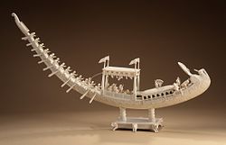
[[File:Royal Peacock Barge LACMA M.82.154.jpg|thumb|Art of [[Murshidabad]]. An [[ivory]] [[elephant tusk]] crafted into a model of the Royal Peacock Barge of the [[Nawab of Bengal]].]] | |||
[[Mughal Bengal]] had the richest elite and was the wealthiest region in the subcontinent. Bengal's trade and wealth impressed the Mughals so much that it was described as the ''Paradise of the Nations'' by the [[Mughal Emperor]]s.<ref>{{cite book |title=A Collection of Treaties and Engagements with the Native Princes and States of Asia: Concluded on Behalf of the East India Company by the British Governments in India, Viz. by the Government of Bengal Etc. : Also Copies of Sunnuds Or Grants of Certain Privileges and Imunities to the East India Company by the Mogul and Other Native Princes of Hindustan |url=https://archive.org/details/bub_gb_J_1RAAAAcAAJ |access-date=23 August 2013 |year=1812 |publisher=United East-India Company |page=[https://archive.org/details/bub_gb_J_1RAAAAcAAJ/page/n55 28]}}</ref> A new provincial capital was built in [[Dhaka]]. Members of the imperial family were appointed to positions in Mughal Bengal, including the position of governor (''[[subedar]]''). Dhaka became a centre of palace intrigue and politics. Some of the most prominent governors included [[Rajput]] general [[Man Singh I]], Emperor [[Shah Jahan]]'s son Prince [[Shah Shuja (Mughal prince)|Shah Shuja]], Emperor [[Aurangzeb]]'s son and later Mughal emperor [[Muhammad Azam Shah|Azam Shah]], and the influential aristocrat [[Shaista Khan]]. During the tenure of Shaista Khan, the Portuguese and Arakanese were expelled from the port of Chittagong in 1666. Bengal became the eastern frontier of the Mughal administration. By the 18th century, Bengal became home to a semi-independent aristocracy led by the [[Nawabs of Bengal]].<ref name="Ahmed2011">{{cite book |title=A Comprehensive History of Medieval India: Twelfth to the Mid-Eighteenth Century |author=Ahmed, F. S. |date=2011 |publisher=Pearson |isbn=9788131732021 |url=https://books.google.com/books?id=sxhAtCflwOMC |access-date=7 January 2017}}</ref> Bengal premier [[Murshid Quli Khan]] managed to curtail the influence of the governor due to his rivalry with Prince Azam Shah. Khan controlled Bengal's finances since he was in charge of the treasury. He shifted the provincial capital from Dhaka to [[Murshidabad]]. | |||
In 1717, the Mughal court in Delhi recognised the hereditary monarchy of the Nawab of Bengal. The ruler was officially titled as the "Nawab of Bengal, [[Bihar]] and [[Orissa]]", as the Nawab ruled over the three regions in the eastern subcontinent. The Nawabs began issuing their own coins but continued to pledge nominal allegiance to the Mughal emperor. The wealth of Bengal was vital for the Mughal court because Delhi received its biggest share of revenue from the Nawab's court. The Nawabs presided over a period of unprecedented economic growth and prosperity, including an era of growing organisation in textiles, banking, a military-industrial complex, the production of fine quality [[handicrafts]], and other trades. A process of [[proto-industrialisation]] was underway. Under the Nawabs, the streets of Bengali cities were filled with brokers, workers, peons, naibs, wakils, and ordinary traders.<ref name="auto">{{cite web |url=http://en.banglapedia.org/index.php?title=Murshidabad |title=Murshidabad |website=Banglapedia}}</ref> The Nawab's state was a major exporter of [[muslin trade in Bengal|Bengal muslin]], silk, [[gunpowder]] and [[saltpetre]]. The Nawabs also permitted European trading companies to operate in Bengal, including the [[British East India Company]], the [[John Law's Company|French East India Company]], the [[Danish East India Company]], the [[Austrian East India Company]], the [[Ostend Company]], and the [[Dutch East India Company]]. The Nawabs were also suspicious of the growing influence of these companies. | |||
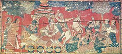
[[File:Krishna traveling to Mathura (Bengal painting).jpg|thumb|Bengali manuscript painting, 17th century]] | |||
Under Mughal rule, Bengal was a centre of the worldwide [[muslin]] and silk trades. During the Mughal era, the most important centre of cotton production was Bengal, particularly around its capital city of Dhaka, leading to muslin being called "daka" in distant markets such as Central Asia.<ref name="eaton">Richard Maxwell Eaton (1996), [https://books.google.com/books?id=gKhChF3yAOUC&pg=PA202 ''The Rise of Islam and the Bengal Frontier, 1204–1760'', page 202], [[University of California Press]]</ref> Domestically, much of India depended on Bengali products such as rice, silks and cotton textiles. Overseas, Europeans depended on Bengali products such as cotton textiles, silks and opium; Bengal accounted for 40% of [[Dutch East India Company|Dutch]] imports from Asia, for example, including more than 50% of textiles and around 80% of silks.<ref name="Prakash">[[Om Prakash (historian)|Om Prakash]], "[http://link.galegroup.com/apps/doc/CX3447600139/WHIC?u=seat24826&xid=6b597320 Empire, Mughal]", ''History of World Trade Since 1450'', edited by [[John J. McCusker]], vol. 1, Macmillan Reference USA, 2006, pp. 237–240, ''World History in Context''. Retrieved 3 August 2017</ref> From Bengal, saltpetre was also shipped to Europe, opium was sold in [[Indonesia]], raw silk was exported to Japan and the Netherlands, cotton and silk textiles were exported to Europe, Indonesia, and Japan,<ref name="richards95">[[John F. Richards]] (1995), [https://books.google.com/books?id=HHyVh29gy4QC&pg=PA202 ''The Mughal Empire'', page 202], [[Cambridge University Press]]</ref> cotton cloth was exported to the Americas and the Indian Ocean.<ref name="riello">{{cite book |title=How India Clothed the World: The World of South Asian Textiles, 1500–1850 |author=Giorgio Riello, Tirthankar Roy |publisher=[[Brill Publishers]] | year=2009 |page=174 |url=https://books.google.com/books?id=niuwCQAAQBAJ&pg=PA174|isbn=9789047429975 }}</ref> Bengal also had a large [[shipbuilding]] industry. In terms of shipbuilding tonnage during the 16th–18th centuries, economic historian Indrajit Ray estimates the annual output of Bengal at 223,250 tons, compared with 23,061 tons produced in nineteen colonies in North America from 1769 to 1771.<ref name="ray174">{{cite book |last=Ray |first=Indrajit |year=2011 |title=Bengal Industries and the British Industrial Revolution (1757–1857) |url=https://books.google.com/books?id=CHOrAgAAQBAJ&pg=PA174 |publisher=Routledge |page=174 |isbn=978-1-136-82552-1}}</ref> | |||
Since the 16th century, European traders traversed the sea routes to Bengal, following the Portuguese conquests of Malacca and Goa. The Portuguese established a [[Portuguese Chittagong|settlement in Chittagong]] with permission from the Bengal Sultanate in 1528 but were later expelled by the Mughals in 1666. In the 18th century, the Mughal Court rapidly disintegrated due to [[Nader Shah's invasion of India|Nader Shah's invasion]] and internal rebellions, allowing European colonial powers to set up trading posts across the territory. The British East India Company eventually emerged as the foremost military power in the region; and defeated the last independent Nawab of Bengal at the [[Battle of Plassey]] in 1757.<ref name="Ahmed2011" /> | |||
=== Colonial era (1757–1947) === | |||
{{Main|Bengal Presidency}} | |||
[[File:Victoria Memorial, Calcutta - LIFE.jpg|thumb|[[Victoria Memorial, Kolkata|Victoria Memorial]] in [[Calcutta]]]] | |||
[[File:Lord Clive meeting with Mir Jafar after the Battle of Plassey.jpg|thumb|The [[Battle of Plassey]] in 1757 ushered in British rule.]] | |||
The British [[East India Company]] began influencing and controlling the [[Nawab of Bengal]] from 1757 after the Battle of Plassey, thus signalling the start of British influence in India. British control of Bengal increased between 1757 and 1793 while the Nawab was reduced to a puppet figure.<ref>{{cite book |author=Baten, Jörg |title=A History of the Global Economy. From 1500 to the Present |date=2016 |publisher=Cambridge University Press |page=251 |isbn=978-1-107-50718-0}}</ref> | |||
with the [[Presidency of Fort William]] asserting greater control over the entire province of Bengal and neighbouring territories. [[Kolkata|Calcutta]] was named the capital of [[British territories in India]] in 1772. The presidency was run by a military-civil administration, including the [[Bengal Army]], and had the world's sixth earliest railway network. Between 1833 and 1854, the [[Governor of Bengal]] was concurrently the [[Governor-General of India]] for many years. Great [[Famines in India|Bengal famines]] struck several times during colonial rule (notably the [[Great Bengal famine of 1770]] and [[Bengal famine of 1943]]).<ref>[https://www.independent.co.uk/news/uk/home-news/worst-atrocities-british-empire-amritsar-boer-war-concentration-camp-mau-mau-a6821756.html 5 of the worst atrocities carried out by the British Empire]. ''The Independent''. 19 January 2016.</ref><ref>[https://www.theguardian.com/world/2019/mar/29/winston-churchill-policies-contributed-to-1943-bengal-famine-study Churchill's policies contributed to 1943 Bengal famine – study]. ''The Guardian''. 29 March 2019.</ref> Under British rule, Bengal experienced the [[deindustrialisation]] of its pre-colonial economy.<ref name="ray">{{cite book |last=Ray |first=Indrajit |year=2011 |title=Bengal Industries and the British Industrial Revolution (1757–1857) |url=https://books.google.com/books?id=CHOrAgAAQBAJ&pg=PA7 |publisher=Routledge |pages=7–10 |isbn=978-1-136-82552-1}}</ref> | |||
Company policies led to the deindustrialisation of Bengal's textile industry.<ref>{{cite web|url=http://academic.eb.com/levels/collegiate/article/Cornwallis-Code/26365|title=Cornwallis Code|date=4 February 2009|website=Encyclopædia Britannica|access-date=24 February 2017}}</ref> The capital amassed by the East India Company in Bengal was invested in the emerging [[Industrial Revolution]] in [[United Kingdom of Great Britain and Ireland|Great Britain]], in industries such as [[Textile manufacture during the Industrial Revolution|textile manufacturing]].<ref name="ray"/><ref name="sengupta">Shombit Sengupta, [http://www.financialexpress.com/archive/bengals-plunder-gifted-the-british-industrial-revolution/576476/ Bengals plunder gifted the British Industrial Revolution], ''[[The Financial Express (India)|The Financial Express]]'', 8 February 2010</ref> Economic mismanagement, alongside drought and a smallpox epidemic, directly led to the Great Bengal famine of 1770, which is estimated to have caused the deaths of between 1 million and 10 million people.<ref name="Roy2019">{{citation|last=Roy|first=Tirthankar|title=How British Rule Changed India's Economy: The Paradox of the Raj|url=https://books.google.com/books?id=XBWZDwAAQBAJ&pg=PA117|year=2019|publisher=Springer|isbn=978-3-030-17708-9|pages=117–|quote=The 1769-1770 famine in Bengal followed two years of erratic rainfall worsened by a smallpox epidemic.}}</ref><ref>{{Cite book|last=Datta|first=Rajat|title=Society, economy, and the market : commercialization in rural Bengal, c. 1760–1800|date=2000|publisher=Manohar Publishers & Distributors|isbn=81-7304-341-8|location=New Delhi|pages=262, 266|oclc=44927255}}</ref><ref>{{cite book|author=Amartya Sen|title=Poverty and Famines: An Essay on Entitlement and Deprivation|url=https://archive.org/details/povertyfamineses0000sena|url-access=registration|year=1981|publisher=Oxford University Press|isbn=978-0-19-828463-5|page=[https://archive.org/details/povertyfamineses0000sena/page/39 39]}}</ref><ref name="Jonsson2013p167">{{cite book|author=Fredrik Albritton Jonsson|title=Enlightenment's Frontier: The Scottish Highlands and the Origins of Environmentalism|url=https://books.google.com/books?id=d9FUmajYyqgC&pg=PT167|date=18 June 2013|publisher=Yale University Press|isbn=978-0-300-16374-2|pages=167–170}}</ref> | |||
In 1862, the [[British Bengal Legislative Council|Bengal Legislative Council]] was set up as the first modern [[List of legislatures in South Asia|legislature in India]]. Elected representation was gradually introduced during the early 20th century, including with the [[Morley-Minto reforms]] and the system of [[dyarchy]]. In 1937, the council became the upper chamber of the Bengali legislature while the [[Bengal Legislative Assembly (1937—1947)|Bengal Legislative Assembly]] was created. Between 1937 and 1947, the chief executive of the government was the [[Prime Minister of Bengal]]. | |||
The Bengal Presidency was the largest administrative unit in the [[British Empire]]. At its height, it covered large parts of present-day India, Pakistan, Bangladesh, Burma, Malaysia, and Singapore. In 1830, the British Straits Settlements on the coast of the [[Malacca Straits]] was made a residency of Bengal. The area included the erstwhile [[Prince of Wales Island (Malaysia)|Prince of Wales Island]], [[Province Wellesley]], [[Malacca]] and [[Singapore]].<ref name="residency"/> In 1867, [[Penang]], Singapore and Malacca were separated from Bengal into the [[Straits Settlements]].<ref name="residency">{{cite web |url=http://eresources.nlb.gov.sg/history/events/bd541c73-58ef-4bb1-9de7-173f00913286 |title=The Straits Settlements becomes a residency – Singapore History |website=Eresources.nlb.gov.sg |access-date=30 March 2020}}</ref> [[British Burma]] became a province of India and a later a [[Crown colony]] in itself. Western areas, including the [[Ceded and Conquered Provinces]] and [[Punjab Province (British India)|The Punjab]], were further reorganised. Northeastern areas became [[Colonial Assam]]. | |||
[[File:Khas Mahal (Agra Fort)-1.jpg|thumb|left|[[Bengal roofs]] seen on Mughal architecture, c. 1600s]] | |||
In 1876, about 200,000 people were killed in Bengal by the [[1876 Bangladesh cyclone|Great Backerganj Cyclone of 1876]] in the [[Barisal]] region.<ref>{{cite web |last1=Chowdhury |first1=Masud Hasan |title=Cyclone |url=http://en.banglapedia.org/index.php?title=Cyclone |website=[[Banglapedia]] | publisher=[[Asiatic Society of Bangladesh]] | access-date=6 August 2015 |archive-url=https://web.archive.org/web/20160119131247/http://en.banglapedia.org/index.php?title=Cyclone |archive-date=19 January 2016 |url-status=live}}</ref> About 50 million were killed in Bengal due to massive plague outbreaks and famines which happened in 1895 to 1920, mostly in western Bengal.<ref>{{Cite book|title=The "Gandhians" of Bengal: Nationalism, Social Reconstruction and Cultural Orientations 1920–1942|page=19|quote=Malaria was endemic in rural areas during the 19th century, particularly in western Bengal. This was ... The famine of 1769–70 resulted in about ten million deaths, while 50 million died of malaria, plague and famine between 1895 and 19206.}}</ref> | |||
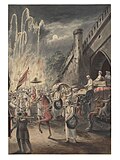
[[File:Mahomedan wedding at night.jpg|thumb|Wedding at night, [[Murshidabad]], Bengal, 1810]] | |||
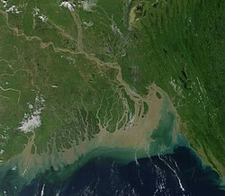
[[File:Gangesdelta klein.jpg|thumb|upright=1.35|The [[Ganges-Brahmaputra delta]]]] | |||
The [[Indian Rebellion of 1857]] was initiated on the outskirts of Calcutta, and spread to Dhaka, Chittagong, Jalpaiguri, Sylhet and Agartala, in solidarity with revolts in North India. The failure of the rebellion led to the abolition of the [[Company Rule in India]] and establishment of direct rule over India by the British, commonly referred to as the [[British Raj]]. The late 19th and early 20th century [[Bengal Renaissance]] had a great impact on the cultural and economic life of Bengal and started a great advance in the literature and science of Bengal. Between 1905 and 1911, an abortive attempt was made to [[Partition of Bengal (1905)|divide the province of Bengal]] into two: Bengal proper and the short-lived province of [[Eastern Bengal and Assam]] where the [[All India Muslim League]] was founded.<ref name=baxter3>{{cite book |last=Baxter |first=Craig|author-link = Craig Baxter |year=1997 |title=Bangladesh: From a Nation to a State |location=Boulder, CO |publisher=Westview Press |pages=39–40 |isbn=0-8133-2854-3}}</ref> In 1911, the Bengali poet and polymath [[Rabindranath Tagore]] became Asia's first Nobel laureate when he won the [[Nobel Prize in Literature]]. | |||
Bengal played a major role in the [[Indian independence movement]], in which [[Revolutionary movement for Indian independence|revolutionary groups]] were dominant. Armed attempts to overthrow the British Raj began with the rebellion of [[Titumir]], and reached a climax when [[Subhas Chandra Bose]] led the [[Indian National Army]] against the British. Bengal was also central in the rising political awareness of the Muslim population—the [[All-India Muslim League]] was established in Dhaka in 1906. The Muslim homeland movement pushed for a sovereign state in eastern India with the [[Lahore Resolution]] in 1943. [[Hindu nationalism]] was also strong in Bengal, which was home to groups like the [[Hindu Mahasabha]]. In spite of a last-ditch effort by politicians [[Huseyn Shaheed Suhrawardy]], [[Sarat Chandra Bose]] to form a [[United Bengal]],<ref name=unitedbengal>{{cite web |url=http://en.banglapedia.org/index.php?title=United_Independent_Bengal_Movement |title=United Independent Bengal Movement |access-date=5 August 2015 |author=Chitta Ranjan Misra |website=[[Banglapedia]] | publisher=Asiatic Society of Bangladesh |archive-url=https://web.archive.org/web/20150805022148/http://en.banglapedia.org/index.php?title=United_Independent_Bengal_Movement |archive-date=5 August 2015}}</ref> when India [[History of the Republic of India|gained independence]] in 1947, Bengal was [[Partition of Bengal (1947)|partitioned]] along religious lines.<ref name = parttionbanglaped /> The western joined India (and was named West Bengal) while the eastern part joined Pakistan as a province called [[East Bengal]] (later renamed [[East Pakistan]], giving rise to Bangladesh in 1971). The circumstances of partition were bloody, with widespread religious riots in Bengal.<ref name=parttionbanglaped>{{cite web |url=http://en.banglapedia.org/index.php?title=Partition_of_Bengal,_1947 |title=Partition of Bengal, 1947 |access-date=5 August 2015 |author=Harun-or-Rashid |website=[[Banglapedia]] | publisher=Asiatic Society of Bangladesh |archive-url=https://web.archive.org/web/20150702002256/http://en.banglapedia.org/index.php?title=Partition_of_Bengal,_1947 |archive-date=2 July 2015 |url-status=live }}</ref><ref name=calcuttakilling>{{cite web |url=http://en.banglapedia.org/index.php?title=Calcutta_Riot,_1946 |title=Calcutta Riot (1946) |access-date=5 August 2015 |author=Suranjan Das |website=[[Banglapedia]] | publisher=Asiatic Society of Bangladesh |archive-url=https://web.archive.org/web/20150801150533/http://en.banglapedia.org/index.php?title=Calcutta_Riot%2C_1946 |archive-date=1 August 2015 |url-status=dead }}</ref> | |||
===Partition of Bengal (1947)=== | |||
{{See also|United Bengal|History of Bangladesh|History of West Bengal}}{{Main|Partition of Bengal (1947)}} | |||
On 27 April 1947, the last [[Prime Minister of Bengal]] [[Huseyn Shaheed Suhrawardy]] held a press conference in New Delhi where he outlined his vision for an independent Bengal. Suhrawardy said "Let us pause for a moment to consider what Bengal can be if it remains united. It will be a great country, indeed the richest and the most prosperous in India capable of giving to its people a high standard of living, where a great people will be able to rise to the fullest height of their stature, a land that will truly be plentiful. It will be rich in agriculture, rich in industry and commerce and in course of time it will be one of the powerful and progressive states of the world. If Bengal remains united this will be no dream, no fantasy".<ref>{{cite news |url=https://scroll.in/article/907754/why-did-british-prime-minister-attlee-think-bengal-was-going-to-be-an-independent-country-in-1947 |title=Why did British prime minister Attlee think Bengal was going to be an independent country in 1947? |work=Scroll.in |date=6 January 2019}}</ref> On 2 June 1947, [[British Prime Minister]] [[Clement Attlee]] told the [[US Ambassador to the United Kingdom]] that there was a "distinct possibility Bengal might decide against partition and against joining either Hindustan or Pakistan".<ref>{{cite news |url=https://www.dawn.com/news/1453994/uk-pm-attlee-believed-bengal-may-opt-to-be-a-separate-country |title=UK PM Attlee believed Bengal may opt to be a separate country |newspaper=Dawn|location=Pakistan|date=28 December 2018}}</ref> | |||
On 3 June 1947, the [[Mountbatten Plan]] outlined the [[partition of British India]]. On 20 June, the Bengal Legislative Assembly met to decide on the partition of Bengal. At the preliminary joint meeting, it was decided (126 votes to 90) that if the province remained united, it should join the [[Constituent Assembly of Pakistan]]. At a separate meeting of legislators from [[West Bengal]], it was decided (58 votes to 21) that the province should be partitioned and West Bengal should join the [[Constituent Assembly of India]]. At another meeting of legislators from [[East Bengal]], it was decided (106 votes to 35) that the province should not be partitioned and (107 votes to 34) that East Bengal should join the Constituent Assembly of [[Pakistan]] if Bengal was partitioned.<ref>{{cite book |last=Bose |first=Sugata |title=Agrarian Bengal: Economy, Social Structure and Politics |url=https://books.google.com/books?id=fxXInQEACAAJ |year=1986 |publisher=Cambridge University Press |page=230 |isbn=978-0-521-30448-1}}</ref> On 6 July, the [[Sylhet Division|Sylhet district]] of Assam voted in a [[1947 Sylhet referendum|referendum to join East Bengal]]. | |||
The English barrister [[Cyril Radcliffe]] was instructed to draw the borders of Pakistan and India. The [[Radcliffe Line]] created the boundary between the [[Dominion of India]] and the [[Dominion of Pakistan]], which later became the [[Bangladesh-India border]]. The Radcliffe Line awarded two-thirds of Bengal as the eastern wing of Pakistan, although the historic Bengali capitals of [[Gauda (city)|Gaur]], [[Pandua, Malda|Pandua]], [[Murshidabad]] and Calcutta fell on the Indian side close to the border with Pakistan. Dhaka's status as a capital was also restored. | |||
== Geography == | == Geography == | ||
{{Main|Geography of Bangladesh|Geography of West Bengal}} | {{Main|Geography of Bangladesh|Geography of West Bengal}} | ||
The flat and fertile Bangladesh Plain dominates the [[geography of Bangladesh]]. The [[Chittagong Hill Tracts]] and [[Sylhet region]] | Most of the Bengal region lies in the [[Ganges-Brahmaputra delta]], but there are highlands in its north, northeast and southeast. The Ganges Delta arises from the confluence of the rivers [[Ganges]], [[Brahmaputra River|Brahmaputra]], and [[Meghna River|Meghna]] rivers and their respective tributaries. The total area of Bengal is {{convert|237212|km2}}—West Bengal is {{convert|88752|km2|0|abbr=on}} and Bangladesh {{convert|148460|km2|0|abbr=on}}. | ||
The flat and fertile Bangladesh Plain dominates the [[geography of Bangladesh]]. The [[Chittagong Hill Tracts]] and [[Sylhet region]] are home to most of the [[List of mountains in Bangladesh|mountains in Bangladesh]]. Most parts of Bangladesh are within {{convert|10|m|ft|abbr=off}} above the sea level, and it is believed that about 10% of the land would be flooded if the sea level were to rise by {{convert|1|m|ft|abbr=off}}.<ref name=ali>{{cite journal |last=Ali |first=A |year=1996 |title=Vulnerability of Bangladesh to climate change and sea level rise through tropical cyclones and storm surges |doi=10.1007/BF00175563 |journal=Water, Air, & Soil Pollution |volume=92 |issue=1–2 |pages=171–179 |bibcode=1996WASP...92..171A |s2cid=93611792 |url=https://link.springer.com/article/10.1007/BF00175563|url-access=subscription}}</ref> Because of this low elevation, much of this region is exceptionally vulnerable to seasonal flooding due to monsoons. | |||
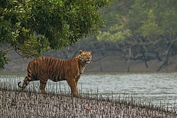
The highest point in Bangladesh is in Mowdok range at {{convert|1052|m|ft|abbr=off}}.<ref>[http://www.sol.co.uk/v/viewfinder/elevmisquotes.html#keok Summit Elevations: Frequent Internet Errors.] {{webarchive|url=https://web.archive.org/web/20130725020735/http://www.sol.co.uk/v/viewfinder/elevmisquotes.html |date=25 July 2013 }} Retrieved 13 April 2006.</ref> A major part of the coastline comprises a [[marsh]]y [[jungle]], the [[Sundarbans]], the largest [[mangrove]] forest in the world and home to diverse flora and fauna, including the [[royal Bengal tiger]]. In 1997, this region was declared endangered.<ref name=sundarbans>{{cite journal |last=IUCN |year=1997 |title=Sundarban wildlife sanctuaries Bangladesh |journal=World Heritage Nomination-IUCN Technical Evaluation}}</ref> | The highest point in Bangladesh is in Mowdok range at {{convert|1052|m|ft|abbr=off}}.<ref>[http://www.sol.co.uk/v/viewfinder/elevmisquotes.html#keok Summit Elevations: Frequent Internet Errors.] {{webarchive|url=https://web.archive.org/web/20130725020735/http://www.sol.co.uk/v/viewfinder/elevmisquotes.html |date=25 July 2013 }} Retrieved 13 April 2006.</ref> A major part of the coastline comprises a [[marsh]]y [[jungle]], the [[Sundarbans]], the largest [[mangrove]] forest in the world and home to diverse flora and fauna, including the [[royal Bengal tiger]]. In 1997, this region was declared endangered.<ref name=sundarbans>{{cite journal |last=IUCN |year=1997 |title=Sundarban wildlife sanctuaries Bangladesh |journal=World Heritage Nomination-IUCN Technical Evaluation}}</ref> | ||
West Bengal is on the eastern bottleneck of India, stretching from the [[Himalaya]]s in the north to the Bay of Bengal in the south. The state has a total area of {{convert|88752|km2|sqmi|0|abbr=on}}.<ref name=area>{{cite web |url=http://www.indianmirror.com/geography/geo9.html |title=Statistical Facts about India |access-date=26 October 2006 | | West Bengal is on the eastern bottleneck of India, stretching from the [[Himalaya]]s in the north to the Bay of Bengal in the south. The state has a total area of {{convert|88752|km2|sqmi|0|abbr=on}}.<ref name=area>{{cite web |url=http://www.indianmirror.com/geography/geo9.html |title=Statistical Facts about India |access-date=26 October 2006 |website=indianmirror.com |archive-url=https://web.archive.org/web/20061026055639/http://www.indianmirror.com/geography/geo9.html |archive-date=26 October 2006 |url-status=live}}</ref> The [[Darjeeling Himalayan hill region]] in the northern extreme of the state belongs to the eastern Himalaya. This region contains [[Sandakfu]] ({{convert|3636|m|ft|0|abbr=on}})—the highest peak of the state.<ref name=sandak>{{cite web |url=http://yhaindia.org/sandakphu_trek.htm |title=National Himalayan Sandakphu-Gurdum Trekking Expedition: 2006 |access-date=26 October 2006 |publisher=Youth Hostels Association of India: West Bengal State Branch |archive-url=https://web.archive.org/web/20061024013140/http://www.yhaindia.org/sandakphu_trek.htm <!-- Bot retrieved archive --> |archive-date=24 October 2006}}</ref> The narrow [[Terai region]] separates this region from the plains, which in turn transitions into the Ganges delta towards the south. The [[Rarh region]] intervenes between the Ganges delta in the east and the [[western plateau and high lands]]. A small coastal region is on the extreme south, while the Sundarbans mangrove forests form a remarkable geographical landmark at the Ganges delta. | ||
At least nine districts in West Bengal and 42 districts in Bangladesh have [[Arsenic contamination of groundwater|arsenic levels in groundwater]] above the World Health Organization maximum permissible limit of 50 | At least nine districts in West Bengal and 42 districts in Bangladesh have [[Arsenic contamination of groundwater|arsenic levels in groundwater]] above the World Health Organization maximum permissible limit of 50 μg/L or 50 parts per billion and the untreated water is unfit for human consumption.<ref name=chowdhury>{{cite journal |title=Groundwater arsenic contamination in Bangladesh and West Bengal, India |last1=Chowdhury |first1=U. K. |last2=Biswas |first2=B. K. |last3=Chowdhury |first3=T. R. |last4=Samanta |first4=G. |last5=Mandal |first5=B. K. |last6=Basu |first6=G. C. |last7=Chanda |first7=C. R. |last8=Lodh |first8=D. |last9=Saha |first9=K. C. |last10=Mukherjee |first10=S. K. |last11=Roy |first11=S. |last12=Kabir |first12=S. |last13=Quamruzzaman |first13=Q. |last14=Chakraborti |first14=D. |display-authors=3 |date=May 2000 |journal=[[Environmental Health Perspectives]] | volume=108 |issue=4 |pages=393–397 |url=http://www.ehponline.org/members/2000/108p393-397chowdhury/chowdhury-full.html |doi=10.2307/3454378 |jstor=3454378 |url-status=dead |archive-url=https://web.archive.org/web/20070927002931/http://www.ehponline.org/members/2000/108p393-397chowdhury/chowdhury-full.html |archive-date=27 September 2007 |pmid=10811564 |pmc=1638054}}</ref> The water causes arsenicosis, skin cancer and various other complications in the body. | ||
=== Geographic distinctions === | === Geographic distinctions === | ||
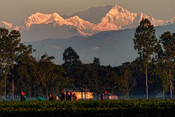
[[File:Kanchenjunga view from Bangladesh.jpg|thumb|[[Kangchenjunga]], the third highest mountain in the world, seen from a tea garden in Bangladesh. Kangchenjunga is often visible from the plains of [[Tetulia Upazila|Tetulia]] in the northernmost tip of Bangladesh.|198x198px]] | |||
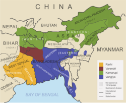
==== North Bengal ==== | ==== North Bengal ==== | ||
[[North Bengal]] is a term used for the north-western part of Bangladesh and northern part of West Bengal. The Bangladeshi part comprises [[Rajshahi Division]] and [[Rangpur Division]]. Generally, it is the area lying west of [[Jamuna River (Bangladesh)|Jamuna River]] and north of [[Padma River]], and includes the [[Barind Tract]]. Politically, West Bengal's part comprises [[Jalpaiguri Division]] and most of [[Malda division]] (except [[Murshidabad district]]) together and Bihar's parts include [[Kishanganj district]]. [[Darjeeling]] Hilly are also part of North Bengal. The people of Jaipaiguri, Alipurduar and Cooch Behar usually identify themselves as North Bengali. North Bengal is divided into [[Terai]] and [[Dooars]] regions. North Bengal is also noted for its rich cultural heritage, including two UNESCO World Heritage Sites. Aside from the Bengali majority, North Bengal is home to many other communities including Nepalis, [[Santhal people]], Lepchas and Rajbongshis. | |||
[[North Bengal]] is a term used for the north-western part of Bangladesh and northern part of West Bengal. The Bangladeshi part comprises [[Rajshahi Division]] and [[Rangpur Division]]. Generally, it is the area lying west of [[Jamuna River (Bangladesh)|Jamuna River]] and north of [[Padma River]], and includes the [[Barind Tract]]. Politically, West Bengal's part comprises [[Jalpaiguri Division]] | |||
==== Northeast Bengal ==== | ==== Northeast Bengal ==== | ||
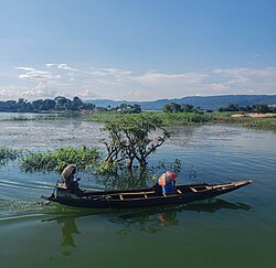
[[File: | [[File:People crossing Tanguar Haor in a boat.jpg|alt=|thumb|Tanguar Haor in [[Sunamganj District]], Bangladesh. Haor are a common sight in the northeast of Bengal.|184x184px]] | ||
Northeast Bengal<ref name=" | |||
Northeast Bengal<ref name="Lethbridge1874">{{cite book |title=An Easy Introduction to the History and Geography of Bengal: For the Junior Classes in Schools |author=Lethbridge, E. |date=1874 |publisher=Thacker |url=https://archive.org/details/easyintroduction00lethrich |page=[https://archive.org/details/easyintroduction00lethrich/page/5 5] |access-date=7 January 2017}}</ref> refers to the Sylhet region, which today comprises the [[Sylhet Division]] of Bangladesh and [[Karimganj district]] in the Indian state of [[Assam]]. The region is famous for its fertile land terrain, many rivers, extensive tea plantations, rainforests and wetlands. The [[Brahmaputra River|Brahmaputra]] and [[Barak River|Barak]] river are the geographic markers of the area. The city of [[Sylhet]] is its largest urban centre, and the region is known for its unique regional [[Sylheti language]]. The ancient name of the region is Srihatta and Nasratshahi.<ref name="en.banglapedia.org">{{cite book |last=Akhter |first=Nasrin |year=2012 |chapter=Sarkar |chapter-url=http://en.banglapedia.org/index.php?title=Sarkar |editor1-last=Islam |editor1-first=Sirajul |editor1-link=Sirajul Islam |editor2-last=Jamal |editor2-first=Ahmed A. |title=Banglapedia: National Encyclopedia of Bangladesh |edition=Second |publisher=[[Asiatic Society of Bangladesh]]}}</ref> The region was ruled by the [[Kamarupa]] and [[Harikela]] kingdoms as well as the [[Bengal Sultanate]]. It later became a district of the [[Mughal Empire]]. Alongside the predominant Bengali population resides a small [[Garo people|Garo]], [[Bishnupriya Manipuri]], [[Khasi people|Khasia]] and other tribal minorities.<ref name="en.banglapedia.org" /> | |||
The region is the crossroads of Bengal and [[northeast India]]. | The region is the crossroads of Bengal and [[northeast India]]. | ||
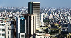
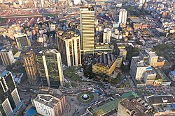
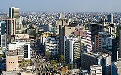
[[File:Bangladesh Bank (33398162476).jpg|left|thumb|307x307px|Central Bengal, one of the most urban and developed regions in Bengal]] | |||
==== Central Bengal ==== | ==== Central Bengal ==== | ||
| Line 116: | Line 207: | ||
==== South Bengal ==== | ==== South Bengal ==== | ||
{{Main|South Bengal}} | {{Main|South Bengal}} | ||
South Bengal covers the southwestern Bangladesh and the southern part of the Indian state of West Bengal.The Bangladeshi part includes [[Khulna Division]], [[Barisal Division]] and the proposed [[Faridpur Division]]<ref>{{Cite book |url=https://books.google.com/books?id=PpIzAFZ5zZEC&q=South%20Bengal%20area%20districts&pg=PA16 |title=Social Structure and Cultural Practices in Slums: A Study of Slums in Dhaka City |isbn=9788172111106 |last1=Das |first1=Tulshi Kumar |year=2000}}</ref> The | |||
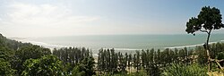
[[File:Cox's Bazar beach 15.jpg|thumb|300px|[[Cox's Bazar]] has the longest uninterrupted sea beach in the world.]] | |||
South Bengal covers the southwestern Bangladesh and the southern part of the Indian state of West Bengal. The Bangladeshi part includes [[Khulna Division]], [[Barisal Division]] and the proposed [[Faridpur Division]]<ref>{{Cite book |url=https://books.google.com/books?id=PpIzAFZ5zZEC&q=South%20Bengal%20area%20districts&pg=PA16 |title=Social Structure and Cultural Practices in Slums: A Study of Slums in Dhaka City |isbn=9788172111106 |last1=Das |first1=Tulshi Kumar |year=2000|publisher=Northern Book Centre }}</ref> The part of South Bengal of West Bengal includes [[Presidency division]], [[Burdwan division]] and [[Medinipur division]].<ref name="swhydro">{{cite web |url=http://www.swhydro.arizona.edu/07symposium/presentationpdf/ChristianaD_pro.pdf |title=Arsenic Mitigation in West Bengal, India: New Hope for Millions |author=David Christiana |publisher=Southwest Hydrology |page=32 |date=1 September 2007 |access-date=20 December 2008 |archive-url=https://web.archive.org/web/20160305124232/http://www.swhydro.arizona.edu/07symposium/presentationpdf/ChristianaD_pro.pdf |archive-date=5 March 2016 |url-status=dead }}</ref><ref>{{Cite book |url=https://books.google.com/books?id=xgoYwm4xiVYC&q=%22South%20Bengal%22&pg=PA322 |title=Agroforestry: Systems and Practices |isbn=9788189422622 |last1=Puri |first1=Sunil |year=2007|publisher=New India }}</ref><ref>{{Cite book |url=https://books.google.com/books?id=toTvPa0CRIgC&q=South%20Bengal%20area%20districts&pg=PA347 |title=Gandhi and globalisation |isbn=9788183242967 |last1=Reddy |first1=Angadi Ranga |year=2009|publisher=Mittal Publications }}</ref> | |||
The [[Sundarbans]], a major [[biodiversity hotspot]], is located in South Bengal. Bangladesh hosts 60% of the forest, with the remainder in India. | The [[Sundarbans]], a major [[biodiversity hotspot]], is located in South Bengal. Bangladesh hosts 60% of the forest, with the remainder in India. | ||
| Line 122: | Line 216: | ||
==== Southeast Bengal ==== | ==== Southeast Bengal ==== | ||
{{Main|Greater Chittagong}} | {{Main|Greater Chittagong}} | ||
[[File: | |||
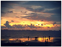
Southeast Bengal<ref name=" | [[File:Sunset of Porenga.jpg|thumb|Sunset at [[Patenga|Potenga Beach]], [[Chittagong]], Bangladesh|276x276px]] | ||
Southeast Bengal<ref name="Andaya2015">{{cite book |title=A History of Early Modern Southeast Asia, 1400–1830 |author1=Andaya, B. W. |author2=Andaya, L. Y. |date=2015 |publisher=Cambridge University Press |isbn=978-0-521-88992-6 |url=https://books.google.com/books?id=0Rh2BgAAQBAJ&pg=PA220 |page=220 |access-date=7 January 2017}}</ref><ref name="Singh2006">{{cite book |title=Modern World System and Indian Proto-industrialization: Bengal 1650–1800 |author=Singh, A. K. |date=2006 |volume=1 |publisher=Northern Book Centre |isbn=9788172112011 |url=https://books.google.com/books?id=WwNUblS-jpwC&pg=PA225 |page=225 |access-date=7 January 2017}}</ref><ref name="Banu1992">{{cite book |title=Islam in Bangladesh |author=Banu, U. A. B. Razia Akter |year=1992 |publisher=Brill |isbn=978-90-04-09497-0 |url=https://books.google.com/books?id=XyzqATEDPSgC&pg=PA6 |page=6 |access-date=7 January 2017 |quote=in Samatata (South-east Bengal) where the Buddhist Khadaga dynasty ruled throughout the fifth, sixth and seventh centuries AD.}}</ref> refers to the hilly-coastal [[Chittagonian language|Chittagonian]]-speaking and coastal Bengali-speaking areas of [[Chittagong Division]] in southeastern Bangladesh. The region is noted for its [[thalassocracy|thalassocratic]] and [[seafaring]] heritage. The area was dominated by the Bengali [[Harikela]] and [[Samatata]] kingdoms in antiquity. It was known to Arab traders as ''Samandar'' in the 9th century.<ref>{{cite book |last=Rashid |first=M Harunar |year=2012 |chapter=Harikela |chapter-url=http://en.banglapedia.org/index.php?title=Harikela |editor1-last=Islam |editor1-first=Sirajul |editor1-link=Sirajul Islam |editor2-last=Jamal |editor2-first=Ahmed A. |title=Banglapedia: National Encyclopedia of Bangladesh |edition=Second |publisher=[[Asiatic Society of Bangladesh]]}}</ref> During the medieval period, the region was ruled by the [[Chandra dynasty]], the [[sultanate of Bengal]], the [[kingdom of Tripura]], the [[kingdom of Mrauk U]], the [[Portuguese Empire]] and the [[Mughal Empire]], prior to the advent of British rule. The [[Chittagonian language]], a sister of Bengali is prevalent in coastal areas of southeast Bengal. Along with its Bengali population, it is also home to [[Tibeto-Burman]] ethnic groups, including the [[Chakma people|Chakma]], [[Marma people|Marma]], [[Tanchangya people|Tanchangya]] and [[Bawm people|Bawm]] peoples. | |||
Southeast Bengal is considered a bridge to Southeast Asia and the northern parts of [[Arakan]] are also historically considered to be a part of it.<ref>{{cite news |title=Chittagong to bridge S Asian nations |url=http://archive.thedailystar.net/newDesign/cache/cached-news-details-226586.html |newspaper=The Daily Star |date=17 March 2012 |access-date=12 August 2016 |archive-url=https://web.archive.org/web/20160813113736/http://archive.thedailystar.net/newDesign/cache/cached-news-details-226586.html |archive-date=13 August 2016 |url-status=live}}</ref> | Southeast Bengal is considered a bridge to Southeast Asia and the northern parts of [[Arakan]] are also historically considered to be a part of it.<ref>{{cite news |title=Chittagong to bridge S Asian nations |url=http://archive.thedailystar.net/newDesign/cache/cached-news-details-226586.html |newspaper=The Daily Star |date=17 March 2012 |access-date=12 August 2016 |archive-url=https://web.archive.org/web/20160813113736/http://archive.thedailystar.net/newDesign/cache/cached-news-details-226586.html |archive-date=13 August 2016 |url-status=live}}</ref> | ||
| Line 130: | Line 226: | ||
There are four [[World Heritage Sites]] in the region, including the [[Sundarbans]], the [[Somapura Mahavihara]], the [[Mosque City of Bagerhat]] and the [[Darjeeling Himalayan Railway]]. Other prominent places include the [[Bishnupur, Bankura]] temple city, the [[Adina Mosque]], the [[Katra Masjid|Caravanserai Mosque]], numerous [[zamindar]] palaces (like [[Ahsan Manzil]] and [[Cooch Behar Palace]]), the [[Lalbagh Fort]], the [[Bara Katra|Great Caravanserai ruins]], the [[Choto Katra|Shaista Khan Caravanserai ruins]], the Kolkata [[Victoria Memorial (Kolkata)|Victoria Memorial]], the Dhaka Parliament Building, archaeologically excavated ancient fort cities in [[Mahasthangarh]], [[Mainamati]], [[Chandraketugarh]] and [[Wari-Bateshwar]], the [[Jaldapara National Park]], the [[Lawachara National Park]], the [[Teknaf Game Reserve]] and the [[Chittagong Hill Tracts]]. | There are four [[World Heritage Sites]] in the region, including the [[Sundarbans]], the [[Somapura Mahavihara]], the [[Mosque City of Bagerhat]] and the [[Darjeeling Himalayan Railway]]. Other prominent places include the [[Bishnupur, Bankura]] temple city, the [[Adina Mosque]], the [[Katra Masjid|Caravanserai Mosque]], numerous [[zamindar]] palaces (like [[Ahsan Manzil]] and [[Cooch Behar Palace]]), the [[Lalbagh Fort]], the [[Bara Katra|Great Caravanserai ruins]], the [[Choto Katra|Shaista Khan Caravanserai ruins]], the Kolkata [[Victoria Memorial (Kolkata)|Victoria Memorial]], the Dhaka Parliament Building, archaeologically excavated ancient fort cities in [[Mahasthangarh]], [[Mainamati]], [[Chandraketugarh]] and [[Wari-Bateshwar]], the [[Jaldapara National Park]], the [[Lawachara National Park]], the [[Teknaf Game Reserve]] and the [[Chittagong Hill Tracts]]. | ||
[[Cox's Bazar]] in southeastern Bangladesh is home to the longest natural sea beach in the world with an unbroken length of 120 km (75 mi). It is also a growing [[surfing]] destination.<ref>{{cite news |title=World's longest natural sea beach under threat |url=https://www.bbc.com/news/world-asia-20699989 | | [[Cox's Bazar]] in southeastern Bangladesh is home to the longest natural sea beach in the world with an unbroken length of 120 km (75 mi). It is also a growing [[surfing]] destination.<ref>{{cite news |title=World's longest natural sea beach under threat |url=https://www.bbc.com/news/world-asia-20699989 |publisher=BBC News |date=28 December 2012 |access-date=21 June 2018 |archive-url=https://web.archive.org/web/20170113172432/http://www.bbc.com/news/world-asia-20699989 |archive-date=13 January 2017 |url-status=live}}</ref> [[St. Martin's Island]], off the coast of Chittagong Division, is home to the sole [[coral reef]] in Bengal. | ||
== | === Other regions === | ||
[[File: | [[File:Bengali speaking zone.png|thumb|Today, [[Bengali language|Bengali]] is still spoken in areas beside Bengal proper, including the Barak Valley, Tripura and the Andaman and Nicobar Islands.]] | ||
The | Bengal was a regional power of the Indian subcontinent. The administrative jurisdiction of Bengal historically extended beyond the territory of Bengal proper. In the 9th century, the Pala Empire of Bengal ruled large parts of northern India. The Bengal Sultanate controlled Bengal, Assam, Arakan, Bihar and Orissa at different periods in history. In Mughal Bengal, the Nawab of Bengal had a jurisdiction covering Bengal, Bihar and Orissa. Bengal's administrative jurisdiction reached its greatest extent under the British Empire, when the Bengal Presidency extended from the Straits of Malacca in the east to the Khyber Pass in the west. In the late-19th and early-20th centuries, administrative reorganisation drastically reduced the territory of Bengal. | ||
Several regions bordering Bengal proper continue to have high levels of Bengali influence. The Indian state of Tripura has a Bengali majority population. Bengali influence is also prevalent in the Indian regions of Assam, Meghalaya, Bihar and the Andaman and Nicobar Islands; as well as in Myanmar's Rakhine State. | |||
=== | ====Arakan==== | ||
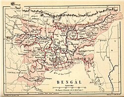
[[File:Eastern Lower Bengal and Chittagong with Arakan.jpg|thumb|Bengal and Arakan in 1638]] | |||
[[Arakan]] (now [[Rakhine State]], [[Myanmar]]) has historically been under strong Bengali influence. Since antiquity, Bengal has influenced the culture of Arakan. The ancient Bengali script was used in Arakan.<ref>"Three medallions above the head contain sacred syllables in proto-Bengali script". [[Pamela Gutman]] and | |||
[[ | Zaw Min Yu, 'Vesali', Burma's Lost Kingdoms: Splendours of Arakan (Orchid Press 2001). p. 57</ref> An Arakanese inscription recorded the reign of the Bengali [[Candra dynasty]]. [[Paul Wheatley (geographer)|Paul Wheatley]] described the "Indianization" of Arakan.<ref>[[Pamela Gutman]] and Zaw Min Yu, Burma's Lost Kingdoms: Splendours of Arakan (Orchid Press 2001). p. 3</ref> | ||
According to [[Pamela Gutman]], "Arakan was ruled by kings who adopted Indian titles and traditions to suit their own environment. Indian Brahmins conducted royal ceremonies, Buddhist monks spread their teachings, traders came and went and artists and architects used Indian models for inspiration. In the later period, there was also influence from the Islamic courts of Bengal and Delhi".<ref>[[Pamela Gutman]] and Zaw Min Yu, Burma's Lost Kingdoms: Splendours of Arakan (Orchid Press 2001). p. 8</ref> Arakan emerged as a [[vassal state]] of the [[Bengal Sultanate]].<ref name="Chowdhury2008">{{cite book |last1=Chowdhury |first1=Mohammed |title=Bengal-Arakan Relations, 1430–1666 A.D. |url=https://books.google.com/books?id=rohuAAAAMAAJ |year=2008 |publisher=Firma K.L.M. |isbn=9788171021185 |access-date=17 May 2023}}</ref> It later became an independent kingdom. The royal court and culture of the [[Kingdom of Mrauk U]] was heavily influenced by Bengal. [[Bengali Muslims]] served in the royal court as ministers and military commanders.<ref name="Chowdhury2008"/> [[Bengali Hindus]] and [[Bengali Buddhists]] served as priests. Some of the most important poets of medieval [[Bengali literature]] lived in Arakan, including [[Alaol]] and [[Daulat Qazi]].<ref name="Umran Chowdhury, Dhaka Tribune">{{cite news |author=Umran Chowdhury, Dhaka Tribune |url=https://scroll.in/article/1006362/the-history-of-the-rohingyas-that-myanmar-refuses-to-acknowledge |title=The history of the Rohingyas that Myanmar refuses to acknowledge |work=Scroll.in |date=29 September 2021 |access-date=17 May 2023}}</ref> In 1660, [[Shah Shuja (Mughal prince)|Prince Shah Shuja]], the governor of Mughal Bengal and a pretender of the [[Peacock Throne]] of India, was forced to seek asylum in Arakan.<ref>{{cite web |url=https://lostfootsteps.org/en/history/the-indian-prince-who-fled-to-mrauk-u |title=The Indian Prince who fled to Mrauk-U |website=Lost Footsteps |access-date=17 May 2023}}</ref><ref>{{cite journal |url=https://www.jstor.org/stable/44138771 |jstor=44138771 |title=A Contemporary Dutch Account of Shah Shuja at Arakan |last1=Ray |first1=Aniruddha |journal=Proceedings of the Indian History Congress |year=1974 |volume=35 |pages=112–118}}</ref> Bengali influence in the Arakanese royal court persisted until Burmese annexation in the 18th century. | |||
=== | The modern-day [[Rohingya people|Rohingya]] population is a legacy of Bengal's influence on Arakan.<ref>{{cite magazine |last=Islam |first=Nurul |title=Rohingya: The descendants of ancient Arakan |url=https://archive.dhakatribune.com/magazine/weekend-tribune/2017/10/12/rohingya-descendants-ancient-arakan |magazine=Weekend Tribune |date=12 October 2017}}</ref><ref name="Umran Chowdhury, Dhaka Tribune"/> The [[Rohingya genocide]] resulted in the displacement of over a million people between 2016 and 2017, with many being uprooted from their homes in Rakhine State. | ||
====Assam==== | |||
[[File:Bengali-Assamese subbranches.png|thumb|Region of the [[Bengali-Assamese languages]]]] | |||
The Indian state of [[Assam]] shares many cultural similarities with Bengal. The Assamese language uses the same script as the Bengali language. The [[Barak Valley]] has a Bengali-speaking majority population. During the [[Partition of India]], Assam was also partitioned along with Bengal. The [[Sylhet Division]] joined [[East Bengal]] in Pakistan, with the exception of [[Karimganj]] which joined Indian Assam. Previously, East Bengal and Assam were part of a single province called [[Eastern Bengal and Assam]] between 1905 and 1912 under the [[British Raj]].<ref>{{cite journal |url=https://www.jstor.org/stable/43553644 | jstor=43553644 | last1=Iqbal | first1=Iftekhar | title=The Space between Nation and Empire: The Making and Unmaking of Eastern Bengal and Assam Province, 1905–1911 | journal=The Journal of Asian Studies | year=2015 | volume=74 | issue=1 | pages=69–84 | doi=10.1017/S0021911814001661 | s2cid=161412009 | url-access=subscription }}</ref> | |||
Assam and Bengal were often part of the same kingdoms, including [[Kamarupa]], [[Gauda Kingdom|Gauda]] and [[Kamata Kingdom|Kamata]]. Large parts of Assam were annexed by [[Alauddin Hussain Shah]] during the Bengal Sultanate.<ref>Sarkar, J. N. (1992), "Chapter II The Turko-Afghan Invasions", in Barpujari, H. K. (ed.), The Comprehensive History of Assam, vol. 2, Guwahati: Assam Publication Board, pp. 35–48</ref> Assam was one of the few regions in the subcontinent to successfully resist Mughal expansion and never fell completely under Mughal rule. | |||
[[ | |||
====Andaman and Nicobar Islands==== | |||
Bengali is the most spoken language among the population of the [[Andaman and Nicobar Islands]], a strategically important archipelago which is controlled by India as a federal territory. The islands were once used as a British penal colony. During [[World War II]], the islands were seized by the Japanese and controlled by the [[Provisional Government of Free India]]. Anti-British leader [[Subhash Chandra Bose]] visited and renamed the islands. Between 1949 and 1971, the Indian government resettled many [[Bengali Hindus]] in the Andaman and Nicobar Islands.<ref>{{cite web|url=https://reviews.history.ac.uk/review/2042 |title=Review of ''Crossing the Bay of Bengal'' |first1=Madhumita |last1=Mazumdar |doi-access=free |doi= 10.14296/RiH/2014/2042 |publisher=Reviews in History |date= 5 January 2017 |access-date=17 May 2023}}</ref> | |||
====Bihar==== | |||
[[File:Pope1880BengalPres2.jpg|thumb|Bengal in 1880, including Bihar, Orissa and Assam]] | |||
In antiquity, Bihar and Bengal were often part of the same kingdoms. The ancient region of [[Magadha (Mahajanapada)|Magadha]] covered both Bihar and Bengal. Magadha was the birthplace or bastion of several pan-Indian empires, including the [[Mauryan Empire]], the [[Gupta Empire]] and the [[Pala Empire]]. Bengal, Bihar and Orissa together formed a single province under the [[Mughal Empire]]. The Nawab of Bengal was styled as the Nawab of Bengal, Bihar and Orissa.<ref name="banglapedia1">{{cite web|url=https://en.banglapedia.org/index.php/Nawab |title=Nawab |website=Banglapedia |date=18 June 2021 |access-date=17 May 2023}}</ref> | |||
=== | ====Chittagong Hill Tracts==== | ||
The [[Chittagong Hill Tracts]] is the southeastern frontier of Bangladesh. Its indigenous population includes [[Tibeto-Burman]] ethnicities, including the [[Chakma people]], [[Bawm people]] and [[Mru people|Mro people]] among others. The region was historically ruled by tribal chieftains of the [[Chakma Circle]] and [[Bohmong Circle]]. In 1713, the [[Chakma Raja]] signed a treaty with [[Mughal Bengal]] after obtaining permission from [[Farrukhsiyar|Emperor Farrukhsiyar]] for trade with the plains of Chittagong.<ref>{{cite book |chapter-url=https://www.taylorfrancis.com/chapters/edit/10.4324/9781003406020-6/mughal-influence-chittagong-chittagong-hill-tracts-cht-ashfaque-hossain-ananda-bikash-chakma |doi=10.4324/9781003406020 |isbn=9781003406020 |title=The Mughals and the North-East |chapter=Mughal Influence on Chittagong and Chittagong Hill Tracts (CHT) |year=2023 |publisher=Routledge |last1=Nag |first1=Sajal |s2cid=258409383}}</ref><ref name="thedailystar2">{{cite news |url=https://www.thedailystar.net/opinion/in-focus/news/chakma-resistance-british-rule-3090111 |title=Chakma resistance to British rule |work=The Daily Star |date=8 August 2022 |type=Opinion}}</ref> Like the kings of Arakan, the Chakma Circle began to fashion themselves using Mughal nomenclatures and titles. They initially resisted the [[Permanent Settlement]] and the activities of the [[East India Company]].<ref name="thedailystar2"/> The tribal royal families of the region came under heavy Bengali influence. The Chakma queen [[Benita Roy]] was a friend of [[Rabindranath Tagore]]. The region was governed by the [[Chittagong Hill Tracts manual]] under colonial rule. The manual was significantly amended after the end of British rule; and the region became fully integrated with Bangladesh.<ref>{{cite web |url=http://bdlaws.minlaw.gov.bd/act-1313.html |title=The Chittagong Hill-tracts Regulation, 1900}}</ref> | |||
[[ | |||
====Malay Archipelago==== | |||
[[File:Bengal Presidency (1849-1853) with modern borders.png|thumb|Extent of the Bengal Presidency between 1858 and 1867, including the Straits Settlements]] | |||
Through trade, settlements and the exchange of ideas; parts of [[Maritime Southeast Asia]] became linked with Bengal.<ref>{{Cite journal |last=Ghosh |first=Suchandra |year=2013 |title=Locating South Eastern Bengal in the Buddhist Network of Bay of Bengal (C. 7th Century CE-13th Century CE) |journal=Proceedings of the Indian History Congress |volume=74 |pages=148–153 |jstor=44158810}}</ref><ref>{{Cite journal|url=https://doi.org/10.1080/19480881.2019.1640577|title=Crossings and contacts across the Bay of Bengal: a connected history of ports in early South and Southeast Asia|first=Suchandra|last=Ghosh|date=2 September 2019|journal=Journal of the Indian Ocean Region|volume=15|issue=3|pages=281–296|via=Taylor and Francis+NEJM|doi=10.1080/19480881.2019.1640577|s2cid=202332142 |url-access=subscription}}</ref> Language, literature, art, governing systems, religions and philosophies in ancient [[Sumatra]] and [[Java]] were influenced by Bengal. [[Indianized kingdom|Hindu-Buddhist kingdom]]s in Southeast Asia depended on the Bay of Bengal for trade and ideas. [[Islam in Southeast Asia]] also spread through the Bay of Bengal, which was a bridge between the Malay Archipelago and Indo-Islamic states of the Indian subcontinent.<ref>{{cite book|author=Sunil S. Amrith|title=Crossing the Bay of Bengal|url=https://books.google.com/books?id=8eWwAAAAQBAJ&pg=PA37|date=7 October 2013|publisher=Harvard University Press|isbn=978-0-674-72846-2|page=37}}</ref><ref>{{Cite book|last=Formichi|first=Chiara|url=https://books.google.com/books?id=t-fWDwAAQBAJ|title=Islam and Asia: A History|publisher=Cambridge University Press|year=2020|isbn=978-1-107-10612-3|pages=75–79}}</ref> A large number of wealthy merchants from Bengal were based in Malacca.<ref name="Habib2011"/> Bengali ships were the largest ships in the waters of the Malay Archipelago during the 15th century.<ref>Tapan Raychaudhuri; Irfan Habib, eds. (1982). The Cambridge Economic History of India. Vol. I. Cambridge University Press. p. 130. ISBN 978-0-521-22692-9.</ref> | |||
Between 1830 and 1867, the ports of Singapore and [[Malacca]], the island of [[Penang]], and a portion of the [[Malay Peninsula]] were ruled under the jurisdiction of the [[Bengal Presidency]] of the [[British Empire]].<ref>Jarman, J. L. (Ed). (1998). Annual reports of the Straits Settlements 1855–1941 (Vol 1: 1855–1867, pp. 3–4). Slough, UK: Archive Editions. Call no.: RSING English 959.51 STR.</ref> These areas were known as the [[Straits Settlements]], which was separated from the Bengal Presidency and converted into a [[Crown colony]] in 1867.<ref name=EB1911>{{EB1911|wstitle=Straits Settlements|last=Clifford|first=Hugh Charles|author-link=Hugh Clifford (colonial administrator)|volume=25|pages=980–981|inline=1}}</ref>{{RP|980}} | |||
====Meghalaya==== | |||
The Indian state of [[Meghalaya]] historically came under the influence of [[Shah Jalal]], a Muslim missionary and conqueror from [[Sylhet]]. During [[British Raj|British rule]], the city of [[Shillong]] was the [[summer capital]] of [[Eastern Bengal and Assam]] (modern Bangladesh and Northeast India). Shillong boasted the highest per capita income in British India.<ref name="orfonline1"/> | |||
=== | ====North India==== | ||
[[File:Sepoy of the Indian Infantry, 1900 (c).jpg|thumb|upright|A sepoy of the [[Bengal Army]], which played a key role in the expansion of the Bengal Presidency into the northern reaches of India up to the [[Khyber Pass]]]] | |||
==== India ==== | The ancient Mauryan, Gupta and [[Pala Empire|Pala]] empires of the [[Magadha (Mahajanapada)|Magadha]] region (Bihar and Bengal) extended into northern India. The westernmost border of the Bengal Sultanate extended towards [[Varanasi]] and [[Jaunpur district|Jaunpur]].<ref>Kunal Chakrabarti; Shubhra Chakrabarti (22 August 2013). Historical Dictionary of the Bengalis. Scarecrow Press. p. 12. ISBN 978-0-8108-8024-5.</ref><ref name="Hasan2007p16-17"/> In the 19th century, [[Punjab Province (British India)|Punjab]] and the [[Ceded and Conquered Provinces]] formed the western extent of the Bengal Presidency. According to the British historian [[Rosie Llewellyn-Jones]], "The Bengal Presidency, an administrative division introduced by the East India Company, would later include not only the whole of northern India up to the Khyber Pass on the north-west frontier with Afghanistan, but would spread eastwards to Burma and Singapore as well".<ref>{{cite book |last1=Llewellyn-Jones |first1=Rosie |title=Empire Building: The Construction of British India, 1690–1860 |year=2023 |url=https://books.google.com/books?id=vXysEAAAQBAJ&pg=PT26 |access-date=28 July 2023 |publisher=Hurst Publishers |isbn=978-1-80526-026-4 |page=25}}</ref> | ||
====Odisha==== | |||
[[Odisha]], previously known as Orissa, has a significant Bengali minority. Historically, the region has faced invasions from Bengal, including an invasion by [[Shamsuddin Ilyas Shah]].<ref>{{cite web|url=https://en.banglapedia.org/index.php/Iliyas_Shah |title=Iliyas Shah |website=Banglapedia |date=18 June 2021 |access-date=17 May 2023}}</ref> Parts of the region were ruled by the [[Bengal Sultanate]] and [[Mughal Bengal]]. The [[Nawab of Bengal]] was styled as the "Nawab of Bengal, Bihar and Orissa" because the Nawab was granted jurisdiction over Orissa by the [[Mughal Emperor]].<ref name="banglapedia1"/> | |||
====Tibet==== | |||
[[ | During the [[Pala Empire|Pala dynasty]], Tibet received missionaries from Bengal who influenced the emergence of [[Tibetan Buddhism]].<ref>{{cite web |url=https://www.britannica.com/topic/Pala-dynasty |title=Pala dynasty {{pipe}} Indian Empire, Buddhist Monarchs, Bengal Region |website=Encyclopædia Britannica |date=14 June 2023}}</ref><ref>{{cite web |url=https://en.banglapedia.org/index.php/Pala_Dynasty |title=Pala Dynasty |website=Banglapedia |date=18 June 2021 |access-date=28 July 2023}}</ref> One of the most notable missionaries was [[Atisa]]. During the 13th century, Tibet experienced an [[Islamic invasion of Tibet|Islamic invasion]] by the forces of [[Bakhtiyar Khalji]], the Muslim conqueror of Bengal.<ref>{{cite web |url=https://tibetpolicy.net/china-and-strategic-infrastructures-in-tibet-ccps-recipe-for-a-troubled-relationship/ |title=China and Strategic Infrastructures in Tibet: CCP's Recipe for a Troubled Relationship |date=16 May 2023}}</ref> | ||
====Tripura==== | |||
[[ | The [[Tripura (princely state)|princely state of Tripura]] was ruled by the [[Manikya dynasty]] until the 1949 [[Tripura Merger Agreement]]. Tripura was historically a [[vassal state]] of Bengal. After assuming the throne with military support from the Bengal Sultanate in 1464, [[Ratna Manikya I]] introduced administrative reforms inspired by the government of Bengal. The Tripura kings requested Sultan [[Ruknuddin Barbak Shah|Barbak Shah]] to provide manpower for developing the administration of Tripura. As a result, [[Bengali Hindu]] bureaucrats, cultivators and artisans began settling in Tripura.<ref>Sarma, Ramani Mohan (1987). Political History of Tripura. Puthipatra.</ref> Today, the Indian state of [[Tripura]] has a Bengali-majority population. Modern Tripura is a gateway for trade and transport links between [[Bangladesh]] and [[Northeast India]].<ref>{{cite news |last=Deb |first=Debraj |url=https://indianexpress.com/article/north-east-india/representatives-japan-bangladesh-tripura-gateway-ne-india-at-conclave-8553149/ |title=Representatives of Japan, Bangladesh look at Tripura as potential gateway of NE India at conclave |work=The Indian Express |date=12 April 2023 |access-date=17 May 2023}}</ref><ref>{{cite news |url=https://www.hindustantimes.com/india-news/tripura-emerging-as-international-trade-gateway-of-northeast-pm-modi-101671372968462.html |title=Tripura emerging as international trade gateway of northeast: PM Modi |date=18 December 2022 |work=Hindustan Times |access-date=17 May 2023}}</ref> In [[Bengali culture]], the celebrated singer [[S. D. Burman]] was a member of the Tripura royal family. | ||
=== | === Flora and fauna === | ||
[[File: | [[File:Sundarban Tiger.jpg|thumb|The [[Bengal tiger]]]] | ||
===== | The flat Bengal Plain, which covers most of Bangladesh and West Bengal, is one of the most [[Soil fertility|fertile]] areas on Earth, with lush vegetation and farmland dominating its landscape. Bengali villages are buried among groves of [[mango]], [[jackfruit]], [[betel nut]] and [[date palm]]. Rice, [[jute]], [[mustard plant|mustard]] and [[sugarcane]] plantations are a common sight. [[Body of water|Water bodies]] and [[wetland]]s provide a habitat for many aquatic plants in the Ganges-Brahmaputra delta. The northern part of the region features Himalayan foothills (''[[Dooars]]'') with densely wooded [[Sal (tree)|Sal]] and other tropical [[evergreen]] trees.<ref name=India123>{{cite web |url=http://www.webindia123.com/westbengal/land/forest.htm#N |title=Natural vegetation |access-date = 31 October 2006 |work=West Bengal |publisher=Suni System (P) Ltd |url-status = live |archive-url=https://web.archive.org/web/20060523204956/http://www.webindia123.com/westbengal/land/forest.htm#N |archive-date = 23 May 2006 }}</ref><ref>{{cite web|url=https://en.banglapedia.org/index.php/Sal_Forest |title=Sal Forest |website=Banglapedia |date=18 June 2021 |access-date=28 July 2023}}</ref> Above an elevation of 1,000 metres (3,300 ft), the forest becomes predominantly subtropical, with a predominance of temperate-forest trees such as [[oak]]s, [[conifer]]s and [[rhododendron]]s. Sal woodland is also found across central Bangladesh, particularly in the [[Bhawal National Park]]. The [[Lawachara National Park]] is a [[rainforest]] in northeastern Bangladesh.<ref>{{cite web|url=http://www.nishorgo.org/nishorgo/files_pdf/Secondary%20Data%20on%20Lawachara%20NP.pdf |title=Secondary Data Collection for Pilot Protected Areas: Lawachara National Park |date=November 2003 |archive-url=https://web.archive.org/web/20111001204429/http://www.nishorgo.org/nishorgo/files_pdf/Secondary%20Data%20on%20Lawachara%20NP.pdf |access-date=28 July 2023|archive-date=1 October 2011 }}</ref> The Chittagong Hill Tracts in southeastern Bangladesh is noted for its high degree of [[biodiversity]].<ref>{{cite web |url=https://unpo.org/article/1537 | title=UNPO: Chittagong Hill Tracts: The vanishing forest biodiversity of Bangladesh | date=2 November 2009 }}</ref> | ||
[[ | The [[littoral]] [[Sundarbans]] in the southwestern part of Bengal is the largest [[mangrove forest]] in the world and a [[UNESCO World Heritage Site]].<ref>{{cite web |author=UNESCO World Heritage Centre |url=https://whc.unesco.org/en/list/798/#:~:text=The%20Sundarbans%20Reserve%20Forest%20(SRF,mangrove%20forest%20in%20the%20world |title=The Sundarbans – UNESCO World Heritage Centre |publisher=UNESCO |access-date=28 July 2023}}</ref> The region has over [[List of mammals in Bangladesh|89 species of mammals]], [[List of birds of Bangladesh|628 species of birds]] and [[List of fishes in Bangladesh|numerous species of fish]].<ref>{{cite news |author=Muhammad Selim Hossain |url=http://archive.thedailystar.net/newDesign/news-details.php?nid=89375 |title=Conserving biodiversity must for survival |work=The Daily Star |date=23 May 2009 |archive-url=https://web.archive.org/web/20150530100603/http://archive.thedailystar.net/newDesign/news-details.php?nid=89375 |access-date=28 July 2023 |archive-date=30 May 2015}}</ref> For Bangladesh, the [[Nymphaea|water lily]], the [[oriental magpie-robin]], the [[hilsa]] and [[mango tree]] are national symbols. For West Bengal, the [[white-throated kingfisher]], the [[Alstonia|chatim tree]] and the [[night-flowering jasmine]] are state symbols. The [[Bengal tiger]] is the [[national animal]] of Bangladesh and India. The [[fishing cat]] is the state animal of West Bengal. | ||
[[ | |||
== | == Politics == | ||
Today, the region of Bengal proper is divided between the [[sovereign state]] of the [[Bangladesh|People's Republic of Bangladesh]] and the [[States and union territories of India|Indian state]] of [[West Bengal]].<ref>{{cite web |url=https://www.britannica.com/place/Bengal-region-Asia |title=Bengal {{pipe}} region, Asia |website=Encyclopædia Britannica |date=16 June 2023}}</ref> The Bengali-speaking [[Barak Valley]] forms part of the Indian state of [[Assam]]. The Indian state of [[Tripura]] has a Bengali-speaking majority and was formerly the princely state of [[Hill Tipperah]]. In the Bay of Bengal, [[St. Martin's Island]] is governed by Bangladesh; while the [[Andaman and Nicobar Islands]] has a plurality of Bengali speakers and is governed by India's federal government as a [[union territory]]. | |||
=== Bangladeshi Republic === | |||
{{Main|Politics of Bangladesh}} | |||
[[File:রাতের বেলায় বঙ্গভবনের সৌন্দর্য্য! 02.jpg|thumb|[[Bangabhaban]] (the ''House of Bengal'') is the [[presidential palace]] of Bangladesh.|331x331px]] | |||
The state of Bangladesh is a [[parliamentary republic]] based on the [[Westminster system]], with a [[Constitution of Bangladesh|written constitution]] and a [[President of Bangladesh|President]] elected by parliament for mostly ceremonial purposes. The [[Government of Bangladesh|government]] is headed by a Prime Minister, who is appointed by the President from among the popularly elected 300 Members of Parliament in the [[Jatiyo Sangshad]], the national parliament. The Prime Minister is traditionally the leader of the single largest party in the Jatiyo Sangshad. Under the constitution, while recognising [[Islam]] as the country's [[established religion]], the constitution grants [[freedom of religion]] to non-Muslims. | |||
Between 1975 and 1990, Bangladesh had a [[presidential system]] of government. Since the 1990s, it was administered by non-political technocratic [[Caretaker government of Bangladesh|caretaker governments]] on four occasions, the last being under military-backed emergency rule in 2007 and 2008. The [[Awami League]] and the [[Bangladesh Nationalist Party]] (BNP) were the two most dominant political parties in Bangladesh until the [[July Revolution (Bangladesh)|July Revolution]] of 2024, which led to the ousting of [[Sheikh Hasina]] following mass protests and a nationwide uprising. In the aftermath, a non-partisan [[Yunus Ministry|interim government]] was formed under Nobel laureate [[Muhammad Yunus]] to restore democratic governance and oversee institutional reforms. Much like the technocratic caretaker governments between 1990 and 2008, this interim administration pledged neutrality and began preparations for constitutional changes and future elections. | |||
Bangladesh is a member of the [[United Nations|UN]], [[World Trade Organization|WTO]], [[International Monetary Fund|IMF]], the [[World Bank]], [[Asian Development Bank|ADB]], [[Organization of Islamic Cooperation|OIC]], [[Islamic Development Bank|IDB]], [[South Asian Association for Regional Cooperation|SAARC]], [[Bay of Bengal Initiative for Multi-Sectoral Technical and Economic Cooperation|BIMSTEC]] and the [[Islamic Military Counter Terrorism Coalition|IMCTC]]. Bangladesh has achieved significant strides in [[List of countries by Human Development Index|human development]] compared to its neighbours. | |||
=== | === Indian Bengal === | ||
{{Main| | {{Main|Politics of West Bengal}} | ||
[[File:Writer's Building (14839639795).jpg|thumb|[[Writers' Building]], the official seat of the [[Government of West Bengal]]|328x328px]] | |||
[[File:Raj Bhaban 1.jpg|thumb|[[Raj Bhavan, Kolkata|Raj Bhavan]] the [[official residence]] of the [[Governor of West Bengal]], [[India]]]] | |||
West Bengal is a constituent state of the [[India|Republic of India]], with local [[State governments of India|executives]] and [[Vidhan Sabha|assemblies]]- features shared with other states in the Indian federal system. The [[president of India]] appoints a governor as the ceremonial representative of the [[Government of India|union government]]. The governor appoints the [[chief minister]] on the nomination of the legislative assembly. The chief minister is the traditionally the leader of the party or coalition with most seats in the assembly. [[President's rule]] is often imposed in Indian states as a direct intervention of the union government led by the [[prime minister of India]]. The Bengali-speaking zone of India carries 48 seats in the lower house of India, [[Lok Sabha]]. | |||
West Bengal is a constituent state of the [[India|Republic of India]], with local [[State governments of India|executives]] and [[Vidhan Sabha|assemblies]]- features shared with other states in the Indian federal system. The [[president of India]] appoints a governor as the ceremonial representative of the [[Government of India|union government]]. The governor appoints the [[chief minister]] on the nomination of the | |||
Each state has popularly elected members in the Indian lower house of parliament, the [[Lok Sabha]]. Each state nominates members to the Indian upper house of parliament, the [[Rajya Sabha]]. | Each state has popularly elected members in the Indian lower house of parliament, the [[Lok Sabha]]. Each state nominates members to the Indian upper house of parliament, the [[Rajya Sabha]]. | ||
The state legislative assemblies also play a key role in electing the ceremonial president of India. The former president of India, [[Pranab Mukherjee]], was a native of West Bengal and a leader of the [[Indian National Congress]]. | The state legislative assemblies also play a key role in electing the ceremonial president of India. The former president of India, [[Pranab Mukherjee]], was a native of West Bengal and a leader of the [[Indian National Congress]]. The former [[Leader of Opposition in Lok Sabha|leader of opposition]] of India, [[Adhir Ranjan Chowdhury]] is from [[West Bengal]]. He has been elected from [[Baharampur Lok Sabha constituency]]. | ||
The | The major political forces in the Bengali-speaking zone of India are the [[Left Front (West Bengal)|Left Front]] and the [[Trinamool Congress]], the [[Indian National Congress]] and the [[Bharatiya Janata Party]]. The Bengali-speaking zone of India is considered stronghold for [[Communism in India]]. Bengalis are known not to vote on communal lines but in recent years this conception has how changed.<ref>{{cite news |url=https://www.ndtv.com/india-news/pirzada-abbas-siddiqui-announces-indian-secular-front-isf-for-bengal-elections-2356170 |title="Want to be Kingmaker": Muslim Preacher Announces Party for Bengal Polls |publisher=NDTV}}</ref> The [[West Bengal]] based [[Trinamool Congress]] is now the third largest party of India in terms of number of MP or MLA after the [[Bharatiya Janata Party]] and the [[Indian National Congress]]. Earlier the [[Communist Party of India (Marxist)]] held this position. | ||
=== Crossborder relations === | === Crossborder relations === | ||
{{Main|Bangladesh-India relations}} | {{Main|Bangladesh-India relations|Indians in Bangladesh|Bangladeshis in India}} | ||
[[File:Inauguration of the first edition of the lN-BN CORPAT (01).jpg|thumb|A meeting between the naval commanders of India and Bangladesh|311x311px]] | |||
The Bangladesh High Commission in | India and Bangladesh are the world's first and eighth most populous countries respectively. [[Bangladesh-India relations]] began on a high note in 1971 when India played a major role in the [[liberation of Bangladesh]], with the Indian Bengali populace and media providing overwhelming support to the independence movement in the former East Pakistan. The two countries had a twenty five-year friendship treaty between 1972 and 1996. However, differences over river sharing, border security and access to trade have long plagued the relationship. In more recent years, a consensus has evolved in both countries on the importance of developing good relations, as well as a strategic partnership in South Asia and beyond. Commercial, cultural and defence co-operation have expanded since 2010, when Prime Ministers [[Sheikh Hasina]] and [[Manmohan Singh]] pledged to reinvigorate ties. | ||
The Bangladesh High Commission in New Delhi operates a Deputy High Commission in [[Kolkata]] and a consular office in [[Agartala]]. India has a High Commission in [[Dhaka]] with consulates in [[Chittagong]] and [[Rajshahi]]. Frequent international air, bus and rail services connect major cities in Bangladesh and Indian Bengal, particularly the three largest cities- Dhaka, Kolkata and Chittagong. Undocumented immigration of Bangladeshi workers is a controversial issue championed by right-wing nationalist parties in India but finds little sympathy in West Bengal.<ref name=natwarspeech>{{cite web |url=http://www.mea.gov.in/incoming-visit-detail.htm |title=Address by External Affairs Minister Shri Natwar Singh at India-Bangladesh Dialogue Organised by Centre for Policy Dialogue and India International Centre |date=7 August 2005 |website=Speeches |publisher=Ministry of External Affairs, New Delhi |access-date=28 April 2016 |archive-url=https://web.archive.org/web/20160505224301/http://www.mea.gov.in/incoming-visit-detail.htm?2663 |archive-date=5 May 2016 |url-status=live}}</ref> India has since fenced the border which has been criticised by Bangladesh.<ref name=migrHindu>{{cite magazine |last=Chattopadhyay |first=S. S. |date=June 2007 |title=Constant traffic |magazine=Frontline |volume=24 |issue=11 |url=http://www.hinduonnet.com/fline/fl2411/stories/20070615003701400.htm |access-date=26 February 2008 |archive-url=https://web.archive.org/web/20080417025216/http://www.hinduonnet.com/fline/fl2411/stories/20070615003701400.htm |archive-date=17 April 2008 |url-status=usurped }}</ref> | |||
== Economy == | |||
{{Main|Economy of Bangladesh|Economy of West Bengal}} | |||
[[File:2.শাপলা চত্বর.jpg|thumb|Downtown [[Dhaka]]|310x310px]] | |||
The [[Ganges Delta]] provided advantages of fertile soil, ample water, and an abundance of fish, wildlife, and fruit.<ref name="hp" /> Living standards for Bengal's elite were relatively better than other parts of the [[Indian subcontinent]].<ref name="hp" /> Between 400 and 1200, Bengal had a well-developed economy in terms of land ownership, agriculture, livestock, shipping, trade, commerce, taxation, and banking.<ref>{{cite thesis|author=Kamrunnesa Islam|title=Economic History of Bengal|url=https://eprints.soas.ac.uk/29147/|location=SOAS, University of London|degree=PhD|doi=10.25501/SOAS.00029147|year=1996}}</ref> The apparent vibrancy of the Bengal economy in the beginning of the 15th century is attributed to the end of tribute payments to the [[Delhi Sultanate]], which ceased after the creation of the [[Bengal Sultanate]] and stopped the outflow of wealth. [[Ma Huan]]'s travelogue recorded a booming shipbuilding industry and significant [[international trade]] in Bengal. | |||
In 1338, [[Ibn Battuta]] noticed that the silver taka was the most popular currency in the region instead of the Islamic [[dinar]].<ref name="Blanchard2005">{{cite book |author=Ian Blanchard |title=Mining, Metallurgy and Minting in the Middle Ages: Continuing Afo-European supremacy, 1250–1450 |url=https://books.google.com/books?id=um-EXNlRKO4C&pg=PA1264 |year=2005 |publisher=Franz Steiner Verlag |isbn=978-3-515-08704-9 |page=1264}}</ref> In 1415, members of [[Admiral Zheng He]]'s entourage also noticed the dominance of the taka. The currency was the most important symbol of sovereignty for the [[Sultan of Bengal]]. The Sultanate of Bengal established an estimated 27 [[Mint (facility)|mints]] in provincial capitals across the kingdom.<ref name="banglapedia2">{{cite web |url=http://en.banglapedia.org/index.php?title=Coins |title=Coins |website=Banglapedia |access-date=14 February 2017}}</ref><ref name="banglapedia3">{{cite web |url=http://en.banglapedia.org/index.php?title=Currency_System |title=Currency System |website=Banglapedia |access-date=14 February 2017}}</ref> These provincial capitals were known as Mint Towns.<ref>{{cite web |url=https://en.banglapedia.org/index.php/Mint_Towns |title=Mint Towns |website=Banglapedia}}</ref> These Mint Towns formed an integral aspect of governance and administration in Bengal. | |||
[[ | The taka continued to be issued in [[Mughal Bengal]], which inherited the sultanate's legacy. As Bengal became more prosperous and integrated into the [[world economy]] under Mughal rule, the taka replaced shell currency in rural areas and became the standardised [[legal tender]]. It was also used in commerce with the [[Dutch East India Company]], the [[John Law's Company|French East India Company]], the [[Danish East India Company]] and the [[British East India Company]]. Under Mughal rule, Bengal was the centre of the worldwide [[muslin]] trade. The [[muslin trade in Bengal]] was patronised by the Mughal imperial court. Muslin from Bengal was worn by aristocratic ladies in courts as far away as Europe, Persia and Central Asia. The treasury of the [[Nawab of Bengal]] was the biggest source of revenue for the imperial Mughal court in Delhi. Bengal had a large [[shipbuilding]] industry. The shipbuilding output of Bengal during the 16th and 17th centuries stood at 223,250{{nbsp}}tons annually, which was higher than the volume of shipbuilding in the nineteen colonies of North America between 1769 and 1771.<ref name="ray174" /> | ||
Historically, Bengal has been the industrial leader of the subcontinent. Mughal Bengal saw the emergence of a proto-industrial economy backed up by textiles and gunpowder. The organised early modern economy flourished till the beginning of British rule in the mid 18th-century, when the region underwent radical and revolutionary changes in government, trade, and regulation. The British displaced the indigenous ruling class and transferred much of the region's wealth back to the colonial metropole in Britain. In the 19th century, the British began investing in railways and limited industrialisation. However, the Bengali economy was dominated by trade in raw materials during much of the colonial period, particularly the [[jute trade]].<ref>{{cite web |url=https://en.banglapedia.org/index.php/Railway | title=Railway |website=Banglapedia}}</ref> | |||
The [[partition of India]] changed the economic geography of the region. Calcutta in West Bengal inherited a thriving industrial base from the colonial period, particularly in terms of jute processing. East Pakistan soon developed its industrial base, including the [[Adamjee Jute Mills|world's largest jute mill]]. In 1972, the newly independent government of Bangladesh nationalised 580 industrial plants. These industries were later privatised in the late 1970s as Bangladesh moved towards a market-oriented economy. [[Economic liberalization|Liberal reforms]] in 1991 paved the way for a major expansion of Bangladesh's private sector industry, including in telecoms, natural gas, textiles, pharmaceuticals, ceramics, steel and shipbuilding. In 2022, Bangladesh was the second largest economy in South Asia after India.<ref>{{cite news |url=https://www.thedailystar.net/bangladesh/bangladesh-ranked-41st-largest-economy-in-2019-all-over-the-world-study-1684078 |title=Bangladesh ranked 41st largest economy in 2019 all over the world |work=The Daily Star |date=8 January 2019 |access-date=2 October 2022}}</ref><ref name="scroll.in">{{cite news |author=Sayeed Iftekhar Ahmed |url=https://scroll.in/article/1019006/where-do-bangladesh-and-pakistan-stand-after-50-years-of-separation#:~:text=Bangladesh%20outpaces%20Pakistan%20across%20all,the%20world's%20fastest%2Dgrowing%20economies |title=Where do Bangladesh and Pakistan stand after 50 years of separation? |work=Scroll.in |date=18 March 2022 |access-date=2 October 2022}}</ref> | |||
{{ | |||
| | |||
| | |||
| | |||
| | |||
| | |||
{{ | |||
| | |||
| | |||
| | |||
| | |||
}} | |||
{{ | The region is one of the largest rice producing areas in the world, with West Bengal being India's largest rice producer and Bangladesh being the world's fourth largest rice producer.<ref name="importantindia">{{cite web |url=http://www.importantindia.com/10116/major-rice-producing-states-in-india/ |website=importantindia.com |title=7 Major Rice Producing States in India – Important India |access-date=7 January 2017 |archive-url=https://web.archive.org/web/20161129120550/http://www.importantindia.com/10116/major-rice-producing-states-in-india/ |archive-date=29 November 2016 |url-status=dead |date=21 January 2014}}</ref> Three Bengali economists have been Nobel laureates, including [[Amartya Sen]] and [[Abhijit Banerjee]] who won the [[Nobel Memorial Prize in Economics]] and [[Muhammad Yunus]] who won the [[Nobel Peace Prize]]. | ||
| | |||
| | |||
| | |||
| | |||
| | |||
| | |||
| | |||
{| class="wikitable" | {| class="wikitable" border="1" | ||
! Bengal | |||
! [[GDP|Real economy (nominal <br /> GDP per capita)]] in 2023–2024) | |||
! Nominal economy <br /> (nominal GDP in 2023–2024) | |||
! Population <br /> (2025) | |||
|- | |- | ||
| [[ | | ''[[Bangladesh]]'s [[Dhaka]] ([[Dhaka|Dhaka Municipal Corporation Area]])'' | ||
| | | $5,000 | ||
| $70 billion | |||
| 3.7 crore<ref>{{Cite web |title=Dhaka world’s 2nd most populous city with 3.66 crore people: UN {{!}} The Daily Star |url=https://www.thedailystar.net/news/bangladesh/news/dhaka-worlds-2nd-most-populous-city-366-crore-people-un-4044546 |access-date=24 January 2026 |website=www.thedailystar.net |language=en}}</ref><ref name=":0">{{Cite news |last=Madden |first=Duncan |title=Tokyo Loses Title Of World’s Most Populous City, According To UN |url=https://www.forbes.com/sites/duncanmadden/2025/11/28/tokyo-loses-title-of-worlds-most-populous-city-according-to-un/ |access-date=24 January 2026 |work=Forbes |language=en}}</ref> | |||
|- | |- | ||
| [[ | | ''[[West Bengal]]'s [[Kolkata|Kolkata District]] ([[Kolkata|Kolkata Municipal Corporation Area]])'' | ||
| | | $4,400 | ||
| $20 billion | |||
| 2.2 crore<ref name=":0" /> | |||
|- | |- | ||
| [[ | | [[Bangladesh]] ([[East Bengal]]) | ||
| | | $2,700 | ||
| $460 billion | |||
| 17.5 crore<ref>{{Cite web |title=Bangladesh’s population hits 175.7 million {{!}} The Daily Star |url=https://www.thedailystar.net/news/bangladesh/news/bangladeshs-population-hits-1757-million-3934196 |access-date=24 January 2026 |website=www.thedailystar.net |language=en}}</ref><ref>{{Cite web |title=Total population Bangladesh |url=https://www.statista.com/statistics/438167/total-population-of-bangladesh/?srsltid=AfmBOoryiJw9EeS_GcQIPdiCt1jG5MhxftBUdgRNio_uXcgPyVe42gZt |access-date=24 January 2026 |website=Statista |language=en}}</ref> (more than 17.3 crore Bengalis)<ref>Bengalis constitute 99% of the total population of Bangladesh.</ref><ref>{{Cite book |title=The Chambers Dictionary |publisher=Chambers |year=2003 |isbn=0-550-10105-5 |edition=9th |chapter=Bengal}}</ref> | |||
|- | |- | ||
| | | [[India]]'s [[West Bengal]] | ||
| | | $2,400 | ||
|- | | $240 billion | ||
| | | 10 crore<ref>{{Cite web |title=West Bengal Population 2026 |url=https://www.indiacensus.net/states/west-bengal |access-date=24 January 2026 |website=www.indiacensus.net |language=en-US}}</ref><ref>{{Cite web |last=Rana |first=Rajeev |date=3 January 2021 |title=West Bengal Population 2026 {{!}} Sex Ratio {{!}} Literacy Rate {{!}} Future Projection |url=https://www.findeasy.in/population-of-west-bengal/ |access-date=24 January 2026 |website=Find Easy |language=en-US}}</ref><ref>{{Cite web |title=West Bengal Population 2026: Religion, Literacy, and Census Data Insights |url=https://censusofindia.net/west-bengal/19 |access-date=24 January 2026 |website=censusofindia.net}}</ref> (around 8-8.5 crore Bengalis)<ref>Bengalis constitute 80-86% of the total population of West Bengal.</ref><ref>{{Cite book |title=The Chambers Dictionary |publisher=Chambers |year=2003 |isbn=0-550-10105-5 |edition=9th |chapter=Bengal}}</ref> | ||
| | |- | ||
|} | |} | ||
===Stock markets=== | |||
*[[Dhaka Stock Exchange]] | |||
*[[Chittagong Stock Exchange]] | |||
*[[Calcutta Stock Exchange]] | |||
===Ports and harbours=== | |||
*[[Port of Chittagong]] | |||
*[[Port of Kolkata]] | |||
*[[Port of Mongla]] | |||
*[[Haldia Port|Port of Haldia]] | |||
*[[Port of Payra]] | |||
*[[Port of Pangaon]] | |||
*[[Port of Khulna]] | |||
*[[Farakka Port|Port of Farakka]] | |||
*[[Port of Narayanganj]] | |||
*[[Port of Ashuganj]] | |||
*[[Port of Barisal]] | |||
*[[Matarbari Port]] | |||
*Land port of [[Benapole]]-[[Petrapole]] | |||
===Chambers of commerce=== | |||
*[[Bengal Chamber of Commerce and Industry]] | |||
*[[Bengal National Chamber of Commerce & Industry]] | |||
*[[Federation of Bangladesh Chambers of Commerce and Industry]] (FBCCI) | |||
*[[Chittagong Chamber of Commerce & Industry]] | |||
*[[Dhaka Chamber of Commerce & Industry]] (DCCI) | |||
*[[Metropolitan Chamber of Commerce and Industry, Dhaka|Metropolitan Chamber of Commerce and Industry]] (MCCI) | |||
=== Intra-Bengal trade === | |||
Bangladesh and India are the largest trading partners in South Asia, with two-way trade valued at an estimated US$16 billion.<ref>{{cite news |url=https://theprint.in/diplomacy/delhi-dhaka-trade-becoming-one-sided-need-to-balance-it-says-bangladesh-fm-on-india-visit/1004819/ |title=Delhi-Dhaka trade becoming one-sided, need to balance it, says Bangladesh FM on India visit |work=ThePrint |date=21 June 2022}}</ref> Most of this trade relationship is centred on some of the world's busiest [[land port]]s on the [[Bangladesh-India border]]. The [[Bangladesh Bhutan India Nepal]] Initiative seeks to boost trade through a Regional Motor Vehicles Agreement.<ref>{{cite web |url=https://aric.adb.org/initiative/bangladesh-bhutan-india-and-nepal-motor-vehicles-agreement |title=Bangladesh, Bhutan, India and Nepal Motor Vehicles Agreement Initiative}}</ref> | |||
== | == Demographics == | ||
{{Main| | {{Main|Demographics of Bangladesh|Demographics of West Bengal|Languages of Bangladesh}} | ||
}} | |||
The region is one of the | {{Pie chart | ||
|caption = Language in Bengal | |||
|label1=[[Bengali language|Bengali]]|color1=Red|value1=92 | |||
|label2=Others|color2=dodgerblue|value2=8}} | |||
The Bengal region is one of the [[Population density|most densely populated areas]] in the world. With a population of 300 million, [[Bengalis]] are the third largest ethnic group in the world after the [[Han Chinese]] and [[Arabs]].{{efn|Roughly 163 million in Bangladesh and 100 million in the [[India|Republic of India]] ([[CIA Factbook]] 2014 estimates, numbers subject to rapid population growth); about 3 million [[Bangladeshis in the Middle East]], 1 million [[Bengalis in Pakistan]], 0.4 million [[British Bangladeshi]].}} | |||
According to provisional results of 2011 Bangladesh census, the population of Bangladesh was 149,772,364;<ref name=BBSprovjul2011>{{cite web |title=2011 Population & Housing Census: Preliminary Results |url=http://www.bbs.gov.bd/WebTestApplication/userfiles/Image/BBS/PHC2011Preliminary%20Result.pdf |publisher=Bangladesh Bureau of Statistics, Statistics Division, Ministry of Planning, Government of the People's Republic of Bangladesh |date=July 2011 |access-date=17 November 2013 |url-status=dead |archive-url=https://web.archive.org/web/20130115170757/http://www.bbs.gov.bd/WebTestApplication/userfiles/Image/BBS/PHC2011Preliminary%20Result.pdf |archive-date=15 January 2013 }}</ref> however, CIA's ''[[The World Factbook]]'' gives 163,654,860 as its population in a July 2013 estimate. According to the provisional results of the 2011 Indian national census, West Bengal has a population of 91,347,736.<ref name="2011 pp tableA2">{{cite web |url=http://www.censusindia.gov.in/2011-prov-results/prov_data_products_wb.html |title=Area, population, decennial growth rate and density for 2001 and 2011 at a glance for West Bengal and the districts: provisional population totals paper 1 of 2011: West Bengal |publisher=Registrar General & Census Commissioner, India |access-date=26 January 2012 |archive-url=https://web.archive.org/web/20120107060612/http://censusindia.gov.in/2011-prov-results/prov_data_products_wb.html |archive-date=7 January 2012 |url-status=live }}</ref> "So, the Bengal region, {{as of|2011|lc=y}}, has at least 241.1 million people. This figures give a population density of 1003.9/km<sup>2</sup>; making it among the most densely populated areas in the world.<ref name=censuswb>{{cite web |url=http://www.censusindia.gov.in/ |title=Provisional Population Totals: West Bengal |access-date=26 August 2006 |website=Census of India, 2001 |publisher=Office of the Registrar General & Census Commissioner, India |archive-url=https://web.archive.org/web/20070514045222/http://www.censusindia.gov.in/ |archive-date=14 May 2007 |url-status=live }}</ref><ref name="WorldBank">[[World Bank Group|World Bank]] Development Indicators Database, 2006.</ref> | |||
[[Bengali language|Bengali]] is the main language spoken in Bengal. Many phonological, lexical, and structural differences from the standard variety occur in peripheral varieties of Bengali across the region. Other regional languages closely related to Bengali include [[Sylheti language|Sylheti]], [[Chittagonian language|Chittagonian]], [[Chakma language|Chakma]], [[Rangpuri language|Rangpuri/Rajbangshi]], [[Hajong language|Hajong]], [[Rohingya language|Rohingya]], and [[Tangchangya language|Tangchangya]].<ref name="ethnologue.com">{{cite web |url=http://www.ethnologue.com/country/BD/languages |title=Bangladesh |website=Ethnologue |access-date=26 June 2015 |archive-url=https://web.archive.org/web/20150626114709/http://www.ethnologue.com/country/BD/languages |archive-date=26 June 2015 |url-status=live}}</ref> | |||
According to the 2011 Indian census, 18% of the Bengali-speakers are bilingual of whom half can speak [[Hindi]], and 5% are trilingual.<ref>{{Cite news |last=Nagarajan |first=Rema |date=14 November 2018 |title=Hindi, Bengali speakers India's least multilingual groups |url=https://timesofindia.indiatimes.com/india/hindi-bengali-speakers-indias-least-multilingual-groups/articleshow/66612384.cms |issn=0971-8257 |work=The Times of India |access-date=19 July 2023}}</ref> | |||
In general, [[Bengalis]] are followers of [[Islam]], [[Hinduism]], [[Christianity]] and [[Buddhism]] with a significant number are [[Irreligion|Irreligious]]. | |||
= | {| class="wikitable sortable" | ||
|+Population trends for major religious groups in the Bengal region (West Bengal and Bangladesh) under the [[British Raj|British India]] (1881–1941) | |||
|- style="text-align: left;" | |||
! Religious<br />group | |||
! Population <br />% 1881 | |||
! Population <br />% 1891 | |||
[ | ! Population <br />% 1901 | ||
! Population <br />% 1911 | |||
! Population <br />% 1921 | |||
! Population <br />% 1931 | |||
! Population <br />% 1941 | |||
|- | |- | ||
! | ! style="background: green; color: white;"| Islam | ||
| 50.16% || 50.7% || 51.58% || 52.74% || 53.99% || 54.87% || 54.73% | |||
|- | |- | ||
! style="background: Orange; color: white;"| Hinduism | |||
| | | 48.45% || 47.27% || 46.60% || 44.80% || 43.27% || 43.04% || 41.55% | ||
|- | |- | ||
| | ! style="background: DodgerBlue; color: white;"| Christianity | ||
| | | 0.2% || – || – || – || – || – || – | ||
| | |||
|- | |- | ||
! style="background: Yellow; color: white;"| Buddhism | |||
| | | 0.69% || – || – || – || – || – || – | ||
|- | |- | ||
! style="background: Silver;"| Other religions | |||
| 0.5% || – || – || – || – || – | |||
| | ||- | ||
| | |||
| | |||
|- | |||
|} | |} | ||
{| class="wikitable" | {| class="wikitable" | ||
|+ | |+ '''Bengal region religious diversity as per 2011 census'''<ref name=census2011>{{cite web|url=http://203.112.218.65:8008/WebTestApplication/userfiles/Image/National%20Reports/Union%20Statistics.pdf|title=Population & Housing Census |year=2011 |author=[[Bangladesh Bureau of Statistics]] |publisher=Bangladesh Government |access-date=17 April 2015 |page=xiii |quote="Population By Religion (%) Muslim 90.39 Hindu 8.54 Buddhist 0.60 Christian 0.37 Others 0.14" |archive-url=https://web.archive.org/web/20170903181037/http://203.112.218.65:8008/WebTestApplication/userfiles/Image/National%20Reports/Union%20Statistics.pdf |archive-date=3 September 2017 |url-status=dead}}</ref><ref>Data Archived 4 September 2011 at the Wayback Machine. Census – Bangladesh Bureau of Statistics</ref><ref>{{cite web|url=https://censusindia.gov.in |title=Census of India Website : Office of the Registrar General & Census Commissioner, India |publisher=Censusindia.gov.in |access-date=17 July 2021}}</ref> & 2026 est. | ||
|- | |- | ||
! Religion | |||
! Population | |||
|- | |- | ||
| [[ | | [[Bengali Muslims|Muslims]] ([[File:Star and Crescent.svg|18px]]) | ||
| | | ~215-220 million (2026 est.){{Efn|Bangladesh: ~160 million{{efn|2022 census & 2024 World Bank Report<ref>{{cite web |title=Ethnic population in 2022 census |url=https://sid.portal.gov.bd/sites/default/files/files/sid.portal.gov.bd/publications/01ad1ffe_cfef_4811_af97_594b6c64d7c3/PHC_Preliminary_Report_(English)_August_2022.pdf |access-date=13 October 2024 |archive-date=8 July 2024 |archive-url=https://web.archive.org/web/20240708004426/https://sid.portal.gov.bd/sites/default/files/files/sid.portal.gov.bd/publications/01ad1ffe_cfef_4811_af97_594b6c64d7c3/PHC_Preliminary_Report_(English)_August_2022.pdf |url-status=dead }}</ref><ref name="unpop">{{cite web|url=https://data.worldbank.org/indicator/SP.POP.TOTL?locations=BD|title=Population, total – Bangladesh|publisher=[[World Bank]]|access-date=4 April 2025}}</ref>{{Efn|The number of [[Bangladeshis]] worldwide exceeds 190 million. Nearly 15 million Bangladeshis live outside Bangladesh and are not included during national census counts.<ref name="BangladeshiMigrants">{{Cite web |title=Migrants’ contribution to the 50-year journey of Bangladesh {{!}} The Daily Star |url=https://www.thedailystar.net/supplements/celebrating-50-years-bangladesh/news/migrants-contribution-the-50-year-journey-bangladesh-2067097 |access-date=28 February 2026 |website=www.thedailystar.net |language=en}}</ref><ref name="BangladeshMigrationSnapshot">{{Cite web |title=Bangladesh — Migration Snapshot Report 2024 {{!}} Displacement Tracking Matrix |url=https://dtm.iom.int/reports/bangladesh-migration-snapshot-report-2024 |access-date=28 February 2026 |website=dtm.iom.int}}</ref> Considering the total number of Bengalis to be around 270–280 million, Bangladeshis constitute approximately 67–70% of the global Bengali population.|name=Bangladeshis}}}}, India: ~36 million{{Efn|{{Efn|The estimated population of India in 2026 is about 1.48 billion,<ref>{{Cite web |title=India population 2026 |url=https://www.statista.com/statistics/263766/total-population-of-india/?srsltid=AfmBOooamdezfszPIjHhIIL1lMP9N5cS5LS6CHHcqlOGjZjOr8MGR2ib |access-date=24 March 2026 |website=Statista |language=en}}</ref><ref>{{Cite web |title=World Bank Open Data |url=https://data.worldbank.org/ |access-date=24 March 2026 |website=World Bank Open Data}}</ref> of which approximately 8% are Bengalis.<ref>{{Cite web |title=CENSUS OF INDIA (LANGUAGE) |url=https://censusindia.gov.in/nada/index.php/catalog/42458/download/46089/C-16_25062018.pdf |url-status=live |archive-url=https://web.archive.org/web/20260222053153/https://censusindia.gov.in/nada/index.php/catalog/42458/download/46089/C-16_25062018.pdf |archive-date=22 February 2026 |access-date=24 March 2026 |website=Census of India}}</ref> Approximately 30% of them are Bengali Muslims.<ref>[[2011 census of India]]</ref>}}<ref name="PopWestBengal" /><ref name="PopAssam" /><ref>{{cite news | url=https://theprint.in/politics/not-cows-to-be-milked-muslims-in-bengal-kerala-assam-are-now-assertive-want-recognition/635205/ | title='Not cows to be milked' — Muslims in Bengal, Kerala, Assam are now assertive, want recognition | work=ThePrint | date=7 April 2021 | access-date=26 March 2023 | archive-date=26 March 2023 | archive-url=https://web.archive.org/web/20230326074534/https://theprint.in/politics/not-cows-to-be-milked-muslims-in-bengal-kerala-assam-are-now-assertive-want-recognition/635205/ | url-status=live }}</ref><ref>{{cite magazine |last1=Bhattacharya |first1=Abhik |title=Museum To Display 'Miya' Culture In Assam Sealed, CM Says Only 'Lungi' Belongs To Them |url=https://www.outlookindia.com/national/museum-to-display-miya-culture-in-assam-sealed-cm-says-only-lungi-belongs-to-them-news-232546 |magazine=Outlook |date=26 October 2022}}</ref><ref>{{cite news | url=https://scroll.in/article/1008662/explained-why-religious-fault-lines-are-emerging-in-tripura | title=Explained: Why religious fault lines are emerging in Tripura | work=scroll.in | access-date=26 March 2023 | archive-date=11 November 2021 | archive-url=https://web.archive.org/web/20211111172246/https://scroll.in/article/1008662/explained-why-religious-fault-lines-are-emerging-in-tripura | url-status=live }}</ref>}}, Others: ~15-17 million{{Efn|<ref>{{Cite web |date=2025-05-15 |title=Bangladeshi migrant workers: Turning the focus to psychosocial issues |url=https://www.tbsnews.net/thoughts/bangladeshi-migrant-workers-turning-focus-psychosocial-issues-1142981 |access-date=2026-04-20 |website=The Business Standard |language=en}}</ref><ref>{{Cite web |title=What is the actual number of Bangladeshi migrant workers? |url=https://www.dhakatribune.com/bangladesh/migration/333923/what-is-the-actual-number-of-bangladeshi-migrant |access-date=2026-04-20 |website=Dhaka Tribune |language=en}}</ref><ref>{{Cite web |last=Mirza |first=Ayesha |date=2025-06-27 |title=Pakistan's Forgotten Bengalis |url=https://thecontrapuntal.com/pakistans-forgotten-bengalis/ |access-date=2026-04-20 |website=The Contrapuntal |language=en}}</ref>}} (2026 est.)}} | ||
| | |||
| [[ | |||
| {{ | |||
|- | |- | ||
| [[ | | [[Bengali Hindus|Hindus]] ([[File:Om.svg|15px]]) | ||
| | | ~95-97 million (2026 est.){{Efn|India: ~82 million{{Efn|The estimated population of India in 2026 is about 1.48 billion,<ref>{{Cite web |title=India population 2026 |url=https://www.statista.com/statistics/263766/total-population-of-india/?srsltid=AfmBOooamdezfszPIjHhIIL1lMP9N5cS5LS6CHHcqlOGjZjOr8MGR2ib |access-date=24 March 2026 |website=Statista |language=en}}</ref><ref>{{Cite web |title=World Bank Open Data |url=https://data.worldbank.org/ |access-date=24 March 2026 |website=World Bank Open Data}}</ref> of which approximately 8% are Bengalis.<ref>{{Cite web |title=CENSUS OF INDIA (LANGUAGE) |url=https://censusindia.gov.in/nada/index.php/catalog/42458/download/46089/C-16_25062018.pdf |url-status=live |archive-url=https://web.archive.org/web/20260222053153/https://censusindia.gov.in/nada/index.php/catalog/42458/download/46089/C-16_25062018.pdf |archive-date=22 February 2026 |access-date=24 March 2026 |website=Census of India}}</ref> Approximately 70% of them are Bengali Hindus.<ref>[[2011 census of India]]</ref>}}, Bangladesh: ~15 million{{Efn|Bangladesh’s population is expected to be around 180 million in 2026.<ref>{{Cite web |title=Bangladesh’s population hits 175.7 million {{!}} The Daily Star |url=https://www.thedailystar.net/news/bangladesh/news/bangladeshs-population-hits-1757-million-3934196 |access-date=2026-04-21 |website=www.thedailystar.net |language=en}}</ref> Approximately 7.95% of the population follows Hinduism.<ref>{{cite news |url=https://www.dhakatribune.com/bangladesh/2022/07/27/census-2022-number-of-muslims-increased-in-the-country |title=Census 2022: Number of Muslims increased in the country |work=[[Dhaka Tribune]] |date=27 July 2022 |access-date=1 October 2022 |archive-date=26 March 2023 |archive-url=https://web.archive.org/web/20230326033444/https://www.dhakatribune.com/bangladesh/2022/07/27/census-2022-number-of-muslims-increased-in-the-country |url-status=live}}</ref>}} (2026 est.)}} | ||
| | |||
| | |||
| | |||
|- | |- | ||
| [[ | | [[Bengali Christians|Christians]] ([[File:Christian cross.svg|12px]]) | ||
| 1,718,887 | |||
| | |||
|- | |- | ||
| [[ | | [[Bengali Buddhists|Buddhists]] ([[File:Dharma Wheel.svg|18px]]) | ||
| | | 1,278,871 | ||
| | |||
|- | |- | ||
| | | Other or no religion | ||
| | | 1,707,917 | ||
|- | |- | ||
| | | Total | ||
| | | ~315 million | ||
|} | |} | ||
=== | In addition, several minority ethnolinguistic groups are native to the region. These include speakers of other Indo-Aryan languages (e.g., [[Bishnupriya Manipuri language|Bishnupriya Manipuri]], [[Sadri language|Oraon Sadri]], various [[Bihari languages]]), [[Tibeto-Burman languages]] (e.g., [[A'Tong language|A'Tong]], [[Chak language|Chak]], [[Koch language|Koch]], [[Garo language|Garo]], [[Megam language|Megam]], [[Meitei language|Meitei]] (officially called "[[Manipuri language|Manipuri]]"), [[Mizo language|Mizo]], [[Mru language|Mru]], [[Pangkhua language|Pangkhua]], [[Rakhine language|Rakhine]]/[[Marma Language|Marma]], [[Kok Borok language|Kok Borok]], [[Reang language|Riang]], [[Tippera language|Tippera]], [[Usoi language|Usoi]], various [[Chin languages]]), [[Austroasiatic languages]] (e.g., [[Khasi language|Khasi]], [[Koda language|Koda]], [[Mundari language|Mundari]], [[Pnar language|Pnar]], [[Santali language|Santali]], [[War language|War]]), and [[Dravidian languages]] (e.g., [[Kurukh language|Kurukh]], [[Sauria Paharia language|Sauria Paharia]]).<ref name="ethnologue.com" /> | ||
Life expectancy is around 72.49 years for Bangladesh<ref>{{Cite CIA World Factbook |country=Bangladesh |access-date=31 October 2009}}</ref> and 70.2 for West Bengal.<ref>{{cite web |title=Contents 2010–14 |url=http://www.censusindia.gov.in/Vital_Statistics/SRS_Life_Table/1.CONTENTS-2010-14.pdf |publisher=Office of the Registrar General & Census Commissioner, India |access-date=12 January 2017 |archive-url=https://web.archive.org/web/20161113174353/http://www.censusindia.gov.in/Vital_Statistics/SRS_Life_Table/1.CONTENTS-2010-14.pdf |archive-date=13 November 2016 |url-status=live}}</ref><ref name="life table">{{cite web |title=Abridged Life Tables- 2010–14 |url=http://www.censusindia.gov.in/Vital_Statistics/SRS_Life_Table/2.Analysis_2010-14.pdf |page=5 |publisher=Office of the Registrar General & Census Commissioner, India |access-date=12 January 2017 |archive-url=https://web.archive.org/web/20170110123124/http://www.censusindia.gov.in/Vital_Statistics/SRS_Life_Table/2.Analysis_2010-14.pdf |archive-date=10 January 2017 |url-status=live}}</ref> In terms of literacy, West Bengal leads with 77% literacy rate,<ref name=censuswb /> in Bangladesh the rate is approximately 72.9%.<ref>{{cite book |last=CRI |title=Bangladesh Education for All |date=2014 |publisher=CRI Publication |isbn=978-0-7566-9859-1 |page=138 |url=http://cri.org.bd/publication/2015/Bangladesh%20Education%20for%20All/#/1/ |access-date=6 May 2017 |archive-url=https://web.archive.org/web/20170814012330/http://cri.org.bd/publication/2015/Bangladesh%20Education%20for%20All/#/1/ |archive-date=14 August 2017 |url-status=live}}</ref>{{efn|CRI do not give a breakdown by gender or state the age bracket for the data}} The level of poverty in West Bengal is at 19.98%, while in Bangladesh it stands at 12.9%<ref>{{cite web |url=http://www.rbi.org.in/scripts/PublicationsView.aspx?id=15283 |title=Table 162, Number and Percentage of Population Below Poverty Line |publisher=Reserve Bank of India, Government of India |year=2013 |access-date=20 April 2014 |archive-url=https://web.archive.org/web/20140407102043/http://www.rbi.org.in/scripts/PublicationsView.aspx?id=15283 |archive-date=7 April 2014 |url-status=dead}}</ref><ref>{{cite web |last1=Misha |first1=Farzana |last2=Sulaiman |first2=Munshi |title=Bangladesh Priorities: Poverty, Sulaiman and Misha {{pipe}} Copenhagen Consensus Center |url=http://www.copenhagenconsensus.com/publication/bangladesh-priorities-poverty-sulaiman-and-misha |website=copenhagenconsensus.com |access-date=7 April 2016 |archive-url=https://web.archive.org/web/20160416191511/http://www.copenhagenconsensus.com/publication/bangladesh-priorities-poverty-sulaiman-and-misha |archive-date=16 April 2016 |url-status=live}}</ref><ref name="unicef_stats">{{cite web |url=http://www.unicef.org/infobycountry/bangladesh_bangladesh_statistics.html |title=Statistics |date=18 December 2013 |website=UNICEF |access-date=2 March 2007 |archive-url=https://web.archive.org/web/20151219134729/http://www.unicef.org/infobycountry/bangladesh_bangladesh_statistics.html |archive-date=19 December 2015 |url-status=live}}</ref> | |||
West Bengal has one of the lowest total fertility rates in India. West Bengal's TFR of 1.6 roughly equals that of Canada.<ref>{{cite news |url=http://www.livemint.com/Politics/1rl0WtFHAUyrXy1KcwGYlK/Why-West-Bengal-is-like-Canada-and-Bihar-like-Swaziland.html |title=Why West Bengal is like Canada, and Bihar like Swaziland |work=Mint |access-date=7 September 2017 |archive-url=https://web.archive.org/web/20160724083636/http://www.livemint.com/Politics/1rl0WtFHAUyrXy1KcwGYlK/Why-West-Bengal-is-like-Canada-and-Bihar-like-Swaziland.html |archive-date=24 July 2016 |url-status=live|date=25 December 2014}}</ref> | |||
{| class="wikitable" | === Major cities === | ||
|+ List of | The Bengal region is home to the some of the world's [[List of urban areas by population|major urban areas]], [[Dhaka]] is the [[List of urban areas by population|4th largest urban area]] in the world, while [[Kolkata]] is [[List of urban areas by population|17th largest urban area]].{{citation needed|date=February 2025}} | ||
{| class="sortable wikitable" | |||
|+ List of million plus urban areas of Bengal | |||
|- | |- | ||
! Rank | |||
! City | |||
! Country | |||
| | ! data-sort-type="numeric" | Population (2024) | ||
! Image | |||
|- | |- | ||
| [[ | | align="center" | 1 || '''[[Dhaka]]''' || {{flag|Bangladesh}} | ||
| | | data-sort-value="1" | 24,653,000<ref>{{Cite web |title=Dhaka, Bangladesh Metro Area Population 1950-2024 |url=https://www.macrotrends.net/global-metrics/cities/20119/dhaka/population |access-date=24 October 2024 |website=www.macrotrends.net}}</ref> | ||
| {{ | | [[File:Dhaka April (33244268934).jpg|alt=|thumb|130px|[[Dhaka]]]] | ||
| [[File: | |||
|- | |- | ||
| [[ | | align="center" | 2 || '''[[Kolkata]]''' || {{flag|India}} | ||
| | | data-sort-value="2" | 15,845,000<ref>{{Cite web |title=Calcutta, India Metro Area Population 1950-2024 |url=https://www.macrotrends.net/global-metrics/cities/21211/calcutta/population |access-date=24 October 2024 |website=www.macrotrends.net}}</ref> | ||
| {{ | | [[File:EM Bypass Kolkata.jpg|thumb|130px|[[Kolkata]]]] | ||
| [[File: | |||
|- | |- | ||
| | | align="center" | 3 || '''[[Chittagong]]''' || {{flag|Bangladesh}} | ||
| data-sort-value="3" | 5,653,000<ref>{{Cite web |title=Chittagong, Bangladesh Metro Area Population 1950-2024 |url=https://www.macrotrends.net/global-metrics/cities/20115/chittagong/population |access-date=24 October 2024 |website=www.macrotrends.net}}</ref> | |||
| [[File:Chittagong city skyline.jpg|thumb|130px|[[Chittagong]]]] | |||
| | |||
| [[Chittagong | |||
| | |||
| {{ | |||
| | |||
| [[File: | |||
|- | |- | ||
| [[ | | align="center" | 4 || '''[[Asansol]]''' || {{flag|India}} | ||
| | | data-sort-value="4" | 1,565,000<ref>{{Cite web |title=Asansol, India Metro Area Population 1950-2024 |url=https://www.macrotrends.net/global-metrics/cities/21170/asansol/population |access-date=24 October 2024 |website=www.macrotrends.net}}</ref> | ||
| {{ | | [[File:Modernisation of ISP.JPG|thumb|130px|[[Asansol]]]] | ||
| [[File: | |||
|- | |- | ||
| [[Siliguri]] | | align="center" | 5 || '''[[Siliguri]]''' || {{flag|India}} | ||
| | | data-sort-value="5" | 1,191,000<ref>{{Cite web |title=Siliguri, India Metro Area Population 1950-2024 |url=https://www.macrotrends.net/global-metrics/cities/21405/siliguri/population |access-date=24 October 2024 |website=www.macrotrends.net}}</ref> | ||
| {{ | | [[File:Siliguri view 3.jpg|thumb|130px|[[Siliguri]]]] | ||
| [[File:Siliguri view.jpg|thumb| | |||
|} | |} | ||
== | ====Other major cities in West Bengal==== | ||
Other important cities of West Bengal region such as [[Howrah]], [[Kalyani, West Bengal|Kalyani]], [[Basirhat]], [[Kharagpur]], [[Durgapur]], [[Coochbehar]], [[Malda, West Bengal|Malda]], [[Chandannagar]], [[Bardhaman]], [[Darjeeling]] etc.<ref>{{cite web |title=West Bengal (India): State, Major Agglomerations & Cities |url=https://www.citypopulation.de/en/india/cities/westbengal/ |website=CityPopulation.de |access-date=10 May 2025}}</ref> | |||
====Other major cities in Bangladesh==== | |||
Other important cities in Bangladesh such as [[Sylhet]], [[Khulna]], [[Jessore]], [[Rajshahi]], [[Rangpur, Bangladesh|Rangpur]], [[Cox's Bazar]] etc. | |||
== Culture == | == Culture == | ||
{{Main|Culture of Bengal}} | {{Main|Culture of Bengal}} | ||
=== Language === | === Language === | ||
{{Main|Bengali language}} | {{Main|Bengali language}} | ||
Bengali binds together a culturally diverse region and is an important contributor to regional identity. The 1952 [[Bengali | [[File:Bengali letters.svg|thumb|left|[[Bengali alphabet|Bengali letters]]]] | ||
The [[Bengali language]] developed between the 7th and 10th centuries from [[Apabhraṃśa]] and [[Magadhi Prakrit]].<ref name="britannica2">{{cite encyclopedia |url=https://global.britannica.com/topic/Bengali-language |encyclopedia=Encyclopædia Britannica |title=Bengali language |access-date=7 January 2017}}</ref> It is written using the indigenous [[Bengali alphabet]], a descendant of the ancient [[Brahmi script]]. Bengali is the [[List of languages by number of native speakers|5th most spoken language in the world]]. It is an eastern [[Indo-Aryan language]] and one of the easternmost branches of the [[Indo-European language family]]. It is part of the [[Bengali-Assamese languages]]. Bengali has greatly influenced other languages in the region, including [[Odia language|Odia]], [[Assamese language|Assamese]], [[Chakma language|Chakma]], [[Nepali language|Nepali]] and [[Rohingya language|Rohingya]]. It is the sole [[state language]] of Bangladesh and the second most spoken language in India.<ref>{{cite web |title=Scheduled Languages in Descending Order of Speakers' Strength – 2011 |url=http://censusindia.gov.in/2011census/Language-2011/Statement-4.pdf |archive-url=https://ghostarchive.org/archive/20221009/http://censusindia.gov.in/2011census/Language-2011/Statement-4.pdf |archive-date=9 October 2022 |url-status=live |website=censusindia.gov.in |access-date=10 April 2020}}</ref> It is also the seventh most spoken language by total number of speakers in the world. | |||
[[File:Bengali dialects.png|thumb|centre|Bengali and its dialects]] | |||
Bengali binds together a culturally diverse region and is an important contributor to regional identity. The 1952 [[Bengali language movement]] in East Pakistan is commemorated by [[UNESCO]] as [[International Mother Language Day]], as part of global efforts to preserve linguistic identity. | |||
=== Currency === | === Currency === | ||
{{Main|History of the taka}} | {{Main|History of the taka}} | ||
[[File:Coin - Silver - Circa 9-10th Century 13th Century CE - Harikela Kingdom - ACCN 90-C2752 - Indian Museum - Kolkata 2014-04-04 4303.JPG|thumb|left|A silver coin with Proto-Bengali script, 9th century]] | [[File:Coin - Silver - Circa 9-10th Century 13th Century CE - Harikela Kingdom - ACCN 90-C2752 - Indian Museum - Kolkata 2014-04-04 4303.JPG|thumb|left|A silver coin with Proto-Bengali script, 9th century]] | ||
In both Bangladesh and West Bengal, currency is commonly denominated as taka. The [[Bangladesh taka]] is an official standard bearer of this tradition, while the [[Indian rupee]] is also written as taka in Bengali script on all of its banknotes. The [[history of the taka]] dates back centuries. Bengal was home one of the world's earliest coin currencies in the first millennium BCE. Under the Delhi Sultanate, the taka was introduced by [[Muhammad bin Tughluq]] in 1329. Bengal became the stronghold of the taka. The silver currency was the most important symbol of sovereignty of the [[Sultanate of Bengal]]. It was traded on the [[Silk Road]] and replicated in [[Nepal]] and China's [[Tibet]]an protectorate. The [[Pakistani rupee]] was scripted in Bengali as taka on its banknotes until Bangladesh's creation in 1971. | |||
In both [[Bangladesh]] and [[West Bengal]], currency is commonly denominated as taka. The [[Bangladesh taka]] is an official standard bearer of this tradition, while the [[Indian rupee]] is also written as taka in Bengali script on all of its banknotes. The [[history of the taka]] dates back centuries. Bengal was home one of the world's earliest coin currencies in the first millennium BCE. Under the Delhi Sultanate, the taka was introduced by [[Muhammad bin Tughluq]] in 1329. Bengal became the stronghold of the taka. The silver currency was the most important symbol of sovereignty of the [[Sultanate of Bengal]]. It was traded on the [[Silk Road]] and replicated in [[Nepal]] and China's [[Tibet]]an protectorate. The [[Pakistani rupee]] was scripted in Bengali as taka on its banknotes until Bangladesh's creation in 1971. | |||
=== Literature === | === Literature === | ||
{{Main|Bengali literature|Bangladeshi English literature}} | |||
{{Main|Bengali | |||
[[File:Tagore Iran.jpg|thumb|left|[[Rabindranath Tagore]], known as the Bengali Shakespeare, being hosted at the Parliament of [[Iran]] in the 1930s]] | [[File:Tagore Iran.jpg|thumb|left|[[Rabindranath Tagore]], known as the Bengali Shakespeare, being hosted at the Parliament of [[Iran]] in the 1930s]] | ||
Bengali literature has a rich heritage. It has a history stretching back to the 3rd century BCE, when the main language was [[Sanskrit]] written in the [[brahmi]] script. The [[Bengali language]] and [[Bengali–Assamese script|script]] evolved | |||
Bengali literature has a rich heritage. It has a history stretching back to the 3rd century BCE, when the main language was [[Sanskrit]] written in the [[brahmi]] script. The [[Bengali language]] and [[Bengali–Assamese script|script]] evolved {{Circa|1000 CE}} from [[Magadhi Prakrit]]. Bengal has a long tradition in folk literature, evidenced by the ''[[Charyapada|Chôrjapôdô]]'', ''[[Mangalkavya]]'', ''[[Shreekrishna Kirtana]]'', ''[[Maimansingha Gitika]]'' or ''[[Thakurmar Jhuli]]''. Bengali literature in the medieval age was often either religious (e.g. [[Chandidas]]), or adaptations from other languages (e.g. [[Alaol]]). During the [[Bengal Renaissance]] of the nineteenth and twentieth centuries, [[Bengali literature]] was modernised through the works of authors such as [[Michael Madhusudan Dutta]], [[Ishwar Chandra Vidyasagar]], [[Bankim Chandra Chattopadhyay]], [[Rabindranath Tagore]], [[Sarat Chandra Chattopadhyay]], [[Kazi Nazrul Islam]], [[Satyendranath Dutta]], [[Begum Rokeya]] and [[Jibanananda Das]]. In the 20th century, prominent modern Bengali writers included [[Syed Mujtaba Ali]], [[Jasimuddin]], [[Manik Bandopadhyay]], [[Tarasankar Bandyopadhyay]], [[Bibhutibhushan Bandyopadhyay]], [[Buddhadeb Bose]], [[Sunil Gangopadhyay]] and [[Humayun Ahmed]]. | |||
Prominent contemporary Bengali writers in English include [[Amitav Ghosh]], [[Tahmima Anam]], [[Jhumpa Lahiri]] and [[Zia Haider Rahman]] among others. | Prominent contemporary Bengali writers in English include [[Amitav Ghosh]], [[Tahmima Anam]], [[Jhumpa Lahiri]] and [[Zia Haider Rahman]] among others. | ||
| Line 613: | Line 553: | ||
=== Personification === | === Personification === | ||
{{Main|Mother Bengal}} | {{Main|Mother Bengal}} | ||
The [[Bangamata]] is a female [[national personification|personification]] of Bengal which was created during the [[Bengali Renaissance]] and later adopted by the [[Bengali nationalism|Bengali nationalists]].<ref>[http://appweb.cortland.edu/ojs/index.php/Wagadu/article/viewArticle/250/464 Symbols of Water and Woman on Selected Examples of Modern Bengali Literature in the Context of Mythological Tradition] {{webarchive |url=https://web.archive.org/web/20131212184455/http://appweb.cortland.edu/ojs/index.php/Wagadu/article/viewArticle/250/464 |date=12 December 2013 }}</ref> [[Hindu nationalism|Hindu nationalists]] adopted a modified [[Bharat Mata]] as a national personification of India.<ref>{{Cite news |url=https://www.livemint.com/Politics/lSOX1BWMcgypBUV8mUb8cJ/The-origins-of-Bharat-Mata.html|title=The origins of Bharat Mata|last=Roche|first=Elizabeth|date=17 March 2016|work=LiveMint|access-date=18 November 2019}}</ref> The Mother Bengal represents not only biological motherness but its attributed characteristics as well – protection, never ending love, consolation, care, the beginning and the end of life. In [[Amar Sonar Bangla]], the national anthem of Bangladesh, [[Rabindranath Tagore]] has used the word "Maa" (Mother) numerous times to refer to the motherland i.e. Bengal. | The [[Bangamata]] is a female [[national personification|personification]] of Bengal which was created during the [[Bengali Renaissance]] and later adopted by the [[Bengali nationalism|Bengali nationalists]].<ref>[http://appweb.cortland.edu/ojs/index.php/Wagadu/article/viewArticle/250/464 Symbols of Water and Woman on Selected Examples of Modern Bengali Literature in the Context of Mythological Tradition] {{webarchive |url=https://web.archive.org/web/20131212184455/http://appweb.cortland.edu/ojs/index.php/Wagadu/article/viewArticle/250/464 |date=12 December 2013 }}</ref> [[Hindu nationalism|Hindu nationalists]] adopted a modified [[Bharat Mata]] as a national personification of India.<ref>{{Cite news |url=https://www.livemint.com/Politics/lSOX1BWMcgypBUV8mUb8cJ/The-origins-of-Bharat-Mata.html|title=The origins of Bharat Mata|last=Roche|first=Elizabeth|date=17 March 2016|work=LiveMint|access-date=18 November 2019}}</ref> The Mother Bengal represents not only biological motherness but its attributed characteristics as well – protection, never ending love, consolation, care, the beginning and the end of life. In [[Amar Sonar Bangla]], the national anthem of Bangladesh, [[Rabindranath Tagore]] has used the word "Maa" (Mother) numerous times to refer to the motherland i.e. Bengal. | ||
{{Multiple image | |||
| image1 = Bharat Mata by Abanindranath Tagore.jpg | |||
| caption1 = The nationalist sentiments that this painting evoked transformed [[Abanindranath Tagore]]'s initial thoughts "[[Bangamata]]" after the [[Partition of Bengal (1905)]] into [[Bharat Mata]] (Mother India), a pan-Indian figure, inspiring people across the length and breadth of the nation during the [[Indian independence movement]]. | |||
| image2 = কোলকাতা ভাষা শহীদ মিনার.jpg | |||
| caption2 = [[Mother Language Day]] Monument in [[Kolkata]], [[West Bengal]] representing Language Matyrs on the lap of [[Bangamata]] (Mother Bengal) during [[Bangladesh Liberation War]]. | |||
| total_width = 600 | |||
}} | |||
=== Art === | === Art === | ||
{{See also|Bangladeshi art}} | {{See also|Bangladeshi art}} | ||
[[File:CezanneGalleryofSaifulIslam2012.JPG|thumb|Bangladeshi paintings | [[File:CezanneGalleryofSaifulIslam2012.JPG|thumb|Bangladeshi paintings for sale at an art gallery in Dhaka]] | ||
The Pala-Sena School of Art developed in Bengal between the 8th and 12th centuries and is considered a high point of classical Asian art.<ref name=" | |||
The Pala-Sena School of Art developed in Bengal between the 8th and 12th centuries and is considered a high point of classical Asian art.<ref name="Bagchi1993">{{cite book |title=The History and Culture of the Pālas of Bengal and Bihar, Cir. 750 A.D.-cir. 1200 A.D |author=Bagchi, J. |date=1993 |publisher=Abhinav Publications |isbn=9788170173014 |url=https://books.google.com/books?id=J7RKoMeAtpUC&pg=PA127 |page=127 |access-date=7 January 2017}}</ref><ref name="Huntington1984">{{cite book |title=The "Påala-Sena" Schools of Sculpture |author=Huntington, S. L. |date=1984 |publisher=E.J. Brill |isbn=9789004068568 |url=https://books.google.com/books?id=xLA3AAAAIAAJ&pg=PA4 |page=4 |access-date=7 January 2017}}</ref> It included sculptures and paintings.<ref name="britannica3">{{cite encyclopedia |url=https://www.britannica.com/topic/Pala-art |encyclopedia=Encyclopædia Britannica |title=Pala art |access-date=7 January 2017 |archive-url=https://web.archive.org/web/20161003233853/https://www.britannica.com/topic/Pala-art |archive-date=3 October 2016 |url-status=live}}</ref> | |||
Islamic Bengal was noted for its production of the finest cotton fabrics and [[sari]]s, notably the [[Jamdani]], which received warrants from the Mughal court.<ref name="metmuseum">{{cite web |url=http://www.metmuseum.org/blogs/ruminations/2015/bangladeshi-islamic-art | | Islamic Bengal was noted for its production of the finest cotton fabrics and [[sari]]s, notably the [[Jamdani]], which received warrants from the Mughal court.<ref name="metmuseum">{{cite web |url=http://www.metmuseum.org/blogs/ruminations/2015/bangladeshi-islamic-art |website=metmuseum.org |title=In Search of Bangladeshi Islamic Art {{pipe}} The Metropolitan Museum of Art |date=12 November 2015 |access-date=7 January 2017 |archive-url=https://web.archive.org/web/20160812083629/http://www.metmuseum.org/blogs/ruminations/2015/bangladeshi-islamic-art |archive-date=12 August 2016 |url-status=live}}</ref> [[Zainul Abedin]] was the pioneer of modern [[Bangladeshi art]]. The country has a thriving and internationally acclaimed [[contemporary art]] scene.<ref name="nytimes">{{cite news |url=https://www.nytimes.com/2014/03/14/arts/international/in-bangladesh-a-vibrant-contemporary-scene.html |newspaper=The New York Times |title=In Bangladesh, a Vibrant Contemporary Scene |access-date=7 January 2017 |archive-url=https://web.archive.org/web/20170821170739/https://www.nytimes.com/2014/03/14/arts/international/in-bangladesh-a-vibrant-contemporary-scene.html |archive-date=21 August 2017 |url-status=live |date=13 March 2014 |last1=Yee |first1=Amy}}</ref> | ||
=== Architecture === | === Architecture === | ||
{{Main|Architecture of Bengal}} | {{Main|Architecture of Bengal}} | ||
[[File:Momin Mosque after restoration.jpg|thumb|[[Bungalow]]s originated from [[Bengali architecture]]]] | |||
Classical Bengali architecture features [[terracotta]] buildings. Ancient Bengali kingdoms laid the foundations of the region's architectural heritage through the construction of monasteries and temples (for example, the [[Somapura Mahavihara]]). During the [[Bengal Sultanate|sultanate period]], a distinct and glorious Islamic style of architecture developed the region.<ref name="akdn">{{cite web |url=http://www.akdn.org/architecture/project/bait-ur-rouf-mosque | | [[File:Momin Mosque after restoration.jpg|thumb|[[Bungalow]]s originated from [[Bengali architecture]].]] | ||
Classical Bengali architecture features [[terracotta]] buildings. Ancient Bengali kingdoms laid the foundations of the region's architectural heritage through the construction of monasteries and temples (for example, the [[Somapura Mahavihara]]). During the [[Bengal Sultanate|sultanate period]], a distinct and glorious Islamic style of architecture developed the region.<ref name="akdn">{{cite web |url=http://www.akdn.org/architecture/project/bait-ur-rouf-mosque |website=akdn.org |title=Bait Ur Rouf Mosque {{pipe}} Aga Khan Development Network |access-date=7 January 2017 |archive-url=https://web.archive.org/web/20161119103806/http://www.akdn.org/architecture/project/bait-ur-rouf-mosque |archive-date=19 November 2016 |url-status=live}}</ref> Most Islamic buildings were small and highly artistic terracotta mosques with multiple domes and no minarets. Bengal was also home to the largest mosque in South Asia at [[Adina Mosque| | |||
Adina]]. Bengali vernacular architecture is credited for inspiring the popularity of the [[bungalow]].<ref>''[[Oxford English Dictionary]]'', "bungalow"; [http://www.etymonline.com/index.php?search=bungalow&searchmode=none Online Etymology Dictionary] {{Webarchive|url=https://web.archive.org/web/20160406071037/http://www.etymonline.com/index.php?search=bungalow&searchmode=none |date=6 April 2016 }}</ref> | Adina]]. Bengali vernacular architecture is credited for inspiring the popularity of the [[bungalow]].<ref>''[[Oxford English Dictionary]]'', "bungalow"; [http://www.etymonline.com/index.php?search=bungalow&searchmode=none Online Etymology Dictionary] {{Webarchive|url=https://web.archive.org/web/20160406071037/http://www.etymonline.com/index.php?search=bungalow&searchmode=none |date=6 April 2016 }}</ref> | ||
The Bengal region also has a rich heritage of [[Indo-Saracenic architecture]], including numerous [[zamindar]] palaces and mansions. The most prominent example of this style is the [[Victoria Memorial, Kolkata]]. | The Bengal region also has a rich heritage of [[Indo-Saracenic architecture]], including numerous [[zamindar]] palaces and mansions. The most prominent example of this style is the [[Victoria Memorial, Kolkata]]. | ||
In the 1950s, [[Muzharul Islam]] pioneered the modernist terracotta style of architecture in South Asia. This was followed by the design of the [[Jatiyo Sangshad Bhaban]] by the renowned American architect [[Louis Kahn]] in the 1960s, which was based on the aesthetic heritage of Bengali architecture and geography.<ref name="worldviewcities">{{cite web |url=http://www.worldviewcities.org/dhaka/islam.html | | In the 1950s, [[Muzharul Islam]] pioneered the modernist terracotta style of architecture in South Asia. This was followed by the design of the [[Jatiyo Sangshad Bhaban]] by the renowned American architect [[Louis Kahn]] in the 1960s, which was based on the aesthetic heritage of Bengali architecture and geography.<ref name="worldviewcities">{{cite web |url=http://www.worldviewcities.org/dhaka/islam.html |website=worldviewcities.org |title=Worldview |access-date=7 January 2017 |archive-url=https://web.archive.org/web/20161230094254/http://www.worldviewcities.org/dhaka/islam.html |archive-date=30 December 2016 |url-status=live}}</ref><ref name="worldviewcities2">{{cite web |url=http://www.worldviewcities.org/dhaka/philadelphia.html |website=worldviewcities.org |title=Worldview |access-date=7 January 2017 |archive-url=https://web.archive.org/web/20170102231001/http://www.worldviewcities.org/dhaka/philadelphia.html |archive-date=2 January 2017 |url-status=live}}</ref> | ||
=== Sciences === | === Sciences === | ||
{{main|Science and technology in Bangladesh}} | {{main|Science and technology in Bangladesh}} | ||
[[File:FR khan sculputure at Sears tower.jpg|thumb|A sculpture | |||
[[File:FR khan sculputure at Sears tower.jpg|thumb|A sculpture of the Bengali-American engineer [[Fazlur Rahman Khan]] at [[Sears Tower]] in the United States]] | |||
The [[Gupta dynasty]], which is believed to have originated in North Bengal, pioneered the invention of [[chess]], the concept of [[zero]], the [[heliocentrism|theory of Earth orbiting the Sun]], the study of [[Sun|solar]] and [[Moon|lunar]] eclipses and the flourishing of [[Sanskrit literature]] and [[Sanskrit drama|drama]].<ref name="Murray 1913" /><ref>Thomas | |||
The [[Gupta dynasty]], which is believed to have originated in North Bengal, pioneered the invention of [[chess]], the concept of [[zero]], the [[heliocentrism|theory of Earth orbiting the Sun]], the study of [[Sun|solar]] and [[Moon|lunar]] eclipses and the flourishing of [[Sanskrit literature]] and [[Sanskrit drama|drama]].<ref name="Murray 1913" /><ref>{{cite book |last1=Koshy |first1=Thomas |title=Elementary Number Theory with Applications |year=2002 |publisher=Harcourt / Academic press |isbn=0-12-421171-2 |page=567}}</ref> | |||
The educational reforms during the [[British Raj]] gave birth to many distinguished scientists in Bengal. Sir [[Jagadish Chandra Bose]] pioneered the investigation of radio and [[microwave]] [[optics]], made significant contributions to [[plant science]], and laid the foundations of experimental science in the Indian subcontinent.<ref>{{cite book |last1=Chatterjee |first1=Santimay |last2=Chatterjee |first2=Enakshi |title=Satyendra Nath Bose |year=1976 |location=New Delhi |publisher=National Book Trust |oclc=3017431 |pages=5–6}}</ref> [[IEEE]] named him one of the [[People known as the father or mother of something|fathers]] of radio science.<ref>{{cite conference |title=Sir J. C. Bose and radio science |last1=Sen |first1=A. K. |year=1997 |publisher=IEEE |book-title=Microwave Symposium Digest |pages=557–560 |location=Denver, CO |conference=IEEE MTT-S International Microwave Symposium |isbn=0-7803-3814-6 |doi=10.1109/MWSYM.1997.602854}}</ref> He was the first person from the Indian subcontinent to receive a [[United States patent law|US patent]], in 1904. In 1924–25, while researching at the University of Dhaka, [[Satyendra Nath Bose]] well known for his works in [[quantum mechanics]], provided the foundation for [[Bose–Einstein statistics]] and the theory of the [[Bose–Einstein condensate]].<ref name=SMahanti>{{cite web |last=Mahanti |first=Subodh |title=Satyendra Nath Bose, The Creator of Quantum Statistics |url=http://www.vigyanprasar.gov.in/scientists/snbose/bosenew.htm |publisher=Vigyan Prasar |archive-url=https://web.archive.org/web/20160712081636/http://www.vigyanprasar.gov.in/scientists/snbose/bosenew.htm |archive-date=12 July 2016 |url-status=live}}</ref><ref>{{cite book |last=Wali |first=Kameshwar C |author-link=Kameshwar C. Wali |year=2009 |title=Satyendra Nath Bose: his life and times |location=Singapore |publisher=World Scientific |pages=xvii, xviii, xx (Foreword) |isbn=978-981-279-070-5}}</ref><ref name="OConnorRobertson">{{cite web |last1=O'Connor |first1=J J |last2=Robertson |first2=E F |date=October 2003 |title=Satyendranath Bose |url=http://www-history.mcs.st-andrews.ac.uk/Biographies/Bose.html |publisher=The MacTutor History of Mathematics archive |archive-url=https://web.archive.org/web/20170116083306/http://www-history.mcs.st-andrews.ac.uk/Biographies/Bose.html |archive-date=16 January 2017 |url-status=live}}</ref> [[Meghnad Saha]] was the first scientist to relate a star's spectrum to its temperature, developing thermal ionization equations (notably the [[Saha ionization equation]]) that have been foundational in the fields of astrophysics and astrochemistry.<ref name="Distillations">{{cite journal |last1=Kean |first1=Sam |title=A forgotten star |journal=Distillations |year=2017 |volume=3 |issue=1 |pages=4–5 |url=https://www.sciencehistory.org/distillations/magazine/a-forgotten-star |access-date=22 March 2018}}</ref> [[Amal Kumar Raychaudhuri]] was a physicist, known for his research in general relativity and cosmology. His most significant contribution is the eponymous [[Raychaudhuri equation]], which demonstrates that singularities arise inevitably in general relativity and is a key ingredient in the proofs of the Penrose–Hawking singularity theorems.<ref>{{cite news |url=http://www.thehindu.com/sci-tech/science/no-big-bang-the-universe-was-there-all-along-studies/article6959499.ece |title=No Big Bang, the universe was there all along: studies |first=Shubashree |last=Desikan |date=5 March 2015 |access-date=2 January 2018 |newspaper=The Hindu |url-status=live |archive-url=https://web.archive.org/web/20170621211441/http://www.thehindu.com/sci-tech/science/no-big-bang-the-universe-was-there-all-along-studies/article6959499.ece |archive-date=21 June 2017}}</ref> | |||
In the United States, the Bangladeshi-American engineer [[Fazlur Rahman Khan]] emerged as the "father of tubular designs" in skyscraper construction. [[Ashoke Sen]] is an Indian theoretical physicist whose main area of work is string theory. He was among the first recipients of the [[Fundamental Physics Prize]] "for opening the path to the realisation that all string theories are different limits of the same underlying theory".<ref name="Pulakkat">{{cite news |last=Pulakkat |first=Hari |date=19 December 2013 |title=How many of us know about Breakthrough Prize winner, Ashoke Sen? |url=http://articles.economictimes.indiatimes.com/2013-12-19/news/45377589_1_ashoke-sen-yuri-milner-scientists |archive-url=https://web.archive.org/web/20131222155950/http://articles.economictimes.indiatimes.com/2013-12-19/news/45377589_1_ashoke-sen-yuri-milner-scientists |url-status=dead |archive-date=22 December 2013 |newspaper=[[The Economic Times]]}}</ref> | |||
=== Music === | === Music === | ||
{{Main|Music of Bengal}} | {{Main|Music of Bengal|Music of Bangladesh}} | ||
[[File:Tharundas baul.jpg|thumb|A [[Baul]] musician. The Baul ballads of | |||
The [[Baul]] tradition is a unique heritage of Bengali folk music.<ref name=baulbengalonline>{{cite web |url=http://bengalonline.sitemarvel.com/bengali-folklore.asp?art=baul |title=The Bauls of Bengal |access-date=26 October 2006 |website | [[File:Tharundas baul.jpg|thumb|A [[Baul]] musician. The Baul ballads of Bangladesh are classified by UNESCO as [[intangible cultural heritage]].]] | ||
The [[Baul]] tradition is a unique heritage of Bengali folk music.<ref name=baulbengalonline>{{cite web |url=http://bengalonline.sitemarvel.com/bengali-folklore.asp?art=baul |title=The Bauls of Bengal |access-date=26 October 2006 |website=BengalOnline |archive-url=https://web.archive.org/web/20030119135124/http://bengalonline.sitemarvel.com/bengali-folklore.asp?art=baul |archive-date=19 January 2003 |url-status=live}}</ref> The 19th century mystic poet [[Lalon Shah]] is the most celebrated practitioner of the tradition.<ref>{{cite web |url=http://en.banglapedia.org/index.php?title=Anirvan |title=Anirvan |access-date=5 August 2015 |last=Banik |first=Nandadulal |website=[[Banglapedia]] |publisher=Asiatic Society of Bangladesh |archive-url=https://web.archive.org/web/20160203161749/http://en.banglapedia.org/index.php?title=Anirvan |archive-date=3 February 2016 |url-status=live}}</ref> Other folk music forms include [[Gombhira]], [[Bhatiali]] and [[Bhawaiya]]. [[Hason Raja]] is a renowned folk poet of the Sylhet region. Folk music in Bengal is often accompanied by the [[ektara]], a one-stringed instrument. Other instruments include the [[dotara]], [[dhol]], flute, and [[tabla]]. The region also has a rich heritage in [[Hindustani classical music|North Indian classical music]]. | |||
=== Cuisine === | === Cuisine === | ||
{{Main|Bengali cuisine}} | {{Main|Bengali cuisine|Bangladeshi cuisine}} | ||
[[Bengali cuisine]] is the only traditionally developed multi-course tradition from the Indian subcontinent. Rice and fish are traditional favourite foods, leading to a saying that "fish and rice make a Bengali".<ref name=machhe>{{cite web |url=http://govdocs.aquake.org/cgi/reprint/2003/1201/12010300.pdf |title=Development of freshwater fish farming and poverty alleviation: A case study from Bangladesh |access-date=22 October 2006 |author=Gertjan de Graaf, Abdul Latif |publisher=Aqua KE Government |url-status=dead |archive-url=https://web.archive.org/web/20061101103614/http://govdocs.aquake.org/cgi/reprint/2003/1201/12010300.pdf |archive-date=1 November 2006 }}</ref> Bengal's vast repertoire of fish-based dishes includes [[Hilsa]] preparations, a favourite among Bengalis. Bengalis make distinctive [[confectionery|sweetmeats]] from milk products, including ''[[Rasgulla|Rôshogolla]]'', ''Chômchôm'', and several kinds of ''[[Pithe]]''. The old city of Dhaka is noted for its distinct Indo-Islamic cuisine, including [[biryani]], [[bakarkhani]] and [[kebab]] dishes. | [[Bengali cuisine]] is the only traditionally developed multi-course tradition from the Indian subcontinent. Rice and fish are traditional favourite foods, leading to a saying that "fish and rice make a Bengali".<ref name=machhe>{{cite web |url=http://govdocs.aquake.org/cgi/reprint/2003/1201/12010300.pdf |title=Development of freshwater fish farming and poverty alleviation: A case study from Bangladesh |access-date=22 October 2006 |author=Gertjan de Graaf, Abdul Latif |publisher=Aqua KE Government |url-status=dead |archive-url=https://web.archive.org/web/20061101103614/http://govdocs.aquake.org/cgi/reprint/2003/1201/12010300.pdf |archive-date=1 November 2006 }}</ref> Bengal's vast repertoire of fish-based dishes includes [[Hilsa]] preparations, a favourite among Bengalis. Bengalis make distinctive [[confectionery|sweetmeats]] from milk products, including ''[[Rasgulla|Rôshogolla]]'', ''Chômchôm'', and several kinds of ''[[Pithe]]''. The old city of Dhaka is noted for its distinct Indo-Islamic cuisine, including [[biryani]], [[bakarkhani]] and [[kebab]] dishes. | ||
=== Boats === | === Boats === | ||
{{See also|Country boats in Bangladesh}} | {{See also|Country boats in Bangladesh}} | ||
[[File:Frans Balthasar Solvyns - Budgerow.jpg|thumb|left|18th century painting of a [[budgerow]]]] | [[File:Frans Balthasar Solvyns - Budgerow.jpg|thumb|left|18th-century painting of a [[budgerow]]]] | ||
There are 150 types of Bengali country boats plying the [[List of rivers in Bangladesh|700 rivers of the Bengal delta]], the vast [[floodplain]] and many [[oxbow lake]]s. They vary in design and size. The boats include the [[dinghy]] and [[sampan]] among others. Country boats are a central element of [[Bengali culture]] and have inspired generations of artists and poets, including the ivory artisans of the Mughal era. The country has a long shipbuilding tradition, dating back many centuries. Wooden boats are made of timber such as ''Jarul'' ([[dipterocarpus]] turbinatus),'' sal'' ([[shorea robusta]]), ''sundari'' ([[heritiera fomes]]), and ''[[Teak|Burma teak]]'' (tectons grandis). Medieval Bengal was shipbuilding hub for the [[Mughal Empire|Mughal]] and [[Ottoman Empire|Ottoman]] navies.<ref name="bpedia">{{cite book |last=Hossain |first=Khandakar Akhter |year=2012 |chapter=Shipbuilding Industry |chapter-url=http://en.banglapedia.org/index.php?title=Shipbuilding_Industry |editor1-last=Islam |editor1-first=Sirajul |editor1-link=Sirajul Islam |editor2-last=Jamal |editor2-first=Ahmed A. |title=Banglapedia: National Encyclopedia of Bangladesh |edition=Second |publisher=[[Asiatic Society of Bangladesh]]}}</ref><ref name="newagezakaria">{{cite news |title=Prospects of shipbuilding industry in Bangladesh |url=http://newagebd.com/newspaper1/archive_details.php?date=2011-12-17&nid=43675 |url-status=dead |newspaper=New Age |access-date=30 July 2015 |archive-url=https://web.archive.org/web/20131217222253/http://newagebd.com/newspaper1/archive_details.php?date=2011-12-17&nid=43675 |archive-date=17 December 2013}}</ref> The British [[Royal Navy]] later utilised Bengali shipyards in the 19th century, including for the [[Battle of Trafalgar]]. | There are 150 types of Bengali country boats plying the [[List of rivers in Bangladesh|700 rivers of the Bengal delta]], the vast [[floodplain]] and many [[oxbow lake]]s. They vary in design and size. The boats include the [[dinghy]] and [[sampan]] among others. Country boats are a central element of [[Bengali culture]] and have inspired generations of artists and poets, including the ivory artisans of the Mughal era. The country has a long shipbuilding tradition, dating back many centuries. Wooden boats are made of timber such as ''Jarul'' ([[dipterocarpus]] turbinatus),'' sal'' ([[shorea robusta]]), ''sundari'' ([[heritiera fomes]]), and ''[[Teak|Burma teak]]'' (tectons grandis). Medieval Bengal was shipbuilding hub for the [[Mughal Empire|Mughal]] and [[Ottoman Empire|Ottoman]] navies.<ref name="bpedia">{{cite book |last=Hossain |first=Khandakar Akhter |year=2012 |chapter=Shipbuilding Industry |chapter-url=http://en.banglapedia.org/index.php?title=Shipbuilding_Industry |editor1-last=Islam |editor1-first=Sirajul |editor1-link=Sirajul Islam |editor2-last=Jamal |editor2-first=Ahmed A. |title=Banglapedia: National Encyclopedia of Bangladesh |edition=Second |publisher=[[Asiatic Society of Bangladesh]]}}</ref><ref name="newagezakaria">{{cite news |title=Prospects of shipbuilding industry in Bangladesh |url=http://newagebd.com/newspaper1/archive_details.php?date=2011-12-17&nid=43675 |url-status=dead |newspaper=New Age |access-date=30 July 2015 |archive-url=https://web.archive.org/web/20131217222253/http://newagebd.com/newspaper1/archive_details.php?date=2011-12-17&nid=43675 |archive-date=17 December 2013}}</ref> The British [[Royal Navy]] later utilised Bengali shipyards in the 19th century, including for the [[Battle of Trafalgar]]. | ||
=== Attire === | === Attire === | ||
Bengali women commonly wear the ''[[sari|shaŗi]]'' | [[File:Bridal Photo.jpg|thumb|Traditional bride of Bangladesh]] | ||
Bengali women commonly wear the ''[[sari|shaŗi]]'', often distinctly designed according to local cultural customs. In urban areas, many women and men wear Western-style attire. Among men, European dressing has greater acceptance. Men also wear traditional costumes such as the ''panjabi''<ref>{{Cite web |last=Sarkar |first=Puja |date=5 May 2020 |title=Panjabi with a twist |url=https://www.thedailystar.net/lifestyle/ls-pick/news/panjabi-twist-1899448?amp |access-date=24 October 2024 |website=The Daily Star |language=en}}</ref> with ''[[dhoti]]'' or ''[[pyjama]]'', often on religious occasions. The [[lungi]], a kind of long skirt, is widely worn by Bangladeshi men.{{citation needed|date=March 2021}} | |||
=== Festivals === | === Festivals === | ||
{{Main|List of festivals in Bangladesh|List of festivals | {{Main|List of festivals in Bangladesh|List of festivals in West Bengal}} | ||
[[File:Mongol Shobhajatra, Pohela Boishakh (18).jpg|thumb|[[Mangal Shobhajatra]] parade during the [[Bengali New Year]] in Bangladesh]] | |||
For [[Bengali Muslims]], the major religious festivals are [[Eid al-Fitr]], [[Eid al-Adha]], [[Mawlid]], [[Muharram]], and [[Barat Night|Shab-e-Barat]]. For [[Bengali Hindus]], the major religious festivals include [[Durga Puja]], [[Kali Puja]], [[Janmashtami]] and [[Rath Yatra]]. In honour of [[Bengali Buddhists]] and [[Bengali Christians]], both [[Buddha's Birthday]] and [[Christmas]] are public holidays in the region. The [[Bengali New Year]] is the main secular festival of Bengali culture celebrated by people regardless of religious and social backgrounds. The biggest congregation in Bengal is the [[Bishwa ijtema]], which is also the world's second largest Islamic congregation. Other Bengali festivals include the [[Pohela Falgun|first day of spring]] and the [[Nabanna]] harvest festival in autumn. | |||
[[ | |||
=== Media === | === Media === | ||
Bangladesh has a diverse, outspoken and privately owned [[News media|press]] | {{See also|Mass media in Bangladesh}} | ||
Bangladesh has a diverse, outspoken and privately owned [[News media|press]]. English-language titles are popular in the urban readership.<ref>{{cite news |title=Bangladesh profile – Media |url=https://www.bbc.com/news/world-south-asia-12650946 |publisher=BBC News |access-date=21 June 2018 |archive-url=https://web.archive.org/web/20180731160445/https://www.bbc.com/news/world-south-asia-12650946 |archive-date=31 July 2018 |url-status=live}}</ref> West Bengal had 559 published newspapers in 2005,<ref name=rniindia>{{cite web |url=https://rni.nic.in/pii.htm |title=General Review |access-date=1 September 2006 |publisher=Registrar of Newspapers for India |url-status=dead |archive-url=https://web.archive.org/web/20070927070139/https://rni.nic.in/pii.htm |archive-date=27 September 2007}}</ref> of which 430 were in Bengali, with the largest circulated [[Bengali-language newspapers|Bengali language newspapers]] and magazines in the world.<ref name=rniindia /> [[Cinema of Bangladesh|Bengali cinema]] is divided between the media hubs of Dhaka and Kolkata. | |||
=== Sports === | === Sports === | ||
{{See also|Bangladesh Games|Bengali traditional games}} | |||
[[Cricket]] and [[association football|football]] are popular sports in the Bengal region. Local games include sports such as [[Kho Kho]] and [[Kabaddi]], the latter being the national sport of Bangladesh. An Indo-Bangladesh ''Bengali Games'' has been organised among the athletes of the Bengali speaking areas of the two countries.<ref name=indobangla>{{cite news |date=26 February 2008 |title=Bangladesh dominate Indo-Bangla Games, clinch 45 gold medals |url=http://www.thaindian.com/newsportal/uncategorized/bangladesh-dominate-indo-bangla-games-clinch-45-gold-medals_10021599.html |newspaper=Thaindian News |agency=Indian-Asian News Service |access-date=27 February 2008 |archive-url=https://web.archive.org/web/20090210232012/http://www.thaindian.com/newsportal/uncategorized/bangladesh-dominate-indo-bangla-games-clinch-45-gold-medals_10021599.html |archive-date=10 February 2009 |url-status=live }}</ref> | [[Cricket]] and [[association football|football]] are popular sports in the Bengal region. Local games include sports such as [[Kho Kho]] and [[Kabaddi]], the latter being the national sport of Bangladesh. An Indo-Bangladesh ''Bengali Games'' has been organised among the athletes of the Bengali speaking areas of the two countries.<ref name=indobangla>{{cite news |date=26 February 2008 |title=Bangladesh dominate Indo-Bangla Games, clinch 45 gold medals |url=http://www.thaindian.com/newsportal/uncategorized/bangladesh-dominate-indo-bangla-games-clinch-45-gold-medals_10021599.html |newspaper=Thaindian News |agency=Indian-Asian News Service |access-date=27 February 2008 |archive-url=https://web.archive.org/web/20090210232012/http://www.thaindian.com/newsportal/uncategorized/bangladesh-dominate-indo-bangla-games-clinch-45-gold-medals_10021599.html |archive-date=10 February 2009 |url-status=live }}</ref> | ||
== See also == | == See also == | ||
* [[ | * [[Bangladeshi diaspora]] | ||
* [[List of Bengalis]] | * [[List of Bengalis]] | ||
* [[ | * [[Zerat]] | ||
== Notes == | == Notes == | ||
{{ | {{notelist}} | ||
== References == | == References == | ||
{{ | <references> | ||
<ref name="google5">{{cite book |title=The Rise of Islam and the Bengal Frontier, 1204–1760 |author=Eaton, R. M. |date=1996 |publisher=University of California Press |isbn=978-0-520-20507-9 |url=https://books.google.com/books?id=gKhChF3yAOUC |access-date=7 January 2017}}</ref> | |||
<ref name="hp">Lawrence B. Lesser. "Historical Perspective". [http://lcweb2.loc.gov/frd/cs/bdtoc.html ''A Country Study: Bangladesh''] (James Heitzman and Robert Worden, editors). [[Library of Congress]] [[Federal Research Division]] (September 1988). ''This article incorporates text from this source, which is in the public domain.''[http://lcweb2.loc.gov/frd/cs/about.html About the Country Studies / Area Handbooks Program: Country Studies – Federal Research Division, Library of Congress]</ref> | |||
</references> | |||
== External links == | == External links == | ||
{{ | {{Sister project links}} | ||
{{Authority control}} | {{Authority control}} | ||
[[Category:Bengal| ]] | [[Category:Bengal| ]] | ||
[[Category:Regions of Asia]] | [[Category:Regions of Asia]] | ||
[[Category:Geography of South Asia]] | [[Category:Geography of South Asia]] | ||
[[Category:Geography of Bangladesh]] | [[Category:Geography of Bangladesh]] | ||
[[Category:History of Bengal| B]] | |||
[[Category:History of | |||
[[Category:Regions of India]] | [[Category:Regions of India]] | ||
[[Category:Historical | [[Category:Historical regions in India]] | ||
[[Category:Subdivisions of British India]] | [[Category:Subdivisions of British India]] | ||
Latest revision as of 22:19, 1 May 2026
Bengal
| |
|---|---|
Region | |
 Bengal region in Asia | |
| Continent | Asia |
| Countries |  Bangladesh Bangladesh  India (West Bengal, Karimganj district of Assam) India (West Bengal, Karimganj district of Assam) |
| Iron Age India, Vedic India, Suhma kingdom, Pundravardhana, Vanga kingdom | 1500 – c. 500 BCE |
| Gangaridai, Nanda Empire | 500 – c. 350 BCE |
| Mauryan Empire | 4th century – 2nd century BCE |
| Shunga Empire, Gupta Empire, Later Gupta dynasty | 185–75 BCE, 3rd century CE – 543 CE, 6th–7th century |
| Gauda Kingdom | 590–633 CE |
| Pala Empire, Sena Empire, Deva Empire | 8th–11th century, 11th–12th century, 12th–13th century |
| Delhi Sultanate, Bengal Sultanate | 1204–1339 CE, 1338–1576 CE |
| Bengal Subah (Mughal Empire), Nawabs of Bengal | 1565–1717 CE, 1717–1765 CE |
| Bengal Presidency (British India) | 1765–1947 CE |
| Divisions | |
| Area | |
| • Total | 239,021 km2 (92,287 sq mi) |
| Population (2022) | |
| • Total | 273,610,384 |
| • Density | 1,144/km2 (2,960/sq mi) |
| Demonym(s) | Bengali |
| Time zone | UTC+5:30, UTC+6:00 |
| Internet TLD | .bd, .in (English) .বাংলা, .ভারত (Bengali) |
| Largest urban areas | |


Bengal (/bɛnˈɡɔːl/ ben-GAWL)[1][2][lower-alpha 1] is a geographical, ethnolinguistic, historically geopolitical region in South Asia, located north of the Bay of Bengal. Today, it is politically divided between the sovereign state of Bangladesh, the Indian state of West Bengal, and Karimganj district in the Indian state of Assam.
The ancient Vanga Kingdom is widely regarded as the namesake of the Bengal region.[3] The Bengali calendar dates back to the reign of Shashanka in the 7th century CE. The Pala Empire was founded in Bengal during the 8th century. The Sena dynasty and Deva dynasty ruled between the 11th and 13th centuries. By the 14th century, Bengal was absorbed by Muslim conquests in the Indian subcontinent. An independent Bengal Sultanate was formed and became the eastern frontier of the Islamic world.[4][5][6] During this period, Bengal's rule and influence spread to Assam, Arakan, Tripura, Bihar, and Odisha (formerly Orissa).[7][8] Bengal Subah later emerged as a prosperous part of the Mughal Empire.
The last independent Nawab of Bengal was defeated in 1757 at the Battle of Plassey by the East India Company. The company's Bengal Presidency grew into the largest administrative unit of British India with Calcutta as the capital of both Bengal and India until 1911. As a result of the first partition of Bengal, a short-lived province called Eastern Bengal and Assam existed between 1905 and 1911 with its capital in the former Mughal capital Dhaka. Following the Sylhet referendum and votes by the Bengal Legislative Council and Bengal Legislative Assembly, the region was again divided along religious lines in 1947.
Bengali culture, particularly its literature, music, art and cinema, are well known in South Asia and beyond. The region is also notable for its economic and social scientists, which includes several Nobel laureates. Once home to the city with the highest per capita income level in British India,[9] the region is today a leader in South Asia in terms of gender parity, the gender pay gap and other indices of human development.[10][11][12][13][14]
Etymology[edit | edit source]
The name of Bengal is derived from the ancient kingdom of Vanga (pronounced Bôngô),[15][16] the earliest records of which date back to the Mahabharata epic in the first millennium BCE.[16] The land of Vaṅga later came to be known as Vaṅgāla (Bāṅgālā) and its earliest reference is in the Comilla copperplates (720 CE) of earlier Buddhist Deva King Ananda Deva, where he was mentioned as Sri Vaṅgāla Mrīgānka, meaning the moon of Bengal.[17][18] The reference to 'Vangalam' is present in an inscription in the Brihadisvara Temple at Thanjavur, which is one of the oldest references to Bengal.[19] The term Vangaladesa is used to describe the region in 11th-century South Indian records.[20][21][22] In the early 12th-century Sanskrit text Manasollasa, the name Gaudabangala was mentioned to denote the whole Bengal region.[23] The modern term Bangla became prominent from the 14th century, which saw the establishment of the Sultanate of Bengal, whose first ruler Shamsuddin Ilyas Shah was known as the Shah of Bangala.[24] Arab geographers Ahmad ibn Majid and Sulaiman Al Mahri also mention the region as 'Bangala' and the 'land of Bang'.[25] The Portuguese referred to the region as Bengala in the Age of Discovery.[26]
History[edit | edit source]
Antiquity[edit | edit source]


.jpg)

Neolithic sites have been found in several parts of the region.[27] In the second millennium BCE, rice-cultivating communities dotted the region. By the eleventh century BCE, people in Bengal lived in systematically aligned homes, produced copper objects, and crafted black and red pottery. Remnants of Copper Age settlements are located in the region.[28] At the advent of the Iron Age, people in Bengal adopted iron-based weapons, tools and irrigation equipment.[29] From 600 BCE, the second wave of urbanisation engulfed the north Indian subcontinent as part of the Northern Black Polished Ware culture. Ancient archaeological sites and cities in Dihar, Pandu Rajar Dhibi, Mahasthangarh, Chandraketugarh and Wari-Bateshwar emerged. The Ganges, Brahmaputra and Meghna rivers were natural arteries for communication and transportation.[30] Estuaries on the Bay of Bengal allowed for maritime trade with distant lands in Southeast Asia and elsewhere.[30]
The ancient geopolitical divisions of Bengal included Varendra, Suhma, Anga, Vanga, Samatata and Harikela. These regions were often independent or under the rule of larger empires. The Mahasthan Brahmi Inscription indicates that Bengal was ruled by the Mauryan Empire in the 3rd century BCE.[31] The inscription was an administrative order instructing relief for a distressed segment of the population.[31] Punch-marked coins found in the region indicate that coins were used as currency during the Iron Age.[32][33] The namesake of Bengal is the ancient Vanga Kingdom which was reputed as a naval power with overseas colonies. A prince from Bengal named Vijaya founded the first kingdom in Sri Lanka. The two most prominent pan-Indian empires of this period included the Mauryans and the Gupta Empire. The region was a centre of artistic, political, social, spiritual and scientific thinking, including the invention of chess, Indian numerals, and the concept of zero.[34]
The region was known to the ancient Greeks and Romans as Gangaridai.[35] The Greek ambassador Megasthenes chronicled its military strength and dominance of the Ganges delta. The invasion army of Alexander the Great was deterred by the accounts of Gangaridai's power in 325 BCE, including a cavalry of war elephants. Later Roman accounts noted maritime trade routes with Bengal. 1st century Roman coins with images of Hercules were found in the region and point to trade links with Roman Egypt through the Red Sea.[36] The Wari-Bateshwar ruins are believed to be the emporium (trading centre) of Sounagoura mentioned by Roman geographer Claudius Ptolemy.[37][38] A Roman amphora was found in Purba Medinipur district of West Bengal which was made in Aelana (present-day Aqaba, Jordan) between the 4th and 7th centuries AD.[39]
.jpg)
The first unified Bengali polity can be traced to the reign of Shashanka. The origins of the Bengali calendar can be traced to his reign. Shashanka founded the Gauda Kingdom. After Shashanka's death, Bengal experienced a period of civil war known as Matsyanyayam.[40] The ancient city of Gauda later gave birth to the Pala Empire. The first Pala emperor Gopala I was chosen by an assembly of chieftains in Gauda. The Pala kingdom grew into one of the largest empires in the Indian subcontinent. The Pala period saw advances in linguistics, sculpture, painting, and education. The empire achieved its greatest territorial extent under Dharmapala and Devapala. The Palas vied for control of Kannauj with the rival Gurjara-Pratihara and Rashtrakuta dynasties. Pala influence also extended to Tibet and Sumatra due to the travels and preachings of Atisa. The university of Nalanda was established by the Palas. They also built the Somapura Mahavihara, which was the largest monastic institution in the subcontinent. The rule of the Palas eventually disintegrated. The Chandra dynasty ruled southeastern Bengal and Arakan. The Varman dynasty ruled parts of northeastern Bengal and Assam. The Sena dynasty emerged as the main successor of the Palas by the 11th century. The Senas were a resurgent Hindu dynasty which ruled much of Bengal. The smaller Deva dynasty also ruled parts of the region. Ancient Chinese visitors like Xuanzang provided elaborate accounts of Bengal's cities and monastic institutions.[41]
Muslim trade with Bengal flourished after the fall of the Sasanian Empire and the Arab takeover of Persian trade routes. Much of this trade occurred with southeastern Bengal in areas east of the Meghna River. Bengal was probably used as a transit route to China by the earliest Muslims. Abbasid coins have been discovered in the archaeological ruins of Paharpur and Mainamati.[42] A collection of Sasanian, Umayyad and Abbasid coins are preserved in the Bangladesh National Museum.[43]
Sultanate period[edit | edit source]

In 1204, the Ghurid general Muhammad bin Bakhtiyar Khalji began the Islamic conquest of Bengal.[44] The fall of Lakhnauti was recounted by historians circa 1243. Lakhnauti was the capital of the Sena dynasty. According to historical accounts, Ghurid cavalry swept across the Gangetic plains towards Bengal. They entered the Bengali capital disguised as horse traders. Once inside the royal compound, Bakhtiyar and his horsemen swiftly overpowered the guards of the Sena king who had just sat down to eat a meal. The king then hastily fled to the forest with his followers.[45] The overthrow of the Sena king has been described as a coup d'état, which "inaugurated an era, lasting over five centuries, during which most of Bengal was dominated by rulers professing the Islamic faith. In itself this was not exceptional, since from about this time until the eighteenth century, Muslim sovereigns ruled over most of the Indian subcontinent. What was exceptional, however, was that among India's interior provinces only in Bengal—a region approximately the size of England and Scotland combined—did a majority of the indigenous population adopt the religion of the ruling class, Islam".[45] Bengal became a province of the Delhi Sultanate. A coin featuring a horseman was issued to celebrate the Muslim conquest of Lakhnauti with inscriptions in Sanskrit and Arabic. An abortive Islamic invasion of Tibet was also mounted by Bakhtiyar. Bengal was under the formal rule of the Delhi Sultanate for approximately 150 years. Delhi struggled to consolidate control over Bengal. Rebel governors often sought to assert autonomy or independence. Sultan Iltutmish re-established control over Bengal in 1225 after suppressing the rebels. Due to the considerable overland distance, Delhi's authority in Bengal was relatively weak. It was left to local governors to expand territory and bring new areas under Muslim rule, such as through the Conquest of Sylhet in 1303.
In 1338, new rebellions sprung up in Bengal's three main towns. Governors in Lakhnauti, Satgaon and Sonargaon declared independence from Delhi. This allowed the ruler of Sonargaon, Fakhruddin Mubarak Shah, to annexe Chittagong to the Islamic administration. By 1352, the ruler of Satgaon, Shamsuddin Ilyas Shah, unified the region into an independent state. Ilyas Shah established his capital in Pandua.[46] The new breakaway state emerged as the Bengal Sultanate, which developed into a territorial, mercantile and maritime empire. At the time, the Islamic world stretched from Muslim Spain in the west to Bengal in the east.
The initial raids of Ilyas Shah saw the first Muslim army enter Nepal and stretched from Varanasi in the west to Orissa in the south to Assam in the east.[47] The Delhi army continued to fend off the new Bengali army. The Bengal-Delhi War ended in 1359 when Delhi recognised the independence of Bengal. Ilyas Shah's son Sikandar Shah defeated Delhi Sultan Firuz Shah Tughluq during the Siege of Ekdala Fort. A subsequent peace treaty recognised Bengal's independence and Sikandar Shah was gifted a golden crown by the Sultan of Delhi.[48] The ruler of Arakan sought refuge in Bengal during the reign of Ghiyasuddin Azam Shah. Jalaluddin Muhammad Shah later helped the Arakanese king to regain control of his throne in exchange for becoming a tributary state of the Bengal Sultanate. Bengali influence in Arakan persisted for 300 years.[49] Bengal also helped the king of Tripura to regain control of his throne in exchange for becoming a tributary state. The ruler of the Jaunpur Sultanate also sought refuge in Bengal.[50] The vassal states of Bengal included Arakan, Tripura, Chandradwip and Pratapgarh. At its peak, the Bengal Sultanate's territory included parts of Arakan, Assam, Bihar, Orissa, and Tripura.[7] The Bengal Sultanate experienced its greatest military success under Alauddin Hussain Shah, who was proclaimed as the conqueror of Assam after his forces led by Shah Ismail Ghazi overthrew the Khen dynasty and annexed large parts of Assam. In maritime trade, the Bengal Sultanate benefited from Indian Ocean trade networks and emerged as a hub of re-exports. A giraffe was brought by African envoys from Malindi to Bengal's court and was later gifted to Imperial China. Ship-owing merchants acted as envoys of the Sultan while travelling to different regions in Asia and Africa. Many rich Bengali merchants lived in Malacca.[51] Bengali ships transported embassies from Brunei, Aceh and Malacca to China. Bengal and the Maldives had a vast trade in shell currency.[52] The Sultan of Bengal donated funds to build schools in the Hejaz region of Arabia.[53]
The five dynastic periods of the Bengal Sultanate spanned from the Ilyas Shahi dynasty, to a period of rule by Bengali converts, to the Hussain Shahi dynasty, to a period of rule by Abyssinian usurpers; an interruption by the Suri dynasty; and ended with the Karrani dynasty. The Battle of Raj Mahal and the capture of Daud Khan Karrani marked the end of the Bengal Sultanate during the reign of Mughal Emperor Akbar. In the late 16th century, a confederation called the Baro-Bhuyan resisted Mughal invasions in eastern Bengal. The Baro-Bhuyan included twelve Muslim and Hindu leaders of the Zamindars of Bengal. They were led by Isa Khan, a former prime minister of the Bengal Sultanate. By the 17th century, the Mughals were able to fully absorb the region to their empire.
Mughal period[edit | edit source]


Mughal Bengal had the richest elite and was the wealthiest region in the subcontinent. Bengal's trade and wealth impressed the Mughals so much that it was described as the Paradise of the Nations by the Mughal Emperors.[54] A new provincial capital was built in Dhaka. Members of the imperial family were appointed to positions in Mughal Bengal, including the position of governor (subedar). Dhaka became a centre of palace intrigue and politics. Some of the most prominent governors included Rajput general Man Singh I, Emperor Shah Jahan's son Prince Shah Shuja, Emperor Aurangzeb's son and later Mughal emperor Azam Shah, and the influential aristocrat Shaista Khan. During the tenure of Shaista Khan, the Portuguese and Arakanese were expelled from the port of Chittagong in 1666. Bengal became the eastern frontier of the Mughal administration. By the 18th century, Bengal became home to a semi-independent aristocracy led by the Nawabs of Bengal.[55] Bengal premier Murshid Quli Khan managed to curtail the influence of the governor due to his rivalry with Prince Azam Shah. Khan controlled Bengal's finances since he was in charge of the treasury. He shifted the provincial capital from Dhaka to Murshidabad.
In 1717, the Mughal court in Delhi recognised the hereditary monarchy of the Nawab of Bengal. The ruler was officially titled as the "Nawab of Bengal, Bihar and Orissa", as the Nawab ruled over the three regions in the eastern subcontinent. The Nawabs began issuing their own coins but continued to pledge nominal allegiance to the Mughal emperor. The wealth of Bengal was vital for the Mughal court because Delhi received its biggest share of revenue from the Nawab's court. The Nawabs presided over a period of unprecedented economic growth and prosperity, including an era of growing organisation in textiles, banking, a military-industrial complex, the production of fine quality handicrafts, and other trades. A process of proto-industrialisation was underway. Under the Nawabs, the streets of Bengali cities were filled with brokers, workers, peons, naibs, wakils, and ordinary traders.[56] The Nawab's state was a major exporter of Bengal muslin, silk, gunpowder and saltpetre. The Nawabs also permitted European trading companies to operate in Bengal, including the British East India Company, the French East India Company, the Danish East India Company, the Austrian East India Company, the Ostend Company, and the Dutch East India Company. The Nawabs were also suspicious of the growing influence of these companies.
.jpg)
Under Mughal rule, Bengal was a centre of the worldwide muslin and silk trades. During the Mughal era, the most important centre of cotton production was Bengal, particularly around its capital city of Dhaka, leading to muslin being called "daka" in distant markets such as Central Asia.[57] Domestically, much of India depended on Bengali products such as rice, silks and cotton textiles. Overseas, Europeans depended on Bengali products such as cotton textiles, silks and opium; Bengal accounted for 40% of Dutch imports from Asia, for example, including more than 50% of textiles and around 80% of silks.[58] From Bengal, saltpetre was also shipped to Europe, opium was sold in Indonesia, raw silk was exported to Japan and the Netherlands, cotton and silk textiles were exported to Europe, Indonesia, and Japan,[59] cotton cloth was exported to the Americas and the Indian Ocean.[60] Bengal also had a large shipbuilding industry. In terms of shipbuilding tonnage during the 16th–18th centuries, economic historian Indrajit Ray estimates the annual output of Bengal at 223,250 tons, compared with 23,061 tons produced in nineteen colonies in North America from 1769 to 1771.[61]
Since the 16th century, European traders traversed the sea routes to Bengal, following the Portuguese conquests of Malacca and Goa. The Portuguese established a settlement in Chittagong with permission from the Bengal Sultanate in 1528 but were later expelled by the Mughals in 1666. In the 18th century, the Mughal Court rapidly disintegrated due to Nader Shah's invasion and internal rebellions, allowing European colonial powers to set up trading posts across the territory. The British East India Company eventually emerged as the foremost military power in the region; and defeated the last independent Nawab of Bengal at the Battle of Plassey in 1757.[55]
Colonial era (1757–1947)[edit | edit source]


The British East India Company began influencing and controlling the Nawab of Bengal from 1757 after the Battle of Plassey, thus signalling the start of British influence in India. British control of Bengal increased between 1757 and 1793 while the Nawab was reduced to a puppet figure.[62] with the Presidency of Fort William asserting greater control over the entire province of Bengal and neighbouring territories. Calcutta was named the capital of British territories in India in 1772. The presidency was run by a military-civil administration, including the Bengal Army, and had the world's sixth earliest railway network. Between 1833 and 1854, the Governor of Bengal was concurrently the Governor-General of India for many years. Great Bengal famines struck several times during colonial rule (notably the Great Bengal famine of 1770 and Bengal famine of 1943).[63][64] Under British rule, Bengal experienced the deindustrialisation of its pre-colonial economy.[65]
Company policies led to the deindustrialisation of Bengal's textile industry.[66] The capital amassed by the East India Company in Bengal was invested in the emerging Industrial Revolution in Great Britain, in industries such as textile manufacturing.[65][67] Economic mismanagement, alongside drought and a smallpox epidemic, directly led to the Great Bengal famine of 1770, which is estimated to have caused the deaths of between 1 million and 10 million people.[68][69][70][71]
In 1862, the Bengal Legislative Council was set up as the first modern legislature in India. Elected representation was gradually introduced during the early 20th century, including with the Morley-Minto reforms and the system of dyarchy. In 1937, the council became the upper chamber of the Bengali legislature while the Bengal Legislative Assembly was created. Between 1937 and 1947, the chief executive of the government was the Prime Minister of Bengal.
The Bengal Presidency was the largest administrative unit in the British Empire. At its height, it covered large parts of present-day India, Pakistan, Bangladesh, Burma, Malaysia, and Singapore. In 1830, the British Straits Settlements on the coast of the Malacca Straits was made a residency of Bengal. The area included the erstwhile Prince of Wales Island, Province Wellesley, Malacca and Singapore.[72] In 1867, Penang, Singapore and Malacca were separated from Bengal into the Straits Settlements.[72] British Burma became a province of India and a later a Crown colony in itself. Western areas, including the Ceded and Conquered Provinces and The Punjab, were further reorganised. Northeastern areas became Colonial Assam.
-1.jpg)
In 1876, about 200,000 people were killed in Bengal by the Great Backerganj Cyclone of 1876 in the Barisal region.[73] About 50 million were killed in Bengal due to massive plague outbreaks and famines which happened in 1895 to 1920, mostly in western Bengal.[74]


The Indian Rebellion of 1857 was initiated on the outskirts of Calcutta, and spread to Dhaka, Chittagong, Jalpaiguri, Sylhet and Agartala, in solidarity with revolts in North India. The failure of the rebellion led to the abolition of the Company Rule in India and establishment of direct rule over India by the British, commonly referred to as the British Raj. The late 19th and early 20th century Bengal Renaissance had a great impact on the cultural and economic life of Bengal and started a great advance in the literature and science of Bengal. Between 1905 and 1911, an abortive attempt was made to divide the province of Bengal into two: Bengal proper and the short-lived province of Eastern Bengal and Assam where the All India Muslim League was founded.[75] In 1911, the Bengali poet and polymath Rabindranath Tagore became Asia's first Nobel laureate when he won the Nobel Prize in Literature.
Bengal played a major role in the Indian independence movement, in which revolutionary groups were dominant. Armed attempts to overthrow the British Raj began with the rebellion of Titumir, and reached a climax when Subhas Chandra Bose led the Indian National Army against the British. Bengal was also central in the rising political awareness of the Muslim population—the All-India Muslim League was established in Dhaka in 1906. The Muslim homeland movement pushed for a sovereign state in eastern India with the Lahore Resolution in 1943. Hindu nationalism was also strong in Bengal, which was home to groups like the Hindu Mahasabha. In spite of a last-ditch effort by politicians Huseyn Shaheed Suhrawardy, Sarat Chandra Bose to form a United Bengal,[76] when India gained independence in 1947, Bengal was partitioned along religious lines.[77] The western joined India (and was named West Bengal) while the eastern part joined Pakistan as a province called East Bengal (later renamed East Pakistan, giving rise to Bangladesh in 1971). The circumstances of partition were bloody, with widespread religious riots in Bengal.[77][78]
Partition of Bengal (1947)[edit | edit source]
On 27 April 1947, the last Prime Minister of Bengal Huseyn Shaheed Suhrawardy held a press conference in New Delhi where he outlined his vision for an independent Bengal. Suhrawardy said "Let us pause for a moment to consider what Bengal can be if it remains united. It will be a great country, indeed the richest and the most prosperous in India capable of giving to its people a high standard of living, where a great people will be able to rise to the fullest height of their stature, a land that will truly be plentiful. It will be rich in agriculture, rich in industry and commerce and in course of time it will be one of the powerful and progressive states of the world. If Bengal remains united this will be no dream, no fantasy".[79] On 2 June 1947, British Prime Minister Clement Attlee told the US Ambassador to the United Kingdom that there was a "distinct possibility Bengal might decide against partition and against joining either Hindustan or Pakistan".[80]
On 3 June 1947, the Mountbatten Plan outlined the partition of British India. On 20 June, the Bengal Legislative Assembly met to decide on the partition of Bengal. At the preliminary joint meeting, it was decided (126 votes to 90) that if the province remained united, it should join the Constituent Assembly of Pakistan. At a separate meeting of legislators from West Bengal, it was decided (58 votes to 21) that the province should be partitioned and West Bengal should join the Constituent Assembly of India. At another meeting of legislators from East Bengal, it was decided (106 votes to 35) that the province should not be partitioned and (107 votes to 34) that East Bengal should join the Constituent Assembly of Pakistan if Bengal was partitioned.[81] On 6 July, the Sylhet district of Assam voted in a referendum to join East Bengal.
The English barrister Cyril Radcliffe was instructed to draw the borders of Pakistan and India. The Radcliffe Line created the boundary between the Dominion of India and the Dominion of Pakistan, which later became the Bangladesh-India border. The Radcliffe Line awarded two-thirds of Bengal as the eastern wing of Pakistan, although the historic Bengali capitals of Gaur, Pandua, Murshidabad and Calcutta fell on the Indian side close to the border with Pakistan. Dhaka's status as a capital was also restored.
Geography[edit | edit source]
Most of the Bengal region lies in the Ganges-Brahmaputra delta, but there are highlands in its north, northeast and southeast. The Ganges Delta arises from the confluence of the rivers Ganges, Brahmaputra, and Meghna rivers and their respective tributaries. The total area of Bengal is 237,212 square kilometres (91,588 sq mi)—West Bengal is 88,752 km2 (34,267 sq mi) and Bangladesh 148,460 km2 (57,321 sq mi).
The flat and fertile Bangladesh Plain dominates the geography of Bangladesh. The Chittagong Hill Tracts and Sylhet region are home to most of the mountains in Bangladesh. Most parts of Bangladesh are within 10 metres (33 feet) above the sea level, and it is believed that about 10% of the land would be flooded if the sea level were to rise by 1 metre (3.3 feet).[82] Because of this low elevation, much of this region is exceptionally vulnerable to seasonal flooding due to monsoons. The highest point in Bangladesh is in Mowdok range at 1,052 metres (3,451 feet).[83] A major part of the coastline comprises a marshy jungle, the Sundarbans, the largest mangrove forest in the world and home to diverse flora and fauna, including the royal Bengal tiger. In 1997, this region was declared endangered.[84]
West Bengal is on the eastern bottleneck of India, stretching from the Himalayas in the north to the Bay of Bengal in the south. The state has a total area of 88,752 km2 (34,267 sq mi).[85] The Darjeeling Himalayan hill region in the northern extreme of the state belongs to the eastern Himalaya. This region contains Sandakfu (3,636 m (11,929 ft))—the highest peak of the state.[86] The narrow Terai region separates this region from the plains, which in turn transitions into the Ganges delta towards the south. The Rarh region intervenes between the Ganges delta in the east and the western plateau and high lands. A small coastal region is on the extreme south, while the Sundarbans mangrove forests form a remarkable geographical landmark at the Ganges delta.
At least nine districts in West Bengal and 42 districts in Bangladesh have arsenic levels in groundwater above the World Health Organization maximum permissible limit of 50 μg/L or 50 parts per billion and the untreated water is unfit for human consumption.[87] The water causes arsenicosis, skin cancer and various other complications in the body.
Geographic distinctions[edit | edit source]

North Bengal[edit | edit source]
North Bengal is a term used for the north-western part of Bangladesh and northern part of West Bengal. The Bangladeshi part comprises Rajshahi Division and Rangpur Division. Generally, it is the area lying west of Jamuna River and north of Padma River, and includes the Barind Tract. Politically, West Bengal's part comprises Jalpaiguri Division and most of Malda division (except Murshidabad district) together and Bihar's parts include Kishanganj district. Darjeeling Hilly are also part of North Bengal. The people of Jaipaiguri, Alipurduar and Cooch Behar usually identify themselves as North Bengali. North Bengal is divided into Terai and Dooars regions. North Bengal is also noted for its rich cultural heritage, including two UNESCO World Heritage Sites. Aside from the Bengali majority, North Bengal is home to many other communities including Nepalis, Santhal people, Lepchas and Rajbongshis.
Northeast Bengal[edit | edit source]

Northeast Bengal[88] refers to the Sylhet region, which today comprises the Sylhet Division of Bangladesh and Karimganj district in the Indian state of Assam. The region is famous for its fertile land terrain, many rivers, extensive tea plantations, rainforests and wetlands. The Brahmaputra and Barak river are the geographic markers of the area. The city of Sylhet is its largest urban centre, and the region is known for its unique regional Sylheti language. The ancient name of the region is Srihatta and Nasratshahi.[89] The region was ruled by the Kamarupa and Harikela kingdoms as well as the Bengal Sultanate. It later became a district of the Mughal Empire. Alongside the predominant Bengali population resides a small Garo, Bishnupriya Manipuri, Khasia and other tribal minorities.[89]
The region is the crossroads of Bengal and northeast India.
.jpg)
Central Bengal[edit | edit source]
Central Bengal refers to the Dhaka Division of Bangladesh. It includes the elevated Madhupur tract with a large Sal tree forest. The Padma River cuts through the southern part of the region, separating the greater Faridpur region. In the north lies the greater Mymensingh and Tangail regions.
South Bengal[edit | edit source]

South Bengal covers the southwestern Bangladesh and the southern part of the Indian state of West Bengal. The Bangladeshi part includes Khulna Division, Barisal Division and the proposed Faridpur Division[90] The part of South Bengal of West Bengal includes Presidency division, Burdwan division and Medinipur division.[91][92][93]
The Sundarbans, a major biodiversity hotspot, is located in South Bengal. Bangladesh hosts 60% of the forest, with the remainder in India.
Southeast Bengal[edit | edit source]

Southeast Bengal[94][95][96] refers to the hilly-coastal Chittagonian-speaking and coastal Bengali-speaking areas of Chittagong Division in southeastern Bangladesh. The region is noted for its thalassocratic and seafaring heritage. The area was dominated by the Bengali Harikela and Samatata kingdoms in antiquity. It was known to Arab traders as Samandar in the 9th century.[97] During the medieval period, the region was ruled by the Chandra dynasty, the sultanate of Bengal, the kingdom of Tripura, the kingdom of Mrauk U, the Portuguese Empire and the Mughal Empire, prior to the advent of British rule. The Chittagonian language, a sister of Bengali is prevalent in coastal areas of southeast Bengal. Along with its Bengali population, it is also home to Tibeto-Burman ethnic groups, including the Chakma, Marma, Tanchangya and Bawm peoples.
Southeast Bengal is considered a bridge to Southeast Asia and the northern parts of Arakan are also historically considered to be a part of it.[98]
Places of interest[edit | edit source]
There are four World Heritage Sites in the region, including the Sundarbans, the Somapura Mahavihara, the Mosque City of Bagerhat and the Darjeeling Himalayan Railway. Other prominent places include the Bishnupur, Bankura temple city, the Adina Mosque, the Caravanserai Mosque, numerous zamindar palaces (like Ahsan Manzil and Cooch Behar Palace), the Lalbagh Fort, the Great Caravanserai ruins, the Shaista Khan Caravanserai ruins, the Kolkata Victoria Memorial, the Dhaka Parliament Building, archaeologically excavated ancient fort cities in Mahasthangarh, Mainamati, Chandraketugarh and Wari-Bateshwar, the Jaldapara National Park, the Lawachara National Park, the Teknaf Game Reserve and the Chittagong Hill Tracts.
Cox's Bazar in southeastern Bangladesh is home to the longest natural sea beach in the world with an unbroken length of 120 km (75 mi). It is also a growing surfing destination.[99] St. Martin's Island, off the coast of Chittagong Division, is home to the sole coral reef in Bengal.
Other regions[edit | edit source]

Bengal was a regional power of the Indian subcontinent. The administrative jurisdiction of Bengal historically extended beyond the territory of Bengal proper. In the 9th century, the Pala Empire of Bengal ruled large parts of northern India. The Bengal Sultanate controlled Bengal, Assam, Arakan, Bihar and Orissa at different periods in history. In Mughal Bengal, the Nawab of Bengal had a jurisdiction covering Bengal, Bihar and Orissa. Bengal's administrative jurisdiction reached its greatest extent under the British Empire, when the Bengal Presidency extended from the Straits of Malacca in the east to the Khyber Pass in the west. In the late-19th and early-20th centuries, administrative reorganisation drastically reduced the territory of Bengal.
Several regions bordering Bengal proper continue to have high levels of Bengali influence. The Indian state of Tripura has a Bengali majority population. Bengali influence is also prevalent in the Indian regions of Assam, Meghalaya, Bihar and the Andaman and Nicobar Islands; as well as in Myanmar's Rakhine State.
Arakan[edit | edit source]

Arakan (now Rakhine State, Myanmar) has historically been under strong Bengali influence. Since antiquity, Bengal has influenced the culture of Arakan. The ancient Bengali script was used in Arakan.[100] An Arakanese inscription recorded the reign of the Bengali Candra dynasty. Paul Wheatley described the "Indianization" of Arakan.[101]
According to Pamela Gutman, "Arakan was ruled by kings who adopted Indian titles and traditions to suit their own environment. Indian Brahmins conducted royal ceremonies, Buddhist monks spread their teachings, traders came and went and artists and architects used Indian models for inspiration. In the later period, there was also influence from the Islamic courts of Bengal and Delhi".[102] Arakan emerged as a vassal state of the Bengal Sultanate.[103] It later became an independent kingdom. The royal court and culture of the Kingdom of Mrauk U was heavily influenced by Bengal. Bengali Muslims served in the royal court as ministers and military commanders.[103] Bengali Hindus and Bengali Buddhists served as priests. Some of the most important poets of medieval Bengali literature lived in Arakan, including Alaol and Daulat Qazi.[104] In 1660, Prince Shah Shuja, the governor of Mughal Bengal and a pretender of the Peacock Throne of India, was forced to seek asylum in Arakan.[105][106] Bengali influence in the Arakanese royal court persisted until Burmese annexation in the 18th century.
The modern-day Rohingya population is a legacy of Bengal's influence on Arakan.[107][104] The Rohingya genocide resulted in the displacement of over a million people between 2016 and 2017, with many being uprooted from their homes in Rakhine State.
Assam[edit | edit source]

The Indian state of Assam shares many cultural similarities with Bengal. The Assamese language uses the same script as the Bengali language. The Barak Valley has a Bengali-speaking majority population. During the Partition of India, Assam was also partitioned along with Bengal. The Sylhet Division joined East Bengal in Pakistan, with the exception of Karimganj which joined Indian Assam. Previously, East Bengal and Assam were part of a single province called Eastern Bengal and Assam between 1905 and 1912 under the British Raj.[108]
Assam and Bengal were often part of the same kingdoms, including Kamarupa, Gauda and Kamata. Large parts of Assam were annexed by Alauddin Hussain Shah during the Bengal Sultanate.[109] Assam was one of the few regions in the subcontinent to successfully resist Mughal expansion and never fell completely under Mughal rule.
Andaman and Nicobar Islands[edit | edit source]
Bengali is the most spoken language among the population of the Andaman and Nicobar Islands, a strategically important archipelago which is controlled by India as a federal territory. The islands were once used as a British penal colony. During World War II, the islands were seized by the Japanese and controlled by the Provisional Government of Free India. Anti-British leader Subhash Chandra Bose visited and renamed the islands. Between 1949 and 1971, the Indian government resettled many Bengali Hindus in the Andaman and Nicobar Islands.[110]
Bihar[edit | edit source]

In antiquity, Bihar and Bengal were often part of the same kingdoms. The ancient region of Magadha covered both Bihar and Bengal. Magadha was the birthplace or bastion of several pan-Indian empires, including the Mauryan Empire, the Gupta Empire and the Pala Empire. Bengal, Bihar and Orissa together formed a single province under the Mughal Empire. The Nawab of Bengal was styled as the Nawab of Bengal, Bihar and Orissa.[111]
Chittagong Hill Tracts[edit | edit source]
The Chittagong Hill Tracts is the southeastern frontier of Bangladesh. Its indigenous population includes Tibeto-Burman ethnicities, including the Chakma people, Bawm people and Mro people among others. The region was historically ruled by tribal chieftains of the Chakma Circle and Bohmong Circle. In 1713, the Chakma Raja signed a treaty with Mughal Bengal after obtaining permission from Emperor Farrukhsiyar for trade with the plains of Chittagong.[112][113] Like the kings of Arakan, the Chakma Circle began to fashion themselves using Mughal nomenclatures and titles. They initially resisted the Permanent Settlement and the activities of the East India Company.[113] The tribal royal families of the region came under heavy Bengali influence. The Chakma queen Benita Roy was a friend of Rabindranath Tagore. The region was governed by the Chittagong Hill Tracts manual under colonial rule. The manual was significantly amended after the end of British rule; and the region became fully integrated with Bangladesh.[114]
Malay Archipelago[edit | edit source]
_with_modern_borders.png)
Through trade, settlements and the exchange of ideas; parts of Maritime Southeast Asia became linked with Bengal.[115][116] Language, literature, art, governing systems, religions and philosophies in ancient Sumatra and Java were influenced by Bengal. Hindu-Buddhist kingdoms in Southeast Asia depended on the Bay of Bengal for trade and ideas. Islam in Southeast Asia also spread through the Bay of Bengal, which was a bridge between the Malay Archipelago and Indo-Islamic states of the Indian subcontinent.[117][118] A large number of wealthy merchants from Bengal were based in Malacca.[51] Bengali ships were the largest ships in the waters of the Malay Archipelago during the 15th century.[119]
Between 1830 and 1867, the ports of Singapore and Malacca, the island of Penang, and a portion of the Malay Peninsula were ruled under the jurisdiction of the Bengal Presidency of the British Empire.[120] These areas were known as the Straits Settlements, which was separated from the Bengal Presidency and converted into a Crown colony in 1867.[121]:980
Meghalaya[edit | edit source]
The Indian state of Meghalaya historically came under the influence of Shah Jalal, a Muslim missionary and conqueror from Sylhet. During British rule, the city of Shillong was the summer capital of Eastern Bengal and Assam (modern Bangladesh and Northeast India). Shillong boasted the highest per capita income in British India.[9]
North India[edit | edit source]
.jpg)
The ancient Mauryan, Gupta and Pala empires of the Magadha region (Bihar and Bengal) extended into northern India. The westernmost border of the Bengal Sultanate extended towards Varanasi and Jaunpur.[122][50] In the 19th century, Punjab and the Ceded and Conquered Provinces formed the western extent of the Bengal Presidency. According to the British historian Rosie Llewellyn-Jones, "The Bengal Presidency, an administrative division introduced by the East India Company, would later include not only the whole of northern India up to the Khyber Pass on the north-west frontier with Afghanistan, but would spread eastwards to Burma and Singapore as well".[123]
Odisha[edit | edit source]
Odisha, previously known as Orissa, has a significant Bengali minority. Historically, the region has faced invasions from Bengal, including an invasion by Shamsuddin Ilyas Shah.[124] Parts of the region were ruled by the Bengal Sultanate and Mughal Bengal. The Nawab of Bengal was styled as the "Nawab of Bengal, Bihar and Orissa" because the Nawab was granted jurisdiction over Orissa by the Mughal Emperor.[111]
Tibet[edit | edit source]
During the Pala dynasty, Tibet received missionaries from Bengal who influenced the emergence of Tibetan Buddhism.[125][126] One of the most notable missionaries was Atisa. During the 13th century, Tibet experienced an Islamic invasion by the forces of Bakhtiyar Khalji, the Muslim conqueror of Bengal.[127]
Tripura[edit | edit source]
The princely state of Tripura was ruled by the Manikya dynasty until the 1949 Tripura Merger Agreement. Tripura was historically a vassal state of Bengal. After assuming the throne with military support from the Bengal Sultanate in 1464, Ratna Manikya I introduced administrative reforms inspired by the government of Bengal. The Tripura kings requested Sultan Barbak Shah to provide manpower for developing the administration of Tripura. As a result, Bengali Hindu bureaucrats, cultivators and artisans began settling in Tripura.[128] Today, the Indian state of Tripura has a Bengali-majority population. Modern Tripura is a gateway for trade and transport links between Bangladesh and Northeast India.[129][130] In Bengali culture, the celebrated singer S. D. Burman was a member of the Tripura royal family.
Flora and fauna[edit | edit source]

The flat Bengal Plain, which covers most of Bangladesh and West Bengal, is one of the most fertile areas on Earth, with lush vegetation and farmland dominating its landscape. Bengali villages are buried among groves of mango, jackfruit, betel nut and date palm. Rice, jute, mustard and sugarcane plantations are a common sight. Water bodies and wetlands provide a habitat for many aquatic plants in the Ganges-Brahmaputra delta. The northern part of the region features Himalayan foothills (Dooars) with densely wooded Sal and other tropical evergreen trees.[131][132] Above an elevation of 1,000 metres (3,300 ft), the forest becomes predominantly subtropical, with a predominance of temperate-forest trees such as oaks, conifers and rhododendrons. Sal woodland is also found across central Bangladesh, particularly in the Bhawal National Park. The Lawachara National Park is a rainforest in northeastern Bangladesh.[133] The Chittagong Hill Tracts in southeastern Bangladesh is noted for its high degree of biodiversity.[134]
The littoral Sundarbans in the southwestern part of Bengal is the largest mangrove forest in the world and a UNESCO World Heritage Site.[135] The region has over 89 species of mammals, 628 species of birds and numerous species of fish.[136] For Bangladesh, the water lily, the oriental magpie-robin, the hilsa and mango tree are national symbols. For West Bengal, the white-throated kingfisher, the chatim tree and the night-flowering jasmine are state symbols. The Bengal tiger is the national animal of Bangladesh and India. The fishing cat is the state animal of West Bengal.
Politics[edit | edit source]
Today, the region of Bengal proper is divided between the sovereign state of the People's Republic of Bangladesh and the Indian state of West Bengal.[137] The Bengali-speaking Barak Valley forms part of the Indian state of Assam. The Indian state of Tripura has a Bengali-speaking majority and was formerly the princely state of Hill Tipperah. In the Bay of Bengal, St. Martin's Island is governed by Bangladesh; while the Andaman and Nicobar Islands has a plurality of Bengali speakers and is governed by India's federal government as a union territory.
Bangladeshi Republic[edit | edit source]

The state of Bangladesh is a parliamentary republic based on the Westminster system, with a written constitution and a President elected by parliament for mostly ceremonial purposes. The government is headed by a Prime Minister, who is appointed by the President from among the popularly elected 300 Members of Parliament in the Jatiyo Sangshad, the national parliament. The Prime Minister is traditionally the leader of the single largest party in the Jatiyo Sangshad. Under the constitution, while recognising Islam as the country's established religion, the constitution grants freedom of religion to non-Muslims.
Between 1975 and 1990, Bangladesh had a presidential system of government. Since the 1990s, it was administered by non-political technocratic caretaker governments on four occasions, the last being under military-backed emergency rule in 2007 and 2008. The Awami League and the Bangladesh Nationalist Party (BNP) were the two most dominant political parties in Bangladesh until the July Revolution of 2024, which led to the ousting of Sheikh Hasina following mass protests and a nationwide uprising. In the aftermath, a non-partisan interim government was formed under Nobel laureate Muhammad Yunus to restore democratic governance and oversee institutional reforms. Much like the technocratic caretaker governments between 1990 and 2008, this interim administration pledged neutrality and began preparations for constitutional changes and future elections.
Bangladesh is a member of the UN, WTO, IMF, the World Bank, ADB, OIC, IDB, SAARC, BIMSTEC and the IMCTC. Bangladesh has achieved significant strides in human development compared to its neighbours.
Indian Bengal[edit | edit source]
.jpg)

West Bengal is a constituent state of the Republic of India, with local executives and assemblies- features shared with other states in the Indian federal system. The president of India appoints a governor as the ceremonial representative of the union government. The governor appoints the chief minister on the nomination of the legislative assembly. The chief minister is the traditionally the leader of the party or coalition with most seats in the assembly. President's rule is often imposed in Indian states as a direct intervention of the union government led by the prime minister of India. The Bengali-speaking zone of India carries 48 seats in the lower house of India, Lok Sabha.
Each state has popularly elected members in the Indian lower house of parliament, the Lok Sabha. Each state nominates members to the Indian upper house of parliament, the Rajya Sabha.
The state legislative assemblies also play a key role in electing the ceremonial president of India. The former president of India, Pranab Mukherjee, was a native of West Bengal and a leader of the Indian National Congress. The former leader of opposition of India, Adhir Ranjan Chowdhury is from West Bengal. He has been elected from Baharampur Lok Sabha constituency.
The major political forces in the Bengali-speaking zone of India are the Left Front and the Trinamool Congress, the Indian National Congress and the Bharatiya Janata Party. The Bengali-speaking zone of India is considered stronghold for Communism in India. Bengalis are known not to vote on communal lines but in recent years this conception has how changed.[138] The West Bengal based Trinamool Congress is now the third largest party of India in terms of number of MP or MLA after the Bharatiya Janata Party and the Indian National Congress. Earlier the Communist Party of India (Marxist) held this position.
Crossborder relations[edit | edit source]
.jpg)
India and Bangladesh are the world's first and eighth most populous countries respectively. Bangladesh-India relations began on a high note in 1971 when India played a major role in the liberation of Bangladesh, with the Indian Bengali populace and media providing overwhelming support to the independence movement in the former East Pakistan. The two countries had a twenty five-year friendship treaty between 1972 and 1996. However, differences over river sharing, border security and access to trade have long plagued the relationship. In more recent years, a consensus has evolved in both countries on the importance of developing good relations, as well as a strategic partnership in South Asia and beyond. Commercial, cultural and defence co-operation have expanded since 2010, when Prime Ministers Sheikh Hasina and Manmohan Singh pledged to reinvigorate ties.
The Bangladesh High Commission in New Delhi operates a Deputy High Commission in Kolkata and a consular office in Agartala. India has a High Commission in Dhaka with consulates in Chittagong and Rajshahi. Frequent international air, bus and rail services connect major cities in Bangladesh and Indian Bengal, particularly the three largest cities- Dhaka, Kolkata and Chittagong. Undocumented immigration of Bangladeshi workers is a controversial issue championed by right-wing nationalist parties in India but finds little sympathy in West Bengal.[139] India has since fenced the border which has been criticised by Bangladesh.[140]
Economy[edit | edit source]

The Ganges Delta provided advantages of fertile soil, ample water, and an abundance of fish, wildlife, and fruit.[141] Living standards for Bengal's elite were relatively better than other parts of the Indian subcontinent.[141] Between 400 and 1200, Bengal had a well-developed economy in terms of land ownership, agriculture, livestock, shipping, trade, commerce, taxation, and banking.[142] The apparent vibrancy of the Bengal economy in the beginning of the 15th century is attributed to the end of tribute payments to the Delhi Sultanate, which ceased after the creation of the Bengal Sultanate and stopped the outflow of wealth. Ma Huan's travelogue recorded a booming shipbuilding industry and significant international trade in Bengal.
In 1338, Ibn Battuta noticed that the silver taka was the most popular currency in the region instead of the Islamic dinar.[143] In 1415, members of Admiral Zheng He's entourage also noticed the dominance of the taka. The currency was the most important symbol of sovereignty for the Sultan of Bengal. The Sultanate of Bengal established an estimated 27 mints in provincial capitals across the kingdom.[144][145] These provincial capitals were known as Mint Towns.[146] These Mint Towns formed an integral aspect of governance and administration in Bengal.
The taka continued to be issued in Mughal Bengal, which inherited the sultanate's legacy. As Bengal became more prosperous and integrated into the world economy under Mughal rule, the taka replaced shell currency in rural areas and became the standardised legal tender. It was also used in commerce with the Dutch East India Company, the French East India Company, the Danish East India Company and the British East India Company. Under Mughal rule, Bengal was the centre of the worldwide muslin trade. The muslin trade in Bengal was patronised by the Mughal imperial court. Muslin from Bengal was worn by aristocratic ladies in courts as far away as Europe, Persia and Central Asia. The treasury of the Nawab of Bengal was the biggest source of revenue for the imperial Mughal court in Delhi. Bengal had a large shipbuilding industry. The shipbuilding output of Bengal during the 16th and 17th centuries stood at 223,250 tons annually, which was higher than the volume of shipbuilding in the nineteen colonies of North America between 1769 and 1771.[61]
Historically, Bengal has been the industrial leader of the subcontinent. Mughal Bengal saw the emergence of a proto-industrial economy backed up by textiles and gunpowder. The organised early modern economy flourished till the beginning of British rule in the mid 18th-century, when the region underwent radical and revolutionary changes in government, trade, and regulation. The British displaced the indigenous ruling class and transferred much of the region's wealth back to the colonial metropole in Britain. In the 19th century, the British began investing in railways and limited industrialisation. However, the Bengali economy was dominated by trade in raw materials during much of the colonial period, particularly the jute trade.[147]
The partition of India changed the economic geography of the region. Calcutta in West Bengal inherited a thriving industrial base from the colonial period, particularly in terms of jute processing. East Pakistan soon developed its industrial base, including the world's largest jute mill. In 1972, the newly independent government of Bangladesh nationalised 580 industrial plants. These industries were later privatised in the late 1970s as Bangladesh moved towards a market-oriented economy. Liberal reforms in 1991 paved the way for a major expansion of Bangladesh's private sector industry, including in telecoms, natural gas, textiles, pharmaceuticals, ceramics, steel and shipbuilding. In 2022, Bangladesh was the second largest economy in South Asia after India.[148][149]
The region is one of the largest rice producing areas in the world, with West Bengal being India's largest rice producer and Bangladesh being the world's fourth largest rice producer.[150] Three Bengali economists have been Nobel laureates, including Amartya Sen and Abhijit Banerjee who won the Nobel Memorial Prize in Economics and Muhammad Yunus who won the Nobel Peace Prize.
| Bengal | Real economy (nominal GDP per capita) in 2023–2024) |
Nominal economy (nominal GDP in 2023–2024) |
Population (2025) |
|---|---|---|---|
| Bangladesh's Dhaka (Dhaka Municipal Corporation Area) | $5,000 | $70 billion | 3.7 crore[151][152] |
| West Bengal's Kolkata District (Kolkata Municipal Corporation Area) | $4,400 | $20 billion | 2.2 crore[152] |
| Bangladesh (East Bengal) | $2,700 | $460 billion | 17.5 crore[153][154] (more than 17.3 crore Bengalis)[155][156] |
| India's West Bengal | $2,400 | $240 billion | 10 crore[157][158][159] (around 8-8.5 crore Bengalis)[160][161] |
Stock markets[edit | edit source]
Ports and harbours[edit | edit source]
- Port of Chittagong
- Port of Kolkata
- Port of Mongla
- Port of Haldia
- Port of Payra
- Port of Pangaon
- Port of Khulna
- Port of Farakka
- Port of Narayanganj
- Port of Ashuganj
- Port of Barisal
- Matarbari Port
- Land port of Benapole-Petrapole
Chambers of commerce[edit | edit source]
- Bengal Chamber of Commerce and Industry
- Bengal National Chamber of Commerce & Industry
- Federation of Bangladesh Chambers of Commerce and Industry (FBCCI)
- Chittagong Chamber of Commerce & Industry
- Dhaka Chamber of Commerce & Industry (DCCI)
- Metropolitan Chamber of Commerce and Industry (MCCI)
Intra-Bengal trade[edit | edit source]
Bangladesh and India are the largest trading partners in South Asia, with two-way trade valued at an estimated US$16 billion.[162] Most of this trade relationship is centred on some of the world's busiest land ports on the Bangladesh-India border. The Bangladesh Bhutan India Nepal Initiative seeks to boost trade through a Regional Motor Vehicles Agreement.[163]
Demographics[edit | edit source]
- Bengali (92.0%)
- Others (8.00%)
The Bengal region is one of the most densely populated areas in the world. With a population of 300 million, Bengalis are the third largest ethnic group in the world after the Han Chinese and Arabs.[lower-alpha 2] According to provisional results of 2011 Bangladesh census, the population of Bangladesh was 149,772,364;[164] however, CIA's The World Factbook gives 163,654,860 as its population in a July 2013 estimate. According to the provisional results of the 2011 Indian national census, West Bengal has a population of 91,347,736.[165] "So, the Bengal region, as of 2011[update], has at least 241.1 million people. This figures give a population density of 1003.9/km2; making it among the most densely populated areas in the world.[166][167]
Bengali is the main language spoken in Bengal. Many phonological, lexical, and structural differences from the standard variety occur in peripheral varieties of Bengali across the region. Other regional languages closely related to Bengali include Sylheti, Chittagonian, Chakma, Rangpuri/Rajbangshi, Hajong, Rohingya, and Tangchangya.[168]
According to the 2011 Indian census, 18% of the Bengali-speakers are bilingual of whom half can speak Hindi, and 5% are trilingual.[169]
In general, Bengalis are followers of Islam, Hinduism, Christianity and Buddhism with a significant number are Irreligious.
| Religious group |
Population % 1881 |
Population % 1891 |
Population % 1901 |
Population % 1911 |
Population % 1921 |
Population % 1931 |
Population % 1941 |
|---|---|---|---|---|---|---|---|
| Islam | 50.16% | 50.7% | 51.58% | 52.74% | 53.99% | 54.87% | 54.73% |
| Hinduism | 48.45% | 47.27% | 46.60% | 44.80% | 43.27% | 43.04% | 41.55% |
| Christianity | 0.2% | – | – | – | – | – | – |
| Buddhism | 0.69% | – | – | – | – | – | – |
| Other religions | 0.5% | – | – | – | – | – | - |
| Religion | Population |
|---|---|
Muslims ( ) )
|
~215-220 million (2026 est.)[lower-alpha 8] |
Hindus ( ) )
|
~95-97 million (2026 est.)[lower-alpha 11] |
Christians ( ) )
|
1,718,887 |
Buddhists ( ) )
|
1,278,871 |
| Other or no religion | 1,707,917 |
| Total | ~315 million |
In addition, several minority ethnolinguistic groups are native to the region. These include speakers of other Indo-Aryan languages (e.g., Bishnupriya Manipuri, Oraon Sadri, various Bihari languages), Tibeto-Burman languages (e.g., A'Tong, Chak, Koch, Garo, Megam, Meitei (officially called "Manipuri"), Mizo, Mru, Pangkhua, Rakhine/Marma, Kok Borok, Riang, Tippera, Usoi, various Chin languages), Austroasiatic languages (e.g., Khasi, Koda, Mundari, Pnar, Santali, War), and Dravidian languages (e.g., Kurukh, Sauria Paharia).[168]
Life expectancy is around 72.49 years for Bangladesh[195] and 70.2 for West Bengal.[196][197] In terms of literacy, West Bengal leads with 77% literacy rate,[166] in Bangladesh the rate is approximately 72.9%.[198][lower-alpha 12] The level of poverty in West Bengal is at 19.98%, while in Bangladesh it stands at 12.9%[199][200][201]
West Bengal has one of the lowest total fertility rates in India. West Bengal's TFR of 1.6 roughly equals that of Canada.[202]
Major cities[edit | edit source]
The Bengal region is home to the some of the world's major urban areas, Dhaka is the 4th largest urban area in the world, while Kolkata is 17th largest urban area.[citation needed]
| Rank | City | Country | Population (2024) | Image |
|---|---|---|---|---|
| 1 | Dhaka | Bangladesh
|
24,653,000[203] | .jpg) |
| 2 | Kolkata | India
|
15,845,000[204] |  |
| 3 | Chittagong | Bangladesh
|
5,653,000[205] |  |
| 4 | Asansol | India
|
1,565,000[206] |  |
| 5 | Siliguri | India
|
1,191,000[207] |  |
Other major cities in West Bengal[edit | edit source]
Other important cities of West Bengal region such as Howrah, Kalyani, Basirhat, Kharagpur, Durgapur, Coochbehar, Malda, Chandannagar, Bardhaman, Darjeeling etc.[208]
Other major cities in Bangladesh[edit | edit source]
Other important cities in Bangladesh such as Sylhet, Khulna, Jessore, Rajshahi, Rangpur, Cox's Bazar etc.
Culture[edit | edit source]
Language[edit | edit source]

The Bengali language developed between the 7th and 10th centuries from Apabhraṃśa and Magadhi Prakrit.[209] It is written using the indigenous Bengali alphabet, a descendant of the ancient Brahmi script. Bengali is the 5th most spoken language in the world. It is an eastern Indo-Aryan language and one of the easternmost branches of the Indo-European language family. It is part of the Bengali-Assamese languages. Bengali has greatly influenced other languages in the region, including Odia, Assamese, Chakma, Nepali and Rohingya. It is the sole state language of Bangladesh and the second most spoken language in India.[210] It is also the seventh most spoken language by total number of speakers in the world.
Bengali binds together a culturally diverse region and is an important contributor to regional identity. The 1952 Bengali language movement in East Pakistan is commemorated by UNESCO as International Mother Language Day, as part of global efforts to preserve linguistic identity.
Currency[edit | edit source]

In both Bangladesh and West Bengal, currency is commonly denominated as taka. The Bangladesh taka is an official standard bearer of this tradition, while the Indian rupee is also written as taka in Bengali script on all of its banknotes. The history of the taka dates back centuries. Bengal was home one of the world's earliest coin currencies in the first millennium BCE. Under the Delhi Sultanate, the taka was introduced by Muhammad bin Tughluq in 1329. Bengal became the stronghold of the taka. The silver currency was the most important symbol of sovereignty of the Sultanate of Bengal. It was traded on the Silk Road and replicated in Nepal and China's Tibetan protectorate. The Pakistani rupee was scripted in Bengali as taka on its banknotes until Bangladesh's creation in 1971.
Literature[edit | edit source]

Bengali literature has a rich heritage. It has a history stretching back to the 3rd century BCE, when the main language was Sanskrit written in the brahmi script. The Bengali language and script evolved c. 1000 CE from Magadhi Prakrit. Bengal has a long tradition in folk literature, evidenced by the Chôrjapôdô, Mangalkavya, Shreekrishna Kirtana, Maimansingha Gitika or Thakurmar Jhuli. Bengali literature in the medieval age was often either religious (e.g. Chandidas), or adaptations from other languages (e.g. Alaol). During the Bengal Renaissance of the nineteenth and twentieth centuries, Bengali literature was modernised through the works of authors such as Michael Madhusudan Dutta, Ishwar Chandra Vidyasagar, Bankim Chandra Chattopadhyay, Rabindranath Tagore, Sarat Chandra Chattopadhyay, Kazi Nazrul Islam, Satyendranath Dutta, Begum Rokeya and Jibanananda Das. In the 20th century, prominent modern Bengali writers included Syed Mujtaba Ali, Jasimuddin, Manik Bandopadhyay, Tarasankar Bandyopadhyay, Bibhutibhushan Bandyopadhyay, Buddhadeb Bose, Sunil Gangopadhyay and Humayun Ahmed.
Prominent contemporary Bengali writers in English include Amitav Ghosh, Tahmima Anam, Jhumpa Lahiri and Zia Haider Rahman among others.
Personification[edit | edit source]
The Bangamata is a female personification of Bengal which was created during the Bengali Renaissance and later adopted by the Bengali nationalists.[211] Hindu nationalists adopted a modified Bharat Mata as a national personification of India.[212] The Mother Bengal represents not only biological motherness but its attributed characteristics as well – protection, never ending love, consolation, care, the beginning and the end of life. In Amar Sonar Bangla, the national anthem of Bangladesh, Rabindranath Tagore has used the word "Maa" (Mother) numerous times to refer to the motherland i.e. Bengal.


Art[edit | edit source]

The Pala-Sena School of Art developed in Bengal between the 8th and 12th centuries and is considered a high point of classical Asian art.[213][214] It included sculptures and paintings.[215]
Islamic Bengal was noted for its production of the finest cotton fabrics and saris, notably the Jamdani, which received warrants from the Mughal court.[216] Zainul Abedin was the pioneer of modern Bangladeshi art. The country has a thriving and internationally acclaimed contemporary art scene.[217]
Architecture[edit | edit source]

Classical Bengali architecture features terracotta buildings. Ancient Bengali kingdoms laid the foundations of the region's architectural heritage through the construction of monasteries and temples (for example, the Somapura Mahavihara). During the sultanate period, a distinct and glorious Islamic style of architecture developed the region.[218] Most Islamic buildings were small and highly artistic terracotta mosques with multiple domes and no minarets. Bengal was also home to the largest mosque in South Asia at Adina. Bengali vernacular architecture is credited for inspiring the popularity of the bungalow.[219]
The Bengal region also has a rich heritage of Indo-Saracenic architecture, including numerous zamindar palaces and mansions. The most prominent example of this style is the Victoria Memorial, Kolkata.
In the 1950s, Muzharul Islam pioneered the modernist terracotta style of architecture in South Asia. This was followed by the design of the Jatiyo Sangshad Bhaban by the renowned American architect Louis Kahn in the 1960s, which was based on the aesthetic heritage of Bengali architecture and geography.[220][221]
Sciences[edit | edit source]

The Gupta dynasty, which is believed to have originated in North Bengal, pioneered the invention of chess, the concept of zero, the theory of Earth orbiting the Sun, the study of solar and lunar eclipses and the flourishing of Sanskrit literature and drama.[34][222]
The educational reforms during the British Raj gave birth to many distinguished scientists in Bengal. Sir Jagadish Chandra Bose pioneered the investigation of radio and microwave optics, made significant contributions to plant science, and laid the foundations of experimental science in the Indian subcontinent.[223] IEEE named him one of the fathers of radio science.[224] He was the first person from the Indian subcontinent to receive a US patent, in 1904. In 1924–25, while researching at the University of Dhaka, Satyendra Nath Bose well known for his works in quantum mechanics, provided the foundation for Bose–Einstein statistics and the theory of the Bose–Einstein condensate.[225][226][227] Meghnad Saha was the first scientist to relate a star's spectrum to its temperature, developing thermal ionization equations (notably the Saha ionization equation) that have been foundational in the fields of astrophysics and astrochemistry.[228] Amal Kumar Raychaudhuri was a physicist, known for his research in general relativity and cosmology. His most significant contribution is the eponymous Raychaudhuri equation, which demonstrates that singularities arise inevitably in general relativity and is a key ingredient in the proofs of the Penrose–Hawking singularity theorems.[229]
In the United States, the Bangladeshi-American engineer Fazlur Rahman Khan emerged as the "father of tubular designs" in skyscraper construction. Ashoke Sen is an Indian theoretical physicist whose main area of work is string theory. He was among the first recipients of the Fundamental Physics Prize "for opening the path to the realisation that all string theories are different limits of the same underlying theory".[230]
Music[edit | edit source]

The Baul tradition is a unique heritage of Bengali folk music.[231] The 19th century mystic poet Lalon Shah is the most celebrated practitioner of the tradition.[232] Other folk music forms include Gombhira, Bhatiali and Bhawaiya. Hason Raja is a renowned folk poet of the Sylhet region. Folk music in Bengal is often accompanied by the ektara, a one-stringed instrument. Other instruments include the dotara, dhol, flute, and tabla. The region also has a rich heritage in North Indian classical music.
Cuisine[edit | edit source]
Bengali cuisine is the only traditionally developed multi-course tradition from the Indian subcontinent. Rice and fish are traditional favourite foods, leading to a saying that "fish and rice make a Bengali".[233] Bengal's vast repertoire of fish-based dishes includes Hilsa preparations, a favourite among Bengalis. Bengalis make distinctive sweetmeats from milk products, including Rôshogolla, Chômchôm, and several kinds of Pithe. The old city of Dhaka is noted for its distinct Indo-Islamic cuisine, including biryani, bakarkhani and kebab dishes.
Boats[edit | edit source]

There are 150 types of Bengali country boats plying the 700 rivers of the Bengal delta, the vast floodplain and many oxbow lakes. They vary in design and size. The boats include the dinghy and sampan among others. Country boats are a central element of Bengali culture and have inspired generations of artists and poets, including the ivory artisans of the Mughal era. The country has a long shipbuilding tradition, dating back many centuries. Wooden boats are made of timber such as Jarul (dipterocarpus turbinatus), sal (shorea robusta), sundari (heritiera fomes), and Burma teak (tectons grandis). Medieval Bengal was shipbuilding hub for the Mughal and Ottoman navies.[234][235] The British Royal Navy later utilised Bengali shipyards in the 19th century, including for the Battle of Trafalgar.
Attire[edit | edit source]

Bengali women commonly wear the shaŗi, often distinctly designed according to local cultural customs. In urban areas, many women and men wear Western-style attire. Among men, European dressing has greater acceptance. Men also wear traditional costumes such as the panjabi[236] with dhoti or pyjama, often on religious occasions. The lungi, a kind of long skirt, is widely worn by Bangladeshi men.[citation needed]
Festivals[edit | edit source]
.jpg)
For Bengali Muslims, the major religious festivals are Eid al-Fitr, Eid al-Adha, Mawlid, Muharram, and Shab-e-Barat. For Bengali Hindus, the major religious festivals include Durga Puja, Kali Puja, Janmashtami and Rath Yatra. In honour of Bengali Buddhists and Bengali Christians, both Buddha's Birthday and Christmas are public holidays in the region. The Bengali New Year is the main secular festival of Bengali culture celebrated by people regardless of religious and social backgrounds. The biggest congregation in Bengal is the Bishwa ijtema, which is also the world's second largest Islamic congregation. Other Bengali festivals include the first day of spring and the Nabanna harvest festival in autumn.
Media[edit | edit source]
Bangladesh has a diverse, outspoken and privately owned press. English-language titles are popular in the urban readership.[237] West Bengal had 559 published newspapers in 2005,[238] of which 430 were in Bengali, with the largest circulated Bengali language newspapers and magazines in the world.[238] Bengali cinema is divided between the media hubs of Dhaka and Kolkata.
Sports[edit | edit source]
Cricket and football are popular sports in the Bengal region. Local games include sports such as Kho Kho and Kabaddi, the latter being the national sport of Bangladesh. An Indo-Bangladesh Bengali Games has been organised among the athletes of the Bengali speaking areas of the two countries.[239]
See also[edit | edit source]
Notes[edit | edit source]
- ↑ Bengali: বঙ্গ, romanized: Bôṅgô, pronounced [ˈbɔŋɡo]
 [[:Media:LL-Q9610 (ben)-Titodutta-বঙ্গ.wav|]] (help·info) or Bengali: বাংলা, romanized: Bāṅlā, pronounced [ˈbaŋla]
- ↑ Roughly 163 million in Bangladesh and 100 million in the Republic of India (CIA Factbook 2014 estimates, numbers subject to rapid population growth); about 3 million Bangladeshis in the Middle East, 1 million Bengalis in Pakistan, 0.4 million British Bangladeshi.
- ↑ The number of Bangladeshis worldwide exceeds 190 million. Nearly 15 million Bangladeshis live outside Bangladesh and are not included during national census counts.[175][176] Considering the total number of Bengalis to be around 270–280 million, Bangladeshis constitute approximately 67–70% of the global Bengali population.
- ↑ 2022 census & 2024 World Bank Report[173][174][lower-alpha 3]
- ↑ The estimated population of India in 2026 is about 1.48 billion,[177][178] of which approximately 8% are Bengalis.[179] Approximately 30% of them are Bengali Muslims.[180]
- ↑ [lower-alpha 5][181][182][183][184][185]
- ↑ [186][187][188]
- ↑ Bangladesh: ~160 million[lower-alpha 4], India: ~36 million[lower-alpha 6], Others: ~15-17 million[lower-alpha 7] (2026 est.)
- ↑ The estimated population of India in 2026 is about 1.48 billion,[189][190] of which approximately 8% are Bengalis.[191] Approximately 70% of them are Bengali Hindus.[192]
- ↑ Bangladesh’s population is expected to be around 180 million in 2026.[193] Approximately 7.95% of the population follows Hinduism.[194]
- ↑ India: ~82 million[lower-alpha 9], Bangladesh: ~15 million[lower-alpha 10] (2026 est.)
- ↑ CRI do not give a breakdown by gender or state the age bracket for the data
References[edit | edit source]
- ↑ "Bengal". The Chambers Dictionary (9th ed.). Chambers. 2003. ISBN 0-550-10105-5.
- ↑ "Oxford Dictionaries". Archived from the original on 29 August 2017. Retrieved 22 February 2017.
- ↑ "Vanga | ancient kingdom, India". Encyclopædia Britannica.
- ↑ "The Rise of Islam and the Bengal Frontier, 1204–1760".
- ↑ "Welcome to Encyclopaedia Iranica".
- ↑ "Know your history". Dhaka Tribune. 27 November 2022.
- ↑ 7.0 7.1 David Lewis (31 October 2011). Bangladesh: Politics, Economy and Civil Society. Cambridge University Press. pp. 44–45. ISBN 978-1-139-50257-3.
- ↑ Perween Hasan (2007). Sultans and Mosques: The Early Muslim Architecture of Bangladesh. I.B.Tauris. pp. 16–17. ISBN 978-1-84511-381-0. "[Husayn Shah pushed] its western frontier past Bihar up to Saran in Jaunpur ... when Sultan Husayn Shah Sharqi of Jaunpur fled to Bengal after being defeated in battle by Sultan Sikandar Lodhi of Delhi, the latter attacked Bengal in pursuit of the Jaunpur ruler. Unable to make any gains, Sikandar Lodhi returned home after concluding a peace treaty with the Bengal sultan."
- ↑ 9.0 9.1 "Looking ahead retrospectively: A Bangladeshi perspective | ORF".
- ↑ Bhattacharya, Pramit (25 December 2014). "Why West Bengal is like Canada, and Bihar like Swaziland". Mint. Retrieved 20 January 2025.
- ↑ "Bangladesh ahead of India in social indicators: Amartya". The Daily Star. 23 February 2015. Retrieved 20 January 2025.
- ↑ Grover, Priyamvada (11 October 2018). "Bangladesh is better off than India, not a poor, backward neighbour anymore". ThePrint. Retrieved 20 January 2025.
- ↑ "New directions for human development in Bangladesh".
- ↑ "Bangladesh marches ahead of India in Global Gender Gap Index". The Times of India. 20 December 2019. Retrieved 20 January 2025.
- ↑ Rahman, Urmi (2014). Bangladesh – Culture Smart!: The Essential Guide to Customs & Culture. Kuperard. pp. 26–. ISBN 978-1-85733-696-2.
- ↑ 16.0 16.1 "Vanga". Encyclopædia Britannica. Archived from the original on 30 July 2016. Retrieved 7 January 2017.
- ↑ Friedberg, Arthur L.; Friedberg, Ira S. (12 April 2025). Gold coins of the World. Coin & Currency Institute. ISBN 978-0-87184-308-1.
- ↑ "Copperplates". Banglapedia. Retrieved 12 April 2025.
- ↑ Sengupta, Nitish K. (2011). Land of Two Rivers: A History of Bengal from the Mahabharata to Mujib. Penguin Books India. p. 10. ISBN 978-0-14-341678-4.
Also, we have the reference to 'Vangalam' in an inscription in the Vrihadeshwara temple at Tanjore in south India as one among the countries overrun by the Cholas. This is perhaps the earliest reference to Bengal as such.
- ↑ Keay, John (2000). India: A History. Atlantic Monthly Press. p. 220. ISBN 978-0-87113-800-2.
In C1020 ... launched Rajendra's great northern escapade ... peoples he defeated have been tentatively identified ... 'Vangala-desa where the rain water never stopped' sounds like a fair description of Bengal in the monsoon.
- ↑ Allan, J.; Haig, T. Wolseley; Dodwell, H. H. (1934). Dodwell, H. H. (ed.). The Cambridge Shorter History of India. Cambridge University Press. p. 145.
- ↑ Sen, Sailendra Nath (1999) [First published 1988]. Ancient Indian History and Civilization. New Age International. p. 281. ISBN 978-81-224-1198-0.
- ↑ Sukumar Sen (1366). "Itihas". p. 19.
- ↑ Hasan, Perween (2007). Sultans and Mosques: The Early Muslim Architecture of Bangladesh. I.B.Tauris. pp. 13–. ISBN 978-1-84511-381-0.
- ↑ Siddiq, Mohammad Yusuf (19 November 2015). Epigraphy and Islamic Culture: Inscriptions of the Early Muslim Rulers of Bengal (1205-1494). Routledge. p. 29. ISBN 978-1-317-58745-3.
- ↑ Lach, Donald F.; Kley, Edwin J. Van (1998). Asia in the Making of Europe, Volume III: A Century of Advance. Book 3: Southeast Asia. University of Chicago Press. pp. 1124–. ISBN 978-0-226-46768-9.
- ↑ "Prehistory". Banglapedia.
- ↑ "Wari-Bateshwar: In search of origins". The Daily Star. 18 August 2008.
- ↑ "The Rise of Islam and the Bengal Frontier, 1204–1760".
- ↑ 30.0 30.1 Eaton, R. M. (1996). The Rise of Islam and the Bengal Frontier, 1204–1760. University of California Press. ISBN 978-0-520-20507-9. Retrieved 7 January 2017.
- ↑ 31.0 31.1 "Mahasthan Brahmi Inscription". Banglapedia.
- ↑ "Punch Marked Coins". Banglapedia.
- ↑ "About Taka Museum". bb.org.bd.
- ↑ 34.0 34.1 Murray, H. J. R. (1913). A History of Chess. Benjamin Press (originally published by Oxford University Press). ISBN 978-0-936317-01-4. OCLC 13472872.
- ↑ Chowdhury, AM. "Gangaridai". Banglapedia. Asiatic Society of Bangladesh. Archived from the original on 2 June 2015. Retrieved 5 August 2015.
- ↑ "A Family's Passion". Archaeology Magazine. November–December 2013.
- ↑ Mizanur Rahman; et al. "Wari-Bateshwar and Vikrampura: 2 Successful Case Studies in Bangladesh 3 Archaeobotany" (PDF). University College London. Retrieved 6 March 2023.
- ↑ Hossain, Emran (19 March 2008). "Wari-Bateshwar one of earliest kingdoms". The Daily Star.
- ↑ Sarkar, Sebanti (19 February 2018). "In rural Bengal, an indefatigable relic hunter has uncovered a hidden chapter of history". Scroll.in. Retrieved 18 February 2024.
- ↑ "Matsyanyayam". Banglapedia.
- ↑ "Hiuen-Tsang". Banglapedia.
- ↑ "Coins". Banglapedia.
- ↑ "Microsoft Word – 4_H_942 Revised_ Monir m.doc" (PDF). Archived (PDF) from the original on 9 October 2022. Retrieved 6 February 2022.
- ↑ Eaton, Richard M. (1993). The Rise of Islam and the Bengal Frontier, 1204–1760. University of California Press.
By the time Muhammad Bakhtiyar conquered northwestern Bengal in 1204
- ↑ 45.0 45.1 "The Rise of Islam and the Bengal Frontier, 1204–1760".
- ↑ "Iliyas Shah". Banglapedia.
- ↑ "Iliyas Shah". Banglapedia.
- ↑ Nitish K. Sengupta (2011). Land of Two Rivers: A History of Bengal from the Mahabharata to Mujib. Penguin Books India. p. 73. ISBN 978-0-14-341678-4.
- ↑ Chowdhury, Mohammed Ali (25 November 2004). Bengal-Arakan Relations, 1430–1666 A.D. Firma K.L.M. ISBN 9788171021185.
- ↑ 50.0 50.1 Perween Hasan (2007). Sultans and Mosques: The Early Muslim Architecture of Bangladesh. I.B.Tauris. pp. 16–17. ISBN 978-1-84511-381-0.
[Husayn Shah pushed] its western frontier past Bihar up to Saran in Jaunpur ... when Sultan Husayn Shah Sharqi of Jaunpur fled to Bengal after being defeated in battle by Sultan Sikandar Lodhi of Delhi, the latter attacked Bengal in pursuit of the Jaunpur ruler. Unable to make any gains, Sikandar Lodhi returned home after concluding a peace treaty with the Bengal sultan.
- ↑ 51.0 51.1 Irfan Habib (2011). Economic History of Medieval India, 1200–1500. Pearson Education India. p. 185. ISBN 978-81-317-2791-1.
- ↑ Boomgaard, P. (1 January 2008). Linking Destinies: Trade, Towns and Kin in Asian History. BRILL. ISBN 9789004253995. Archived from the original on 6 January 2017. Retrieved 23 August 2016.
- ↑ "Ghiyasia Madrasa". Banglapedia.
- ↑ A Collection of Treaties and Engagements with the Native Princes and States of Asia: Concluded on Behalf of the East India Company by the British Governments in India, Viz. by the Government of Bengal Etc. : Also Copies of Sunnuds Or Grants of Certain Privileges and Imunities to the East India Company by the Mogul and Other Native Princes of Hindustan. United East-India Company. 1812. p. 28. Retrieved 23 August 2013.
- ↑ 55.0 55.1 Ahmed, F. S. (2011). A Comprehensive History of Medieval India: Twelfth to the Mid-Eighteenth Century. Pearson. ISBN 9788131732021. Retrieved 7 January 2017.
- ↑ "Murshidabad". Banglapedia.
- ↑ Richard Maxwell Eaton (1996), The Rise of Islam and the Bengal Frontier, 1204–1760, page 202, University of California Press
- ↑ Om Prakash, "Empire, Mughal", History of World Trade Since 1450, edited by John J. McCusker, vol. 1, Macmillan Reference USA, 2006, pp. 237–240, World History in Context. Retrieved 3 August 2017
- ↑ John F. Richards (1995), The Mughal Empire, page 202, Cambridge University Press
- ↑ Giorgio Riello, Tirthankar Roy (2009). How India Clothed the World: The World of South Asian Textiles, 1500–1850. Brill Publishers. p. 174. ISBN 9789047429975.
- ↑ 61.0 61.1 Ray, Indrajit (2011). Bengal Industries and the British Industrial Revolution (1757–1857). Routledge. p. 174. ISBN 978-1-136-82552-1.
- ↑ Baten, Jörg (2016). A History of the Global Economy. From 1500 to the Present. Cambridge University Press. p. 251. ISBN 978-1-107-50718-0.
- ↑ 5 of the worst atrocities carried out by the British Empire. The Independent. 19 January 2016.
- ↑ Churchill's policies contributed to 1943 Bengal famine – study. The Guardian. 29 March 2019.
- ↑ 65.0 65.1 Ray, Indrajit (2011). Bengal Industries and the British Industrial Revolution (1757–1857). Routledge. pp. 7–10. ISBN 978-1-136-82552-1.
- ↑ "Cornwallis Code". Encyclopædia Britannica. 4 February 2009. Retrieved 24 February 2017.
- ↑ Shombit Sengupta, Bengals plunder gifted the British Industrial Revolution, The Financial Express, 8 February 2010
- ↑ Roy, Tirthankar (2019), How British Rule Changed India's Economy: The Paradox of the Raj, Springer, pp. 117–, ISBN 978-3-030-17708-9,
The 1769-1770 famine in Bengal followed two years of erratic rainfall worsened by a smallpox epidemic.
- ↑ Datta, Rajat (2000). Society, economy, and the market : commercialization in rural Bengal, c. 1760–1800. New Delhi: Manohar Publishers & Distributors. pp. 262, 266. ISBN 81-7304-341-8. OCLC 44927255.
- ↑ Amartya Sen (1981). Poverty and Famines: An Essay on Entitlement and Deprivation. Oxford University Press. p. 39. ISBN 978-0-19-828463-5.
- ↑ Fredrik Albritton Jonsson (18 June 2013). Enlightenment's Frontier: The Scottish Highlands and the Origins of Environmentalism. Yale University Press. pp. 167–170. ISBN 978-0-300-16374-2.
- ↑ 72.0 72.1 "The Straits Settlements becomes a residency – Singapore History". Eresources.nlb.gov.sg. Retrieved 30 March 2020.
- ↑ Chowdhury, Masud Hasan. "Cyclone". Banglapedia. Asiatic Society of Bangladesh. Archived from the original on 19 January 2016. Retrieved 6 August 2015.
- ↑ The "Gandhians" of Bengal: Nationalism, Social Reconstruction and Cultural Orientations 1920–1942. p. 19.
Malaria was endemic in rural areas during the 19th century, particularly in western Bengal. This was ... The famine of 1769–70 resulted in about ten million deaths, while 50 million died of malaria, plague and famine between 1895 and 19206.
- ↑ Baxter, Craig (1997). Bangladesh: From a Nation to a State. Boulder, CO: Westview Press. pp. 39–40. ISBN 0-8133-2854-3.
- ↑ Chitta Ranjan Misra. "United Independent Bengal Movement". Banglapedia. Asiatic Society of Bangladesh. Archived from the original on 5 August 2015. Retrieved 5 August 2015.
- ↑ 77.0 77.1 Harun-or-Rashid. "Partition of Bengal, 1947". Banglapedia. Asiatic Society of Bangladesh. Archived from the original on 2 July 2015. Retrieved 5 August 2015.
- ↑ Suranjan Das. "Calcutta Riot (1946)". Banglapedia. Asiatic Society of Bangladesh. Archived from the original on 1 August 2015. Retrieved 5 August 2015.
- ↑ "Why did British prime minister Attlee think Bengal was going to be an independent country in 1947?". Scroll.in. 6 January 2019.
- ↑ "UK PM Attlee believed Bengal may opt to be a separate country". Dawn. Pakistan. 28 December 2018.
- ↑ Bose, Sugata (1986). Agrarian Bengal: Economy, Social Structure and Politics. Cambridge University Press. p. 230. ISBN 978-0-521-30448-1.
- ↑ Ali, A (1996). "Vulnerability of Bangladesh to climate change and sea level rise through tropical cyclones and storm surges". Water, Air, & Soil Pollution. 92 (1–2): 171–179. Bibcode:1996WASP...92..171A. doi:10.1007/BF00175563. S2CID 93611792.
- ↑ Summit Elevations: Frequent Internet Errors. Archived 25 July 2013 at the Wayback Machine Retrieved 13 April 2006.
- ↑ IUCN (1997). "Sundarban wildlife sanctuaries Bangladesh". World Heritage Nomination-IUCN Technical Evaluation.
- ↑ "Statistical Facts about India". indianmirror.com. Archived from the original on 26 October 2006. Retrieved 26 October 2006.
- ↑ "National Himalayan Sandakphu-Gurdum Trekking Expedition: 2006". Youth Hostels Association of India: West Bengal State Branch. Archived from the original on 24 October 2006. Retrieved 26 October 2006.
- ↑ Chowdhury, U. K.; Biswas, B. K.; Chowdhury, T. R.; et al. (May 2000). "Groundwater arsenic contamination in Bangladesh and West Bengal, India". Environmental Health Perspectives. 108 (4): 393–397. doi:10.2307/3454378. JSTOR 3454378. PMC 1638054. PMID 10811564. Archived from the original on 27 September 2007.
- ↑ Lethbridge, E. (1874). An Easy Introduction to the History and Geography of Bengal: For the Junior Classes in Schools. Thacker. p. 5. Retrieved 7 January 2017.
- ↑ 89.0 89.1 Akhter, Nasrin (2012). "Sarkar". In Islam, Sirajul; Jamal, Ahmed A. (eds.). Banglapedia: National Encyclopedia of Bangladesh (Second ed.). Asiatic Society of Bangladesh.
- ↑ Das, Tulshi Kumar (2000). Social Structure and Cultural Practices in Slums: A Study of Slums in Dhaka City. Northern Book Centre. ISBN 9788172111106.
- ↑ David Christiana (1 September 2007). "Arsenic Mitigation in West Bengal, India: New Hope for Millions" (PDF). Southwest Hydrology. p. 32. Archived from the original (PDF) on 5 March 2016. Retrieved 20 December 2008.
- ↑ Puri, Sunil (2007). Agroforestry: Systems and Practices. New India. ISBN 9788189422622.
- ↑ Reddy, Angadi Ranga (2009). Gandhi and globalisation. Mittal Publications. ISBN 9788183242967.
- ↑ Andaya, B. W.; Andaya, L. Y. (2015). A History of Early Modern Southeast Asia, 1400–1830. Cambridge University Press. p. 220. ISBN 978-0-521-88992-6. Retrieved 7 January 2017.
- ↑ Singh, A. K. (2006). Modern World System and Indian Proto-industrialization: Bengal 1650–1800. Vol. 1. Northern Book Centre. p. 225. ISBN 9788172112011. Retrieved 7 January 2017.
- ↑ Banu, U. A. B. Razia Akter (1992). Islam in Bangladesh. Brill. p. 6. ISBN 978-90-04-09497-0. Retrieved 7 January 2017.
in Samatata (South-east Bengal) where the Buddhist Khadaga dynasty ruled throughout the fifth, sixth and seventh centuries AD.
- ↑ Rashid, M Harunar (2012). "Harikela". In Islam, Sirajul; Jamal, Ahmed A. (eds.). Banglapedia: National Encyclopedia of Bangladesh (Second ed.). Asiatic Society of Bangladesh.
- ↑ "Chittagong to bridge S Asian nations". The Daily Star. 17 March 2012. Archived from the original on 13 August 2016. Retrieved 12 August 2016.
- ↑ "World's longest natural sea beach under threat". BBC News. 28 December 2012. Archived from the original on 13 January 2017. Retrieved 21 June 2018.
- ↑ "Three medallions above the head contain sacred syllables in proto-Bengali script". Pamela Gutman and Zaw Min Yu, 'Vesali', Burma's Lost Kingdoms: Splendours of Arakan (Orchid Press 2001). p. 57
- ↑ Pamela Gutman and Zaw Min Yu, Burma's Lost Kingdoms: Splendours of Arakan (Orchid Press 2001). p. 3
- ↑ Pamela Gutman and Zaw Min Yu, Burma's Lost Kingdoms: Splendours of Arakan (Orchid Press 2001). p. 8
- ↑ 103.0 103.1 Chowdhury, Mohammed (2008). Bengal-Arakan Relations, 1430–1666 A.D. Firma K.L.M. ISBN 9788171021185. Retrieved 17 May 2023.
- ↑ 104.0 104.1 Umran Chowdhury, Dhaka Tribune (29 September 2021). "The history of the Rohingyas that Myanmar refuses to acknowledge". Scroll.in. Retrieved 17 May 2023.
- ↑ "The Indian Prince who fled to Mrauk-U". Lost Footsteps. Retrieved 17 May 2023.
- ↑ Ray, Aniruddha (1974). "A Contemporary Dutch Account of Shah Shuja at Arakan". Proceedings of the Indian History Congress. 35: 112–118. JSTOR 44138771.
- ↑ Islam, Nurul (12 October 2017). "Rohingya: The descendants of ancient Arakan". Weekend Tribune.
- ↑ Iqbal, Iftekhar (2015). "The Space between Nation and Empire: The Making and Unmaking of Eastern Bengal and Assam Province, 1905–1911". The Journal of Asian Studies. 74 (1): 69–84. doi:10.1017/S0021911814001661. JSTOR 43553644. S2CID 161412009.
- ↑ Sarkar, J. N. (1992), "Chapter II The Turko-Afghan Invasions", in Barpujari, H. K. (ed.), The Comprehensive History of Assam, vol. 2, Guwahati: Assam Publication Board, pp. 35–48
- ↑ Mazumdar, Madhumita (5 January 2017). "Review of Crossing the Bay of Bengal". Reviews in History. doi:10.14296/RiH/2014/2042. Retrieved 17 May 2023.
- ↑ 111.0 111.1 "Nawab". Banglapedia. 18 June 2021. Retrieved 17 May 2023.
- ↑ Nag, Sajal (2023). "Mughal Influence on Chittagong and Chittagong Hill Tracts (CHT)". The Mughals and the North-East. Routledge. doi:10.4324/9781003406020. ISBN 9781003406020. S2CID 258409383.
- ↑ 113.0 113.1 "Chakma resistance to British rule". The Daily Star (Opinion). 8 August 2022.
- ↑ "The Chittagong Hill-tracts Regulation, 1900".
- ↑ Ghosh, Suchandra (2013). "Locating South Eastern Bengal in the Buddhist Network of Bay of Bengal (C. 7th Century CE-13th Century CE)". Proceedings of the Indian History Congress. 74: 148–153. JSTOR 44158810.
- ↑ Ghosh, Suchandra (2 September 2019). "Crossings and contacts across the Bay of Bengal: a connected history of ports in early South and Southeast Asia". Journal of the Indian Ocean Region. 15 (3): 281–296. doi:10.1080/19480881.2019.1640577. S2CID 202332142 – via Taylor and Francis+NEJM.
- ↑ Sunil S. Amrith (7 October 2013). Crossing the Bay of Bengal. Harvard University Press. p. 37. ISBN 978-0-674-72846-2.
- ↑ Formichi, Chiara (2020). Islam and Asia: A History. Cambridge University Press. pp. 75–79. ISBN 978-1-107-10612-3.
- ↑ Tapan Raychaudhuri; Irfan Habib, eds. (1982). The Cambridge Economic History of India. Vol. I. Cambridge University Press. p. 130. ISBN 978-0-521-22692-9.
- ↑ Jarman, J. L. (Ed). (1998). Annual reports of the Straits Settlements 1855–1941 (Vol 1: 1855–1867, pp. 3–4). Slough, UK: Archive Editions. Call no.: RSING English 959.51 STR.
- ↑
 One or more of the preceding sentences incorporates text from a publication now in the public domain: Clifford, Hugh Charles (1911). "Straits Settlements". In Chisholm, Hugh (ed.). Encyclopædia Britannica. Vol. 25 (11th ed.). Cambridge University Press. pp. 980–981.
- ↑ Kunal Chakrabarti; Shubhra Chakrabarti (22 August 2013). Historical Dictionary of the Bengalis. Scarecrow Press. p. 12. ISBN 978-0-8108-8024-5.
- ↑ Llewellyn-Jones, Rosie (2023). Empire Building: The Construction of British India, 1690–1860. Hurst Publishers. p. 25. ISBN 978-1-80526-026-4. Retrieved 28 July 2023.
- ↑ "Iliyas Shah". Banglapedia. 18 June 2021. Retrieved 17 May 2023.
- ↑ "Pala dynasty | Indian Empire, Buddhist Monarchs, Bengal Region". Encyclopædia Britannica. 14 June 2023.
- ↑ "Pala Dynasty". Banglapedia. 18 June 2021. Retrieved 28 July 2023.
- ↑ "China and Strategic Infrastructures in Tibet: CCP's Recipe for a Troubled Relationship". 16 May 2023.
- ↑ Sarma, Ramani Mohan (1987). Political History of Tripura. Puthipatra.
- ↑ Deb, Debraj (12 April 2023). "Representatives of Japan, Bangladesh look at Tripura as potential gateway of NE India at conclave". The Indian Express. Retrieved 17 May 2023.
- ↑ "Tripura emerging as international trade gateway of northeast: PM Modi". Hindustan Times. 18 December 2022. Retrieved 17 May 2023.
- ↑ "Natural vegetation". West Bengal. Suni System (P) Ltd. Archived from the original on 23 May 2006. Retrieved 31 October 2006.
- ↑ "Sal Forest". Banglapedia. 18 June 2021. Retrieved 28 July 2023.
- ↑ "Secondary Data Collection for Pilot Protected Areas: Lawachara National Park" (PDF). November 2003. Archived from the original (PDF) on 1 October 2011. Retrieved 28 July 2023.
- ↑ "UNPO: Chittagong Hill Tracts: The vanishing forest biodiversity of Bangladesh". 2 November 2009.
- ↑ UNESCO World Heritage Centre. "The Sundarbans – UNESCO World Heritage Centre". UNESCO. Retrieved 28 July 2023.
- ↑ Muhammad Selim Hossain (23 May 2009). "Conserving biodiversity must for survival". The Daily Star. Archived from the original on 30 May 2015. Retrieved 28 July 2023.
- ↑ "Bengal | region, Asia". Encyclopædia Britannica. 16 June 2023.
- ↑ ""Want to be Kingmaker": Muslim Preacher Announces Party for Bengal Polls". NDTV.
- ↑ "Address by External Affairs Minister Shri Natwar Singh at India-Bangladesh Dialogue Organised by Centre for Policy Dialogue and India International Centre". Speeches. Ministry of External Affairs, New Delhi. 7 August 2005. Archived from the original on 5 May 2016. Retrieved 28 April 2016.
- ↑ Chattopadhyay, S. S. (June 2007). "Constant traffic". Frontline. Vol. 24, no. 11. Archived from the original on 17 April 2008. Retrieved 26 February 2008.
- ↑ 141.0 141.1 Lawrence B. Lesser. "Historical Perspective". A Country Study: Bangladesh (James Heitzman and Robert Worden, editors). Library of Congress Federal Research Division (September 1988). This article incorporates text from this source, which is in the public domain.About the Country Studies / Area Handbooks Program: Country Studies – Federal Research Division, Library of Congress
- ↑ Kamrunnesa Islam (1996). Economic History of Bengal (PhD thesis). SOAS, University of London. doi:10.25501/SOAS.00029147.
- ↑ Ian Blanchard (2005). Mining, Metallurgy and Minting in the Middle Ages: Continuing Afo-European supremacy, 1250–1450. Franz Steiner Verlag. p. 1264. ISBN 978-3-515-08704-9.
- ↑ "Coins". Banglapedia. Retrieved 14 February 2017.
- ↑ "Currency System". Banglapedia. Retrieved 14 February 2017.
- ↑ "Mint Towns". Banglapedia.
- ↑ "Railway". Banglapedia.
- ↑ "Bangladesh ranked 41st largest economy in 2019 all over the world". The Daily Star. 8 January 2019. Retrieved 2 October 2022.
- ↑ Sayeed Iftekhar Ahmed (18 March 2022). "Where do Bangladesh and Pakistan stand after 50 years of separation?". Scroll.in. Retrieved 2 October 2022.
- ↑ "7 Major Rice Producing States in India – Important India". importantindia.com. 21 January 2014. Archived from the original on 29 November 2016. Retrieved 7 January 2017.
- ↑ "Dhaka world's 2nd most populous city with 3.66 crore people: UN | The Daily Star". www.thedailystar.net. Retrieved 24 January 2026.
- ↑ 152.0 152.1 Madden, Duncan. "Tokyo Loses Title Of World's Most Populous City, According To UN". Forbes. Retrieved 24 January 2026.
- ↑ "Bangladesh's population hits 175.7 million | The Daily Star". www.thedailystar.net. Retrieved 24 January 2026.
- ↑ "Total population Bangladesh". Statista. Retrieved 24 January 2026.
- ↑ Bengalis constitute 99% of the total population of Bangladesh.
- ↑ "Bengal". The Chambers Dictionary (9th ed.). Chambers. 2003. ISBN 0-550-10105-5.
- ↑ "West Bengal Population 2026". www.indiacensus.net. Retrieved 24 January 2026.
- ↑ Rana, Rajeev (3 January 2021). "West Bengal Population 2026 | Sex Ratio | Literacy Rate | Future Projection". Find Easy. Retrieved 24 January 2026.
- ↑ "West Bengal Population 2026: Religion, Literacy, and Census Data Insights". censusofindia.net. Retrieved 24 January 2026.
- ↑ Bengalis constitute 80-86% of the total population of West Bengal.
- ↑ "Bengal". The Chambers Dictionary (9th ed.). Chambers. 2003. ISBN 0-550-10105-5.
- ↑ "Delhi-Dhaka trade becoming one-sided, need to balance it, says Bangladesh FM on India visit". ThePrint. 21 June 2022.
- ↑ "Bangladesh, Bhutan, India and Nepal Motor Vehicles Agreement Initiative".
- ↑ "2011 Population & Housing Census: Preliminary Results" (PDF). Bangladesh Bureau of Statistics, Statistics Division, Ministry of Planning, Government of the People's Republic of Bangladesh. July 2011. Archived from the original (PDF) on 15 January 2013. Retrieved 17 November 2013.
- ↑ "Area, population, decennial growth rate and density for 2001 and 2011 at a glance for West Bengal and the districts: provisional population totals paper 1 of 2011: West Bengal". Registrar General & Census Commissioner, India. Archived from the original on 7 January 2012. Retrieved 26 January 2012.
- ↑ 166.0 166.1 "Provisional Population Totals: West Bengal". Census of India, 2001. Office of the Registrar General & Census Commissioner, India. Archived from the original on 14 May 2007. Retrieved 26 August 2006.
- ↑ World Bank Development Indicators Database, 2006.
- ↑ 168.0 168.1 "Bangladesh". Ethnologue. Archived from the original on 26 June 2015. Retrieved 26 June 2015.
- ↑ Nagarajan, Rema (14 November 2018). "Hindi, Bengali speakers India's least multilingual groups". The Times of India. ISSN 0971-8257. Retrieved 19 July 2023.
- ↑ Bangladesh Bureau of Statistics (2011). "Population & Housing Census" (PDF). Bangladesh Government. p. xiii. Archived from the original (PDF) on 3 September 2017. Retrieved 17 April 2015.
Population By Religion (%) Muslim 90.39 Hindu 8.54 Buddhist 0.60 Christian 0.37 Others 0.14
- ↑ Data Archived 4 September 2011 at the Wayback Machine. Census – Bangladesh Bureau of Statistics
- ↑ "Census of India Website : Office of the Registrar General & Census Commissioner, India". Censusindia.gov.in. Retrieved 17 July 2021.
- ↑ "Ethnic population in 2022 census" (PDF). Archived from the original (PDF) on 8 July 2024. Retrieved 13 October 2024.
- ↑ "Population, total – Bangladesh". World Bank. Retrieved 4 April 2025.
- ↑ "Migrants' contribution to the 50-year journey of Bangladesh | The Daily Star". www.thedailystar.net. Retrieved 28 February 2026.
- ↑ "Bangladesh — Migration Snapshot Report 2024 | Displacement Tracking Matrix". dtm.iom.int. Retrieved 28 February 2026.
- ↑ "India population 2026". Statista. Retrieved 24 March 2026.
- ↑ "World Bank Open Data". World Bank Open Data. Retrieved 24 March 2026.
- ↑ "CENSUS OF INDIA (LANGUAGE)" (PDF). Census of India. Archived (PDF) from the original on 22 February 2026. Retrieved 24 March 2026.
- ↑ 2011 census of India
- ↑ Cite error: Invalid
<ref>tag; no text was provided for refs namedPopWestBengal - ↑ Cite error: Invalid
<ref>tag; no text was provided for refs namedPopAssam - ↑ "'Not cows to be milked' — Muslims in Bengal, Kerala, Assam are now assertive, want recognition". ThePrint. 7 April 2021. Archived from the original on 26 March 2023. Retrieved 26 March 2023.
- ↑ Bhattacharya, Abhik (26 October 2022). "Museum To Display 'Miya' Culture In Assam Sealed, CM Says Only 'Lungi' Belongs To Them". Outlook.
- ↑ "Explained: Why religious fault lines are emerging in Tripura". scroll.in. Archived from the original on 11 November 2021. Retrieved 26 March 2023.
- ↑ "Bangladeshi migrant workers: Turning the focus to psychosocial issues". The Business Standard. 15 May 2025. Retrieved 20 April 2026.
- ↑ "What is the actual number of Bangladeshi migrant workers?". Dhaka Tribune. Retrieved 20 April 2026.
- ↑ Mirza, Ayesha (27 June 2025). "Pakistan's Forgotten Bengalis". The Contrapuntal. Retrieved 20 April 2026.
- ↑ "India population 2026". Statista. Retrieved 24 March 2026.
- ↑ "World Bank Open Data". World Bank Open Data. Retrieved 24 March 2026.
- ↑ "CENSUS OF INDIA (LANGUAGE)" (PDF). Census of India. Archived (PDF) from the original on 22 February 2026. Retrieved 24 March 2026.
- ↑ 2011 census of India
- ↑ "Bangladesh's population hits 175.7 million | The Daily Star". www.thedailystar.net. Retrieved 21 April 2026.
- ↑ "Census 2022: Number of Muslims increased in the country". Dhaka Tribune. 27 July 2022. Archived from the original on 26 March 2023. Retrieved 1 October 2022.
- ↑ "Bangladesh". The World Factbook (2009 ed.). Central Intelligence Agency. Retrieved 31 October 2009.
- ↑ "Contents 2010–14" (PDF). Office of the Registrar General & Census Commissioner, India. Archived (PDF) from the original on 13 November 2016. Retrieved 12 January 2017.
- ↑ "Abridged Life Tables- 2010–14" (PDF). Office of the Registrar General & Census Commissioner, India. p. 5. Archived (PDF) from the original on 10 January 2017. Retrieved 12 January 2017.
- ↑ CRI (2014). Bangladesh Education for All. CRI Publication. p. 138. ISBN 978-0-7566-9859-1. Archived from the original on 14 August 2017. Retrieved 6 May 2017.
- ↑ "Table 162, Number and Percentage of Population Below Poverty Line". Reserve Bank of India, Government of India. 2013. Archived from the original on 7 April 2014. Retrieved 20 April 2014.
- ↑ Misha, Farzana; Sulaiman, Munshi. "Bangladesh Priorities: Poverty, Sulaiman and Misha | Copenhagen Consensus Center". copenhagenconsensus.com. Archived from the original on 16 April 2016. Retrieved 7 April 2016.
- ↑ "Statistics". UNICEF. 18 December 2013. Archived from the original on 19 December 2015. Retrieved 2 March 2007.
- ↑ "Why West Bengal is like Canada, and Bihar like Swaziland". Mint. 25 December 2014. Archived from the original on 24 July 2016. Retrieved 7 September 2017.
- ↑ "Dhaka, Bangladesh Metro Area Population 1950-2024". www.macrotrends.net. Retrieved 24 October 2024.
- ↑ "Calcutta, India Metro Area Population 1950-2024". www.macrotrends.net. Retrieved 24 October 2024.
- ↑ "Chittagong, Bangladesh Metro Area Population 1950-2024". www.macrotrends.net. Retrieved 24 October 2024.
- ↑ "Asansol, India Metro Area Population 1950-2024". www.macrotrends.net. Retrieved 24 October 2024.
- ↑ "Siliguri, India Metro Area Population 1950-2024". www.macrotrends.net. Retrieved 24 October 2024.
- ↑ "West Bengal (India): State, Major Agglomerations & Cities". CityPopulation.de. Retrieved 10 May 2025.
- ↑ "Bengali language". Encyclopædia Britannica. Retrieved 7 January 2017.
- ↑ "Scheduled Languages in Descending Order of Speakers' Strength – 2011" (PDF). censusindia.gov.in. Archived (PDF) from the original on 9 October 2022. Retrieved 10 April 2020.
- ↑ Symbols of Water and Woman on Selected Examples of Modern Bengali Literature in the Context of Mythological Tradition Archived 12 December 2013 at the Wayback Machine
- ↑ Roche, Elizabeth (17 March 2016). "The origins of Bharat Mata". LiveMint. Retrieved 18 November 2019.
- ↑ Bagchi, J. (1993). The History and Culture of the Pālas of Bengal and Bihar, Cir. 750 A.D.-cir. 1200 A.D. Abhinav Publications. p. 127. ISBN 9788170173014. Retrieved 7 January 2017.
- ↑ Huntington, S. L. (1984). The "Påala-Sena" Schools of Sculpture. E.J. Brill. p. 4. ISBN 9789004068568. Retrieved 7 January 2017.
- ↑ "Pala art". Encyclopædia Britannica. Archived from the original on 3 October 2016. Retrieved 7 January 2017.
- ↑ "In Search of Bangladeshi Islamic Art | The Metropolitan Museum of Art". metmuseum.org. 12 November 2015. Archived from the original on 12 August 2016. Retrieved 7 January 2017.
- ↑ Yee, Amy (13 March 2014). "In Bangladesh, a Vibrant Contemporary Scene". The New York Times. Archived from the original on 21 August 2017. Retrieved 7 January 2017.
- ↑ "Bait Ur Rouf Mosque | Aga Khan Development Network". akdn.org. Archived from the original on 19 November 2016. Retrieved 7 January 2017.
- ↑ Oxford English Dictionary, "bungalow"; Online Etymology Dictionary Archived 6 April 2016 at the Wayback Machine
- ↑ "Worldview". worldviewcities.org. Archived from the original on 30 December 2016. Retrieved 7 January 2017.
- ↑ "Worldview". worldviewcities.org. Archived from the original on 2 January 2017. Retrieved 7 January 2017.
- ↑ Koshy, Thomas (2002). Elementary Number Theory with Applications. Harcourt / Academic press. p. 567. ISBN 0-12-421171-2.
- ↑ Chatterjee, Santimay; Chatterjee, Enakshi (1976). Satyendra Nath Bose. New Delhi: National Book Trust. pp. 5–6. OCLC 3017431.
- ↑ Sen, A. K. (1997). "Sir J. C. Bose and radio science". Microwave Symposium Digest. IEEE MTT-S International Microwave Symposium. Denver, CO: IEEE. pp. 557–560. doi:10.1109/MWSYM.1997.602854. ISBN 0-7803-3814-6.
- ↑ Mahanti, Subodh. "Satyendra Nath Bose, The Creator of Quantum Statistics". Vigyan Prasar. Archived from the original on 12 July 2016.
- ↑ Wali, Kameshwar C (2009). Satyendra Nath Bose: his life and times. Singapore: World Scientific. pp. xvii, xviii, xx (Foreword). ISBN 978-981-279-070-5.
- ↑ O'Connor, J J; Robertson, E F (October 2003). "Satyendranath Bose". The MacTutor History of Mathematics archive. Archived from the original on 16 January 2017.
- ↑ Kean, Sam (2017). "A forgotten star". Distillations. 3 (1): 4–5. Retrieved 22 March 2018.
- ↑ Desikan, Shubashree (5 March 2015). "No Big Bang, the universe was there all along: studies". The Hindu. Archived from the original on 21 June 2017. Retrieved 2 January 2018.
- ↑ Pulakkat, Hari (19 December 2013). "How many of us know about Breakthrough Prize winner, Ashoke Sen?". The Economic Times. Archived from the original on 22 December 2013.
- ↑ "The Bauls of Bengal". BengalOnline. Archived from the original on 19 January 2003. Retrieved 26 October 2006.
- ↑ Banik, Nandadulal. "Anirvan". Banglapedia. Asiatic Society of Bangladesh. Archived from the original on 3 February 2016. Retrieved 5 August 2015.
- ↑ Gertjan de Graaf, Abdul Latif. "Development of freshwater fish farming and poverty alleviation: A case study from Bangladesh" (PDF). Aqua KE Government. Archived from the original (PDF) on 1 November 2006. Retrieved 22 October 2006.
- ↑ Hossain, Khandakar Akhter (2012). "Shipbuilding Industry". In Islam, Sirajul; Jamal, Ahmed A. (eds.). Banglapedia: National Encyclopedia of Bangladesh (Second ed.). Asiatic Society of Bangladesh.
- ↑ "Prospects of shipbuilding industry in Bangladesh". New Age. Archived from the original on 17 December 2013. Retrieved 30 July 2015.
- ↑ Sarkar, Puja (5 May 2020). "Panjabi with a twist". The Daily Star. Retrieved 24 October 2024.
- ↑ "Bangladesh profile – Media". BBC News. Archived from the original on 31 July 2018. Retrieved 21 June 2018.
- ↑ 238.0 238.1 "General Review". Registrar of Newspapers for India. Archived from the original on 27 September 2007. Retrieved 1 September 2006.
- ↑ "Bangladesh dominate Indo-Bangla Games, clinch 45 gold medals". Thaindian News. Indian-Asian News Service. 26 February 2008. Archived from the original on 10 February 2009. Retrieved 27 February 2008.