




WikiDwarfBOT (talk | contribs) robot: add new article |
Luisa35774 (talk | contribs) adjust formatting per standard format for consistency |
||
| Line 1: | Line 1: | ||
{{About|the municipality in India|its namesake district|Bilaspur district (disambiguation){{!}}Bilaspur district}} | {{About|the municipality in India|its namesake district|Bilaspur district (disambiguation){{!}}Bilaspur district}} | ||
{{Other | {{Other places|Bilaspur (disambiguation){{!}}Bilaspur (disambiguation)}} | ||
{{more citations needed|date=October 2020}} | {{more citations needed|date=October 2020}} | ||
{{Use dmy dates|date=October 2018}} | {{Use dmy dates|date=October 2018}} | ||
<!-- See [[Wikipedia:WikiProject Indian cities]] for details --> | <!-- See [[Wikipedia:WikiProject Indian cities]] for details --> | ||
{{Infobox settlement | {{Infobox settlement | ||
| name | | name = Bilaspur | ||
| official_name | | official_name = Law Capital of Chhattisgarh | ||
| other_name | | other_name = | ||
| settlement_type | | settlement_type = [[Metropolis]] | ||
| image_skyline | | image_skyline = {{multiple image | ||
| border = infobox | | border = infobox | ||
| total_width = 275 | | total_width = 275 | ||
| image_style = | | image_style = | ||
| perrow = 1/1/2/2 | | perrow = 1/2/1/2/2 | ||
| image1 = Bilaspur Junction Railway Station.jpg | | image1 = Bilaspur Junction Railway Station Building 001.jpg | ||
| image2 = छत्तीसगढ़ उच्च न्यायालय बिलासपुर.JPG | | image2 = छत्तीसगढ़ उच्च न्यायालय बिलासपुर.JPG | ||
| image3 = | | image3 = Nagpur Bilaspur VB Express train 20230512 171733.jpg | ||
| image4 | | image4 = 6th 7th century Bhima Kichak Temple, Malhar Chhattisgarh India - 2.jpg | ||
| image5 = Ratanpur Mahamaya Temple.jpg | |||
| | | image6 = | ||
| | | image7 = Alliance Air Aircraft at Bilaspur Airport 566836888.png | ||
| | |||
| image9 = | | image9 = | ||
| image10 = | | image10 = | ||
| image11 = | | image11 = | ||
}} | }} | ||
| image_caption | | image_caption = ''From top, left to right:'' [[Bilaspur Junction railway station]], [[Chhattisgarh High Court]], [[Bilaspur–Nagpur Vande Bharat Express]], [[Malhar, Chhattisgarh|Bhim Kichak temple, Malhar]], [[Mahamaya Temple]], [[Bilaspur Airport]]. | ||
| nickname | | nickname = Judicial capital | ||
| pushpin_map | | pushpin_map = India Chhattisgarh#India | ||
| pushpin_label_position | | pushpin_label_position = | ||
| pushpin_map_alt | | pushpin_map_alt = | ||
| pushpin_map_caption | | pushpin_map_caption = Location in Chhattisgarh, India | ||
| coordinates | | coordinates = {{coord|22.09|N|82.15|E|display=inline,title}} | ||
| subdivision_type | | subdivision_type = Country | ||
| subdivision_name | | subdivision_name = {{flag|India}} | ||
| subdivision_type1 | | subdivision_type1 = [[States and territories of India|State]] | ||
| subdivision_type2 | | subdivision_type2 = [[List of districts of India|District]] | ||
| subdivision_name1 | | subdivision_name1 = [[Chhattisgarh]] | ||
| subdivision_name2 | | subdivision_name2 = [[Bilaspur District, Chhattisgarh|Bilaspur]] | ||
| established_title | | established_title = <!-- Established --> | ||
| established_date | | established_date = | ||
| named_for | | named_for = Bilasa Bai | ||
| government_type | | government_type = | ||
| governing_body | | governing_body = Bilaspur Municipal Corporation (BMC) | ||
| leader_party | | leader_party = [[Bharatiya Janata Party|BJP]] | ||
| leader_title | | leader_title = Mayor | ||
| leader_name | | leader_name = Pooja Vidhani | ||
| leader_title1 | | leader_title1 = [[Member of Parliament|MP]] | ||
| | | leader_name1 = [[Tokhan Sahu]] | ||
| unit_pref | | leader_title2 = [[Member of the legislative assembly|MLA]] | ||
| area_total_km2 | | leader_name2 = [[Amar Agrawal]] | ||
| leader_title3 = [[District Collector]] | |||
| elevation_footnotes | | leader_name3 = Shri Sanjay Agrawal (IAS) | ||
| elevation_m | | unit_pref = Metric | ||
| | | area_total_km2 = 205 | ||
| population_as_of | | elevation_footnotes = | ||
| elevation_m = 207 | |||
| population_total = 805000 | |||
| population_as_of = 2026 | |||
| population_urban_footnotes = | | population_urban_footnotes = | ||
| population_rank | | population_rank = [[List of cities in India by population|57th]] | ||
| demographics_type1 | | demographics_type1 = Languages | ||
| demographics1_title1 | | demographics1_title1 = Official | ||
| timezone1 | | demographics1_info1 = [[Hindi]], [[Chhattisgarhi]] | ||
| utc_offset1 | | timezone1 = [[Indian Standard Time|IST]] | ||
| postal_code_type | | utc_offset1 = +5:30 | ||
| postal_code | | postal_code_type = [[Postal Index Number|PIN]] | ||
| area_code | | postal_code = 495001, 495003, 495004, 495006 (Bilaspur)<ref>{{Cite web |url=https://indiapincodes.net/Chhattisgarh/Bilaspur/ |title=Bilaspur |access-date=6 August 2022 |archive-date=6 August 2022 |archive-url=https://web.archive.org/web/20220806041431/https://indiapincodes.net/Chhattisgarh/Bilaspur/ |url-status=live }}</ref> | ||
| area_code_type | | area_code = 07752 | ||
| registration_plate | | area_code_type = Telephone code 31221 | ||
| registration_plate = CG-10 | |||
| website | | website = {{URL|https://bilaspur.gov.in/en/}} | ||
}} | }} | ||
'''Bilaspur''' | '''Bilaspur''' is a city located in [[Bilaspur District, Chhattisgarh|Bilaspur District]] in the [[India]]n [[States and territories of India|state]] of [[Chhattisgarh]].<ref name=":0">{{Cite web |title=Malhar – A Rhythm of Antiquity – Indian History and Architecture |url=https://puratattva.in/2011/09/26/malhar-a-rhythm-of-antiquity-1121 |access-date=2022-03-25 |language=en-US |archive-date=10 November 2020 |archive-url=https://web.archive.org/web/20201110144629/https://puratattva.in/2011/09/26/malhar-a-rhythm-of-antiquity-1121 |url-status=dead }}</ref> Bilaspur is the administrative headquarters of the [[Bilaspur district, Chhattisgarh|Bilaspur District]] and Bilaspur Division. The [[Chhattisgarh High Court]], located at [[Bodri]], District Bilaspur has privileged it with the title ''Nyayadhani'' (Law Capital) of the State. This city is the commercial center and business hub of the northeast [[Chhattisgarh]] region. | ||
Bilaspur is also an important city for the [[Indian Railways]], as it is the headquarters for [[South East Central Railway Zone (India)|South East Central Railway Zone]] (SECR) and the Bilaspur Railway Division. Bilaspur is also the headquarters of [[South Eastern Coalfields Limited]]. Chhattisgarh's biggest power plant operated by [[NTPC Limited|NTPC]] is in Sipat. PowerGrid in Sipat pools electricity from other power plants in region and transmits electricity to Delhi via one of longest [[HVDC]] line. | |||
Bilaspur is known for its aromatic rice variety named ‘doobraj’ [[rice]], [[loom|Handloom]] [[woven]] colourful soft kosa [[silk]] [[saree]]s.<ref>{{Cite web |last=Hamar Bilaspur E-Library |date=2019 |title=About Hamar Bilashpur |url=http://www.hamarbilaspur-elibrary.com/about.html |access-date=2022-03-21 |website=www.hamarbilaspur-elibrary.com |archive-date=7 January 2022 |archive-url=https://web.archive.org/web/20220107191326/http://hamarbilaspur-elibrary.com/about.html |url-status=dead }}</ref> Basic Tasar Silkworm Seed Organisation (BTSSO) ({{URL|http://www.btsso.org/|website}}) under the Central Silk Board, Government of India collects, executes the production and supply of nucleus and basic tasar seed from surrounding areas. | |||
[[Indian Standard Time]] ('''IST'''), the [[time zone]] observed throughout [[India]] with a [[time offset]] of [[UTC+05:30]], passes approx 30 km east of the city. | |||
Bilaspur is one of the 100 Indian cities to be developed as a [[Smart city]] under the [[Smart Cities Mission]].<ref>{{cite web |work=firstpost.com |url= http://www.firstpost.com/business/why-only-98-cities-instead-of-100-announced-all-questions-answered-about-smart-cities-project-2410576.html |title=Why only 98 cities instead of 100 announced: All questions answered about smart cities project |date= 28 August 2015 |access-date=25 November 2016}}</ref> | Bilaspur is one of the 100 Indian cities to be developed as a [[Smart city]] under the [[Smart Cities Mission]].<ref>{{cite web |work=firstpost.com |url=http://www.firstpost.com/business/why-only-98-cities-instead-of-100-announced-all-questions-answered-about-smart-cities-project-2410576.html |title=Why only 98 cities instead of 100 announced: All questions answered about smart cities project |date=28 August 2015 |access-date=25 November 2016 |archive-date=19 January 2017 |archive-url=https://web.archive.org/web/20170119003746/http://www.firstpost.com/business/why-only-98-cities-instead-of-100-announced-all-questions-answered-about-smart-cities-project-2410576.html |url-status=live }}</ref> | ||
== History == | == History == | ||
Historically, Bilaspur was part of [[Dakshina Kosala]] and was near capital of [[Malhar, Chhattisgarh]] (ancient Mallar), Sirpur (ancient Shripura), Tuman (ancient Tummana), and Ratanpur (ancient Ratnapura). From 5th | Historically, Bilaspur was part of [[Dakshina Kosala]] and was near capital of [[Malhar, Chhattisgarh]] (ancient Mallar), Sirpur (ancient Shripura), Tuman (ancient Tummana), and Ratanpur (ancient Ratnapura). From the 5th century onwards it was controlled by the [[Kalachuris of Ratnapura|Kalachuri dynasty]] of [[Ratanpur]]. [[Ratanpur]] was historical capital of [[Chhattisgarh]] state for many different dynasty. Bilaspur city, however, came into prominence around 1741, the year of the [[Maratha Empire]] rule, when a Maratha official took up his abode there to control dynasty of [[Ratanpur]]. | ||
The management of Bilaspur district was taken over by the [[British East India Company]] in 1818 after [[Bhosale]] lost territory in [[Third Anglo-Maratha War]]. Under Bhosale of the Nagpur kingdom there were many subedars or zamindars/landlords like Akbar Khan, Vazeer Khan, Sao and others in Bilaspur. | The management of Bilaspur district was taken over by the [[British East India Company]] in 1818 after [[Bhosale]] lost territory in [[Third Anglo-Maratha War]]. Under Bhosale of the [[Nagpur]] kingdom there were many subedars or zamindars/landlords like Akbar Khan, Vazeer Khan, Sao and others in Bilaspur. | ||
Bilaspur district was constituted in 1861, followed by Bilaspur municipality in 1867.<ref>{{Cite web |title=History {{!}} District Bilaspur {{!}} India |url=https://bilaspur.gov.in/en/about-district/history/ |access-date=2022-03-21 |language=en-US}}</ref> Famines in the Bilaspur district were recorded by the British administration in 1828–9, 1834–5, 1845–6, 1868–9 and 1899–1900. In 1868-9 and 1899–1900, the rains failed almost completely, resulting in severe distress, migration and desertion of villages. After the 1868-9 famine there was prosperity for the next 25 years; but in 1895 there was a very poor harvest, followed in 1896 by a complete failure of crops, and severe famine continued throughout 1897. In that year the mortality rate was as high as one in six people. The famine of 1897 was followed by two favorable years; but in 1899 the [[monsoon]] failed completely and the rice crop was wholly destroyed. | Bilaspur district was constituted in 1861, followed by Bilaspur municipality in 1867.<ref>{{Cite web |title=History {{!}} District Bilaspur {{!}} India |url=https://bilaspur.gov.in/en/about-district/history/ |access-date=2022-03-21 |language=en-US |archive-date=23 January 2022 |archive-url=https://web.archive.org/web/20220123123124/https://bilaspur.gov.in/en/about-district/history/ |url-status=live }}</ref> Famines in the Bilaspur district were recorded by the British administration in 1828–9, 1834–5, 1845–6, 1868–9 and 1899–1900. In 1868-9 and 1899–1900, the rains failed almost completely, resulting in severe distress, migration and desertion of villages. After the 1868-9 famine there was prosperity for the next 25 years; but in 1895 there was a very poor harvest, followed in 1896 by a complete failure of crops, and severe famine continued throughout 1897. In that year the mortality rate was as high as one in six people. The famine of 1897 was followed by two favorable years; but in 1899 the [[monsoon]] failed completely and the rice crop was wholly destroyed. | ||
[[Satguru Ghasidas|Guru Ghasidas]] (1756–1836) started a religious movement, Satnamis (meaning the worshippers of Satnam(not related to Sikhism), between 1820 and 1830 primarily around the Sonakhan forests. This religious movement preached against idol-worship, and instead stressed that God is synonymous with truth. His community was a farming community. The university at Bilaspur is named after him as [[Guru Ghasidas University]]. | [[Satguru Ghasidas|Guru Ghasidas]] (1756–1836) started a religious movement, Satnamis (meaning the worshippers of Satnam(not related to Sikhism), between 1820 and 1830 primarily around the Sonakhan forests. This religious movement preached against idol-worship, and instead stressed that God is synonymous with truth. His community was a farming community. The university at Bilaspur is named after him as [[Guru Ghasidas University]]. | ||
Railways arrived at Bilaspur in the decade 1880–90, with the arrival of the [[Bengal Nagpur Railway]]. In 1888 [[Mistri]] Jagmal Gangji and other | Railways arrived at Bilaspur in the decade 1880–90, with the arrival of the [[Bengal Nagpur Railway]]. In 1888 [[Mistri]] Jagmal Gangji and other Mistri Railway Contractors laid the first railway tracks from [[Rajnandgaon]] to Bilaspur, and in that same year fellow [[Kutchi people|Kutchi]] contractor [[Khoda Ramji Chawda|Khoda Ramji]] and others built the line from Bilaspur to [[Jharsuguda]], including the bridge over the Champa river. | ||
In 1890, the present railway station and yard were constructed by the Gujarati railway contractor Jagmal Gangji. His son [[Mulji Jagmal Sawaria]] was later given the title of "Rao Sahib" by the British for his contribution to the development of the town, railways and the district. Jagmal Block and Jagmal Chowk in the city are named after Jagmal Gangji Sawaria. | In 1890, the present railway station and yard were constructed by the Gujarati railway contractor Jagmal Gangji. His son [[Mulji Jagmal Sawaria]] was later given the title of "Rao Sahib" by the British for his contribution to the development of the town, railways and the district. Jagmal Block and Jagmal Chowk in the city are named after Jagmal Gangji Sawaria. | ||
| Line 94: | Line 99: | ||
== Etymology == | == Etymology == | ||
[[ | Historical records like ''[[The Imperial Gazetteer of India]]'' <ref>[https://dsal.uchicago.edu/reference/gazetteer/pager.html?objectid=DS405.1.I34_V08_239.gif ''Imperial Gazetteer of India'', Vol 8, 1908].</ref> note that the city is said to be named after a fisherwoman by the name of "Bilasa" in the 17th century, and for a long period it consisted only of a few fishermen's huts. [[James Forsyth (traveller)|James Forsyth]] stated that Bilaspur is named after the "Palash" trees (''[[Butea frondosa]]'') which are found in abundance in the area.<ref>''The highlands of central India'', James Forsyth, 1889.</ref> In [[Sanskrit]] Bilas means playful or enjoyment and Pur means city or town. So, literally Bilaspur mean the city of enjoyment. | ||
== Geography == | == Geography == | ||
Bilaspur is located at {{Coord|22.09|N|82.15|E|}}.<ref>{{Cite web|url=http://www.fallingrain.com/world/IN/37/Bilaspur.html|title=Maps, Weather, and Airports for Bilaspur, India|website=www.fallingrain.com}}</ref> It has an average elevation of 264 metres (866 ft). | Bilaspur is located at {{Coord|22.09|N|82.15|E|}}.<ref>{{Cite web|url=http://www.fallingrain.com/world/IN/37/Bilaspur.html|title=Maps, Weather, and Airports for Bilaspur, India|website=www.fallingrain.com|access-date=18 March 2007|archive-date=6 September 2013|archive-url=https://web.archive.org/web/20130906181236/http://www.fallingrain.com/world/IN/37/Bilaspur.html|url-status=live}}</ref> It has an average elevation of 264 metres (866 ft). | ||
Bilaspur is situated on the banks of the rain-fed Arpa River, which originates from the [[Maikal Hills|Maikal]] Range of Central India. It's a [[Dolomite (mineral)|dolomite]] rich region surrounded by dense forests in the north and the [[Coal mining|coal mines]] of the Hasdeo Valley in the east. | Bilaspur is situated on the banks of the rain-fed Arpa River, which originates from the [[Maikal Hills|Maikal]] Range of Central India. It's a [[Dolomite (mineral)|dolomite]] rich region surrounded by dense forests in the north and the [[Coal mining|coal mines]] of the Hasdeo Valley in the east. | ||
Bilaspur District is surrounded by | Bilaspur District is surrounded by Gaurella-Pendra-Marwahi District in the north, [[Anuppur]] District of [[Madhya Pradesh]], [[Mungeli]] and, [[Baloda Bazar district|Baloda Bazar-Bhata Para]] District in the south and [[Korba, Chhattisgarh|Korba]] and [[Janjgir-Champa]] District in the east. | ||
Major cities around Bilaspur are: | Major cities around Bilaspur are: | ||
* [[Raipur]] in South-West | * [[Raipur]] and [[Bhilai|Durg-Bhilai]] in South-West | ||
* [[Nagpur]] in West | * [[Nagpur]] in West | ||
*[[Bhopal]] | * [[Bhopal]] and [[Jabalpur]] in North-West | ||
* [[Varanasi]] and [[Prayagraj]] in North | |||
* [[ | * [[Ranchi]] and [[Patna]] in North-East | ||
* [[ | * [[Korba, Chhattisgarh|Korba]], [[Raigarh]], [[Rourkela]] and [[Bhubaneswar]] in East | ||
* [[ | |||
=== Climate === | === Climate === | ||
| Line 117: | Line 120: | ||
{{Weather box | {{Weather box | ||
|location = Bilaspur | | location = Bilaspur (1991–2020) | ||
|metric first = | | metric first = yes | ||
|single line = | | single line = yes | ||
|Jan high C = | | width = auto | ||
|Feb high C = | | Jan record high C = 35.6 | ||
|Mar high C = 30 | | Feb record high C = 38.2 | ||
|Apr high C = | | Mar record high C = 43.2 | ||
|May high C = | | Apr record high C = 45.8 | ||
|Jun high C = | | May record high C = 49.3 | ||
|Jul high C = | | Jun record high C = 47.2 | ||
|Aug high C = | | Jul record high C = 41.0 | ||
|Sep high C = | | Aug record high C = 36.2 | ||
|Oct high C = | | Sep record high C = 36.6 | ||
|Nov high C = | | Oct record high C = 37.0 | ||
|Dec high C = 23 | | Nov record high C = 35.1 | ||
|Jan low C = | | Dec record high C = 33.6 | ||
|Feb low C = | |year record high C = | ||
|Mar low C = | | Jan high C = 27.6 | ||
|Apr low C = | | Feb high C = 30.8 | ||
|May low C = | | Mar high C = 36.4 | ||
|Jun low C = | | Apr high C = 40.2 | ||
|Jul low C = | | May high C = 42.4 | ||
|Aug low C = 22 | | Jun high C = 36.5 | ||
|Sep low C = | | Jul high C = 32.6 | ||
|Oct low C = | | Aug high C = 31.4 | ||
|Nov low C = | | Sep high C = 32.1 | ||
|Dec low C = | | Oct high C = 32.2 | ||
|Jan | | Nov high C = 30.8 | ||
|Feb | | Dec high C = 28.8 | ||
|Mar | |year high C = 33.2 | ||
|Apr | | Jan low C = 11.6 | ||
|May | | Feb low C = 14.3 | ||
|Jun | | Mar low C = 18.8 | ||
|Jul | | Apr low C = 23.5 | ||
|Aug | | May low C = 26.4 | ||
|Sep | | Jun low C = 25.7 | ||
|Oct | | Jul low C = 24.8 | ||
|Nov | | Aug low C = 24.8 | ||
|Dec | | Sep low C = 23.8 | ||
|source = [ | | Oct low C = 20.4 | ||
|date = | | Nov low C = 16.0 | ||
}} | | Dec low C = 12.4 | ||
|year low C = 20.3 | |||
| Jan record low C = 5.9 | |||
| Feb record low C = 8.3 | |||
| Mar record low C = 12.5 | |||
| Apr record low C = 16.4 | |||
| May record low C = 21.0 | |||
| Jun record low C = 21.6 | |||
| Jul record low C = 20.9 | |||
| Aug record low C = 22.4 | |||
| Sep record low C = 19.4 | |||
| Oct record low C = 12.0 | |||
| Nov record low C = 9.2 | |||
| Dec record low C = 6.5 | |||
|year record low C = | |||
| rain colour = green | |||
| Jan rain mm = 20.6 | |||
| Feb rain mm = 17.6 | |||
| Mar rain mm = 18.1 | |||
| Apr rain mm = 22.8 | |||
| May rain mm = 16.5 | |||
| Jun rain mm = 144.8 | |||
| Jul rain mm = 317.3 | |||
| Aug rain mm = 365.8 | |||
| Sep rain mm = 215.5 | |||
| Oct rain mm = 55.9 | |||
| Nov rain mm = 8.3 | |||
| Dec rain mm = 4.7 | |||
|year rain mm = 1208.1 | |||
| Jan rain days = 1.5 | |||
| Feb rain days = 1.6 | |||
| Mar rain days = 1.8 | |||
| Apr rain days = 1.9 | |||
| May rain days = 1.7 | |||
| Jun rain days = 8.8 | |||
| Jul rain days = 15.9 | |||
| Aug rain days = 15.7 | |||
| Sep rain days = 9.8 | |||
| Oct rain days = 3.2 | |||
| Nov rain days = 0.8 | |||
| Dec rain days = 0.5 | |||
|year rain days = 63.0 | |||
|source 1 = [[India Meteorological Department]]<ref>{{cite web | |||
| url = https://imdpune.gov.in/library/public/Climatological%20Tables%201991-2020.pdf | |||
| title = Climatological Tables of Observatories in India 1991-2020 | |||
| publisher = [[India Meteorological Department]] | |||
| access-date = April 8, 2024 | |||
}}</ref>}} | |||
== Demographics == | == Demographics == | ||
{{As of|2011}} India [[census]], Bilaspur Municipal Corp had a population of | {{As of|2011}} India [[census]], Bilaspur Municipal Corp had a population of 331,030.<ref name="censusco-city">{{cite web|url=https://realtimes.in/single.php?id=9180|title=Bilaspur City Population Census 2011|website=www.realtimes.in|archive-url=https://web.archive.org/web/20181125115626/https://realtimes.in/single.php?id=9180|archive-date=25 November 2018|url-status=dead}}</ref> Bilaspur urban area population was estimated at 365,579.<ref name="censusgov-urban">{{cite web|title=Table 3 PR UA Citiees 1Lakh and Above|url=http://censusindia.gov.in/2011-prov-results/paper2/data_files/India2/Table_3_PR_UA_Citiees_1Lakh_and_Above.pdf|publisher=Census of India|access-date=22 July 2015|archive-date=17 October 2013|archive-url=https://web.archive.org/web/20131017153124/http://censusindia.gov.in/2011-prov-results/paper2/data_files/India2/Table_3_PR_UA_Citiees_1Lakh_and_Above.pdf|url-status=live}}</ref> In August 2019, adjacent 18 towns and sub-urban areas were included in the Bilaspur Municipal Corporation. Males constitute 51% of the population and females 49%. Bilaspur has an average literacy rate of 91.29%, higher than the national average of 59.5%; with male literacy of 92.94% and female literacy of 88.33%. 15% of the population is under 6 years of age. | ||
According to the [[2011 census of India|2011 census]], Bilaspur District, Chhattisgarh has a [[Demographics of India|population]] of 2,662,077,<ref name="districtcensus">{{cite web | url = http://www.realtimes.in| title = District Census 2011 | access-date = 2011-09-30 | year = 2011 | publisher = Census2011.co.in}}</ref> roughly equal to the nation of [[Kuwait]]<ref name="cia">{{cite web | author = US Directorate of Intelligence | title = Country Comparison:Population | url = https://www.cia.gov/library/publications/the-world-factbook/rankorder/2119rank.html | archive-url = https://web.archive.org/web/20070613004507/https://www.cia.gov/library/publications/the-world-factbook/rankorder/2119rank.html | url-status = dead | archive-date = 13 June 2007 | access-date = 2011-10-01 | quote = Kuwait 2,595,62 | According to the [[2011 census of India|2011 census]], Bilaspur District, Chhattisgarh has a [[Demographics of India|population]] of 2,662,077,<ref name="districtcensus">{{cite web | url = http://www.realtimes.in/ | title = District Census 2011 | access-date = 2011-09-30 | year = 2011 | publisher = Census2011.co.in | archive-date = 24 November 2018 | archive-url = https://web.archive.org/web/20181124162554/https://www.realtimes.in/ | url-status = live }}</ref> roughly equal to the nation of [[Kuwait]]<ref name="cia">{{cite web | author = US Directorate of Intelligence | title = Country Comparison:Population | url = https://www.cia.gov/library/publications/the-world-factbook/rankorder/2119rank.html | archive-url = https://web.archive.org/web/20070613004507/https://www.cia.gov/library/publications/the-world-factbook/rankorder/2119rank.html | url-status = dead | archive-date = 13 June 2007 | access-date = 2011-10-01 | quote = Kuwait 2,595,62 | ||
}}</ref> or the US state of [[Nevada]].<ref>{{cite web | }}</ref> or the US state of [[Nevada]].<ref>{{cite web | ||
|url=http://2010.census.gov/2010census/data/apportionment-pop-text.php | |url=http://2010.census.gov/2010census/data/apportionment-pop-text.php | ||
| Line 175: | Line 225: | ||
}}</ref> Bilaspur District ranks 152nd in India (out of a total of [[Districts of India|640]]).<ref name=districtcensus/> The district has a population density of {{convert| 322 |PD/sqkm|PD/sqmi}} .<ref name=districtcensus/> Its [[Family planning in India|population growth rate]] over the decade 2001–2011 was 33.21%.<ref name=districtcensus/> Bilaspur has a [[sex ratio]] of 972 [[Women in India|females]] for every 1000 males,<ref name=districtcensus/> and a [[Literacy in India|literacy rate]] of 71.59%.<ref name=districtcensus/> | }}</ref> Bilaspur District ranks 152nd in India (out of a total of [[Districts of India|640]]).<ref name=districtcensus/> The district has a population density of {{convert| 322 |PD/sqkm|PD/sqmi}} .<ref name=districtcensus/> Its [[Family planning in India|population growth rate]] over the decade 2001–2011 was 33.21%.<ref name=districtcensus/> Bilaspur has a [[sex ratio]] of 972 [[Women in India|females]] for every 1000 males,<ref name=districtcensus/> and a [[Literacy in India|literacy rate]] of 71.59%.<ref name=districtcensus/> | ||
The main languages spoken are [[Chhattisgarhi]] | The main languages spoken are [[Chhattisgarhi]] and [[Hindi]]. | ||
== Administration == | == Administration == | ||
{{See also|List of cities in Chhattisgarh}} | {{See also|List of cities in Chhattisgarh}} | ||
Bilaspur Division | '''Bilaspur Division''' | ||
Bilaspur district is the headquarter of the Bilaspur Division of Chhattisgarh. This division consists of eight districts (as of May 2024) - | |||
# Bilaspur | |||
# Korba | |||
# Raigarh | |||
# Janjgir-Champa | |||
# Mungeli | |||
# Gaurella-Pendra-Marwahi | |||
# Sakti | |||
# Sarangarh-Bhilaigarh | |||
'''Tehsil''' | |||
The Bilaspur district consists of 11 Tehsils - Bilaspur, [[Kota, Bilaspur|Kota]], [[Takhatpur]], [[Bilha, India|Bilha]], [[Masturi, India|Masturi]], [[Ratanpur, Chhattisgarh|Ratanpur]], [[Sipat, India|Sipat]], [[Belgahna]], [[Beltara]], [[Bodri]] and [[Sakri]]. | |||
'''Block Samiti''' | |||
Bilaspur district is divided into 4 block samitis which covers 483 Gram Panchayats and 708 villages (as of May 2024). These are - | |||
# Kota (101 Panchayat covering 162 villages). | |||
# Takhatpur (117 Panchayat covering 178 villages). | |||
# Belha (139 Panchayat covering 174 villages). | |||
# Masturi (126 Panchayat covering 173 villages). | |||
'''Bilaspur City Administration''' | |||
Bilaspur is | The Bilaspur city is a Nagar Nigam and district headquarter of Bilaspur district. Bilaspur City runs under the administration of the [[Bilaspur Municipal Corporation]] (BMC). Its Nagar Nigam, Municipality, District Magistrate, Sub-Divisional Magistrate, Tehsildar office and collectorate office are all situated near Nehru Chowk. It has three Nagar Palikas namely (1) Takhatpur, (2) ''Ratanpur'', (3) ''Tifra''. It has been categorised into seven Nagar Panchayat namely (1) Bilha (2) Kota (3) Bodri and (4) Malhar (5) Gourella (6) Sakri (7) Sirgitti.<ref>{{cite web | url=https://bilaspur.gov.in/en/public-utility-category/urban-body/ | title=Urban body | District Bilaspur | India }}</ref> | ||
== Culture == | == Culture == | ||
| Line 207: | Line 263: | ||
[[File:6th 7th century Bhima Kichak Temple, Malhar Chhattisgarh India - 10.jpg|thumb|6th 7th century Bhima Kichak Temple, Malhar Chhattisgarh India - 10]] | [[File:6th 7th century Bhima Kichak Temple, Malhar Chhattisgarh India - 10.jpg|thumb|6th 7th century Bhima Kichak Temple, Malhar Chhattisgarh India - 10]] | ||
Bilaspur is rich in its cultural heritage. Bilaspur has its own dance styles, cuisine, music and traditional folk songs. In rural areas, women wear garlands made of one rupee coins. This has gone out of fashion in recent times. The city celebrates all the major [[festival]]s of India. There are some local festivals such as the colorful | Bilaspur is rich in its cultural heritage. Bilaspur has its own dance styles, cuisine, music and traditional folk songs. In rural areas, women wear garlands made of one rupee coins. This has gone out of fashion in recent times. The city celebrates all the major [[festival]]s of India. There are some local festivals such as the colorful Raut Nach (November), harley, and pola. The Raut Nach Mahotsav is the folk-dance festival of Bilaspur celebrated by Yaduvanshis also known as Rauts in Chhattisgarh to honor lord Krishna and to thank nature for good crop season. | ||
There are other folk dances like Panthi, Karma, Kaksar and Padnwani (Needs to be added content). | |||
The town has been the home of several literary, theatre, arts personalities including [[Makhan Lal Chaturvedi]], [[Satyadev Dubey]], [[Bimal Mitra]], [[Shrikant Verma]]. | The town has been the home of several literary, theatre, arts personalities including [[Makhan Lal Chaturvedi]], [[Satyadev Dubey]], [[Bimal Mitra]], [[Shrikant Verma]]. | ||
| Line 216: | Line 274: | ||
Electricity is government-regulated and, as of now, no power cuts are effected, thanks to the massive expansion in energy generating capacity both by public and private companies in the energy sector. | Electricity is government-regulated and, as of now, no power cuts are effected, thanks to the massive expansion in energy generating capacity both by public and private companies in the energy sector. | ||
== Hospitals and | == Hospitals and health care facilities == | ||
Bilaspur is home to many hospitals & nursing homes, some run by the state government and others by the private sector. City has a government medical college named Chhattisgarh Institute of Medical Science which has 750 beds for patients. There is Apollo Hospitals in the private sector, which is 300 bedded specialty hospital. A new mental hospital is established in village Sendri (Ratanpur Road) which provides quality treatment. More than 25 Sanjivni express and Mahatari express are running in city. It also has private dental colleges in the city area. | Bilaspur is home to many hospitals & nursing homes, some run by the state government and others by the private sector. City has a government medical college named Chhattisgarh Institute of Medical Science which has 750 beds for patients. There is Apollo Hospitals in the private sector, which is 300 bedded specialty hospital. A new mental hospital is established in village Sendri (Ratanpur Road) which provides quality treatment. More than 25 Sanjivni express and Mahatari express are running in city. It also has private dental colleges in the city area. | ||
== Economy == | == Economy == | ||
[[File:CityMall-36 of Bilaspur.jpg|thumb|City-36 Shopping Mall, Bilaspur]] | [[File:CityMall-36 of Bilaspur.jpg|thumb|City-36 Shopping Mall, Bilaspur]] | ||
Bilaspur is the center of electric power generation in India. Bilaspur and the surrounding area generate 10,000 MW of electricity, and an additional 50,000 MW are planned in the next few years. As many as 22 companies are interested to tap an estimated power generation potential of 50,000 megawatts in the region. The railways have gotten a major boost with big energy sector players set to invest Rs.5,000 crore in three proposed railways corridors around Bilaspur.<ref>{{cite news |last1=P |first1=Maneesh |last2=DelhiJuly 3 |first2=ey New |title=Cash-strapped Railways gets major investment boost for Maoists areas |url= | Bilaspur is the center of electric power generation in India. Bilaspur and the surrounding area generate 10,000 MW of electricity, and an additional 50,000 MW are planned in the next few years. As many as 22 companies are interested to tap an estimated power generation potential of 50,000 megawatts in the region. The railways have gotten a major boost with big energy sector players set to invest Rs.5,000 crore in three proposed railways corridors around Bilaspur.<ref>{{cite news |last1=P |first1=Maneesh |last2=DelhiJuly 3 |first2=ey New |title=Cash-strapped Railways gets major investment boost for Maoists areas |url=https://www.indiatoday.in/india/story/cash-strapped-railways-gets-big-coal-boost-107806-2012-07-02 |access-date=7 September 2021 |work=India Today |language=en |archive-date=19 April 2017 |archive-url=https://web.archive.org/web/20170419002747/http://indiatoday.intoday.in/story/cash-strapped-railways-gets-big-coal-boost/1/203474.html |url-status=live }}</ref> Chhattisgarh is also known as "The Rice Bowl" – ''Dhan ka katora''. Bilaspur is the centre of agri products. There are approx. 500 rice and dall mills in the surrounding area. In FY2022/21, the [[South East Central Railway zone]], whose geography encompasses Bilaspur, earned Rs 14,2855.71 crore, "the highest among all of the railway divisions of Indian Railways".<ref>{{Cite news |last=टाइम्स न्यूज़ नेटवर्क |date=2021-04-03 |title=Dhanbad rail div earns over 14 cr, highest among all units in '20-21 |work=The Times of India |url=https://timesofindia.indiatimes.com/city/ranchi/dhanbad-rail-div-earns-over-14-cr-highest-among-all-units-in-20-21/articleshow/81877402.cms |access-date=2022-03-21 |archive-date=21 March 2022 |archive-url=https://web.archive.org/web/20220321055608/https://timesofindia.indiatimes.com/city/ranchi/dhanbad-rail-div-earns-over-14-cr-highest-among-all-units-in-20-21/articleshow/81877402.cms |url-status=live }}</ref> The Bilaspur railways zone comprises the divisions of Bilaspur, [[Nagpur]] and [[Raipur]]. [[South Eastern Coalfields Limited]] (SECL), a subsidiary of Public Sector Unit Coal India Limited (CIL) – A Maharatna Company, is situated with headquarters at Bilaspur. SECL is a Miniratna PSU under the Ministry of Coal, with several awards in its credentials including best PSU award in 1997–98. An integrated action plan for development of civic infrastructure, including hi-tech water purifier system, proper drainage facilities and cleanliness, is being planned by the state government for cities and towns, while the proposed 'Arpa Project' would give a new life to the city of Bilaspur, minister for urban administration and health Amar Agrawal said in an interview to the ''Times of India'', a leading newspaper of India. The State Government has drawn up an ambitious plan of Rs2,000 crore to develop the Arpa river bank in Bilaspur district during the next seven years. For this, the Government has constituted a ‘Special Area Development Authority’ (SADA) for the development of the Arpa river bank near Bilaspur city. | ||
The Government has invited proposals from interested national and international institutions for the development of the river bank on a PPP model. The Authority has prepared a project for the development of the river and is now in search of organisations that would be interested in developing the river on a Public Private Partnership (PPP). | The Government has invited proposals from interested national and international institutions for the development of the river bank on a PPP model. The Authority has prepared a project for the development of the river and is now in search of organisations that would be interested in developing the river on a Public Private Partnership (PPP). | ||
| Line 240: | Line 298: | ||
== Transport == | == Transport == | ||
===Roadways=== | ===Roadways=== | ||
[[File:Raipur-Bilaspur National Highway.jpg|thumb|[[National Highway 49 (India)|NH-49]] passing through as Bilaspur bypass]] | [[File:Raipur-Bilaspur National Highway.jpg|thumb|[[National Highway 49 (India)|NH-49]] passing through as Bilaspur bypass]] | ||
| Line 265: | Line 324: | ||
===Rail=== | ===Rail=== | ||
[[File:Bilaspur Junction Railway Station.jpg|thumb|[[Bilaspur railway station|Bilaspur Junction Railway Station]]]] | [[File:Bilaspur Junction Railway Station.jpg|thumb|[[Bilaspur railway station|Bilaspur Junction Railway Station]]]] | ||
The nearest railway station is [[Bilaspur railway station|Bilaspur Junction railway station]], which is the Zonal and divisional headquarter of the [[South East Central Railway zone]] of the [[Indian Railways]]. | The nearest railway station is [[Bilaspur railway station|Bilaspur Junction railway station]], which is the Zonal and divisional headquarter of the [[South East Central Railway zone]] of the [[Indian Railways]]. | ||
[[File:Bilaspur Railway Station (Chhatisgarh,India) and Shri Rabindranath Tagore.jpg|thumb|Bilaspur Railway Station (Chhattisgarh, India) and Shri Rabindranath Tagore]] | [[File:Bilaspur Railway Station (Chhatisgarh,India) and Shri Rabindranath Tagore.jpg|thumb|Bilaspur Railway Station (Chhattisgarh, India) and Shri Rabindranath Tagore]] | ||
It is the busiest junction of Chhattisgarh, and the second busiest of central India after [[Itarsi Junction railway station|Itarsi station]] for passenger trains. It is the third cleanest railway station in India after [[Surat railway station|Surat]] and [[Rajkot railway station|Rajkot]] stations. It is well connected with the rest of the country, as it lies on the [[Tatanagar–Bilaspur section]] of the [[Howrah–Nagpur–Mumbai line]] and a junction, as another line goes towards [[Delhi]] via [[Katni]]. The station has the fifth longest railway platform in India after [[Hubballi Junction railway station|Hubballi]], [[Gorakhpur railway station|Gorakhpur]], [[Kollam Junction railway station|Kollam]] and [[Kharagpur Junction railway station|Kharagpur]] stations. The [[Bilaspur Rajdhani Express]] is the train that connects Bilaspur with the [[New Delhi railway station|national capital]] every two days in a week. [[Vande Bharat Express]] from Bilaspur to [[Nagpur]] provide high speed connectivity. | Bilaspur is junction of 4x4x3 railway lines with quadruple railway lines going to [[Mumbai]]-[[Howrah]] and triple lines going towards [[Katni]]-[[New Delhi]]. It is the busiest junction of Chhattisgarh, and the second busiest of central India after [[Itarsi Junction railway station|Itarsi station]] for passenger trains. It is the third cleanest railway station in India after [[Surat railway station|Surat]] and [[Rajkot railway station|Rajkot]] stations. It is well connected with the rest of the country, as it lies on the [[Tatanagar–Bilaspur section]] of the [[Howrah–Nagpur–Mumbai line]] and a junction, as another line goes towards [[Delhi]] via [[Katni]]. The station has the fifth longest railway platform in India after [[Hubballi Junction railway station|Hubballi]], [[Gorakhpur railway station|Gorakhpur]], [[Kollam Junction railway station|Kollam]] and [[Kharagpur Junction railway station|Kharagpur]] stations. The [[Bilaspur Rajdhani Express]] is the train that connects Bilaspur with the [[New Delhi railway station|national capital]] every two days in a week. [[Vande Bharat Express]] from Bilaspur to [[Nagpur]] provide high speed connectivity. | ||
Because of the station's location, daily connections are available for [[Kolkata]], [[Mumbai]], [[New Delhi]], [[Pune]], [[Nagpur]], [[Ahmedabad]], [[Indore]], [[Bhopal]], [[Amritsar]], [[Agra]], [[Roorkee]], [[Haridwar]], [[Visakhapatnam]], [[Bhubaneswar]], [[Puri]], [[Jamshedpur]], [[Patna]], [[Jabalpur]], [[Raipur]], [[Varanasi]], [[Jaipur]], [[Bikaner]], [[Udaipur]], [[Ajmer]], [[Thiruvananthapuram]], [[Kollam]], [[Chennai]], [[Ernakulam]], [[Tirupati, Andhra Pradesh|Tirupati]], [[Tirunelveli]], [[Bangalore]], [[Bhuj]], [[Gandhidham]], [[Okha, India|Okha]], [[Porbandar]], [[Dhanbad]], [[Hyderabad, India|Hyderabad]], [[Jaipur]], [[Gorakhpur]], [[Shirdi]], [[Udaipur]], [[Bikaner]], [[Jammu]], [[Jodhpur]], [[Kanpur]], [[Lucknow]], [[Ranchi]], [[Guwahati]] among many other cities throughput India. For services within the state, daily local trains run to all cities of the state. | Because of the station's location, daily connections are available for [[Kolkata]], [[Mumbai]], [[New Delhi]], [[Pune]], [[Nagpur]], [[Ahmedabad]], [[Indore]], [[Bhopal]], [[Amritsar]], [[Agra]], [[Roorkee]], [[Haridwar]], [[Visakhapatnam]], [[Bhubaneswar]], [[Cuttack]], [[Khordha]], [[Rourkela]], [[Puri]], [[Jamshedpur]], [[Patna]], [[Jabalpur]], [[Raipur]], [[Varanasi]], [[Jaipur]], [[Bikaner]], [[Udaipur]], [[Ajmer]], [[Thiruvananthapuram]], [[Kollam]], [[Chennai]], [[Ernakulam]], [[Tirupati, Andhra Pradesh|Tirupati]], [[Tirunelveli]], [[Bangalore]], [[Bhuj]], [[Gandhidham]], [[Okha, India|Okha]], [[Porbandar]], [[Dhanbad]], [[Hyderabad, India|Hyderabad]], [[Jaipur]], [[Gorakhpur]], [[Shirdi]], [[Udaipur]], [[Bikaner]], [[Jammu]], [[Jodhpur]], [[Kanpur]], [[Lucknow]], [[Ranchi]], [[Guwahati]] among many other cities throughput India. For services within the state, daily local trains run to all cities of the state. | ||
Other railway stations present near Bilaspur city are: | Other railway stations present near Bilaspur city are: | ||
| Line 280: | Line 339: | ||
Uslapur is the other Major city station which is 8 km from the main junction station. It is used as secondary station for express trains towards Katni. There is loco training centre for loco drivers in which trainees from various part of the central comes. | Uslapur is the other Major city station which is 8 km from the main junction station. It is used as secondary station for express trains towards Katni. There is loco training centre for loco drivers in which trainees from various part of the central comes. | ||
Fourth railway line between Bilaspur and Jharsuguda is under construction and which is presently a triple line section. Fourth line between Bilaspur and [[Durg Junction railway station|Durg Jn]] is approved in railway budget of FY23-24. Third railway line between Bilaspur and [[Katni]] is under construction. The survey of fourth railway line between Bilaspur and Nagpur is underway. Most upgrades are to handle [[coal]] evacuation from coal mining areas in East India to power plants in west of Bilaspur. A 10 km long grade separator is currently added between 3rd line of Bilaspur and Uslapur. | Fourth railway line between Bilaspur and Jharsuguda is under construction and which is presently a triple line section. Fourth line between Bilaspur and [[Durg Junction railway station|Durg Jn]] is approved in railway budget of FY23-24. Third railway line between Bilaspur and [[Katni]] is under construction. The survey of fourth railway line between Bilaspur and Nagpur is underway. Most upgrades are to handle [[coal]] evacuation from coal mining areas in East India to power plants in west of Bilaspur. A 10 km long grade separator is currently added between 3rd line of Bilaspur and Uslapur. | ||
===Bus transport=== | ===Bus transport=== | ||
The Bilaspur Bus Station is the main bus station of the city. It is also known as ''Hi-tech Bus Stand''. It is well connected with other cities within and outside the state. Daily bus services are operated by government and private operators to cities like [[Jashpur]], [[Ambikapur, Chhattisgarh|Ambikapur]], [[Raipur]], [[Jagdalpur]], [[Korba, Chhattisgarh|Korba]], [[Nagpur]], [[Durg]], [[Bhilai]], Mungeli, Kawardha, [[Raigarh]], Narayanpur, [[Kondagaon]], [[Jabalpur]], [[Varanasi]], [[Prayagraj]], [[Nagpur]], [[Gondia]], [[Mandla]], Anuppur, Shehdol, [[Jharsuguda]], [[Sambalpur]], [[Bhawanipatna]], [[Hyderabad, India|Hyderabad]], among others. | The Bilaspur Bus Station is the main bus station of the city. It is also known as ''Hi-tech Bus Stand''. It is well connected with other cities within and outside the state. Daily bus services are operated by government and private operators to cities like [[Jashpur]], [[Ambikapur, Chhattisgarh|Ambikapur]], [[Raipur]], [[Jagdalpur]], [[Korba, Chhattisgarh|Korba]], [[Nagpur]], [[Durg]], [[Bhilai]], Mungeli, Kawardha, [[Raigarh]], Narayanpur, [[Kondagaon]], [[Jabalpur]], [[Varanasi]], [[Prayagraj]], [[Nagpur]], [[Gondia]], [[Mandla]], Anuppur, Shehdol, [[Jharsuguda]], [[Sambalpur]], [[Bhawanipatna]], [[Hyderabad, India|Hyderabad]], among others. | ||
===Air=== | ===Air=== | ||
[[File:Bilaspur Airport.png|thumb|[[Bilaspur Airport|Bilasa Devi Kevat Airport, Bilaspur]]]] | [[File:Bilaspur Airport.png|thumb|[[Bilaspur Airport|Bilasa Devi Kevat Airport, Bilaspur]]]] | ||
The nearest airport is [[ | The nearest airport is [[Bilasa Devi Kevat Airport]], also known as Bilaspur Airport, located {{cvt|13|km}} south of the city. Currently, there are direct flights from the airport to [[Jabalpur]], [[Hyderabad]], [[Delhi]], [[Kolkata]], [[Prayagraj]], [[Jagdalpur]], operated by [[Alliance Air (India)|Alliance Air]].<ref>{{cite web|title=Bilaspur to be connected to Delhi, Jabalpur, Prayagraj from 1 March|url=https://www.livemint.com/news/india/bilaspur-to-be-connected-to-delhi-jabalpur-prayagraj-from-1-march-11613613981260.html|website=www.livemint.com|date=18 February 2021|access-date=1 March 2021|archive-date=24 May 2022|archive-url=https://web.archive.org/web/20220524084016/https://www.livemint.com/news/india/bilaspur-to-be-connected-to-delhi-jabalpur-prayagraj-from-1-march-11613613981260.html|url-status=live}}</ref><ref>{{cite web|title=Alliance Air launches flights from Bilaspur under UDAN scheme|url=https://www.business-standard.com/article/current-affairs/alliance-air-launches-flights-from-bilaspur-under-udan-scheme-121030101150_1.html|website=www.livemint.com|date=March 2021|access-date=1 March 2021|archive-date=1 March 2021|archive-url=https://web.archive.org/web/20210301170736/https://www.business-standard.com/article/current-affairs/alliance-air-launches-flights-from-bilaspur-under-udan-scheme-121030101150_1.html|url-status=live}}</ref> | ||
== Tourism == | == Tourism == | ||
===Natural attractions=== | ===Natural attractions=== | ||
The [[Achanakmar-Amarkantak Biosphere Reserve]] is the prime tourist attraction of Bilaspur, and has been recognized by the [[UNESCO]] for its dramatic and ecologically diverse landscape.<ref>{{Cite web |url=https://en.unesco.org/biosphere/aspac/achanakmar-amarkantak|title=Achanakmar-Amarkantak Biosphere Reserve, India |date=23 January 2019 }}</ref> It is reputed to have some of the densest forests in the country and an even spread of hills and rivers. One of the places worth visiting within the biosphere reserve is the [[Achanakmar Wildlife Sanctuary]].<ref>{{Cite web |url=http://forest.cg.gov.in/nature_tourism.htm#P9 |title=Chhattisgarh Forest Department / Nature Tourism |access-date=27 July 2012 |archive-url=https://web.archive.org/web/20120117183112/http://forest.cg.gov.in/nature_tourism.htm#P9 |archive-date=17 January 2012 |url-status=dead |df=dmy-all }}</ref> Home to a wide variety of wildlife, the sanctuary is spread over an area of 551 km<sup>2</sup> (213 mi<sup>2</sup>), and was set up in 1975 under the [[Wildlife Protection Act]]. The sanctuary is 55 km (34 mi) away from Bilaspur, and remains closed during the monsoon season. | The [[Achanakmar-Amarkantak Biosphere Reserve]] is the prime tourist attraction of Bilaspur, and has been recognized by the [[UNESCO]] for its dramatic and ecologically diverse landscape.<ref>{{Cite web |url=https://en.unesco.org/biosphere/aspac/achanakmar-amarkantak |title=Achanakmar-Amarkantak Biosphere Reserve, India |date=23 January 2019 |access-date=26 May 2022 |archive-date=26 May 2022 |archive-url=https://web.archive.org/web/20220526131631/https://en.unesco.org/biosphere/aspac/achanakmar-amarkantak |url-status=live }}</ref> It is reputed to have some of the densest forests in the country and an even spread of hills and rivers. One of the places worth visiting within the biosphere reserve is the [[Achanakmar Wildlife Sanctuary]].<ref>{{Cite web |url=http://forest.cg.gov.in/nature_tourism.htm#P9 |title=Chhattisgarh Forest Department / Nature Tourism |access-date=27 July 2012 |archive-url=https://web.archive.org/web/20120117183112/http://forest.cg.gov.in/nature_tourism.htm#P9 |archive-date=17 January 2012 |url-status=dead |df=dmy-all }}</ref> Home to a wide variety of wildlife, the sanctuary is spread over an area of 551 km<sup>2</sup> (213 mi<sup>2</sup>), and was set up in 1975 under the [[Wild Life (Protection) Act, 1972|Wildlife Protection Act]]. The sanctuary is 55 km (34 mi) away from Bilaspur, and remains closed during the monsoon season. | ||
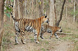
[[File:Achankmar Tiger.jpg|thumb|Tigers at the sanctuary]] | [[File:Achankmar Tiger.jpg|thumb|Tigers at the sanctuary]] | ||
Just before entry into | Just before entry into | ||
| Line 297: | Line 357: | ||
In the sanctuary, the presence of animals like the [[Guar]] (Indian bison) and [[tiger]]s are in high numbers, as reported by multiple sightings by visitors. Other animals include [[leopard]]s, [[Chital]]s, [[Pantherinae|panther]]s, [[striped hyena]]s, [[canis]]', [[sloth bear]]s, [[Dhole]]s, [[Sambar deer]]s, [[Nilgai]]s, [[four-horned antelope|Indian four-horned antelope]]s and [[chinkara]]s, which populate the sanctuary in equal numbers. Trips to the sanctuary can be organized via private taxi and bus operators. | In the sanctuary, the presence of animals like the [[Guar]] (Indian bison) and [[tiger]]s are in high numbers, as reported by multiple sightings by visitors. Other animals include [[leopard]]s, [[Chital]]s, [[Pantherinae|panther]]s, [[striped hyena]]s, [[canis]]', [[sloth bear]]s, [[Dhole]]s, [[Sambar deer]]s, [[Nilgai]]s, [[four-horned antelope|Indian four-horned antelope]]s and [[chinkara]]s, which populate the sanctuary in equal numbers. Trips to the sanctuary can be organized via private taxi and bus operators. | ||
===Man-made attractions=== | ===Man-made & Historical attractions=== | ||
Various archeological sites and temples in and around Bilaspur attract tourists from all over the world. There are more than 20 recognized and protected monuments and sites by the [[Archaeological Survey of India]].<ref>{{cite web|url=http://www.asiraipurcircle.in/Monuments_sites_ProtectedMonuments.html|title=Archaeological Survey of India (ASI), Raipur Circle, Raipur }}</ref> Other than the [[Achanakmar Wildlife Sanctuary]], the following are the man-made tourist attractions: | Various archeological sites and temples in and around Bilaspur attract tourists from all over the world. There are more than 20 recognized and protected monuments and sites by the [[Archaeological Survey of India]].<ref>{{cite web|url=http://www.asiraipurcircle.in/Monuments_sites_ProtectedMonuments.html|title=Archaeological Survey of India (ASI), Raipur Circle, Raipur|access-date=26 May 2022|archive-date=27 September 2022|archive-url=https://web.archive.org/web/20220927050811/http://www.asiraipurcircle.in/Monuments_sites_ProtectedMonuments.html|url-status=live}}</ref> Other than the [[Achanakmar Wildlife Sanctuary]], the following are the man-made tourist attractions: | ||
*'''Dams:''' Khutaghat dam, (55 km), known for its lush and green environment due its location in the [[Baghelkhand|Baghelkhand range]], [[Khudia Dam]] (75 km) and Hasdev Bango Dam is (105 km) from Bilaspur, respectively. | |||
* '''[[Ratanpur, Chhattisgarh|Ratanpur]]''': Ratanpur was capital of ancient [[Chhattisgarh]] until Maratha Empire. At present it served as spiritual capital of the region and known for historical Mahamaya temple and Ram Tekri Mandir. | * '''[[Ratanpur, Chhattisgarh|Ratanpur]]''': Ratanpur was capital of ancient [[Chhattisgarh]] until Maratha Empire. At present it served as spiritual capital of the region and known for historical Mahamaya temple and Ram Tekri Mandir. | ||
*'''[[Malhar, Chhattisgarh|Malhar]]''': Malhar is one of the main centre of archeology. Ruins of forts to ancient temples and fort are found here. Malhar is of historical significance, as it was visited by [[Xuanzang]], the [[Chinese people|Chinese]] historian. It is situated {{cvt|31|km}} southeast of Bilaspur. In Malhar, many ancient temples have been found by excavations, such as Pataleshwar temple, Devri temple and Dindeshwari temple. The four-handed idol of Lord Vishnu is also significant as it is the earliest sculptural representation, dating back to approx. 1000 BCE, to the Ratnapura–Kalachuri Regime.<ref name=":0" /> Malhar has a museum too for providing knowledge and information to tourists and interested people, maintained by the Archaeological Survey of India. '''Ratanpur''' is located {{cvt|25|km}} north of Bilaspur, and is known for its Mahamaya temple and Ram Tekri Mandir. | *'''[[Malhar, Chhattisgarh|Malhar]]''': Malhar is one of the main centre of archeology. Ruins of forts to ancient temples and fort are found here. Malhar is of historical significance, as it was visited by [[Xuanzang]], the [[Chinese people|Chinese]] historian. It is situated {{cvt|31|km}} southeast of Bilaspur. In Malhar, many ancient temples have been found by excavations, such as Pataleshwar temple, Devri temple and Dindeshwari temple. The four-handed idol of Lord Vishnu is also significant as it is the earliest sculptural representation, dating back to approx. 1000 BCE, to the Ratnapura–Kalachuri Regime.<ref name=":0" /> Malhar has a museum too for providing knowledge and information to tourists and interested people, maintained by the Archaeological Survey of India. '''Ratanpur''' is located {{cvt|25|km}} north of Bilaspur, and is known for its Mahamaya temple and Ram Tekri Mandir. | ||
[[File:Temple Carvings in Malhar Bilaspur Chhattisgarh 2009.jpg|thumb|Temple carvings in Malhar]] | [[File:Temple Carvings in Malhar Bilaspur Chhattisgarh 2009.jpg|thumb|Temple carvings in Malhar]] | ||
| Line 309: | Line 367: | ||
*'''Talagram:''' Located {{cvt|27|km}} south of Bilaspur, situated on the banks of the Maniyari River, is the location for the "Deorani-Jethani" temple. | *'''Talagram:''' Located {{cvt|27|km}} south of Bilaspur, situated on the banks of the Maniyari River, is the location for the "Deorani-Jethani" temple. | ||
*'''Tala:''' Located {{cvt|27|km}} south of Bilaspur, is famous for its [[Rudra]] Shiva.<ref>{{Cite news |title=Devrani Jethani Temples |work=WebIndia123 |url=https://tourism.webindia123.com/tourism/pilgrimcenters/temples/Devrani_Jethani_Temples/index.htm |access-date=2022-03-21 |archive-date=27 May 2022 |archive-url=https://web.archive.org/web/20220527130705/https://tourism.webindia123.com/tourism/pilgrimcenters/temples/Devrani_Jethani_Temples/index.htm |url-status=live }}</ref> | |||
*'''Tala:''' Located {{cvt|27|km}} south of Bilaspur, is famous for its [[Rudra]] Shiva.<ref>{{Cite news |title=Devrani Jethani Temples |work=WebIndia123 |url=https://tourism.webindia123.com/tourism/pilgrimcenters/temples/Devrani_Jethani_Temples/index.htm |access-date=2022-03-21}}</ref> | *'''Belpan:''' Located {{cvt|40|km}} west of Bilaspur, there is a huge pond, as well as a [[samadhi (shrine)|samadhi]]. | ||
*'''Kabir Chabutra:''' Located near the [[Raipur]] bypass road, or the [[National Highway 53 (India)|NH-53]], at a distance of {{cvt|110|km}} south from Bilaspur, is a hub for [[mahatma]]s (saints). As Bilaspur is situated on the banks of the [[Arpa (river), Chhattisgarh|Arpa]] river, Leelagar and Maniyari are other small rivers of the district, where there are accommodation facilities, out of which most of these facilities are under development to promote tourism along the river areas. | |||
*'''Belpan:''' Located {{cvt|40|km}} west of Bilaspur, there is a huge pond, as well as a [[samadhi (shrine)|samadhi]]. | *'''Sonmuda:''' Located {{cvt|106|km}} north of Bilaspur, it is a well-known attraction, which gives a panoramic view of valleys, hills and forest. This is also the place where the [[Sone River]] originates from. | ||
*'''Kabir Chabutra:''' Located near the [[Raipur]] bypass road, or the [[National Highway 53 (India)|NH-53]], at a distance of {{cvt|110|km}} south from Bilaspur, is a hub for [[mahatma]]s (saints). As Bilaspur is situated on the banks of the [[Arpa (river), Chhattisgarh|Arpa]] river, Leelagar and Maniyari are other small rivers of the district, where there are accommodation facilities, out of which most of these facilities are under development to promote tourism along the river areas. | |||
*'''Sonmuda:''' Located {{cvt|106|km}} north of Bilaspur, it is a well-known attraction, which gives a panoramic view of valleys, hills and forest. This is also the place where the [[Sone River]] originates from. | |||
*'''[[Amarkantak]]:''' Located {{cvt|117|km}} northwest of Bilaspur, in Madhya Pradesh, is known for being the origin of the [[Narmada River]]. | *'''[[Amarkantak]]:''' Located {{cvt|117|km}} northwest of Bilaspur, in Madhya Pradesh, is known for being the origin of the [[Narmada River]]. | ||
*'''Kanan Pendari Zoological Garden:''' Located within city limits. | *'''Kanan Pendari Zoological Garden:''' Located within city limits. | ||
*'''Kirari Godhi:''' Located {{cvt|19|km}} south of Bilaspur, close to Tala, is known for its ancient Shiva temple, dating to 11th-12th Century AD. | *'''Kirari Godhi:''' Located {{cvt|19|km}} south of Bilaspur, close to Tala, is known for its ancient Shiva temple, dating to 11th-12th Century AD. | ||
*'''Sargaon:''' Located {{cvt|27|km}} southwest of Bilaspur, also close to Tala, is known for its ''‘Dhoom Nath’'' or ''‘Dumeshwari Devi’'' Temple, dedicated to Lord Shiva, dating back to the 12th century AD. | |||
*'''Sargaon:''' Located {{cvt|27|km}} southwest of Bilaspur, also close to Tala, is known for its ''‘Dhoom Nath’'' or ''‘Dumeshwari Devi’'' Temple, dedicated to Lord Shiva, dating back to 12th | |||
*'''Bhartiya Nagar:''' Known for its Shri Aiyyappa Mandir, located near Tifra flyover, within city limits. | *'''Bhartiya Nagar:''' Known for its Shri Aiyyappa Mandir, located near Tifra flyover, within city limits. | ||
*'''[[Mungeli]]:''' Located {{cvt|51|km}} west of Bilaspur, it is known for its Maa Mahamaya Temple. | *'''[[Mungeli]]:''' Located {{cvt|51|km}} west of Bilaspur, it is known for its Maa Mahamaya Temple. | ||
*'''Pali:''' Located {{cvt|50|km}} north of Bilaspur, it is known for its ancient Mahadev Temple. | *'''Pali:''' Located {{cvt|50|km}} north of Bilaspur, it is known for its ancient Mahadev Temple. | ||
*'''Smriti Vatika:''' A lush, green, planned garden, located just before the entrance of the Kanan Pendari Zoological Garden, in the city. | *'''Smriti Vatika:''' A lush, green, planned garden, located just before the entrance of the Kanan Pendari Zoological Garden, in the city. | ||
* '''[[Rani Sati Temple]]:''' A religious temple built in within Bilaspur made by the [[Marwaris]], where the deity of [[Jhunjhunu]]'s temple is worshipped. | * '''[[Rani Sati Temple]]:''' A religious temple built in within Bilaspur made by the [[Marwaris]], where the deity of [[Jhunjhunu]]'s temple is worshipped. | ||
* Many '''amusement park''' and '''water parks''' are also located near city. Bubble Island, Waterbomb, Alakart, Radhika Water Park, Ishika Amusement park are major attractions for children and families. Smriti Van ''(not to be confused with Smriti Vatika, as Smriti Van is close to [[Bilaspur railway station]])'' and Urja Parks are also situated in Rajkishore Nagar area of the city. | * Many '''amusement park''' and '''water parks''' are also located near city. Bubble Island, Waterbomb, Alakart, Radhika Water Park, Ishika Amusement park are major attractions for children and families. Smriti Van ''(not to be confused with Smriti Vatika, as Smriti Van is close to [[Bilaspur railway station]])'' and Urja Parks are also situated in Rajkishore Nagar area of the city. | ||
* '''Maa Marimai Temple''' is also a temple of Bilaspur. | * '''Maa Marimai Temple''' is also a temple of Bilaspur. | ||
== Food == | == Food & cuisine== | ||
Bilaspur is famous for food varieties, such as ''Doobraj rice, fara, | Bilaspur is famous for food varieties, such as ''Doobraj rice, Fara/Muthiya (Rice floor dumpling), doodh-fara (sweet and milky version of fara), Cheela (Dosa like rice pancake), rice roll, sonhari (Poori made from Rice Flour or Sweet Potato), ayirsa roti(Rice-jaggery based dry dish), Gulgula/Gulgul Bhajiya (Sweet fritter made using wheat flour), angakar/mota roti (roti made from rice/wheat flour using leftover cooked rice), thetri-khurmi, Chousela (rice flour poori) , Bhajiya Kadhi (Savoury-salty Yogurt/curd dish), Sabudana bada (Sago fritter), Bafuari/Bhajiya, Idhar Kadhi (Kadhi made using Arbi leaves), airsa, tamatar fatka'' (tomato chutney), different types of ''bhajis'' (includes leafy vegetables like bathua, palak, chench, tirpaniya, khatta bhaji, laal bhaji, amari patua, Bohar Bhaji), etc. The wheat grown in the region is called ''sharbati'' (juicy) or like a sweet refreshing drink. The rotis made from the flour of this wheat are soft and tasty.<ref>{{Cite web|date=|title=sharbati wheat (gehu)|url=https://www.amazon.in/Sharbati-Wheat-Mixture-Preservatives-Washed/dp/B07N7TKSG6#:~:text=Sharbati%20gehu%20gets%20it%20name,softer%20for%20a%20longer%20period.|access-date=|website=|archive-date=5 April 2023|archive-url=https://web.archive.org/web/20230405171555/https://www.amazon.in/Sharbati-Wheat-Mixture-Preservatives-Washed/dp/B07N7TKSG6#:~:text=Sharbati%20gehu%20gets%20it%20name,softer%20for%20a%20longer%20period.|url-status=live}}</ref><ref>{{Cite web|last=|first=|date=|title=sharbati wheat|url=https://www.amazon.in/Sharbati-Wheat-Mixture-Preservatives-Washed/dp/B07N7TKSG6#:~:text=Sharbati%20gehu%20gets%20it%20name,softer%20for%20a%20longer%20period.|access-date=|website=|archive-date=5 April 2023|archive-url=https://web.archive.org/web/20230405171555/https://www.amazon.in/Sharbati-Wheat-Mixture-Preservatives-Washed/dp/B07N7TKSG6#:~:text=Sharbati%20gehu%20gets%20it%20name,softer%20for%20a%20longer%20period.|url-status=live}}</ref> | ||
== Education == | == Education == | ||
[[File:New IT building GGV Bilaspur, Nov2011.jpg|thumb|New IT building GGV Bilaspur]] | [[File:New IT building GGV Bilaspur, Nov2011.jpg|thumb|New IT building GGV Bilaspur]] | ||
Bilaspur has | Bilaspur has emerged as a prominent educational hub in Chhattisgarh, attracting students from across the state for studies in engineering, medicine, and various competitive examinations. The city is home to several universities and colleges that contribute to its reputation as an educational center. | ||
Bilaspur hosts five universities, including the centrally recognized [[Guru Ghasidas Vishwavidyalaya]] and [[Atal Bihari Vajpayee Vishwavidyalaya]], both of which offer a wide range of undergraduate and postgraduate programs. Additionally, specialized institutions like [[Pandit Sundarlal Sharma (Open) University]] cater to distance education, while [[Dr. C. V. Raman University]] and [[Maharishi University of Management and Technology]] focus on innovative and management-oriented courses. | |||
The city also boasts numerous notable colleges, such as the [[Institute of Technology, Guru Ghasidas University]] and [[Chhattisgarh Institute of Medical Sciences]], which provide quality education in engineering, medicine, and other disciplines. Government colleges like [[Govt. E. Raghvendra Rao P.G. Science College]] have achieved 'A' grade accreditation, underlining the city's academic standards. | |||
Bilaspur's school system includes a mix of public and private institutions, offering diverse educational opportunities from primary to higher secondary levels. Notable schools include [[Krishna Public School]], [[Delhi Public School]], and [[Kendriya Vidyalaya]], which are known for their academic excellence. | |||
The city also supports extracurricular activities, with an active National Cadet Corps (NCC) presence, including one of the 14 army wing NCC battalions from the Raipur group, affiliated with the Madhya Pradesh and Chhattisgarh directorate. | |||
== Media == | == Media == | ||
| Line 458: | Line 474: | ||
== Notable people == | == Notable people == | ||
* [[Rai Saheb Mulji Jagmal]] - railway, civil contractor, coal mines owner & philanthropist | |||
* [[Leslie Claudius]], former Olympic field hockey player. He has distinction of being one of only two Indian players to win four [[Olympic medal|Olympic]] medals | * [[Leslie Claudius]], former Olympic field hockey player. He has distinction of being one of only two Indian players to win four [[Olympic medal|Olympic]] medals | ||
* Balakrishna Shivram Moonje ([[B. S. Moonje]]) was a leader of the Hindu Mahasabha | * Balakrishna Shivram Moonje ([[B. S. Moonje]]) was a leader of the Hindu Mahasabha | ||
* [[Satyadev Dubey]], [[Padmabhushan]], theater director, actor, playwright, screenwriter. He directed [[Amrish Puri]] in [[Andha Yug]] and known for Junoon (1979), Bhumika (1977) and Aakrosh (1980) | * [[Satyadev Dubey]], [[Padmabhushan]], theater director, actor, playwright, screenwriter. He directed [[Amrish Puri]] in [[Andha Yug]] and known for Junoon (1979), Bhumika (1977) and Aakrosh (1980) | ||
* [[Makhanlal Chaturvedi]] wrote ''Pushp ki Abhilaashaa'' ({{ | * [[Makhanlal Chaturvedi]] wrote ''Pushp ki Abhilaashaa'' ({{langx|hi|पुष्प की अभिलाषा}}) in Bilaspur Central Jail when he was prison by British for sedition charges. | ||
* [[Bimal Mitra]] was a renowned Bengali writer with more than one hundred novels and short stories. One of his most popular novel Shaheb Bibi Golam was adopted in Hindi movie. He served in railways in Bilaspur for long year. | * [[Bimal Mitra]] was a renowned Bengali writer with more than one hundred novels and short stories. One of his most popular novel Shaheb Bibi Golam was adopted in Hindi movie. He served in railways in Bilaspur for long year. | ||
* Bilasa Devi,<ref>{{Cite web |date=2020-01-01 |title=बिलासपुर के नामकरण की कहानी वीरांगना बिलासा केंवटिन के कारण है शहर की पहचान |url=https://www.naidunia.com/chhattisgarh/bilaspur-this-is-the-story-of-bilaspur-naming-discussed-since-400-years-of-the-valor-of-bilasa-kentwin-4868573 |access-date=2023-02-01 |website=Nai Dunia |language=hi |archive-date=1 February 2023 |archive-url=https://web.archive.org/web/20230201142010/https://www.naidunia.com/chhattisgarh/bilaspur-this-is-the-story-of-bilaspur-naming-discussed-since-400-years-of-the-valor-of-bilasa-kentwin-4868573 |url-status=live }}</ref> founder of Bilaspur city and amazon of Chhattisgarh | |||
* Bilasa Devi,<ref>{{Cite web |date=2020-01-01 |title=बिलासपुर के नामकरण की कहानी वीरांगना बिलासा केंवटिन के कारण है शहर की पहचान |url=https://www.naidunia.com/chhattisgarh/bilaspur-this-is-the-story-of-bilaspur-naming-discussed-since-400-years-of-the-valor-of-bilasa-kentwin-4868573 |access-date=2023-02-01 |website=Nai Dunia |language=hi}}</ref> founder of Bilaspur city and amazon of Chhattisgarh | |||
* [[Satyajeet Dubey]], voice and film actor | * [[Satyajeet Dubey]], voice and film actor | ||
* [[Ajit Jogi]], first chief minister of the state of Chhattisgarh | * [[Ajit Jogi]], first chief minister of the state of Chhattisgarh | ||
*[[Ingrid Mcleod]], a nominated Lok Sabha member representing India's Anglo-Indian community | *[[Ingrid Mcleod]], a nominated Lok Sabha member representing India's Anglo-Indian community | ||
* [[Shrikant Verma]], a noted poet and Member of Parliament | * [[Shrikant Verma]], a noted poet and Member of Parliament | ||
* [[Arun Sao]], | * [[Arun Sao]], former member of parliament from [[Bilaspur (Lok Sabha constituency)|Bilaspur Lok Sabha]] seat and deputy chief minister of Chhattisgarh | ||
* [[Jagannath Prasad Bhanu]], Hindi scholar and writer of poetry and prose | |||
* [[Tokhan Sahu]], elected MP from [[Bilaspur (Lok Sabha constituency)|Bilaspur Lok Sabha]] seat and a Minister of State for Housing and Urban Affairs of India | |||
* [[Shanker Shesh]], playwright, author, poet and story writer | |||
== References == | == References == | ||
{{Reflist}} | {{Reflist}} | ||
*{{Cite web |title=Malhar – A Rhythm of Antiquity |url=https://puratattva.in/2011/09/26/malhar-a-rhythm-of-antiquity-1121 |website=Indian History and Architecture}} | *{{Cite web |title=Malhar – A Rhythm of Antiquity |url=https://puratattva.in/2011/09/26/malhar-a-rhythm-of-antiquity-1121 |website=Indian History and Architecture |access-date=25 March 2022 |archive-date=10 November 2020 |archive-url=https://web.archive.org/web/20201110144629/https://puratattva.in/2011/09/26/malhar-a-rhythm-of-antiquity-1121 |url-status=dead }} | ||
*The census has been taken from Hari Bhoomi Bilaspur Bhaskar Edition dated 23/12/2013. | *The census has been taken from Hari Bhoomi Bilaspur Bhaskar Edition dated 23/12/2013. | ||
== External links == | == External links == | ||
{{Commons category|Bilaspur, Chhattisgarh}} | |||
* | * {{Wikivoyage inline|Bilaspur (Chhattisgarh)}} | ||
* {{Official website| | * {{Official website|https://bilaspur.gov.in/en/}} | ||
* [https://web.archive.org/web/20060228054756/http://www.chhattisgarh.com/bilaspur/bilaspur.htm Map of Bilaspur, Chhattisgarh] | * [https://web.archive.org/web/20060228054756/http://www.chhattisgarh.com/bilaspur/bilaspur.htm Map of Bilaspur, Chhattisgarh] | ||
{{Bilaspur district, Chhattisgarh}} | {{Bilaspur district, Chhattisgarh}} | ||
Latest revision as of 10:59, 27 March 2026
 | This article needs more citations. (October 2020) |
Bilaspur | |
|---|---|
| Law Capital of Chhattisgarh | |
| Nickname: Judicial capital | |
  Bilaspur Location in Chhattisgarh, India  Bilaspur Bilaspur (India) | |
| Coordinates: 22°05′N 82°09′E / 22.09°N 82.15°E | |
| Country |  India India |
| State | Chhattisgarh |
| District | Bilaspur |
| Named for | Bilasa Bai |
| Government | |
| • Body | Bilaspur Municipal Corporation (BMC) |
| • Mayor | Pooja Vidhani (BJP) |
| • MP | Tokhan Sahu |
| • MLA | Amar Agrawal |
| • District Collector | Shri Sanjay Agrawal (IAS) |
| Area | |
| • Total | 205 km2 (79 sq mi) |
| Elevation | 207 m (679 ft) |
| Population (2026) | |
| • Total | 805,000 |
| • Rank | 57th |
| Languages | |
| • Official | Hindi, Chhattisgarhi |
| Time zone | UTC+5:30 (IST) |
| PIN | 495001, 495003, 495004, 495006 (Bilaspur)[1] |
| Telephone code 31221 | 07752 |
| Vehicle registration | CG-10 |
| Website | bilaspur |


Bilaspur is a city located in Bilaspur District in the Indian state of Chhattisgarh.[2] Bilaspur is the administrative headquarters of the Bilaspur District and Bilaspur Division. The Chhattisgarh High Court, located at Bodri, District Bilaspur has privileged it with the title Nyayadhani (Law Capital) of the State. This city is the commercial center and business hub of the northeast Chhattisgarh region.
Bilaspur is also an important city for the Indian Railways, as it is the headquarters for South East Central Railway Zone (SECR) and the Bilaspur Railway Division. Bilaspur is also the headquarters of South Eastern Coalfields Limited. Chhattisgarh's biggest power plant operated by NTPC is in Sipat. PowerGrid in Sipat pools electricity from other power plants in region and transmits electricity to Delhi via one of longest HVDC line.
Bilaspur is known for its aromatic rice variety named ‘doobraj’ rice, Handloom woven colourful soft kosa silk sarees.[3] Basic Tasar Silkworm Seed Organisation (BTSSO) (website) under the Central Silk Board, Government of India collects, executes the production and supply of nucleus and basic tasar seed from surrounding areas.
Indian Standard Time (IST), the time zone observed throughout India with a time offset of UTC+05:30, passes approx 30 km east of the city.
Bilaspur is one of the 100 Indian cities to be developed as a Smart city under the Smart Cities Mission.[4]
History[edit | edit source]
Historically, Bilaspur was part of Dakshina Kosala and was near capital of Malhar, Chhattisgarh (ancient Mallar), Sirpur (ancient Shripura), Tuman (ancient Tummana), and Ratanpur (ancient Ratnapura). From the 5th century onwards it was controlled by the Kalachuri dynasty of Ratanpur. Ratanpur was historical capital of Chhattisgarh state for many different dynasty. Bilaspur city, however, came into prominence around 1741, the year of the Maratha Empire rule, when a Maratha official took up his abode there to control dynasty of Ratanpur.
The management of Bilaspur district was taken over by the British East India Company in 1818 after Bhosale lost territory in Third Anglo-Maratha War. Under Bhosale of the Nagpur kingdom there were many subedars or zamindars/landlords like Akbar Khan, Vazeer Khan, Sao and others in Bilaspur.
Bilaspur district was constituted in 1861, followed by Bilaspur municipality in 1867.[5] Famines in the Bilaspur district were recorded by the British administration in 1828–9, 1834–5, 1845–6, 1868–9 and 1899–1900. In 1868-9 and 1899–1900, the rains failed almost completely, resulting in severe distress, migration and desertion of villages. After the 1868-9 famine there was prosperity for the next 25 years; but in 1895 there was a very poor harvest, followed in 1896 by a complete failure of crops, and severe famine continued throughout 1897. In that year the mortality rate was as high as one in six people. The famine of 1897 was followed by two favorable years; but in 1899 the monsoon failed completely and the rice crop was wholly destroyed.
Guru Ghasidas (1756–1836) started a religious movement, Satnamis (meaning the worshippers of Satnam(not related to Sikhism), between 1820 and 1830 primarily around the Sonakhan forests. This religious movement preached against idol-worship, and instead stressed that God is synonymous with truth. His community was a farming community. The university at Bilaspur is named after him as Guru Ghasidas University.
Railways arrived at Bilaspur in the decade 1880–90, with the arrival of the Bengal Nagpur Railway. In 1888 Mistri Jagmal Gangji and other Mistri Railway Contractors laid the first railway tracks from Rajnandgaon to Bilaspur, and in that same year fellow Kutchi contractor Khoda Ramji and others built the line from Bilaspur to Jharsuguda, including the bridge over the Champa river.
In 1890, the present railway station and yard were constructed by the Gujarati railway contractor Jagmal Gangji. His son Mulji Jagmal Sawaria was later given the title of "Rao Sahib" by the British for his contribution to the development of the town, railways and the district. Jagmal Block and Jagmal Chowk in the city are named after Jagmal Gangji Sawaria.
In 1901, the population of Bilaspur was 18,937 and it was the eighth-largest town in the Central Provinces of British India. In 1908, weaving of tasar silk and cotton clothes were recorded as the major industries of Bilaspur.
Etymology[edit | edit source]
Historical records like The Imperial Gazetteer of India [6] note that the city is said to be named after a fisherwoman by the name of "Bilasa" in the 17th century, and for a long period it consisted only of a few fishermen's huts. James Forsyth stated that Bilaspur is named after the "Palash" trees (Butea frondosa) which are found in abundance in the area.[7] In Sanskrit Bilas means playful or enjoyment and Pur means city or town. So, literally Bilaspur mean the city of enjoyment.
Geography[edit | edit source]
Bilaspur is located at 22°05′N 82°09′E / 22.09°N 82.15°E.[8] It has an average elevation of 264 metres (866 ft).
Bilaspur is situated on the banks of the rain-fed Arpa River, which originates from the Maikal Range of Central India. It's a dolomite rich region surrounded by dense forests in the north and the coal mines of the Hasdeo Valley in the east.
Bilaspur District is surrounded by Gaurella-Pendra-Marwahi District in the north, Anuppur District of Madhya Pradesh, Mungeli and, Baloda Bazar-Bhata Para District in the south and Korba and Janjgir-Champa District in the east.
Major cities around Bilaspur are:
- Raipur and Durg-Bhilai in South-West
- Nagpur in West
- Bhopal and Jabalpur in North-West
- Varanasi and Prayagraj in North
- Ranchi and Patna in North-East
- Korba, Raigarh, Rourkela and Bhubaneswar in East
Climate[edit | edit source]
The climate in Bilaspur, Chhattisgarh has been colder than the Raipur region for the winters in December (minimum temperature 6 °C, 42 °F in the last week of December annually, while some areas have even reported temperature going down as low as 3-4 °C, 37 °F), which resembles northern Chhattisgarh. However most of the winter goes mild and pleasant. The city experiences moderate rains in the monsoon. The summers are relatively hot and dry, with maximum temperature 48+ °C, 113 °F.
| Climate data for Bilaspur (1991–2020) | |||||||||||||
|---|---|---|---|---|---|---|---|---|---|---|---|---|---|
| Month | Jan | Feb | Mar | Apr | May | Jun | Jul | Aug | Sep | Oct | Nov | Dec | Year |
| Record high °C (°F) | 35.6 (96.1) |
38.2 (100.8) |
43.2 (109.8) |
45.8 (114.4) |
49.3 (120.7) |
47.2 (117.0) |
41.0 (105.8) |
36.2 (97.2) |
36.6 (97.9) |
37.0 (98.6) |
35.1 (95.2) |
33.6 (92.5) |
49.3 (120.7) |
| Average high °C (°F) | 27.6 (81.7) |
30.8 (87.4) |
36.4 (97.5) |
40.2 (104.4) |
42.4 (108.3) |
36.5 (97.7) |
32.6 (90.7) |
31.4 (88.5) |
32.1 (89.8) |
32.2 (90.0) |
30.8 (87.4) |
28.8 (83.8) |
33.2 (91.8) |
| Average low °C (°F) | 11.6 (52.9) |
14.3 (57.7) |
18.8 (65.8) |
23.5 (74.3) |
26.4 (79.5) |
25.7 (78.3) |
24.8 (76.6) |
24.8 (76.6) |
23.8 (74.8) |
20.4 (68.7) |
16.0 (60.8) |
12.4 (54.3) |
20.3 (68.5) |
| Record low °C (°F) | 5.9 (42.6) |
8.3 (46.9) |
12.5 (54.5) |
16.4 (61.5) |
21.0 (69.8) |
21.6 (70.9) |
20.9 (69.6) |
22.4 (72.3) |
19.4 (66.9) |
12.0 (53.6) |
9.2 (48.6) |
6.5 (43.7) |
5.9 (42.6) |
| Average rainfall mm (inches) | 20.6 (0.81) |
17.6 (0.69) |
18.1 (0.71) |
22.8 (0.90) |
16.5 (0.65) |
144.8 (5.70) |
317.3 (12.49) |
365.8 (14.40) |
215.5 (8.48) |
55.9 (2.20) |
8.3 (0.33) |
4.7 (0.19) |
1,208.1 (47.56) |
| Average rainy days | 1.5 | 1.6 | 1.8 | 1.9 | 1.7 | 8.8 | 15.9 | 15.7 | 9.8 | 3.2 | 0.8 | 0.5 | 63.0 |
| Source: India Meteorological Department[9] | |||||||||||||
Demographics[edit | edit source]
As of 2011[update] India census, Bilaspur Municipal Corp had a population of 331,030.[10] Bilaspur urban area population was estimated at 365,579.[11] In August 2019, adjacent 18 towns and sub-urban areas were included in the Bilaspur Municipal Corporation. Males constitute 51% of the population and females 49%. Bilaspur has an average literacy rate of 91.29%, higher than the national average of 59.5%; with male literacy of 92.94% and female literacy of 88.33%. 15% of the population is under 6 years of age.
According to the 2011 census, Bilaspur District, Chhattisgarh has a population of 2,662,077,[12] roughly equal to the nation of Kuwait[13] or the US state of Nevada.[14] Bilaspur District ranks 152nd in India (out of a total of 640).[12] The district has a population density of 322 inhabitants per square kilometre (830/sq mi) .[12] Its population growth rate over the decade 2001–2011 was 33.21%.[12] Bilaspur has a sex ratio of 972 females for every 1000 males,[12] and a literacy rate of 71.59%.[12]
The main languages spoken are Chhattisgarhi and Hindi.
Administration[edit | edit source]
Bilaspur Division
Bilaspur district is the headquarter of the Bilaspur Division of Chhattisgarh. This division consists of eight districts (as of May 2024) -
- Bilaspur
- Korba
- Raigarh
- Janjgir-Champa
- Mungeli
- Gaurella-Pendra-Marwahi
- Sakti
- Sarangarh-Bhilaigarh
Tehsil
The Bilaspur district consists of 11 Tehsils - Bilaspur, Kota, Takhatpur, Bilha, Masturi, Ratanpur, Sipat, Belgahna, Beltara, Bodri and Sakri.
Block Samiti
Bilaspur district is divided into 4 block samitis which covers 483 Gram Panchayats and 708 villages (as of May 2024). These are -
- Kota (101 Panchayat covering 162 villages).
- Takhatpur (117 Panchayat covering 178 villages).
- Belha (139 Panchayat covering 174 villages).
- Masturi (126 Panchayat covering 173 villages).
Bilaspur City Administration
The Bilaspur city is a Nagar Nigam and district headquarter of Bilaspur district. Bilaspur City runs under the administration of the Bilaspur Municipal Corporation (BMC). Its Nagar Nigam, Municipality, District Magistrate, Sub-Divisional Magistrate, Tehsildar office and collectorate office are all situated near Nehru Chowk. It has three Nagar Palikas namely (1) Takhatpur, (2) Ratanpur, (3) Tifra. It has been categorised into seven Nagar Panchayat namely (1) Bilha (2) Kota (3) Bodri and (4) Malhar (5) Gourella (6) Sakri (7) Sirgitti.[15]
Culture[edit | edit source]


Bilaspur is rich in its cultural heritage. Bilaspur has its own dance styles, cuisine, music and traditional folk songs. In rural areas, women wear garlands made of one rupee coins. This has gone out of fashion in recent times. The city celebrates all the major festivals of India. There are some local festivals such as the colorful Raut Nach (November), harley, and pola. The Raut Nach Mahotsav is the folk-dance festival of Bilaspur celebrated by Yaduvanshis also known as Rauts in Chhattisgarh to honor lord Krishna and to thank nature for good crop season.
There are other folk dances like Panthi, Karma, Kaksar and Padnwani (Needs to be added content).
The town has been the home of several literary, theatre, arts personalities including Makhan Lal Chaturvedi, Satyadev Dubey, Bimal Mitra, Shrikant Verma.
Utility services[edit | edit source]
Over the years, Bilaspur has developed many 4 – lane and 6 – lane roads, street lighting and squares.[citation needed] However, the last decade[when?] has seen large-scale unregulated urbanization and residential and commercial expansion, over-straining the water resources and generally defunct civic amenities due to indifferent officials and politicians.[original research?] There is a master plan for the city and surrounding areas.
Electricity is government-regulated and, as of now, no power cuts are effected, thanks to the massive expansion in energy generating capacity both by public and private companies in the energy sector.
Hospitals and health care facilities[edit | edit source]
Bilaspur is home to many hospitals & nursing homes, some run by the state government and others by the private sector. City has a government medical college named Chhattisgarh Institute of Medical Science which has 750 beds for patients. There is Apollo Hospitals in the private sector, which is 300 bedded specialty hospital. A new mental hospital is established in village Sendri (Ratanpur Road) which provides quality treatment. More than 25 Sanjivni express and Mahatari express are running in city. It also has private dental colleges in the city area.
Economy[edit | edit source]

Bilaspur is the center of electric power generation in India. Bilaspur and the surrounding area generate 10,000 MW of electricity, and an additional 50,000 MW are planned in the next few years. As many as 22 companies are interested to tap an estimated power generation potential of 50,000 megawatts in the region. The railways have gotten a major boost with big energy sector players set to invest Rs.5,000 crore in three proposed railways corridors around Bilaspur.[16] Chhattisgarh is also known as "The Rice Bowl" – Dhan ka katora. Bilaspur is the centre of agri products. There are approx. 500 rice and dall mills in the surrounding area. In FY2022/21, the South East Central Railway zone, whose geography encompasses Bilaspur, earned Rs 14,2855.71 crore, "the highest among all of the railway divisions of Indian Railways".[17] The Bilaspur railways zone comprises the divisions of Bilaspur, Nagpur and Raipur. South Eastern Coalfields Limited (SECL), a subsidiary of Public Sector Unit Coal India Limited (CIL) – A Maharatna Company, is situated with headquarters at Bilaspur. SECL is a Miniratna PSU under the Ministry of Coal, with several awards in its credentials including best PSU award in 1997–98. An integrated action plan for development of civic infrastructure, including hi-tech water purifier system, proper drainage facilities and cleanliness, is being planned by the state government for cities and towns, while the proposed 'Arpa Project' would give a new life to the city of Bilaspur, minister for urban administration and health Amar Agrawal said in an interview to the Times of India, a leading newspaper of India. The State Government has drawn up an ambitious plan of Rs2,000 crore to develop the Arpa river bank in Bilaspur district during the next seven years. For this, the Government has constituted a ‘Special Area Development Authority’ (SADA) for the development of the Arpa river bank near Bilaspur city.
The Government has invited proposals from interested national and international institutions for the development of the river bank on a PPP model. The Authority has prepared a project for the development of the river and is now in search of organisations that would be interested in developing the river on a Public Private Partnership (PPP).
According to SADA, about 653 hectares of area on the banks of the river would be developed. This area is 13.4 km in length. Commercial, residential, entertainment and other institutional facilities would be developed in this area. On both the sides of the river, 13.4-km-long retaining wall, houses and commercial complexes would be constructed, besides bridge, roads and walkways. Water supply, sewerage, drainage, electricity supply would be provided in the area.
The estimated cost of all the works is Rs2,000 crore. The development works would be taken up in phases during the next seven years.
Of the total 653-hectare area, some of the land is owned privately. In lieu of acquisition of private land, the affected people would be given land at other areas. After development about 267 hectares of land will be made available for sale. By selling this land, the developer could recover the invested amount. The downtown is called Gol Bazaar (Circular Market). Gol Bazaar, Sadar Bazaar and company Garden Chowk are buzzing and vibrant but overcrowded with slow-moving traffic. In contrast there are some newly developed areas as well. The Vyapar Vihar is a newly developed commercial and goods transport area. Bilaspur has Chhattisgarh's first hi-tech bus stand at Bodri.
It has the High Court of Chhattisgarh which is Asia's largest court (in area).
- Industries: Around Bilaspur, there are many industrial areas, including Tifra, Sirgitti and Silpahri Industrial Growth Centres. Sirgitti, Silpahri and Tifra around Bilapur are major industrial areas near Bilaspur. Located on the outskirts of Bilaspur city Sirgitti Industrial Centre is spread over an area of approx. 338 hectares. With about 324 industries it provides direct employment to 4431 persons. Silpahari Industrial Centre is another industrial area near Bilaspur and is home to many sponge iron industries. Tifra Industrial Area situated on the outskirts of Bilaspur city is spread over an area of approx. 65 hectares. Many chemical, PVC footwear, HDPE woven sacks, polythene bags and sheets, soft drinks and other units are located here. CSIDC or Chhattisgarh State Industrial Development Corporation Limited is responsible for the development of maintenance of all these industrial areas in and around Bilaspur. Chhattisgarh Laghu Evam Sahayak Udyog Sangh or CLSUS is an association of industries which represents all major industries of Bilaspur and Chhattisgarh. BEC Fertilizers – a unit of Bhilai Engineering Corporation is situated in the Sirgitti Industrial Area.
- Power plants – Bilaspur has India's second largest power plant of NTPC at Sipat which generates power of 2980 MW with 3 units of 660 MW each and 1 unit of 1000 MW. Many thermal power plants are coming up in the surrounding area of Bilaspur. Also notable are Nova, KSK, Gitanjali, Mahanadi etc.
- Legal: The day the state of Chhattisgarh was constituted (1 November 2000) with its capital at Raipur, the High Court of Chhattisgarh was established at Bilaspur. It is the 19th high court of India.
- Banks: All major Indian banks have branches and ATMs in the city. SBI have approx. 80 ATMs in the city as of 2013.
- Website: A website dedicated to provide information on Bilaspur is maintained by NIC.
- A new Indoor stadium is under construction at Behtarai Road.
Transport[edit | edit source]
Roadways[edit | edit source]

Bilaspur is well-connected with a network of national highways intersecting it. The national highways are National Highway 130 (NH-130) connecting Bilaspur with Ambikapur and Raipur directly, National Highway 130A (NH-130A), National Highway 45 (NH-45) and National Highway 49 (NH-49). The proposed Narmada Expressway will start from Bilaspur, and will run till Ahmedabad, along the route of the Narmada River. Once completed, it will help to enhance connectivity and commute from Bilaspur to neighbouring states, and will also provide direct connectivity to the national and the financial capitals of India, as well as with Madhya Pradesh, via the Delhi–Mumbai Expressway and other expressways. EC-7: Raipur- Bilaspur - Ranchi - Dhanbad Economic Corridors of India or Industrial Corridors of India is identified under Bharatmala road network and passes through Bilaspur - Baloda - Urga. The construction of Bilaspur - Urga expressway is expected to complete by 2024.
The following table provides the routes of the national highways passing through Bilaspur:
| NH | Route |
|---|---|
| NH-45 | Bhopal » Jabalpur » Amarkantak » Bilaspur |
| NH-49 | Bilaspur » Raigarh » Jharsuguda » Kharagpur |
| NH-130 | Raipur » Simga » Bilaspur » Katghora » Ambikapur |
| NH-130A | Pondi » Mungeli » Bilaspur » Sipat » Dharamjayagarh » Pathalgaon |
Rail[edit | edit source]

The nearest railway station is Bilaspur Junction railway station, which is the Zonal and divisional headquarter of the South East Central Railway zone of the Indian Railways.
_and_Shri_Rabindranath_Tagore.jpg)
Bilaspur is junction of 4x4x3 railway lines with quadruple railway lines going to Mumbai-Howrah and triple lines going towards Katni-New Delhi. It is the busiest junction of Chhattisgarh, and the second busiest of central India after Itarsi station for passenger trains. It is the third cleanest railway station in India after Surat and Rajkot stations. It is well connected with the rest of the country, as it lies on the Tatanagar–Bilaspur section of the Howrah–Nagpur–Mumbai line and a junction, as another line goes towards Delhi via Katni. The station has the fifth longest railway platform in India after Hubballi, Gorakhpur, Kollam and Kharagpur stations. The Bilaspur Rajdhani Express is the train that connects Bilaspur with the national capital every two days in a week. Vande Bharat Express from Bilaspur to Nagpur provide high speed connectivity.
Because of the station's location, daily connections are available for Kolkata, Mumbai, New Delhi, Pune, Nagpur, Ahmedabad, Indore, Bhopal, Amritsar, Agra, Roorkee, Haridwar, Visakhapatnam, Bhubaneswar, Cuttack, Khordha, Rourkela, Puri, Jamshedpur, Patna, Jabalpur, Raipur, Varanasi, Jaipur, Bikaner, Udaipur, Ajmer, Thiruvananthapuram, Kollam, Chennai, Ernakulam, Tirupati, Tirunelveli, Bangalore, Bhuj, Gandhidham, Okha, Porbandar, Dhanbad, Hyderabad, Jaipur, Gorakhpur, Shirdi, Udaipur, Bikaner, Jammu, Jodhpur, Kanpur, Lucknow, Ranchi, Guwahati among many other cities throughput India. For services within the state, daily local trains run to all cities of the state.
Other railway stations present near Bilaspur city are:
- Uslapur
- Chakarbhata
- Dadhapara
- Gatora
Uslapur is the other Major city station which is 8 km from the main junction station. It is used as secondary station for express trains towards Katni. There is loco training centre for loco drivers in which trainees from various part of the central comes.
Fourth railway line between Bilaspur and Jharsuguda is under construction and which is presently a triple line section. Fourth line between Bilaspur and Durg Jn is approved in railway budget of FY23-24. Third railway line between Bilaspur and Katni is under construction. The survey of fourth railway line between Bilaspur and Nagpur is underway. Most upgrades are to handle coal evacuation from coal mining areas in East India to power plants in west of Bilaspur. A 10 km long grade separator is currently added between 3rd line of Bilaspur and Uslapur.
Bus transport[edit | edit source]
The Bilaspur Bus Station is the main bus station of the city. It is also known as Hi-tech Bus Stand. It is well connected with other cities within and outside the state. Daily bus services are operated by government and private operators to cities like Jashpur, Ambikapur, Raipur, Jagdalpur, Korba, Nagpur, Durg, Bhilai, Mungeli, Kawardha, Raigarh, Narayanpur, Kondagaon, Jabalpur, Varanasi, Prayagraj, Nagpur, Gondia, Mandla, Anuppur, Shehdol, Jharsuguda, Sambalpur, Bhawanipatna, Hyderabad, among others.
Air[edit | edit source]

The nearest airport is Bilasa Devi Kevat Airport, also known as Bilaspur Airport, located 13 km (8.1 mi) south of the city. Currently, there are direct flights from the airport to Jabalpur, Hyderabad, Delhi, Kolkata, Prayagraj, Jagdalpur, operated by Alliance Air.[18][19]
Tourism[edit | edit source]
Natural attractions[edit | edit source]
The Achanakmar-Amarkantak Biosphere Reserve is the prime tourist attraction of Bilaspur, and has been recognized by the UNESCO for its dramatic and ecologically diverse landscape.[20] It is reputed to have some of the densest forests in the country and an even spread of hills and rivers. One of the places worth visiting within the biosphere reserve is the Achanakmar Wildlife Sanctuary.[21] Home to a wide variety of wildlife, the sanctuary is spread over an area of 551 km2 (213 mi2), and was set up in 1975 under the Wildlife Protection Act. The sanctuary is 55 km (34 mi) away from Bilaspur, and remains closed during the monsoon season.

Just before entry into the sanctuary, is the Ghongapani Dam. Beyond the sanctuary, for accommodation, on the way to Amarkantak, there are government guest houses in Achanakmar, Keonchi and Lamni. These guest houses can be booked with governmental officials in the district headquarters, also by booking only from their official websites. The forest guest housed at Lamni were built by the British. It is 1,850 feet above sea level, and was built in June 1913.
In the sanctuary, the presence of animals like the Guar (Indian bison) and tigers are in high numbers, as reported by multiple sightings by visitors. Other animals include leopards, Chitals, panthers, striped hyenas, canis', sloth bears, Dholes, Sambar deers, Nilgais, Indian four-horned antelopes and chinkaras, which populate the sanctuary in equal numbers. Trips to the sanctuary can be organized via private taxi and bus operators.
Man-made & Historical attractions[edit | edit source]
Various archeological sites and temples in and around Bilaspur attract tourists from all over the world. There are more than 20 recognized and protected monuments and sites by the Archaeological Survey of India.[22] Other than the Achanakmar Wildlife Sanctuary, the following are the man-made tourist attractions:
- Dams: Khutaghat dam, (55 km), known for its lush and green environment due its location in the Baghelkhand range, Khudia Dam (75 km) and Hasdev Bango Dam is (105 km) from Bilaspur, respectively.
- Ratanpur: Ratanpur was capital of ancient Chhattisgarh until Maratha Empire. At present it served as spiritual capital of the region and known for historical Mahamaya temple and Ram Tekri Mandir.
- Malhar: Malhar is one of the main centre of archeology. Ruins of forts to ancient temples and fort are found here. Malhar is of historical significance, as it was visited by Xuanzang, the Chinese historian. It is situated 31 km (19 mi) southeast of Bilaspur. In Malhar, many ancient temples have been found by excavations, such as Pataleshwar temple, Devri temple and Dindeshwari temple. The four-handed idol of Lord Vishnu is also significant as it is the earliest sculptural representation, dating back to approx. 1000 BCE, to the Ratnapura–Kalachuri Regime.[2] Malhar has a museum too for providing knowledge and information to tourists and interested people, maintained by the Archaeological Survey of India. Ratanpur is located 25 km (16 mi) north of Bilaspur, and is known for its Mahamaya temple and Ram Tekri Mandir.


- Talagram: Located 27 km (17 mi) south of Bilaspur, situated on the banks of the Maniyari River, is the location for the "Deorani-Jethani" temple.
- Tala: Located 27 km (17 mi) south of Bilaspur, is famous for its Rudra Shiva.[23]
- Belpan: Located 40 km (25 mi) west of Bilaspur, there is a huge pond, as well as a samadhi.
- Kabir Chabutra: Located near the Raipur bypass road, or the NH-53, at a distance of 110 km (68 mi) south from Bilaspur, is a hub for mahatmas (saints). As Bilaspur is situated on the banks of the Arpa river, Leelagar and Maniyari are other small rivers of the district, where there are accommodation facilities, out of which most of these facilities are under development to promote tourism along the river areas.
- Sonmuda: Located 106 km (66 mi) north of Bilaspur, it is a well-known attraction, which gives a panoramic view of valleys, hills and forest. This is also the place where the Sone River originates from.
- Amarkantak: Located 117 km (73 mi) northwest of Bilaspur, in Madhya Pradesh, is known for being the origin of the Narmada River.
- Kanan Pendari Zoological Garden: Located within city limits.
- Kirari Godhi: Located 19 km (12 mi) south of Bilaspur, close to Tala, is known for its ancient Shiva temple, dating to 11th-12th Century AD.
- Sargaon: Located 27 km (17 mi) southwest of Bilaspur, also close to Tala, is known for its ‘Dhoom Nath’ or ‘Dumeshwari Devi’ Temple, dedicated to Lord Shiva, dating back to the 12th century AD.
- Bhartiya Nagar: Known for its Shri Aiyyappa Mandir, located near Tifra flyover, within city limits.
- Mungeli: Located 51 km (32 mi) west of Bilaspur, it is known for its Maa Mahamaya Temple.
- Pali: Located 50 km (31 mi) north of Bilaspur, it is known for its ancient Mahadev Temple.
- Smriti Vatika: A lush, green, planned garden, located just before the entrance of the Kanan Pendari Zoological Garden, in the city.
- Rani Sati Temple: A religious temple built in within Bilaspur made by the Marwaris, where the deity of Jhunjhunu's temple is worshipped.
- Many amusement park and water parks are also located near city. Bubble Island, Waterbomb, Alakart, Radhika Water Park, Ishika Amusement park are major attractions for children and families. Smriti Van (not to be confused with Smriti Vatika, as Smriti Van is close to Bilaspur railway station) and Urja Parks are also situated in Rajkishore Nagar area of the city.
- Maa Marimai Temple is also a temple of Bilaspur.
Food & cuisine[edit | edit source]
Bilaspur is famous for food varieties, such as Doobraj rice, Fara/Muthiya (Rice floor dumpling), doodh-fara (sweet and milky version of fara), Cheela (Dosa like rice pancake), rice roll, sonhari (Poori made from Rice Flour or Sweet Potato), ayirsa roti(Rice-jaggery based dry dish), Gulgula/Gulgul Bhajiya (Sweet fritter made using wheat flour), angakar/mota roti (roti made from rice/wheat flour using leftover cooked rice), thetri-khurmi, Chousela (rice flour poori) , Bhajiya Kadhi (Savoury-salty Yogurt/curd dish), Sabudana bada (Sago fritter), Bafuari/Bhajiya, Idhar Kadhi (Kadhi made using Arbi leaves), airsa, tamatar fatka (tomato chutney), different types of bhajis (includes leafy vegetables like bathua, palak, chench, tirpaniya, khatta bhaji, laal bhaji, amari patua, Bohar Bhaji), etc. The wheat grown in the region is called sharbati (juicy) or like a sweet refreshing drink. The rotis made from the flour of this wheat are soft and tasty.[24][25]
Education[edit | edit source]

Bilaspur has emerged as a prominent educational hub in Chhattisgarh, attracting students from across the state for studies in engineering, medicine, and various competitive examinations. The city is home to several universities and colleges that contribute to its reputation as an educational center.
Bilaspur hosts five universities, including the centrally recognized Guru Ghasidas Vishwavidyalaya and Atal Bihari Vajpayee Vishwavidyalaya, both of which offer a wide range of undergraduate and postgraduate programs. Additionally, specialized institutions like Pandit Sundarlal Sharma (Open) University cater to distance education, while Dr. C. V. Raman University and Maharishi University of Management and Technology focus on innovative and management-oriented courses.
The city also boasts numerous notable colleges, such as the Institute of Technology, Guru Ghasidas University and Chhattisgarh Institute of Medical Sciences, which provide quality education in engineering, medicine, and other disciplines. Government colleges like Govt. E. Raghvendra Rao P.G. Science College have achieved 'A' grade accreditation, underlining the city's academic standards.
Bilaspur's school system includes a mix of public and private institutions, offering diverse educational opportunities from primary to higher secondary levels. Notable schools include Krishna Public School, Delhi Public School, and Kendriya Vidyalaya, which are known for their academic excellence.
The city also supports extracurricular activities, with an active National Cadet Corps (NCC) presence, including one of the 14 army wing NCC battalions from the Raipur group, affiliated with the Madhya Pradesh and Chhattisgarh directorate.
Media[edit | edit source]
Print and news media[edit | edit source]
The city publishes print media newspapers in Hindi languages.
The following electronic media channels deliver local news 24*7:
- Chhattisgarh Cable Networks (CCN)
- Grand Gumber Channel
- Siti News Channel
- Abhi Tak (CCN owned News Channel)
- Z 24 Ghante – Chhattisgarh Bilaspur Buero
- E TV M.P. CG. Bilaspur Buereu
- Sahara TV M.P. CG. Bilaspur Buereu
- P7 /Pearls News M.P. C.G. Bilaspur
- Aaj Tak, Bilaspur Buereu
- India TV, Bilaspur Buereu
Radio[edit | edit source]
Bilaspur city has 5 FM Radio Stations which are-
| Frequency Modulation | Channel | Slogan |
|---|---|---|
| 90.4 FM | Radio Raman (Community Radio Station of Dr. C.V. Raman University – Kota, Bilaspur) | Hamar Radio Hamar Sangi |
| 91.1 FM | FM Tadka | Apni Suno..! |
| 91.9 FM | Radio Orange | Kuch Khatta Kuch Meetha |
| 92.7 FM | Radio Rangila | Jam Ke Suno |
| 94.3 FM | My FM | Jiyo Dil Se |
| 103.2 FM | All India Radio Bilaspur & Vividh Bharti | Desh Ki Surili Dhadkan |
TV/Doordarshan[edit | edit source]
- Bilaspur has High Power TV Transmitter of Doordarshan at Bahatarai
Web portals[edit | edit source]
| Website name | URL | Notes | ||
|---|---|---|---|---|
| Bilaspur- Government Website | http://bilaspur.gov.in/ | Official government website for the city. Land records and other e-governance projects are available from here. | ||
| Bilaspur University- ABVV | https://bilaspuruniversity.ac.in/ | Portal for almost all the higher education institutions in bilaspur, all affiliated with Bilaspur university | ||
| Bilaspur- CIMS Medical College | http://cimsbilaspur.ac.in/ | Official government website for the CIMS-Chandu lal Agrawal Memorial (कोयला वाले) medical College, Bilaspur |
Notable people[edit | edit source]
- Rai Saheb Mulji Jagmal - railway, civil contractor, coal mines owner & philanthropist
- Leslie Claudius, former Olympic field hockey player. He has distinction of being one of only two Indian players to win four Olympic medals
- Balakrishna Shivram Moonje (B. S. Moonje) was a leader of the Hindu Mahasabha
- Satyadev Dubey, Padmabhushan, theater director, actor, playwright, screenwriter. He directed Amrish Puri in Andha Yug and known for Junoon (1979), Bhumika (1977) and Aakrosh (1980)
- Makhanlal Chaturvedi wrote Pushp ki Abhilaashaa (Hindi: पुष्प की अभिलाषा) in Bilaspur Central Jail when he was prison by British for sedition charges.
- Bimal Mitra was a renowned Bengali writer with more than one hundred novels and short stories. One of his most popular novel Shaheb Bibi Golam was adopted in Hindi movie. He served in railways in Bilaspur for long year.
- Bilasa Devi,[26] founder of Bilaspur city and amazon of Chhattisgarh
- Satyajeet Dubey, voice and film actor
- Ajit Jogi, first chief minister of the state of Chhattisgarh
- Ingrid Mcleod, a nominated Lok Sabha member representing India's Anglo-Indian community
- Shrikant Verma, a noted poet and Member of Parliament
- Arun Sao, former member of parliament from Bilaspur Lok Sabha seat and deputy chief minister of Chhattisgarh
- Jagannath Prasad Bhanu, Hindi scholar and writer of poetry and prose
- Tokhan Sahu, elected MP from Bilaspur Lok Sabha seat and a Minister of State for Housing and Urban Affairs of India
- Shanker Shesh, playwright, author, poet and story writer
References[edit | edit source]
- ↑ "Bilaspur". Archived from the original on 6 August 2022. Retrieved 6 August 2022.
- ↑ 2.0 2.1 "Malhar – A Rhythm of Antiquity – Indian History and Architecture". Archived from the original on 10 November 2020. Retrieved 25 March 2022.
- ↑ Hamar Bilaspur E-Library (2019). "About Hamar Bilashpur". www.hamarbilaspur-elibrary.com. Archived from the original on 7 January 2022. Retrieved 21 March 2022.
- ↑ "Why only 98 cities instead of 100 announced: All questions answered about smart cities project". firstpost.com. 28 August 2015. Archived from the original on 19 January 2017. Retrieved 25 November 2016.
- ↑ "History | District Bilaspur | India". Archived from the original on 23 January 2022. Retrieved 21 March 2022.
- ↑ Imperial Gazetteer of India, Vol 8, 1908.
- ↑ The highlands of central India, James Forsyth, 1889.
- ↑ "Maps, Weather, and Airports for Bilaspur, India". www.fallingrain.com. Archived from the original on 6 September 2013. Retrieved 18 March 2007.
- ↑ "Climatological Tables of Observatories in India 1991-2020" (PDF). India Meteorological Department. Retrieved 8 April 2024.
- ↑ "Bilaspur City Population Census 2011". www.realtimes.in. Archived from the original on 25 November 2018.
- ↑ "Table 3 PR UA Citiees 1Lakh and Above" (PDF). Census of India. Archived (PDF) from the original on 17 October 2013. Retrieved 22 July 2015.
- ↑ 12.0 12.1 12.2 12.3 12.4 12.5 "District Census 2011". Census2011.co.in. 2011. Archived from the original on 24 November 2018. Retrieved 30 September 2011.
- ↑ US Directorate of Intelligence. "Country Comparison:Population". Archived from the original on 13 June 2007. Retrieved 1 October 2011.
Kuwait 2,595,62
- ↑ "2010 Resident Population Data". U. S. Census Bureau. Archived from the original on 1 January 2011. Retrieved 30 September 2011.
Nevada 2,700,551
- ↑ "Urban body | District Bilaspur | India".
- ↑ P, Maneesh; DelhiJuly 3, ey New. "Cash-strapped Railways gets major investment boost for Maoists areas". India Today. Archived from the original on 19 April 2017. Retrieved 7 September 2021.
{{cite news}}: CS1 maint: numeric names: authors list (link) - ↑ टाइम्स न्यूज़ नेटवर्क (3 April 2021). "Dhanbad rail div earns over 14 cr, highest among all units in '20-21". The Times of India. Archived from the original on 21 March 2022. Retrieved 21 March 2022.
- ↑ "Bilaspur to be connected to Delhi, Jabalpur, Prayagraj from 1 March". www.livemint.com. 18 February 2021. Archived from the original on 24 May 2022. Retrieved 1 March 2021.
- ↑ "Alliance Air launches flights from Bilaspur under UDAN scheme". www.livemint.com. March 2021. Archived from the original on 1 March 2021. Retrieved 1 March 2021.
- ↑ "Achanakmar-Amarkantak Biosphere Reserve, India". 23 January 2019. Archived from the original on 26 May 2022. Retrieved 26 May 2022.
- ↑ "Chhattisgarh Forest Department / Nature Tourism". Archived from the original on 17 January 2012. Retrieved 27 July 2012.
- ↑ "Archaeological Survey of India (ASI), Raipur Circle, Raipur". Archived from the original on 27 September 2022. Retrieved 26 May 2022.
- ↑ "Devrani Jethani Temples". WebIndia123. Archived from the original on 27 May 2022. Retrieved 21 March 2022.
- ↑ "sharbati wheat (gehu)". Archived from the original on 5 April 2023.
- ↑ "sharbati wheat". Archived from the original on 5 April 2023.
- ↑ "बिलासपुर के नामकरण की कहानी वीरांगना बिलासा केंवटिन के कारण है शहर की पहचान". Nai Dunia (in हिन्दी). 1 January 2020. Archived from the original on 1 February 2023. Retrieved 1 February 2023.

- "Malhar – A Rhythm of Antiquity". Indian History and Architecture. Archived from the original on 10 November 2020. Retrieved 25 March 2022.
- The census has been taken from Hari Bhoomi Bilaspur Bhaskar Edition dated 23/12/2013.