.svg)
Lakshadweep: Difference between revisions
CleanupBot (talk | contribs) m (→External links: Add {{source}} tag) |
m (Removed empty portal template using script) |
||
| (5 intermediate revisions by 3 users not shown) | |||
| Line 1: | Line 1: | ||
{{Redirect|Laccadives|the subgroup|Laccadive Islands}} | {{Redirect|Laccadives|the subgroup|Laccadive Islands}} | ||
{{Short description|Union territory of India}} | {{Short description|Union territory of India}}{{Use dmy dates|date=December 2015}} | ||
{{Use dmy dates|date= | {{Use Indian English|date=December 2015}} | ||
{{Use Indian English|date= | {{Infobox Indian state or territory | ||
{{Infobox | | name = Lakshadweep | ||
| name | | type = Union Territory | ||
| image_seal = Lakshadweep Banner.png | |||
| image_map = | |||
| type | | coordinates = {{coord|region:IN-LD|display=inline,title}} | ||
| | | region = South India | ||
| formation_date4 = 1 November 1956 | |||
| capital = Kavaratti | |||
| largestcity = Andrott | |||
| Administrator = [[Praful Khoda Patel]]<ref>{{Cite web|title=Who's Who | Lakshadweep | India |date=26 May 2021 |publisher=U.T. Administration of Lakshadweep |url=https://lakshadweep.gov.in/about-lakshadweep/whos-who/ }}</ref> | |||
| lok_sabha_seats = Mohammed Faizal P. P | |||
| area_total_km2 = 32.62 | |||
| area_rank = 36th | |||
| population_total = 64,473 | |||
| population_as_of = 2011 | |||
| population_density = 2,000 | |||
| 0fficial_Langs = {{hlist|[[Hindi]]||[[English language|English]]<ref>{{cite web|url=http://nclm.nic.in/shared/linkimages/NCLM50thReport.pdf |page=109 |title=50th Report of the Commissioner for Linguistic Minorities in India |date=16 July 2014 |access-date=6 November 2016 |url-status=dead |archive-url=https://web.archive.org/web/20160708012438/http://nclm.nic.in/shared/linkimages/NCLM50thReport.pdf |archive-date= 8 July 2016 }}</ref>}} | |||
| judiciary = [[Kerala High Court]] | |||
| HDI = 0.751 | |||
| HDI_year = 2019 | |||
| HDI_rank = 4th | |||
| image_map | | literacy = 91.85% | ||
| literacy_year = 2011 | |||
| iso_code = IN-LD | |||
| coordinates | | registration_plate = LD | ||
| | | website = lakshadweep.gov.in | ||
| bird = [[Brown noddy]] | |||
| fish = [[Butterfly fish]] | |||
| | | tree = [[Bread fruit ]] | ||
| | |||
| | |||
| | |||
| area_total_km2 | |||
| area_rank | |||
| population_total | |||
| population_as_of | |||
| | |||
| | |||
| | |||
| | |||
| | |||
| | |||
| | |||
| | |||
| iso_code | |||
| registration_plate | |||
| website | |||
| | |||
| | |||
| tree | |||
}} | }} | ||
'''Lakshadweep''' ([[Hindi]]: लक्षद्वीप) is a [[union territory]] of [[India]]. It is an [[archipelago]] of 36 islands in the [[Arabian Sea|Arabian sea]], located {{convert|200|to|440|km|mi|abbr=on}} off the [[Malabar Coast]]. | |||
The name ''Lakshadweep'' means "one [[lakh]] islands" (one hundred thousand islands) in [[Sanskrit]], though the Laccadive Islands are just one part of the archipelago of no more than a hundred islands. [[Malayalam]] is the primary as well as the widely spoken [[First language|native language]] in the territory.<ref name=":0">{{cite book|title=Sura's Year Book 2006|url=https://books.google.com/books?id=Fz2WDD8sB0MC&q=jeseri%2C+lakshadweep&pg=PA250|year=2006|isbn=978-81-7254-124-8|page=250}}</ref><ref>{{Cite encyclopedia|title=Lakshadweep |encyclopedia=The Columbia Encyclopedia |edition=Sixth |year=2008 |url=http://www.encyclopedia.com/topic/Lakshadweep.aspx |url-status=dead |archive-url=https://web.archive.org/web/20100127104251/http://www.encyclopedia.com/topic/Lakshadweep.aspx |archive-date=27 January 2010 }}</ref> The islands form the [[List of states and union territories of India by population|smallest union territory of India]] and their total surface area is approximately {{convert|32|km2|sqmi|abbr=on}}. The [[lagoon]] area covers about {{convert|4200|km2|sqmi|abbr=on}}, the [[territorial waters]] area {{convert|20000|km2|sqmi|abbr=on}} and the [[exclusive economic zone]] area {{convert|400000|km2|sqmi|abbr=on}}. The region forms a single [[Indian district]] with 10 subdivisions. [[Kavaratti]] serves as the capital of the Union Territory and the region comes under the [[jurisdiction]] of [[Kerala High Court]]. The islands are the northernmost of the Lakshadweep–Maldives–Chagos group of islands, which are the tops of a vast undersea mountain range, the [[Chagos-Laccadive Ridge|Chagos-Lakshadweep Ridge]].<ref>{{cite journal |title=Origin and compensation of Chagos-Laccadive ridge, Indian ocean, from admittance analysis of gravity and bathymetry data |date=1991-07-31 |doi=10.1016/0012-821X(91)90119-3 |bibcode=1991E&PSL.105...47A |volume=105 |issue=1–3 |journal=Earth and Planetary Science Letters |pages=47–54 |last1=Ashalatha |first1=B. |last2=Subrahmanyam |first2=C. |last3=Singh |first3=R.N. |df=dmy-all }}</ref> The Lakshadweep originally consisted of 36 islands; however, due to the Parali 1 island being submerged in water due to sea erosion, 35 islands remain.<ref>{{Cite web|url=https://www.livemint.com/Science/QFLIaXhV8NswaWkdcdyisL/Uninhabited-Lakshadweep-island-Parali-I-vanishes-4-others-s.html|title=Uninhabited Lakshadweep island Parali I vanishes, 4 others shrinking fast: study|last=PTI|date=2017-09-06|website=Mint|language=en|access-date=2021-04-07}}</ref> | |||
The islands were also mentioned in the Buddhist [[Jataka tales|Jataka stories]] of the sixth century BCE. [[Islam]] was established in the region when Muslims arrived around the seventh century. During the medieval period, the region was ruled by the [[Chera dynasty]], the [[Chola dynasty]], and finally the [[Kolathunadu|Kingdom of Kannur]]. The Catholic [[Portuguese India|Portuguese]] arrived around 1498 but were expelled by 1545. The region was then ruled by the Muslim house of [[Arakkal kingdom|Arakkal]], who were vassals to the [[Kolathiri]] Rajas of [[Kannur]], followed by [[Tipu Sultan]]. On his death in 1799, most of the region passed on to the [[British Raj|British]] and with their departure, the Union Territory was formed in 1956. | |||
Of the total 36 islands, 10 are inhabited. At the [[2011 Indian census]], the population of the Union Territory was 64,473. The majority of the indigenous population is Muslim and most of them belong to the [[Shafi'i|Shafi school]] of the Sunni sect. The islanders are ethnically similar to the [[Malayali]] people of the nearest [[Indian state]] of [[Kerala]]. Most of the population speaks [[Malayalam]] with [[Maldivian language|Dhivehi]] being the most spoken language in [[Minicoy]] island. [[Jeseri]] dialect is spoken in the inhabited islands of archipelago, namely [[Amindivi]] and [[Laccadive Islands]], with an exception of the southernmost island of [[Minicoy]],<ref name=":1">{{cite book|title=Lakshadweep Pradesikabhasha Nighandu (Translation: Lakshadweep Regional Language Dictionary), Editor: Dr. Koyammakoya M.|isbn=978-81-922822-9-9|last1=Kōyammakkōya|first1=Eṃ|year=2012}}</ref> where the [[Mahl people|Mahl dialect]] is used.<ref name="Cain">{{cite book |last= Cain|first= B.D. |title= Dhivehi (Maldivian): A Synchronic and Diachronic Study (Ph.D. dissertation)|publisher= Cornell University |year= 2000 }}</ref> The [[Arabi Malayalam script|Ponnani script]] of Malayalam was used to write [[Jeseri]] until the [[British Raj]].<ref name="Subramoniam"/> The culture is almost similar to that of [[Mappila]]s in the nearest mainland state of [[Kerala]].<ref name="cult"/> The islands are served by an [[Agatti Aerodrome|airport]] on [[Agatti Island]]. The main occupation of the people is [[fishing]] and coconut cultivation, with [[tuna]] being the main item of export. | |||
==History== | ==History== | ||
===Ancient | ===Ancient history=== | ||
As the islands have no aboriginal inhabitants, scholars have suggested different histories for the settlement of these islands. Archaeological evidence supports the existence of human settlement in the region around 1500 BCE, [[Jataka]] stories of Buddhism has mentioned these islands, which documented the spread of Buddhism to the islands during 6th century BC.<ref>Sharma, A. & Khan, M. Buddha heads and some grave head stones from Lakshadweep. In Rao, S. R. (ed.), The Role of universities and research institutes in marine archaeology, 129–131 (1994).</ref><ref>Saigal, O. Lakshadweep. (National Book Trust, India), 1–219 (2000).</ref> Buddhist era archaeological finds are also noteable, during Buddhist era monk [[Sanghmitra]] is believed to have visited the island.<ref>Archaeology of Maldives and Lakshadweep, A.K Sharma, pages 4-15.</ref> The islands have long been known to sailors, as indicated by an anonymous reference from the first century CE to the region in [[Periplus of the Erythraean Sea]].<ref name=thefreelibrary>{{cite web|title=Marine investigations in the Lakshadweep Islands, India.|url=http://www.thefreelibrary.com/Marine+investigations+in+the+Lakshadweep+Islands,+India.-a065537229|publisher=thefreelibrary.com|access-date=1 August 2012|archive-url=https://web.archive.org/web/20130927040024/http://www.thefreelibrary.com/Marine+investigations+in+the+Lakshadweep+Islands,+India.-a065537229|archive-date=27 September 2013|url-status=live|df=dmy-all}}</ref> There are references to the control of the islands by the [[Chera Dynasty|Cheras]] in the [[Sangam literature|Sangam]] ''[[Patiṟṟuppattu]]''. Local traditions and legends attribute the first settlement on these islands to the period of [[Legend of Cheraman Perumals|Cheraman Perumal]], the last Chera king of Kerala.<ref>“Lakshadweep & Its People 1992-1993” Planning Department, Govt. Secretariat, Lakshadweep Administration, Kavaratti. Page: 12.</ref> The oldest inhabited islands in the group are [[Amini, India|Amini]], [[Kalpeni]] [[Andrott]], [[Kavaratti]], and [[Agatti]]. | |||
=== | ===Islamic influences=== | ||
The local legends attribute the history of [[Islam]] here to the [[Legend of Cheraman Perumals]], the last [[Chera]] king of [[Kerala]], who left for pilgrimage from the island of [[Dharmadom]] near [[Kannur]] to [[Mecca]].<ref name="ld">{{Cite web|url=https://lakshadweep.gov.in/about-lakshadweep/history/|title=History of Lakshadweep|website=lakshadweep.gov.in|publisher=Government of India}}</ref> However, the legend is not substantiated.<ref name="ld"/> According to popular tradition, [[Islam]] was brought to Lakshadweep by [[Sheikh Ubaidullah|Ubaidullah]] in 661 CE. His grave is located on the island of [[Andrott]].<ref>{{cite web|title=History|url=http://lakshadweep.nic.in/KL_History.html|publisher=lakshadweep.nic.in|access-date=1 August 2012|archive-url=https://web.archive.org/web/20120514235511/http://lakshadweep.nic.in/KL_History.html|archive-date=14 May 2012|url-status=dead|df=dmy-all}}</ref> | |||
=== | ===Medieval period=== | ||
During the 11th century, the islands came under the rule of the Late [[Cholas]]<ref name=thefreelibrary/> and subsequently the [[Kolathunadu|Kingdom of | During the 11th century, the islands came under the rule of the Late [[Cholas]] when the [[Cholas]] conquered parts of [[Kerala]]<ref name=thefreelibrary/><ref>{{cite web |url=http://www.kerala.cc/keralahistory/index34.htm |archive-url=https://web.archive.org/web/20010321010740/http://www.kerala.cc/keralahistory/index34.htm |url-status=dead |archive-date=21 March 2001 |title=The Buddhist History of Kerala |publisher=Kerala.cc |access-date=25 September 2013}}</ref><ref>{{cite book |author=A Sreedhara Menon |title=A Survey Of Kerala History |url=https://books.google.com/books?id=FVsw35oEBv4C&pg=PA166 |access-date=9 August 2012 |date=1 January 2007 |publisher=DC Books |isbn=978-81-264-1578-6 |page=138}}</ref> and subsequently the islands came under the [[Kolathunadu|Kingdom of Kannur]].<ref name=britannica>{{cite web|title=Lakshadweep|url=https://www.britannica.com/EBchecked/topic/328296/Lakshadweep/46340/History|publisher=Encyclopædia Britannica, Inc.|access-date=2 August 2012|archive-url=https://web.archive.org/web/20130228225201/https://www.britannica.com/EBchecked/topic/328296/Lakshadweep/46340/History|archive-date=28 February 2013|url-status=live|df=dmy-all}}</ref> The islands had an important role in the [[Indian Ocean trade]] during the medieval period as it was located in the principal trade route which connected the [[Middle East]] with [[Malabar Coast]], [[Sri Lanka|Ceylon]], and [[Southeast Asia]] ([[Indonesia]] and [[Malaysia]]).<ref name="sl"/> | ||
===Modern | ===Modern period=== | ||
In the 16th century, the Portuguese ruled the seas between | In the 16th century, the Portuguese ruled the seas between [[Ormus]] and the [[Malabar Coast]] and south to [[Sri Lanka|Ceylon]]. As early as 1498 when the [[Vasco da Gama]] arrived at [[Kozhikode]] during the [[Age of Discovery]],<ref name="sl">{{cite book |author=Charles Corn |year=1999 |orig-year=First published 1998 |title=The Scents of Eden: A History of the Spice Trade |publisher=Kodansha America |pages=4–5 |isbn=978-1-56836-249-6}}</ref> they took control of the archipelago (called Laquedivas by them), later on to exploit [[coir]] production, until the islanders expelled them in 1545. In the mid 16th century all the inhabited islands of the Lakshadweep were conferred as ''[[jagir]]'' on the ruling family of the [[Cannanore Kingdom]] (Arakkal Kingdom) by the [[Chirakkal Royal Family|Chirakkal]] or [[Kolattiri Raja]] in order to grant protection from the [[Portuguese Empire|Portuguese]].<ref>[http://www.ebooksread.com/authors-eng/william-wilson-hunter/the-imperial-gazetteer-of-india-volume-8-tnu/page-46-the-imperial-gazetteer-of-india-volume-8-tnu.shtml The imperial gazetteer of India (Volume 8)]</ref> The [[Arakkal kingdom]] had jurisdiction over [[Laccadive Islands|Laccadive]] and [[Amindivi]] groups of islands, in addition to the city of [[Kannur]].<ref name="Malabar">{{cite book |last1=Sreedhara Menon |first1=A. |title=''Kerala Charitram'' |year=2007 |publisher=DC Books |location=Kottayam |isbn=978-8126415885 |edition=2007 |url=https://books.google.com/books?id=FAlXPgAACAAJ&q=%E0%B4%95%E0%B5%87%E0%B4%B0%E0%B4%B3+%E0%B4%9A%E0%B4%B0%E0%B4%BF%E0%B4%A4%E0%B5%8D%E0%B4%B0%E0%B4%82}}</ref> The islands are also mentioned in great detail in the stories of the Arab traveller [[Ibn Batuta]].<ref>{{Cite journal|title=South Asia: Journal of South Asian Studies: Volume 2: Sources towards a history of the Laccadive Islands |journal=South Asia: Journal of South Asian Studies |volume=2 |pages=130–150 |date=1979 |doi=10.1080/00856407908722989 |last1=Forbes |first1=Andrew D.W. }}</ref> | ||
The [[Aminidivi]] group of islands ( | The [[Aminidivi]] group of islands (Amini, Kadmat, Kiltan, Chetlath, and Bitra) came under the rule of [[Tipu Sultan]] in 1787.<ref name="ml1951"/> They were passed to British control after the [[Third Anglo-Mysore War]] and were attached to [[Kasaragod district|Kasaragod Taluk]] of [[South Canara]].<ref name="ml1951">{{cite book | ||
| author = Government of Madras | year=1953 | |||
| title= 1951 Census Handbook- South Canara District | publisher=Madras Government Press | |||
| url= http://lsi.gov.in:8081/jspui/bitstream/123456789/6023/1/7746_1951.pdf | |||
}}</ref> The rest of the islands (Agatti, Andrott, Minicoy, Kavaratti, Kalpeni, and Bangaram) remained under the [[suzerainty]] of the [[Ali Raja|Arakkal family]] of [[Arakkal Kingdom|Kannur]] in return for a payment of annual tribute.<ref name="Logan">{{Cite book|title=Malabar Manual (Volume-I)|last=Logan|first=William|publisher=Asian Educational Services|year=2010|isbn=9788120604476|location=New Delhi}}</ref> The British took over the administration of those islands for nonpayment of arrears. These islands were attached to the [[Malabar district]] of the [[Madras Presidency]] during the [[British Raj]].<ref>{{cite book|last=Logan|first=William|title=Malabar Manual|year=1887|publisher=Asian Education Services|location=New Delhi|isbn=978-81-206-0446-9|page=2|url=https://books.google.com/books?id=9mR2QXrVEJIC&q=Palghat&pg=PA2|access-date=15 November 2015|archive-url=https://web.archive.org/web/20160112082021/https://books.google.com/books?id=9mR2QXrVEJIC&lpg=PP1&pg=PA2#v=onepage&q=Palghat&f=false|archive-date=12 January 2016|url-status=live|df=dmy-all}}</ref> Later it was placed under [[Kozhikode]] [[Tehsil|Taluk]].<ref name="census | |||
_1951">{{Cite book|title=1951 census handbook - Malabar district|publisher=Government of Madras|year=1953|location=Chennai|url=http://lsi.gov.in:8081/jspui/bitstream/123456789/6425/1/20493_1951_MAL.pdf}}</ref> | |||
===Independent India=== | ===Independent India=== | ||
On 1 November 1956, during the [[States Reorganisation Act|reorganization of Indian states]], the Lakshadweep islands were separated from [[Malabar District]] and organised into a separate union territory for administrative purposes. The new territory was called Laccadive, Minicoy, and Amindivi Islands before adopting the Lakshadweep name on 1 November 1973.{{ | On 1 November 1956, during the [[States Reorganisation Act|reorganization of Indian states]], the Lakshadweep islands were separated from [[Malabar District]] and organised into a separate union territory for administrative purposes.<ref name="src_1956">{{Cite web|url=https://legislative.gov.in/sites/default/files/A1956-37.pdf|title=The States Reorganisation Act, 1956|website=legislative.gov.in|publisher=Government of India}}</ref> The new territory was called Laccadive, Minicoy, and Amindivi Islands before adopting the Lakshadweep name on 1 November 1973.<ref name="ld"/> The headquarters of the new union territory remained at [[Kozhikode]] for nearly a decade until 1964.<ref name="clt">{{Cite book|title=District Census Handbook -Laccadive, Minicoy, and Amindivi Islands (1971) - Village Directory|last=P. M. Nair|publisher=Administrator and Ex-Officio Director of Census Operations, Laccadive, Minicoy, and Amindivi Island|year=1979|location=Kavaratti& Government Printing Press, Kozhikode|pages=2|url=http://lsi.gov.in:8081/jspui/bitstream/123456789/7315/1/26141_1971_LAC.pdf}}</ref> In 1964, the seat of [[List of administrators of Lakshadweep|administrator]] of the islands was shifted to [[Kavaratti]].<ref name="clt"/> | ||
To safeguard India's vital [[shipping lane]]s to the [[Middle East]], and the growing relevance of the islands in security considerations, an [[Indian Navy]] base, [[INS Dweeprakshak]], was commissioned on Kavaratti island.<ref name=hindu-lakshadweep>{{cite news|url=http://www.thehindu.com/news/states/kerala/article3370886.ece|title=Navy commissions full-scale station in Lakshadweep| | To safeguard India's vital [[shipping lane]]s to the [[Middle East]], and the growing relevance of the islands in security considerations, an [[Indian Navy]] base, [[INS Dweeprakshak]], was commissioned on Kavaratti island.<ref name=hindu-lakshadweep>{{cite news|url=http://www.thehindu.com/news/states/kerala/article3370886.ece|title=Navy commissions full-scale station in Lakshadweep|work=The Hindu|date=1 May 2012|access-date=9 May 2012|archive-url=https://web.archive.org/web/20120503220537/http://www.thehindu.com/news/states/kerala/article3370886.ece|archive-date=3 May 2012|url-status=dead|df=dmy-all}}</ref> | ||
==Geography== | ==Geography== | ||
[[File:LakshadweepIsland.jpg|thumb|One of the uninhabited islands in [[Bangaram Atoll]], Lakshadweep.]] | [[File:LakshadweepIsland.jpg|thumb|One of the uninhabited islands in [[Bangaram Atoll]], Lakshadweep.]] | ||
[[File:Lakshadweep.jpg|thumb|Satellite picture showing the atolls of the Lakshadweep except for [[Minicoy]].]] | [[File:Lakshadweep.jpg|thumb|Satellite picture showing the atolls of the Lakshadweep except for [[Minicoy]].]] | ||
Lakshadweep is an [[archipelago]] of twelve [[atoll]]s, three [[reef]]s and five submerged [[Bank (topography)|banks]], with a total of about thirty- | Lakshadweep is an [[archipelago]] of twelve [[atoll]]s, three [[reef]]s and five submerged [[Bank (topography)|banks]], with a total of about thirty-six islands and islets. The reefs are in fact also atolls, although mostly submerged, with only small unvegetated sand cays above the high-water mark. The submerged banks are sunken atolls. Almost all the atolls have a northeast–southwest orientation with the islands lying on the eastern rim, and a mostly submerged reef on the western rim, enclosing a lagoon. It has ten inhabited islands, 17 uninhabited islands, attached [[islets]], four newly formed islets and five submerged reefs.<ref name=lap>{{cite web|title=Location, Area and Population|url=http://lakshadweep.nic.in/KL_locationAreaPopulation.html|publisher=lakshadweep.nic.in|access-date=1 August 2012|archive-url=https://web.archive.org/web/20120512103200/http://lakshadweep.nic.in/KL_locationAreaPopulation.html|archive-date=12 May 2012|url-status=dead|df=dmy-all}}</ref> | ||
The main islands are [[Kavaratti]], [[Agatti]], [[Minicoy]], and [[Amini Island|Amini]]. The total population of the territory is 64, | ===Climate=== | ||
{{Weather box | |||
| location = Lakshadweep 1981–2010, extremes 1996–2012 | |||
| metric first = Y | |||
| single line = Y | |||
| width = auto | |||
| Jan record high C = 35.3 | |||
| Feb record high C = 35.3 | |||
| Mar record high C = 38.0 | |||
| Apr record high C = 37.8 | |||
| May record high C = 37.0 | |||
| Jun record high C = 37.8 | |||
| Jul record high C = 32.7 | |||
| Aug record high C = 34.8 | |||
| Sep record high C = 33.3 | |||
| Oct record high C = 35.0 | |||
| Nov record high C = 35.0 | |||
| Dec record high C = 36.3 | |||
| year record high C = 38.0 | |||
| Jan high C = 31.2 | |||
| Feb high C = 31.5 | |||
| Mar high C = 32.4 | |||
| Apr high C = 33.2 | |||
| May high C = 32.8 | |||
| Jun high C = 31.1 | |||
| Jul high C = 30.4 | |||
| Aug high C = 30.5 | |||
| Sep high C = 30.5 | |||
| Oct high C = 30.9 | |||
| Nov high C = 31.4 | |||
| Dec high C = 31.3 | |||
| year high C = 31.4 | |||
| Jan low C = 25.8 | |||
| Feb low C = 26.0 | |||
| Mar low C = 27.0 | |||
| Apr low C = 28.1 | |||
| May low C = 27.6 | |||
| Jun low C = 25.9 | |||
| Jul low C = 25.7 | |||
| Aug low C = 25.8 | |||
| Sep low C = 25.8 | |||
| Oct low C = 26.1 | |||
| Nov low C = 26.1 | |||
| Dec low C = 25.9 | |||
| year low C = 26.3 | |||
| Jan record low C = 22.5 | |||
| Feb record low C = 23.5 | |||
| Mar record low C = 24.2 | |||
| Apr record low C = 23.2 | |||
| May record low C = 22.1 | |||
| Jun record low C = 22.3 | |||
| Jul record low C = 22.7 | |||
| Aug record low C = 22.5 | |||
| Sep record low C = 22.7 | |||
| Oct record low C = 22.2 | |||
| Nov record low C = 22.1 | |||
| Dec record low C = 22.8 | |||
| year record low C = 22.1 | |||
| rain colour = green | |||
| Jan rain mm = 8.3 | |||
| Feb rain mm = 2.0 | |||
| Mar rain mm = 0.5 | |||
| Apr rain mm = 5.6 | |||
| May rain mm | |||
| Apr rain days = 0.4 | |||
| May rain days = 6.5 | |||
| Jun rain days = 16.0 | |||
| Jul rain days = 16.1 | |||
| Aug rain days = 12.5 | |||
| Sep rain days = 10.0 | |||
| Oct rain days = 9.3 | |||
| Nov rain days = 5.5 | |||
| Dec rain days = 2.4 | |||
| year rain days = 79.5 | |||
|time day = 17:30 [[Indian Standard Time|IST]] | |||
| Jan humidity = 69 | |||
| Feb humidity = 68 | |||
| Mar humidity = 67 | |||
| Apr humidity = 67 | |||
| May humidity = 72 | |||
| Jun humidity = 79 | |||
| Jul humidity = 80 | |||
| Aug humidity = 78 | |||
| Sep humidity = 78 | |||
| Oct humidity = 77 | |||
| Nov humidity = 75 | |||
| Dec humidity = 70 | |||
|year humidity = 73 | |||
|source 1 = [[India Meteorological Department]]<ref name=IMDnormals> | |||
{{cite web | |||
| archiveurl = https://web.archive.org/web/20200205040301/http://imdpune.gov.in/library/public/1981-2010%20CLIM%20NORMALS%20%28STATWISE%29.pdf | |||
| archivedate = 5 February 2020 | |||
| url = http://imdpune.gov.in/library/public/1981-2010%20CLIM%20NORMALS%20%28STATWISE%29.pdf | |||
| title = Station: Agatti (A) Climatological Table 1981–2010 | |||
| work = Climatological Normals 1981–2010 | |||
| publisher = India Meteorological Department | |||
| date = January 2015 | |||
| pages = 7–8 | |||
| accessdate = 29 February 2020}}</ref><ref name=IMDextremes> | |||
{{cite web | |||
| archiveurl = https://web.archive.org/web/20200205042509/http://imdpune.gov.in/library/public/EXTREMES%20OF%20TEMPERATURE%20and%20RAINFALL%20upto%202012.pdf | |||
| archivedate = 5 February 2020 | |||
| url = http://imdpune.gov.in/library/public/EXTREMES%20OF%20TEMPERATURE%20and%20RAINFALL%20upto%202012.pdf | |||
| title = Extremes of Temperature & Rainfall for Indian Stations (Up to 2012) | |||
| publisher = India Meteorological Department | |||
| date = December 2016 | |||
| page = M112 | |||
| accessdate = 29 February 2020}}</ref> | |||
}} | |||
The main islands are [[Kavaratti]], [[Agatti]], [[Minicoy]], and [[Amini Island|Amini]]. The total population of the territory is 64,473 according to the [[demographics of India|2011 census]]. Agatti has an [[Agatti Aerodrome|airport]] with direct flights from [[Kochi (India)|Kochi]]. | |||
===India's Coral Islands=== | ===India's Coral Islands=== | ||
| Line 152: | Line 192: | ||
The atolls, reefs, and banks are listed from north to south in the table: | The atolls, reefs, and banks are listed from north to south in the table: | ||
{| class="wikitable" | {| class="wikitable sortable" | ||
|- | |- | ||
![[Atoll]]/[[Reef]]/[[Bank (topography)|Bank]]<br />('' | ![[Atoll]]/[[Reef]]/[[Bank (topography)|Bank]]<br />(''Alternative name'') !! Type !! Land area<br />(km<sup>2</sup>) !! [[Lagoon]] area<br />(km<sup>2</sup>) !! No. of islets !! Population [[census]]<br />(2001) !! [[Geographic coordinate system|Location]] | ||
|- | |- | ||
| colspan=9 style="text-align:center; background:#efefef;"| '''[[Aminidivi|Aminidivi Islands]]''' | | colspan=9 style="text-align:center; background:#efefef;"| '''[[Aminidivi|Aminidivi Islands]]''' | ||
|- style="background: #CCF;" | |- style="background: #CCF;" | ||
|[[Cora Divh]]|| | |[[Cora Divh]] || Bank || align=right | {{mdash}} || align=right | 339.45 || align=right | {{mdash}} || align=right | {{mdash}} || {{coord|13|42|N|72|11|E|name=Cora Divh}} | ||
|- style="background: #CCF;" | |- style="background: #CCF;" | ||
|[[Sesostris Bank]]|| | |[[Sesostris Bank]] || Bank || align=right | {{mdash}} || align=right | 388.53 || align=right | {{mdash}} || align=right | {{mdash}} || {{coord|13|08|N|72|00|E|name=Sesostris Bank}} | ||
|- style="background: #CCF;" | |- style="background: #CCF;" | ||
|[[Bassas de Pedro]]<br />(''Munyal Par'', ''Padua Bank'')|| | |[[Bassas de Pedro]]<br />(''Munyal Par'', ''Padua Bank'') || Bank || align=right | {{mdash}} || align=right | 2474.33 || align=right | {{mdash}} || align=right | {{mdash}} || {{coord|13|07|N|72|25|E|name=Bassas de Pedro}} | ||
|- style="background: #FFC;" | |- style="background: #FFC;" | ||
| [[Cherbaniani Reef]] (''Beleapani Reef'')|| | | [[Cherbaniani Reef]] (''Beleapani Reef'') || Reef || align=right | 0.01 || align=right | 172.59 || align=right | 2 || align=right | {{mdash}} || {{coord|12|18|N|71|53|E|name=Cherbaniani Reef}} | ||
|- style="background: #FFC;" | |- style="background: #FFC;" | ||
| [[Byramgore Reef]] (''Chereapani'')|| | | [[Byramgore Reef]] (''Chereapani'') || Reef || align=right | 0.01 || align=right | 57.46 || align=right | 1 || align=right | {{mdash}} || {{coord|11|54|N|71|49|E|name=Byramgore Reef}} | ||
|- style="background: #CFC;" | |- style="background: #CFC;" | ||
|[[Chetlat Island]]|| | |[[Chetlat Island]] || Atoll || align=right | 1.14 || align=right | 1.60 || align=right | 1 || align=right | 2,289 || {{coord|11|42|N|72|42|E|name=Chetlat Island}} | ||
|- style="background: #CFC;" | |- style="background: #CFC;" | ||
|[[Bitra|Bitrā Island]]|| | |[[Bitra|Bitrā Island]] || Atoll || align=right | 0.10 || align=right | 45.61 || align=right | 2 || align=right | 264 || {{coord|11|33|N|72|09|E|name=Bitrā Island}} | ||
|- style="background: #CFC;" | |- style="background: #CFC;" | ||
|[[Kiltan|Kiltān Island]]|| | |[[Kiltan|Kiltān Island]] || Atoll || align=right | 2.20 || align=right | 1.76 || align=right | 1 || align=right | 3,664 || {{coord|11|29|N|73|00|E|name=Kiltān Island}} | ||
|- style="background: #CFC;" | |- style="background: #CFC;" | ||
|[[Kadmat Island]] (''Cardamom'')|| | |[[Kadmat Island]] (''Cardamom'') || Atoll || align=right | 3.20 || align=right | 37.50 || align=right | 1 || align=right | 5,319 || {{coord|11|14|N|72|47|E|name=Kadmat Island}} | ||
|- style="background: #CCF;" | |- style="background: #CCF;" | ||
|[[Elikalpeni Bank]]|| | |[[Elikalpeni Bank]] || Bank || align=right | {{mdash}} || align=right | 95.91 || align=right | {{mdash}} || align=right | {{mdash}} || {{coord|11|12|N|73|58|E|name=Elikalpeni Bank}} | ||
|- style="background: #FFC;" | |- style="background: #FFC;" | ||
| [[Perumal Par]]|| | | [[Perumal Par]] || Reef || align=right | 0.01 || align=right | 83.02 || align=right | 1 || align=right | {{mdash}} || {{coord|11|10|N|72|04|E|name=Perumal Par}} | ||
|- style="background: #CFC;" | |- style="background: #CFC;" | ||
|[[Amini, India|Amini Island]]<sup> 1)</sup>|| | |[[Amini, India|Amini Island]]<sup> 1)</sup> || Atoll || align=right | 2.59 || align=right | 155.09<sup>1)</sup> || align=right | 1 || align=right | 7,340 || {{coord|11|06|N|72|45|E|name=Amini Island}} | ||
|- | |- | ||
| colspan=9 style="text-align:center; background:#efefef;"| '''[[Laccadive Islands]]''' | | colspan=9 style="text-align:center; background:#efefef;"| '''[[Laccadive Islands]]''' | ||
|- style="background: #CFC;" | |- style="background: #CFC;" | ||
|[[Agatti|Agatti Island]] (''Agatti'') <sup>2)</sup>|| | |[[Agatti|Agatti Island]] (''Agatti'') <sup>2)</sup> || Atoll || align=right | 2.70 || align=right | 4.84 || align=right | 1 || align=right | 8,000 || {{coord|10|50|N|73|41|E|name=Agatti Island}} | ||
|- style="background: #CFC;" | |- style="background: #CFC;" | ||
|[[Bangaram|Bangaram Island]] (''Bangaram'') <sup>2)</sup>|| | |[[Bangaram|Bangaram Island]] (''Bangaram'') <sup>2)</sup> || Atoll || align=right | 2.30 || align=right | 4.84 || align=right | 4 || align=right | 61 || {{coord|10|50|N|73|41|E|name=Bangaram Island}} | ||
|- style="background: #CFC;" | |- style="background: #CFC;" | ||
|[[Pitti|Pitti Island]]<sup> 1)</sup>|| | |[[Pitti|Pitti Island]]<sup> 1)</sup> || Islet || align=right | 0.01 || align="right" |155.09 || align=right | 1 || align=right | {{mdash}} || {{coord|10|50|N|72|38|E|name=Pitti Island}} | ||
|- style="background: #CFC;" | |- style="background: #CFC;" | ||
|[[Andrott|Androth Island]] (''Andrott'')|| | |[[Andrott|Androth Island]] (''Andrott'') || Atoll || align=right | 4.90 || align=right | 4.84 || align=right | 1 || align=right | 10,720 || {{coord|10|50|N|73|41|E|name=Androth Island}} | ||
|- style="background: #CFC;" | |- style="background: #CFC;" | ||
|[[Kavaratti|Kavaratti Island]]|| | |[[Kavaratti|Kavaratti Island]] || Atoll || align=right | 4.22 || align=right | 4.96 || align=right | 1 || align=right | 10,113 || {{coord|10|33|N|72|38|E|name=Kavaratti Island}} | ||
|- style="background: #CFC;" | |- style="background: #CFC;" | ||
|[[Kalpeni|Kalpeni Island]]|| | |[[Kalpeni|Kalpeni Island]] || Atoll || align=right | 2.79 || align=right | 25.60 || align=right | 5 || align=right | 4,319 || {{coord|10|05|N|73|38|E|name=Kalpeni Island}} | ||
|- style="background: #CFC;" | |- style="background: #CFC;" | ||
|[[Suheli Par]] <sup>3)</sup>|| | |[[Suheli Par]] <sup>3)</sup> || Atoll || align=right | 0.57 || align=right | 78.76 || align=right | 2 || align=right | {{mdash}} || {{coord|10|05|N|72|17|E|name=Suheli Par}} | ||
|- | |- | ||
| colspan=9 style="text-align:center; background:#efefef;"| '''[[Minicoy Island|Minicoy Atoll]]''' | | colspan=9 style="text-align:center; background:#efefef;"| '''[[Minicoy Island|Minicoy Atoll]]''' | ||
|- style="background: #CCF;" | |- style="background: #CCF;" | ||
|[[Investigator Bank]]|| | |[[Investigator Bank]] || Bank || align=right | {{mdash}} || align=right | 141.78 || align=right | {{mdash}} || align=right | {{mdash}} || {{coord|08|32|N|73|17|E|name=Investigator Bank}} | ||
|- style="background: #CFC;" | |- style="background: #CFC;" | ||
|[[Minicoy Island]]<sup> 4)</sup>|| | |[[Minicoy Island]] <sup> 4)</sup> || Atoll || align=right | 4.80 || align=right | 30.60 || align=right | 2 || align=right | 9,495 || {{coord|08|17|N|73|02|E|name=Minicoy Island}} | ||
|- style="background: #CFC;" | |- style="background: #CFC;" | ||
|[[Viringili (Maliku Atoll)|Viringili Island]]<sup> 4)</sup>|| | |[[Viringili (Maliku Atoll)|Viringili Island]]<sup> 4)</sup> || Islet || align=right | 0.02 || align=right | 30.60 || align=right | 1 || align=right | {{mdash}} || {{coord|08|27|N|73|01|E|name=Viringili (Maliku Atoll)}} | ||
|- | |- | ||
|'''Lakshadweep'''|| || align=right|32.69|| align=right|4203.14||align=right|32|| align=right|60,595||08°16'-13°58'N,<br />71°44°-74°24'E | |'''Lakshadweep''' || || align=right | 32.69 || align=right | 4203.14 || align=right | 32 || align=right | 60,595 || 08°16'-13°58'N,<br />71°44°-74°24'E | ||
|- | |- | ||
| colspan=9 style="text-align:left; background:#fff;"|<sup>1) </sup> Amini Island and Pitti Island are both on [[Pitti Bank]], a largely sunken atoll with a lagoon area of 155.09 km<sup>2</sup> | | colspan=9 style="text-align:left; background:#fff;"|<sup>1)</sup> Amini Island and Pitti Island are both on [[Pitti Bank]], a largely sunken atoll with a lagoon area of 155.09 km<sup>2</sup> | ||
|- | |- | ||
| colspan=9 style="text-align:left; background:#fff;"|<sup>2) </sup>Bangaram and Agatti Islands are connected by a shallow submarine ridge | | colspan=9 style="text-align:left; background:#fff;"|<sup>2)</sup> Bangaram and Agatti Islands are connected by a shallow submarine ridge | ||
|- | |- | ||
| colspan=9 style="text-align:left; background:#fff;"|<sup>3) </sup> | | colspan=9 style="text-align:left; background:#fff;"|<sup>3)</sup> New international tourist resort, otherwise uninhabited, but with a population 61 at the 1990 census | ||
|- | |- | ||
| colspan=9 style="text-align:left; background:#fff;"|<sup>4) </sup> Minicoy Island and Viringili Island are both on [[Minicoy|Maliku Atoll]] | | colspan=9 style="text-align:left; background:#fff;"|<sup>4)</sup> Minicoy Island and Viringili Island are both on [[Minicoy|Maliku Atoll]] | ||
|} | |} | ||
| Line 246: | Line 286: | ||
==Government and administration== | ==Government and administration== | ||
[[File:INDIA, LAKSHADWEEP (LACCADIVE) ISLANDS c.2000 passenger plate - Flickr - woody1778a.jpg|thumb|left|Plate in Western Script is from the Laccadive Islands]] | [[File:INDIA, LAKSHADWEEP (LACCADIVE) ISLANDS c.2000 passenger plate - Flickr - woody1778a.jpg|thumb|left|Plate in Western Script is from the Laccadive Islands]] | ||
Lakshadweep | Lakshadweep is one of India's eight [[Union Territories|union territories]]. The islands constitute a single [[Districts of India|Indian district]], and are governed by an administrator appointed by the [[President of India]] under article 239 of the [[constitution of India|constitution]]. The current administrator is [[Praful Khoda Patel]].<ref>{{cite web|title=Administrator's Profile | ||
|url=https://lakshadweep.gov.in/about-lakshadweep/profile-administrator/ |publisher=lakshadweep.nic.in|access-date=1 August 2012|archive-url=https://web.archive.org/web/20120505135226/http://lakshadweep.nic.in/depts/panchayath/lpr94.htm|archive-date=5 May 2012|url-status=dead|df=dmy-all}}</ref> | |||
There are ten sub-divisions of the territory. In Minicoy and Agatti the Sub Division is under a Deputy Collector while in the remaining eight islands developmental activities are coordinated by Sub Divisional Officers. The Collector cum Development Commissioner who is also the District Magistrate oversees matters coming under district administration, such as revenue, land settlement, law and order. The District Magistrate is assisted by one Additional District Magistrate and Ten Executive Magistrates with respect to enforcement of law and order. Administrator in his capacity as Inspector General of Lakshadweep Police has command and control of the Lakshadweep Police. Administration Secretariat is in Kavaratti.<ref>{{cite web|title=Administrative Setup|url=http://lakshadweep.nic.in/administration.html|publisher=lakshadweep.nic.in|access-date=1 August 2012|archive-url=https://web.archive.org/web/20120415082341/http://www.lakshadweep.nic.in/administration.html|archive-date=15 April 2012|url-status=dead|df=dmy-all}}</ref> | |||
For judiciary, the union territory, along with the state of [[Kerala]] falls within the jurisdiction of the [[Kerala High Court]] at [[Kochi]], and corresponds to a system of lower courts under it. Since 1997, the District and Sessions Court in Kavaratti has served as the court of first instance for Lakshadweep. The union territory is also served by two [[District Munsiff Court|Munsiff Courts]] in Andrott and Amini.<ref>{{cite web|title=Judicial Setup|url=http://lakshadweep.nic.in/judicialsetup.html|publisher=lakshadweep.nic.in|access-date=1 August 2012|archive-url=https://web.archive.org/web/20120307225309/http://lakshadweep.nic.in/judicialsetup.html|archive-date=7 March 2012|url-status=dead|df=dmy-all}}</ref> Since 1969, judges and [[Chief magistrate|judicial magistrates]] often include judicial officers from mainland Kerala serving on a rotational basis for both the district and munsiff courts.<ref>{{Cite web |date=2021-06-20 |title=Lakshadweep admin moots proposal for shifting HC jurisdiction from Kerala to Karnataka |url=https://indianexpress.com/article/india/lakshadweep-admin-moots-proposal-for-shifting-hc-jurisdiction-from-kerala-to-karnataka-7367685/ |access-date=2023-07-05 |website=The Indian Express |language=en}}</ref><ref name=":2" /> In December 2022, a female judicial officer was appointed to the island, in a significant first.<ref name=":2">{{Cite web |last=A |first=Timely |date=2023-06-15 |title=ലക്ഷദീപിലെ ആദ്യ വനിതാ ജഡ്ജിയായി മലയാളി |url=https://timelynews.net/ലക്ഷദീപിലെ-ആദ്യ-വനിതാ-ജഡ/ |access-date=2023-07-05 |website=Timely news thodupuzha |language=en-US}}</ref> | |||
The territory elects one member to the [[lower house]] of the [[Parliament of India|Indian parliament]], the [[Lok Sabha]].<ref>{{cite web|title=Our Parliament|url=http://www.parliamentofindia.nic.in/ls/intro/p1.htm|publisher=parliamentofindia.nic.in|access-date=1 August 2012|archive-url=https://web.archive.org/web/20120709235221/http://parliamentofindia.nic.in/ls/intro/p1.htm|archive-date=9 July 2012|url-status=live|df=dmy-all}}</ref> The [[Lakshadweep Lok Sabha constituency|Lakshadweep Lok Sabha Constituency]] is a reserved constituency for [[Scheduled tribes|Scheduled Tribes]].<ref>{{Cite web |title=Constituency {{!}} Lakshadweep {{!}} India |url=https://lakshadweep.gov.in/about-lakshadweep/administrative-setup/constituencies/ |access-date=2023-07-05 |language=en-US}}</ref> The current member of parliament is [[Mohammed Faizal P. P|Mohammed Faizal P. P.]] from the [[Nationalist Congress Party]]. | |||
==Demographics== | ==Demographics== | ||
[[File:ISS002-E-7260.PNG|thumb|150px|NASA picture of Maliku Atoll with Minicoy Island]] | [[File:ISS002-E-7260.PNG|thumb|150px|NASA picture of Maliku Atoll with Minicoy Island]] | ||
According to the [[2011 census of India|2011 census]] Lakshadweep has a [[Demographics of India|population]] of 64,473,<ref name=districtcensus>{{cite web | url = http://www.census2011.co.in/district.php | title = District Census 2011 | access-date = 30 September 2011 | year = 2011 | publisher = Census2011.co.in | archive-url = https://web.archive.org/web/20110611224943/http://www.census2011.co.in/district.php | archive-date = 11 June 2011 | url-status = live | df = dmy-all }}</ref> roughly equal in number to that of the [[Marshall Islands]].<ref name="cia"> | According to the [[2011 census of India|2011 census]] Lakshadweep has a [[Demographics of India|population]] of 64,473,<ref name=districtcensus>{{cite web | url = http://www.census2011.co.in/district.php | title = District Census 2011 | access-date = 30 September 2011 | year = 2011 | publisher = Census2011.co.in | archive-url = https://web.archive.org/web/20110611224943/http://www.census2011.co.in/district.php | archive-date = 11 June 2011 | url-status = live | df = dmy-all }}</ref> roughly equal in number to that of the [[Marshall Islands]].<ref name="cia"> | ||
{{cite web | author = US Directorate of Intelligence | title = Country Comparison: Population | url = https://www.cia.gov/library/publications/the-world-factbook/rankorder/2119rank.html | access-date = 1 October 2011 | quote = Marshall Islands 67,182 July 2011 est. | archive-url = https://web.archive.org/web/20110927165947/https://www.cia.gov/library/publications/the-world-factbook/rankorder/2119rank.html | archive-date = 27 September 2011 | url-status = | {{cite web | author = US Directorate of Intelligence | title = Country Comparison: Population | url = https://www.cia.gov/library/publications/the-world-factbook/rankorder/2119rank.html | access-date = 1 October 2011 | quote = Marshall Islands 67,182 July 2011 est. | archive-url = https://web.archive.org/web/20110927165947/https://www.cia.gov/library/publications/the-world-factbook/rankorder/2119rank.html | archive-date = 27 September 2011 | url-status = dead | df = dmy-all }} | ||
</ref> | </ref> This gives it a ranking of 627th among the 640 districts in India.<ref name=districtcensus/> Lakshadweep has an urban population of 50,332 (78%) and rural population of 14,141 (22%).<ref name= "census2011"/> The district has a population density of {{convert|2013|PD/sqkm|PD/sqmi}}.<ref name=districtcensus/> Its [[Family planning in India|population growth rate]] over the decade 2001-2011 was 6.23%.<ref name=districtcensus/> Lakshadweep has a [[sex ratio]] of 946 [[Women in India|females]] for every 1000 males,<ref name=districtcensus/> and a [[Literacy in India|literacy rate]] of 92.28%.<ref name=districtcensus/> [[Fertility rate]] in Lakshadweep is 1.4, which is way below the national average.<ref>{{Cite web|url=https://www.ndtv.com/india-news/kerala-in-furore-over-changes-made-in-lakshadweep-by-new-administrator-2448638|title = Lakshadweep Changes, Blamed on New Administrator, Trigger Outcry}}</ref> | ||
Most people of Lakshadweep are descendants of migrants from the [[Malabar Coast]] of southwest India and the islanders are ethnically similar to coastal Kerala's [[Malayali people]]. More than 93% of the indigenous population are Muslims, and the majority of them belong to the [[Shafi'i|Shafi School]] of the Sunni Sect. The southernmost and second largest island of [[Minicoy Island|Minicoy]] has an ethnically [[Mahls]] population that are native to the [[Maldives]].<ref name=lap/><ref>{{cite web|title=Lakshadweep|url=http://www.borderdarshan.com/lakshadweep.html|publisher=borderdarshan.com|access-date=1 August 2012|url-status=dead|archive-url=https://web.archive.org/web/20130113061357/http://www.borderdarshan.com/lakshadweep.html|archive-date=13 January 2013|df=dmy-all}}</ref> | Most people of Lakshadweep are descendants of migrants from the [[Malabar Coast]] of southwest India and the islanders are ethnically similar to coastal Kerala's [[Malayali people]]. More than 93% of the indigenous population are Muslims, and the majority of them belong to the [[Shafi'i|Shafi School]] of the Sunni Sect. The southernmost and second largest island of [[Minicoy Island|Minicoy]] has an ethnically [[Mahls]] population that are native to the [[Maldives]].<ref name=lap/><ref>{{cite web|title=Lakshadweep|url=http://www.borderdarshan.com/lakshadweep.html|publisher=borderdarshan.com|access-date=1 August 2012|url-status=dead|archive-url=https://web.archive.org/web/20130113061357/http://www.borderdarshan.com/lakshadweep.html|archive-date=13 January 2013|df=dmy-all}}</ref> | ||
| Line 260: | Line 307: | ||
{{Pie chart | {{Pie chart | ||
| thumb = right | | thumb = right | ||
| caption = Religion in | | caption = Religion in Lakshadweep (2011)<ref name= "census2011">{{cite web|title=Population by religion community - 2011|url=http://www.censusindia.gov.in/2011census/C-01/DDW00C-01%20MDDS.XLS|website=Census of India, 2011|publisher=The Registrar General & Census Commissioner, India|archive-url=https://web.archive.org/web/20150825155850/http://www.censusindia.gov.in/2011census/C-01/DDW00C-01%20MDDS.XLS|archive-date=25 August 2015}}</ref><ref>{{Cite web|url=https://www.indiacensus.net/district/lakshadweep|title=Lakshadweep Population 2021}}</ref> | ||
| label1 = [[Islam]]|color1 = green | | label1 = [[Islam]]|color1 = green | ||
| value1 = 96.58 | | value1 = 96.58 | ||
| label2 = [[Hinduism]]|color2 = darkorange | | label2 = [[Hinduism]]|color2 = darkorange | ||
| value2 = 2.77 | | value2 = 2.77 | ||
| label3 = [[Christianity]]|color3 = | | label3 = [[Christianity]]|color3 = blue | ||
| value3 = 0.49 | | value3 = 0.49 | ||
| label4 = | | label4 = |color5 = red | ||
| value4 = 0. | | value4 = 0.0 | ||
| label5 = | | label5 = |color6 = white | ||
| value5 = 0. | | value5 = 0.0 | ||
| label6 = | | label6 = |color4 = #FFFF00 | ||
| value6 = 0. | | value6 = 0.0 | ||
| label7 = Other or | | label7 = Other or Irreligious|color7 = black | ||
| value7 = 0. | | value7 = 0.16 | ||
}} | }} | ||
The inhabitants of Lakshadweep were known to practice | The inhabitants of Lakshadweep were known to practice [[Hinduism]]. Then Islam was propounded by the [[Sheikh Ubaidullah]].<ref>{{cite web |url=http://lakshadweep.nic.in/ISLAND_web/KILTAN/history.html |title=Kiltan Island |publisher=Lakshadweep.nic.in |access-date=25 February 2015 |archive-url=https://web.archive.org/web/20140503203222/http://lakshadweep.nic.in/ISLAND_web/KILTAN/history.html |archive-date=3 May 2014 |url-status=dead |df=dmy-all }}</ref> | ||
The spread of Islam has contributed to the religious identity of Lakshadweep thus leaving Muslims as the majority of the population. [[Eid al-Fitr|Eid-ul-Fitr]], [[Muharram]], [[Eid al-Adha|Eid-ul-Adha]] and [[Mawlid|Milad-un-Nabi]] are the prominent occasions when the people of the island gather in various mosques. | The spread of Islam has contributed to the religious identity of Lakshadweep thus leaving Muslims as the majority of the population. [[Eid al-Fitr|Eid-ul-Fitr]], [[Muharram]], [[Eid al-Adha|Eid-ul-Adha]] and [[Mawlid|Milad-un-Nabi]] are the prominent occasions when the people of the island gather in various mosques. The culture is almost similar to that of [[Mappila]]s in the nearest mainland state of [[Kerala]].<ref name="cult">{{Cite web|url=https://lakshadweep.gov.in/about-lakshadweep/culture-heritage/|title=Lakshadweep-Culture and Heritage|website=lakshadweep.gov.in|publisher=Government of India}}</ref> | ||
Religious observance in Lakshadweep is characterized by certain festivals that are found in its core ethnic groups. Moulood is one such religious event when the islanders offer prayers to the divine power and eat in groups. The festival of Ratheeb is another uncommon occasion which originated in the Kavaratti region of Lakshadweep. The grave of Sheikh Kasim, one of the respected saints is praised during Ratheeb by the people of the island to gather his holy blessings. | Religious observance in Lakshadweep is characterized by certain festivals that are found in its core ethnic groups. Moulood is one such religious event when the islanders offer prayers to the divine power and eat in groups. The festival of Ratheeb is another uncommon occasion which originated in the Kavaratti region of Lakshadweep. The grave of Sheikh Kasim, one of the respected saints is praised during Ratheeb by the people of the island to gather his holy blessings. | ||
[[Sunni Islam]] (following the [[Shafiʽi school|Shafi'i]] school) is the predominant faith.<ref>{{Cite book|last=Miller|first=Roland E.|url=https://books.google.com/books?id=TC6zCAAAQBAJ|title=Mappila Muslim Culture: How a Historic Muslim Community in India Has Blended Tradition and Modernity|publisher=SUNY Press|year=2015|isbn=978-1-4384-5601-0|pages=368}}</ref> | |||
===Languages=== | ===Languages=== | ||
| Line 289: | Line 336: | ||
| thumb = right | | thumb = right | ||
| caption = Languages of Lakshadweep (2011)<ref>[http://www.censusindia.gov.in/2011census/C-16.html 2011 Census of India, Population By Mother Tongue]</ref> | | caption = Languages of Lakshadweep (2011)<ref>[http://www.censusindia.gov.in/2011census/C-16.html 2011 Census of India, Population By Mother Tongue]</ref> | ||
| label1 = Malayalam | | label1 = [[Malayalam]] | ||
| value1 = 84.17 | | value1 = 84.17 | ||
| color1 = | | color1 = lightsalmon | ||
| label2 = Dhivehi (Mahl dialect) | | label2 = [[Maldivian language|Dhivehi]] ([[Mahl dialect]]) | ||
| value2 = 14.44 | | value2 = 14.44 | ||
| color2 = | | color2 = lightgreen | ||
| label3 = Others | | label3 = Others | ||
| value3 = 1.39 | | value3 = 1.39 | ||
| Line 300: | Line 347: | ||
}} | }} | ||
The principal languages of Lakshadweep are [[Malayalam]], [[ | The principal languages of Lakshadweep are [[Malayalam]], [[Jeseri]] (Dweep Bhasha) and [[Maldivian language|Mahl]].<ref>{{Cite web|url=https://www.india.gov.in/|archive-url=https://web.archive.org/web/20110205082119/http://india.gov.in/knowindia/ut_lakshadweep.php|url-status=dead|title=National Portal of India|archive-date=5 February 2011|website=www.india.gov.in}}</ref> The people of all the northern islands speak a [[dialect]] of Malayalam with the influence of [[Arabic]] similar to [[Arabi Malayalam]]. The people of [[Minicoy]], the southernmost atoll, speak Mahl, a variant of [[Divehi language]] spoken in the [[Maldives]]. '''Jeseri''' (also known as '''Jesri''' or '''Dweep Bhasha''') is a [[dialect]] of [[Malayalam]],<ref name=":1" /> spoken in Lakshadweep.<ref name=":0" /><ref>{{cite book|title=India, a reference annual|url=https://books.google.com/books?id=GHpDAAAAYAAJ&q=jeseri,+lakshadweep|year=2004|publisher=[[Government of India]]|isbn=978-81-230-1156-1|page=851}}</ref> It is spoken on the islands of [[Chetlat]], [[Bitra]], [[Kiltan]], [[Kadmat Island|Kadmat]], [[Amini Island|Amini]], [[Kavaratti]], [[Androth]], [[Agatti]], and [[Kalpeni]], in the archipelago of Lakshadweep. Each of these islands has its own dialect. | ||
Malayalam with [[Malayalam script]] was introduced as the | Malayalam with [[Malayalam script]] was introduced as the primary language of Lakshadweep during the [[British Raj]], while previously a type of [[Arabic script]], which is also known as [[Ponnani]] script or [[Arabi Malayalam script]], was used for writing the language.<ref name="Subramoniam">Subramoniam, V. I. (1997). ''Dravidian Encyclopaedia''. Vol. 3, Language and literature. Thiruvananthapuram (Kerala): International School of Dravidian Linguistics. pp. 508-09. [http://worldcat.org/isbn/818569222X]</ref> The policy was continued by the Indian government. Malayalam serves as a link language on the islands including on the Mahl dominated Minicoy Island.<ref>{{cite book|url=https://books.google.com/books?id=b_a4G_Tw2ycC&q=Lakshadweep+malayalam&pg=PA13 |title=The Muslim Tribes of Lakshadweep Islands: An Anthropological Appraisal of ... - Makhan Jha - Google Books |access-date=2015-02-25|isbn=9788175330320 |last1=Jha |first1=Makhan |year=1997 }}</ref> The dances here include: Lava Dance, Kolkali Dance and Parichakli Dance. | ||
==Economy== | ==Economy== | ||
Lakshadweep's gross territorial domestic product for 2004 is estimated at | Lakshadweep's gross territorial domestic product for 2004 is estimated at {{INRConvert|3.24|b|year=2004|lk=r}} at current prices. There is little [[economic inequality]] in Lakshadweep and the [[poverty]] index is low. [[Coconut fibre]] extraction and production of fibre products is Lakshadweep's main industry. There are five coir fibre factories, five production demonstration centres and seven fibre curling units run by the government of India. These units produce coir fibre, coir yarn, curled fibre and corridor mattings.<ref>{{cite web |url=http://rbidocs.rbi.org.in/rdocs/PublicationReport/Pdfs/84466.pdf |title=Report of the Working Group on Improvement of Banking Services in the Union Territory of Lakshadweep |publisher=Rbidocs.rbi.org.in |access-date=25 February 2015 |archive-url=https://web.archive.org/web/20130525191638/http://rbidocs.rbi.org.in/rdocs/PublicationReport/Pdfs/84466.pdf |archive-date=25 May 2013 |url-status=live |df=dmy-all }}</ref> | ||
===Fisheries=== | ===Fisheries=== | ||
Lakshadweep comprises the only coral [[atolls]] of the country. With a vast [[lagoon]] of {{convert|4,200|km2|abbr=on}}, it has [[territorial waters]] of {{convert|20,000|km2|abbr=on}}, Exclusive Economic Zone (EEZ) of | Lakshadweep comprises the only coral [[atolls]] of the country. With a vast [[lagoon]] of {{convert|4,200|km2|abbr=on}}, it has [[territorial waters]] of {{convert|20,000|km2|abbr=on}}, Exclusive Economic Zone (EEZ) of {{convert|400,000|km2|abbr=on}} and [[coast|coastal line]] of about {{convert|132|km}}. There is an estimation of about {{convert|100|kt|abbr=off}} of [[tuna]] and tuna-like fishes and about an equal quantity of [[shark]] in the [[Laccadive Sea|sea around Lakshadweep]]. Fishing is the main livelihood of the islanders, or else it is coconut fibre.<ref name=fisheries1>{{cite web|title=FISHERIES|url=http://lakshadweep.nic.in/AnnualPlan_2011_2012_7.htm|publisher=lakshadweep.nic.in|access-date=1 August 2012|archive-url=https://web.archive.org/web/20120511234921/http://lakshadweep.nic.in/AnnualPlan_2011_2012_7.htm|archive-date=11 May 2012|url-status=dead|df=dmy-all}}</ref> Freshly caught tuna is processed by drying it in the sun after cooking and smoking. The resultant product, known as 'mas', are popular products exported from these islands to [[Southeast Asia|southeast Asian countries]].<ref name=fisheries2>{{cite web|title=Department of Fisheries-About Us|url=http://lakshadweep.nic.in/depts/fisheries/About%20Us.htm|publisher=lakshadweep.nic.in|access-date=1 August 2012|archive-url=https://web.archive.org/web/20130425212729/http://lakshadweep.nic.in/depts/fisheries/About%20Us.htm|archive-date=25 April 2013|url-status=dead|df=dmy-all}}</ref> Eleven workshops in the islands and two boat building yards cater to the needs of fishermen. There are 375 boats in operation in Lakshadweep.<ref name=fisheries3>{{cite web|title=Fisheries|url=http://lakshadweep.nic.in/KL_Fisheries.html|publisher=lakshadweep.nic.in|access-date=1 August 2012|archive-url=https://web.archive.org/web/20120512104129/http://lakshadweep.nic.in/KL_Fisheries.html|archive-date=12 May 2012|url-status=dead|df=dmy-all}}</ref> | ||
===Tourism=== | ===Tourism=== | ||
Due to its isolation and scenic appeal, Lakshadweep was already known as a tourist attraction for Indians since 1974.<ref>{{cite web |url=http://lakshadweeptourism.nic.in/ |title=Tourism in Lakshadweep |publisher=Lakshadweeptourism.nic.in |date=1988-10-22 |access-date=2015-02-25 |url-status=dead |archive-url=https://web.archive.org/web/20150219123906/http://lakshadweeptourism.nic.in/ |archive-date=19 February 2015 |df=dmy-all }}</ref> This brings in significant revenue, which is likely to increase. Since such a small region cannot support industries, the government is actively promoting tourism as a means of income in [[Bangaram Island|Bangaram]] and Kadmat islands. Bangaram is projected to become a major destination for international tourism.<ref>[http://www.mapsofindia.com/lakshadweep/tourism/bangaram-island.html] {{webarchive|url=https://web.archive.org/web/20110510124248/http://www.mapsofindia.com/lakshadweep/tourism/bangaram-island.html|date=10 May 2011}}</ref> Marine fauna are plentiful. Water sports activities such as [[scuba diving]], [[wind surfing]], [[snorkelling]], [[surfing]], [[kayaking]], [[canoeing]], [[water skiing]], [[sportfishing]], yachting and night sea voyages are popular activities among tourists. Tourists flock to these islands throughout the year, except during the [[southwest monsoon]] months when seas are extremely rough. The government has also proposed to set up two customs clearance check-in offices so that tourists can enter directly instead of getting permission from the nearest customs office in Kochi, which is {{convert|260|nmi|mi km}} from these islands. These will be the smallest customs offices in India. Tourism is expected to get a big boost after these offices open as the islands lie on one of the busiest cruise passages.{{citation needed|date=February 2020}} | Due to its isolation and scenic appeal, Lakshadweep was already known as a tourist attraction for Indians since 1974.<ref>{{cite web |url=http://lakshadweeptourism.nic.in/ |title=Tourism in Lakshadweep |publisher=Lakshadweeptourism.nic.in |date=1988-10-22 |access-date=2015-02-25 |url-status=dead |archive-url=https://web.archive.org/web/20150219123906/http://lakshadweeptourism.nic.in/ |archive-date=19 February 2015 |df=dmy-all }}</ref> This brings in significant revenue, which is likely to increase. Since such a small region cannot support industries, the government is actively promoting tourism as a means of income in [[Bangaram Island|Bangaram]] and Kadmat islands. Bangaram is projected to become a major destination for international tourism.<ref>[http://www.mapsofindia.com/lakshadweep/tourism/bangaram-island.html] {{webarchive|url=https://web.archive.org/web/20110510124248/http://www.mapsofindia.com/lakshadweep/tourism/bangaram-island.html|date=10 May 2011}}</ref> Marine fauna are plentiful. Water sports activities such as [[scuba diving]], [[wind surfing]], [[snorkelling]], [[surfing]], [[kayaking]], [[canoeing]], [[water skiing]], [[sportfishing]], yachting and night sea voyages are popular activities among tourists. Tourists flock to these islands throughout the year, except during the [[southwest monsoon]] months when seas are extremely rough. The government has also proposed to set up two customs clearance check-in offices so that tourists can enter directly instead of getting permission from the nearest customs office in Kochi, which is {{convert|260|nmi|mi km}} from these islands. These will be the smallest customs offices in India. Tourism is expected to get a big boost after these offices open as the islands lie on one of the busiest cruise passages.{{citation needed|date=February 2020}} | ||
Tourists essentially need a permission to visit the islands; foreign nationals are not permitted to visit certain islands.<ref>{{cite web |title=Entry Permits |url=http://lakshadweep.nic.in/depts/revenue/entry_permits.htm |url-status=dead |archive-url=https://web.archive.org/web/20150224123645/http://lakshadweep.nic.in/depts/revenue/entry_permits.htm |archive-date=24 February 2015 |access-date=25 February 2015 |publisher=Union Territory of Lakshadweep}}</ref> According to the current [[alcohol laws of India]], [[alcoholic beverage]] consumption is not permitted in the Lakshadweep Archipelago except on [[Bangaram Island]].<ref>{{cite news |title=Introduction to Lakshadweep Islands |newspaper=The New York Times |url=http://travel.nytimes.com/frommers/travel/guides/asia/india/kerala/lakshadweep-islands/frm_lakshadwee_3484010001.html |url-status=live |access-date=1 August 2012 |archive-url=https://web.archive.org/web/20130211045612/http://travel.nytimes.com/frommers/travel/guides/asia/india/kerala/lakshadweep-islands/frm_lakshadwee_3484010001.html |archive-date=11 February 2013 |df=dmy-all}}</ref> | |||
To boost the economy, high-end tourism, tele-medicine, tele-education, fisheries, and others, the union government announced a project to install under-sea fibre optic cable for high-speed mobile and internet connectivity between [[Kochi]] and 11 islands of Lakshadweep including Kavaratti, Kalpeni, Agati, Amini, Androth, Minicoy, Bangaram, Bitra, Chetlat, Kiltan and Kadmat. This {{INRConvert|10.72|b}} project will be completed by May 2023.<ref name="live,1">[https://www.livemint.com/news/india/cabinet-approves-undersea-fibre-link-between-lakshadweep-islands-and-kochi-11607520516666.html Cabinet approves undersea fibre link between Lakshadweep islands and Kochi], Live Mint, 9 Dec 2020.</ref> | |||
Lakshadweep will receive its first statue of [[Mahatma Gandhi]] in connection with the celebrations of Mahatma Gandhi's 152nd birthday.<ref>{{Cite web|date=2021-10-02|title=Lakshadweep to get its first statue – of Mahatma Gandhi|url=https://indianexpress.com/article/india/lakshadweep-to-get-its-first-statue-of-mahatma-gandhi-7547176/|access-date=2021-10-02|website=The Indian Express|language=en}}</ref> | |||
===Desalination=== | ===Desalination=== | ||
A [[low-temperature thermal desalination]] plant opened on Kavaratti in 2005, at a cost of {{INR}}50 million (€922,000). The experimental plant, which uses the temperature difference between warm surface seawater and much colder seawater at | A [[low-temperature thermal desalination]] plant opened on Kavaratti in 2005, at a cost of {{INR}}50 million (€922,000). The experimental plant, which uses the temperature difference between warm surface seawater and much colder seawater at {{convert|500|m|abbr=on|adj=on}} depth to generate potable water as well as energy, was put in place to produce 100,000 litres/day of potable water from seawater.<ref name=plantpress>{{cite press release|title=World's first ever low temperature thermal desalination plant opened at Kavaratti|publisher=[[Ministry of Science and Technology (India)]]|date=23 May 2005|url=http://pib.nic.in/newsite/erelease.aspx?relid=9439|access-date=1 August 2012|archive-url=https://web.archive.org/web/20120426172244/http://pib.nic.in/newsite/erelease.aspx?relid=9439|archive-date=26 April 2012|url-status=live|df=dmy-all}}</ref><ref>{{cite press release|title=One Million Litre Per Day (1 MLD) Barge Mounted Desalination Plant|publisher=[[Ministry of Science and Technology (India)]]|date=18 April 2007|url=http://pib.nic.in/newsite/erelease.aspx?relid=26958|access-date=1 August 2012|archive-url=https://web.archive.org/web/20130425230651/http://pib.nic.in/newsite/erelease.aspx?relid=26958|archive-date=25 April 2013|url-status=live|df=dmy-all}}</ref> Production costs in 2005 were {{INR}}220-250/m<sup>3</sup> (€4.1-4.6/m<sup>3</sup>); the cost was supposed to drop to {{INR}}30-60/m<sup>3</sup> (€0.55-1.11/m<sup>3</sup>) with increased capacity.<ref>{{cite press release|title=Desalination: India opens world's first low temperature thermal desalination plant |publisher=Press Information Bureau, Government of India |date=23 May 2005 |url=http://www.source.irc.nl/page/24010 |access-date=3 August 2012 |url-status=dead |archive-url=https://web.archive.org/web/20120722034730/http://www.source.irc.nl/page/24010 |archive-date=22 July 2012 }}</ref> | ||
The technology was developed by the [[National Institute of Ocean Technology]]. It can be used to produce drinking water and also for power generation and air conditioning. In addition, the deep seawater contains extra nutrients for fish, an important source of food and income for the local population. The government plans to set up desalination plants with a capacity of 10 million litres/per day on all islands and coastal areas.<ref name=plantpress/> In 2009, the NIOT announced plans to build plants on [[Maliku Atoll|Minicoy]], [[Agatti Island|Agatti]] and [[Andrott]].<ref>{{cite news|url=http://www.hindu.com/2009/11/19/stories/2009111961820300.htm|title=City institute plans to develop manned submersibles|date=19 November 2009|work=[[The Hindu]]|access-date=1 August 2012|archive-url=https://web.archive.org/web/20091224082947/http://www.hindu.com/2009/11/19/stories/2009111961820300.htm|archive-date=24 December 2009|url-status= | The technology was developed by the [[National Institute of Ocean Technology]]. It can be used to produce drinking water and also for power generation and air conditioning. In addition, the deep seawater contains extra nutrients for fish, an important source of food and income for the local population. The government plans to set up desalination plants with a capacity of 10 million litres/per day on all islands and coastal areas.<ref name=plantpress/> In 2009, the NIOT announced plans to build plants on [[Maliku Atoll|Minicoy]], [[Agatti Island|Agatti]] and [[Andrott]].<ref>{{cite news|url=http://www.hindu.com/2009/11/19/stories/2009111961820300.htm|title=City institute plans to develop manned submersibles|date=19 November 2009|work=[[The Hindu]]|access-date=1 August 2012|archive-url=https://web.archive.org/web/20091224082947/http://www.hindu.com/2009/11/19/stories/2009111961820300.htm|archive-date=24 December 2009|url-status=dead|df=dmy-all}}</ref> | ||
==Education== | ==Education== | ||
=== | ===General=== | ||
* [[Calicut University Centre, Kadmath]] | * [[Calicut University Centre, Kadmath]] | ||
* [[Government Jawaharlal Nehru College, Lakshadweep]] | * [[Government Jawaharlal Nehru College, Lakshadweep]] | ||
* [[Mahatma Gandhi College, Lakshadweep]] | * [[Mahatma Gandhi College, Lakshadweep]] | ||
* [[P. M. Sayeed Calicut University Centre, Andrott]] | * [[P. M. Sayeed Calicut University Centre, Andrott]] | ||
* College of Education, Calicut University Centre, Kavaratti | |||
===School=== | ===School=== | ||
* [[Jawahar Navodaya Vidyalaya, Minicoy]] | * [[Jawahar Navodaya Vidyalaya, Minicoy]] | ||
== | ==Transportation== | ||
[[Agatti | |||
=== Air === | |||
[[Agatti Airport]] on Agatti Island is the only airport in Lakshadweep. [[Alliance Air (India)|Alliance Air]], sole state-owned carrier, serves Agatti and flies to [[Kochi (India)|Kochi]] and [[Bengaluru]]. Other islands are linked by the [[Pawan Hans]] helicopter<ref>{{cite web |url=http://www.mapsofindia.com/flight-schedule/kochi-agatti.html |title=Kochi to Agatti Flights and their Schedule |publisher=Mapsofindia.com |date=2014-09-08 |access-date=2015-02-25 |archive-url=https://web.archive.org/web/20111117043118/http://www.mapsofindia.com/flight-schedule/kochi-agatti.html |archive-date=17 November 2011 |url-status=live |df=dmy-all }}</ref> | |||
=== Sea/Cruise === | |||
Six ships connect Kochi, [[Kozhikode]] ([[Beypore]]) and Lakshadweep: {{ship|MV|Kavaratti||6}}, MV ''Amindivi'', MV ''Minicoy'', MV ''Arabian Sea'', MV ''Lakshadweep Sea'' and MV ''Bharath Seema''.<ref>{{cite web|url=http://lakshadweep.nic.in/howtoreach.html|title=Means of Transport|publisher=Union Territory of Lakshadweep|access-date=1 August 2012|archive-url=https://web.archive.org/web/20141231102317/http://lakshadweep.nic.in/howtoreach.html|archive-date=31 December 2014|url-status=dead|df=dmy-all}}</ref> Boat/ferry service is available between islands. | |||
{{clear}} | {{clear}} | ||
<gallery mode="packed" heights="134"> | <gallery mode="packed" heights="134"> | ||
File:MV Amindivi 001.JPG|Passenger ship MV ''Amindivi'' of the | File:Kavaratti Island, Lakshadweep, India 20160324- DSC1618.jpg|Water sports at [[Kavaratti]] Island | ||
File:MV Amindivi 001.JPG|Passenger ship MV ''[[Amindivi]]'' of the Lakshdweep Islands administration docked at Old Mangalore port | |||
File:Agatti island, Lakshadweep.jpg|[[Agatti]] island, [[Lakshdweep]] | |||
File:Agatti island, Lakshadweep.jpg|Agatti island, | File:RED BILLED TROPIC BIRD.jpg|A rare [[red-billed tropicbird]] (Phaethon aethereus subsp. indicus) found in small islands of Lakshdweep | ||
File:RED BILLED TROPIC BIRD.jpg|A rare red-billed tropicbird (Phaethon aethereus subsp. indicus) found in small islands of | File:Green turtle Lakshadweep.jpg|[[Green turtle]] near [[Laccadive Sea]] | ||
File:Green turtle Lakshadweep.jpg|Green turtle | File:Scuba diving @ Lakshadweep.jpg|[[Octopus]] | ||
File:Scuba diving @ Lakshadweep.jpg|Octopus | File:Chaetodon falcula.jpg|Closeup of a [[Butterfly Fish]] ([[Chaetodon falcula]]) in a reef, Lakshdweep. | ||
File:Coral Reef.jpg|[[Coral Reef]] near [[Bangaram Island]], Lakshdweep | |||
File:Picasso triggerfish2.jpg|A Lagoon [[Triggerfish]] swimming around the reef of Lakshdweep. | |||
</gallery> | </gallery> | ||
==See also== | ==See also== | ||
* [[Coral reefs in India]] | * [[Coral reefs in India]] | ||
* [[Agatti Island]] | |||
* [[Lakshadweep (Lok Sabha constituency)]] | * [[Lakshadweep (Lok Sabha constituency)]] | ||
* [[Lakshadweep Police]] | * [[Lakshadweep Police]] | ||
* [[Andaman Islands]] | |||
==References== | ==References== | ||
| Line 357: | Line 418: | ||
==Further reading== | ==Further reading== | ||
* [[R. C. Majumdar]] (1979) ''The History of Ancient Lakshadweep'', Calcutta. | * [[R. C. Majumdar]] (1979) ''The History of Ancient Lakshadweep'', Calcutta. | ||
* S. Anandan, [https://www.thehindu.com/news/national/lakshadweep-between-the-sea-and-a-hard-place/article34678112.ece Lakshadweep – Between the sea and a hard place], The Hindu, 30 May 2021. | |||
==External links== | ==External links== | ||
* | |||
* | * [https://www.thenationalnews.com/world/asia/paradise-lost-india-s-lakshadweep-islanders-reject-plan-to-create-new-maldives-1.1241327#1 "Paradise lost? India's Lakshadweep islanders reject plan to create 'new Maldives'. Islanders accuse new administrator of trying to erase their traditions, identity and livelihood", "The National", June 15, 2021] | ||
{{Lakshadweep}} | {{Lakshadweep}} | ||
| Line 369: | Line 433: | ||
{{Authority control}} | {{Authority control}} | ||
[[Category:Union territories of India]] | |||
[[Category:Union | |||
[[Category:Islands of Lakshadweep|*]] | [[Category:Islands of Lakshadweep|*]] | ||
[[Category:Atolls of India]] | [[Category:Atolls of India]] | ||
Latest revision as of 15:04, 14 August 2023
Lakshadweep | |
|---|---|
| Coordinates: Lua error in Module:Coordinates at line 611: attempt to index field 'wikibase' (a nil value). | |
| Country | |
| Region | South India |
| Formation | 1 November 1956 |
| Capital | Kavaratti |
| Largest city | Andrott |
| Government | |
| • Body | Government of Lakshadweep |
| • Administrator | Praful Khoda Patel[1] |
| National Parliament | Parliament of India |
| • Lok Sabha | Mohammed Faizal P. P |
| High Court | Kerala High Court |
| Area | |
| • Total | 32.62 km2 (12.59 sq mi) |
| • Rank | 36th |
| Population (2011) | |
| • Total | 64,473 |
| • Density | 2,000/km2 (5,000/sq mi) |
| Language | |
| • Official | |
| Time zone | UTC+05:30 (IST) |
| ISO 3166 code | IN-LD |
| Vehicle registration | LD |
| HDI (2019) | 0.751 (4th) |
| Literacy (2011) | 91.85% |
| Website | lakshadweep |
| Symbols of Lakshadweep | |
| Bird | Brown noddy |
| Fish | Butterfly fish |
| Tree | Bread fruit |
| List of union territory symbols | |
Lakshadweep (Hindi: लक्षद्वीप) is a union territory of India. It is an archipelago of 36 islands in the Arabian sea, located 200 to 440 km (120 to 270 mi) off the Malabar Coast.
The name Lakshadweep means "one lakh islands" (one hundred thousand islands) in Sanskrit, though the Laccadive Islands are just one part of the archipelago of no more than a hundred islands. Malayalam is the primary as well as the widely spoken native language in the territory.[3][4] The islands form the smallest union territory of India and their total surface area is approximately 32 km2 (12 sq mi). The lagoon area covers about 4,200 km2 (1,600 sq mi), the territorial waters area 20,000 km2 (7,700 sq mi) and the exclusive economic zone area 400,000 km2 (150,000 sq mi). The region forms a single Indian district with 10 subdivisions. Kavaratti serves as the capital of the Union Territory and the region comes under the jurisdiction of Kerala High Court. The islands are the northernmost of the Lakshadweep–Maldives–Chagos group of islands, which are the tops of a vast undersea mountain range, the Chagos-Lakshadweep Ridge.[5] The Lakshadweep originally consisted of 36 islands; however, due to the Parali 1 island being submerged in water due to sea erosion, 35 islands remain.[6]
The islands were also mentioned in the Buddhist Jataka stories of the sixth century BCE. Islam was established in the region when Muslims arrived around the seventh century. During the medieval period, the region was ruled by the Chera dynasty, the Chola dynasty, and finally the Kingdom of Kannur. The Catholic Portuguese arrived around 1498 but were expelled by 1545. The region was then ruled by the Muslim house of Arakkal, who were vassals to the Kolathiri Rajas of Kannur, followed by Tipu Sultan. On his death in 1799, most of the region passed on to the British and with their departure, the Union Territory was formed in 1956.
Of the total 36 islands, 10 are inhabited. At the 2011 Indian census, the population of the Union Territory was 64,473. The majority of the indigenous population is Muslim and most of them belong to the Shafi school of the Sunni sect. The islanders are ethnically similar to the Malayali people of the nearest Indian state of Kerala. Most of the population speaks Malayalam with Dhivehi being the most spoken language in Minicoy island. Jeseri dialect is spoken in the inhabited islands of archipelago, namely Amindivi and Laccadive Islands, with an exception of the southernmost island of Minicoy,[7] where the Mahl dialect is used.[8] The Ponnani script of Malayalam was used to write Jeseri until the British Raj.[9] The culture is almost similar to that of Mappilas in the nearest mainland state of Kerala.[10] The islands are served by an airport on Agatti Island. The main occupation of the people is fishing and coconut cultivation, with tuna being the main item of export.
History[edit]
Ancient history[edit]
As the islands have no aboriginal inhabitants, scholars have suggested different histories for the settlement of these islands. Archaeological evidence supports the existence of human settlement in the region around 1500 BCE, Jataka stories of Buddhism has mentioned these islands, which documented the spread of Buddhism to the islands during 6th century BC.[11][12] Buddhist era archaeological finds are also noteable, during Buddhist era monk Sanghmitra is believed to have visited the island.[13] The islands have long been known to sailors, as indicated by an anonymous reference from the first century CE to the region in Periplus of the Erythraean Sea.[14] There are references to the control of the islands by the Cheras in the Sangam Patiṟṟuppattu. Local traditions and legends attribute the first settlement on these islands to the period of Cheraman Perumal, the last Chera king of Kerala.[15] The oldest inhabited islands in the group are Amini, Kalpeni Andrott, Kavaratti, and Agatti.
Islamic influences[edit]
The local legends attribute the history of Islam here to the Legend of Cheraman Perumals, the last Chera king of Kerala, who left for pilgrimage from the island of Dharmadom near Kannur to Mecca.[16] However, the legend is not substantiated.[16] According to popular tradition, Islam was brought to Lakshadweep by Ubaidullah in 661 CE. His grave is located on the island of Andrott.[17]
Medieval period[edit]
During the 11th century, the islands came under the rule of the Late Cholas when the Cholas conquered parts of Kerala[14][18][19] and subsequently the islands came under the Kingdom of Kannur.[20] The islands had an important role in the Indian Ocean trade during the medieval period as it was located in the principal trade route which connected the Middle East with Malabar Coast, Ceylon, and Southeast Asia (Indonesia and Malaysia).[21]
Modern period[edit]
In the 16th century, the Portuguese ruled the seas between Ormus and the Malabar Coast and south to Ceylon. As early as 1498 when the Vasco da Gama arrived at Kozhikode during the Age of Discovery,[21] they took control of the archipelago (called Laquedivas by them), later on to exploit coir production, until the islanders expelled them in 1545. In the mid 16th century all the inhabited islands of the Lakshadweep were conferred as jagir on the ruling family of the Cannanore Kingdom (Arakkal Kingdom) by the Chirakkal or Kolattiri Raja in order to grant protection from the Portuguese.[22] The Arakkal kingdom had jurisdiction over Laccadive and Amindivi groups of islands, in addition to the city of Kannur.[23] The islands are also mentioned in great detail in the stories of the Arab traveller Ibn Batuta.[24]
The Aminidivi group of islands (Amini, Kadmat, Kiltan, Chetlath, and Bitra) came under the rule of Tipu Sultan in 1787.[25] They were passed to British control after the Third Anglo-Mysore War and were attached to Kasaragod Taluk of South Canara.[25] The rest of the islands (Agatti, Andrott, Minicoy, Kavaratti, Kalpeni, and Bangaram) remained under the suzerainty of the Arakkal family of Kannur in return for a payment of annual tribute.[26] The British took over the administration of those islands for nonpayment of arrears. These islands were attached to the Malabar district of the Madras Presidency during the British Raj.[27] Later it was placed under Kozhikode Taluk.[28]
Independent India[edit]
On 1 November 1956, during the reorganization of Indian states, the Lakshadweep islands were separated from Malabar District and organised into a separate union territory for administrative purposes.[29] The new territory was called Laccadive, Minicoy, and Amindivi Islands before adopting the Lakshadweep name on 1 November 1973.[16] The headquarters of the new union territory remained at Kozhikode for nearly a decade until 1964.[30] In 1964, the seat of administrator of the islands was shifted to Kavaratti.[30]
To safeguard India's vital shipping lanes to the Middle East, and the growing relevance of the islands in security considerations, an Indian Navy base, INS Dweeprakshak, was commissioned on Kavaratti island.[31]
Geography[edit]


Lakshadweep is an archipelago of twelve atolls, three reefs and five submerged banks, with a total of about thirty-six islands and islets. The reefs are in fact also atolls, although mostly submerged, with only small unvegetated sand cays above the high-water mark. The submerged banks are sunken atolls. Almost all the atolls have a northeast–southwest orientation with the islands lying on the eastern rim, and a mostly submerged reef on the western rim, enclosing a lagoon. It has ten inhabited islands, 17 uninhabited islands, attached islets, four newly formed islets and five submerged reefs.[32]
Climate[edit]
| Climate data for Lakshadweep 1981–2010, extremes 1996–2012 | |||||||||||||
|---|---|---|---|---|---|---|---|---|---|---|---|---|---|
| Month | Jan | Feb | Mar | Apr | May | Jun | Jul | Aug | Sep | Oct | Nov | Dec | Year |
| Record high °C (°F) | 35.3 (95.5) |
35.3 (95.5) |
38.0 (100.4) |
37.8 (100.0) |
37.0 (98.6) |
37.8 (100.0) |
32.7 (90.9) |
34.8 (94.6) |
33.3 (91.9) |
35.0 (95.0) |
35.0 (95.0) |
36.3 (97.3) |
38.0 (100.4) |
| Average high °C (°F) | 31.2 (88.2) |
31.5 (88.7) |
32.4 (90.3) |
33.2 (91.8) |
32.8 (91.0) |
31.1 (88.0) |
30.4 (86.7) |
30.5 (86.9) |
30.5 (86.9) |
30.9 (87.6) |
31.4 (88.5) |
31.3 (88.3) |
31.4 (88.5) |
| Average low °C (°F) | 25.8 (78.4) |
26.0 (78.8) |
27.0 (80.6) |
28.1 (82.6) |
27.6 (81.7) |
25.9 (78.6) |
25.7 (78.3) |
25.8 (78.4) |
25.8 (78.4) |
26.1 (79.0) |
26.1 (79.0) |
25.9 (78.6) |
26.3 (79.3) |
| Record low °C (°F) | 22.5 (72.5) |
23.5 (74.3) |
24.2 (75.6) |
23.2 (73.8) |
22.1 (71.8) |
22.3 (72.1) |
22.7 (72.9) |
22.5 (72.5) |
22.7 (72.9) |
22.2 (72.0) |
22.1 (71.8) |
22.8 (73.0) |
22.1 (71.8) |
| Average rainfall mm (inches) | 8.3 (0.33) |
2.0 (0.08) |
0.5 (0.02) |
5.6 (0.22) |
— | — | — | — | — | — | — | — | — |
| Average rainy days | — | — | — | 0.4 | 6.5 | 16.0 | 16.1 | 12.5 | 10.0 | 9.3 | 5.5 | 2.4 | 79.5 |
| Average relative humidity (%) (at 17:30 IST) | 69 | 68 | 67 | 67 | 72 | 79 | 80 | 78 | 78 | 77 | 75 | 70 | 73 |
| Source: India Meteorological Department[33][34] | |||||||||||||
The main islands are Kavaratti, Agatti, Minicoy, and Amini. The total population of the territory is 64,473 according to the 2011 census. Agatti has an airport with direct flights from Kochi.
India's Coral Islands[edit]
The Aminidivi subgroup of islands (consisting of Amini, Keltan, Chetlat, Kadamat, Bitra, and Perumal Par) and the Laccadive subgroup of islands (comprising mainly Androth, Kalpeni, Kavaratti, Pitti, and Suheli Par), both subgroups having a submarine connection between them through Pitti Bank. Together with Minicoy Island, a lonely atoll located at the southern end of the 200-km-broad Nine Degree Channel, they form the Coral Islands of India in the Arabian Sea. All these islands have been built up by corals and have fringing coral reefs very close to their shores.[35]
Two banks further north are not considered part of the group:
The atolls, reefs, and banks are listed from north to south in the table:
Flora and fauna[edit]

The Lakshadweep Archipelago, together with the Maldives and the Chagos, forms the Maldives-Lakshadweep-Chagos Archipelago tropical moist forests ecoregion.[36] It has over 600 species of marine fishes, 78 species of corals, 82 species of seaweed, 52 species of crabs, 2 species of lobsters, 48 species of gastropods, 12 species of bivalves, 101 species of birds.[37][38] It is one of the four coral reef regions in India.[39] The corals are a major attraction for the tourist. Pitti Island, is an important breeding place for sea turtles and for a number of pelagic birds such as the brown noddy (Anous stolidus), lesser crested tern (Sterna bengalensis) and greater crested tern (Sterna bergii).[40] The island has been declared a bird sanctuary.[41] Cetacean diversity off the Lakshadweep Islands and in adjacent areas is higher than other areas although a lack of scientific study results in poor understanding and conservation promoting. These include various whales (e.g. pygmy blue, Bryde's,[42] sperm[43]), smaller cetaceans (e.g. orca,[44] pilot whale[45]) and dolphins.[46][47][48][49]
| Animal | Butterfly fish[50][51] | |
|---|---|---|
| Bird | Noddy tern[50][51] | |
| Tree | Bread fruit[50][51] | 
|
| Flower | Not designated |
The region does not have a rich flora and almost all the plants can be found on the mainland of India. There is also an absence of forest in the region. Nearly 400 species of flowering plants have been documented, including three species of sea grasses Cymodocea isoetifolia, Syringodium isoetifolium and Thalassia hemprichii, other angiosperms as Pandanus, Heliotropium foertherianum, Tournefortia argentea and Pemphis acidula as well as fungi, algae, lichens are also found. The common flora of the coral sands include coconut groves and coastal shrubs as Pemphis acidula, Cordia subcordata, Scaevola taccada, Thespesia populnea, Suriana maritima, Dodonaea viscosa, Guettarda speciosa and seaweeds such as sea lettuces, Codium and Hypena.[37][52]
Government and administration[edit]
_ISLANDS_c.2000_passenger_plate_-_Flickr_-_woody1778a.jpg)
Lakshadweep is one of India's eight union territories. The islands constitute a single Indian district, and are governed by an administrator appointed by the President of India under article 239 of the constitution. The current administrator is Praful Khoda Patel.[53]
There are ten sub-divisions of the territory. In Minicoy and Agatti the Sub Division is under a Deputy Collector while in the remaining eight islands developmental activities are coordinated by Sub Divisional Officers. The Collector cum Development Commissioner who is also the District Magistrate oversees matters coming under district administration, such as revenue, land settlement, law and order. The District Magistrate is assisted by one Additional District Magistrate and Ten Executive Magistrates with respect to enforcement of law and order. Administrator in his capacity as Inspector General of Lakshadweep Police has command and control of the Lakshadweep Police. Administration Secretariat is in Kavaratti.[54]
For judiciary, the union territory, along with the state of Kerala falls within the jurisdiction of the Kerala High Court at Kochi, and corresponds to a system of lower courts under it. Since 1997, the District and Sessions Court in Kavaratti has served as the court of first instance for Lakshadweep. The union territory is also served by two Munsiff Courts in Andrott and Amini.[55] Since 1969, judges and judicial magistrates often include judicial officers from mainland Kerala serving on a rotational basis for both the district and munsiff courts.[56][57] In December 2022, a female judicial officer was appointed to the island, in a significant first.[57]
The territory elects one member to the lower house of the Indian parliament, the Lok Sabha.[58] The Lakshadweep Lok Sabha Constituency is a reserved constituency for Scheduled Tribes.[59] The current member of parliament is Mohammed Faizal P. P. from the Nationalist Congress Party.
Demographics[edit]

According to the 2011 census Lakshadweep has a population of 64,473,[60] roughly equal in number to that of the Marshall Islands.[61] This gives it a ranking of 627th among the 640 districts in India.[60] Lakshadweep has an urban population of 50,332 (78%) and rural population of 14,141 (22%).[62] The district has a population density of 2,013 inhabitants per square kilometre (5,210/sq mi).[60] Its population growth rate over the decade 2001-2011 was 6.23%.[60] Lakshadweep has a sex ratio of 946 females for every 1000 males,[60] and a literacy rate of 92.28%.[60] Fertility rate in Lakshadweep is 1.4, which is way below the national average.[63]
Most people of Lakshadweep are descendants of migrants from the Malabar Coast of southwest India and the islanders are ethnically similar to coastal Kerala's Malayali people. More than 93% of the indigenous population are Muslims, and the majority of them belong to the Shafi School of the Sunni Sect. The southernmost and second largest island of Minicoy has an ethnically Mahls population that are native to the Maldives.[32][64]
Religion[edit]
This section needs additional citations for verification. (October 2016) |
Religion in Lakshadweep (2011)[62][65]
The inhabitants of Lakshadweep were known to practice Hinduism. Then Islam was propounded by the Sheikh Ubaidullah.[66]
The spread of Islam has contributed to the religious identity of Lakshadweep thus leaving Muslims as the majority of the population. Eid-ul-Fitr, Muharram, Eid-ul-Adha and Milad-un-Nabi are the prominent occasions when the people of the island gather in various mosques. The culture is almost similar to that of Mappilas in the nearest mainland state of Kerala.[10]
Religious observance in Lakshadweep is characterized by certain festivals that are found in its core ethnic groups. Moulood is one such religious event when the islanders offer prayers to the divine power and eat in groups. The festival of Ratheeb is another uncommon occasion which originated in the Kavaratti region of Lakshadweep. The grave of Sheikh Kasim, one of the respected saints is praised during Ratheeb by the people of the island to gather his holy blessings.
Sunni Islam (following the Shafi'i school) is the predominant faith.[67]
Languages[edit]
The principal languages of Lakshadweep are Malayalam, Jeseri (Dweep Bhasha) and Mahl.[69] The people of all the northern islands speak a dialect of Malayalam with the influence of Arabic similar to Arabi Malayalam. The people of Minicoy, the southernmost atoll, speak Mahl, a variant of Divehi language spoken in the Maldives. Jeseri (also known as Jesri or Dweep Bhasha) is a dialect of Malayalam,[7] spoken in Lakshadweep.[3][70] It is spoken on the islands of Chetlat, Bitra, Kiltan, Kadmat, Amini, Kavaratti, Androth, Agatti, and Kalpeni, in the archipelago of Lakshadweep. Each of these islands has its own dialect.
Malayalam with Malayalam script was introduced as the primary language of Lakshadweep during the British Raj, while previously a type of Arabic script, which is also known as Ponnani script or Arabi Malayalam script, was used for writing the language.[9] The policy was continued by the Indian government. Malayalam serves as a link language on the islands including on the Mahl dominated Minicoy Island.[71] The dances here include: Lava Dance, Kolkali Dance and Parichakli Dance.
Economy[edit]
Lakshadweep's gross territorial domestic product for 2004 is estimated at ₹3.24 billion (equivalent to ₹9.2 billion or US$110 million in 2019) at current prices. There is little economic inequality in Lakshadweep and the poverty index is low. Coconut fibre extraction and production of fibre products is Lakshadweep's main industry. There are five coir fibre factories, five production demonstration centres and seven fibre curling units run by the government of India. These units produce coir fibre, coir yarn, curled fibre and corridor mattings.[72]
Fisheries[edit]
Lakshadweep comprises the only coral atolls of the country. With a vast lagoon of 4,200 km2 (1,600 sq mi), it has territorial waters of 20,000 km2 (7,700 sq mi), Exclusive Economic Zone (EEZ) of 400,000 km2 (150,000 sq mi) and coastal line of about 132 kilometres (82 mi). There is an estimation of about 100 kilotonnes (98,000 long tons; 110,000 short tons) of tuna and tuna-like fishes and about an equal quantity of shark in the sea around Lakshadweep. Fishing is the main livelihood of the islanders, or else it is coconut fibre.[73] Freshly caught tuna is processed by drying it in the sun after cooking and smoking. The resultant product, known as 'mas', are popular products exported from these islands to southeast Asian countries.[74] Eleven workshops in the islands and two boat building yards cater to the needs of fishermen. There are 375 boats in operation in Lakshadweep.[75]
Tourism[edit]
Due to its isolation and scenic appeal, Lakshadweep was already known as a tourist attraction for Indians since 1974.[76] This brings in significant revenue, which is likely to increase. Since such a small region cannot support industries, the government is actively promoting tourism as a means of income in Bangaram and Kadmat islands. Bangaram is projected to become a major destination for international tourism.[77] Marine fauna are plentiful. Water sports activities such as scuba diving, wind surfing, snorkelling, surfing, kayaking, canoeing, water skiing, sportfishing, yachting and night sea voyages are popular activities among tourists. Tourists flock to these islands throughout the year, except during the southwest monsoon months when seas are extremely rough. The government has also proposed to set up two customs clearance check-in offices so that tourists can enter directly instead of getting permission from the nearest customs office in Kochi, which is 260 nautical miles (300 mi; 480 km) from these islands. These will be the smallest customs offices in India. Tourism is expected to get a big boost after these offices open as the islands lie on one of the busiest cruise passages.[citation needed]
Tourists essentially need a permission to visit the islands; foreign nationals are not permitted to visit certain islands.[78] According to the current alcohol laws of India, alcoholic beverage consumption is not permitted in the Lakshadweep Archipelago except on Bangaram Island.[79]
To boost the economy, high-end tourism, tele-medicine, tele-education, fisheries, and others, the union government announced a project to install under-sea fibre optic cable for high-speed mobile and internet connectivity between Kochi and 11 islands of Lakshadweep including Kavaratti, Kalpeni, Agati, Amini, Androth, Minicoy, Bangaram, Bitra, Chetlat, Kiltan and Kadmat. This ₹10.72 billion (US$120 million) project will be completed by May 2023.[80]
Lakshadweep will receive its first statue of Mahatma Gandhi in connection with the celebrations of Mahatma Gandhi's 152nd birthday.[81]
Desalination[edit]
A low-temperature thermal desalination plant opened on Kavaratti in 2005, at a cost of ₹50 million (€922,000). The experimental plant, which uses the temperature difference between warm surface seawater and much colder seawater at 500 m (1,600 ft) depth to generate potable water as well as energy, was put in place to produce 100,000 litres/day of potable water from seawater.[82][83] Production costs in 2005 were ₹220-250/m3 (€4.1-4.6/m3); the cost was supposed to drop to ₹30-60/m3 (€0.55-1.11/m3) with increased capacity.[84]
The technology was developed by the National Institute of Ocean Technology. It can be used to produce drinking water and also for power generation and air conditioning. In addition, the deep seawater contains extra nutrients for fish, an important source of food and income for the local population. The government plans to set up desalination plants with a capacity of 10 million litres/per day on all islands and coastal areas.[82] In 2009, the NIOT announced plans to build plants on Minicoy, Agatti and Andrott.[85]
Education[edit]
General[edit]
- Calicut University Centre, Kadmath
- Government Jawaharlal Nehru College, Lakshadweep
- Mahatma Gandhi College, Lakshadweep
- P. M. Sayeed Calicut University Centre, Andrott
- College of Education, Calicut University Centre, Kavaratti
School[edit]
Transportation[edit]
Air[edit]
Agatti Airport on Agatti Island is the only airport in Lakshadweep. Alliance Air, sole state-owned carrier, serves Agatti and flies to Kochi and Bengaluru. Other islands are linked by the Pawan Hans helicopter[86]
Sea/Cruise[edit]
Six ships connect Kochi, Kozhikode (Beypore) and Lakshadweep: MV Kavaratti, MV Amindivi, MV Minicoy, MV Arabian Sea, MV Lakshadweep Sea and MV Bharath Seema.[87] Boat/ferry service is available between islands.

Water sports at Kavaratti Island

Passenger ship MV Amindivi of the Lakshdweep Islands administration docked at Old Mangalore port
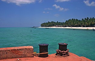
Agatti island, Lakshdweep

A rare red-billed tropicbird (Phaethon aethereus subsp. indicus) found in small islands of Lakshdweep

Closeup of a Butterfly Fish (Chaetodon falcula) in a reef, Lakshdweep.

Coral Reef near Bangaram Island, Lakshdweep

A Lagoon Triggerfish swimming around the reef of Lakshdweep.


See also[edit]
- Coral reefs in India
- Agatti Island
- Lakshadweep (Lok Sabha constituency)
- Lakshadweep Police
- Andaman Islands
References[edit]
- ↑ "Who's Who | Lakshadweep | India". U.T. Administration of Lakshadweep. 26 May 2021.
- ↑ "50th Report of the Commissioner for Linguistic Minorities in India" (PDF). 16 July 2014. p. 109. Archived from the original (PDF) on 8 July 2016. Retrieved 6 November 2016.
- ↑ 3.0 3.1 Sura's Year Book 2006. 2006. p. 250. ISBN 978-81-7254-124-8.
- ↑ "Lakshadweep". The Columbia Encyclopedia (Sixth ed.). 2008. Archived from the original on 27 January 2010.
- ↑ Ashalatha, B.; Subrahmanyam, C.; Singh, R.N. (31 July 1991). "Origin and compensation of Chagos-Laccadive ridge, Indian ocean, from admittance analysis of gravity and bathymetry data". Earth and Planetary Science Letters. 105 (1–3): 47–54. Bibcode:1991E&PSL.105...47A. doi:10.1016/0012-821X(91)90119-3.
- ↑ PTI (6 September 2017). "Uninhabited Lakshadweep island Parali I vanishes, 4 others shrinking fast: study". Mint. Retrieved 7 April 2021.
- ↑ 7.0 7.1 Kōyammakkōya, Eṃ (2012). Lakshadweep Pradesikabhasha Nighandu (Translation: Lakshadweep Regional Language Dictionary), Editor: Dr. Koyammakoya M. ISBN 978-81-922822-9-9.
- ↑ Cain, B.D. (2000). Dhivehi (Maldivian): A Synchronic and Diachronic Study (Ph.D. dissertation). Cornell University.
- ↑ 9.0 9.1 Subramoniam, V. I. (1997). Dravidian Encyclopaedia. Vol. 3, Language and literature. Thiruvananthapuram (Kerala): International School of Dravidian Linguistics. pp. 508-09. [1]
- ↑ 10.0 10.1 "Lakshadweep-Culture and Heritage". lakshadweep.gov.in. Government of India.
- ↑ Sharma, A. & Khan, M. Buddha heads and some grave head stones from Lakshadweep. In Rao, S. R. (ed.), The Role of universities and research institutes in marine archaeology, 129–131 (1994).
- ↑ Saigal, O. Lakshadweep. (National Book Trust, India), 1–219 (2000).
- ↑ Archaeology of Maldives and Lakshadweep, A.K Sharma, pages 4-15.
- ↑ 14.0 14.1 "Marine investigations in the Lakshadweep Islands, India". thefreelibrary.com. Archived from the original on 27 September 2013. Retrieved 1 August 2012.
- ↑ “Lakshadweep & Its People 1992-1993” Planning Department, Govt. Secretariat, Lakshadweep Administration, Kavaratti. Page: 12.
- ↑ 16.0 16.1 16.2 "History of Lakshadweep". lakshadweep.gov.in. Government of India.
- ↑ "History". lakshadweep.nic.in. Archived from the original on 14 May 2012. Retrieved 1 August 2012.
- ↑ "The Buddhist History of Kerala". Kerala.cc. Archived from the original on 21 March 2001. Retrieved 25 September 2013.
- ↑ A Sreedhara Menon (1 January 2007). A Survey Of Kerala History. DC Books. p. 138. ISBN 978-81-264-1578-6. Retrieved 9 August 2012.
- ↑ "Lakshadweep". Encyclopædia Britannica, Inc. Archived from the original on 28 February 2013. Retrieved 2 August 2012.
- ↑ 21.0 21.1 Charles Corn (1999) [First published 1998]. The Scents of Eden: A History of the Spice Trade. Kodansha America. pp. 4–5. ISBN 978-1-56836-249-6.
- ↑ The imperial gazetteer of India (Volume 8)
- ↑ Sreedhara Menon, A. (2007). Kerala Charitram (2007 ed.). Kottayam: DC Books. ISBN 978-8126415885.
- ↑ Forbes, Andrew D.W. (1979). "South Asia: Journal of South Asian Studies: Volume 2: Sources towards a history of the Laccadive Islands". South Asia: Journal of South Asian Studies. 2: 130–150. doi:10.1080/00856407908722989.
- ↑ 25.0 25.1 Government of Madras (1953). 1951 Census Handbook- South Canara District (PDF). Madras Government Press.
- ↑ Logan, William (2010). Malabar Manual (Volume-I). New Delhi: Asian Educational Services. ISBN 9788120604476.
- ↑ Logan, William (1887). Malabar Manual. New Delhi: Asian Education Services. p. 2. ISBN 978-81-206-0446-9. Archived from the original on 12 January 2016. Retrieved 15 November 2015.
- ↑ 1951 census handbook - Malabar district (PDF). Chennai: Government of Madras. 1953.
- ↑ "The States Reorganisation Act, 1956" (PDF). legislative.gov.in. Government of India.
- ↑ 30.0 30.1 P. M. Nair (1979). District Census Handbook -Laccadive, Minicoy, and Amindivi Islands (1971) - Village Directory (PDF). Kavaratti& Government Printing Press, Kozhikode: Administrator and Ex-Officio Director of Census Operations, Laccadive, Minicoy, and Amindivi Island. p. 2.
- ↑ "Navy commissions full-scale station in Lakshadweep". The Hindu. 1 May 2012. Archived from the original on 3 May 2012. Retrieved 9 May 2012.
- ↑ 32.0 32.1 "Location, Area and Population". lakshadweep.nic.in. Archived from the original on 12 May 2012. Retrieved 1 August 2012.
- ↑ "Station: Agatti (A) Climatological Table 1981–2010" (PDF). Climatological Normals 1981–2010. India Meteorological Department. January 2015. pp. 7–8. Archived from the original (PDF) on 5 February 2020. Retrieved 29 February 2020.
- ↑ "Extremes of Temperature & Rainfall for Indian Stations (Up to 2012)" (PDF). India Meteorological Department. December 2016. p. M112. Archived from the original (PDF) on 5 February 2020. Retrieved 29 February 2020.
- ↑ 'INDIA: A Physical Geography' (ISBN 81-230-0656-X), 1968, Publications Dn, Ministry of I&B, Govt. of India. page:74.
- ↑ "Maldives-Lakshadweep-Chagos Archipelago tropical moist forests". Terrestrial Ecoregions. World Wildlife Fund.
- ↑ 37.0 37.1 "Biodiversity and Environment Protection" (PDF). Lakshadweep Development Report. Planning Commission of India. Archived from the original (PDF) on 5 May 2012. Retrieved 3 August 2012.
- ↑ Khan, Asif N (2017). "FIRST RECORD OF ORIENTAL PRATINCOLE GLAREOLA MALDIVARUM FROM LAKSHADWEEP ARCHIPELAGO". Journal of the Bombay Natural History Society. 114. Archived from the original on 31 August 2018. Retrieved 6 February 2018.
- ↑ "Lakshadweep Development Report" (PDF). Department of Environment and Forests (Union Territory of Lakshadweep). Archived from the original (PDF) on 25 April 2013. Retrieved 3 August 2012.
- ↑ [2] Archived 12 January 2012 at the Wayback Machine
- ↑ "The Wild Life (Protection) Act, 1972". Department of Environment and Forests (Union Territory of Lakshadweep). Archived from the original on 25 April 2013. Retrieved 5 August 2012.
- ↑ The Marine Mammal Conservation Network of India. Submit a Record - Sightings and Strandings - Bryde's whale Archived 19 April 2017 at the Wayback Machine. Retrieved on April 19, 2017
- ↑ Khan E.. 2012. Whales @ Lakshadweep island-Video by Ehjaz Archived 10 August 2017 at the Wayback Machine. YouTube. Retrieved on April 19, 2017
- ↑ The Marine Mammal Conservation Network of India. Submit a Record - Sightings and Strandings - Killer whale Archived 19 April 2017 at the Wayback Machine. Retrieved on April 19, 2017
- ↑ The Nature Conservation Foundation India. 2017. This pygmy killer whale took a fancy to our team's dive boat in Lakshadweep, making them feel a tad uncomfortable while diving in to work! Archived 22 April 2017 at the Wayback Machine. Twitter. Retrieved on April 19, 2017
- ↑ Panicker D.. 2016. Cetacean Diversity and Distribution in the Lakshadweep Islands, India Archived 19 April 2017 at the Wayback Machine. The Rufford Foundation. Retrieved on April 19, 2017
- ↑ Dsouza A.. 2015. Angels of the Sea – Dolphins and Whales in India Archived 17 September 2017 at the Wayback Machine. The Royale - Defining Trenz by couponraja.in.. Retrieved on April 19, 2017
- ↑ Vinayak A.. 2016. Travel Guide - 6 Best Dolphin Destinations in India Archived 20 April 2017 at the Wayback Machine. The Native Planet. Retrieved on April 19, 2017
- ↑ Harsha S.. 2014. Dolphin Spotting in India Archived 20 April 2017 at the Wayback Machine. The Latest India News. Retrieved on April 19, 2017
- ↑ 50.0 50.1 50.2 "Symbols of Lakshadweep". knowindia.gov.in. Archived from the original on 12 November 2013. Retrieved 17 October 2013.
- ↑ 51.0 51.1 51.2 "Lakshadweep Key Indicators" (PDF). Archived from the original (PDF) on 17 October 2013. Retrieved 17 October 2013.
- ↑ Rao, T.A. & J.L. Ellis, Flora of Lakshadweep Islands off the Malabar coast, peninsular India, with emphasis on phytogeographical distribution of plants. Journal of Economic and Taxonomic Botany 19:235-250. 1995
- ↑ "Administrator's Profile". lakshadweep.nic.in. Archived from the original on 5 May 2012. Retrieved 1 August 2012.
- ↑ "Administrative Setup". lakshadweep.nic.in. Archived from the original on 15 April 2012. Retrieved 1 August 2012.
- ↑ "Judicial Setup". lakshadweep.nic.in. Archived from the original on 7 March 2012. Retrieved 1 August 2012.
- ↑ "Lakshadweep admin moots proposal for shifting HC jurisdiction from Kerala to Karnataka". The Indian Express. 20 June 2021. Retrieved 5 July 2023.
- ↑ 57.0 57.1 A, Timely (15 June 2023). "ലക്ഷദീപിലെ ആദ്യ വനിതാ ജഡ്ജിയായി മലയാളി". Timely news thodupuzha. Retrieved 5 July 2023.
- ↑ "Our Parliament". parliamentofindia.nic.in. Archived from the original on 9 July 2012. Retrieved 1 August 2012.
- ↑ "Constituency | Lakshadweep | India". Retrieved 5 July 2023.
- ↑ 60.0 60.1 60.2 60.3 60.4 60.5 "District Census 2011". Census2011.co.in. 2011. Archived from the original on 11 June 2011. Retrieved 30 September 2011.
- ↑
US Directorate of Intelligence. "Country Comparison: Population". Archived from the original on 27 September 2011. Retrieved 1 October 2011.
Marshall Islands 67,182 July 2011 est.
- ↑ 62.0 62.1 "Population by religion community - 2011". Census of India, 2011. The Registrar General & Census Commissioner, India. Archived from the original on 25 August 2015.
- ↑ "Lakshadweep Changes, Blamed on New Administrator, Trigger Outcry".
- ↑ "Lakshadweep". borderdarshan.com. Archived from the original on 13 January 2013. Retrieved 1 August 2012.
- ↑ "Lakshadweep Population 2021".
- ↑ "Kiltan Island". Lakshadweep.nic.in. Archived from the original on 3 May 2014. Retrieved 25 February 2015.
- ↑ Miller, Roland E. (2015). Mappila Muslim Culture: How a Historic Muslim Community in India Has Blended Tradition and Modernity. SUNY Press. p. 368. ISBN 978-1-4384-5601-0.
- ↑ 2011 Census of India, Population By Mother Tongue
- ↑ "National Portal of India". www.india.gov.in. Archived from the original on 5 February 2011.
- ↑ India, a reference annual. Government of India. 2004. p. 851. ISBN 978-81-230-1156-1.
- ↑ Jha, Makhan (1997). The Muslim Tribes of Lakshadweep Islands: An Anthropological Appraisal of ... - Makhan Jha - Google Books. ISBN 9788175330320. Retrieved 25 February 2015.
- ↑ "Report of the Working Group on Improvement of Banking Services in the Union Territory of Lakshadweep" (PDF). Rbidocs.rbi.org.in. Archived (PDF) from the original on 25 May 2013. Retrieved 25 February 2015.
- ↑ "FISHERIES". lakshadweep.nic.in. Archived from the original on 11 May 2012. Retrieved 1 August 2012.
- ↑ "Department of Fisheries-About Us". lakshadweep.nic.in. Archived from the original on 25 April 2013. Retrieved 1 August 2012.
- ↑ "Fisheries". lakshadweep.nic.in. Archived from the original on 12 May 2012. Retrieved 1 August 2012.
- ↑ "Tourism in Lakshadweep". Lakshadweeptourism.nic.in. 22 October 1988. Archived from the original on 19 February 2015. Retrieved 25 February 2015.
- ↑ [3] Archived 10 May 2011 at the Wayback Machine
- ↑ "Entry Permits". Union Territory of Lakshadweep. Archived from the original on 24 February 2015. Retrieved 25 February 2015.
- ↑ "Introduction to Lakshadweep Islands". The New York Times. Archived from the original on 11 February 2013. Retrieved 1 August 2012.
- ↑ Cabinet approves undersea fibre link between Lakshadweep islands and Kochi, Live Mint, 9 Dec 2020.
- ↑ "Lakshadweep to get its first statue – of Mahatma Gandhi". The Indian Express. 2 October 2021. Retrieved 2 October 2021.
- ↑ 82.0 82.1 "World's first ever low temperature thermal desalination plant opened at Kavaratti" (Press release). Ministry of Science and Technology (India). 23 May 2005. Archived from the original on 26 April 2012. Retrieved 1 August 2012.
- ↑ "One Million Litre Per Day (1 MLD) Barge Mounted Desalination Plant" (Press release). Ministry of Science and Technology (India). 18 April 2007. Archived from the original on 25 April 2013. Retrieved 1 August 2012.
- ↑ "Desalination: India opens world's first low temperature thermal desalination plant" (Press release). Press Information Bureau, Government of India. 23 May 2005. Archived from the original on 22 July 2012. Retrieved 3 August 2012.
- ↑ "City institute plans to develop manned submersibles". The Hindu. 19 November 2009. Archived from the original on 24 December 2009. Retrieved 1 August 2012.
- ↑ "Kochi to Agatti Flights and their Schedule". Mapsofindia.com. 8 September 2014. Archived from the original on 17 November 2011. Retrieved 25 February 2015.
- ↑ "Means of Transport". Union Territory of Lakshadweep. Archived from the original on 31 December 2014. Retrieved 1 August 2012.
Further reading[edit]
- R. C. Majumdar (1979) The History of Ancient Lakshadweep, Calcutta.
- S. Anandan, Lakshadweep – Between the sea and a hard place, The Hindu, 30 May 2021.
External links[edit]
Countries and territories bordering the Indian Ocean | ||
|---|---|---|
| Africa |  | |
| Asia |
| |
| Other | ||
- Pages using weather box with unknown parameters
- Articles with unsourced statements from February 2020
- Union territories of India
- Islands of Lakshadweep
- Atolls of India
- Archipelagoes of the Indian Ocean
- 5th-century establishments
- Populated places established in the 5th century
- States and territories established in 1956
- 1956 establishments in India
- States and union territories of India
- Districts of Lakshadweep