.png)


The history of human settlement in the west Indian state of Rajasthan dates back to about 5,000 years ago. This region was inhabited during great floods after the ice age as well. This area was known as Matsya kingdom. It was the site of the Indus Valley Civilization. The early medieval period saw the rise of many Rajput kingdoms like Pratihars, Chauhans of Ajmer, Guhilot and Sisodias of Mewar, Shekhawats of Shekhawati Sikar, Rathores of Marwar.

The Pratihar Empire acted as a barrier for Arab invaders from the 8th to the 11th century.it was the power of the Pratihara army that effectively barred the progress of the Arabs beyond the confines of Sindh, their only conquest for nearly 300 years.
After Matsya kingdom this area was known as Rajputana around the time when the Kachwaha migrated to the region.[1] The Kachwahas continued to assist their Rajput allies in many Fatal battles including First Battle of Tarain and later in the disastrous Second Battle of Tarain.[2] The last time where Kachwahas fought for Rajputs was under Rana Sanga of Chittor in the Battle of Khanwa.[3]
Sisodia of Chittor, who continue to resist Mughals against heavy odds and gave rise to Maharana Pratap who became a symbol of Rajput valour along with Rana Sanga and Prithviraj Chauhan.[4] After Indian Independence in 1947, the various princely states of Rajasthan were integrated. The British made several treaties with rulers of Rajasthan and also made allies out of local rulers, who were allowed to rule their princely states. This period was marked by famines and economic exploitation.
Periods of history of Rajasthan[edit | edit source]
Stone Age[edit | edit source]
- Early Stone Age
10,00,000 – 1,00,000 BCE
- Middle Stone Age
1,00,000–50,000 BCE
- Later Stone Age
50,000–5000 BCE
Bronze Age[edit | edit source]
- Early Bronze Age
5000-3300 BCE
- Later Bronze Age
3300-1500 BCE
Vedic Period[edit | edit source]
- Iron Age
1500–500 BCE
Classical Period[edit | edit source]
Ancient Kingdoms of Rajasthan[edit | edit source]
Many Kingdoms of Rajasthan Ruled from (500 BCE to 300 CE) like- Sivi, Salwa, Malava and Others.
Under Gupta Empire[edit | edit source]
Many Kingdoms of Rajasthan ruled independently under Gupta Empire from (300-600 CE)
Rajput Period[edit | edit source]
Many Rajput & other Kingdoms (not only Rajput many others also) ruled Rajasthan as-
- Early Rajput Period from (600-1200 CE)
- Middle Rajput Period from
(1200-1674 CE)
- Later Rajput Period from
(1674-1857 CE)
Indus Valley Civilisation (3300–1500 BCE)[edit | edit source]
Sindhu - Saraswati Civilization or The Indus Valley Civilisation was a Bronze Age civilisation in the northwestern regions of India, lasting from 3300 BCE to 1300 BCE, and in its mature form from 2600 BCE to 1900 BCE.
.png)
Together with ancient Egypt and Mesopotamia, it was one of three early civilisations of the Near East and South Asia, and of the three, the most widespread, its sites spanning an area stretching from northeast Afghanistan, through much of Pakistan, and into western and northwestern India. It flourished in the basins of the Indus River, which flows through the length of Pakistan, and along a system of perennial, mostly monsoon-fed, rivers that once coursed in the vicinity of the seasonal Ghaggar-Hakra river in northwest India and eastern Pakistan
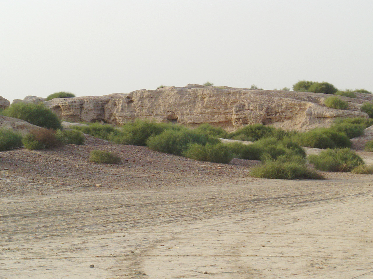
Kalibangan Civilization[edit | edit source]
Ancient Civilisation of Rajasthan-
Kalibangān is a town located in Tehsil Pilibangān, between Suratgarh and Hanumangarh in Hanumangarh District, Rajasthan, India 205 km from Bikaner. It is also identified as being established in the triangle of land at the confluence of Drishadvati and Sarasvati Rivers. The prehistoric and pre-Mauryan character of Indus Valley Civilization was first identified by Luigi Tessitori at this site. Kalibangan's excavation report was published in its entirety in 2003 by the Archaeological Survey of India, 34 years after the completion of excavations.

The report concluded that Kalibangan was a major provincial capital of the Indus Valley Civilization. Kalibangan is distinguished by its unique fire altars and "world's earliest attested ploughed field".It is around 2900 BC that the region of Kalibangan developed into what can be considered a planned city. The Kalibangan pre-historic site was discovered by Luigi Pio Tessitori, an Italian Indologist (1887–1919). He was doing some research in ancient Indian texts and was surprised by the character of ruins in that area. He sought help from Sir John Marshall of the Archaeological Survey of India. At that time the ASI was conducting excavations at Harappa, but they were unaware of the significance of the ruins. In fact, Tessitori was the first person to recognize that the ruins were 'Prehistoric' and pre-Mauryan. Luigi Pio Tessitori also pointed out the nature of the culture, but at that time it was not possible to guess that the ruins of Kalibangan lay within the Indus Valley Civilisation. He died five years before the Harappan culture was formally recognized.
After India's independence, both the major Harappan cities together with the Indus became a part of Pakistan and Indian archaeologists were compelled to intensify the search for Harappan sites in India. Amlānand Ghosh (Ex. Director General, Archaeological Survey of India, or ASI) was the first person to recognise this site as Harappan and marked it out for excavations. Under the leadership of B. B. Lal (then Director General, ASI), Balkrishna (B.K.) Thapar, M. D. Khare, K. M. Shrivastava and S. P. Jain carried out excavations for 9 years (1960–9) in 9 successive excavation sessions. Two ancient mounds were excavated, spread over half a kilometre (an area of a quarter square kilometre). On the western side is the smaller mound (KLB1), 9 meters high and known as the citadel. The Eastern mound, which is higher (12 meters) and bigger, is known as the lower city (KLB2).
The excavation unexpectedly brought to light a twofold sequence of cultures, of which the upper one (Kalibangan I) belongs to the Harappan, showing the characteristic grid layout of a metropolis and the lower one (Kalibangan II) was formerly called pre-Harappan but is now called "Early Harappan or antecedent Harappan". Other nearby sites belonging to IVC include Balu, Kunal, Banawali etc.[5][6]
Matsya kingdom (1500-500 BCE)[edit | edit source]
Matsya kingdom was an ancient kingdom of India. It was located in central India near Kuru. It was founded by Matsya Dwaita, a son of the great emperor Uparachira Vasu.
Geography[edit | edit source]

To the north of Central Matsya was Kuru. Kuru territories like Yakrilloma were located to the east. To its west was Salwa, and to its northwest was Mahothha. Nishada, Nishadha, and Kuru territories like Navarashtra were located to the south of Matsya.
Kurukshetra War[edit | edit source]
The entire Matsya royal family came to fight for the Pandavas in the Mahabharata war. Virata came with his brothers, Uttara, and Shankha. Shweta also came from the south with his son Nirbhita.

On the first day, Uttara died fighting Shalya. At the death of his half-brother, Shweta was infuriated and started wreaking havoc in the Kuru armies. Bhishma came and killed him. On the seventh day, Dronacharya killed Shankha and Nirbhita. On the fifteenth day, Dronacharya killed Virata. All of Virata's brothers also died fighting Dronacharya. The remnant of the Matsya army was slaughtered at midnight by Ashwastamma on the eighteenth day.[7][8][9]
Ancient Kingdoms of Rajasthan (500 BCE–300 CE)[edit | edit source]

Northern Rajasthan Area[edit | edit source]
Eastern Rajasthan Area[edit | edit source]
Central Rajasthan Area[edit | edit source]
Western Rajasthan Area[edit | edit source]
Southern Rajasthan Area[edit | edit source]
These warrior Kingdoms defeated many foreign invaders like Saka, Huna & Others.
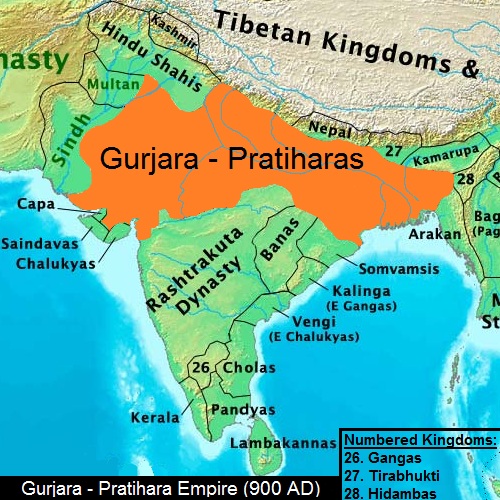
Pratihara dynasty (550–1036 CE)[edit | edit source]
The Pratihar Rajput Empire acted as a barrier for Arab invaders from the 6th to the 11th century. The chief accomplishment of the Pratihars lies in its successful resistance to foreign invasions from the west, starting in the days of Junaid. Umayyad campaigns in India (740) An alliance of rulers under Nagabhata I defeated the Arabs in 711 CE, and forced them to retreat to Sindh.[10] Historian R. C. Majumdar says that this was openly acknowledged by the Arab writers. He further notes that historians of India have wondered at the slow progress of Muslim invaders in India, as compared with their rapid advance in other parts of the world. Now there seems little doubt that it was the power of the Pratihara army that effectively barred the progress of the Arabs beyond the confines of Sindh, their only conquest for nearly 300 years.[11]

Major Branches of Pratihara dynasty-
Mandor Branch (550–880)[edit | edit source]
- Harishchandra Pratihara, (550–575)
- Rajjila Pratihara, (575–600)
- Nerabhatta Pratihara, (600–625)
- Naggabhatta Pratihara, (625–650)
- Tate Pratihara, (650–675)
- Yashovardhan, (675–700)
- Chanduka, (700–725)
- Shiluka, (725–750)
- Jhotta, (750–775)
- Bhilladhai, (775–800)
- Kake Pratihara, (800–825)
- Baauka, (825–850)
- Kakkuka, (850–880)
Bhinmala (Kannuj) Branch (725–1036)[edit | edit source]
- Nagabhata I (725–756)
- Kakustha (756–765)
- Devaraja (765–778)
- Vatsaraja (778–805)
- Nagabhata II (800–833)
- Ramabhadra (833–836)
- Mihira Bhoja (836–890)
- Mahendrapala I (890–910)
- Bhoja II (910–913)
- Mahipala I (913–944)
- Mahendrapala II (944–948)
- Devpala (948–954)
- Vinaykpala (954–955)
- Mahipala II (955–956)
- Vijaypala II (956–960)
- Rajapala (960–1018)
- Trilochanpala (1018–1027)
- Jasapala (Yashpala) (1024–1036)
Baddoch Branch (600–700)[edit | edit source]
Rajogarh Branch[edit | edit source]
NOTE: Badegujar were rulers of Rajogarh
- Parmeshver Manthandev, (885–915)
- No records found after Parmeshver Manthandev
Pratihara Art[edit | edit source]
There are notable examples of architecture from the Gurjara-Pratihara era, including sculptures and carved panels.[12] Their temples, constructed in an open pavilion style. One of the most notable Gurjara-Pratihara style of architecture was Khajuraho, built by their vassals, the Chandelas of Bundelkhand.[13]
- Māru-Gurjara architecture-
Māru-Gurjara architecture was developed during Gurjara Pratihara Empire.

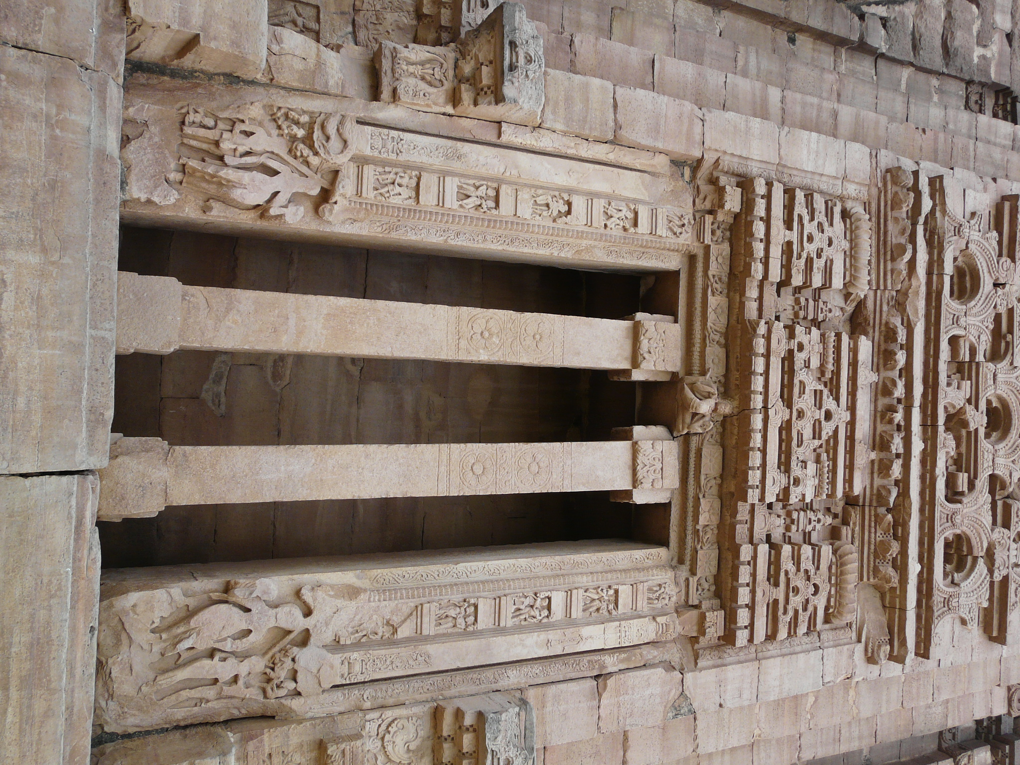
Mahavira Jain temple, Osian[edit | edit source]

Mahavira Jain temple, Osian temple was constructed in 783 CE,[14] making it the oldest surviving Jain temple in western India.[15]
Bateshwar Hindu temples complex[edit | edit source]
Bateshwar Hindu temples, Madhya Pradesh was constructed during the Gurjara-Pratihara Empire between 8th to 11th century.[16]
Baroli temples complex[edit | edit source]

.jpg)
Baroli temples complex are eight temples, built by the Gurjara-Pratiharas, is situated within a walled enclosured.
Chahamana or Chauhan dynasty (500-1315 CE)[edit | edit source]
Chauhan dynasty or Chahamana dynasty was a great power from 6th 12th Century, Chauchan dynasty ruled more than 400 years. Chauchan was a Rajput dynasty that ruled modern parts of Rajasthan, Haryana, Madhya Pradesh & Delhi. They sacrificed all they have & also self for protecting of Motherland from Maleechas. Chahamanas were classifies the dynasty among the four Agnivanshi Rajput clans, whose ancestors are said to have come out of Agnikund sacrificial fire pit. The earliest sources to mention this legend are the 16th century recensions of Prithviraj Raso.
The ruling dynasties belonging to the Chauhan clan included:-
* Chahamanas of Shakambhari (Chauhans of Ajmer)
- Chahamanas of Naddula (Chauhans of Nadol)
- Chahamanas of Lata[18]
- Chahamanas of Dholpur[19]
- Chahamanas of Partabgarh[20]
- Chahamanas of Jalor (Chauhans of Jalore); branched off from the Chahamanas of Naddula
- Chahamanas of Ranastambhapura (Chauhans of Ranthambore); branched off from the Chahamanas of Shakambhari.
The princely states ruled by families claiming Chauhan descent include:-[21]
Chahamanas of Shakambhari (500-1194)[edit | edit source]
The Chahamanas of Shakambhari (IAST: Cāhamāna), colloquially known as the Chauhans of Sambhar, were a dynasty that ruled parts of the present-day Rajasthan and its neighbouring areas in India, between 6th and 12th centuries. The territory ruled by them was known as Sapadalaksha. They were the most prominent ruling family of the Chahamana (Chauhan) clan, and were categorized among Agnivanshi Rajputs in the later medieval legends.
The Chahamanas originally had their capital at Shakambhari (present-day Sambhar Lake Town). Until the 10th century, they ruled as Pratihara vassals. When the Pratihara power declined after the Tripartite Struggle, the Chahamana ruler Simharaja assumed the title Maharajadhiraja. In the early 12th century, Ajayaraja II moved the kingdom's capital to Ajayameru (modern Ajmer). For this reason, the Chahamana rulers are also known as the Chauhans of Ajmer.
Territory[edit | edit source]
As the Chahamana territory expanded, the entire region ruled by them came to be known as Sapadalaksha. or Jangladesh.[22] This included the later Chahamana capitals Ajayameru (Ajmer) and Shakambhari (Sambhar).[23] The term also came to be applied to the larger area captured by the Chahamanas. The early medieval Indian inscriptions and the writings of the contemporary Muslim historians suggest that the following cities were also included in Sapadalaksha:- Hansi (now in Haryana), Mandore (now in Marwar region), and Mandalgarh (now in Mewar region).[24]
History[edit | edit source]
The earliest historical Chahamana king is the 6th century ruler Vasudeva.

The Ana Sagar lake in Ajmer was commissioned by the Chahamana ruler Arnoraja.
The subsequent Chahamana kings faced several Ghaznavid raids. Ajayaraja II (r. c. 1110-1135 CE) repulsed a Ghaznavid attack, and also defeated the Paramara king Naravarman. He moved the kingdom's capital from Shakambhari to Ajayameru (Ajmer), a city that he either established or greatly expanded.[25][26] His successor Arnoraja raided the Tomara territory, and also repulsed a Ghaznavid invasion. However, he suffered setbacks against the Gujarat Chaulukya kings Jayasimha Siddharaja and Kumarapala, and was killed by his own son Jagaddeva.[27]

Arnoraja's younger son Vigraharaja IV greatly expanded the Chahamana territories, and captured Delhi from the Tomaras. The most celebrated ruler of the dynasty was Someshvara's son Prithviraja III, better known as Prithviraj Chauhan. He defeated several neighbouring kings, including the Chandela ruler Paramardi in 1182-83, although he could not annex the Chandela territory to his kingdom.[28] In 1191, he defeated the Ghurid king Muhammad of Ghor at the first Battle of Tarain. However, the next year, he was defeated at the second Battle of Tarain, and subsequently killed.[29]
Muhammad of Ghor appointed Prithviraja's son Govindaraja IV as a vassal. Prithviraja's brother Hariraja dethroned him, and regained control of a part of his ancestral kingdom. Hariraja was defeated by the Ghurids in 1194 CE. Govindaraja was granted the fief of Ranthambore by the Ghurids. There, he established a new branch of the dynasty.[30]
Cultural Achievements[edit | edit source]

The Chahamanas commissioned a number of Hindu temples, several of which were destroyed by the Ghurid invaders after the defeat of Prithviraja III.[31]
Multiple Chahamana rulers contributed to the construction of the Harshanatha temple, which was probably commissioned by Govindaraja I.[32] According to Prithviraja Vijaya:
- Simharaja commissioned a large Shiva temple at Pushkar[33]
- Chamundaraja commissioned a Vishnu temple at Narapura (modern Narwar in Ajmer district)[34]
- Prithviraja I built a food distribution centre (anna-satra) on the road to Somnath temple for pilgrims.[35]
- Someshvara commissioned a number of temples, including five temples in Ajmer.[36][37]
Vigraharaja IV was known for his patronage to arts and literature, and himself composed the play Harikeli Nataka. The structure that was later converted into the Adhai Din Ka Jhonpra mosque was constructed during his reign.[38]
List of rulers[edit | edit source]
.jpg)
Following is a list of Chahamana rulers of Shakambhari and Ajmer, with approximate period of reign, as estimated by R. B. Singh:[39]
- Chahamana (c. 2nd century CE)
- Vasu-deva (c. 6th century CE)
- Samanta-raja (c. 684-709 CE); identified as the legendary Manik Rai by R. B. Singh
- Nara-deva (c. 709-721 CE)
- Ajaya-raja I (c. 721-734 CE), alias Jayaraja or Ajayapala
- Vigraha-raja I (c. 734-759 CE)
- Chandra-raja I (c. 759-771 CE)
- Gopendra-raja (c. 771-784 CE)
- Durlabha-raja I (c. 784-809 CE)
- Govinda-raja I (c. 809-836 CE), alias Guvaka I
- Chandra-raja II (c. 836-863 CE)
- Govindaraja II (c. 863-890 CE), alias Guvaka II
- Chandana-raja (c. 890-917 CE)
- Vakpati-raja (c. 917-944 CE); his younger son established the Naddula Chahamana branch
- Simha-raja (c. 944-971 CE)
- Vigraha-raja II (c. 971-998 CE)
- Durlabha-raja II (c. 998-1012 CE)
- Govinda-raja III (c. 1012-1026 CE)
- Vakpati-raja II (c. 1026-1040 CE)
- Viryarama (c. 1040 CE)
- Chamunda-raja (c. 1040-1065 CE)
- Durlabha-raja III (c. 1065-1070 CE), alias Duśala
- Vigraha-raja III (c. 1070-1090 CE), alias Visala
- Prithvi-raja I (c. 1090-1110 CE)
- Ajaya-raja II (c. 1110-1135 CE), moved the capital to Ajayameru (Ajmer)
- Arno-raja (c. 1135-1150 CE), alias Ana
- Jagad-deva (c. 1150 CE)
- Vigraha-raja IV (c. 1150-1164 CE), alias Visaladeva
- Apara-gangeya (c. 1164-1165 CE)
- Prithvi-raja II (c. 1165-1169 CE)
- Someshvara (c. 1169-1178 CE)
- Prithvi-raja III (c. 1178-1192 CE), better known as Prithviraj Chauhan
- Govinda-raja IV (c. 1192 CE); banished by Hari-raja for accepting Muslim suzerainty; established the Chahamana branch of Ranastambhapura
- Hari-raja (c. 1193-1194 CE)
Chahamanas of Naddula (950-1197)[edit | edit source]
The Chahamanas of Naddula, also known as the Chauhans of Nadol, were an Indian dynasty. They ruled the Marwar area around their capital Naddula (present-day Nadol in Rajasthan) between 10th and 12th centuries. The Chahamanas of Naddula were an offshoot of the Chahamanas of Shakambhari. Their founder was Lakshmana (alias Rao Lakha) was the son of the 10th century Shakambari ruler Vakpatiraja I. His brother Simharaja succeeded their father as the Shakambhari ruler.[40] The subsequent rulers fought against the neighbouring kingdoms of the Paramaras of Malwa, the Chaulukyas, the Ghaznavids,.[41] The last ruler Jayata-simha was probably defeated by Qutb al-Din Aibak in 1197 CE.[42]
List of rulers[edit | edit source]
Following is a list of Chahmana rulers of Naddula, with approximate period of reign, as estimated by R. B. Singh:[43]
- Lakshmana (c. 950-982 CE), alias Rao Lakha or Lakhana
- Shobhita (c. 982-986 CE)
- Baliraja (c. 986-990 CE)
- Vigrahapala (c. 990-994 CE)
- Mahindra (c. 994-1015 CE), alias Mahindu or Mahendra
- Ashvapala (c. 1015-1019 CE)
- Ahila (c. 1019-1024 CE)
- Anahilla (c. 1024-1055 CE)
- Balaprasada (c. 1055-1070 CE)
- Jendraraja (c. 1070-1080 CE)
- Prithvipala (c. 1080-1090 CE)
- Jojalladeva (c. 1090-1110 CE)
- Asharaja (c. 1110-1119 CE), alias Ashvaraja
- Ratnapala (c. 1119-1132 CE)
- Rayapala (c. 1132-1145 CE)
- Katukaraja (c. 1145-1148 CE)
- Alhanadeva (c. 1148-1163 CE)
- Kelhanadeva (c. 1163-1193 CE)
- Jayatasimha (c. 1193-1197 CE)
Chahamanas of Jalor (1160-1311)[edit | edit source]
The Chahamanas of Jalor, also known as the Chauhans of Jalor in vernacular legends, were an Indian dynasty that ruled the area around Jalore in present-day Rajasthan between 1160 and 1311. They branched off from the Chahamanas of Naddula, and then ruled as feudatories of the Chaulukyas of Gujarat. For a brief period, they became independent, but ultimately succumbed to the Delhi Sultanate at the Siege of Jalore.
The Chahamanas of Jalor descended from Alhana, a Chahamana king of the Naddula branch. Originally, the Jalore Fort was controlled by a branch of the Paramaras until early 12th century. The Chahamanas of Naddula seized its control during Alhana's reign. Kirtipala, a son of Alhana, received a feudal grant of 12 villages from his father and his brother (the crown-prince) Kelhana. He controlled his domains from Suvarnagiri or Sonagiri, the hill on which Jalore Fort is located. Because of this, the branch to which he belonged came to be known as Sonagara.[44]
List of Rulers[edit | edit source]
The Chahamana rulers of the Jalor branch, with their estimated periods of reign, are as follows:[45]
- Kirti-pala (c. 1160-1182 CE)
- Samara-simha (c. 1182-1204 CE)
- Udaya-simha (c. 1204-1257 CE)
- Chachiga-deva (c. 1257-1282 CE)
- Samanta-simha (c. 1282-1305 CE)
- Kanhada-deva (c. 1292-1311 CE)
- Virama-deva (1311 CE); crowned during the Siege of Jalore, but died 2½ days later.[46][47]
Chahamanas of Ranastambhapura (1192-1301)[edit | edit source]
The Chahamanas of Ranastambhapura were a 13th-century Indian dynasty. They ruled the area around their capital Ranastambhapura (Ranthambore) in present-day Rajasthan, initially as vassals of the Delhi Sultanate, and later as sovereigns. They belonged to the Chahamana (Chauhan) clan, and are also known as Chauhans of Ranthambore in vernacular Rajasthani bardic literature.
The Chahamana line of Ranastambhapura was established by Govindaraja, who agreed to rule as a vassal of the Ghurids in 1192, after they defeated his father, the Shakambhari Chahamana king Prithviraja III. Govindaraja's descendants gained and lost their independence to the Delhi Sultanate multiple times during the 13th century. Hammira, the last king of the dynasty, adopted an expansionist policy, and raided several neighbouring kingdoms. The dynasty ended with his defeat against the Delhi Sultan Alauddin Khalji at the Siege of Ranthambore in 1301.
List of rulers[edit | edit source]
- Govinda-raja (1192 CE)
- Balhana-deva or Balhan, son of Govinda
- Prahlada or Prahlad, son of Balhana
- Viranarayana or Vir Narayan, son of Prahlada
- Vagabhata, son of Balhana; known as Bahar Deo in bardic chronicles
- Jaitra-simha or Jaitra Singh
- Hammira-deva or Hammir Dev (1301 CE)
Mewar dynasty (550–1950)[edit | edit source]
The Guhila dynasty ruled the Medapata (modern Mewar) region in present-day Rajasthan state of India.

In the 6th century, three different Guhila dynasties are known to have ruled in present-day Rajasthan:
- Guhilas of Nagda-Ahar,
- Guhilas of Kishkindha (modern Kalyanpur),
- Guhilas of Dhavagarta (present-day Dhor).
None of these dynasties claimed any prestigious origin in their 7th century records.[48] The Guhilas of Dhavagarta explicitly mentioned the Mori (later Maurya) kings as their overlords, and the early kings of the other two dynasties also bore the titles indicating their subordinate status.[49] By the 10th century, the Guhilas of Nagda-Ahar were the only among the three dynasties to have survived. By this time, their political status had increased, and the Guhila kings had assumed high royal titles such as Maharajadhiraja.
During this period, the dynasty started claiming a prestigious origin, stating that its founder Guhadatta was a mahideva (Brahmin) who had migrated from Anandapura (present-day Vadnagar in Gujarat).[50]
R. C. Majumdar theorizes that Bappa achieved a highly significant military success, because of which he gained reputation as the dynasty's founder.[51]
The later bardic chronicles mention a fabricated genealogy, claiming that the dynasty's founder Guhaditya was a son of Shiladitya, the Maitraka ruler of Vallabhi. This claim is not supported by historical evidence.[52]
History[edit | edit source]
According to the 977 CE Atpur inscription and the 1083 CE Kadmal inscription, Guhadatta was succeeded by Bhoja, who commissioned the construction of a tank at Eklingji. The 1285 CE Achaleshwar inscription describes him as a devotee of Vishnu.[53] Bhoja was succeeded by Mahendra and Nagaditya. The bardic legends state that Nagaditya was killed in a battle with the Bhils.[53]
Nagaditya's successor Shiladitya raised the political status of the family significantly, as suggested by his 646 CE Samoli inscription, as well as the inscriptions of his successors, including the 1274 CE Chittor inscription and the 1285 CE Abu inscription. R. V. Somani theorizes that the copper and zinc mines at Jawar were excavated during his reign, which greatly increased the economic prosperity of the kingdom.
Mahendra was succeeded by Kalabhoja, who has been identified as Bappa Rawal by several historians including G. H. Ojha.[54]
In the mid-12th century, the dynasty divided into two branches. The senior branch (whose rulers are called Rawal in the later medieval literature) ruled from Chitrakuta (modern Chittorgarh), and ended with Ratnasimha's defeat against the Delhi Sultanate at the 1303 Siege of Chittorgarh. The junior branch ruled from Sesoda with the title Rana, and gave rise to the Sisodia Rajput dynasty.
List of Rulers[edit | edit source]
Guhila dynasty (550–1303)[edit | edit source]
- Bappaka (550–566)
- Guhaditya / Guhlia (566–580) (Real founder of the dynasty)
- Bhoja (580–602)
- Mahendra (I) (602–616)
- Nāga (616–646)
- Śiladitya (646–661 )
- Aparājita (661–697 )
- Mahendra (II) (697–728)
- Bappa Rawal / Kālabhoja (728–753)
- Khommāṇa (I) (753–773)
- Mattaṭa (773–790)
- Bhartṛipaṭṭa (I) (790–813)
- Rawalsiṃha (813–820)
- Khommāṇa (II) (820–853)
- Mahāyaka (853–900)
- Khommāṇa (III) (900–942)
- Bhartṛipaṭṭa (II) (942–943 CE)
- Allaṭa (943–953 )
- Naravāhana (953–971 )
- Śalivāhana (971–977 )
- Śaktikumāra (977–993 )
- Āmraprasāda (993–998)
- Śuchivarman (998–1010)
- Naravarman (1010–1035)
- Kīrtivarman (1035–1050)
- Yogarāja (1050–1075)
- Vairaṭa (1075–1090)
- Vaṃśapāla (1090–1100)
- Vairisiṃha (1100–1122)
- Vijayasiṃha (1122–1130)
- Vairisiṃha (II) (1130–1136)
- Arisiṃha (1136–1145)
- Choḍa (1145–1151)
- Vikramasiṃha (1151–1158)
- Raṇasiṃha (1158–1165 )[55][56][57]
Branching of Guhil Dynasty[edit | edit source]
- Ranasingh (1158 CE) During his reign, the Guhil dynasty got divided into two branches.
- First (Rawal Branch)—Kṣemasiṃha, son of Raṇasiṃha, ruled over Mewar by building Rawal Branch.
- Second (Rana Branch)—Rahapa, the second son of Raṇasiṃha started the Rana Branch by establishing Sisoda bases. Due to his stay in Rana Sisoda hideout, he was later called Sisodia.[56][57]
Post-split Rawal branch[edit | edit source]
- Kṣemasiṃha (1165–1172)
- Sāmantasiṃha (1172–1179)
- Kumārasiṃha (1179–1185)
- Mathanasiṃha (1185–1201)
- Padmasiṃha (1201–1213)
- Jaitrasingh (1213–1261)
- Tejasingh (1261–1273)
- Samarasingh (1273–1301)
- Ratnasingh (1301–1303).[58][59]
Rana branch (1162–1326)[edit | edit source]
Rahapa, a son of Ranasimha alias Karna, established the Rana branch. According to the 1652 Eklingji inscription, Rahapa's successors were:
- Rahapa/Karna (1162)
- Narapati (1185)
- Dinakara (1200)
- Jasakarna (1218)
- Nagapala (1238)
- Karnapala (1266)
- Bhuvanasimha (1280)
- Bhimasimha (1297)
- Jayasimha (1312)
- Lakhanasimha (1318)
- Arisimha (Arasi) (1322)
- Hammir Singh (1326)[60]
Sisodia Dynasty (1326-1950)[edit | edit source]
- Hammir Singh (1326–1364)
- Kshetra Singh (1364–1382)
- Lakha Singh (1382–1421)
- Mokal Singh (1421–1433)
- Rana Kumbha (1433–1468)
- Udai Singh I (1468–1473)
- Rana Raimal (1473–1508)
- Rana Sanga (1508–1527), under his rule Mewar reached its pinnacle in power and prosperity.[61]
- Ratan Singh II (1528–1531)
- Vikramaditya Singh (1531–1536)
- Vanvir Singh (1536–1540)
- Udai Singh II (1540–1572)
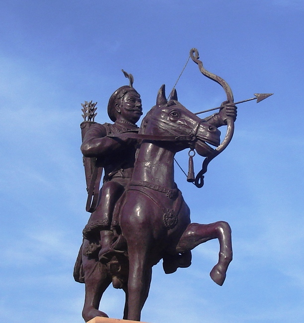
- Maharana Pratap (1572–1597), 13th king of Mewar, notable for his military resistance against the Mughal Empire
- Amar Singh I (1597–1620)
- Karan Singh II (1620–1628)
- Jagat Singh I (1628–1652)
- Raj Singh I (1652–1680)
- Jai Singh (1680–1698)
- Amar Singh II (1698–1710)
- Sangram Singh II (1710–1734)
- Jagat Singh II (1734–1751)
- Pratap Singh II (1751–1754)
- Raj Singh II (1754–1762)
- Ari Singh II (1762–1772)
- Hamir Singh II (1772–1778)
- Bhim Singh (1778–1828)
- Jawan Singh (1828–1838)
- Shambhu Singh (1861–1874)
- Sajjan Singh (1874–1884)
- Fateh Singh (1884–1930)
- Bhupal Singh (1930–1950)
Early Modern period (1526-1858 CE)[edit | edit source]
Mughal Conquests[edit | edit source]

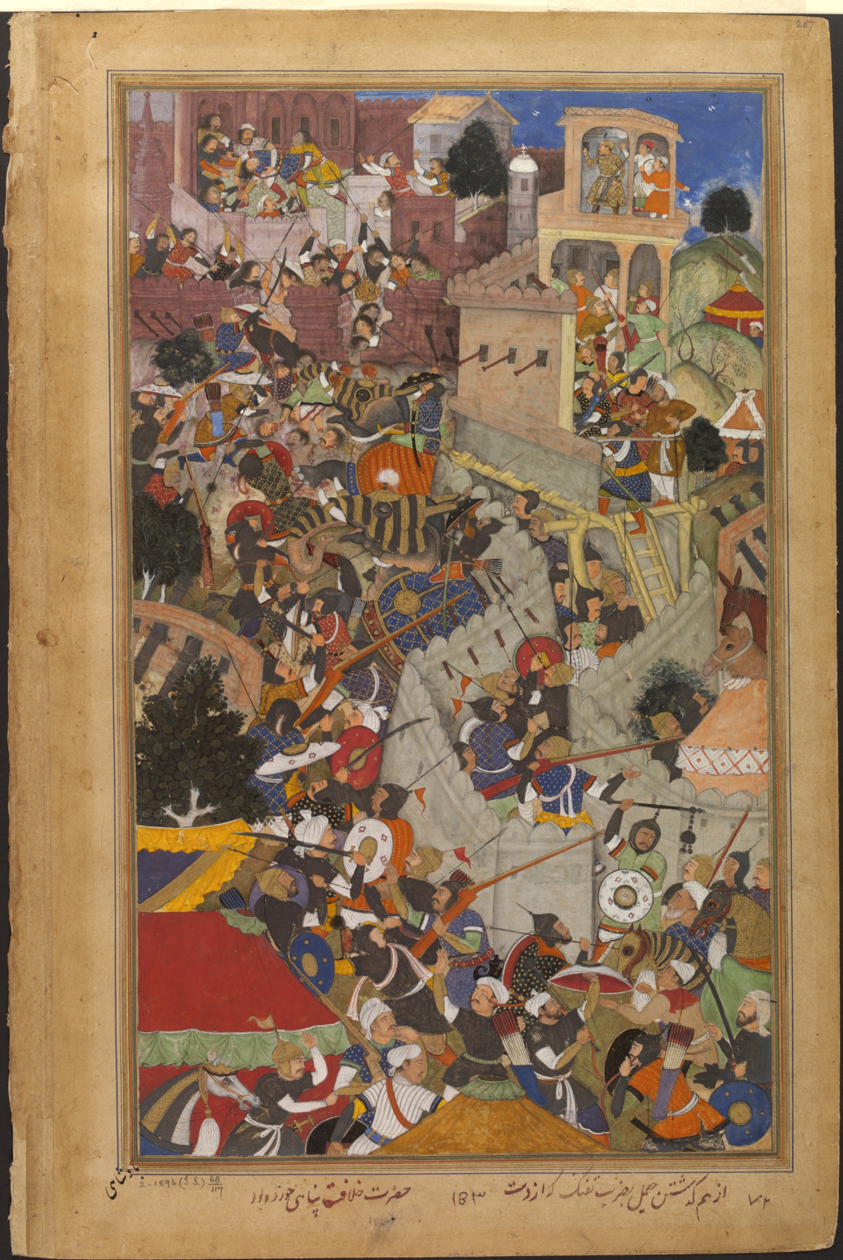
The Mughal Emperor Akbar expanded the empire into Rajputana in the 16th century CE. He laid siege to Chittor and defeated the Kingdom of Mewar in 1568. He also laid siege to Ranthambore and defeated the forces of Surjan Hada in the same year.

![Suraj Mal was ruler of Bharatpur, some contemporary historians described him as "the Plato of the Jat people" and by a modern writer as the "Jat Odysseus", because of his political sagacity, steady intellect and clear vision.[62]](/wiki/File:Maharaja_Suraj_Mal.jpg)
Akbar also arranged matrimonial alliances to gain the trust of Rajput rulers. He himself married the Rajput princess Jodha Bai. He also granted high offices to a large number of Rajput princes, and maintained cordial relations with them, such as Man Singh, one of the navaratnas. However, some Rajput rulers were not ready to accept Akbar's dominance and preferred to remain independent. Two such rulers were Udai Singh of Mewar and Chandrasen Rathore of Marwar. They did not accept Akbar's supremacy and were at constant war with him. This struggle was continued by Rana Pratap, the successor of Udai Singh. His army met with Akbar's forces at the Battle of Haldighati where he was defeated and wounded. Since then he remained in recluse for twelve years and attacked the Mughals from time to time.
Mughal influence is seen in the styles of Rajput painting and Rajput architecture of the medieval period.
Maratha Empire[edit | edit source]
Since the early 1700s, the Maratha Empire began expanding northwards, led by Peshwa Baji Rao I of Pune. This expansion finally brought the newly founded Maratha Empire in contact with the Rajputs. Rajasthan saw many invasions by the Marathas, under military leadership of Holkars and Scindhias.[63]
British colonial period (1858-1947 CE)[edit | edit source]

The arrival of the British East India Company in the region led to the administrative designation of some geographically, culturally, economically and historically diverse areas, which had never shared a common political identity, under the name of the Rajputana Agency. This was a significant identifier, being modified later to Rajputana Province and lasting until the renaming to Rajasthan in 1949. The Company officially recognized various entities, although sources disagree concerning the details, and also included Ajmer-Merwara, which was the only area under direct British control. Of these areas, Marwar and Jaipur were the most significant in the early 19th century, although it was Mewar that gained particular attention from James Tod, a Company employee who was enamoured of Rajputana and wrote extensively, if often uncritically, of the people, history and geography of the Agency as a whole.
Alliances were formed between the Company and these various princely and chiefly entities in the early 19th century, accepting British sovereignty in return for local autonomy and protection from the Marathas and Pindari depredations. Following the Mughal tradition and more importantly due to its strategic location Ajmer became a province of British India, while the autonomous Rajput states, the Muslim state of Tonk, and the Jat states of Bharatpur, Dholpur were organized into the Rajputana Agency. In 1817–18, the British Government concluded treaties of alliance with almost all the states of Rajputana. Thus began the British rule over Rajasthan, then called Rajputana.
Post-independence (1947 CE - present)[edit | edit source]
.jpg)
The name of Rajasthan as Rajputana became more pronounced or Popular in 12th century before Ghurid invasions, also Rajput as a separate caste emerge in Indian social structure around that time in 12th century.[64] The Kachwaha Rajput clan migrated to the region and made Amber their capital in the 12th century and for 600 years continued to be a political centre.[1]
It took seven stages to form Rajasthan as defined today. In March 1948 the Matsya Union consisted of Alwar, Bharatpur, Dhaulpur and Karauli was formed. Also, in March 1948 Banswara, Bundi, Dungarpur, Jhalawar, Kishangarh, Kota, Pratapgarh, Shahpura and Tonk joined the Indian union and formed a part of Rajasthan. In April 1948 Udaipur joined the state and the Maharana of Udaipur was made Rajpramukh. Therefore, in 1948 the merger of south and southeastern states was almost complete. Still retaining their independence from India were Jaipur State and the desert kingdoms of Bikaner, Jodhpur, and Jaisalmer. From a security point of view, it was claimed that it was vital to the new Indian Union to ensure that the desert kingdoms were integrated into the new nation. The princes finally agreed to sign the Instrument of Accession, and the kingdoms of Bikaner, Jodhpur, Jaisalmer and Jaipur acceded in March 1949. This time, the Maharaja of Jaipur, Man Singh II, was made the Rajpramukh of the state and Jaipur became its capital. Later in 1949, the United States of Matsya, comprising the former kingdoms of Bharatpur, Alwar, Karauli and Dholpur, was incorporated into Rajasthan. On January 26, 1950, 18 states of united Rajasthan merged with Sirohi to join the state leaving Abu and Dilwara to remain a part of Greater Bombay and now Gujarat.
Gurumukh Nihal Singh was appointed as first governor of Rajasthan. Hiralal Shastri was the first nominated chief minister of the state, taking office on 7 April 1949. He was succeeded by two other nominated holders of the office before Tika Ram Paliwal became the first elected chief minister from 3 March 1951.
In November 1956, under the provisions of the States Re-organisation Act, the erstwhile part 'C' state of Ajmer, Abu Road Taluka, former part of Sirohi princely state (which were merged in former Bombay), State and Sunel-Tappa region of the former Madhya Bharat merged with Rajasthan and Sironj sub district of Jhalawar was transferred to Madhya Pradesh. Thus giving the existing boundary Rajasthan. Today with further reorganisation of the states of Uttar Pradesh, Madhya Pradesh and Bihar. Rajasthan has become the largest state of the Indian Republic.
The princes of the former kingdoms were constitutionally granted handsome remuneration in the form of privy purses and privileges to assist them in the discharge of their financial obligations. In 1970, Indira Gandhi, who was then the Prime Minister of India, commenced under-takings to discontinue the privy purses, which were abolished in 1971. Many of the former princes still continue to use the title of Maharaja, but the title has little power other than as a status symbol. Many of the Maharajas still hold their palaces and have converted them into profitable hotels, while some have made good in politics. The democratically elected Government runs the state with a chief minister as its executive head and the governor as the head of the state. Currently, including the new district of Pratapgarh, there are 33 districts, 105 sub-divisions, 37,889 villages, 241 tehsils and 222 towns in Rajasthan.
See also[edit | edit source]
- Timeline of history of Rajasthan
- Outline of Rajasthan
- List of battles of Rajasthan
- List of Rajput dynasties
- Matsya kingdom
- List of Chief Ministers of Rajasthan
References[edit | edit source]
Notes
Citations
- ↑ 1.0 1.1 Jadunath Sarkar 1994, pp. 22.
- ↑ Jadunath Sarkar 1994, pp. 25-27.
- ↑ Jadunath Sarkar 1994, pp. 32-33.
- ↑ Jadunath Sarkar 1994, pp. 41-42.
- ↑ Calkins, PB; Alam M. "India". Encyclopædia Britannica. Retrieved 31 December 2008.
- ↑ Lal, BB (2002). "The Homeland of Indo-European Languages and Culture: Some Thoughts". Purātattva. Indian Archaeological Society. pp. 1–5.
- ↑ Malik, Dr Malti (2016). History of India. New Saraswati House India Pvt Ltd. pp. 52–53. ISBN 978-81-7335-498-4.
- ↑ "Integration of Rajasthan". Rajasthan Legislative Assembly website. Retrieved 4 June 2009.
- ↑ Dalal, Roshen (14 July 2017), "Hinduism and its basic texts", Reading the Sacred Scriptures, 1 [edition]. | New York : Routledge, 2017. |: Routledge, pp. 250, 157–170, ISBN 978-1-315-54593-6, retrieved 16 September 2020
{{citation}}: CS1 maint: location (link) CS1 maint: work parameter with ISBN (link) - ↑ R. C. Majumdar 1977, p. 298-299
- ↑ Radhey Shyam Chaurasia (2002). History of Ancient India: Earliest Times to 1000 A. D. Atlantic Publishers & Distributors. pp. 207–208. ISBN 978-81-269-0027-5.
- ↑ Kala, Jayantika (1988). Epic scenes in Indian plastic art. Abhinav Publications. p. 5. ISBN 978-81-7017-228-4.
- ↑ Mitter 2001, p. 66.
- ↑ Kalia 1982, p. 2.
- ↑ Cort 1998, p. 112.
- ↑ "ASI to resume restoration of Bateshwar temple complex in Chambal". Hindustan Times. 21 May 2018.
- ↑ K. D. Bajpai (2006). History of Gopāchala. Bharatiya Jnanpith. p. 31. ISBN 978-81-263-1155-2.
- ↑ Singh 1964, p. 105.
- ↑ Singh 1964, p. 114.
- ↑ Singh 1964, p. 115.
- ↑ Memoranda on the Indian States. Government Of India. 1939. pp. 110–139.
- ↑ Har Bilas Sarda 1935, p. 217.
- ↑ Har Bilas Sarda 1935, p. 224.
- ↑ Har Bilas Sarda 1935, p. 225.
- ↑ R. B. Singh 1964, pp. 131-132.
- ↑ Dasharatha Sharma 1959, p. 40.
- ↑ R. B. Singh 1964, p. 140-141.
- ↑ Cynthia Talbot 2015, pp. 39.
- ↑ Iqtidar Alam Khan 2008, p. xvii.
- ↑ R. B. Singh 1964, p. 221.
- ↑ Dasharatha Sharma 1959, p. 87.
- ↑ Dasharatha Sharma 1959, p. 26.
- ↑ R. B. Singh 1964, p. 104.
- ↑ R. B. Singh 1964, p. 124.
- ↑ R. B. Singh 1964, p. 128.
- ↑ Dasharatha Sharma 1959, pp. 69-70.
- ↑ R. B. Singh 1964, p. 159.
- ↑ Cynthia Talbot 2015, pp. 37-38.
- ↑ R. B. Singh 1964, pp. 51-70.
- ↑ R. B. Singh 1964, p. 233.
- ↑ Sailendra Nath Sen 1999, p. 334.
- ↑ R. B. Singh 1964, pp. 262-263.
- ↑ R. B. Singh 1964, pp. 252-265.
- ↑ Ashok Kumar Srivastava 1979, pp. 1-2.
- ↑ Ashok Kumar Srivastava 1979, p. xvi.
- ↑ Dasharatha Sharma 1959, p. 169.
- ↑ Ashok Kumar Srivastava 1979, p. 53.
- ↑ Nandini Sinha 1991, p. 64.
- ↑ Nandini Sinha, 1991 & p.
- ↑ Nandini Sinha 1991, p. 66.
- ↑ R. C. Majumdar 1977, p. 299.
- ↑ Ram Vallabh Somani 1976, p. 34.
- ↑ 53.0 53.1 Ram Vallabh Somani 1976, p. 36.
- ↑ Ram Vallabh Somani 1976, p. 40.
- ↑ Anil Chandra Banerjee 1958, p. 15.
- ↑ 56.0 56.1 N. P. Chakravarti 1987, pp. 119-121.
- ↑ 57.0 57.1 Anil Chandra Banerjee 1958, pp. 14-15.
- ↑ N. P. Chakravarti 1987, p. 121.
- ↑ Akshaya Keerty Vyas 1937, pp. 312-313.
- ↑ D. C. Ganguly 1957, p. 91.
- ↑ "Maharana Sanga; the Hindupat, the last great leader of the Rajput race: Sarda, Har Bilas, Diwan Bahadur, 1867-1955 : Free Download, Borrow, and Streaming". Internet Archive. Retrieved 16 August 2020.
- ↑ R.C.Majumdar, H.C.Raychaudhury, Kalikaranjan Datta: An Advanced History of India, fourth edition, 1978, ISBN 0-333-90298-X, Page-535
- ↑ Naravane, M. S. (1999). The Rajputs of Rajputana: A Glimpse of Medieval Rajasthan. ISBN 9788176481182. Retrieved 16 March 2014.
- ↑ Jadunath Sarkar 1960, pp. 32.
Further Reading
- Gupta, R. K.; Bakshi, S. R. (2008), Studies In Indian History: Rajasthan Through The Ages: The Heritage Of Rajputs, vol. 1, Sarup & Sons, ISBN 9788176258418
Primary Sources Bhatnagar, V. S. (1991). Kanhadade Prabandha: India's greatest patriotic saga of medieval times: Padmanābha's epic account of Kānhaḍade. New Delhi: Voice of India.
Bibliography[edit | edit source]
- Percival Spear (1990). A History of India. Penguin Books India. ISBN 978-0-14-0138368-.
- Jadunath Sarkar (1960). Military History of India. Orient Longmans.
- Jadunath Sarkar (1994). A History of Jaipur: C. 1503-1938. Orient Blackswan. ISBN 978-81-250-0333-5.
- Chaube, J. (1975). History of Gujarat Kingdom, 1458-1537. Munshiram Manoharlal Publishers.
- Cort, John E. (1998), Open Boundaries: Jain Communities and Cultures in Indian History, SUNY Press, ISBN 9780791437865
- Gopinath Sharma (1954). Mewar & the Mughal Emperors (1526-1707 A.D.). S.L. Agarwala.
- Kalia, Asha (1982), Art of Osian Temples: Socio-economic and Religious Life in India, 8th-12th Centuries A.D., Abhinav Publications, ISBN 9780391025585
- Mitter, Partha (2001). Indian Art. Oxford University Press. ISBN 978-0-19-284221-3.
- Rao, K. V. Krishna (1991). Prepare Or Perish: A Study of National Security. Lancer Publishers. ISBN 978-81-7212-001-6.
- Chaurasia, Radhey Shyam (2002). History of Medieval India: From 1000 A.D. to 1707 A.D. Atlantic Publishers & Dist. ISBN 978-81-269-0123-4.
- Sharma, G. N., Bhatnagar, V. S., & University of Rajasthan. (1992). The Historians and sources of history of Rajasthan. Jaipur: Centre for Rajasthan Studies, University of Rajasthan.
