

Vadnagar | |
|---|---|
Town | |
 Panoramic view of the town | |
 Vadnagar Location in Gujarat  Vadnagar Location in India | |
| Coordinates: 23°47′06″N 72°38′24″E / 23.785°N 72.64°E | |
| Country | |
| State | Gujarat |
| District | Mehsana |
| Region | North Gujarat |
| Government | |
| • Body | Vadnagar Municipality |
| Area | |
| • Total | 7.08 km2 (2.73 sq mi) |
| Elevation | 143 m (469 ft) |
| Population (2011)[1] | |
| • Total | 27,790 |
| • Density | 3,900/km2 (10,000/sq mi) |
| Languages | |
| • Official | Gujarati, Hindi, English |
| Time zone | UTC+5:30 (IST) |
| Vehicle registration | GJ-02 |
Vadnagar is a town and municipality in the Mehsana district of the state of Gujarat in India. It is located 35 km (22 mi) from Mehsana. Its ancient names include Anartapura (the capital of Anarta) and Anandapura. It was a location visited by Xuanzang in 640 C.E. The founder and the first Director-General of the Archaeological Survey of India (ASI), Alexander Cunningham, had identified Anandapura with the town of Vadnagar.[2] Vadnagar is also the birthplace of Narendra Modi, the current Prime Minister of India.
History[edit | edit source]
The archeological excavations presented sequence assigned from 4th-3rd century BCE to the present period.[3] Recent excavations, in six trenches, consider the beginning of the site to be around 800 BCE, (ca. 2754 calibrated years before present).[4]
Archaeologists found seven cultural periods of continuous human presence: 1) Pre-Mauryan, (ca. 800-320 BCE), (contemporary to Late-Vedic/pre-Buddhist Mahajanapadas or oligarchic republics), 2) Mauryan (ca. 320-185 BCE), 3) Indo-Greek, 4) Indo-Scythian or Shaka-Kshatrapas (ca. 35-415 CE), ('Satraps', descendants of provincial governors of the ancient Achaemenid Empire), 5) Hindu-Solankis, 6) Sultanate-Mughal (Islamic) to Gaekwad-British colonial rule (ca. 318 years before present), and 7) Recent.[5]
Several ancient inscriptions and literary sources mention a town called Anartapura or Anandapura, identified as the area in and around the present-day Vadnagar. The epic tale Mahabharata mentions the Anarta Kingdom in the northern part of present-day Gujarat. The oldest Puranic legend about Gujarat is about a king named Anartha. The town is mentioned in the Tirtha Mahatmya section of the Nagara Khanda of the Skanda Purana, by the name of Chamatkarapura.[6] The Junagadh rock inscription (dating from 150 C.E.) of the Western Kshatrapa King, Rudradaman I, mentions a region called "Anartha" (meaningless) in northern present-day Gujarat.
The Maitraka rulers of Vallabhi (505-648 C.E.) issued land grants to the Brahmins of Anarthapura or Anandapura.[7] The Harsola copper plates (949 C.E.) of the Paramara king record the granting of two villages in Gujarat area to the Nagar Brahmins, who originated from Anandapura. which is also identified with Vadnagar, and is associated with the Nagar Brahmins.[8] In 2009, archaeologists discovered a 4 km long fortification near Vadnagar, which they believe could be the historical Anartapura.[7]
Vadnagar has also yielded an image of Bodhisattva dated back to the 3rd or 4th century C.E. This image may have been brought from Mathura to install in one of the town's Buddhist monasteries.[citation needed] Vadnagar's old town is found inside the walls of a fort with six gates: Kirti, Arjun, Nadiol, Amarthol, Ghaskol and Pithori. The town was added to the tentative list of the UNESCO World Heritage sites in December 2022.[9]
Geography[edit | edit source]
Vadnagar is located at 23°47′N 72°38′E / 23.78°N 72.63°E. It covers an area of about 7.08 km2 (2.73 sq mi) and has an average elevation of 143 m (469 ft) above the mean sea level. It lies in a relatively flat and dry region, as compared to the rest of Gujarat.[10]
Climate[edit | edit source]
The climate in Vadnagar is generally cold during winters and hot in summers, with temperatures varying from 14 °C (57 °F) to as high as 42 °C (108 °F). The average annual rainfall is about 670 mm. Relative humidity is generally high, especially in the monsoon and post–monsoon months, because of the interiorly location of the town.[11]
Demographics[edit | edit source]
As of Census 2011, Vadnagar's population was 27,790, including 14,097 males and 13,693 females. Its female sex ratio is 971 compared to the state average of 919. Moreover, Vadnagar's child sex ratio is around 937 compared to the 890 state average. In Vadnagar, 12.26% of the population is under 6 years of age. Vadnagar's average literacy rate is 80.53%, higher than the 78.03% national average: male literacy is 90.41%, and female literacy is 70.42%.[12]
Economy[edit | edit source]
Almost the entire population of Vadnagar is engaged in agriculture and primary sector, because it is relatively isolated from the rest of Gujarat, as compared to other towns and cities like Mehsana, and developmental stages related to secondary and tertiary sectors are yet to be done. The primary sector accounts for around 40% of the total workforce. Another important industry on which the population is dependent is tourism, because in and around the town, there are many tourist attractions. Thus, it has a large potential yet to be tapped.
Languages[edit | edit source]
Gujarati, being the state language of Gujarat, is spoken by most of the people in Vadnagar. Hindi and English are other common languages.
Historic and cultural landmarks[edit | edit source]
- Sharmistha Lake: a lake with a small island, it is connected by a 7 km long inlet canal. The island has been developed into an urban park, including an open-air theatre.
- Buddhist monastery: The recent excavations have brought to light a Buddhist monastery belonging to the 2nd-7th century AD, within the fortified area of Vadnagar. The monastery had two votive stupas and an open central courtyard, around which initially nine cells were constructed. The arrangement of the cells around the central courtyard creates a swastika-like pattern.[13]

- Hatkeshwar Mahadev Temple: It is a 15th-century temple, and is the most significant of the numerous Shiva shrines. He is the family deity of the Nagar Brahmins. Facing east, the temple is enclosed by a high wall surmounted by three circular domes, interspersed with flat stretches, symbolising the Indo-Saracenic architecture. From the roof of the sanctum sanctorum, a massive shikara rises high above into the sky. A massive congregation hall leads to the sanctum, which houses a Shiva linga, and is said to have self-emerged, or as it is said, swayambhu (lit. has self-emerged). The premises also have an ancient Kashivishveshvara Shiva temple, a Swaminarayan temple and two Jain temples. The temple's exterior is exquisitely and profusely decorated with the figures of nine planets, regent deities, the chief gods of the Hindu pantheon, scenes from the life of Krishna, Pandava princes Ramayana and Mahabharata, musicians, dancing apsaras, as well as varied animal and floral motifs.[14]
- Sitala Mata Temple: It is ornately carved with figures of celestial beings. Its door frames and ceilings depict the Rasmandala, portraying Krishna dancing with milkmaids.

- Vadnagar Archaeological Experiential Museum was built at an estimated cost of ₹298 crore (US$42 million).[15] It was inaugurated on 16 January 2025.[16] It is the first experiential archaeological museum in India.[17] It was opened to the public from 1 February 2025.[18] It covers 2500 years history of continuous human habitation of the town as well as its cultural history.[19]
- Kirti Toran: The town is famous for its two toranas, a pair of 12th-century columns supporting an arch, about 40 feet tall built in red and yellow sandstone, just north of the walled town. They stand on the bank of the Sharmistha Lake. Their pillars and arches are decorated with lozenges at the base and geometric and floral designs (i.e., leaves, creepers and lotus), animal motifs, human figures engaged in various activities, and divine figures in different poses. The one to the east is in better condition and has been used as a symbol of Gujarat in recent times. Initially, one torana was intact while the other was ruined. The ruined one was re-erected in 2007 by the Archaeological Survey of India (ASI).[20] The toranas might have served as an entrance to a large temple complex, but no remains of such have been found till date.[21]
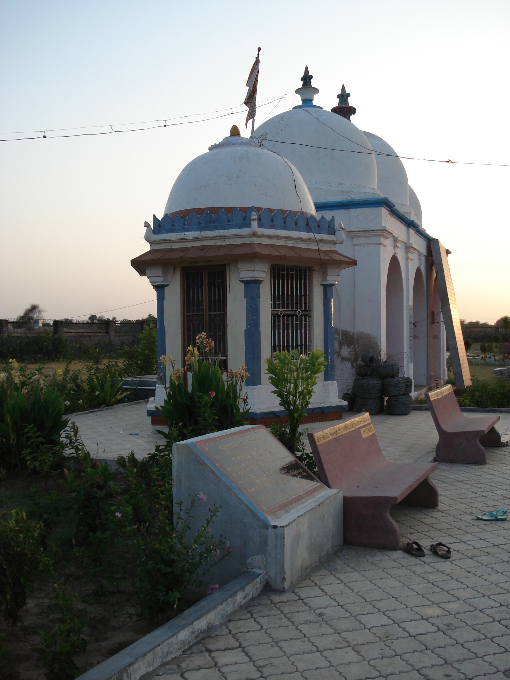
Other places include Tana-Riri garden and shrine, Gauri kund, Pancham Mehta's Vav (stepwell), Janjanio well, Baithakji of Gusaiji, an ancient library and a directional stone from the Solanki period.[22]
-
 Hathi Jain temple
 -
 Tana-Riri garden and shrine
 -
 Gauri kund
 -
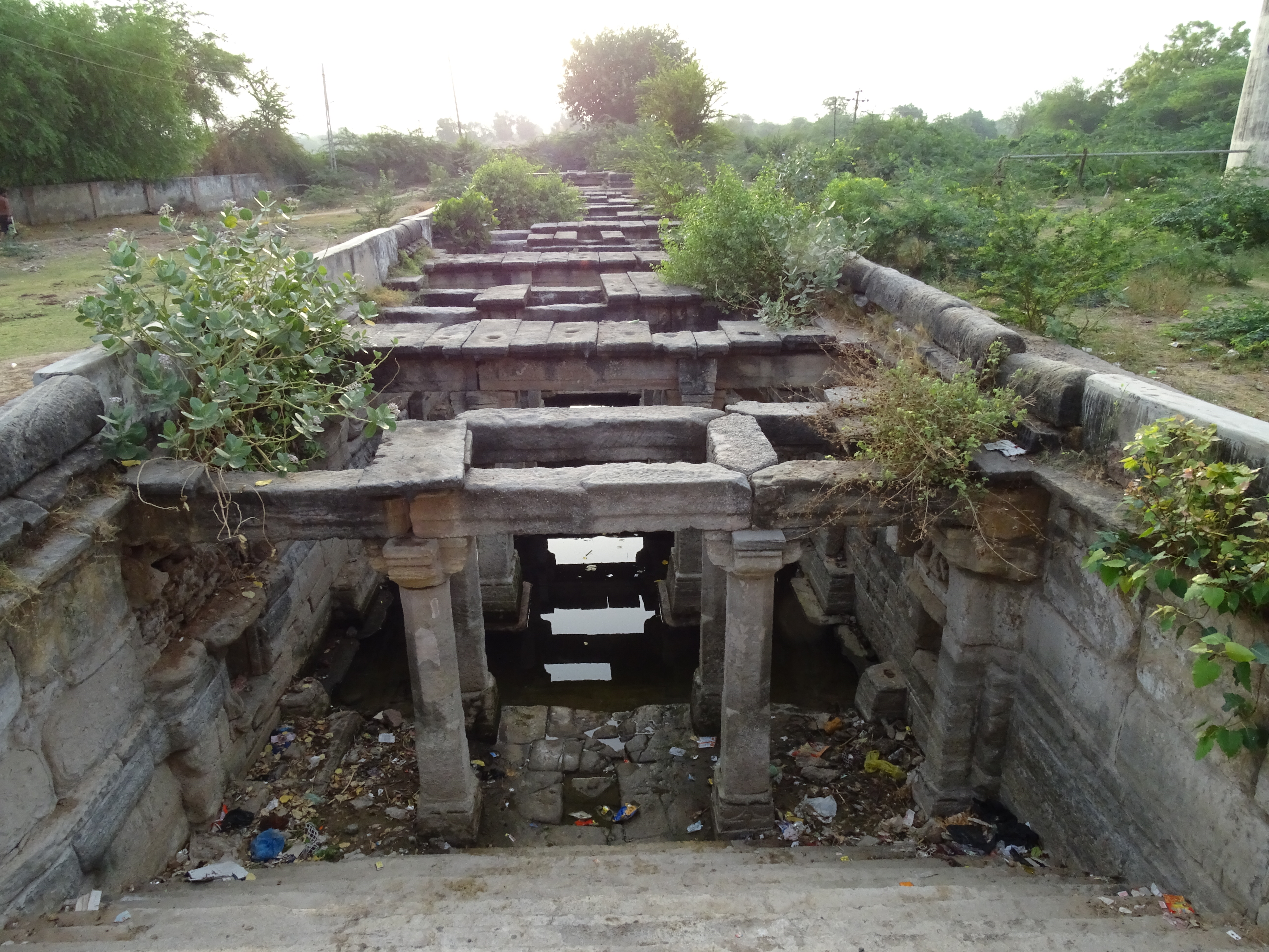 Pancham Mehta's Vav


There are many temples, dedicated to almost every god in Hinduism:
- Shiva:
- Dwaneshwar Mahadev Temple,
- Somnath Mahadev Temple and
- Kashi Vishveshvara Temple,
- Vishnupuri Temple,
- Chhabila Temple,
- Hanuman Temple,
- Ashapuri Mata Temple,
- Ambaji Mata Temple,
- Sitla Mata Temple,
- Bhuvaneshpuri Temple,
- Amther Mata Temple,
- Gauri kund and
- Swaminarayan Temple.
There are remains of a Buddhist monastery dating from the 7th century C.E., as well as two Jain derasars.[23]
Education[edit | edit source]
- Schools
- Anarth Shikshan Kendra
- Shri B. N. High School
- Jawahar Navodaya Vidyalaya
- Navin Sarva Vidyalaya
- Pattharwali School
- Royal English Medium School
- Saraswati Vidya Mandir
- Sarvajanik Vidyayalaya, Vaghasi
- Vadnagar Girls High School
- Colleges
- Arts and Commerce College, Vadnagar
- GMERS Medical College, Vadnagar
- Government ITI, Vadnagar
- Government Polytechnic, Vadnagar
- Government Science College, Vadnagar
Healthcare[edit | edit source]
- Hospitals
- Bhavna Hospital
- Drishti Hospital
- GMERS Medical College & Civil Hospital
- Sadbhavna Hospital
- Sardar Patel General Hospital
- Vadnagar Nagrik Mandal Hospital
- Vasant Prabha Hospital
Transport[edit | edit source]
Road[edit | edit source]
The Gujarat State Highway 56 (SH-56) passes through Vadnagar, that connects it directly with Mehsana, Visnagar and Ambaji.
Rail[edit | edit source]
The Vadnagar railway station lies on the Mehsana-Taranga line, that directly connects Vadnagar with the rest of the state and beyond through Mehsana Junction railway station.
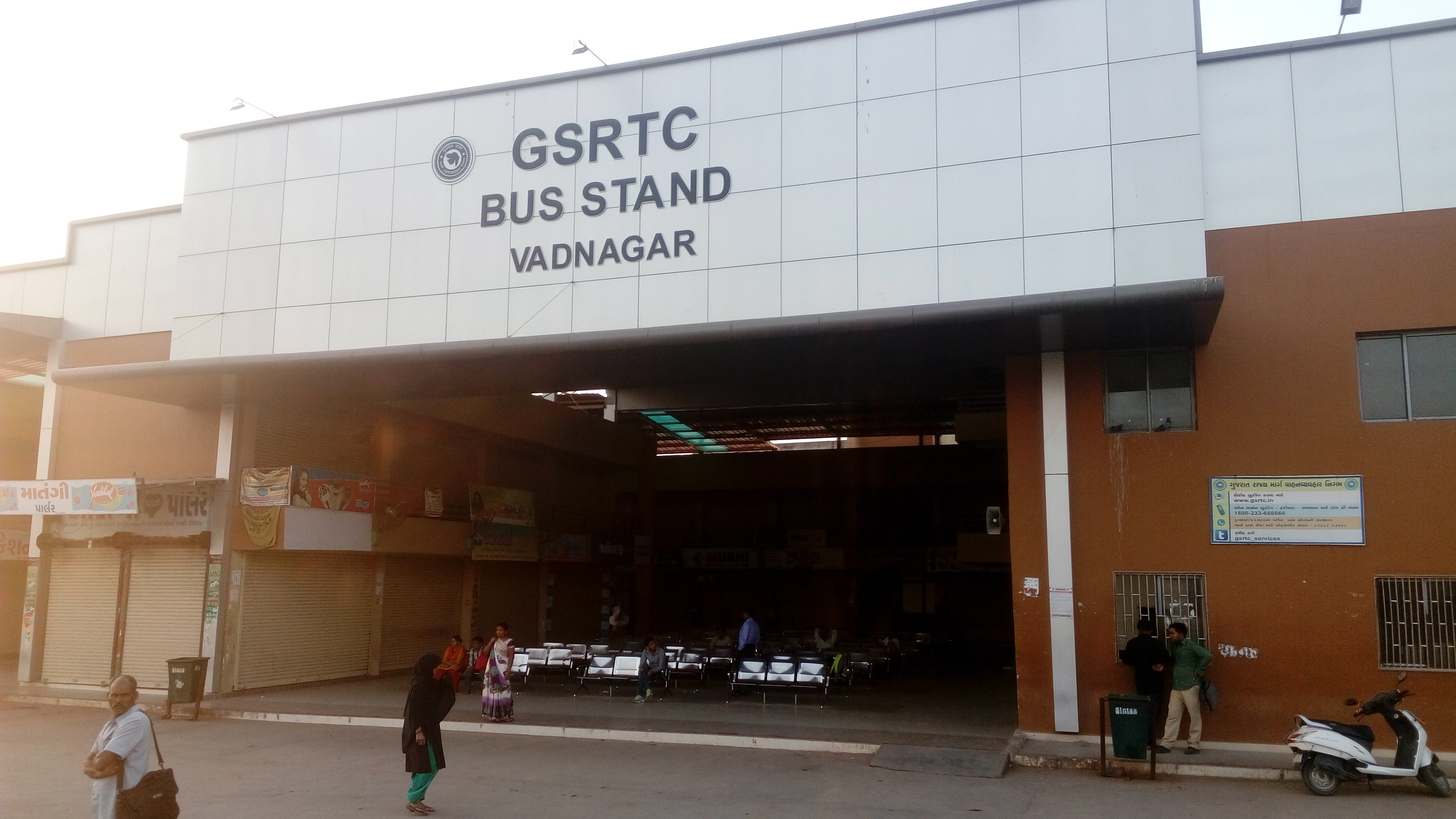
Bus[edit | edit source]

The Vadnagar bus station is located within the centre of the town. Buses are available from here to all major towns and cities in Gujarat and neighbouring states, that operate under Gujarat State Road Transport Corporation (GSRTC), private and tourism operators.
Air[edit | edit source]
The nearest airport is Mehsana Airport, located 36 km (22 mi) south-west from Vadnagar at Mehsana. However, currently, the airport is only used for private and government purposes, not for civilian or passenger services. Hence, the nearest operational airport is Sardar Vallabhbhai Patel International Airport, located 93 km (58 mi) south from the town at Ahmedabad.
Notable people[edit | edit source]
- Shankar Chaudhary, politician, current speaker of Gujarat Legislative Assembly, former Minister of State for Health and Family Welfare, Medical Education, Environment (All Independent charges) and Urban Development, Government of Gujarat
- Asit Kumarr Modi, Indian TV producer and actor, known for Taarak Mehta Ka Ooltah Chashmah
- Narendra Modi, 14th and current Prime Minister of India
- Vasant Parikh, Indian politician
See also[edit | edit source]
References[edit | edit source]
- ↑ "Census of India: Search Details". Archived from the original on 24 September 2015. Retrieved 12 May 2014.
- ↑ The Ancient Geography of India: I. The Buddhist Period, Including the Campaigns of Alexander, and the Travels of Hwen-Thsang. By Sir Alexander Cunningham, p.493-494
- ↑ Rawat, Yadubirsingh (2011). "11. Recently Found Ancient Monastery and Other Buddhist Remains at Vadnagar and Taranga In North Gujarat, India". Bujang Valley and Early Civilisations in South East Asia, Malaysia: 209–232 – via Academia.
- ↑ Sarkar, Anindya, et al., (2024). "Climate, human settlement, and migration in South Asia from early historic to medieval period: Evidence from new excavation at Vadnagar, Western India", in: Quaternary Science Reviews, Volume 324, 15 January 2024, 108470: "Radiocarbon chronology of mollusc carbonates, charcoal and drill core sediments, retrieved from six trenches suggest that the settlement began at ~2754 years B.P. contemporary to Late-Vedic/pre-Buddhist Mahajanapadas or oligarchic republics of ancient India" (Conclusions).
- ↑ Sarkar, Anindya, et al., (2024). "Climate, human settlement, and migration in South Asia from early historic to medieval period: Evidence from new archaeological excavation at Vadnagar, Western India", in: Quaternary Science Reviews, Volume 324, 15 January 2024, 108470.
- ↑ "Tirtha Mahatmya Nagara Khanda Skanda Purana". Wisdomlib.org. Retrieved 12 January 2020.
- ↑ 7.0 7.1 "Lost city could be Gujarat's womb: Archaeologists". The Times of India. 4 September 2009. Retrieved 20 August 2014.
- ↑ Harihar Vitthal Trivedi (1991). Inscriptions of the Paramāras (Part 2). Corpus Inscriptionum Indicarum Volume VII: Inscriptions of the Paramāras, Chandēllas, Kachchapaghātas, and two minor dynasties. Archaeological Survey of India. p. 5. doi:10.5281/zenodo.1451755.
- ↑ "Vadnagar town, Modhera Sun Temple, Unakoti sculptures added to UNESCO's tentative list of World Heritage Sites". The Hindu. 20 December 2022. ISSN 0971-751X. Retrieved 21 December 2022.
- ↑ Falling Rain Genomics, Inc - Vadnagar
- ↑ "Yearly & Monthly weather - Vadnagar, India". Weather Atlas. Retrieved 18 January 2024.
- ↑ "Census of India 2011: Data from the 2011 Census, including cities, villages and towns (Provisional)". Census Commission of India. Retrieved 18 January 2024.
- ↑ "Buddhist Monastery, Vadnagar". Gujarat Tourism. Retrieved 18 January 2024.
- ↑ "Hatkeshwar Temple". Gujarat Tourism. Retrieved 18 January 2024.
- ↑ "In Vadnagar today, Shah to dedicate archaeological museum, PM's school to public". The Indian Express. 16 January 2025. Retrieved 17 January 2025.
- ↑ "Amit Shah inaugurates Vadnagar Archaeological Museum, Prerna Sankul and Vadnagar Sports Complex at Mehsana". ANI News. Retrieved 17 January 2025.
- ↑ "Amit Shah to inaugurate archaeological museum in PM Modi's hometown Vadnagar on Jan 16". Deccan Herald. Retrieved 17 January 2025.
- ↑ "1 ફેબ્રુઆરીથી સામાન્ય જનતા મુલાકાત લઈ શકશે:સાત કાળના વડનગરની પ્રતીતિ કરાવતું મ્યુઝિયમ જોવામાં ત્રણ કલાક વીતી જશે". Divya Bhaskar (in ગુજરાતી). 16 January 2024.
- ↑ "Amit Shah to inaugurate archaeological museum in PM Modi's hometown Vadnagar on Jan 16". Deccan Herald. Retrieved 17 January 2025.
- ↑ "ASI erects ancient Vadnagar gate". The Times of India. 15 March 2007. ISSN 0971-8257. Retrieved 16 October 2023.
- ↑ "Kirti Toran". Gujarat Tourism. Retrieved 18 January 2024.
- ↑ "Kirti Toran, Vadnagar | District Mahesana, Government of Gujarat | India". mahesana.nic.in. Archived from the original on 19 August 2020. Retrieved 12 January 2022.
- ↑ "Vadnagar". Gujarat Tourism. Retrieved 18 January 2024.
| Topics |  | |
|---|---|---|
| Regions of Gujarat | ||
| Districts | ||
| Major cities | ||
| Ecoregions | ||
| Economy | ||
.png)