Balsi Purbapara | |
|---|---|
Village | |
Balsi Purbapara is located in West Bengal Balsi Purbapara Location in West Bengal, India  Balsi Purbapara Balsi Purbapara (India) | |
| Coordinates: 23°09′35″N 87°33′06″E / 23.1597°N 87.5517°E | |
| Country | |
| State | West Bengal |
| District | Bankura |
| Population (2011) | |
| • Total | 1,516 |
| Languages | |
| • Official | Bengali, English |
| Time zone | UTC+5:30 (IST) |
| PIN | 722206 |
| Telephone/STD code | 03244 |
| Lok Sabha constituency | Bishnupur |
| Vidhan Sabha constituency | Indas |
| Website | bankura |
Balsi Purbapara is a village in the Patrasayer CD block in the Bishnupur subdivision of the Bankura district in the state of West Bengal, India.
Geography[edit | edit source]
Lua error in Module:OSM_Location_map at line 1984: attempt to index field 'wikibase' (a nil value).
Location[edit | edit source]
Balsi Purbapara is located at 23°09′35″N 87°33′06″E / 23.1597°N 87.5517°E.
Note: The map alongside presents some of the notable locations in the subdivision. All places marked in the map are linked in the larger full screen map.
Demographics[edit | edit source]
According to the 2011 Census of India, Balsi Purbapara had a total population of 1,516, of which 1767 (51%) were males and 749 (49%) were females. There were 155 persons in the age range of 0–6 years. The total number of literate persons in Balsi Purbapara was 1,002 (73.62% of the population over 6 years).[1]
Education[edit | edit source]
Balsi High School is a Bengali-medium coeducational institution established in 1945. It has facilities for teaching from class V to class XII. The school has 5 computers, a library with 2,000 books and a playground.[2]
Patrasayer Mahavidyalaya was established in 2005 at Patrasayer[3][4]
Culture[edit | edit source]
David J. McCutchion mentions the Vishnu temple as a good example of 19th century terracotta decorated standard ‘Birbhum-Bardhaman’ type Bengal deul. He also mentions a Lakshmi Narayana temple with a low towered at-chala built of laterite with stucco work in 1652, another low towered at-chala, a pancharatna dolamancha and an ek-ratna rasmancha.[5]
Balsi Purbapara picture gallery[edit | edit source]
-
 At-chala Shiva temple and Vishnu deul
 -
 Terracotta panel in the Vishnu deul
 -
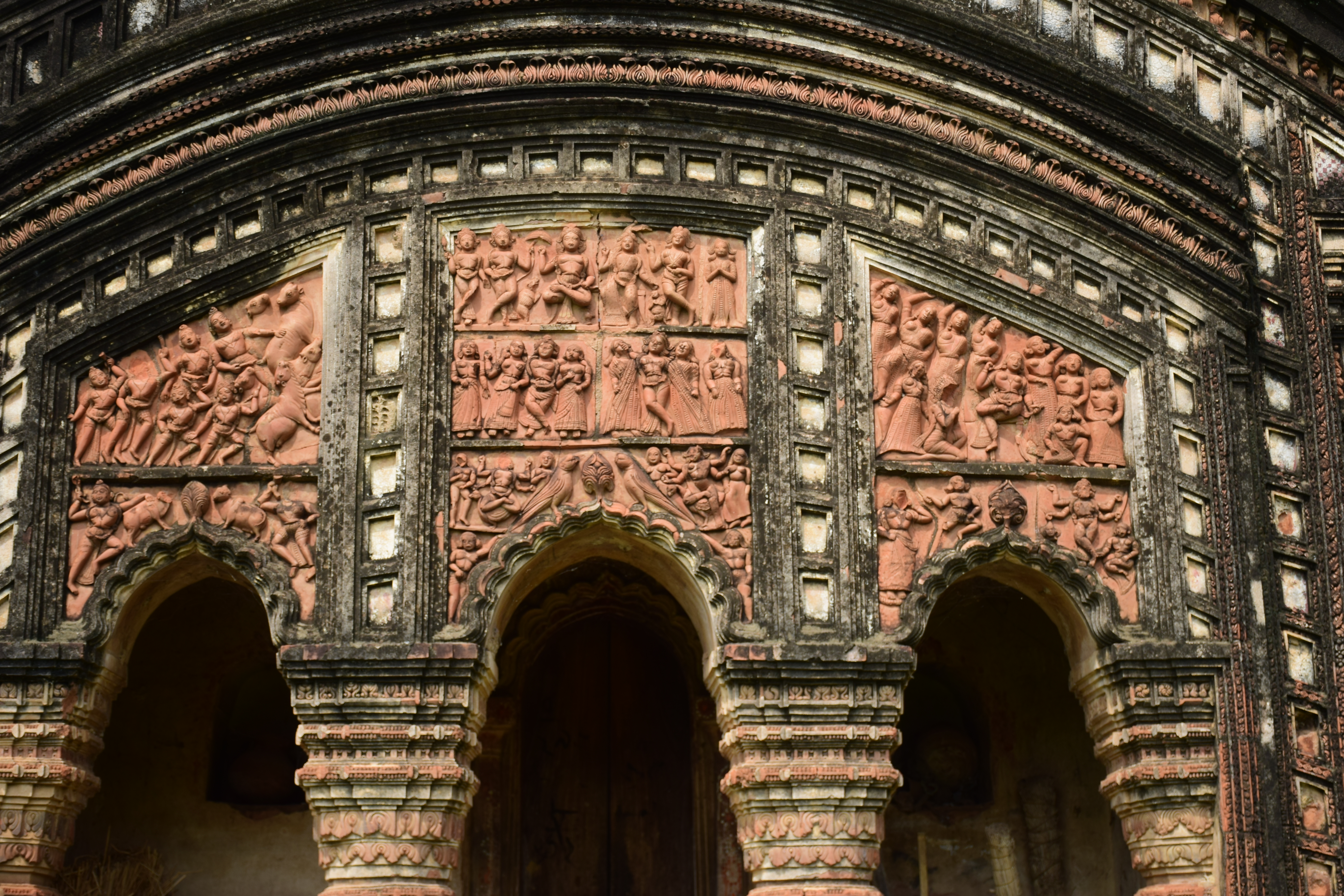 Terracotta panel in the Shiva temple
 -
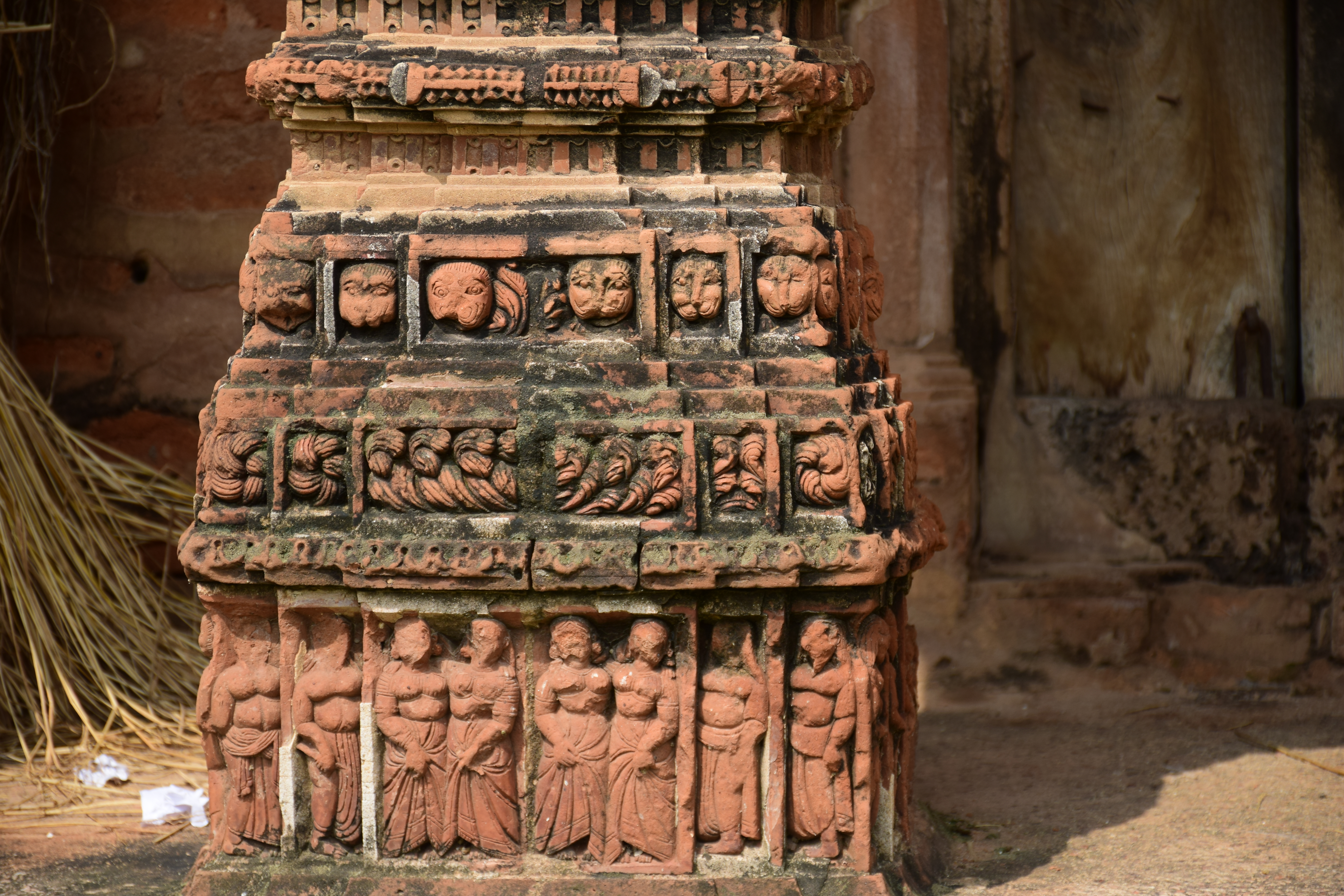 Terracotta work in the Shiva temple


The pictures are a part of Wiki Explores Bankura programme, an initiative by West Bengal Wikimedians User Group
Healthcare[edit | edit source]
There is a primary health centre at Balsi, with 10 beds.[6]
References[edit | edit source]
- ↑ "CD block Wise Primary Census Abstract Data(PCA)". West Bengal – District-wise CD blocks. Registrar General and Census Commissioner, India. Retrieved 18 April 2020.
- ↑ "Balsi HS". Schools.org.in. Retrieved 4 May 2020.
- ↑ "Patrasayer Mahavidyalaya". Patrasayer Mahavidyalaya. Archived from the original on 6 January 2017. Retrieved 29 November 2016.
- ↑ "Patrasayer Mahaviyalaya". College Admission. Retrieved 6 March 2018.
- ↑ McCutchion, David J., Late Mediaeval Temples of Bengal, first published 1972, reprinted 2017, pages 24, 39, 75, 77. The Asiatic Society, Kolkata, ISBN 978-93-81574-65-2
- ↑ "Health & Family Welfare Department" (PDF). Health Statistics – Primary Health Centres. Government of West Bengal. Retrieved 10 April 2020.
External links[edit | edit source]
Cities, towns and locations in Bankura District | |||||||
|---|---|---|---|---|---|---|---|
| Cities, municipal and census towns |
| ||||||
| Locations other than cities and towns |
| ||||||
| Related topics | |||||||