


WikiDwarfBOT (talk | contribs) Cleanup: Source modification. |
minor rework information for consistency and fixed typos |
||
| Line 11: | Line 11: | ||
| location = [[Leh district]] ([[Ladakh]], India),<br/> [[Rutog County]] ([[Tibet Autonomous Region|Tibet]], China) | | location = [[Leh district]] ([[Ladakh]], India),<br/> [[Rutog County]] ([[Tibet Autonomous Region|Tibet]], China) | ||
| coords = {{coord|33|43|04.59|N|78|53|48.48|E|type:waterbody|display=inline,title}} | | coords = {{coord|33|43|04.59|N|78|53|48.48|E|type:waterbody|display=inline,title}} | ||
| type = [[Soda lake]]<br/>[[dimictic lake]] (east basin)<ref>Wang | | type = [[Soda lake]]<br/>[[dimictic lake]] (east basin)<ref>{{cite journal | last1 = Wang | first1 = M. | last2 = Hou | first2 = J. | last3 = Lei | first3 = Y. | year = 2014 | title = Classification of Tibetan lakes based on variations in seasonal lake water temperature | url = | journal = Chinese Science Bulletin | volume = 59 | issue = 34| pages = 4847–4855 | doi = 10.1007/s11434-014-0588-8 | bibcode = 2014ChSBu..59.4847W }}</ref><br/>cold monomictic lake (west basin){{citation needed|date=July 2019}} | ||
| inflow = | | inflow = | ||
| outflow = | | outflow = | ||
| Line 61: | Line 61: | ||
|zwpy = Como Nganglharingbo | |zwpy = Como Nganglharingbo | ||
}} | }} | ||
'''Pangong Tso''' or '''Pangong Lake''' ({{bo|t=སྤང་གོང་མཚོ}};<ref name="eki"> | '''Pangong Tso''' or '''Pangong Lake''' ({{bo|t=སྤང་གོང་མཚོ}};<ref name="eki">{{Cite web |title=Ngari prefecture |publisher=Institute of the Estonian Language |date=2018-06-03 |access-date=9 January 2020 |url=https://www.eki.ee/knab/valik/cn54ng.htm |work=Geographical names of Tibet AR (China) |archive-date=10 January 2020 |archive-url=https://web.archive.org/web/20200110214226/https://www.eki.ee/knab/valik/cn54ng.htm |url-status=live }}</ref> {{lang-zh|s=班公错|p=Bān gōng cuò}}; {{langx|hi|text=पैंगोंग झील|translit=Paiṅgoṅg jhīl|translit-std=iso}}) is an [[endorheic]] [[lake]] spanning eastern [[Ladakh]] and [[Ngari Prefecture|West Tibet]] situated at an elevation of {{convert|4225|m|abbr=on}}. It is {{convert|134|km|abbr=on}} long. Approximately 50% of the length of the overall lake lies within Tibet administered by China, 40% in Indian-administered Ladakh; the remaining 10% is disputed and is a <i>de facto</i> buffer zone between India and China. The lake is {{convert|5|km|abbr=on}} wide at its broadest point. All together it covers almost 700 km<sup>2</sup>. During winter the lake freezes completely, despite being [[saline water]]. It has a land-locked basin separated from the [[Indus River]] basin by a small elevated ridge, but is believed to have been part of the Indus basin in prehistoric times.<ref> | ||
{{Cite web |title=Ngari prefecture |publisher=Institute of the Estonian Language |date=2018-06-03 |access-date=9 January 2020 |url=https://www.eki.ee/knab/valik/cn54ng.htm |work=Geographical names of Tibet AR (China)}} | {{cite news |title=River basins with Major and medium dams & barrages location map in India, WRIS |url=http://india-wris.nrsc.gov.in/wrpapp.html?show=JI00410/ |archive-url=https://web.archive.org/web/20160304025619/http://india-wris.nrsc.gov.in/wrpapp.html?show=JI00410%2F |archive-date=4 March 2016 |type=Adobe Flash Player version 10.0.0 or greater}} | ||
</ref> {{zh|s=班公错|p=Bān gōng cuò}}; {{ | |||
{{cite news |title=River basins with Major and medium dams & barrages location map in India, WRIS |url=http://india-wris.nrsc.gov.in/wrpapp.html?show=JI00410/ | |||
</ref> | </ref> | ||
| Line 80: | Line 78: | ||
</ref><ref name="Rindani2016"> | </ref><ref name="Rindani2016"> | ||
{{cite book |author=Kirit Rindani |title=Indian Himalaya: Story of a 100 Visits |url=https://books.google.com/books?id=nHZ5CwAAQBAJ&pg=PT80 |date=7 January 2016 |publisher=Partridge Publishing India |isbn=978-1-4828-5886-0 |page=80 |quote=The word Pangong means 'extensive concavity' which probably explains its size.}} | {{cite book |author=Kirit Rindani |title=Indian Himalaya: Story of a 100 Visits |url=https://books.google.com/books?id=nHZ5CwAAQBAJ&pg=PT80 |date=7 January 2016 |publisher=Partridge Publishing India |isbn=978-1-4828-5886-0 |page=80 |quote=The word Pangong means 'extensive concavity' which probably explains its size.}} | ||
</ref> ''Tsomo Nganglha Ringpo'' is Tibetan that is interpreted to mean various different but similar meanings -- "long, narrow, enchanted lake" by Chinese media sources,<ref> | </ref> ''Tsomo Nganglha Ringpo'' is Tibetan that is interpreted to mean various different but similar meanings -- "long, narrow, enchanted lake" by Chinese media sources,<ref>{{cite news |title=Pangong Tso Lake in Tibet |work=China Daily |date=2012-07-17 |url=https://www.chinadaily.com.cn/travel/2012-07/17/content_15589533.htm |quote=Pangong Tso Lake is a trans-border lake extending from the Ali prefecture of China's Tibet autonomous region to India. About 155 kilometers in length, the geographic features of the lake are indicated in the name which in Tibetan means "long, narrow, enchanted lake". |access-date=9 January 2020 |archive-date=24 January 2020 |archive-url=https://web.archive.org/web/20200124202959/https://www.chinadaily.com.cn/travel/2012-07/17/content_15589533.htm |url-status=live }}</ref> "female narrow very long lake" by early European explorers,<ref name="Trotter1877">{{cite journal |last1=Trotter |first1=H. |title=Account of the Pundit's Journey in Great Tibet from Leh in Ladakh to Lhasa, and of His Return to India Via Assam |journal=Journal of the Royal Geographical Society of London |volume=47 |year=1877 |pages=86–136 |issn=0266-6235 |doi=10.2307/1798740 |jstor=1798740 |url=https://zenodo.org/record/1449388 |quote=the Pangong, but better known to the Tibetans as the Chomo Gna Laring Cho, which, being literally interpreted, means "Female narrow very long lake." |access-date=6 May 2020 |archive-date=4 November 2020 |archive-url=https://web.archive.org/web/20201104064616/https://zenodo.org/record/1449388 |url-status=live }}</ref> and "long-necked swan lake" by other modern sources.<ref> | ||
{{cite news |title=Pangong Tso Lake in Tibet |work=China Daily |date=2012-07-17 |url=https://www.chinadaily.com.cn/travel/2012-07/17/content_15589533.htm |quote=Pangong Tso Lake is a trans-border lake extending from the Ali prefecture of China's Tibet autonomous region to India. About 155 kilometers in length, the geographic features of the lake are indicated in the name which in Tibetan means "long, narrow, enchanted lake".}} | |||
</ref> "female narrow very long lake" by early European explorers,<ref name="Trotter1877"> | |||
{{cite journal |last1=Trotter |first1=H. |title=Account of the Pundit's Journey in Great Tibet from Leh in Ladakh to Lhasa, and of His Return to India Via Assam |journal=Journal of the Royal Geographical Society of London |volume=47 |year=1877 |pages=86–136 |issn=0266-6235 |doi=10.2307/1798740 |jstor=1798740 |url=https://zenodo.org/record/1449388 |quote=the Pangong, but better known to the Tibetans as the Chomo Gna Laring Cho, which, being literally interpreted, means "Female narrow very long lake."}} | |||
</ref> and "long-necked swan lake" by other modern sources.<ref> | |||
{{cite news |title=Pangong Tso Lake in the Northern Tibet |publisher=Kangba TV |date=2017-03-06 |url=http://en.kangbatv.com/ly/jdjs/201703/t20170306_3312250.html |quote=Pangong Tso Lake, at an altitude of 4,200 meters, is also called Tsomo Nganglha Ringpo Lake, which means "a swan with a long neck" in Tibetan. }} | {{cite news |title=Pangong Tso Lake in the Northern Tibet |publisher=Kangba TV |date=2017-03-06 |url=http://en.kangbatv.com/ly/jdjs/201703/t20170306_3312250.html |quote=Pangong Tso Lake, at an altitude of 4,200 meters, is also called Tsomo Nganglha Ringpo Lake, which means "a swan with a long neck" in Tibetan. }} | ||
</ref> | </ref> | ||
== Geography == | == Geography == | ||
{{ | {{anchor | Geo | Range }} | ||
{{see also | Tangtse#Geography | l1= Geography of Tangtse | Spanggur_Tso#Geography | l2= Geography of Spanggur Tso | Rezang_La | l3= Geography of Rezang La | Chushul#Geography | l4= Geography of Chushul | Geography of Ladakh | Geography of Tibet }} | |||
Pangong Tso is surrounded by three mountain ranges: [[Changchenmo Range]] to the north, [[Pangong Range]] to the west, and [[Gangdise Shan|Kailash Range]] (Gangdise Shan range) to the south.<ref name="chapk1" /><ref name="chapk3">[https://theprint.in/opinion/if-india-loses-grip-on-kailash-range-pla-will-make-sure-we-never-get-it-back/542327/?amp If India loses grip on Kailash Range, PLA will make sure we never get it back], The Print, 12 November 2020.</ref><ref name="chapk2">[https://www.thehindu.com/news/national/both-china-india-ramp-up-infrastructure-on-north-bank-of-pangong-tso/article67034490.ece/ India, China ramp up infra on north bank of Pangong Tso lake], The Hindu, 3 July 2023.</ref> According to the [[Britannica]], the Changchenmo Range and Pangong Range are sometimes considered easternmost part of the [[Karakoram Range]].<ref name="chapk1">[https://www.britannica.com/place/Pangong-Range Karakoram: Pangong Range], Britannica, accessed 13 October 2023.</ref> ''Kailash Range'', runs along southern bank of the Pangong Tso, from centre of Pangong Tso at [[Lukung]] to the west to [[Phursook Bay]] and [[Mount Kailash]].<ref name=chapk3/> | |||
== Sino-Indian border dispute == | == Sino-Indian border dispute == | ||
| Line 100: | Line 98: | ||
| width = 400 | | width = 400 | ||
| height = 240 | | height = 240 | ||
| caption = {{center|Contested LAC near the Pangong Lake<ref name="Pangong border"> | | caption = {{center|Contested LAC near the Pangong Lake<ref name="Pangong border">{{citation |editor=India, Ministry of External Affairs |title=Report of the Officials of the Governments of India and the People's Republic of China on the Boundary Question |url=https://books.google.com/books?id=AP4ruQEACAAJ |year=1962 |publisher=Government of India Press }}, {{cite report |url=http://www.archieve.claudearpi.net/maintenance/uploaded_pics/ORC_01-32_Part1.pdf |title=Chinese Report, Part 1 |pages=4–5 |access-date=5 July 2020 |archive-date=13 October 2020 |archive-url=https://web.archive.org/web/20201013164954/http://www.archieve.claudearpi.net/maintenance/uploaded_pics/ORC_01-32_Part1.pdf |url-status=live }}<br/> | ||
{{citation |editor=India, Ministry of External Affairs |title=Report of the Officials of the Governments of India and the People's Republic of China on the Boundary Question |url=https://books.google.com/books?id=AP4ruQEACAAJ |year=1962 |publisher=Government of India Press}}, {{cite report |url=http://www.archieve.claudearpi.net/maintenance/uploaded_pics/ORC_01-32_Part1.pdf |title=Chinese Report, Part 1 |pages=4–5}}<br/> | The location and terrain features of this traditional customary boundary line are now described as follows in three sectors, western, middle and eastern. ... From Ane Pass southwards, the boundary line runs along the mountain ridge and passes through peak 6,127 (approximately 78° 46' E, 38° 50' N) [''sic''] and then southwards to the northern bank of the Pangong Lake' (approximately '''78° 49' E, 33° 44' N'''). It crosses this lake and reaches its southern bank at approximately '''78° 43' E, 33° 40' N'''. Then it goes in a south-easterly direction along the watershed dividing the Tongada River and the streams flowing into the Spanggur Lake until it reaches Mount Sajum.</ref>{{efn|The LAC displayed is that marked by the OpenStreetMap editors, said to reflect the Chinese maps.}}<br/>with "fingers" – mountain spurs jutting into the lake<ref name="Panag fingers">{{cite news |author=Lt Gen [[Harcharanjit Singh Panag|HS Panag]] (Retd) |date=4 June 2020 |url=https://theprint.in/opinion/indias-fingers-have-come-under-chinese-boots-denial-wont-help-us/435145/ |title=India's Fingers have come under Chinese boots. Denial won't help us |work=The Print |access-date=16 June 2020 |archive-date=4 June 2020 |archive-url=https://web.archive.org/web/20200604122153/https://theprint.in/opinion/indias-fingers-have-come-under-chinese-boots-denial-wont-help-us/435145/ |url-status=live }}</ref>}} | ||
The location and terrain features of this traditional customary boundary line are now described as follows in three sectors, western, middle and eastern. ... From Ane Pass southwards, the boundary line runs along the mountain ridge and passes through peak 6,127 (approximately 78° 46' E, 38° 50' N) [''sic''] and then southwards to the northern bank of the Pangong Lake' (approximately '''78° 49' E, 33° 44' N'''). It crosses this lake and reaches its southern bank at approximately '''78° 43' E, 33° 40' N'''. Then it goes in a south-easterly direction along the watershed dividing the Tongada River and the streams flowing into the Spanggur Lake until it reaches Mount Sajum. | |||
</ref>{{efn|The LAC displayed is that marked by the OpenStreetMap editors, said to reflect the Chinese maps.}}<br/>with "fingers" – mountain spurs jutting into the lake<ref name="Panag fingers">{{cite news |author=Lt Gen [[Harcharanjit Singh Panag|HS Panag]] (Retd) |date=4 June 2020 |url=https://theprint.in/opinion/indias-fingers-have-come-under-chinese-boots-denial-wont-help-us/435145/ |title=India's Fingers have come under Chinese boots. Denial won't help us |work=The Print}}</ref>}} | |||
| nolabels = 1 | | nolabels = 1 | ||
| map-data = | | map-data = | ||
| Line 336: | Line 332: | ||
}} | }} | ||
Pangong Tso is disputed territory. The [[Line of Actual Control]] (LAC) passes through the lake. A section of the lake approximately 20 km east from the LAC is controlled by China but claimed by India. The eastern end of the lake is in [[Tibet]]. After the mid-19th century, Pangong Tso was at the southern end of [[Origins of the Sino-Indian border dispute#The Johnson Line|Johnson Line]], an early attempt at demarcation between India and China in the [[Aksai Chin]] region. | Pangong Tso is disputed territory. The [[Line of Actual Control]] (LAC) passes through the lake. A section of the lake approximately 20 km east from the LAC is controlled by China but claimed by India. To the south is the smaller [[Spanggur Tso]] lake. The eastern end of the lake is in [[Tibet]]. After the mid-19th century, Pangong Tso was at the southern end of [[Origins of the Sino-Indian border dispute#The Johnson Line|Johnson Line]], an early attempt at demarcation between India and China in the [[Aksai Chin]] region. | ||
[[Khurnak Fort]] lies on the northern bank of the lake, about halfway up Pangong Tso. The dispute over the fort was discussed in a 1924 conference, which remained inconclusive. After the conference, the British government decided that Tibetans had a better case and not only Khurnak Fort but also Dokpo Karpo and Nyagzu were part of Tibet. In 1929, following the protests of Kashmir Durbar, they decided to drop the British claims made in behalf of Kashmir state.<ref name="t002">{{cite book | last=Lamb | first=A. | title=Tibet, China & India 1914-1950: A History of Imperial Diplomacy | publisher=Roxford Books | year=1989 | isbn=978-0-907129-03-5 | url=https://books.google.com/books?id=Nm5wAAAAMAAJ | access-date=2024-08-01 | page=359}}</ref> The Chinese established their military presence in the Khurnak Fort by 1958.<ref> | |||
{{Cite book |last=Sali |first=M. L. |url=https://books.google.com/books?id=Z6y2E9gw5oIC |title=India-China Border Dispute: A Case Study of the Eastern Sector |date=1998 |publisher=APH Publishing |isbn=978-81-7024-964-1 | | {{Cite book |last=Sali |first=M. L. |url=https://books.google.com/books?id=Z6y2E9gw5oIC |title=India-China Border Dispute: A Case Study of the Eastern Sector |date=1998 |publisher=APH Publishing |isbn=978-81-7024-964-1 |page=82}} | ||
</ref> | </ref> | ||
On 20 October 1962, Pangong Tso saw military action during the [[Sino-Indian War]], successful for the Chinese [[People's Liberation Army]] (PLA).<ref name="Burkitt"> | On 20 October 1962, Pangong Tso saw military action during the [[Sino-Indian War]], successful for the Chinese [[People's Liberation Army]] (PLA).<ref name="Burkitt">{{Cite book |last1=Burkitt |first1=Laurie |last2=Scobell |first2=Andrew |last3=Wortzel |first3=Larry M. |title=The Lessons of History: The Chinese People's Liberation Army at 75 |publisher=[[Strategic Studies Institute]] |pages=340–341 |date=July 2003 |isbn=1-58487-126-1 |url=http://www.strategicstudiesinstitute.army.mil/pdffiles/PUB52.pdf |access-date=26 June 2009 |archive-date=5 February 2012 |archive-url=https://web.archive.org/web/20120205072610/http://www.strategicstudiesinstitute.army.mil/pdffiles/PUB52.pdf }}</ref> The area remains a sensitive border point along the LAC.<ref name="Pubby">{{cite news |author=Pubby |first=Manu |date=7 October 2008 |title=Pangong Lake is border flashpoint between India and China |newspaper=The Indian Express |url=http://www.indianexpress.com/news/pangong-lake-is-border-flashpoint-between-india-and-china/370135/0 |access-date=23 June 2009 |archive-date=6 July 2009 |archive-url=https://web.archive.org/web/20090706174711/http://www.indianexpress.com/news/pangong-lake-is-border-flashpoint-between-india-and-china/370135/0 |url-status=live }}</ref><ref name="Shahin"> | ||
{{Cite book |last1=Burkitt |first1=Laurie |last2=Scobell |first2=Andrew |last3=Wortzel |first3=Larry M. |title=The Lessons of History: The Chinese People's Liberation Army at 75 |publisher=[[Strategic Studies Institute]] |pages=340–341 |date=July 2003 |isbn=1-58487-126-1 |url=http://www.strategicstudiesinstitute.army.mil/pdffiles/PUB52.pdf}} | |||
</ref> The area remains a sensitive border point along the LAC.<ref name="Pubby"> | |||
{{cite news |author=Pubby |first=Manu |date=7 October 2008 |title=Pangong Lake is border flashpoint between India and China |newspaper=The Indian Express |url=http://www.indianexpress.com/news/pangong-lake-is-border-flashpoint-between-india-and-china/370135/0}} | |||
</ref><ref name="Shahin"> | |||
{{cite news |author=Shahin |first=Sultan |date=1 August 2003 |title=Vajpayee claps with one hand on border dispute |url=http://www.atimes.com/atimes/South_Asia/EH01Df02.html |url-status=unfit |archive-url=https://web.archive.org/web/20030801213428/http://atimes.com/atimes/South_Asia/EH01Df02.html |archive-date=2003-08-01 |publisher=Asia Times}} | {{cite news |author=Shahin |first=Sultan |date=1 August 2003 |title=Vajpayee claps with one hand on border dispute |url=http://www.atimes.com/atimes/South_Asia/EH01Df02.html |url-status=unfit |archive-url=https://web.archive.org/web/20030801213428/http://atimes.com/atimes/South_Asia/EH01Df02.html |archive-date=2003-08-01 |publisher=Asia Times}} | ||
</ref> Incursions from the Chinese side are common.<ref name="Holslag"> | </ref> Incursions from the Chinese side are common.<ref name="Holslag"> | ||
{{cite journal |author=Holslag |first=Jonathan |year=2008 |title=China, India and the Military Security Dilemma, Vol 3(5) |url=http://www.vub.ac.be/biccs/documents/APaper_BICCS_2008_China%20India%20Security%20Dilemma.pdf | {{cite journal |author=Holslag |first=Jonathan |year=2008 |title=China, India and the Military Security Dilemma, Vol 3(5) |url=http://www.vub.ac.be/biccs/documents/APaper_BICCS_2008_China%20India%20Security%20Dilemma.pdf |journal=BICCS Background Papers |publisher=Brussels Institute of Contemporary China Studies (BICCS) |archive-url=https://web.archive.org/web/20110606004107/http://www.vub.ac.be/biccs/documents/APaper_BICCS_2008_China%20India%20Security%20Dilemma.pdf |archive-date=6 June 2011 |access-date=2009-06-24}} | ||
</ref> | </ref> | ||
In August 2017, Indian and Chinese forces near Pangong Tso engaged in a [[melee]] involving kicking, punching, rock throwing, and use of makeshift weapons such as sticks and rods.<ref name="hket"/><ref> | In August 2017, Indian and Chinese forces near Pangong Tso engaged in a [[melee]] involving kicking, punching, rock throwing, and use of makeshift weapons such as sticks and rods.<ref name="hket"/><ref>{{cite news |author=Sushant Singh |title=India-China conflict in Ladakh: The importance of the Pangong Tso lake |date=20 May 2020 |work=[[The Indian Express]] |url=https://indianexpress.com/article/explained/india-china-conflict-in-ladakh-the-importance-of-the-pangong-tso-lake-6419377/ |access-date=21 May 2020 |archive-date=12 February 2021 |archive-url=https://web.archive.org/web/20210212020229/https://indianexpress.com/article/explained/india-china-conflict-in-ladakh-the-importance-of-the-pangong-tso-lake-6419377/ |url-status=live }}</ref> | ||
{{cite news |author=Sushant Singh |title=India-China conflict in Ladakh: The importance of the Pangong Tso lake |date=20 May 2020 |work=[[The Indian Express]] |url=https://indianexpress.com/article/explained/india-china-conflict-in-ladakh-the-importance-of-the-pangong-tso-lake-6419377/}} | On 11 September 2019, PLA troops confronted Indian troops on the northern bank.<ref>{{cite news |title=Indian, Chinese Troops Face-off in Ladakh Ahead of Modi-Xi Summit, Army Says Tension De-escalated |date=12 September 2019 |work=CNN-News18 |url=https://www.news18.com/news/india/indian-chinese-troops-face-off-in-ladakh-month-ahead-of-modi-xi-jinping-summit-2305615.html |access-date=12 May 2020 |archive-date=7 November 2019 |archive-url=https://web.archive.org/web/20191107231903/https://www.news18.com/news/india/indian-chinese-troops-face-off-in-ladakh-month-ahead-of-modi-xi-jinping-summit-2305615.html |url-status=live }}</ref><ref>{{cite news |url=https://www.rti.org.tw/news/view/id/2054821 |trans-title=China's military exercises in Tibet frequently affect China and India's future crisis response |script-title=zh:中國在西藏地區軍演頻繁 牽動中印未來危機應對 |date=10 March 2020 |language=zh-tw |editor=Chang Ya-Han {{lang |zh-tw |張雅涵}} |work=[[Radio Taiwan International]] |access-date=16 May 2020 |archive-date=11 March 2020 |archive-url=https://web.archive.org/web/20200311153414/https://www.rti.org.tw/news/view/id/2054821 |url-status=live }}</ref> | ||
</ref> | On 5–6 May 2020, a face-off between about 250 Indian and Chinese troops near the lake resulted in casualties on both sides.<ref>{{cite news |author=Dinakar Peri |date=10 May 2020 |title=Indian, Chinese troops face off in Eastern Ladakh, Sikkim |newspaper=[[The Hindu]] |url=https://www.thehindu.com/news/national/indian-chinese-troops-face-off-in-eastern-ladakh-sikkim/article31548893.ece |url-access=limited |access-date=13 May 2020 |archive-date=12 May 2020 |archive-url=https://web.archive.org/web/20200512053057/https://www.thehindu.com/news/national/indian-chinese-troops-face-off-in-eastern-ladakh-sikkim/article31548893.ece |url-status=live }}</ref><ref name="hket"> | ||
On 11 September 2019, PLA troops confronted Indian troops on the northern bank.<ref> | |||
{{cite news |title=Indian, Chinese Troops Face-off in Ladakh Ahead of Modi-Xi Summit, Army Says Tension De-escalated |date=12 September 2019 |work=CNN-News18 |url=https://www.news18.com/news/india/indian-chinese-troops-face-off-in-ladakh-month-ahead-of-modi-xi-jinping-summit-2305615.html}} | |||
</ref><ref> | |||
{{cite news |url=https://www.rti.org.tw/news/view/id/2054821 |trans-title=China's military exercises in Tibet frequently affect China and India's future crisis response |script-title=zh:中國在西藏地區軍演頻繁 牽動中印未來危機應對 |date=10 March 2020 |language=zh-tw |editor=Chang Ya-Han {{lang |zh-tw |張雅涵}} |work=[[Radio Taiwan International]]}} | |||
</ref> | |||
On 5–6 May 2020, a face-off between about 250 Indian and Chinese troops near the lake resulted in casualties on both sides.<ref> | |||
{{cite news |author=Dinakar Peri |date=10 May 2020 |title=Indian, Chinese troops face off in Eastern Ladakh, Sikkim |newspaper=[[The Hindu]] |url=https://www.thehindu.com/news/national/indian-chinese-troops-face-off-in-eastern-ladakh-sikkim/article31548893.ece |url-access=limited}} | |||
</ref><ref name="hket"> | |||
{{cite web |script-title=zh:中印邊境再爆衝突 150士兵毆鬥釀12傷 |trans-title=Another 150 soldiers in the Sino-Indian border conflict caused 12 injuries in a fight |work=[[Hong Kong Economic Times]] |date=11 May 2020 |author={{lang |zh-hant |費風}} |language=zh-hant |url=https://china.hket.com/article/2639292/中印邊境再爆衝突%20%20150士兵毆鬥釀12傷 |quote={{lang |zh-hant |消息指,第一起事件發生於5月5日至6日,在中印邊境的班公錯湖(Pangong Tso )地區,當時解放軍的「侵略性巡邏」(aggressive patrolling)被印度軍方阻攔。「結果發生了混亂,雙方都有一些士兵受傷。」{...}2017年8月,兩國軍隊曾於拉達克地區班公湖附近爆發衝突,當時雙方擲石攻擊對方,雙方均有人受傷,最終兩軍在半小時後退回各自據點。}}}} | {{cite web |script-title=zh:中印邊境再爆衝突 150士兵毆鬥釀12傷 |trans-title=Another 150 soldiers in the Sino-Indian border conflict caused 12 injuries in a fight |work=[[Hong Kong Economic Times]] |date=11 May 2020 |author={{lang |zh-hant |費風}} |language=zh-hant |url=https://china.hket.com/article/2639292/中印邊境再爆衝突%20%20150士兵毆鬥釀12傷 |quote={{lang |zh-hant |消息指,第一起事件發生於5月5日至6日,在中印邊境的班公錯湖(Pangong Tso )地區,當時解放軍的「侵略性巡邏」(aggressive patrolling)被印度軍方阻攔。「結果發生了混亂,雙方都有一些士兵受傷。」{...}2017年8月,兩國軍隊曾於拉達克地區班公湖附近爆發衝突,當時雙方擲石攻擊對方,雙方均有人受傷,最終兩軍在半小時後退回各自據點。}}}} | ||
</ref><ref> | </ref><ref>{{cite news |title=Chinese military bolsters troops in Aksai Chin region in Sino-India border: Report |date=19 May 2020 |newspaper=[[The Economic Times]] |url=https://economictimes.indiatimes.com/news/defence/chinese-military-bolsters-troops-in-aksai-chin-region-in-sino-india-border-report/articleshow/75810930.cms |quote=On May 5, around 250 Indian and Chinese army personnel clashed in Pangong Tso lake area in Eastern Ladakh. |access-date=20 May 2020 |archive-date=19 May 2020 |archive-url=https://web.archive.org/web/20200519125336/https://economictimes.indiatimes.com/news/defence/chinese-military-bolsters-troops-in-aksai-chin-region-in-sino-india-border-report/articleshow/75810930.cms |url-status=live }}</ref><ref>{{cite news |last=Khalid |first=Saif |date=28 May 2020 |title='All-out combat' feared as India, China engage in border standoff |url=https://www.aljazeera.com/news/2020/5/28/all-out-combat-feared-as-india-china-engage-in-border-standoff |work=Al Jazeera |access-date=5 February 2022 |archive-date=5 February 2022 |archive-url=https://web.archive.org/web/20220205102530/https://www.aljazeera.com/news/2020/5/28/all-out-combat-feared-as-india-china-engage-in-border-standoff |url-status=live }}</ref> | ||
{{cite news |title=Chinese military bolsters troops in Aksai Chin region in Sino-India border: Report |date=19 May 2020 |newspaper=[[The Economic Times]] |url=https://economictimes.indiatimes.com/news/defence/chinese-military-bolsters-troops-in-aksai-chin-region-in-sino-india-border-report/articleshow/75810930.cms |quote=On May 5, around 250 Indian and Chinese army personnel clashed in Pangong Tso lake area in Eastern Ladakh.}} | |||
</ref><ref> | On 29–30 August 2020, Indian troops occupied many heights on the south bank of Pangong Tso. The heights included [[Rezang La]], Reqin La, Black Top, Hanan, Helmet, [[Gurung Hill]], Gorkha Hill and Magar Hill.<ref name="Print 30 heights">{{cite news |last1=Dutta |first1=Amrita Nayak |title=Army now holding 30 dominating heights, earlier unoccupied, on southern bank of Pangong Tso |work=ThePrint |date=3 September 2020 |url=https://theprint.in/defence/army-now-holding-30-dominating-heights-earlier-unoccupied-on-southern-bank-of-pangong-tso/495077/ |access-date=15 December 2020 |archive-date=2 November 2020 |archive-url=https://web.archive.org/web/20201102084611/https://theprint.in/defence/army-now-holding-30-dominating-heights-earlier-unoccupied-on-southern-bank-of-pangong-tso/495077/ |url-status=live }}</ref> Some of these heights are in the grey zone of the LAC and overlook Chinese camps.<ref name="Week heights">{{cite news |last=Sagar |first=Pradip R |date=2 September 2020 |title=India controls dominating heights in Chushul sector |url=https://www.theweek.in/news/india/2020/09/02/india-now-controls-dominating-heights-in-chushul-sector.html |work=The Week |access-date=15 December 2020 |archive-date=12 February 2021 |archive-url=https://web.archive.org/web/20210212042416/https://www.theweek.in/news/india/2020/09/02/india-now-controls-dominating-heights-in-chushul-sector.html |url-status=live }}</ref> | ||
{{cite news |last=Khalid |first=Saif |date=28 May 2020 |title='All-out combat' feared as India, China engage in border standoff |url=https://www.aljazeera.com/news/2020/5/28/all-out-combat-feared-as-india-china-engage-in-border-standoff |work=Al Jazeera}} | India chose to pull back from these positions as leverage for larger disengagement.<ref name="News18 turning point">{{cite news |last=Dhoundial |first=Shreya |date=2021-02-17 |title=India's Move to Occupy Kailash Range Became Turning Point in Disengagement Talks: Lt Gen YK Joshi |url=https://www.news18.com/news/india/indias-move-to-occupy-kailash-range-became-turning-point-in-disengagement-talks-lt-gen-yk-joshi-3445079.html |work=News18 |access-date=7 February 2022 |archive-date=17 February 2021 |archive-url=https://web.archive.org/web/20210217162456/https://www.news18.com/news/india/indias-move-to-occupy-kailash-range-became-turning-point-in-disengagement-talks-lt-gen-yk-joshi-3445079.html |url-status=live }}</ref> Both the Chinese and Indian militaries have vessels stationed on the lake.<ref name="Forbes fleets">{{cite news |last=Hooper |first=Craig |date=5 July 2020 |title=On Pangong Lake, Chinese And Indian Fleets Square Off At 14,000 Feet |url=https://www.forbes.com/sites/craighooper/2020/07/05/at-pangong-tso-chinese-and-indian-fleets-square-off-at-14000-feet/ |work=Forbes |access-date=13 February 2022 |archive-date=13 February 2022 |archive-url=https://web.archive.org/web/20220213135849/https://www.forbes.com/sites/craighooper/2020/07/05/at-pangong-tso-chinese-and-indian-fleets-square-off-at-14000-feet/ |url-status=live }}</ref><ref name="TOI boats">{{cite news |last=P |first=Rajat |date=13 June 2021 |title=Army gets special boats for Pangong Tso |url=https://timesofindia.indiatimes.com/india/army-begins-inducting-new-specialized-boats-for-pangong-tso/articleshow/83467836.cms |work=The Times of India |access-date=13 February 2022 |archive-date=13 February 2022 |archive-url=https://web.archive.org/web/20220213135849/https://timesofindia.indiatimes.com/india/army-begins-inducting-new-specialized-boats-for-pangong-tso/articleshow/83467836.cms |url-status=live }}</ref><ref name="NIE firepower mobility">{{cite news |last=Singh |first=Mayank |date=18 August 2021 |title=China raises firepower & mobility near Pangong Tso |url=https://www.newindianexpress.com/nation/2021/aug/18/china-raises-firepower-mobility-near-pangong-tso-2346276.html |work=The New Indian Express |access-date=13 February 2022 |archive-date=14 February 2022 |archive-url=https://web.archive.org/web/20220214235014/https://www.newindianexpress.com/nation/2021/aug/18/china-raises-firepower-mobility-near-pangong-tso-2346276.html |url-status=live }}</ref> | ||
</ref> | |||
Since 2022, China built a bridge across the lake near the Khurnak Fort.<ref name="NDTV bridge">{{cite news |last=Som |first=Vishnu |author-link=Vishnu Som |title=Chinese Bridge Over Pangong Lake In Illegally Held Territory: Government |work=NDTV |date=7 January 2022 |url=https://www.ndtv.com/india-news/china-bridge-pangong-lake-chinese-bridge-over-pangong-lake-in-illegally-held-territory-government-2692890 |access-date=8 January 2022 |archive-date=8 January 2022 |archive-url=https://web.archive.org/web/20220108111351/https://www.ndtv.com/india-news/china-bridge-pangong-lake-chinese-bridge-over-pangong-lake-in-illegally-held-territory-government-2692890 |url-status=live }}</ref><ref name="HT bridge">{{cite news |last=Laskar |first=Rezaul H |title=India says China's bridge on Pangong Lake located in areas under 'illegal occupation' |work=Hindustan Times |date=2022-02-04 |url=https://www.hindustantimes.com/india-news/india-says-china-s-bridge-on-pangong-lake-located-in-areas-under-illegal-occupation-101643995642536.html |access-date=7 February 2022 |archive-date=7 February 2022 |archive-url=https://web.archive.org/web/20220207142500/https://www.hindustantimes.com/india-news/india-says-china-s-bridge-on-pangong-lake-located-in-areas-under-illegal-occupation-101643995642536.html |url-status=live }}</ref> The construction of the 400-meter bridge was completed in July 2024.<ref name="u509">{{cite web | title=China Makes Pangong Lake Bridge Operational, Builds Village Near LAC in Demchuk | website=Kashmir Times| date=2024-07-31 | url=https://kashmirtimes.com/china-makes-pangong-lake-bridge-operational-builds-village-near-lac-in-demchuk/}}</ref> | |||
==Transport & roads == | |||
{{anchor | Road | Roads | Transport }} | |||
{{see also | India-China Border Roads | India-China border infrastructure | Tourism in Ladakh#Roads | l3= Touristic roads in Ladakh }} | |||
Following roads provide the access within the Indian held area: | |||
* "[[Chang Chenmo River#MLR|Phobrang-Marsimik La-Tsogtsalu-Hot Springs Road]]" (PMTHR) or "Marsimik La Road" (MLR) in Changchenmo Range, via [[Phobrang]] & [[Marsimik La]] is a motorable black-topped road which runs east of Pangong Tso.<ref name=etau2>{{cite web |title=India boosts road links to LAC standoff points |work=Indian Express |author=Mayank Singh |url=https://www.newindianexpress.com/nation/2022/jul/22/india-boosts-road-links-to-lac-standoff-points-2479299.html |date=2 July 2023}}</ref> It also provides access to the "Finger-4 Road". | |||
{{anchor | F4R }} | |||
* "Finger-4 Road" (F4R), is a black top motorable road till "Finger-4" on the northern bank of the Pangong Tso, being built by India which will be completed by 2025.<ref name=brid3>[https://www.thehindu.com/news/national/both-china-india-ramp-up-infrastructure-on-north-bank-of-pangong-tso/article67034490.ece India, China ramp up infra on north bank of Pangong Tso lake] {{Webarchive|url=https://web.archive.org/web/20230703143823/https://www.thehindu.com/news/national/both-china-india-ramp-up-infrastructure-on-north-bank-of-pangong-tso/article67034490.ece |date=3 July 2023 }}, The Hindu, 2 July 2023.</ref> | |||
{{anchor | LCR }} | |||
* "Lukung-Chartse Road" (LC Road), 32 km long road connects the northwest bank of Pangong Tso.<ref name=luk1>[https://www.indiandefensenews.in/2023/08/year-end-deadline-set-for-bro-to.html YEAR-END DEADLINE SET FOR BRO TO COMPLETE 20 ROADS ALONG LAC AS STANDOFF WITH CHINA LOOKS INCREASINGLY IRREVERSIBLE], INDIAN DEFENCE NEWS, AUGUST 03, 2023.</ref> | |||
{{anchor | CKC }} | |||
* "Chushul-Lukung Road" (CC road),<ref name=CLR1>[https://www.business-standard.com/india-news/wildlife-board-approves-5-roads-in-ladakh-including-daulat-beg-oldie-route-124101700391_1.html Wildlife Board approves 5 roads in Ladakh, including Daulat Beg Oldie route], Business Standard, 17 October 2024.</ref> also called the "Surtok-Kakstet-Chushul Road" (CKC road), a motorable black-topped road parallel to the southern bank of Pangong Tso, provides shortest route from [[Surtok]]<!--Note: retain the red link to encourage the article creation.-->, [[Spangmik]], [[Man Pangong|Man]], [[Merak, Ladakh|Merak]] & [[Kakshet]]<!--Note: retain the red link to encourage the article creation.--> to Chushul. | |||
** "Thakung Post Road": is a 5.8 km long spur of "Chushul-Lukung Road" from a T-section and it goes to Thakung Post of Indian Military, constructed under [[India–China Border Roads|ICBR Phase-III]].<ref name=CLR1/> | |||
{{anchor | PL }} | |||
* "Pangong Lakeshore Road" (PL road), is a motorable road along the scenic southern shore of Pangong Tso from Kakset to Chushul via Lukung and Thakung (Indian military post). | |||
Following roads provide the access within the China held area: | |||
China is | * "[[China National Highway 696]]":<!--Note: retain the red link to encourage the article creation.--> runs along the India China LAC and border along a route which is opposite India held [[Daulat Beg Oldie]] (DBO) & [[Burtsa]], near Kongka La pass, to Nyagzu and Khurnak Fort, to Recho (opposite India-held [[Dungti]]<!--Note: retain the red link to encourage the article creation.-->). | ||
{{cite news | | * "[[China National Highway 219]]" passes by the eastern end of Pangong Tso. The lake can be accessed by driving 12 km from [[Rutog Town|Rutog]] or 130 km from [[Shiquanhe]]. Tourists can rent a boat on the lake, but landing on islands is not allowed, to protecting the avian breeding grounds. There are several restaurants along the shore.<ref>{{cite news |last1=黄慧英 |script-title=zh:一措再措 邂逅高原湖泊的绝美 |trans-title=Take measures to meet the beauty of plateau lakes |publisher=tibet.cn |date=4 August 2018 |language=zh |url=http://www.tibet.cn/cn/travel/201807/t20180704_6029034.html |access-date=22 September 2018 |archive-date=22 September 2018 |archive-url=https://web.archive.org/web/20180922173348/http://www.tibet.cn/cn/travel/201807/t20180704_6029034.html |url-status=live }}</ref> {{anchor| Khurnak}}The "Khurnak Bridges" are the twin adjacent bridges over the Pangong Tso, one smaller and a bigger one for the heavier vehicle, built by China to connect [[Khurnak Fort]] on the north bank to Rutog in southeast via a new road which will reduce the distance between two locations by 150 km. India claims that this bridge is illegal as it lies in the area claimed by India. It lies 20 km east of the point [Finger 8] which India perceives to be the location of [[Line of Actual Control|LAC]].<ref name=brid1>[https://indianexpress.com/article/india/defence-sources-china-pangong-tso-2nd-bridge-permanent-mea-7928121/ MEA: Two bridges built by China in Pangong area occupied illegally] {{Webarchive|url=https://web.archive.org/web/20230703143823/https://indianexpress.com/article/india/defence-sources-china-pangong-tso-2nd-bridge-permanent-mea-7928121/ |date=3 July 2023 }}, Indian Express, 21 May 2022.</ref><ref name=brid2>[https://eurasiantimes.com/chinas-2nd-bridge-on-disputed-pangong-lake-is-near/ 'Xi Hao' India! China's 2nd Bridge On Disputed Pangong Lake Is Near Completion, Satellite Imagery Reveals] {{Webarchive|url=https://web.archive.org/web/20230703143825/https://eurasiantimes.com/chinas-2nd-bridge-on-disputed-pangong-lake-is-near/ |date=3 July 2023 }}, Eurasian Times, 17 Nov 2022.</ref> | ||
</ref> | |||
{{ | |||
{{ | |||
</ref><ref name= | |||
{{ | |||
</ref> | |||
== Tourism == | == Tourism == | ||
{{anchor | Tourism | | {{anchor | Tourism }} | ||
{{see also | Tourism in Ladakh }} | |||
<!-- [[File:Txu-oclc-6654394-ni-44-3rd-ed.jpg|thumb|right|Map including Pangong Tso ([[Army Map Service|AMS]], 1950)]] | <!-- [[File:Txu-oclc-6654394-ni-44-3rd-ed.jpg|thumb|right|Map including Pangong Tso ([[Army Map Service|AMS]], 1950)]] | ||
[[File:Map India and Pakistan 1-250,000 Tile NI 44-9 Pangong Tso.jpg|thumb|right|Map including Pangong Tso ([[Army Map Service|AMS]], 1954){{efn|name=delin|From map: "THE DELINEATION OF INTERNATIONAL BOUNDARIES ON THIS MAP MUST NOT BE CONSIDERED AUTHORITATIVE"}}]] | [[File:Map India and Pakistan 1-250,000 Tile NI 44-9 Pangong Tso.jpg|thumb|right|Map including Pangong Tso ([[Army Map Service|AMS]], 1954){{efn|name=delin|From map: "THE DELINEATION OF INTERNATIONAL BOUNDARIES ON THIS MAP MUST NOT BE CONSIDERED AUTHORITATIVE"}}]] | ||
[[File:Ni-44-9-chushul-china-india.pdf|thumb|right|Map including Pangong Tso / Bangong Co ([[Defense Mapping Agency|DMA]], 1992))]] --> | [[File:Ni-44-9-chushul-china-india.pdf|thumb|right|Map including Pangong Tso / Bangong Co ([[Defense Mapping Agency|DMA]], 1992))]] --> | ||
Pangong Tso is part of the [[India–China border infrastructure#Tourism|Bharat Ranbhoomi Darshan]] initiative of the Indian Military which will boost border tourism, patriotism, local infrastructure and economy while reversing civilian outward migration from these remote locations, it entails 77 battleground war memorials in border area including the [[Battle of Longewala|Longewala War Memorial]], [[Battle of Longewala|Sadhewala War Memorial]],<ref name=bdp2>[https://www.indiatimes.com/news/here-is-the-story-of-tanot-mata-the-diety-who-protected-indian-soldiers-from-pakistani-bombs-at-longewala-in-1971-war-259867.html The Story Of Tanot Mata, The Deity Who Protected Our Soldiers From Pakistani Bombs In 1971 War], India Times, 16 Dec 2020.</ref> [[Siachen Base Camp (India)|Siachen base camp]], [[Kargil]], [[Galwan]], [[Rezang La]], [[Doklam]], [[Bum La]], [[Cho La (Sikkim and Tibet)|Cho La]], [[Kibithu]], etc.<ref name=bdp1>[https://www.indiatoday.in/india/story/battleground-tourism-india-indian-army-ministry-of-tourism-galwan-siachel-kargil-longewala-battle-2665110-2025-01-15. Add Galwan, Siachen to holiday plan. India is opening battle tourism bunker], India Today, 15 Jan 2025.</ref> | |||
</ref> | |||
[[ | On the Indian side, an [[Inner Line Permit]] is required to visit the lake, as it lies on the Sino-Indian [[Line of Actual Control]]. For security reasons, India does not permit boating. Groups are permitted, accompanied by an accredited guide.<ref>{{cite news |title=A handy guide on how to visit the famous Pangong Lake in Ladakh |work=Times of India Travel |date=3 December 2020 |url=https://timesofindia.indiatimes.com/travel/things-to-do/a-handy-guide-on-how-to-visit-the-famous-pangong-lake-in-ladakh/photostory/79549816.cms |access-date=13 February 2022 |archive-date=13 February 2022 |archive-url=https://web.archive.org/web/20220213125213/https://timesofindia.indiatimes.com/travel/things-to-do/a-handy-guide-on-how-to-visit-the-famous-pangong-lake-in-ladakh/photostory/79549816.cms |url-status=live }}</ref><ref>{{cite news |last=Javaid |first=Azaan |title=Pangong Tso opens for tourists amid Ladakh stand-off. This is how you can visit it |work=ThePrint |date=2021-01-13 |url=https://theprint.in/india/pangong-tso-opens-for-tourists-amid-ladakh-stand-off-this-is-how-you-can-visit-it/584196/ |access-date=13 February 2022 |archive-date=13 February 2022 |archive-url=https://web.archive.org/web/20220213100450/https://theprint.in/india/pangong-tso-opens-for-tourists-amid-ladakh-stand-off-this-is-how-you-can-visit-it/584196/ |url-status=live }}</ref> A surge in Indian tourists has presented environmental challenges due to inadequate infrastructure to accommodate and manage the growing number of visitors.<ref>{{Cite web |last=Ariel Sophia Bardi |title=How "3 Idiots" Destroyed Ladakh |website=[[BuzzFeed]] |date=22 November 2016 |url=https://www.buzzfeed.com/arielbardi/what-has-3-idiots-done-to-ladakh |access-date=2 June 2023 |archive-date=2 June 2023 |archive-url=https://web.archive.org/web/20230602155801/https://www.buzzfeed.com/arielbardi/what-has-3-idiots-done-to-ladakh |url-status=live }}</ref> | ||
{{cite news | | |||
</ref> {{ | |||
== Flora and fauna == | |||
{{ see also | Wildlife of Ladakh }} | |||
The eastern part of the lake is fresh, with the content of [[total dissolved solids]] at 0.68 g/L, while the western part of the lake is saline, with the salinity at 11.02 g/L.<ref>{{cite web |title=班公错 |url=http://www.tibetol.cn/html/2013/hp_0415/487.html |language=zh |access-date=22 September 2018 |archive-date=22 September 2018 |archive-url=https://web.archive.org/web/20180922135914/http://www.tibetol.cn/html/2013/hp_0415/487.html |url-status=live }}</ref> The [[brackish water]]<ref name="Pant" /> of the lake has very low micro-vegetation. Guides report that there are no fish or other aquatic life on the Indian side of the lake, except for some small [[crustacean]]s. On the other hand, visitors see numerous ducks and gulls over and on the lake surface. There are some species of scrub and perennial herbs that grow in the marshes around the lake. | |||
The eastern part of the lake is fresh, with the content of [[total dissolved solids]] at 0.68 g/L, while the western part of the lake is saline, with the salinity at 11.02 g/L.<ref>{{cite web |title=班公错 |url=http://www.tibetol.cn/html/2013/hp_0415/487.html |language=zh}}</ref> The [[brackish water]]<ref name="Pant" /> of the lake has very low micro-vegetation. Guides report that there are no fish or other aquatic life on the Indian side of the lake, except for some small [[crustacean]]s. On the other hand, visitors see numerous ducks and gulls over and on the lake surface. There are some species of scrub and perennial herbs that grow in the marshes around the lake. | |||
The lake acts as an important breeding ground for a variety of birds including a number of migratory birds. During summer, the [[Bar-headed goose|bar-headed geese]] and [[Brahmini ducks]] are commonly seen here.<ref> | The lake acts as an important breeding ground for a variety of birds including a number of migratory birds. During summer, the [[Bar-headed goose|bar-headed geese]] and [[Brahmini ducks]] are commonly seen here.<ref>{{Cite journal |last=Khan |first=Asif |date=2016 |title=Ladakh: The Land Beyond |journal=Buceros |volume=21 |issue=3 |pages=6–15 |url=https://drive.google.com/file/d/0B7UUVmCgCiGATFFhcGJqdkg3S28/view?usp=sharing |access-date=26 October 2017 |archive-date=26 February 2020 |archive-url=https://web.archive.org/web/20200226011710/https://drive.google.com/file/d/0B7UUVmCgCiGATFFhcGJqdkg3S28/view?usp=sharing |url-status=live }}</ref> The region around the lake supports a number of species of wildlife including the [[kiang]] and the [[marmot]]. The lake hosts large quantities of fish, especially ''[[False osman|Schizopygopsis stoliczkai]]''<ref> | ||
{{Cite journal |last=Khan |first=Asif |date=2016 |title=Ladakh: The Land Beyond |journal=Buceros |volume=21 |issue=3 |pages=6–15 |url=https://drive.google.com/file/d/0B7UUVmCgCiGATFFhcGJqdkg3S28/view?usp=sharing}} | {{cite web |title=Schizopygopsis stoliczkae |website=China Animal Scientific Database |access-date=22 September 2018 |url=http://www.bioinfo.cn/db05/BjdwSpecies.php?action=view&id=6256 |archive-url=https://web.archive.org/web/20160305004532/http://www.bioinfo.cn/db05/BjdwSpecies.php?action=view&id=6256 |archive-date=5 March 2016 }} | ||
</ref> The region around the lake supports a number of species of wildlife including the [[kiang]] and the [[marmot]]. The lake hosts large quantities of fish, especially ''[[False osman|Schizopygopsis stoliczkai]]''<ref> | |||
{{cite web |title=Schizopygopsis stoliczkae |website=China Animal Scientific Database |access-date=22 September 2018 |url=http://www.bioinfo.cn/db05/BjdwSpecies.php?action=view&id=6256 |archive-url=https://web.archive.org/web/20160305004532/http://www.bioinfo.cn/db05/BjdwSpecies.php?action=view&id=6256 |archive-date=5 March 2016 | |||
</ref> and ''[[Kunar snowtrout|Racoma labiata]]''.<ref> | </ref> and ''[[Kunar snowtrout|Racoma labiata]]''.<ref> | ||
{{cite web |title=Racoma labiata |website=China Animal Scientific Database |url=http://www.bioinfo.cn/db05/BjdwSpecies.php?action=view&id=6226 |access-date=22 September 2018 |archive-url=https://web.archive.org/web/20160305015534/http://www.bioinfo.cn/db05/BjdwSpecies.php?action=view&id=6226 |archive-date=5 March 2016 | {{cite web |title=Racoma labiata |website=China Animal Scientific Database |url=http://www.bioinfo.cn/db05/BjdwSpecies.php?action=view&id=6226 |access-date=22 September 2018 |archive-url=https://web.archive.org/web/20160305015534/http://www.bioinfo.cn/db05/BjdwSpecies.php?action=view&id=6226 |archive-date=5 March 2016 }} | ||
</ref> Freshwater snails of the genus ''[[Radix (gastropod)|Radix]]'' also live in the lake.<ref name="Oheimb 2011">Oheimb | </ref> Freshwater snails of the genus ''[[Radix (gastropod)|Radix]]'' also live in the lake.<ref name="Oheimb 2011">{{cite journal | last1 = Oheimb | first1 = Parm Viktor von | last2 = Albrecht | first2 = Christian | last3 = Riedel | first3 = Frank | last4 = Du | first4 = Lina | last5 = Yang | first5 = Junxing | last6 = Aldridge | first6 = David C. | last7 = Bößneck | first7 = Ulrich | last8 = Zhang | first8 = Hucai | last9 = Wilke | first9 = Thomas | year = 2011 | title = Freshwater Biogeography and Limnological Evolution of the Tibetan Plateau - Insights from a Plateau-Wide Distributed Gastropod Taxon (''Radix'' spp.) | journal = [[PLOS One]] | volume = 6 | issue = 10| article-number = e26307 | doi = 10.1371/journal.pone.0026307 | doi-access = free | pmid = 22028853 | pmc = 3197626 | bibcode = 2011PLoSO...626307V }}</ref> | ||
Formerly, Pangong Tso had an outlet to the [[Shyok River]], a tributary of the [[Indus River]], but it was closed off by natural damming. Two streams feed the lake from the Indian side, forming marshes and wetlands at the edges.<ref name="Gujja"> | Formerly, Pangong Tso had an outlet to the [[Shyok River]], a tributary of the [[Indus River]], but it was closed off by natural damming. Two streams feed the lake from the Indian side, forming marshes and wetlands at the edges.<ref name="Gujja"> | ||
{{cite journal |author1=Biksham Gujja |author2=Archana Chatterjee |author3=Parikshit Gautam |author4=Pankaj Chandan |name-list-style=amp |title=Wetlands and Lakes at the Top of the World |journal=Mountain Research and Development |volume=23 |issue=3 |date=August 2003 |pages=219–221 |publisher=[[International Mountain Society]] |location=Bern, Switzerland |issn=1994-7151 |doi=10.1659/0276-4741(2003)023[0219:WALATT]2.0.CO;2|s2cid=130202320 }} | {{cite journal |author1=Biksham Gujja |author2=Archana Chatterjee |author3=Parikshit Gautam |author4=Pankaj Chandan |name-list-style=amp |title=Wetlands and Lakes at the Top of the World |journal=Mountain Research and Development |volume=23 |issue=3 |date=August 2003 |pages=219–221 |publisher=[[International Mountain Society]] |location=Bern, Switzerland |issn=1994-7151 |doi=10.1659/0276-4741(2003)023[0219:WALATT]2.0.CO;2|s2cid=130202320 |doi-access=free }} | ||
</ref> Strand lines above current lake level reveal a {{Convert|5|m|abbr=on}} thick layer of mud and laminated sand, suggesting the lake has shrunken recently on the geological scale.<ref name="Pant"> | </ref> Strand lines above current lake level reveal a {{Convert|5|m|abbr=on}} thick layer of mud and laminated sand, suggesting the lake has shrunken recently on the geological scale.<ref name="Pant">{{cite journal |author1=R. K. Pant |author2=N. R. Phadtare |author3=L. S. Chamyal |author4=Navin Juyal |date=10 June 2005 |title=Quaternary deposits in Ladakh and Karakoram Himalaya: A treasure trove of the palaeoclimate records |journal=Current Science |volume=88 |issue=11 |url=https://www.academia.edu/26184431 |access-date=6 May 2020 |archive-date=20 January 2023 |archive-url=https://web.archive.org/web/20230120071453/https://www.academia.edu/26184431 |url-status=live }}</ref> On the Indian side, no fish have been observed, however in the stream coming from the south-eastern side (Cheshul nalla), three fish species (''Schizopygopsis stoliczkae'', ''[[Tibetan stone loach]]'' and ''[[Triplophysa gracilis]]'') have been reported (Bhat et al., 2011). The low [[biodiversity]] has been reported as being due to high salinity and harsh environmental conditions (Bhat et al., 2011). | ||
{{cite journal |author1=R. K. Pant |author2=N. R. Phadtare |author3=L. S. Chamyal |author4=Navin Juyal |date=10 June 2005 |title=Quaternary deposits in Ladakh and Karakoram Himalaya: A treasure trove of the palaeoclimate records |journal=Current Science| volume=88 |issue=11 |url=https://www.academia.edu/26184431}} | |||
</ref> On the Indian side, no fish have been observed, however in the stream coming from the south-eastern side (Cheshul nalla), three fish species (''Schizopygopsis stoliczkae'', ''[[Tibetan stone loach]]'' and ''[[Triplophysa gracilis]]'') have been reported (Bhat et al., 2011). The low [[biodiversity]] has been reported as being due to high salinity and harsh environmental conditions (Bhat et al., 2011). | |||
Bird Islet is a popular location for bird-watching for tourists in [[Ngari Prefecture|Ngari]].<ref name="birdislet"> | Bird Islet is a popular location for bird-watching for tourists in [[Ngari Prefecture|Ngari]].<ref name="birdislet"> | ||
| Line 494: | Line 474: | ||
File:Frozen, Pangong Tso.jpg|Frozen, Pangong Tso | File:Frozen, Pangong Tso.jpg|Frozen, Pangong Tso | ||
File:Pangong Lake Transparent Water & Pebbles.jpg|Transparent water | File:Pangong Lake Transparent Water & Pebbles.jpg|Transparent water | ||
File:Pangong Tso.JPG|During summer | File:Pangong Tso.JPG|During summer | ||
File:Ducks in Pangong Tso.jpg|Birds | File:Ducks in Pangong Tso.jpg|Birds | ||
File:Pangong Lake, Ladakh valley.jpg | |||
File:Pangong Lake, Ladakh, India 06.jpg | |||
File:Pangong Lake, Ladakh, India 05.jpg | |||
File:Pangong Lake, Ladakh, India 04.jpg | |||
File:Pangong Lake, Ladakh, India 02.jpg | |||
File:Pangong Lake, Ladakh, India 03.jpg | |||
File:Pangong Lake, Ladakh, India 01.jpg | |||
</gallery> | </gallery> | ||
| Line 532: | Line 518: | ||
* {{citation |last=Cunningham |first=Alexander |title=Ladak: Physical, Statistical, Historical |publisher=Wm. H. Allen and Co |location=London |year=1854 |url=https://archive.org/details/ladakphysicalsta00cunnrich |via=archive.org |ref={{sfnref|Cunningham, Ladak|1854}}}} | * {{citation |last=Cunningham |first=Alexander |title=Ladak: Physical, Statistical, Historical |publisher=Wm. H. Allen and Co |location=London |year=1854 |url=https://archive.org/details/ladakphysicalsta00cunnrich |via=archive.org |ref={{sfnref|Cunningham, Ladak|1854}}}} | ||
* {{cite journal |last1=Dortch |first1=Jason M. |last2=Owen |first2=Lewis A. |last3=Caffee |first3=Marc W. |last4=Kamp |first4=Ulrich |title=Catastrophic partial drainage of Pangong Tso, northern India and Tibet |journal=Geomorphology |volume=125 |issue=1 |year=2011 |pages=109–121 |issn=0169-555X |doi=10.1016/j.geomorph.2010.08.017 |bibcode=2011Geomo.125..109D |ref={{sfnref|Dortch et al., Catastrophic partial drainage of Pangong Tso|2011}}}} | * {{cite journal |last1=Dortch |first1=Jason M. |last2=Owen |first2=Lewis A. |last3=Caffee |first3=Marc W. |last4=Kamp |first4=Ulrich |title=Catastrophic partial drainage of Pangong Tso, northern India and Tibet |journal=Geomorphology |volume=125 |issue=1 |year=2011 |pages=109–121 |issn=0169-555X |doi=10.1016/j.geomorph.2010.08.017 |bibcode=2011Geomo.125..109D |ref={{sfnref|Dortch et al., Catastrophic partial drainage of Pangong Tso|2011}}}} | ||
* {{citation |last=Godwin-Austen |first=H. H. |title=Notes on the Pangong Lake District of Ladakh, from a Journal made during a Survey in 1863 |journal=The Journal of the Royal Geographical Society of London |url=https://books.google.com/books?id=1lwMAAAAIAAJ&pg=PA351 |year=1867 |volume=37 |pages=343–363 |publisher=J. Murray |location=London |doi=10.2307/1798534 |jstor=1798534 |ref={{sfnref|Godwin-Austen, Notes on the Pangong Lake District|1867}}}} | * {{citation |last=Godwin-Austen |first=H. H. |title=Notes on the Pangong Lake District of Ladakh, from a Journal made during a Survey in 1863 |journal=The Journal of the Royal Geographical Society of London |url=https://books.google.com/books?id=1lwMAAAAIAAJ&pg=PA351 |year=1867 |volume=37 |pages=343–363 |publisher=J. Murray |location=London |doi=10.2307/1798534 |jstor=1798534 |ref={{sfnref|Godwin-Austen, Notes on the Pangong Lake District|1867}}|url-access=subscription }} | ||
* {{citation |first=Ellsworth |last=Huntington |title=Pangong: A Glacial Lake in the Tibetan Plateau |journal=The Journal of Geology |publisher=University of Chicago |volume=14 |number=7 |year=1906 |pages=599–617 |doi=10.1086/621337 |bibcode=1906JG.....14..599H |s2cid=129014522 |url=https://zenodo.org/record/2318025 }} | * {{citation |first=Ellsworth |last=Huntington |title=Pangong: A Glacial Lake in the Tibetan Plateau |journal=The Journal of Geology |publisher=University of Chicago |volume=14 |number=7 |year=1906 |pages=599–617 |doi=10.1086/621337 |bibcode=1906JG.....14..599H |s2cid=129014522 |url=https://zenodo.org/record/2318025 }} | ||
* {{citation |last=Strachey |first=Henry |title=Physical Geography of Western Tibet |publisher=William Clows and Sons |location=London |date=1854 |url=https://archive.org/details/physicalgeograp00stragoog |via=archive.org |ref={{sfnref|Strachey, Physical Geography of Western Tibet|1854}}}} | * {{citation |last=Strachey |first=Henry |title=Physical Geography of Western Tibet |publisher=William Clows and Sons |location=London |date=1854 |url=https://archive.org/details/physicalgeograp00stragoog |via=archive.org |ref={{sfnref|Strachey, Physical Geography of Western Tibet|1854}}}} | ||
== Further reading == | == Further reading == | ||
{{commons category}} | |||
{{wikivoyage listing|Leh}} | |||
* {{cite journal |last1=Streule |first1=M.J. |last2=Phillips |first2=R.J. |last3=Searle |first3=M.P. |last4=Waters |first4=D.J. |last5=Horstwood |first5=M.S.A. |title=Evolution and chronology of the Pangong Metamorphic Complex adjacent to the Karakoram Fault, Ladakh: constraints from thermobarometry, metamorphic modelling and U–Pb geochronology |journal=Journal of the Geological Society |volume=166 |issue=5 |year=2009 |pages=919–932 |issn=0016-7649 |doi=10.1144/0016-76492008-117|bibcode=2009JGSoc.166..919S |s2cid=6633788 |url=http://nora.nerc.ac.uk/id/eprint/8429/1/Streule_et_al_Pangong_revised_-_NORA_version.pdf }} | * {{cite journal |last1=Streule |first1=M.J. |last2=Phillips |first2=R.J. |last3=Searle |first3=M.P. |last4=Waters |first4=D.J. |last5=Horstwood |first5=M.S.A. |title=Evolution and chronology of the Pangong Metamorphic Complex adjacent to the Karakoram Fault, Ladakh: constraints from thermobarometry, metamorphic modelling and U–Pb geochronology |journal=Journal of the Geological Society |volume=166 |issue=5 |year=2009 |pages=919–932 |issn=0016-7649 |doi=10.1144/0016-76492008-117|bibcode=2009JGSoc.166..919S |s2cid=6633788 |url=http://nora.nerc.ac.uk/id/eprint/8429/1/Streule_et_al_Pangong_revised_-_NORA_version.pdf }} | ||
* {{Cite journal|vauthors=Srivastava P, Kumar A, Singh R, Deepak O, Kumar AM, Ray Y, Jayangondaperumal R, Phartiyal B, Chahal P, Sharma P, Ghosh R, Kumar N, Agnihotri R|date=July 2020|title=Rapid lake level fall in Pangong Tso (lake) in Ladakh, NW Himalaya: a response of late Holocene aridity|url=https://www.currentscience.ac.in/Volumes/119/02/0219.pdf|journal=Current Science|volume=119|issue=2|pages=219–231|doi=10.18520/cs/v119/i2/219-231 |s2cid=239601454 }} | * {{Cite journal|vauthors=Srivastava P, Kumar A, Singh R, Deepak O, Kumar AM, Ray Y, Jayangondaperumal R, Phartiyal B, Chahal P, Sharma P, Ghosh R, Kumar N, Agnihotri R|date=July 2020|title=Rapid lake level fall in Pangong Tso (lake) in Ladakh, NW Himalaya: a response of late Holocene aridity|url=https://www.currentscience.ac.in/Volumes/119/02/0219.pdf|journal=Current Science|volume=119|issue=2|pages=219–231|doi=10.18520/cs/v119/i2/219-231 |s2cid=239601454 }} | ||
Latest revision as of 20:40, 26 December 2025
| Pangong Tso | |
|---|---|
.jpg) A view of Pangong Tso from space | |
| Lua error in Module:Location_map at line 851: Unable to find the specified location map definition: "Module:Location map/data/China Tibet Ngari" does not exist. | |
| Location | Leh district (Ladakh, India), Rutog County (Tibet, China) |
| Coordinates | 33°43′04.59″N 78°53′48.48″E / 33.7179417°N 78.8968000°E |
| Type | Soda lake dimictic lake (east basin)[1] cold monomictic lake (west basin)[citation needed] |
| Basin countries | China, India |
| Max. length | 134 km (83 mi) |
| Max. width | 5 km (3.1 mi) |
| Surface area | approx. 700 km2 (270 sq mi) |
| Max. depth | 330 ft. (100 m) |
| Surface elevation | 4,225 metres (13,862 ft)[2] |
| Frozen | during winter |
| Pangong Tso |
|---|
| Tsomo Nganglha Ringpo |
|---|
Pangong Tso or Pangong Lake (Tibetan: སྤང་གོང་མཚོ;[3] Chinese: 班公错; pinyin: Bān gōng cuò; Hindi: पैंगोंग झील, romanized: Paiṅgoṅg jhīl) is an endorheic lake spanning eastern Ladakh and West Tibet situated at an elevation of 4,225 m (13,862 ft). It is 134 km (83 mi) long. Approximately 50% of the length of the overall lake lies within Tibet administered by China, 40% in Indian-administered Ladakh; the remaining 10% is disputed and is a de facto buffer zone between India and China. The lake is 5 km (3.1 mi) wide at its broadest point. All together it covers almost 700 km2. During winter the lake freezes completely, despite being saline water. It has a land-locked basin separated from the Indus River basin by a small elevated ridge, but is believed to have been part of the Indus basin in prehistoric times.[4]
Names[edit | edit source]
Historically, the lake is viewed as being made up five sublakes, which are connected through narrow water channels. The name Pangong Tso only applied to the westernmost lake that is mostly in Ladakh. The main lake on the Tibetan side is called Tso Nyak (the "middle lake"). It is followed by two small lakes called Rum Tso. The last lake near Rutog is called Nyak Tso again.[5][6] The whole lake group was and is still often referred to as Tsomo Nganglha Ringpo (Tibetan: མཚོ་མོ་ངང་ལྷ་རིང་པོ[3]) in Tibetan.
There are different interpretations of the meanings of both Pangong Tso and Tsomo Nganglha Ringpo. The Ladakh government website says "Pangong Tso" is Tibetan, meaning "high grassland lake",[7] however travel books say Pangong means "hollow".[8][9] Tsomo Nganglha Ringpo is Tibetan that is interpreted to mean various different but similar meanings -- "long, narrow, enchanted lake" by Chinese media sources,[10] "female narrow very long lake" by early European explorers,[11] and "long-necked swan lake" by other modern sources.[12]
Geography[edit | edit source]
Pangong Tso is surrounded by three mountain ranges: Changchenmo Range to the north, Pangong Range to the west, and Kailash Range (Gangdise Shan range) to the south.[13][14][15] According to the Britannica, the Changchenmo Range and Pangong Range are sometimes considered easternmost part of the Karakoram Range.[13] Kailash Range, runs along southern bank of the Pangong Tso, from centre of Pangong Tso at Lukung to the west to Phursook Bay and Mount Kailash.[14]
Sino-Indian border dispute[edit | edit source]
Lua error in Module:OSM_Location_map at line 1984: attempt to index field 'wikibase' (a nil value).
Pangong Tso is disputed territory. The Line of Actual Control (LAC) passes through the lake. A section of the lake approximately 20 km east from the LAC is controlled by China but claimed by India. To the south is the smaller Spanggur Tso lake. The eastern end of the lake is in Tibet. After the mid-19th century, Pangong Tso was at the southern end of Johnson Line, an early attempt at demarcation between India and China in the Aksai Chin region.
Khurnak Fort lies on the northern bank of the lake, about halfway up Pangong Tso. The dispute over the fort was discussed in a 1924 conference, which remained inconclusive. After the conference, the British government decided that Tibetans had a better case and not only Khurnak Fort but also Dokpo Karpo and Nyagzu were part of Tibet. In 1929, following the protests of Kashmir Durbar, they decided to drop the British claims made in behalf of Kashmir state.[18] The Chinese established their military presence in the Khurnak Fort by 1958.[19]
On 20 October 1962, Pangong Tso saw military action during the Sino-Indian War, successful for the Chinese People's Liberation Army (PLA).[20] The area remains a sensitive border point along the LAC.[21][22] Incursions from the Chinese side are common.[23]
In August 2017, Indian and Chinese forces near Pangong Tso engaged in a melee involving kicking, punching, rock throwing, and use of makeshift weapons such as sticks and rods.[24][25] On 11 September 2019, PLA troops confronted Indian troops on the northern bank.[26][27] On 5–6 May 2020, a face-off between about 250 Indian and Chinese troops near the lake resulted in casualties on both sides.[28][24][29][30]
On 29–30 August 2020, Indian troops occupied many heights on the south bank of Pangong Tso. The heights included Rezang La, Reqin La, Black Top, Hanan, Helmet, Gurung Hill, Gorkha Hill and Magar Hill.[31] Some of these heights are in the grey zone of the LAC and overlook Chinese camps.[32] India chose to pull back from these positions as leverage for larger disengagement.[33] Both the Chinese and Indian militaries have vessels stationed on the lake.[34][35][36]
Since 2022, China built a bridge across the lake near the Khurnak Fort.[37][38] The construction of the 400-meter bridge was completed in July 2024.[39]
Transport & roads[edit | edit source]
Following roads provide the access within the Indian held area:
- "Phobrang-Marsimik La-Tsogtsalu-Hot Springs Road" (PMTHR) or "Marsimik La Road" (MLR) in Changchenmo Range, via Phobrang & Marsimik La is a motorable black-topped road which runs east of Pangong Tso.[40] It also provides access to the "Finger-4 Road".
- "Finger-4 Road" (F4R), is a black top motorable road till "Finger-4" on the northern bank of the Pangong Tso, being built by India which will be completed by 2025.[41]
- "Lukung-Chartse Road" (LC Road), 32 km long road connects the northwest bank of Pangong Tso.[42]
- "Chushul-Lukung Road" (CC road),[43] also called the "Surtok-Kakstet-Chushul Road" (CKC road), a motorable black-topped road parallel to the southern bank of Pangong Tso, provides shortest route from Surtok, Spangmik, Man, Merak & Kakshet to Chushul.
- "Thakung Post Road": is a 5.8 km long spur of "Chushul-Lukung Road" from a T-section and it goes to Thakung Post of Indian Military, constructed under ICBR Phase-III.[43]
- "Pangong Lakeshore Road" (PL road), is a motorable road along the scenic southern shore of Pangong Tso from Kakset to Chushul via Lukung and Thakung (Indian military post).
Following roads provide the access within the China held area:
- "China National Highway 696": runs along the India China LAC and border along a route which is opposite India held Daulat Beg Oldie (DBO) & Burtsa, near Kongka La pass, to Nyagzu and Khurnak Fort, to Recho (opposite India-held Dungti).
- "China National Highway 219" passes by the eastern end of Pangong Tso. The lake can be accessed by driving 12 km from Rutog or 130 km from Shiquanhe. Tourists can rent a boat on the lake, but landing on islands is not allowed, to protecting the avian breeding grounds. There are several restaurants along the shore.[44] The "Khurnak Bridges" are the twin adjacent bridges over the Pangong Tso, one smaller and a bigger one for the heavier vehicle, built by China to connect Khurnak Fort on the north bank to Rutog in southeast via a new road which will reduce the distance between two locations by 150 km. India claims that this bridge is illegal as it lies in the area claimed by India. It lies 20 km east of the point [Finger 8] which India perceives to be the location of LAC.[45][46]
Tourism[edit | edit source]
Pangong Tso is part of the Bharat Ranbhoomi Darshan initiative of the Indian Military which will boost border tourism, patriotism, local infrastructure and economy while reversing civilian outward migration from these remote locations, it entails 77 battleground war memorials in border area including the Longewala War Memorial, Sadhewala War Memorial,[47] Siachen base camp, Kargil, Galwan, Rezang La, Doklam, Bum La, Cho La, Kibithu, etc.[48]
On the Indian side, an Inner Line Permit is required to visit the lake, as it lies on the Sino-Indian Line of Actual Control. For security reasons, India does not permit boating. Groups are permitted, accompanied by an accredited guide.[49][50] A surge in Indian tourists has presented environmental challenges due to inadequate infrastructure to accommodate and manage the growing number of visitors.[51]
Flora and fauna[edit | edit source]
The eastern part of the lake is fresh, with the content of total dissolved solids at 0.68 g/L, while the western part of the lake is saline, with the salinity at 11.02 g/L.[52] The brackish water[53] of the lake has very low micro-vegetation. Guides report that there are no fish or other aquatic life on the Indian side of the lake, except for some small crustaceans. On the other hand, visitors see numerous ducks and gulls over and on the lake surface. There are some species of scrub and perennial herbs that grow in the marshes around the lake.
The lake acts as an important breeding ground for a variety of birds including a number of migratory birds. During summer, the bar-headed geese and Brahmini ducks are commonly seen here.[54] The region around the lake supports a number of species of wildlife including the kiang and the marmot. The lake hosts large quantities of fish, especially Schizopygopsis stoliczkai[55] and Racoma labiata.[56] Freshwater snails of the genus Radix also live in the lake.[57]
Formerly, Pangong Tso had an outlet to the Shyok River, a tributary of the Indus River, but it was closed off by natural damming. Two streams feed the lake from the Indian side, forming marshes and wetlands at the edges.[58] Strand lines above current lake level reveal a 5 m (16 ft) thick layer of mud and laminated sand, suggesting the lake has shrunken recently on the geological scale.[53] On the Indian side, no fish have been observed, however in the stream coming from the south-eastern side (Cheshul nalla), three fish species (Schizopygopsis stoliczkae, Tibetan stone loach and Triplophysa gracilis) have been reported (Bhat et al., 2011). The low biodiversity has been reported as being due to high salinity and harsh environmental conditions (Bhat et al., 2011).
Bird Islet is a popular location for bird-watching for tourists in Ngari.[59]
Climate[edit | edit source]
| Climate data for Pangong Tso | |||||||||||||
|---|---|---|---|---|---|---|---|---|---|---|---|---|---|
| Month | Jan | Feb | Mar | Apr | May | Jun | Jul | Aug | Sep | Oct | Nov | Dec | Year |
| Average high °C (°F) | −5.9 (21.4) |
−3.7 (25.3) |
0.9 (33.6) |
6.9 (44.4) |
11.6 (52.9) |
17.4 (63.3) |
20.5 (68.9) |
19.7 (67.5) |
15.5 (59.9) |
7.9 (46.2) |
1.5 (34.7) |
−3.3 (26.1) |
7.4 (45.4) |
| Daily mean °C (°F) | −13.3 (8.1) |
−10.8 (12.6) |
−6.0 (21.2) |
−0.5 (31.1) |
3.8 (38.8) |
9.5 (49.1) |
13.1 (55.6) |
12.7 (54.9) |
7.8 (46.0) |
−0.3 (31.5) |
−6.8 (19.8) |
−11.3 (11.7) |
−0.2 (31.7) |
| Average low °C (°F) | −20.6 (−5.1) |
−17.9 (−0.2) |
−12.8 (9.0) |
−7.8 (18.0) |
−3.9 (25.0) |
1.6 (34.9) |
5.8 (42.4) |
5.7 (42.3) |
0.2 (32.4) |
−8.5 (16.7) |
−15.1 (4.8) |
−19.3 (−2.7) |
−7.7 (18.1) |
| Average precipitation mm (inches) | 4 (0.2) |
2 (0.1) |
3 (0.1) |
3 (0.1) |
4 (0.2) |
2 (0.1) |
11 (0.4) |
15 (0.6) |
4 (0.2) |
2 (0.1) |
2 (0.1) |
3 (0.1) |
55 (2.3) |
| Source: Climate-Data.org | |||||||||||||
Gallery[edit | edit source]

-
 Frozen, Pangong Tso
 -
 Transparent water
 -
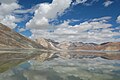 During summer
 -
 Birds
Birds -

-

-

-

-

-

-


Maps[edit | edit source]


See also[edit | edit source]
References[edit | edit source]
- Notes
- Citations
- ↑ Wang, M.; Hou, J.; Lei, Y. (2014). "Classification of Tibetan lakes based on variations in seasonal lake water temperature". Chinese Science Bulletin. 59 (34): 4847–4855. Bibcode:2014ChSBu..59.4847W. doi:10.1007/s11434-014-0588-8.
- ↑ Dortch et al., Catastrophic partial drainage of Pangong Tso (2011), p. 111.
- ↑ 3.0 3.1 "Ngari prefecture". Geographical names of Tibet AR (China). Institute of the Estonian Language. 3 June 2018. Archived from the original on 10 January 2020. Retrieved 9 January 2020.
- ↑ "River basins with Major and medium dams & barrages location map in India, WRIS" (Adobe Flash Player version 10.0.0 or greater). Archived from the original on 4 March 2016.
- ↑
Hedin, Sven Anders (1907). Scientific Results of a Journey in Central Asia 1899-1902: Central and West Tibet. Lithographic institute of the General staff of the Swedish army. p. 521.
From Noh to Bal Rawling followed the same route that I did along the northern shore of the Tso-ngombo, which he calls the Tso Mo Gualari, dividing it into the sections: Tso Nyak, the twin lakes Rum Tso and Nyak Tso. He says that it consists of a string of five lakes 120 m. in length, the four most southern of which are fresh, and Pangong, the most northerly, salt. They are joined together by channels about 60 feet in width and 15 feet deep, the current running at nearly 1½ mile an hour.
- ↑
Saward, M. H. (1878). Routes in Asia: Routes in the territories of the Maharaja of Jummoo and Kashmir, and adjacent countries. Office of the Superintendent of Government Printing. pp. 31–33.
Only the lower lake (the Pangong Tso proper) lies in Ladak, the middle (Tso Nyak) and upper lakes being in Rudok territory. ... The waters of the western end are much more salt than those of the eastern end near Ot. in the stream connecting the Pangong Tso with Nyak Tso the water becomes drinkable, and rich grass is found on the banks.
- ↑
"Pangong Lake". Union Territory of Ladakh. 29 October 2019. Retrieved 9 January 2020.
Pangong Lake, one of the most famous lakes in Leh Ladakh, derives its name from the Tibetan word, "Pangong Tso", which means "high grassland lake".
- ↑
Michelle Coxall; Paul Greenway (1 September 1996). Indian Himalaya: a Lonely Planet travel survival kit. Lonely Planet. ISBN 978-0-86442-413-6.
The salty Pangong Tso - Pangong means 'hollow' - is the highest lake in Ladakh at about 4300m, and is flanked by massive peaks over 6500m high.
- ↑
Kirit Rindani (7 January 2016). Indian Himalaya: Story of a 100 Visits. Partridge Publishing India. p. 80. ISBN 978-1-4828-5886-0.
The word Pangong means 'extensive concavity' which probably explains its size.
- ↑ "Pangong Tso Lake in Tibet". China Daily. 17 July 2012. Archived from the original on 24 January 2020. Retrieved 9 January 2020.
Pangong Tso Lake is a trans-border lake extending from the Ali prefecture of China's Tibet autonomous region to India. About 155 kilometers in length, the geographic features of the lake are indicated in the name which in Tibetan means "long, narrow, enchanted lake".
- ↑ Trotter, H. (1877). "Account of the Pundit's Journey in Great Tibet from Leh in Ladakh to Lhasa, and of His Return to India Via Assam". Journal of the Royal Geographical Society of London. 47: 86–136. doi:10.2307/1798740. ISSN 0266-6235. JSTOR 1798740. Archived from the original on 4 November 2020. Retrieved 6 May 2020.
the Pangong, but better known to the Tibetans as the Chomo Gna Laring Cho, which, being literally interpreted, means "Female narrow very long lake."
- ↑
"Pangong Tso Lake in the Northern Tibet". Kangba TV. 6 March 2017.
Pangong Tso Lake, at an altitude of 4,200 meters, is also called Tsomo Nganglha Ringpo Lake, which means "a swan with a long neck" in Tibetan.
- ↑ 13.0 13.1 Karakoram: Pangong Range, Britannica, accessed 13 October 2023.
- ↑ 14.0 14.1 If India loses grip on Kailash Range, PLA will make sure we never get it back, The Print, 12 November 2020.
- ↑ India, China ramp up infra on north bank of Pangong Tso lake, The Hindu, 3 July 2023.
- ↑ India, Ministry of External Affairs, ed. (1962), Report of the Officials of the Governments of India and the People's Republic of China on the Boundary Question, Government of India Press, Chinese Report, Part 1 (PDF) (Report). pp. 4–5. Archived (PDF) from the original on 13 October 2020. Retrieved 5 July 2020.
The location and terrain features of this traditional customary boundary line are now described as follows in three sectors, western, middle and eastern. ... From Ane Pass southwards, the boundary line runs along the mountain ridge and passes through peak 6,127 (approximately 78° 46' E, 38° 50' N) [sic] and then southwards to the northern bank of the Pangong Lake' (approximately 78° 49' E, 33° 44' N). It crosses this lake and reaches its southern bank at approximately 78° 43' E, 33° 40' N. Then it goes in a south-easterly direction along the watershed dividing the Tongada River and the streams flowing into the Spanggur Lake until it reaches Mount Sajum. - ↑ Lt Gen HS Panag (Retd) (4 June 2020). "India's Fingers have come under Chinese boots. Denial won't help us". The Print. Archived from the original on 4 June 2020. Retrieved 16 June 2020.
- ↑ Lamb, A. (1989). Tibet, China & India 1914-1950: A History of Imperial Diplomacy. Roxford Books. p. 359. ISBN 978-0-907129-03-5. Retrieved 1 August 2024.
- ↑ Sali, M. L. (1998). India-China Border Dispute: A Case Study of the Eastern Sector. APH Publishing. p. 82. ISBN 978-81-7024-964-1.
- ↑ Burkitt, Laurie; Scobell, Andrew; Wortzel, Larry M. (July 2003). The Lessons of History: The Chinese People's Liberation Army at 75 (PDF). Strategic Studies Institute. pp. 340–341. ISBN 1-58487-126-1. Archived from the original (PDF) on 5 February 2012. Retrieved 26 June 2009.
- ↑ Pubby, Manu (7 October 2008). "Pangong Lake is border flashpoint between India and China". The Indian Express. Archived from the original on 6 July 2009. Retrieved 23 June 2009.
- ↑ Shahin, Sultan (1 August 2003). "Vajpayee claps with one hand on border dispute". Asia Times. Archived from the original on 1 August 2003.
- ↑ Holslag, Jonathan (2008). "China, India and the Military Security Dilemma, Vol 3(5)" (PDF). BICCS Background Papers. Brussels Institute of Contemporary China Studies (BICCS). Archived from the original (PDF) on 6 June 2011. Retrieved 24 June 2009.
- ↑ 24.0 24.1
費風 (11 May 2020). 中印邊境再爆衝突 150士兵毆鬥釀12傷 [Another 150 soldiers in the Sino-Indian border conflict caused 12 injuries in a fight]. Hong Kong Economic Times (in 中文(繁體)).
消息指,第一起事件發生於5月5日至6日,在中印邊境的班公錯湖(Pangong Tso )地區,當時解放軍的「侵略性巡邏」(aggressive patrolling)被印度軍方阻攔。「結果發生了混亂,雙方都有一些士兵受傷。」{...}2017年8月,兩國軍隊曾於拉達克地區班公湖附近爆發衝突,當時雙方擲石攻擊對方,雙方均有人受傷,最終兩軍在半小時後退回各自據點。
- ↑ Sushant Singh (20 May 2020). "India-China conflict in Ladakh: The importance of the Pangong Tso lake". The Indian Express. Archived from the original on 12 February 2021. Retrieved 21 May 2020.
- ↑ "Indian, Chinese Troops Face-off in Ladakh Ahead of Modi-Xi Summit, Army Says Tension De-escalated". CNN-News18. 12 September 2019. Archived from the original on 7 November 2019. Retrieved 12 May 2020.
- ↑ Chang Ya-Han 張雅涵, ed. (10 March 2020). 中國在西藏地區軍演頻繁 牽動中印未來危機應對 [China's military exercises in Tibet frequently affect China and India's future crisis response]. Radio Taiwan International (in 中文(臺灣)). Archived from the original on 11 March 2020. Retrieved 16 May 2020.
- ↑ Dinakar Peri (10 May 2020). "Indian, Chinese troops face off in Eastern Ladakh, Sikkim". The Hindu. Archived from the original on 12 May 2020. Retrieved 13 May 2020.
- ↑ "Chinese military bolsters troops in Aksai Chin region in Sino-India border: Report". The Economic Times. 19 May 2020. Archived from the original on 19 May 2020. Retrieved 20 May 2020.
On May 5, around 250 Indian and Chinese army personnel clashed in Pangong Tso lake area in Eastern Ladakh.
- ↑ Khalid, Saif (28 May 2020). "'All-out combat' feared as India, China engage in border standoff". Al Jazeera. Archived from the original on 5 February 2022. Retrieved 5 February 2022.
- ↑ Dutta, Amrita Nayak (3 September 2020). "Army now holding 30 dominating heights, earlier unoccupied, on southern bank of Pangong Tso". ThePrint. Archived from the original on 2 November 2020. Retrieved 15 December 2020.
- ↑ Sagar, Pradip R (2 September 2020). "India controls dominating heights in Chushul sector". The Week. Archived from the original on 12 February 2021. Retrieved 15 December 2020.
- ↑ Dhoundial, Shreya (17 February 2021). "India's Move to Occupy Kailash Range Became Turning Point in Disengagement Talks: Lt Gen YK Joshi". News18. Archived from the original on 17 February 2021. Retrieved 7 February 2022.
- ↑ Hooper, Craig (5 July 2020). "On Pangong Lake, Chinese And Indian Fleets Square Off At 14,000 Feet". Forbes. Archived from the original on 13 February 2022. Retrieved 13 February 2022.
- ↑ P, Rajat (13 June 2021). "Army gets special boats for Pangong Tso". The Times of India. Archived from the original on 13 February 2022. Retrieved 13 February 2022.
- ↑ Singh, Mayank (18 August 2021). "China raises firepower & mobility near Pangong Tso". The New Indian Express. Archived from the original on 14 February 2022. Retrieved 13 February 2022.
- ↑ Som, Vishnu (7 January 2022). "Chinese Bridge Over Pangong Lake In Illegally Held Territory: Government". NDTV. Archived from the original on 8 January 2022. Retrieved 8 January 2022.
- ↑ Laskar, Rezaul H (4 February 2022). "India says China's bridge on Pangong Lake located in areas under 'illegal occupation'". Hindustan Times. Archived from the original on 7 February 2022. Retrieved 7 February 2022.
- ↑ "China Makes Pangong Lake Bridge Operational, Builds Village Near LAC in Demchuk". Kashmir Times. 31 July 2024.
- ↑ Mayank Singh (2 July 2023). "India boosts road links to LAC standoff points". Indian Express.
- ↑ India, China ramp up infra on north bank of Pangong Tso lake Archived 3 July 2023 at the Wayback Machine, The Hindu, 2 July 2023.
- ↑ YEAR-END DEADLINE SET FOR BRO TO COMPLETE 20 ROADS ALONG LAC AS STANDOFF WITH CHINA LOOKS INCREASINGLY IRREVERSIBLE, INDIAN DEFENCE NEWS, AUGUST 03, 2023.
- ↑ 43.0 43.1 Wildlife Board approves 5 roads in Ladakh, including Daulat Beg Oldie route, Business Standard, 17 October 2024.
- ↑ 黄慧英 (4 August 2018). 一措再措 邂逅高原湖泊的绝美 [Take measures to meet the beauty of plateau lakes] (in 中文). tibet.cn. Archived from the original on 22 September 2018. Retrieved 22 September 2018.
- ↑ MEA: Two bridges built by China in Pangong area occupied illegally Archived 3 July 2023 at the Wayback Machine, Indian Express, 21 May 2022.
- ↑ 'Xi Hao' India! China's 2nd Bridge On Disputed Pangong Lake Is Near Completion, Satellite Imagery Reveals Archived 3 July 2023 at the Wayback Machine, Eurasian Times, 17 Nov 2022.
- ↑ The Story Of Tanot Mata, The Deity Who Protected Our Soldiers From Pakistani Bombs In 1971 War, India Times, 16 Dec 2020.
- ↑ Add Galwan, Siachen to holiday plan. India is opening battle tourism bunker, India Today, 15 Jan 2025.
- ↑ "A handy guide on how to visit the famous Pangong Lake in Ladakh". Times of India Travel. 3 December 2020. Archived from the original on 13 February 2022. Retrieved 13 February 2022.
- ↑ Javaid, Azaan (13 January 2021). "Pangong Tso opens for tourists amid Ladakh stand-off. This is how you can visit it". ThePrint. Archived from the original on 13 February 2022. Retrieved 13 February 2022.
- ↑ Ariel Sophia Bardi (22 November 2016). "How "3 Idiots" Destroyed Ladakh". BuzzFeed. Archived from the original on 2 June 2023. Retrieved 2 June 2023.
- ↑ "班公错" (in 中文). Archived from the original on 22 September 2018. Retrieved 22 September 2018.
- ↑ 53.0 53.1 R. K. Pant; N. R. Phadtare; L. S. Chamyal; Navin Juyal (10 June 2005). "Quaternary deposits in Ladakh and Karakoram Himalaya: A treasure trove of the palaeoclimate records". Current Science. 88 (11). Archived from the original on 20 January 2023. Retrieved 6 May 2020.
- ↑ Khan, Asif (2016). "Ladakh: The Land Beyond". Buceros. 21 (3): 6–15. Archived from the original on 26 February 2020. Retrieved 26 October 2017.
- ↑ "Schizopygopsis stoliczkae". China Animal Scientific Database. Archived from the original on 5 March 2016. Retrieved 22 September 2018.
- ↑ "Racoma labiata". China Animal Scientific Database. Archived from the original on 5 March 2016. Retrieved 22 September 2018.
- ↑ Oheimb, Parm Viktor von; Albrecht, Christian; Riedel, Frank; Du, Lina; Yang, Junxing; Aldridge, David C.; Bößneck, Ulrich; Zhang, Hucai; Wilke, Thomas (2011). "Freshwater Biogeography and Limnological Evolution of the Tibetan Plateau - Insights from a Plateau-Wide Distributed Gastropod Taxon (Radix spp.)". PLOS One. 6 (10) e26307. Bibcode:2011PLoSO...626307V. doi:10.1371/journal.pone.0026307. PMC 3197626. PMID 22028853.
- ↑ Biksham Gujja; Archana Chatterjee; Parikshit Gautam & Pankaj Chandan (August 2003). "Wetlands and Lakes at the Top of the World". Mountain Research and Development. 23 (3). Bern, Switzerland: International Mountain Society: 219–221. doi:10.1659/0276-4741(2003)023[0219:WALATT]2.0.CO;2. ISSN 1994-7151. S2CID 130202320.
- ↑ Dreams of Snow Land. Beijing: Foreign Languages Press. 2005. pp. 273-275. ISBN 7-119-03883-4 – via archive.org.
Bibliography[edit | edit source]
- Cunningham, Alexander (1854), Ladak: Physical, Statistical, Historical, London: Wm. H. Allen and Co – via archive.org
- Dortch, Jason M.; Owen, Lewis A.; Caffee, Marc W.; Kamp, Ulrich (2011). "Catastrophic partial drainage of Pangong Tso, northern India and Tibet". Geomorphology. 125 (1): 109–121. Bibcode:2011Geomo.125..109D. doi:10.1016/j.geomorph.2010.08.017. ISSN 0169-555X.
- Godwin-Austen, H. H. (1867), "Notes on the Pangong Lake District of Ladakh, from a Journal made during a Survey in 1863", The Journal of the Royal Geographical Society of London, 37, London: J. Murray: 343–363, doi:10.2307/1798534, JSTOR 1798534
- Huntington, Ellsworth (1906), "Pangong: A Glacial Lake in the Tibetan Plateau", The Journal of Geology, 14 (7), University of Chicago: 599–617, Bibcode:1906JG.....14..599H, doi:10.1086/621337, S2CID 129014522
- Strachey, Henry (1854), Physical Geography of Western Tibet, London: William Clows and Sons – via archive.org
Further reading[edit | edit source]
- Streule, M.J.; Phillips, R.J.; Searle, M.P.; Waters, D.J.; Horstwood, M.S.A. (2009). "Evolution and chronology of the Pangong Metamorphic Complex adjacent to the Karakoram Fault, Ladakh: constraints from thermobarometry, metamorphic modelling and U–Pb geochronology" (PDF). Journal of the Geological Society. 166 (5): 919–932. Bibcode:2009JGSoc.166..919S. doi:10.1144/0016-76492008-117. ISSN 0016-7649. S2CID 6633788.
- Srivastava P, Kumar A, Singh R, Deepak O, Kumar AM, Ray Y, Jayangondaperumal R, Phartiyal B, Chahal P, Sharma P, Ghosh R, Kumar N, Agnihotri R (July 2020). "Rapid lake level fall in Pangong Tso (lake) in Ladakh, NW Himalaya: a response of late Holocene aridity" (PDF). Current Science. 119 (2): 219–231. doi:10.18520/cs/v119/i2/219-231. S2CID 239601454.
- SINO-INDIAN BORDER DEFENSES CHUSHUL AREA (CIA, 1963)
| History |
| ||||||||||||||||||
|---|---|---|---|---|---|---|---|---|---|---|---|---|---|---|---|---|---|---|---|
| Administration | |||||||||||||||||||
| Geography |
| ||||||||||||||||||
| Human settlements | |||||||||||||||||||
| Culture |
| ||||||||||||||||||
| Tourism and wildlife |
| ||||||||||||||||||
| Transport |
| ||||||||||||||||||
| Infrastructure |
| ||||||||||||||||||
| See also |
| ||||||||||||||||||
