

Bot: The file File:Gilgit Baltistan Government Logo.svg has been removed, as it does not exist. |
formatting fix |
||
| Line 1: | Line 1: | ||
{{ | {{short description|none}} | ||
<!-- "none" is preferred when the title is sufficiently descriptive; see [[BP:SDNONE]] --> | |||
{{ | {{pp-extended|small=yes}} | ||
{{Use British English|date=May 2020}} | |||
{{Use dmy dates|date=January 2019}} | {{Use dmy dates|date=January 2019}} | ||
{{Infobox subdivision type | {{Infobox subdivision type | ||
| name | | name = Administrative Units:<br />Islamic Republic of Pakistan | ||
| map | | map = File:Pakistan location map.svg | ||
| category | | category = [[Federated state]] | ||
| start_date | | start_date = [[Legal Framework Order, 1970|1 July 1970]] | ||
| current_number | | current_number = {{plainlist| | ||
* 4 [[ | * 4 [[province]]s | ||
* 2 [[ | * 2 [[Kashmir conflict|administrative territories]] | ||
* 1 [[federal territory]] | * 1 [[federal territory]] | ||
}} | }} | ||
| number_date | | number_date = | ||
| population_range | | population_range = {{Collapsible list | ||
| area_range | | title = ''{{nobold|Least, most:}}'' | ||
'' | | 1,249,000 ([[Gilgit–Baltistan]]) | ||
| government | | 110,012,442 ([[Punjab, Pakistan|Punjab]]) | ||
}} | |||
| area_range = {{Collapsible list | |||
| title = ''{{nobold|Smallest, largest:}}'' | |||
| {{Convert|349.81|sqmi|order=flip|abbr=on}}, [[Islamabad Capital Territory]] | |||
| subdivision | | {{Convert|134050|sqmi|order=flip|abbr=on}}, [[Balochistan, Pakistan|Balochistan]] | ||
[[Divisions of Pakistan|Divisions]] | }} | ||
| government = {{Collapsible list | |||
| title = ''{{nobold|Descending order:}}'' | |||
| 1. [[Government of Pakistan|National government]] | |||
| 2. [[List of provincial governments of Pakistan|Provincial governments]] | |||
|territory = {{flag|Pakistan}} | | 3. [[Districts of Pakistan#Administration|District governments]] | ||
| 4. [[Tehsil Municipal Administration]] | |||
| 5. [[Local government in Pakistan|Local governments]] | |||
}} | |||
| subdivision = {{Collapsible list | |||
| title = ''{{nobold|Descending order:}}'' | |||
| 1. [[Divisions of Pakistan|Divisions]] | |||
| 2. [[Districts of Pakistan|Districts]] | |||
| 3. [[List of tehsils in Pakistan|Tehsils]] | |||
| 4. [[Union council (Pakistan)|Union councils]] | |||
}} | |||
| territory = {{flag|Pakistan}} | |||
}} | }} | ||
{{Politics of Pakistan}} | {{Politics of Pakistan}} | ||
[[Pakistan]] is administratively divided into four [[province]]s, one [[federal territory]], and two [[territorial dispute|disputed territories]]: the provinces of [[Punjab, Pakistan|Punjab]], [[Sindh]], [[Khyber Pakhtunkhwa]], and [[Balochistan, Pakistan|Balochistan]]; the [[Islamabad Capital Territory]]; and the administrative territories{{#tag:ref|Proclaimed as autonomous by the [[Government of Pakistan]].|group="Note"}} of [[Azad Kashmir|Azad Jammu and Kashmir]] and [[Gilgit-Baltistan|Gilgit–Baltistan]].{{#tag:ref|In November 2020, erstwhile Pakistani prime minister [[Imran Khan]] announced that Gilgit–Baltistan would attain "provisional provincial status" after the [[2020 Gilgit-Baltistan Assembly election|2020 assembly election]].<ref name="ProvisionalProvincialStatus1">{{cite web |title=Fifth province |url=https://tribune.com.pk/story/2270797/fifth-province |website=Fifth province {{pipe}} The Express Tribune |publisher=The Express Tribune |access-date=14 November 2020 |archive-url=https://web.archive.org/web/20201109185546/https://tribune.com.pk/story/2270797/fifth-province |archive-date=9 November 2020 |date=2 November 2020 |url-status=live}}</ref><ref name="ProvisionalProvincialStatus2">{{cite web |title=Pakistani PM says he will upgrade status of part of Kashmir, angering India |url=https://www.reuters.com/article/pakistan-politics-kashmir/pakistani-pm-says-he-will-upgrade-status-of-part-of-kashmir-angering-india-idINKBN27H1FP |publisher=Reuters |access-date=14 November 2020 |archive-url=https://web.archive.org/web/20201102040803/https://www.reuters.com/article/pakistan-politics-kashmir/pakistani-pm-says-he-will-upgrade-status-of-part-of-kashmir-angering-india-idINKBN27H1FP |archive-date=2 November 2020 |date=1 November 2020 |url-status=live}}</ref><ref name="ProvisionalProvincialStatus3">{{cite web |title=Gilgit-Baltistan to get provisional provincial status post-election: PM Imran |url=https://www.thenews.com.pk/print/737641-gilgit-baltistan-to-get-provisional-provincial-status-post-election-pm-imran |website=[[The News International]] |location=Karachi |access-date=14 November 2020 |date=2 November 2020 |archive-date=14 November 2020 |archive-url=https://web.archive.org/web/20201114231112/https://www.thenews.com.pk/print/737641-gilgit-baltistan-to-get-provisional-provincial-status-post-election-pm-imran |url-status=live }}</ref>|group="Note"}}<ref>{{Cite web |date=1998-07-20 |editor-last=Tikkanen |editor-first=Amy |editor2-last=Gorlinski |editor2-first=Virginia |editor3-last=Javed |editor3-first=Murtaza |editor4-last=Tesch |editor4-first=Noah |title=Azad Kashmir {{!}} quasi-state, Kashmir region, India-Pakistan |url=https://www.britannica.com/place/Azad-Kashmir |url-status=live |archive-url=https://web.archive.org/web/20201012065802/https://www.britannica.com/place/Azad-Kashmir |archive-date=2020-10-12 |access-date=2020-11-05 |website=Encyclopedia Britannica |language=en}}</ref><ref>{{Cite web |title=Pakistan's Gilgit-Baltistan: Between the Kashmir conflict and China |url=https://www.trtworld.com/magazine/pakistan-s-gilgit-baltistan-between-the-kashmir-conflict-and-china-40053 |url-status=live |archive-url=https://web.archive.org/web/20201104211548/https://www.trtworld.com/magazine/pakistan-s-gilgit-baltistan-between-the-kashmir-conflict-and-china-40053 |archive-date=4 November 2020 |access-date=2020-11-05 |website=Pakistan's Gilgit-Baltistan: Between the Kashmir conflict and China |language=en}}</ref> As part of the [[Kashmir conflict]] with neighbouring [[India]], Pakistan has also claimed sovereignty over the Indian-controlled territories of [[Jammu and Kashmir (union territory)|Jammu and Kashmir]] and [[Ladakh]] since the [[Indo-Pakistani War of 1947–1948|First Kashmir War]] of 1947–1948. It also has a territorial dispute with India over [[Junagadh State|Junagadh]],<ref>{{cite news |last=Iwanek |first=Krzysztof |date=10 August 2020 |title= Why Did Pakistan Lay Claim to the Indian Territory of Junagadh? |url=https://thediplomat.com/2020/08/why-did-pakistan-lay-claim-to-the-indian-territory-of-junagadh/ |work=The Diplomat |access-date=25 July 2024}}</ref><ref>{{cite web |url=https://blogs.nottingham.ac.uk/mapcollection/2019/10/03/pakistan-india-and-mapping-the-contested-accession-of-south-asias-princely-states/ |title= Pakistan, India and mapping the contested accession of South Asia's princely states |last=Jagessar |first=Philip |date= 3 October 2019 |website= |publisher= University of Nottingham |access-date=25 July 2024}}</ref><ref>{{cite news |url=https://thehimalayantimes.com/world/pakistan-unveils-new-political-map-claiming-jammu-india-retorts/ |title=After Nepal, Pakistan unveils new political map; Jammu & Kashmir and Ladakh claimed, India retorts |work=The Himalayan Times |date=4 August 2020 |access-date=25 July 2024}}</ref><ref>{{cite news |last=Noronha |first=Rahul |date=7 August 2020 |title=Why Pakistan has claimed Junagadh in its new political map |work=India Today |url=https://www.indiatoday.in/india-today-insight/story/why-pakistan-has-claimed-junagadh-in-its-new-political-map-1708515-2020-08-06 |access-date=25 July 2024}}</ref> but has never exercised administrative authority over either regions. All of Pakistan's provinces and territories are subdivided into [[divisions of Pakistan|divisions]], which are further subdivided into [[districts of Pakistan|districts]], and then [[list of tehsils in Pakistan|tehsils]], which are again further subdivided into [[union council (Pakistan)|union councils]].<ref>{{Cite web|url=http://www.pbs.gov.pk/sites/default/files/LIST%20OF%20DISTRICTS%20%26%20TEHSILS.pdf|title=List of Districts, Tehsils/Talukas|date=July 2014|website=Pakistan Bureau of Statistics|access-date=15 October 2016|archive-date=9 October 2016|archive-url=https://web.archive.org/web/20161009115713/http://www.pbs.gov.pk/sites/default/files/LIST%20OF%20DISTRICTS%20%26%20TEHSILS.pdf|url-status=live}}</ref> | |||
==History | ==History== | ||
{{Main|Former administrative units of Pakistan}} | {{Main|Former administrative units of Pakistan}} | ||
=== | ===Post-independence=== | ||
[[Pakistan]] inherited the territory comprising its current provinces from | {{Disputed map|section=y|date=November 2024}}[[File:Princely states of Pakistan map.gif|thumb|right|[[West Pakistan]] (pale yellow) as it was at the time of independence, with the independent princely states of 1947 in purple]] | ||
[[Pakistan]] inherited the territory comprising its current provinces from [[British Raj|India]] following the [[Partition of India]] on [[Independence Day (Pakistan)|14 August 1947]]. Two days after independence, the [[Muslims|Muslim]]-majority [[Murshidabad district]] in [[Bengal]] was moved out of the [[Dominion of Pakistan]] and put within the [[Dominion of India]] due to a boundary adjustment by the [[Radcliffe Line|Radcliffe Commission]] which was aimed at keeping the [[Hooghly River]] entirely within India.<ref name="Murshidabad Govt Website">{{Cite web |url=http://murshidabad.gov.in/ |title=Murshidabad Govt Website |access-date=17 December 2018 |archive-url=https://web.archive.org/web/20140716073018/http://murshidabad.gov.in/ |archive-date=16 July 2014 |url-status=dead }}</ref><ref>{{cite book|last1=Chatterji|first1=Joya|url=https://books.google.com/books?id=FjQ0iWSq2R0C&pg=PA59|title=The Spoils of Partition: Bengal and India, 1947–1967|date=2007|publisher=Cambridge University Press|isbn=9781139468305|page=59|language=en|access-date=21 June 2019|archive-date=24 June 2021|archive-url=https://web.archive.org/web/20210624203647/https://books.google.com/books?id=FjQ0iWSq2R0C&pg=PA59|url-status=live}}</ref> At its inception, Pakistan consisted of two wings, which were separated from each other by around {{Convert|1600|km|mi}} of Indian territory. The western wing consisted of a merger of the [[North-West Frontier Province]], [[West Punjab]], [[Sind Province (1936–55)|Sind Province]], and [[Baluchistan (Chief Commissioner's Province)|Baluchistan CCP]]. The eastern wing consisted of [[East Bengal]]. What later became the [[Princely states of Pakistan]] chose at first to remain independent. | |||
In 1948, [[Karachi]] was separated from Sind Province to form the [[Federal Capital Territory (Pakistan)|Federal Capital Territory]]. In 1950, the North-West Frontier Province absorbed the princely states of [[Amb (princely state)|Amb]] and [[Phulra]] while West Punjab (designated 'West' to distinguish it from India's [[East Punjab|Punjab in the east]]) was renamed to simply [[Punjab, Pakistan|Punjab]]. In 1952, the four princely states in the southwest formed the [[Baluchistan States Union]]. | In 1948, [[Karachi]] was separated from Sind Province to form the [[Federal Capital Territory (Pakistan)|Federal Capital Territory]]. In 1950, the North-West Frontier Province absorbed the princely states of [[Amb (princely state)|Amb]] and [[Phulra]] while West Punjab (designated 'West' to distinguish it from India's [[East Punjab|Punjab in the east]]) was renamed to simply [[Punjab, Pakistan|Punjab]]. In 1952, the four princely states in the southwest formed the [[Baluchistan States Union]]. | ||
| Line 51: | Line 64: | ||
In 1970, the second military [[President of Pakistan|President]], [[Yahya Khan]], abolished the political structure of West Pakistan and established four new provinces: [[Sindh]], Punjab, [[Balochistan, Pakistan|Balochistan]] and the North-West Frontier Province. In 1971, the [[Bengalis|Bengali]]-majority wing of East Pakistan [[Secession|seceded]] from the Pakistani union following the [[Bangladesh Liberation War]], consequently forming the independent [[Bangladesh|People's Republic of Bangladesh]]. In 1974, the remaining princely states of [[Hunza (princely state)|Hunza]] and [[Nagar (princely state)|Nagar]] were abolished and their territories merged into the [[Gilgit Agency]], following which the [[Gilgit-Baltistan|Northern Areas]] were formed. In 1975, portions of the districts of [[Peshawar District|Peshawar]] and [[Dera Ismail Khan District|Dera Ismail Khan]] were separated to form the [[Federally Administered Tribal Areas]]. In 1981, the region surrounding Islamabad was separated from Punjab province, and renamed to the [[Islamabad Capital Territory]]. | In 1970, the second military [[President of Pakistan|President]], [[Yahya Khan]], abolished the political structure of West Pakistan and established four new provinces: [[Sindh]], Punjab, [[Balochistan, Pakistan|Balochistan]] and the North-West Frontier Province. In 1971, the [[Bengalis|Bengali]]-majority wing of East Pakistan [[Secession|seceded]] from the Pakistani union following the [[Bangladesh Liberation War]], consequently forming the independent [[Bangladesh|People's Republic of Bangladesh]]. In 1974, the remaining princely states of [[Hunza (princely state)|Hunza]] and [[Nagar (princely state)|Nagar]] were abolished and their territories merged into the [[Gilgit Agency]], following which the [[Gilgit-Baltistan|Northern Areas]] were formed. In 1975, portions of the districts of [[Peshawar District|Peshawar]] and [[Dera Ismail Khan District|Dera Ismail Khan]] were separated to form the [[Federally Administered Tribal Areas]]. In 1981, the region surrounding Islamabad was separated from Punjab province, and renamed to the [[Islamabad Capital Territory]]. | ||
In August 2000, [[Divisions of Pakistan|divisions]] were abolished as part of a plan to restructure [[Local government in Pakistan|local governments]], followed by elections in 2001. Many of the functions previously handled at a provincial level had been transferred to individual [[Districts of Pakistan|districts]] and [[ | In August 2000, [[Divisions of Pakistan|divisions]] were abolished as part of a plan to restructure [[Local government in Pakistan|local governments]], followed by elections in 2001. Many of the functions previously handled at a provincial level had been transferred to individual [[Districts of Pakistan|districts]] and [[tehsil]]s. In 2008, the government restored the former divisions and appointed commissioners. | ||
In 2009, the Northern Areas were renamed to Gilgit-Baltistan, and retained its formal status as an [[Autonomous administrative division|autonomous territory]].<ref>{{cite news|title=Northern Areas renamed Gilgit-Baltistan Poll for assembly, CM in Nov Regional groups unhappy: Autonomy package for NAs approved|url=https://www.dawn.com/news/851176|work=DAWN|date=August 30, 2009|access-date=8 May 2018|archive-date=8 May 2018|archive-url=https://web.archive.org/web/20180508185655/https://www.dawn.com/news/851176|url-status=live}}</ref><ref>{{cite news|title=Disputed Northern Areas renamed as Gilgit-Baltistan|url=https://www.hindustantimes.com/world/disputed-northern-areas-renamed-as-gilgit-baltistan/story-qickZAJF82JoXg1CnzZJsJ.html|work=Hindustan Times|date=Aug 30, 2009|access-date=3 November 2019|archive-date=3 November 2019|archive-url=https://web.archive.org/web/20191103103232/https://www.hindustantimes.com/world/disputed-northern-areas-renamed-as-gilgit-baltistan/story-qickZAJF82JoXg1CnzZJsJ.html|url-status=live}}</ref> In 2010, the North-West Frontier Province was formally renamed to [[Khyber Pakhtunkhwa]].<ref>{{cite news|title=From NWFP to Khyber Pakhtunkhwa|url=https://www.dawn.com/news/854215|work=DAWN|date=April 1, 2010|access-date=8 May 2018|archive-date=8 May 2018|archive-url=https://web.archive.org/web/20180508185415/https://www.dawn.com/news/854215|url-status=live}}</ref> In 2018, the [[National Assembly of Pakistan]] and [[Provincial Assembly of Khyber Pakhtunkhwa|Khyber Pakhtunkhwa Provincial Assembly]] passed the historic ''FATA Merger Bill'' with the [[Twenty-fifth Amendment to the Constitution of Pakistan|Twenty-Fifth Constitutional Amendment]]. On 31 May 2018, the final step in the merger of the Federally Administered Tribal Areas with Khyber Pakhtunkhwa was completed, as then-President [[Mamnoon Hussain]] signed the 25th Constitutional Amendment Bill into law. The amendment's signing abolished the Federally Administered Tribal Areas as a separate political entity and merged them into the province of Khyber Pakhtunkhwa.<ref>{{cite web|url=https://tribune.com.pk/story/1720162/1-jui-f-stages-protest-outside-k-p-assembly-ahead-vote-31st-amendment-bill/|title=New dawn for FATA as K-P approves merger - The Express Tribune|date=27 May 2018|access-date=27 May 2018|archive-date=27 May 2018|archive-url=https://web.archive.org/web/20180527091009/https://tribune.com.pk/story/1720162/1-jui-f-stages-protest-outside-k-p-assembly-ahead-vote-31st-amendment-bill/|url-status=live}}</ref><ref>{{cite web|url=https://www.dawn.com/news/1410351|title=KP Assembly approves landmark bill merging Fata with province|first=Arif|last=Hayat|date=27 May 2018|access-date=27 May 2018|archive-date=27 May 2018|archive-url=https://web.archive.org/web/20180527130911/https://www.dawn.com/news/1410351|url-status=live}}</ref><ref>{{cite web|url=https://www.dawn.com/news/1411156/president-signs-kp-fata-merger-bill-into-law|title=President signs KP-Fata merger bill into law|first=Amir|last=Wasim|date=31 May 2018|access-date=31 May 2018|archive-date=31 May 2018|archive-url=https://web.archive.org/web/20180531112516/https://www.dawn.com/news/1411156/president-signs-kp-fata-merger-bill-into-law|url-status=live}}</ref> | In 2009, the Northern Areas were renamed to Gilgit-Baltistan, and retained its formal status as an [[Autonomous administrative division|autonomous territory]].<ref>{{cite news|title=Northern Areas renamed Gilgit-Baltistan Poll for assembly, CM in Nov Regional groups unhappy: Autonomy package for NAs approved|url=https://www.dawn.com/news/851176|work=DAWN|date=August 30, 2009|access-date=8 May 2018|archive-date=8 May 2018|archive-url=https://web.archive.org/web/20180508185655/https://www.dawn.com/news/851176|url-status=live}}</ref><ref>{{cite news|title=Disputed Northern Areas renamed as Gilgit-Baltistan|url=https://www.hindustantimes.com/world/disputed-northern-areas-renamed-as-gilgit-baltistan/story-qickZAJF82JoXg1CnzZJsJ.html|work=Hindustan Times|date=Aug 30, 2009|access-date=3 November 2019|archive-date=3 November 2019|archive-url=https://web.archive.org/web/20191103103232/https://www.hindustantimes.com/world/disputed-northern-areas-renamed-as-gilgit-baltistan/story-qickZAJF82JoXg1CnzZJsJ.html|url-status=live}}</ref> In 2010, the North-West Frontier Province was formally renamed to [[Khyber Pakhtunkhwa]].<ref>{{cite news|title=From NWFP to Khyber Pakhtunkhwa|url=https://www.dawn.com/news/854215|work=DAWN|date=April 1, 2010|access-date=8 May 2018|archive-date=8 May 2018|archive-url=https://web.archive.org/web/20180508185415/https://www.dawn.com/news/854215|url-status=live}}</ref> In 2018, the [[National Assembly of Pakistan]] and [[Provincial Assembly of Khyber Pakhtunkhwa|Khyber Pakhtunkhwa Provincial Assembly]] passed the historic ''FATA Merger Bill'' with the [[Twenty-fifth Amendment to the Constitution of Pakistan|Twenty-Fifth Constitutional Amendment]]. On 31 May 2018, the final step in the merger of the Federally Administered Tribal Areas with Khyber Pakhtunkhwa was completed, as then-President [[Mamnoon Hussain]] signed the 25th Constitutional Amendment Bill into law. The amendment's signing abolished the Federally Administered Tribal Areas as a separate political entity and merged them into the province of Khyber Pakhtunkhwa.<ref>{{cite web|url=https://tribune.com.pk/story/1720162/1-jui-f-stages-protest-outside-k-p-assembly-ahead-vote-31st-amendment-bill/|title=New dawn for FATA as K-P approves merger - The Express Tribune|date=27 May 2018|access-date=27 May 2018|archive-date=27 May 2018|archive-url=https://web.archive.org/web/20180527091009/https://tribune.com.pk/story/1720162/1-jui-f-stages-protest-outside-k-p-assembly-ahead-vote-31st-amendment-bill/|url-status=live}}</ref><ref>{{cite web|url=https://www.dawn.com/news/1410351|title=KP Assembly approves landmark bill merging Fata with province|first=Arif|last=Hayat|date=27 May 2018|access-date=27 May 2018|archive-date=27 May 2018|archive-url=https://web.archive.org/web/20180527130911/https://www.dawn.com/news/1410351|url-status=live}}</ref><ref>{{cite web|url=https://www.dawn.com/news/1411156/president-signs-kp-fata-merger-bill-into-law|title=President signs KP-Fata merger bill into law|first=Amir|last=Wasim|date=31 May 2018|access-date=31 May 2018|archive-date=31 May 2018|archive-url=https://web.archive.org/web/20180531112516/https://www.dawn.com/news/1411156/president-signs-kp-fata-merger-bill-into-law|url-status=live}}</ref> | ||
| Line 62: | Line 75: | ||
{{Tree chart/start}} | {{Tree chart/start}} | ||
{{Tree chart|}} | {{Tree chart|}} | ||
{{Tree chart| | | FED | FED=''' | {{Tree chart| | | FED | FED='''[[Pakistan|Islamic Republic of Pakistan]]'''}} | ||
{{Tree chart| | | |!| | | | | }} | {{Tree chart| | | |!| | | | | }} | ||
{{Tree chart| | | PRO | PRO='''Province'''<br>(e.g. [[Punjab, Pakistan|Punjab Province]])}} | {{Tree chart| | | PRO | PRO='''Province'''<br>(e.g. [[Punjab, Pakistan|Punjab Province]])}} | ||
| Line 77: | Line 90: | ||
=== Division === | === Division === | ||
{{Main|Divisions of Pakistan}} | {{Main|Divisions of Pakistan}}{{unref section|date=February 2026}} | ||
The Provinces and administrative territories of Pakistan are subdivided into administrative "divisions", Divisional Commissioner is the administrative head of a division. Divisional Commissioner is appointed by the government of Pakistan from [[Pakistan Administrative Service]] | The Provinces and administrative territories of Pakistan are subdivided into administrative "divisions", Divisional Commissioner is the administrative head of a division. Divisional Commissioner is appointed by the government of Pakistan from [[Pakistan Administrative Service]] | ||
| Line 90: | Line 103: | ||
=== Tehsil === | === Tehsil === | ||
{{Main|Tehsils of Pakistan}} | {{Main|Tehsils of Pakistan}} | ||
Among the three tiers of local government, tehsil government is the second tier. It is where the functions, responsibilities, and authorities of districts government are divided into smaller units, these units are known as "tehsils". The tehsils are used all over Pakistan except Sindh province where the word "taluka" is used instead, although the functions and authorities are the same. The head of the Tehsil government is "Tehsil Nazim" who is assisted by the tehsil Naib-Nazim. Every tehsil has a [[Tehsil Municipal Administration]], consisting of a tehsil council, Tehsil Nazim, tehsil/taluka municipal officer (TMO), chief officer and other officials of the local council.<ref>{{cite web|url=https://www.researchgate.net/figure/Administrative-Structure-of-the-Tehsil-Municipal-Administration_fig3_253292593|title=Administrative Structure of the Tehsil Municipal Administration|website= | Among the three tiers of local government, tehsil government is the second tier. It is where the functions, responsibilities, and authorities of districts government are divided into smaller units, these units are known as "tehsils". The tehsils are used all over Pakistan except Sindh province where the word "taluka" is used instead, although the functions and authorities are the same. The head of the Tehsil government is "Tehsil Nazim" who is assisted by the tehsil Naib-Nazim. Every tehsil has a [[Tehsil Municipal Administration]], consisting of a tehsil council, Tehsil Nazim, tehsil/taluka municipal officer (TMO), chief officer and other officials of the local council.<ref>{{cite web|url=https://www.researchgate.net/figure/Administrative-Structure-of-the-Tehsil-Municipal-Administration_fig3_253292593|title=Administrative Structure of the Tehsil Municipal Administration|website=ResearchGate|last1=Ebel|first1=Robert E.|date=January 2006|accessdate=September 6, 2020|archive-date=11 July 2021|archive-url=https://web.archive.org/web/20210711184759/https://www.researchgate.net/figure/Administrative-Structure-of-the-Tehsil-Municipal-Administration_fig3_253292593|url-status=live}}</ref> | ||
=== Union council === | === Union council === | ||
{{Main|Union councils of Pakistan}} | {{Main|Union councils of Pakistan}}{{unref section|date=February 2026}} | ||
Members of the union council including Union Administrator and Vice Union Administrator are elected through direct elections based on adult franchise and on the basis of joint electorate. However, for the election to the reserved seats for women in Zila Council proportionately divided among tehsils or towns shall be all members of the union councils in a tehsil or town. It is the responsibility of the Chief Election Commissioner to organize and conduct these elections. | Members of the union council including Union Administrator and Vice Union Administrator are elected through direct elections based on adult franchise and on the basis of joint electorate. However, for the election to the reserved seats for women in Zila Council proportionately divided among tehsils or towns shall be all members of the union councils in a tehsil or town. It is the responsibility of the Chief Election Commissioner to organize and conduct these elections. | ||
| Line 99: | Line 112: | ||
{| class="wikitable sortable" style="text-align:right;" | {| class="wikitable sortable" style="text-align:right;" | ||
|- | |- | ||
! | |||
! Name (English) | ! Name (English) | ||
! | ! Abbr. | ||
! Capital and<br> largest city | |||
! Capital | |||
! class="unsortable" | Emblem | ! class="unsortable" | Emblem | ||
! class="unsortable" | Flag | ! class="unsortable" | Flag | ||
! class="unsortable" | Map | ! class="unsortable" | Map | ||
! Map Key | ! Map Key | ||
|- | |- | ||
| | |||
| style="text-align:left;" | [[Azad Kashmir|Azad Jammu and Kashmir]]{{efn|name=disputed|Disputed with India.}} | | style="text-align:left;" | [[Azad Kashmir|Azad Jammu and Kashmir]]{{efn|name=disputed|Disputed with India.}} | ||
| style="text-align:center;" | AJK | | style="text-align:center;" | AJK | ||
| style="text-align:left;" | [[Muzaffarabad]] | | style="text-align:left;" | [[Muzaffarabad]] | ||
| style="text-align:center;" | [[File:State Seal of Azad Jammu and Kashmir (Pakistan).png|60px]] | | style="text-align:center;" | [[File:State Seal of Azad Jammu and Kashmir (Pakistan).png|60px]] | ||
| style="text-align:center;" | [[File:Flag of Azad Kashmir.svg|border|50px]] | | style="text-align:center;" | [[File:Flag of Azad Kashmir.svg|border|50px]] | ||
| [[File:Azad Kashmir in Pakistan (claims hatched).svg|120px]] | | [[File:Azad Kashmir in Pakistan (claims hatched).svg|120px]] | ||
| 6 | | 6 | ||
|- | |- | ||
| | |||
| style="text-align:left;" | [[Balochistan, Pakistan|Balochistan]] | | style="text-align:left;" | [[Balochistan, Pakistan|Balochistan]] | ||
| style="text-align:center;" | BA | |||
| style="text-align:center;" | | |||
| style="text-align:left;" | [[Quetta]] | | style="text-align:left;" | [[Quetta]] | ||
| style="text-align:center;" | [[File:Coat of arms of Balochistan.svg|60px]] | | style="text-align:center;" | [[File:Coat of arms of Balochistan.svg|60px]] | ||
| style="text-align:center;" | [[File:Flag of Balochistan.svg|border| | | style="text-align:center;" | [[File:Flag of Balochistan.svg|border|51x51px]] | ||
| [[File:Balochistan in Pakistan (claims hatched).svg|120px]] | | [[File:Balochistan in Pakistan (claims hatched).svg|120px]] | ||
| 1 | | 1 | ||
|- | |- | ||
| | |||
| style="text-align:left;" | [[Gilgit-Baltistan]]{{efn|name=disputed|Disputed with India.}} | | style="text-align:left;" | [[Gilgit-Baltistan]]{{efn|name=disputed|Disputed with India.}} | ||
| style="text-align:center;" | GB | | style="text-align:center;" | GB | ||
| style="text-align:left;" | [[Gilgit]] | | style="text-align:left;" | [[Gilgit]] | ||
| style="text-align: | | style="text-align:center;" | [[File:Coat of Arms of Gilgit-Baltistan.png|67x67px]] | ||
| style="text-align:center;" | | | style="text-align:center;" | | ||
| [[File:Gilgit-Baltistan in Pakistan (de-facto + wo Glacier) (claims hatched).svg|120px]] | | [[File:Gilgit-Baltistan in Pakistan (de-facto + wo Glacier) (claims hatched).svg|120px]] | ||
| 7 | | 7 | ||
|- | |- | ||
| | |||
| style="text-align:left;" | [[Islamabad Capital Territory]] | | style="text-align:left;" | [[Islamabad Capital Territory]] | ||
| style="text-align:center;" | IS / ICT | |||
| style="text-align:center;" | ICT | |||
| style="text-align:left;" | [[Islamabad]] | | style="text-align:left;" | [[Islamabad]] | ||
| style="text-align: | | style="text-align:center;" | | ||
| style="text-align:center;" | | | style="text-align:center;" | [[File:Islamabad City Flag.png|border|51x51px]] | ||
| | |||
| [[File:Islamabad Capital Territory in Pakistan (special marker) (claims hatched).svg|120px]] | | [[File:Islamabad Capital Territory in Pakistan (special marker) (claims hatched).svg|120px]] | ||
| 5 | | 5 | ||
|- | |- | ||
| | |||
| style="text-align:left;" | [[Khyber Pakhtunkhwa]] | | style="text-align:left;" | [[Khyber Pakhtunkhwa]] | ||
| style="text-align:center;" | KP / KPK | |||
| style="text-align:center;" | KP | |||
| style="text-align:left;" | [[Peshawar]] | | style="text-align:left;" | [[Peshawar]] | ||
| style="text-align:center;" | [[File:Coat of arms of Khyber Pakhtunkhwa.svg|60px]] | | style="text-align:center;" | [[File:Coat of arms of Khyber Pakhtunkhwa.svg|60px]] | ||
| style="text-align:center;" | [[File:Flag of Khyber Pakhtunkhwa.svg|border|50px]] | | style="text-align:center;" | [[File:Flag of Khyber Pakhtunkhwa.svg|border|50px]] | ||
| [[File:Khyber Pakhtunkhwa in Pakistan (claims hatched).svg|120px]] | | [[File:Khyber Pakhtunkhwa in Pakistan (claims hatched).svg|120px]] | ||
| 2 | | 2 | ||
|- | |- | ||
| | |||
| style="text-align:left;" | [[Punjab, Pakistan|Punjab]] | | style="text-align:left;" | [[Punjab, Pakistan|Punjab]] | ||
| style="text-align:center;" | PB | |||
| style="text-align:center;" | | |||
| style="text-align:left;" | [[Lahore]] | | style="text-align:left;" | [[Lahore]] | ||
| style="text-align:center;" | [[File:Coat of arms of Punjab.svg|60px]] | | style="text-align:center;" | [[File:Coat of arms of Punjab.svg|60px]] | ||
| style="text-align:center;" | [[File:Flag of Punjab.svg|border|50px]] | | style="text-align:center;" | [[File:Flag of Punjab.svg|border|50px]] | ||
| [[File:Punjab in Pakistan (claims hatched).svg|120px]] | | [[File:Punjab in Pakistan (claims hatched).svg|120px]] | ||
| 3 | | 3 | ||
|- | |- | ||
| | |||
| style="text-align:left;" | [[Sindh]] | | style="text-align:left;" | [[Sindh]] | ||
| style="text-align:center;" | SD | |||
| style="text-align:center;" | | |||
| style="text-align:left;" | [[Karachi]] | | style="text-align:left;" | [[Karachi]] | ||
| style="text-align:center;" | [[File:Coat of arms of Sindh Province.svg|60px]] | | style="text-align:center;" | [[File:Coat of arms of Sindh Province.svg|60px]] | ||
| style="text-align:center;" | [[File:Flag of Sindh.svg|border|50px]] | | style="text-align:center;" | [[File:Flag of Sindh.svg|border|50px]] | ||
| [[File:Sindh in Pakistan (claims hatched).svg|120px]] | | [[File:Sindh in Pakistan (claims hatched).svg|120px]] | ||
| 4 | | 4 | ||
|- class="sortbottom" | |- class="sortbottom" | ||
! | |||
! style="text-align:left;" | [[Pakistan]] | ! style="text-align:left;" | [[Pakistan]] | ||
! style="text-align:center;" | PAK | ! style="text-align:center;" | PAK | ||
! style="text-align:left;" | Islamabad | ! style="text-align:left;" | Islamabad | ||
! style="text-align:center;" | [[File:State emblem of Pakistan.svg|60px]] | ! style="text-align:center;" | [[File:State emblem of Pakistan.svg|60px]] | ||
! style="text-align:center;" | [[File:Flag of Pakistan.svg|border|50px]] | ! style="text-align:center;" | [[File:Flag of Pakistan.svg|border|50px]] | ||
! [[File:Pakistan adm location map.svg|120px]] | ! [[File:Pakistan adm location map.svg|120px]] | ||
! | ! | ||
|} | |} | ||
=== Proposed provinces | Note: (a) 2023 Population total excludes Azad Kashmir and Gilgit-Baltistan | ||
==Uncontrolled administrative units== | |||
{{see also|Kashmir conflict|Annexation of Junagadh}} | |||
{{static row numbers}} | |||
{| class="wikitable sortable" style="text-align:right;" | |||
|- | |||
! | |||
! Name (English) | |||
! Capital and<br> largest city | |||
! class="unsortable" | Emblem | |||
! class="unsortable" | Flag | |||
! class="unsortable" | Map | |||
|- | |||
| | |||
| style="text-align:left;" | [[Jammu and Kashmir (state)|Jammu and Kashmir]]{{efn|name=disputed|Disputed with India.}} | |||
| style="text-align:left;" | [[Srinagar]] | |||
| style="text-align:center;" | N/A | |||
| style="text-align:center;" | N/A | |||
| [[File:Indian administered Kashmir in Pakistan (claims hatched).svg|120px]] | |||
|- | |||
| | |||
| style="text-align:left;" | [[Junagadh State|Junagadh]]{{efn|name=disputed|Disputed with India.}} | |||
| style="text-align:left;" | [[Junagadh]] | |||
| style="text-align:center;" | [[File:Junaghad State Emblem 1947.png|60px]] | |||
| style="text-align:center;" | [[File:State Flag of Junaghad.jpg|border|50px]] | |||
| [[File:Junaghad state.jpg|120px]] | |||
|} | |||
==At independence== | |||
===(i) Provinces of Pakistan=== | |||
{| class="wikitable sortable" style="text-align:center;" | |||
|- | |||
! Name | |||
! Capital | |||
! class="unsortable" | Emblem | |||
! class="unsortable" | Flag | |||
! class="unsortable" | Map | |||
|- | |||
| style="text-align:left;" | [[East Bengal]]<br>{{nastaliq|مشرقی بنگال}}<br>পূর্ব বাংলা | |||
| style="text-align:left;" | [[Dacca]]<br>{{nastaliq|ڈھاکہ}}<br>ঢাকা | |||
| style="text-align:center;" | [[File:Emblem of East Bengal (1947-1956).svg|60px]] | |||
| style="text-align:center;" | ''None'' | |||
| [[File:East Bengal Map.png|60px]] | |||
|- | |||
| style="text-align:left;" | [[West Punjab]]<br>{{nastaliq|مغربی پنجاب}}<br>পশ্চিম পাঞ্জাব | |||
| style="text-align:left;" | [[Lahore]]<br>{{nastaliq|لاہور}}<br>লাহোর | |||
| style="text-align:center;" | [[File:Coat of arms of Punjab.svg|60px]] | |||
| style="text-align:center;" | [[File:Flag of Punjab.svg|50px]] | |||
| [[File:West Punjab map.gif|60px]] | |||
|- | |||
| style="text-align:left;" | [[Sind Province (1936–1955)|Sind]]<br>{{nastaliq|سندھ}}<br>সিন্ধু | |||
| style="text-align:left;" | [[Hyderabad, Sindh|Hyderabad]]<br>{{Nastaliq|حیدر آباد}}<br>হায়দ্রাবাদ | |||
| style="text-align:center;" | [[File:Coat of arms of Sindh Province.svg|60px]] | |||
| style="text-align:center;" | [[File:Flag of Sindh.svg|50px]] | |||
| [[File:Sind (1936-1955) map.gif|60px]] | |||
|- | |||
| style="text-align:left;" | [[North-West Frontier Province|North-West Frontier]]<br>{{nastaliq|شمال مغربی سرحدی}}<br>উত্তর-পশ্চিম সীমান্ত | |||
| style="text-align:left;" | [[Peshawar]]<br>{{nastaliq|پشاور}}<br>পেশাওয়ার | |||
| style="text-align:center;" | [[File:Coat of arms of Khyber Pakhtunkhwa.svg|60px]] | |||
| style="text-align:center;" | [[File:Flag of Khyber Pakhtunkhwa.svg|50px]] | |||
| [[File:NWFP (1901-1955) map.gif|60px]] | |||
|- | |||
| style="text-align:left;" | [[Baluchistan (Chief Commissioner's Province)|Baluchistan]]<br>{{nastaliq|بلوچستان}}<br>বেলুচিস্তান | |||
| style="text-align:left;" | [[Quetta]]<br>{{nastaliq|کوئٹہ}}<br>কোয়েটা | |||
| style="text-align:center;" | [[File:Coat of arms of Balochistan.svg|60px]] | |||
| style="text-align:center;" | [[File:Flag of Balochistan.svg|50px]] | |||
| [[File:Baluchistan CCP map.png|60px]] | |||
|} | |||
===(ii) Federal Capital Territory of Pakistan=== | |||
{| class="wikitable sortable" style="text-align:center;" | |||
|- | |||
! Name | |||
! Capital | |||
! class="unsortable" | Emblem | |||
! class="unsortable" | Flag | |||
! class="unsortable" | Map | |||
|- | |||
| style="text-align:left;" | [[Federal Capital Territory (Pakistan)|Federal Capital Territory]]<br>{{nastaliq|وفاقی دارالحکومت}}<br>বেফাকী রাজধানী এলাকা | |||
| style="text-align:left;" | [[Karachi]]<br>{{nastaliq|کراچی}}<br>করাচী | |||
| style="text-align:center;" | [[File:Emblem of Pakistan (1954-1972).svg|60px|Emblem of Federal Capital Territory]] | |||
| style="text-align:center;" | [[File:Flag of Pakistan.svg|75px|Flag of Federal Capital Territory]] | |||
| [[File:FCT Pakistan map.gif|60px|Federal Capital Territory]] | |||
|} | |||
===(iii) Princely States of Pakistan=== | |||
{{Main|Princely states of Pakistan}} | |||
Between August 1947 and March 1948, the rulers of the following [[princely states]] (which had existed alongside but outside [[British India]]) [[Instrument of Accession|acceded]] their states to Pakistan, giving up control of their external affairs, while all retaining internal self-government, at least to begin with. This was lost by stages, until by 1974 all of the states had been fully integrated into Pakistan. | |||
{| class="wikitable sortable" style="text-align:center;" | |||
|- | |||
! Name | |||
! Capital | |||
! class="unsortable" | Coat of arms | |||
! class="unsortable" | Flag | |||
! class="unsortable" | Map | |||
|- | |||
| style="text-align:left;" | [[Bahawalpur (princely state)|Bahawalpur]]<br>{{nastaliq|بہاولپور}}<br>বাহাওয়ালপুর | |||
| style="text-align:left;" | [[Bahawalpur]]<br>{{nastaliq|بہاولپور}}<br>বাহাওয়ালপুর | |||
| style="text-align:center;" | [[File:Coat of arms of State of Bahawalpur.svg|60px]] | |||
| style="text-align:center;" | [[File:Flag of State of Bahawalpur.svg|50px]] | |||
| [[File:Bahawalpur map.png|60px]] | |||
|- | |||
| style="text-align:left;" | [[Khairpur (princely state)|Khairpur]]<br>{{nastaliq|خیرپور}}<br>খয়েরপুর | |||
| style="text-align:left;" | [[Khairpur]]<br>{{nastaliq|خیرپور}}<br>খয়েরপুর | |||
| style="text-align:center;" | ''None'' | |||
| style="text-align:center;" | [[File:Khairpurflag.png|50px]] | |||
| [[File:Khairpur map.gif|60px]] | |||
|- | |||
| style="text-align:left;" | [[Khanate of Kalat|Kalat]]<br>{{nastaliq|قلات}}<br>কালাত | |||
| style="text-align:left;" | [[Kalat, Balochistan|Kalat]]<br>{{nastaliq|قلات}}<br>কালাত | |||
| style="text-align:center;" | ''None'' | |||
| style="text-align:center;" | [[File:FlagofKalat.svg|50px]] | |||
| [[File:Kalat Pakistan.jpg|60px]] | |||
|- | |||
| style="text-align:left;" | [[Las Bela (princely state)|Las Bela]]<br>{{nastaliq|لاس بیلا۔}}<br>লাস বেলা | |||
| style="text-align:left;" | [[Bela, Pakistan|Bela]]<br>{{nastaliq|بݔلہ}}<br>বেলা | |||
| style="text-align:center;" | ''None'' | |||
| style="text-align:center;" | [[File:Flag of the State of Las Bela.svg|50px]] | |||
| [[File:Las Bela Map.gif|60px]] | |||
|- | |||
| style="text-align:left;" | [[Kharan (princely state)|Kharan]]<br>{{nastaliq|خاران}}<br>খারান | |||
| style="text-align:left;" | [[Kharan, Pakistan|Kharan]]<br>{{nastaliq|خاران}}<br>খারান | |||
| style="text-align:center;" | ''None'' | |||
| style="text-align:center;" | [[File:Flag of the State of Kharan.svg|50px]] | |||
| [[File:Kharan Map.gif|60px]] | |||
|- | |||
| style="text-align:left;" | [[Makran (princely state)|Makran]]<br>{{nastaliq|مکران}}<br>মাকরন | |||
| style="text-align:left;" | [[Turbat|Kech]]<br>{{nastaliq|کیچ}}<br>কেচ | |||
| style="text-align:center;" | ''None'' | |||
| style="text-align:center;" | [[File:Flag of Makran (Princely State).svg|50px]] | |||
| [[File:Makran Map.gif|60px]] | |||
|- | |||
| style="text-align:left;" | [[Phulra]]<br>{{nastaliq|پھلرا}}<br>ফুলরা | |||
| style="text-align:left;" | [[Amb, Pakistan|Amb]]<br>{{nastaliq|امب}}<br>আমবা | |||
| style="text-align:center;" | ''None'' | |||
| style="text-align:center;" | ''None'' | |||
| [[File:Phulra map.gif|60px]] | |||
|- | |||
| style="text-align:left;" | [[Amb (princely state)|Amb]]<br>{{nastaliq|امب}}<br>আমবা | |||
| style="text-align:left;" | [[Shergarh, Mansehra|Shergard]]<br>{{nastaliq|شیر گڑھ}}<br>শেরগড় | |||
| style="text-align:center;" | [[File:Amb state 123.JPG|60px]] | |||
| style="text-align:center;" | [[File:Flag of the State of Amb.svg|50px]] | |||
| [[File:Amb map.png|60px]] | |||
|- | |||
| style="text-align:left;" | [[Swat (princely state)|Swat]]<br>{{nastaliq|سوات}}<br>সোয়াত | |||
| style="text-align:left;" | [[Saidu Sharif]]<br>{{nastaliq|سیدو شریف}}<br>সাইদু শরীফ | |||
| style="text-align:center;" | ''None'' | |||
| style="text-align:center;" | [[File:Flag of Swat.svg|50px]] | |||
| [[File:Swat map.gif|60px]] | |||
|- | |||
| style="text-align:left;" | [[Dir (princely state)|Dir]]<br>{{nastaliq|دیر}}<br>দির | |||
| style="text-align:left;" | [[Dir (city)|Dir]]<br>{{nastaliq|دیر}}<br>দির | |||
| style="text-align:center;" | ''None'' | |||
| style="text-align:center;" | [[File:Flag of the State of Dir 2.svg|50px]] | |||
| [[File:Dir map.png|60px]] | |||
|- | |||
| style="text-align:left;" | [[Chitral (princely state)|Chitral]]<br>{{nastaliq|چترال}}<br>চিত্রল | |||
| style="text-align:left;" | [[Buni]]<br>{{nastaliq|بنی}}<br>বুনি | |||
| style="text-align:center;" | [[File:Coat of arms of State of Chitral.svg|60px]] | |||
| style="text-align:center;" | [[File:Flag of State of Chitral.svg|50px]] | |||
| [[File:Chitral map.png|60px]] | |||
|- | |||
| style="text-align:left;" | [[Hunza (princely state)|Hunza]]<br>{{nastaliq|ہنزہ}}<br>হুনজা | |||
| style="text-align:left;" | [[Karimabad, Gilgit-Baltistan|Baltit]]<br>{{nastaliq|بلتیت}}<br>বাল্টিট | |||
| style="text-align:center;" | [[File:Coat of arms of Hunza.svg|60px]] | |||
| style="text-align:center;" | [[File:Flag of Hunza.svg|50px]] | |||
| [[File:Locator map of GBA-6 (Hunza).png|60px]] | |||
|- | |||
| style="text-align:left;" | [[Nagar (princely state)|Nagar]]<br>{{nastaliq|نگر}}<br>নগর | |||
| style="text-align:left;" | [[Nagarkhas]]<br>{{nastaliq|نگرخاس}}<br>নগরখাস | |||
| style="text-align:center;" | [[File:Nagar state logo.png|60px]] | |||
| style="text-align:center;" | [[File:Nagar State Flag.png|50px]] | |||
| [[File:Nagar Map.gif|60px]] | |||
|- | |||
| style="text-align:left;" | [[Gilgit Agency|Gilgit]]<br>{{nastaliq|گلگت ایجنسی}}<br>গিলগিট রাষ্ট্রসংস্থা | |||
| style="text-align:left;" | [[Gilgit]]<br>{{nastaliq|گلگت}}<br>গিলগিট | |||
| style="text-align:center;" | ''None'' | |||
| style="text-align:center;" | ''None'' | |||
| [[File:Gilgit Agency map.gif|60px]] | |||
|} | |||
==Proposed provinces== | |||
* [[Bahawalpur Province]] | * [[Bahawalpur Province]] | ||
* [[Saraikistan|South Punjab Province]] | * [[Saraikistan|South Punjab Province]] | ||
* [[South Balochistan Province|South Balochistan]]<ref>{{Cite web|title=A new province in south Balochistan?|url=https://www.thefridaytimes.com/a-new-province-in-south-balochistan/%3famp=1|access-date=2021-09-12|website=www.thefridaytimes.com|language=en}}{{Dead link|date=December 2025 |bot=InternetArchiveBot }}</ref> | |||
* [[Karachi|Karachi Province]]<ref>{{cite web|url=https://www.dawn.com/news/1079781|title=Karachi as a province|first=S. Akbar|last=Zaidi|date=11 January 2014|access-date=31 May 2018|archive-date=13 May 2018|archive-url=https://web.archive.org/web/20180513171145/https://www.dawn.com/news/1079781|url-status=live}}</ref> / [[Jinnahpur|Jinnahpur Province | * [[Karachi|Karachi Province]]<ref>{{cite web|url=https://www.dawn.com/news/1079781|title=Karachi as a province|first=S. Akbar|last=Zaidi|date=11 January 2014|access-date=31 May 2018|archive-date=13 May 2018|archive-url=https://web.archive.org/web/20180513171145/https://www.dawn.com/news/1079781|url-status=live}}</ref> / [[Jinnahpur|Jinnahpur Province]] | ||
* [[Hazara province movement|Hazara Province]]<ref>{{cite | * [[Hazara province movement|Hazara Province]]<ref>{{cite news|url=https://www.dawn.com/news/1409134|title=TSH to shut Hazara after Eid|first=|last=|work=[[Dawn (newspaper)|Dawn]]|date=22 May 2018|access-date=31 May 2018|archive-date=22 May 2018|archive-url=https://web.archive.org/web/20180522065819/https://www.dawn.com/news/1409134|url-status=live}}</ref><ref>{{cite web|url=https://www.brecorder.com/2018/05/08/416588/treasury-benches-demand-appreciation-opposition-criticize-govt-for-ignoring-development/|title=Treasury benches demand appreciation, opposition criticize govt for ignoring development -|date=8 May 2018|access-date=31 May 2018|archive-date=20 June 2018|archive-url=https://web.archive.org/web/20180620153549/https://www.brecorder.com/2018/05/08/416588/treasury-benches-demand-appreciation-opposition-criticize-govt-for-ignoring-development/|url-status=live}}</ref> | ||
* [[Gilgit-Baltistan|Gilgit-Baltistan Province]]<ref name=":0">{{Cite news|url=http://archive.indianexpress.com/news/gilgitbaltistan-a-question-of-autonomy/519428/2|title=Gilgit-Baltistan: A question of autonomy|last=Singh|first=Pallavi|date=29 April 2010|work=The Indian Express|quote=But it falls short of the main demand of the people of Gilgit- Baltistan for a constitutional status to the region as a fifth province and for Pakistani citizenship to its people.|access-date=27 December 2016|archive-date=20 March 2017|archive-url=https://web.archive.org/web/20170320001447/http://archive.indianexpress.com/news/gilgitbaltistan-a-question-of-autonomy/519428/2|url-status=live}}</ref><ref name=":1">{{Cite news|url=https://www.reuters.com/article/us-pakistan-election-idUSTRE5AB1ZE20091112|title=Pakistan's disputed Northern Areas go to polls|last=Shigri|first=Manzar|date=12 November 2009|work=Reuters|quote=Many of the 1.5 million people of Gilgit-Baltistan oppose integration into Kashmir and want their area to be merged into Pakistan and declared a separate province.|access-date=27 December 2016|archive-date=27 December 2016|archive-url=https://web.archive.org/web/20161227130945/http://www.reuters.com/article/us-pakistan-election-idUSTRE5AB1ZE20091112|url-status=live}}</ref> / [[Balawaristan|Balawaristan Province]] / [[Karakoram Province]] | * [[Gilgit-Baltistan|Gilgit-Baltistan Province]]<ref name=":0">{{Cite news|url=http://archive.indianexpress.com/news/gilgitbaltistan-a-question-of-autonomy/519428/2|title=Gilgit-Baltistan: A question of autonomy|last=Singh|first=Pallavi|date=29 April 2010|work=The Indian Express|quote=But it falls short of the main demand of the people of Gilgit- Baltistan for a constitutional status to the region as a fifth province and for Pakistani citizenship to its people.|access-date=27 December 2016|archive-date=20 March 2017|archive-url=https://web.archive.org/web/20170320001447/http://archive.indianexpress.com/news/gilgitbaltistan-a-question-of-autonomy/519428/2|url-status=live}}</ref><ref name=":1">{{Cite news|url=https://www.reuters.com/article/us-pakistan-election-idUSTRE5AB1ZE20091112|title=Pakistan's disputed Northern Areas go to polls|last=Shigri|first=Manzar|date=12 November 2009|work=Reuters|quote=Many of the 1.5 million people of Gilgit-Baltistan oppose integration into Kashmir and want their area to be merged into Pakistan and declared a separate province.|access-date=27 December 2016|archive-date=27 December 2016|archive-url=https://web.archive.org/web/20161227130945/http://www.reuters.com/article/us-pakistan-election-idUSTRE5AB1ZE20091112|url-status=live}}</ref> / [[Balawaristan|Balawaristan Province]] / [[Karakoram Province]] | ||
* [[Divisions of Pakistan|Review of the Divisions of Pakistan for New Provinces]]<ref>{{Cite web|last=Babakhel|first=Mohammad Ali|date=2019-01-16|title=New provinces?|url=https://www.dawn.com/news/1457865|access-date=2020-11-06|website=DAWN.COM|language=en|archive-date=16 June 2020|archive-url=https://web.archive.org/web/20200616055726/https://www.dawn.com/news/1457865|url-status=live}}</ref><ref>{{Cite web|url=https://tribune.com.pk/story/1905813/6-new-provincial-map-pakistan|title=A new provincial map of Pakistan?|work=The Express Tribune|access-date=5 January 2021|archive-date=24 June 2021|archive-url=https://web.archive.org/web/20210624215854/https://tribune.com.pk/story/1905813/6-new-provincial-map-pakistan|url-status=live}}</ref> | * [[Divisions of Pakistan|Review of the Divisions of Pakistan for New Provinces]]<ref>{{Cite web|last=Babakhel|first=Mohammad Ali|date=2019-01-16|title=New provinces?|url=https://www.dawn.com/news/1457865|access-date=2020-11-06|website=DAWN.COM|language=en|archive-date=16 June 2020|archive-url=https://web.archive.org/web/20200616055726/https://www.dawn.com/news/1457865|url-status=live}}</ref><ref>{{Cite web|url=https://tribune.com.pk/story/1905813/6-new-provincial-map-pakistan|title=A new provincial map of Pakistan?|work=The Express Tribune|date=7 February 2019 |access-date=5 January 2021|archive-date=24 June 2021|archive-url=https://web.archive.org/web/20210624215854/https://tribune.com.pk/story/1905813/6-new-provincial-map-pakistan|url-status=live}}</ref> | ||
==See also== | ==See also== | ||
{{ | {{Portal|Pakistan}} | ||
* [[Cantonment (Pakistan)]], permanent military stations, which may include significant civilian populations | * [[Cantonment (Pakistan)]], permanent military stations, which may include significant civilian populations | ||
* [[Former administrative units of Pakistan]] | * [[Former administrative units of Pakistan]] | ||
| Line 238: | Line 394: | ||
* [[List of capitals in Pakistan]] | * [[List of capitals in Pakistan]] | ||
* [[List of cities in Pakistan by population]] | * [[List of cities in Pakistan by population]] | ||
* [[List of Pakistani | * [[List of Pakistani administrative units by gross state product]] | ||
* [[List of Pakistani administrative divisions by highest elevation]] | |||
* [[Local government in Pakistan]] | * [[Local government in Pakistan]] | ||
** [[Divisions of Pakistan]] | ** [[Divisions of Pakistan]] | ||
| Line 258: | Line 415: | ||
* [http://www.islamabad.gov.pk/ Government of Islamabad Capital Territory] {{Webarchive|url=https://web.archive.org/web/20081122033707/http://www.islamabad.gov.pk/ |date=22 November 2008 }} | * [http://www.islamabad.gov.pk/ Government of Islamabad Capital Territory] {{Webarchive|url=https://web.archive.org/web/20081122033707/http://www.islamabad.gov.pk/ |date=22 November 2008 }} | ||
* [http://www.khyberpakhtunkhwa.gov.pk/ Government of Khyber Pakhtunkhwa] | * [http://www.khyberpakhtunkhwa.gov.pk/ Government of Khyber Pakhtunkhwa] | ||
* [http://www.punjab.gov.pk/ Government of Punjab] | * [http://www.punjab.gov.pk/ Government of Punjab] {{Webarchive|url=https://web.archive.org/web/20150510003636/http://www.punjab.gov.pk/ |date=10 May 2015 }} | ||
* [http://www.sindh.gov.pk/ Government of Sindh] | * [http://www.sindh.gov.pk/ Government of Sindh] {{Webarchive|url=https://web.archive.org/web/20130531075317/http://www.sindh.gov.pk/ |date=31 May 2013 }} | ||
{{Administrative units of Pakistan}} | {{Administrative units of Pakistan}} | ||
| Line 267: | Line 424: | ||
{{DEFAULTSORT:Administrative units of Pakistan}} | {{DEFAULTSORT:Administrative units of Pakistan}} | ||
[[Category:Subdivisions of Pakistan|*]] | |||
[[Category: | |||
Latest revision as of 00:29, 17 March 2026
| Administrative Units: Islamic Republic of Pakistan | |
|---|---|
 | |
| Category | Federated state |
| Location |  Pakistan Pakistan |
| Created | 1 July 1970 |
| Number | |
| Populations | Least, most:
|
| Areas | Smallest, largest:
|
| Government | Descending order:
|
| Subdivisions | Descending order:
|
 |
|---|
| This article is part of a series on the politics and government of Pakistan |

.svg)
|
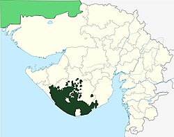
Pakistan is administratively divided into four provinces, one federal territory, and two disputed territories: the provinces of Punjab, Sindh, Khyber Pakhtunkhwa, and Balochistan; the Islamabad Capital Territory; and the administrative territories[Note 1] of Azad Jammu and Kashmir and Gilgit–Baltistan.[Note 2][4][5] As part of the Kashmir conflict with neighbouring India, Pakistan has also claimed sovereignty over the Indian-controlled territories of Jammu and Kashmir and Ladakh since the First Kashmir War of 1947–1948. It also has a territorial dispute with India over Junagadh,[6][7][8][9] but has never exercised administrative authority over either regions. All of Pakistan's provinces and territories are subdivided into divisions, which are further subdivided into districts, and then tehsils, which are again further subdivided into union councils.[10]
History[edit | edit source]
Post-independence[edit | edit source]
 | The factual accuracy of the map included in this section is disputed. (November 2024) |

Pakistan inherited the territory comprising its current provinces from India following the Partition of India on 14 August 1947. Two days after independence, the Muslim-majority Murshidabad district in Bengal was moved out of the Dominion of Pakistan and put within the Dominion of India due to a boundary adjustment by the Radcliffe Commission which was aimed at keeping the Hooghly River entirely within India.[11][12] At its inception, Pakistan consisted of two wings, which were separated from each other by around 1,600 kilometres (990 mi) of Indian territory. The western wing consisted of a merger of the North-West Frontier Province, West Punjab, Sind Province, and Baluchistan CCP. The eastern wing consisted of East Bengal. What later became the Princely states of Pakistan chose at first to remain independent.
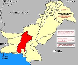
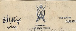
In 1948, Karachi was separated from Sind Province to form the Federal Capital Territory. In 1950, the North-West Frontier Province absorbed the princely states of Amb and Phulra while West Punjab (designated 'West' to distinguish it from India's Punjab in the east) was renamed to simply Punjab. In 1952, the four princely states in the southwest formed the Baluchistan States Union.
In 1955, the One Unit policy was launched by then-Prime Minister Muhammad Ali Bogra, whereby all the provinces and princely states of the western wing were merged to form the provincial wing of West Pakistan, with Lahore serving as its provincial capital. Simultaneously, East Bengal was redesignated as East Pakistan, with Dacca serving as its provincial capital. The One Unit policy aimed to reduce expenditure and to eliminate provincial prejudices, but the military coup of 1958 brought difficulties when the first military President, Ayub Khan, abolished the office of the Chief Minister of West Pakistan in favour of Governor rule.
On 7 September 1958, after four years of negotiations (including six months of intense negotiations), Pakistan purchased the enclave of Gwadar from Oman for ₨.5.5 billion (US$3 million; approximately $22,410,311.42 in 2017).[13] Gwadar formally became a part of Pakistan on 8 December 1958, ending 174 years of Omani rule. In 1960, the federal capital was moved from Karachi to Rawalpindi and in 1961, the Federal Capital Territory was also merged into West Pakistan. In 1966, the capital was again moved to the newly constructed city of Islamabad. In 1962, Dacca was made the legislative capital of the country due to East Pakistan's high population.[14] Following the 1963 Sino–Pakistan Agreement, a part of the Gilgit Agency (controlled by Pakistan since the First Kashmir War) was formally relinquished by Pakistan to the People's Republic of China (the Trans-Karakoram Tract/Shaksgam Valley in northeastern Kashmir) with the provision that the settlement was subject to the final solution of the Kashmir dispute between India and Pakistan.
Since 1970[edit | edit source]
In 1970, the second military President, Yahya Khan, abolished the political structure of West Pakistan and established four new provinces: Sindh, Punjab, Balochistan and the North-West Frontier Province. In 1971, the Bengali-majority wing of East Pakistan seceded from the Pakistani union following the Bangladesh Liberation War, consequently forming the independent People's Republic of Bangladesh. In 1974, the remaining princely states of Hunza and Nagar were abolished and their territories merged into the Gilgit Agency, following which the Northern Areas were formed. In 1975, portions of the districts of Peshawar and Dera Ismail Khan were separated to form the Federally Administered Tribal Areas. In 1981, the region surrounding Islamabad was separated from Punjab province, and renamed to the Islamabad Capital Territory.
In August 2000, divisions were abolished as part of a plan to restructure local governments, followed by elections in 2001. Many of the functions previously handled at a provincial level had been transferred to individual districts and tehsils. In 2008, the government restored the former divisions and appointed commissioners.
In 2009, the Northern Areas were renamed to Gilgit-Baltistan, and retained its formal status as an autonomous territory.[15][16] In 2010, the North-West Frontier Province was formally renamed to Khyber Pakhtunkhwa.[17] In 2018, the National Assembly of Pakistan and Khyber Pakhtunkhwa Provincial Assembly passed the historic FATA Merger Bill with the Twenty-Fifth Constitutional Amendment. On 31 May 2018, the final step in the merger of the Federally Administered Tribal Areas with Khyber Pakhtunkhwa was completed, as then-President Mamnoon Hussain signed the 25th Constitutional Amendment Bill into law. The amendment's signing abolished the Federally Administered Tribal Areas as a separate political entity and merged them into the province of Khyber Pakhtunkhwa.[18][19][20]
Tiers of governance[edit | edit source]
The diagram below outlines the six tiers of government:
Division[edit | edit source]
The Provinces and administrative territories of Pakistan are subdivided into administrative "divisions", Divisional Commissioner is the administrative head of a division. Divisional Commissioner is appointed by the government of Pakistan from Pakistan Administrative Service
District[edit | edit source]
The District Coordination Officer is the administrative head of the District Administration. They have wide-ranging responsibility for overseeing, improving and directing the approved plans of the District Government.[21]
The Zila Nazim used to be the executive head of the District Administration until 2010 when the government gave their powers to the District Coordination Officers also. Their role is similar to district governor or prefect, with responsibility for implementing government strategy and developing initiatives arising out of it.[22]
In order to decentralize administrative and financial authority to be accountable to Local Governments, for good governance, effective delivery of services, and transparent decision making through institutionalized participation of the people at grassroots level, elections to the local government institutions are held after every four years on none party basis by the Chief Election Commissioner of Pakistan.
Tehsil[edit | edit source]
Among the three tiers of local government, tehsil government is the second tier. It is where the functions, responsibilities, and authorities of districts government are divided into smaller units, these units are known as "tehsils". The tehsils are used all over Pakistan except Sindh province where the word "taluka" is used instead, although the functions and authorities are the same. The head of the Tehsil government is "Tehsil Nazim" who is assisted by the tehsil Naib-Nazim. Every tehsil has a Tehsil Municipal Administration, consisting of a tehsil council, Tehsil Nazim, tehsil/taluka municipal officer (TMO), chief officer and other officials of the local council.[23]
Union council[edit | edit source]
Members of the union council including Union Administrator and Vice Union Administrator are elected through direct elections based on adult franchise and on the basis of joint electorate. However, for the election to the reserved seats for women in Zila Council proportionately divided among tehsils or towns shall be all members of the union councils in a tehsil or town. It is the responsibility of the Chief Election Commissioner to organize and conduct these elections.
Current administrative units[edit | edit source]
| Name (English) | Abbr. | Capital and largest city |
Emblem | Flag | Map | Map Key | |
|---|---|---|---|---|---|---|---|
| Azad Jammu and Kashmir[lower-alpha 1] | AJK | Muzaffarabad | .png)
|

|
.svg)
|
6 | |
| Balochistan | BA | Quetta | 
|

|
.svg)
|
1 | |
| Gilgit-Baltistan[lower-alpha 1] | GB | Gilgit | 
|
_(claims_hatched).svg)
|
7 | ||
| Islamabad Capital Territory | IS / ICT | Islamabad | 
|
_(claims_hatched).svg)
|
5 | ||
| Khyber Pakhtunkhwa | KP / KPK | Peshawar | 
|

|
.svg)
|
2 | |
| Punjab | PB | Lahore | 
|

|
.svg)
|
3 | |
| Sindh | SD | Karachi | 
|

|
.svg)
|
4 | |
| Pakistan | PAK | Islamabad |
|

|

|
Note: (a) 2023 Population total excludes Azad Kashmir and Gilgit-Baltistan
Uncontrolled administrative units[edit | edit source]
| Name (English) | Capital and largest city |
Emblem | Flag | Map | |
|---|---|---|---|---|---|
| Jammu and Kashmir[lower-alpha 1] | Srinagar | N/A | N/A | .svg)
| |
| Junagadh[lower-alpha 1] | Junagadh | 
|

|

|
At independence[edit | edit source]
(i) Provinces of Pakistan[edit | edit source]
| Name | Capital | Emblem | Flag | Map |
|---|---|---|---|---|
| East Bengal مشرقی بنگال পূর্ব বাংলা |
Dacca ڈھاکہ ঢাকা |
.svg)
|
None | 
|
| West Punjab مغربی پنجاب পশ্চিম পাঞ্জাব |
Lahore لاہور লাহোর |
|
|

|
| Sind سندھ সিন্ধু |
Hyderabad حیدر آباد হায়দ্রাবাদ |
|
|
_map.gif)
|
| North-West Frontier شمال مغربی سرحدی উত্তর-পশ্চিম সীমান্ত |
Peshawar پشاور পেশাওয়ার |
|
|
_map.gif)
|
| Baluchistan بلوچستان বেলুচিস্তান |
Quetta کوئٹہ কোয়েটা |
|
|

|
(ii) Federal Capital Territory of Pakistan[edit | edit source]
| Name | Capital | Emblem | Flag | Map |
|---|---|---|---|---|
| Federal Capital Territory وفاقی دارالحکومت বেফাকী রাজধানী এলাকা |
Karachi کراچی করাচী |
.svg)
|
|

|
(iii) Princely States of Pakistan[edit | edit source]
Between August 1947 and March 1948, the rulers of the following princely states (which had existed alongside but outside British India) acceded their states to Pakistan, giving up control of their external affairs, while all retaining internal self-government, at least to begin with. This was lost by stages, until by 1974 all of the states had been fully integrated into Pakistan.
| Name | Capital | Coat of arms | Flag | Map |
|---|---|---|---|---|
| Bahawalpur بہاولپور বাহাওয়ালপুর |
Bahawalpur بہاولپور বাহাওয়ালপুর |

|

|

|
| Khairpur خیرپور খয়েরপুর |
Khairpur خیرپور খয়েরপুর |
None | 
|

|
| Kalat قلات কালাত |
Kalat قلات কালাত |
None | 
|

|
| Las Bela لاس بیلا۔ লাস বেলা |
Bela بݔلہ বেলা |
None | 
|

|
| Kharan خاران খারান |
Kharan خاران খারান |
None | 
|

|
| Makran مکران মাকরন |
Kech کیچ কেচ |
None | .svg)
|

|
| Phulra پھلرا ফুলরা |
Amb امب আমবা |
None | None | 
|
| Amb امب আমবা |
Shergard شیر گڑھ শেরগড় |

|

|

|
| Swat سوات সোয়াত |
Saidu Sharif سیدو شریف সাইদু শরীফ |
None | 
|

|
| Dir دیر দির |
Dir دیر দির |
None | 
|

|
| Chitral چترال চিত্রল |
Buni بنی বুনি |

|

|

|
| Hunza ہنزہ হুনজা |
Baltit بلتیت বাল্টিট |

|

|
.png)
|
| Nagar نگر নগর |
Nagarkhas نگرخاس নগরখাস |

|

|

|
| Gilgit گلگت ایجنسی গিলগিট রাষ্ট্রসংস্থা |
Gilgit گلگت গিলগিট |
None | None | 
|
Proposed provinces[edit | edit source]
- Bahawalpur Province
- South Punjab Province
- South Balochistan[24]
- Karachi Province[25] / Jinnahpur Province
- Hazara Province[26][27]
- Gilgit-Baltistan Province[28][29] / Balawaristan Province / Karakoram Province
- Review of the Divisions of Pakistan for New Provinces[30][31]
See also[edit | edit source]
- Cantonment (Pakistan), permanent military stations, which may include significant civilian populations
- Former administrative units of Pakistan
- Former princely states of Pakistan
- ISO 3166-2:PK
- List of administrative units of Pakistan by Human Development Index
- List of capitals in Pakistan
- List of cities in Pakistan by population
- List of Pakistani administrative units by gross state product
- List of Pakistani administrative divisions by highest elevation
- Local government in Pakistan
Notes[edit | edit source]
- ↑ Proclaimed as autonomous by the Government of Pakistan.
- ↑ In November 2020, erstwhile Pakistani prime minister Imran Khan announced that Gilgit–Baltistan would attain "provisional provincial status" after the 2020 assembly election.[1][2][3]
References[edit | edit source]
- ↑ "Fifth province". Fifth province | The Express Tribune. The Express Tribune. 2 November 2020. Archived from the original on 9 November 2020. Retrieved 14 November 2020.
- ↑ "Pakistani PM says he will upgrade status of part of Kashmir, angering India". Reuters. 1 November 2020. Archived from the original on 2 November 2020. Retrieved 14 November 2020.
- ↑ "Gilgit-Baltistan to get provisional provincial status post-election: PM Imran". The News International. Karachi. 2 November 2020. Archived from the original on 14 November 2020. Retrieved 14 November 2020.
- ↑ Tikkanen, Amy; Gorlinski, Virginia; Javed, Murtaza; Tesch, Noah, eds. (20 July 1998). "Azad Kashmir | quasi-state, Kashmir region, India-Pakistan". Encyclopedia Britannica. Archived from the original on 12 October 2020. Retrieved 5 November 2020.
- ↑ "Pakistan's Gilgit-Baltistan: Between the Kashmir conflict and China". Pakistan's Gilgit-Baltistan: Between the Kashmir conflict and China. Archived from the original on 4 November 2020. Retrieved 5 November 2020.
- ↑ Iwanek, Krzysztof (10 August 2020). "Why Did Pakistan Lay Claim to the Indian Territory of Junagadh?". The Diplomat. Retrieved 25 July 2024.
- ↑ Jagessar, Philip (3 October 2019). "Pakistan, India and mapping the contested accession of South Asia's princely states". University of Nottingham. Retrieved 25 July 2024.
- ↑ "After Nepal, Pakistan unveils new political map; Jammu & Kashmir and Ladakh claimed, India retorts". The Himalayan Times. 4 August 2020. Retrieved 25 July 2024.
- ↑ Noronha, Rahul (7 August 2020). "Why Pakistan has claimed Junagadh in its new political map". India Today. Retrieved 25 July 2024.
- ↑ "List of Districts, Tehsils/Talukas" (PDF). Pakistan Bureau of Statistics. July 2014. Archived (PDF) from the original on 9 October 2016. Retrieved 15 October 2016.
- ↑ "Murshidabad Govt Website". Archived from the original on 16 July 2014. Retrieved 17 December 2018.
- ↑ Chatterji, Joya (2007). The Spoils of Partition: Bengal and India, 1947–1967. Cambridge University Press. p. 59. ISBN 9781139468305. Archived from the original on 24 June 2021. Retrieved 21 June 2019.
- ↑ Harris, Matt (11 February 2019). "Who Purchased Gwadar?". CPIC Global. Archived from the original on 26 January 2021. Retrieved 11 July 2021.
- ↑ Pakistan Affairs. Information Division, Embassy of Pakistan. 1968. p. 19. Archived from the original on 23 December 2019. Retrieved 3 November 2019.
- ↑ "Northern Areas renamed Gilgit-Baltistan Poll for assembly, CM in Nov Regional groups unhappy: Autonomy package for NAs approved". DAWN. 30 August 2009. Archived from the original on 8 May 2018. Retrieved 8 May 2018.
- ↑ "Disputed Northern Areas renamed as Gilgit-Baltistan". Hindustan Times. 30 August 2009. Archived from the original on 3 November 2019. Retrieved 3 November 2019.
- ↑ "From NWFP to Khyber Pakhtunkhwa". DAWN. 1 April 2010. Archived from the original on 8 May 2018. Retrieved 8 May 2018.
- ↑ "New dawn for FATA as K-P approves merger - The Express Tribune". 27 May 2018. Archived from the original on 27 May 2018. Retrieved 27 May 2018.
- ↑ Hayat, Arif (27 May 2018). "KP Assembly approves landmark bill merging Fata with province". Archived from the original on 27 May 2018. Retrieved 27 May 2018.
- ↑ Wasim, Amir (31 May 2018). "President signs KP-Fata merger bill into law". Archived from the original on 31 May 2018. Retrieved 31 May 2018.
- ↑ DCO job description Archived 2013-04-30 at the Wayback Machine
- ↑ Zila Nazim job description Archived 2007-07-04 at the Wayback Machine
- ↑ Ebel, Robert E. (January 2006). "Administrative Structure of the Tehsil Municipal Administration". ResearchGate. Archived from the original on 11 July 2021. Retrieved 6 September 2020.
- ↑ "A new province in south Balochistan?". www.thefridaytimes.com. Retrieved 12 September 2021.[dead link]
- ↑ Zaidi, S. Akbar (11 January 2014). "Karachi as a province". Archived from the original on 13 May 2018. Retrieved 31 May 2018.
- ↑ "TSH to shut Hazara after Eid". Dawn. 22 May 2018. Archived from the original on 22 May 2018. Retrieved 31 May 2018.
- ↑ "Treasury benches demand appreciation, opposition criticize govt for ignoring development -". 8 May 2018. Archived from the original on 20 June 2018. Retrieved 31 May 2018.
- ↑ Singh, Pallavi (29 April 2010). "Gilgit-Baltistan: A question of autonomy". The Indian Express. Archived from the original on 20 March 2017. Retrieved 27 December 2016.
But it falls short of the main demand of the people of Gilgit- Baltistan for a constitutional status to the region as a fifth province and for Pakistani citizenship to its people.
- ↑ Shigri, Manzar (12 November 2009). "Pakistan's disputed Northern Areas go to polls". Reuters. Archived from the original on 27 December 2016. Retrieved 27 December 2016.
Many of the 1.5 million people of Gilgit-Baltistan oppose integration into Kashmir and want their area to be merged into Pakistan and declared a separate province.
- ↑ Babakhel, Mohammad Ali (16 January 2019). "New provinces?". DAWN.COM. Archived from the original on 16 June 2020. Retrieved 6 November 2020.
- ↑ "A new provincial map of Pakistan?". The Express Tribune. 7 February 2019. Archived from the original on 24 June 2021. Retrieved 5 January 2021.
External links[edit | edit source]
- Government of Azad Jammu & Kashmir
- Government of Balochistan
- Government of Gilgit-Baltistan
- Government of Islamabad Capital Territory Archived 22 November 2008 at the Wayback Machine
- Government of Khyber Pakhtunkhwa
- Government of Punjab Archived 10 May 2015 at the Wayback Machine
- Government of Sindh Archived 31 May 2013 at the Wayback Machine
Template:Administrative units of Pakistan


