


| Divisions of Pakistan पाकिस्तान के प्रभाग | |
|---|---|
| Also known as: پاکستان کے ڈویژن[A 1] | |
 Map of divisions of Pakistan | |
| Category | Second-level administrative division |
| Location |  Islamic Republic of Pakistan Islamic Republic of Pakistan |
| Number | 37 (as of 2024) |
| Government | Divisional government |
| Subdivisions | Districts Tehsils Union councils |
 |
|---|
| This article is part of a series on the politics and government of Pakistan |

.svg)
|
The administrative units of Pakistan comprise four provinces, two territories in the Kashmir region, and a capital territory. The provinces and territories are further subdivided into 37 divisions, which are subsequently divided into districts, tehsils, and finally union councils. The division system was abolished in 2000 but was subsequently restored in 2008.
These divisions do not encompass the Islamabad Capital Territory. The formerly Federally Administered Tribal Areas (FATA), which previously held the same administrative status as provinces, were merged into Khyber Pakhtunkhwa province and incorporated into neighbouring divisions within that province in 2018.
History[edit | edit source]
The administrative divisions constituted an integral tier of government from colonial times, with the Governor's provinces of British India being subdivided into divisions, which were further divided into districts. At the time of creation in 1947, the new nation of Pakistan comprised two geographically separated wings – eastern and western. Three of Pakistan's provinces were subdivided into ten administrative divisions. The single province in the eastern wing, East Bengal, comprised four divisions – Chittagong, Dacca, Khulna and Rajshahi. West Punjab province contained four divisions – Lahore, Multan, Rawalpindi, and Sargodha. The North-West Frontier Province (as it was then known) had two divisions – Dera Ismail Khan and Peshawar. Most of the former Sind Province became Hyderabad Division. The majority of divisions were named after their respective divisional capitals, though some exceptions existed.
From 1955 to 1970, the One Unit policy consolidated the administrative structure into only two provinces – East and West Pakistan. East Pakistan retained the same divisions as East Bengal previously possessed, while West Pakistan progressively gained seven new divisions to supplement the original six divisions. The Baluchistan States Union was reorganised into Kalat Division, while the former Baluchistan Chief Commissioner's Province became Quetta Division. The princely State of Khairpur, combined with portions of Hyderabad division, formed Khairpur Division. The former princely state of Bahawalpur was established as Bahawalpur Division, thereby joining West Punjab. In 1959, the Federal Capital Territory was absorbed into West Pakistan, and in 1960, it was merged with the district of Las Bela to create the Karachi-Bela Division. In 1969, the princely states of Chitral, Dir and Swat were incorporated into West Pakistan as the Malakand Division, with Saidu serving as the divisional headquarters. Khairpur division was abolished in 1975 and replaced with Sukkur Division. In 1980, Sukkur division was bifurcated to establish Larkana division. Mirpurkhas division was created in 1990 through the bifurcation of Hyderabad division.
Current divisions by administrative units[edit | edit source]
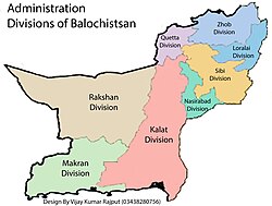
The current administrative structure of Pakistan comprises 37 divisions in total, distributed across five provinces and two Pakistan-administered regions of Kashmir. Within the four provinces, there are 31 divisions: Balochistan contains 8 divisions, Khyber Pakhtunkhwa has 7 divisions, Punjab features 10 divisions, and Sindh encompasses 6 divisions. These divisions are accompanied by their respective population figures as recorded in the Census of Pakistan 2023.[1][2][3][4] The 6 divisions located in Pakistan-occupied Kashmir.
Provinces[edit | edit source]
Balochistan[edit | edit source]

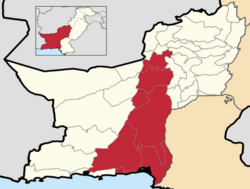
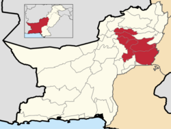
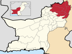
| Division[5] | Districts[5][6] | Area[5] | Population (2023)[5] | Population Density (2023)[5] | Literacy rate (2023)[5] | Map | Capital |
|---|---|---|---|---|---|---|---|
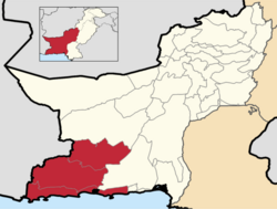
| Khuzdar Division | 41,208 km2 (15,910 sq mi) | 1,547,812 | 37.5/km2 | 39.39% |  |
Khuzdar | |
| Lasbela Division | 44,463 km2 (17,167 sq mi) | 859,935 | 19.3/km2 | 39.05% | |
Lasbela | |
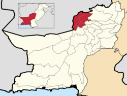
| Loralai Division | 17,047 km2 (6,582 sq mi) | 1,073,686 | 62.98/km2 | 43.89% |  |
Loralai | |
| Zhob Division | 27,128 km2 (10,474 sq mi) | 957,579 | 34.19/km2 | 34.33% |  |
Zhob | |
| Makuran Division | 52,067 km2 (20,103 sq mi) | 1,875,872 | 36.03/km2 | 47.69% |  |
Turbat | |
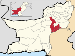
| Naseerabad Division | 9,447 km2 (3,648 sq mi) | 1,601,347 | 169.5/km2 | 34.23% |  |
Dera Murad Jamali | |
| Quetta Division | 9,434 km2 (3,642 sq mi) | 2,908,763 | 308.3/km2 | 51.68% |  |
Quetta | |
| Pishin Division | 11,112 km2 (4,290 sq mi) | 1,663,671 | 292.55/km2 | 51.68% | |
Pishin | |
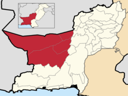
| Rakhshan Division | 98,596 km2 (38,068 sq mi) | 940,001 | 10.55/km2 | 36.84% |  |
Kharan | |
| Koh-e-Sulaiman Division | 14,963 km2 (5,777 sq mi) | 635,552 | 42.47/km2 | 34.70% | |
Rakhni | |
| Sevi Division | 15,934 km2 (6,152 sq mi) | 1,046,548 | 34.0/km2 | 34.70% | |
Sibi |
Khyber Pakhtunkhwa[edit | edit source]

Punjab[edit | edit source]
This section is an excerpt from Divisions of Punjab, Pakistan § List of divisions by population over the years.
| Name | Headquarters | Districts | Area
(km2)[5] |
Population (2023)[5] | Population Density (2023)[5] | Literacy
rate (2023)[5] |
Map |
|---|---|---|---|---|---|---|---|
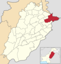
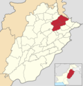
| Bahawalpur[7] | Bahawalpur | 45,588 | 13,400,009 | 293.94/km2 | 52.13% | .svg) | |
| Dera Ghazi Khan[8] | Dera Ghazi Khan | 38,778 | 12,892,465 | 332.47/km2 | 48.00% | .svg) | |
| Faisalabad[9] | Faisalabad | 17,918 | 16,228,526 | 905.71/km2 | 68.80% | .svg) | |
| Gujranwala[10] | Gujranwala | 7,779 | 11,416,686 | 937.11/km2 | 76.41% | _(2022).png) | |
| Gujrat[11] | Gujrat | 9,438 | 7,362,182 | 670/km2 | 76.41% | .png) | |
| Lahore[12] | Lahore | 11,727 | 22,772,710 | 1941.90/km2 | 73.63% | .svg) | |
| Multan[13] | Multan | 15,211 | 14,085,102 | 925.98/km2 | 59.43% | .svg) | |
| Rawalpindi[14] | Rawalpindi | 18,823 | 10,804,250 | 574.50 | 79.9% | .svg) | |
| Sahiwal[15] | Sahiwal | 10,302 | 8,533,471 | 828.33/km2 | 61.02% | .svg) | |
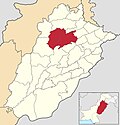
| Sargodha[16] | Sargodha | 26,360 | 9,591,275 | 263.86/km2 | 63.19% |  |
Sindh[edit | edit source]
| Name | Headquarter | Districts | Area
(km2)[5] |
Population (2023)[5] | Pop. Density (2023)[5] | Literacy rate (2023)[5] | Map |
|---|---|---|---|---|---|---|---|
| Hyderabad Division | Hyderabad | 48,670 | 1,16,59,246 | 239.56/km2 | 45.38% | .svg) | |
| Karachi Division | Karachi | 3,527 | 2,03,82,881 | 5,779.10/km2 | 75.11% | .svg) | |
| Larkana Division | Larkana | 15,213 | 70,93,706 | 466.29/km2 | 44.53% | .svg) | |
| Mirpur Khas Division | Mirpur Khas | 28,170 | 46,19,624 | 153.99/km2 | 40.41% | .svg) | |
| Shaheed Benazirabad Division | Nawabshah | 18,176 | 59,30,649 | 326.29/km2 | 49.91% | .svg) | |
| Sukkur Division | Sukkur | 27,158 | 60,10,041 | 221.30/km2 | 59.72% | .svg) |
Pakistan-oocupied Kashmir[edit | edit source]
| Divisions of Azad Jammu & Kashmir | |||||
|---|---|---|---|---|---|
| Division | Area (km2) | Population 1998 Census |
Population 2017 Census |
Population 2023 Census |
Capital |
| Mirpur | 4,388 | 1,198,249 | 1,651,018 | N/A | Mirpur |
| Muzaffarabad | 6,117 | 745,733 | 1,072,150 | N/A | Muzaffarabad |
| Poonch | 2,792 | 1,028,541 | 1,322,198 | N/A | Rawalakot |
| Divisions of Gilgit-Baltistan | |||||
| Division | Area (km2) | Population 1998 Census |
Population 2017 Census |
Population 2023 Census |
Capital |
| Gilgit | - | N/A | N/A | N/A | Gilgit |
| Baltistan | - | N/A | N/A | N/A | Skardu |
| Diamer | - | N/A | N/A | N/A | Chilas |
List of all divisions by population over the years[edit | edit source]
| Division | Pop.
2023 |
Pop.
2017 |
Pop.
1998 |
Pop.
1981 |
Pop.
1972 |
Pop.
1961 |
Pop.
1951 |
Province |
|---|---|---|---|---|---|---|---|---|
| Islamabad | 23,63,863 | 20,06,572 | 8,05,235 | 3,40,286 | – | – | – | Islamabad |
| Bahawalpur | 1,34,00,009 | 1,14,64,031 | 76,35,591 | 40,68,636 | – | – | – | Punjab |
| Lahore | 2,27,72,710 | 1,93,98,081 | 1,20,15,649 | 71,83,097 | – | – | – | |
| Dera Ghazi Khan | 1,28,92,465 | 1,10,14,398 | 65,03,590 | 37,46,837 | – | – | – | |
| Faisalabad | 1,62,28,526 | 1,41,77,081 | 98,85,685 | 66,67,425 | – | – | – | |
| Multan | 1,40,85,102 | 1,22,65,161 | 84,47,557 | 54,08,561 | – | – | – | |
| Rawalpindi | 1,08,04,250 | 1,00,07,821 | 66,59,528 | 44,32,729 | – | – | – | |
| Sargodha | 95,91,275 | 81,81,499 | 56,79,766 | 39,30,628 | – | – | – | |
| Sahiwal | 85,33,471 | 53,62,866 | 42,71,247 | – | – | – | – | |
| Gujranwala | 1,14,16,686 | 97,83,183 | 61,01,052 | 39,34,861 | 32,18,873 | 25,87,061 | 18,35,178 | |
| Gujrat | 73,62,182 | 63,37,678 | 46,85,773 | 32,64,764 | 27,13,675 | 18,72,505 | 16,26,496 | |
| Mirpur Khas | 46,19,624 | 42,28,683 | 25,85,417 | 15,01,882 | – | – | – | Sindh |
| Hyderabad | 1,16,59,246 | 1,05,92,635 | 68,29,537 | 46,78,290 | – | – | – | |
| Karachi | 2,03,82,881 | 1,60,51,521 | 98,56,318 | 54,37,984 | – | – | – | |
| Larkana | 70,93,706 | 61,92,380 | 42,10,650 | 27,46,201 | – | – | – | |
| Shaheed Benazirabad | 59,30,649 | 52,82,277 | 35,10,036 | 25,60,448 | – | – | – | |
| Sukkur | 60,10,041 | 55,38,555 | 34,47,935 | 21,03,861 | – | – | – | |
| Dera Ismail Khan | 31,88,779 | 20,19,017 | 10,91,211 | 6,35,494 | – | – | – | KPK |
| Bannu | 30,92,078 | 20,44,074 | 11,65,692 | 7,10,786 | – | – | – | |
| Kohat | 37,52,436 | 22,18,971 | 13,07,969 | 7,58,772 | – | – | – | |
| Hazara | 61,88,736 | 53,25,121 | 35,05,581 | 27,01,257 | – | – | – | |
| Malakand | 99,59,399 | 75,14,694 | 42,62,700 | 24,66,767 | – | – | – | |
| Mardan | 46,39,498 | 39,97,677 | 24,86,904 | 15,06,500 | – | – | – | |
| Peshawar | 1,00,35,171 | 74,03,817 | 39,23,588 | 22,81,752 | – | – | – | |
| Kalat | 27,21,018 | 25,09,230 | 14,57,722 | 10,44,174 | – | – | – | Balochistan |
| Nasirabad | 20,44,021 | 5,91,144 | 10,76,708 | 6,99,669 | – | – | – | |
| Makran | 18,75,872 | 14,89,015 | 8,32,753 | 6,52,602 | – | – | – | |
| Quetta | 42,59,163 | 41,74,562 | 16,99,957 | 8,80,618 | – | – | – | |
| Sibi | 11,56,748 | 10,38,010 | 6,30,901 | 3,05,768 | – | – | – | |
| Zhob | 9,27,579 | 8,06,238 | 4,68,695 | 3,61,647 | 1,71,989 | – | – | |
| Loralai | 8,70,000 | 7,36,209 | 4,87,748 | – | – | – | – | |
| Rakhshan | 10,40,001 | 7,37,162 | 4,09,473 | – | – | – | – | |
| Mirpur | – | 16,51,018 | 11,98,249 | – | – | – | – | AJK |
| Muzaffarabad | – | 10,72,150 | 7,45,733 | – | – | – | – | |
| Poonch | – | 13,22,198 | 10,28,541 | – | – | – | – | |
| Gilgit | – | – | – | – | – | – | – | Gilgit-Baltistan |
| Baltistan | – | – | – | – | – | – | – | |
| Diamer | – | – | – | – | – | – | – |
List of all divisions by population, area, density, literacy rate etc.[edit | edit source]
| Division | Population
(2023) |
Area (km2) |
Density/ (km2) (2017) |
Literacy
rate (2023) |
Capital | Province |
|---|---|---|---|---|---|---|
| Islamabad | 23,63,863 | 906 | 2214.76 | 83.97% | Islamabad | Islamabad |
| Dera Ismail Khan | 31,88,779 | 9,005 | 224.21 | 41.73% | Dera Ismail Khan | KPK |
| Bannu | 30,92,078 | 4,391 | 465.51 | 42.11% | Bannu | |
| Kohat | 37,52,436 | 7,012 | 316.45 | 50.89% | Kohat | |
| Hazara | 61,88,736 | 17,194 | 309.7 | 60.95% | Abbottabad | |
| Malakand | 99,59,399 | 29,872 | 251.56 | 47.51% | Saidu | |
| Mardan | 46,39,498 | 3,046 | 1312.43 | 56.90% | Mardan | |
| Peshawar | 1,00,35,171 | 4,001 | 1850.49 | 51.32% | Peshawar | |
| Dera Ghazi Khan | 1,28,92,465 | 38,778 | 284.04 | 48.00% | Dera Ghazi Khan | Punjab |
| Lahore | 2,27,72,710 | 11,727 | 1654.14 | 73.63% | Lahore | |
| Faisalabad | 1,62,28,526 | 17,917 | 791.26 | 68.80% | Faisalabad | |
| Bahawalpur | 1,34,00,009 | 45,588 | 251.47 | 52.13% | Bahawalpur | |
| Gujranwala | 1,14,16,686 | 7,779 | 937.11 | 76.41% | Gujranwala | |
| Gujrat | 73,62,182 | 9,438 | 780.05 | 75.30% | Gujrat | |
| Multan | 1,40,85,102 | 17,935 | 683.87 | 59.43% | Multan | |
| Rawalpindi | 1,08,04,250 | 18,823 | 574.5 | 79.90% | Rawalpindi | |
| Sargodha | 95,91,275 | 26,360 | 310.38 | 63.19% | Sargodha | |
| Sahiwal | 85,33,471 | 10,302 | 520.57 | 61.02% | Sahiwal | |
| Karachi | 2,03,82,881 | 3,528 | 4549.75 | 75.11% | Karachi | Sindh |
| Mirpur Khas | 46,19,624 | 28,171 | 150.11 | 40.41% | Mirpur Khas | |
| Hyderabad | 1,16,59,246 | 64,963 | 163.06 | 45.38% | Hyderabad | |
| Larkana | 70,93,706 | 15,543 | 398.4 | 44.53% | Larkana | |
| Shaheed Benazirabad | 59,30,649 | 18,175 | 290.63 | 49.91% | Shaheed Benazirabad | |
| Sukkur | 60,10,041 | 34,752 | 159.37 | 49.72% | Sukkur | |
| Makran | 18,75,872 | 52,067 | 28.6 | 47.69% | Turbat | Balochistan |
| Nasirabad | 20,44,021 | 16,946 | 34.88 | 32.59% | Dera Murad Jamali | |
| Quetta | 42,59,163 | 64,310 | 64.91 | 51.68% | Quetta | |
| Khuzdar | 27,21,018 | 91,767 | 17.85 | 38.72% | Khuzdar | |
| Sibi | 11,56,748 | 27,055 | 38.37 | 34.70% | Sibi | |
| Rakhshan | 10,40,001 | 98,596 | – | 36.84% | Kharan | |
| Zhob | 9,27,579 | 27,128 | 34.2 | 32.33% | Zhob | |
| Loralai | 8,70,000 | 17,260 | 50.4 | 39.89% | Loralai | |
| Mirpur | – | 4,388 | – | – | Mirpur | AJK |
| Muzaffarabad | – | 6,117 | – | – | Muzaffarabad | |
| Poonch | – | 2,792 | – | – | Rawalakot | |
| Gilgit | – | – | – | – | Gilgit | Gilgit-Baltistan |
| Baltistan | – | – | – | – | Skardu | |
| Diamer | – | – | – | – | Chilas |
Notes and References[edit | edit source]
Notes[edit | edit source]
- ↑ पाकिस्तान के डिवीज़न्
References[edit | edit source]
- ↑ "Households, Populations, Household Size and Annual Growth Rate | Balochistan" (PDF). pbs.gov.pk. Pakistan Bureau Statistics. Retrieved 8 May 2025.
- ↑ "Households, Populations, Household Size and Annual Growth Rate | Punjab" (PDF). pbs.gov.pk. Pakistan Bureau Statistics. Retrieved 8 May 2025.
- ↑ "Households, Populations, Household Size and Annual Growth Rate | Khyber Pakhtunkhwa" (PDF). pbs.gov.pk. Pakistan Bureau Statistics. Retrieved 8 May 2025.
- ↑ "Households, Populations, Household Size and Annual Growth Rate | Sindh" (PDF). pbs.gov.pk. Pakistan Bureau Statistics. Retrieved 8 May 2025.
- ↑ 5.00 5.01 5.02 5.03 5.04 5.05 5.06 5.07 5.08 5.09 5.10 5.11 5.12 5.13 "Table 12: Literacy Rate, Enrolment And Out Of School Population By Sex And Rural/Urban 2023" (PDF). Cite error: Invalid
<ref>tag; name ":0" defined multiple times with different content - ↑ "Provincial cabinet approves three new districts". www.nation.com. Retrieved 2023-07-03.
- ↑ "TMA Bahawalpur Division | Local Government and Community Development". lgcd.punjab.gov.pk. Retrieved 2019-04-05.
- ↑ "TMA Dera Ghazi Khan Division | Local Government and Community Development". lgcd.punjab.gov.pk. Retrieved 2019-04-05.
- ↑ "TMA Faisalabad Division | Local Government and Community Development". lgcd.punjab.gov.pk. Retrieved 2019-04-05.
- ↑ "Gujranwala Division | Local Government and Community Development". lgcd.punjab.gov.pk. Retrieved 2019-04-05.
- ↑ "Gujrat Division | Local Government and Community Development". lgcd.punjab.gov.pk. Retrieved 2019-04-05.
- ↑ "Lahore Division | Local Government and Community Development". lgcd.punjab.gov.pk. Archived from the original on 2021-07-09. Retrieved 2019-04-05.
- ↑ "Multan Division | Local Government and Community Development". lgcd.punjab.gov.pk. Retrieved 2019-04-05.
- ↑ "TMA Rawalpindi Division | Local Government and Community Development". lgcd.punjab.gov.pk. Retrieved 2019-04-05.
- ↑ "Sahiwal Division | Local Government and Community Development". lgcd.punjab.gov.pk. Retrieved 2019-04-05.
- ↑ "Sargodha Division | Local Government and Community Development". lgcd.punjab.gov.pk. Retrieved 2019-04-05.
- ↑ "Info" (PDF). www.pbs.gov.pk.
- ↑ "Pakistan Divisions". www.statoids.com.
- ↑ "Population of the districts of KPK" (PDF).
- ↑ "Population of the districts of Punjab" (PDF).
- ↑ "Population of the districts of Balochistan" (PDF).
- ↑ "Population of the districts of Sindh" (PDF).