




m Removing protection template from an unprotected page |
ReinaSligo4 (talk | contribs) No edit summary |
||
| Line 1: | Line 1: | ||
{{Short description|Geographic region in Andhra Pradesh, India}} | |||
{{Use Indian English|date=August 2016}} | {{Use Indian English|date=August 2016}} | ||
{{Use dmy dates|date=August 2016}} | {{Use dmy dates|date=August 2016}} | ||
| Line 9: | Line 9: | ||
{{Infobox settlement | {{Infobox settlement | ||
| name = Rayalaseema | | name = Rayalaseema | ||
| other_name = | | other_name = Tirupati region | ||
| settlement_type = [[ | | settlement_type = [[#Administrative divisions|Geographic region of Andhra Pradesh]] | ||
| image_skyline = {{multiple image | | image_skyline = {{multiple image | ||
| border = infobox | | border = infobox | ||
| Line 25: | Line 25: | ||
}} | }} | ||
| image_alt = | | image_alt = | ||
| image_caption = Clockwise from top: [[Koundinya Wildlife Sanctuary | | image_caption = Clockwise from top: [[Koundinya Wildlife Sanctuary]], [[Monolithic Bull, Andhra Pradesh|Lepakshi Monolithic Bull]], [[Tirumala]] Garudasila, 200 years memorable Pylon in [[Kadapa]], [[Sri Soumyanatha Swamy Temple (Nandalur)]], Konda Reddy Fort, and [[Venkateswara Temple]]. | ||
| nickname = Cultural Region of Andhra Pradesh | | nickname = Cultural Region of Andhra Pradesh | ||
| image_map = Rayalaseema Andhra Pradesh new districts.png | | image_map = Rayalaseema Andhra Pradesh new districts.png | ||
| map_caption = Rayalaseema in Andhra Pradesh | | map_caption = Rayalaseema in Andhra Pradesh | ||
| coordinates = | | coordinates = | ||
| Line 34: | Line 33: | ||
| subdivision_name = {{flagu|India}} | | subdivision_name = {{flagu|India}} | ||
| subdivision_type1 = [[States and union territories of India|State]] | | subdivision_type1 = [[States and union territories of India|State]] | ||
| subdivision_name1 = {{flagicon image|}}[[Andhra Pradesh]] | | subdivision_name1 = {{flagicon image|Emblem of Andhra Pradesh.svg}}[[Andhra Pradesh]] | ||
| subdivision_type2 = [[District|District(s)]] | | subdivision_type2 = [[District|District(s)]] | ||
| subdivision_name2 = *[[ | | subdivision_name2 = *[[Anantapuramu district]] | ||
*[[Annamayya district]] | *[[Annamayya district]] | ||
*[[Chittoor district]] | *[[Chittoor district]] | ||
*[[Kurnool district]] | *[[Kurnool district]] | ||
*[[Markapuram district]] | |||
*[[Nandyal district]] | *[[Nandyal district]] | ||
*[[Sri Sathya Sai district]] | *[[Sri Sathya Sai district]] | ||
*[[Tirupati district]] | *[[Tirupati district]] | ||
*[[Kadapa | *[[Kadapa district]] | ||
| subdivision_type3 = Largest cities | | subdivision_type3 = Largest cities | ||
| subdivision_name3 = *[[ | | subdivision_name3 = *[[Tirupati]] | ||
*[[ | *[[Kurnool]] | ||
*[[Kadapa]] | *[[Kadapa]] | ||
*[[Anantapur]] | |||
| unit_pref = Metric | | unit_pref = Metric | ||
| area_footnotes = <ref>{{cite web|url=http://www.mapsofindia.com/maps/andhrapradesh/andhrapradesh-factsheet.htm|title=Andhra Pradesh Fact Sheet|work=mapsofindia.com}}</ref> | | area_footnotes = <ref>{{cite web|url=http://www.mapsofindia.com/maps/andhrapradesh/andhrapradesh-factsheet.htm|title=Andhra Pradesh Fact Sheet|work=mapsofindia.com}}</ref> | ||
| area_total_km2 = | | area_total_km2 = 81,234 | ||
| area_rank = | | area_rank = 14 | ||
| elevation_footnotes = | | elevation_footnotes = | ||
| elevation_m = | | elevation_m = | ||
| Line 64: | Line 59: | ||
| population_as_of = 2011 | | population_as_of = 2011 | ||
| population_rank = | | population_rank = | ||
| population_density_km2 = | | population_density_km2 = 246 | ||
| population_demonym = | | population_demonym = | ||
| demographics_type1 = Languages | | demographics_type1 = Languages | ||
| Line 73: | Line 68: | ||
| postal_code_type = <!-- [[Postal Index Number|PIN]] --> | | postal_code_type = <!-- [[Postal Index Number|PIN]] --> | ||
| postal_code = | | postal_code = | ||
| registration_plate = AP02, AP03, AP04, AP21, AP39 | | registration_plate = AP02, AP03, AP04, AP21, AP39, AP40 | ||
| blank1_name_sec1 = Largest airport | | blank1_name_sec1 = Largest airport | ||
| blank1_info_sec1 = [[Tirupati Airport]] | | blank1_info_sec1 = [[Tirupati Airport]] | ||
| Line 81: | Line 76: | ||
[[File:Gooty Fort Watchtower.jpg|alt=|thumb|Gooty Fort In Anantapur District]] | [[File:Gooty Fort Watchtower.jpg|alt=|thumb|Gooty Fort In Anantapur District]] | ||
[[File:Gandikota fort view.jpg|thumb|Gandikota Fort view]] | [[File:Gandikota fort view.jpg|thumb|Gandikota Fort view]] | ||
[[File:PSLV-C40- Lift off from First Launch Pad of SDSC SHAR Sriharikota 004.jpg|thumb|Satish Dhawan Space | [[File:PSLV-C40- Lift off from First Launch Pad of SDSC SHAR Sriharikota 004.jpg|thumb|Satish Dhawan Space Centre In Tirupati District]] | ||
'''Rayalaseema''' ([[International Alphabet of Sanskrit Transliteration|IAST]]: ''Rāyalasīma'') is a geographic region in the [[Indian state]] of [[Andhra Pradesh]]. It comprises | '''Rayalaseema''' ([[International Alphabet of Sanskrit Transliteration|IAST]]: ''Rāyalasīma'') ([[Telugu language|Telugu]]: రాయలసీమ) is a geographic region in the [[Indian state]] of [[Andhra Pradesh]]. It comprises nine southern districts of the State, namely [[Kurnool district|Kurnool]], [[Anantapur district|Anantapur]], [[YSR Kadapa district|Kadapa]], [[Chittoor district|Chittoor]], [[Sri Sathya Sai district|Sri Sathya Sai]], [[Nandyal district|Nandyal]], [[Annamayya district|Annamayya]], [[Tirupati district|Tirupati]], [[Markapuram district | Markapuram]]. As of [[2011 census of India]], the region had a population of 15,184,908 and cover an area of {{convert|81,234|km2|mi2|abbr=on}}.<ref name="census">{{cite web|title=Population of AP districts(2011)|url=http://www.ap.gov.in/Other%20Docs/Population.pdf|publisher=ap.gov.in|access-date=25 May 2014|page=14|url-status=dead|archive-url=https://web.archive.org/web/20131112141602/http://www.ap.gov.in/Other%20Docs/Population.pdf|archive-date=12 November 2013|df=dmy-all}}</ref> | ||
== Etymology == | == Etymology == | ||
The region was previously called ''Ceded districts'' during the rule of the [[British Raj]]. This is with reference to the time when the [[Nizam of Hyderabad]], Ali Khan ceded the region to the British as a part of subsidiary alliance. Chilukuri Narayana Rao, a Telugu lecturer and activist from Anantapur deemed the term "ceded" as derogatory and coined the term ''Rayalaseema''.<ref name=":0">{{cite news|url=http://www.thehindu.com/news/national/andhra-pradesh/the-birth-of-rayalaseema/article5948111.ece|title=The birth of Rayalaseema|last1=Correspondent|first1=Special|work=The Hindu|access-date=12 June 2017}}</ref> In the Andhra Mahasabha and Ceded Districts Conference held at [[Nandyal]]a in November 1928, he moved a resolution to the effect which was accepted by the other delegates of the conference. | The region was previously called ''Ceded districts'' during the rule of the [[British Raj]]. This is with reference to the time when the [[Nizam of Hyderabad]], Ali Khan, ceded the region to the British as a part of subsidiary alliance. Chilukuri Narayana Rao, a Telugu lecturer and activist from Anantapur, deemed the term "ceded" as derogatory and coined the term ''Rayalaseema''.<ref name=":0">{{cite news|url=http://www.thehindu.com/news/national/andhra-pradesh/the-birth-of-rayalaseema/article5948111.ece|title=The birth of Rayalaseema|last1=Correspondent|first1=Special|work=The Hindu|access-date=12 June 2017}}</ref> In the Andhra Mahasabha and Ceded Districts Conference held at [[Nandyal]]a in November 1928, he moved a resolution to the effect which was accepted by the other delegates of the conference. | ||
The name ''Rayalaseema'' hearkened back to the [[Vijayanagara]] times, whose Kings used a suffix ''Rāya'' (tadbhava of Sanskrit Rāja) or ''Rāyalu'' in Telugu as their regnal title. The boundaries of Rayalaseema roughly match the territorial extent of the [[Aravidu dynasty]], the last dynasty to rule the Vijayanagara Empire.<ref name=":0" /> People of region coined their land as a '''Raya Desam.''' | |||
=== Post independence === | === Post independence === | ||
| Line 98: | Line 90: | ||
The four districts of the region were part of the [[Madras Presidency]] until 1953.<ref>{{cite web|url=https://news.google.com/newspapers?nid=P9oYG7HA76QC&dat=19531001&printsec=frontpage|work=The Indian Express|via=Google News Archive Search|title=The Indian Express - Google News Archive Search}}</ref> From 1953 to 1956, the region was a part of [[Andhra State]] and in 1956, the [[Telangana]] region was merged with [[Andhra State]] to form [[Andhra Pradesh]] State.<ref>{{cite web|url=https://news.google.com/newspapers?nid=P9oYG7HA76QC&dat=19560221&printsec=frontpage|work=The Indian Express|via=Google News Archive Search|title=The Indian Express - Google News Archive Search}}</ref> On 2 February 1970, three taluks from [[Kurnool district|Kurnool]] i.e., [[Markapur]], [[Cumbum, Andhra Pradesh|Cumbum]] and [[Giddalur]] were merged along with some other taluks of [[Nellore district]] and [[Guntur district]] to form [[Prakasam district]]. | The four districts of the region were part of the [[Madras Presidency]] until 1953.<ref>{{cite web|url=https://news.google.com/newspapers?nid=P9oYG7HA76QC&dat=19531001&printsec=frontpage|work=The Indian Express|via=Google News Archive Search|title=The Indian Express - Google News Archive Search}}</ref> From 1953 to 1956, the region was a part of [[Andhra State]] and in 1956, the [[Telangana]] region was merged with [[Andhra State]] to form [[Andhra Pradesh]] State.<ref>{{cite web|url=https://news.google.com/newspapers?nid=P9oYG7HA76QC&dat=19560221&printsec=frontpage|work=The Indian Express|via=Google News Archive Search|title=The Indian Express - Google News Archive Search}}</ref> On 2 February 1970, three taluks from [[Kurnool district|Kurnool]] i.e., [[Markapur]], [[Cumbum, Andhra Pradesh|Cumbum]] and [[Giddalur]] were merged along with some other taluks of [[Nellore district]] and [[Guntur district]] to form [[Prakasam district]]. | ||
In February 2014, the [[Andhra Pradesh Reorganisation Act, 2014]] bill was passed by the [[Parliament of India]] for the formation of [[Telangana]] state comprising [[List of districts | In February 2014, the [[Andhra Pradesh Reorganisation Act, 2014]] bill was passed by the [[Parliament of India]] for the formation of [[Telangana]] state comprising [[List of districts of Telangana|ten districts]]. [[Hyderabad]] will remain as a joint capital for 10 years for both Andhra Pradesh and Telangana.<ref name=reorganisation>{{cite web |title=The Andhra Pradesh Reorganisation Act, 2014 |url=http://www.indiacode.nic.in/acts2014/6%20of%202014.pdf|website=India Code Legislative Department|publisher=Ministry of Law and Justice|access-date=14 July 2015|page=2|date=1 March 2014}}</ref> The new State of Telangana came into existence on 2 June 2014 after approval from the [[President of India]].<ref>{{cite web | ||
|url=http://www.newindianexpress.com/states/andhra_pradesh/Telangana-State-to-Be-Born-on-June-2/2014/03/04/article2090470.ece|title=Telangana state formation gazette|publisher=The New Indian Express|access-date=14 May 2014}}</ref> The formation of a new state named ''Telangana'' from ''Andhra Pradesh'' is not considered an amendment to the Constitution of India per article 3 and 4 of that document.<ref>{{cite web | url=http://indiankanoon.org/doc/1015123/ | title=Constitution of India Sub-section |website=Indiankanoon.org| date=4 March 2014 | access-date=23 April 2014}}</ref> | |url=http://www.newindianexpress.com/states/andhra_pradesh/Telangana-State-to-Be-Born-on-June-2/2014/03/04/article2090470.ece|archive-url=https://web.archive.org/web/20140307142700/http://www.newindianexpress.com/states/andhra_pradesh/Telangana-State-to-Be-Born-on-June-2/2014/03/04/article2090470.ece|url-status=dead|archive-date=7 March 2014|title=Telangana state formation gazette|publisher=The New Indian Express|access-date=14 May 2014}}</ref> The formation of a new state named ''Telangana'' from ''Andhra Pradesh'' is not considered an amendment to the Constitution of India per article 3 and 4 of that document.<ref>{{cite web | url=http://indiankanoon.org/doc/1015123/ | title=Constitution of India Sub-section |website=Indiankanoon.org| date=4 March 2014 | access-date=23 April 2014}}</ref> | ||
[[File:Rayalaseema in Andhra Pradesh.png|thumb|left|200px|Rayalaseema districts before 4th April 2022]] | [[File:Rayalaseema in Andhra Pradesh.png|thumb|left|200px|Rayalaseema districts before 4th April 2022]] | ||
{{Pie chart | |||
|caption = Languages of Rayalaseema <ref>{{Cite web |title=Table C-16 Population by mother tongue: Andhra Pradesh |url=https://censusindia.gov.in/nada/index.php/catalog/10193/download/13305/DDW-C16-STMT-MDDS-2800.XLSX |publisher=[[Registrar General and Census Commissioner of India]] |access-date=4 January 2023 |archive-date=12 November 2022 |archive-url=https://web.archive.org/web/20221112190710/https://censusindia.gov.in/nada/index.php/catalog/10193/download/13305/DDW-C16-STMT-MDDS-2800.XLSX |url-status=live }}</ref> | |||
|label1 = [[Telugu language|Telugu]] |value1 = 81.09 |color1 = steelblue | |||
|label2 = [[Urdu]] |value2 = 12.10 |color2 = green | |||
|label3 = [[Tamil language|Tamil]] |value3 = 3.00 |color3 = cornflowerblue | |||
|label4 = [[Kannada]] |value4 = 2.13 |color4 = darkslateblue | |||
|label5 = Others |value5 = 1.68 |color5 = grey | |||
|thumb=right}} | |||
== Geography == | == Geography == | ||
Rayalaseema region is located in the southern region of the state of Andhra Pradesh. The region borders the state of [[Tamil Nadu]] to the south, [[Karnataka]] to the west and [[Telangana]] to the north. Some areas in [[Coastal Andhra]], such as [[Markapur revenue division]] of | Rayalaseema region is located in the southern region of the state of Andhra Pradesh. The region borders the state of [[Tamil Nadu]] to the south, [[Karnataka]] to the west and [[Telangana]] to the north, Nellore, Markapuram districts and bay of Bengal in the east. Some areas in [[Coastal Andhra]], such as [[Markapur revenue division]] of Markapuram district, share similar geography, culture and climate to Rayalaseema as they are once part of the Kurnool district.<ref>{{cite news|title=Andhra Pradesh – end of an era|url=http://www.business-standard.com/article/news-ians/andhra-pradesh-end-of-an-era-113073001018_1.html|access-date=8 April 2016|work=Business Standard|date=30 July 2013|location=Hyderabad}}</ref> | ||
===Lake=== | |||
The only lake located in the region of Rayalaseema is [[Pulicat Lake]]. The major part of the lake is located in [[Sullurupeta revenue division|Sullurpeta]] division of [[Tirupati district]]. | |||
[[Pulicat Lake]] is the second largest [[brackish water]] [[lagoon]] in [[India]], (after [[Chilika Lake]]), measuring 759 square kilometres (293 sq mi). Major part of the lagoon comes under [[Tirupati district]] of Andhra Pradesh. The lagoon is one of the three important wetlands to attract [[northeast monsoon]] rain clouds during the October to December season. The lagoon comprises the following regions, which adds up 759 square kilometres (293 sq mi) according to [[Andhra Pradesh]]. | |||
== Education == | == Education == | ||
| Line 109: | Line 112: | ||
=== Universities === | === Universities === | ||
* [[Sri Venkateswara University]] | * [[Sri Venkateswara University]] | ||
* [[Sri | * [[Sri Krishnadevaraya University]] | ||
* [[Yogi Vemana University]] | * [[Yogi Vemana University]] | ||
* [[Rayalaseema University]] | * [[Rayalaseema University]] | ||
| Line 119: | Line 122: | ||
=== Medical colleges === | === Medical colleges === | ||
* [[Sri Venkateswara Medical College]] | * [[Sri Venkateswara Medical College]],[[Tirupati]] | ||
* [[Rajiv Gandhi Institute of Medical Sciences, Kadapa]] | * [[Rajiv Gandhi Institute of Medical Sciences, Kadapa]] | ||
* [[Kurnool Medical College]] | * [[Kurnool Medical College]] | ||
* [[Government Medical College, Anantapur]] | * [[Government Medical College, Anantapur]] | ||
* [[ | * [[Sri Padmavathi Medical College for Women]],[[Tirupati]] | ||
* [[Santharam Medical College, Nandyal]] | * [[Santharam Medical College, Nandyal]] | ||
* [[PES Institute of Medical Sciences & Research, Kuppam]] | * [[PES Institute of Medical Sciences & Research, Kuppam]] | ||
* Govt medical college,[[Pulivendula]] | |||
=== Central institutions === | === Central institutions === | ||
* [[Indian Institute of Technology, Tirupati]] | * [[Indian Institute of Technology, Tirupati]] | ||
* [[Indian Institute of Science Education and Research, Tirupati]] | * [[Indian Institute of Science Education and Research, Tirupati]] | ||
*[[Indian Institute of Information Technology, Sri City]] | |||
* [[Indian Culinary Institute, Tirupati]] | * [[Indian Culinary Institute, Tirupati]] | ||
* [[National Sanskrit University]] | * [[National Sanskrit University]] | ||
| Line 136: | Line 141: | ||
=== Deemed universities === | === Deemed universities === | ||
* [[Sri Sathya Sai University]] | * [[Sri Sathya Sai University]], Puttaparthi | ||
* [[Annamacharya Institute of Technology And Science]], Rajampeta | |||
== Transport == | == Transport == | ||
| Line 144: | Line 150: | ||
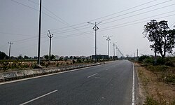
The road network in region consists of many [[National Highway (India)|National Highways]] such as, [[National Highway 40 (India)|NH 40]], [[National Highway 42 (India)|NH 42]], [[National Highway 44 (India)|NH 44]], [[National Highway 140 (India)|NH 140]], [[National Highway 167 (India)|NH 167]], [[National Highway 340 (India)|NH 340]], [[National Highway 67 (India)|NH 67]], [[National Highway 69 (India)|NH 69]], [[National Highway 71 (India)|NH 71]], [[National Highway 716 (India)|NH 716]]. | The road network in region consists of many [[National Highway (India)|National Highways]] such as, [[National Highway 40 (India)|NH 40]], [[National Highway 42 (India)|NH 42]], [[National Highway 44 (India)|NH 44]], [[National Highway 140 (India)|NH 140]], [[National Highway 167 (India)|NH 167]], [[National Highway 340 (India)|NH 340]], [[National Highway 67 (India)|NH 67]], [[National Highway 69 (India)|NH 69]], [[National Highway 71 (India)|NH 71]], [[National Highway 716 (India)|NH 716]]. | ||
[[File:NH 716 Near Renigunta.jpg|thumb|NH 716 Near Renigunta]] | [[File:NH 716 Near Renigunta.jpg|thumb|NH 716 Near Renigunta]] | ||
NH 544F | |||
NH 544G | |||
NH 544DD | |||
=== Railways === | === Railways === | ||
{{Main|Guntakal railway division}} | {{Main|Guntakal railway division}} | ||
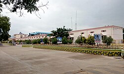
[[File:Long View of Station Building.jpg|thumb|Kadapa Railway Station Premises]] | [[File:Long View of Station Building.jpg|thumb|Kadapa Railway Station Premises]] | ||
| Line 156: | Line 166: | ||
Rayalaseema region has air connectivity with four airports [[Tirupati International Airport]], [[Sri Sathya Sai Airport]], [[Kadapa Airport]] and [[Kurnool Airport]]. | Rayalaseema region has air connectivity with four airports [[Tirupati International Airport]], [[Sri Sathya Sai Airport]], [[Kadapa Airport]] and [[Kurnool Airport]]. | ||
===Waterways=== | ===Waterways=== | ||
[[Dugarajapatnam Port]] is a proposed port in [[Tirupati district]].<ref>{{cite web |title=Decks cleared for Dugarajapatnam port |url=http://timesofindia.indiatimes.com/city/hyderabad/Decks-cleared-for-Dugarajapatnam-port/articleshow/30299638.cms |work=The Times of India}}</ref> | [[Dugarajapatnam Port]] is a proposed port in [[Tirupati district]].<ref>{{cite web |title=Decks cleared for Dugarajapatnam port |url=http://timesofindia.indiatimes.com/city/hyderabad/Decks-cleared-for-Dugarajapatnam-port/articleshow/30299638.cms |work=The Times of India}}</ref> | ||
| Line 163: | Line 174: | ||
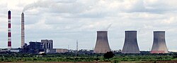
[[File:Rayalaseema Thermal Power Station.jpg|thumb|Rayalaseema Thermal Power Station]] | [[File:Rayalaseema Thermal Power Station.jpg|thumb|Rayalaseema Thermal Power Station]] | ||
Rayalaseema Region has thermal as well solar power plants. [[Rayalaseema Thermal Power Station]] is located in [[Kadapa district]] and Andhra Pradesh government recently sanctioned solar power parks in Rayalaseema districts<ref>{{cite web|url=http://m.thehindubusinessline.com/news/national/ap-solar-corpn-sanctions-4000-mw-power-parks/article8018438.ece|title=AP Solar Corpn sanctions 4,000 MW power parks|date=22 December 2015|website=M.thehindubusinessline.com}}</ref> with a capacity of 4000MW's.Today the state of Andhra Pradesh stood No.1 position in solar power generation with an installed capacity of 1868 MW<ref>{{cite news|url=https://www.thehindu.com/todays-paper/tp-national/tp-andhrapradesh/with-kurnool-solar-park-state-takes-a-giant-leap/article18289685.ece|title=With Kurnool solar park, State takes a giant leap|first=V.|last=Raghavendra|date=29 April 2017|access-date=16 February 2019|newspaper=The Hindu}}</ref> In India and also offers world's largest solar power park of 1000 MW is also located in Andhra Pradesh. | Rayalaseema Region has thermal as well solar power plants. [[Rayalaseema Thermal Power Station]] is located in [[Kadapa district]] and Andhra Pradesh government recently sanctioned solar power parks in Rayalaseema districts<ref>{{cite web|url=http://m.thehindubusinessline.com/news/national/ap-solar-corpn-sanctions-4000-mw-power-parks/article8018438.ece|title=AP Solar Corpn sanctions 4,000 MW power parks|date=22 December 2015|website=M.thehindubusinessline.com}}</ref> with a capacity of 4000MW's.Today the state of Andhra Pradesh stood No.1 position in solar power generation with an installed capacity of 1868 MW<ref>{{cite news|url=https://www.thehindu.com/todays-paper/tp-national/tp-andhrapradesh/with-kurnool-solar-park-state-takes-a-giant-leap/article18289685.ece|title=With Kurnool solar park, State takes a giant leap|first=V.|last=Raghavendra|date=29 April 2017|access-date=16 February 2019|newspaper=The Hindu}}</ref> In India and also offers world's largest solar power park of 1000 MW is also located in Andhra Pradesh. | ||
== Politics == | == Politics == | ||
[[Neelam Sanjiva Reddy]], [[Damodaram Sanjivayya]], [[ | [[Neelam Sanjiva Reddy]], [[Damodaram Sanjivayya]], [[N. Janardhana Reddy]], [[Kotla Vijaya Bhaskara Reddy|K.V. Bhaskara Reddy]], [[N. Chandrababu Naidu]], [[Y. S. Rajasekhara Reddy]], [[N.Kiran Kumar Reddy]] and [[Y. S. Jagan Mohan Reddy]], who served as [[Chief Minister of Andhra Pradesh]], hail from the Rayalaseema region of the state. The region saw as many as [[List of Chief Ministers of Andhra Pradesh|8 chief ministers]] for the state.<ref>{{cite web|url=http://www.telangana.com/why_telangana.htm|title=Telangana.com – Committed For Development|website=Telangana.com|access-date=3 September 2015|archive-date=12 June 2016|archive-url=https://web.archive.org/web/20160612150324/http://www.telangana.com/why_telangana.htm|url-status=dead}}</ref> | ||
=== Factionalism === | === Factionalism === | ||
{{See also|Organised crime in India#Andhra Pradesh factionalism}}Rayalaseema is home to numerous factional families who are often intertwined with political parties and violently clash with each other. Government employees | {{See also|Organised crime in India#Andhra Pradesh factionalism}}Rayalaseema is home to numerous factional families who are often intertwined with political parties and violently clash with each other. Government employees consider as dead postings in the region. The high crime rate is attributed to Rayalaseema's high poverty rate. Although violence has declined since 2000s. Police records estimate that in the past 35 years, about 8,465 civilians have died as a result of factional violence.<ref>{{Cite web|title=Factionalism, Violence and Politics in Andhra Pradesh's Rayalaseema|url=https://thewire.in/politics/rayalaseema-politics-andhra-pradesh|access-date=2021-08-01|website=The Wire}}</ref><ref>{{Cite web|agency=TNN|date=Mar 23, 2019|title=Of the sordid theatre of faction killings in Rayalaseema region {{!}} Vijayawada News - Times of India|url=https://timesofindia.indiatimes.com/city/vijayawada/of-the-sordid-theatre-of-faction-killings-in-rayalaseema-region/articleshow/68529414.cms|access-date=2021-08-01|website=The Times of India|language=en}}</ref> | ||
=== Sri Bagh act === | === Sri Bagh act === | ||
Based on Sri Bagh | Based on Sri Bagh Act signed on 18 November 1937, Kurnool was made the capital of the new state after the division of [[Andhra State]] from the [[Madras State]].<ref>{{cite book|last1=Raju|first1=P. Yenadi|title=Rayalaseema during colonial times : a study un indian nationalism|date=2003|publisher=Northern Book Centre|location=New Delhi|isbn=978-81-7211-139-7|page=214|url=https://books.google.com/books?id=I3C11beCHF0C&q=Sri+Baghpact&pg=PA214|access-date=3 September 2015}}</ref><ref>{{cite web|url=http://www.aponline.gov.in/quick%20links/hist-cult/history_post.html|title=APonline – History and Culture – History-Post-Independence Era|work=aponline.gov.in|url-status=dead|archive-url=https://web.archive.org/web/20131220113947/http://www.aponline.gov.in/quick%20links/hist-cult/history_post.html|archive-date=20 December 2013|df=dmy-all}}</ref> As per the second State Resolution Commission, the state capital was shifted to [[Hyderabad]] upon formation of Andhra Pradesh by [[States Reorganisation Act, 1956]].<ref>{{cite news|title=Revive Sri Bagh pact, demands vedika|url=http://www.thehindu.com/todays-paper/tp-national/tp-andhrapradesh/revive-sri-bagh-pact-demands-vedika/article6128868.ece|access-date=3 September 2015|date=19 June 2014|location=Hyderabad}}</ref> | ||
== See also == | == See also == | ||
* [[Coastal Andhra]] | * [[Coastal Andhra]] | ||
* [[Uttarandhra]] | * [[Uttarandhra]] | ||
* [[List_of_districts_of_Andhra_Pradesh#Districts|List of districts of Andhra Pradesh by regions]] | |||
== References == | == References == | ||
| Line 207: | Line 214: | ||
[[Category:Geography of Kurnool district]] | [[Category:Geography of Kurnool district]] | ||
[[Category:Geography of Tirupati district]] | [[Category:Geography of Tirupati district]] | ||
[[Category:Regions of India]] | |||
Latest revision as of 01:51, 24 March 2026
 | This article has multiple issues. Please help improve it or discuss these issues on the talk page. (Learn how and when to remove these template messages)
|


Rayalaseema
Tirupati region | |
|---|---|
Clockwise from top: Koundinya Wildlife Sanctuary, Lepakshi Monolithic Bull, Tirumala Garudasila, 200 years memorable Pylon in Kadapa, Sri Soumyanatha Swamy Temple (Nandalur), Konda Reddy Fort, and Venkateswara Temple. | |
| Nickname: Cultural Region of Andhra Pradesh | |
| Error creating thumbnail: File with dimensions greater than 12.5 MP Rayalaseema in Andhra Pradesh | |
| Country |  India India |
| State |  Andhra Pradesh Andhra Pradesh |
| District(s) | |
| Largest cities | |
| Area | |
| • Total | 81,234 km2 (31,365 sq mi) |
| • Rank | 14 |
| Population (2011) | |
| • Total | 15,184,908 |
| • Density | 246/km2 (640/sq mi) |
| Languages | |
| • Official | Telugu |
| Time zone | UTC+05:30 (IST) |
| Vehicle registration | AP02, AP03, AP04, AP21, AP39, AP40 |
| Largest airport | Tirupati Airport |
.JPG)

.jpg)


Rayalaseema (IAST: Rāyalasīma) (Telugu: రాయలసీమ) is a geographic region in the Indian state of Andhra Pradesh. It comprises nine southern districts of the State, namely Kurnool, Anantapur, Kadapa, Chittoor, Sri Sathya Sai, Nandyal, Annamayya, Tirupati, Markapuram. As of 2011 census of India, the region had a population of 15,184,908 and cover an area of 81,234 km2 (31,365 sq mi).[2]
Etymology[edit | edit source]
The region was previously called Ceded districts during the rule of the British Raj. This is with reference to the time when the Nizam of Hyderabad, Ali Khan, ceded the region to the British as a part of subsidiary alliance. Chilukuri Narayana Rao, a Telugu lecturer and activist from Anantapur, deemed the term "ceded" as derogatory and coined the term Rayalaseema.[3] In the Andhra Mahasabha and Ceded Districts Conference held at Nandyala in November 1928, he moved a resolution to the effect which was accepted by the other delegates of the conference.
The name Rayalaseema hearkened back to the Vijayanagara times, whose Kings used a suffix Rāya (tadbhava of Sanskrit Rāja) or Rāyalu in Telugu as their regnal title. The boundaries of Rayalaseema roughly match the territorial extent of the Aravidu dynasty, the last dynasty to rule the Vijayanagara Empire.[3] People of region coined their land as a Raya Desam.
Post independence[edit | edit source]
The four districts of the region were part of the Madras Presidency until 1953.[4] From 1953 to 1956, the region was a part of Andhra State and in 1956, the Telangana region was merged with Andhra State to form Andhra Pradesh State.[5] On 2 February 1970, three taluks from Kurnool i.e., Markapur, Cumbum and Giddalur were merged along with some other taluks of Nellore district and Guntur district to form Prakasam district.
In February 2014, the Andhra Pradesh Reorganisation Act, 2014 bill was passed by the Parliament of India for the formation of Telangana state comprising ten districts. Hyderabad will remain as a joint capital for 10 years for both Andhra Pradesh and Telangana.[6] The new State of Telangana came into existence on 2 June 2014 after approval from the President of India.[7] The formation of a new state named Telangana from Andhra Pradesh is not considered an amendment to the Constitution of India per article 3 and 4 of that document.[8]

Geography[edit | edit source]
Rayalaseema region is located in the southern region of the state of Andhra Pradesh. The region borders the state of Tamil Nadu to the south, Karnataka to the west and Telangana to the north, Nellore, Markapuram districts and bay of Bengal in the east. Some areas in Coastal Andhra, such as Markapur revenue division of Markapuram district, share similar geography, culture and climate to Rayalaseema as they are once part of the Kurnool district.[10]
Lake[edit | edit source]
The only lake located in the region of Rayalaseema is Pulicat Lake. The major part of the lake is located in Sullurpeta division of Tirupati district. Pulicat Lake is the second largest brackish water lagoon in India, (after Chilika Lake), measuring 759 square kilometres (293 sq mi). Major part of the lagoon comes under Tirupati district of Andhra Pradesh. The lagoon is one of the three important wetlands to attract northeast monsoon rain clouds during the October to December season. The lagoon comprises the following regions, which adds up 759 square kilometres (293 sq mi) according to Andhra Pradesh.
Education[edit | edit source]
Universities[edit | edit source]
- Sri Venkateswara University
- Sri Krishnadevaraya University
- Yogi Vemana University
- Rayalaseema University
- Dr. Abdul Haq Urdu University
- Dravidian University
- Sri Padmavati Mahila Visvavidyalayam
- JNTU Anantapur
- Sanskrit Vidyapeeth
Medical colleges[edit | edit source]
- Sri Venkateswara Medical College,Tirupati
- Rajiv Gandhi Institute of Medical Sciences, Kadapa
- Kurnool Medical College
- Government Medical College, Anantapur
- Sri Padmavathi Medical College for Women,Tirupati
- Santharam Medical College, Nandyal
- PES Institute of Medical Sciences & Research, Kuppam
- Govt medical college,Pulivendula
Central institutions[edit | edit source]
- Indian Institute of Technology, Tirupati
- Indian Institute of Science Education and Research, Tirupati
- Indian Institute of Information Technology, Sri City
- Indian Culinary Institute, Tirupati
- National Sanskrit University
- Indian Institute of Information Technology, Design and Manufacturing, Kurnool
- Central University of Andhra Pradesh
Deemed universities[edit | edit source]
- Sri Sathya Sai University, Puttaparthi
- Annamacharya Institute of Technology And Science, Rajampeta
Transport[edit | edit source]
Roadways[edit | edit source]

The road network in region consists of many National Highways such as, NH 40, NH 42, NH 44, NH 140, NH 167, NH 340, NH 67, NH 69, NH 71, NH 716.

NH 544F NH 544G NH 544DD
Railways[edit | edit source]

The rail connectivity is getting better with the projects allocated or being part of the region such as, Nandyal–Yerraguntla, Nadikudi–Srikalahasti, Kadapa–Bangalore sections are the under development projects which forms a part of the region.[11] Most of the region falls under the jurisdiction of Guntakal railway division of South Central Railway zone.
Airports[edit | edit source]

Rayalaseema region has air connectivity with four airports Tirupati International Airport, Sri Sathya Sai Airport, Kadapa Airport and Kurnool Airport.
Waterways[edit | edit source]
Dugarajapatnam Port is a proposed port in Tirupati district.[12]
Infrastructure[edit | edit source]
Power[edit | edit source]

Rayalaseema Region has thermal as well solar power plants. Rayalaseema Thermal Power Station is located in Kadapa district and Andhra Pradesh government recently sanctioned solar power parks in Rayalaseema districts[13] with a capacity of 4000MW's.Today the state of Andhra Pradesh stood No.1 position in solar power generation with an installed capacity of 1868 MW[14] In India and also offers world's largest solar power park of 1000 MW is also located in Andhra Pradesh.
Politics[edit | edit source]
Neelam Sanjiva Reddy, Damodaram Sanjivayya, N. Janardhana Reddy, K.V. Bhaskara Reddy, N. Chandrababu Naidu, Y. S. Rajasekhara Reddy, N.Kiran Kumar Reddy and Y. S. Jagan Mohan Reddy, who served as Chief Minister of Andhra Pradesh, hail from the Rayalaseema region of the state. The region saw as many as 8 chief ministers for the state.[15]
Factionalism[edit | edit source]
Rayalaseema is home to numerous factional families who are often intertwined with political parties and violently clash with each other. Government employees consider as dead postings in the region. The high crime rate is attributed to Rayalaseema's high poverty rate. Although violence has declined since 2000s. Police records estimate that in the past 35 years, about 8,465 civilians have died as a result of factional violence.[16][17]
Sri Bagh act[edit | edit source]
Based on Sri Bagh Act signed on 18 November 1937, Kurnool was made the capital of the new state after the division of Andhra State from the Madras State.[18][19] As per the second State Resolution Commission, the state capital was shifted to Hyderabad upon formation of Andhra Pradesh by States Reorganisation Act, 1956.[20]
See also[edit | edit source]
References[edit | edit source]
- ↑ "Andhra Pradesh Fact Sheet". mapsofindia.com.
- ↑ "Population of AP districts(2011)" (PDF). ap.gov.in. p. 14. Archived from the original (PDF) on 12 November 2013. Retrieved 25 May 2014.
- ↑ 3.0 3.1 Correspondent, Special. "The birth of Rayalaseema". The Hindu. Retrieved 12 June 2017.
{{cite news}}:|last1=has generic name (help) - ↑ "The Indian Express - Google News Archive Search". The Indian Express – via Google News Archive Search.
- ↑ "The Indian Express - Google News Archive Search". The Indian Express – via Google News Archive Search.
- ↑ "The Andhra Pradesh Reorganisation Act, 2014" (PDF). India Code Legislative Department. Ministry of Law and Justice. 1 March 2014. p. 2. Retrieved 14 July 2015.
- ↑ "Telangana state formation gazette". The New Indian Express. Archived from the original on 7 March 2014. Retrieved 14 May 2014.
- ↑ "Constitution of India Sub-section". Indiankanoon.org. 4 March 2014. Retrieved 23 April 2014.
- ↑ "Table C-16 Population by mother tongue: Andhra Pradesh". Registrar General and Census Commissioner of India. Archived from the original on 12 November 2022. Retrieved 4 January 2023.
- ↑ "Andhra Pradesh – end of an era". Business Standard. Hyderabad. 30 July 2013. Retrieved 8 April 2016.
- ↑ "Proper rail connectivity still a far cry in Rayalaseema". The Hindu. Retrieved 26 May 2017.
- ↑ "Decks cleared for Dugarajapatnam port". The Times of India.
- ↑ "AP Solar Corpn sanctions 4,000 MW power parks". M.thehindubusinessline.com. 22 December 2015.
- ↑ Raghavendra, V. (29 April 2017). "With Kurnool solar park, State takes a giant leap". The Hindu. Retrieved 16 February 2019.
- ↑ "Telangana.com – Committed For Development". Telangana.com. Archived from the original on 12 June 2016. Retrieved 3 September 2015.
- ↑ "Factionalism, Violence and Politics in Andhra Pradesh's Rayalaseema". The Wire. Retrieved 1 August 2021.
- ↑ "Of the sordid theatre of faction killings in Rayalaseema region | Vijayawada News - Times of India". The Times of India. TNN. 23 March 2019. Retrieved 1 August 2021.
- ↑ Raju, P. Yenadi (2003). Rayalaseema during colonial times : a study un indian nationalism. New Delhi: Northern Book Centre. p. 214. ISBN 978-81-7211-139-7. Retrieved 3 September 2015.
- ↑ "APonline – History and Culture – History-Post-Independence Era". aponline.gov.in. Archived from the original on 20 December 2013.
- ↑ "Revive Sri Bagh pact, demands vedika". Hyderabad. 19 June 2014. Retrieved 3 September 2015.
External links[edit | edit source]
Further reading[edit | edit source]
- Reddy, G. Samba Siva (2006–2007). "Making of Micro-Regional Identities in the Colonial Context: Studying the Rayalaseema Maha Sabha, 1934–1956". Proceedings of the Indian History Congress. 67: 500–513. JSTOR 44147969.
| Central India | (Madhya Pradesh/Uttar Pradesh) (Madhya Pradesh/Uttar Pradesh) (Chhattisgarh/Madhya Pradesh/Maharashtra/Odisha/Telangana) (Madhya Pradesh) (Madhya Pradesh) (Madhya Pradesh) |  |
|---|---|---|
| East India | ||
| North India | (Uttar Pradesh) (Uttar Pradesh) (Uttar Pradesh) (Jammu and Kashmir) (Jammu and Kashmir) (Jammu and Kashmir) (Uttar Pradesh) | |
| Northeast India | (Assam/Manipur) (Assam) (Mizoram) (Assam/Nagaland) (Meghalaya) (Assam) (Tripura) | |
| South India | (Karnataka) (Karnataka) (Karnataka) (Tamil Nadu) (Puducherry) (Kerala) (Andhra Pradesh) (Karnataka/Kerala) | |
| West India | (Maharashtra) (Goa/Karnataka/Maharashtra) (Gujarat) (Maharashtra) (Rajasthan) (Gujarat) (Maharashtra) | |
- Pages using the JsonConfig extension
- Articles needing additional references from May 2017
- Rayalaseema
- Regions of Andhra Pradesh
- Proposed states and union territories of India
- Geography of Anantapur district
- Geography of Chittoor district
- Geography of Kadapa district
- Geography of Kurnool district
- Geography of Tirupati district
- Regions of India