



WikiDwarfBOT (talk | contribs) Cleanup: Source modification. |
basic update formatting to improve readability also and cleaned formatting as per guidelines |
||
| Line 1: | Line 1: | ||
{{Short description|Union territory of India}} | {{Short description|Union territory of India}} | ||
{{good article}} | |||
{{Use Indian English|date= | {{Use Indian English|date=March 2026}} | ||
{{Use dmy dates|date= | {{Use dmy dates|date=March 2026}} | ||
{{Infobox Indian state or territory | {{Infobox Indian state or territory | ||
| name = Andaman and Nicobar Islands | | name = Andaman and Nicobar Islands | ||
| image_skyline = {{ | | image_skyline = {{Photomontage | ||
| | |photo1a = The Coral Reef at the Andaman Islands.jpg | ||
| | |photo2a = Havelock,_Andaman_&_Nicobar_Islands.JPG | ||
| | |photo2b = Ross_Island_(Netaji_Subhas_Bose_Island).jpg | ||
|photo3a = Andaman.jpg | |||
|photo3b = Shaheed Island, Andaman Islands, Tropical beach.jpg | |||
| | |photo4a = Front_View_of_Cellular_Jail,_Port_Blair.JPG | ||
| | |spacing = 1 | ||
| | |size = 250 | ||
| | |position = center | ||
|border = 0 | |||
| | |color = #000000 | ||
|foot_montage = '''Clockwise from top-right''': [[Coral reef]]s around the islands; [[Ross Island, South Andaman district|Ross Island]] in [[South Andaman]]; Beach at [[Neil Island]]; [[Cellular Jail]] in [[Port Blair]]; [[Andaman Sea]]; [[Havelock Island]] in [[Andaman Islands]] | |||
}} | |||
| image_caption = | |||
| type = Union territory | | type = Union territory | ||
| image_seal = Andaman and Nicobar Islands | | image_seal = Seal of Andaman and Nicobar Islands.png | ||
| motto = [[Satyameva Jayate]] ([[Sanskrit]])<br />"Truth alone triumphs"{{force singular}} | |||
| motto = Satyameva Jayate <br/> | |||
| image_map = IN-AN.svg | | image_map = IN-AN.svg | ||
| coordinates = {{coord|11.68|92. | | coordinates = {{coord|11.68|92.72|type:adm1st_region:IN-AN|display=inline,title}} | ||
| region = East India | | region = East India | ||
| formation_date4 = 1 November 1956 | | formation_date4 = 1 November 1956 | ||
| Line 31: | Line 31: | ||
| districts = [[List of districts of the Andaman and Nicobar Islands|3]] | | districts = [[List of districts of the Andaman and Nicobar Islands|3]] | ||
| Lt_governor = [[Devendra Kumar Joshi]] | | Lt_governor = [[Devendra Kumar Joshi]] | ||
| Chief_secretary = | | Chief_secretary = Chandra Bhushan Kumar, [[Indian Administrative Service|IAS]] | ||
| lok_sabha_seats = 1 seat | |||
| lok_sabha_seats = 1 seat | |||
| judiciary = [[Calcutta High Court#Principal seat and benches|Calcutta High Court (Port Blair Bench)]] | | judiciary = [[Calcutta High Court#Principal seat and benches|Calcutta High Court (Port Blair Bench)]] | ||
| area_footnotes = <ref>{{cite | | area_footnotes = <ref name="Area">{{cite report |url=https://mospi.nic.in/sites/default/files/publication_reports/SelectedSocio-EconomicStatisticsIndia2017_27oct17.pdf |title=Socio-economic statistics |publisher=[[Government of India]] |access-date=1 January 2019}}</ref> | ||
| area_total_km2 = 8249 | | area_total_km2 = 8249 | ||
| area_rank = 29th | | area_rank = 29th | ||
| length_km = 467 | | length_km = 467 | ||
| width_km = 24 | | width_km = 24 | ||
| elevation_m = | | elevation_m = | ||
| elevation_max_m = 732 | | elevation_max_m = 732 | ||
| elevation_max_point = [[Saddle Peak (Andaman Islands)|Saddle Peak]] | | elevation_max_point = [[Saddle Peak (Andaman Islands)|Saddle Peak]] | ||
| elevation_min_m = 0 | | elevation_min_m = 0 | ||
| elevation_min_point = [[Andaman Sea]] | | elevation_min_point = [[Andaman Sea]] and [[Bay of Bengal]] | ||
| population_footnotes = <ref> | | population_footnotes = <ref name="Pop">{{cite report |title=State-wise population |url=https://censusindia.gov.in/nada/index.php/catalog/42555/download/46181/2011-IndiaState-0000.xlsx |access-date=1 January 2024 |publisher=[[Government of India]]}}</ref> | ||
| population_total = | | population_total = 380,581 | ||
| population_as_of = 2011 | | population_as_of = 2011 | ||
| population_rank = 34th | | population_rank = 34th | ||
| Line 54: | Line 52: | ||
| population_rural = 62.3% | | population_rural = 62.3% | ||
| population_demonym = [[Andamanese peoples|Andamanese]], [[Nicobarese people|Nicobarese]] | | population_demonym = [[Andamanese peoples|Andamanese]], [[Nicobarese people|Nicobarese]] | ||
| 0fficial_Langs = [[Hindi]] | | 0fficial_Langs = {{ubl|[[Hindi]]|[[Indian English|English]]}} | ||
| official_script = [[Devanagari script]] | | official_script = {{ubl|[[Devanagari]]|[[Latin script|Latin]]}} | ||
| GDP_total = {{ | | GDP_total = {{Increase}}{{INRConvert|0.12499|lc|lk=r}} | ||
| GDP_year = | | GDP_year = 2023-24 | ||
| GDP_rank = 33rd | | GDP_rank = 33rd | ||
| GDP_per_capita = | | GDP_per_capita = {{INRConvert|year=2023|310143|lk=r}} | ||
| HDI = {{ | | GDP_per_capita_rank = 16th | ||
| HDI_year = | | HDI = {{increase}} 0.706 {{color|#0c0|High}}<ref>{{cite web|title=India: Subnational HDI|url=https://globaldatalab.org/shdi/table/shdi/IND/|work=Global Data Labs|access-date=8 June 2025}}</ref> | ||
| HDI_rank = | | HDI_year = 2022 | ||
| literacy = {{ | | HDI_rank = 11th | ||
| literacy_year = | | literacy = 91.1<ref>{{cite report|url=https://www.mospi.gov.in/sites/default/files/publication_reports/AnnualReport_PLFS2023-24L2.pdf|title=Annual Report, Periodic Labour Force Survey (PLFS) (July 2023 – June 2024)|date=23 September 2024|publisher=National Sample Survey Office, [[Ministry of Statistics and Programme Implementation]], [[Government of India]]|pages=A-10|chapter=Appendix-A: Detailed tables, Table (7): Literacy rate (in per cent) of persons of different age groups for each State/UT (aged 7 & above, rural+urban)}}</ref> | ||
| literacy_rank = | | literacy_year = 2024 | ||
| literacy_rank = 11th | |||
| sex_ratio = 876[[female|♀]]/1000 [[male|♂]] | | sex_ratio = 876[[female|♀]]/1000 [[male|♂]] | ||
| sexratio_year = 2011 | | sexratio_year = 2011 | ||
| Line 78: | Line 77: | ||
}} | }} | ||
The '''Andaman and Nicobar Islands''' is a [[union territory]] of | The '''Andaman and Nicobar Islands''' is a [[union territory]] of India comprising 836 islands, of which only 31 are inhabited. The islands are grouped into two main clusters: the northern [[Andaman Islands]] and the southern [[Nicobar Islands]], separated by the {{cvt|150|km}}-wide [[Ten Degree Channel]]. The capital and largest city of the territory, [[Port Blair]] (officially Sri Vijaya Puram), is located approximately {{cvt|1,190|km}} from [[Chennai]] and {{cvt|1,255|km}} from [[Kolkata]] in [[mainland India]]. The islands are situated between the [[Bay of Bengal]] to the west and the [[Andaman Sea]] to the east. The northernmost point is {{cvt|901|km}} from the mouth of the [[Hooghly River]]. [[Indira Point]], located at 6°45'10″N and 93°49'36″E on the southern tip of [[Great Nicobar]], is the southernmost point of India. | ||
The territory | The territory shares [[maritime border]]s with [[Indonesia]] located about {{cvt|165|km}} to the south, [[Myanmar]] located {{cvt|280|km}} to the north-east and [[Thailand]] located {{cvt|650|km}} to the south-east. The islands occupy a total land area of approximately {{cvt|8249|km2}} with a population of 380,581 as per the [[2011 Census of India|2011 census]]. The territory is divided into three [[districts of the Andaman and Nicobar Islands|districts]]: [[Nicobar District|Nicobar]], [[South Andaman district|South Andaman]], and [[North and Middle Andaman district|North and Middle Andaman]] with the capitals at [[Car Nicobar]], Port Blair and [[Mayabunder]] respectively. | ||
Genetic and cultural studies suggest that the indigenous Andamanese people may have been isolated from other populations during the [[Middle Paleolithic]] era, more than 30,000 years ago. Archeological evidence of civilisation has been dated back to 2,200 years. In the 11th century, [[Cholas]], one of the [[Three Crowned Kings|three Tamil kingdoms]], used the islands as a [[naval base]] to launch expeditions in South East Asia. The [[Danish East India Company|Danish]] were the first Europeans to arrive on the islands in 1755. The islands became part of the [[British Raj]] in 1868. During the [[Second World War]], the islands were [[Japanese occupation of the Andaman and Nicobar Islands|invaded]] by the [[Empire of Japan]]. After [[Indian Independence Act 1947|Indian Independence]] in 1947, the region became a province and later a union territory after the adoption of the [[Constitution of India]] in 1950. | |||
The Andaman | The islands host the [[Andaman and Nicobar Command]], the only geographical command operated jointly by the three major wings of the [[Indian Armed Forces]]: the [[Indian Army|Army]], the [[Indian Air Force|Air Force]] and the [[Indian Navy|Navy]]. While [[Hindi]] and English are the official languages, the major spoken languages include [[Bengali language|Bengali]], [[Tamil language|Tamil]] and [[Telugu language|Telugu]]. Indigenous people speak any of the [[Andamanese languages|Andamanese]] or [[Nicobarese languages|Nicobarese]] family of languages. [[Hinduism]] is the majority religion in the union territory, with a significant Christian minority. The islands include [[North Sentinel Island]], home to the [[Sentinelese people]], an [[uncontacted people|uncontacted tribe]]. | ||
==Etymology== | |||
The name Andaman might have been derived from ''Handuman'', after the Indian God [[Hanuman]] from the [[Hinduism|Hindu]] epic [[Ramayana]].<ref name="SA">{{cite web |url=https://southandaman.nic.in/history/ |title=History of South Andaman |work=[[Government of Andaman and Nicobar Islands]] |access-date=1 December 2023}}</ref> The place was called with a similar name by the [[Malay people|Malays]], who used to be involved in [[History of slavery|slave trade]] in the region.<ref name="NA">{{cite web |url=https://northmiddle.andaman.nic.in/history/ |title=History of North Andaman |work=[[Government of Andaman and Nicobar Islands]] |access-date=1 December 2023}}</ref> The place was also referred by various names such as ''Angademan'' by [[Ptolemy]] in the 2nd century CE and ''Angamanian'' by [[Marco Polo]] in 13th century.<ref name="SA"/> Nicobar, which was located in the sea route connecting [[South India]] to [[South East Asia]], was known as ''Nakkavaram'', meaning "open/naked land" borrowed from [[Tamil language]] which later became ''Nicobar''.<ref name="NB">{{cite web |url=http://db.and.nic.in/nicobars/Profile/GeoFeat.php |title=History of Nicobar |publisher=[[Government of India]] |access-date=1 December 2023}}</ref> In the [[Middle Ages|middle ages]] (500-1500 AD), Nicobar was known as ''Lankhabatus'' in [[Arabia]], probably a mis-transcription of the name ''Nakkavaram''. An 11th-century work ''[[Kathasaritsagara|Kathasaritsagar]]'' indicates the name as ''Narkel Dweep'' (meaning Coconut Island in Bengali).<ref name="NB"/> Marco Polo termed the island as ''Necuverann'', while the islands were known as ''Lo-Jan Kuo'' in China, a translation of ''Nakkavar'' with the same meaning.<ref name="NB"/> | |||
==History== | ==History== | ||
{{Main|History of the Andaman and Nicobar Islands}} | {{Main|History of the Andaman and Nicobar Islands}} | ||
=== | === Early history === | ||
Genetic and cultural studies suggest that the indigenous [[Andamanese]] people may have been isolated from other populations during the Middle Paleolithic era, which ended 30,000 years ago.<ref>{{cite journal |last1=Palanichamy |first1=Malliya G. |first2=Suraksha |last2=Agrawal |first3=Yong-Gang |last3=Yao |first4=Qing-Peng |last4=Kong |first5=Chang |last5=Sun |first6=Faisal |last6=Khan |first7=Tapas Kumar |last7=Chaudhuri |first8=Ya-Ping |last8=Zhang |year=2006 |title=Comment on 'Reconstructing the Origin of Andaman Islanders' |journal=[[Science (journal)|Science]] |volume=311 |issue=5760 |pages=470 |doi=10.1126/science.1120176 |pmid=16439647 |doi-access=free}}</ref> Archeological work on the islands has concentrated on [[shell midden]] sites.<ref name="Cooper">{{cite journal |url=https://core.ac.uk/download/pdf/5105366.pdf |title=The Salient Features of Site Location in the Andaman Islands, Indian Ocean |first=Zarine |last=Cooper |journal=Asian Perspectives |volume=36 |year=1996 |page=222 |access-date=1 December 2023}}</ref> The islands were mentioned by [[Ptolemy]] in the 2nd century CE.<ref name="NA"/><ref name="NB"/> | |||
The | === Middle Ages === | ||
[[File:Chola Empire map2.png|thumb|left|The [[Cholas]] used the islands as a [[naval base]] in the 11th century to launch attacks in [[South East Asia]].]] | |||
== | The [[Nicobar islands]] existed on a major trade route connecting India to the South East Asia and had much contact with the outside world for centuries. But there are very few accounts of information as there was no written language with the indigenous people to document their history.<ref name="Williams"/> The islands appeared in the accounts of travellers like [[Faxian]] in the 6th century and [[Yijing (monk)|Yijing]] in the 7th century.<ref name="NB"/> | ||
[[Rajendra Chola | In the 11th century, [[Rajendra Chola I]] of the [[Chola dynasty]] invaded parts of South East Asia using the [[Nicobar islands]] as an intermediate naval base.<ref>{{cite book |last=Hultzsch |first=E. |chapter-url=https://archive.org/details/in.gov.ignca.79603/page/n115/mode/2up?view=theater |title=South Indian Inscriptions: Tamil Inscriptions of Rajaraja, Rajendra Chola and Others in the Rajarajesvara Temple at Tanjavur |publisher=Superintendent, Government Press |year=1991 |volume=2 |location=Chennai |pages=109 |language=Tamil |chapter=Inscriptions on the walls of the central shrine |author-link=E. Hultzsch |access-date=21 September 2022 |issue=1}}</ref><ref>{{cite book |last=Nilakanta Sastri |first=K. A. |chapter-url=https://archive.org/details/in.gov.ignca.4293/page/n229/mode/2up?view=theater |title=The Cholas |publisher=G. S. Press |year=1955 |edition=2nd |location=Chennai |pages=211–213 |chapter=Rajendra- (A.D. 1012-1044) |author-link=K. A. Nilakanta Sastri}}</ref> It was part of an established Chola trade route connecting India and South East Asia, a practice that continued during the subsequent reigns of [[Rajendra II]] and [[Kulothunga I]].<ref>{{cite book |title=Between 2 Oceans (2nd Edn): A Military History of Singapore from 1275 to 1971 |first=Malcolm H. |last=Murfett |page=16}}</ref><ref>{{cite book |title=Asia: A Concise History |first=Arthur |last=Cotterell |page=190}}</ref> Chola inscriptions from [[Thanjavur]], dated to 1050, describe the islands as ''Ma-Nakkavaram'' meaning "great open/naked land" in Tamil.<ref>{{cite book |publisher=Government of India |year=1908 |title=The Andaman and Nicobar Islands: Local Gazetteer |page=57}}</ref><ref>{{cite journal |last=Cœdès |first=George |author-link=George Cœdès |date=1918 |title=Le Royaume De Srivijaya |trans-title=The Kingdom of Srivijaya |url=https://www.jstor.org/stable/43729861 |journal=Bulletin de l'École Française d'Extrême-Orient |language=French |volume=18 |issue=6 |pages=6 |doi=10.3406/befeo.1918.5894 |jstor=43729861 |url-access=registration |access-date=21 September 2022 |archive-date=20 September 2022 |archive-url=https://web.archive.org/web/20220920195311/https://www.jstor.org/stable/43729861 |url-status=live}}</ref> The islands were later noted by Marco Polo in the 13th century and [[Odoric of Pordenone|Friar Oderic]] in the early 14th century.<ref name="NB"/><ref>{{Cite book |last1=Yule |first1=Henry |title=Hobson-Jobson: A Glossary of Colloquial Anglo-Indian Words and Phrases, and of Kindred Terms, Etymological, Historical, Geographical and Discursive |title-link=Hobson-Jobson |last2=Burnell |first2=Arthur Coke |publisher=J. Murray |year=1903 |volume=1 |location=London |pages=624–625 |chapter=Nicobar Islands |chapter-url=https://books.google.com/books?id=PQYYAAAAMAAJ&pg=PA624 |access-date=18 March 2023 |archive-date=26 March 2023 |archive-url=https://web.archive.org/web/20230326164807/https://books.google.com/books?id=PQYYAAAAMAAJ&pg=PA624 |url-status=live }}</ref> | ||
=== | === European colonisation === | ||
[[File:Andaman tribals fishing (c. 1870).jpg|thumb| | [[File:Andaman tribals fishing (c. 1870).jpg|thumb|left|[[Andamanese]] fishing ({{circa|1870}})]] | ||
| | |||
The European [[colonisation]] on the islands began when settlers from the [[Danish East India Company]] arrived on the Nicobar Islands on 12 December 1755.<ref>{{cite book |author1=Danish National Archives |author2=C. Rise Hansen |title=Sources of the History of North Africa, Asia and Oceania in Denmark |url=https://books.google.com/books?id=EL77Dk9jyaQC&pg=PA19 |date=18 October 2011 |publisher=Walter de Gruyter |isbn=978-3-11-097036-4 |pages=19}}</ref> On 1 January 1756, the Nicobar Islands were made into a [[Danish overseas colonies|Danish colony]], first named {{lang|da|Nye Danmark}} (New Denmark) and later {{lang|da|Frederiksøerne}} (Frederick's Islands).<ref name="Haensel">{{cite book |title=Letters on the Nicobar islands, their natural productions, and the manners, customs, and superstitions of the natives with an account of an attempt made by the Church of the United Brethren, to convert them to Christianity |url=https://www.gutenberg.org/ebooks/26781 |first=John Gottfried |last=Haensel |editor=Christian Ignatius Latrobe |year=1812 |access-date=19 May 2021 |archive-date=19 May 2021 |archive-url=https://web.archive.org/web/20210519045816/https://www.gutenberg.org/ebooks/26781 |url-status=live}}</ref> The islands were managed from the Danish colony of [[Tharangambadi|Tranquebar]] in the Indian mainland. However, various attempts to settle on the islands were unsuccessful due to repeated outbreaks of [[malaria]], which led to the death of the colonists.<ref name="Williams">{{cite book |title=Indigenous Peoples: An Encyclopedia of Culture, History, and Threats to Survival |first=Victoria R. |last=Williams |year=2020 |isbn=979-8-216-10219-9 |publisher=Bloomsbury Publishing}}</ref> | |||
| url = https://www.gutenberg.org/ebooks/ | |||
| | |||
| | |||
| | |||
| | |||
| access-date = 19 May 2021 | |||
| archive-date = 19 May 2021 | |||
| archive-url = https://web.archive.org/web/ | |||
| url-status = live | |||
}}</ref> | |||
In 1789, the | Between 1778 and 1783, [[William Bolts]] tried to establish an [[Austrian colonisation of Nicobar Islands|Austrian colony]] on the Nicobar islands, mistakenly assuming that the Danish had abandoned the claims to the islands, renaming them ''Theresa islands''.<ref>{{cite book |url=https://www.gutenberg.org/ebooks/38462 |title=Narrative of the Circumnavigation of the Globe by the Austrian Frigate Novara |volume=II |first=Karl Ritter |last=von Scherzer |page=63 |access-date=19 May 2021 |archive-date=19 May 2021 |archive-url=https://web.archive.org/web/20210519054326/https://www.gutenberg.org/ebooks/38462 |url-status=live}}</ref> In 1789, [[Archibald Blair]] of the [[Royal Indian Navy]] colonised the [[Andaman islands]], and established a [[naval base]].<ref name="SA"/> In 1794, a [[penal colony]] was established on the [[Chatham Island (Andaman Islands)|Chatham island]] and the first batch of 100 prisoners were sent to the island. The prisoners were used for labour, and worked under a civil contract. After two years, the colony was abandoned. The settlement was abandoned in 1796.<ref name="Vaidik">{{cite book |title=Imperial Andamans: Colonial Encounter and Island History |first=A. |last=Vaidik |year=2010 |page=35-37 |isbn=978-0-230-27488-4 |publisher=Palgrave Macmillan}}</ref> | ||
[[File:Cellular jail or kaalaapani.jpg|thumb|left|[[Cellular Jail]] in [[Port Blair]] constructed during the [[British Raj]]]] | |||
[[ | In February 1858, the British re-established a colony in [[Port Blair]].<ref>{{cite journal |url=http://www.jstor.org/stable/44137988 |author=Mathur, L. P. |title=A Historical Study of Euro-Asian Interest in the Andaman and Nicobar Islands |year=1967 |journal=Proceedings of the Indian History Congress |volume=29 |page=60 |jstor=44137988 |access-date=19 May 2021 |archive-date=19 May 2021 |archive-url=https://web.archive.org/web/20210519055108/https://www.jstor.org/stable/44137988 |url-status=live}}</ref> A new [[Ross Island Penal Colony|penal colony]] was established on the [[Ross Island, South Andaman district|Ross Island]] near Port Blair, mainly to house the prisoners of the [[Indian rebellion of 1857]], and the first set of 200 convicts arrived at the island in March 1858.<ref name="Vaidik"/> The prisoners were used for hard labour and the clearing of forests led to frequent confrontation with the native Andamanese people. Many of the prisoners died in conflict, while some were hanged for trying to escape, apart from deaths due to disease and starvation.<ref name="SA"/> Between 1864 and 1868, [[Kingdom of Italy|Italy]] tried to buy the Nicobar islands from the Danish. On 16 October 1868, the Danish sold the rights to the Nicobar islands to the British, which was made part of the [[British Raj|British India]] in 1869.<ref name="Williams"/> In 1872, the Andaman and Nicobar Islands were united under a single command and administered by a chief commissioner based out of Port Blair. The construction of the [[Cellular Jail]] started in 1896 and was completed in 1906. The jail was used to house [[political prisoner]]s and [[Indian Independence movement|independence activists]] away from the Indian mainland.<ref>{{cite journal |url=http://www.jstor.org/stable/41856271 |author=Murthy, R.V.R. |title=Cellular Jail:a Century of Sacrifices |year=2006 |journal=The Indian Journal of Political Science |volume=67 |issue=4 |pages=879–888 |jstor=41856271 |access-date=3 June 2021 |archive-date=3 June 2021 |archive-url=https://web.archive.org/web/20210603044817/https://www.jstor.org/stable/41856271 |url-status=live}}</ref><ref>{{cite news |url=https://www.independent.co.uk/news/long_reads/cellular-jail-india-integral-country-fight-freedom-independence-british-colony-andaman-and-nicobar-islands-port-blair-sushil-dasguputa-a7883691.html |archive-url=https://web.archive.org/web/20201111041305/https://www.independent.co.uk/news/long_reads/cellular-jail-india-integral-country-fight-freedom-independence-british-colony-andaman-and-nicobar-islands-port-blair-sushil-dasguputa-a7883691.html |archive-date=11 November 2020 |url-access=limited |url-status=live |title=How India's Cellular Jail was integral in the country's fight for freedom |date=14 August 2017 |work=[[The Independent]]}}</ref> | ||
[[ | |||
In 1872, the Andaman and Nicobar | |||
===World War II=== | ===World War II=== | ||
[[File:The British Occupation of the Nicobar Islands, 1945 SE5438.jpg|thumb|Surrender of the [[Empire of Japan|Japanese]] to [[Nathu Singh Rathore|Nathu Singh]] aboard ''[[HMS Rocksand (F184)|HMS Rocksand]]'' in 1945]] | |||
[[File:The British Occupation of the Nicobar Islands, 1945 SE5438.jpg|thumb|Japanese | {{see|Japanese occupation of the Andaman and Nicobar Islands}} | ||
During [[Second World War]], the Andaman and Nicobar islands were invaded by [[Empire of Japan|Japan]]. The Japanese captured Port Blair on 23 March 1942 and established control over the islands.<ref>{{cite web |first=Klemen |last=L |url=https://warfare.gq/dutcheastindies/andaman.html |title=The capture of Andaman Islands, March 1942 |date=1999–2000 |work=Forgotten Campaign: The Dutch East Indies Campaign 1941–1942 |access-date=31 January 2024 |archive-date=26 July 2021 |archive-url=https://web.archive.org/web/20210726181150/https://warfare.gq/dutcheastindies/andaman.html |url-status=dead}}</ref> Japan gave provisional control of the islands to the [[Azad Hind]] organisation of [[Subhash Chandra Bose]] on 29 December 1943, and the Andaman and Nicobar islands were renamed as ''Shaheed-Dweep'' (Martyr island) and ''Swaraj-dweep'' (Self-rule island) respectively.<ref name="Japan">{{cite web |url=https://indianexpress.com/article/research/the-forgotten-story-of-the-japanese-ruling-over-a-part-of-india-8887379/ |title=The forgotten story of the Japanese ruling over (a part of) India |work=[[The Indian Express]] |access-date=1 December 2023}}</ref> Bose appointed general [[A. D. Loganathan]] as the governor of the islands. However, he had limited power while the real control of the islands remained with the Japanese.<ref name="Japan"/> | |||
During | |||
There were reports of widespread looting, arson, rape, and [[extrajudicial killing]]s during the Japanese occupation.<ref name="Japan"/><ref name="Red">{{cite book |title=Japanese in the Andaman & Nicobar Islands: Red Sun over black Water |first=Jayant |last=Dasgupta |pages=67, 87, 91–95, 101, 131-133 |isbn=978-8-170-49138-5 |year=2002 |publisher=Manas Publications}}</ref> The residents were often killed by the Japanese for trivial reasons. The largest incident was the [[Homfreyganj massacre]] on 30 January 1944, where 44 local civilians were shot by the Japanese on suspicion of spying.<ref name="Red"/> | |||
Approximately 2,000 people were reportedly killed in Port Blair during the occupation, which represented ten per cent of the pre-war population of the settlement.<ref name="Red"/><ref>{{cite book|title=Kala Pani: History of Andaman & Nicobar Islands, with a Study of Indiaʼs Freedom Struggle|last=Mathur|first=L. P. |year=1985|publisher=Eastern Book Corporation|isbn=978-8-185-07700-0|pages=254-255}}</ref> Japanese vice admiral Teizo Hara and major general Tamenori Sato surrendered to lieutenant colonel [[Nathu Singh Rathore]], commanding officer of the [[Rajput Regiment]], on 15 August 1945 aboard the [[Royal Navy]] ship [[HMS Rocksand (F184)|''HMS Rocksand'']]. On 7 October 1945, the territory was officially handed back to British brigadier J. A. Salomons, commander of the [[116th Indian Infantry Brigade]], and chief administrator Noel Patterson, in a ceremony at the Gymkhana Ground in Port Blair.<ref>{{cite book |title=The Rise and Fall of Imperial Japan |first=Stephen |last=Wynn |year=2020 |isbn=978-1-473-86551-8 |publisher=Pen & Sword Books Limited |page=124}}</ref> | |||
=== | === Post independence === | ||
During the [[Partition of India]], the British announced their intention to retain possession of the islands and use them to resettle [[Anglo-Indians]] and [[Anglo-Burmese people|Anglo-Burmese]] on these islands. The islands were claimed by the [[Indian National Congress]] for India and the [[Muslim League (Pakistan)|Muslim League]] for [[Pakistan]] during the partition negotiations.<ref>{{cite book |title=Andaman and Nicobar Islands: A Geo-political and Strategic Perspective |first=R. V. R. |last=Murthy |year=2007 |isbn=978-8-172-11219-6 |publisher=Northern Book Centre |page=117 |quote=Muslim league pleaded with the British that Andaman and Nicobar should go to the proposed Pakistan}}</ref><ref>{{cite news |url=https://thefridaytimes.com/09-Oct-2020/mr-jinnah-s-bid-for-the-andaman-islands |title=Jinnah's bid for Andaman Islands |date=9 October 2020 |access-date=12 March 2024 |work=[[The Friday Times]] }}</ref> After the [[Indian Independence Act, 1947|Indian Independence]] in 1947, the islands became part of the [[Dominion of India]]. As per the [[Constitution of India]], the Islands were designated as the only part D territory in 1950, to be administered by a lieutenant governor appointed by the [[Government of India]].<ref>{{cite act |title=Constitution of India |chapter=[[Parliament of India]] |year=1950 |url=https://cdnbbsr.s3waas.gov.in/s380537a945c7aaa788ccfcdf1b99b5d8f/uploads/2023/05/2023050195.pdf |publisher=[[Government of India]] |access-date=31 December 2023}}</ref> The islands were later used to resettle people displaced during the partition with a substantial number of displaced immigrants establishing agricultural colonies.<ref>{{cite news |title=Bengali settlers in the Andaman Islands: the performance of homeland |url=https://www.iias.asia/the-newsletter/article/bengali-settlers-andaman-islands-performance-homeland |access-date=29 October 2022 |publisher=IIAS Asia |archive-date=24 June 2021 |archive-url=https://web.archive.org/web/20210624200953/https://www.iias.asia/the-newsletter/article/bengali-settlers-andaman-islands-performance-homeland |url-status=live}}</ref> The islands became a separate [[union territory]] administered by the [[Government of India]], following the [[States Reorganisation Act, 1956|re-organization]] in 1956.<ref name="Planning Commission Report">{{cite book |title=Andaman and Nicobar Islands Development Report |series=State Development Report series |publisher=[[Planning Commission of India]] |edition=illustrated |year=2008 |isbn=978-81-7188-652-4 |url=https://books.google.com/books?id=ujf2N5O4iKgC |access-date=12 March 2011 |archive-url=https://web.archive.org/web/20151209011823/https://books.google.com/books?id=ujf2N5O4iKgC |archive-date=9 December 2015 |url-status=live}}</ref> The islands have been developed into a key defence establishment since the 1980s due to its strategic location in the Bay of Bengal across the [[Strait of Malacca]].<ref>{{cite book |title=India's Defense Strategy and the India–ASEAN Relationship, RSIS Monograph No.28 |author=David Brewster |url=https://www.academia.edu/7716140 |access-date=24 August 2014 |archive-date=26 March 2023 |archive-url=https://web.archive.org/web/20230326031701/https://www.academia.edu/7716140 |url-status=live}}</ref><ref>{{cite news |last1=Sawhney |first1=Pravin |title=A watchtower on the high seas |url=https://www.tribuneindia.com/news/comment/a-watchtower-on-the-high-seas/720929.html |newspaper=[[The Tribune (Chandigarh)|The Tribune]] |access-date=16 April 2019 |date=30 January 2019 |archive-url=https://web.archive.org/web/20190416050217/https://www.tribuneindia.com/news/comment/a-watchtower-on-the-high-seas/720929.html |archive-date=16 April 2019 |url-status=live}}</ref> | |||
On 26 December 2004, the coasts of the Andaman and Nicobar islands experienced {{cvt|10|m}} high [[tsunami]] waves following [[2004 Indian Ocean earthquake and tsunami|an undersea earthquake in the Indian Ocean]] which resulted in more than 2,000 casualties, 46,000 injuries and rendering at least 40,000 homeless.<ref>{{cite book |title=Sumatra-Andaman Islands Earthquake and Tsunami of December 6, 2004: Lifeline Performance |year=2007 |publisher=[[American Society of Civil Engineers]], Technical Council on Lifeline Earthquake Engineering |location=[[Reston, Virginia]] |isbn=9780784409510 |url=http://www.asce.org/Product.aspx?id=2147486137&productid=5511 |editor=Carl Strand and John Masek |url-status=dead |archive-url=https://web.archive.org/web/20131024115815/http://www.asce.org/Product.aspx?id=2147486137&productid=5511 |archive-date=24 October 2013}}</ref> The locals and tourists on the islands suffered the greatest casualties while the indigenous people largely survived unscathed due to movement to high grounds following the oral traditions passed down over generations that warned them to [[emergency evacuation|evacuate]] following earthquakes.<ref>{{cite news |url=http://news.bbc.co.uk/2/hi/south_asia/4181855.stm |work=[[BBC News Online]] |title=Tsunami folklore 'saved islanders' |date=20 January 2005 |access-date=23 April 2010 |archive-url=https://web.archive.org/web/20090930002820/http://news.bbc.co.uk/2/hi/south_asia/4181855.stm |archive-date=30 September 2009 |url-status=live}}</ref> | |||
==Geography== | ==Geography== | ||
[[File: | [[File:Map of Nicobar and Andaman Islands-en.svg|thumb|135px|Map of Andaman and Nicobar Islands]] | ||
[[ | The territory consists of 836 [[islands]] and [[islets]] occupying an area of {{cvt|8249|km2}}, of which only 31 are permanently inhabited.<ref name="UT">{{cite web |url=https://www.andaman.gov.in/about |title=UT Profile |work=[[Government of Andaman and Nicobar Islands]] |access-date=1 December 2023 |archive-date=1 December 2023 |archive-url=https://web.archive.org/web/20231201173150/https://www.andaman.gov.in/about |url-status=dead }}</ref> The islands extend from 6° to 14° North [[latitudes]] and from 92° to 94° East [[longitudes]].<ref>{{cite web |title=Brief Industrial Profile of Andaman and Nicobar Islands |url=http://dcmsme.gov.in/dips/a%20&%20n%20islands.pdf |publisher=[[Ministry of Micro, Small and Medium Enterprises]], [[Government of India]] |access-date=1 May 2019 |archive-url=https://web.archive.org/web/20151106072349/http://dcmsme.gov.in/dips/A%20%26%20N%20Islands.pdf |archive-date=6 November 2015 |url-status=live}}</ref> The islands are grouped into the north Andaman Islands and south Nicobar Islands, separated by the {{cvt|150|km}} wide [[Ten Degree Channel]].<ref name="UT"/> The Andamans cover an area of {{cvt|6408|km2}} while the Nicobar group covers an area of {{cvt|1841|km2}}.<ref name="UT"/> The highest point is the [[Saddle Peak (Andaman Islands)|Saddle Peak]] at {{cvt|732|m}}, located in North Andaman Island.<ref>{{cite encyclopedia |title=Saddle peak |url=https://www.britannica.com/place/Saddle-Peak |access-date=1 December 2023 |encyclopedia=[[Britannica]]}}</ref> | ||
[[File:Barren Volcano, Barren Island, Andaman and Nicobar Islands, India—Cropped.png|thumb|left|upright=0.8|[[Barren Island (Andaman Islands)|Barren Island]], the only [[active volcano]] in India]] | |||
The | The northernmost point of the islands is {{cvt|901|km}} away from the mouth of the [[Hooghly River]] in the Indian mainland. The territory shares [[maritime border]]s with [[Indonesia]] located about {{cvt|165|km}} to the south, [[Myanmar]] located {{cvt|280|km}} to the north-east and [[Thailand]] located {{cvt|650|km}} to the south-east.<ref>{{cite report |title=Maritime Boundaries of India - A Case Study |year=1990 |url=https://core.ac.uk/download/56693807.pdf |publisher=[[University of Rhode Island]] |access-date=1 December 2023}}</ref> Indira Point, the southernmost point of India, is located at 6°45'10″N and 93°49'36″E at the southern tip of [[Great Nicobar]].<ref>{{cite web |url=https://www.dgll.nic.in/DGLL-light-house-location/about-portblair/indira-point-lighthouse |title=Indira Point |publisher=[[Government of India]] |access-date=1 December 2023}}</ref> The capital and largest city is [[Port Blair]] (officially Sri Vijaya Puram<ref>{{cite press release|title=Government has decided to rename the capital of Andaman & Nicobar Islands Port Blair as Sri Vijaya Puram|url=https://pib.gov.in/PressReleaseIframePage.aspx?PRID=2054647|work=[[Press Information Bureau]]|access-date=13 September 2024|date=13 September 2024}}</ref>), located {{cvt|1190|km}} from [[Chennai]] and {{cvt|1255|km}} from [[Kolkata]] on the Indian mainland.<ref name="Planning Commission Report"/> [[Barren Island (Andaman Islands)|Barren Island]], the only [[active volcano]] in India, is located in the Andaman Sea.<ref>{{cite web |url=https://volcano.si.edu/volcano.cfm?vn=260010 |title=Barren Island |publisher=[[Smithsonian]] |access-date=1 December 2023}}</ref><ref>{{cite web |url=https://www.incredibleindia.org/content/incredible-india-v2/en/destinations/andaman-and-nicobar/barren-island.html |title=Barren Island |publisher=[[Ministry of Tourism (India)|Ministry of Tourism]], [[Government of India]] |access-date=1 December 2023}}</ref><ref>{{cite news |url=https://www.news18.com/news/buzz/did-you-know-india-has-an-active-volcano-its-located-in-andamans-barren-island-4413956.html |title=Did You Know India Has an Active Volcano? It's Located in Andaman's Barren Island |date=7 November 2021 |access-date=1 December 2023 |work=[[News18]] }}</ref> | ||
The islands have a {{cvt|1962|km}} long coast-line.<ref name="Bio"/> The topography of the territory varies significantly across various islands. The islands may have sandy, rocky [[sandstone]] or marshy beaches on the coastlines and might be surrounded by [[shoals]] and [[coral reef]]s.<ref name="Topo"/> The altitude varies significantly from completely flat islands to gradually raising topography from the coast to the interior in larger islands.<ref name="Topo"/> The islands are generally surrounded by shallow seas of varying depths in the vicinity with some deep natural bays occurring along certain coasts.<ref name="Topo"/> The islands have a moderate temperature around the year with the average ranging from {{cvt|23 to 31|°C}}.<ref name="Climate">{{cite web |url=https://www.andamantourism.gov.in/about.php |title=About Andamans |work=[[Government of Andaman and Nicobar Islands]] |access-date=1 December 2023}}</ref> The islands have a [[tropical climate]] with warm summers and not so chill winters.<ref name="Climate"/> The rainfall is dependent on the [[monsoon]]s and [[tropical cyclone]]s are common in late summer.<ref name="Climate"/> | |||
===Flora=== | === Flora and fauna === | ||
{{further|List of endemic birds of the Andaman and Nicobar Islands}} | |||
[[File:Havelock_Island,_Canopy_of_tropical_moist_evergreen_forest,_Andaman_Islands.jpg|thumb|Tropical [[Evergreen forests]] in the interior of the islands]] | |||
The | The islands have [[mangrove]]s interspersed with marshes, [[coconut tree]]s or dispersed bushy vegetation along the coast.<ref name="Topo">{{cite report |title=Maricultural potential Andaman and Nicobar |url=http://eprints.cmfri.org.in/809/1/Bulletin_No_34.pdf |publisher=[[Central Marine Fisheries Research Institute]] |year=1983 |access-date=1 December 2023}}</ref> There are twelve types of forests that occur in the islands including [[evergreen forest|evergreen]], [[deciduous forest|deciduous]], mangrove, [[littoral]], [[bamboo]], [[Montane ecosystems|sub-montane]] and [[brackish water]] forests.<ref name="UT1">{{cite web |url=http://www.and.nic.in/andaman/flora.php |title=Flora and Fauna |work=[[Government of Andaman and Nicobar Islands]] |access-date=1 December 2023}}</ref> [[North Andaman]] is characterised by wet evergreen forests with [[climbing plants]], [[Middle Andaman]] has moist deciduous forests and [[South Andaman]] islands have [[epiphytic]] vegetation, mostly [[ferns]] and [[orchids]].<ref name="UT1"/> The North Nicobar islands are mostly barren with [[grasslands]] while evergreen forests form the dominant vegetation in the central and southern islands of the Nicobar group.<ref name="UT1"/> The forest coverage is estimated to be 86.2% of the total land area with about 2,200 varieties of plants of which 200 are [[endemic]] and 1,300 do not occur in mainland India.<ref name="UT1"/> There are more than 200 species used for timber.<ref name="UT1"/> | ||
[[ | |||
{{multiple image | |||
| total_width = 280 | |||
| image1 = Elephant at Andaman and Nicobar Islands.jpg | |||
| caption1 = [[Indian elephant]]s were introduced in the islands during the 19th century to move timber. | |||
| align = left | |||
| image2 = Nicobar Pigeon 820.jpg | |||
| caption2 = [[Nicobar pigeon]], the closest living relative to the extinct [[Dodo]] | |||
}} | |||
There are | There are more than 8300 species of fauna of which 1117 are endemic to the islands.<ref name="Fauna">{{cite report |url=https://faunaofindia.nic.in/PDFVolumes/spb/057/index.pdf |title=Endemic Fauna of Andaman and Nicobar Islands Bay of Bengal |publisher=[[Zoological Survey of India]] |access-date=1 December 2023 |year=2013}}</ref><ref>{{cite book |last1=Rao |first1=Kailash Chandra |last2=Devi |first2=Kamala |year=2013 |title=Endemic Animals of Andaman and Nicobar Islands |isbn=978-81-8171-351-3 |publisher=[[Zoological Survey of India]]}}</ref> Most of the larger species were introduced by colonists and travellers, some of which became endemic due to their prolonged isolation. There are about 55 mammal species of which 32 are endemic with 26 species of rats and 14 species of bats, the most among the mammals.<ref name="UT1"/><ref name="Bio"/> The [[endangered species|endangered]] [[Indian elephant]] can be found in forested or mountainous areas of the islands, which were originally introduced from the mainland to help with the timber extraction in 1883.<ref>{{cite web |title=The incredible life of India's iconic swimming elephant |url=https://qz.com/india/749169/the-incredible-life-of-indias-iconic-swimming-elephant/ |access-date=22 June 2020 |date=4 August 2016 |work=Qz |first=Maria |last=Thomas |archive-date=22 June 2020 |archive-url=https://web.archive.org/web/20200622170915/https://qz.com/india/749169/the-incredible-life-of-indias-iconic-swimming-elephant/ |url-status=live}}</ref> Endangered and critically endangered species endemic to the islands include the [[Andaman White-toothed Shrew|Andaman white-toothed shrew]], [[Andaman Spiny Shrew|Andaman spiny shrew]], [[Jenkin's Shrew|Jenkin's shrew]], [[Nicobar shrew|Nicobar spiny shrew]], [[Nicobar Tree Shrew|Nicobar tree shrew]], [[Miller's Nicobar rat]], [[palm rat]], [[Andaman teal]], [[Nicobar scops owl]], [[Andaman boobook]], and [[Minervarya charlesdarwini|Darwin's eastern frog]].<ref name="Fauna"/> Other large fauna include [[wild boar]], [[spotted deer]], [[barking deer]] and [[sambar deer]].<ref name="UT1"/> There are about 270 species of birds in the islands of which 90 are endemic.<ref name="Fauna"/> The islands' [[caves]] are nesting grounds for the [[edible-nest swiftlet]], whose nests are prized for [[bird's nest soup]].<ref>{{cite report |first=R. |last=Sankaran |year=1999 |url=http://www.traffic.org/species-reports/traffic_species_birds8.pdf |title=The impact of nest collection on the Edible-nest Swiftlet in the Andaman and Nicobar Islands |access-date=4 July 2010 |publisher=[[Salim Ali Centre for Ornithology and Natural History]] |location=Coimbatore}}</ref> The islands serve as an intermediate resting site for birds such as [[Horsfield's bronze cuckoo]], [[Zappey's flycatcher]] and [[Javan pond heron]] during long distance [[Bird migration|migration]]s.<ref>{{cite web |last=Singh |first=Shiv Sahay |date=21 April 2019 |title=In a first, east Asian birds make Andaman stopover |work=[[The Hindu]] |url=https://www.thehindu.com/news/national/other-states/in-a-first-east-asian-birds-make-andaman-stopover/article26905336.ece |access-date=7 March 2021 |issn=0971-751X |archive-date=7 November 2020 |archive-url=https://web.archive.org/web/20201107235922/https://www.thehindu.com/news/national/other-states/in-a-first-east-asian-birds-make-andaman-stopover/article26905336.ece |url-status=live}}</ref> The [[Nicobar pigeon]] found in the islands is the closest living relative to the extinct [[dodo]].<ref>{{cite journal |doi=10.1126/science.295.5560.1683 |last1=Shapiro |first1=B. |last2=Sibthorpe |first2=D. |last3=Rambaut |first3=A. |last4=Austin |first4=J. |last5=Wragg |first5=G. M. |last6=Bininda-Emonds |first6=O. R. P. |last7=Lee |first7=P. L. M. |last8=Cooper |first8=A. |date=2002 |title=Flight of the Dodo |journal=[[Science (journal)|Science]] |volume=295 |issue=5560 |pages=1683 |pmid=11872833 |url=http://pgl.soe.ucsc.edu/dodo_Shapiro02.pdf}}</ref> | ||
[[File:Coral_reef_Elephant_Beach_,Andaman_03.jpg|thumb|[[Coral]]s around the [[Havelock Island]]]] | |||
There are about 64 species of reptiles of which half of them are endemic to the islands.<ref name="Fauna"/> More than 1350 species of [[echinoderm]]s and [[mollusc]]s and 200 species of [[coral]]s are found in the seas surrounding the islands.<ref name="Bio"/> Larger marine species include [[salt water crocodile]]s, [[dugong]]s, [[turtles]], [[dolphins]] and [[whales]].<ref name="Bio"/> There are more than 1350 species of [[fishes]] including 13 [[fresh water]] species.<ref name="Fauna"/> The islands are well known for prized [[shellfish]], the commercial exploitation of which began in the early 20th century.<ref name="UT1"/> The territory is home for about 896 species of winged insects including 225 [[butterfly]] species.<ref name="Fauna"/><ref name="UT1"/> | |||
There are about nine [[national park]]s, 96 [[wildlife sanctuaries]] and one [[biosphere reserve]] in the islands.<ref>{{cite web |url=https://wiienvis.nic.in/Database/Andaman_Nicobar_Islands_7843.aspx |title=Andaman and Nicobar Islands |publisher=Environmental Information System, [[Ministry of Environment, Forest and Climate Change]], [[Government of India]] |access-date=1 December 2023}}</ref><ref name="Bio">{{cite report |url=https://www.andamantourism.gov.in/admin-pannel/docfile/46-biodiversity.pdf |title=Biodiversity of Andaman and Nicobar |work=[[Government of Andaman and Nicobar Islands]] |access-date=1 December 2023}}</ref> The Andaman regional centre of the [[Zoological Survey of India]] was established in 1977.<ref>{{cite web|url=https://zsi.gov.in/regional-centres/en?rc=44|title=Regional centres|work=[[Zoological Survey of India]]|access-date=1 June 2025}}</ref> The [[Mahatma Gandhi Marine National Park]] was established in 1983 and consists of 15 islands in South Andaman.<ref>{{cite web|url=https://www.incredibleindia.gov.in/en/andaman-and-nicobar-islands/sri-vijaya-puram/mahatma-gandhi-marine-national-park|title=Mahatma Gandhi Marine National Park|work=[[Government of India]]|access-date=1 June 2025}}</ref> | |||
{|class="wikitable" style="text-align:left;" style="font-size: 85%" | |||
|+Official symbols of Andaman and Nicobar<ref name="Symbol">{{cite web |url=https://wiienvis.nic.in/KidsCentre/state_symbols_india_8411.aspx |title=State Symbols of India |publisher=Environmental Information System, [[Ministry of Environment, Forest and Climate Change]], [[Government of India]] |access-date=30 August 2023}}</ref> | |||
{|class=" | |||
| | |||
|- | |- | ||
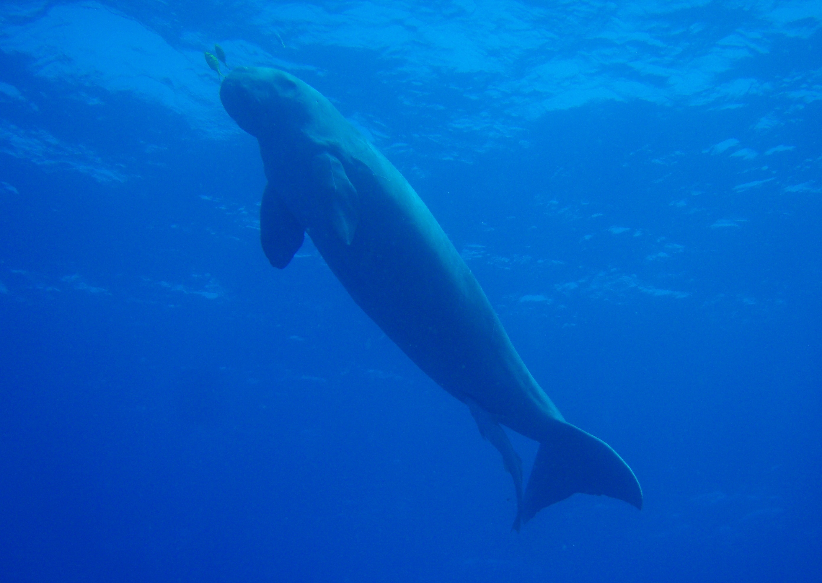
|[[ | |[[List of Indian state animals|Animal]] | ||
|[[Dugong]] (''Dugong dugon'') | |||
|[[File:Dugong.JPG|75px]] | |||
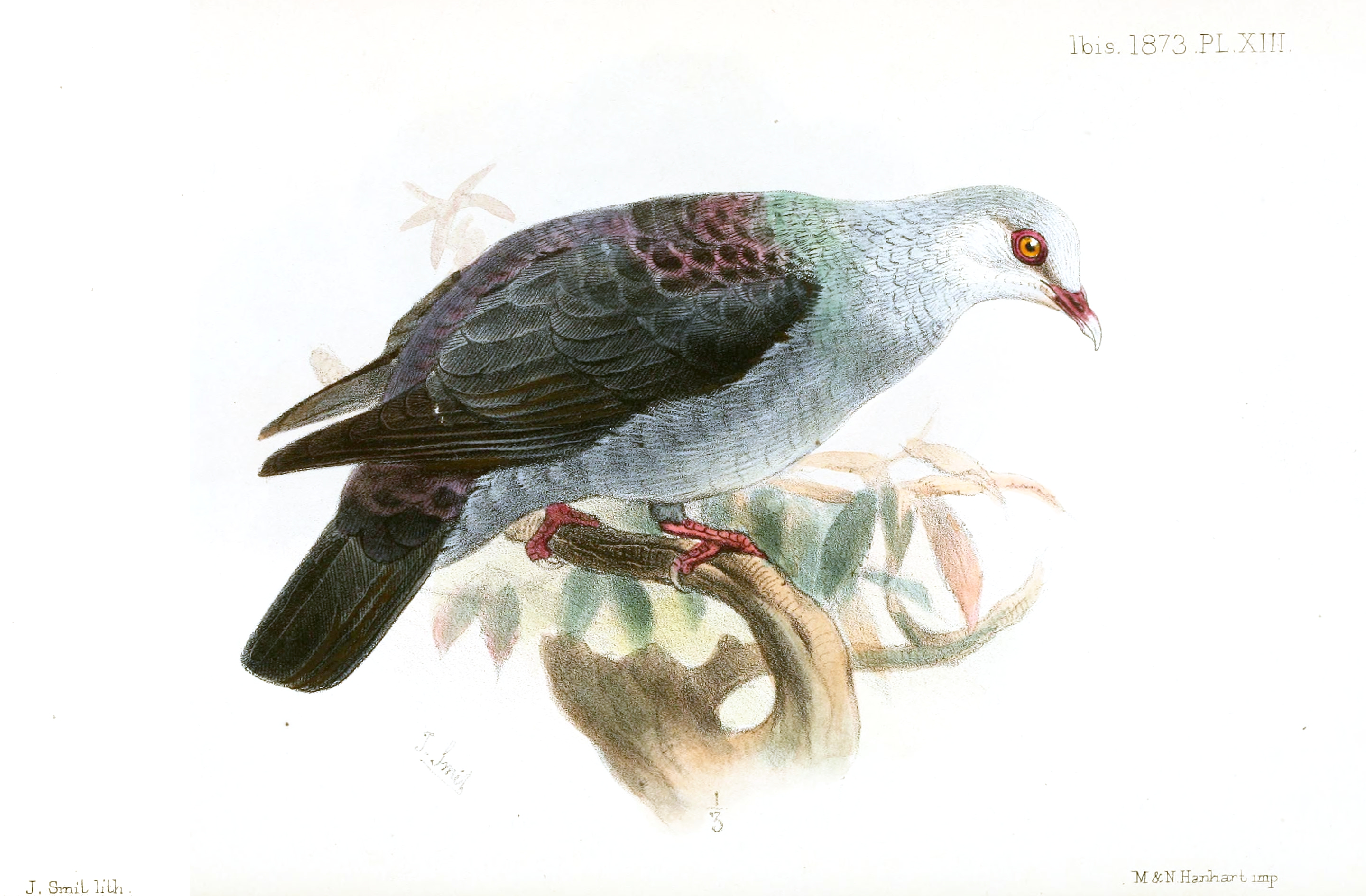
|[[List of Indian state birds|Bird]] | |||
|[[Andaman wood pigeon]] (''Columba palumboides'') | |||
|[[File:IanthoenasColumboidesSmit.jpg|75px]] | |||
|- | |- | ||
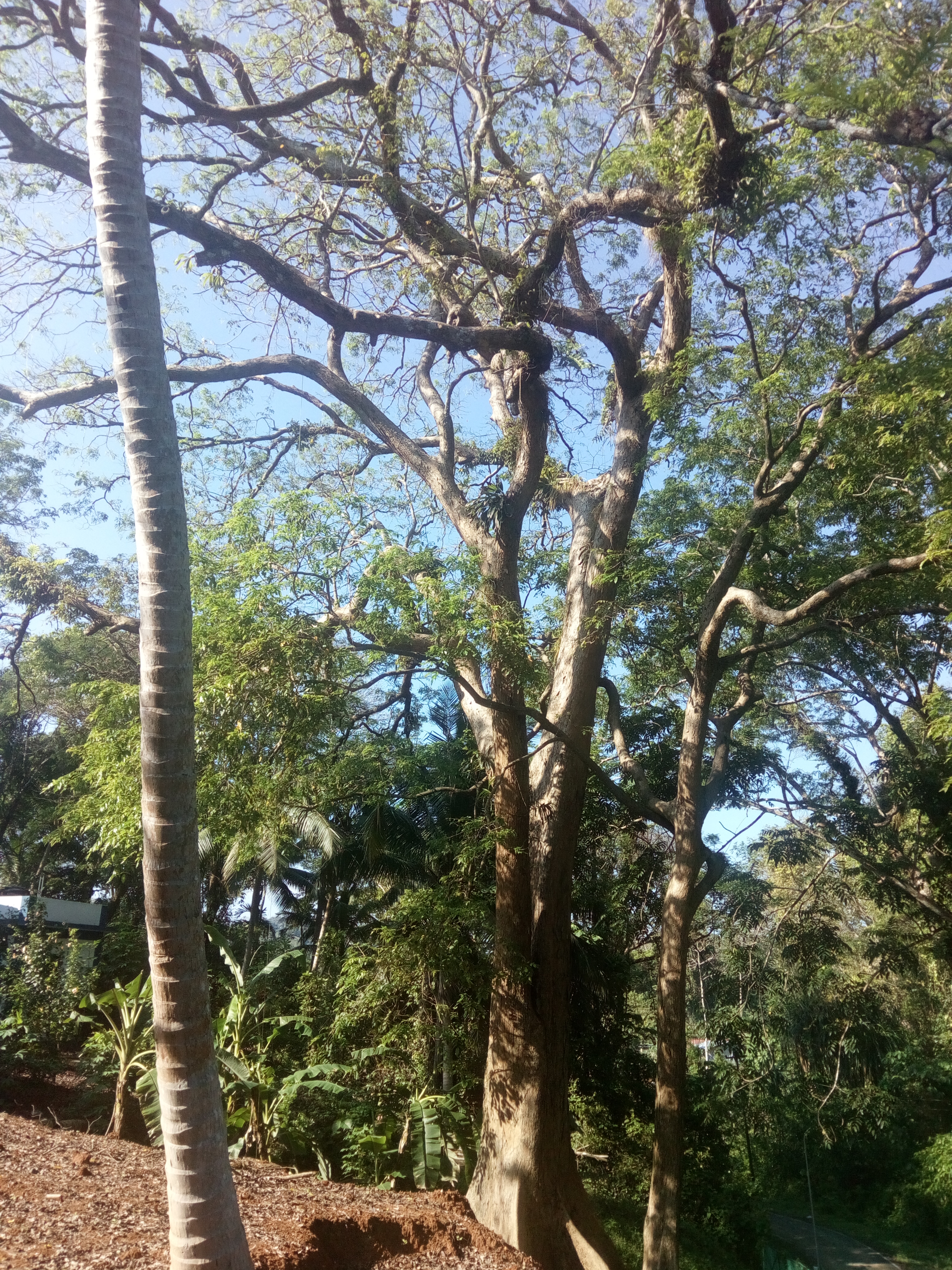
|[[List of Indian state trees|Tree]] | |||
|[[Andaman padauk]] (''Pterocarpus dalbergioides'') | |||
|[[File:Andeman padauk 05.jpg|75px]] | |||
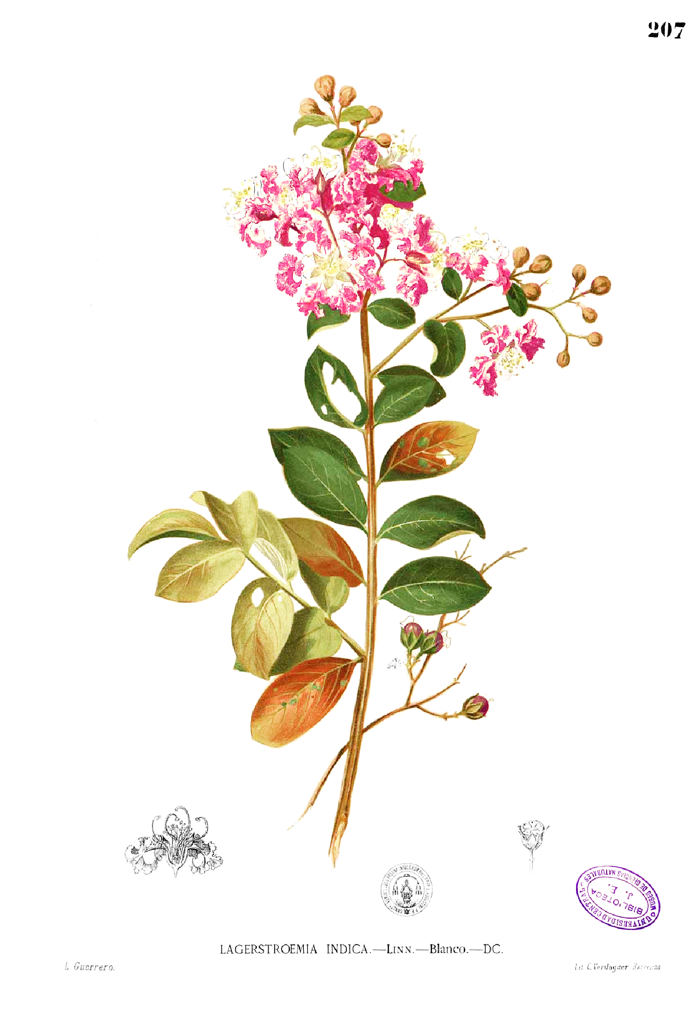
|[[List of Indian state flowers|Flower]] | |||
|[[Lagerstroemia|Pyinma]] (''Lagerstroemia hypoleuca'') | |||
|[[File:Lagerstroemia indica Blanco1.207.png|75px]] | |||
|} | |} | ||
==Demographics== | |||
{{Historical population|state=collapsed|source=[[Census of India]]<ref>{{cite report |url=https://www.censusindia.gov.in/2011census/PCA/A2_Data_Table.html |title=Decadal Variation In Population Since 1901 |website=Census of India : Office of the Registrar General & Census Commissioner, India |access-date=19 May 2021 |archive-date=10 October 2021 |archive-url=https://web.archive.org/web/20211010234955/https://www.censusindia.gov.in/2011census/PCA/A2_Data_Table.html |url-status=live}}</ref><ref name="UT"/> | |||
|1901|24649 | |||
|1911|26459 | |||
| | |1921|27086 | ||
|1931|29463 | |||
| | |1941|33768 | ||
| | |1951|30971 | ||
| | |1961|63548 | ||
| | |1971|115133 | ||
| | |1981|188741 | ||
| | |1991|280661 | ||
| | |2001|356152 | ||
| | |2011|380581 | ||
| | |2019|434192{{efn|Projected}} | ||
| | |||
| | |||
}} | }} | ||
As per the [[2011 Census of India|2011 census]], the population was 380,581, of which 202,871 (53.3%) were males and 177,710 (46.7%) were females.<ref name="Pop"/> The sex ratio was 878 females per 1,000 males.<ref>{{cite report |title=Census of India |url=http://www.censusindia.gov.in/2011-prov-results/data_files/ani/ani_press_release.pdf |access-date=13 April 2012 |archive-url=https://web.archive.org/web/20111113163050/http://www.censusindia.gov.in/2011-prov-results/data_files/ani/ani_press_release.pdf |archive-date=13 November 2011 |url-status=live}}</ref> There were a total of 94,551 households and about 143,488 (37.7%) of the population lived in urban areas.<ref name="Pop"/> [[Hinduism]] (69.5%) is the major religion of people of the Andaman and Nicobar Islands followed by Christianity (21.7%) and [[Islam]] (8.5%).<ref name="RL"/> | |||
{{bar box | |||
|title=Religion in Andaman and Nicobar (2011)<ref name="RL">{{cite report |title=Population by religion community – 2011 |url=https://censusindia.gov.in/nada/index.php/catalog/11361/download/14474/DDW00C-01%20MDDS.XLS |publisher=[[Government of India]] |access-date=1 December 2023}}</ref> | |||
|titlebar=#Fcd116 | |||
[[ | |left1=Religion | ||
|right1=Percent | |||
|float=right | |||
{{ | |bars= | ||
| | {{bar percent|[[Hinduism]]|darkorange|69.45}} | ||
{{bar percent|[[Christianity]]|blue|21.28}} | |||
| | {{bar percent|[[Islam]]|green|8.52}} | ||
{{bar percent|Others|black|0.75}} | |||
| | |||
| | |||
| | |||
| | |||
| | |||
| | |||
| | |||
| | |||
| | |||
| | |||
| | |||
| | |||
| | |||
| | |||
| | |||
| | |||
}} | }} | ||
The Andaman islands were populated by the [[Andamanese peoples|indigenous people]] (the [[Great Andamanese]], the [[Onge]], the [[Jarawas (Andaman Islands)|Jarawa]] and the [[Sentinelese]]) who were isolated and spoke [[Andamanese languages]] for thousands of years.<ref>{{cite web |url=https://www.and.nic.in/C_charter/Dir_tw/pri_tri.htm |title=Tribes of Andaman |publisher=[[Government of India]] |access-date=1 December 2023}}</ref> The Nicobar islands, which was part of trade routes and was frequented by travellers, were populated by [[Shompen people]] before the islands were settled by [[Nicobarese people]], who spoke [[Austroasiatic]] languages.<ref name="Williams"/> The islands include the [[North Sentinel Island]], home to the Sentinelese people, among the only known [[Uncontacted people|uncontacted tribe]]s in India.<ref>{{cite book |last=Pandit |first=T. N. |year=1990 |title=The Sentinelese |pages=17–20 |location=Kolkata |publisher=Seagull Books |isbn=978-81-7046-081-7}}</ref> When the islands were first colonised, the population of the natives were estimated to be around 5,000 and while the population of islands temporarily increased during colonisation, the population saw a massive spike post-1960s due to the policies of the Union Government that encouraged settlers from other parts of the country.<ref>{{cite news |last=Sekhsaria |first=Pankaj |title=How a statist vision of development has brought Andaman's tribals close to extinction |url=https://scroll.in/article/833293/how-a-statist-vision-of-development-has-brought-andamans-tribals-close-to-extinction |work=Scroll |date=3 April 2017 |access-date=21 November 2020 |archive-date=29 November 2020 |archive-url=https://web.archive.org/web/20201129063143/https://scroll.in/article/833293/how-a-statist-vision-of-development-has-brought-andamans-tribals-close-to-extinction |url-status=live}}</ref> In the early 21st century, the population of indigenous people has drastically dropped. {{as of|2016}}, it was estimated to consist of 44 Great Andamanese, 380 Jarawas, 101 Onges, 15 Sentinelese and 229 Shompens.<ref name="IT">{{cite press release |url=https://pib.gov.in/newsite/PrintRelease.aspx?relid=136700 |title=Tribals in A & N Islands |date=24 February 2016 |publisher=[[Government of India]] |access-date=1 December 2023}}</ref> The Government of India is trying to protect the remnant population by providing access to healthcare facilities, communication and social engagement.<ref>{{cite press release |url=https://pib.gov.in/PressReleasePage.aspx?PRID=1774260 |title=Tribal Communities of Andaman and Nicobar celebrate Azadi ka Amrit Mahotsav week of Tribal Affairs with fanfare in their inimitable style |date=23 November 2021 |publisher=[[Government of India]] |access-date=1 December 2023}}</ref><ref name="IT"/> | |||
== | {{bar box | ||
|title=Distribution of languages in Andaman and Nicobar (2011)<ref name="Lang"/> | |||
|titlebar=#Fcd116 | |||
|left1=Language | |||
|right1=Percent | |||
|float=right | |||
|bars= | |||
{{bar percent|[[Bengali language|Bengali]]|red|28.49}} | |||
{{bar percent|[[Tamil language|Tamil]]|#C46210|15.20}} | |||
{{bar percent|[[Telugu language|Telugu]]|blue|13.24}} | |||
{{bar percent|[[Hindi language|Hindi]]|darkorange|12.91}} | |||
{{bar percent|[[Nicobarese languages|Nicobarese]]|#F88379|7.60}} | |||
{{bar percent|[[Malayalam]]|midnightblue|7.22}} | |||
{{ | {{bar percent|[[Nagpuri language|Nagpuri]]| | ||
#FDEE00|5.53}} | |||
{{bar percent|[[Kurukh language|Kurukh]]|#D0FF14|3.96}} | |||
| | {{bar percent|Others|grey|5.84}} | ||
| | |||
}} | }} | ||
===Languages=== | |||
The Andamanese people speak about a dozen endangered Andamanese languages, which belong to two families, [[Great Andamanese languages|Great Andamanese]] and [[Ongan languages|Ongan]] that are unrelated to each other or to any other language group.<ref>{{cite journal |first=S |last=Manoharan |year=1983 |title=Subgrouping Andamanese group of languages |journal=International Journal of Dravidian Linguistics |volume=12 |pages=82–95}}</ref> There are two unattested languages: [[Sentinelese language|Sentinelese]], spoken by Sentinelese people, who refuse contact with outsiders, which might be related to Ongan as per [[Anvita Abbi]] and [[Jangil]], which became extinct in the 1920s.<ref>{{cite web |last=Abbi |first=Anvita |date=20 April 2020 |title=The Pandemic Also Threatens Endangered Languages |work=Scientific American |url=https://blogs.scientificamerican.com/voices/the-pandemic-also-threatens-endangered-languages/ |access-date=28 December 2023}}</ref><ref>{{cite book |last=Webber |first=George |date=20 May 2013 |title=George Webber's Lonely Islands, Chapter 8: The Tribes |url=http://www.andaman.org/BOOK/chapter8/text8.htm#jangil |archive-url=https://web.archive.org/web/20130520161055/http://www.andaman.org/BOOK/chapter8/text8.htm#jangil |access-date=29 December 2023 |archive-date=20 May 2013}}</ref> Indigenous to the Nicobar Islands are the [[Shompen language]], spoken by Shompen people and the five [[Nicobarese languages]], which form part of the [[Austroasiatic languages|Austroasiatic]] language family and are spoken by about {{sigfig|28912|2}} people or 7.6% of the population.<ref>{{Cite book |last=Lal |first=Parmanand |year=1977 |title=Great Nicobar Island: study in human ecology |publisher=Anthropological Survey of India}}</ref><ref name="Lang"/> | |||
[[ | The majority of the population, however, are speakers of immigrant languages which include [[Bengali language|Bengali]] (28.5%), [[Tamil language|Tamil]] (15.2%), [[Telugu language|Telugu]] (13.2%), [[Hindi]] (12.9%), [[Malayalam]] (7.2%). [[Sadri language|Sadri]] (5.5%), and [[Kurukh language|Kurukh]] (4%).<ref name="Lang">{{cite report |title=C-16: Population by mother tongue, India - 2011 |work=Office of the Registrar General & Census Commissioner, India |url=https://censusindia.gov.in/nada/index.php/catalog/10191 |access-date=7 November 2022 |archive-date=14 October 2022 |archive-url=https://web.archive.org/web/20221014173010/https://censusindia.gov.in/nada/index.php/catalog/10191 |url-status=live}}</ref> [[Hindi]] is the official language of the region, while English is declared an additional official language for communication purposes.<ref>{{cite report |url=http://164.100.166.181/annualreport/52ndReport_CLM_English.pdf |title=Report of the Commissioner for linguistic minorities: 52nd report (July 2014 to June 2015) |pages=49–53 |publisher=Commissioner for Linguistic Minorities, Ministry of Minority Affairs, [[Government of India]] |access-date=10 October 2023}}</ref> | ||
== Administration and politics == | |||
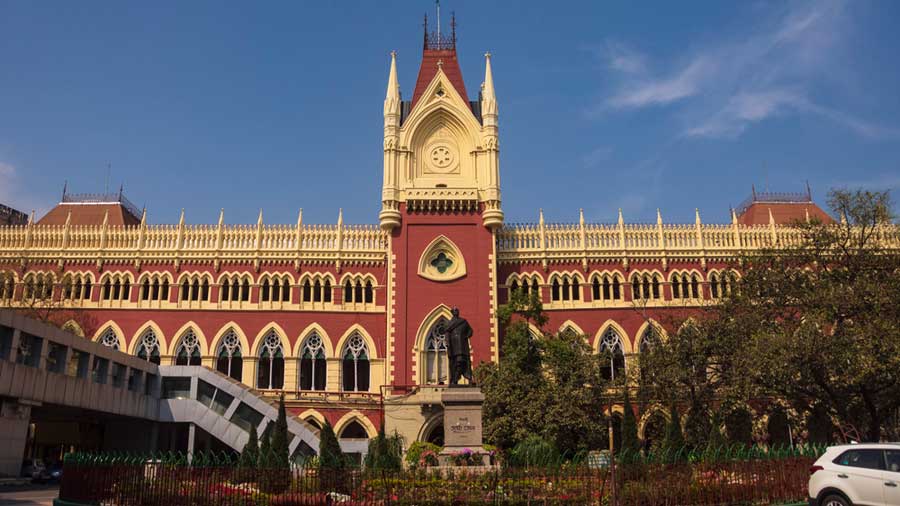
[[File:Calcutta_highcourt.jpg|thumb|The [[Calcutta High Court]] has jurisdiction over the islands, and operates a circuit bench in [[Port Blair]]]] | |||
The islands form a part of the union territory of Andaman and Nicobar Islands and is administered by a [[Lieutenant Governor (India)|Lieutenant Governor]] on behalf of the Government of India.<ref>{{cite web |url=https://www.india.gov.in/my-government/whos-who/lt-governors-administrators |title=Lt Governors and Administrators |publisher=[[Government of India]] |access-date=1 December 2023}}</ref> The union territory was established in 1956 with a chief commissioner as the head of the administration.<ref>{{cite act |url=https://interstatecouncil.gov.in/wp-content/uploads/2016/08/states_reorganisation_act.pdf |title=States Reorganisation Act, 1956 |date=14 September 1953 |legislature=[[Parliament of India]] |access-date=1 December 2023}}{{Dead link|date=March 2024 |bot=InternetArchiveBot |fix-attempted=yes }}</ref> In 1982, the [[List of Lieutenant Governors of Andaman and Nicobar Islands|Lieutenant Governor]] replaced the Chief Commissioner as the head of administration. | |||
In 1981, a "Pradesh council" with councillors as representatives of the people was constituted to advise the Lieutenant Governor.<ref>{{cite report |url=https://eparlib.nic.in/bitstream/123456789/10871/1/11_III_20121996_p178_p185_t324.pdf |title=Andaman and Nicobar Bill |publisher=[[Parliament of India]] |access-date=1 December 2023}}</ref> The territory sends one representative to [[Lok Sabha]] of the [[Parliament of India|Indian Parliament]] from its [[Andaman and Nicobar Islands Lok Sabha constituency]].<ref>{{cite report |url=https://www.mea.gov.in/Uploads/PublicationDocs/19167_State_wise_seats_in_Lok_Sabha_18-03-2009.pdf |title=State/UT wise Lok Sabha seats |publisher=[[Government of India]] |access-date=1 December 2023}}</ref> The territory is divided into three districts, each headed by a deputy commissioner.<ref name="Dist">{{cite web |url=http://www.and.nic.in/gov/districtsgov.php |title=Districts of Andaman and Nicobar |publisher=[[Government of India]] |access-date=1 December 2023}}</ref> The [[Calcutta High Court]] has jurisdiction over the islands with a permanent seat at Port Blair.<ref>{{cite web |url=https://www.calcuttahighcourt.gov.in/ |title=About, Calcutta High Court |publisher=[[Calcutta High Court]] |access-date=1 December 2023}}</ref> | |||
= | {|class="sortable wikitable" | ||
|+Districts of Andaman and Nicobar<ref name="Dist"/> | |||
|- | |- | ||
| | !scope="col"| District | ||
| | !scope="col"| Capital | ||
!scope="col"| Area<br />(km<sup>2</sup>)<ref>{{cite report |url=http://andssw1.and.nic.in/ecostat/2007/area.pdf |title=Area and Population |publisher=[[Government of India]] |access-date=1 December 2023}}</ref> | |||
!scope="col"| Population<br />(2011)<ref name="DG">{{cite report |url=http://andssw1.and.nic.in/ecostat/basicstatPDF2021_22/1.Demography.pdf |title=Demography |publisher=[[Government of India]] |access-date=1 December 2023}}</ref> | |||
!scope="col" class=unsortable| [[Tehsil]]s<ref name="DG"/> | |||
|- | |- | ||
| | |scope="row"| [[North and Middle Andaman district|North and Middle Andaman]] | ||
| | |[[Mayabunder]] | ||
|align=right|{{formatnum:3302}} | |||
|align=right|{{formatnum:105597}} | |||
|[[Diglipur]], [[Mayabunder]], [[Rangat]] | |||
|- | |- | ||
| | |scope="row"| [[South Andaman district|South Andaman]] | ||
| | |[[Port Blair]] | ||
|align=right|{{formatnum:3106}} | |||
|align=right|{{formatnum:238142}} | |||
|[[Port Blair]], [[Ferrargunj]], [[Little Andaman]] | |||
|- | |- | ||
| | |scope="row"| [[Nicobar district|Nicobar]] | ||
| | |[[Car Nicobar]] | ||
|align=right|{{formatnum:1841}} | |||
|align=right|{{formatnum:36842}} | |||
|[[Car Nicobar Subdivision|Car Nicobar]], [[Nancowry Subdivision|Nancowry]], [[Great Nicobar Subdivision|Great Nicobar]] | |||
|} | |} | ||
The indigenous communities have their own system of administration. There are long term settlements known as ''baraij'' and short-term settlements known as ''chang''. The coast-dwellers (''aryoto'') have semi-permanent settlements and the interior groups (''eremtaga'') dwell on temporary settlements, which enable them to migrate during dry seasons.<ref name="Cooper"/> | |||
== | ==Economy== | ||
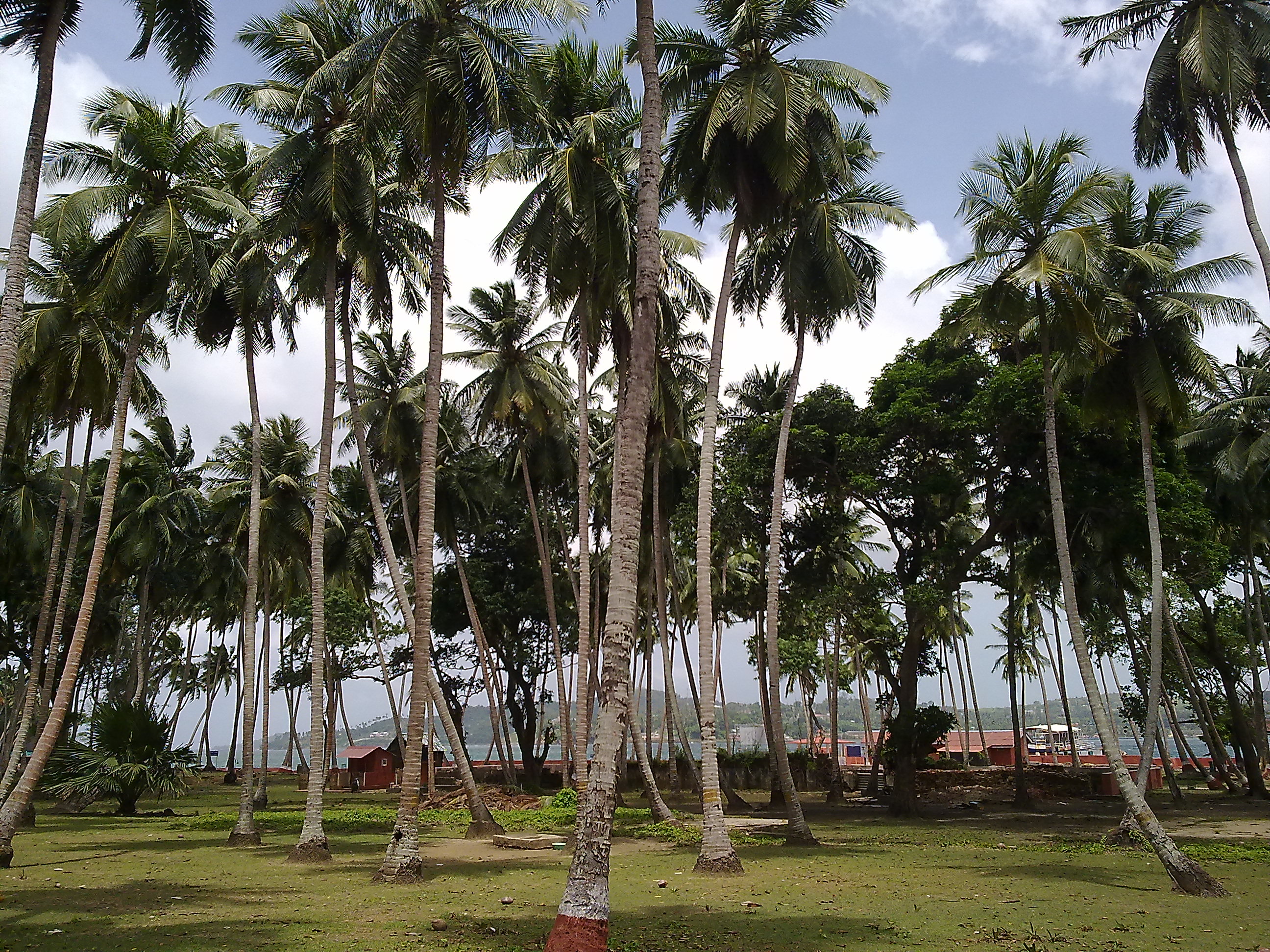
[[File:Ross Island Trees - panoramio.jpg|thumb|[[Coconut]] trees in [[South Andaman district|South Andaman]]]] | |||
=== | {{As of|2022}}, the [[Gross state product|GSDP]] was {{INRConvert|103|b}}.<ref name="GSDP">{{cite report |url=https://www.rbi.org.in/Scripts/PublicationsView.aspx?id=22091 |title=GDP of states/UTs |publisher=[[Reserve Bank of India]] |access-date=1 December 2023}}</ref> Agriculture is a major occupation with nearly 50% of the population engaged in the sector.<ref name="CA"/> Only about {{convert|48675|ha}} of land, which is about 6% of the total land area, can be used for agriculture.<ref name="CA">{{cite report |url=https://aniidco.and.nic.in/announcement/PIM%20Andaman.pdf |title=Eco-tourism in Andaman & Nicobar Islands |publisher=[[Government of India]] |page=50 |access-date=1 December 2023}}</ref> [[Rice]] is the main food crop, grown in about 20% of the arable land.<ref>{{cite web |url=https://agri.and.nic.in/history1.htm |title=History of agriculture |publisher=[[Government of India]] |page=50 |access-date=1 December 2023}}</ref> Most of the food for consumption is imported from mainland India.<ref name="CA"/> Coconut and [[arecanut]] are the cash crops grown in the Nicobar islands.<ref name="CA"/> Other crops include [[pulses]], [[oilseeds]], vegetables like [[okra]], [[brinjal]], [[Cucurbitaceae|cucurbit]] and [[radish]]; [[spices]] and [[fruits]] such as [[mango]], [[Manilkara zapota|sapota]], orange, banana, [[guava]] and [[pineapple]].<ref name="Agri">{{cite web |url=https://agri.and.nic.in/objective.htm |title=Objectives of Agriculture |publisher=[[Government of India]] |access-date=1 December 2023}}</ref> Rubber, [[red oil]], [[Palm (plant)|palm]] and [[cashew]] are grown on a limited scale in plantations.<ref name="Agri"/> The territory has an [[exclusive economic zone]] of more than 0.6 million sq. km, which contributes to the fishing industry. {{As of|2017}}, the region produced 27,526 tonnes of fish, mostly from marine sector with minor contribution from inland fisheries.<ref name="Agri"/> | ||
=== | {{As of|2008}}, there were 1,833 registered small-scale industries with majority being involved in engineering, [[woodworking]] and textiles apart from 21 factories.<ref name="Econ">{{cite report |url=http://andssw1.and.nic.in/ecostat/stats/Economic%20survey%20ANI/CHAPTER%20-%208.pdf |title=Economic survey |publisher=[[Government of India]] |access-date=1 December 2023}}</ref> District Industries Centre (DIC) is the body responsible for the development of small and medium industries in the islands.<ref name="Econ"/> Andaman and Nicobar Islands Integrated Development Corporation Limited (ANIIDCO), established in 1988, is responsible for the development and economic growth of the islands.<ref name="Econ"/> | ||
=== | === Tourism === | ||
{{further|Tourism in Andaman and Nicobar Islands}} | |||
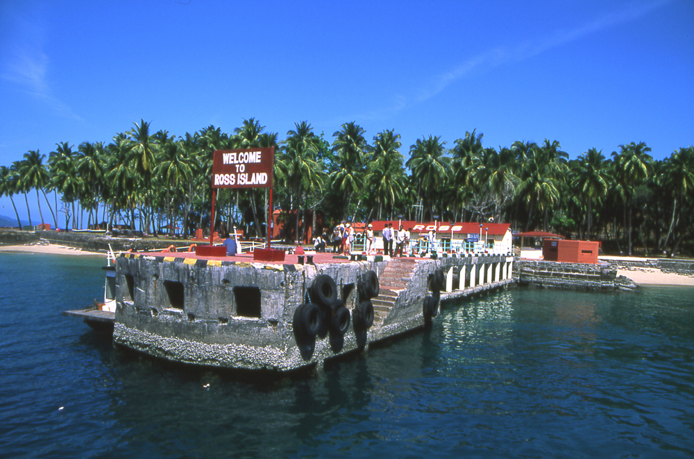
[[File:Andaman_ross_is.jpg|thumb|[[Ross Island, South Andaman district|Netaji Subhash Chandra Bose Island]] in 2004]] | |||
Tourism is one of the major contributors to the economy of the islands. The islands had more than 400,000 visitors in 2016 with a 94% contribution from domestic tourists.<ref name="CA"/> In 2018, plans to develop facilities in various islands under the National Institute of Transforming India (NITI) Aayog was initiated by Government of India, with the aim of increasing tourist inflows.<ref>{{cite report |title=Holistic Development of Islands |url=http://niti.gov.in/content/holistic-development-islands-islanders-benefits |website=Niti Aayog |access-date=4 December 2018 |archive-url=https://web.archive.org/web/20181204200629/http://niti.gov.in/content/holistic-development-islands-islanders-benefits |archive-date=4 December 2018 |url-status=live}}</ref><ref name="CA"/> Foreign tourists are issued Restricted Area Permits (RAP) which gives access to specific areas with conditions.<ref>{{cite report |url=https://www.mha.gov.in/PDF_Other/AnnexVII_01022018.pdf |title=Protected and Restricted Areas |publisher=[[Government of India]] |access-date=1 December 2023}}</ref> While domestic tourists do not require a permit to visit the accessible parts of the islands, the tribal reserves are forbidden and requires special permission for access.<ref>{{cite web |title=For Foreigners |url=https://www.andaman.gov.in/tourism/Foreigners |publisher=[[Government of India]] |access-date=1 December 2023 |archive-date=3 December 2023 |archive-url=https://web.archive.org/web/20231203050254/https://www.andaman.gov.in/tourism/Foreigners |url-status=dead }}</ref> The islands have many beaches due to its long coastline and various [[water sports]] are practised including [[kayaking]], [[scuba diving]] and [[parasailing]].<ref>{{cite web |url=https://www.andamantourism.gov.in/watersports.php |title=Water sports |publisher=[[Government of India]] |access-date=1 December 2023}}</ref> | |||
== | Major attractions include the [[Cellular Jail]], Chatham Saw Mill, Forest Museum, Samudrika Naval Marine Museum, Anthropological Museum, Fisheries Aquarium, Science Center and Carbyn's cove in Port Blair; Bharatpur, Lakshmanpur and Sitapur beaches in [[Shaheed Dweep]]; Elephant and Radhanagar beaches in [[Swaraj Dweep]]; Hudi tikri, Red, Bird and Bat islands, Amkunj beach near Rangat; Dhaninallah mangroves and Karmatang beach near Mayabunder; [[limestone]] caves and mud volcanoes near Diglipur; Craggy island and [[Ross Island, South Andaman district|Ross]] & [[Smith Island (Andaman Islands)|Smith islands]] and various national parks and protected sanctuaries.<ref>{{cite web |url=https://www.andamantourism.gov.in/tour_package.php |title=Andaman tour |publisher=[[Government of India]] |access-date=1 December 2023}}</ref> | ||
== | ==Transportation== | ||
[[File:Veer Savarkar International Airport – New Terminal.jpg|thumb|[[Veer Savarkar International Airport]] is the only major airport in the islands.]] | |||
The Andaman and Nicobar is considered strategically important to India due to their location in the Indian Ocean. The islands lie to the southeast of the Bay of Bengal and close to the Strait of Malacca, one of the major maritime routes. Its location helps India monitor maritime traffic in the region and serves as a strategic location for military deployment.<ref>{{cite web|last=Deshmukh |first=S L |date=30 December 2021 |title=Strategic Importance of Andaman and Nicobar Command- A Revaluation |url=https://dras.in/strategic-importance-of-andaman-and-nicobar-command-a-revaluation/ |work=Defence Research and Studies |access-date=1 March 2026}}</ref> The [[Andaman and Nicobar Command]] of [[Indian Armed Forces]] operates [[air base]]s of [[Car Nicobar Air Force Base|Car Nicobar AFS]], [[INS Kohassa]], [[INS Utkrosh]], and [[INS Baaz]].<ref>{{cite press release |url=https://pib.gov.in/pressreleaseshare.aspx?prid=1560445 |title=Headquarters Andaman Nicobar Command ANC to enhance its operational capability with the upcoming commissioning of INS Kohassa |date=18 January 2019 |access-date=1 December 2023 |publisher=[[Government of India]]}}</ref> | |||
=== | The islands are served by [[Veer Savarkar International Airport]] near Port Blair which has regular flights to major cities in India.<ref>{{cite report |url=https://www.dgca.gov.in/digigov-portal/?page=jsp/dgca/InventoryList/aerodrome/public/PUBLIC%20USE%20LICENSED%20AERODROME%20(PUBLIC%20AND%20PRIVATE)%20AND%20HELIPORT%20-converted%20(1).pdf |title=List of Aerodromes Licensed in Public Use Category |publisher=[[Directorate General of Civil Aviation (India)|Directorate General of Civil Aviation]] of India |access-date=11 October 2023}}</ref> The airport operates as a [[civil enclave]], sharing airside facilities with INS Utkrosh of the [[Indian Navy]].<ref>{{cite press release |title=New Terminal Building at Port Blair Airport by March 2018 |url=https://pib.nic.in/newsite/erelease.aspx?relid=98538 |publisher=[[Press Information Bureau]] |date=22 August 2013 |access-date=6 January 2014}}</ref> The airport has a single [[runway]] of {{cvt|3290|m|ft|sigfig=5}} in length, with the civilian terminal operated by the [[Airports Authority of India]] with air traffic operations managed by the Indian Navy.<ref>{{cite news |url=http://www.sainiksamachar.nic.in/englisharchives/2011/oct16-11/h5.htm |title=Andaman & Nicobar Command: Saga of Synergy |work=Sainik Samachar |access-date=9 January 2012}}</ref> | ||
There are 23 ports along the islands with a major port at [[Port Blair Port|Port Blair]] and eight other significant ports including [[Diglipur]], [[Mayabunder]], [[Rangat]], [[Hut Bay]], [[Car Nicobar]], [[Katchal Island|Katchal]] and [[Campbell Bay, Great Nicobar|Campbell Bay]].<ref>{{cite web |url=http://andssw1.and.nic.in/pmb/history.html |title=History of Ports |publisher=Port Management Board, [[Government of India]] |access-date=1 December 2023}}</ref><ref>{{cite news |title=India plans Rs 10,000 cr transshipment port at Great Nicobar Island: PM |url=https://hr.economictimes.indiatimes.com/news/industry/india-plans-rs-10000-cr-transshipment-port-at-great-nicobar-island-pm/77466638 |access-date=10 August 2020 |newspaper=[[The Economic Times]] |archive-date=19 September 2020 |archive-url=https://web.archive.org/web/20200919070235/https://hr.economictimes.indiatimes.com/news/industry/india-plans-rs-10000-cr-transshipment-port-at-great-nicobar-island-pm/77466638 |url-status=live}}</ref> In 2022, the Government of India proposed the development of a [[International Container Transshipment Terminal, Great Nicobar Island|new container ship terminal]] and an airport at Great Nicobar.<ref>{{cite news |date=22 November 2022 |title=Development of Great Nicobar: strategic imperative and ecological concerns |url=https://indianexpress.com/article/explained/great-nicobar-development-project-proposal-concerns-8281844/ |access-date=29 November 2022 |newspaper=[[The Indian Express]] |archive-date=26 November 2022 |archive-url=https://web.archive.org/web/20221126090805/https://indianexpress.com/article/explained/great-nicobar-development-project-proposal-concerns-8281844/ |url-status=live}}</ref> There are 39 [[light houses]] situated across the islands.<ref>{{cite web |url=https://dgll.nic.in/DGLL-light-house-location/portblair |title=Light houses |access-date=1 December 2023 |publisher=[[Government of India]]}}</ref> | |||
[[ | |||
[[ | |||
{{As of|2018}}, there are {{cvt|422|km}} long [[National Highway (India)|national highways]] in the state with the major highway being the {{cvt|230.7|km}} long [[National Highway 4 (India)|NH 4]] connecting Port Blair and Diglipur.<ref>{{cite report |url=https://morth.nic.in/sites/default/files/State_wise_Length_of_National_Highways_in_India.pdf |title=State-wise length of National Highways in India |date=30 November 2018 |publisher=[[Ministry of Road Transport and Highways]] |access-date=9 May 2019 |archive-url=https://web.archive.org/web/20200929205249/https://morth.nic.in/sites/default/files/State_wise_Length_of_National_Highways_in_India.pdf |archive-date=29 September 2020}}</ref><ref>{{cite report |url=https://morth.nic.in/sites/default/files/PragatiKiNayiGati/pdf/andaman.pdf |title=Andaman, Road development |access-date=1 December 2023 |publisher=[[Government of India]]}}</ref> | |||
== | == Infrastructure == | ||
=== Power === | |||
There is no single power grid connecting all the islands and independent power houses caters to the power requirements of individual islands.<ref>{{cite web |title=Electricity in Andaman |url=https://vidyut.andaman.gov.in/ |access-date=1 December 2023 |publisher=[[Government of India]] |archive-date=20 September 2024 |archive-url=https://web.archive.org/web/20240920011811/https://vidyut.andaman.gov.in/ |url-status=dead }}</ref> The islands have an installed power capacity of 68.46 [[Mega watt|MW]] with majority of the power generated from [[diesel fuel|diesel]] [[power plant]]s and a single [[hydroelectric power]]plant of 5.25 MW on Kalpong river.<ref>{{cite web |title=Electricity department of Andaman |url=https://vidyut.andaman.gov.in/Forms/AboutUs.aspx |access-date=1 December 2023 |publisher=[[Government of India]] |archive-date=21 September 2024 |archive-url=https://web.archive.org/web/20240921005918/https://vidyut.andaman.gov.in/Forms/AboutUs.aspx |url-status=dead }}</ref> In 2016, a new 15 MW [[diesel fuel|diesel]] [[power plant]] was established in South Andaman with [[India–Japan relations|Japanese]] assistance.<ref>{{cite news |date=13 March 2016 |title=India collaborates with Japan on Andamans project |url=http://www.thehindu.com/todays-paper/tp-national/india-collaborates-with-japan-on-andamans-project/article8347298.ece |url-status=live |archive-url=https://web.archive.org/web/20160316150103/http://www.thehindu.com/todays-paper/tp-national/india-collaborates-with-japan-on-andamans-project/article8347298.ece |archive-date=16 March 2016 |access-date=14 June 2016 |newspaper=[[The Hindu]] |issn=0971-751X}}</ref><ref>{{cite web |title=These 8 narrow choke-points are critical to the world's oil trade |url=http://www.businessinsider.in/These-8-narrow-chokepoints-are-critical-to-the-worlds-oil-trade/articleshow/46775193.cms |url-status=live |archive-url=https://web.archive.org/web/20160629151009/http://www.businessinsider.in/These-8-narrow-chokepoints-are-critical-to-the-worlds-oil-trade/articleshow/46775193.cms |archive-date=29 June 2016 |access-date=14 June 2016 |newspaper=Business Insider}}</ref> Commissioned in June 2020, a 10 MW [[photovoltaic power station]] is operated by [[NLC India Limited|NLC India]] in Port Blair.<ref>{{cite news|last=Kala|first=Rishi Ranjan|date=18 June 2024|title=The solar way of providing power to eco-sensitive zones|url=https://www.thehindubusinessline.com/companies/the-solar-way-of-providing-power-to-eco-sensitive-zones/article68304964.ece|newspaper=[[Business Line]]|access-date=30 October 2024}}</ref><ref>{{cite web|date=23 February 2022|title=Power plant profile: NLC Dolly Gunj Solar PV Park, India|url=https://www.power-technology.com/marketdata/power-plant-profile-nlc-dolly-gunj-solar-pv-park-india/|work=Power Technology|access-date=30 October 2024}}</ref> In 2022, the government proposed additional power plants and infrastructure to be developed in Great Nicobar.<ref>{{cite news |last=Ramakrishna |first=Ishika |date=20 October 2022 |title=Massive infrastructure project threatens Great Nicobar Island |url=https://frontline.thehindu.com/environment/massive-infrastructure-project-proposed-by-central-government-threatens-great-nicobar-island/article65991977.ece |url-status=live |archive-url=https://web.archive.org/web/20221129133005/https://frontline.thehindu.com/environment/massive-infrastructure-project-proposed-by-central-government-threatens-great-nicobar-island/article65991977.ece |archive-date=29 November 2022 |access-date=29 November 2022 |newspaper=[[The Hindu]]}}</ref> | |||
[[ | === Telecommunication === | ||
[[4G]] mobile service is provided by various telecom operators in the islands.<ref>{{cite news |url=https://indianexpress.com/article/technology/tech-news-technology/airtel-first-mobile-operator-launch-services-andaman-nicobar-6551752/ |title=Airtel becomes the first mobile operator to launch 4G services in Andaman and Nicobar |date=12 August 2020 |newspaper=[[The Indian Express]] |access-date=1 December 2023}}</ref> Till 2020, Internet was provided through [[Satellite Internet access|satellite links]] and access was limited. [[Bharat Broadband Network]] started work on laying [[Fiber-optic communication|fiber optic]] [[Submarine communications cable|submarine cable]]s connecting the islands with Chennai in December 2018.<ref>{{cite news |date=10 August 2020 |title=PM Modi inaugurates 2,312-kilometre undersea optical fiber cable link between Andaman-Chennai |url=https://indianexpress.com/article/india/narendra-modi-chennai-andaman-nicobar-islands-submarine-optical-fibre-project-6548424/ |access-date=10 August 2020 |newspaper=[[The Indian Express]] |archive-date=19 September 2020 |archive-url=https://web.archive.org/web/20200919202032/https://indianexpress.com/article/india/narendra-modi-chennai-andaman-nicobar-islands-submarine-optical-fibre-project-6548424/ |url-status=live}}</ref><ref>{{cite news |url=https://www.thehindu.com/news/national/other-states/its-2018-but-still-tough-to-get-online-in-the-andamans/article22785543.ece |title=It's 2018, but still tough to get online in the Andamans |last=Sridhar |first=Lalitha |date=17 February 2018 |newspaper=[[The Hindu]] |access-date=8 November 2018 |language=en-IN |issn=0971-751X |archive-date=4 May 2020 |archive-url=https://web.archive.org/web/20200504042913/https://www.thehindu.com/news/national/other-states/its-2018-but-still-tough-to-get-online-in-the-andamans/article22785543.ece |url-status=live}}</ref> On 10 August 2020, the undersea [[Submarine communications cable|optical fibre cable]] went live, which enabled high-speed broadband connections in the islands.<ref>{{cite news |title=Andaman and Nicobar islands' fast-speed internet will depend on a 2,300 kilometer-long fiber optic cable |url=https://www.businessinsider.in/tech/news/pm-modi-andaman-and-nicobar-islands-fast-speed-internet-will-depend-on-a-2300-kilometer-long-fiber-optic-cable/articleshow/77460772.cms |access-date=11 August 2020 |work=Business Insider |archive-date=16 April 2021 |archive-url=https://web.archive.org/web/20210416115653/https://www.businessinsider.in/tech/news/pm-modi-andaman-and-nicobar-islands-fast-speed-internet-will-depend-on-a-2300-kilometer-long-fiber-optic-cable/articleshow/77460772.cms |url-status=live}}</ref><ref>{{cite news |date=26 June 2018 |title=BSNL to enhance bandwidth 400 times in Andaman and Nicobar island in 2 years |url=https://www.financialexpress.com/industry/bsnl-to-enhance-bandwidth-400-times-in-andaman-and-nicobar-island-in-2-years/1221457/ |url-status=live |archive-url=https://web.archive.org/web/20181108184401/https://www.financialexpress.com/industry/bsnl-to-enhance-bandwidth-400-times-in-andaman-and-nicobar-island-in-2-years/1221457/ |archive-date=8 November 2018 |access-date=8 November 2018 |newspaper=Financial Express}}</ref><ref>{{cite news |date=10 August 2020 |title=PM Modi inaugurates Chennai-Andaman & Nicobar submarine optical cable project |url=https://timesofindia.indiatimes.com/business/india-business/pm-modi-inaugurates-chennai-andaman-nicobar-submarine-optical-cable-project/articleshow/77456251.cms |access-date=10 August 2020 |newspaper=[[The Times of India]] |archive-date=11 August 2020 |archive-url=https://web.archive.org/web/20200811064333/https://timesofindia.indiatimes.com/business/india-business/pm-modi-inaugurates-chennai-andaman-nicobar-submarine-optical-cable-project/articleshow/77456251.cms |url-status=live}}</ref> | |||
==Education== | |||
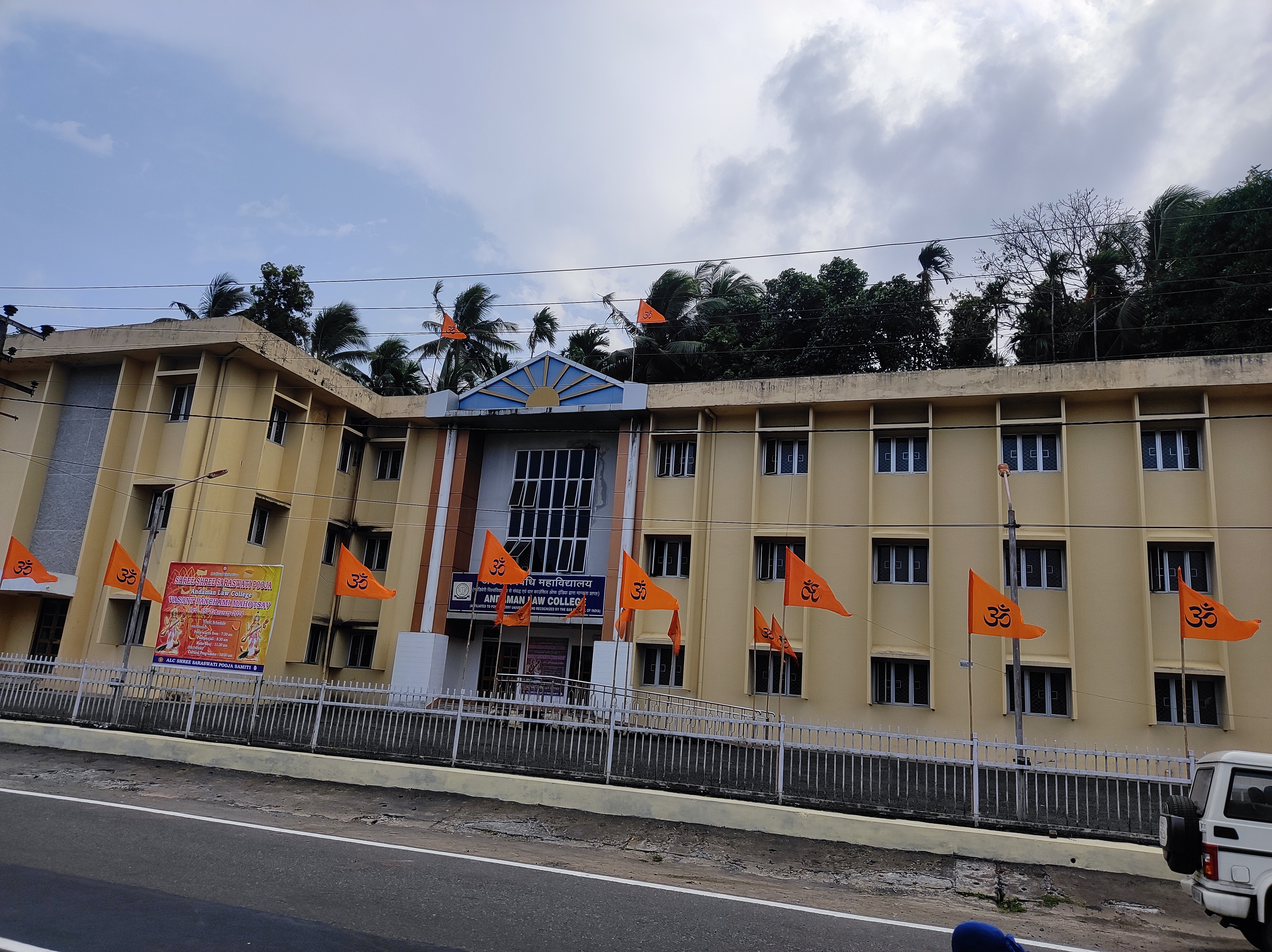
[[File:Andaman_Law_College.jpg|thumb|[[Andaman Law College]]]] | |||
The first primary school in the islands was established in 1881.<ref name="School"/> During Independence, 12 schools were functioning on the islands including one high school.<ref name="School"/> {{As of|2023}}, there are 428 schools functioning in the islands with a total enrolment of 86,081 students.<ref name="School">{{cite web |url=https://education.andaman.gov.in/History.aspx |title=History of education |publisher=[[Government of Andaman and Nicobar Islands]] |access-date=1 December 2023 |archive-date=20 September 2024 |archive-url=https://web.archive.org/web/20240920145840/https://education.andaman.gov.in/History.aspx |url-status=dead }}</ref> | |||
The | The [[Andaman and Nicobar Islands Institute of Medical Sciences]] was established in 1963.<ref>{{cite web |url=https://www.nmc.org.in/MCIRest/open/getDocument%3Fpath%3D/Documents/Public/Portal/LatestNews/FMG.pdf |title=Andaman and Nicobar Islands Institute of Medical Sciences |work=[[National Accreditation Council]] |access-date=1 June 2025}}</ref><ref>{{cite web |url=http://andssw1.and.nic.in/aniims/pages/AboutUS.html |title=About us |publisher=[[Andaman and Nicobar Islands Institute of Medical Sciences]] |access-date=1 December 2023}}</ref> The [[Jawaharlal Nehru Government College|Jawaharlal Nehru Rajkeeya Mahavidyalaya]] was established later in 1967.<ref>{{cite report|url=http://naac.gov.in/images/docs/ACCREDITATION_STATUS/Institutions-whose-accreditation-period-is-valid-as-on-11032020.xls|title=Accreditation status|work=[[National Assessment and Accreditation Council]]|access-date=1 June 2025}}</ref><ref>{{cite web |url=https://jnrm.and.nic.in/About/about.htm |title=About us |publisher=[[Jawaharlal Nehru Government College]] |access-date=1 December 2023}}</ref> Dr. B. R. Ambedkar Government Polytechnic was established in 1984 and the affiliated engineering college, [[Dr. B. R. Ambedkar Institute of Technology]] was established in 1989.<ref>{{cite web| url=https://cdnbbsr.s3waas.gov.in/s36a4cbdaedcbda0fa8ddc7ea32073c475/uploads/2025/02/20250210626497713.pdf |title=Dr. B. R. Ambedkar Institute of Technology |work=[[Government of India]] |date=February 2025 |access-date=1 June 2025}}</ref><ref>{{cite web |url=https://dbrait.andaman.gov.in/ |title=About us |publisher=[[Dr. B. R. Ambedkar Institute of Technology]] |access-date=1 December 2023 |archive-date=22 September 2024 |archive-url=https://web.archive.org/web/20240922005902/https://dbrait.andaman.gov.in/ |url-status=dead }}</ref> The [[Mahatma Gandhi Government College]] was established in 1990 and is affiliated to [[Pondicherry University]].<ref>{{cite web |url=https://www.agnirva.com/colleges/andaman-and-nicobar/mahatma-gandhi-government-college-mayabunder |title=Mahatma Gandhi Government College |work=Agnirva |access-date=1 June 2025}}</ref><ref>{{cite web |url=https://www.and.nic.in/mggc/vision.html |title=About us |publisher=[[Mahatma Gandhi Government College]] |access-date=1 December 2023}}</ref> The [[Andaman Law College]] is the only [[law college]] in the state, and was established in 2016.<ref>{{cite web |url=https://backup.pondiuni.edu.in/sites/default/files/Andaman_law_colge_Recuiment_13062016.pdf |title=Andaman Law College |work=[[Pondicherry University]] |date=13 June 2016 |access-date=1 June 2025}}</ref><ref>{{cite report |url=https://collegeadmission.andaman.gov.in/images/law.pdf |title=About us |publisher=[[Andaman Law College]] |access-date=1 December 2023 |archive-date=22 September 2024 |archive-url=https://web.archive.org/web/20240922011510/https://collegeadmission.andaman.gov.in/images/law.pdf |url-status=dead }}</ref> | ||
== | ==In popular culture== | ||
< | * [[Arthur Conan Doyle]] refers to the Andaman islands in the [[Sherlock Holmes]] novel ''[[The Sign of the Four]]''.<ref>{{cite news |title=The 'wild' people as tourist stops |last=Hill |first=David |newspaper=[[The Hindu]] |date=31 March 2012 |url=https://www.thehindu.com/opinion/op-ed/the-wild-people-as-tourist-stops/article3263326.ece |access-date=12 October 2018 |archive-url=https://web.archive.org/web/20131225080305/http://www.thehindu.com/opinion/op-ed/the-wild-people-as-tourist-stops/article3263326.ece |archive-date=25 December 2013 |url-status=live}}</ref> | ||
* [[Bengali language|Bengali]] author [[Sunil Gangopadhyay]] based the events of one his ''[[Kakababu]]'' series of adventure thriller novels, ''[[Kakababu#Adventures of Kakababu Sontu|Sabuj Dwiper Raja]]'' (1976), on the islands. In 1979, it was made into a [[Sabuj Dwiper Raja|film of the same name]], shot extensively on the islands.<ref>{{cite book |last1=Adese |first1=Jennifer |last2=Innes |first2=Robert Alexander |title=Indigenous Celebrity: Entanglements with Fame |date=9 April 2021 |publisher=[[University of Manitoba Press]] |isbn=978-0-88755-922-8 |page=185 |url=https://books.google.com/books?id=BBYjEAAAQBAJ&dq=Sabuj+Dwiper+Raja+andaman+and+nicobar+islands&pg=PA185 |access-date=4 April 2023 |archive-date=7 April 2023 |archive-url=https://web.archive.org/web/20230407071442/https://books.google.com/books?id=BBYjEAAAQBAJ&dq=Sabuj+Dwiper+Raja+andaman+and+nicobar+islands&pg=PA185 |url-status=live}}</ref><ref>{{cite news |last1=Mortuza |first1=Shamsad |title=On Black Water and the Bengali Fear of Seafaring |url=https://www.thedailystar.net/in-focus/news/black-water-and-the-bengali-fear-seafaring-1690288 |access-date=4 April 2023 |work=The Daily Star |date=21 January 2019 |archive-date=4 April 2023 |archive-url=https://web.archive.org/web/20230404133216/https://www.thedailystar.net/in-focus/news/black-water-and-the-bengali-fear-seafaring-1690288 |url-status=live}}</ref> | |||
* The [[National Film Awards|National Award]]-winning [[Malayalam cinema|Malayalam]] film ''[[Kaalapani]]'' was set against the backdrop of [[Cellular Jail|Port Blair's Cellular Jail]] and was extensively shot in the islands.<ref>{{Cite news |title=Kalapani movie, 25 years |url=https://www.manoramaonline.com/movies/features/2020/04/09/kalapani-movie-24-years-special-article.html |access-date=21 November 2020 |work=[[OnManorama]] |date=9 April 2020 |language=ml |archive-date=21 November 2020 |archive-url=https://web.archive.org/web/20201121074220/https://www.manoramaonline.com/movies/features/2020/04/09/kalapani-movie-24-years-special-article.html |url-status=live}}</ref> | |||
* The [[List of Netflix original programming|Netflix Original Series]] ''[[Kaala Paani]]'' is based on a fictional illness that spreads in the islands.<ref>{{cite news |last1=Khurana |first1=Ankur |title=Kaala Paani Season 1 Review : A well-acted and intriguing survival drama |url=https://timesofindia.indiatimes.com/web-series/reviews/hindi/kaala-paani/season-1/seasonreview/104490160.cms |access-date=27 October 2023 |newspaper=[[The Times of India]] |date=18 October 2023}}</ref> | |||
* ''[[Hitman 3]]'' features a fictional island in Nicobar called Ambrose island that was added as a new map in a free update to the game, and is home to a group of pirates operating in the Strait of Malacca.<ref>{{cite web|url=https://www.videogameschronicle.com/news/hitman-3s-new-ambrose-island-map-dated-with-location-reveal-trailer/|title=Hitman 3's new Ambrose Island map dated with location reveal trailer|first=Tom|last=Ivan|work=Video Games Chronicle|date=8 July 2021|access-date=2 August 2023|archive-date=22 March 2023|archive-url=https://web.archive.org/web/20230322093844/https://www.videogameschronicle.com/news/hitman-3s-new-ambrose-island-map-dated-with-location-reveal-trailer/|url-status=live}}</ref> | |||
</ | |||
==See also== | == See also == | ||
{{Portal|Geography|Islands|Asia|India}} | {{Portal|Geography|Islands|Asia|India}} | ||
* [[Coral reefs in India]] | * [[Coral reefs in India]] | ||
* [[ | * [[Lakshadweep]] | ||
* [[List of islands of India]] | * [[List of islands of India]] | ||
==References== | == Notes == | ||
{{notelist}} | |||
== References == | |||
{{reflist}} | {{reflist}} | ||
==External links== | ==External links== | ||
{{Commons}} | |||
{{Wikivoyage}} | |||
{{Union Territory of Andaman and Nicobar Islands}} | {{Union Territory of Andaman and Nicobar Islands}} | ||
| Line 475: | Line 339: | ||
[[Category:Andaman and Nicobar Islands| ]] | [[Category:Andaman and Nicobar Islands| ]] | ||
[[Category:1956 establishments in India]] | [[Category:1956 establishments in India]] | ||
[[Category:Andaman Sea]] | |||
[[Category:Dependent territories in Asia]] | |||
[[Category:Islands of the Andaman and Nicobar Islands|01]] | |||
[[Category:Islands of the Andaman Sea]] | |||
[[Category:Islands of the Bay of Bengal]] | |||
[[Category:States and territories established in 1956]] | [[Category:States and territories established in 1956]] | ||
[[Category:States and union territories of India]] | |||
[[Category:Union territories of India]] | [[Category:Union territories of India]] | ||
[[Category: | [[Category:East India]] | ||
[[Category:Volcanic arc islands]] | [[Category:Volcanic arc islands]] | ||
Latest revision as of 22:20, 5 May 2026
Andaman and Nicobar Islands | |
|---|---|
  .jpg)    Clockwise from top-right: Coral reefs around the islands; Ross Island in South Andaman; Beach at Neil Island; Cellular Jail in Port Blair; Andaman Sea; Havelock Island in Andaman Islands | |
| Motto(s): | |
 Location of Andaman and Nicobar Islands in India | |
| Coordinates: 11°41′N 92°43′E / 11.68°N 92.72°E | |
| Country |  India India |
| Region | East India |
| Formation | 1 November 1956 |
| Capital and largest city | Port Blair |
| Districts | 3 |
| Government | |
| • Body | Government of Andaman and Nicobar Islands |
| • Lieutenant governor | Devendra Kumar Joshi |
| • Chief secretary | Chandra Bhushan Kumar, IAS |
| National Parliament | Parliament of India |
| • Lok Sabha | 1 seat |
| High Court | Calcutta High Court (Port Blair Bench) |
| Area | |
| • Total | 8,249 km2 (3,185 sq mi) |
| • Rank | 29th |
| Dimensions | |
| • Length | 467 km (290 mi) |
| • Width | 24 km (15 mi) |
| Highest elevation | 732 m (2,402 ft) |
| Lowest elevation (Andaman Sea and Bay of Bengal) | 0 m (0 ft) |
| Population (2011)[2] | |
| • Total | 380,581 |
| • Rank | 34th |
| • Density | 46/km2 (120/sq mi) |
| • Urban | 37.7% |
| • Rural | 62.3% |
| Demonym(s) | Andamanese, Nicobarese |
| Language | |
| • Official | |
| • Official script | |
| GDP | |
| • Total (2023-24) |  ₹0.12499 lakh crore (US$1.8 billion) ₹0.12499 lakh crore (US$1.8 billion) |
| • Rank | 33rd |
| • Per capita | ₹310,143 (US$4,300) (16th) |
| Time zone | UTC+05:30 (IST) |
| ISO 3166 code | IN-AN |
| Vehicle registration | AN |
| HDI (2022) | 0.706 High[3] (11th) |
| Literacy (2024) | 91.1[4] (11th) |
| Sex ratio (2011) | 876♀/1000 ♂ (22nd) |
| Website | andaman |
| Symbols of Andaman and Nicobar Islands | |
| Mammal | Dugong |
| Bird | Andaman wood pigeon |
| Flower | Pyinma |
| Tree | Andaman Padauk |
| List of Indian state and union territory symbols | |

The Andaman and Nicobar Islands is a union territory of India comprising 836 islands, of which only 31 are inhabited. The islands are grouped into two main clusters: the northern Andaman Islands and the southern Nicobar Islands, separated by the 150 km (93 mi)-wide Ten Degree Channel. The capital and largest city of the territory, Port Blair (officially Sri Vijaya Puram), is located approximately 1,190 km (740 mi) from Chennai and 1,255 km (780 mi) from Kolkata in mainland India. The islands are situated between the Bay of Bengal to the west and the Andaman Sea to the east. The northernmost point is 901 km (560 mi) from the mouth of the Hooghly River. Indira Point, located at 6°45'10″N and 93°49'36″E on the southern tip of Great Nicobar, is the southernmost point of India.
The territory shares maritime borders with Indonesia located about 165 km (103 mi) to the south, Myanmar located 280 km (170 mi) to the north-east and Thailand located 650 km (400 mi) to the south-east. The islands occupy a total land area of approximately 8,249 km2 (3,185 sq mi) with a population of 380,581 as per the 2011 census. The territory is divided into three districts: Nicobar, South Andaman, and North and Middle Andaman with the capitals at Car Nicobar, Port Blair and Mayabunder respectively.
Genetic and cultural studies suggest that the indigenous Andamanese people may have been isolated from other populations during the Middle Paleolithic era, more than 30,000 years ago. Archeological evidence of civilisation has been dated back to 2,200 years. In the 11th century, Cholas, one of the three Tamil kingdoms, used the islands as a naval base to launch expeditions in South East Asia. The Danish were the first Europeans to arrive on the islands in 1755. The islands became part of the British Raj in 1868. During the Second World War, the islands were invaded by the Empire of Japan. After Indian Independence in 1947, the region became a province and later a union territory after the adoption of the Constitution of India in 1950.
The islands host the Andaman and Nicobar Command, the only geographical command operated jointly by the three major wings of the Indian Armed Forces: the Army, the Air Force and the Navy. While Hindi and English are the official languages, the major spoken languages include Bengali, Tamil and Telugu. Indigenous people speak any of the Andamanese or Nicobarese family of languages. Hinduism is the majority religion in the union territory, with a significant Christian minority. The islands include North Sentinel Island, home to the Sentinelese people, an uncontacted tribe.
Etymology[edit | edit source]
The name Andaman might have been derived from Handuman, after the Indian God Hanuman from the Hindu epic Ramayana.[5] The place was called with a similar name by the Malays, who used to be involved in slave trade in the region.[6] The place was also referred by various names such as Angademan by Ptolemy in the 2nd century CE and Angamanian by Marco Polo in 13th century.[5] Nicobar, which was located in the sea route connecting South India to South East Asia, was known as Nakkavaram, meaning "open/naked land" borrowed from Tamil language which later became Nicobar.[7] In the middle ages (500-1500 AD), Nicobar was known as Lankhabatus in Arabia, probably a mis-transcription of the name Nakkavaram. An 11th-century work Kathasaritsagar indicates the name as Narkel Dweep (meaning Coconut Island in Bengali).[7] Marco Polo termed the island as Necuverann, while the islands were known as Lo-Jan Kuo in China, a translation of Nakkavar with the same meaning.[7]
History[edit | edit source]
Early history[edit | edit source]
Genetic and cultural studies suggest that the indigenous Andamanese people may have been isolated from other populations during the Middle Paleolithic era, which ended 30,000 years ago.[8] Archeological work on the islands has concentrated on shell midden sites.[9] The islands were mentioned by Ptolemy in the 2nd century CE.[6][7]
Middle Ages[edit | edit source]

The Nicobar islands existed on a major trade route connecting India to the South East Asia and had much contact with the outside world for centuries. But there are very few accounts of information as there was no written language with the indigenous people to document their history.[10] The islands appeared in the accounts of travellers like Faxian in the 6th century and Yijing in the 7th century.[7]
In the 11th century, Rajendra Chola I of the Chola dynasty invaded parts of South East Asia using the Nicobar islands as an intermediate naval base.[11][12] It was part of an established Chola trade route connecting India and South East Asia, a practice that continued during the subsequent reigns of Rajendra II and Kulothunga I.[13][14] Chola inscriptions from Thanjavur, dated to 1050, describe the islands as Ma-Nakkavaram meaning "great open/naked land" in Tamil.[15][16] The islands were later noted by Marco Polo in the 13th century and Friar Oderic in the early 14th century.[7][17]
European colonisation[edit | edit source]
.jpg)
The European colonisation on the islands began when settlers from the Danish East India Company arrived on the Nicobar Islands on 12 December 1755.[18] On 1 January 1756, the Nicobar Islands were made into a Danish colony, first named Nye Danmark (New Denmark) and later Frederiksøerne (Frederick's Islands).[19] The islands were managed from the Danish colony of Tranquebar in the Indian mainland. However, various attempts to settle on the islands were unsuccessful due to repeated outbreaks of malaria, which led to the death of the colonists.[10]
Between 1778 and 1783, William Bolts tried to establish an Austrian colony on the Nicobar islands, mistakenly assuming that the Danish had abandoned the claims to the islands, renaming them Theresa islands.[20] In 1789, Archibald Blair of the Royal Indian Navy colonised the Andaman islands, and established a naval base.[5] In 1794, a penal colony was established on the Chatham island and the first batch of 100 prisoners were sent to the island. The prisoners were used for labour, and worked under a civil contract. After two years, the colony was abandoned. The settlement was abandoned in 1796.[21]

In February 1858, the British re-established a colony in Port Blair.[22] A new penal colony was established on the Ross Island near Port Blair, mainly to house the prisoners of the Indian rebellion of 1857, and the first set of 200 convicts arrived at the island in March 1858.[21] The prisoners were used for hard labour and the clearing of forests led to frequent confrontation with the native Andamanese people. Many of the prisoners died in conflict, while some were hanged for trying to escape, apart from deaths due to disease and starvation.[5] Between 1864 and 1868, Italy tried to buy the Nicobar islands from the Danish. On 16 October 1868, the Danish sold the rights to the Nicobar islands to the British, which was made part of the British India in 1869.[10] In 1872, the Andaman and Nicobar Islands were united under a single command and administered by a chief commissioner based out of Port Blair. The construction of the Cellular Jail started in 1896 and was completed in 1906. The jail was used to house political prisoners and independence activists away from the Indian mainland.[23][24]
World War II[edit | edit source]

During Second World War, the Andaman and Nicobar islands were invaded by Japan. The Japanese captured Port Blair on 23 March 1942 and established control over the islands.[25] Japan gave provisional control of the islands to the Azad Hind organisation of Subhash Chandra Bose on 29 December 1943, and the Andaman and Nicobar islands were renamed as Shaheed-Dweep (Martyr island) and Swaraj-dweep (Self-rule island) respectively.[26] Bose appointed general A. D. Loganathan as the governor of the islands. However, he had limited power while the real control of the islands remained with the Japanese.[26]
There were reports of widespread looting, arson, rape, and extrajudicial killings during the Japanese occupation.[26][27] The residents were often killed by the Japanese for trivial reasons. The largest incident was the Homfreyganj massacre on 30 January 1944, where 44 local civilians were shot by the Japanese on suspicion of spying.[27] Approximately 2,000 people were reportedly killed in Port Blair during the occupation, which represented ten per cent of the pre-war population of the settlement.[27][28] Japanese vice admiral Teizo Hara and major general Tamenori Sato surrendered to lieutenant colonel Nathu Singh Rathore, commanding officer of the Rajput Regiment, on 15 August 1945 aboard the Royal Navy ship HMS Rocksand. On 7 October 1945, the territory was officially handed back to British brigadier J. A. Salomons, commander of the 116th Indian Infantry Brigade, and chief administrator Noel Patterson, in a ceremony at the Gymkhana Ground in Port Blair.[29]
Post independence[edit | edit source]
During the Partition of India, the British announced their intention to retain possession of the islands and use them to resettle Anglo-Indians and Anglo-Burmese on these islands. The islands were claimed by the Indian National Congress for India and the Muslim League for Pakistan during the partition negotiations.[30][31] After the Indian Independence in 1947, the islands became part of the Dominion of India. As per the Constitution of India, the Islands were designated as the only part D territory in 1950, to be administered by a lieutenant governor appointed by the Government of India.[32] The islands were later used to resettle people displaced during the partition with a substantial number of displaced immigrants establishing agricultural colonies.[33] The islands became a separate union territory administered by the Government of India, following the re-organization in 1956.[34] The islands have been developed into a key defence establishment since the 1980s due to its strategic location in the Bay of Bengal across the Strait of Malacca.[35][36]
On 26 December 2004, the coasts of the Andaman and Nicobar islands experienced 10 m (33 ft) high tsunami waves following an undersea earthquake in the Indian Ocean which resulted in more than 2,000 casualties, 46,000 injuries and rendering at least 40,000 homeless.[37] The locals and tourists on the islands suffered the greatest casualties while the indigenous people largely survived unscathed due to movement to high grounds following the oral traditions passed down over generations that warned them to evacuate following earthquakes.[38]
Geography[edit | edit source]

The territory consists of 836 islands and islets occupying an area of 8,249 km2 (3,185 sq mi), of which only 31 are permanently inhabited.[39] The islands extend from 6° to 14° North latitudes and from 92° to 94° East longitudes.[40] The islands are grouped into the north Andaman Islands and south Nicobar Islands, separated by the 150 km (93 mi) wide Ten Degree Channel.[39] The Andamans cover an area of 6,408 km2 (2,474 sq mi) while the Nicobar group covers an area of 1,841 km2 (711 sq mi).[39] The highest point is the Saddle Peak at 732 m (2,402 ft), located in North Andaman Island.[41]

The northernmost point of the islands is 901 km (560 mi) away from the mouth of the Hooghly River in the Indian mainland. The territory shares maritime borders with Indonesia located about 165 km (103 mi) to the south, Myanmar located 280 km (170 mi) to the north-east and Thailand located 650 km (400 mi) to the south-east.[42] Indira Point, the southernmost point of India, is located at 6°45'10″N and 93°49'36″E at the southern tip of Great Nicobar.[43] The capital and largest city is Port Blair (officially Sri Vijaya Puram[44]), located 1,190 km (740 mi) from Chennai and 1,255 km (780 mi) from Kolkata on the Indian mainland.[34] Barren Island, the only active volcano in India, is located in the Andaman Sea.[45][46][47]
The islands have a 1,962 km (1,219 mi) long coast-line.[48] The topography of the territory varies significantly across various islands. The islands may have sandy, rocky sandstone or marshy beaches on the coastlines and might be surrounded by shoals and coral reefs.[49] The altitude varies significantly from completely flat islands to gradually raising topography from the coast to the interior in larger islands.[49] The islands are generally surrounded by shallow seas of varying depths in the vicinity with some deep natural bays occurring along certain coasts.[49] The islands have a moderate temperature around the year with the average ranging from 23 to 31 °C (73 to 88 °F).[50] The islands have a tropical climate with warm summers and not so chill winters.[50] The rainfall is dependent on the monsoons and tropical cyclones are common in late summer.[50]
Flora and fauna[edit | edit source]

The islands have mangroves interspersed with marshes, coconut trees or dispersed bushy vegetation along the coast.[49] There are twelve types of forests that occur in the islands including evergreen, deciduous, mangrove, littoral, bamboo, sub-montane and brackish water forests.[51] North Andaman is characterised by wet evergreen forests with climbing plants, Middle Andaman has moist deciduous forests and South Andaman islands have epiphytic vegetation, mostly ferns and orchids.[51] The North Nicobar islands are mostly barren with grasslands while evergreen forests form the dominant vegetation in the central and southern islands of the Nicobar group.[51] The forest coverage is estimated to be 86.2% of the total land area with about 2,200 varieties of plants of which 200 are endemic and 1,300 do not occur in mainland India.[51] There are more than 200 species used for timber.[51]


There are more than 8300 species of fauna of which 1117 are endemic to the islands.[52][53] Most of the larger species were introduced by colonists and travellers, some of which became endemic due to their prolonged isolation. There are about 55 mammal species of which 32 are endemic with 26 species of rats and 14 species of bats, the most among the mammals.[51][48] The endangered Indian elephant can be found in forested or mountainous areas of the islands, which were originally introduced from the mainland to help with the timber extraction in 1883.[54] Endangered and critically endangered species endemic to the islands include the Andaman white-toothed shrew, Andaman spiny shrew, Jenkin's shrew, Nicobar spiny shrew, Nicobar tree shrew, Miller's Nicobar rat, palm rat, Andaman teal, Nicobar scops owl, Andaman boobook, and Darwin's eastern frog.[52] Other large fauna include wild boar, spotted deer, barking deer and sambar deer.[51] There are about 270 species of birds in the islands of which 90 are endemic.[52] The islands' caves are nesting grounds for the edible-nest swiftlet, whose nests are prized for bird's nest soup.[55] The islands serve as an intermediate resting site for birds such as Horsfield's bronze cuckoo, Zappey's flycatcher and Javan pond heron during long distance migrations.[56] The Nicobar pigeon found in the islands is the closest living relative to the extinct dodo.[57]

There are about 64 species of reptiles of which half of them are endemic to the islands.[52] More than 1350 species of echinoderms and molluscs and 200 species of corals are found in the seas surrounding the islands.[48] Larger marine species include salt water crocodiles, dugongs, turtles, dolphins and whales.[48] There are more than 1350 species of fishes including 13 fresh water species.[52] The islands are well known for prized shellfish, the commercial exploitation of which began in the early 20th century.[51] The territory is home for about 896 species of winged insects including 225 butterfly species.[52][51]
There are about nine national parks, 96 wildlife sanctuaries and one biosphere reserve in the islands.[58][48] The Andaman regional centre of the Zoological Survey of India was established in 1977.[59] The Mahatma Gandhi Marine National Park was established in 1983 and consists of 15 islands in South Andaman.[60]
| Animal | Dugong (Dugong dugon) | 
|
Bird | Andaman wood pigeon (Columba palumboides) | 
|
| Tree | Andaman padauk (Pterocarpus dalbergioides) | 
|
Flower | Pyinma (Lagerstroemia hypoleuca) | 
|
Demographics[edit | edit source]
| Year | Pop. | ±% |
|---|---|---|
| 1901 | 24,649 | — |
| 1911 | 26,459 | +7.3% |
| 1921 | 27,086 | +2.4% |
| 1931 | 29,463 | +8.8% |
| 1941 | 33,768 | +14.6% |
| 1951 | 30,971 | −8.3% |
| 1961 | 63,548 | +105.2% |
| 1971 | 115,133 | +81.2% |
| 1981 | 188,741 | +63.9% |
| 1991 | 280,661 | +48.7% |
| 2001 | 356,152 | +26.9% |
| 2011 | 380,581 | +6.9% |
| 2019 | 434,192[lower-alpha 1] | +14.1% |
| Source: Census of India[62][39] | ||
As per the 2011 census, the population was 380,581, of which 202,871 (53.3%) were males and 177,710 (46.7%) were females.[2] The sex ratio was 878 females per 1,000 males.[63] There were a total of 94,551 households and about 143,488 (37.7%) of the population lived in urban areas.[2] Hinduism (69.5%) is the major religion of people of the Andaman and Nicobar Islands followed by Christianity (21.7%) and Islam (8.5%).[64]
The Andaman islands were populated by the indigenous people (the Great Andamanese, the Onge, the Jarawa and the Sentinelese) who were isolated and spoke Andamanese languages for thousands of years.[65] The Nicobar islands, which was part of trade routes and was frequented by travellers, were populated by Shompen people before the islands were settled by Nicobarese people, who spoke Austroasiatic languages.[10] The islands include the North Sentinel Island, home to the Sentinelese people, among the only known uncontacted tribes in India.[66] When the islands were first colonised, the population of the natives were estimated to be around 5,000 and while the population of islands temporarily increased during colonisation, the population saw a massive spike post-1960s due to the policies of the Union Government that encouraged settlers from other parts of the country.[67] In the early 21st century, the population of indigenous people has drastically dropped. As of 2016[update], it was estimated to consist of 44 Great Andamanese, 380 Jarawas, 101 Onges, 15 Sentinelese and 229 Shompens.[68] The Government of India is trying to protect the remnant population by providing access to healthcare facilities, communication and social engagement.[69][68]
Languages[edit | edit source]
The Andamanese people speak about a dozen endangered Andamanese languages, which belong to two families, Great Andamanese and Ongan that are unrelated to each other or to any other language group.[71] There are two unattested languages: Sentinelese, spoken by Sentinelese people, who refuse contact with outsiders, which might be related to Ongan as per Anvita Abbi and Jangil, which became extinct in the 1920s.[72][73] Indigenous to the Nicobar Islands are the Shompen language, spoken by Shompen people and the five Nicobarese languages, which form part of the Austroasiatic language family and are spoken by about 29,000 people or 7.6% of the population.[74][70]
The majority of the population, however, are speakers of immigrant languages which include Bengali (28.5%), Tamil (15.2%), Telugu (13.2%), Hindi (12.9%), Malayalam (7.2%). Sadri (5.5%), and Kurukh (4%).[70] Hindi is the official language of the region, while English is declared an additional official language for communication purposes.[75]
Administration and politics[edit | edit source]

The islands form a part of the union territory of Andaman and Nicobar Islands and is administered by a Lieutenant Governor on behalf of the Government of India.[76] The union territory was established in 1956 with a chief commissioner as the head of the administration.[77] In 1982, the Lieutenant Governor replaced the Chief Commissioner as the head of administration. In 1981, a "Pradesh council" with councillors as representatives of the people was constituted to advise the Lieutenant Governor.[78] The territory sends one representative to Lok Sabha of the Indian Parliament from its Andaman and Nicobar Islands Lok Sabha constituency.[79] The territory is divided into three districts, each headed by a deputy commissioner.[80] The Calcutta High Court has jurisdiction over the islands with a permanent seat at Port Blair.[81]
| District | Capital | Area (km2)[82] |
Population (2011)[83] |
Tehsils[83] |
|---|---|---|---|---|
| North and Middle Andaman | Mayabunder | 3,302 | 105,597 | Diglipur, Mayabunder, Rangat |
| South Andaman | Port Blair | 3,106 | 238,142 | Port Blair, Ferrargunj, Little Andaman |
| Nicobar | Car Nicobar | 1,841 | 36,842 | Car Nicobar, Nancowry, Great Nicobar |
The indigenous communities have their own system of administration. There are long term settlements known as baraij and short-term settlements known as chang. The coast-dwellers (aryoto) have semi-permanent settlements and the interior groups (eremtaga) dwell on temporary settlements, which enable them to migrate during dry seasons.[9]
Economy[edit | edit source]

As of 2022[update], the GSDP was ₹103 billion (US$1.4 billion).[84] Agriculture is a major occupation with nearly 50% of the population engaged in the sector.[85] Only about 48,675 hectares (120,280 acres) of land, which is about 6% of the total land area, can be used for agriculture.[85] Rice is the main food crop, grown in about 20% of the arable land.[86] Most of the food for consumption is imported from mainland India.[85] Coconut and arecanut are the cash crops grown in the Nicobar islands.[85] Other crops include pulses, oilseeds, vegetables like okra, brinjal, cucurbit and radish; spices and fruits such as mango, sapota, orange, banana, guava and pineapple.[87] Rubber, red oil, palm and cashew are grown on a limited scale in plantations.[87] The territory has an exclusive economic zone of more than 0.6 million sq. km, which contributes to the fishing industry. As of 2017[update], the region produced 27,526 tonnes of fish, mostly from marine sector with minor contribution from inland fisheries.[87]
As of 2008[update], there were 1,833 registered small-scale industries with majority being involved in engineering, woodworking and textiles apart from 21 factories.[88] District Industries Centre (DIC) is the body responsible for the development of small and medium industries in the islands.[88] Andaman and Nicobar Islands Integrated Development Corporation Limited (ANIIDCO), established in 1988, is responsible for the development and economic growth of the islands.[88]
Tourism[edit | edit source]

Tourism is one of the major contributors to the economy of the islands. The islands had more than 400,000 visitors in 2016 with a 94% contribution from domestic tourists.[85] In 2018, plans to develop facilities in various islands under the National Institute of Transforming India (NITI) Aayog was initiated by Government of India, with the aim of increasing tourist inflows.[89][85] Foreign tourists are issued Restricted Area Permits (RAP) which gives access to specific areas with conditions.[90] While domestic tourists do not require a permit to visit the accessible parts of the islands, the tribal reserves are forbidden and requires special permission for access.[91] The islands have many beaches due to its long coastline and various water sports are practised including kayaking, scuba diving and parasailing.[92]
Major attractions include the Cellular Jail, Chatham Saw Mill, Forest Museum, Samudrika Naval Marine Museum, Anthropological Museum, Fisheries Aquarium, Science Center and Carbyn's cove in Port Blair; Bharatpur, Lakshmanpur and Sitapur beaches in Shaheed Dweep; Elephant and Radhanagar beaches in Swaraj Dweep; Hudi tikri, Red, Bird and Bat islands, Amkunj beach near Rangat; Dhaninallah mangroves and Karmatang beach near Mayabunder; limestone caves and mud volcanoes near Diglipur; Craggy island and Ross & Smith islands and various national parks and protected sanctuaries.[93]
Transportation[edit | edit source]

The Andaman and Nicobar is considered strategically important to India due to their location in the Indian Ocean. The islands lie to the southeast of the Bay of Bengal and close to the Strait of Malacca, one of the major maritime routes. Its location helps India monitor maritime traffic in the region and serves as a strategic location for military deployment.[94] The Andaman and Nicobar Command of Indian Armed Forces operates air bases of Car Nicobar AFS, INS Kohassa, INS Utkrosh, and INS Baaz.[95]
The islands are served by Veer Savarkar International Airport near Port Blair which has regular flights to major cities in India.[96] The airport operates as a civil enclave, sharing airside facilities with INS Utkrosh of the Indian Navy.[97] The airport has a single runway of 3,290 m (10,794 ft) in length, with the civilian terminal operated by the Airports Authority of India with air traffic operations managed by the Indian Navy.[98]
There are 23 ports along the islands with a major port at Port Blair and eight other significant ports including Diglipur, Mayabunder, Rangat, Hut Bay, Car Nicobar, Katchal and Campbell Bay.[99][100] In 2022, the Government of India proposed the development of a new container ship terminal and an airport at Great Nicobar.[101] There are 39 light houses situated across the islands.[102]
As of 2018[update], there are 422 km (262 mi) long national highways in the state with the major highway being the 230.7 km (143.4 mi) long NH 4 connecting Port Blair and Diglipur.[103][104]
Infrastructure[edit | edit source]
Power[edit | edit source]
There is no single power grid connecting all the islands and independent power houses caters to the power requirements of individual islands.[105] The islands have an installed power capacity of 68.46 MW with majority of the power generated from diesel power plants and a single hydroelectric powerplant of 5.25 MW on Kalpong river.[106] In 2016, a new 15 MW diesel power plant was established in South Andaman with Japanese assistance.[107][108] Commissioned in June 2020, a 10 MW photovoltaic power station is operated by NLC India in Port Blair.[109][110] In 2022, the government proposed additional power plants and infrastructure to be developed in Great Nicobar.[111]
Telecommunication[edit | edit source]
4G mobile service is provided by various telecom operators in the islands.[112] Till 2020, Internet was provided through satellite links and access was limited. Bharat Broadband Network started work on laying fiber optic submarine cables connecting the islands with Chennai in December 2018.[113][114] On 10 August 2020, the undersea optical fibre cable went live, which enabled high-speed broadband connections in the islands.[115][116][117]
Education[edit | edit source]

The first primary school in the islands was established in 1881.[118] During Independence, 12 schools were functioning on the islands including one high school.[118] As of 2023[update], there are 428 schools functioning in the islands with a total enrolment of 86,081 students.[118]
The Andaman and Nicobar Islands Institute of Medical Sciences was established in 1963.[119][120] The Jawaharlal Nehru Rajkeeya Mahavidyalaya was established later in 1967.[121][122] Dr. B. R. Ambedkar Government Polytechnic was established in 1984 and the affiliated engineering college, Dr. B. R. Ambedkar Institute of Technology was established in 1989.[123][124] The Mahatma Gandhi Government College was established in 1990 and is affiliated to Pondicherry University.[125][126] The Andaman Law College is the only law college in the state, and was established in 2016.[127][128]
In popular culture[edit | edit source]
- Arthur Conan Doyle refers to the Andaman islands in the Sherlock Holmes novel The Sign of the Four.[129]
- Bengali author Sunil Gangopadhyay based the events of one his Kakababu series of adventure thriller novels, Sabuj Dwiper Raja (1976), on the islands. In 1979, it was made into a film of the same name, shot extensively on the islands.[130][131]
- The National Award-winning Malayalam film Kaalapani was set against the backdrop of Port Blair's Cellular Jail and was extensively shot in the islands.[132]
- The Netflix Original Series Kaala Paani is based on a fictional illness that spreads in the islands.[133]
- Hitman 3 features a fictional island in Nicobar called Ambrose island that was added as a new map in a free update to the game, and is home to a group of pirates operating in the Strait of Malacca.[134]
See also[edit | edit source]

Notes[edit | edit source]
- ↑ Projected
References[edit | edit source]
- ↑ Socio-economic statistics (PDF) (Report). Government of India. Retrieved 1 January 2019.
- ↑ 2.0 2.1 2.2 State-wise population (Report). Government of India. Retrieved 1 January 2024.
- ↑ "India: Subnational HDI". Global Data Labs. Retrieved 8 June 2025.
- ↑ "Appendix-A: Detailed tables, Table (7): Literacy rate (in per cent) of persons of different age groups for each State/UT (aged 7 & above, rural+urban)". Annual Report, Periodic Labour Force Survey (PLFS) (July 2023 – June 2024) (PDF) (Report). National Sample Survey Office, Ministry of Statistics and Programme Implementation, Government of India. 23 September 2024. pp. A-10.
- ↑ 5.0 5.1 5.2 5.3 "History of South Andaman". Government of Andaman and Nicobar Islands. Retrieved 1 December 2023.
- ↑ 6.0 6.1 "History of North Andaman". Government of Andaman and Nicobar Islands. Retrieved 1 December 2023.
- ↑ 7.0 7.1 7.2 7.3 7.4 7.5 "History of Nicobar". Government of India. Retrieved 1 December 2023.
- ↑ Palanichamy, Malliya G.; Agrawal, Suraksha; Yao, Yong-Gang; Kong, Qing-Peng; Sun, Chang; Khan, Faisal; Chaudhuri, Tapas Kumar; Zhang, Ya-Ping (2006). "Comment on 'Reconstructing the Origin of Andaman Islanders'". Science. 311 (5760): 470. doi:10.1126/science.1120176. PMID 16439647.
- ↑ 9.0 9.1 Cooper, Zarine (1996). "The Salient Features of Site Location in the Andaman Islands, Indian Ocean" (PDF). Asian Perspectives. 36: 222. Retrieved 1 December 2023.
- ↑ 10.0 10.1 10.2 10.3 Williams, Victoria R. (2020). Indigenous Peoples: An Encyclopedia of Culture, History, and Threats to Survival. Bloomsbury Publishing. ISBN 979-8-216-10219-9.
- ↑ Hultzsch, E. (1991). "Inscriptions on the walls of the central shrine". South Indian Inscriptions: Tamil Inscriptions of Rajaraja, Rajendra Chola and Others in the Rajarajesvara Temple at Tanjavur (in Tamil). Vol. 2. Chennai: Superintendent, Government Press. p. 109. Retrieved 21 September 2022.
{{cite book}}: CS1 maint: unrecognized language (link) - ↑ Nilakanta Sastri, K. A. (1955). "Rajendra- (A.D. 1012-1044)". The Cholas (2nd ed.). Chennai: G. S. Press. pp. 211–213.
- ↑ Murfett, Malcolm H. Between 2 Oceans (2nd Edn): A Military History of Singapore from 1275 to 1971. p. 16.
- ↑ Cotterell, Arthur. Asia: A Concise History. p. 190.
- ↑ The Andaman and Nicobar Islands: Local Gazetteer. Government of India. 1908. p. 57.
- ↑ Cœdès, George (1918). "Le Royaume De Srivijaya" [The Kingdom of Srivijaya]. Bulletin de l'École Française d'Extrême-Orient (in French). 18 (6): 6. doi:10.3406/befeo.1918.5894. JSTOR 43729861. Archived from the original on 20 September 2022. Retrieved 21 September 2022.
{{cite journal}}: CS1 maint: unrecognized language (link) - ↑ Yule, Henry; Burnell, Arthur Coke (1903). "Nicobar Islands". Hobson-Jobson: A Glossary of Colloquial Anglo-Indian Words and Phrases, and of Kindred Terms, Etymological, Historical, Geographical and Discursive. Vol. 1. London: J. Murray. pp. 624–625. Archived from the original on 26 March 2023. Retrieved 18 March 2023.
- ↑ Danish National Archives; C. Rise Hansen (18 October 2011). Sources of the History of North Africa, Asia and Oceania in Denmark. Walter de Gruyter. p. 19. ISBN 978-3-11-097036-4.
- ↑ Haensel, John Gottfried (1812). Christian Ignatius Latrobe (ed.). Letters on the Nicobar islands, their natural productions, and the manners, customs, and superstitions of the natives with an account of an attempt made by the Church of the United Brethren, to convert them to Christianity. Archived from the original on 19 May 2021. Retrieved 19 May 2021.
- ↑ von Scherzer, Karl Ritter. Narrative of the Circumnavigation of the Globe by the Austrian Frigate Novara. Vol. II. p. 63. Archived from the original on 19 May 2021. Retrieved 19 May 2021.
- ↑ 21.0 21.1 Vaidik, A. (2010). Imperial Andamans: Colonial Encounter and Island History. Palgrave Macmillan. p. 35-37. ISBN 978-0-230-27488-4.
- ↑ Mathur, L. P. (1967). "A Historical Study of Euro-Asian Interest in the Andaman and Nicobar Islands". Proceedings of the Indian History Congress. 29: 60. JSTOR 44137988. Archived from the original on 19 May 2021. Retrieved 19 May 2021.
- ↑ Murthy, R.V.R. (2006). "Cellular Jail:a Century of Sacrifices". The Indian Journal of Political Science. 67 (4): 879–888. JSTOR 41856271. Archived from the original on 3 June 2021. Retrieved 3 June 2021.
- ↑ "How India's Cellular Jail was integral in the country's fight for freedom". The Independent. 14 August 2017. Archived from the original on 11 November 2020.
- ↑ L, Klemen (1999–2000). "The capture of Andaman Islands, March 1942". Forgotten Campaign: The Dutch East Indies Campaign 1941–1942. Archived from the original on 26 July 2021. Retrieved 31 January 2024.
- ↑ 26.0 26.1 26.2 "The forgotten story of the Japanese ruling over (a part of) India". The Indian Express. Retrieved 1 December 2023.
- ↑ 27.0 27.1 27.2 Dasgupta, Jayant (2002). Japanese in the Andaman & Nicobar Islands: Red Sun over black Water. Manas Publications. pp. 67, 87, 91–95, 101, 131–133. ISBN 978-8-170-49138-5.
- ↑ Mathur, L. P. (1985). Kala Pani: History of Andaman & Nicobar Islands, with a Study of Indiaʼs Freedom Struggle. Eastern Book Corporation. pp. 254–255. ISBN 978-8-185-07700-0.
- ↑ Wynn, Stephen (2020). The Rise and Fall of Imperial Japan. Pen & Sword Books Limited. p. 124. ISBN 978-1-473-86551-8.
- ↑ Murthy, R. V. R. (2007). Andaman and Nicobar Islands: A Geo-political and Strategic Perspective. Northern Book Centre. p. 117. ISBN 978-8-172-11219-6.
Muslim league pleaded with the British that Andaman and Nicobar should go to the proposed Pakistan
- ↑ "Jinnah's bid for Andaman Islands". The Friday Times. 9 October 2020. Retrieved 12 March 2024.
- ↑ "Parliament of India". Act of 1950 (PDF). Government of India. Retrieved 31 December 2023.
- ↑ "Bengali settlers in the Andaman Islands: the performance of homeland". IIAS Asia. Archived from the original on 24 June 2021. Retrieved 29 October 2022.
- ↑ 34.0 34.1 Andaman and Nicobar Islands Development Report. State Development Report series (illustrated ed.). Planning Commission of India. 2008. ISBN 978-81-7188-652-4. Archived from the original on 9 December 2015. Retrieved 12 March 2011.
- ↑ David Brewster. India's Defense Strategy and the India–ASEAN Relationship, RSIS Monograph No.28. Archived from the original on 26 March 2023. Retrieved 24 August 2014.
- ↑ Sawhney, Pravin (30 January 2019). "A watchtower on the high seas". The Tribune. Archived from the original on 16 April 2019. Retrieved 16 April 2019.
- ↑ Carl Strand and John Masek, ed. (2007). Sumatra-Andaman Islands Earthquake and Tsunami of December 6, 2004: Lifeline Performance. Reston, Virginia: American Society of Civil Engineers, Technical Council on Lifeline Earthquake Engineering. ISBN 9780784409510. Archived from the original on 24 October 2013.
- ↑ "Tsunami folklore 'saved islanders'". BBC News Online. 20 January 2005. Archived from the original on 30 September 2009. Retrieved 23 April 2010.
- ↑ 39.0 39.1 39.2 39.3 "UT Profile". Government of Andaman and Nicobar Islands. Archived from the original on 1 December 2023. Retrieved 1 December 2023.
- ↑ "Brief Industrial Profile of Andaman and Nicobar Islands" (PDF). Ministry of Micro, Small and Medium Enterprises, Government of India. Archived (PDF) from the original on 6 November 2015. Retrieved 1 May 2019.
- ↑ "Saddle peak". Britannica. Retrieved 1 December 2023.
- ↑ Maritime Boundaries of India - A Case Study (PDF) (Report). University of Rhode Island. 1990. Retrieved 1 December 2023.
- ↑ "Indira Point". Government of India. Retrieved 1 December 2023.
- ↑ "Government has decided to rename the capital of Andaman & Nicobar Islands Port Blair as Sri Vijaya Puram". Press Information Bureau (Press release). 13 September 2024. Retrieved 13 September 2024.
- ↑ "Barren Island". Smithsonian. Retrieved 1 December 2023.
- ↑ "Barren Island". Ministry of Tourism, Government of India. Retrieved 1 December 2023.
- ↑ "Did You Know India Has an Active Volcano? It's Located in Andaman's Barren Island". News18. 7 November 2021. Retrieved 1 December 2023.
- ↑ 48.0 48.1 48.2 48.3 48.4 Biodiversity of Andaman and Nicobar (PDF). Government of Andaman and Nicobar Islands (Report). Retrieved 1 December 2023.
- ↑ 49.0 49.1 49.2 49.3 Maricultural potential Andaman and Nicobar (PDF) (Report). Central Marine Fisheries Research Institute. 1983. Retrieved 1 December 2023.
- ↑ 50.0 50.1 50.2 "About Andamans". Government of Andaman and Nicobar Islands. Retrieved 1 December 2023.
- ↑ 51.0 51.1 51.2 51.3 51.4 51.5 51.6 51.7 51.8 "Flora and Fauna". Government of Andaman and Nicobar Islands. Retrieved 1 December 2023.
- ↑ 52.0 52.1 52.2 52.3 52.4 52.5 Endemic Fauna of Andaman and Nicobar Islands Bay of Bengal (PDF) (Report). Zoological Survey of India. 2013. Retrieved 1 December 2023.
- ↑ Rao, Kailash Chandra; Devi, Kamala (2013). Endemic Animals of Andaman and Nicobar Islands. Zoological Survey of India. ISBN 978-81-8171-351-3.
- ↑ Thomas, Maria (4 August 2016). "The incredible life of India's iconic swimming elephant". Qz. Archived from the original on 22 June 2020. Retrieved 22 June 2020.
- ↑ Sankaran, R. (1999). The impact of nest collection on the Edible-nest Swiftlet in the Andaman and Nicobar Islands (PDF) (Report). Coimbatore: Salim Ali Centre for Ornithology and Natural History. Retrieved 4 July 2010.
- ↑ Singh, Shiv Sahay (21 April 2019). "In a first, east Asian birds make Andaman stopover". The Hindu. ISSN 0971-751X. Archived from the original on 7 November 2020. Retrieved 7 March 2021.
- ↑ Shapiro, B.; Sibthorpe, D.; Rambaut, A.; Austin, J.; Wragg, G. M.; Bininda-Emonds, O. R. P.; Lee, P. L. M.; Cooper, A. (2002). "Flight of the Dodo" (PDF). Science. 295 (5560): 1683. doi:10.1126/science.295.5560.1683. PMID 11872833.
- ↑ "Andaman and Nicobar Islands". Environmental Information System, Ministry of Environment, Forest and Climate Change, Government of India. Retrieved 1 December 2023.
- ↑ "Regional centres". Zoological Survey of India. Retrieved 1 June 2025.
- ↑ "Mahatma Gandhi Marine National Park". Government of India. Retrieved 1 June 2025.
- ↑ "State Symbols of India". Environmental Information System, Ministry of Environment, Forest and Climate Change, Government of India. Retrieved 30 August 2023.
- ↑ Decadal Variation In Population Since 1901. Census of India : Office of the Registrar General & Census Commissioner, India (Report). Archived from the original on 10 October 2021. Retrieved 19 May 2021.
- ↑ Census of India (PDF) (Report). Archived (PDF) from the original on 13 November 2011. Retrieved 13 April 2012.
- ↑ 64.0 64.1 Population by religion community – 2011 (Report). Government of India. Retrieved 1 December 2023.
- ↑ "Tribes of Andaman". Government of India. Retrieved 1 December 2023.
- ↑ Pandit, T. N. (1990). The Sentinelese. Kolkata: Seagull Books. pp. 17–20. ISBN 978-81-7046-081-7.
- ↑ Sekhsaria, Pankaj (3 April 2017). "How a statist vision of development has brought Andaman's tribals close to extinction". Scroll. Archived from the original on 29 November 2020. Retrieved 21 November 2020.
- ↑ 68.0 68.1 "Tribals in A & N Islands" (Press release). Government of India. 24 February 2016. Retrieved 1 December 2023.
- ↑ "Tribal Communities of Andaman and Nicobar celebrate Azadi ka Amrit Mahotsav week of Tribal Affairs with fanfare in their inimitable style" (Press release). Government of India. 23 November 2021. Retrieved 1 December 2023.
- ↑ 70.0 70.1 70.2 C-16: Population by mother tongue, India - 2011. Office of the Registrar General & Census Commissioner, India (Report). Archived from the original on 14 October 2022. Retrieved 7 November 2022.
- ↑ Manoharan, S (1983). "Subgrouping Andamanese group of languages". International Journal of Dravidian Linguistics. 12: 82–95.
- ↑ Abbi, Anvita (20 April 2020). "The Pandemic Also Threatens Endangered Languages". Scientific American. Retrieved 28 December 2023.
- ↑ Webber, George (20 May 2013). George Webber's Lonely Islands, Chapter 8: The Tribes. Archived from the original on 20 May 2013. Retrieved 29 December 2023.
- ↑ Lal, Parmanand (1977). Great Nicobar Island: study in human ecology. Anthropological Survey of India.
- ↑ Report of the Commissioner for linguistic minorities: 52nd report (July 2014 to June 2015) (PDF) (Report). Commissioner for Linguistic Minorities, Ministry of Minority Affairs, Government of India. pp. 49–53. Retrieved 10 October 2023.
- ↑ "Lt Governors and Administrators". Government of India. Retrieved 1 December 2023.
- ↑ "States Reorganisation Act, 1956". Act of 14 September 1953 (PDF). Parliament of India. Retrieved 1 December 2023.[permanent dead link]
- ↑ Andaman and Nicobar Bill (PDF) (Report). Parliament of India. Retrieved 1 December 2023.
- ↑ State/UT wise Lok Sabha seats (PDF) (Report). Government of India. Retrieved 1 December 2023.
- ↑ 80.0 80.1 "Districts of Andaman and Nicobar". Government of India. Retrieved 1 December 2023.
- ↑ "About, Calcutta High Court". Calcutta High Court. Retrieved 1 December 2023.
- ↑ Area and Population (PDF) (Report). Government of India. Retrieved 1 December 2023.
- ↑ 83.0 83.1 Demography (PDF) (Report). Government of India. Retrieved 1 December 2023.
- ↑ GDP of states/UTs (Report). Reserve Bank of India. Retrieved 1 December 2023.
- ↑ 85.0 85.1 85.2 85.3 85.4 85.5 Eco-tourism in Andaman & Nicobar Islands (PDF) (Report). Government of India. p. 50. Retrieved 1 December 2023.
- ↑ "History of agriculture". Government of India. p. 50. Retrieved 1 December 2023.
- ↑ 87.0 87.1 87.2 "Objectives of Agriculture". Government of India. Retrieved 1 December 2023.
- ↑ 88.0 88.1 88.2 Economic survey (PDF) (Report). Government of India. Retrieved 1 December 2023.
- ↑ Holistic Development of Islands. Niti Aayog (Report). Archived from the original on 4 December 2018. Retrieved 4 December 2018.
- ↑ Protected and Restricted Areas (PDF) (Report). Government of India. Retrieved 1 December 2023.
- ↑ "For Foreigners". Government of India. Archived from the original on 3 December 2023. Retrieved 1 December 2023.
- ↑ "Water sports". Government of India. Retrieved 1 December 2023.
- ↑ "Andaman tour". Government of India. Retrieved 1 December 2023.
- ↑ Deshmukh, S L (30 December 2021). "Strategic Importance of Andaman and Nicobar Command- A Revaluation". Defence Research and Studies. Retrieved 1 March 2026.
- ↑ "Headquarters Andaman Nicobar Command ANC to enhance its operational capability with the upcoming commissioning of INS Kohassa" (Press release). Government of India. 18 January 2019. Retrieved 1 December 2023.
- ↑ List of Aerodromes Licensed in Public Use Category (PDF) (Report). Directorate General of Civil Aviation of India. Retrieved 11 October 2023.
- ↑ "New Terminal Building at Port Blair Airport by March 2018" (Press release). Press Information Bureau. 22 August 2013. Retrieved 6 January 2014.
- ↑ "Andaman & Nicobar Command: Saga of Synergy". Sainik Samachar. Retrieved 9 January 2012.
- ↑ "History of Ports". Port Management Board, Government of India. Retrieved 1 December 2023.
- ↑ "India plans Rs 10,000 cr transshipment port at Great Nicobar Island: PM". The Economic Times. Archived from the original on 19 September 2020. Retrieved 10 August 2020.
- ↑ "Development of Great Nicobar: strategic imperative and ecological concerns". The Indian Express. 22 November 2022. Archived from the original on 26 November 2022. Retrieved 29 November 2022.
- ↑ "Light houses". Government of India. Retrieved 1 December 2023.
- ↑ State-wise length of National Highways in India (PDF) (Report). Ministry of Road Transport and Highways. 30 November 2018. Archived from the original (PDF) on 29 September 2020. Retrieved 9 May 2019.
- ↑ Andaman, Road development (PDF) (Report). Government of India. Retrieved 1 December 2023.
- ↑ "Electricity in Andaman". Government of India. Archived from the original on 20 September 2024. Retrieved 1 December 2023.
- ↑ "Electricity department of Andaman". Government of India. Archived from the original on 21 September 2024. Retrieved 1 December 2023.
- ↑ "India collaborates with Japan on Andamans project". The Hindu. 13 March 2016. ISSN 0971-751X. Archived from the original on 16 March 2016. Retrieved 14 June 2016.
- ↑ "These 8 narrow choke-points are critical to the world's oil trade". Business Insider. Archived from the original on 29 June 2016. Retrieved 14 June 2016.
- ↑ Kala, Rishi Ranjan (18 June 2024). "The solar way of providing power to eco-sensitive zones". Business Line. Retrieved 30 October 2024.
- ↑ "Power plant profile: NLC Dolly Gunj Solar PV Park, India". Power Technology. 23 February 2022. Retrieved 30 October 2024.
- ↑ Ramakrishna, Ishika (20 October 2022). "Massive infrastructure project threatens Great Nicobar Island". The Hindu. Archived from the original on 29 November 2022. Retrieved 29 November 2022.
- ↑ "Airtel becomes the first mobile operator to launch 4G services in Andaman and Nicobar". The Indian Express. 12 August 2020. Retrieved 1 December 2023.
- ↑ "PM Modi inaugurates 2,312-kilometre undersea optical fiber cable link between Andaman-Chennai". The Indian Express. 10 August 2020. Archived from the original on 19 September 2020. Retrieved 10 August 2020.
- ↑ Sridhar, Lalitha (17 February 2018). "It's 2018, but still tough to get online in the Andamans". The Hindu. ISSN 0971-751X. Archived from the original on 4 May 2020. Retrieved 8 November 2018.
- ↑ "Andaman and Nicobar islands' fast-speed internet will depend on a 2,300 kilometer-long fiber optic cable". Business Insider. Archived from the original on 16 April 2021. Retrieved 11 August 2020.
- ↑ "BSNL to enhance bandwidth 400 times in Andaman and Nicobar island in 2 years". Financial Express. 26 June 2018. Archived from the original on 8 November 2018. Retrieved 8 November 2018.
- ↑ "PM Modi inaugurates Chennai-Andaman & Nicobar submarine optical cable project". The Times of India. 10 August 2020. Archived from the original on 11 August 2020. Retrieved 10 August 2020.
- ↑ 118.0 118.1 118.2 "History of education". Government of Andaman and Nicobar Islands. Archived from the original on 20 September 2024. Retrieved 1 December 2023.
- ↑ "Andaman and Nicobar Islands Institute of Medical Sciences" (PDF). National Accreditation Council. Retrieved 1 June 2025.
- ↑ "About us". Andaman and Nicobar Islands Institute of Medical Sciences. Retrieved 1 December 2023.
- ↑ Accreditation status. National Assessment and Accreditation Council (Report). Retrieved 1 June 2025.
- ↑ "About us". Jawaharlal Nehru Government College. Retrieved 1 December 2023.
- ↑ "Dr. B. R. Ambedkar Institute of Technology" (PDF). Government of India. February 2025. Retrieved 1 June 2025.
- ↑ "About us". Dr. B. R. Ambedkar Institute of Technology. Archived from the original on 22 September 2024. Retrieved 1 December 2023.
- ↑ "Mahatma Gandhi Government College". Agnirva. Retrieved 1 June 2025.
- ↑ "About us". Mahatma Gandhi Government College. Retrieved 1 December 2023.
- ↑ "Andaman Law College" (PDF). Pondicherry University. 13 June 2016. Retrieved 1 June 2025.
- ↑ About us (PDF) (Report). Andaman Law College. Archived from the original (PDF) on 22 September 2024. Retrieved 1 December 2023.
- ↑ Hill, David (31 March 2012). "The 'wild' people as tourist stops". The Hindu. Archived from the original on 25 December 2013. Retrieved 12 October 2018.
- ↑ Adese, Jennifer; Innes, Robert Alexander (9 April 2021). Indigenous Celebrity: Entanglements with Fame. University of Manitoba Press. p. 185. ISBN 978-0-88755-922-8. Archived from the original on 7 April 2023. Retrieved 4 April 2023.
- ↑ Mortuza, Shamsad (21 January 2019). "On Black Water and the Bengali Fear of Seafaring". The Daily Star. Archived from the original on 4 April 2023. Retrieved 4 April 2023.
- ↑ "Kalapani movie, 25 years". OnManorama (in മലയാളം). 9 April 2020. Archived from the original on 21 November 2020. Retrieved 21 November 2020.
- ↑ Khurana, Ankur (18 October 2023). "Kaala Paani Season 1 Review : A well-acted and intriguing survival drama". The Times of India. Retrieved 27 October 2023.
- ↑ Ivan, Tom (8 July 2021). "Hitman 3's new Ambrose Island map dated with location reveal trailer". Video Games Chronicle. Archived from the original on 22 March 2023. Retrieved 2 August 2023.