







robot: Update article |
m fixed issues |
||
| (One intermediate revision by one other user not shown) | |||
| Line 1: | Line 1: | ||
{{Use dmy dates|date= | {{Multiple issues| | ||
{{More citations needed|date=July 2024}} | |||
{{Copy edit|date=July 2025}} | |||
}} | |||
{{Use Indian English|date=March 2026}} | |||
{{Use dmy dates|date=March 2026}} | |||
{{Infobox settlement | {{Infobox settlement | ||
| name | | name = Kanyakumari district | ||
| settlement_type | | settlement_type = [[List of districts of Tamil Nadu|District]] of [[Tamil Nadu]] | ||
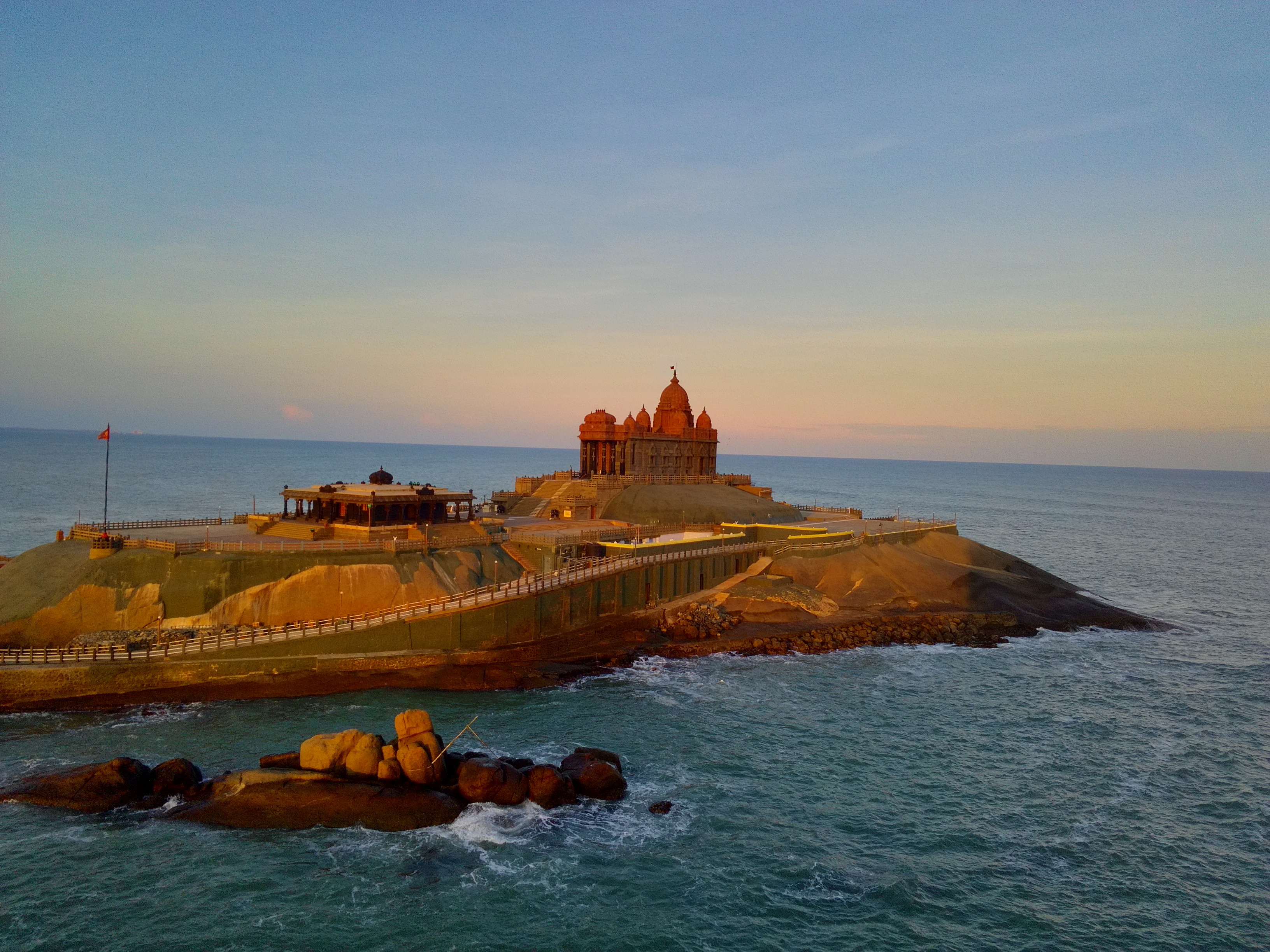
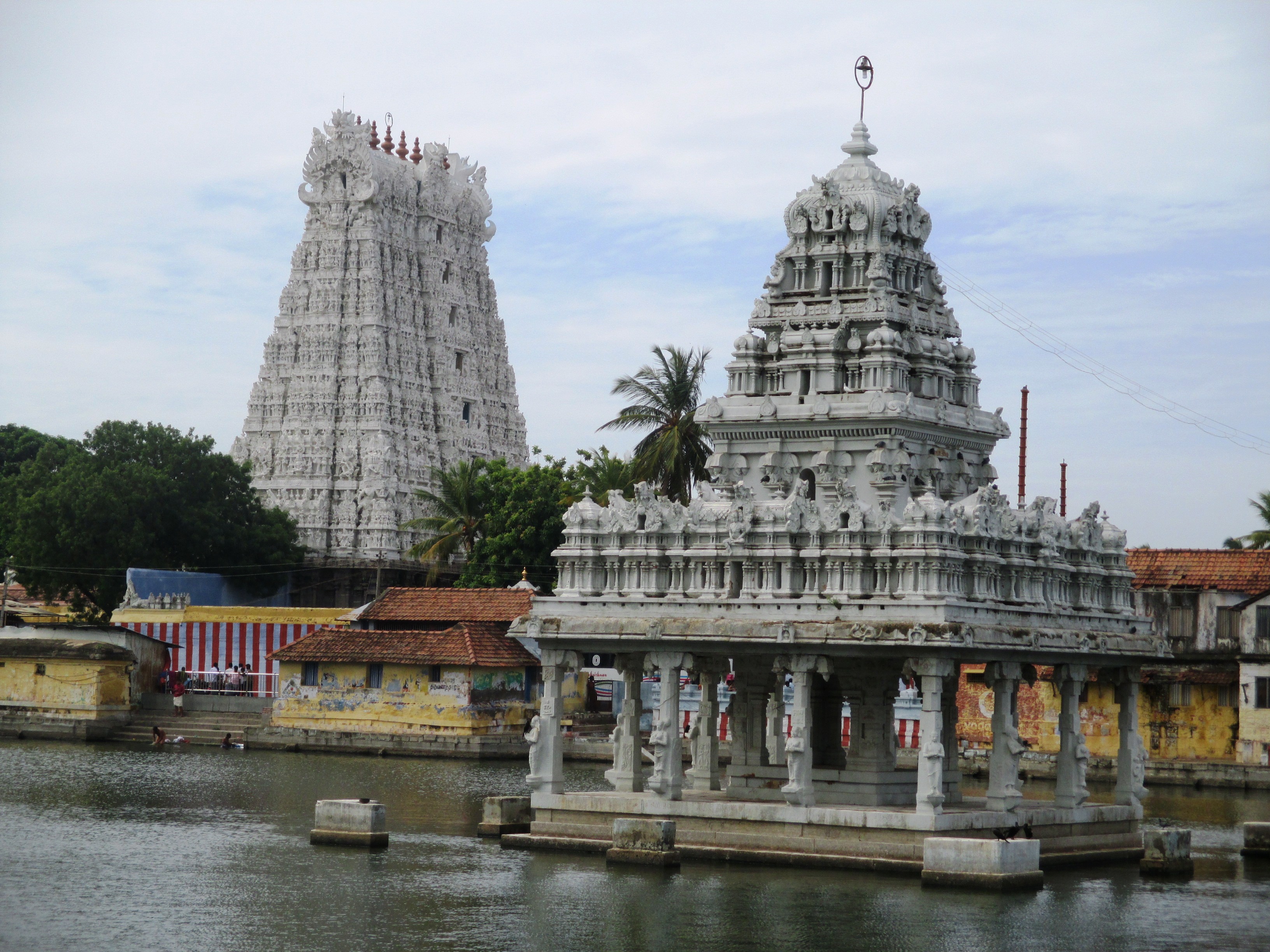
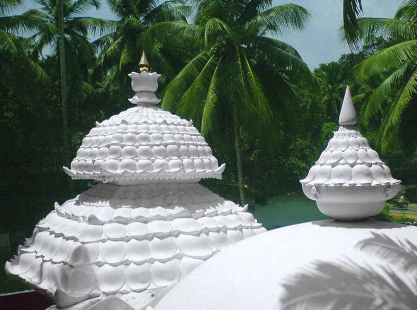
| image_skyline | | image_skyline = {{multiple image|perrow = 1/2/2|align = center|total_width=300|caption_align=center| | ||
| image1 = KanniyakumariCollageMontage.jpg | |||
| image2 = | |||
| | | image3 = | ||
| | | image4 = | ||
| | |||
| | |||
| | |||
| | |||
| | |||
}} | }} | ||
| map_alt | | image_caption = Montage of Kanyakumari district | ||
| map_caption | | mapframe = yes | ||
| coordinates | | mapframe-point = none | ||
| subdivision_type | | map_alt = | ||
| subdivision_name | | map_caption = Location in Tamil Nadu | ||
| subdivision_type1 | | coordinates = {{Coord|8.32|N|77.34|E|display=inline,title}} | ||
| subdivision_name1 | | subdivision_type = Country | ||
| subdivision_type2 | | subdivision_name = India | ||
| subdivision_name2 | | subdivision_type1 = [[States and union territories of India|State]] | ||
| seat_type | | subdivision_name1 = [[Tamil Nadu]] | ||
| seat | | subdivision_type2 = [[List of districts in India|District]] | ||
| parts_type | | subdivision_name2 = Kanyakumari | ||
| parts | | seat_type = Headquarters | ||
| leader_title1 | | seat = [[Nagercoil]] | ||
| leader_name1 | | parts_type = [[Tehsil|Taluks]] | ||
| leader_title2 | | parts = # [[Agastheeswaram]], | ||
| leader_name2 | # [[Kalkulam]], | ||
| leader_title3 | # [[Thovalai]], | ||
| leader_name3 | # [[Vilavancode]], | ||
| leader_title4 | # [[Killiyur, Kanniyakumari|Killiyur]], | ||
| leader_name4 | # [[Thiruvattar]] | ||
| unit_pref | | leader_title1 = [[District Collector]] | ||
Metric | | leader_name1 = R. Alagu Meena, [[Indian Administrative Service|I.A.S]]<ref>{{cite web |title=Kanniyakumari District |url=https://www.tn.gov.in/contact_directory/district_administration/9 |website=www.tn.gov.in |access-date=21 July 2024}}</ref> | ||
| area_total_km2 | | leader_title2 = [[Superintendent of Police]] | ||
| elevation_footnotes | | leader_name2 = R. Stalin, [[Indian Police Service|I.P.S]]<ref>{{cite news |title=New SP takes charge in Kanniyakumari district |url=https://www.thehindu.com/news/cities/Madurai/new-sp-takes-charge-in-kanniyakumari-district/article69057610.ece |work=The Hindu |date=3 January 2025 |access-date=31 July 2025}}</ref> | ||
| elevation_m | | leader_title3 = District Forest Officer | ||
| population_footnotes | | leader_name3 = M. illayaraja, [[Indian Forest Service|I.F.S]] | ||
| population_total | | leader_title4 = District Panchayat chairman | ||
| population_as_of | | leader_name4 = S. Merliant Dhas | ||
| population_density_km2 | | unit_pref = Metric | ||
| demographics_type1 | | area_total_km2 = 1672 | ||
| demographics1_title1 | | elevation_footnotes = | ||
| demographics1_info1 | | elevation_m = | ||
| demographics1_title2 | | population_footnotes = | ||
| demographics1_info2 | | population_total = 18,70,374 | ||
| timezone1 | | population_as_of = 2011 | ||
| utc_offset1 | | population_density_km2 = auto | ||
| postal_code_type | | demographics_type1 = Languages | ||
| postal_code | | demographics1_title1 = Official | ||
| area_code_type | | demographics1_info1 = [[Tamil language|Tamil]] | ||
| area_code | | demographics1_title2 = Minority | ||
| registration_plate | | demographics1_info2 = [[Malayalam]] | ||
| blank1_name_sec1 | | timezone1 = [[Indian Standard Time|IST]] | ||
| blank1_info_sec1 | | utc_offset1 = +5:30 | ||
| blank2_name_sec1 | | postal_code_type = [[Postal Index Number|PIN]] | ||
| blank2_info_sec1 | | postal_code = 629 xxx | ||
| blank3_name_sec1 | | area_code_type = Telephone code | ||
| blank3_info_sec1 | | area_code = 04652 for [[Nagercoil]] & 04651 for [[Marthandam]] | ||
| blank4_name_sec1 | | registration_plate = TN-74 for [[Nagercoil]] & TN-75 for [[Marthandam]] | ||
| blank4_info_sec1 | | blank1_name_sec1 = Coastline | ||
| blank5_name_sec1 | | blank1_info_sec1 = {{Convert|72|km|mi}} | ||
| blank5_info_sec1 | | blank2_name_sec1 = [[Human sex ratio|Sex ratio]] | ||
| blank6_name_sec1 | | blank2_info_sec1 = M-1000/F-1014 [[male|♂]]/[[female|♀]] | ||
| blank6_info_sec1 | | blank3_name_sec1 = Literacy | ||
| blank7_name_sec1 | | blank3_info_sec1 = 97.6% | ||
| blank7_info_sec1 | | blank4_name_sec1 = Legislature type | ||
| blank1_name_sec2 | | blank4_info_sec1 = Elected | ||
| blank1_info_sec2 | | blank5_name_sec1 = Current Member of Parliament (M.P) | ||
| blank2_name_sec2 | | blank5_info_sec1 = [[Vijay Vasanth]] | ||
| blank2_info_sec2 | | blank6_name_sec1 = [[Lok Sabha]] constituency | ||
| blank3_name_sec2 | | blank6_info_sec1 = [[Kanniyakumari]] | ||
| blank3_info_sec2 | | blank7_name_sec1 = Legislative Assembly Constituencies (6 M.L.A) | ||
| blank4_name_sec2 | | blank7_info_sec1 = # [[N. Thalavai Sundaram]] (Kanyakumari) | ||
| blank4_info_sec2 | # [[M. R. Gandhi]] (Nagercoil) | ||
| website | # [[J. G. Prince]] (Colachel) | ||
| official_name | # [[Mano Thangaraj|T. Mano Thangaraj]] (Padmanabhapuram) | ||
# [[Tharahai Cuthbert]] (Vilavancode) | |||
# [[S. Rajeshkumar]] (Killiyoor) | |||
| blank1_name_sec2 = [[Precipitation (meteorology)|Precipitation]] | |||
| blank1_info_sec2 = {{convert|2382|mm|in}} | |||
| blank2_name_sec2 = Avg. summer temperature | |||
| blank2_info_sec2 = {{convert|31|°C|°F}} | |||
| blank3_name_sec2 = Avg. winter temperature | |||
| blank3_info_sec2 = {{convert|22|°C|°F}} | |||
| blank4_name_sec2 = Central location: | |||
| blank4_info_sec2 = {{Coord|8|03|N|77|15|E}} | |||
| website = {{URL|https://kanniyakumari.nic.in/}} | |||
| official_name = | |||
}} | }} | ||
'''Kanyakumari district''' is one of the 38 [[list of districts of Tamil Nadu|districts]] | '''Kanyakumari district''' ({{IPA|ta|kɐnːijaːkumaːɾi|lang}}), officially '''Kanniyakumari district''', is one of the 38 [[list of districts of Tamil Nadu|districts]] of [[Tamil Nadu]] state and the southernmost [[list of districts in India|district]] in mainland [[India]]. It stands second in terms of population density among the districts of [[Tamil Nadu]].<ref>[https://web.archive.org/web/20121016162632/http://ibnlive.in.com/news/kumari-second-most-urbanised-tn-district/168794-60-118.html Kumari second most urbanised TN district – South India – Tamil Nadu – ibnlive<!-- Bot generated title -->]</ref> It is also the richest district in [[Tamil Nadu]] in terms of per capita income,<ref>{{cite web | url=https://tamil.asianetnews.com/tamilnadu/these-are-the-top-10-richest-districts-of-tamil-nadu-candipa-chennai-not-coimbatore--rxzguq | title=தமிழ்நாட்டின் முதல் 5 பணக்கார மாவட்டங்கள் இவை தான்.. கண்டிப்பா சென்னை, கோவை இல்லை }}</ref><ref>{{cite web |title=State Income chapter 2.1 Growth Imperatives |website=Tamil Nadu Government |url=http://www.tn.gov.in/dear/State%20Income.pdf }}</ref> and also tops the state in Human Development Index (HDI), literacy, and education.<ref>{{Cite news|url=https://www.thehindu.com/news/national/tamil-nadu/kanniyakumari-tops-hdi-rankings/article18470625.ece|title = Kanniyakumari tops HDI rankings|newspaper = The Hindu|date = 17 May 2017|last1 = Ramakrishnan|first1 = T.}}</ref><ref>{{Cite web|url=https://www.thehindubusinessline.com/economy/TNs-literacy-rate-at-new-high/article20411985.ece|title = TN's literacy rate at new high| date=22 March 2012 }}</ref> The district's headquarters is [[Nagercoil]].<ref>{{Cite web |title=About District |url=https://kanniyakumari.nic.in/about-district/ |access-date=21 December 2025 |website=Kanniyakumari District Administration}}</ref> | ||
Kanyakumari district has a varied topography with the sea on three sides and the mountains of the [[Western Ghats]] bordering the northern side. Except for a small stretch of land to the east of [[Kanyakumari]] town, almost the entire district is sandwiched between the [[Western Ghats]] and the [[Arabian Sea]] – the only district in [[ | Kanyakumari district has a varied topography, with the sea on three sides and the mountains of the [[Western Ghats]] bordering the northern side. Except for a small stretch of land to the east of [[Kanyakumari]] town, almost the entire district is sandwiched between the [[Western Ghats]] and the [[Arabian Sea]] – the only district in [[Tamil Nadu]] state facing the Arabian Sea. | ||
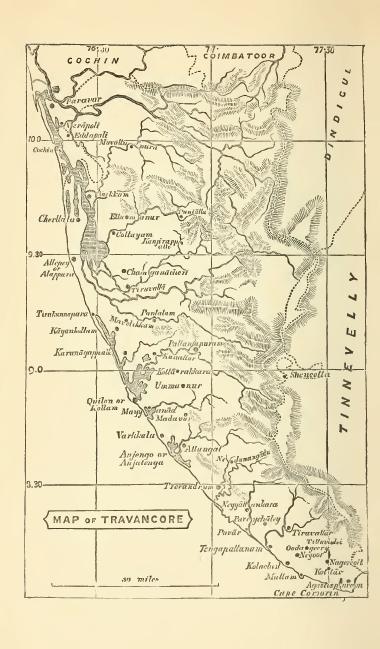
Historically, [[Nanjinad]] and Edai Nadu, which comprise the present-day Kanyakumari district, were ruled by various Tamil and Malayalam dynasties: the [[Chera dynasty|Cheras]], the [[Ay dynasty|Ay]]/[[Venad]]/[[Travancore royal family|Travancore]] dynasty, the [[Pandyan dynasty|Pandyans]], the [[Chola dynasty|Chozhans]] and the [[Nayak dynasty|Nayaks]]. A few artefacts have been unearthed by archaeological excavations.<ref>{{Cite web|title=Keeladi Excavation – A Revelation That Rewrites The History of Tamil Nadu – Tamilnadu Tourism|date=22 October 2019 |url=https://www.tamilnadutourism.com/blog/keeladi-excavation-a-revelation-that-rewrites-the-history-of-tamil-nadu/|access-date=7 September 2020|language=en-US}}</ref> It was part of the princely state of [[Travancore]] during the colonial times prior to [[Independence Day (India)|India's independence]];<ref>{{Cite web|title=Districts Details {{!}} Tamil Nadu Government Portal|url=https://www.tn.gov.in/district_details/573|access-date=7 September 2020|website=tn.gov.in}}</ref> four of the eight [[tehsil]]s of [[Thiruvananthapuram district]] were separated from the erstwhile Travancore Kingdom to form the new district of Kanyakumari, and they were made the part of [[Madras Presidency]] under recommendations from the [[States Reorganisation Commission]] in 1956. The Presidency was later renamed Tamil Nadu. | |||
The district is the birthplace of [[Ayyavazhi]]. Many historical assumptions persist in the district and state, which associate sages such as [[Agastya]], [[Vyasa]], [[Tolkāppiyam|Tolkappiyar]], [[Avvaiyar (8th-century poet)|Avvaiyar]] and [[Valluvar]] with the district. | |||
==Etymology== | |||
{{excerpt|Kanyakumari#Etymology|paragraphs=1|file=no}} | |||
==History== | ==History== | ||
| Line 101: | Line 112: | ||
The area that comprises the current Kanyakumari district was a part of the old Ay kingdom of the first and second Sangam ages. Following the decline of the Ay kingdoms, the area became Venad, with its capital [[Padmanabhapuram]] located North, North West of Nagercoil. The wealth of the Nanjilnadu beckoned many invaded kings including the Nayaks during the reign of [[Umayamma Rani]]. The [[Venad]] region was in anarchy before [[Marthanda Varma]] ascended the throne in 1729 CE. Under their rule anarchy was dominant in [[Kanyakumari]] region. However, [[Marthanda Varma]] brought a sense of disorder under control by annexing the nearby territories, putting down the feudal lords and establishing the strong state of [[Travancore]]. He had also bought some portions of Kanyakumari from the then viceroy making it the southern boundary. Under his rule, the district improved in a social context as well as economically. The famous [[battle of Colachel]] took place in the district. Later, the Maharajas of Travancore built the forts at Aramboly (Aralvaimozhy) to prevent any invasion from the Carnatic Kings. Key elements of [[Velu Thampi Dalawa|Velu Thampi Dalawa's]] revolt occurred in the area and the English East India company's army under Col. | The area that comprises the current Kanyakumari district was a part of the old Ay kingdom of the first and second Sangam ages. Following the decline of the Ay kingdoms, the area became Venad, with its capital [[Padmanabhapuram]] located North, North West of Nagercoil. The wealth of the Nanjilnadu beckoned many invaded kings including the Nayaks during the reign of [[Umayamma Rani]]. The [[Venad]] region was in anarchy before [[Marthanda Varma]] ascended the throne in 1729 CE. Under their rule anarchy was dominant in [[Kanyakumari]] region. However, [[Marthanda Varma]] brought a sense of disorder under control by annexing the nearby territories, putting down the feudal lords and establishing the strong state of [[Travancore]]. He had also bought some portions of Kanyakumari from the then viceroy making it the southern boundary. Under his rule, the district improved in a social context as well as economically. The famous [[battle of Colachel]] took place in the district. Later, the Maharajas of Travancore built the forts at Aramboly (Aralvaimozhy) to prevent any invasion from the Carnatic Kings. Key elements of [[Velu Thampi Dalawa|Velu Thampi Dalawa's]] revolt occurred in the area and the English East India company's army under Col. | ||
Leger broke through the fortifications and entered Travancore in 1810. In the year 1949, the area became a part of the reestablished [[Travancore]] Cochin state. The people of Agasteeswarem, Thovalai, Kalkulam and Vilavancode taluks, which formed the southern divisions of the former district of [[Trivandrum]], were predominantly Tamil speaking people. An extreme agitation by Tamil speaking residents under the leadership of [[A. Nesamony|Marshal Nesamony]] took place for including Kanyakumari within [[Tamil Nadu]]. Eventually the merger happened in 1956 based on [[States Reorganisation Act, 1956|language | Leger broke through the fortifications and entered Travancore in 1810. In the year 1949, the area became a part of the reestablished [[Travancore]] Cochin state. The people of Agasteeswarem, Thovalai, Kalkulam and Vilavancode taluks, which formed the southern divisions of the former district of [[Trivandrum district|Trivandrum]], were predominantly Tamil speaking people. The present Kanyakumari district was historically part of the erstwhile Travancore State. Four Tamil-speaking taluks viz., Vilavancode, Kalkulam, Thovala and Agastheeswaram which now form the Kanyakumari district was transferred to Madras State on 1 November 1956. The changes that were effected between the taluks and the villages as on 1 October 1956 are furnished in the fly-leaf to Table A-I.<ref>{{cite web |title=Census 1961 Kerala State |website=lsi.gov.in |url=http://lsi.gov.in:8081/jspui/bitstream/123456789/5670/1/22065_1961_TRI.pdf |page=14 |archive-date=24 June 2021 |archive-url=https://web.archive.org/web/20210624202258/http://lsi.gov.in:8081/jspui/bitstream/123456789/5670/1/22065_1961_TRI.pdf }}</ref> An extreme agitation by Tamil speaking residents under the leadership of [[A. Nesamony|Marshal Nesamony]] took place for including Kanyakumari within [[Tamil Nadu]]. Eventually the merger happened in 1956 based on [[States Reorganisation Act, 1956|language reorganisation of states]]. | ||
Historically, [[Nanjilnadu]] (Agastheeswaram and Thovalai taluks) and [[Eda Nadu]] (Vilavancode and Kalkulam taluks) which comprises the present Kanyakumari district. The district were ruled by various dynasties: [[Venad|Venad Kingdom]], [[Travancore|Travancore Kingdom]], the [[Chera dynasty|Cheras]], the [[Chola dynasty|Cholas]], the [[Ay kingdom|Ays]] and the [[Nayak dynasty|Nayaks]]. A few | Historically, [[Nanjilnadu]] (Agastheeswaram and Thovalai taluks) and [[Eda Nadu]] (Vilavancode and Kalkulam taluks) which comprises the present Kanyakumari district. The district were ruled by various dynasties: [[Venad|Venad Kingdom]], [[Travancore|Travancore Kingdom]], the [[Chera dynasty|Cheras]], the [[Chola dynasty|Cholas]], the [[Ay kingdom|Ays]] and the [[Nayak dynasty|Nayaks]]. A few artefacts were unearthed by archaeological excavations in parts of the district. The district was part of the princely state of [[Travancore]] during the colonial times prior to [[Independence Day (India)|India's independence]]; four of the eight [[tehsil]]s of [[Thiruvananthapuram district]] were separated to form the new district of Kanyakumari in 1956 following the demands of reunion made by the Tamil speaking majority people (about 70% of the population), who feels that their feelings were suppressed by the erstwhile Travancore Kingdom which has Malayalam-majority population. The four taluks were made the part of then [[Madras State]] under recommendations from the [[States Reorganisation Commission]] in 1956. The Madras State was later renamed Tamil Nadu in 1969 and Kanyakumari, today, is one of the 38 districts of [[Tamil Nadu]] state. | ||
The district is the birthplace of [[Ayyavazhi]], the [[Henotheism|henotheistic]] belief initiated by [[Hari Gopalan Citar|Hari Gopalan Seedar]], one among the | The district is the birthplace of [[Ayyavazhi]], the [[Henotheism|henotheistic]] belief initiated by [[Hari Gopalan Citar|Hari Gopalan Seedar]], one among the five prime disciples of [[Ayya Vaikundar]]. The social, religious and cultural history of the 19th century Kanyakumari district is intrinsically inter-twined with those of Ayyavazhi. Many historical assumptions persist in the district and state, which associate with sages namely [[Vyasa]], [[Agastya]], [[Tolkāppiyam|Tolkappiyar]], [[Avvaiyar (8th-century poet)|Avvaiyar]] and [[Valluvar]]. | ||
=== Legend === | |||
{{excerpt|Kanyakumari#Legend|paragraphs=1-2|file=no}} | |||
== Geography == | == Geography == | ||
Kanyakumari District is | The district is situated between 77°15' and 77°36' east longitude and 8°03' and 8°35' north latitude.<ref>{{Cite web |last=Ministry of Environment & Forests |title=Kanyakumari District |url=http://tnenvis.nic.in/files/KANYAKUMARI%20%20.pdf}}</ref><ref>{{Cite web |last=Maps of India |title=District Map of Kanyakumari |url=https://www.mapsofindia.com/maps/tamilnadu/districts/kanyakumari.htm |website=www.mapsofindia.com}}</ref> The district has borders with [[Tirunelveli district]] in the North & North East, the [[Gulf of Mannar]] in the East, the [[Indian Ocean]] in the South, the [[Arabian Sea]] in the West and the [[Thiruvananthapuram District]] ([[Kerala]]) in the West.<ref>{{Cite web |title=District Profile - 2017 |url=https://cdn.s3waas.gov.in/s38fe0093bb30d6f8c31474bd0764e6ac0/uploads/2018/04/2018040581-1.pdf |website=kanniyakumari.nic.in}}</ref> | ||
Kanyakumari district has a varied topography with sea on three sides and the mountains of the [[Western Ghats]] bordering the northern side. Geologically, the landmass of the district is much younger when compared to the rest of state – faulted as late as 2.5 million years during the [[Miocene]], after which numerous [[Marine transgression|transgression]], as well as regression of sea, had shaped the western coast of the district.<ref>{{Cite web |last=Mines department Report |title=District Survey report for Rough stone Kanniyakumari District |url=https://tnmines.tn.gov.in/pdf/dsr/7.pdf |website=tnmines.tn.gov.in}}</ref> | |||
The district can be categorised into three natural divisions:<ref>{{Cite web |last=ENVIS Centre Tamil Nadu |title=Kanyakumari District |url=http://tnenvis.nic.in/files/KANYAKUMARI%20%20.pdf |website=tnenvis.nic.in}}</ref> | |||
*Mountainous terrain is located in the northern and north-eastern portion of the district. It includes the northern parts of Vilavancode and Kalkulam taluks. It includes several impressive hilltops and is an extension of a larger mountain range to the north. | |||
*Stretching along the southern and south-eastern and south-western parts of the district, the coastal region is fringed with coconut trees. Although predominantly sandy, there are occasional slightly elevated patches of red cliffs. | |||
*Situated between the mountainous terrain and the sea-coast, the plains area features rolling, undulated valleys and plains interspersed with rivers and streams. | |||
Within the northern mountainous range of the district lies the scenic sanitarium of ''Muthukuzhivayal''. South of ''Peermedu'', this range stands out due to its significant breadth. The rugged landscape boasts bluff ridges and conical peaks, forming a continuation of the Western Ghats that stretches all the way to the [[Aralvaimozhi]] Pass. Notably, the perfectly detached ''Kattadimalai'' stands out as a prominent rocky mass. Continuing southward, a broken rocky spur shapes into [[Marunthuvazh Malai]], situated approximately 7 kilometres northwest of [[Kanyakumari]]. The [[Vellimalai]] in [[Kalkulam]] taluk and the Maruntuvazh malai in [[Agastheeswaram]] taluk are important isolated hills. The variations in altitude and climate across the hilly terrain of the district have led to a diverse vegetation profile, showcasing distinct representations of different land types. The highest hill within the district is [[Mahendragiri, Tamil Nadu|Mahendragiri]] (1,654 meters) in [[Thovalai taluk]], situated on the border between Kanyakumariand Tirunelveli districts. ''Kalmalai'' (900 meters), ''Moliyadi'' (700 meters) located at the head of old [[Kulasekaram]] reserved forest area and ''Tadakai malai'' (960 meters) are some of the notable hills in the district.<ref>{{Cite book |first=M. |last=Gopalakrishnan |title=Gazetteers of India - Kanyakumari District |publisher=Commissioner of Archives & Historical Research, Government of Tamil Nadu |location=Chennai |publication-date=13 January 1995 |page=15 |language=English }}</ref> | |||
The mountainous terrain in the northern and eastern portions of the district contains an extensive plateau amidst elevated hilltops. While most of the hills have steep slopes, some exhibit a more gradual spread. While the area is predominantly agricultural, numerous plantations and few handloom industries thrive in this region.<ref>{{Cite web |date=9 July 2024 |title=Kanniyakumari {{!}} Temple Town, Coastal Beauty, Tourist Destination {{!}} Britannica |url=https://www.britannica.com/place/Kanniyakumari |access-date=12 July 2024 |website=www.britannica.com |language=en}}</ref> The central area of the district, particularly Agastiswaram taluk, consists of vast plains. This includes the plains at [[Vellimalai]], [[Mylaudy]] and [[Derisanamcope]]. | |||
The district features an extensive 71.5 kilometre coastline.<ref>{{Cite web |title=District Profile – ICAR-KrishiVigyan Kendra, Kanyakumari |url=https://tnau.ac.in/site/kvk-kanyakumari/district-profile/ |archive-url=http://web.archive.org/web/20260104112014/https://tnau.ac.in/site/kvk-kanyakumari/district-profile/ |archive-date=4 January 2026 |access-date=17 March 2026 |website=tnau.ac.in |language=en-US}}</ref> Predominantly regular in its configuration, the coast showcases notable projections toward the sea at locations such as Kanyakumari, [[Muttom, Kanyakumari|Muttam]], and Erayanthurai. Additionally, there are a few minor sea ports. The ancient port of [[Colachel]] stands as the sole natural port on the west coast of Tamil Nadu while Kanyakumari serves as another minor port, primarily catering to tourists. Another minor port at is situated along the edge of Manakudi Estaury. Kanyakumari is the only district in Tamil Nadu facing the [[Arabian Sea]].<ref>{{Cite web |title=Kanyakumari district topographic map, elevation, terrain |url=https://en-in.topographic-map.com/map-k1mv57/Kanyakumari-district/ |access-date=12 July 2024 |website=Topographic maps |language=en}}</ref> | |||
===Rivers=== | |||
[[Pazhayar]], the southernmost river in India, originates from the secondary range of the Western Ghats, draining [[Mahendragiri, Tamil Nadu|Mahendragiri]] peak and nearby estates. Flowing through Thovalai and Agastiswaram taluks, the Pazhayar significantly supports irrigation. Its course spans approximately 37 kilometres, ultimately joining the Manakkudy Lagoon at [[Tamaraikulam|Thamaraikulam]]. Notable places along the river include [[Boothapandi]], [[Thalakudi]], Vadasseri, [[Nagercoil]], and [[Suchindram]].<ref>{{Cite web |title=pazhayar - INDIA WRIS WIKI |url=https://indiawris.gov.in/wiki/doku.php?id=pazhayar |access-date=12 July 2024 |website=indiawris.gov.in}}</ref> | |||
[[Kothai river|Kodayar]] originates east of ''Valia Malai'' peak within the southern part of the Muthukuzhivayal plateau and flows southwest through a wild tract. Two streams—one from ''Motavan Pothai'' and the other from ''Thacchamala'' hills—contribute to this river. The [[Pechiparai Dam]] intercepts the Kodayar, creating the Pachipparai lake. With a rocky bed, steep banks, sharp curves, and frequent falls, the Kodayar remains largely untamed except for a few kilometres near its end. The [[Tirparappu Waterfalls]] along this river stands at approximately 13 meters. After covering 32 kilometres in [[Kalkulam]] and Vilavancode taluks, the Kodayar merges with the Paraliyar to form the western Tambaraparani. It flows southwest through [[Kuzhithurai]], [[Munchirai]] and eventually into the [[Thengapattanam]] estuary where it meets the sea.<ref name="rjisacjournal.com">{{Cite web |date=18 October 2015 |title=MULTI PURPOSE RIVER VALLEY PROJECTS IN KANYAKUMARI DISTRICT {{!}} rjisacjournal.com |url=https://www.rjisacjournal.com/multi-purpose-river-valley-projects-in-kanyakumari-district/ |access-date=12 July 2024 |language=en-US}}</ref> | |||
Originating north of Mahendragiri, the [[Pahrali River|Paraliyar]], another major river of the district flows southwesterly and passes out of the forest area a mile above Ponmanai<ref name=Bourdillon>{{Cite book |last=T. F. Bourdillon |url=http://archive.org/details/TravancoreForests |title=Travancore Forests |date=1892}}</ref> where it encounters the [[Perunchani Dam]]. The Left Bank Channel supplies water from the Pechipparai reservoir before reaching the weir known as Puthen dam. The ancient ''Pandyan dam'', built in Pandiyan era, across the Paraliyar in Kalkulam taluk, along with the Pandyan Kal and related irrigation works, constitute one of the region's ancient irrigation systems. About a kilometre downstream from the Pandyan dam, the river meets the 250-year-old Puthen dam.<ref>{{Cite journal |date=7 April 2021 |title=Physical and chemical characteristics of Paraliyar river in Kanyakumari district, Tamil Nadu, India |journal=Journal of Research in Biology |volume=2 |issue=5 |pages=424–438 |url=https://ojs.jresearchbiology.com/index.php/jrb/article/view/234 |language=en-US |last1=L |first1=Dyona |last2=A |first2=Stella Roslin }}</ref> The river runs through the Kalkulam and Vilavancode taluks and covers 37 kilometres before joining the Kodayar near [[Thiruvattar]], forming the western [[Thamirabarani River]].<ref name="rjisacjournal.com"/> | |||
Valliyar, a minor river, originates at an altitude of 950m in the Velimalai hills<ref>{{Cite journal |first1=S. Bhagavathi |last1=Perumal |first2=P. |last2=Thamarai |title=Lithological Studies and Types of Soils Along Coastal Area of Kanyakumari to Colachel Coastal Belt |url=https://neptjournal.com/upload-images/NL-10-27-(27)B-1262.pdf |journal=Nature Environment and Pollution Technology |issn=0972-6268 }}</ref> and passes through [[Kothanalloor]], Kalkulam, [[Eraniel]], [[Thalakulam]] and [[Manavalakurichi]] before joining the [[Arabian Sea]] at Kadiapattanam. Along the way, it merges with the [[Thuvalar]], another small river originating from the Mampazhathurai hills. [[Mullayar]] another minor river flows approximately 11 kilometres through Vilavancode taluk and joins the western Tambraparani near Thikkurichi.<ref>{{Cite web |title=Kanyakumari {{!}} TWAD |url=https://twadboard.tn.gov.in/content/kanyakumari |access-date=12 July 2024 |website=twadboard.tn.gov.in}}</ref> | |||
==Geology== | |||
The district features diverse topography with its northern and western regions consist of hilly terrain and forests, while the southeastern and central parts are characterised by agricultural lands. Along the southern border lies an extensive sea-shore interspersed by valleys and plains. The coastal uplands of the district are characterised by rocky outcrops and rugged coastlines, with notable Teri sand dune complexes. The coastlines of [[Kanyakumari]], [[Theerthakkarai]], [[Muttom, Kanyakumari|Muttom]], and Kadiyapattanam are especially rocky. In Muttom, a [[Teri (geology)|Teri dune complex]] extends along the coast; [[Dune|sand dunes]] also stretch from Manakudi to [[Sothavilai Beach|Sothavilai]].<ref>{{Cite journal |last=Aran Castro A J, Kumar R S, Justine K Antony, Pagare N S, P.Raj Kumar, Praveen Raj R |title=Delineation of coastal geomorphology along the coast of Kanyakumari district, southernmost coast of India |url=https://www.tojqi.net/index.php/journal/article/download/4952/3474/5414 |journal=Turkish Online Journal of Qualitative Inquiry |volume=12 |issue=7 |page=6982}}</ref> Additionally, sandy beaches and isolated boulders define the southern coastline.<ref>{{Cite book |first=M. |last=Gopalakrishnan |title=Gazetteers of India - Kanyakumari District |publisher=Commissioner of Archives & Historical Research, Government of Tamil Nadu |location=Chennai |publication-date=13 January 1995 |page=11 |language=English }}</ref> | |||
The [[Geography of South India|Peninsular India]] is typically described as a highland with [[Fault (geology)|faulting]] on both sides. During the [[Archean|Archaean Eon]], the eastern coast experienced faulting, whereas the faulting of the western coast, including the major parts of the Kanyakumari district, occurred later—approximately 25 million years ago—during the early [[Miocene era]]. Subsequent [[marine transgression|transgressions]] and [[marine regression|regressions]] of the sea led to the formation of various sedimentary layers. | |||
Over time, the sea receded, resulting in [[Tectonic uplift|uplifted]] land masses. Evidence of this uplift includes deeply entrenched streams, waterfalls, high hanging valleys, alluvial flats, and marine sediment patches at higher elevations. Notably, shelly [[limestone]] formations in Kanyakumari further support the theory of land uplift in this area. The uplift likely occurred in stages, rejuvenating older streams. The wind gap at Mekkode resulted from river piracy, where the [[Pahrali River|Paraliyar]] was captured by the [[Kothai River|Kodayar]], possibly during the [[Tertiary period]]. The straight west coastline, uninterrupted by breaks, suggests faulting during the [[Pliocene epoch]]. Similarly, changes in the Kodayar River's course—from northward to northeast to southwest indicate faulting along its path. | |||
Geologically, the region features two main rock groups: the [[Khondalite]]s, and [[Charnockite]]s while a third group, [[Migmatite]]s<ref>{{Cite web |last=Department of Geology and Mining, Government of Tamil Nadu |title=District Survey Report for Rough stone Kanya kumari district |url=https://tnmines.tn.gov.in/pdf/dsr/7.pdf |website=tnmines.tn.gov.in}}</ref> is also found. The Khondalites, composed of garnetiferous [[Sillimanite]]-[[Graphite]] [[Gneiss]]es and [[Garnet]]-[[Biotite]] [[gneiss]]es, dominate a significant portion of the district.<ref>{{Cite web |title=Groundwater Resources - Kanyakumari District |url=https://www.nwm.gov.in/sites/default/files/Notes%20on%20Kaniyakumari%20District.pdf |website=www.nwm.gov.in}}</ref> The Charnockites are exposed in areas between [[Padmanabhapuram]], [[Aralvaimozhi]], [[Kulasekaram]], [[Thuckalay]], and [[Rajakkamangalam]]. The distinctive occurrence of [[Alkali feldspar granite|feldspathic granites]] across a significant portion of this region indicates that the rocks underwent intense [[Fold (geology)|isoclinal folding]], resulting in repeated bands. These folds align in a northwest–southeast direction and may have subsequently experienced cross-folding.<ref>{{Cite web |title=BiblioMed.org - Fulltext article Viewer |url=https://www.bibliomed.org/fulltextpdf.php?mno=141245 |access-date=19 July 2024 |website=www.bibliomed.org}}</ref> These charnockites also occur as lenses and patches within the khondalites. Additionally, thin [[Pegmatite]] bodies and [[quartz]] veins intrude the khondalites. Tertiary-age [[Varkala]] beds appear as thin cappings south of [[Kaliyakkavilai]] near the coast.<ref>{{Cite web |last=National Water Mission |title=Ground Water Resources Kanyakumari District |url=https://nwm.gov.in/sites/default/files/Notes%20on%20Kaniyakumari%20District.pdf |website=nwm.gov.in}}</ref> | |||
The basement rocks are covered by a sequence of soil types, including [[red soil]], [[lateritic soil]], [[clay]], [[Alluvium|river alluvium]], coastal alluvium, and black and red [[Sand|sandy soil]]s. These soil layers have thicknesses ranging from 1 metre to 1.5 meters in most locations. The underlying geological terrain belongs to the [[Peninsular Gneiss]]. The coastal belt around Kanyakumari, [[Kovalam]], and [[Vattakottai]] contains recent-age formations, including [[Calcareous]] [[sandstone]]s, [[Shelly limestone|limeshell]]s, and [[Kankar]]y [[Limestone]]. Lateral deposits, including sand, [[zircon]], [[rutile]], [[ilmenite]], and [[garnet]], are commonly found along the entire sea coast of Kanyakumari.<ref>{{Cite journal |last1=Perumal |first1=Dr S. Bhagavathi |last2=Subramanian |first2=Dr V. Balaji |last3=Nigun.T |first3=Krithik |last4=Priyanka.V |last5=Hegde .G |first5=Geethesh |last6=R |first6=Rameswaran |date=13 March 2021 |title=Study Of Geological Parameters Along The Coastal Area Of Arabian Sea, Kanyakumari To Colachel, South Tamilnadu, India |url=https://ilkogretim-online.org/index.php/pub/article/view/2080 |journal=Elementary Education Online |language=en |volume=20 |issue=1 |pages=4888–4901 |issn=1305-3515}}</ref> | |||
==Climate== | |||
Kanyakumari district experiences a [[tropical climate]], characterised by warm temperatures throughout the year as per the [[Köppen climate classification]]. The district generally has high temperatures year-round, with average highs ranging from 29 °C to 33 °C (84 °F to 91 °F) and average lows from 23 °C to 26 °C (73 °F to 79 °F). The [[Summer]] from March to May is typically hot, with temperatures often exceeding 34 °C (93 °F). The heat is more intense due to weaker winds. The region's proximity to the [[Equator]] makes it hard to distinctly define the summer season and summers are significantly wetter than winters.<ref>{{Cite web |url=https://en.climate-data.org/asia/india/tamil-nadu/kanniyakumari-34132/ |access-date=19 September 2024 |website=en.climate-data.org |title=Kanniyakumari climate: Average Temperature by month, Kanniyakumari water temperature }}</ref> [[Winter]]s from January to February are mild and pleasant, with temperatures rarely dropping below 19 °C (66 °F). The district lies at the intersection of two distinct climate zones. To the northwest, the [[Malabar coast]], west of the Western Ghats, experiences heavy rainfall during the summer monsoon from June to September. In contrast, the southeastern coast, starting from [[Kanyakumari]], has a [[semi-arid climate]] due to the limited impact of the summer monsoon. However, the retreating monsoon from October to December brings more rain, though its effects are somewhat reduced by the proximity of [[Sri Lanka]].<ref>{{Cite web |title=Kanyakumari climate: weather by month, temperature, rain - Climates to Travel |url=https://www.climatestotravel.com/climate/india/kanyakumari |access-date=19 September 2024 |website=www.climatestotravel.com}}</ref> | |||
The [[Indian Ocean Geoid Low]], Earth's largest [[gravity anomaly]], located south of Kanyakumari, influences the region's climate by altering sea levels, [[ocean current]]s, and monsoon dynamics, contributing to coastal erosion and long-term atmospheric trends. Its [[deep mantle]] origins are linked to tectonic shifts that subtly affect oceanic heat distribution and [[atmospheric circulation]].<ref>{{Cite web |title=NATIONAL CENTRE FOR POLAR AND OCEAN RESEARCH (NCPOR), GOA |url=https://www.ncpor.res.in/pages/view/190/253-indian-ocean-geoid-low |access-date=12 June 2025 |website=www.ncpor.res.in}}</ref><ref>{{Cite web |date=12 March 2025 |title=Indian Scientists Decode Indian Ocean's 'Gravity Hole' |url=https://indian.community/news/indian-scientists-solve-mystery-of-indian-oceans-gravity-hole/ |access-date=12 June 2025 |language=en-US}}</ref> | |||
{{Weather box | |||
| location = Kanyakumari (1991–2021, Rainy days:1999-2019) | |||
| metric first = Yes | |||
| single line = Yes | |||
| Jan high C = 29.4 | |||
| Feb high C = 30.5 | |||
| Mar high C = 31.5 | |||
| Apr high C = 31.5 | |||
| May high C = 30.7 | |||
| Jun high C = 29.1 | |||
| Jul high C = 29.0 | |||
| Aug high C = 29.3 | |||
| Sep high C = 29.5 | |||
| Oct high C = 29.0 | |||
| Nov high C = 28.4 | |||
| Dec high C = 28.5 | |||
| year high C = - | |||
| Jan mean C = 26.0 | |||
| Feb mean C = 26.8 | |||
| Mar mean C = 28.0 | |||
| Apr mean C = 28.5 | |||
| May mean C = 28.1 | |||
| Jun mean C = 26.9 | |||
| Jul mean C = 26.5 | |||
| Aug mean C = 26.6 | |||
| Sep mean C = 26.7 | |||
| Oct mean C = 26.5 | |||
| Nov mean C = 26.1 | |||
| Dec mean C = 25.9 | |||
| year mean C = - | |||
| Jan low C = 23.1 | |||
| Feb low C = 23.6 | |||
| Mar low C = 24.9 | |||
| Apr low C = 26.1 | |||
| May low C = 26.2 | |||
| Jun low C = 25.3 | |||
| Jul low C = 24.8 | |||
| Aug low C = 24.7 | |||
| Sep low C = 24.8 | |||
| Oct low C = 24.7 | |||
| Nov low C = 24.2 | |||
| Dec low C = 23.6 | |||
| year low C = - | |||
| rain colour = green | |||
| Jan rain mm = 15.0 | |||
| Feb rain mm = 12.0 | |||
| Mar rain mm = 27.0 | |||
| Apr rain mm = 56.0 | |||
| May rain mm = 81.0 | |||
| Jun rain mm = 83.0 | |||
| Jul rain mm = 42.0 | |||
| Aug rain mm = 37.0 | |||
| Sep rain mm = 49.0 | |||
| Oct rain mm = 137.0 | |||
| Nov rain mm = 183.0 | |||
| Dec rain mm = 71.0 | |||
| year rain mm = - | |||
| Jan rain days = 2 | |||
| Feb rain days = 2 | |||
| Mar rain days = 3 | |||
| Apr rain days = 7 | |||
| May rain days = 9 | |||
| Jun rain days = 11 | |||
| Jul rain days = 7 | |||
| Aug rain days = 6 | |||
| Sep rain days = 7 | |||
| Oct rain days = 12 | |||
| Nov rain days = 13 | |||
| Dec rain days = 6 | |||
| year rain days = - | |||
| time day = 17:30 [[Indian Standard Time|IST]] | |||
| Jan humidity = 69 | |||
| Feb humidity = 68 | |||
| Mar humidity = 71 | |||
| Apr humidity = 76 | |||
| May humidity = 78 | |||
| Jun humidity = 81 | |||
| Jul humidity = 80 | |||
| Aug humidity = 79 | |||
| Sep humidity = 79 | |||
| Oct humidity = 80 | |||
| Nov humidity = 80 | |||
| Dec humidity = 73 | |||
| year humidity = - | |||
| Jand sun = 9.9 | |||
| Febd sun = 10.1 | |||
| Mard sun = 10.2 | |||
| Aprd sun = 10.0 | |||
| Mayd sun = 9.6 | |||
| Jund sun = 9.7 | |||
| Juld sun = 10.1 | |||
| Augd sun = 10.1 | |||
| Sepd sun = 9.8 | |||
| Octd sun = 9.4 | |||
| Novd sun = 8.9 | |||
| Decd sun = 9.4 | |||
| yeard sun = - | |||
| source 1 = <ref>{{Cite web |title=Kanniyakumari climate: Average Temperature by month, Kanniyakumari water temperature |url=https://en.climate-data.org/asia/india/tamil-nadu/kanniyakumari-34132/ |access-date=19 September 2024 |website=en.climate-data.org}}</ref> | |||
}} | |||
Unlike other [[List of districts of Tamil Nadu|districts in Tamil Nadu]], it receives rainfall both from the [[Monsoon#Southwest monsoon|South-west]] and the [[Monsoon#Northeast monsoon|North-east monsoon]]s. The region receives moderate rainfall, with the heaviest rains occurring from October to December due to the northeast monsoon which sometimes causes floods. The southwest monsoon, from June to September, also brings some rain, but its effects are less pronounced compared to other parts of [[India]]. The average rainfall of the district is 1456.8 mm per annum. From 2005 onwards the annual rainfall is estimated to be 1006 mm.<ref>{{Cite web |last=ENVIS Center, Tamil Nadu. |title=Kanyakumari District |url=http://tnenvis.nic.in/files/KANYAKUMARI%20%20.pdf |website=tnenvis.nic.in}}</ref> The driest month is February and the greatest amount of precipitation occurs in November. [[Humidity]] levels are relatively high, especially during the monsoon seasons, contributing to a humid and warm atmosphere. June has the highest relative humidity, while February has the lowest. November experiences the most rainy days, whereas January has the fewest. | |||
Overall, Kanyakumari's climate is warm and humid, with significant rainfall during the monsoon [[Season]]s. This tropical climate supports the region's rich [[biodiversity]] and lush landscapes.<ref>{{Cite web |last=WMO |title=World Weather Information Service |url=https://worldweather.wmo.int/en/city.html?cityId=1597 |access-date=19 September 2024 |website=World Weather Information Service |language=EN}}</ref> | |||
==Biodiversity== | |||
As part of the [[Western Ghats]], one of the world's eight hottest biodiversity hotspots,<ref>{{Cite web |last=Centre |first=UNESCO World Heritage |title=Western Ghats |url=https://whc.unesco.org/en/list/1342/ |access-date=29 July 2024 |website=UNESCO World Heritage Centre |language=en}}</ref> this district boasts a rich diversity of flora and fauna, many of which are endemic to the region.<ref>{{Cite journal |last1=S. Sukumaran |last2=S. Jeeva |last3=D.S.Raj |last4=D.Kannan |title=Floristic Diversity, Conservation Status and Economic Value of Miniature Sacred Groves in Kanyakumari District, Tamil Nadu, Southern Peninsular India |url=https://wgbis.ces.iisc.ac.in/biodiversity/sahyadri_enews/newsletter/issue42/bibliography/Floristic-Diversity-Conservation-Status-and-Economic-Value-of-Miniature-Sacred-Groves-in-Kanyakumari-District.PDF |journal=TÜB‹TAK Academic Journals |volume=32}}</ref> The area is home to several endangered and threatened species, including the Indian Bison, Indian Rock Python, Lion-tailed Macaque, and Nilgiri Tahr. The [[Kanyakumari Wildlife Sanctuary]], a protected area covering 457.78 km<sup>2</sup>, is situated in the northern and north-western parts of the district. It constitutes the southern section of the [[Agastyamalai]] region, bordered by Kerala's [[Neyyar Wildlife Sanctuary]] to the west and [[Kalakkad Mundanthurai Tiger Reserve]] to the east.<ref>{{Cite journal |title=Structure of plant community in tropical deciduous forests of Kanyakumari Wildlife Sanctuary, India |url=https://www.researchgate.net/publication/313051457 |journal=Biodiversitas |volume=18 |issue=1 |page=392 }}</ref> Seven rivers including the [[Pahrali]] and [[Thamirabarani]] have their origin in this forest.<ref>{{Cite web |title=Kanniyakumari Wildlife Sanctuary |url=https://www.tamilnadutourism.tn.gov.in/destinations/kanyakumari-wildlife-sanctuary |website=Tamil Nadu Tourism.tn.gov.in }}</ref> The forests and jungles of Kanyakumari district host approximately 600 species of timber trees and 3,500 other plant species.<ref>{{Cite book |last=M. Gopalakrishnan |title=Gazetteers of India - Kanyakumari District |date=13 January 1995 |publisher=Commissioner of Archives & Historical Research, Government of Tamil Nadu |location=Chennai |page=23 |language=English }}</ref> The [[Suchindram Theroor Birds Sanctuary|wetlands of Suchindrum]] and [[Arumanallur]] alone support numerous variety of floral and faunal species across hundreds of genera.<ref>{{Cite journal |last=Ani Besant S & Anami Augustus Arul |title=Floristic diversity of Arumanalloor wetland in Kanyakumari district of Tamil Nadu |url=https://www.botanyjournals.com/assets/archives/2022/vol7issue1/7-1-66-133.pdf |journal=International Journal of Botany Studies |volume=7 |issue=1 |pages=698–702}}</ref><ref>{{Cite web |title=Tamil Nadu Wetlands Mission |url=https://www.tnswa.org/ |access-date=29 July 2024 |website=www.tnswa.org |language=en}}</ref> New species are frequently being identified throughout the region.<ref>{{Cite news |last=Manoj |first=E. M. |date=17 November 2023 |title=BSI scientists discover two new plant species on the Western Ghats |url=https://www.thehindu.com/news/national/kerala/bsi-scientists-discover-two-new-plant-species-on-the-western-ghats/article67544021.ece |access-date=29 July 2024 |work=The Hindu |language=en-IN |issn=0971-751X}}</ref><ref>{{Cite journal |last1=Narayanan |first1=Surya |last2=Mohapatra |first2=Pratyush P. |last3=Balan |first3=Amirtha |last4=Das |first4=Sandeep |last5=Gower |first5=David J. |date=15 April 2021 |title=A new species of Xylophis Beddome, 1878 (Serpentes: Pareidae) from the southern Western Ghats of India |url=https://vertebrate-zoology.arphahub.com/article/63986/ |journal=Vertebrate Zoology |language=en |volume=71 |pages=219–230 |doi=10.3897/vz.71.e63986 |doi-access=free |issn=2625-8498}}</ref> | |||
===Forests=== | |||
[[File:Pechiparai Reservoir, Kanyakumari District - with Western Ghats in the background.jpg|thumb|The [[Western Ghats]] at Pechiparai, Kanyakumari District]] | |||
Out of the total land area of 168,356.216 hectares, approximately 48,423 hectares are covered by forests. [[Reserve Forest|Reserved forest]]s account for 44,799 hectares, while 3,605 hectares are unclassed forests. Additionally, there are 19 hectares of reserved lands. Most of the forests in the district are situated on slopes of hills and plateaus, benefiting from high rainfall and serving as catchment areas for numerous streams and rivers. The forests in the district are lush and [[Virgin forest|virgin]] and is 75 million years old. The forest of this region comes under Boothapandy Mahendra-giri Reserve forest and is managed by the District Forest Officer with Headquarters at [[Nagercoil]].<ref name=Kanyakumari>{{Cite web |title=Kanyakumari District |url=http://tnenvis.nic.in/files/KANYAKUMARI%20%20.pdf |website=tnenvis.nic.in}}</ref> | |||
The jungles host around 600 species of gigantic timber trees and 3,500 other plants, many of which hold significant economic value. Notable timber trees include [[teak]], [[rosewood]] (blackwood), [[Artocarpus hirsutus|Jungle Jack]], [[Malabar ebony]], [[Adina cordifolia]], [[Terminalia elliptica|Karumaruthu]], and [[Pterocarpus marsupium|Vengai]]. Softwood varieties like [[Bombax ceiba]] and glossy-leaved jack are also abundant, along with [[Reed (plant)|reeds]], [[bamboo]]s, and [[sandalwood]]. Plantations of [[cardamom]] and [[tea]] thrive at higher elevations, while [[Piperaceae|pepper]], [[rubber]], [[ginger]], and [[turmeric]] flourish in lower areas.<ref name=Bourdillon/> Due to various local geological factors, the forests in the Kanyakumari division encompass 14 distinct types, based on the [[Biogeographic classification of India|Champion and | |||
Seth's classification]]<ref>{{Cite journal |title=Structure of plant community in tropical deciduous forests of Kanyakumari Wildlife Sanctuary, India |url=https://www.researchgate.net/publication/313051457 |journal=Biodiversitas |volume=18 |issue=1 |page=393}}</ref> ranging from lush tropical wet evergreen forests to tropical thorn forests, all within a relatively small area.<ref name=Kanyakumari/> The region hosts a diverse array of plant species, with its natural vegetation encompassing [[Deccan thorn scrub forests|southern thorn forests]], dry deciduous forests, moist deciduous forests, semi-evergreen forests, and [[Shola|evergreen hill sholas]] interspersed with [[Grassland|grassy downs]].<ref name="Kanniyakumari Wildlife Sanctuary">{{Cite web |title=Kanniyakumari Wildlife Sanctuary |url=https://www.tamilnadutourism.tn.gov.in/destinations/kanyakumari-wildlife-sanctuary |website=tamilnadutourism.tn.gov.in}}</ref> | |||
'''[[South Deccan Plateau dry deciduous forests|Dry deciduous forests]]''': These forests, ranging from an altitude of 200 to 600 meters occur in regions like [[Keeriparai]], Mangolamottai (lower Kodayar), Maruthaparai ([[Kulasekaram]]), [[Ulakkai Aruvi Waterfalls|Ulakkaruvi]], and Kuttiyar. Tree and shrub species include [[Adina cordifolia]], [[Cochlospermum religiosum]], [[Dillenia pentagyna]] ''Hydnocarpus laurifolius'', [[Lannea coromandelica]] and [[Terminalia chebula]] | |||
etc. ''Desmodium triangulare'' of the [[Legume|Legume family]], the root [[parasites]] [[Aeginetia indica]] and [[pedunculata]] have also been recorded in the region.<ref>{{Cite book |last=M. Gopalakrishnan |title=Gazetteers of India - Kanyakumari District. |date=13 January 1995 |publisher=Commissioner of Archives & Historical Research, Government of Tamil Nadu |location=Chennai |page=25 |language=English }}</ref> | |||
'''[[South Western Ghats moist deciduous forests|Moist deciduous forests]]''': These forests occur around Kilaviaru mountains and [[Kalikesam]] river near ''Balamore'' and ''Vallachithode'' at an altitude of about 60 meters. Common trees include [[Acronychia pedunculata]], [[Alstonia scholaris]], [[Scleropyrum wallichianum]], and [[Vateria indica]]. [[Liana]]s [[Gnetum]] and Derris thyrsiflora thrive in these areas. [[Lithophyte|Lithophytic herbs]] like ''Begonia floccifera'' and [[Begonia malabarica]] are abundant around ''Kilaviyaru''. | |||
'''[[Evergreen forest|Tropical Wet Evergreen Forests]]''': These forests and found in ''Upper Kodayar'', ''Muthukuzhivayal'', and [[Mahendragiri, Tamil Nadu|Mahendragiri]] above 800 meters. These dense, impenetrable forests receive heavy monsoon rains, supporting abundant [[Epiphyte|epiphytic]] and [[Terrestrial plant|terrestrial]] [[orchid]]s. Tall trees with huge trunks include [[Aglaia bourdillonii]], [[Cullenia exarillata]], [[Dimocarpus longan]]etc. Climbers like [[Embelia| Embelia basaal]] and [[Smilax zeylanica]] are common along with epiphytes [[Aeschynanthus|Aeschynanthus perrottetii]] and [[Hoya (plant)|Hoya pauciflora]].<ref>{{Cite book |last=M. Gopalakrishnan |title=Gazetteers of India - Kanyakumari District. |date=13 January 1995 |publisher=Commissioner of Archives & Historical Research, Government of Tamil Nadu |location=Chennai |pages=25–26 |language=English }}</ref> | |||
'''[[Grasslands]]''': At elevated altitudes in Muthukuzhivayal, [[Mahendragiri (Tamil Nadu)|Mahendragiri]], and Upper Kodayar, distinct grasslands thrive. Within the forested areas, each river basin—[[Kothai river|Kodayar]] and [[Pahrali River|Pahrali]]—encompasses approximately 30 square miles of grasslands.<ref name=Bourdillon/> Common grass species in this region include [[Chrysopogon|Chrysopogon orientalis]], [[Eulalia (plant)|Eulalia phaeothrix]], [[Themeda|Themeda trimula]], and [[Zenkeria sebastinei]]. Amidst the grasses and rocky crevices, one can find beautiful [[orchid]]s and Impatiens flowering alongside ferns. Additionally, other [[herbaceous]] plants such as [[Acrotrema arnottianum]], [[Centratherum|Centratherum rangacharii]], [[Exacum travancoricum]], [[Leucas|Leucas vestita]], [[Linum|Linum mysorense]], [[Hedyotis purpurascens]], [[Heracleum (plant)|Heracleum candeolleanum]], and [[Senecio|Senecio ludens]] thrive. On dripping rocks, [[Utricularia purpurea]] and [[Utricularia reticulata]] are commonly observed.<ref>{{Cite book |last=M. Gopalakrishnan |title=Gazetteers of India - Kanyakumari District. |date=13 January 1995 |publisher=Commissioner of Archives & Historical Research, Government of Tamil Nadu |location=Chennai |page=26 |language=English }}</ref> | |||
===Flora=== | |||
The Hills of the region harbour a unique [[xerophytic]] flora, adapted to arid conditions. At higher elevations, large grasses like [[Andropogon]], [[Panicum]], [[lemon grass]], and [[fodder]] grass thrive, creating a verdant carpet. Closer to the base, shrubby forms—such as species of [[Phoenix (plant)|Phoenix]], [[Cycas]], and Inthai—find their niche. Abundant [[bamboo]] clumps (including [[Ochlandra]]) and dense cane growths (both bamboo family members) abound. Sheltered beneath the grasses, [[ephemeral]] annual herbs and [[herbaceous]] [[perennial]]s emerge during favourable seasons. In the sheltered valleys, extensive [[paddy cultivation]] sustains the region. Paddy remains the staple food crop. [[Tapioca]], the second most important food crop, thrives primarily in [[Kalkulam]] and [[Vilavancode]] taluks. [[Palmyrah]] and [[coconut]] groves dot the plains and coastal regions.<ref name=Gopalakrishnan>{{Cite book |first=M. |last=Gopalakrishnan |title=Gazetteers of India - Kanyakumari District |publisher=Commissioner of Archives & Historical Research, Government of Tamil Nadu |location=Chennai |publication-date=13 January 1995 |page=16 |language=English }}</ref> | |||
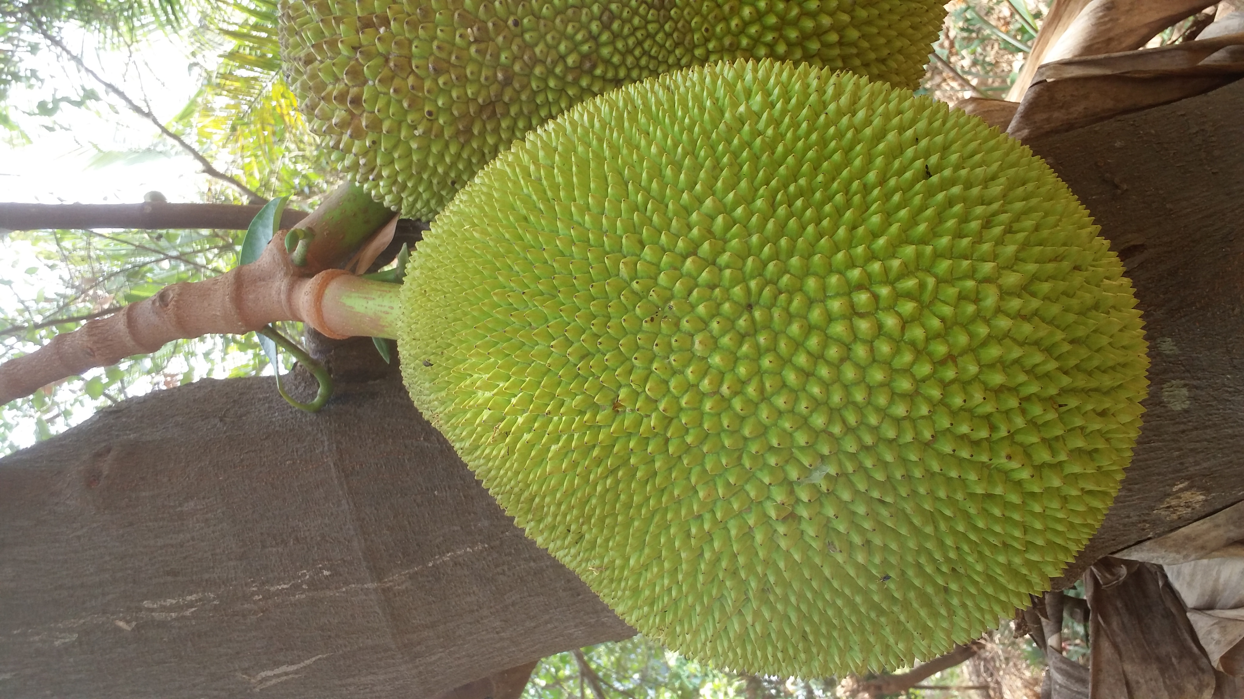
The landscape is adorned with significant [[Avenue (landscape)|avenue trees]], including the [[Banyan]], [[Artocarpus hirsutus|jungle jack]], [[Eugenia]], [[Portia tree]], [[Tamarind]] and more. Common edible fruits—such as [[mango]]es, [[jackfruit]], [[custard apple]], various [[banana|plantain varieties]], [[pineapple]], [[guava]], and more—contribute to local livelihoods. [[Orange (fruit)|Orange]]s, [[Lime (fruit)|lime]], and [[pomegranate]] also flourish. [[Grape]] cultivation occurs in specific pockets. 329 plant species have been identified across 201 [[sacred groves]] in the district. These species belong to 251 [[genera]] within 110 families. Among them, 12 are categorised as rare, [[endemic]], and [[threatened]]. One out of every seven species found in the groves of the region are rare.<ref>{{Cite journal |last=Selvamony Sukumaran, Solomon Jeeva |date=2008 |title=A floristic study on miniature sacred forests at Agastheeshwaram, southern peninsular India |journal=EurAsian Journal of BioSciences |volume=2 |pages=66–72}}</ref> Notably, [[Alpinia galanga]], [[Gloriosa superba]], [[Nymphaea pubescens]], [[Hemidesmus indicus]], [[Kaempferia galanga]], and [[Rauvolfia serpentina]] are endangered while [[Justicia (plant)|Justicia beddomei]], [[Leea indica]], and [[Petiveria alliacea]] are considered rare. Furthermore, species such as [[Indigofera|Indigofera uniflora]], [[Naregamia alata]], [[Ochlandra|Ochlandra scriptoria]], and [[Osbeckia aspera]] are endemic to the sacred groves of the district.<ref>{{Cite web |title=Rare and Endemic plants in the Sacred groves of Kanyakumari district |url=http://re.indiaenvironmentportal.org.in/files/Indian%20Journal%20of%20Forest%204.pdf |website=re.indiaenvironmentportal.org.in}}</ref> | |||
[[File:Black Pepper on Jackfruit Tree - Kerala - IMG 3623.jpg|thumb|[[Black pepper]] on [[Jackfruit]] tree.]] | |||
Around 60 species of [[medicinal plants]] thrive in the district. These include the medicinal weeds such as [[Abrus precatorius]], | |||
[[Abutilon indicum]], [[Acalypha indica]], [[Achyranthes aspera]], [[Acorus calamus]], [[Aloe vera]], [[Alternanthera sessilis]], etc.,<ref>{{Cite journal |title=Weeds of Kanyakumari district and their value in rural life |url=https://nopr.niscpr.res.in/bitstream/123456789/6936/1/IJTK%205%284%29%20%282006%29%20501-509.pdf |journal=Indian Journal of Traditional Knowledge |volume=5 |issue=October 2006 |pages=501–509}}</ref> and those found around the sacred groves include [[Atalantia monophylla]], [[Atalantia| Atalantia racemosa]], [[Mesua ferrea]], [[Commelina benghalensis]], and [[Sterculia urens]].<ref>{{Cite journal |title=Medicinal plants of sacred groves in Kanyakumari district Southern Western Ghats |url=http://indiaenvironmentportal.org.in/files/Medicinal%20plants%20of%20sacred%20groves%20in%20Kanyakumari%20distric.pdf |journal=Indian Journal of Traditional Knowledge |volume=9 |issue=April 2010 |pages=294–299}}</ref> | |||
Showy or scented flowers—such as [[Artemisia absinthium|Kolunthu]], [[Magnolia champaca|Chempakam]], [[Lawsonia inermis|henna]], Ceylon [[Jasmine]] [[Tabernaemontana divaricata| | |||
Nanthiarvattam]], [[Saraca indica|Asokam]], and more—adorn gardens and natural spaces of the eastern areas. Several [[rose]] varieties flourish in well-tended gardens. | |||
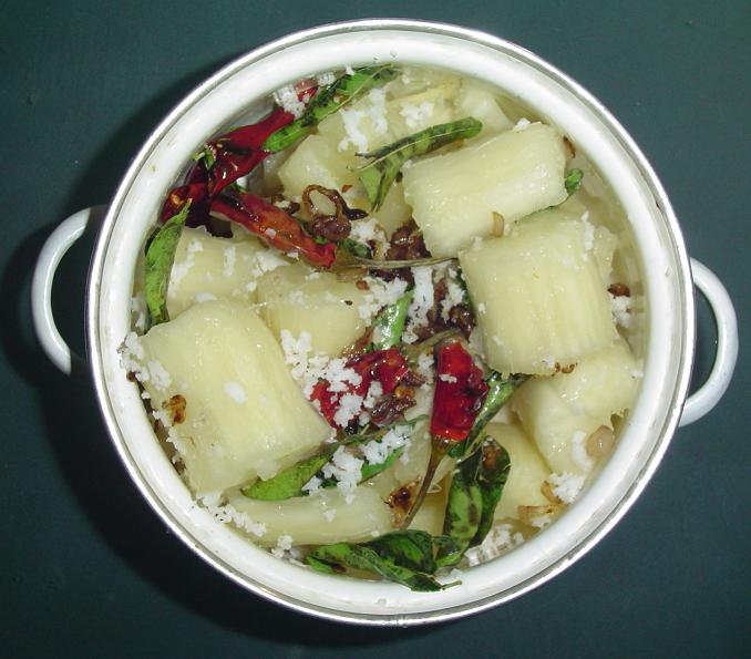
Of the [[Spice]]s, the ''Kanyakumari clove'' which accounts for 65% of India's clove production is produced around ''Maramalai'', ''Karumparai'' and ''Velimalai'' areas above ''Veerapuli Reserve'' and ''Mahendragiri'' hills of the district.<ref>{{Cite news |date=10 October 2021 |title=GI tag for Kanniyakumari clove: What makes this southern spice unique |url=https://timesofindia.indiatimes.com/city/chennai/gi-tag-for-kanniyakumari-clove-what-makes-this-southern-spice-unique/articleshow/86886438.cms |access-date=2 August 2024 |work=The Times of India |issn=0971-8257}}</ref> [[Cardamom]], [[black pepper]], [[ginger]], [[turmeric]] and other spices too thrive here. Tuberous plants like [[sweet potato]], [[arrow-root]], and [[tapioca]] yield edible roots.<ref name=Gopalakrishnan/> | |||
The hedges in the region consist of a variety of thorny or succulent shrubs. Among them are the [[Screw-pine]], [[Opuntia|Prickly-pear]], [[Pineapple]], [[Agave]], and [[Euphorbia]]. Additional hedge plants include [[Jatropha]], [[Pithecolobium]], [[Casuarina]], [[Sesbania]], [[Erythrina]], [[Pongu]], and [[Lantana]]. [[vine|Climber]]s, most of which have leafy growth, overgrow these hedges. Other than the [[Xerophytes|xerophytic]] vegetation, the district also hosts [[Aquatic plant|hydrophytic]] flora. In the [[pond]]s, large associations of [[Lotus (plant)|lotus]] and [[Nymphaeaceae|water lilies]] thrive, along with smaller [[Nymphoides hydrophylla|Limnanthemum]] plants. Floating plants like [[Trapa bispinosa]] and [[Pistia|pistia statistis]] cover water surfaces, often beneath the shade of big banyan trees. Submerged plants, including [[Ceratophyllum]], [[Utricularia]], and [[Chara (alga)|Chara]], form a close tangle underwater. In shallow tanks and river basins, reeds flourish in marshy soil. These [[Reed (plant)|reeds]] consist of [[juncus]], [[scirpus]], [[cyperus]], and [[typha]], forming a dense palisade of leaves over the water surface. Numerous [[marsh]]y plants thrive between the reeds and along the margins.<ref>{{Cite book |first=M. |last=Gopalakrishnan |title=Gazetteers of India - Kanyakumari District |publisher=Commissioner of Archives & Historical Research, Government of Tamil Nadu |location=Chennai |publication-date=13 January 1995 |page=17 |language=English }}</ref> | |||
The plains, up to an elevation of 200 meters, are characterised by [[Deccan thorn scrub forests|Southern tropical thorny forests]]. Notable locations within this ecosystem include [[Anjugramam]], Vattakkottai, [[Kanyakumari]], [[Marunthuvazh Malai]], [[Colachel]], and [[Kuzhithurai]]. These forests support a variety of plant life. Common trees found in the interior plains include [[Cassia siamea]], [[Dichrostachys cinerea]], [[Morinda pubescens]], [[Thespesia populnea]], [[Ficus bengalensis]], [[Mangifera indica]], [[Alstonia scholaris]], [[Pongamia pinnata]], and [[Calophyllum inophyllum]]. Shrubs and [[Subshrub| | |||
under shrubs]] like [[Crotalaria|Crotalaria gigantea]], [[Cassia auriculata]], [[Vitex negundo]], [[Crotalaria striata]], and [[Dodonaea viscosa]] are abundant. Beneath the shade of these shrubs and trees, herbaceous plants such as [[Rhinacanthus nasutus]], [[Asystasia gangetica]] and [[Vernonia cinerea]] thrive. Climbers like [[Pterolobium hexapetalum]], [[Lantana camara]], [[Cissus quadrangularis]], [[Aganosma cymosa]], [[Coccinia grandis]], [[Pergularia daemia]] and [[Jasminum angustifolium]] are also frequently encountered in this ecosystem.<ref>{{Cite journal |last1=Mary Kensa |first1=V. |last2=S.j |first2=BeemaJainab |last3=A |first3=Kavitha |last4=S |first4=Rejitha |last5=M |first5=Anusha |last6=R |first6=Vinitha |date=30 June 2015 |title=Survey of Climbers in Atchankulam, Kottaram Panchayat, Kanyakumari District, Tamilnadu, India |url=https://krjournal.com/index.php/krj/article/view/83 |journal=Kongunadu Research Journal |language=en |volume=2 |issue=1 |pages=88–93 |doi=10.26524/krj72 |issn=2349-2694|doi-access=free }}</ref> | |||
The coastal areas face unique challenges due to factors like sandy soil, [[aridity]], scanty rainfall, and strong winds. In the Foreshore sandy areas, species like [[Spinifex littoreus]], [[Ipomoea pes-caprae]] (Sweet), [[Sesuvium portulacastrum]], [[Trianthema portulacastrum]], [[Atriplex|Atriplex repens]], [[Cyperus rotundus]], [[Mollugo cerviana]], [[Tephrosia purpurea]], [[Tricyrtis hirta|T. hirta]], [[Pedalium murex]] and various [[Portulaca]] species shall be found. In marshy backwater areas, [[Suaeda nudiflora]], [[Salicornia|Salicornia brachiata]], and [[Arthrocnemum indicum]] are frequently found. Backwaters near river mouths and connecting canals are often thickly fringed with [[Pandanus tectorius]]. [[Acrostichum aureum]] and [[Excoecaria agallocha]] are common in shallow waters. In the Manakudy, [[Thengapattanam]] [[Munchirai]] backwater area, [[Barringtonia racemosa]], [[Ixora coccinea]], and [[Nauclea|Nauclea missionis]] thrive. Closer to the shore, [[Neptunia (plant)|Neptunia]] and [[Hygrophila (plant)|Hygrophila]] grow intermingled with [[Aeschynomene aspera]], [[Ludwigia (plant)|Ludwigia]], and [[Ipomoea aquatica|Ipomoea reptans]]. More than 100 species, spanning across 90 genera and 46 families including [[Adenanthera pavonina]], [[Ficus religiosa]], [[Psidium guajava]], [[Ocimum tenuiflorum]], [[Waltheria indica]], [[Dendrobium macrostachyum]] and [[Sida acuta]] were recorded in the sacred groves along the south-west coast of the district.<ref>{{Cite journal |title=Phytosociological studies of the sacred grove of Kanyakumari district, Tamilnadu, India. |url=https://www.researchgate.net/publication/324974733 |journal=Tropical Plant Research |issue=5 |pages=29–40}}</ref> The vegetation in the cape area is typically [[xerophytic]]. [[Acacia planifrons]] groves characterise this region. Within the Acacia woods, [[cacti]], [[agave]], and [[aloe]] grow, accompanied by a ground cover of typical xerophytic herbs, including various grasses. Moving to the inland sandy areas, these regions are characterised by xerophytic plants such as [[Euphorbia tirucalli]], [[Jatropha curcas]], [[Jatropha gossypiifolia]], [[Cleome|Cleome aspera]], [[Chorispora tenella]], [[Aerva lanata]], [[Phyla nodiflora]], and [[Zornia|Zornia diphylla]].<ref>{{Cite book |first=M. |last=Gopalakrishnan |title=Gazetteers of India - Kanyakumari District |publisher=Commissioner of Archives & Historical Research, Government of Tamil Nadu |location=Chennai |publication-date=13 January 1995 |page=18 |language=English }}</ref> | |||
===Fauna=== | |||
[[File:Micronia aculeata, Thiruvattar, India.jpg|thumb|[[Micronia aculeata]], spotted at [[Attoor, Kanyakumari|Attoor]].]] | |||
The district is abundant in wildlife, with its hill forests showcasing a wide variety of fauna, representing most species of [[South India|Southern India]]. The district's fauna belongs to the [[Indian subcontinent|Cis gangetic]] sub-region of the [[Indomalayan realm]], with its hill fauna showing affinities with the [[Himalaya]]s and the southwestern hill group in [[Sri Lanka]]. The district hosts ten orders of [[mammal]]s. Four species of [[primate]]s are found in the [[shola]]s and [[South Western Ghats moist deciduous forests|moist deciduous forests]], including the [[Bonnet macaque]] and [[Toque macaque]] at lower altitudes, and the [[Lion-tailed macaque]] and [[Nilgiri Langur]] at elevations above 2,000 feet. The [[Slender Loris]] of the order [[Lemuroidea]] occurs in the interior forests. Situated at the tail-end of the [[Central Asian Flyway]], the region attracts numerous [[Bird migration|migratory birds]] from thousands of miles away.<ref>{{Cite news |last=Shailaja Robert Grubh |title=Sanctuary in the lowland plains |url=http://www.hindu.com/thehindu/yw/2003/02/01/stories/2003020101320300.htm |archive-url=https://web.archive.org/web/20030821165901/http://www.hindu.com/thehindu/yw/2003/02/01/stories/2003020101320300.htm |archive-date=21 August 2003 |work=The Hindu}}</ref> | |||
[[Felis tigris|Tigers]] are found around the Black Rock estate which descend to lower reaches during October and November, occasionally entering bordering villages. [[Felis pardus|Panther]]s inhabit moist deciduous forests and often prey on domesticated animals. [[Melursus ursinus|Bear]]s usually reside at elevations above 3,000 feet but sometimes descend to lower levels. [[Cuon alpinus|Wild dogs]] are found in the lower hills of the Muthukuzhi valley, while the [[Herpestes edwardsii|Indian Grey Mongoose]] and [[Felis chaus|Jungle Cats]] are common in the low country and jungles. [[Jackal]]s and [[fox]]es are also common. | |||
The [[Paraechinus micropus|South Indian Hedgehog]] is found throughout the district. [[Bat]]s are very common, with four different species present. Among [[squirrel]]s, the [[Indian palm squirrel|Palm Squirrel]] is most commonly found in the countryside, while the [[Malabar Squirrel]] inhabits the jungles. The [[Hystrix indica|Indian Porcupine]] is found throughout the forests. [[Rat]]s, [[mice]], and [[hare]]s are very common, with [[Black rat]] and [[Mus booduga]] found across the district.<ref>{{Cite journal |last=Chandra Sen |first=J.S |title=Observations on the Carnivores of Kanyakumari district |url=https://zoosprint.org/index.php/zp/article/view/4951/4381 |journal=Zoos' Print |pages=60–61}}</ref><ref name="Kanniyakumari Wildlife Sanctuary"/> | |||
[[Indian Elephant|Elephant]]s are abundant in the upper reaches of ''Asambu'' and ''Veerapuli'' reserves and are occasionally spotted around Kodayar, [[Perunchani Dam|Perunchani]] and ''Balamore'' areas. [[Cervidae|Deer]] are seen throughout the hilly forests, with three species present: The [[Spotted Deer]], [[Rusa unicolor|Sambur]], and the [[Muntiacus muntjak|Barking Deer]]. The Muthukuzhi valley and the entire ''Asambu region'' are favoured by Sambur deer. The [[Bos gaurus|Gaur]] is the largest of the two [[bovine]]s found in the forests, living in rock caves on hills up to an elevation of 5,000 feet. Small herds of bison frequent the [[shola]]s and grassy areas around the Muthukuzhi valley and the higher reaches of Asambu. The [[Hemitragus hylocrius|wild goat]] is usually confined to grassy slopes. [[Sus scrofa|Wild bear]]s are found on the hills and jungles in herds. Additionally, aquatic [[dolphin]]s and [[porpoise]]s are found in river mouths and backwaters. [[Indian pangolin]]s are also present in forests and surrounding valleys.<ref>{{Cite book |first=M. |last=Gopalakrishnan |title=Gazetteers of India - Kanyakumari District |publisher=Commissioner of Archives & Historical Research, Government of Tamil Nadu |location=Chennai |publication-date=13 January 1995 |page=27 |language=English }}</ref> | |||
The district's forests support a rich variety of [[Bird|avifauna]], with about 360 species recorded. Notably, 140 out of the 204 species of South Indian [[Passerine|Passerine birds]] are found here. The [[House Crow]] is the most common bird, while the [[jungle crow]] is less frequently seen. [[Common babbler]]s include the earthy-brown [[jungle babbler]] and the slimmer common babbler found in dry plains. [[Magpie-robin]]s are usually seen near human habitations. Other common birds include the [[cuckoo]], [[golden oriole]] and [[Indian robin]] which are frequently noted in dry areas.<ref>{{Cite journal |last=S Jeya, M Suja |date=22 January 2022 |title=Avifauna along the agro ecosystem of Tholayavattam and its environs, Kanyakumari district, Tamil Nadu |url=https://www.ecologyjournal.in/assets/archives/2022/vol4issue1/4-1-13-681.pdf |journal=International Journal of Ecology and Environmental Sciences |volume=4 |issue=1 |pages=15–20}}</ref> The [[tailorbird]] and the [[drongo]] or king crow often visit the countryside. The [[red-vented bulbul]] is seen in plains where food is plentiful and at elevations of about 4,000 feet. The [[Iora]] is found in gardens and groves. Among [[Shrike]]s, the [[Scarlet minivet]] is the most common, found in woody areas and evergreen jungles. The [[Common myna]] is found on grasslands, while the common weaver bird or [[Baya weaver]] is seen in coconut groves of valleys and plains. The skylark is often heard in low country and on hills. | |||
Three species of [[sunbird]]s — Cinnyris zeylanicus, [[Purple sunbird|Cinnyris asiaticus]], and [[Loten's sunbird]] — are frequently found in gardens. Common [[woodpecker]]s include the [[Black-rumped flameback|golden-backed woodpecker]], the Yellow-fronted Pied Woodpecker, and the [[Rufous woodpecker|Southern Rufous woodpecker]]. The [[Malabar whistling thrush]], a blue-black bird, is found near hilly streams. [[Paradise flycatcher]]s often visit shady groves, gardens, and deciduous jungles with bamboo-clad regions. 87 bird species from 39 families and 15 orders, including [[omnivore]]s, [[carnivore]]s, [[piscivore]]s, [[herbivore]]s, [[granivore]]s, and [[nectarivore]]s, such as the [[Eurasian Spoonbill]], [[Brahminy Starling]], [[Glossy Ibis]], [[Black-headed ibis|Oriental White Ibis]] and [[Spot-billed Pelican]] have been observed around the [[Swamithoppe]] [[Salt evaporation pond|saltpan]]s.<ref>{{Cite journal |last=Jude D, Karthick M, Ram Kumar R, Sathyananth M, Stephenraj D and Azhagu Raj R. |date=2022 |title=Avifaunal Diversity of Swamythoopu Salt Pan, Kanyakumari, Tamil Nadu, India |url=https://www.researchgate.net/publication/358219852 |journal=International Journal of Zoological Investigations |volume=8 |issue=1 |pages=138–151|doi=10.33745/ijzi.2022.v08i01.018 }}</ref> | |||
== | The [[House sparrow]] is commonly found around human habitations. [[Parrot]]s are mostly seen in hilly and woody areas while various varieties of [[Kingfisher]]s including [[White-throated kingfisher]], [[Common kingfisher]] and | ||
[[Pied kingfisher]] are found beside inundated paddy fields, ponds, kutcha wells and sandy seashores.<ref>{{Cite book |last=P.K.Nambiar |title=Census of India 1961 - District Census Handbook, Kanyakumari. Volume I & II |date=1966 |publisher=The Director Of Stationery And Printing, Madras |location=Chennai |page=8 |language=English}}</ref> [[Bee-eater]]s are very common. The Indian [[Rock Dove|blue rock pigeons]] are seen all over the plains. Among [[Galliformes|game birds]], the [[Grey junglefowl|Jungle fowl]] is common around the Asambu forests in the [[Azhagiapandiapuram]] range. [[Francolinus]] is often seen in [[Deccan thorn scrub forests|thorny scrubby areas]]. Two main varieties of [[owl]]s are the [[Spotted owlet]] and the [[Eastern barn owl|Barn owl]], which occasionally stray into the countryside and perch on house tops. Other varieties include the [[Brown fish owl]] and the [[Indian eagle-owl|Indian great horned owl]]. Two important species of [[Kite (bird)|kite]]s in this district are the [[Black kite|pariah kite]] and the [[Brahminy kite]].<ref>{{Cite web |date=14 September 2024 |title=Bird List - Kalikesham, Kanyakumari wildlife sanctuary, Kanniyakumari, Tamil Nadu, India - eBird Hotspot |url=https://ebird.org/hotspot/L4916764/bird-list |access-date=18 September 2024 |website=ebird.org}}</ref><ref>{{Cite journal |last=S Jeya, M Suja |date=22 January 2022 |title=Avifauna along the agro ecosystem of Tholayavattam and its environs, Kanyakumari district, Tamil Nadu |url=https://www.ecologyjournal.in/assets/archives/2022/vol4issue1/4-1-13-681.pdf |journal=International Journal of Ecology and Environmental Sciences |volume=4 |issue=1 |page=16}}</ref> | |||
Among the [[Bird of prey|birds of prey]], the [[White-rumped vulture]] and the [[Egyptian vulture|White scavenger vulture]] are prominent. [[Water bird]]s are common along coastal backwaters, inundated paddy fields, and tanks. The [[White-breasted waterhen]] is often seen in marshy areas overgrown with reeds and bushes, and on the margins of ponds. [[Stork]]s and [[Coot]]s are frequently found in inundated paddy fields, tanks, ponds, and rivers. Comb ducks are observed at Suchindram and Theroor wetlands<ref>{{Cite journal |last1=Grubh |first1=R. B. |last2=Pandian |first2=P. |last3=Rajesh |first3=A. |last4=Ross |first4=M. |last5=Grubh |first5=S. |date=15 November 2007 |title=Southern-most breeding record of the Comb Duck Sarkidiornis melanotos from India |url=https://indianbirds.in/pdfs/IB4.1_GrubhETAL_CombDuck.pdf |journal=Indian Birds |volume=4 |issue=1 |page=15}}</ref> while four other species of [[duck]]s are common in the area. The [[Indian pond heron]] is abundant in paddy fields and ponds. [[Flamingo]]s including [[Greater flamingo]]s could be spotted across the [[Rajakkamangalam]] and Manakudi estuary throughout the year.<ref>{{Cite news |date=3 January 2019 |title=Over 40 bird species spotted in Kanyakumari survey |url=https://timesofindia.indiatimes.com/city/madurai/over-40-bird-species-spotted-in-kanyakumari-survey/articleshow/67356848.cms |access-date=11 September 2024 |work=The Times of India |issn=0971-8257}}</ref> | |||
The region's reptiles include [[crocodile]]s, [[tortoise]]s, [[turtle]]s, [[lizard]]s, and [[snake]]s. There are two species of [[crocodile]]s, nine species of [[chelonian]]s, 33 of [[lizard]]s, and 74 of [[snake]]s. The [[Ophiophagus hannah|King Cobra]] frequents rivers and streams in shola forests.<ref>{{Cite news |title=13-foot-long king cobra rescued in Kanniyakumari district |url=https://www.thehindu.com/news/cities/Madurai/13-foot-long-king-cobra-rescued-in-kanniyakumari-district/article68911143.ece |work=The Hindu |issn=0971-751X |date=25 November 2024 |access-date=30 November 2024}}</ref><ref>{{Cite news |title=15-feet-long king cobra rescued |url=https://www.thehindu.com/news/national/tamil-nadu/15-feet-long-king-cobra-rescued/article67442651.ece |work=The Hindu |issn=0971-751X |date=20 October 2023 |access-date=30 November 2024}}</ref> The [[Echis carinata|Viper]] and the [[Indian cobra]] are common, often found in tree hollows and dilapidated houses. [[Rat snake]]s are frequently seen and [[Python molurus|Pythons]] are found in dry sandy areas. Among [[amphibian]]s, 34 species of frogs are present, including [[Rana aurantiaca]], Ixalus travancoricus, and [[Ferguson's toad]]. The [[Indirana beddomii|Indian Leaping frog]] is found around Kiripparai areas.<ref>{{Cite journal |last1=Garg |first1=Sonali |last2=Biju |first2=S. D. |date=16 November 2016 |title=Molecular and Morphological Study of Leaping Frogs (Anura, Ranixalidae) with Description of Two New Species |journal=PLOS ONE |volume=11 |issue=11 |article-number=e0166326 |doi=10.1371/journal.pone.0166326 |doi-access=free |issn=1932-6203 |pmc=5112961 |pmid=27851823|bibcode=2016PLoSO..1166326G }}</ref> | |||
The coastal area is known for its rich variety of fish, with nearly 370 species identified. [[Whale shark]]s<ref name="faunajournal.com">{{Cite web |title=Biodiversity of Aquatic Insect Population in Two Permanent Ponds of Kanyakumari District |url=https://www.faunajournal.com/vol1Issue2/5.1.html |access-date=18 September 2024 |website=www.faunajournal.com}}</ref> and [[Saw fish]]<ref>{{Cite web |title=INCOIS-MSSRF:Season Based Fish Catch Calendar |url=http://59.160.153.188/library/sites/default/files/Season-Based-Fish-Catch%20Calender.pdf}}</ref> are abundant in the seas, along with [[flatfish]], [[Prawn]]s, [[Shrimp]], and [[Crabs]]. [[Rock oyster]]s form dense colonies at [[Kovalam]], and a small octopus species is found under rocks at Cape Comorin. The [[Turbinella pyrum|sacred chank]] is found in large quantities here. At Cape Comorin, two species of top shells [[Trochus radiatus]] and Trochus costatus are abundant. Various poisonous insects, including [[Scorpion]]s and [[Spider]]s, are found in the district. Ticks of the genus [[Ixodes]] are commonly found in grasslands. Among [[arthropod]]s, insects such as [[Ranatra]], [[Cybister]], [[Earwig]]s, [[Prodasineura]], [[Hydrometra]], [[Cockroach]]es, [[leaf insect]]s, [[Grasshopper]]s, and [[Crickets]] are notable.<ref name="faunajournal.com"/><ref>{{Cite book |first=M. |last=Gopalakrishnan |title=Gazetteers of India - Kanyakumari District |publisher=Commissioner of Archives & Historical Research, Government of Tamil Nadu |location=Chennai |publication-date=13 January 1995 |page=28 |language=English }}</ref> | |||
==Nanjil special foods== | |||
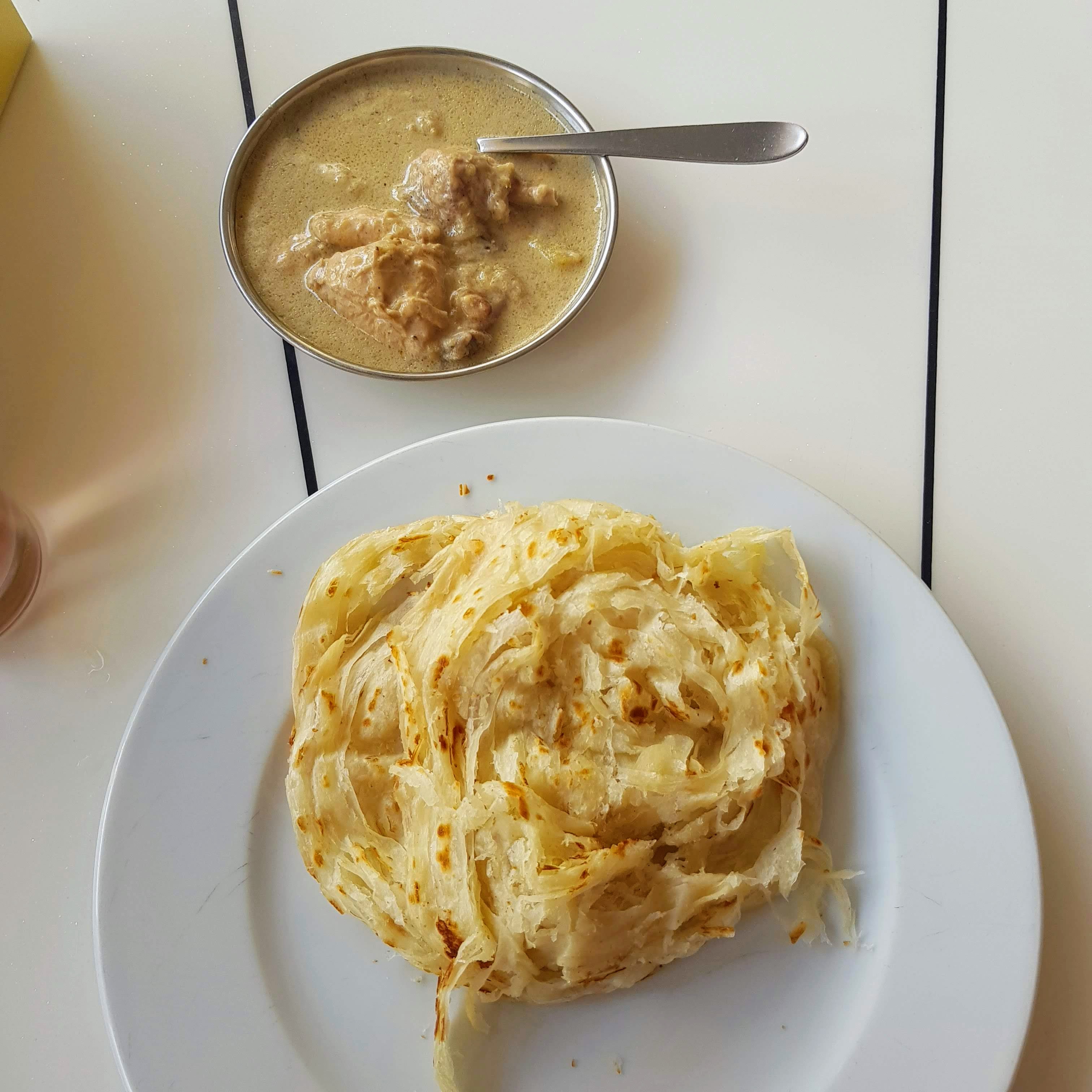
''' | '''[[Nanjil Nadu]] Cuisine''', hailing from the Southern coastal region of [[Tamil Nadu]], is a blend of Tamil and Kerala culinary traditions. Known for its abundant use of coconut and coconut oil, this cuisine stands out with its distinct and rich flavours. The dishes are often infused with aromatic spices, tangy tamarind, and the freshness of coastal ingredients. | ||
Below is an overview of the listed dishes: | |||
''' | 1. '''Nanjil Fish Curry''' | ||
A signature dish of the region, this [[curry]] is made with freshly caught fish, tamarind, and coconut-based spices, delivering a tangy and spicy flavour. | |||
<!-- Deleted image removed: [[File:Kanyakumari fish fry.jpg|thumb]] --> | |||
{{clear}} | |||
2. '''[[Avial]]''' | |||
A classic South Indian dish, [[Avial]] is a medley of vegetables cooked with grated coconut and yoghurt, tempered with curry leaves and coconut oil. | |||
[[File:Ayiyal.jpg|thumb]] | |||
{{clear}} | |||
3. '''Nendran Chips''' | |||
These crispy [[banana chips]], made from ripe or raw [[Nendran banana]], are fried to perfection in coconut oil, making them a popular snack. | |||
[[File:Chips Palakkad.jpg|thumb]] | |||
{{clear}} | |||
4. '''Venthaya Curry''' | |||
A unique [[fenugreek]] based curry with a slightly bitter yet aromatic taste, often prepared with tamarind and coconut milk. | |||
{{clear}} | |||
5. '''Munthiri Kothu''' | |||
A traditional sweet made of rice flour, jaggery, and roasted mung beans, deep-fried in small clusters, resembling grape bunches. | |||
[[File:Munthiri-Kothu.jpg|thumb]] | |||
{{clear}} | |||
6. '''Karupatti Mittai''' | |||
A wholesome candy made using palm jaggery ([[karupatti]]) and nuts, offering a delightful natural sweetness. | |||
{{clear}} | |||
7. '''Kottar Rice Murukku''' | |||
A crunchy snack made of rice flour, this spiral-shaped savoury is a local speciality of [[Kottar]], a locality in Nagercoil. | |||
[[File:A Traditional Tamil Snack Murukku.jpg|thumb]] | |||
{{clear}} | |||
8. '''Nungu Sarbath''' | |||
A refreshing summer drink made with ice apple (nungu, [[Borassus flabellifer]]), flavoured syrups, and sometimes [[basil seeds]], providing a cooling effect. | |||
<!-- Deleted image removed: [[File:Nungu Sarbath palm fruit smash.jpg|thumb]] --> | |||
{{clear}} | |||
9. '''Pazha Bajji (Banana sweet vada) ''' | |||
Deep-fried banana fritters are a sweet and crispy snack made with ripe bananas coated in a spiced batter. | |||
[[File:Banana Fritters and tea.jpg|thumb]] | |||
{{clear}} | |||
10. '''Thenkuzhal Mittai''' is a delicious sweet which is a deep-fried, sugar-coated version of Thenkuzhal Murukku, similar to Manoharam Mittai, where crispy rice flour tubes are coated in jaggery or sugar syrup, giving | |||
them a crunchy yet sweet taste. | |||
<!-- Deleted image removed: [[File: thenkuzhal mittai in kanyakumari and kerala border sugar sweet.jpg|thumb]] --> | |||
{{clear}} | |||
11. '''[[Parrota]]''' | |||
A flaky, layered flatbread, often served with spicy curries or meat dishes, making it a favourite street food in Nagercoil. | |||
[[File:Malabar Porotta.jpg|thumb]] | |||
{{clear}} | |||
12. '''Kothu Parrota''' is another popular dish that consists of flaky parotta (layered flatbread) that is shredded and stir-fried with eggs, spices, onions, tomatoes, and sometimes chicken, meat, or vegetables. It is cooked on a hot griddle with a rhythmic chopping motion using metal spatulas, giving it a signature texture and flavor. | |||
[[File:Chicken Kottu.jpg|thumb]] | |||
{{clear}} | |||
13. '''Maravazhi Kilangu''' '''([[Tapioca]] / [[Cassava]]) with Fish Curry''' is another classic dish, which satisfies the appetite of the people in this region. It combines soft, boiled tapioca with a spicy, flavourful fish curry, creating a delicious and comforting meal. | |||
[[File:Tapioca.jpg|thumb]] | |||
{{clear}} | |||
14. '''Chakka chips (Jackfruit chips)''' | |||
Jackfruit Chips – a homemade snack straight from the heart of Kerala, crafted from perfectly aged jackfruit and deep-fried in Pure coconut oil. This traditional snack is designed to fulfill your taste buds with a savoury crunch and natural sweetness that will leave you craving more. [[File:Chakka-chips.JPG|thumb]] | |||
Nagercoil's culinary offerings reflect its rich cultural heritage and coastal bounty, making it a must-visit destination for food enthusiasts. | |||
==Governance== | |||
Kanyakumari District was officially formed on 1 November 1956, as a result of the [[States Reorganisation Act, 1956]], which aimed to reorganise state boundaries based on linguistic lines. The [[District magistrate|District Collector]] is the chief administrative officer, responsible for overall administration, including [[Law and order (politics)|law and order]], [[Revenue service|revenue collection]], and implementation of government schemes. The [[Superintendent of police (India)|Superintendent of Police]] oversees the police force and maintains law and order in the district. The District Revenue Officer (DRO) assists the District Collector in revenue administration and land-related issues.<ref>{{Cite book |first=M. |last=Gopalakrishnan |title=Gazetteers of India - Kanyakumari District |publisher=Commissioner of Archives & Historical Research, Government of Tamil Nadu |location=Chennai |publication-date=13 January 1995 |pages=579–581 |language=English }}</ref> | |||
[[ | The District is divided into two revenue divisions: [[Nagercoil division]] and [[Padmanabhapuram division]]. These divisions are further subdivided into [[Tehsil|taluk]]s, which are the basic administrative units. Each taluk is managed by a [[Tahsildar]], who handles revenue collection, land records, and local administration. | ||
There are nine blocks within these taluks: [[Agastheeswaram block|Agastheeswaram]], [[Rajakkamangalam block|Rajakkamangalam]], [[Thovalai block|Thovalai]], [[Kurunthancode block|Kurunthancode]], [[Thuckalay block|Thuckalay]], [[Thiruvattar block|Thiruvattar]], [[Killiyoor block|Killiyoor]], [[Munchirai block|Munchirai]], and [[Melpuram block|Melpuram]]. Each block is managed by a Block Development Officer.<ref>{{Cite web |title=District Profile:Kanyakumari District |url=https://cdn.s3waas.gov.in/s38fe0093bb30d6f8c31474bd0764e6ac0/uploads/2024/01/2024012095.pdf |website=kanniyakumari.nic.in}}</ref> | |||
There is a [[Municipal corporation (India)|municipal corporation]] in the district, the [[Nagercoil Municipal Corporation]], five [[Municipality|municipalities]] and 50 [[Town Panchayat]]s, which are responsible for urban infrastructure, [[sanitation]], and public services.<ref>{{Cite web |title=Local Bodies {{!}} Kanniyakumari District, Government of TamilNadu {{!}} India |url=https://kanniyakumari.nic.in/localbodies/ |access-date=29 April 2024 |language=en-US}}</ref> Rural areas are governed by [[Panchayat]]s, which are local self-government bodies responsible for village-level administration and development.<ref>{{Cite book |first=M. |last=Gopalakrishnan |title=Gazetteers of India - Kanyakumari District |publisher=Commissioner of Archives & Historical Research, Government of Tamil Nadu |location=Chennai |publication-date=13 January 1995 |page=595 |language=English }}</ref> | |||
The District includes the [[Kanniyakumari Lok Sabha constituency]], which is represented in the [[Lok Sabha]] by a [[Member of Parliament]]. This constituency is divided into six assembly constituencies, each represented by a [[Member of the Legislative Assembly]] in the [[Tamil Nadu Legislative Assembly]]. The legislative assembly segments include [[Kanyakumari Assembly constituency|Kanyakumari]], [[Nagercoil Assembly constituency|Nagercoil]], [[Colachal Assembly constituency|Colachal]], [[Padmanabhapuram Assembly constituency|Padmanabhapuram]], [[Vilavancode Assembly constituency|Vilavancode]], and [[Killiyoor Assembly constituency|Killiyoor]].<ref>{{Cite web |title=Kanyakumari (Tamil Nadu) Lok Sabha Election Results 2019 - Parliamentary Constituency, Winning MP and Party Name |url=https://www.elections.in/tamil-nadu/parliamentary-constituencies/kanyakumari.html |access-date=21 September 2024 |website=www.elections.in}}</ref> | |||
The judiciary in the District operates under the framework of the [[Judiciary of India|Indian judicial system]], ensuring justice and legal order in the region. The [[District courts of India|District Court]] in Kanyakumari is the principal court of original jurisdiction in [[Civil law (legal system)|civil]] and [[Criminal law|criminal]] matters. It handles cases that require significant judicial intervention and has the authority to hear appeals from [[lower court]]s. The court is managed by a District Judge, who is responsible for the administration of justice within the district. Other subordinate courts include those in Padmanabhapuram and Kuzhithurai.<ref>{{Cite web |title=Kanniyakumari District Court {{!}} India |url=https://kanniyakumari.dcourts.gov.in/ |access-date=21 September 2024 |language=en-US}}</ref> | |||
[[ | ===Revenue Divisions and Taluks=== | ||
* [[Nagercoil division]] | |||
** [[Agastheeswaram taluk]], HQ: [[Nagercoil]] | |||
** [[Thovalai taluk]], HQ: [[Boothapandi]] | |||
* [[Padmanabhapuram division]] | |||
** [[Kallkkulam taluk]], HQ: [[Padmanabhapuram]] | |||
** [[Thiruvattar|Thiruvattar taluk]], HQ: [[Thiruvattar]] | |||
** [[Killiyur, Kanniyakumari|Killiyur taluk]], HQ: [[Killiyur, Kanniyakumari|Killiyur]] | |||
** [[Vilavancode taluk]], HQ: [[Kuzhithurai, Kanyakumari|Kuzhithurai]] | |||
===Panchayat Unions=== | |||
* [[Agastheeswaram block|Agastheeswaram]] | |||
* [[Rajakkamangalam block|Rajakkamangalam]] | |||
* [[Thovalai block|Thovalai]] | |||
* [[Kurunthancode block|Kurunthancode]] | |||
* [[Thuckalay block|Thuckalay]] | |||
* [[Thiruvattar block|Thiruvattar]] | |||
* [[Killiyoor block|Killiyoor]] | |||
* [[Munchirai block|Munchirai]] | |||
* [[Melpuram block|Melpuram]] | |||
===Municipal Corporation=== | |||
* [[Nagercoil Municipal Corporation|Nagercoil]] | |||
== | ===Municipalities=== | ||
* [[Padmanabhapuram]] | |||
* [[Kuzhithurai, Kanyakumari|Kuzhithurai]] | |||
* [[Colachel]] | |||
* [[Kollankodu]] | |||
* [[Kanniyakumari]] | |||
===Town Panchayats=== | |||
{{unreferenced section|date=April 2025}} | |||
[[Agastheeswaram]], [[Kottaram]], [[Azhagappapuram]], [[Anjugramam]], [[Thenthamaraikulam]], [[Mylaudy]], [[Suchindram]], [[Theroor]], [[Marungur]], [[Puthalam]], [[Ganapathipuram]], [[Aralvaimozhi]], [[Boothapandi]], [[Thalakudi|Thazhakudi]], [[Azhagiapandiapuram]], [[Reethapuram]], [[Kallukuttam]], [[Neiyyur]], [[Thingalnagar]], [[Eraniel]], [[Mandaikadu]], [[Manavalakurichi]], [[Villukuri]], [[Vellimalai]], [[Vilavur]], [[Kumarapuram]], [[Kothanallur]], [[Verkilambi|Verkizhambi]], [[Thiruvithancode]], [[Mulagumudu]], [[Kappiyarai]], [[Valvaithankoshtam|Valavachaghoshtam]], [[Attoor]], [[Thiruvattar]], [[Kulasekharam]], [[Thiruparappu]], [[Ponmanai]], [[Pudukadai]], [[Killiyur, Kanniyakumari|Killiyur]], [[Karungal]], [[Palapallam]], [[Kilkulam|Keezhkulam]], [[Kaliyakkavilai]], [[Nallur, Kanyakumari|Nallur]], [[Unnamalaikadai]], [[Pacode]], [[Edaikodu]], [[Pazhugal]], [[Arumanai]], [[Kadayal]]. | |||
===Proposed Municipalities=== | |||
* | {{unreferenced section|date=April 2025}} | ||
* | * [[Suchindram]] (merging town panchayats of [[Suchindram]], [[Theroor]], parakkai, puthalam and near by villages) | ||
* | * [[Mylaudy]] (merging town panchayats of [[Marungoor]], Azhagappapuram, Rajavoor, Karumpathoor, village Panchayats of Kulasekarapuram and nearby) | ||
* | * Anjugramam (merging of Anjugramam, Paulkulam, Variyoor and near by village) | ||
* Killiyur | * [[Boothapandi]] (merging town panchayats of [[Boothapandi]] [[Azhagiapandiapuram]] and [[Thalakudi|Thazhakudi]]) | ||
* [[Neiyyur]] (merging town panchayats of [[Eraniel]], [[Neiyyur]] and [[Thingalnagar]]) | |||
* [[Thiruvithancode]] (merging town panchayats of [[Thiruvithancode]], [[Mulagumudu]], [[Kappiyarai]] and [[Valvaithankoshtam|Valavachaghoshtam]]) | |||
* [[Thiruvattar]] (merging town panchayats of [[Thiruvattar]] and [[Attoor]]) | |||
* [[Kulasekharam]] (merging town panchayats of [[Kulasekharam]] and [[Thiruparappu]]) | |||
* [[Killiyur, Kanniyakumari|Killiyur]] (merging town panchayats of [[Killiyur, Kanniyakumari|Killiyur]], [[Pudukadai]], [[Kilkulam|Keezhkulam]]) | |||
* [[Karungal]] (merging town panchayats of [[Palapallam]] [[Karungal]], Melmidalam village | |||
* [[Melpuram]] (merging town panchayats of [[Pacode]], [[Edaikodu]] and [[Pazhugal]]) | |||
== | ===Proposed Town Panchayats=== | ||
[[ | {{unreferenced section|date=April 2025}} | ||
[[Rajakkamangalam]], [[Thovalai]], [[Thengapattanam]] | |||
==Demographics== | ==Demographics== | ||
{{historical populations|11=1901|12=3,59,248|13=1911|14=4,22,260|15=1921|16=4,94,125|17=1931|18=5,81,851|19=1941|20=6,76,975|21=1951|22=8,26,380|23=1961|24=9,96,915|25=1971|26=12,22,549|27=1981|28=14,23,399|29=1991|30=16,00,349|31=2001|32=16,76,034|33=2011|34=18,70,374|percentages=pagr|footnote=source:<ref>[http://www.censusindia.gov.in/2011census/PCA/A2_Data_Table.html Decadal Variation In Population Since 1901]</ref>|align=right}} | |||
According to the [[2011 census of India|2011 Census]], the district had a population of 1,870,374, comprising 926,345 males and 944,029 females. This represents an 11.60% increase from the [[2001 census of India|2001 Census]], which recorded a population of 1,676,034. The district's population accounted for 2.59% of Tamil Nadu's total population in 2011, a slight decrease from 2.69% in 2001. The [[population density]] rose from 995 people per square kilometre in 2001 to 1,111 in 2011. [[List of Scheduled Castes|Scheduled Castes]] constituted 4% and [[List of Scheduled Tribes|Scheduled Tribes]] 0.4% of the district's population. [[Tamil language|Tamil]] is the most widely spoken language in Kanyakumari district, though there is a significant minority (5.76%) of [[Malayalam]] speakers living mainly along the [[Kerala]] border.<ref name="language">{{Cite web |title=Table C-16 Population by Mother Tongue: Tamil Nadu |url=https://censusindia.gov.in/nada/index.php/catalog/10222/download/13334/DDW-C16-STMT-MDDS-3300.XLSX |website=[[Census of India]] |publisher=[[Registrar General and Census Commissioner of India]]}}</ref> | |||
As of the 2011 Census, Kanyakumari's population was 1,870,374, with [[Hindus]] (48.7%), [[Christians]] (46.9%), and [[Muslims]] (4.2%) being the major religious groups. The district's western taluks are predominantly Christian, while the eastern taluks are mainly Hindu. The [[literacy rate]] in the district remained high, averaging 91.75% in 2011, unchanged from 2001. Male literacy was 93.65%, while female literacy was 89.90%, showing an improvement from 90.37% and 84.79%, respectively, in 2001.<ref>{{Cite web |title=Kanyakumari district |url=https://www.city-facts.com/kanniyakumari/population |website=www.city-facts.com}}</ref> The total number of literates in the district was 1,548,738, with 780,541 males and 768,197 females, a significant increase from 1,308,322 literates in 2001. | |||
The child population of 182,350, aged 0–6, comprised 9.75% of the district's total population, down from 10.84% in 2001. The child sex ratio was 964 girls per 1,000 boys, a minor decrease from 968 in 2001.<ref>{{Cite web |title=Kanniyakumari (Kanyakumari) District Population Census 2011 - 2021 - 2024, Tamil Nadu literacy sex ratio and density |url=https://www.census2011.co.in/census/district/51-kanniyakumari.html |access-date=1 October 2024 |website=www.census2011.co.in}}</ref> | |||
The district had a total of 483,539 [[household]]s. There was a total of 679,620 workers, comprising 12,229 [[cultivator]]s, 51,350 main [[agricultural labourer]]s, 21,078 in household [[Industry (economics)|industries]], 468,001 other workers, 126,962 marginal workers, 3,381 marginal cultivators, 21,517 marginal agricultural labourers, 14,711 marginal workers in household industries, and 87,353 other marginal workers.<ref name="districtcensus">{{Cite web |title=District Census Handbook 2011 - Kanniyakumari |url=https://censusindia.gov.in/nada/index.php/catalog/1144/download/3590/DH_2011_3328_PART_A_DCHB_KANNIYAKUMARI.pdf |website=[[Census of India]]|publisher=[[Registrar General and Census Commissioner of India]]}}</ref> The sex ratio in the district improved slightly, standing at 1,019 females per 1,000 males in 2011,<ref>{{Cite web |title=Districts of India- Socio-economic statistical data of Kanyakumari District, Tamil Nadu |url=https://www.indiastatdistricts.com/tamilnadu/kanyakumari-district |access-date=1 October 2024 |website=www.indiastatdistricts.com}}</ref> compared to 1,014 in 2001. The national average [[sex ratio]] in India was 940, indicating that Kanyakumari had a relatively balanced [[gender ratio]]. | |||
82.33% of Kanyakumari's population lived in urban areas, totalling 1,539,802 people. The literacy rate in urban areas was 91.96%, with male literacy at 93.92% and female literacy at 90.06%. The [[Literacy in India|literacy rate]] in rural areas was 90.76%, with male literacy at 92.39% and female literacy at 89.16%.<ref>{{Cite web |title=Kanniyakumari (Kanyakumari) District Population Census 2011 - 2021 - 2024, Tamil Nadu literacy sex ratio and density |url=https://www.census2011.co.in/census/district/51-kanniyakumari.html |access-date=1 October 2024 |website=www.census2011.co.in}}</ref> | |||
==Politics== | |||
===Kanyakumari Lok Sabha Constituency=== | |||
{|class="wikitable" style="text-align:center" | |||
|- | |||
!Constituency number | |||
!Constituency name | |||
!Reserved for | |||
!Elected member | |||
!colspan=2|Political party | |||
!colspan=2|Alliance | |||
|- | |||
|39 | |||
|[[Kanniyakumari Lok Sabha constituency|Kanyakumari]] | |||
|General | |||
|[[Vijay Vasanth]] | |||
|[[Indian National Congress]] | |||
|{{party color cell|Indian National Congress}} | |||
|[[Indian National Developmental Inclusive Alliance|INDIA]] | |||
|{{party color cell|Indian National Developmental Inclusive Alliance}} | |||
|} | |||
===Members of Legislative Assembly from Kanyakumari district=== | |||
{{transcluded section|source=16th Tamil Nadu Assembly}} | |||
{{#section:16th Tamil Nadu Assembly|MLA Header}} | |||
{{#section:16th Tamil Nadu Assembly|Kanyakumari district}} | |||
|} | |||
==Places of interest== | |||
===Thiruvalluvar Statue=== | |||
[[File:Statue of Thiruvalluvar.jpg|thumb|Statue of Valluvar at Kanyakumari]] | |||
The '''''Thiruvalluvar Statue''''', or the '''''Valluvar Statue''''', is a {{convert|133|ft|m|order=flip|adj=mid|-tall}} stone sculpture of the [[Tamil people|Tamil]] poet and philosopher [[Valluvar]], author of the [[Tirukkural]], an ancient Tamil work on [[Dharma]] and [[morality]]. It is located atop a small island near the town of [[Kanyakumari (town)|Kanniyakumari]] on the southernmost point of the [[Indian peninsula]] on the [[Coromandel Coast]], where two seas (the [[Bay of Bengal]] and the [[Arabian Sea]]) and an ocean (the [[Indian Ocean]]) meet. The statue was sculpted by the Indian sculptor [[V. Ganapati Sthapati]], who also created the [[Iraivan Temple]], and was unveiled on the millennium day of 1 January 2000 by the then Chief Minister [[M. Karunanidhi]]. It is currently the 25th tallest statue in [[India]]. | |||
===Thirparappu Waterfalls=== | |||
[[File:Thirparappu Waterfalls (2).jpg|thumb|Thriparappu falls]] | |||
Thirparappu Waterfalls are waterfalls in Kanniyakumari District. It is also known as 'Courtallam of Kanniyakumari'. The Mahadevar Temple is very near to the waterfalls. The waterfalls is {{cvt|7|km}} from [[Kulasekaram]]. Actually the waterfalls is exactly 34 km from city centre, Nagercoil. | |||
===Manimedai=== | |||
[[File:Nagercoil Clock Tower.jpg|thumb|Manimedai]] | |||
Manimedai is situated in the central part of [[Nagercoil]]. Manimedai literally means High Clock. It is the symbol of the Nagercoil Town. A clock is placed in a High Clock gauge, so the place becomes Manimedai. The construction of the Clock gauge began in 1892 in the period of [[Travancore]] Maharajas. After construction, it was opened by His Highness Sree Moolam Thirunal Varma, the King of Travancore. The clock placed in the gauge was gifted to the English missionary in Nagercoil. | |||
===Mathur Aqueduct=== | |||
[[File:Mathur Hanging Trough Bridge.JPG|thumb|Mathur Aqueduct]] | |||
The [[Mathur Aqueduct]] was built to pass the cultivable water between two mountains. Mathur Aqueduct was built between Aruvikkarai and Mudhalaaru in Paraliyaru River. The aqueduct was built by Former Chief Minister of Tamil Nadu Perunthalaivar Thiru Kamarajar. Mathur aqueduct was South Asia's largest aqueduct. The aqueduct is {{cvt|1240|ft}} long, {{cvt|101|ft}} high with 28 giant pillars. It is {{cvt|3|km}} from [[Thiruvattar]] and 26 km from Nagercoil. | |||
=== | ===Padmanabhapuram palace=== | ||
[[File:Padmanabhapuram Palace 6.jpg|thumb|Padmanabhapuram Palace|alt=Padmanabhapuram Palace]] | |||
Before centuries, the houses that has all the facilities are known as Palaces. The rulers of states, the Kings resides in such Palaces. [[Padmanabhapuram Palace]] was once the official residence of Travancore Kings. [[Padmanabhapuram Palace]] was built in [[Kerala]] styled Architecture with woods. The palace was built in 18th century by Travancore King Thiru [[Marthanda Varma|Anizham Thirunal Marthanda Varma]]. The palace was situated in 6.5 acres in 186 acres fort. The palace is under the control of [[Government of Kerala|Kerala Government]]. The palace is situated just 2 km from [[Thuckalay]]. | |||
===Udayagiri Fort=== | |||
[[Udayagiri Fort]] was situated just 10 km from [[Parvathipuram, Tamil Nadu|Parvathipuram]]. The fort was situated in 22½ hectares in a place called [[Puliyoorkurichi]]. The Fort is maintained by the Ministry of Forests, Government of Tamil Nadu. | |||
=== | ===Vattakkottai=== | ||
[[File:Vattakottai Fort 2.jpg|thumb|Inside of the fort.|alt=Inside of the Vattakottai Fort.]] | |||
The word '[[Vattakottai Fort|Vattakkottai]]' means Circle Fort and is circular. The Fort was constructed along the seashore in the East coast. The fort was situated in 3½ acres with compound stones constructed for 25 meters in height and constructed by [[Travancore]] Army Chief Dilanai. The fort is under the control of the Archaeological Department, Government of India. It is situated 6 km north of [[Kanyakumari|Kanniyakumari]] and 2 km south of [[Anjugramam]]. | |||
===Vivekananda Rock=== | |||
[[File:RockMemorial.jpg|thumb|Vivekananda Rock Memorial]] | |||
[[Vivekananda Rock Memorial]] is a monument in Vavathurai in Kanniyakumari District. It is located just 500 meters east in the mainland of [[Vavathurai]]. The rock was built in 1970 in honour of [[Swami Vivekananda]] who is said to have attained enlightenment on the rock. Vivekanand was a disciple of Swami [[Ramakrishna Paramahansa]].<ref>{{cite web |title=Biography of Swami Vivekanand |url=https://www.newstrend.news/343932/swami-vivekananda-rock-memorial-kanyakumari/ |website=newstrend.news |date=22 April 2020 |access-date=23 April 2020}}</ref> According to local legends, [[Devi Kanya Kumari|Goddess Kumari]] performed Tapas in devotion of [[lord Shiva]] in these rocks. The rocks are surrounded by the [[Laccadive Sea]]. | |||
== | ===Thanumalayan Temple=== | ||
The '''Thanumalayan Temple''', also called '''Sthanumalayan Temple''', is an important [[Hindu temple]] located in [[Suchindram]] in the Kanyakumari district of [[Tamil Nadu]], [[India]]. The Thanumalayan Temple is of importance to both [[Shaivaite]] and [[Vaishnavite]] sects of Hinduism, as the name ''Stanumalaya'' denotes the [[Trimurti]]; "Stanu" means Mahesha; "Mal" means Vishnu; and the "Ayan" means Brahma.<ref>{{cite web |date=29 January 2002 |title=History of Suchindram temples |url=http://www.thehindu.com/br/2002/01/29/stories/2002012900150300.htm |access-date=24 May 2020 |work=[[The Hindu]]}}</ref> It counts among the [[Abhimana Kshethram|Abhimana Kshetrams]] in Vaishnavite traditions. It is one of the [[108 Shiva Temples]] revered by the Kerala Hindu culture, though this temple is now in Tamil Nadu, after Kanyakumari District was merged into Tamil Nadu from [[Travancore]]. | |||
[[File:SUCHINDAM (3).jpg|thumb|The Temple]] | |||
|thumb = | |||
===Chitharal Jain Rock Cut Temple=== | |||
[[File:Bas-relief at Chitharal Jain Monuments.jpg|thumb|Jain bas-relief on the north side outer wall of the cave temple.]] | |||
It is famous for the Rock-cut temple. Hill rock at [[Chitharal Jain Monuments and Bhagavati Temple|Chitharal]] has a cave containing Rock-cut sculptures of Thirthankaras and attendant deities carved inside and outside dating back to 9th Century A.D by King [[Mahendra Varman I]].<ref>{{Cite web|url=https://kanniyakumari.nic.in/tourist-place/chidaral-jain-temple/|title = Chitharal Jain Rock Cut Temple | Kanniyakumari District, Government of TamilNadu | India}}</ref> | |||
==Festivals== | ==Festivals== | ||
The Kollemcode Tookam festival is another famous festival celebrated by the people of the district and also by the people from nearby | [[File:Thiru Nizhal Thangal of Attoor.jpg|thumb|right|An octo-circular [[Ayyavazhi]] | ||
[[Nizhal Thangal of Attoor|Nizhal Thangal]] near [[Thiruvattar]] on the [[Martandam]]-[[Kulasekaram]] road.]] | |||
===Mandaikadu Festival=== | |||
The [[Mandaikadu]] festival is celebrated in March by people of the district and by those in Kerala. Traditionally, participants would chant while walking while others would provide them with butter, milk, water, [[jaggery]], and coffee. The festival, which is celebrated for ten days, later became a social function, especially on Sunday. | |||
===Kollemcode Festival === | |||
The Kollemcode Tookam festival is another famous festival celebrated by the people of the district and also by the people from the nearby Thiruvananthapuram district of Kerala state. It is celebrated for 10 days during the month of March/April with the famous Child Tookam taking place on the 10th day corresponding to Meena Bharani as per the Malayalam calendar. | |||
The ''"ezhunnalath"'' or elephant procession festival of [[Alappancode Easwara Kala Bhoothathan Temple|Alappancode Sree Eeswarakala Bhoodhathan Temple]] located at Anducode is also another major festival of the district. It is the largest elephant festival of Tamil Nadu and is often considered Tamil Nadu' Thrissur Pooram. | |||
===Ayya birthday Celebration=== | |||
The [[Ayya Vaikunda Avataram|Ayya vaikunda Avataram]] of [[Ayyavazhi]] is widely celebrated throughout the district.<ref>[[Dina Thanthi|The Daily Thanthi]], ''Nagercoil Edition'', 5 April 2006.</ref><ref>{{cite web|url=https://www.dinamalar.com/2006mar03/general_tn3.asp |title=Dina Malar |access-date=3 February 2007 |url-status=live |archive-url=https://web.archive.org/web/20070927021910/http://www.dinamalar.com/2006mar03/general_tn3.asp |archive-date=27 September 2007 }}</ref> The [[Kodiyettru Thirunal]] is celebrated in the religious headquarters of [[Swamithope pathi]] and attracts large crowds<ref>{{cite web |url=http://www.hindu.com/2008/06/03/stories/2008060351640300.htm |archive-url=https://web.archive.org/web/20080605145454/http://www.hindu.com/2008/06/03/stories/2008060351640300.htm |archive-date=5 June 2008 |work=[[The Hindu]]|access-date=3 June 2008 |title=''"Thousands of people witnessed the Vaikasi car festival at Vaikundar temple at Swamithoppu..."''}}</ref> from Tamil Nadu and across India.<ref>[[Dina Thanthi|The Daily Thanthi]] ([[Nagercoil]] Edition), 29 January 2007, Page 12, "Devotees from the districts of Kanyakumari, [[Tirunelveli]], [[Thoothukkudi]], [[Theni]], [[Chennai]], [[Coimbatore]] and also from the State of [[Kerala]] participated in the Car festival."</ref><ref>[[Dina Thanthi|The Daily Thanthi]] ([[Coimbatore]] Edition), 3 June 2008, Page 4, "Thousands of devotees from the districts of [[Madurai]], [[Tirunelveli]], [[Thoothukkudi]], [[Theni]], [[Coimbatore]] and also from the State of [[Kerala]] participated in the Car festival."</ref><ref>[[Dinakaran]] ([[Tirunelveli]] Edition), 3 June 2008, Page 6, "Thousands of devotees from the districts of Kanyakumari, [[Tirunelveli]], [[Thoothukkudi]], [[Virudhunager]], [[Theni]], and also from the State of [[Kerala]] participated in the Car festival."</ref> | |||
===Sucheendrum temple car festival=== | |||
[[File:Oor koodi therr illuthal.JPG|thumb|The Temple Chariot festival]] | |||
the religious significance of the [[Thanumalayan Temple]] stems from the fact that the main statue of linga represent Siva (Sthanu), [[Vishnu]] (maal) and [[Brahma]] (Ayan) (as well as giving the temple its name). The representation of the three central gods of Hinduism in one linga makes it unique in India. The 10-day [[Temple car|Car Festival]] celebrated in this temple during between December and January every year attracts crowds of thousands of people. Special worship practices are followed and the festival images of Sthanumalayan, Aram valartha Nayagi and Vinayagar are taken in the temple car around the streets of the temple. Another festival known as Teppam is celebrated during between April and May every year. The Sanskrit work ''Sucindrastalamahatmya'' gives a full-fledged legendary account of the origin and development of this temple.<ref>{{cite news|title=Thousands participate in Suchindram car festival|url=https://www.thehindu.com/news/cities/Madurai/Thousands-participate-in-Suchindram-car-festival/article17018745.ece|work=The Hindu|date=10 January 2017|access-date=24 May 2020}}</ref> | |||
===Kottar, St. Francis Xavier's temple festival=== | |||
Church records indicate that [[St. Francis Xavier's Cathedral, Kottar|St. Xavier Church]] was built in 1600. In 1865, the Shrine of Mary was renovated and enlarged. In 1930, the church was raised to the status of a [[cathedral]]. The annual festival is celebrated during November – December lasting for 10 days. The people from various place and near by state kerala people also join during the festival. During the festival other religious people also Get together. and helping to organise the Festival by various ways. | |||
===Kanya Kumari, Bagavathi Amman temple festival=== | |||
*Chitra Pournima Festival: on the Full moon day in May | |||
*[[Navaratri|Navaratri festival]]: 9 day festival in (September–October). The music artists get an opportunity to offer their artistic skill to the goddess by performing in the ''Navarathri Mandapam''. | |||
*Vaisakha festival: 10-day festival in May–June culminating by a ''Thoni Ezhunellathu'' in May–June. During this festival Devi will be taken in procession both in the morning and evening, during Aaraatu the eastern door is opened. On the ninth day, the ''Thoni Ezhunellathu'' takes place. Devi will be taken round the water on the western part in a boat.<ref name="Kanya Kumari- templenet">{{cite web|url=http://www.templenet.com/Tamilnadu/kumari.html |title= Kanyakumari Temples of Tamilnadu |publisher=templenet |year= 2013 |access-date= 25 July 2013}}</ref> | |||
*Kalabham festival: The idol is smeared in Sandal paste in the last Friday of the month of Karkidaka or Aadi, in July–August.<ref>{{Cite web|url=http://www.journeymart.com/de/india/tamilnadu/kanyakumari/festivals/default.aspx|title=India|access-date=25 July 2013|archive-date=1 November 2019|archive-url=https://web.archive.org/web/20191101181233/http://journeymart.com/de/india/tamilnadu/kanyakumari/festivals/default.aspx}}</ref> | |||
===Onam festival=== | |||
[[File:Sadhya DSW.jpg|thumb|200px|Onam sadya]] | |||
Onam is widely celebrated in many places throughout Kanniyakumari district, especially in the western part of the district. This festival holds significance for most of the people in Kanniyakumari, as the district was formerly part of the Travancore kingdom. The date of Onam celebration is based on the ''[[Panchangam]]'' and falls on the 22nd [[Nakshatra]] [[Shravana|Thiruvonam]] in the month ''Chingam'' of the [[Malayalam calendar]], which in the [[Gregorian calendar]] falls between August and September.<ref>{{Cite web|url=http://www.onamfestival.org/|title=Onam Festival – Onam in India, Onamfestival.org|website=www.onamfestival.org|access-date=22 August 2023|archive-date=22 August 2023|archive-url=https://web.archive.org/web/20230822103053/http://www.onamfestival.org/|url-status=live }}</ref><ref>{{Cite book |last=Hospital|first=Clifford G.|title=The Righteous Demon: A Study of Bali |publisher=[[University of British Columbia Press]] |year=1984 |isbn=978-0-7748-0187-4 |oclc=10920170 |location=Vancouver }}</ref> | |||
===Kuzhithurai Vavubali Exhibition=== | |||
Annual Karkida Vavu Bali (Shradham for the ancestors held during the Mahalaya Amavasai) ceremony that is held here during July/Aug (Malayalam month Karkidakam). Along with the religious ceremony during this time, the famous annual exhibition fair - Vavubali Mela / Exhibition - was started by Shri. T.C Kesava Pillai, MLC from Kuzhithurai in the 1900s. Today, this is continued by the [[Kuzhithurai, Kanyakumari|Kuzhithurai Town Municipality]].<ref>{{Cite web|author1=Vinfra |url=https://www.onlinekanyakumari.com/kuzhithurai-vavubali-exhibition-2023-kanyakumari/|title=Vavubali Exhibition, Kuzhithurai|work=OnlineKanyakumari |date=29 June 2023 }}</ref> | |||
The people from various place and near by state kerala people also join during the festival. During the festival other religious people also Get together. | |||
===Marungoor Soora Samharam and mylaudy Arattu fest=== | |||
The [[Lord Murugan|Subramania]] Swamy Temple, which is situated atop a small hillock is worth a place to visit. This temple area is called as Kumarapuram thoppur, [[Marungoor]]. Because of Kumaran's (Subramania swamy) name. Shashti and [[Surasamharam]] are the famous festivals at this temple. The famous kandhashashti kavasam festival is very popular over here and celebrated as major festival. after 5 days later [[Lord Murugan|Subramania]] Swamy come to [[mylaudy]] by the silver horse car and bath in Mylaudy river and abishekam with 17 products. Every year it was celebrated only in kanyakumari district after 5 days of [[Surasamharam]] fest. | |||
The people from various place join during the festival. During the festival other religious people also Get together. | |||
==Transport and highways== | ==Transport and highways== | ||
===Roadways=== | ===Roadways=== | ||
There are two major [[National Highway (India)|National Highways]] (NH) roads originating from | There are two major [[National Highway (India)|National Highways]] (NH) roads originating from Kanniyakumari town. One is the National Highway 44 which connects Kanniyakumari with Srinagar of [[Jammu and Kashmir (union territory)|Jammu & Kashmir]]. NH 44 connects North India with South India. The road passes through [[Madurai]], [[Hosur]], [[Bengaluru]], [[Hyderabad]], [[Nagpur]], [[Jhansi]], [[Delhi]] and [[Jalandhar]]. It covers 3745 kilometres. The other is the National Highway 66 that connects Kanniyakumari with [[Panvel]] (38 km from [[Mumbai]]) in Maharashtra. NH 66 roughly runs north–south parallel to the western ghats. It passes through [[Thiruvananthapuram]], [[Kochi]], [[Kozhikode]], [[Mangaluru]], [[Udupi]], [[Margoa]] and [[Ratnagiri]]. Nagercoil, the district capital is well connected with the rest of [[Tamil Nadu]]. | ||
====SETC Buses==== | |||
The government transport body [[State Express Transport Corporation]] (SETC) is operating direct buses to [[Chennai]], [[Ootacamund]], [[Coimbatore]], [[Vellore]], [[Chidambaram]], [[Thiruchirappalli]], [[Kodaikanal]], [[Tirupur]], [[Erode]], [[Kalpakkam]], [[Velankanni]], and [[Thiruvannamalai]]. It also operates direct buses to [[Bengaluru]], [[Puducherry (city)|Pondicherry]] and [[Tirupati]]. Some bus services to the aforesaid destinations are originating from [[Kanyakumari|Kanniyakumari]], [[Colachel]], [[Marthandam]], [[Kulasekaram]], [[Kaliyakkavilai]], and [[Thiruvananthapuram]]. | |||
====TNSTC Buses==== | |||
Another government transport body known as [[Tamil Nadu State Transport Corporation]] (TNSTC) operates direct buses to various destinations inside [[Tamil Nadu]]. Some of the terminating stations are [[Chennai]], [[Tiruppur]], [[Periyakulam]], [[Kodaikanal]], [[Rameswaram]], [[Thiruchirappalli]], [[Dindigul]], [[Thanjavur]], [[Palani]], [[Salem, Tamil Nadu|Salem]], [[Coimbatore]], [[Karaikudi]], [[Kumily]], [[Bodinayakkanur]], [[Erode]], and [[Sivakasi]]. Most of these buses starts their journey from [[Nagercoil]] while some buses starts from [[Kanyakumari|Kanniyakumari]], [[Marthandam]], [[Colachel]], [[Kulasekaram]], and [[Kaliyakkavilai]]. TNSTC also operates frequent bus services to [[Madurai]], [[Tirunelveli]], [[Tiruchendur]], [[Tuticorin]], and [[Thiruvananthapuram]]. | |||
====KSRTC Buses==== | |||
The [[Government of Kerala]] operating [[KSRTC SWIFT|KSRTC Buses]] between [[Kerala]] and [[Tamilnadu]] from [[Thiruvananthapuram]] to [[Nagercoil]], [[Kanyakumari|Kanniyakumari]] | |||
and [[KSRTC SWIFT|KSRTC Bus]] between Holy Places [[Haripad]], [[Thiruvananthapuram]], [[Nagercoil]], [[Mylaudy]], [[Athankarai Dargah|Athankarai Pallivasal]] (Tirunelveli dist). | |||
===Railways=== | ===Railways=== | ||
There is a railway station located at | There is a railway station located at [[Kanniyakumari Terminus railway station|Kanniyakumari]] where trains terminate. The [[Vivek Express]] starting from [[Kanniyakumari Terminus railway station|Kanniyakumari]] is the longest-running train in India.<ref>{{Cite web |title=The longest train journey in India |url=https://www.bbc.com/travel/article/20160511-the-longest-train-journey-in-india |access-date=29 April 2024 |website=www.bbc.com |date=25 February 2022 }}</ref> It connects [[Kanniyakumari Terminus railway station|Kanniyakumari]] with [[Dibrugarh]], in [[Assam]]. [[Nagercoil Junction railway station]] is the district's primary railway station located near [[Kottar]] and is also commonly known as Kottar Railway station. There is also another railway station in Nagercoil, known as [[Nagercoil Town railway station]]. There is rail connectivity from Nagercoil, the district capital, to most parts of the country with daily trains running to [[Mumbai]], [[Chennai]], [[Bengaluru]], [[Guruvayur]], [[Thiruvananthapuram]], [[madurai]], [[Coimbatore]], [[Trichy]], [[Mangaluru]], [[Tambaram]] etc. and weekly trains to [[New Delhi]], [[Kolkata]], [[Gujarat]], [[Hyderabad]], [[Puducherry (city)|Pondicherry]], [[Bilaspur, Chhattisgarh|Bilaspur]], [[Rameswaram]], [[North East India]] and [[Jammu and Kashmir (union territory)|Jammu and Kashmir]]. The other stations in the Kanyakumari district are [[Eraniel railway station]], [[Palliyadi]] railway station, [[Kuzhithurai railway station]], and [[Kuzhithurai]] west railway station. Passenger trains connect [[Nagercoil]] with [[Thiruvananthapuram]], [[Kollam]], [[Punalur]], [[Kottayam]], [[Tirunelveli]], [[Madurai]], and [[Coimbatore]]. | ||
===Airways=== | ===Airways=== | ||
The nearest | The nearest international airport is [[Thiruvananthapuram International Airport]] which is 76 km from Kanniyakumari. The Civil Aviation Ministry is planning to construct an airport near Swamithoppu in Kanniyakumari District as the initiative attracts international tourists to the district.<ref>{{Cite news |date=1 August 2021 |title=MP seeks airport in Kanyakumari |url=https://timesofindia.indiatimes.com/city/madurai/mp-seeks-airport-in-kanyakumari/articleshow/84934640.cms |access-date=29 April 2024 |work=The Times of India |issn=0971-8257}}</ref> | ||
==Education== | ==Education== | ||
According to the [[2011 census of India|2011 Census]], Kanyakumari has a literacy rate of 91.7%, compared to Tamil Nadu's literacy rate of 80.1%. The district has recorded the highest male literacy rate of 92.4% and the female literacy rate of 89.2% in rural areas, as well as the highest female literacy rate of 90.1% in urban areas.<ref>{{Cite report |url=https://censusindia.gov.in/nada/index.php/catalog/1144 |title=Census of India 2011 - Tamil Nadu - Series 34 - Part XII A - District Census Handbook, Kanniyakumari |date=2014}}</ref> | |||
The district | |||
The district | The district is home to many well-established institutions like colleges such as [[Scott Christian College]] (est. 1809), South Travancore Hindu College (est. 1952), Holy Cross College (est. 1965), [[Women's Christian College, Nagercoil|Women Christian College]], Sivanthi Aditanar College (est. 1984) and schools such as Ringletaube Higher Secondary School (est. 1809), Scott Christian Higher Secondary School (est. 1819), Duthie Girls School (est. 1819), St. Joseph's Convent Higher Secondary School (est. 1910), [[Carmel Higher Secondary School]] (est. 1922), S.L.B. Government Higher Secondary School (est. 1924), S.M.R.V. Higher Secondary School (est. 1919). | ||
{{Further|St. John's College of Arts and Science}} | |||
== | ==Geographical indication== | ||
*'''Kanyakumari Matti Banana''' | |||
{{Further|Kanyakumari Matti Banana}} | |||
[[Kanyakumari Matti Banana]] was awarded the [[List of geographical indications in India|Geographical Indication]] (GI) status tag from the [[Geographical Indication Registry (India)|Geographical Indications Registry]], under the [[Government of India|Union Government of India]], on 31 July 2023 and is valid until 28 April 2030.<ref>{{cite web |title=Tamil Nadu banana |url=https://search.ipindia.gov.in/GIRPublic/Application/Details/757 |website=Intellectual Property India |access-date=19 December 2024}}</ref><ref>{{cite news |last1=Rajan |first1=C. Palanivel |title=GI-tagged agricultural products face challenges due to climate change |url=https://www.thehindu.com/news/cities/Madurai/gi-tagged-agricultural-products-face-challenges-due-to-climate-change/article67594454.ece |access-date=19 December 2024 |work=The Hindu |date=1 December 2023 |language=en-IN}}</ref> | |||
Kanyakumari Banana and Horticulture Farmers Producer Company Limited from Veeyanoor, proposed the GI registration of Kanyakumari Matti Banana. After filing the application in April 2021, the banana was granted the GI tag in 2023 by the Geographical Indication Registry in [[Chennai]], making the name "Kanyakumari Matti Banana" exclusive to the bananas grown in the region. It thus became the third banana variety from Tamil Nadu after [[Sirumalai Hill Banana]] and the 59th type of goods from Tamil Nadu to earn the GI tag.<ref>{{cite news |title=Tamil Nadu tops GI chart with 58 tags; three more products join the league |url=https://timesofindia.indiatimes.com/city/chennai/tamil-nadu-tops-gi-chart-with-58-tags-three-more-products-join-the-league/articleshow/102263775.cms |access-date=19 December 2024 |work=The Times of India |date=31 July 2023}}</ref><ref>{{cite web |title=Life-Enriching Banana Festival |url=https://www.icar.org.in/life-enriching-banana-festival |website=Indian Council of Agricultural Research Krishi Bhavan |access-date=19 December 2024}}</ref><ref>{{cite news |last1=May 29 |first1=ByIffath FathimaIffath Fathima / Updated |title=IIHR showcases diverse jackfruit, banana, mango |url=https://bangaloremirror.indiatimes.com/bangalore/others/iihr-showcases-diverse-jackfruit-banana-mango/articleshow/110505362.cms |access-date=19 December 2024 |work=Bangalore Mirror |language=en}}</ref> | |||
The GI tag protects the banana from illegal selling and marketing, and gives it legal protection and a unique identity. | |||
* '''Marthandam honey''' | |||
In the heart of Kanniyakumari district in Tamil Nadu lies Marthandam, also known as the 'honey capital'. Here, the Marthandam Beekeepers Co-operative Society produces Marthandam Honey, which recently earned a Geographical Indication tag, or a GI tag.Each year, Marthandam produces about 6 lakh kg of honey. It's a thick, organic honey packed with natural enzymes, antioxidants, and plant nutrition.<ref>{{Cite web |last=admin |date=6 December 2023 |title=GI Tagged Marthandam Honey |url=https://thepeopleexpress.com/gi-tagged-marthandam-honey/ |access-date=8 June 2025 |website=The People Express |language=en}}</ref> | |||
== | * '''Mylaudy stone sculpture''' | ||
Stone sculpture, stone cutting with large machine's, stone temple making is famous in Mylaudy.<ref name="issuu.com">{{Cite web|url=https://issuu.com/aswinskumar1998/docs/ar._portfolio|title=Stone makings of god in mylaudy|work=Issuu |date=23 February 2021 }}</ref> famous for making many God's statute next to [[Mahabalipuram]]. Kattabomman statue in [[Kayatharu]] and Thiruvalluvar statue in Chennai were created in Myaudy. Mylaudy sirpi's were skilled in carving idols in one stone. Mylaudy stone sculpture got [[geographical indications| geographical indications in Tamil Nadu]] on 31 March 2023.<ref name="search.ipindia.gov.in">{{Cite web|url=https://search.ipindia.gov.in/GIRPublic/Application/Details/428|title=Myladi Stone carvings}}</ref> | |||
*'''Kanyakumari Clove''' | |||
Tamil Nadu produces about 1,000 tonnes of the total 1,100 tonnes produced in India, with the district accounting for approximately 65 per cent of the total. The environment of Kanyakumari district's hilly parts is perfect for clove farming. Both the south-west and north-east monsoons help this region. In addition, the 'sea mist' enters and works up the moisture required by the crop. Cloves can be grown in this dark soil, which is rich in organic elements. This distinguishes the cloves grown in the area. | |||
The | The crop grown in the district is highly sought after because it contains the highest proportion of volatile oil content in clove buds. Eugenol is also aided by the 'sea mist.' The clove buds have a superior scent and flavour thanks to the greater eugenol acetate content in the oil.<ref name="kk dist clove">{{Cite web|url=https://unacademy.com/content/upsc/study-material/general-awareness/geographical-indication-tag-for-kanyakumari-clove/|title=kanyakumari cloves}}</ref> | ||
*'''Eathomozhy Tall Coconut''' | |||
{{Further|Eathomozhy Tall Coconut}} | |||
Eathomozhy Tall Coconut is a variety of coconut tree known for its tall stature and is native to the Eathomozhy region in Kanyakumari district, Tamil Nadu, India. It was granted a Geographical Indication (GI) tag, highlighting its unique characteristics and connection to the region. These trees are known for their height, reaching up to 30 meters, and their large fruits with a thick shell and high copra content. | |||
[[File:Coconut trees grown denser around this region.jpg|thumb|Coconut trees]] | |||
==See also== | ==See also== | ||
| Line 280: | Line 655: | ||
}} | }} | ||
* {{Citation | * {{Citation | ||
| author = Government of India | year= | | author = Government of India | year=2014–2015 | ||
| title= District Census Handbook | | title= District Census Handbook – Kanniyakumari (Part-A) 2011 | publisher=Directorate of Census Operations, Tamil Nadu | ||
| url= https://censusindia.gov.in/2011census/dchb/DCHB_A/33/3328_PART_A_DCHB_KANNIYAKUMARI.pdf | | url= https://censusindia.gov.in/2011census/dchb/DCHB_A/33/3328_PART_A_DCHB_KANNIYAKUMARI.pdf | ||
}} | }} | ||
* {{Citation | * {{Citation | ||
| author = Government of India | year= | | author = Government of India | year=2014–2015 | ||
| title= District Census Handbook | | title= District Census Handbook – Kanniyakumari (Part-B) 2011 | publisher=Directorate of Census Operations, Tamil Nadu | ||
| url= https://censusindia.gov.in/2011census/dchb/3328_PART_B_DCHB_KANNIYAKUMARI.pdf | | url= https://censusindia.gov.in/2011census/dchb/3328_PART_B_DCHB_KANNIYAKUMARI.pdf | ||
}} | }} | ||
| Line 292: | Line 667: | ||
==External links== | ==External links== | ||
{{Commons category}} | {{Commons category}} | ||
* [https://kanniyakumari.nic.in/ Official Website of | * [https://kanniyakumari.nic.in/ Official Website of Kanniyakumari district] | ||
* [ | * [https://kanyakumaridistrict.com/ About Kanniyakumari district] | ||
*[https://gk-questions.com/general-introduction-to-tamil-nadu/ General Introduction of Tamil Nadu] | *[https://gk-questions.com/general-introduction-to-tamil-nadu/ General Introduction of Tamil Nadu] | ||
| Line 308: | Line 683: | ||
}} | }} | ||
{{District | {{Kanyakumari District}} | ||
{{Tamil Nadu}} | {{Tamil Nadu}} | ||
{{Authority control}} | {{Authority control}} | ||
[[Category:Kanyakumari district| ]] | [[Category:Kanyakumari district| ]] | ||
[[Category:Districts of Tamil Nadu]] | [[Category:Districts of Tamil Nadu]] | ||
[[Category:1956 establishments in Madras State]] | [[Category:1956 establishments in Madras State]] | ||
Latest revision as of 01:13, 27 March 2026
 | This article has multiple issues. Please help improve it or discuss these issues on the talk page. (Learn how and when to remove these template messages)
|

Kanyakumari district | |
|---|---|
Montage of Kanyakumari district | |
| Coordinates: 8°19′N 77°20′E / 8.32°N 77.34°E | |
| Country | India |
| State | Tamil Nadu |
| District | Kanyakumari |
| Headquarters | Nagercoil |
| Taluks | |
| Government | |
| • District Collector | R. Alagu Meena, I.A.S[1] |
| • Superintendent of Police | R. Stalin, I.P.S[2] |
| • District Forest Officer | M. illayaraja, I.F.S |
| • District Panchayat chairman | S. Merliant Dhas |
| Area | |
| • Total | 1,672 km2 (646 sq mi) |
| Population (2011) | |
| • Total | 1,870,374 |
| • Density | 1,100/km2 (2,900/sq mi) |
| Languages | |
| • Official | Tamil |
| • Minority | Malayalam |
| Time zone | UTC+5:30 (IST) |
| PIN | 629 xxx |
| Telephone code | 04652 for Nagercoil & 04651 for Marthandam |
| Vehicle registration | TN-74 for Nagercoil & TN-75 for Marthandam |
| Coastline | 72 kilometres (45 mi) |
| Sex ratio | M-1000/F-1014 ♂/♀ |
| Literacy | 97.6% |
| Legislature type | Elected |
| Current Member of Parliament (M.P) | Vijay Vasanth |
| Lok Sabha constituency | Kanniyakumari |
| Legislative Assembly Constituencies (6 M.L.A) |
|
| Precipitation | 2,382 millimetres (93.8 in) |
| Avg. summer temperature | 31 °C (88 °F) |
| Avg. winter temperature | 22 °C (72 °F) |
| Central location: | 8°03′N 77°15′E / 8.050°N 77.250°E |
| Website | kanniyakumari |

Kanyakumari district (ta), officially Kanniyakumari district, is one of the 38 districts of Tamil Nadu state and the southernmost district in mainland India. It stands second in terms of population density among the districts of Tamil Nadu.[3] It is also the richest district in Tamil Nadu in terms of per capita income,[4][5] and also tops the state in Human Development Index (HDI), literacy, and education.[6][7] The district's headquarters is Nagercoil.[8]
Kanyakumari district has a varied topography, with the sea on three sides and the mountains of the Western Ghats bordering the northern side. Except for a small stretch of land to the east of Kanyakumari town, almost the entire district is sandwiched between the Western Ghats and the Arabian Sea – the only district in Tamil Nadu state facing the Arabian Sea.
Historically, Nanjinad and Edai Nadu, which comprise the present-day Kanyakumari district, were ruled by various Tamil and Malayalam dynasties: the Cheras, the Ay/Venad/Travancore dynasty, the Pandyans, the Chozhans and the Nayaks. A few artefacts have been unearthed by archaeological excavations.[9] It was part of the princely state of Travancore during the colonial times prior to India's independence;[10] four of the eight tehsils of Thiruvananthapuram district were separated from the erstwhile Travancore Kingdom to form the new district of Kanyakumari, and they were made the part of Madras Presidency under recommendations from the States Reorganisation Commission in 1956. The Presidency was later renamed Tamil Nadu.
The district is the birthplace of Ayyavazhi. Many historical assumptions persist in the district and state, which associate sages such as Agastya, Vyasa, Tolkappiyar, Avvaiyar and Valluvar with the district.
Etymology[edit | edit source]
Lua error in Module:TNT at line 159: Missing JsonConfig extension; Cannot load https://commons.wikimedia.org/wiki/Data:I18n/Module:Excerpt.tab.
History[edit | edit source]

The area that comprises the current Kanyakumari district was a part of the old Ay kingdom of the first and second Sangam ages. Following the decline of the Ay kingdoms, the area became Venad, with its capital Padmanabhapuram located North, North West of Nagercoil. The wealth of the Nanjilnadu beckoned many invaded kings including the Nayaks during the reign of Umayamma Rani. The Venad region was in anarchy before Marthanda Varma ascended the throne in 1729 CE. Under their rule anarchy was dominant in Kanyakumari region. However, Marthanda Varma brought a sense of disorder under control by annexing the nearby territories, putting down the feudal lords and establishing the strong state of Travancore. He had also bought some portions of Kanyakumari from the then viceroy making it the southern boundary. Under his rule, the district improved in a social context as well as economically. The famous battle of Colachel took place in the district. Later, the Maharajas of Travancore built the forts at Aramboly (Aralvaimozhy) to prevent any invasion from the Carnatic Kings. Key elements of Velu Thampi Dalawa's revolt occurred in the area and the English East India company's army under Col.
Leger broke through the fortifications and entered Travancore in 1810. In the year 1949, the area became a part of the reestablished Travancore Cochin state. The people of Agasteeswarem, Thovalai, Kalkulam and Vilavancode taluks, which formed the southern divisions of the former district of Trivandrum, were predominantly Tamil speaking people. The present Kanyakumari district was historically part of the erstwhile Travancore State. Four Tamil-speaking taluks viz., Vilavancode, Kalkulam, Thovala and Agastheeswaram which now form the Kanyakumari district was transferred to Madras State on 1 November 1956. The changes that were effected between the taluks and the villages as on 1 October 1956 are furnished in the fly-leaf to Table A-I.[11] An extreme agitation by Tamil speaking residents under the leadership of Marshal Nesamony took place for including Kanyakumari within Tamil Nadu. Eventually the merger happened in 1956 based on language reorganisation of states.
Historically, Nanjilnadu (Agastheeswaram and Thovalai taluks) and Eda Nadu (Vilavancode and Kalkulam taluks) which comprises the present Kanyakumari district. The district were ruled by various dynasties: Venad Kingdom, Travancore Kingdom, the Cheras, the Cholas, the Ays and the Nayaks. A few artefacts were unearthed by archaeological excavations in parts of the district. The district was part of the princely state of Travancore during the colonial times prior to India's independence; four of the eight tehsils of Thiruvananthapuram district were separated to form the new district of Kanyakumari in 1956 following the demands of reunion made by the Tamil speaking majority people (about 70% of the population), who feels that their feelings were suppressed by the erstwhile Travancore Kingdom which has Malayalam-majority population. The four taluks were made the part of then Madras State under recommendations from the States Reorganisation Commission in 1956. The Madras State was later renamed Tamil Nadu in 1969 and Kanyakumari, today, is one of the 38 districts of Tamil Nadu state.
The district is the birthplace of Ayyavazhi, the henotheistic belief initiated by Hari Gopalan Seedar, one among the five prime disciples of Ayya Vaikundar. The social, religious and cultural history of the 19th century Kanyakumari district is intrinsically inter-twined with those of Ayyavazhi. Many historical assumptions persist in the district and state, which associate with sages namely Vyasa, Agastya, Tolkappiyar, Avvaiyar and Valluvar.
Legend[edit | edit source]
Lua error in Module:TNT at line 159: Missing JsonConfig extension; Cannot load https://commons.wikimedia.org/wiki/Data:I18n/Module:Excerpt.tab.
Geography[edit | edit source]
The district is situated between 77°15' and 77°36' east longitude and 8°03' and 8°35' north latitude.[12][13] The district has borders with Tirunelveli district in the North & North East, the Gulf of Mannar in the East, the Indian Ocean in the South, the Arabian Sea in the West and the Thiruvananthapuram District (Kerala) in the West.[14]
Kanyakumari district has a varied topography with sea on three sides and the mountains of the Western Ghats bordering the northern side. Geologically, the landmass of the district is much younger when compared to the rest of state – faulted as late as 2.5 million years during the Miocene, after which numerous transgression, as well as regression of sea, had shaped the western coast of the district.[15]
The district can be categorised into three natural divisions:[16]
- Mountainous terrain is located in the northern and north-eastern portion of the district. It includes the northern parts of Vilavancode and Kalkulam taluks. It includes several impressive hilltops and is an extension of a larger mountain range to the north.
- Stretching along the southern and south-eastern and south-western parts of the district, the coastal region is fringed with coconut trees. Although predominantly sandy, there are occasional slightly elevated patches of red cliffs.
- Situated between the mountainous terrain and the sea-coast, the plains area features rolling, undulated valleys and plains interspersed with rivers and streams.
Within the northern mountainous range of the district lies the scenic sanitarium of Muthukuzhivayal. South of Peermedu, this range stands out due to its significant breadth. The rugged landscape boasts bluff ridges and conical peaks, forming a continuation of the Western Ghats that stretches all the way to the Aralvaimozhi Pass. Notably, the perfectly detached Kattadimalai stands out as a prominent rocky mass. Continuing southward, a broken rocky spur shapes into Marunthuvazh Malai, situated approximately 7 kilometres northwest of Kanyakumari. The Vellimalai in Kalkulam taluk and the Maruntuvazh malai in Agastheeswaram taluk are important isolated hills. The variations in altitude and climate across the hilly terrain of the district have led to a diverse vegetation profile, showcasing distinct representations of different land types. The highest hill within the district is Mahendragiri (1,654 meters) in Thovalai taluk, situated on the border between Kanyakumariand Tirunelveli districts. Kalmalai (900 meters), Moliyadi (700 meters) located at the head of old Kulasekaram reserved forest area and Tadakai malai (960 meters) are some of the notable hills in the district.[17]
The mountainous terrain in the northern and eastern portions of the district contains an extensive plateau amidst elevated hilltops. While most of the hills have steep slopes, some exhibit a more gradual spread. While the area is predominantly agricultural, numerous plantations and few handloom industries thrive in this region.[18] The central area of the district, particularly Agastiswaram taluk, consists of vast plains. This includes the plains at Vellimalai, Mylaudy and Derisanamcope.
The district features an extensive 71.5 kilometre coastline.[19] Predominantly regular in its configuration, the coast showcases notable projections toward the sea at locations such as Kanyakumari, Muttam, and Erayanthurai. Additionally, there are a few minor sea ports. The ancient port of Colachel stands as the sole natural port on the west coast of Tamil Nadu while Kanyakumari serves as another minor port, primarily catering to tourists. Another minor port at is situated along the edge of Manakudi Estaury. Kanyakumari is the only district in Tamil Nadu facing the Arabian Sea.[20]
Rivers[edit | edit source]
Pazhayar, the southernmost river in India, originates from the secondary range of the Western Ghats, draining Mahendragiri peak and nearby estates. Flowing through Thovalai and Agastiswaram taluks, the Pazhayar significantly supports irrigation. Its course spans approximately 37 kilometres, ultimately joining the Manakkudy Lagoon at Thamaraikulam. Notable places along the river include Boothapandi, Thalakudi, Vadasseri, Nagercoil, and Suchindram.[21]
Kodayar originates east of Valia Malai peak within the southern part of the Muthukuzhivayal plateau and flows southwest through a wild tract. Two streams—one from Motavan Pothai and the other from Thacchamala hills—contribute to this river. The Pechiparai Dam intercepts the Kodayar, creating the Pachipparai lake. With a rocky bed, steep banks, sharp curves, and frequent falls, the Kodayar remains largely untamed except for a few kilometres near its end. The Tirparappu Waterfalls along this river stands at approximately 13 meters. After covering 32 kilometres in Kalkulam and Vilavancode taluks, the Kodayar merges with the Paraliyar to form the western Tambaraparani. It flows southwest through Kuzhithurai, Munchirai and eventually into the Thengapattanam estuary where it meets the sea.[22]
Originating north of Mahendragiri, the Paraliyar, another major river of the district flows southwesterly and passes out of the forest area a mile above Ponmanai[23] where it encounters the Perunchani Dam. The Left Bank Channel supplies water from the Pechipparai reservoir before reaching the weir known as Puthen dam. The ancient Pandyan dam, built in Pandiyan era, across the Paraliyar in Kalkulam taluk, along with the Pandyan Kal and related irrigation works, constitute one of the region's ancient irrigation systems. About a kilometre downstream from the Pandyan dam, the river meets the 250-year-old Puthen dam.[24] The river runs through the Kalkulam and Vilavancode taluks and covers 37 kilometres before joining the Kodayar near Thiruvattar, forming the western Thamirabarani River.[22]
Valliyar, a minor river, originates at an altitude of 950m in the Velimalai hills[25] and passes through Kothanalloor, Kalkulam, Eraniel, Thalakulam and Manavalakurichi before joining the Arabian Sea at Kadiapattanam. Along the way, it merges with the Thuvalar, another small river originating from the Mampazhathurai hills. Mullayar another minor river flows approximately 11 kilometres through Vilavancode taluk and joins the western Tambraparani near Thikkurichi.[26]
Geology[edit | edit source]
The district features diverse topography with its northern and western regions consist of hilly terrain and forests, while the southeastern and central parts are characterised by agricultural lands. Along the southern border lies an extensive sea-shore interspersed by valleys and plains. The coastal uplands of the district are characterised by rocky outcrops and rugged coastlines, with notable Teri sand dune complexes. The coastlines of Kanyakumari, Theerthakkarai, Muttom, and Kadiyapattanam are especially rocky. In Muttom, a Teri dune complex extends along the coast; sand dunes also stretch from Manakudi to Sothavilai.[27] Additionally, sandy beaches and isolated boulders define the southern coastline.[28]
The Peninsular India is typically described as a highland with faulting on both sides. During the Archaean Eon, the eastern coast experienced faulting, whereas the faulting of the western coast, including the major parts of the Kanyakumari district, occurred later—approximately 25 million years ago—during the early Miocene era. Subsequent transgressions and regressions of the sea led to the formation of various sedimentary layers.
Over time, the sea receded, resulting in uplifted land masses. Evidence of this uplift includes deeply entrenched streams, waterfalls, high hanging valleys, alluvial flats, and marine sediment patches at higher elevations. Notably, shelly limestone formations in Kanyakumari further support the theory of land uplift in this area. The uplift likely occurred in stages, rejuvenating older streams. The wind gap at Mekkode resulted from river piracy, where the Paraliyar was captured by the Kodayar, possibly during the Tertiary period. The straight west coastline, uninterrupted by breaks, suggests faulting during the Pliocene epoch. Similarly, changes in the Kodayar River's course—from northward to northeast to southwest indicate faulting along its path.
Geologically, the region features two main rock groups: the Khondalites, and Charnockites while a third group, Migmatites[29] is also found. The Khondalites, composed of garnetiferous Sillimanite-Graphite Gneisses and Garnet-Biotite gneisses, dominate a significant portion of the district.[30] The Charnockites are exposed in areas between Padmanabhapuram, Aralvaimozhi, Kulasekaram, Thuckalay, and Rajakkamangalam. The distinctive occurrence of feldspathic granites across a significant portion of this region indicates that the rocks underwent intense isoclinal folding, resulting in repeated bands. These folds align in a northwest–southeast direction and may have subsequently experienced cross-folding.[31] These charnockites also occur as lenses and patches within the khondalites. Additionally, thin Pegmatite bodies and quartz veins intrude the khondalites. Tertiary-age Varkala beds appear as thin cappings south of Kaliyakkavilai near the coast.[32]
The basement rocks are covered by a sequence of soil types, including red soil, lateritic soil, clay, river alluvium, coastal alluvium, and black and red sandy soils. These soil layers have thicknesses ranging from 1 metre to 1.5 meters in most locations. The underlying geological terrain belongs to the Peninsular Gneiss. The coastal belt around Kanyakumari, Kovalam, and Vattakottai contains recent-age formations, including Calcareous sandstones, limeshells, and Kankary Limestone. Lateral deposits, including sand, zircon, rutile, ilmenite, and garnet, are commonly found along the entire sea coast of Kanyakumari.[33]
Climate[edit | edit source]
Kanyakumari district experiences a tropical climate, characterised by warm temperatures throughout the year as per the Köppen climate classification. The district generally has high temperatures year-round, with average highs ranging from 29 °C to 33 °C (84 °F to 91 °F) and average lows from 23 °C to 26 °C (73 °F to 79 °F). The Summer from March to May is typically hot, with temperatures often exceeding 34 °C (93 °F). The heat is more intense due to weaker winds. The region's proximity to the Equator makes it hard to distinctly define the summer season and summers are significantly wetter than winters.[34] Winters from January to February are mild and pleasant, with temperatures rarely dropping below 19 °C (66 °F). The district lies at the intersection of two distinct climate zones. To the northwest, the Malabar coast, west of the Western Ghats, experiences heavy rainfall during the summer monsoon from June to September. In contrast, the southeastern coast, starting from Kanyakumari, has a semi-arid climate due to the limited impact of the summer monsoon. However, the retreating monsoon from October to December brings more rain, though its effects are somewhat reduced by the proximity of Sri Lanka.[35]
The Indian Ocean Geoid Low, Earth's largest gravity anomaly, located south of Kanyakumari, influences the region's climate by altering sea levels, ocean currents, and monsoon dynamics, contributing to coastal erosion and long-term atmospheric trends. Its deep mantle origins are linked to tectonic shifts that subtly affect oceanic heat distribution and atmospheric circulation.[36][37]
| Climate data for Kanyakumari (1991–2021, Rainy days:1999-2019) | |||||||||||||
|---|---|---|---|---|---|---|---|---|---|---|---|---|---|
| Month | Jan | Feb | Mar | Apr | May | Jun | Jul | Aug | Sep | Oct | Nov | Dec | Year |
| Average high °C (°F) | 29.4 (84.9) |
30.5 (86.9) |
31.5 (88.7) |
31.5 (88.7) |
30.7 (87.3) |
29.1 (84.4) |
29.0 (84.2) |
29.3 (84.7) |
29.5 (85.1) |
29.0 (84.2) |
28.4 (83.1) |
28.5 (83.3) |
29.7 (85.5) |
| Daily mean °C (°F) | 26.0 (78.8) |
26.8 (80.2) |
28.0 (82.4) |
28.5 (83.3) |
28.1 (82.6) |
26.9 (80.4) |
26.5 (79.7) |
26.6 (79.9) |
26.7 (80.1) |
26.5 (79.7) |
26.1 (79.0) |
25.9 (78.6) |
26.9 (80.4) |
| Average low °C (°F) | 23.1 (73.6) |
23.6 (74.5) |
24.9 (76.8) |
26.1 (79.0) |
26.2 (79.2) |
25.3 (77.5) |
24.8 (76.6) |
24.7 (76.5) |
24.8 (76.6) |
24.7 (76.5) |
24.2 (75.6) |
23.6 (74.5) |
24.7 (76.4) |
| Average rainfall mm (inches) | 15.0 (0.59) |
12.0 (0.47) |
27.0 (1.06) |
56.0 (2.20) |
81.0 (3.19) |
83.0 (3.27) |
42.0 (1.65) |
37.0 (1.46) |
49.0 (1.93) |
137.0 (5.39) |
183.0 (7.20) |
71.0 (2.80) |
793 (31.21) |
| Average rainy days | 2 | 2 | 3 | 7 | 9 | 11 | 7 | 6 | 7 | 12 | 13 | 6 | 85 |
| Average relative humidity (%) (at 17:30 IST) | 69 | 68 | 71 | 76 | 78 | 81 | 80 | 79 | 79 | 80 | 80 | 73 | 76 |
| Mean daily sunshine hours | 9.9 | 10.1 | 10.2 | 10.0 | 9.6 | 9.7 | 10.1 | 10.1 | 9.8 | 9.4 | 8.9 | 9.4 | 9.8 |
| Source: [38] | |||||||||||||
Unlike other districts in Tamil Nadu, it receives rainfall both from the South-west and the North-east monsoons. The region receives moderate rainfall, with the heaviest rains occurring from October to December due to the northeast monsoon which sometimes causes floods. The southwest monsoon, from June to September, also brings some rain, but its effects are less pronounced compared to other parts of India. The average rainfall of the district is 1456.8 mm per annum. From 2005 onwards the annual rainfall is estimated to be 1006 mm.[39] The driest month is February and the greatest amount of precipitation occurs in November. Humidity levels are relatively high, especially during the monsoon seasons, contributing to a humid and warm atmosphere. June has the highest relative humidity, while February has the lowest. November experiences the most rainy days, whereas January has the fewest. Overall, Kanyakumari's climate is warm and humid, with significant rainfall during the monsoon Seasons. This tropical climate supports the region's rich biodiversity and lush landscapes.[40]
Biodiversity[edit | edit source]
As part of the Western Ghats, one of the world's eight hottest biodiversity hotspots,[41] this district boasts a rich diversity of flora and fauna, many of which are endemic to the region.[42] The area is home to several endangered and threatened species, including the Indian Bison, Indian Rock Python, Lion-tailed Macaque, and Nilgiri Tahr. The Kanyakumari Wildlife Sanctuary, a protected area covering 457.78 km2, is situated in the northern and north-western parts of the district. It constitutes the southern section of the Agastyamalai region, bordered by Kerala's Neyyar Wildlife Sanctuary to the west and Kalakkad Mundanthurai Tiger Reserve to the east.[43] Seven rivers including the Pahrali and Thamirabarani have their origin in this forest.[44] The forests and jungles of Kanyakumari district host approximately 600 species of timber trees and 3,500 other plant species.[45] The wetlands of Suchindrum and Arumanallur alone support numerous variety of floral and faunal species across hundreds of genera.[46][47] New species are frequently being identified throughout the region.[48][49]
Forests[edit | edit source]

Out of the total land area of 168,356.216 hectares, approximately 48,423 hectares are covered by forests. Reserved forests account for 44,799 hectares, while 3,605 hectares are unclassed forests. Additionally, there are 19 hectares of reserved lands. Most of the forests in the district are situated on slopes of hills and plateaus, benefiting from high rainfall and serving as catchment areas for numerous streams and rivers. The forests in the district are lush and virgin and is 75 million years old. The forest of this region comes under Boothapandy Mahendra-giri Reserve forest and is managed by the District Forest Officer with Headquarters at Nagercoil.[50]
The jungles host around 600 species of gigantic timber trees and 3,500 other plants, many of which hold significant economic value. Notable timber trees include teak, rosewood (blackwood), Jungle Jack, Malabar ebony, Adina cordifolia, Karumaruthu, and Vengai. Softwood varieties like Bombax ceiba and glossy-leaved jack are also abundant, along with reeds, bamboos, and sandalwood. Plantations of cardamom and tea thrive at higher elevations, while pepper, rubber, ginger, and turmeric flourish in lower areas.[23] Due to various local geological factors, the forests in the Kanyakumari division encompass 14 distinct types, based on the Champion and Seth's classification[51] ranging from lush tropical wet evergreen forests to tropical thorn forests, all within a relatively small area.[50] The region hosts a diverse array of plant species, with its natural vegetation encompassing southern thorn forests, dry deciduous forests, moist deciduous forests, semi-evergreen forests, and evergreen hill sholas interspersed with grassy downs.[52]
Dry deciduous forests: These forests, ranging from an altitude of 200 to 600 meters occur in regions like Keeriparai, Mangolamottai (lower Kodayar), Maruthaparai (Kulasekaram), Ulakkaruvi, and Kuttiyar. Tree and shrub species include Adina cordifolia, Cochlospermum religiosum, Dillenia pentagyna Hydnocarpus laurifolius, Lannea coromandelica and Terminalia chebula etc. Desmodium triangulare of the Legume family, the root parasites Aeginetia indica and pedunculata have also been recorded in the region.[53]
Moist deciduous forests: These forests occur around Kilaviaru mountains and Kalikesam river near Balamore and Vallachithode at an altitude of about 60 meters. Common trees include Acronychia pedunculata, Alstonia scholaris, Scleropyrum wallichianum, and Vateria indica. Lianas Gnetum and Derris thyrsiflora thrive in these areas. Lithophytic herbs like Begonia floccifera and Begonia malabarica are abundant around Kilaviyaru.
Tropical Wet Evergreen Forests: These forests and found in Upper Kodayar, Muthukuzhivayal, and Mahendragiri above 800 meters. These dense, impenetrable forests receive heavy monsoon rains, supporting abundant epiphytic and terrestrial orchids. Tall trees with huge trunks include Aglaia bourdillonii, Cullenia exarillata, Dimocarpus longanetc. Climbers like Embelia basaal and Smilax zeylanica are common along with epiphytes Aeschynanthus perrottetii and Hoya pauciflora.[54]
Grasslands: At elevated altitudes in Muthukuzhivayal, Mahendragiri, and Upper Kodayar, distinct grasslands thrive. Within the forested areas, each river basin—Kodayar and Pahrali—encompasses approximately 30 square miles of grasslands.[23] Common grass species in this region include Chrysopogon orientalis, Eulalia phaeothrix, Themeda trimula, and Zenkeria sebastinei. Amidst the grasses and rocky crevices, one can find beautiful orchids and Impatiens flowering alongside ferns. Additionally, other herbaceous plants such as Acrotrema arnottianum, Centratherum rangacharii, Exacum travancoricum, Leucas vestita, Linum mysorense, Hedyotis purpurascens, Heracleum candeolleanum, and Senecio ludens thrive. On dripping rocks, Utricularia purpurea and Utricularia reticulata are commonly observed.[55]
Flora[edit | edit source]
The Hills of the region harbour a unique xerophytic flora, adapted to arid conditions. At higher elevations, large grasses like Andropogon, Panicum, lemon grass, and fodder grass thrive, creating a verdant carpet. Closer to the base, shrubby forms—such as species of Phoenix, Cycas, and Inthai—find their niche. Abundant bamboo clumps (including Ochlandra) and dense cane growths (both bamboo family members) abound. Sheltered beneath the grasses, ephemeral annual herbs and herbaceous perennials emerge during favourable seasons. In the sheltered valleys, extensive paddy cultivation sustains the region. Paddy remains the staple food crop. Tapioca, the second most important food crop, thrives primarily in Kalkulam and Vilavancode taluks. Palmyrah and coconut groves dot the plains and coastal regions.[56]
The landscape is adorned with significant avenue trees, including the Banyan, jungle jack, Eugenia, Portia tree, Tamarind and more. Common edible fruits—such as mangoes, jackfruit, custard apple, various plantain varieties, pineapple, guava, and more—contribute to local livelihoods. Oranges, lime, and pomegranate also flourish. Grape cultivation occurs in specific pockets. 329 plant species have been identified across 201 sacred groves in the district. These species belong to 251 genera within 110 families. Among them, 12 are categorised as rare, endemic, and threatened. One out of every seven species found in the groves of the region are rare.[57] Notably, Alpinia galanga, Gloriosa superba, Nymphaea pubescens, Hemidesmus indicus, Kaempferia galanga, and Rauvolfia serpentina are endangered while Justicia beddomei, Leea indica, and Petiveria alliacea are considered rare. Furthermore, species such as Indigofera uniflora, Naregamia alata, Ochlandra scriptoria, and Osbeckia aspera are endemic to the sacred groves of the district.[58]

Around 60 species of medicinal plants thrive in the district. These include the medicinal weeds such as Abrus precatorius, Abutilon indicum, Acalypha indica, Achyranthes aspera, Acorus calamus, Aloe vera, Alternanthera sessilis, etc.,[59] and those found around the sacred groves include Atalantia monophylla, Atalantia racemosa, Mesua ferrea, Commelina benghalensis, and Sterculia urens.[60] Showy or scented flowers—such as Kolunthu, Chempakam, henna, Ceylon Jasmine Nanthiarvattam, Asokam, and more—adorn gardens and natural spaces of the eastern areas. Several rose varieties flourish in well-tended gardens. Of the Spices, the Kanyakumari clove which accounts for 65% of India's clove production is produced around Maramalai, Karumparai and Velimalai areas above Veerapuli Reserve and Mahendragiri hills of the district.[61] Cardamom, black pepper, ginger, turmeric and other spices too thrive here. Tuberous plants like sweet potato, arrow-root, and tapioca yield edible roots.[56] The hedges in the region consist of a variety of thorny or succulent shrubs. Among them are the Screw-pine, Prickly-pear, Pineapple, Agave, and Euphorbia. Additional hedge plants include Jatropha, Pithecolobium, Casuarina, Sesbania, Erythrina, Pongu, and Lantana. Climbers, most of which have leafy growth, overgrow these hedges. Other than the xerophytic vegetation, the district also hosts hydrophytic flora. In the ponds, large associations of lotus and water lilies thrive, along with smaller Limnanthemum plants. Floating plants like Trapa bispinosa and pistia statistis cover water surfaces, often beneath the shade of big banyan trees. Submerged plants, including Ceratophyllum, Utricularia, and Chara, form a close tangle underwater. In shallow tanks and river basins, reeds flourish in marshy soil. These reeds consist of juncus, scirpus, cyperus, and typha, forming a dense palisade of leaves over the water surface. Numerous marshy plants thrive between the reeds and along the margins.[62]
The plains, up to an elevation of 200 meters, are characterised by Southern tropical thorny forests. Notable locations within this ecosystem include Anjugramam, Vattakkottai, Kanyakumari, Marunthuvazh Malai, Colachel, and Kuzhithurai. These forests support a variety of plant life. Common trees found in the interior plains include Cassia siamea, Dichrostachys cinerea, Morinda pubescens, Thespesia populnea, Ficus bengalensis, Mangifera indica, Alstonia scholaris, Pongamia pinnata, and Calophyllum inophyllum. Shrubs and under shrubs like Crotalaria gigantea, Cassia auriculata, Vitex negundo, Crotalaria striata, and Dodonaea viscosa are abundant. Beneath the shade of these shrubs and trees, herbaceous plants such as Rhinacanthus nasutus, Asystasia gangetica and Vernonia cinerea thrive. Climbers like Pterolobium hexapetalum, Lantana camara, Cissus quadrangularis, Aganosma cymosa, Coccinia grandis, Pergularia daemia and Jasminum angustifolium are also frequently encountered in this ecosystem.[63]
The coastal areas face unique challenges due to factors like sandy soil, aridity, scanty rainfall, and strong winds. In the Foreshore sandy areas, species like Spinifex littoreus, Ipomoea pes-caprae (Sweet), Sesuvium portulacastrum, Trianthema portulacastrum, Atriplex repens, Cyperus rotundus, Mollugo cerviana, Tephrosia purpurea, T. hirta, Pedalium murex and various Portulaca species shall be found. In marshy backwater areas, Suaeda nudiflora, Salicornia brachiata, and Arthrocnemum indicum are frequently found. Backwaters near river mouths and connecting canals are often thickly fringed with Pandanus tectorius. Acrostichum aureum and Excoecaria agallocha are common in shallow waters. In the Manakudy, Thengapattanam Munchirai backwater area, Barringtonia racemosa, Ixora coccinea, and Nauclea missionis thrive. Closer to the shore, Neptunia and Hygrophila grow intermingled with Aeschynomene aspera, Ludwigia, and Ipomoea reptans. More than 100 species, spanning across 90 genera and 46 families including Adenanthera pavonina, Ficus religiosa, Psidium guajava, Ocimum tenuiflorum, Waltheria indica, Dendrobium macrostachyum and Sida acuta were recorded in the sacred groves along the south-west coast of the district.[64] The vegetation in the cape area is typically xerophytic. Acacia planifrons groves characterise this region. Within the Acacia woods, cacti, agave, and aloe grow, accompanied by a ground cover of typical xerophytic herbs, including various grasses. Moving to the inland sandy areas, these regions are characterised by xerophytic plants such as Euphorbia tirucalli, Jatropha curcas, Jatropha gossypiifolia, Cleome aspera, Chorispora tenella, Aerva lanata, Phyla nodiflora, and Zornia diphylla.[65]
Fauna[edit | edit source]

The district is abundant in wildlife, with its hill forests showcasing a wide variety of fauna, representing most species of Southern India. The district's fauna belongs to the Cis gangetic sub-region of the Indomalayan realm, with its hill fauna showing affinities with the Himalayas and the southwestern hill group in Sri Lanka. The district hosts ten orders of mammals. Four species of primates are found in the sholas and moist deciduous forests, including the Bonnet macaque and Toque macaque at lower altitudes, and the Lion-tailed macaque and Nilgiri Langur at elevations above 2,000 feet. The Slender Loris of the order Lemuroidea occurs in the interior forests. Situated at the tail-end of the Central Asian Flyway, the region attracts numerous migratory birds from thousands of miles away.[66]
Tigers are found around the Black Rock estate which descend to lower reaches during October and November, occasionally entering bordering villages. Panthers inhabit moist deciduous forests and often prey on domesticated animals. Bears usually reside at elevations above 3,000 feet but sometimes descend to lower levels. Wild dogs are found in the lower hills of the Muthukuzhi valley, while the Indian Grey Mongoose and Jungle Cats are common in the low country and jungles. Jackals and foxes are also common. The South Indian Hedgehog is found throughout the district. Bats are very common, with four different species present. Among squirrels, the Palm Squirrel is most commonly found in the countryside, while the Malabar Squirrel inhabits the jungles. The Indian Porcupine is found throughout the forests. Rats, mice, and hares are very common, with Black rat and Mus booduga found across the district.[67][52]
Elephants are abundant in the upper reaches of Asambu and Veerapuli reserves and are occasionally spotted around Kodayar, Perunchani and Balamore areas. Deer are seen throughout the hilly forests, with three species present: The Spotted Deer, Sambur, and the Barking Deer. The Muthukuzhi valley and the entire Asambu region are favoured by Sambur deer. The Gaur is the largest of the two bovines found in the forests, living in rock caves on hills up to an elevation of 5,000 feet. Small herds of bison frequent the sholas and grassy areas around the Muthukuzhi valley and the higher reaches of Asambu. The wild goat is usually confined to grassy slopes. Wild bears are found on the hills and jungles in herds. Additionally, aquatic dolphins and porpoises are found in river mouths and backwaters. Indian pangolins are also present in forests and surrounding valleys.[68]
The district's forests support a rich variety of avifauna, with about 360 species recorded. Notably, 140 out of the 204 species of South Indian Passerine birds are found here. The House Crow is the most common bird, while the jungle crow is less frequently seen. Common babblers include the earthy-brown jungle babbler and the slimmer common babbler found in dry plains. Magpie-robins are usually seen near human habitations. Other common birds include the cuckoo, golden oriole and Indian robin which are frequently noted in dry areas.[69] The tailorbird and the drongo or king crow often visit the countryside. The red-vented bulbul is seen in plains where food is plentiful and at elevations of about 4,000 feet. The Iora is found in gardens and groves. Among Shrikes, the Scarlet minivet is the most common, found in woody areas and evergreen jungles. The Common myna is found on grasslands, while the common weaver bird or Baya weaver is seen in coconut groves of valleys and plains. The skylark is often heard in low country and on hills.
Three species of sunbirds — Cinnyris zeylanicus, Cinnyris asiaticus, and Loten's sunbird — are frequently found in gardens. Common woodpeckers include the golden-backed woodpecker, the Yellow-fronted Pied Woodpecker, and the Southern Rufous woodpecker. The Malabar whistling thrush, a blue-black bird, is found near hilly streams. Paradise flycatchers often visit shady groves, gardens, and deciduous jungles with bamboo-clad regions. 87 bird species from 39 families and 15 orders, including omnivores, carnivores, piscivores, herbivores, granivores, and nectarivores, such as the Eurasian Spoonbill, Brahminy Starling, Glossy Ibis, Oriental White Ibis and Spot-billed Pelican have been observed around the Swamithoppe saltpans.[70]
The House sparrow is commonly found around human habitations. Parrots are mostly seen in hilly and woody areas while various varieties of Kingfishers including White-throated kingfisher, Common kingfisher and Pied kingfisher are found beside inundated paddy fields, ponds, kutcha wells and sandy seashores.[71] Bee-eaters are very common. The Indian blue rock pigeons are seen all over the plains. Among game birds, the Jungle fowl is common around the Asambu forests in the Azhagiapandiapuram range. Francolinus is often seen in thorny scrubby areas. Two main varieties of owls are the Spotted owlet and the Barn owl, which occasionally stray into the countryside and perch on house tops. Other varieties include the Brown fish owl and the Indian great horned owl. Two important species of kites in this district are the pariah kite and the Brahminy kite.[72][73]
Among the birds of prey, the White-rumped vulture and the White scavenger vulture are prominent. Water birds are common along coastal backwaters, inundated paddy fields, and tanks. The White-breasted waterhen is often seen in marshy areas overgrown with reeds and bushes, and on the margins of ponds. Storks and Coots are frequently found in inundated paddy fields, tanks, ponds, and rivers. Comb ducks are observed at Suchindram and Theroor wetlands[74] while four other species of ducks are common in the area. The Indian pond heron is abundant in paddy fields and ponds. Flamingos including Greater flamingos could be spotted across the Rajakkamangalam and Manakudi estuary throughout the year.[75]
The region's reptiles include crocodiles, tortoises, turtles, lizards, and snakes. There are two species of crocodiles, nine species of chelonians, 33 of lizards, and 74 of snakes. The King Cobra frequents rivers and streams in shola forests.[76][77] The Viper and the Indian cobra are common, often found in tree hollows and dilapidated houses. Rat snakes are frequently seen and Pythons are found in dry sandy areas. Among amphibians, 34 species of frogs are present, including Rana aurantiaca, Ixalus travancoricus, and Ferguson's toad. The Indian Leaping frog is found around Kiripparai areas.[78]
The coastal area is known for its rich variety of fish, with nearly 370 species identified. Whale sharks[79] and Saw fish[80] are abundant in the seas, along with flatfish, Prawns, Shrimp, and Crabs. Rock oysters form dense colonies at Kovalam, and a small octopus species is found under rocks at Cape Comorin. The sacred chank is found in large quantities here. At Cape Comorin, two species of top shells Trochus radiatus and Trochus costatus are abundant. Various poisonous insects, including Scorpions and Spiders, are found in the district. Ticks of the genus Ixodes are commonly found in grasslands. Among arthropods, insects such as Ranatra, Cybister, Earwigs, Prodasineura, Hydrometra, Cockroaches, leaf insects, Grasshoppers, and Crickets are notable.[79][81]
Nanjil special foods[edit | edit source]
Nanjil Nadu Cuisine, hailing from the Southern coastal region of Tamil Nadu, is a blend of Tamil and Kerala culinary traditions. Known for its abundant use of coconut and coconut oil, this cuisine stands out with its distinct and rich flavours. The dishes are often infused with aromatic spices, tangy tamarind, and the freshness of coastal ingredients.
Below is an overview of the listed dishes:
1. Nanjil Fish Curry A signature dish of the region, this curry is made with freshly caught fish, tamarind, and coconut-based spices, delivering a tangy and spicy flavour.
2. Avial A classic South Indian dish, Avial is a medley of vegetables cooked with grated coconut and yoghurt, tempered with curry leaves and coconut oil.

3. Nendran Chips These crispy banana chips, made from ripe or raw Nendran banana, are fried to perfection in coconut oil, making them a popular snack.

4. Venthaya Curry A unique fenugreek based curry with a slightly bitter yet aromatic taste, often prepared with tamarind and coconut milk.
5. Munthiri Kothu A traditional sweet made of rice flour, jaggery, and roasted mung beans, deep-fried in small clusters, resembling grape bunches.

6. Karupatti Mittai A wholesome candy made using palm jaggery (karupatti) and nuts, offering a delightful natural sweetness.
7. Kottar Rice Murukku A crunchy snack made of rice flour, this spiral-shaped savoury is a local speciality of Kottar, a locality in Nagercoil.

8. Nungu Sarbath A refreshing summer drink made with ice apple (nungu, Borassus flabellifer), flavoured syrups, and sometimes basil seeds, providing a cooling effect.
9. Pazha Bajji (Banana sweet vada) Deep-fried banana fritters are a sweet and crispy snack made with ripe bananas coated in a spiced batter.

10. Thenkuzhal Mittai is a delicious sweet which is a deep-fried, sugar-coated version of Thenkuzhal Murukku, similar to Manoharam Mittai, where crispy rice flour tubes are coated in jaggery or sugar syrup, giving them a crunchy yet sweet taste.
11. Parrota A flaky, layered flatbread, often served with spicy curries or meat dishes, making it a favourite street food in Nagercoil.

12. Kothu Parrota is another popular dish that consists of flaky parotta (layered flatbread) that is shredded and stir-fried with eggs, spices, onions, tomatoes, and sometimes chicken, meat, or vegetables. It is cooked on a hot griddle with a rhythmic chopping motion using metal spatulas, giving it a signature texture and flavor.

13. Maravazhi Kilangu (Tapioca / Cassava) with Fish Curry is another classic dish, which satisfies the appetite of the people in this region. It combines soft, boiled tapioca with a spicy, flavourful fish curry, creating a delicious and comforting meal.

14. Chakka chips (Jackfruit chips)
Jackfruit Chips – a homemade snack straight from the heart of Kerala, crafted from perfectly aged jackfruit and deep-fried in Pure coconut oil. This traditional snack is designed to fulfill your taste buds with a savoury crunch and natural sweetness that will leave you craving more.

Nagercoil's culinary offerings reflect its rich cultural heritage and coastal bounty, making it a must-visit destination for food enthusiasts.
Governance[edit | edit source]
Kanyakumari District was officially formed on 1 November 1956, as a result of the States Reorganisation Act, 1956, which aimed to reorganise state boundaries based on linguistic lines. The District Collector is the chief administrative officer, responsible for overall administration, including law and order, revenue collection, and implementation of government schemes. The Superintendent of Police oversees the police force and maintains law and order in the district. The District Revenue Officer (DRO) assists the District Collector in revenue administration and land-related issues.[82]
The District is divided into two revenue divisions: Nagercoil division and Padmanabhapuram division. These divisions are further subdivided into taluks, which are the basic administrative units. Each taluk is managed by a Tahsildar, who handles revenue collection, land records, and local administration.
There are nine blocks within these taluks: Agastheeswaram, Rajakkamangalam, Thovalai, Kurunthancode, Thuckalay, Thiruvattar, Killiyoor, Munchirai, and Melpuram. Each block is managed by a Block Development Officer.[83]
There is a municipal corporation in the district, the Nagercoil Municipal Corporation, five municipalities and 50 Town Panchayats, which are responsible for urban infrastructure, sanitation, and public services.[84] Rural areas are governed by Panchayats, which are local self-government bodies responsible for village-level administration and development.[85]
The District includes the Kanniyakumari Lok Sabha constituency, which is represented in the Lok Sabha by a Member of Parliament. This constituency is divided into six assembly constituencies, each represented by a Member of the Legislative Assembly in the Tamil Nadu Legislative Assembly. The legislative assembly segments include Kanyakumari, Nagercoil, Colachal, Padmanabhapuram, Vilavancode, and Killiyoor.[86]
The judiciary in the District operates under the framework of the Indian judicial system, ensuring justice and legal order in the region. The District Court in Kanyakumari is the principal court of original jurisdiction in civil and criminal matters. It handles cases that require significant judicial intervention and has the authority to hear appeals from lower courts. The court is managed by a District Judge, who is responsible for the administration of justice within the district. Other subordinate courts include those in Padmanabhapuram and Kuzhithurai.[87]
Revenue Divisions and Taluks[edit | edit source]
Panchayat Unions[edit | edit source]
- Agastheeswaram
- Rajakkamangalam
- Thovalai
- Kurunthancode
- Thuckalay
- Thiruvattar
- Killiyoor
- Munchirai
- Melpuram
Municipal Corporation[edit | edit source]
Municipalities[edit | edit source]
Town Panchayats[edit | edit source]
 | This section does not cite any sources. (April 2025) |
Agastheeswaram, Kottaram, Azhagappapuram, Anjugramam, Thenthamaraikulam, Mylaudy, Suchindram, Theroor, Marungur, Puthalam, Ganapathipuram, Aralvaimozhi, Boothapandi, Thazhakudi, Azhagiapandiapuram, Reethapuram, Kallukuttam, Neiyyur, Thingalnagar, Eraniel, Mandaikadu, Manavalakurichi, Villukuri, Vellimalai, Vilavur, Kumarapuram, Kothanallur, Verkizhambi, Thiruvithancode, Mulagumudu, Kappiyarai, Valavachaghoshtam, Attoor, Thiruvattar, Kulasekharam, Thiruparappu, Ponmanai, Pudukadai, Killiyur, Karungal, Palapallam, Keezhkulam, Kaliyakkavilai, Nallur, Unnamalaikadai, Pacode, Edaikodu, Pazhugal, Arumanai, Kadayal.
Proposed Municipalities[edit | edit source]
| This section does not cite any sources. (April 2025) |
- Suchindram (merging town panchayats of Suchindram, Theroor, parakkai, puthalam and near by villages)
- Mylaudy (merging town panchayats of Marungoor, Azhagappapuram, Rajavoor, Karumpathoor, village Panchayats of Kulasekarapuram and nearby)
- Anjugramam (merging of Anjugramam, Paulkulam, Variyoor and near by village)
- Boothapandi (merging town panchayats of Boothapandi Azhagiapandiapuram and Thazhakudi)
- Neiyyur (merging town panchayats of Eraniel, Neiyyur and Thingalnagar)
- Thiruvithancode (merging town panchayats of Thiruvithancode, Mulagumudu, Kappiyarai and Valavachaghoshtam)
- Thiruvattar (merging town panchayats of Thiruvattar and Attoor)
- Kulasekharam (merging town panchayats of Kulasekharam and Thiruparappu)
- Killiyur (merging town panchayats of Killiyur, Pudukadai, Keezhkulam)
- Karungal (merging town panchayats of Palapallam Karungal, Melmidalam village
- Melpuram (merging town panchayats of Pacode, Edaikodu and Pazhugal)
Proposed Town Panchayats[edit | edit source]
| This section does not cite any sources. (April 2025) |
Rajakkamangalam, Thovalai, Thengapattanam
Demographics[edit | edit source]
| Year | Pop. | ±% p.a. |
|---|---|---|
| 1901 | 359,248 | — |
| 1911 | 422,260 | +1.63% |
| 1921 | 494,125 | +1.58% |
| 1931 | 581,851 | +1.65% |
| 1941 | 676,975 | +1.53% |
| 1951 | 826,380 | +2.01% |
| 1961 | 996,915 | +1.89% |
| 1971 | 1,222,549 | +2.06% |
| 1981 | 1,423,399 | +1.53% |
| 1991 | 1,600,349 | +1.18% |
| 2001 | 1,676,034 | +0.46% |
| 2011 | 1,870,374 | +1.10% |
| source:[88] | ||
According to the 2011 Census, the district had a population of 1,870,374, comprising 926,345 males and 944,029 females. This represents an 11.60% increase from the 2001 Census, which recorded a population of 1,676,034. The district's population accounted for 2.59% of Tamil Nadu's total population in 2011, a slight decrease from 2.69% in 2001. The population density rose from 995 people per square kilometre in 2001 to 1,111 in 2011. Scheduled Castes constituted 4% and Scheduled Tribes 0.4% of the district's population. Tamil is the most widely spoken language in Kanyakumari district, though there is a significant minority (5.76%) of Malayalam speakers living mainly along the Kerala border.[89]
As of the 2011 Census, Kanyakumari's population was 1,870,374, with Hindus (48.7%), Christians (46.9%), and Muslims (4.2%) being the major religious groups. The district's western taluks are predominantly Christian, while the eastern taluks are mainly Hindu. The literacy rate in the district remained high, averaging 91.75% in 2011, unchanged from 2001. Male literacy was 93.65%, while female literacy was 89.90%, showing an improvement from 90.37% and 84.79%, respectively, in 2001.[90] The total number of literates in the district was 1,548,738, with 780,541 males and 768,197 females, a significant increase from 1,308,322 literates in 2001. The child population of 182,350, aged 0–6, comprised 9.75% of the district's total population, down from 10.84% in 2001. The child sex ratio was 964 girls per 1,000 boys, a minor decrease from 968 in 2001.[91]
The district had a total of 483,539 households. There was a total of 679,620 workers, comprising 12,229 cultivators, 51,350 main agricultural labourers, 21,078 in household industries, 468,001 other workers, 126,962 marginal workers, 3,381 marginal cultivators, 21,517 marginal agricultural labourers, 14,711 marginal workers in household industries, and 87,353 other marginal workers.[92] The sex ratio in the district improved slightly, standing at 1,019 females per 1,000 males in 2011,[93] compared to 1,014 in 2001. The national average sex ratio in India was 940, indicating that Kanyakumari had a relatively balanced gender ratio. 82.33% of Kanyakumari's population lived in urban areas, totalling 1,539,802 people. The literacy rate in urban areas was 91.96%, with male literacy at 93.92% and female literacy at 90.06%. The literacy rate in rural areas was 90.76%, with male literacy at 92.39% and female literacy at 89.16%.[94]
Politics[edit | edit source]
Kanyakumari Lok Sabha Constituency[edit | edit source]
| Constituency number | Constituency name | Reserved for | Elected member | Political party | Alliance | ||
|---|---|---|---|---|---|---|---|
| 39 | Kanyakumari | General | Vijay Vasanth | Indian National Congress | INDIA | ||
Members of Legislative Assembly from Kanyakumari district[edit | edit source]
| District | No. | Constituency | Name | Party | Alliance | Remarks | ||
|---|---|---|---|---|---|---|---|---|
Places of interest[edit | edit source]
Thiruvalluvar Statue[edit | edit source]

The Thiruvalluvar Statue, or the Valluvar Statue, is a 41-metre-tall (133 ft) stone sculpture of the Tamil poet and philosopher Valluvar, author of the Tirukkural, an ancient Tamil work on Dharma and morality. It is located atop a small island near the town of Kanniyakumari on the southernmost point of the Indian peninsula on the Coromandel Coast, where two seas (the Bay of Bengal and the Arabian Sea) and an ocean (the Indian Ocean) meet. The statue was sculpted by the Indian sculptor V. Ganapati Sthapati, who also created the Iraivan Temple, and was unveiled on the millennium day of 1 January 2000 by the then Chief Minister M. Karunanidhi. It is currently the 25th tallest statue in India.
Thirparappu Waterfalls[edit | edit source]
.jpg)
Thirparappu Waterfalls are waterfalls in Kanniyakumari District. It is also known as 'Courtallam of Kanniyakumari'. The Mahadevar Temple is very near to the waterfalls. The waterfalls is 7 km (4.3 mi) from Kulasekaram. Actually the waterfalls is exactly 34 km from city centre, Nagercoil.
Manimedai[edit | edit source]

Manimedai is situated in the central part of Nagercoil. Manimedai literally means High Clock. It is the symbol of the Nagercoil Town. A clock is placed in a High Clock gauge, so the place becomes Manimedai. The construction of the Clock gauge began in 1892 in the period of Travancore Maharajas. After construction, it was opened by His Highness Sree Moolam Thirunal Varma, the King of Travancore. The clock placed in the gauge was gifted to the English missionary in Nagercoil.
Mathur Aqueduct[edit | edit source]

The Mathur Aqueduct was built to pass the cultivable water between two mountains. Mathur Aqueduct was built between Aruvikkarai and Mudhalaaru in Paraliyaru River. The aqueduct was built by Former Chief Minister of Tamil Nadu Perunthalaivar Thiru Kamarajar. Mathur aqueduct was South Asia's largest aqueduct. The aqueduct is 1,240 ft (380 m) long, 101 ft (31 m) high with 28 giant pillars. It is 3 km (1.9 mi) from Thiruvattar and 26 km from Nagercoil.
Padmanabhapuram palace[edit | edit source]

Before centuries, the houses that has all the facilities are known as Palaces. The rulers of states, the Kings resides in such Palaces. Padmanabhapuram Palace was once the official residence of Travancore Kings. Padmanabhapuram Palace was built in Kerala styled Architecture with woods. The palace was built in 18th century by Travancore King Thiru Anizham Thirunal Marthanda Varma. The palace was situated in 6.5 acres in 186 acres fort. The palace is under the control of Kerala Government. The palace is situated just 2 km from Thuckalay.
Udayagiri Fort[edit | edit source]
Udayagiri Fort was situated just 10 km from Parvathipuram. The fort was situated in 22½ hectares in a place called Puliyoorkurichi. The Fort is maintained by the Ministry of Forests, Government of Tamil Nadu.
Vattakkottai[edit | edit source]

The word 'Vattakkottai' means Circle Fort and is circular. The Fort was constructed along the seashore in the East coast. The fort was situated in 3½ acres with compound stones constructed for 25 meters in height and constructed by Travancore Army Chief Dilanai. The fort is under the control of the Archaeological Department, Government of India. It is situated 6 km north of Kanniyakumari and 2 km south of Anjugramam.
Vivekananda Rock[edit | edit source]

Vivekananda Rock Memorial is a monument in Vavathurai in Kanniyakumari District. It is located just 500 meters east in the mainland of Vavathurai. The rock was built in 1970 in honour of Swami Vivekananda who is said to have attained enlightenment on the rock. Vivekanand was a disciple of Swami Ramakrishna Paramahansa.[95] According to local legends, Goddess Kumari performed Tapas in devotion of lord Shiva in these rocks. The rocks are surrounded by the Laccadive Sea.
Thanumalayan Temple[edit | edit source]
The Thanumalayan Temple, also called Sthanumalayan Temple, is an important Hindu temple located in Suchindram in the Kanyakumari district of Tamil Nadu, India. The Thanumalayan Temple is of importance to both Shaivaite and Vaishnavite sects of Hinduism, as the name Stanumalaya denotes the Trimurti; "Stanu" means Mahesha; "Mal" means Vishnu; and the "Ayan" means Brahma.[96] It counts among the Abhimana Kshetrams in Vaishnavite traditions. It is one of the 108 Shiva Temples revered by the Kerala Hindu culture, though this temple is now in Tamil Nadu, after Kanyakumari District was merged into Tamil Nadu from Travancore.
.jpg)
Chitharal Jain Rock Cut Temple[edit | edit source]

It is famous for the Rock-cut temple. Hill rock at Chitharal has a cave containing Rock-cut sculptures of Thirthankaras and attendant deities carved inside and outside dating back to 9th Century A.D by King Mahendra Varman I.[97]
Festivals[edit | edit source]

Mandaikadu Festival[edit | edit source]
The Mandaikadu festival is celebrated in March by people of the district and by those in Kerala. Traditionally, participants would chant while walking while others would provide them with butter, milk, water, jaggery, and coffee. The festival, which is celebrated for ten days, later became a social function, especially on Sunday.
Kollemcode Festival[edit | edit source]
The Kollemcode Tookam festival is another famous festival celebrated by the people of the district and also by the people from the nearby Thiruvananthapuram district of Kerala state. It is celebrated for 10 days during the month of March/April with the famous Child Tookam taking place on the 10th day corresponding to Meena Bharani as per the Malayalam calendar.
The "ezhunnalath" or elephant procession festival of Alappancode Sree Eeswarakala Bhoodhathan Temple located at Anducode is also another major festival of the district. It is the largest elephant festival of Tamil Nadu and is often considered Tamil Nadu' Thrissur Pooram.
Ayya birthday Celebration[edit | edit source]
The Ayya vaikunda Avataram of Ayyavazhi is widely celebrated throughout the district.[98][99] The Kodiyettru Thirunal is celebrated in the religious headquarters of Swamithope pathi and attracts large crowds[100] from Tamil Nadu and across India.[101][102][103]
Sucheendrum temple car festival[edit | edit source]

the religious significance of the Thanumalayan Temple stems from the fact that the main statue of linga represent Siva (Sthanu), Vishnu (maal) and Brahma (Ayan) (as well as giving the temple its name). The representation of the three central gods of Hinduism in one linga makes it unique in India. The 10-day Car Festival celebrated in this temple during between December and January every year attracts crowds of thousands of people. Special worship practices are followed and the festival images of Sthanumalayan, Aram valartha Nayagi and Vinayagar are taken in the temple car around the streets of the temple. Another festival known as Teppam is celebrated during between April and May every year. The Sanskrit work Sucindrastalamahatmya gives a full-fledged legendary account of the origin and development of this temple.[104]
Kottar, St. Francis Xavier's temple festival[edit | edit source]
Church records indicate that St. Xavier Church was built in 1600. In 1865, the Shrine of Mary was renovated and enlarged. In 1930, the church was raised to the status of a cathedral. The annual festival is celebrated during November – December lasting for 10 days. The people from various place and near by state kerala people also join during the festival. During the festival other religious people also Get together. and helping to organise the Festival by various ways.
Kanya Kumari, Bagavathi Amman temple festival[edit | edit source]
- Chitra Pournima Festival: on the Full moon day in May
- Navaratri festival: 9 day festival in (September–October). The music artists get an opportunity to offer their artistic skill to the goddess by performing in the Navarathri Mandapam.
- Vaisakha festival: 10-day festival in May–June culminating by a Thoni Ezhunellathu in May–June. During this festival Devi will be taken in procession both in the morning and evening, during Aaraatu the eastern door is opened. On the ninth day, the Thoni Ezhunellathu takes place. Devi will be taken round the water on the western part in a boat.[105]
- Kalabham festival: The idol is smeared in Sandal paste in the last Friday of the month of Karkidaka or Aadi, in July–August.[106]
Onam festival[edit | edit source]

Onam is widely celebrated in many places throughout Kanniyakumari district, especially in the western part of the district. This festival holds significance for most of the people in Kanniyakumari, as the district was formerly part of the Travancore kingdom. The date of Onam celebration is based on the Panchangam and falls on the 22nd Nakshatra Thiruvonam in the month Chingam of the Malayalam calendar, which in the Gregorian calendar falls between August and September.[107][108]
Kuzhithurai Vavubali Exhibition[edit | edit source]
Annual Karkida Vavu Bali (Shradham for the ancestors held during the Mahalaya Amavasai) ceremony that is held here during July/Aug (Malayalam month Karkidakam). Along with the religious ceremony during this time, the famous annual exhibition fair - Vavubali Mela / Exhibition - was started by Shri. T.C Kesava Pillai, MLC from Kuzhithurai in the 1900s. Today, this is continued by the Kuzhithurai Town Municipality.[109] The people from various place and near by state kerala people also join during the festival. During the festival other religious people also Get together.
Marungoor Soora Samharam and mylaudy Arattu fest[edit | edit source]
The Subramania Swamy Temple, which is situated atop a small hillock is worth a place to visit. This temple area is called as Kumarapuram thoppur, Marungoor. Because of Kumaran's (Subramania swamy) name. Shashti and Surasamharam are the famous festivals at this temple. The famous kandhashashti kavasam festival is very popular over here and celebrated as major festival. after 5 days later Subramania Swamy come to mylaudy by the silver horse car and bath in Mylaudy river and abishekam with 17 products. Every year it was celebrated only in kanyakumari district after 5 days of Surasamharam fest. The people from various place join during the festival. During the festival other religious people also Get together.
Transport and highways[edit | edit source]
Roadways[edit | edit source]
There are two major National Highways (NH) roads originating from Kanniyakumari town. One is the National Highway 44 which connects Kanniyakumari with Srinagar of Jammu & Kashmir. NH 44 connects North India with South India. The road passes through Madurai, Hosur, Bengaluru, Hyderabad, Nagpur, Jhansi, Delhi and Jalandhar. It covers 3745 kilometres. The other is the National Highway 66 that connects Kanniyakumari with Panvel (38 km from Mumbai) in Maharashtra. NH 66 roughly runs north–south parallel to the western ghats. It passes through Thiruvananthapuram, Kochi, Kozhikode, Mangaluru, Udupi, Margoa and Ratnagiri. Nagercoil, the district capital is well connected with the rest of Tamil Nadu.
SETC Buses[edit | edit source]
The government transport body State Express Transport Corporation (SETC) is operating direct buses to Chennai, Ootacamund, Coimbatore, Vellore, Chidambaram, Thiruchirappalli, Kodaikanal, Tirupur, Erode, Kalpakkam, Velankanni, and Thiruvannamalai. It also operates direct buses to Bengaluru, Pondicherry and Tirupati. Some bus services to the aforesaid destinations are originating from Kanniyakumari, Colachel, Marthandam, Kulasekaram, Kaliyakkavilai, and Thiruvananthapuram.
TNSTC Buses[edit | edit source]
Another government transport body known as Tamil Nadu State Transport Corporation (TNSTC) operates direct buses to various destinations inside Tamil Nadu. Some of the terminating stations are Chennai, Tiruppur, Periyakulam, Kodaikanal, Rameswaram, Thiruchirappalli, Dindigul, Thanjavur, Palani, Salem, Coimbatore, Karaikudi, Kumily, Bodinayakkanur, Erode, and Sivakasi. Most of these buses starts their journey from Nagercoil while some buses starts from Kanniyakumari, Marthandam, Colachel, Kulasekaram, and Kaliyakkavilai. TNSTC also operates frequent bus services to Madurai, Tirunelveli, Tiruchendur, Tuticorin, and Thiruvananthapuram.
KSRTC Buses[edit | edit source]
The Government of Kerala operating KSRTC Buses between Kerala and Tamilnadu from Thiruvananthapuram to Nagercoil, Kanniyakumari and KSRTC Bus between Holy Places Haripad, Thiruvananthapuram, Nagercoil, Mylaudy, Athankarai Pallivasal (Tirunelveli dist).
Railways[edit | edit source]
There is a railway station located at Kanniyakumari where trains terminate. The Vivek Express starting from Kanniyakumari is the longest-running train in India.[110] It connects Kanniyakumari with Dibrugarh, in Assam. Nagercoil Junction railway station is the district's primary railway station located near Kottar and is also commonly known as Kottar Railway station. There is also another railway station in Nagercoil, known as Nagercoil Town railway station. There is rail connectivity from Nagercoil, the district capital, to most parts of the country with daily trains running to Mumbai, Chennai, Bengaluru, Guruvayur, Thiruvananthapuram, madurai, Coimbatore, Trichy, Mangaluru, Tambaram etc. and weekly trains to New Delhi, Kolkata, Gujarat, Hyderabad, Pondicherry, Bilaspur, Rameswaram, North East India and Jammu and Kashmir. The other stations in the Kanyakumari district are Eraniel railway station, Palliyadi railway station, Kuzhithurai railway station, and Kuzhithurai west railway station. Passenger trains connect Nagercoil with Thiruvananthapuram, Kollam, Punalur, Kottayam, Tirunelveli, Madurai, and Coimbatore.
Airways[edit | edit source]
The nearest international airport is Thiruvananthapuram International Airport which is 76 km from Kanniyakumari. The Civil Aviation Ministry is planning to construct an airport near Swamithoppu in Kanniyakumari District as the initiative attracts international tourists to the district.[111]
Education[edit | edit source]
According to the 2011 Census, Kanyakumari has a literacy rate of 91.7%, compared to Tamil Nadu's literacy rate of 80.1%. The district has recorded the highest male literacy rate of 92.4% and the female literacy rate of 89.2% in rural areas, as well as the highest female literacy rate of 90.1% in urban areas.[112]
The district is home to many well-established institutions like colleges such as Scott Christian College (est. 1809), South Travancore Hindu College (est. 1952), Holy Cross College (est. 1965), Women Christian College, Sivanthi Aditanar College (est. 1984) and schools such as Ringletaube Higher Secondary School (est. 1809), Scott Christian Higher Secondary School (est. 1819), Duthie Girls School (est. 1819), St. Joseph's Convent Higher Secondary School (est. 1910), Carmel Higher Secondary School (est. 1922), S.L.B. Government Higher Secondary School (est. 1924), S.M.R.V. Higher Secondary School (est. 1919).
Geographical indication[edit | edit source]
- Kanyakumari Matti Banana
Kanyakumari Matti Banana was awarded the Geographical Indication (GI) status tag from the Geographical Indications Registry, under the Union Government of India, on 31 July 2023 and is valid until 28 April 2030.[113][114]
Kanyakumari Banana and Horticulture Farmers Producer Company Limited from Veeyanoor, proposed the GI registration of Kanyakumari Matti Banana. After filing the application in April 2021, the banana was granted the GI tag in 2023 by the Geographical Indication Registry in Chennai, making the name "Kanyakumari Matti Banana" exclusive to the bananas grown in the region. It thus became the third banana variety from Tamil Nadu after Sirumalai Hill Banana and the 59th type of goods from Tamil Nadu to earn the GI tag.[115][116][117]
The GI tag protects the banana from illegal selling and marketing, and gives it legal protection and a unique identity.
- Marthandam honey
In the heart of Kanniyakumari district in Tamil Nadu lies Marthandam, also known as the 'honey capital'. Here, the Marthandam Beekeepers Co-operative Society produces Marthandam Honey, which recently earned a Geographical Indication tag, or a GI tag.Each year, Marthandam produces about 6 lakh kg of honey. It's a thick, organic honey packed with natural enzymes, antioxidants, and plant nutrition.[118]
- Mylaudy stone sculpture
Stone sculpture, stone cutting with large machine's, stone temple making is famous in Mylaudy.[119] famous for making many God's statute next to Mahabalipuram. Kattabomman statue in Kayatharu and Thiruvalluvar statue in Chennai were created in Myaudy. Mylaudy sirpi's were skilled in carving idols in one stone. Mylaudy stone sculpture got geographical indications in Tamil Nadu on 31 March 2023.[120]
- Kanyakumari Clove
Tamil Nadu produces about 1,000 tonnes of the total 1,100 tonnes produced in India, with the district accounting for approximately 65 per cent of the total. The environment of Kanyakumari district's hilly parts is perfect for clove farming. Both the south-west and north-east monsoons help this region. In addition, the 'sea mist' enters and works up the moisture required by the crop. Cloves can be grown in this dark soil, which is rich in organic elements. This distinguishes the cloves grown in the area.
The crop grown in the district is highly sought after because it contains the highest proportion of volatile oil content in clove buds. Eugenol is also aided by the 'sea mist.' The clove buds have a superior scent and flavour thanks to the greater eugenol acetate content in the oil.[121]
- Eathomozhy Tall Coconut
Eathomozhy Tall Coconut is a variety of coconut tree known for its tall stature and is native to the Eathomozhy region in Kanyakumari district, Tamil Nadu, India. It was granted a Geographical Indication (GI) tag, highlighting its unique characteristics and connection to the region. These trees are known for their height, reaching up to 30 meters, and their large fruits with a thick shell and high copra content.

See also[edit | edit source]
References[edit | edit source]
- ↑ "Kanniyakumari District". www.tn.gov.in. Retrieved 21 July 2024.
- ↑ "New SP takes charge in Kanniyakumari district". The Hindu. 3 January 2025. Retrieved 31 July 2025.
- ↑ Kumari second most urbanised TN district – South India – Tamil Nadu – ibnlive
- ↑ "தமிழ்நாட்டின் முதல் 5 பணக்கார மாவட்டங்கள் இவை தான்.. கண்டிப்பா சென்னை, கோவை இல்லை".
- ↑ "State Income chapter 2.1 Growth Imperatives" (PDF). Tamil Nadu Government.
- ↑ Ramakrishnan, T. (17 May 2017). "Kanniyakumari tops HDI rankings". The Hindu.
- ↑ "TN's literacy rate at new high". 22 March 2012.
- ↑ "About District". Kanniyakumari District Administration. Retrieved 21 December 2025.
- ↑ "Keeladi Excavation – A Revelation That Rewrites The History of Tamil Nadu – Tamilnadu Tourism". 22 October 2019. Retrieved 7 September 2020.
- ↑ "Districts Details | Tamil Nadu Government Portal". tn.gov.in. Retrieved 7 September 2020.
- ↑ "Census 1961 Kerala State" (PDF). lsi.gov.in. p. 14. Archived from the original (PDF) on 24 June 2021.
- ↑ Ministry of Environment & Forests. "Kanyakumari District" (PDF).
- ↑ Maps of India. "District Map of Kanyakumari". www.mapsofindia.com.
- ↑ "District Profile - 2017" (PDF). kanniyakumari.nic.in.
- ↑ Mines department Report. "District Survey report for Rough stone Kanniyakumari District" (PDF). tnmines.tn.gov.in.
- ↑ ENVIS Centre Tamil Nadu. "Kanyakumari District" (PDF). tnenvis.nic.in.
- ↑ Gopalakrishnan, M. (13 January 1995). Gazetteers of India - Kanyakumari District. Chennai: Commissioner of Archives & Historical Research, Government of Tamil Nadu. p. 15.
- ↑ "Kanniyakumari | Temple Town, Coastal Beauty, Tourist Destination | Britannica". www.britannica.com. 9 July 2024. Retrieved 12 July 2024.
- ↑ "District Profile – ICAR-KrishiVigyan Kendra, Kanyakumari". tnau.ac.in. Archived from the original on 4 January 2026. Retrieved 17 March 2026.
- ↑ "Kanyakumari district topographic map, elevation, terrain". Topographic maps. Retrieved 12 July 2024.
- ↑ "pazhayar - INDIA WRIS WIKI". indiawris.gov.in. Retrieved 12 July 2024.
- ↑ 22.0 22.1 "MULTI PURPOSE RIVER VALLEY PROJECTS IN KANYAKUMARI DISTRICT | rjisacjournal.com". 18 October 2015. Retrieved 12 July 2024.
- ↑ 23.0 23.1 23.2 T. F. Bourdillon (1892). Travancore Forests.
- ↑ L, Dyona; A, Stella Roslin (7 April 2021). "Physical and chemical characteristics of Paraliyar river in Kanyakumari district, Tamil Nadu, India". Journal of Research in Biology. 2 (5): 424–438.
- ↑ Perumal, S. Bhagavathi; Thamarai, P. "Lithological Studies and Types of Soils Along Coastal Area of Kanyakumari to Colachel Coastal Belt" (PDF). Nature Environment and Pollution Technology. ISSN 0972-6268.
- ↑ "Kanyakumari | TWAD". twadboard.tn.gov.in. Retrieved 12 July 2024.
- ↑ Aran Castro A J, Kumar R S, Justine K Antony, Pagare N S, P.Raj Kumar, Praveen Raj R. "Delineation of coastal geomorphology along the coast of Kanyakumari district, southernmost coast of India". Turkish Online Journal of Qualitative Inquiry. 12 (7): 6982.
{{cite journal}}: CS1 maint: multiple names: authors list (link) - ↑ Gopalakrishnan, M. (13 January 1995). Gazetteers of India - Kanyakumari District. Chennai: Commissioner of Archives & Historical Research, Government of Tamil Nadu. p. 11.
- ↑ Department of Geology and Mining, Government of Tamil Nadu. "District Survey Report for Rough stone Kanya kumari district" (PDF). tnmines.tn.gov.in.
- ↑ "Groundwater Resources - Kanyakumari District" (PDF). www.nwm.gov.in.
- ↑ "BiblioMed.org - Fulltext article Viewer". www.bibliomed.org. Retrieved 19 July 2024.
- ↑ National Water Mission. "Ground Water Resources Kanyakumari District" (PDF). nwm.gov.in.
- ↑ Perumal, Dr S. Bhagavathi; Subramanian, Dr V. Balaji; Nigun.T, Krithik; Priyanka.V; Hegde .G, Geethesh; R, Rameswaran (13 March 2021). "Study Of Geological Parameters Along The Coastal Area Of Arabian Sea, Kanyakumari To Colachel, South Tamilnadu, India". Elementary Education Online. 20 (1): 4888–4901. ISSN 1305-3515.
- ↑ "Kanniyakumari climate: Average Temperature by month, Kanniyakumari water temperature". en.climate-data.org. Retrieved 19 September 2024.
- ↑ "Kanyakumari climate: weather by month, temperature, rain - Climates to Travel". www.climatestotravel.com. Retrieved 19 September 2024.
- ↑ "NATIONAL CENTRE FOR POLAR AND OCEAN RESEARCH (NCPOR), GOA". www.ncpor.res.in. Retrieved 12 June 2025.
- ↑ "Indian Scientists Decode Indian Ocean's 'Gravity Hole'". 12 March 2025. Retrieved 12 June 2025.
- ↑ "Kanniyakumari climate: Average Temperature by month, Kanniyakumari water temperature". en.climate-data.org. Retrieved 19 September 2024.
- ↑ ENVIS Center, Tamil Nadu. "Kanyakumari District" (PDF). tnenvis.nic.in.
- ↑ WMO. "World Weather Information Service". World Weather Information Service. Retrieved 19 September 2024.
- ↑ Centre, UNESCO World Heritage. "Western Ghats". UNESCO World Heritage Centre. Retrieved 29 July 2024.
- ↑ S. Sukumaran; S. Jeeva; D.S.Raj; D.Kannan. "Floristic Diversity, Conservation Status and Economic Value of Miniature Sacred Groves in Kanyakumari District, Tamil Nadu, Southern Peninsular India" (PDF). TÜB‹TAK Academic Journals. 32.
- ↑ "Structure of plant community in tropical deciduous forests of Kanyakumari Wildlife Sanctuary, India". Biodiversitas. 18 (1): 392.
- ↑ "Kanniyakumari Wildlife Sanctuary". Tamil Nadu Tourism.tn.gov.in.
- ↑ M. Gopalakrishnan (13 January 1995). Gazetteers of India - Kanyakumari District. Chennai: Commissioner of Archives & Historical Research, Government of Tamil Nadu. p. 23.
- ↑ Ani Besant S & Anami Augustus Arul. "Floristic diversity of Arumanalloor wetland in Kanyakumari district of Tamil Nadu" (PDF). International Journal of Botany Studies. 7 (1): 698–702.
- ↑ "Tamil Nadu Wetlands Mission". www.tnswa.org. Retrieved 29 July 2024.
- ↑ Manoj, E. M. (17 November 2023). "BSI scientists discover two new plant species on the Western Ghats". The Hindu. ISSN 0971-751X. Retrieved 29 July 2024.
- ↑ Narayanan, Surya; Mohapatra, Pratyush P.; Balan, Amirtha; Das, Sandeep; Gower, David J. (15 April 2021). "A new species of Xylophis Beddome, 1878 (Serpentes: Pareidae) from the southern Western Ghats of India". Vertebrate Zoology. 71: 219–230. doi:10.3897/vz.71.e63986. ISSN 2625-8498.
- ↑ 50.0 50.1 "Kanyakumari District" (PDF). tnenvis.nic.in.
- ↑ "Structure of plant community in tropical deciduous forests of Kanyakumari Wildlife Sanctuary, India". Biodiversitas. 18 (1): 393.
- ↑ 52.0 52.1 "Kanniyakumari Wildlife Sanctuary". tamilnadutourism.tn.gov.in.
- ↑ M. Gopalakrishnan (13 January 1995). Gazetteers of India - Kanyakumari District. Chennai: Commissioner of Archives & Historical Research, Government of Tamil Nadu. p. 25.
- ↑ M. Gopalakrishnan (13 January 1995). Gazetteers of India - Kanyakumari District. Chennai: Commissioner of Archives & Historical Research, Government of Tamil Nadu. pp. 25–26.
- ↑ M. Gopalakrishnan (13 January 1995). Gazetteers of India - Kanyakumari District. Chennai: Commissioner of Archives & Historical Research, Government of Tamil Nadu. p. 26.
- ↑ 56.0 56.1 Gopalakrishnan, M. (13 January 1995). Gazetteers of India - Kanyakumari District. Chennai: Commissioner of Archives & Historical Research, Government of Tamil Nadu. p. 16.
- ↑ Selvamony Sukumaran, Solomon Jeeva (2008). "A floristic study on miniature sacred forests at Agastheeshwaram, southern peninsular India". EurAsian Journal of BioSciences. 2: 66–72.
- ↑ "Rare and Endemic plants in the Sacred groves of Kanyakumari district" (PDF). re.indiaenvironmentportal.org.in.
- ↑ "Weeds of Kanyakumari district and their value in rural life" (PDF). Indian Journal of Traditional Knowledge. 5 (October 2006): 501–509.
- ↑ "Medicinal plants of sacred groves in Kanyakumari district Southern Western Ghats" (PDF). Indian Journal of Traditional Knowledge. 9 (April 2010): 294–299.
- ↑ "GI tag for Kanniyakumari clove: What makes this southern spice unique". The Times of India. 10 October 2021. ISSN 0971-8257. Retrieved 2 August 2024.
- ↑ Gopalakrishnan, M. (13 January 1995). Gazetteers of India - Kanyakumari District. Chennai: Commissioner of Archives & Historical Research, Government of Tamil Nadu. p. 17.
- ↑ Mary Kensa, V.; S.j, BeemaJainab; A, Kavitha; S, Rejitha; M, Anusha; R, Vinitha (30 June 2015). "Survey of Climbers in Atchankulam, Kottaram Panchayat, Kanyakumari District, Tamilnadu, India". Kongunadu Research Journal. 2 (1): 88–93. doi:10.26524/krj72. ISSN 2349-2694.
- ↑ "Phytosociological studies of the sacred grove of Kanyakumari district, Tamilnadu, India". Tropical Plant Research (5): 29–40.
- ↑ Gopalakrishnan, M. (13 January 1995). Gazetteers of India - Kanyakumari District. Chennai: Commissioner of Archives & Historical Research, Government of Tamil Nadu. p. 18.
- ↑ Shailaja Robert Grubh. "Sanctuary in the lowland plains". The Hindu. Archived from the original on 21 August 2003.
- ↑ Chandra Sen, J.S. "Observations on the Carnivores of Kanyakumari district". Zoos' Print: 60–61.
- ↑ Gopalakrishnan, M. (13 January 1995). Gazetteers of India - Kanyakumari District. Chennai: Commissioner of Archives & Historical Research, Government of Tamil Nadu. p. 27.
- ↑ S Jeya, M Suja (22 January 2022). "Avifauna along the agro ecosystem of Tholayavattam and its environs, Kanyakumari district, Tamil Nadu" (PDF). International Journal of Ecology and Environmental Sciences. 4 (1): 15–20.
- ↑ Jude D, Karthick M, Ram Kumar R, Sathyananth M, Stephenraj D and Azhagu Raj R. (2022). "Avifaunal Diversity of Swamythoopu Salt Pan, Kanyakumari, Tamil Nadu, India". International Journal of Zoological Investigations. 8 (1): 138–151. doi:10.33745/ijzi.2022.v08i01.018.
{{cite journal}}: CS1 maint: multiple names: authors list (link) - ↑ P.K.Nambiar (1966). Census of India 1961 - District Census Handbook, Kanyakumari. Volume I & II. Chennai: The Director Of Stationery And Printing, Madras. p. 8.
- ↑ "Bird List - Kalikesham, Kanyakumari wildlife sanctuary, Kanniyakumari, Tamil Nadu, India - eBird Hotspot". ebird.org. 14 September 2024. Retrieved 18 September 2024.
- ↑ S Jeya, M Suja (22 January 2022). "Avifauna along the agro ecosystem of Tholayavattam and its environs, Kanyakumari district, Tamil Nadu" (PDF). International Journal of Ecology and Environmental Sciences. 4 (1): 16.
- ↑ Grubh, R. B.; Pandian, P.; Rajesh, A.; Ross, M.; Grubh, S. (15 November 2007). "Southern-most breeding record of the Comb Duck Sarkidiornis melanotos from India" (PDF). Indian Birds. 4 (1): 15.
- ↑ "Over 40 bird species spotted in Kanyakumari survey". The Times of India. 3 January 2019. ISSN 0971-8257. Retrieved 11 September 2024.
- ↑ "13-foot-long king cobra rescued in Kanniyakumari district". The Hindu. 25 November 2024. ISSN 0971-751X. Retrieved 30 November 2024.
- ↑ "15-feet-long king cobra rescued". The Hindu. 20 October 2023. ISSN 0971-751X. Retrieved 30 November 2024.
- ↑ Garg, Sonali; Biju, S. D. (16 November 2016). "Molecular and Morphological Study of Leaping Frogs (Anura, Ranixalidae) with Description of Two New Species". PLOS ONE. 11 (11) e0166326. Bibcode:2016PLoSO..1166326G. doi:10.1371/journal.pone.0166326. ISSN 1932-6203. PMC 5112961. PMID 27851823.
- ↑ 79.0 79.1 "Biodiversity of Aquatic Insect Population in Two Permanent Ponds of Kanyakumari District". www.faunajournal.com. Retrieved 18 September 2024.
- ↑ "INCOIS-MSSRF:Season Based Fish Catch Calendar" (PDF).
- ↑ Gopalakrishnan, M. (13 January 1995). Gazetteers of India - Kanyakumari District. Chennai: Commissioner of Archives & Historical Research, Government of Tamil Nadu. p. 28.
- ↑ Gopalakrishnan, M. (13 January 1995). Gazetteers of India - Kanyakumari District. Chennai: Commissioner of Archives & Historical Research, Government of Tamil Nadu. pp. 579–581.
- ↑ "District Profile:Kanyakumari District" (PDF). kanniyakumari.nic.in.
- ↑ "Local Bodies | Kanniyakumari District, Government of TamilNadu | India". Retrieved 29 April 2024.
- ↑ Gopalakrishnan, M. (13 January 1995). Gazetteers of India - Kanyakumari District. Chennai: Commissioner of Archives & Historical Research, Government of Tamil Nadu. p. 595.
- ↑ "Kanyakumari (Tamil Nadu) Lok Sabha Election Results 2019 - Parliamentary Constituency, Winning MP and Party Name". www.elections.in. Retrieved 21 September 2024.
- ↑ "Kanniyakumari District Court | India". Retrieved 21 September 2024.
- ↑ Decadal Variation In Population Since 1901
- ↑ "Table C-16 Population by Mother Tongue: Tamil Nadu". Census of India. Registrar General and Census Commissioner of India.
- ↑ "Kanyakumari district". www.city-facts.com.
- ↑ "Kanniyakumari (Kanyakumari) District Population Census 2011 - 2021 - 2024, Tamil Nadu literacy sex ratio and density". www.census2011.co.in. Retrieved 1 October 2024.
- ↑ "District Census Handbook 2011 - Kanniyakumari" (PDF). Census of India. Registrar General and Census Commissioner of India.
- ↑ "Districts of India- Socio-economic statistical data of Kanyakumari District, Tamil Nadu". www.indiastatdistricts.com. Retrieved 1 October 2024.
- ↑ "Kanniyakumari (Kanyakumari) District Population Census 2011 - 2021 - 2024, Tamil Nadu literacy sex ratio and density". www.census2011.co.in. Retrieved 1 October 2024.
- ↑ "Biography of Swami Vivekanand". newstrend.news. 22 April 2020. Retrieved 23 April 2020.
- ↑ "History of Suchindram temples". The Hindu. 29 January 2002. Retrieved 24 May 2020.
- ↑ "Chitharal Jain Rock Cut Temple | Kanniyakumari District, Government of TamilNadu | India".
- ↑ The Daily Thanthi, Nagercoil Edition, 5 April 2006.
- ↑ "Dina Malar". Archived from the original on 27 September 2007. Retrieved 3 February 2007.
- ↑ ""Thousands of people witnessed the Vaikasi car festival at Vaikundar temple at Swamithoppu..."". The Hindu. Archived from the original on 5 June 2008. Retrieved 3 June 2008.
- ↑ The Daily Thanthi (Nagercoil Edition), 29 January 2007, Page 12, "Devotees from the districts of Kanyakumari, Tirunelveli, Thoothukkudi, Theni, Chennai, Coimbatore and also from the State of Kerala participated in the Car festival."
- ↑ The Daily Thanthi (Coimbatore Edition), 3 June 2008, Page 4, "Thousands of devotees from the districts of Madurai, Tirunelveli, Thoothukkudi, Theni, Coimbatore and also from the State of Kerala participated in the Car festival."
- ↑ Dinakaran (Tirunelveli Edition), 3 June 2008, Page 6, "Thousands of devotees from the districts of Kanyakumari, Tirunelveli, Thoothukkudi, Virudhunager, Theni, and also from the State of Kerala participated in the Car festival."
- ↑ "Thousands participate in Suchindram car festival". The Hindu. 10 January 2017. Retrieved 24 May 2020.
- ↑ "Kanyakumari Temples of Tamilnadu". templenet. 2013. Retrieved 25 July 2013.
- ↑ "India". Archived from the original on 1 November 2019. Retrieved 25 July 2013.
- ↑ "Onam Festival – Onam in India, Onamfestival.org". www.onamfestival.org. Archived from the original on 22 August 2023. Retrieved 22 August 2023.
- ↑ Hospital, Clifford G. (1984). The Righteous Demon: A Study of Bali. Vancouver: University of British Columbia Press. ISBN 978-0-7748-0187-4. OCLC 10920170.
- ↑ Vinfra (29 June 2023). "Vavubali Exhibition, Kuzhithurai". OnlineKanyakumari.
- ↑ "The longest train journey in India". www.bbc.com. 25 February 2022. Retrieved 29 April 2024.
- ↑ "MP seeks airport in Kanyakumari". The Times of India. 1 August 2021. ISSN 0971-8257. Retrieved 29 April 2024.
- ↑ Census of India 2011 - Tamil Nadu - Series 34 - Part XII A - District Census Handbook, Kanniyakumari (Report). 2014.
- ↑ "Tamil Nadu banana". Intellectual Property India. Retrieved 19 December 2024.
- ↑ Rajan, C. Palanivel (1 December 2023). "GI-tagged agricultural products face challenges due to climate change". The Hindu. Retrieved 19 December 2024.
- ↑ "Tamil Nadu tops GI chart with 58 tags; three more products join the league". The Times of India. 31 July 2023. Retrieved 19 December 2024.
- ↑ "Life-Enriching Banana Festival". Indian Council of Agricultural Research Krishi Bhavan. Retrieved 19 December 2024.
- ↑ May 29, ByIffath FathimaIffath Fathima / Updated. "IIHR showcases diverse jackfruit, banana, mango". Bangalore Mirror. Retrieved 19 December 2024.
{{cite news}}:|first1=has generic name (help)CS1 maint: numeric names: authors list (link) - ↑ admin (6 December 2023). "GI Tagged Marthandam Honey". The People Express. Retrieved 8 June 2025.
- ↑ "Stone makings of god in mylaudy". Issuu. 23 February 2021.
- ↑ "Myladi Stone carvings".
- ↑ "kanyakumari cloves".
Further reading[edit | edit source]
- U. Sivaraman Nair (1955). Travancore-Cochin Language Handbook (1951) (PDF). Travancore-Cochin Government Press.
- U. Sivaraman Nair (1952), 1951 Census Handbook- Trivandrum District (PDF), Trivandrum: Travancore-Cochin Government Press
- P. K. Nambiar (1965), 1961 Census Handbook- Kanyakumari District (Volume I&II) (PDF), Directorate of Census Operations, Madras
- Government of India (2014–2015), District Census Handbook – Kanniyakumari (Part-A) 2011 (PDF), Directorate of Census Operations, Tamil Nadu
- Government of India (2014–2015), District Census Handbook – Kanniyakumari (Part-B) 2011 (PDF), Directorate of Census Operations, Tamil Nadu
External links[edit | edit source]
- Official Website of Kanniyakumari district
- About Kanniyakumari district
- General Introduction of Tamil Nadu
Places adjacent to Kanyakumari district | ||||||||||
|---|---|---|---|---|---|---|---|---|---|---|
| ||||||||||




| State symbols |
| |
|---|---|---|
| Governance | ||
| Topics | ||
| Major cities | ||
| Districts |
| |
| Lists | ||


.jpeg)

.jpg)