Gomati district
Gomati Hangkor (Kok Borok) | |
|---|---|
 Tripureshwari (Tripura Sundari) Temple | |
| Country | India |
| State | Tripura |
| Established | January 2012 |
| Headquarters | Udaipur |
| Area | |
| • Total | 1,522.8 km2 (588.0 sq mi) |
| Population (2011) | |
| • Total | 441,538 |
| • Density | 290/km2 (750/sq mi) |
| Demographics | |
| • Literacy | 100%[1] |
| Time zone | UTC+05:30 (IST) |
| Website | gomati |
Gomati district is a district of Tripura, India. This district was created in January 2012 when four new districts were created in Tripura, taking the number of districts in the state from four to eight.[2] Udaipur is its headquarters.
The district is famous for its Mata Tripura Sundari Temple which is situated about 3 km away from Udaipur at Matabari. The temple is one of the 51 Mahapithasthans of India. The Gomati figures prominently in Tripura's native folklore, culture, religious rites and ritual so much so that Tripuri people perform posthumous rites.
Geography[edit | edit source]
Topographically, the Gomati district is marked by lush green and fertile Gomati valleys. The towering Debtamura hill range which straddles Udaipur and Amarpur subdivisions of the district with its exquisite sculptural works carved on panels of the hills.[3]
There are 173 villages in this district. The whole district is served by 16 police stations. The only municipality in the district is Udaipur.
Division[edit | edit source]
There are three sub-divisions in Gomati district. They are Udaipur subdivision, Amarpur subdivision and Karbook subdivision.
There are eight blocks under Gomati District. They are Matabari, Tepania, Killa, Kakraban, Amarpur, Ompi, Karbook and Silachhari[4]
Places of interest[edit | edit source]
Places of Interest at Gomati district are as follows:[5]
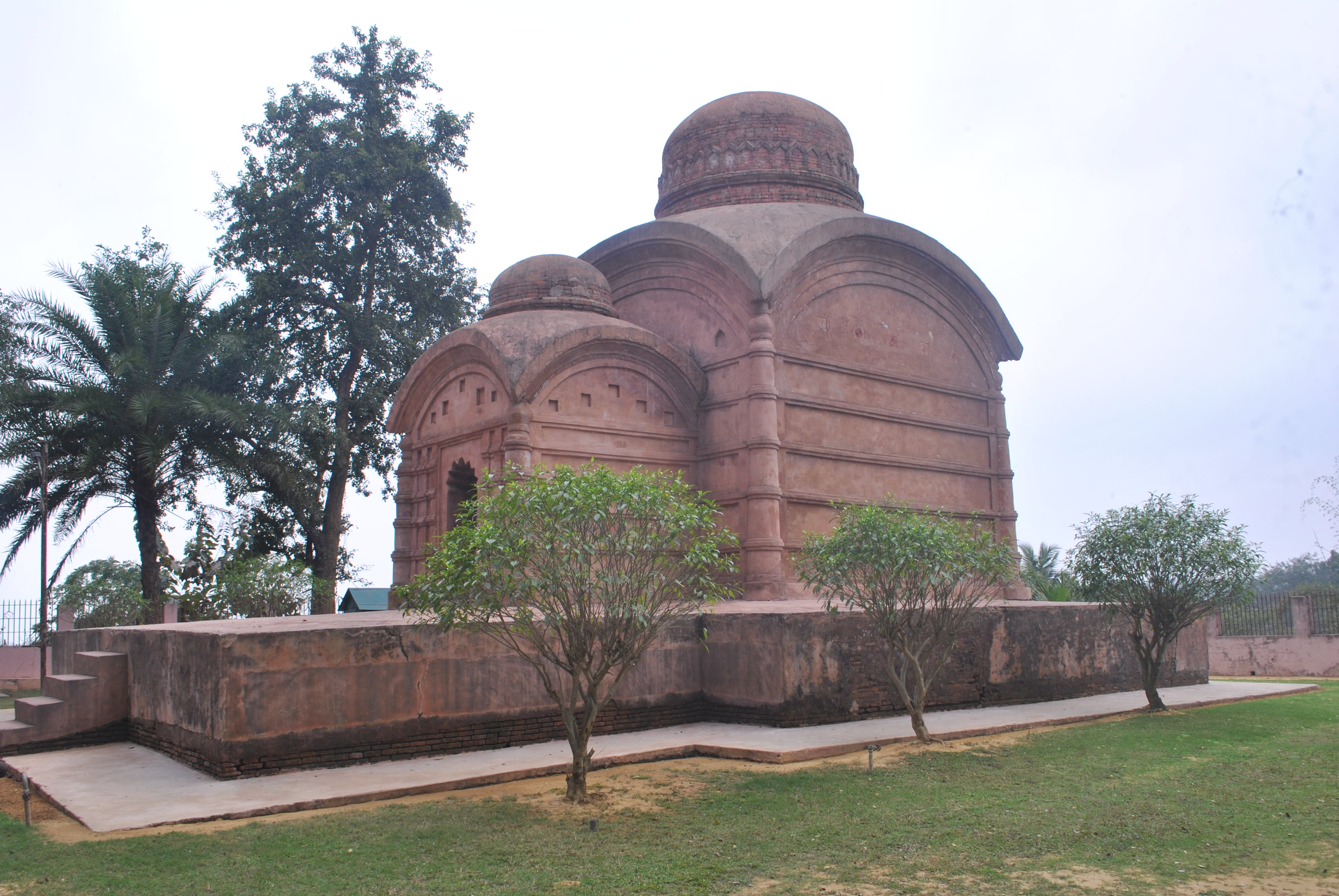
- Tripureshwari Mandir –This is the main attraction of the district. This temple was built on 1501 by Maharaja Dhanya Manikya.
- Bhuvaneswari Temple – The temple is situated besides the river Gomati and is located close to the old royal palace which lies in ruins today. The Bhuvaneswari Temple is dedicated to Goddess Bhuvaneswari and was built in the 17th century by Maharaja Govinda Manikya.[6]
- Old Rajbari – The Ruins of Rajbari, When Udaipur was the capital of the state. Kabiguru Rabindranath Tagore Visited this place.
- Gunabati Temple – Commonly known as Gunabati Mandir Gucchha, it is a group of three temples. Stone inscription of one temple reveals that it was built in the name of Her Highness Maharani Gunabati (wife of Maharaja Govinda Manikya), in 1668 A.D.[7]
- Chobimura – Rock-carved images of Devi Durga and other deities are present here on the bank of River Gomati.
- Tepania eco-park – This park is situated by the side of NH-8. This place has lush green forest and a tree house which are maintained very carefully.
- Tirthmukh — Another pilgrimage centre, located in this district in Amarpur Sub Division.
Transport[edit | edit source]
Roadway[edit | edit source]
National Highway 8 (NH 8), running from Karimganj in Assam to Sabroom in Tripura, passes through this district.[8]
Railway[edit | edit source]
Lumding–Sabroom line of Northeast Frontier Railway passes through Sipahijala district. The segment from Agartala to Sabroom via Udaipur may become operational in 2016.[9][10] There are two stations in the district, namely Udaipur Tripura railway station and Garjee railway station, providing connectivity to Tripura capital Agartala and Assam and other major cities of the state like Dharmanagar, Udaipur and Belonia.[11]
Awards[edit | edit source]
The district received the prestigious Prime Minister's Award for Excellence in Public Administration for the year 2024.[12]
Gallery[edit | edit source]
-
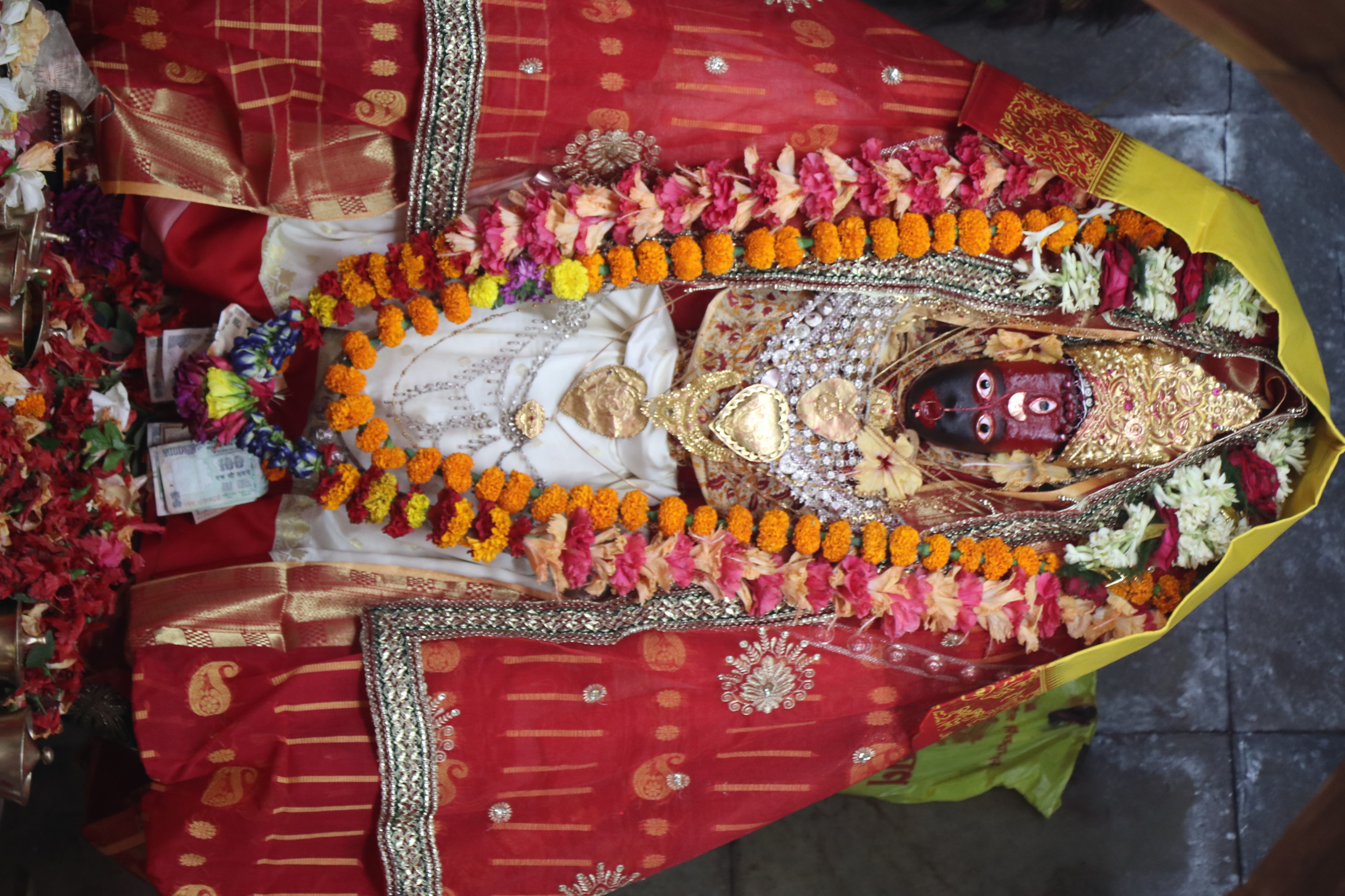 Goddess Tripura Sundari
 -
 Kalyan sagar
 -
 Udaipur railway station
 -
 Tripura Sundari temple
 -
 Bhubaneswari Temple, Rajnagar, Udaipur


References[edit | edit source]
- ↑ "Gomati district website".
- ↑ "Four new districts, six subdivisions for Tripura". CNN-IBN. 26 October 2011. Retrieved 10 April 2012.
{{cite web}}: CS1 maint: deprecated archival service (link) - ↑ "Gomati district website".
- ↑ "Gomati district subdivision and blocks".
- ↑ "Tourism in Gomati district".
- ↑ "Bhuvaneswari temple".
- ↑ "Gunabati temple".
- ↑ "Rationalisation of Numbering Systems of National Highways" (PDF). New Delhi: Department of Road Transport and Highways. Archived from the original (PDF) on 4 December 2018. Retrieved 3 April 2012.
- ↑ First Commercial Broad Gauge Freight Train Arrives In Tripura
- ↑ BG railhead reaches Udaipur amid cheers Archived 2016-03-21 at the Wayback Machine
- ↑ "Indian Rail Info".
- ↑ "Tripura's Gomati district awarded for excellent public administration". India Today NE (in हिन्दी). 21 April 2025. Retrieved 21 April 2025.
External links[edit | edit source]
| State symbols | |
|---|---|
| Topics | |
| Government | |
| Districts | |
| Cities and towns | |
| Education | |
| Culture | |