


This article has multiple issues. Please help improve it or discuss these issues on the talk page. (Learn how and when to remove these template messages)
|
Dharawad district | |
|---|---|
 Amriteswara Temple, Annigeri | |
 Location in Karnataka, India | |
| Coordinates: 15°23′N 75°07′E / 15.39°N 75.12°E | |
| Country | |
| State | Karnataka |
| Headquarters | Dharwad |
| Talukas | Dharwad, Hubli Urban, Hubli Rural, Navalgund, Kundgol, Kalghatgi, Alnavar, Annigeri |
| Government | |
| • Deputy Commissioner & District Magistrate | Nitesh Patil, IAS |
| Area | |
| • Total | 4,265 km2 (1,647 sq mi) |
| Population (2011) | |
| • Total | 1,847,023 |
| • Density | 430/km2 (1,100/sq mi) |
| Languages | |
| • Official | Kannada |
| Time zone | UTC+5:30 (IST) |
| Telephone code | + 91 (0)836 |
| Vehicle registration | KA-25, KA-63 |
| Website | dharwad |
Dharwad is an administrative district of the state of Karnataka in southern India and is the cultural headquarters of North Karnataka.
The administrative headquarters of the district is the town of Dharwad, also known as Dharwar. Dharwad is known for its Dharwad Peda – a milk based sweetmeat. The municipality (resulting from a merger with neighbouring Hubli in 1962) covers 213 km2. Dharwad is located 425 km northwest of Bangalore and 421 km southeast of Pune, on the main highway between Chennai and Pune, the National Highway # 4 (NH4). KREIS North Unit of National Projects Construction Corporation has its headquarters here. Karnataka High Court Bench Dharwad is also here.
Before 1997 the district had an area of 13738 km2. In 1997, the new districts of Gadag and Haveri were carved out of Dharwad's former territory, and a portion of Dharwad district was combined with lands formerly part of three other districts to create the new district of Davanagere.

History[edit | edit source]
The word "Dharwad" means a place of rest on a long journey or a small habitation. For centuries, Dharwad acted as a gateway between the Malenadu region and the plains, and it became a resting place for travelers. The name is derived from the Sanskrit word 'dwarawata', 'dwara' meaning "door" and 'wata' or 'wada' meaning "town".
Another theory is that during the Vijayanagara rule of Dharwad there was a ruler by name "Dharav" (1403), and Dharwad got its name from him. There are some inscriptions that refer to Dharwad as Kampana Sthana.
Inscriptions found near Durga Devi temple in Narendra (a nearby village) and RLS High School date back to the 12th century and have references to Dharwad. This makes Dharwad at least 900 years old. Also, there is an inscription at Hanuman Temple at Bokyapur lake near Garag (a village about 18 km from Dharwad).
The Chalukyas ruled Dharwad during the 12th century. A stone inscription indicates that there was a ruler by the name of Bhaskaradeva in 1117. In the 14th century, the district was first overrun by the Bahmani Sultanate, after which it was annexed to the newly established Hindu kingdom of Vijayanagar, an official of which named Dhar Rao, according to local tradition, built the fort at Dharwad town in 1403. After the defeat of the King of Vijayanagar at Talikot (1565), Dharwad was for a few years practically independent under its Hindu governor; but in 1573 the fort was captured by the sultan of Bijapur, Adil Shah, and Dharwad was annexed to his dominions.[1] Adil Shah built a fort in an area later called Manna Kille, and later Nazratabad. With this fort, the strategic importance of Dharwad increased and it thus attracted the attention of subsequent conquerors, including Aurangzeb, Shivaji, Aurangzeb's son Mu Azam, Peshwa Balaji Baji Rao Peshwa, Hyder Ali, Tipu Sultan and finally the British colonizers.
In 1685, the fort was taken by the Mughal emperor Aurangzeb, and Dharwad, on the break-up of the Mughal empire, fell under the sway of the Maratha Peshwa of Pune. In 1764, the province was overrun by Hyder Ali of the Mysore, who in 1778 captured the fort of Dharwad. The fort was retaken in 1791 by the Marathas. After the final defeat of the Peshwa by the British in 1818, Dharwar was incorporated into the territory of the British East India Company's Bombay Presidency.[1] During the early 19th century, when the British were expanding their domains, they faced a lot of opposition from local rulers, including Baba Saheb of Naragund and Kittur Rani Chennamma.
A Jahagirdar (Baad) on the Indian subcontinent was an aristocrat (The aristocracy are, generally, people that a particular social order considers in the highest social class of that society), typically hereditary, who held enormous tracts of land and held control over his peasants, from whom the Jahagirdars reserved the right to collect tax (often for military purposes). Over time, they took princely and royal titles such as "Raja (King), Nawab (Lord), Mirza (Prince)," and many others. Although Jahagirdars were considered to be equivalent to lords and barons in some cases they were seen as independent, sovereign princes. Often Jahagirdars were Indian princes who had lost their sovereignty due to British Rule. Jagirdari was the predominant form of feudal landownership in Mogul India from the 16th to the 18th century. The owner (Jahagirdar) received a share of the state land tax from the Jagir. In return, he was obligated to maintain a hired cavalry detachment. The average Jagir was immense – approximately 500,000 hectares (50 to 150 villages). The Great Moguls, fearing the separatist tendencies of the Jahagirdars, often transferred them from one Jagir to another. In the 17th century, the Jagirdari system began evolving into a system of hereditary ownership, which ultimately came into existence in the 18th century.
Dharwad was home to the freedom fighter and "Karnataka Kulapurohit", Sri Alur Venkatrao. It was Sri Alur Venkatrao's work, 'Karnataka Gatha Vaibhava', that mooted the idea of unification of Kannada-speaking areas into a state.
Dharwad was peaceful for most of the late 19th century. During those times, the British started an English medium school in Dharwad in 1848. Later, in 1863, the Basel Mission organization started another school. In 1867 the British opened another school, Varmal school, which later on became known as a training college. In 1883, the municipality area included Sidapur, Lakamanhalli, Haveri Pete, Bagtalan, Madihal, Galaganjikop, Malapur, Kamalapur, Narayanpur, Saptapur, Atti Kolla, and Hosayellapur. The British government also established a railway station in 1888.
The town had a station on the Southern Maratha Railway. By 1901, the town had a population of 31,279 and was home to several cotton gina, a cotton mill, and two high schools, one maintained by the government and the other by the Basel Mission.
After India's independence in 1947, the Bombay Presidency was reconstituted as India's Bombay State. In 1956 the southern, Kannada-speaking districts of Bombay State, including Dharwad, were added to Mysore and renamed Karnataka in 1972. Dharwad is home to the Karnataka University and the University of Agricultural Sciences (UAS) as well as numerous other colleges.
In 1941, Dharwad had a population of 47,992.[2] In 1962, the town merged with the adjacent town of Hubli to become a single municipality, Hubli-Dharwad. The population of the twin cities is the second-largest in Karnataka, after Bangalore. Hubli-Dharwad's population increased by 22.99% between 1981 and 1991, from 527,108 to 648,298, and by 21.2% between 1991 and 2001. In the year 2008, a Circuit bench of the High Court of Karnataka was established in Dharwad. The circuit bench at Dharwad caters to the Mumbai – Karnataka region.
Geographical features[edit | edit source]
| Hubli | ||||||||||||||||||||||||||||||||||||||||||||||||||||||||||||
|---|---|---|---|---|---|---|---|---|---|---|---|---|---|---|---|---|---|---|---|---|---|---|---|---|---|---|---|---|---|---|---|---|---|---|---|---|---|---|---|---|---|---|---|---|---|---|---|---|---|---|---|---|---|---|---|---|---|---|---|---|
| Climate chart (explanation) | ||||||||||||||||||||||||||||||||||||||||||||||||||||||||||||
| ||||||||||||||||||||||||||||||||||||||||||||||||||||||||||||
| ||||||||||||||||||||||||||||||||||||||||||||||||||||||||||||
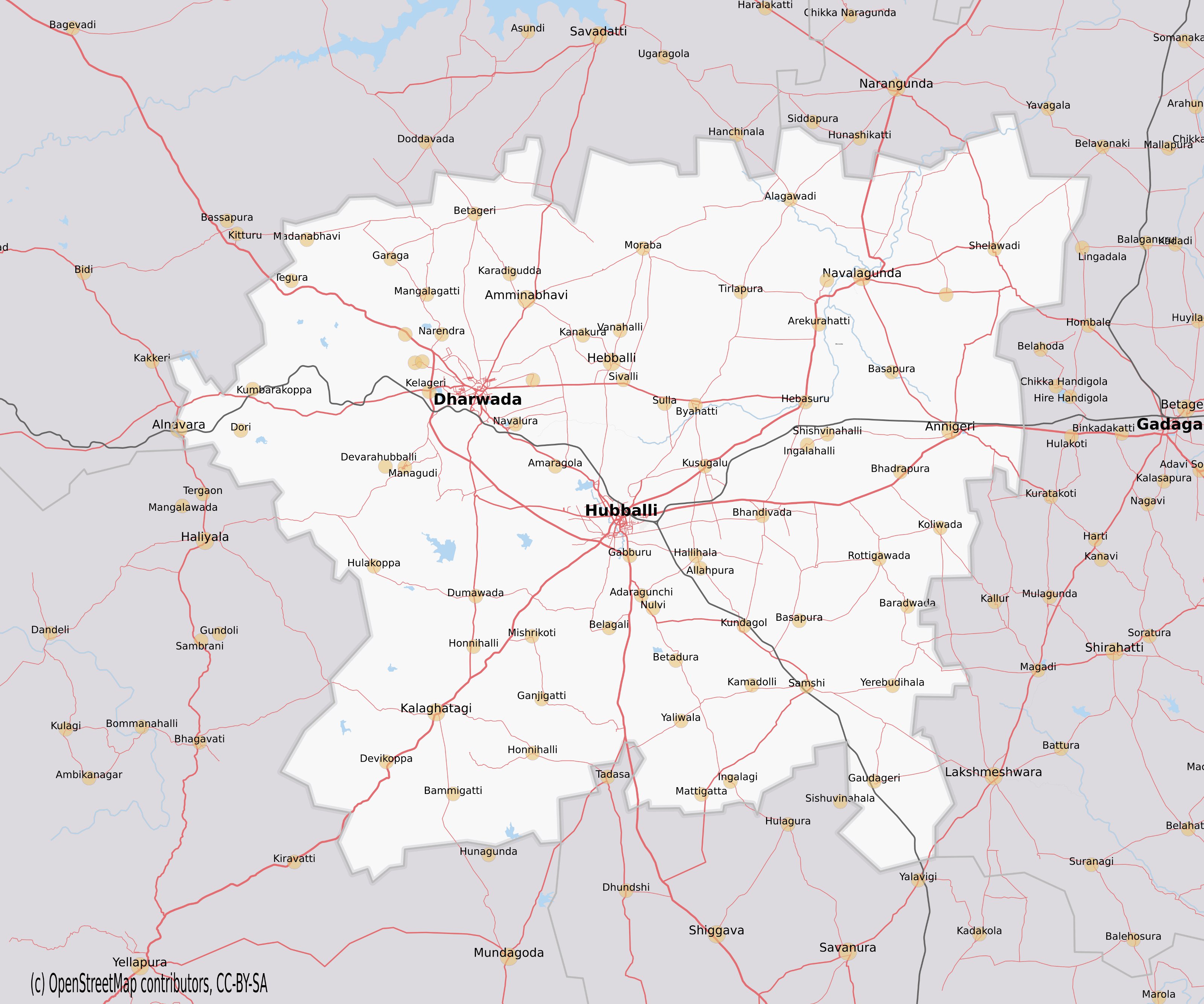
Dharwad district is situated in the Western sector of the northern half of Karnataka State. The District encompasses an area of 4263 km2 lying between the latitudinal parallels of 15°02' and 15°51' North and longitudes of 73°43' and 75°35' East. The district is bounded on the north by the district of Belgaum, on the east by the district of Gadag, on the south by the district of Haveri and on the west by the district of Uttara Kannada. All these districts, which surround Dharwad district, belong to the state of Karnataka.
Sub Divisions of District (Taluka's)
- Dharwad
- Hubli urban
- Hubli Rural
- Kundgol
- Navalgund
- Kalghatgi
- Alnavar
- Annigeri
The District lies approximately 800 m above the sea level, which is why it enjoys a moderate and healthy climate. The District may be divided into 3 natural regions, the Malnad, the Semi-Malnad and the Maidan. These regions on an average receive moderate to heavy rainfall and have dense vegetation. Kalghatagi and Alnavar area in Dharwad taluka in particular receive more rainfall than other talukas of the District.
On the agricultural front, the presence of black soil helps in raising crops like Cotton, Wheat, Ragi, Jowar and Oil seeds and that of red soil is more suitable for paddy.
Notable people[edit | edit source]
- G. S. Amur
- K. S. Amur
- D. R. Bendre
- Kumar Gandharva
- Sawai Gandharva
- Gangubai Hangal
- Shanta Hublikar
- Suresh Heblikar
- R. C. Hiremath
- Bhimsen Joshi
- Girish Karnad
- G. A. Kulkarni
- Sarojini Mahishi
- Mallikarjun Mansur
- Sudha Murthy
- Venkanna H. Naik
- D. C. Pavate
- Basavaraj Rajguru
- C. P. Siddhashrama
Education[edit | edit source]

Dharwad has always been a centre of learning, with many schools, colleges and universities.[citation needed]
List of Universities in Dharwad District
Karnataka University, Dharwad.
University of Agricultural Sciences, Dharwad.
Indian Institute of Technology, Dharwad.
Karnataka State Law University, Hubli.
K. L. E. Technological University, Hubli.
The city of Dharwad is deemed to be the seat of Saraswati because of the educational institutions, educationists, education-loving people[citation needed] and the atmosphere. It is the Cradle of Education in South India and Mainly Karnataka. [citation needed] Students from all surrounding districts come to Dharwad for education. From 8:00 to 10:00 in the morning and 12:00 to 5:00 in the afternoon, the roads of Dharwad, the buses and the autorickshaws brim with students. It appears as though the whole of Dharwad is one big school.
Dharwad has Kannada, English and Urdu medium schools.
Important industrial centre[edit | edit source]
Hubballi (The Sister City of Dharwad) is an important industrial center, with more than 1,000 small and medium scale industries established. They include machine tool industries,Cotton Industries, electrical industries, steel furniture industries, food processing, rubber, leather and leather tanning industries.
Prominent establishments:
- Tata Motors Ltd.
- Tata Marcopolo Motors Ltd.
- Telco Construction Equipment Company Limited (Telcon).
- Kirloskar Electrical Co. Ltd.
- Microfinish Group of Companies.
- Bhoruka Textile Mill.
- New Government Electric Factory Limited (NGEF).
- Karnataka Milk Federation (KMF).
- Universal group of companies.
- BDK Group of Industries.
- Murudeshwar Ceramics Ltd.
- Kamat Group of Hotels.
- JBM Industries.
- DRT Holidays India.
- Vijayanand Roadlines Ltd. (VRL)
- Vibhava Industries (Monkey 555)
IT Park – situated in the heart of the city of Hubballi, it is promoted by the Government of Karnataka IT Department and KEONICS acts as the nodal agency for maintaining and marketing it.
Transportation[edit | edit source]
Road[edit | edit source]
NWKRTC (North West Karnataka Road Transport Corporation) is a state run corporation headquartered at Hubbali. There is excellent inter-city transportation between Hubli, Dharwad, Kalghatgi, Navalgund and Kundgol as NWKRTC and Bendre Nagara Sarige (a consortium of private bus-owners) compete to cater to the large number of commuters between these places daily. Bus services from the twin-cities exist to every part of Karnataka and neighbouring states and other destinations. There are many private bus operators who render travel services between Hubli and Bangalore, Mangalore, Pune, Mumbai, Goa and Hyderabad.
Railway[edit | edit source]
Hubli is the Headquarter of South Western Railways Zone of Indian Railways. Several express and passenger trains ply between Hubli and Bangalore everyday. Hubli being an important railway junction has daily trains to Bangalore, Mumbai, Pune, Miraj, Delhi, Hyderabad, Ahmedabad, Vijayawada, Mysore and weekly services to Chennai, Howrah and Thiruvananthapuram.
Air[edit | edit source]
The closest Airport to Dharwad is at Hubli its Sister City. Hubli Airport (IATA: HBX, ICAO: VOHB) is one of the major operational airports serving northern Karnataka. Currently SpiceJet Airlines have started its operation from Hubli To Bangalore, Mumbai, Hyderabad, Jabalpur, Mangalore, Chennai And Indigo Airlines have started its operation from Hubli to Ahmedabad, Chennai, Bangalore, Cochin, Goa, Alliance Air operates one flight everyday to the state capital Bangalore, Air India has started its operation from Hubli to Mumbai and Bangalore on Tuesday, Wednesday and Saturday. and Star Air (India) will start its operation Hubli To Bangalore, Delhi (Hindon), Pune, and Tirupati on 15 September The airport is currently being upgraded to an international airport.
Demographics[edit | edit source]
According to the 2011 census Dharwad district has a population of 1,847,023,[3] roughly equal to the nation of Kosovo[4] or the US state of West Virginia.[5] This gives it a ranking of 256th in India (out of a total of 640).[3] The district has a population density of 434 inhabitants per square kilometre (1,120/sq mi) .[3] Its population growth rate over the decade 2001–2011 was 15.13%.[3] Dharwad has a sex ratio of 967 females for every 1000 males,[3] and a literacy rate of 80.3%.[3]
| Year | Pop. | ±% p.a. |
|---|---|---|
| 1901 | 421,619 | — |
| 1911 | 388,289 | −0.82% |
| 1921 | 397,902 | +0.24% |
| 1931 | 430,554 | +0.79% |
| 1941 | 466,207 | +0.80% |
| 1951 | 551,466 | +1.69% |
| 1961 | 690,668 | +2.28% |
| 1971 | 875,465 | +2.40% |
| 1981 | 1,149,153 | +2.76% |
| 1991 | 1,374,895 | +1.81% |
| 2001 | 1,604,253 | +1.55% |
| 2011 | 1,847,023 | +1.42% |
| source:[6] | ||
Culture[edit | edit source]
The Dharwad region has contributed to some of the greatest exponents of Hindustani music including Sawai Gandharva, Mallikarjun Mansur, Bhimsen Joshi, Basavaraj Rajaguru, Kumar Gandharva and Gangubai Hangal.
Dharwad is an unlikely outpost of the Kirana gharana. Ustad Abdul Karim Khan was a frequent visitor to Mysore Darbar, where he had been conferred the title of Sangeet Ratna. On the way to Mysore, he used to stay with his brother in Dharwad, where he taught his most famous disciple, Sawai Gandharva. Sawai Gandharva in turn was the guru to Gangubai Hangal, Bhimsen Joshi and Basavaraj Rajaguru.
Jnanpith Award winners D. R. Bendre, V. K. Gokak and Girish Karnad trace their origins to Dharwad. Kannada writers and critics Kirtinath Kurtakoti and C. P. Siddhashrama are from Dharwad. Noted Marathi writer G. A. Kulkarni also lived most of his life. Actresses Shanta Hublikar and Leena Chandavarkar were born here.

Nandan Nilekani, the Co-Chairman of Infosys moved in with his uncle's family in Dharwad for his education and was a student of St Joseph's High School. He has sponsored the construction of Srijana, a state-of-the-art auditorium in the Karnatak College premises.
Sucheta Dalal, the Mumbai-based financial journalist, who exposed the Harshad Mehta scandal studied in Dharwad. Lucy d'Abreu (oldest Briton ever) was also born in Dharwad.
Dharwad is also the birthplace of Palwankar Baloo, the first member of the Dalit community to distinguish himself at cricket, and later to become a political activist for Dalit rights. Sunil Joshi, the Indian cricket bowler, also hails from Dharwar
Tourism[edit | edit source]
Places of interest in Dharwad district comprise many tourist attractions including temples and historical monuments.[7]
- Aminbhavi, about 6 km from Dharwad, is the location of 24 Tirthankara Basadi, Hire Matha and a cave temple. Hire Matha has paintings on a wooden plank. The plank is brought in from Kittur.


- Chandramouleshwara Temple at Unkal is of the Western Chalukya period Chandramouleshwara Shiva temple and Unkal lake.
- Unkal Lake is used as a perfect picnic and has a garden, recreational facilities for children, and boating. The lake is 3 km away from Hubli.

- Bhavanishankar Temple This Chalukyan temple with the image of Sri Narayana is flanked by the ten incarnations of God.
- Asar It was built by Mohammed Ali Shah in about 1646 to serve as a hall of justice. The building was also used to house two hairs from the Prophet's beard. Women are not allowed inside.
- Nrupatunga Hill is a hillock located on the North-Eastern fringe of Hubbali. The top of the hillock has views of Hubli city. The span of the view extends from Amargol in the North to the Airport in the West all the way to the Southern parts of Hubli.

- Siddharoodha Math is a religious institution, a centre of Advaita philosophy as preached by Swami Siddharoodha, is located on the outskirts of Hubli.
- Glass House As the name suggests, this is a palace of glass, inaugurated by the former Indian Prime Minister, Smt. Indira Gandhi.
- Banashankari Temple Amargol is known for the Shankarlinga and Banashankari Temple. It is in between Hubli and Dharwad, and near to Navanagar.
- Annigeri has many historical temples including Kalyani Chalukya period Amriteshwara temple. It is about 30 km from Hubli, between Hubli and Gadag.

Sri Jagadguru Ajaatha Nagalinga Swamy Mutta-Navalagunda
- Kundgol is about 15 km from Hubli-Dharwad. It is home to the Shambhulinga temple. It is known for its place in the history of Hindustani Music in Karnataka.[citation needed] Birthplace of Sawai Gandharva. Bharat Ratna Pandit Bhimsen Joshi and Gangubai Hangal learnt Hindustani music here and Sawai Gandharva was their Guru.
- Kalghatgi:
- Navalgund
Folk Heritage[edit | edit source]
- Dollu Kunitha
It is a popular drum dance. The large drums are decorated with coloured cloth, and are slung around the necks of men. The dances are at times accompanied with songs relating to religious praise or wars.
- Veeragase
Veeragase is popular folk dance. It is a symbolic presentation of the heroism and valour of God Veerabahadhra. Its exponents are called Lingadevaru and they perform the dance with religious fervour at festival time especially during the months of Shravana and Kartika.
- Nandikolu kunitha
This art form is the domain of male devotees of Lord Siva. The Nandi pole is about 18 cubits in length, each cubit representing a 'dharma'. The length of the pole is fitted with brass pots and plates, and ornate silver or brass umbrella at the top with a silk tassel, which is the flag. The performer on a sling balances the pole; this requires skill as well as strength. The sight of the devotee's inspired dance, to the background beat and the resulting symphony of sounds, from the pots and plates on the pole, is truly breathtaking.
- Jodu halige
Halige meaning two percussion instruments used by two artists to produce rhythmic notes of astounding energy and power. Their movements along the stage expressive of their physical energy harmonizes with the notes produced by the instrument. The Haligi (wood) circular in shape is made of buffalo hide. A short stick is used on it. The notes combined with the bodily movement pervade the stage and overflow to the audience.
- Lambani nruthya
Lambani women dressed colourfully and move circularly with clapping and singing. This dance is out of the common. In dress, mode of living and dwelling, they dance on important festivities in a free manner.
- Veerabhadra kunitha
The dance form depicts the story of Veerabhadra, the legendary minor god created by Lord Siva to teach a lesson to his father-in-law Daksha. Veerabhadra to go to the place of the yaga and destroy the ceremony.
The folk art forms of Karnataka need to be revived at the earliest, failing which they will disappear without a trace. Nowadays there is no attempt to perform or encourage in North Karnataka, especially with regard to Doddata, Sannata and Gombeyata.
People, Language, Customs[edit | edit source]
Kannada is most spoken language in this district. The Kannada spoken here is known as Dharwad Kannada. This slightly varies from Kannada spoken in southern Karnataka. Men in rural areas wear headgear called a turban or Pheta. Also many wear white cap on their head.
Agriculture and commerce[edit | edit source]
Jowar, maize, wheat, cotton, onions and rice are grown. The district also grows mangoes, papaya, and bananas as horticultural produce. There are many subsidiary agricultural industries such as the production of puffed rice, beaten rice, and edible oils.
Commercial centre[edit | edit source]
Hubli is the main trading centre for agriculture produce. Farmers not only from Karnataka, but from elsewhere sell their produce here. Hubli has a large APMC market at Amargol located between Hubli and Dharwad. Hubli APMC is an important market for red chillies, onions, rice, cotton and jowar. Hubli-Dharwad city has many medium and small sized industries producing engineering items, electrical goods and agricultural implements. There are several cotton spinning and ginning mills.
Administrative divisions[edit | edit source]
Dharwad District is divided into eight talukas: Dharwad, Hubballi Urban, Hubballi Rural, Kalghatgi, Kundgol, Alnavar, Navalgund and Annigeri. There are fifty panchayat villages under the talukas, each of which manages several villages.[8]
Hubli-Dharwad Municipal Corporation[edit | edit source]
Hubli-Dharwad Municipal Corporation (HDMC) was constituted in the year 1962 by combining two cities separated by a distance of 20 kilometers. This is a unique experiment in urban development history. The area of this Corporation is 213 km². spread over 45 revenue villages. The population of the city as per the 1991 Census was 7 Lacs. The population of Hubli-Dharwad is 943,857 according to 2011 Census.
- Hubli: Under the Government of India Act of 1850, the Hubli-Municipal council was established on 15 August 1855.
- Dharwad: The Dharwad Municipal Council first came into existence on 1 January 1856. The first non-official President of the Council was S.K. Rodda in 1907, and Shri S.V. Mensinkai, was nominated in the following year. But the credit of being the first elected President goes to Shri S.G. Karigudari, who took office in 1920.
Hubli is well known as a commercial as well as industrial centre, whereas Dharwad is seat of learning. Popularly believed that, it is this diversity and geographical positions that the state government amalgamated the two cities. The twin-city Corporation occupies unique place in Karnataka State. After the capital city of Bangalore, this is the largest city Corporation in the State. Off late, HDMC has seen numerous positive changes. The administration has become more transparent and public-friendly. The processes have been streamlined and developmental projects have been taken up on all fronts. With all the standards and policies set, HDMC has been awarded with ISO certification.
See also[edit | edit source]
References[edit | edit source]
- ↑ 1.0 1.1
 One or more of the preceding sentences incorporates text from a publication now in the public domain: Chisholm, Hugh, ed. (1911). "Dharwar". Encyclopædia Britannica. Vol. 8 (11th ed.). Cambridge University Press. p. 143.
- ↑ Columbia-Lippincott Gazetteer. p. 511
- ↑ 3.0 3.1 3.2 3.3 3.4 3.5 "District Census 2011". Census2011.co.in. 2011. Retrieved 30 September 2011.
- ↑ US Directorate of Intelligence. "Country Comparison:Population". Retrieved 1 October 2011.
Kosovo 1,825,632 July 2011 est.
- ↑ "2010 Resident Population Data". U.S. Census Bureau. Archived from the original on 19 October 2013. Retrieved 30 September 2011.
West Virginia 1,852,994
- ↑ Decadal Variation In Population Since 1901
- ↑ "Chapter XIV, Karnataka, The Tourist Paradise". Archived from the original on 4 March 2009. Retrieved 30 March 2009.
- ↑ "Reports of National Panchayat Directory:". Ministry of Panchayati Raj, Government of India. Archived from the original on 7 November 2011. Retrieved 12 February 2013.
.png)