




Created page with "'''Ajmer''' {{IPA-hns|ədʒmeːr|pron|Ajmer.ogg}} is one of the major and oldest cities in the Indian state of Rajasthan and the centre of the eponymous Ajmer District..." |
m robot: Update article |
||
| Line 1: | Line 1: | ||
'''Ajmer''' {{IPA-hns|ədʒmeːr|pron|Ajmer.ogg}} is one of the major and oldest cities in the Indian state of [[Rajasthan]] and the centre of the eponymous [[Ajmer District]]. It is located at the centre of [[Rajasthan]] | {{About|the municipality in Rajasthan, India|its namesake district|Ajmer district|the historical region|Ajmer region}} | ||
{{more citations needed|date=January 2020}} | |||
{{Use dmy dates|date=August 2018}} | |||
{{Use Indian English|date=June 2016}} | |||
{{Infobox settlement | |||
| name = Ajmer | |||
| settlement_type = City | |||
| image_skyline = {{multiple image | |||
| border = infobox | |||
| total_width = 280 | |||
| image_style = border:1; | |||
| perrow = 1/2/2 | |||
| image3 = Prithvi Raj Chauhan (Edited).jpg | |||
| image2 = Mayo college in a sunny day.jpg | |||
| image1 = Ajmer dargah.png | |||
}} | |||
| image_caption = <div>'''Clockwise from the top:'''<br/>[[Ajmer Sharif Dargah]], [[Prithviraj Chauhan]] statue, and [[Mayo College]]</div> | |||
| pushpin_map = India#India Rajasthan | |||
| coordinates = {{coord|26.4499|N|74.6399|E|display=inline,title}} | |||
| subdivision_type = Country | |||
| subdivision_name = [[India]] | |||
| subdivision_type1 = State | |||
| subdivision_name1 = [[Rajasthan]] | |||
| subdivision_type2 = District | |||
| subdivision_name2 = [[Ajmer District|Ajmer]] | |||
| founder = [[Ajayaraja I]] or [[Ajayaraja II]] | |||
| named_for = [[Ajayaraja I]] or [[Ajayaraja II]] | |||
| government_type = Municipal Corporation | |||
| governing_body = Ajmer Municipal Corporation | |||
| leader_title1 = Mayor | |||
| leader_name1 = Braj Lata Hada ([[BJP]])<ref>{{Cite web|url=http://timesofindia.indiatimes.com/articleshow/80743195.cms|title=Braj Lata Hada of BJP was elected mayor of the Ajmer Muncipa .. | |||
|website=Times of India|language=en-US|access-date=2021-02-10}}</ref> | |||
| unit_pref = Metric | |||
| area_total_km2 = 55 | |||
| area_footnotes = <ref>{{cite web|title=AMC|url=http://ajmermc.org/UI/Static/staticpage.aspx?pageid=5}}</ref> | |||
| elevation_footnotes = | |||
| elevation_m = 480 | |||
| population_total = 542,321 | |||
| population_as_of = 2011 | |||
| population_density_km2 = auto | |||
| population_rank = | |||
| population_demonym = | |||
| population_urban = 551,101 | |||
| population_footnotes = <ref name="c2011-c82"/> | |||
| demographics1_title1 = Official | |||
| timezone1 = [[Indian Standard Time|IST]] | |||
| utc_offset1 = +5:30 | |||
| postal_code_type = [[Postal Index Number|PIN]] | |||
| postal_code = 305001 to 305023 | |||
| area_code = 0145, +91145 | |||
| area_code_type = Telephone code | |||
| registration_plate = RJ-01(Ajmer) | |||
RJ-36 (Beawar) | |||
RJ-42 (Kishangarh) | |||
RJ-48 (Kekri) | |||
| website = {{URL|www.ajmer.rajasthan.gov.in}} | |||
| official_name = | |||
}} | |||
'''Ajmer''' {{IPA-hns|ədʒmeːr|pron|Ajmer.ogg}} is one of the major and oldest cities in the Indian state of [[Rajasthan]] and the centre of the eponymous [[Ajmer District]]. It is located at the centre of [[Rajasthan]]. It is also known as heart of [[Rajasthan]].{{citation needed|date=January 2022}} The city was established as "''Ajayameru''" (translated as "Invincible Hills") by a [[Chahamanas of Shakambhari|Chahamana]] ruler, either [[Ajayaraja I]] or [[Ajayaraja II]], and served as their capital until the 12th century CE.{{sfn|Har Bilas Sarda|1911|pp=68-74}}{{sfn|R. B. Singh|1964|p=87}} Home to the [[Ajmer Sharif Dargah|dargah of Moinuddin Chishti]], Ajmer is one of the most important destinations of Islamic pilgrimage in South Asia.<ref name=":1">{{Citation|last=Currie|first=Peter Mark|title=Ajmer|date=2009-10-01|url=https://referenceworks.brillonline.com/entries/encyclopaedia-of-islam-3/*-COM_23249|encyclopedia=Encyclopaedia of Islam, THREE|publisher=Brill|language=en|doi=10.1163/1573-3912_ei3_com_23249|access-date=2021-12-14}}</ref> | |||
Ajmer is surrounded by the [[Aravalli Range|Aravalli Mountains]]. Ajmer had been a municipality since 1869. Ajmer has been selected as one of the heritage cities for the [[Heritage City Development and Augmentation Yojana|HRIDAY]]<ref>{{Cite web|url=http://www.hridayindia.in/hriday-cities/|title=Hriday Cities {{!}} Heritage City Development and Augmentation Yojana (HRIDAY)|website=www.hridayindia.in|language=en-US|access-date=2018-09-28|archive-url=https://web.archive.org/web/20180928082927/http://www.hridayindia.in/hriday-cities/|archive-date=28 September 2018|url-status=dead}}</ref> and Smart City Mission schemes of the [[Government of India]].<ref>{{cite web|url=http://hridayindia.in/|title=Introduction|website=Hriday official website|access-date=30 April 2015|archive-url=https://web.archive.org/web/20150826075658/http://hridayindia.in/|archive-date=26 August 2015|url-status=dead}}</ref> | Ajmer is surrounded by the [[Aravalli Range|Aravalli Mountains]]. Ajmer had been a municipality since 1869. Ajmer has been selected as one of the heritage cities for the [[Heritage City Development and Augmentation Yojana|HRIDAY]]<ref>{{Cite web|url=http://www.hridayindia.in/hriday-cities/|title=Hriday Cities {{!}} Heritage City Development and Augmentation Yojana (HRIDAY)|website=www.hridayindia.in|language=en-US|access-date=2018-09-28|archive-url=https://web.archive.org/web/20180928082927/http://www.hridayindia.in/hriday-cities/|archive-date=28 September 2018|url-status=dead}}</ref> and Smart City Mission schemes of the [[Government of India]].<ref>{{cite web|url=http://hridayindia.in/|title=Introduction|website=Hriday official website|access-date=30 April 2015|archive-url=https://web.archive.org/web/20150826075658/http://hridayindia.in/|archive-date=26 August 2015|url-status=dead}}</ref> | ||
| Line 9: | Line 68: | ||
Ajmer was originally known as ''Ajayameru''. The city was founded by an 11th-century Chahamana king Ajaydeva. Historian [[Dasharatha Sharma]] notes that the earliest mention of the city's name occurs in Palha's ''[[Pattavali]]'', which was copied in 1113 CE (1170 [[Vikrama Samvat|VS]]) at [[Dhara (city)|Dhara]]. This suggests that Ajmer was founded sometime before 1113 CE.{{sfn|Dasharatha Sharma|1959|p=40}} A ''[[prashasti]]'' (eulogistic inscription), issued by [[Vigraharaja IV]] and found at [[Adhai Din Ka Jhonpra]], states Ajayadeva (that is Ajayaraja II) moved his residence to Ajmer.{{sfn|Har Bilas Sarda|1911|pp=68-74}} | Ajmer was originally known as ''Ajayameru''. The city was founded by an 11th-century Chahamana king Ajaydeva. Historian [[Dasharatha Sharma]] notes that the earliest mention of the city's name occurs in Palha's ''[[Pattavali]]'', which was copied in 1113 CE (1170 [[Vikrama Samvat|VS]]) at [[Dhara (city)|Dhara]]. This suggests that Ajmer was founded sometime before 1113 CE.{{sfn|Dasharatha Sharma|1959|p=40}} A ''[[prashasti]]'' (eulogistic inscription), issued by [[Vigraharaja IV]] and found at [[Adhai Din Ka Jhonpra]], states Ajayadeva (that is Ajayaraja II) moved his residence to Ajmer.{{sfn|Har Bilas Sarda|1911|pp=68-74}} | ||
A later text ''[[Prabandha Kosha|Prabandha-Kosha]]'' states that it was the 8th-century king [[Ajayaraja I]] who commissioned the Ajayameru fort, which later came to be known as the [[Taragarh Fort, Ajmer|Taragarh fort]] of Ajmer.{{sfn|R. B. Singh|1964|p=87}} According to historian R. B. Singh, this claim appears to be true, as inscriptions dated to the 8th century CE have been found at Ajmer.{{sfn|R. B. Singh|1964|p=88}} Singh | A later text ''[[Prabandha Kosha|Prabandha-Kosha]]'' states that it was the 8th-century king [[Ajayaraja I]] who commissioned the Ajayameru fort, which later came to be known as the [[Taragarh Fort, Ajmer|Taragarh fort]] of Ajmer.{{sfn|R. B. Singh|1964|p=87}} According to historian R. B. Singh, this claim appears to be true, as inscriptions dated to the 8th century CE have been found at Ajmer.{{sfn|R. B. Singh|1964|p=88}} Singh theorizes that Ajayaraja II later expanded the town area, constructed palaces, and moved the Chahamana capital from [[Sambhar, Rajasthan|Shakambhari]] to Ajmer.{{sfn|R. B. Singh|1964|pp=131-132}} | ||
In 1193, Ajmer was annexed by the [[Mamluk dynasty (Delhi)|Mamluks]] of the [[Delhi Sultanate]], and later was returned to Rajput rulers under condition of tribute.<ref name=":0">{{Cite web|title=Ajmer|url=https://www.britannica.com/place/Ajmer|url-status=live|website=Encyclopaedia Britannica}}</ref> | In 1193, Ajmer was annexed by the [[Mamluk dynasty (Delhi)|Mamluks]] of the [[Delhi Sultanate]], and later was returned to Rajput rulers under condition of tribute.<ref name=":0">{{Cite web|title=Ajmer|url=https://www.britannica.com/place/Ajmer|url-status=live|website=Encyclopaedia Britannica|archive-url=https://web.archive.org/web/20150906032724/http://www.britannica.com/place/Ajmer|archive-date=6 September 2015|access-date=21 October 2020}}</ref> | ||
In 1556, Ajmer came under the [[Mughal Empire]] after being conquered by [[Mughal Emperor]] [[Akbar]].<ref name=":0" /> It was made the capital of the eponymous [[Ajmer Subah]]. The city enjoyed special favour under the Mughals, who made frequent pilgrimages to the city to visit the [[Ajmer Sharif Dargah|''dargah'' of Moinuddin Chishti]]. The city was also used as a military base for campaigns against Rajput rulers, and on a number of occasions became the site of celebration when a campaign bore success. Mughal Emperors and their nobles made generous donations to the city, and endowed it with constructions such as [[Akbari Fort & Museum|Akbar's palace]] and | In 1556, Ajmer came under the [[Mughal Empire]] after being conquered by [[Mughal Emperor]] [[Akbar]].<ref name=":0" /> It was made the capital of the eponymous [[Ajmer Subah]]. The city enjoyed special favour under the Mughals, who made frequent pilgrimages to the city to visit the [[Ajmer Sharif Dargah|''dargah'' of Moinuddin Chishti]]. The city was also used as a military base for campaigns against Rajput rulers, and on a number of occasions became the site of celebration when a campaign bore success. Mughal Emperors and their nobles made generous donations to the city, and endowed it with constructions such as [[Akbari Fort & Museum|Akbar's palace]] and pavilions along the [[Ana Sagar]].<ref>{{Cite book|last=Asher|first=Catherine B.|url=http://dx.doi.org/10.1017/chol9780521267281|title=Architecture of Mughal India|date=1992-09-24|publisher=Cambridge University Press|isbn=978-0-521-26728-1|pages=77–80|doi=10.1017/chol9780521267281}}</ref><ref>{{Cite book|last=Asher|first=Catherine B.|url=http://dx.doi.org/10.1017/chol9780521267281|title=Architecture of Mughal India|date=1992-09-24|publisher=Cambridge University Press|isbn=978-0-521-26728-1|pages=118–122|doi=10.1017/chol9780521267281}}</ref><ref>{{Cite book|last=Asher|first=Catherine B.|url=http://dx.doi.org/10.1017/chol9780521267281|title=Architecture of Mughal India|date=1992-09-24|publisher=Cambridge University Press|isbn=978-0-521-26728-1|pages=170 & 174–178|doi=10.1017/chol9780521267281}}</ref> Their most prominent building activities were in the ''dargah'' and its vicinity.<ref>{{Cite book|last=Asher|first=Catherine B.|url=http://dx.doi.org/10.1017/chol9780521267281|title=Architecture of Mughal India|date=1992-09-24|publisher=Cambridge University Press|isbn=978-0-521-26728-1|pages=220|doi=10.1017/chol9780521267281}}</ref> [[Jahanara Begum]] and [[Dara Shikoh]], children of [[Shah Jahan]], were both born in the city in 1614 and 1615 respectively.<ref>{{cite web |last1=Government of India |first1=MoC |title=IndianCulture |url=https://www.indianculture.gov.in/stories/dara-shikoh |website=indianculture.gov.in |publisher=MoC, IIT Bombay, IGNOU |access-date=21 October 2021}}</ref><ref>{{cite web |editor-last1=Singhal |editor-first1=Shruti |title=thebetterindia |url=https://www.thebetterindia.com/168684/jahanara-begum-mughal-princess-chandni-chowk-history-india/ |website=thebetterindia.com |publisher=thebetterindia |access-date=21 October 2021}}</ref> | ||
Mughal patronage of the city waned | Mughal patronage of the city had waned by the beginning of the 18th century.<ref>{{Cite book|last=Asher|first=Catherine B.|url=http://dx.doi.org/10.1017/chol9780521267281|title=Architecture of Mughal India|date=1992-09-24|publisher=Cambridge University Press|isbn=978-0-521-26728-1|pages=310|doi=10.1017/chol9780521267281}}</ref> In 1771, the [[Scindias]] conquered the city,<ref name=":1" /> and in 1818, the British gained authority over the city.<ref name=":0" /> Colonial-era Ajmer served as the headquarters of the [[Ajmer-Merwara Province]] and possessed a Central jail, a [[Jawaharlal Nehru Medical College, Ajmer#Attached Hospitals|large General Hospital]], and two smaller hospitals according to Gazetteer, 1908. It was the headquarters of a native regiment and of a Railway Volunteer corps. From the 1900s, the United Free Church of Scotland, the church of England, the Roman Catholics, and the American Episcopal Methodists have mission establishments here.<ref>{{Cite news|url=https://www.patrika.com/ajmer-news/world-tourism-day-2018-new-tourism-point-develop-in-ajmer-district-3472887/?ufrm=lsub|title=#World Tourism Day 2018:सूफियत की महक और तीर्थनगरी पुष्कर की सनातन संस्कृति|work=www.patrika.com|access-date=2018-09-28|language=hi-IN}}</ref> At that time there were twelve printing presses in the city, from which eight weekly newspapers were published.<ref>{{Cite book|title=THE IMPERIAL GAZETTEER OF INDIA, 1908.|publisher=OUP|pages=Extract}}</ref> | ||
At the time of Independence Ajmer continued as a separate state with its own legislature until its merger with erstwhile Rajputana province then called Rajasthan. The Legislature of Ajmer State was housed in the building which now houses T. T. College. It had 30 MLAs, and Haribhau | At the time of Independence Ajmer continued as a separate state with its own legislature until its merger with erstwhile Rajputana province then called Rajasthan. The Legislature of Ajmer State was housed in the building which now houses T. T. College. It had 30 MLAs, and Haribhau Upadhyay was the first chief minister of the erstwhile state, with Bhagirath Chaudhary as the first Vidhan Sabha speaker. In 1956, after acceptance of the proposal by Fazil Ali, Ajmer was merged into Rajasthan to form Ajmer District with the addition of Kishangarh sub-division of Jaipur district.<ref>{{Cite news|url=http://epaper.patrika.com/c/32616903|title=Clipping of Patrika Group - Ajmer|access-date=2018-09-28|archive-url=https://web.archive.org/web/20180928083127/http://epaper.patrika.com/c/32616903|archive-date=28 September 2018|url-status=dead}}</ref> | ||
==Other | ==Other Names== | ||
A gujarati historic Novel named ''Gujaratno Jay'' written by [[Zaverchand Meghani]], based on various Jain Prabandhas, describes the city as ''sapādalakṣaṇa'' (સપાદલક્ષણ).<ref>{{Cite book|title=Gujaratno Jay|last=Meghani|first=Zaverchand|publisher=Gurjar Sahitya Bhavan|date=April 2011|isbn=978-81-8461-481-7|location=Ahmdabad|pages=62}}</ref> | |||
==Geography== | ==Geography== | ||
| Line 149: | Line 208: | ||
== Transportation == | == Transportation == | ||
[[File:Pushkar ghati (LongShot).jpg|thumb|Pushkar Valley that connects Pushkar and Ajmer in the Aravalli Mountains]] | [[File:Pushkar ghati (LongShot).jpg|thumb|Pushkar Valley that connects Pushkar and Ajmer in the Aravalli Mountains|227x227px]] | ||
===Air=== | ===Air=== | ||
The [[Kishangarh Airport]] is the nearest airport. It is 25 km from Ajmer city. The Ajmer Airport ground breaking ceremony was done by then Prime Minister of India Dr Manmohan Singh in 2012. The airport was finally completed and inaugurated by then Union Minister of State for Civil Aviation Jayant Sinha and Chief Minister Vasundhara Raje on 11 October 2017.<ref name="DC">{{cite news|title=Kishangarh airport inauguration ends decade long wait of Ajmer residents: CM Raje|url=http://www.deccanchronicle.com/videos/kishangarh-airport-inauguration-ends-decade-long-wait-of-ajmer-residents-cm-raje.html|access-date=13 October 2017|newspaper=[[Deccan Chronicle]]|date=12 October 2017}}</ref> The Airport is operational since then and regular flights to/from Delhi, Mumbai, Hyderabad, Ahmedabad, Indore and Surat are currently available. The airport is now amongst main and busy airports of Rajasthan. Currently SpiceJet and Star Air operate from Ajmer Airport on daily basis. Kishangarh Airport, Ajmer is being managed and operated by Airport Authority of India (AAI). | The [[Kishangarh Airport]] is the nearest airport. It is 25 km from Ajmer city. The Ajmer Airport ground breaking ceremony was done by then Prime Minister of India Dr. Manmohan Singh in 2012. The airport was finally completed and inaugurated by then Union Minister of State for Civil Aviation Jayant Sinha and Chief Minister Vasundhara Raje on 11 October 2017.<ref name="DC">{{cite news|title=Kishangarh airport inauguration ends decade long wait of Ajmer residents: CM Raje|url=http://www.deccanchronicle.com/videos/kishangarh-airport-inauguration-ends-decade-long-wait-of-ajmer-residents-cm-raje.html|access-date=13 October 2017|newspaper=[[Deccan Chronicle]]|date=12 October 2017|archive-date=13 October 2017|archive-url=https://web.archive.org/web/20171013123907/http://www.deccanchronicle.com/videos/kishangarh-airport-inauguration-ends-decade-long-wait-of-ajmer-residents-cm-raje.html|url-status=dead}}</ref> The Airport is operational since then and regular flights to/from Delhi, Mumbai, Hyderabad, Ahmedabad, Indore and Surat are currently available. The airport is now amongst main and busy airports of Rajasthan. Currently SpiceJet and Star Air operate from Ajmer Airport on daily basis. Kishangarh Airport, Ajmer is being managed and operated by Airport Authority of India (AAI). | ||
The [[Jaipur International Airport]] which is 135 km from Ajmer is the nearest International Airport. | The [[Jaipur International Airport]] which is 135 km from Ajmer is the nearest International Airport. | ||
| Line 162: | Line 221: | ||
[[File:A view of ajmer city.jpg|View of Ajmer from [[Taragarh Fort, Ajmer|Taragarh Fort]]|thumb]] | [[File:A view of ajmer city.jpg|View of Ajmer from [[Taragarh Fort, Ajmer|Taragarh Fort]]|thumb]] | ||
[[File:Dargah of moinuddin chishti.jpg|Dargah Sharif Ajmer|thumb]] | [[File:Dargah of moinuddin chishti.jpg|Dargah Sharif Ajmer|thumb]] | ||
[[File: | [[File:Adhai Din-ka-Jhonpra Column detail (6134514518).jpg|thumb|291x291px|A Hindu Style Pillar in Adhai Din Ka Jhopara Monument.]] | ||
[[File:Ayodhya Nagri.jpg|''Swarna Nagari'' in [[Ajmer Jain temple|Soniji Ki Nasiyan]]|thumb]] | [[File:Ayodhya Nagri.jpg|''Swarna Nagari'' in [[Ajmer Jain temple|Soniji Ki Nasiyan]]|thumb]] | ||
[[File:Akbar Fort.jpg|Akbari Fort and Museum|thumb]] | [[File:Akbar Fort.jpg|Akbari Fort and Museum|thumb]] | ||
[[File:Jain Temple-Ajmer.jpg|[[Nareli Jain Temple]] is a recent addition to Ajmer|thumb]] | [[File:Jain Temple-Ajmer.jpg|[[Nareli Jain Temple]] is a recent addition to Ajmer|thumb]] | ||
[[File:Anasagar Lake, Ajmer.JPG|thumb|Baradari on Lake [[Anasagar]]]] | [[File:Anasagar Lake, Ajmer.JPG|thumb|Baradari on Lake [[Anasagar]]]][[File:मक़बरा ख़्वाजा हुसैन अजमेरी रहमतुल्लाह अलैह अजमेर शरीफ .jpg|Tomb of Khwaja Husain Ajmeri|thumb]] | ||
*'''[[Pushkar]]''': Located few kilometres from Ajmer, is an important tourist and pilgrimage destination and a satellite town of Ajmer city. It is famous for '''[[Pushkar Lake]]''' and the 14th century '''[[Brahma Temple at Pushkar]]''', dedicated to [[Brahmā]], according to the ''[[Padma Purana|Padma Purāņa]]'', Pushkar is important pilgrimage site for [[Brahmā|Lord Brahmā]].<ref name="kamakoti.org">[http://www.kamakoti.org/kamakoti/details/padmapurana7.html PADMA PURANA - Significance of Pushkara Tirtha]</ref> Around the world, '''Lord Brahma Temple''' is only situated at Pushkar Lake, Rajasthan, India. | *'''[[Pushkar]]''': Located few kilometres from Ajmer, is an important tourist and pilgrimage destination and a satellite town of Ajmer city. It is famous for '''[[Pushkar Lake]]''' and the 14th century '''[[Brahma Temple at Pushkar]]''', dedicated to [[Brahmā]], according to the ''[[Padma Purana|Padma Purāņa]]'', Pushkar is important pilgrimage site for [[Brahmā|Lord Brahmā]].<ref name="kamakoti.org">[http://www.kamakoti.org/kamakoti/details/padmapurana7.html PADMA PURANA - Significance of Pushkara Tirtha]</ref> Around the world, '''Lord Brahma Temple''' is only situated at Pushkar Lake, Rajasthan, India. | ||
*'''[[Taragarh Fort, Ajmer|Taragarh Fort]]''': It is reputed to be the oldest hill fort in India. It stands, with precipitous surroundings, at a height of 2,855 ft. above sea-level, and between 1,300 and 1,400 ft. above the valley at its base; and it is partially enclosed by a wall some 20 feet thick and as many high, built of huge blocks of stone, cut and squared and are about {{convert|2|mi|km|0|spell=in}} in circumference. This hill fort guarding Ajmer, was the seat of the [[Chauhan]] rulers. It was built by King Ajaypal Chauhan on the summit of Taragarh Hill and overlooks Ajmer. The battlements run along the top of the hill. When it fell to the [[British Raj]], the fort was dismantled on the orders of [[Lord William Bentinck]] in 1832 and was converted into a sanatorium for the British troops stationed at the garrison town of [[Nasirabad, India|Nasirabad]].<ref name="EB1911" /> Within it stands the shrine of a Muhammadan saint, Saiyid Husain, known as the Ganj Shahldan.In the older city, lying in the valley beneath the Taragarh hill and now abandoned, the Nur-chashma, a garden-house used by the Mughals, still remains, as also a water-lift commenced by Maldeo Rathor, to raise water to the Taragarh citadel. | |||
*'''[[Taragarh Fort, Ajmer|Taragarh Fort]]''': It is reputed to be the oldest hill fort in India. It stands, with precipitous surroundings, at a height of 2,855 | |||
*'''[[Ajmer Sharif Dargah]]''': It is a shrine of Khwaja [[Moinuddin Chishti]] which is situated at the foot of the Taragarh hill, and consists of several white marble buildings arranged around two courtyards, including a massive gate donated by the [[Nizam]] of [[Hyderabad state|Hyderabad]], and the Akbari Mosque, built by the [[Mughal Empire|Mughal emperor]] [[Shah Jahan]] and containing the domed tomb of the saint. [[Akbar]] and his queen used to come here by foot every year on pilgrimage from [[Agra]] in observance of a vow when he prayed for a son. The large pillars called "Kose ('Mile') Minars" ([[Kos Minar]]), erected at intervals of about {{convert|2|mi|km|0|spell=in}} along the entire way between Agra and Ajmer mark the places where the royal pilgrims halted every day, they are also seen today, one such is near private bus station in Ajmer City.<ref name="EB1911">{{EB1911|inline=1|wstitle=Ajmere|volume=1|pages=452–453}}</ref> About 125,000 pilgrims visit the site every day. The ''Urs'' of Khwaja Moinuddin Chishti is celebrated every year on the 6th and 7th of Rajab. | *'''[[Ajmer Sharif Dargah]]''': It is a shrine of Khwaja [[Moinuddin Chishti]] which is situated at the foot of the Taragarh hill, and consists of several white marble buildings arranged around two courtyards, including a massive gate donated by the [[Nizam]] of [[Hyderabad state|Hyderabad]], and the Akbari Mosque, built by the [[Mughal Empire|Mughal emperor]] [[Shah Jahan]] and containing the domed tomb of the saint. [[Akbar]] and his queen used to come here by foot every year on pilgrimage from [[Agra]] in observance of a vow when he prayed for a son. The large pillars called "Kose ('Mile') Minars" ([[Kos Minar]]), erected at intervals of about {{convert|2|mi|km|0|spell=in}} along the entire way between Agra and Ajmer mark the places where the royal pilgrims halted every day, they are also seen today, one such is near private bus station in Ajmer City.<ref name="EB1911">{{EB1911|inline=1|wstitle=Ajmere|volume=1|pages=452–453}}</ref> About 125,000 pilgrims visit the site every day. The ''Urs'' of Khwaja Moinuddin Chishti is celebrated every year on the 6th and 7th of Rajab. | ||
*''' | *'''[[Adhai Din Ka Jhonpra]]:''' Literally meaning "shed of two-and-a-half days", it is an [[Archaeological Survey of India|ASI]] protected monument near Ajmer Sharif Dargah and a converted mosque built after the partial destruction of earlier Hindu and Jain temples there on orders of [[Muhammad of Ghor|Muhammad Ghor]]<nowiki/>i after he defeated [[Prithviraj Chauhan]] at the second battle of Tarain .<ref>{{Citation |title=Deprecated (X)HTML Markup |date=2011-11-01 |url=http://dx.doi.org/10.1002/9781118257586.ch8 |work=HTML, XHTML & CSS for Dummies® |pages=119–128 |place=Hoboken, NJ, USA |publisher=Wiley Publishing, Inc. |isbn=978-1-118-25758-6 |access-date=2022-03-19}}</ref><ref>{{Cite web |title=The Sunday Tribune - Spectrum |url=https://www.tribuneindia.com/2007/20070902/spectrum/main2.htm |access-date=2022-03-19 |website=www.tribuneindia.com}}</ref> | ||
*'''[[Mayo College]]''': The college was founded in 1875 at the suggestion of Lord Mayo as a college where the sons of chiefs and nobles might receive an education to fit them for their high positions and important duties.<ref name=Mayo/> It was known as "Indian [[Eton College|Eton]]", as a number of Indian princes studied in this college. The main building, in white marble, is a classic example of [[Indo-Saracenic]] architecture. In front of the college is memorial marble statue of Lord Mayo. The boarding-houses are arranged in the form of a horseshoe, with the college in the centre of the base. Some of the Native States built boarding-houses, while the Government of India presented the college park, comprising 167 acres and formerly the site of the old Residency, and erected the main building, the residences of the principal and vice-principal, and the Ajmer boarding- house. It provided the salaries of the English staff. The foundation-stone of the college was laid in 1878, and the building was opened by the Marquis of Dufferin in 1885.<ref name="Mayo">[http://www.bl.uk/onlinegallery/onlineex/apac/photocoll/m/019pho0000015s5u00015000.html Mayo College, Ajmere - British Library]</ref> John Lockwood Kipling, father of Nobel Laureate, Rudyard Kipling, had been principal of Mayo College. | *'''[[Mayo College]]''': The college was founded in 1875 at the suggestion of Lord Mayo as a college where the sons of chiefs and nobles might receive an education to fit them for their high positions and important duties.<ref name=Mayo/> It was known as "Indian [[Eton College|Eton]]", as a number of Indian princes studied in this college. The main building, in white marble, is a classic example of [[Indo-Saracenic]] architecture. In front of the college is memorial marble statue of Lord Mayo. The boarding-houses are arranged in the form of a horseshoe, with the college in the centre of the base. Some of the Native States built boarding-houses, while the Government of India presented the college park, comprising 167 acres and formerly the site of the old Residency, and erected the main building, the residences of the principal and vice-principal, and the Ajmer boarding- house. It provided the salaries of the English staff. The foundation-stone of the college was laid in 1878, and the building was opened by the Marquis of Dufferin in 1885.<ref name="Mayo">[http://www.bl.uk/onlinegallery/onlineex/apac/photocoll/m/019pho0000015s5u00015000.html Mayo College, Ajmere - British Library]</ref> John Lockwood Kipling, father of Nobel Laureate, Rudyard Kipling, had been principal of Mayo College. | ||
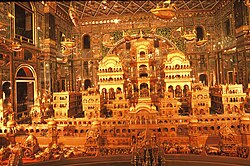
*'''[[Ajmer Jain temple|Soni Ji Ki Nasiyaan]]''': It is architecturally rich [[Jain temple]] built in the late nineteenth century whose main chamber Swarna Nagari "City of Gold", has prominent depiction of ''[[Ayodhya]]'' made from 1000 kg of gold.<ref>{{cite news |date=24 Jul 2017 |title=This Temple In Rajasthan Has A Golden Chamber Where 1000kg Of Gold Was Used To Carve Out Depictions Of Ayodhya. It's Truly Mesmerizing! |newspaper=Daily Bhaskar |url=http://daily.bhaskar.com/news/JM-RIT-jain-temple-gold-ajmer-5653991-PHO.html |access-date=29 Jul 2017}}</ref> | |||
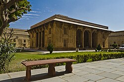
*'''[[Akbari Fort & Museum]]''': The city's museum was once the residence of Prince [[Jahangir|Salīm]], the son of the Emperor [[Akbar]], and presently houses a collection of Mughal and [[Rajput]] armour and sculpture. This is a magnificent example of Mughal architecture, construction of which was commissioned by Akbar in 1570. This is where Salim, as the Emperor [[Jahangir]], read out the [[firman]] permitting the [[British East India Company]] to trade with India.<ref>{{Cite web|url=http://www.rajasthangk.net/2013/05/akbar-ka-kila-ajmer-akbars-fort.html|title=Akbar Ka Kila, AJMER}}</ref> It is a massive square building, with lofty octagonal bastions at each corner. It was the headquarters of the administration in their time and in that of the Marathas. It was here that the emperors appeared in state, and that, as recorded by Sir Thomas Roe, criminals were publicly executed. The interior was used as a magazine during the British occupation until 1857; and the central building, used as a tahsil office. With the fort, the outer city walls, of the same period, are connected. These surround the city and are pierced by the Delhi, Madar, Usri, Agra, and Tirpolia gates. | *'''[[Akbari Fort & Museum]]''': The city's museum was once the residence of Prince [[Jahangir|Salīm]], the son of the Emperor [[Akbar]], and presently houses a collection of Mughal and [[Rajput]] armour and sculpture. This is a magnificent example of Mughal architecture, construction of which was commissioned by Akbar in 1570. This is where Salim, as the Emperor [[Jahangir]], read out the [[firman]] permitting the [[British East India Company]] to trade with India.<ref>{{Cite web|url=http://www.rajasthangk.net/2013/05/akbar-ka-kila-ajmer-akbars-fort.html|title=Akbar Ka Kila, AJMER}}</ref> It is a massive square building, with lofty octagonal bastions at each corner. It was the headquarters of the administration in their time and in that of the Marathas. It was here that the emperors appeared in state, and that, as recorded by Sir Thomas Roe, criminals were publicly executed. The interior was used as a magazine during the British occupation until 1857; and the central building, used as a tahsil office. With the fort, the outer city walls, of the same period, are connected. These surround the city and are pierced by the Delhi, Madar, Usri, Agra, and Tirpolia gates. | ||
*'''[[Nareli Jain Temple]]''': is a Jain temple complex of fourteen temples recently built. It is known for its architecture and intricate stone carvings which gives it both a traditional and contemporary look.<ref>{{cite web|url=http://www.bhaskar.com/news/RAJ-AJM-OMC-enlightenment-completed-the-pilgrimage-area-5291015-PHO.html|title=Enlightenment completed the pilgrimage area - www.bhaskar.com|work=dainikbhaskar|access-date=14 April 2016|date=2016-04-04}}</ref> | *'''[[Nareli Jain Temple]]''': is a Jain temple complex of fourteen temples recently built. It is known for its architecture and intricate stone carvings which gives it both a traditional and contemporary look.<ref>{{cite web|url=http://www.bhaskar.com/news/RAJ-AJM-OMC-enlightenment-completed-the-pilgrimage-area-5291015-PHO.html|title=Enlightenment completed the pilgrimage area - www.bhaskar.com|work=dainikbhaskar|access-date=14 April 2016|date=2016-04-04}}</ref> | ||
*'''[[Ana Sagar| | *'''[[Ana Sagar|Ana Sagar Lake]]''': This is an historic man-made lake built by Maharaja Anaji (1135–1150 CE).<ref name=Madan>{{cite book|title=India through the ages|url=https://archive.org/details/indiathroughages00mada|last=Gopal|first=Madan|year= 1990| page=[https://archive.org/details/indiathroughages00mada/page/173 173]|editor=K.S. Gautam|publisher=Publication Division, Ministry of Information and Broadcasting, Government of India}}</ref> By the lake is the Daulat Bagh, a garden laid out by Emperor Jahangir. Emperor Shah Jahan later added five pavilions, known as the Baradari, between the garden and the lake embankment of the Ana Sagar supports the beautiful marble pavilions erected as pleasure-houses by Shah Jahan. The embankment, moreover, contains the - site of the former ''hammam'' (bath-room). Three of the five pavilions were at one time formed into residences for British officials, while the embankment was covered with office buildings and enclosed by gardens. The houses and enclosures were finally removed in 1900–1902, when the two south pavilions were re-erected, the marble parapet completed, and the embankment restored, as far as practicable, to its early condition. | ||
*'''[[Lake Foy Sagar]]''': It is a picturesque artificial lake that was created as a famine relief project in 1892 some 3 miles to the west of the city. It offers excellent views of Aravali mountains range as well migrating birds.<ref>{{Cite web |url=http://futureofpower.org/wp-content/uploads/2014/04/Ajmer-Summary-Report-of.pdf |title=The Future of Power - summary report, Ajmer - February 2014 |access-date=7 April 2018 |archive-date=20 May 2017 |archive-url=https://web.archive.org/web/20170520111623/http://futureofpower.org/wp-content/uploads/2014/04/Ajmer-Summary-Report-of.pdf |url-status=dead }}</ref> The city used to derive its water-supply from it during colonial times. The water was conveyed into the city and suburbs through pipes which were laid underground. The capacity of the lake is 150,000,000 cubic feet. | *'''[[Lake Foy Sagar]]''': It is a picturesque artificial lake that was created as a famine relief project in 1892 some 3 miles to the west of the city. It offers excellent views of Aravali mountains range as well migrating birds.<ref>{{Cite web |url=http://futureofpower.org/wp-content/uploads/2014/04/Ajmer-Summary-Report-of.pdf |title=The Future of Power - summary report, Ajmer - February 2014 |access-date=7 April 2018 |archive-date=20 May 2017 |archive-url=https://web.archive.org/web/20170520111623/http://futureofpower.org/wp-content/uploads/2014/04/Ajmer-Summary-Report-of.pdf |url-status=dead }}</ref> The city used to derive its water-supply from it during colonial times. The water was conveyed into the city and suburbs through pipes which were laid underground. The capacity of the lake is 150,000,000 cubic feet. | ||
*'''[[Prithviraj Chauhan|Prithviraj Smark]]''': Prithviraj Smark is dedicated to [[Prithviraj Chauhan]]. It is located on the way to Taragarh Fort. This place has a life-size statue of King Prithviraj Chauhan mounted on a horse.<ref>[http://www.urban.rajasthan.gov.in/content/raj/udh/ada-ajmer/en/ajmer--the-city/major-attractions/PRITHVIRAJSMARAK.html Prithviraj Memorial Ajmer]</ref> | *'''[[Prithviraj Chauhan|Prithviraj Smark]]''': Prithviraj Smark is dedicated to [[Prithviraj Chauhan]]. It is located on the way to Taragarh Fort. This place has a life-size statue of King Prithviraj Chauhan mounted on a horse.<ref>[http://www.urban.rajasthan.gov.in/content/raj/udh/ada-ajmer/en/ajmer--the-city/major-attractions/PRITHVIRAJSMARAK.html Prithviraj Memorial Ajmer]</ref> | ||
*'''Tomb of Khwaja Husain Ajmeri''': Khwaja Husain Ajmeri also known as Shaikh Husain Ajmeri, he was a Grandson of Khwaja Moinuddin Chishty of Ajmer from the line of Khwaja Fakhruddin's son Khwaja Husamuddin Jigar Sokhta, he was SajjadaNasheen and Mutwalli<ref>{{Cite web |title=Muntakhab-ut-Tawarikh - Google Search |url=https://www.google.com/search?kgmid=/g/121g7ms5&hl=en-IN&q=Muntakhab-ut-Tawarikh&kgs=6ae889abd1a7e5a0&shndl=0&entrypoint=sh/x/kp/osrp |access-date=2020-04-21 |website=www.google.com}}</ref> of Ajmer Dargah before and the time of Emperor Akbar and Emperor Jahangir, his tomb situated near Sola Khamba (Tomb of Khwaja Alauddin another grandson of Khwaja Moinuddin Chishty of Ajmer), Behind Shahjahani Mosque Dargar Sharif Ajmer, he was leave the world in the year 1619-20 his tomb build in the year 1637–38. | |||
*'''Manibandh''' : Also known as '''Chamunda Mata Mandir''' is one among the 108 Shakti Peeth at Gayatri hills near Pushkar, 11 km from Ajmer. It takes 14 minutes to travel from Pushkar Lake to Chamunda Mata Mandir (about 5–6 km) | |||
== Education == | == Education == | ||
| Line 226: | Line 285: | ||
{{cite web|title=Ajmer City Population Census 2011 {{!}} Rajasthan|url=https://www.census2011.co.in/census/city/82-ajmer.html|website=www.census2011.co.in}}</ref> | {{cite web|title=Ajmer City Population Census 2011 {{!}} Rajasthan|url=https://www.census2011.co.in/census/city/82-ajmer.html|website=www.census2011.co.in}}</ref> | ||
Ajmer's population growth in the decade was 18.48%; this compares to a growth figure of 20.93% in the previous decade.<ref name="c2001-towns">{{cite web|url=http://www.censusindia.net/results/town.php?stad=A&state5=999|archive-url=https://web.archive.org/web/20040616075334/http://www.censusindia.net/results/town.php?stad=A&state5=999 |archive-date=2004-06-16|title= Census of India 2001: Data from the 2001 Census, including cities, villages and towns | Ajmer's population growth in the decade was 18.48%; this compares to a growth figure of 20.93% in the previous decade.<ref name="c2001-towns">{{cite web|url=http://www.censusindia.net/results/town.php?stad=A&state5=999|archive-url=https://web.archive.org/web/20040616075334/http://www.censusindia.net/results/town.php?stad=A&state5=999 |archive-date=2004-06-16|title= Census of India 2001: Data from the 2001 Census, including cities, villages and towns (Provisional)|access-date=2008-11-01|publisher= Census Commission of India}}</ref> | ||
{{Bar chart | {{Bar chart | ||
| title = Population growth through the years | | title = Population growth through the years | ||
| Line 249: | Line 308: | ||
| label16 = 2011 | data16 = 542321 | | label16 = 2011 | data16 = 542321 | ||
}} | }} | ||
===Villages=== | |||
*[[Ajaysar Village, Rajasthan]], located in Srinagar block of Ajmer district | |||
*[[Ashok Nagar Ajmer]] (1989), colony | |||
==See also== | |||
*[[Delhi Gate, Ajmer]] | |||
*[[Ajmeri Gate]] | |||
**[[Ajmeri Gate metro station]] | |||
*[[Qabil Ajmeri]] | |||
*[[Ajmeri Kalakand]] | |||
*[[Marwari language]], also known as Ajmeri, spoken around Marwar and Ajmer | |||
==References== | ==References== | ||
| Line 265: | Line 336: | ||
{{Ajmer|state=expanded}} | {{Ajmer|state=expanded}} | ||
{{Rajasthan}} | {{Rajasthan}} | ||
{{Districts of Rajasthan}}{{Authority control}} | {{Districts of Rajasthan}} | ||
{{Authority control}} | |||
{{Subject bar|portal1=India |commons=yes |s=yes |voy=yes |q=yes}} | {{Subject bar|portal1=India |commons=yes |s=yes |voy=yes |q=yes}} | ||
[[Category:Ajmer| ]] | [[Category:Ajmer| ]] | ||
[[Category:Cities and towns in Ajmer district]] | [[Category:Cities and towns in Ajmer district]] | ||
Revision as of 00:22, 8 May 2022
 | This article needs more citations. (January 2020) |
Ajmer | |
|---|---|
City | |
  Ajmer  Ajmer | |
| Coordinates: 26°27′00″N 74°38′24″E / 26.4499°N 74.6399°E | |
| Country | India |
| State | Rajasthan |
| District | Ajmer |
| Founded by | Ajayaraja I or Ajayaraja II |
| Named for | Ajayaraja I or Ajayaraja II |
| Government | |
| • Type | Municipal Corporation |
| • Body | Ajmer Municipal Corporation |
| • Mayor | Braj Lata Hada (BJP)[1] |
| Area | |
| • City | 55 km2 (21 sq mi) |
| Elevation | 480 m (1,570 ft) |
| Population (2011)[3] | |
| • City | 542,321 |
| • Density | 9,900/km2 (26,000/sq mi) |
| • Urban | 551,101 |
| Time zone | UTC+5:30 (IST) |
| PIN | 305001 to 305023 |
| Telephone code | 0145, +91145 |
| Vehicle registration | RJ-01(Ajmer)
RJ-36 (Beawar) RJ-42 (Kishangarh) RJ-48 (Kekri) |
| Website | www |


.jpg)
Ajmer pronounced [ədʒmeːr] ( listen) is one of the major and oldest cities in the Indian state of Rajasthan and the centre of the eponymous Ajmer District. It is located at the centre of Rajasthan. It is also known as heart of Rajasthan.[citation needed] The city was established as "Ajayameru" (translated as "Invincible Hills") by a Chahamana ruler, either Ajayaraja I or Ajayaraja II, and served as their capital until the 12th century CE.[4][5] Home to the dargah of Moinuddin Chishti, Ajmer is one of the most important destinations of Islamic pilgrimage in South Asia.[6]
Ajmer is surrounded by the Aravalli Mountains. Ajmer had been a municipality since 1869. Ajmer has been selected as one of the heritage cities for the HRIDAY[7] and Smart City Mission schemes of the Government of India.[8]
History

Ajmer was originally known as Ajayameru. The city was founded by an 11th-century Chahamana king Ajaydeva. Historian Dasharatha Sharma notes that the earliest mention of the city's name occurs in Palha's Pattavali, which was copied in 1113 CE (1170 VS) at Dhara. This suggests that Ajmer was founded sometime before 1113 CE.[9] A prashasti (eulogistic inscription), issued by Vigraharaja IV and found at Adhai Din Ka Jhonpra, states Ajayadeva (that is Ajayaraja II) moved his residence to Ajmer.[4]
A later text Prabandha-Kosha states that it was the 8th-century king Ajayaraja I who commissioned the Ajayameru fort, which later came to be known as the Taragarh fort of Ajmer.[5] According to historian R. B. Singh, this claim appears to be true, as inscriptions dated to the 8th century CE have been found at Ajmer.[10] Singh theorizes that Ajayaraja II later expanded the town area, constructed palaces, and moved the Chahamana capital from Shakambhari to Ajmer.[11]
In 1193, Ajmer was annexed by the Mamluks of the Delhi Sultanate, and later was returned to Rajput rulers under condition of tribute.[12]
In 1556, Ajmer came under the Mughal Empire after being conquered by Mughal Emperor Akbar.[12] It was made the capital of the eponymous Ajmer Subah. The city enjoyed special favour under the Mughals, who made frequent pilgrimages to the city to visit the dargah of Moinuddin Chishti. The city was also used as a military base for campaigns against Rajput rulers, and on a number of occasions became the site of celebration when a campaign bore success. Mughal Emperors and their nobles made generous donations to the city, and endowed it with constructions such as Akbar's palace and pavilions along the Ana Sagar.[13][14][15] Their most prominent building activities were in the dargah and its vicinity.[16] Jahanara Begum and Dara Shikoh, children of Shah Jahan, were both born in the city in 1614 and 1615 respectively.[17][18]
Mughal patronage of the city had waned by the beginning of the 18th century.[19] In 1771, the Scindias conquered the city,[6] and in 1818, the British gained authority over the city.[12] Colonial-era Ajmer served as the headquarters of the Ajmer-Merwara Province and possessed a Central jail, a large General Hospital, and two smaller hospitals according to Gazetteer, 1908. It was the headquarters of a native regiment and of a Railway Volunteer corps. From the 1900s, the United Free Church of Scotland, the church of England, the Roman Catholics, and the American Episcopal Methodists have mission establishments here.[20] At that time there were twelve printing presses in the city, from which eight weekly newspapers were published.[21]
At the time of Independence Ajmer continued as a separate state with its own legislature until its merger with erstwhile Rajputana province then called Rajasthan. The Legislature of Ajmer State was housed in the building which now houses T. T. College. It had 30 MLAs, and Haribhau Upadhyay was the first chief minister of the erstwhile state, with Bhagirath Chaudhary as the first Vidhan Sabha speaker. In 1956, after acceptance of the proposal by Fazil Ali, Ajmer was merged into Rajasthan to form Ajmer District with the addition of Kishangarh sub-division of Jaipur district.[22]
Other Names
A gujarati historic Novel named Gujaratno Jay written by Zaverchand Meghani, based on various Jain Prabandhas, describes the city as sapādalakṣaṇa (સપાદલક્ષણ).[23]
Geography
Ajmer is in the northwest of India and is surrounded by the Aravali Mountains. It is situated on the lower slopes of the Taragarh Hill of that range. To the northwest is the Nagapathar Range of the Aravali Mountain Ranges which protects it from desertification from the Thar Desert.
Climate
Ajmer has a hot, semi-arid climate with over 55 centimetres (22 inches) of rain every year, but most of the rain occurs in the monsoon months, between June and September. Temperatures remain relatively high throughout the year, with the summer months of April to early July having an average daily temperature of about 30 °C (86 °F). During the monsoon there is frequent heavy rain and thunderstorms, but flooding is not a common occurrence. The winter months of November to February are mild and temperate with average temperatures ranging from 15–18 °C (59–64 °F) with little or no humidity. There are, however, occasional cold weather fronts that cause temperatures to fall to near freezing levels.
| Climate data for Ajmer (1981–2010, extremes 1901–2012) | |||||||||||||
|---|---|---|---|---|---|---|---|---|---|---|---|---|---|
| Month | Jan | Feb | Mar | Apr | May | Jun | Jul | Aug | Sep | Oct | Nov | Dec | Year |
| Record high °C (°F) | 32.6 (90.7) |
36.8 (98.2) |
42.3 (108.1) |
44.6 (112.3) |
47.4 (117.3) |
46.4 (115.5) |
44.4 (111.9) |
42.3 (108.1) |
42.0 (107.6) |
42.0 (107.6) |
37.4 (99.3) |
34.2 (93.6) |
47.4 (117.3) |
| Average high °C (°F) | 24.3 (75.7) |
27.3 (81.1) |
32.6 (90.7) |
37.8 (100.0) |
40.4 (104.7) |
39.1 (102.4) |
34.3 (93.7) |
32.4 (90.3) |
34.2 (93.6) |
34.7 (94.5) |
30.4 (86.7) |
26.1 (79.0) |
32.8 (91.0) |
| Average low °C (°F) | 9.5 (49.1) |
12.5 (54.5) |
18.1 (64.6) |
23.9 (75.0) |
27.6 (81.7) |
27.8 (82.0) |
25.9 (78.6) |
24.7 (76.5) |
24.3 (75.7) |
20.6 (69.1) |
15.0 (59.0) |
10.7 (51.3) |
20.0 (68.0) |
| Record low °C (°F) | −2.8 (27.0) |
−1.1 (30.0) |
2.2 (36.0) |
9.4 (48.9) |
14.3 (57.7) |
14.7 (58.5) |
14.4 (57.9) |
18.9 (66.0) |
14.6 (58.3) |
7.8 (46.0) |
2.8 (37.0) |
−0.6 (30.9) |
−2.8 (27.0) |
| Average rainfall mm (inches) | 6.1 (0.24) |
7.4 (0.29) |
3.5 (0.14) |
4.2 (0.17) |
18.3 (0.72) |
53.2 (2.09) |
179.7 (7.07) |
159.2 (6.27) |
77.0 (3.03) |
11.3 (0.44) |
3.1 (0.12) |
2.1 (0.08) |
525.1 (20.67) |
| Average rainy days | 0.6 | 0.8 | 0.4 | 0.8 | 1.8 | 3.3 | 8.5 | 8.1 | 3.9 | 0.8 | 0.2 | 0.2 | 29.3 |
| Average relative humidity (%) (at 17:30 IST) | 32 | 25 | 17 | 15 | 18 | 32 | 57 | 64 | 49 | 28 | 31 | 34 | 34 |
| Source: India Meteorological Department[24][25] | |||||||||||||
Transportation
.jpg)
Air
The Kishangarh Airport is the nearest airport. It is 25 km from Ajmer city. The Ajmer Airport ground breaking ceremony was done by then Prime Minister of India Dr. Manmohan Singh in 2012. The airport was finally completed and inaugurated by then Union Minister of State for Civil Aviation Jayant Sinha and Chief Minister Vasundhara Raje on 11 October 2017.[26] The Airport is operational since then and regular flights to/from Delhi, Mumbai, Hyderabad, Ahmedabad, Indore and Surat are currently available. The airport is now amongst main and busy airports of Rajasthan. Currently SpiceJet and Star Air operate from Ajmer Airport on daily basis. Kishangarh Airport, Ajmer is being managed and operated by Airport Authority of India (AAI).
The Jaipur International Airport which is 135 km from Ajmer is the nearest International Airport.
Rail
The Ajmer Junction is the main railway station situated in the city.[27] and was built during colonial times.
Tourism


.jpg)


- Pushkar: Located few kilometres from Ajmer, is an important tourist and pilgrimage destination and a satellite town of Ajmer city. It is famous for Pushkar Lake and the 14th century Brahma Temple at Pushkar, dedicated to Brahmā, according to the Padma Purāņa, Pushkar is important pilgrimage site for Lord Brahmā.[28] Around the world, Lord Brahma Temple is only situated at Pushkar Lake, Rajasthan, India.
- Taragarh Fort: It is reputed to be the oldest hill fort in India. It stands, with precipitous surroundings, at a height of 2,855 ft. above sea-level, and between 1,300 and 1,400 ft. above the valley at its base; and it is partially enclosed by a wall some 20 feet thick and as many high, built of huge blocks of stone, cut and squared and are about 2 miles (3 km)* in circumference. This hill fort guarding Ajmer, was the seat of the Chauhan rulers. It was built by King Ajaypal Chauhan on the summit of Taragarh Hill and overlooks Ajmer. The battlements run along the top of the hill. When it fell to the British Raj, the fort was dismantled on the orders of Lord William Bentinck in 1832 and was converted into a sanatorium for the British troops stationed at the garrison town of Nasirabad.[29] Within it stands the shrine of a Muhammadan saint, Saiyid Husain, known as the Ganj Shahldan.In the older city, lying in the valley beneath the Taragarh hill and now abandoned, the Nur-chashma, a garden-house used by the Mughals, still remains, as also a water-lift commenced by Maldeo Rathor, to raise water to the Taragarh citadel.
- Ajmer Sharif Dargah: It is a shrine of Khwaja Moinuddin Chishti which is situated at the foot of the Taragarh hill, and consists of several white marble buildings arranged around two courtyards, including a massive gate donated by the Nizam of Hyderabad, and the Akbari Mosque, built by the Mughal emperor Shah Jahan and containing the domed tomb of the saint. Akbar and his queen used to come here by foot every year on pilgrimage from Agra in observance of a vow when he prayed for a son. The large pillars called "Kose ('Mile') Minars" (Kos Minar), erected at intervals of about 2 miles (3 km)* along the entire way between Agra and Ajmer mark the places where the royal pilgrims halted every day, they are also seen today, one such is near private bus station in Ajmer City.[29] About 125,000 pilgrims visit the site every day. The Urs of Khwaja Moinuddin Chishti is celebrated every year on the 6th and 7th of Rajab.
- Adhai Din Ka Jhonpra: Literally meaning "shed of two-and-a-half days", it is an ASI protected monument near Ajmer Sharif Dargah and a converted mosque built after the partial destruction of earlier Hindu and Jain temples there on orders of Muhammad Ghori after he defeated Prithviraj Chauhan at the second battle of Tarain .[30][31]
- Mayo College: The college was founded in 1875 at the suggestion of Lord Mayo as a college where the sons of chiefs and nobles might receive an education to fit them for their high positions and important duties.[32] It was known as "Indian Eton", as a number of Indian princes studied in this college. The main building, in white marble, is a classic example of Indo-Saracenic architecture. In front of the college is memorial marble statue of Lord Mayo. The boarding-houses are arranged in the form of a horseshoe, with the college in the centre of the base. Some of the Native States built boarding-houses, while the Government of India presented the college park, comprising 167 acres and formerly the site of the old Residency, and erected the main building, the residences of the principal and vice-principal, and the Ajmer boarding- house. It provided the salaries of the English staff. The foundation-stone of the college was laid in 1878, and the building was opened by the Marquis of Dufferin in 1885.[32] John Lockwood Kipling, father of Nobel Laureate, Rudyard Kipling, had been principal of Mayo College.
- Soni Ji Ki Nasiyaan: It is architecturally rich Jain temple built in the late nineteenth century whose main chamber Swarna Nagari "City of Gold", has prominent depiction of Ayodhya made from 1000 kg of gold.[33]
- Akbari Fort & Museum: The city's museum was once the residence of Prince Salīm, the son of the Emperor Akbar, and presently houses a collection of Mughal and Rajput armour and sculpture. This is a magnificent example of Mughal architecture, construction of which was commissioned by Akbar in 1570. This is where Salim, as the Emperor Jahangir, read out the firman permitting the British East India Company to trade with India.[34] It is a massive square building, with lofty octagonal bastions at each corner. It was the headquarters of the administration in their time and in that of the Marathas. It was here that the emperors appeared in state, and that, as recorded by Sir Thomas Roe, criminals were publicly executed. The interior was used as a magazine during the British occupation until 1857; and the central building, used as a tahsil office. With the fort, the outer city walls, of the same period, are connected. These surround the city and are pierced by the Delhi, Madar, Usri, Agra, and Tirpolia gates.
- Nareli Jain Temple: is a Jain temple complex of fourteen temples recently built. It is known for its architecture and intricate stone carvings which gives it both a traditional and contemporary look.[35]
- Ana Sagar Lake: This is an historic man-made lake built by Maharaja Anaji (1135–1150 CE).[36] By the lake is the Daulat Bagh, a garden laid out by Emperor Jahangir. Emperor Shah Jahan later added five pavilions, known as the Baradari, between the garden and the lake embankment of the Ana Sagar supports the beautiful marble pavilions erected as pleasure-houses by Shah Jahan. The embankment, moreover, contains the - site of the former hammam (bath-room). Three of the five pavilions were at one time formed into residences for British officials, while the embankment was covered with office buildings and enclosed by gardens. The houses and enclosures were finally removed in 1900–1902, when the two south pavilions were re-erected, the marble parapet completed, and the embankment restored, as far as practicable, to its early condition.
- Lake Foy Sagar: It is a picturesque artificial lake that was created as a famine relief project in 1892 some 3 miles to the west of the city. It offers excellent views of Aravali mountains range as well migrating birds.[37] The city used to derive its water-supply from it during colonial times. The water was conveyed into the city and suburbs through pipes which were laid underground. The capacity of the lake is 150,000,000 cubic feet.
- Prithviraj Smark: Prithviraj Smark is dedicated to Prithviraj Chauhan. It is located on the way to Taragarh Fort. This place has a life-size statue of King Prithviraj Chauhan mounted on a horse.[38]
- Tomb of Khwaja Husain Ajmeri: Khwaja Husain Ajmeri also known as Shaikh Husain Ajmeri, he was a Grandson of Khwaja Moinuddin Chishty of Ajmer from the line of Khwaja Fakhruddin's son Khwaja Husamuddin Jigar Sokhta, he was SajjadaNasheen and Mutwalli[39] of Ajmer Dargah before and the time of Emperor Akbar and Emperor Jahangir, his tomb situated near Sola Khamba (Tomb of Khwaja Alauddin another grandson of Khwaja Moinuddin Chishty of Ajmer), Behind Shahjahani Mosque Dargar Sharif Ajmer, he was leave the world in the year 1619-20 his tomb build in the year 1637–38.
- Manibandh : Also known as Chamunda Mata Mandir is one among the 108 Shakti Peeth at Gayatri hills near Pushkar, 11 km from Ajmer. It takes 14 minutes to travel from Pushkar Lake to Chamunda Mata Mandir (about 5–6 km)
Education
The city has many schools and colleges. Among them, Mayo College is a prominent college. The regional office of CBSE is located here.[40]
Demographics
| Population growth of Ajmer | |||
|---|---|---|---|
| Census | Population | %± | |
| 1891 | 68,800 | — | |
| 1901 | 73,800 | 7.3% | |
| 1911 | 86,200 | 16.8% | |
| 1921 | 113,200 | 31.3% | |
| 1931 | 119,500 | 5.6% | |
| 1941 | 147,300 | 23.3% | |
| 1951 | 196,300 | 33.3% | |
| 1961 | 231,200 | 17.8% | |
| 1971 | 264,300 | 14.3% | |
| 1981 | 374,400 | 41.7% | |
| 1991 | 402,700 | 7.6% | |
| 2001 | 485,197 | 20.5% | |
| 2011 | 542,321 | 11.8% | |
| source:[41][42][3] | |||
According to the 2011 census, Ajmer had a population of 542,321 in the city, 551,101 including its suburbs.[3]
The female to male ratio in the city was 947/1,000. The literacy rate in the city was 86.52%, male literacy being 92.08% and female literacy being 80.69%.[3]
Ajmer's population growth in the decade was 18.48%; this compares to a growth figure of 20.93% in the previous decade.[42]
| Year | Population |
|---|---|
| 1891 | 68,800
|
| 1901 | 73,800
|
| 1911 | 86,200
|
| 1921 | 113,200
|
| 1931 | 119,500
|
| 1941 | 147,300
|
| 1951 | 196,300
|
| 1961 | 231,200
|
| 1968 | 265,200
|
| 1971 | 264,300
|
| 1981 | 374,400
|
| 1991 | 402,700
|
| 2001 | 485,197
|
| 2011 | 542,321
|
Villages
- Ajaysar Village, Rajasthan, located in Srinagar block of Ajmer district
- Ashok Nagar Ajmer (1989), colony
See also
- Delhi Gate, Ajmer
- Ajmeri Gate
- Qabil Ajmeri
- Ajmeri Kalakand
- Marwari language, also known as Ajmeri, spoken around Marwar and Ajmer
References
- ↑ "Braj Lata Hada of BJP was elected mayor of the Ajmer Muncipa ." Times of India. Retrieved 10 February 2021.
- ↑ "AMC".
- ↑ 3.0 3.1 3.2 3.3 "Ajmer City Population Census 2011 | Rajasthan". www.census2011.co.in.
- ↑ 4.0 4.1 Har Bilas Sarda 1911, pp. 68-74.
- ↑ 5.0 5.1 R. B. Singh 1964, p. 87.
- ↑ 6.0 6.1 Currie, Peter Mark (1 October 2009), "Ajmer", Encyclopaedia of Islam, THREE, Brill, doi:10.1163/1573-3912_ei3_com_23249, retrieved 14 December 2021
- ↑ "Hriday Cities | Heritage City Development and Augmentation Yojana (HRIDAY)". www.hridayindia.in. Archived from the original on 28 September 2018. Retrieved 28 September 2018.
- ↑ "Introduction". Hriday official website. Archived from the original on 26 August 2015. Retrieved 30 April 2015.
- ↑ Dasharatha Sharma 1959, p. 40.
- ↑ R. B. Singh 1964, p. 88.
- ↑ R. B. Singh 1964, pp. 131-132.
- ↑ 12.0 12.1 12.2 "Ajmer". Encyclopaedia Britannica. Archived from the original on 6 September 2015. Retrieved 21 October 2020.
- ↑ Asher, Catherine B. (24 September 1992). Architecture of Mughal India. Cambridge University Press. pp. 77–80. doi:10.1017/chol9780521267281. ISBN 978-0-521-26728-1.
- ↑ Asher, Catherine B. (24 September 1992). Architecture of Mughal India. Cambridge University Press. pp. 118–122. doi:10.1017/chol9780521267281. ISBN 978-0-521-26728-1.
- ↑ Asher, Catherine B. (24 September 1992). Architecture of Mughal India. Cambridge University Press. pp. 170 & 174–178. doi:10.1017/chol9780521267281. ISBN 978-0-521-26728-1.
- ↑ Asher, Catherine B. (24 September 1992). Architecture of Mughal India. Cambridge University Press. p. 220. doi:10.1017/chol9780521267281. ISBN 978-0-521-26728-1.
- ↑ Government of India, MoC. "IndianCulture". indianculture.gov.in. MoC, IIT Bombay, IGNOU. Retrieved 21 October 2021.
- ↑ Singhal, Shruti (ed.). "thebetterindia". thebetterindia.com. thebetterindia. Retrieved 21 October 2021.
- ↑ Asher, Catherine B. (24 September 1992). Architecture of Mughal India. Cambridge University Press. p. 310. doi:10.1017/chol9780521267281. ISBN 978-0-521-26728-1.
- ↑ "#World Tourism Day 2018:सूफियत की महक और तीर्थनगरी पुष्कर की सनातन संस्कृति". www.patrika.com (in हिन्दी). Retrieved 28 September 2018.
- ↑ THE IMPERIAL GAZETTEER OF INDIA, 1908. OUP. pp. Extract.
- ↑ "Clipping of Patrika Group - Ajmer". Archived from the original on 28 September 2018. Retrieved 28 September 2018.
- ↑ Meghani, Zaverchand (April 2011). Gujaratno Jay. Ahmdabad: Gurjar Sahitya Bhavan. p. 62. ISBN 978-81-8461-481-7.
- ↑ "Station: Ajmer Climatological Table 1981–2010" (PDF). Climatological Normals 1981–2010. India Meteorological Department. January 2015. pp. 19–20. Archived from the original (PDF) on 5 February 2020. Retrieved 20 January 2021.
- ↑ "Extremes of Temperature & Rainfall for Indian Stations (Up to 2012)" (PDF). India Meteorological Department. December 2016. p. M173. Archived from the original (PDF) on 5 February 2020. Retrieved 20 January 2021.
- ↑ "Kishangarh airport inauguration ends decade long wait of Ajmer residents: CM Raje". Deccan Chronicle. 12 October 2017. Archived from the original on 13 October 2017. Retrieved 13 October 2017.
- ↑ "Rajasthan finds favour in railway budget". The Hindu. 26 February 2010. Retrieved 7 June 2014.
- ↑ PADMA PURANA - Significance of Pushkara Tirtha
- ↑ 29.0 29.1
 One or more of the preceding sentences incorporates text from a publication now in the public domain: Chisholm, Hugh, ed. (1911). "Ajmere". Encyclopædia Britannica. Vol. 1 (11th ed.). Cambridge University Press. pp. 452–453.
- ↑ "Deprecated (X)HTML Markup", HTML, XHTML & CSS for Dummies®, Hoboken, NJ, USA: Wiley Publishing, Inc., pp. 119–128, 1 November 2011, ISBN 978-1-118-25758-6, retrieved 19 March 2022
{{citation}}: CS1 maint: work parameter with ISBN (link) - ↑ "The Sunday Tribune - Spectrum". www.tribuneindia.com. Retrieved 19 March 2022.
- ↑ 32.0 32.1 Mayo College, Ajmere - British Library
- ↑ "This Temple In Rajasthan Has A Golden Chamber Where 1000kg Of Gold Was Used To Carve Out Depictions Of Ayodhya. It's Truly Mesmerizing!". Daily Bhaskar. 24 July 2017. Retrieved 29 July 2017.
- ↑ "Akbar Ka Kila, AJMER".
- ↑ "Enlightenment completed the pilgrimage area - www.bhaskar.com". dainikbhaskar. 4 April 2016. Retrieved 14 April 2016.
- ↑ Gopal, Madan (1990). K.S. Gautam (ed.). India through the ages. Publication Division, Ministry of Information and Broadcasting, Government of India. p. 173.
- ↑ "The Future of Power - summary report, Ajmer - February 2014" (PDF). Archived from the original (PDF) on 20 May 2017. Retrieved 7 April 2018.
- ↑ Prithviraj Memorial Ajmer
- ↑ "Muntakhab-ut-Tawarikh - Google Search". www.google.com. Retrieved 21 April 2020.
- ↑ "Over 3lakh to appear for CBSE exams from Ajmer region". The Times of India. 5 March 2018. Retrieved 14 February 2021.
- ↑ "Historical Census of India". Archived from the original on 17 February 2013. Retrieved 22 March 2014.
- ↑ 42.0 42.1 "Census of India 2001: Data from the 2001 Census, including cities, villages and towns (Provisional)". Census Commission of India. Archived from the original on 16 June 2004. Retrieved 1 November 2008.
Bibliography
- Dasharatha Sharma (1959). Early Chauhān Dynasties. S. Chand / Motilal Banarsidass. ISBN 9780842606189.
- Har Bilas Sarda (1911). "Adhai-Din-ka-Jhonpra" (PDF). Ajmer: Historical and Descriptive. Scottish Mission.[permanent dead link]
- R. B. Singh (1964). History of the Chāhamānas. N. Kishore. OCLC 11038728.
- W.D. Begg: The Holy Biography of Hazrat Khwaja Muinuddin Chishti (Millat Book Centre, Delhi, 1999).
- Ajmer The Imperial Gazetteer of India, 1909, v. 5, p. 137-146.
External links
- Ajmer District website
- R. Nath Mughal Architecture Image Collection, Images from Ajmer - University of Washington Digital Collection
Ajmer topics | |||||||||
|---|---|---|---|---|---|---|---|---|---|
| History | |||||||||
| Buildings and landmarks |
| ||||||||
| Education |
| ||||||||
| Transport |
| ||||||||
| Other Topics | |||||||||

| Outline |  | ||||||||||||||
|---|---|---|---|---|---|---|---|---|---|---|---|---|---|---|---|
| Governance | |||||||||||||||
| Divisions and districts |
| ||||||||||||||
| Major cities | |||||||||||||||
| Related templates | |||||||||||||||


Lua error in Module:Sister_project_links at line 463: attempt to index field 'wikibase' (a nil value).