


The Kos Minars (translated: Mile Pillars) are medieval Indian milestones along the Grand Trunk Road on the northern Indian subcontinent that were introduced by the 16th-century Pashtun ruler Sher Shah Suri of the Sur Empire. Kos Minars were erected to serve as markers of distance along royal routes from Agra to Ajmer, Agra to Lahore, and from Agra to Mandu in the south.
Most of the Kos Minars are present in Uttar Pradesh, Rajasthan, Madhya Pradesh, Haryana, and Punjab by the roadsides, railway tracks, paddy fields and in many towns and villages.[1]
Kos Minars were described as a "marvel of India" by early European travellers such as Sir Thomas Roe and have been labeled as an integral part of India's "national communication system" by Archaeological Survey of India.[2]
Characteristics[edit | edit source]
A kos in Sanskrit is one fourth of a yojana,[3] an ancient Indian unit of distance. It represented a distance of approximately 3.22 kilometres (2.00 mi). Minar is an Arabic word for tower, related to minaret.
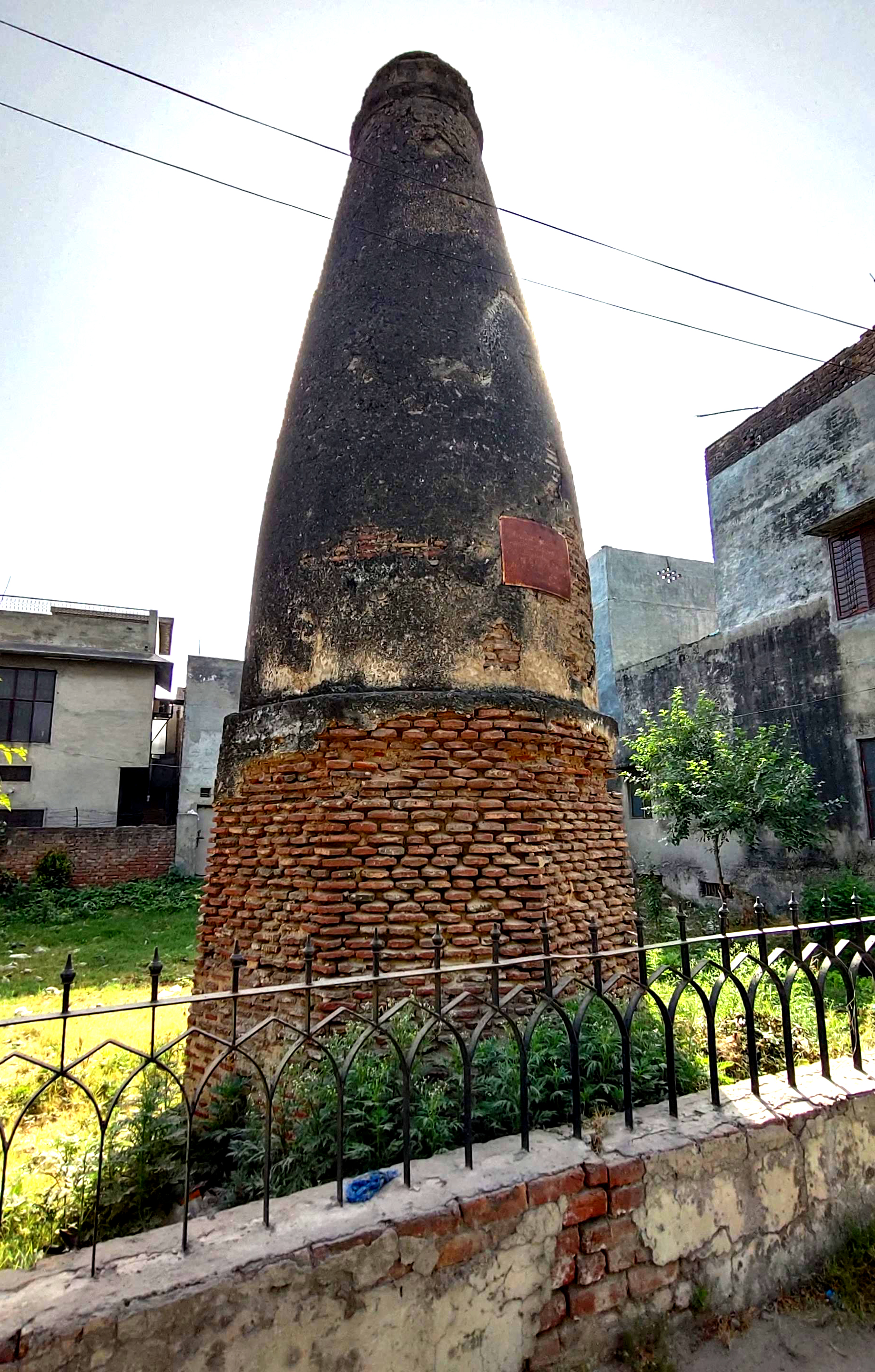
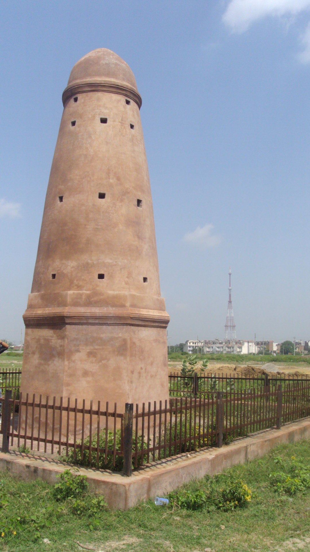
Kos Minars are solid round pillars, around 30 feet (9.1 m) in height, on a masonry platform built with bricks and plastered over with lime. They are not identical. As milestones, they were an important part of communication and travel.
History[edit | edit source]
Maurya period[edit | edit source]
In the third century BC, emperor Ashoka improved existing routes linking his capital city Pataliputra to Dhaka in the east and Kabul via Peshawar in the west and further to Balkh. These routes had landmarks in the form of mud pillars, trees or wells to guide commuters.[4]
Sur period[edit | edit source]
The 16th-century Pashtun ruler Sher Shah Suri introduced improved brick pillars plastered over with lime at every kos. The minars thus came to be called as Kos minars.
Mughal period[edit | edit source]
Abul Fazl recorded in Akbar Nama that in the year 1575 AD, Akbar issued an order that, at every kos on the way from Agra to Ajmer, a pillar or a minar should be erected for the comfort of the travelers.[5][6] In addition, many caravanserais (roadside inns) were built for travelers. Later emperors such as Shah Jahan continued to add to the network of Kos Minars. In the Mughal period, there were around 600 minars.[2] In the north, they were extended as far as Peshawar and in the east to Bengal via Kannauj.
Deterioration and preservation[edit | edit source]
As the British introduced Imperial units and later, independent India adopted the International System of Units, the kos unit of measurement and consequently these minars went out of use. The monuments gradually went into a state of disrepair, as contemporary people ignored their significance.[4] Only 110 Kos minars are left.[2] According to a report of the Archaeology Survey of India, there are 49 in Haryana alone.[7][8] There are also seven Kos Minars in Jalandhar district and five around Ludhiana district in Punjab.[9][10] Conservation work of Kos Minars situated in Jalandhar district started in 2016. Grill fencing was erected at each minar to protect the original structure of Minar.[11] Restoration work for nine Kos Minars near Mathura began in 2018.[4] The Archaeological Survey of India has given Kos Minars protected status and courts have ordered encroachments cleared away.
Photo Gallery[edit | edit source]
-
 Mughalpura, Lahore, Pakistan
 -
 Manhala, Lahore, Pakistan
 -
 Taxla, Pakistan (old G.T.Road)
 -
Delhi Zoo, India
-
 Jalandhar, India
 -
 Dakkhni, Jalandhur, India
 -
 UP, India
 -
 Tarawri, Karnal, India
 -
 Karnal, India
 -
Haryana, India
-
 Ambala, Haryana, India


See also[edit | edit source]
- List of Monuments of National Importance in Haryana, contains over a dozen Kos Minars in Haryana
References[edit | edit source]
- ↑ Gopinath, P. Krishna (12 June 2020). "Kos minars: Pillars of the past". @businessline. Retrieved 27 September 2021.
- ↑ 2.0 2.1 2.2 "Sher Shah Suri's kos minars once meant to show way to travellers stand lost today - Times of India". The Times of India. 27 January 2018. Retrieved 21 December 2018.
- ↑ Arthashastra, Chanakya, 4th century BCE, pp151
- ↑ 4.0 4.1 4.2 Arvind Chauhan (2 March 2019). "These were the 'Google Maps' of 16th century, now they're lost in time". The Times of India.
- ↑ Kos Minar Archived 4 March 2016 at the Wayback Machine University of Alberta.
- ↑ Khandekar, Nivedita (27 October 2012). "A milestone on the highway". Hindustan Times. Retrieved 20 March 2018.
{{cite web}}: CS1 maint: deprecated archival service (link) - ↑ "Kos Minar". Haryana Tourism Corporation. Retrieved 2 March 2019.
- ↑ "Signposts lost in history". Tribune India. 10 September 2006. Archived from the original on 10 February 2022. Retrieved 23 September 2013.
- ↑ Khaira, Rachna (3 May 2017). "ASI notice on encroachment near Nakodar Kos Minar". Tribune India. Jalandhar. Retrieved 27 May 2023.
There are presently seven Kos Minars in the district and all were declared as monuments of national importance.
- ↑ "'Monumental' treasure house". The Times of India. 12 July 2009. Archived from the original on 11 August 2011. Retrieved 23 September 2013.
- ↑ Singh, Dilbag (9 November 2016). "Conservation work of 'Kos Minars' in Jalandhar starts". Hindustan Times. Nurmahal. Retrieved 27 May 2023.