Betma
Betma
Baitmah | |
|---|---|
Town | |
| Coordinates: 22°41′N 75°37′E / 22.68°N 75.62°ECoordinates: 22°41′N 75°37′E / 22.68°N 75.62°E | |
| Country | |
| State | Madhya Pradesh |
| District | Indore |
| Tehsil | Depalpur |
| Population (2001) | |
| • Total | 12,529 |
| Languages | |
| • Official | Hindi |
| Time zone | UTC+5:30 (IST) |
| Postal Index Number | 453001 |
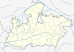
Betma is a town and a nagar panchayat in Indore district in the state of Madhya Pradesh, India.
History[edit | edit source]
A 1020 CE copper-plate inscription of the Paramara king Bhoja was found in Betma.[1]
Kanungo's of Betma - Jagir pargana[edit | edit source]
In the Ain-i-Akbari Betma is one of the mahal and old town of Malwa region and pargana of Kayastha zamidari granted from the Malwa Sultanate in (Hijri AD 1101) (Vikram Samvat 1747) 1689 CE.[citation needed]
In 1733 CE Maratha's captured Malwa and Changed the revenue system. In 1756 Malharrao transferred some villages from Betma pargana 12 villages remained with Kanungo Rai Bakhat Singh and other Villages transferred to Sagour paragna or Depalpur.
Bagh(Wagh) Maratha[edit | edit source]
Malhar Rao Holker granted Betma to his feudal Sardar Madhorao Bhag(Wagh) for local revenue collection in 1757.
Chouhan's of Betma[edit | edit source]
After some years, a Chouhan Rajput appointed Mandloi raja of some villages in Betma(ugai Thikanedar) from Holkers of Indore princely estate. This family traced their ancestry from Raja Hariraj Singh Chouhan brother of Samrat prithviraj singh chouhan.
It is believed that Sikh Guru Nanak Dev, during his second Udasi, stayed in Betma for six months.[citation needed][2] In The age of mughal era Betma was a paragna of Qanungoh(kanungo) hakh Dastoor 26 village under this paragna.Thakur Dungar singh nigam who was the appointed Betma paragna jagirdar and received the sanad & title of kanungo by the akbar's court Mandu sarkar.by caste he was a kastariya kayastha .The family traced their ancestry from Thakur Ganrajdas he was the diwan of rana udaipur prithviraj singh in between 1600 and 1700 century .in holkars time holkars change the revenue policy and holkars appointed to madhorao Wagh for Betma local revenue collection. After some years a chouhan rajputs appointed revenue agent (thikanedar) by the agent of holkars Wagh mansabdar and pargna kanungo of Betma they were decentliy enjoyed their work in campany raj and British India also...
Origin of name is possibly from an event where a significant woman sat which got called ‘baith-ma’ (sit mother).
Education[edit | edit source]
Primary and secondary education in Betma is offered by various schools which are affiliated to either Madhya Pradesh Board of Secondary Education or CBSE......
Geography[edit | edit source]
Betma is located at 22°41′N 75°37′E / 22.68°N 75.62°E.[3] It has an average elevation of 541 metres (1774 feet).
Demographics[edit | edit source]
As of 2001[update] India census,[4] Betma had a population of 12,529. Males constitute 51% of the population and females 49%. 17% of the population is under 6 years of age.
Places of interest[edit | edit source]
- Betma Sahib Gurudwara is of historical significance for Sikhs. It is believed that Guru Nanak Dev Ji visited this place.
- Aman Chaman Mata mandir is also of historical significance to Hindu devotees. All religions worship here. It is main center of betma nagar, here people celebrated a huge dushera festival in all over mp.
- Saeyad Sarkar a Sufi Saint and Spiritual guru resides in village Daulta Bad 10 km away on Depalpur road from Betma. People of different religion from all parts of India visit him to gain spiritual knowledge and blessings.
- Isa Ji Shaheed is a historical significance of Dawoodi Bohra's . Peoples of other religions also worship there to gain the blessings of Isa Ji Shaheed. Dargah e Isa Ji Shaheed is situated in Lakhera Bakhal in Betma.
Transport[edit | edit source]
The nearest airport is indore.
References[edit | edit source]
- ↑ Harihar Vitthal Trivedi (1991). Inscriptions of the Paramāras (Part 2). Corpus Inscriptionum Indicarum Volume VII: Inscriptions of the Paramāras, Chandēllas, Kachchapaghātas, and two minor dynasties. Archaeological Survey of India. p. 35. doi:10.5281/zenodo.1451755.
- ↑ History of malwa, Malwa. History of malwa.
- ↑ Falling Rain Genomics, Inc - Betma
- ↑ "Census of India 2001: Data from the 2001 Census, including cities, villages and towns (Provisional)". Census Commission of India. Archived from the original on 16 June 2004. Retrieved 1 November 2008.

