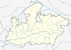
Kasrawad
This article has multiple issues. Please help improve it or discuss these issues on the talk page. (Learn how and when to remove these template messages)
|
Kasrawad is a tehsil and nagar panchayat in Khargone district in the Indian state of Madhya Pradesh.
Kasrawad
Kasrawad Kusrawud | |
|---|---|
| Coordinates: 22°08′N 75°36′E / 22.13°N 75.6°ECoordinates: 22°08′N 75°36′E / 22.13°N 75.6°E | |
| Country | |
| State | Madhya Pradesh |
| District | Khargone |
| Government | |
| • Type | Nagar Parishad |
| • Body | Sachin Yadav (MLA) |
| Elevation | 169 m (554 ft) |
| Population | |
| • Total | 22,750 |
| Languages | |
| • Official | Hindi |
| Time zone | UTC+5:30 (IST) |
| Pincode | 451228 |
| STD Code | 07285 |
GeographyEdit
Kasrawad is located at 22°08′N 75°36′E / 22.13°N 75.6°E.[1] It has an average elevation of 169 metres (554 feet) and is 17 km in east from National Highway 3 (Agra to Mumbai) and about 100 km from Indore.The town is 5 km from the northern banks of the holy Narmada River.
EconomyEdit
Cotton, soya beans, sugar cane and wheat are the main crops in this area. Kasrawad and the surrounding areas are developing very rapidly.[citation needed] People from surrounding villages come here for their shopping and medical needs.
CultureEdit
Places to visit include the pandhari nath mandir in yadav mohalla, laxmi narayan Temple in kushwaha mohalla, Bhavani Mata Temple, ancient Kailask kund, sai baba mandir, museum, satyadham and Baba ki Mazar on Gangleshwar parvat, Mahalakshmi Mandir, Gayatsri Mata Mandir in Shrinagar colony, Gangore place ( Mata ki Vadi).
DemographicsEdit
At the 2001 India census,[2] Kasrawad had a population of 19,035. Males were 51% of the population and females 49%. The average literacy rate was 57%, lower than the national average of 59.5%. Male literacy was 66% and female literacy 48%. 16% of the population were under the age of 6 years.
TransportEdit
The nearest airport is Indore.
ReferencesEdit
- ↑ Falling Rain Genomics, Inc - Kasrawad
- ↑ "Census of India 2001: Data from the 2001 Census, including cities, villages and towns (Provisional)". Census Commission of India. Archived from the original on 16 June 2004. Retrieved 1 November 2008.

