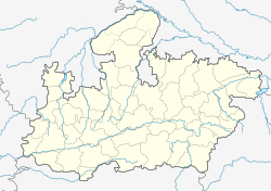
Rajpur, Madhya Pradesh
Rajpur | |
|---|---|
town | |
| Coordinates: 21°56′N 75°08′E / 21.93°N 75.13°ECoordinates: 21°56′N 75°08′E / 21.93°N 75.13°E | |
| Country | |
| State | Madhya Pradesh |
| District | Barwani |
| Government | |
| • Type | Nagar Panchayat |
| • Body | (Bala bacchan, shubhash patel) Rahul Gupta 9630134111 (Inc) |
| Elevation | 225 m (738 ft) |
| Population (2001) | |
| • Total | 17,913 |
| Languages | |
| • Official | Hindi |
| Time zone | UTC+5:30 (IST) |
| PIN | 451447 |
| Telephone code | 07284 |
| ISO 3166 code | IN-MP footnotes |
| Vehicle registration | MP-46 |
Rajpur is a town and a nagar panchayat in Barwani district in the Indian state of Madhya Pradesh. Integrated Border Check Post[1] at Agra Mumbai Highway run by Government of Madhya Pradesh is at Balsamud in Rajpur tehsil.
Geography[edit | edit source]
Rajpur is located at 21°56′N 75°08′E / 21.93°N 75.13°E.[2] It has an average elevation of 225 metres (738 feet).
Demographics[edit | edit source]
As of 2001[update] India census,[3] Rajpur had a population of 17,913. Males constitute 51% of the population and females 49%. Rajpur has an average literacy rate of 59%, lower than the national average of 59.5%: male literacy is 68%, and female literacy is 49%. In Rajpur, 17% of the population is under 6 years of age.
Temples[edit | edit source]
In Rajpur there are many temples. Some of the famous temples names are Bhawani mata temple, Triveni Temple, Hanuman temple., Saiyad Mahar Ali Shah Sarkaar Dargah.
Places to visit[edit | edit source]
Roseshwar dham is the famous place near Rajpur. It is situated on the hill and 5 km from Rajpur. Here two temples are also present. One is shiv temple, other is navgrah temple.
References[edit | edit source]
- ↑ "21 माह में 16 बार महाजाम, जनता के हजारों घंटे बर्बाद". Naidunia. No. 26 December 2014. Naidunia. Jagran Group. 26 December 2014. Retrieved 16 February 2015.
- ↑ Falling Rain Genomics, Inc - Rajpur
- ↑ "Census of India 2001: Data from the 2001 Census, including cities, villages and towns (Provisional)". Census Commission of India. Archived from the original on 16 June 2004. Retrieved 1 November 2008.

