


imported>Chattapadhyay Suman →Demographics: Added language data |
brief improve intro for accuracy and corrected details |
||
| Line 2: | Line 2: | ||
{{Use Indian English|date=January 2016}} | {{Use Indian English|date=January 2016}} | ||
{{Infobox settlement | {{Infobox settlement | ||
| name | | name = Rudrapur | ||
| native_name | | native_name = | ||
| native_name_lang | | native_name_lang = | ||
| other_name | | other_name = | ||
| nickname | | nickname = | ||
| settlement_type | | settlement_type = City | ||
| image_skyline | | image_skyline = {{Photomontage | ||
| photo1a = Radisson, rudrapur 2015.jpg{{!}}Radisson Hotel | | photo1a =Radisson, rudrapur 2015.jpg{{!}}Radisson Hotel | ||
| photo2a = Atariya temple, rudrapur.jpg{{!}}Atariya temple | | photo2a = Atariya temple, rudrapur.jpg{{!}}Atariya temple | ||
| photo2b = Millenium park portrait.jpg{{!}}Gandhi Park | | photo2b = Millenium park portrait.jpg{{!}}Gandhi Park | ||
| photo3a = Metropolis mall rudrapur.jpg{{!}}Metropolis mall | | photo3a = Metropolis mall rudrapur.jpg{{!}}Metropolis mall | ||
| size = 275 |border= | | size = 275 |border= black |spacing= 0.7 |color=none | ||
}} | }} | ||
| image_alt | | image_alt = | ||
| image_caption | | image_caption = '''Clockwise from top:''' <br /> Radisson Hotel, Gandhi Park, Metropolis mall and Atariya temple. | ||
| pushpin_map | | pushpin_map = India Uttarakhand#India | ||
| pushpin_label_position | | pushpin_label_position = right | ||
| pushpin_map_alt | | pushpin_map_alt = | ||
| pushpin_map_caption | | pushpin_map_caption = Location in Uttarakhand, India | ||
| coordinates | | coordinates = {{coord|28.98|N|79.40|E|display=inline,title}} | ||
| subdivision_type | | subdivision_type = Country | ||
| subdivision_name | | subdivision_name = {{flag|India}} | ||
| subdivision_type1 | | subdivision_type1 = [[States and territories of India|State]] | ||
| subdivision_name1 | | subdivision_name1 = [[Uttarakhand]] | ||
| subdivision_type2 | | subdivision_type2 = [[List of districts of Uttarakhand|District]] | ||
| subdivision_name2 | | subdivision_name2 = [[Udham Singh Nagar district|Udham Singh Nagar]] | ||
| established_title1 | | established_title1 = Founded | ||
| established_date1 | | established_date1 = 1588 | ||
| established_title2 | | established_title2 = Municipality | ||
| established_date2 | | established_date2 = 1942 | ||
| founder | | founder = [[Chand kings#List of Chand Kings|Rudra Chand]] | ||
| named_for | | named_for = Raja Shri Shri Rudra Chand | ||
| government_type | | government_type = [[Municipal Corporations in India|Municipal Corporation]] | ||
| governing_body | | governing_body = [[Rudrapur Municipal Corporation]] | ||
| | | leader_title = [[Mayor]] | ||
[[ | | leader_name = Vikas Sharma | ||
| | | leader_party = [[Bharatiya Janata Party|BJP]] | ||
[[ | | leader_title2 = [[Member of Parliament, Lok Sabha|Lok Sabha MP]] | ||
| | | leader_name2 = [[Ajay Bhatt (politician)|Ajay Bhatt]] ([[Bharatiya Janata Party|BJP]]) | ||
| | | leader_title3 = [[Uttarakhand Legislative Assembly|MLA]] | ||
| | | leader_name3 = [[Shiv Arora]] ([[Bharatiya Janata Party|BJP]]) | ||
| | | leader_name4 = Mahesh Chandra Pathak, [[Indian Administrative Service|IAS]] | ||
| unit_pref | | leader_title4 = [[Municipal Commissioner (India)|Municipal Commissioner]] | ||
| area_footnotes | | unit_pref = Metric | ||
| area_rank | | area_footnotes = | ||
| area_total_km2 | | area_rank = | ||
| elevation_footnotes | | area_total_km2 = 47.65 | ||
| elevation_m | | elevation_footnotes = <ref>https://en-in.topographic-map.com/map-c9gl3q/Rudrapur/?center=28.97165%2C79.39711&zoom=15&popup=28.97059%2C79.39751</ref> | ||
| population_total | | elevation_m = 217 | ||
| population_as_of | | population_total = 140,857<ref>https://www.census2011.co.in/census/city/26-rudrapur.html</ref> | ||
| population_footnotes | | population_as_of = 2011 | ||
| population_density_km2 | | population_footnotes = <ref name="cen11city"/> | ||
| population_metro | | population_density_km2 = auto | ||
| population_metro_footnotes | | population_metro = 154,554<ref>https://www.census2011.co.in/census/city/26-rudrapur.html</ref> | ||
| population_rank | | population_metro_footnotes = <ref name="cen11ua"/> | ||
| population_demonym | | population_rank = | ||
| demographics_type1 | | population_demonym = | ||
| demographics1_title1 | | demographics_type1 = Languages | ||
| demographics1_info1 | | demographics1_title1 = Official | ||
| timezone1 | | demographics1_info1 = [[Hindi language|Hindi]] | ||
| utc_offset1 | | demographics1_title2 = Native | ||
| postal_code_type | | demographics1_info2 = [[Bengali language |Bengali]], [[kauravi dialect|Khariboli]], [[Punjabi language|Punjabi]], [[Kumaoni language|Kumaoni]], [[Tharu languages|Tharu]] | ||
| postal_code | | timezone1 = [[Indian Standard Time|IST]] | ||
| area_code_type | | utc_offset1 = +5:30 | ||
| area_code | | postal_code_type = [[Postal Index Number|PIN]] | ||
| registration_plate | | postal_code = 263153 | ||
| website | | area_code_type = Telephone code | ||
| footnotes | | area_code = +91-5944 | ||
| official_name | | registration_plate = UK-06 | ||
| website = {{URL|nagarnigamrudrapur.com}} | |||
| footnotes = | |||
| official_name = Nagar Nigam Rudrapur | |||
| image_seal = Rudrapur_City_Seal.jpg | |||
| seal_size = 250px | |||
}} | }} | ||
'''Rudrapur''' | '''Rudrapur''' is a city that serves as the headquarters of the [[Udham Singh Nagar district]] in the Indian state of [[Uttarakhand]]. Located at a distance of about {{convert|250|km|abbr=on}} northeast of [[New Delhi]] and {{convert|250|km|abbr=on}} south of [[Dehradun]], Rudrapur is located in the fertile [[Terai]] plains in the southern part of [[Kumaon division]] over an area of 27.65 km<sup>2</sup>. With a population of 140,857 according to the [[2011 Census of India|2011 census of India]], it is the [[List of cities in Uttarakhand by population|5th most populous city of Uttarakhand]]. | ||
Rudrapur | Rudrapur was established in the 16th century by [[Chand kings#List of Chand Kings|King Rudra Chand]] of [[Kumaon Kingdom|Kumaon]] to serve as the seat of the governor of the southern [[Tarai]] plains of the kingdom. Since the establishment of the [[State Industrial Development Corporation of Uttarakhand|SIDCUL]] industrial area in its vicinity, the city has undergone rapid development, along with literacy growth and higher employment. Rudrapur is a major industrial and [[List of educational institutions in Rudrapur, Uttarakhand|educational]] hub of the state. | ||
In this area, some artesian water wells produce water under pressure and no pump is required.<ref>{{Cite web|title= | In this area, some artesian water wells produce water under pressure and no pump is required.<ref>{{Cite web|title=District Udham Singh Nagar at a Glance|url=http://cgwb.gov.in/District_Profile/Uttarakhand/UdhamSinghNagar.pdf|access-date=1 July 2020}}</ref> However, in the last two decades, this auto-flow system has drastically declined, leading Rudrapur into a groundwater crisis.<ref>{{Cite web|date=April 21, 2019|first=Aakash |last=Ahuja |title=Uttarakhand's Udham Singh Nagar district: In rice bowl of Uttarakhand, dwindling groundwater a big problem |url=https://timesofindia.indiatimes.com/city/dehradun/uttarakhand-nonseasonal-crops-reason-for-water-crisis-in-udham-singh-nagar/articleshow/68967260.cms|access-date=2020-07-01|website=The Times of India}}</ref> | ||
== Etymology == | == Etymology == | ||
The name "Rudrapur" comprises two words "Rudra" and "Pur". It is believed to be named after the King Rudra Chandra who was handed over this region by the Emperor Akbar in 1588.<ref>{{Cite web|title=History {{!}} District UdhamSinghNagar, Government Of Uttarakhand {{!}} India|url=https://usnagar.nic.in/history/|access-date=2020-10-01}}</ref> Pur is a placename element common to the Indian subcontinent which is derived from the Sanskrit word 'pura' which refers to a city or settlement.<ref>{{Cite web | The name "Rudrapur" comprises two words "Rudra" and "Pur". It is believed to be named after the King Rudra Chandra who was handed over this region by the Emperor Akbar in 1588.<ref>{{Cite web|title=History {{!}} District UdhamSinghNagar, Government Of Uttarakhand {{!}} India|url=https://usnagar.nic.in/history/|access-date=2020-10-01}}</ref> Pur is a placename element common to the Indian subcontinent which is derived from the Sanskrit word 'pura' which refers to a city or settlement.<ref>{{Cite web|date=2019-12-18|title=Largest "pur" suffix cities of India and beyond|url=https://panethos.wordpress.com/2019/12/18/largest-pur-suffix-cities-of-india-and-beyond/|access-date=2020-10-01|website=Panethos}}</ref> | ||
== History == | == History == | ||
[[File:Ruins of Temple.jpg|thumb|left|Ruins of the Ancient city of Govisana at [[Kashipur, Uttarakhand|Kashipur]]. Govisana is the earliest known settlement in the region, visited by the Chinese pilgrim [[Xuanzang]] in the 7th century.]] | [[File:Ruins of Temple.jpg|thumb|left|Ruins of the Ancient city of Govisana at [[Kashipur, Uttarakhand|Kashipur]]. Govisana is the earliest known settlement in the region, visited by the Chinese pilgrim [[Xuanzang]] in the 7th century.]] | ||
The [[Terai]] area, where Rudrapur is located was considered an impenetrable forest for much of the ancient period. Marshy land, extreme heat, rains which lasted months, wild animals, diseases and no means of transportation prevented people from settling here. No historical settlements, except [[Kashipur, Uttarakhand|Govishana]] ({{convert|50|km|mi}} northwest of the city), has been recorded in the area.<ref name="asiatic">{{cite book|title=Journal of the Asiatic Society of Bengal|publisher=Asiatic Society|url=https://archive.org/details/journalasiatics30benggoog}}</ref>{{rp|174–175}} Mughal historians mention that the [[Chand kings|Chand ruler]] of [[Champawat]], ''Gyan Chand'', visited [[Delhi Sultanate]] and received the regions of [[Bhabar]]–[[Terai]] up to the [[Ganges]] as a grant from then Sultan;<ref name="dsal">{{cite web|title=Imperial Gazetteer of India, Volume 18, page 324|url=https://dsal.uchicago.edu/reference/gazetteer/pager.html?objectid=DS405.1.I34_V18_330.gif|website=dsal.uchicago.edu|publisher=Digital South Asia Library|access-date=13 July 2017}}</ref> thus bringing it under the [[Kumaon Kingdom|Kingdom of Kumaon]]. This area remained under local chieftains; it was ''Kirti Chand'' (1488–1503), who first ruled the Terai area, along with the rest of [[Kumaon Kingdom|Kumaon]].<ref name="dsal" /> | The [[Terai]] area, where Rudrapur is located was considered an impenetrable forest for much of the ancient period. Marshy land, extreme heat, rains which lasted months, wild animals, diseases and no means of transportation prevented people from settling here. No historical settlements, except [[Kashipur, Uttarakhand|Govishana]] ({{convert|50|km|mi}} northwest of the city), has been recorded in the area.<ref name="asiatic">{{cite book|title=Journal of the Asiatic Society of Bengal|year=1832|publisher=Asiatic Society|url=https://archive.org/details/journalasiatics30benggoog}}</ref>{{rp|174–175}} | ||
Mughal historians mention that the [[Chand kings|Chand ruler]] of [[Champawat]], ''Gyan Chand'', visited [[Delhi Sultanate]] and received the regions of [[Bhabar]]–[[Terai]] up to the [[Ganges]] as a grant from then Sultan;<ref name="dsal">{{cite web|title=Imperial Gazetteer of India, Volume 18, page 324|url=https://dsal.uchicago.edu/reference/gazetteer/pager.html?objectid=DS405.1.I34_V18_330.gif|website=dsal.uchicago.edu|publisher=Digital South Asia Library|access-date=13 July 2017}}</ref> thus bringing it under the [[Kumaon Kingdom|Kingdom of Kumaon]]. This area remained under local chieftains; it was ''Kirti Chand'' (1488–1503), who first ruled the Terai area, along with the rest of [[Kumaon Kingdom|Kumaon]].<ref name="dsal" /> | |||
Rudrapur town was established in the 16th century by King Rudra Chand of Almora.<ref name="rawat">{{cite book|last1=Rawat|first1=Ajay S.|title=Forest on fire : ecology and politics in the Himalayan Tarai|date=1998|publisher=Cosmo Publications|location=New Delhi|isbn=9788170208402}}</ref>{{rp|6}} It was the residence of the Adhikari (Governor) of Tarai, till the town of [[Kashipur, Uttarakhand|Kashipur]] was Established in 1718.<ref name="handa">{{cite book|last1=Hāṇḍā|first1=Omacanda|title=History of Uttaranchal|date=2002|publisher=Indus Publishing|location=New Delhi|isbn=9788173871344|url=https://books.google.com/books?id=7_Ct9gzvkDQC}}</ref>{{rp|81}} The Kumaoni Army, under Shiv Deo Joshi faced severe defeat during the Battle of Rudrapur, that was fought between Chands and Rohillas in AD 1744.<ref name="handa" />{{rp|92}} Later, King Deep chand built a fort at Rudrapur to keep vigil over the Rohillas.<ref name="rawat" />{{rp|8}}<ref name="handa" />{{rp|95}} | Rudrapur town was established in the 16th century by King Rudra Chand of Almora.<ref name="rawat">{{cite book|last1=Rawat|first1=Ajay S.|title=Forest on fire : ecology and politics in the Himalayan Tarai|date=1998|publisher=Cosmo Publications|location=New Delhi|isbn=9788170208402}}</ref>{{rp|6}} It was the residence of the Adhikari (Governor) of Tarai, till the town of [[Kashipur, Uttarakhand|Kashipur]] was Established in 1718.<ref name="handa">{{cite book|last1=Hāṇḍā|first1=Omacanda|title=History of Uttaranchal|date=2002|publisher=Indus Publishing|location=New Delhi|isbn=9788173871344|url=https://books.google.com/books?id=7_Ct9gzvkDQC}}</ref>{{rp|81}} The Kumaoni Army, under Shiv Deo Joshi faced severe defeat during the Battle of Rudrapur, that was fought between Chands and Rohillas in AD 1744.<ref name="handa" />{{rp|92}} Later, King Deep chand built a fort at Rudrapur to keep vigil over the Rohillas.<ref name="rawat" />{{rp|8}}<ref name="handa" />{{rp|95}} | ||
| Line 91: | Line 98: | ||
[[File:VC Office building Pantnagar.JPG|thumb|[[G. B. Pant University of Agriculture and Technology|Uttar Pradesh Agricultural University]], which was inaugurated by [[Jawaharlal Nehru]] on 17 November 1960, is situated at [[Pantnagar]] near Rudrapur.]] | [[File:VC Office building Pantnagar.JPG|thumb|[[G. B. Pant University of Agriculture and Technology|Uttar Pradesh Agricultural University]], which was inaugurated by [[Jawaharlal Nehru]] on 17 November 1960, is situated at [[Pantnagar]] near Rudrapur.]] | ||
In 1837, Rudrapur was annexed to the collectorate of Rohilkhand.<ref name="pande">{{cite book|last1=Pande|first1=Badri Datt|title=History of Kumaun : English version of "Kumaun ka itihas"|date=1993|publisher=Shyam Prakashan|location=Almora, U.P., India|isbn=81-85865-01-9}}</ref>{{rp|445}} Rudrapur was brought under Kumaon Division in 1858, however it was brought back to Rohilkhand division in 1861.<ref name="pande" />{{rp|445}} In | In 1837, Rudrapur was annexed to the collectorate of Rohilkhand.<ref name="pande">{{cite book|last1=Pande|first1=Badri Datt|title=History of Kumaun : English version of "Kumaun ka itihas"|date=1993|publisher=Shyam Prakashan|location=Almora, U.P., India|isbn=81-85865-01-9}}</ref>{{rp|445}} Rudrapur was brought under Kumaon Division in 1858, however it was brought back to Rohilkhand division in 1861.<ref name="pande" />{{rp|445}} In 1864–65 the whole [[Tarai]] and [[Bhabar]] was put under "Tarai and Bhawar Government Act" which was governed directly by the British crown. In 1891, the Tarai district was dismantled, and Rudrapur was put in the newly created [[Nainital district]]. Post independence Rudrapur and other parts of [[Nainital district]] were merged with [[United Provinces (1937–50)|United Provinces]], which was later renamed the state of [[Uttar Pradesh]]. [[G. B. Pant University of Agriculture and Technology|Uttar Pradesh Agricultural University]], the first agricultural university of India, was established near Rudrapur on 17 November 1960.<ref>{{cite news|title=Over 600 teaching staff go on strike|url=http://timesofindia.indiatimes.com/city/dehradun/Over-600-teaching-staff-go-on-strike/articleshow/53727867.cms|access-date=13 July 2017|work=The Times of India|date=16 August 2016|location=Nainital}}</ref> The university was inaugurated by [[Jawaharlal Nehru]], and soon became a significant force in the development and transfer of [[Hybrid seed|High Yielding Variety seeds]] and related technology.<ref>Uttar Pradesh Agricultural University 1963:14–19 and Charanjit Ahuja "One University That Actually Works" ''Indian Express'', 9 March 1994, p.3</ref> | ||
After [[Operation Blue Star]] in 1984, several [[Sikh extremists]] fled [[Punjab, India|Punjab]] and took refuge in U.P. Tarai.<ref name="rawat" />{{rp|214}} Subsequently, [[1991 Rudrapur bombings|several cases of explosions and Bombings were reported in 1991]]. A bomb blast occurred in Rudrapur market in mid 1991, and another bomb in a state roadways bus was defused in the nick of time.<ref>{{cite news|last1=Pathak|first1=Rahul|title=Terrorists strike during Ram Lila celebrations in Uttar Pradesh|url= | After [[Operation Blue Star]] in 1984, several [[Sikh extremists]] fled [[Punjab, India|Punjab]] and took refuge in U.P. Tarai.<ref name="rawat" />{{rp|214}} Subsequently, [[1991 Rudrapur bombings|several cases of explosions and Bombings were reported in 1991]]. A bomb blast occurred in Rudrapur market in mid 1991, and another bomb in a state roadways bus was defused in the nick of time.<ref>{{cite news|last1=Pathak|first1=Rahul|title=Terrorists strike during Ram Lila celebrations in Uttar Pradesh|url=https://www.indiatoday.in/magazine/indiascope/story/19911115-evil-triumphs-over-good-during-ram-lila-celebrations-815064-1991-11-14|access-date=13 July 2017|publisher=India Today|date=15 November 1991}}</ref> On 17 October 1991, Two bombs exploded at Ramlila celebration in the town, killing 41 people and wounding more than 140.<ref>{{cite news|title=2 Bombs Kill 41 and Injure 140 in India|url=https://www.nytimes.com/1991/10/18/world/2-bombs-kill-41-and-injure-140-in-india.html|access-date=13 July 2017|work=The New York Times|date=18 October 1991}}</ref> Later, two members of the Khalistan Commando force were shot dead by a joint team of the commandos of the [[National Security Guard]] and the [[Delhi Police]].<ref>{{cite book|last1=Singh|first1=Mohinder|title=Punjab 2000: Political and Socio-economic Developments|date=2001|publisher=Anamika Publishers & Distributors|location=New Delhi|isbn=9788186565902|page=502|url=https://books.google.com/books?id=1ZNgVkbUtagC|access-date=13 July 2017}}</ref><ref>{{cite news|title=Two ISI-backed terrorists shot dead in western UP|url=https://m.rediff.com/news/1999/aug/21up.htm|access-date=13 July 2017|work=rediff.com}}</ref> | ||
By 1994, the demand for separate statehood for Uttarakhand achieved almost unanimous acceptance among both the local populace and political parties all over the region.<ref>Kumar, P. (2000). The Uttarakhand Movement: Construction of a Regional Identity. New Delhi: Kanishka Publishers.</ref> Rudrapur was made the headquarter of the [[Udham Singh Nagar district|district of Udham Singh Nagar]], which was carved out from the [[Nainital district]] on 30 September 1995.<ref>{{cite web | last=Singh | first=Anand Raj | title=Mayawati may create new district to tame old foe | website=The New Indian Express | date=12 March 2015 | url=http://www.newindianexpress.com/nation/article398789.ece | access-date=14 May 2016}}</ref> After the [[Parliament of India]] passed the [[Uttar Pradesh Reorganisation Act, 2000]] on 9 November 2000, Rudrapur became a part of [[Uttarakhand]], the 27th state of the [[Republic of India]].<ref>{{cite web|title=The Uttar Pradesh Reorganisation Act, 2000|url=http://vlex.in/vid/the-uttar-pradesh-reorganisation-act-29635891|website=vLex|access-date=15 July 2017}}</ref> | By 1994, the demand for separate statehood for Uttarakhand achieved almost unanimous acceptance among both the local populace and political parties all over the region.<ref>Kumar, P. (2000). The Uttarakhand Movement: Construction of a Regional Identity. New Delhi: Kanishka Publishers.</ref> Rudrapur was made the headquarter of the [[Udham Singh Nagar district|district of Udham Singh Nagar]], which was carved out from the [[Nainital district]] on 30 September 1995.<ref>{{cite web | last=Singh | first=Anand Raj | title=Mayawati may create new district to tame old foe | website=The New Indian Express | date=12 March 2015 | url=http://www.newindianexpress.com/nation/article398789.ece | archive-url=https://web.archive.org/web/20160604045449/http://www.newindianexpress.com/nation/article398789.ece | url-status=dead | archive-date=4 June 2016 | access-date=14 May 2016}}</ref> After the [[Parliament of India]] passed the [[Uttar Pradesh Reorganisation Act, 2000]] on 9 November 2000, Rudrapur became a part of [[Uttarakhand]], the 27th state of the [[Republic of India]].<ref>{{cite web|title=The Uttar Pradesh Reorganisation Act, 2000|url=http://vlex.in/vid/the-uttar-pradesh-reorganisation-act-29635891|website=vLex|access-date=15 July 2017|archive-date=20 June 2018|archive-url=https://web.archive.org/web/20180620102014/https://vlex.in/vid/the-uttar-pradesh-reorganisation-act-29635891|url-status=dead}}</ref> | ||
==Culture and Cityscape== | ==Culture and Cityscape== | ||
| Line 102: | Line 109: | ||
The land lends itself to different forms of agriculture, giving rise to agriculture related activities and industry. [[G. B. Pant University of Agriculture and Technology|Pantnagar University]] is a place of learning in the fields of [[agriculture]] and [[technology]]. | The land lends itself to different forms of agriculture, giving rise to agriculture related activities and industry. [[G. B. Pant University of Agriculture and Technology|Pantnagar University]] is a place of learning in the fields of [[agriculture]] and [[technology]]. | ||
[[Bengalis|Bengali]], [[Punjabis|Punjabi]] & [[Baniya]] community is a major community in Rudrapur . Punjabi & Baniya | [[Bengalis|Bengali]], [[Bhojpuri language|Bhojpuri]], [[Punjabis|Punjabi]] & [[Bania (caste)|Baniya]] community is a major community in Rudrapur . Punjabi & Baniya community people came here during the [[partition of India]] at 1947. The first refugee in this City who was settled and allotted land by an [[Government of India|Indian Government]], who was Merchant and Farmer Late. Gurumukh Ram Chhabra ji (Kanakpur Village),{{citation needed|date=July 2020}} All refugees from [[Pakistan]] after division were settled here by Indian government in lait 1948. The [[Punjabi culture]] is also affecting the regional culture and in return getting affected by it. | ||
The history of development started with 1948, when the problem of partition brought the refugee problem with it. Immigrants from north west and eastern areas were re-established in 164.2 square km land area under "Uttar Pradesh nivesh yojana". Individual citizens were not allotted land in accordance with crown grant act. The first batch of immigrants came in December 1948. | The history of development started with 1948, when the problem of partition brought the refugee problem with it. Immigrants from north west and eastern areas were re-established in 164.2 square km land area under "Uttar Pradesh nivesh yojana". Individual citizens were not allotted land in accordance with crown grant act. The first batch of immigrants came in December 1948. | ||
| Line 109: | Line 116: | ||
=== Landmark === | === Landmark === | ||
Rudrapur is known as the 'Gateway to Kumaon', which is in close proximity to regional attractions like Nainital, Corbett National Park, Bhimtal and Almora. The city itself has numerous | Rudrapur is known as the 'Gateway to Kumaon', which is in close proximity to regional attractions like Nainital, Corbett National Park, Bhimtal and Almora. The city itself has numerous ancient monuments spread through the city, though not maintained in the best condition. Rudrapur is lined with suburbs around the city which offer spiritual relief to those who visit the city.<ref>{{Cite web|title=Rudrapur Tourism – Best Places to Visit & Things to Do in Rudrapur|url=https://www.tourmyindia.com/states/uttarakhand/rudrapur.html|access-date=2020-10-01|website=www.tourmyindia.com}}</ref> | ||
==== Nanak Matta Gurudwara ==== | ==== Nanak Matta Gurudwara ==== | ||
[[Nanakmatta]] (also called, Gurdwara Sri Nanak Matta Sahib Ji ) is an important [[Sikh]] pilgrimage centre, located at [[Nanakmatta]]. It is located on the Rudrapur–[[Tanakpur]] route, 17 km from Khatima and 56 km from the Rudrapur district | [[Nanakmatta]] (also called, Gurdwara Sri Nanak Matta Sahib Ji) is an important [[Sikh]] pilgrimage centre, located at [[Nanakmatta]]. It is located on the Rudrapur–[[Tanakpur]] route, 17 km from [[Khatima]] and 56 km from the Rudrapur district headquarters. The gurudwara is named after [[Guru Nanak Dev Ji]], the first Sikh guru, who is believed to have visited the place on his way to [[Mount Kailash|Kailash Parvat]] in 1515 AD. The gurudwara is a sacred place for the Sikh community and is visited by thousands of pilgrims year-round.<ref name=":7" /> | ||
=== Local Attraction=== | === Local Attraction=== | ||
==== Nanak Matta Dam==== | ==== Nanak Matta Dam==== | ||
Located close to the Nanak Matta Gurudwara, is the Nanak Matta Dam which is built over the Saryu river. The area around the Nanak Matta Dam with its rich greens, still lake waters and fresh air, serve as a picnic spot for the locals and tourists, where one can enjoy boating and fishing.<ref name=":7" /> | Located close to the Nanak Matta Gurudwara, is the Nanak Matta Dam which is built over the [[Sarju|Saryu river]]. The area around the Nanak Matta Dam with its rich greens, still lake waters and fresh air, serve as a picnic spot for the locals and tourists, where one can enjoy boating and fishing.<ref name=":7" /> | ||
==== Atariya Temple ==== | ==== Atariya Temple ==== | ||
Atariya Temple is an old temple with mythological significance, which is locally preached.<ref>{{Cite web|title=Uttarakhand Tourism: Atariya Mandir Rudrapur|url=https://uttarakhand2000.blogspot.com/2016/04/AtariyaMandir.html|access-date=2020-09-30|website=Uttarakhand Tourism}}</ref> The temple encompasses a sacred shrine dedicated to the deity goddess Atariya. The temple is known for its 10-day fair held during sacred Navratras week during which the pilgrims visit the shrine in thousands. Atariya Temple is located at a distance of 2 km from the Rudrapur bus stand.<ref>{{Cite web|title=Rudrapur {{!}} Uttarakhand Tourism Development Board {{!}} Department of Tourism, Government Of Uttarakhand, India|url=https://uttarakhandtourism.gov.in/destination/rudrapur/|access-date=2020-09-30|website={{!}} Uttarakhand Tourism Development Board {{!}} Department of Tourism, Government Of Uttarakhand, India}}</ref> | Atariya Temple is an old temple with mythological significance, which is locally preached.<ref>{{Cite web|title=Uttarakhand Tourism: Atariya Mandir Rudrapur|url=https://uttarakhand2000.blogspot.com/2016/04/AtariyaMandir.html|access-date=2020-09-30|website=Uttarakhand Tourism}}</ref> The temple encompasses a sacred shrine dedicated to the deity goddess Atariya. The temple is known for its 10-day fair held during sacred [[Navaratri|Navratras]] week during which the pilgrims visit the shrine in thousands. Atariya Temple is located at a distance of 2 km from the Rudrapur bus stand.<ref>{{Cite web|title=Rudrapur {{!}} Uttarakhand Tourism Development Board {{!}} Department of Tourism, Government Of Uttarakhand, India|url=https://uttarakhandtourism.gov.in/destination/rudrapur/|access-date=2020-09-30|website={{!}} Uttarakhand Tourism Development Board {{!}} Department of Tourism, Government Of Uttarakhand, India}}</ref> | ||
==== Metropolis Mall ==== | ==== Metropolis Mall ==== | ||
The Metropolis | The Metropolis Mall in Rudrapur is the upcoming local attraction which is located on the main Delhi–Nainital NH-87. It has 3 floors which has 3,00,000 ft<sup>2</sup> of retail space and 400 ft frontage. The mall offers a Wave cinema 4-screen Cineplex, which will be the first Cineplex mall development in the region. This mall is a part of a 55-acre group housing development. which also proposes to have serviced apartments, multi-specialty hospitals as well as banquet halls.<ref>{{Cite web|title=Supertech Metropolis Mall Rudrapur {{!}} Shopping Mall in Rudrapur|url=https://www.supertechlimited.com/commercial/metropolis-mall-rudrapur/index.php|access-date=2020-10-01|website=www.supertechlimited.com}}</ref> | ||
==Demographics== | ==Demographics== | ||
{{ | {{Historical populations|state= | ||
|title= Population growth | |title= Population growth | ||
|1961 | |1961| 9662 | ||
|1971 | |1971| 25173 | ||
|1981 | |1981| 34658 | ||
|1991 | |1991| 61280 | ||
|2001 | |2001| 88676 | ||
|2011 | |2011| 140857 | ||
|footnote = Source: ''DCHB: Udham Singh Nagar''<ref name="dchba">{{cite book|title=District Census Handbook Udham Singh Nagar Part-A|publisher=Directorate of Census Operations, Uttarakhand|location=Dehradun|url=http://www.censusindia.gov.in/2011census/dchb/0512_PART_A_DCHB_UDHAM%20SINGH%20NAGAR.pdf}}</ref>{{rp|369}}}} | |footnote = Source: ''DCHB: Udham Singh Nagar''<ref name="dchba">{{cite book|title=District Census Handbook Udham Singh Nagar Part-A|publisher=Directorate of Census Operations, Uttarakhand|location=Dehradun|url=http://www.censusindia.gov.in/2011census/dchb/0512_PART_A_DCHB_UDHAM%20SINGH%20NAGAR.pdf}}</ref>{{rp|369}}}} | ||
According to the 2011 census, the Rudrapur Urban Agglomeration (Rudrapur UA) has a population of 154,485,<ref name="cen11ua">{{cite web|url=http://censusindia.gov.in/2011-prov-results/paper2/data_files/India2/Table_3_PR_UA_Citiees_1Lakh_and_Above.pdf|title=Urban Agglomerations/Cities having population 1 lakh and above, Provisional Population Totals, Census of India 2011|access-date=25 August 2013|publisher=Office of the Registrar General and Census Commissioner, Ministry of Home Affairs, Government of India}}</ref><ref>{{cite web|title=Rudrapur Metropolitan Urban Region Population 2011 Census|url=http://www.census2011.co.in/census/metropolitan/28-rudrapur.html|website=www.census2011.co.in|access-date=12 July 2017}}</ref> with the municipality contributing 140,884 of it.<ref name="cen11city">{{cite web|url=http://www.censusindia.gov.in/2011-prov-results/paper2/data_files/India2/Table_2_PR_Cities_1Lakh_and_Above.pdf|title=Cities having population 1 lakh and above, Provisional Population Totals, Census of India 2011|access-date=25 August 2013|publisher=Office of the Registrar General and Census Commissioner, Ministry of Home Affairs, Government of India}}</ref> The Rudrapur Urban Agglomeration consists of area falling under [[Rudrapur Municipal Corporation]], [[State Industrial Development Corporation of Uttarakhand#Infrastructure developed by SIDCUL|Rudrapur SIDCUL]] and 2 [[Out growth]]s of Jagatpura and Rampura.<ref>{{Cite web|url=http://censusindia.gov.in/2011-prov-results/paper2/data_files/India2/Table_4_PR_UAs_1Lakh_and_Above_Appendix.pdf|title=CONSTITUENTS OF URBAN AGGLOMERATIONS HAVING POPULATION 1 LAKH & ABOVE, CENSUS 2011|access-date=2017-06-15}}</ref> | According to the 2011 census, the Rudrapur Urban Agglomeration (Rudrapur UA) has a population of 154,485,<ref name="cen11ua">{{cite web|url=http://censusindia.gov.in/2011-prov-results/paper2/data_files/India2/Table_3_PR_UA_Citiees_1Lakh_and_Above.pdf|title=Urban Agglomerations/Cities having population 1 lakh and above, Provisional Population Totals, Census of India 2011|access-date=25 August 2013|publisher=Office of the Registrar General and Census Commissioner, Ministry of Home Affairs, Government of India}}</ref><ref>{{cite web|title=Rudrapur Metropolitan Urban Region Population 2011 Census|url=http://www.census2011.co.in/census/metropolitan/28-rudrapur.html|website=www.census2011.co.in|access-date=12 July 2017}}</ref> with the municipality contributing 140,884 of it.<ref name="cen11city">{{cite web|url=http://www.censusindia.gov.in/2011-prov-results/paper2/data_files/India2/Table_2_PR_Cities_1Lakh_and_Above.pdf|title=Cities having population 1 lakh and above, Provisional Population Totals, Census of India 2011|access-date=25 August 2013|publisher=Office of the Registrar General and Census Commissioner, Ministry of Home Affairs, Government of India}}</ref> This makes Rudrapur the Second most populous city in [[Kumaon division|Kumaon]], and the [[List of cities in Uttarakhand by population|Fifth most populous city]] in [[Uttarakhand]]. Males constitute 53% of the population and females 47% according to the 2011 census.<ref name="census2011" /> Rudrapur has an average [[literacy rate]] of 71%: male literacy is 78%, and female literacy is 63%.<ref name="census2011" /> In Rudrapur, 14% of the population is under 6 years of age.<ref name="census2011" /> The Rudrapur Urban Agglomeration consists of area falling under [[Rudrapur Municipal Corporation]], [[State Industrial Development Corporation of Uttarakhand#Infrastructure developed by SIDCUL|Rudrapur SIDCUL]] and 2 [[Out growth]]s of Jagatpura and Rampura.<ref>{{Cite web|url=http://censusindia.gov.in/2011-prov-results/paper2/data_files/India2/Table_4_PR_UAs_1Lakh_and_Above_Appendix.pdf|title=CONSTITUENTS OF URBAN AGGLOMERATIONS HAVING POPULATION 1 LAKH & ABOVE, CENSUS 2011|access-date=2017-06-15}}</ref> | ||
As of the 2001 India [[census]],<ref>{{cite web |url=http://www.censusindia.net/results/town.php?stad=A&state5=999|archive-url=https://web.archive.org/web/20040616075334/http://www.censusindia.net/results/town.php?stad=A&state5=999|archive-date=2004-06-16|title= Census of India 2001: Data from the 2001 Census, including cities, villages and towns (Provisional)|access-date=2008-11-01|publisher= Census Commission of India}}</ref> Rudrapur had a population of 88,720, which increased to 140,857 in 2011. | As of the 2001 India [[census]],<ref>{{cite web |url=http://www.censusindia.net/results/town.php?stad=A&state5=999|archive-url=https://web.archive.org/web/20040616075334/http://www.censusindia.net/results/town.php?stad=A&state5=999|archive-date=2004-06-16|title= Census of India 2001: Data from the 2001 Census, including cities, villages and towns (Provisional)|access-date=2008-11-01|publisher= Census Commission of India}}</ref> Rudrapur had a population of 88,720, which increased to 140,857 in 2011. The city has witnessed massive population growth most of the time. The population of the city increased around three times during the census years 1961–1971 and nearly doubled during 1981–1991.<ref>{{Cite web|url=http://www.populstat.info/Asia/indiat.htm|title=Historical Census of India}}</ref> Rudrapur surpassed [[Jaspur]] in 1971 and [[Kashipur, Uttarakhand|Kashipur]] in 2011 to become the second most populous city in Kumaun.<ref name="dchba" /> The high growth rate has been attributed to the migration of people from upper hills, and the development of [[State Industrial Development Corporation of Uttarakhand|SIDCUL Industrial Estate]] in recent years. About 80% population of Rudrapur lives on [[Illegal housing in India|Illegally encroached Government land]].<ref>{{cite news|title=रुद्रपुर की 17 नजूल की कालोनियों पर 87 हजार से अधिक की आबादी है काबिज|url=http://www.amarujala.com/uttarakhand/udham-singh-nagar/the-17-colonies-of-nasal-rudrapur-has-a-population-of-over-87-thousand-occupied|access-date=12 July 2017|publisher=Amar Ujala|date=23 November 2016|location=[[Udham Singh Nagar]]|language=hi}}</ref> In addition to that, 41.95% of total population of Rudrapur lives in Slums.<ref name="census2011" /> | ||
===Religion=== | ===Religion=== | ||
{{bar box | {{bar box | ||
|title=Religion in Rudrapur (2011)<ref name="census">{{cite web| title = C-1 Population By Religious Community | url = http://www.censusindia.gov.in/2011census/c-01.html| publisher = Government of India, Ministry of Home Affairs| access-date =11 May 2016}} On this page, select "Uttarakhand" from the download menu. "Rudrapur (NPP + OG)" is at line 345 of the excel file.</ref><ref name="census2011">{{cite web|url=http://www.census2011.co.in/census/city/26-rudrapur.html|title=Rudrapur City Census 2011 data|work=Census2011|access-date=9 March 2017}}</ref> | |title=Religion in Rudrapur City (2011)<ref name="census">{{cite web| title = C-1 Population By Religious Community | url = http://www.censusindia.gov.in/2011census/c-01.html| publisher = Government of India, Ministry of Home Affairs| access-date =11 May 2016}} On this page, select "Uttarakhand" from the download menu. "Rudrapur (NPP + OG)" is at line 345 of the excel file.</ref><ref name="census2011">{{cite web|url=http://www.census2011.co.in/census/city/26-rudrapur.html|title=Rudrapur City Census 2011 data|work=Census2011|access-date=9 March 2017}}</ref> | ||
|titlebar=#Fcd116 | |titlebar=#Fcd116 | ||
|left1=Religion | |left1=Religion | ||
| Line 148: | Line 153: | ||
|float=right | |float=right | ||
|bars= | |bars= | ||
{{bar percent|[[Hinduism]]| | {{bar percent|[[Hinduism]]|DarkOrange|80.29}} | ||
{{bar percent|[[Islam]]| | {{bar percent|[[Islam]]|Green|15.76}} | ||
{{bar percent|[[Sikhism]]| | {{bar percent|[[Sikhism]]|darkkhaki|3.17}} | ||
{{bar percent|[[Buddhism]]| | {{bar percent|[[Buddhism]]|Gold|0.03}} | ||
{{bar percent|[[Christianity]]| | {{bar percent|[[Christianity]]|Blue|0.43}} | ||
{{bar percent|Others| | {{bar percent|Others|Black|0.32}} | ||
}} | }} | ||
According to the 2011 Census of India, 80.29% people in Rudrapur were [[Hindu]]s.<ref name="census" /> 15.76% people followed [[Islam]], making it the second most popular religion in city.<ref name="census" /> [[Christianity]] was followed by 0.43%, [[Jainism]] by 0.12%, [[Sikhism]] by 3.17% and [[Buddhism]] by 3.17%.<ref name="census" /> Around 0.03% stated 'Other Religion' while approximately 0.17% stated 'No Particular Religion'.<ref name="census" /> | According to the 2011 Census of India, 80.29% people in Rudrapur were [[Hindu]]s.<ref name="census" /> 15.76% people followed [[Islam]], making it the second most popular religion in city.<ref name="census" /> [[Christianity]] was followed by 0.43%, [[Jainism]] by 0.12%, [[Sikhism]] by 3.17% and [[Buddhism]] by 3.17%.<ref name="census" /> Around 0.03% stated 'Other Religion' while approximately 0.17% stated 'No Particular Religion'.<ref name="census" /> | ||
The city witnessed [[Communal riot|communal clashes]] on 2 October 2011 following an alleged act of [[sacrilege]], prompting authorities to impose an indefinite curfew.<ref>{{cite news|title=Indefinite curfew imposed in Uttarakhand's Rudrapur town after communal tension|url=http://timesofindia.indiatimes.com/india/Indefinite-curfew-imposed-in-Uttarakhands-Rudrapur-town-after-communal-tension/articleshow/10210256.cms|access-date=12 July 2017|work=The Times of India|date=2 October 2011|location=Dehradun}}</ref><ref>{{cite news|title=रुद्रपुर दंगा मामला : सरकार को जवाब देने के निर्देश|url=http://www.amarujala.com/uttarakhand/nainital/Nainital-67004-116|access-date=12 July 2017|publisher=Amar Ujala|date=23 November 2013|location=Nainital|language=hi}}</ref> Though unconfirmed reports said three persons were killed,<ref name="prashant">{{cite news|last1=Prashant|first1=Shishir|title=Communal riots in Rudrapur, 3 killed|url=http://www.business-standard.com/article/economy-policy/communal-riots-in-rudrapur-3-killed-111100300045_1.html|access-date=12 July 2017|work=Business Standard India|date=3 October 2011|location=New Delhi}}</ref> an official statement later confirmed two deaths in the violence that spread to different parts of the town.<ref>{{cite news|title=Uttarakhand: 2 killed in communal clash, curfew in Rudrapur|url= | The city witnessed [[Communal riot|communal clashes]] on 2 October 2011 following an alleged act of [[sacrilege]], prompting authorities to impose an indefinite curfew.<ref>{{cite news|title=Indefinite curfew imposed in Uttarakhand's Rudrapur town after communal tension|url=http://timesofindia.indiatimes.com/india/Indefinite-curfew-imposed-in-Uttarakhands-Rudrapur-town-after-communal-tension/articleshow/10210256.cms|access-date=12 July 2017|work=The Times of India|date=2 October 2011|location=Dehradun}}</ref><ref>{{cite news|title=रुद्रपुर दंगा मामला : सरकार को जवाब देने के निर्देश|url=http://www.amarujala.com/uttarakhand/nainital/Nainital-67004-116|access-date=12 July 2017|publisher=Amar Ujala|date=23 November 2013|location=Nainital|language=hi}}</ref> Though unconfirmed reports said three persons were killed,<ref name="prashant">{{cite news|last1=Prashant|first1=Shishir|title=Communal riots in Rudrapur, 3 killed|url=http://www.business-standard.com/article/economy-policy/communal-riots-in-rudrapur-3-killed-111100300045_1.html|access-date=12 July 2017|work=Business Standard India|date=3 October 2011|location=New Delhi}}</ref> an official statement later confirmed two deaths in the violence that spread to different parts of the town.<ref>{{cite news|title=Uttarakhand: 2 killed in communal clash, curfew in Rudrapur|url=https://www.indiatoday.in/india/north/story/communal-tension-indefinite-curfew-rudrapur-142476-2011-10-02|access-date=12 July 2017|publisher=India Today|date=3 October 2011|location=Dehradun}}</ref> In the ensuing clashes, nearly 5 shops and scores of vehicles were also torched.<ref name="prashant" /> | ||
===Language=== | ===Language=== | ||
{{Pie chart | {{Pie chart | ||
|thumb = right | |thumb = right | ||
|caption = Languages spoken in Rudrapur city (2011)<ref>https://censusindia.gov.in/2011census/C-16T/DDW-C16-TOWN-STMT-MDDS-0500.XLSX</ref> | |caption = Languages spoken in Rudrapur city (2011)<ref>{{cite web |url=https://censusindia.gov.in/2011census/C-16T/DDW-C16-TOWN-STMT-MDDS-0500.XLSX |format=XLS |title=2011 POPULATION BY MOTHER TONGUE |website=censusindia.gov.in}}</ref> | ||
|label1 = [[Hindi language|Hindi]] | |label1 = [[Hindi language|Hindi]] | ||
|value1 = 74.21 | |value1 = 74.21 | ||
|color1 = | |color1 = orange | ||
|label2 = [[Bengali language| | |label2 = [[Bengali language|Bangla]] | ||
|value2 = 13.14 | |value2 = 13.14 | ||
|color2 = | |color2 = orchid | ||
|label3 = [[Punjabi language|Punjabi]] | |label3 = [[Punjabi language|Punjabi]] | ||
|value3 = 4.36 | |value3 = 4.36 | ||
|color3 = | |color3 = pink | ||
|label4 = [[Urdu language|Urdu]] | |label4 = [[Urdu language|Urdu]] | ||
|value4 = 3.23 | |value4 = 3.23 | ||
|color4 = | |color4 = green | ||
|label5 = [[Kumaoni language|Kumaoni]] | |label5 = [[Kumaoni language|Kumaoni]] | ||
|value5 = 2.60 | |value5 = 2.60 | ||
| Line 180: | Line 186: | ||
|label6 = Others | |label6 = Others | ||
|value6 = 2.49 | |value6 = 2.49 | ||
|color6 = | |color6 = grey | ||
}} | }} | ||
[[Hindi language|Hindi]] is spoken by 1,14,691, [[Bengali language| | [[Hindi language|Hindi]] is spoken by 1,14,691, [[Bengali language|Bangla]] by 20,362, [[Punjabi language|Punjabi]] by 6,740 people, [[Urdu language|Urdu]] by 4,999, and 4,018 people speak [[Kumaoni language|Kumaoni]]. | ||
== Geography == | == Geography == | ||
| Line 191: | Line 197: | ||
=== Climate === | === Climate === | ||
Rudrapur has a tropical climate with an annual average temperature of 24.3 °C. The warmest month annually is June, where the average temperature is 40 °C. January is the coldest month with an average annual temperature of 14.9 °C. The average temperature variation which occurs between the warmest and coldest months is 16.7 °C.<ref name=":6">{{Cite web|title=Rudrapur climate: Average Temperature, weather by month, Rudrapur weather averages – Climate-Data.org|url=https://en.climate-data.org/asia/india/uttarakhand/rudrapur-33827/#:~:text=Rudrapur%20climate%20summary&text=In%20Rudrapur,%20the%20average%20annual,mm%20%7C%2051.3%20inch%20per%20year.|access-date=2020-09-29|website=en.climate-data.org}}</ref> The city experiences an average annual rainfall of 1302mm per year with very high ground water levels ranging between 1m to 3 m.<ref name=":3">{{Cite web|date=26 June 2019|title=Uttarakhand Situational Assessment Report-Faecal Sludge and Septage Management|url=https://scbp.niua.org/sites/default/files/Uttarakhand_Situational_Assessment_Report_.pdf|website=Sanitation Capacity Building platform (SCBP)}}</ref> The average precipitation that the city experiences ranges between 38mm to 3mm monthly.<ref name=":6" /> | Rudrapur has a sub-tropical climate with an annual average temperature of 24.3 °C. The warmest month annually is June, where the average temperature is 40 °C. January is the coldest month with an average annual temperature of 14.9 °C. The average temperature variation which occurs between the warmest and coldest months is 16.7 °C.<ref name=":6">{{Cite web|title=Rudrapur climate: Average Temperature, weather by month, Rudrapur weather averages – Climate-Data.org|url=https://en.climate-data.org/asia/india/uttarakhand/rudrapur-33827/#:~:text=Rudrapur%20climate%20summary&text=In%20Rudrapur,%20the%20average%20annual,mm%20%7C%2051.3%20inch%20per%20year.|access-date=2020-09-29|website=en.climate-data.org}}</ref> The city experiences an average annual rainfall of 1302mm per year with very high ground water levels ranging between 1m to 3 m.<ref name=":3">{{Cite web|date=26 June 2019|title=Uttarakhand Situational Assessment Report-Faecal Sludge and Septage Management|url=https://scbp.niua.org/sites/default/files/Uttarakhand_Situational_Assessment_Report_.pdf|website=Sanitation Capacity Building platform (SCBP)}}</ref> The average precipitation that the city experiences ranges between 38mm to 3mm monthly.<ref name=":6" /> | ||
== Government and politics == | == Government and politics == | ||
=== Civic | === Civic Administration === | ||
The Rudrapur constituency is one of the 70 Vidhan Sabha Assembly Constituencies (AC)<ref>{{Cite web|title=Vidhan Sabha Seats in Uttarakhand – Assembly Seats in Uttarakhand & Representatives|url=https://www.euttaranchal.com/uttarakhand/vidhan-sabha-seats-in-uttarakhand|access-date=2020-09-28|website=eUttaranchal}}</ref> of the Uttarakhand state which has a total of 5 Parliamentary Constituencies (PC).<ref>{{Cite web|title=Rudrapur Vidhan Sabha Election – Rudrapur Assembly Election Results, Polling Stations, Voters, Candidates|url=https://www.electionsinindia.com/uttarakhand/rudrapur-assembly-vidhan-sabha-constituency-elections|access-date=2020-09-28|website=www.electionsinindia.com}}</ref> | The Rudrapur constituency is one of the 70 Vidhan Sabha Assembly Constituencies (AC)<ref>{{Cite web|title=Vidhan Sabha Seats in Uttarakhand – Assembly Seats in Uttarakhand & Representatives|url=https://www.euttaranchal.com/uttarakhand/vidhan-sabha-seats-in-uttarakhand|access-date=2020-09-28|website=eUttaranchal}}</ref> of the Uttarakhand state which has a total of 5 Parliamentary Constituencies (PC).<ref>{{Cite web|title=Rudrapur Vidhan Sabha Election – Rudrapur Assembly Election Results, Polling Stations, Voters, Candidates|url=https://www.electionsinindia.com/uttarakhand/rudrapur-assembly-vidhan-sabha-constituency-elections|access-date=2020-09-28|website=www.electionsinindia.com}}{{Dead link|date=November 2023 |bot=InternetArchiveBot |fix-attempted=yes }}</ref> Shiv Arora from [[BJP]] is the current sitting MLA from the Rudrapur constituency.<ref name=":2">{{Cite web|title=Assemble Constituency- Rudrapur|url=https://www.electionsinindia.com/uttarakhand/rudrapur-assembly-vidhan-sabha-constituency-elections|access-date=28 September 2018|website=Elections In India}}{{Dead link|date=November 2023 |bot=InternetArchiveBot |fix-attempted=yes }}</ref> The administrative district headquarter of Udham Singh Nagar District is located in Rudrapur.<ref name=":1">{{Cite web|title=District Census Handbook-Udham Singh Nagar-2011|url=https://censusindia.gov.in/2011census/dchb/0512_PART_B_DCHB_UDHAM%20SINGH%20NAGAR.pdf|website=Census India}}</ref><ref>{{Cite web|title=Info- Udham Singh Nagar|url=https://districts.ecourts.gov.in/usnagar|access-date=28 September 2020|website=Official website of district court}}</ref> | ||
=== City Government === | |||
The Rudrapur city is governed by the civic body of '''Rudrapur Municipal Corporation''' which is called '''Nagar Nigam Rudrapur.''' <ref name=":0" /> It is one of the | The Rudrapur city is governed by the civic body of '''Rudrapur Municipal Corporation''' which is called '''Nagar Nigam Rudrapur.''' <ref name=":0" /> It is one of the 11 Nagar Nigam in Uttarakhand.<ref name=":1" /> with an area of 27.65 km<sup>2</sup>.<ref name=":3" /> In a process to expand its Municipal Councils, the Uttarakhand government upgraded the Rudrapur city administration from First Class Municipality to Municipal Corporation on 28 February 2013.<ref name=":4">{{Cite web|title=नगर निगम रुद्रपुर, उधम सिंह नगर, उत्तराखण्ड – 263153|url=http://www.nagarnigamrudrapur.com/About.aspx|access-date=2020-09-28|website=www.nagarnigamrudrapur.com|archive-date=18 September 2020|archive-url=https://web.archive.org/web/20200918064409/http://nagarnigamrudrapur.com/About.aspx|url-status=dead}}</ref> The Rudrapur Municipal Corporation is divided into 20 wards which is governed by 20 elected municipal councilors and a Mayor of the city.<ref>{{Cite web|title=List of Elected Reprentatives<!--sic--> of Urban Local Bodies State- Uttarakhand|url=https://udd.uk.gov.in/files/Ward_Memeber_list.pdf|access-date=28 September 2020}}</ref> | ||
=== City Politics === | |||
The main political parties active in Rudrapur city are Bhartiya Janta Party (BJP), Indian National Congress (INC), Bahujan Samaj Party (BSP), Uttarakhand Kranti Dal (UKD) among others.<ref name=":2" /> The current '''Mayor''' of the Rudrapur city is '''Mr. | The main political parties active in Rudrapur city are Bhartiya Janta Party (BJP), Indian National Congress (INC), Bahujan Samaj Party (BSP), Uttarakhand Kranti Dal (UKD) among others.<ref name=":2" /> The current '''Mayor''' of the Rudrapur city is '''Mr. Vikas Sharma''' from BJP.<ref name=":0" /> | ||
== Civic | ==== List of Mayors (Municipal Corporation of Rudrapur) ==== | ||
# Mrs. Soni Koli (Reserved Seat) 03 May 2013 - 03 May 2018 [<nowiki/>[[Bharatiya Janata Party|Bhartiya Janta Party]]] | |||
# Mr. Rampal Singh (Reserved Seat) 02 December 2018 to 02 December 2023 [<nowiki/>[[Bharatiya Janata Party|Bhartiya Janta Party]]] | |||
# Mr. Vikas Sharma (General Seat) 07 February 2025 to present [<nowiki/>[[Bharatiya Janata Party|Bhartiya Janta Party]]] | |||
== Civic Utilities == | |||
=== Water Supply === | === Water Supply === | ||
Most of the city depends on ground water for its daily water requirement,<ref name=":3" /> where only around 11% of the city has a coverage of water supply network supplying 49 liter per capita per day (lpcd) of water daily.<ref name=":5">{{Cite web|title=AMRUT: Atal Mission for Rejuvenation and Urban Transformation|url=https://udd.uk.gov.in/pages/display/125-amrut|access-date=2020-09-29|website=udd.uk.gov.in}}</ref> According to a 2019 Sanitation Capacity building platform (SCBP) report, under AMRUT program, the city plans to increase the water supply coverage of the city to approximately 53% with 87 lpcd of daily water capacity<ref name=":3" /> whereas the AMRUT mission site boasts a target mission of 100% water supply coverage and 135 lpcd of water by the end of the mission for its respective target cities.<ref name=":5" /> | Most of the city depends on ground water for its daily water requirement,<ref name=":3" /> where only around 11% of the city has a coverage of water supply network supplying 49 liter per capita per day (lpcd) of water daily.<ref name=":5">{{Cite web|title=AMRUT: Atal Mission for Rejuvenation and Urban Transformation|url=https://udd.uk.gov.in/pages/display/125-amrut|access-date=2020-09-29|website=udd.uk.gov.in}}</ref> According to a 2019 Sanitation Capacity building platform (SCBP) report, under AMRUT program, the city plans to increase the water supply coverage of the city to approximately 53% with 87 lpcd of daily water capacity<ref name=":3" /> whereas the AMRUT mission site boasts a target mission of 100% water supply coverage and 135 lpcd of water by the end of the mission for its respective target cities.<ref name=":5" /> | ||
=== Sewerage and | === Sewerage and Sanitation === | ||
As per the census 2011, the total percentage of households which had Individual Household Toilets (IHHT) was reported to be around 66.2% of the total number of households in the city. This number according to the AMRUT mission has now been increased to a 100% for the city of Rudrapur <ref name=":5" /> whereas the sewage network coverage in the city according to the 2011 census was 8.4% due to high ground water table and high expenses and technical challenges in laying the system. Most of this system according to the SCBP report is non-functioning and around 68.4% of the households are connected to open drains which lead to the river without any sewage treatment. This has led to over-pollution of the two rivers Kalyani and Begul present within the city.<ref name=":3" /> | As per the census 2011, the total percentage of households which had Individual Household Toilets (IHHT) was reported to be around 66.2% of the total number of households in the city. This number according to the AMRUT mission has now been increased to a 100% for the city of Rudrapur <ref name=":5" /> whereas the sewage network coverage in the city according to the 2011 census was 8.4% due to high ground water table and high expenses and technical challenges in laying the system. Most of this system according to the SCBP report is non-functioning and around 68.4% of the households are connected to open drains which lead to the river without any sewage treatment. This has led to over-pollution of the two rivers Kalyani and Begul present within the city.<ref name=":3" /> | ||
==Transport== | ==Transport== | ||
{{Unreferenced section|date=July 2010}} | {{Unreferenced section|date=July 2010}} | ||
[[File: | [[File:New Delhi- Karnaprayag National Highway 109.jpg|thumb|New Delhi- Karnaprayag NH 109 which connects Delhi to several Tourist Destinations in [[Kumaon division|Kumaon]] Region.]] | ||
The city is served by the [[Pantnagar Airport]] at [[Pantnagar]] {{convert|12.2|km|mi|abbr=on}} from the city centre. The airport is operated by [[Airports Authority of India]] and caters to domestic flights to [[Indira Gandhi International Airport|Delhi]] and [[Dehradun Airport|Dehradun]].<ref>{{cite news|title=Pantnagar Airport to see regular flights again|url=http://www.dailypioneer.com/state-editions/dehradun/pantnagar-airport-to-see-regular-flights-again.html|access-date=30 September 2014|newspaper=[[The Pioneer (India)|The Pioneer]] |date=11 September 2014}}</ref> It has a single runway, which is {{convert|4500|feet|m|abbr=on}} in length and is capable of handling a [[turboprop]] aircraft.<ref name="BS">{{cite news|title=Fly to Pantnagar, Uttarakhand asks Deccan |url=http://www.business-standard.com/india/news/fly-to-pantnagar-uttarakhand-asks-deccan/317973/|work= [[Business Standard]]|date= 2008-03-26|access-date=2009-06-29}}</ref> | The city is served by the [[Pantnagar Airport]] at [[Pantnagar]] {{convert|12.2|km|mi|abbr=on}} from the city centre. The airport is operated by [[Airports Authority of India]] and caters to domestic flights to [[Indira Gandhi International Airport|Delhi]] and [[Dehradun Airport|Dehradun]].<ref>{{cite news|title=Pantnagar Airport to see regular flights again|url=http://www.dailypioneer.com/state-editions/dehradun/pantnagar-airport-to-see-regular-flights-again.html|access-date=30 September 2014|newspaper=[[The Pioneer (India)|The Pioneer]] |date=11 September 2014}}</ref> It has a single runway, which is {{convert|4500|feet|m|abbr=on}} in length and is capable of handling a [[turboprop]] aircraft.<ref name="BS">{{cite news|title=Fly to Pantnagar, Uttarakhand asks Deccan |url=http://www.business-standard.com/india/news/fly-to-pantnagar-uttarakhand-asks-deccan/317973/|work= [[Business Standard]]|date= 2008-03-26|access-date=2009-06-29}}</ref> | ||
Train service in Rudrapur started in 1886, upon the construction of a branch line by [[Rohilkund and Kumaon Railway]] connecting [[Lalkuan Junction railway station|Lalkuan]] on [[Bareilly]]–[[Kathgodam]] line with {{stnlnk|Rampur}}. {{stnlnk|Rudrapur}} lies on the {{stnlnk|Rampur}}–[[Lalkuan Junction railway station|Lalkuan]] broad-gauge railway line and the city falls under the [[Izzatnagar railway division]] of [[North Eastern Railway zone]] of Indian Railways. | Train service in Rudrapur started in 1886, upon the construction of a branch line by [[Rohilkund and Kumaon Railway]] connecting [[Lalkuan Junction railway station|Lalkuan]] on [[Bareilly]]–[[Kathgodam]] line with {{stnlnk|Rampur}}. {{stnlnk|Rudrapur}} lies on the {{stnlnk|Rampur}}–[[Lalkuan Junction railway station|Lalkuan]] broad-gauge railway line and the city falls under the [[Izzatnagar railway division]] of [[North Eastern Railway zone]] of Indian Railways. | ||
Three major [[National Highway (India)|National highways]] run through Rudrapur. [[National Highway 9 (India)|National Highway 9]], which runs from [[Malaut]] in [[Punjab]] to [[Pithoragarh]] in [[Uttarakhand]] passes through Rudrapur. This highway connects Rudrapur with several cities like [[Delhi]], [[Rampur, Uttar Pradesh|Rampur]], [[Haridwar]], [[Saharanpur, Uttar Pradesh|Saharanpur]], [[Dehradun]], [[Nainital]], [[Sitarganj]], [[Khatima]], [[Tanakpur]] and [[Pithoragarh]]. Other Highways starting from Rudrapur include [[National Highway 109 (India)|National Highway 109]] and [[National Highway 309 (India)|National Highway 309]]. Rudrapur Bus Station serves as the central bus stand for [[Uttarakhand Transport Corporation|Uttarakhand Transport Buses]] plying on InterState Routes from the city. The station was built before the 1960s and is spread over approximately 4 acres.<ref>{{cite news|title=अपना रुद्रपुर बस अड्डा होगा चकाचक|url= | Three major [[National Highway (India)|National highways]] run through Rudrapur. [[National Highway 9 (India)|National Highway 9]], which runs from [[Malaut]] in [[Punjab]] to [[Pithoragarh]] in [[Uttarakhand]] passes through Rudrapur. This highway connects Rudrapur with several cities like [[Delhi]], [[Rampur, Uttar Pradesh|Rampur]], [[Haridwar]], [[Saharanpur, Uttar Pradesh|Saharanpur]], [[Dehradun]], [[Nainital]], [[Sitarganj]], [[Khatima]], [[Tanakpur]] and [[Pithoragarh]]. Other Highways starting from Rudrapur include [[National Highway 109 (India)|National Highway 109]] and [[National Highway 309 (India)|National Highway 309]]. Rudrapur Bus Station serves as the central bus stand for [[Uttarakhand Transport Corporation|Uttarakhand Transport Buses]] plying on InterState Routes from the city. The station was built before the 1960s and is spread over approximately 4 acres.<ref>{{cite news|title=अपना रुद्रपुर बस अड्डा होगा चकाचक|url=https://www.jagran.com/uttarakhand/udhamsingh-nagar-14177315.html|access-date=19 April 2017|work=Jagran|date=19 June 2016|location=Rudrapur|language=hi}}</ref> | ||
==Economy== | ==Economy== | ||
| Line 225: | Line 237: | ||
=== Industry === | === Industry === | ||
The development of industries is attributed largely to the setting up of a large Integrated Industrial Estate under State Infrastructure and Industrial Development Corporation of Uttarakhand Limited (SIDCUL). This has propelled the town into the forefront of industrial activity and has attracted companies like [http://www.lscinfratech.com LSC Infratech Ltd.] | The development of industries is attributed largely to the setting up of a large Integrated Industrial Estate under State Infrastructure and Industrial Development Corporation of Uttarakhand Limited (SIDCUL). This has propelled the town into the forefront of industrial activity and has attracted companies like: | ||
* [http://www.lscinfratech.com LSC Infratech Ltd.] | |||
* [[Delta Power solutions]] | |||
* [[Tata Motors]] | |||
* [[Kumar Autowheels Pvt. Ltd.]] | |||
* [[Roquette Riddhi Siddhi Pvt. Ltd.]] | |||
* [[Time Technoplast Limited]] | |||
* [[Nestlé India]] | |||
* [[Bajaj Auto]] | |||
* [[Surya Polypet Pvt. Ltd.]] | |||
* [[Fab Four Technoplast]] | |||
* [[Dabur India Limited]] | |||
* [[TVS Motors]] | |||
* [[Unimax International]] | |||
* [[Unimax Scaffoldings]] | |||
* [[Britannia Industries]] | |||
* [[Mahindra Tractors|Mahindra Tractor]] | |||
* [[Micromax]] | |||
* [[Forme mobile]] | |||
* [[Greenpanel Industries Limited]] | |||
* [[Parle Agro]] | |||
* [[HCL Technologies|HCL]] | |||
* [[Hewlett-Packard|HP]] | |||
* [[Hindustan Zinc Limited]] | |||
* [[Ashok Leyland]] | |||
* [[Ganesha Polytex]] | |||
* [[GuruTie.com]] | |||
* [[Imagine Softech]] – Web Development Company | |||
* [[Biochem Laboratories]] - (water treatment chemicals, plants & spares company), etc. | |||
The city has been transformed into a major industrial hub with many automobile and agro based industries.<ref name="Sidcul">[http://www.sidcul.com/sidculweb/inner_pages.aspx?cat_id=3&art_id=7], SIDCUL</ref> | |||
==Colleges and Schools== | ==Colleges and Schools== | ||
| Line 240: | Line 279: | ||
==External links== | ==External links== | ||
* [http://www.theindianherald.com/2011/10/rudrapur-riot-police-face-flak-over.html "Four killed in police firing after communal riot in Rudrapur"] | * [http://www.theindianherald.com/2011/10/rudrapur-riot-police-face-flak-over.html "Four killed in police firing after communal riot in Rudrapur"] | ||
| Line 247: | Line 284: | ||
{{Uttarakhand}} | {{Uttarakhand}} | ||
{{Authority control}} | |||
[[Category:Rudrapur, Uttarakhand| ]] | [[Category:Rudrapur, Uttarakhand| ]] | ||
[[Category:Cities and towns in Udham Singh Nagar district]] | [[Category:Cities and towns in Udham Singh Nagar district]] | ||
[[Category:Cities in Uttarakhand]] | [[Category:Cities in Uttarakhand]] | ||
Latest revision as of 09:47, 27 March 2026
Rudrapur | |
|---|---|
City | |
| Nagar Nigam Rudrapur | |
    Clockwise from top: Radisson Hotel, Gandhi Park, Metropolis mall and Atariya temple. | |
 Seal | |
  Rudrapur Location in Uttarakhand, India  Rudrapur Rudrapur (India) | |
| Coordinates: 28°59′N 79°24′E / 28.98°N 79.40°E | |
| Country |  India India |
| State | Uttarakhand |
| District | Udham Singh Nagar |
| Founded | 1588 |
| Municipality | 1942 |
| Founded by | Rudra Chand |
| Named for | Raja Shri Shri Rudra Chand |
| Government | |
| • Type | Municipal Corporation |
| • Body | Rudrapur Municipal Corporation |
| • Mayor | Vikas Sharma (BJP) |
| • Lok Sabha MP | Ajay Bhatt (BJP) |
| • MLA | Shiv Arora (BJP) |
| • Municipal Commissioner | Mahesh Chandra Pathak, IAS |
| Area | |
| • City | 47.65 km2 (18.40 sq mi) |
| Elevation | 217 m (712 ft) |
| Population (2011)[4] | |
| • City | 140,857[1] |
| • Metro | 154,554[2] |
| Languages | |
| • Official | Hindi |
| • Native | Bengali, Khariboli, Punjabi, Kumaoni, Tharu |
| Time zone | UTC+5:30 (IST) |
| PIN | 263153 |
| Telephone code | +91-5944 |
| Vehicle registration | UK-06 |
| Website | nagarnigamrudrapur |
Rudrapur is a city that serves as the headquarters of the Udham Singh Nagar district in the Indian state of Uttarakhand. Located at a distance of about 250 km (160 mi) northeast of New Delhi and 250 km (160 mi) south of Dehradun, Rudrapur is located in the fertile Terai plains in the southern part of Kumaon division over an area of 27.65 km2. With a population of 140,857 according to the 2011 census of India, it is the 5th most populous city of Uttarakhand.
Rudrapur was established in the 16th century by King Rudra Chand of Kumaon to serve as the seat of the governor of the southern Tarai plains of the kingdom. Since the establishment of the SIDCUL industrial area in its vicinity, the city has undergone rapid development, along with literacy growth and higher employment. Rudrapur is a major industrial and educational hub of the state.
In this area, some artesian water wells produce water under pressure and no pump is required.[6] However, in the last two decades, this auto-flow system has drastically declined, leading Rudrapur into a groundwater crisis.[7]
Etymology[edit | edit source]
The name "Rudrapur" comprises two words "Rudra" and "Pur". It is believed to be named after the King Rudra Chandra who was handed over this region by the Emperor Akbar in 1588.[8] Pur is a placename element common to the Indian subcontinent which is derived from the Sanskrit word 'pura' which refers to a city or settlement.[9]
History[edit | edit source]

The Terai area, where Rudrapur is located was considered an impenetrable forest for much of the ancient period. Marshy land, extreme heat, rains which lasted months, wild animals, diseases and no means of transportation prevented people from settling here. No historical settlements, except Govishana (50 kilometres (31 mi) northwest of the city), has been recorded in the area.[10]:174–175
Mughal historians mention that the Chand ruler of Champawat, Gyan Chand, visited Delhi Sultanate and received the regions of Bhabar–Terai up to the Ganges as a grant from then Sultan;[11] thus bringing it under the Kingdom of Kumaon. This area remained under local chieftains; it was Kirti Chand (1488–1503), who first ruled the Terai area, along with the rest of Kumaon.[11]
Rudrapur town was established in the 16th century by King Rudra Chand of Almora.[12]:6 It was the residence of the Adhikari (Governor) of Tarai, till the town of Kashipur was Established in 1718.[13]:81 The Kumaoni Army, under Shiv Deo Joshi faced severe defeat during the Battle of Rudrapur, that was fought between Chands and Rohillas in AD 1744.[13]:92 Later, King Deep chand built a fort at Rudrapur to keep vigil over the Rohillas.[12]:8[13]:95
By the end of Eighteenth century, Nand Ram, the Adhikari of Kashipur, murdered the governor of Rudrapur, Manorath Joshi, and declared himself the de facto ruler of the low-lying Terai land, with his capital at Kashipur.[14]:320 After the fall of Almora in 1790, Rudrapur and its surrounding areas were ceded to the Nawab of Oudh, who remained its suzerain until the British occupation in 1801.[15]

In 1837, Rudrapur was annexed to the collectorate of Rohilkhand.[14]:445 Rudrapur was brought under Kumaon Division in 1858, however it was brought back to Rohilkhand division in 1861.[14]:445 In 1864–65 the whole Tarai and Bhabar was put under "Tarai and Bhawar Government Act" which was governed directly by the British crown. In 1891, the Tarai district was dismantled, and Rudrapur was put in the newly created Nainital district. Post independence Rudrapur and other parts of Nainital district were merged with United Provinces, which was later renamed the state of Uttar Pradesh. Uttar Pradesh Agricultural University, the first agricultural university of India, was established near Rudrapur on 17 November 1960.[16] The university was inaugurated by Jawaharlal Nehru, and soon became a significant force in the development and transfer of High Yielding Variety seeds and related technology.[17]
After Operation Blue Star in 1984, several Sikh extremists fled Punjab and took refuge in U.P. Tarai.[12]:214 Subsequently, several cases of explosions and Bombings were reported in 1991. A bomb blast occurred in Rudrapur market in mid 1991, and another bomb in a state roadways bus was defused in the nick of time.[18] On 17 October 1991, Two bombs exploded at Ramlila celebration in the town, killing 41 people and wounding more than 140.[19] Later, two members of the Khalistan Commando force were shot dead by a joint team of the commandos of the National Security Guard and the Delhi Police.[20][21]
By 1994, the demand for separate statehood for Uttarakhand achieved almost unanimous acceptance among both the local populace and political parties all over the region.[22] Rudrapur was made the headquarter of the district of Udham Singh Nagar, which was carved out from the Nainital district on 30 September 1995.[23] After the Parliament of India passed the Uttar Pradesh Reorganisation Act, 2000 on 9 November 2000, Rudrapur became a part of Uttarakhand, the 27th state of the Republic of India.[24]
Culture and Cityscape[edit | edit source]
Culture and Lifestyle[edit | edit source]
The land lends itself to different forms of agriculture, giving rise to agriculture related activities and industry. Pantnagar University is a place of learning in the fields of agriculture and technology.
Bengali, Bhojpuri, Punjabi & Baniya community is a major community in Rudrapur . Punjabi & Baniya community people came here during the partition of India at 1947. The first refugee in this City who was settled and allotted land by an Indian Government, who was Merchant and Farmer Late. Gurumukh Ram Chhabra ji (Kanakpur Village),[citation needed] All refugees from Pakistan after division were settled here by Indian government in lait 1948. The Punjabi culture is also affecting the regional culture and in return getting affected by it.
The history of development started with 1948, when the problem of partition brought the refugee problem with it. Immigrants from north west and eastern areas were re-established in 164.2 square km land area under "Uttar Pradesh nivesh yojana". Individual citizens were not allotted land in accordance with crown grant act. The first batch of immigrants came in December 1948.
People from Kashmir, Punjab, Kerala, Eastern UP, Garhwal, Kumaon, Bengal, Haryana, Rajasthan and Nepal live in groups in this district. This community is an example of unity in diversity with people from many religions and professions and so is the Tarai, which has its heart at Rudrapur.
Landmark[edit | edit source]
Rudrapur is known as the 'Gateway to Kumaon', which is in close proximity to regional attractions like Nainital, Corbett National Park, Bhimtal and Almora. The city itself has numerous ancient monuments spread through the city, though not maintained in the best condition. Rudrapur is lined with suburbs around the city which offer spiritual relief to those who visit the city.[25]
Nanak Matta Gurudwara[edit | edit source]
Nanakmatta (also called, Gurdwara Sri Nanak Matta Sahib Ji) is an important Sikh pilgrimage centre, located at Nanakmatta. It is located on the Rudrapur–Tanakpur route, 17 km from Khatima and 56 km from the Rudrapur district headquarters. The gurudwara is named after Guru Nanak Dev Ji, the first Sikh guru, who is believed to have visited the place on his way to Kailash Parvat in 1515 AD. The gurudwara is a sacred place for the Sikh community and is visited by thousands of pilgrims year-round.[26]
Local Attraction[edit | edit source]
Nanak Matta Dam[edit | edit source]
Located close to the Nanak Matta Gurudwara, is the Nanak Matta Dam which is built over the Saryu river. The area around the Nanak Matta Dam with its rich greens, still lake waters and fresh air, serve as a picnic spot for the locals and tourists, where one can enjoy boating and fishing.[26]
Atariya Temple[edit | edit source]
Atariya Temple is an old temple with mythological significance, which is locally preached.[27] The temple encompasses a sacred shrine dedicated to the deity goddess Atariya. The temple is known for its 10-day fair held during sacred Navratras week during which the pilgrims visit the shrine in thousands. Atariya Temple is located at a distance of 2 km from the Rudrapur bus stand.[28]
Metropolis Mall[edit | edit source]
The Metropolis Mall in Rudrapur is the upcoming local attraction which is located on the main Delhi–Nainital NH-87. It has 3 floors which has 3,00,000 ft2 of retail space and 400 ft frontage. The mall offers a Wave cinema 4-screen Cineplex, which will be the first Cineplex mall development in the region. This mall is a part of a 55-acre group housing development. which also proposes to have serviced apartments, multi-specialty hospitals as well as banquet halls.[29]
Demographics[edit | edit source]
| Year | Pop. | ±% |
|---|---|---|
| 1961 | 9,662 | — |
| 1971 | 25,173 | +160.5% |
| 1981 | 34,658 | +37.7% |
| 1991 | 61,280 | +76.8% |
| 2001 | 88,676 | +44.7% |
| 2011 | 140,857 | +58.8% |
| Source: DCHB: Udham Singh Nagar[30]:369 | ||
According to the 2011 census, the Rudrapur Urban Agglomeration (Rudrapur UA) has a population of 154,485,[5][31] with the municipality contributing 140,884 of it.[4] This makes Rudrapur the Second most populous city in Kumaon, and the Fifth most populous city in Uttarakhand. Males constitute 53% of the population and females 47% according to the 2011 census.[32] Rudrapur has an average literacy rate of 71%: male literacy is 78%, and female literacy is 63%.[32] In Rudrapur, 14% of the population is under 6 years of age.[32] The Rudrapur Urban Agglomeration consists of area falling under Rudrapur Municipal Corporation, Rudrapur SIDCUL and 2 Out growths of Jagatpura and Rampura.[33]
As of the 2001 India census,[34] Rudrapur had a population of 88,720, which increased to 140,857 in 2011. The city has witnessed massive population growth most of the time. The population of the city increased around three times during the census years 1961–1971 and nearly doubled during 1981–1991.[35] Rudrapur surpassed Jaspur in 1971 and Kashipur in 2011 to become the second most populous city in Kumaun.[30] The high growth rate has been attributed to the migration of people from upper hills, and the development of SIDCUL Industrial Estate in recent years. About 80% population of Rudrapur lives on Illegally encroached Government land.[36] In addition to that, 41.95% of total population of Rudrapur lives in Slums.[32]
Religion[edit | edit source]
According to the 2011 Census of India, 80.29% people in Rudrapur were Hindus.[37] 15.76% people followed Islam, making it the second most popular religion in city.[37] Christianity was followed by 0.43%, Jainism by 0.12%, Sikhism by 3.17% and Buddhism by 3.17%.[37] Around 0.03% stated 'Other Religion' while approximately 0.17% stated 'No Particular Religion'.[37]
The city witnessed communal clashes on 2 October 2011 following an alleged act of sacrilege, prompting authorities to impose an indefinite curfew.[38][39] Though unconfirmed reports said three persons were killed,[40] an official statement later confirmed two deaths in the violence that spread to different parts of the town.[41] In the ensuing clashes, nearly 5 shops and scores of vehicles were also torched.[40]
Language[edit | edit source]
Hindi is spoken by 1,14,691, Bangla by 20,362, Punjabi by 6,740 people, Urdu by 4,999, and 4,018 people speak Kumaoni.
Geography[edit | edit source]
Rudrapur is geographically located at latitude: 28.98⁰N and longitude: 79.40⁰E[43] and is 830 feet above the sea level.[44] The city is located 72 km away from Nainital, 259 km from the state capital Dehradun and 230 km from the national capital, Delhi.[45] The Udham Singh Nagar district where the city is situated, lies within the seismic zone 4 in a scale of 2 to 5 (in order of increasing vulnerability to earthquakes)[46] as per the (IS 1893 (Part 1), 2002).[47]
Topology[edit | edit source]
The Rudrapur city is placed in the Terai belt of Uttarakhand state[48] with the two rivers Kalyani and Begul flowing through it.[43] This belt is extremely fertile for agriculture[49] with alluvial soil types -Udifluventic Ustochrepts, Typic Ustipsamments, Udic Ustochrepts, Udic Haplusstolls, Typic Ustochreptscrops- which support crops like paddy, wheat, sugarcane, maize and other pulses grown in the region.[50]
Climate[edit | edit source]
Rudrapur has a sub-tropical climate with an annual average temperature of 24.3 °C. The warmest month annually is June, where the average temperature is 40 °C. January is the coldest month with an average annual temperature of 14.9 °C. The average temperature variation which occurs between the warmest and coldest months is 16.7 °C.[51] The city experiences an average annual rainfall of 1302mm per year with very high ground water levels ranging between 1m to 3 m.[43] The average precipitation that the city experiences ranges between 38mm to 3mm monthly.[51]
Government and politics[edit | edit source]
Civic Administration[edit | edit source]
The Rudrapur constituency is one of the 70 Vidhan Sabha Assembly Constituencies (AC)[52] of the Uttarakhand state which has a total of 5 Parliamentary Constituencies (PC).[53] Shiv Arora from BJP is the current sitting MLA from the Rudrapur constituency.[54] The administrative district headquarter of Udham Singh Nagar District is located in Rudrapur.[55][56]
City Government[edit | edit source]
The Rudrapur city is governed by the civic body of Rudrapur Municipal Corporation which is called Nagar Nigam Rudrapur. [48] It is one of the 11 Nagar Nigam in Uttarakhand.[55] with an area of 27.65 km2.[43] In a process to expand its Municipal Councils, the Uttarakhand government upgraded the Rudrapur city administration from First Class Municipality to Municipal Corporation on 28 February 2013.[45] The Rudrapur Municipal Corporation is divided into 20 wards which is governed by 20 elected municipal councilors and a Mayor of the city.[57]
City Politics[edit | edit source]
The main political parties active in Rudrapur city are Bhartiya Janta Party (BJP), Indian National Congress (INC), Bahujan Samaj Party (BSP), Uttarakhand Kranti Dal (UKD) among others.[54] The current Mayor of the Rudrapur city is Mr. Vikas Sharma from BJP.[48]
List of Mayors (Municipal Corporation of Rudrapur)[edit | edit source]
- Mrs. Soni Koli (Reserved Seat) 03 May 2013 - 03 May 2018 [Bhartiya Janta Party]
- Mr. Rampal Singh (Reserved Seat) 02 December 2018 to 02 December 2023 [Bhartiya Janta Party]
- Mr. Vikas Sharma (General Seat) 07 February 2025 to present [Bhartiya Janta Party]
Civic Utilities[edit | edit source]
Water Supply[edit | edit source]
Most of the city depends on ground water for its daily water requirement,[43] where only around 11% of the city has a coverage of water supply network supplying 49 liter per capita per day (lpcd) of water daily.[58] According to a 2019 Sanitation Capacity building platform (SCBP) report, under AMRUT program, the city plans to increase the water supply coverage of the city to approximately 53% with 87 lpcd of daily water capacity[43] whereas the AMRUT mission site boasts a target mission of 100% water supply coverage and 135 lpcd of water by the end of the mission for its respective target cities.[58]
Sewerage and Sanitation[edit | edit source]
As per the census 2011, the total percentage of households which had Individual Household Toilets (IHHT) was reported to be around 66.2% of the total number of households in the city. This number according to the AMRUT mission has now been increased to a 100% for the city of Rudrapur [58] whereas the sewage network coverage in the city according to the 2011 census was 8.4% due to high ground water table and high expenses and technical challenges in laying the system. Most of this system according to the SCBP report is non-functioning and around 68.4% of the households are connected to open drains which lead to the river without any sewage treatment. This has led to over-pollution of the two rivers Kalyani and Begul present within the city.[43]
Transport[edit | edit source]
 | This section does not cite any sources. (July 2010) |

The city is served by the Pantnagar Airport at Pantnagar 12.2 km (7.6 mi) from the city centre. The airport is operated by Airports Authority of India and caters to domestic flights to Delhi and Dehradun.[59] It has a single runway, which is 4,500 ft (1,400 m) in length and is capable of handling a turboprop aircraft.[60]
Train service in Rudrapur started in 1886, upon the construction of a branch line by Rohilkund and Kumaon Railway connecting Lalkuan on Bareilly–Kathgodam line with Rampur. Rudrapur lies on the Rampur–Lalkuan broad-gauge railway line and the city falls under the Izzatnagar railway division of North Eastern Railway zone of Indian Railways.
Three major National highways run through Rudrapur. National Highway 9, which runs from Malaut in Punjab to Pithoragarh in Uttarakhand passes through Rudrapur. This highway connects Rudrapur with several cities like Delhi, Rampur, Haridwar, Saharanpur, Dehradun, Nainital, Sitarganj, Khatima, Tanakpur and Pithoragarh. Other Highways starting from Rudrapur include National Highway 109 and National Highway 309. Rudrapur Bus Station serves as the central bus stand for Uttarakhand Transport Buses plying on InterState Routes from the city. The station was built before the 1960s and is spread over approximately 4 acres.[61]
Economy[edit | edit source]
Rudrapur has established itself as a significant trading center within the Udham Singh Nagar district, which itself is a big trading center in the region. The district exports include industrial as well as agricultural products, both of which are predominantly channeled from Rudrapur.[26] The Basmati rice from Rudrapur is among the top crop which is produced in the region.[45] Post the setup of State Infrastructure and Industrial Development Corporation of Uttarakhand Limited (SIDCUL), enhanced by the broad-gauge railway network in the area, Rudrapur has developed into an industrial city with its city limits expanding to accommodate new residential demands of the workers and professionals moving into the area.[45]
Industry[edit | edit source]
The development of industries is attributed largely to the setting up of a large Integrated Industrial Estate under State Infrastructure and Industrial Development Corporation of Uttarakhand Limited (SIDCUL). This has propelled the town into the forefront of industrial activity and has attracted companies like:
- LSC Infratech Ltd.
- Delta Power solutions
- Tata Motors
- Kumar Autowheels Pvt. Ltd.
- Roquette Riddhi Siddhi Pvt. Ltd.
- Time Technoplast Limited
- Nestlé India
- Bajaj Auto
- Surya Polypet Pvt. Ltd.
- Fab Four Technoplast
- Dabur India Limited
- TVS Motors
- Unimax International
- Unimax Scaffoldings
- Britannia Industries
- Mahindra Tractor
- Micromax
- Forme mobile
- Greenpanel Industries Limited
- Parle Agro
- HCL
- HP
- Hindustan Zinc Limited
- Ashok Leyland
- Ganesha Polytex
- GuruTie.com
- Imagine Softech – Web Development Company
- Biochem Laboratories - (water treatment chemicals, plants & spares company), etc.
The city has been transformed into a major industrial hub with many automobile and agro based industries.[62]
Colleges and Schools[edit | edit source]
See also[edit | edit source]
References[edit | edit source]
- ↑ https://www.census2011.co.in/census/city/26-rudrapur.html
- ↑ https://www.census2011.co.in/census/city/26-rudrapur.html
- ↑ https://en-in.topographic-map.com/map-c9gl3q/Rudrapur/?center=28.97165%2C79.39711&zoom=15&popup=28.97059%2C79.39751
- ↑ 4.0 4.1 "Cities having population 1 lakh and above, Provisional Population Totals, Census of India 2011" (PDF). Office of the Registrar General and Census Commissioner, Ministry of Home Affairs, Government of India. Retrieved 25 August 2013.
- ↑ 5.0 5.1 "Urban Agglomerations/Cities having population 1 lakh and above, Provisional Population Totals, Census of India 2011" (PDF). Office of the Registrar General and Census Commissioner, Ministry of Home Affairs, Government of India. Retrieved 25 August 2013.
- ↑ "District Udham Singh Nagar at a Glance" (PDF). Retrieved 1 July 2020.
- ↑ Ahuja, Aakash (21 April 2019). "Uttarakhand's Udham Singh Nagar district: In rice bowl of Uttarakhand, dwindling groundwater a big problem". The Times of India. Retrieved 1 July 2020.
- ↑ "History | District UdhamSinghNagar, Government Of Uttarakhand | India". Retrieved 1 October 2020.
- ↑ "Largest "pur" suffix cities of India and beyond". Panethos. 18 December 2019. Retrieved 1 October 2020.
- ↑ Journal of the Asiatic Society of Bengal. Asiatic Society. 1832.
- ↑ 11.0 11.1 "Imperial Gazetteer of India, Volume 18, page 324". dsal.uchicago.edu. Digital South Asia Library. Retrieved 13 July 2017.
- ↑ 12.0 12.1 12.2 Rawat, Ajay S. (1998). Forest on fire : ecology and politics in the Himalayan Tarai. New Delhi: Cosmo Publications. ISBN 9788170208402.
- ↑ 13.0 13.1 13.2 Hāṇḍā, Omacanda (2002). History of Uttaranchal. New Delhi: Indus Publishing. ISBN 9788173871344.
- ↑ 14.0 14.1 14.2 Pande, Badri Datt (1993). History of Kumaun : English version of "Kumaun ka itihas". Almora, U.P., India: Shyam Prakashan. ISBN 81-85865-01-9.
- ↑ "Imperial Gazetteer of India, Volume 18, page 325". dsal.uchicago.edu. Digital South Asia Library. Retrieved 13 July 2017.
- ↑ "Over 600 teaching staff go on strike". The Times of India. Nainital. 16 August 2016. Retrieved 13 July 2017.
- ↑ Uttar Pradesh Agricultural University 1963:14–19 and Charanjit Ahuja "One University That Actually Works" Indian Express, 9 March 1994, p.3
- ↑ Pathak, Rahul (15 November 1991). "Terrorists strike during Ram Lila celebrations in Uttar Pradesh". India Today. Retrieved 13 July 2017.
- ↑ "2 Bombs Kill 41 and Injure 140 in India". The New York Times. 18 October 1991. Retrieved 13 July 2017.
- ↑ Singh, Mohinder (2001). Punjab 2000: Political and Socio-economic Developments. New Delhi: Anamika Publishers & Distributors. p. 502. ISBN 9788186565902. Retrieved 13 July 2017.
- ↑ "Two ISI-backed terrorists shot dead in western UP". rediff.com. Retrieved 13 July 2017.
- ↑ Kumar, P. (2000). The Uttarakhand Movement: Construction of a Regional Identity. New Delhi: Kanishka Publishers.
- ↑ Singh, Anand Raj (12 March 2015). "Mayawati may create new district to tame old foe". The New Indian Express. Archived from the original on 4 June 2016. Retrieved 14 May 2016.
- ↑ "The Uttar Pradesh Reorganisation Act, 2000". vLex. Archived from the original on 20 June 2018. Retrieved 15 July 2017.
- ↑ "Rudrapur Tourism – Best Places to Visit & Things to Do in Rudrapur". www.tourmyindia.com. Retrieved 1 October 2020.
- ↑ 26.0 26.1 26.2 "District Census Handbook-Udham Singh Nagar Part: XII-A" (PDF). Census India. Retrieved 30 September 2020.
- ↑ "Uttarakhand Tourism: Atariya Mandir Rudrapur". Uttarakhand Tourism. Retrieved 30 September 2020.
- ↑ "Rudrapur | Uttarakhand Tourism Development Board | Department of Tourism, Government Of Uttarakhand, India". | Uttarakhand Tourism Development Board | Department of Tourism, Government Of Uttarakhand, India. Retrieved 30 September 2020.
- ↑ "Supertech Metropolis Mall Rudrapur | Shopping Mall in Rudrapur". www.supertechlimited.com. Retrieved 1 October 2020.
- ↑ 30.0 30.1 District Census Handbook Udham Singh Nagar Part-A (PDF). Dehradun: Directorate of Census Operations, Uttarakhand.
- ↑ "Rudrapur Metropolitan Urban Region Population 2011 Census". www.census2011.co.in. Retrieved 12 July 2017.
- ↑ 32.0 32.1 32.2 32.3 32.4 "Rudrapur City Census 2011 data". Census2011. Retrieved 9 March 2017.
- ↑ "CONSTITUENTS OF URBAN AGGLOMERATIONS HAVING POPULATION 1 LAKH & ABOVE, CENSUS 2011" (PDF). Retrieved 15 June 2017.
- ↑ "Census of India 2001: Data from the 2001 Census, including cities, villages and towns (Provisional)". Census Commission of India. Archived from the original on 16 June 2004. Retrieved 1 November 2008.
- ↑ "Historical Census of India".
- ↑ "रुद्रपुर की 17 नजूल की कालोनियों पर 87 हजार से अधिक की आबादी है काबिज" (in हिन्दी). Udham Singh Nagar: Amar Ujala. 23 November 2016. Retrieved 12 July 2017.
- ↑ 37.0 37.1 37.2 37.3 37.4 "C-1 Population By Religious Community". Government of India, Ministry of Home Affairs. Retrieved 11 May 2016. On this page, select "Uttarakhand" from the download menu. "Rudrapur (NPP + OG)" is at line 345 of the excel file.
- ↑ "Indefinite curfew imposed in Uttarakhand's Rudrapur town after communal tension". The Times of India. Dehradun. 2 October 2011. Retrieved 12 July 2017.
- ↑ "रुद्रपुर दंगा मामला : सरकार को जवाब देने के निर्देश" (in हिन्दी). Nainital: Amar Ujala. 23 November 2013. Retrieved 12 July 2017.
- ↑ 40.0 40.1 Prashant, Shishir (3 October 2011). "Communal riots in Rudrapur, 3 killed". Business Standard India. New Delhi. Retrieved 12 July 2017.
- ↑ "Uttarakhand: 2 killed in communal clash, curfew in Rudrapur". Dehradun: India Today. 3 October 2011. Retrieved 12 July 2017.
- ↑ "2011 POPULATION BY MOTHER TONGUE" (XLS). censusindia.gov.in.
- ↑ 43.0 43.1 43.2 43.3 43.4 43.5 43.6 "Uttarakhand Situational Assessment Report-Faecal Sludge and Septage Management" (PDF). Sanitation Capacity Building platform (SCBP). 26 June 2019.
- ↑ "Maps, Weather, and Airports for Rudarpur, India". www.fallingrain.com. Retrieved 29 September 2020.
- ↑ 45.0 45.1 45.2 45.3 "नगर निगम रुद्रपुर, उधम सिंह नगर, उत्तराखण्ड – 263153". www.nagarnigamrudrapur.com. Archived from the original on 18 September 2020. Retrieved 28 September 2020.
- ↑ "Earthquake Zone: DISASTER MITIGATION AND MANAGEMENT CENTER, Government Of Uttarakhand, India". dmmc.uk.gov.in. Retrieved 29 September 2020.
- ↑ "Uttarakhand State Disaster Management Authority : Earthquake". www.usdma.uk.gov.in. Retrieved 29 September 2020.
- ↑ 48.0 48.1 48.2 "Introduction- Rudrapur MC". Rudrapur Nagar Nigam. Retrieved 28 September 2020.
- ↑ "Geography | District UdhamSinghNagar, Government Of Uttarakhand | India". Retrieved 29 September 2020.
- ↑ "District Udham Singh Nagar at a Glance" (PDF). Central Ground Water Board (CGWB). Retrieved 29 September 2020.
- ↑ 51.0 51.1 "Rudrapur climate: Average Temperature, weather by month, Rudrapur weather averages – Climate-Data.org". en.climate-data.org. Retrieved 29 September 2020.
- ↑ "Vidhan Sabha Seats in Uttarakhand – Assembly Seats in Uttarakhand & Representatives". eUttaranchal. Retrieved 28 September 2020.
- ↑ "Rudrapur Vidhan Sabha Election – Rudrapur Assembly Election Results, Polling Stations, Voters, Candidates". www.electionsinindia.com. Retrieved 28 September 2020.[permanent dead link]
- ↑ 54.0 54.1 "Assemble Constituency- Rudrapur". Elections In India. Retrieved 28 September 2018.[permanent dead link]
- ↑ 55.0 55.1 "District Census Handbook-Udham Singh Nagar-2011" (PDF). Census India.
- ↑ "Info- Udham Singh Nagar". Official website of district court. Retrieved 28 September 2020.
- ↑ "List of Elected Reprentatives of Urban Local Bodies State- Uttarakhand" (PDF). Retrieved 28 September 2020.
- ↑ 58.0 58.1 58.2 "AMRUT: Atal Mission for Rejuvenation and Urban Transformation". udd.uk.gov.in. Retrieved 29 September 2020.
- ↑ "Pantnagar Airport to see regular flights again". The Pioneer. 11 September 2014. Retrieved 30 September 2014.
- ↑ "Fly to Pantnagar, Uttarakhand asks Deccan". Business Standard. 26 March 2008. Retrieved 29 June 2009.
- ↑ "अपना रुद्रपुर बस अड्डा होगा चकाचक". Jagran (in हिन्दी). Rudrapur. 19 June 2016. Retrieved 19 April 2017.
- ↑ [1], SIDCUL


External links[edit | edit source]
Template:Udham Singh Nagar district
State of Uttarakhand | |||||||||||||||||
|---|---|---|---|---|---|---|---|---|---|---|---|---|---|---|---|---|---|
| Government | 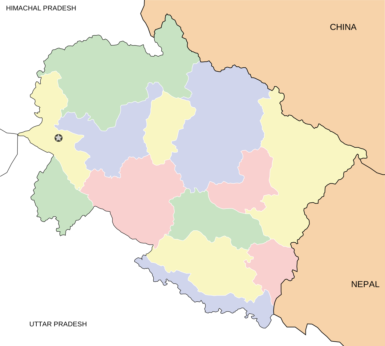 | ||||||||||||||||
| History |
| ||||||||||||||||
| Geography and Ecology |
| ||||||||||||||||
| Demographics |
| ||||||||||||||||
| Administrative divisions |
| ||||||||||||||||
| Politics | |||||||||||||||||
| Tourism |
| ||||||||||||||||
| Sports | |||||||||||||||||
| Other topics | |||||||||||||||||
| Districts |
| ||||||||||||||||
| Major cities | |||||||||||||||||