
imported>GreenC bot Rescued 1 archive link. Wayback Medic 2.5 |
m General cleanup and content improvements |
||
| Line 1: | Line 1: | ||
{{short description|River in India and Pakistan}} | {{short description|River in India and Pakistan}} | ||
{{about|the river|other uses|Shyok (disambiguation){{!}}Shyok}} | |||
{{Use dmy dates|date=February 2020}} | {{Use dmy dates|date=February 2020}} | ||
{{EngvarB|date=February 2020}} | {{EngvarB|date=February 2020}} | ||
{{Infobox river | {{Infobox river | ||
| name | | name = Shyok River | ||
| name_other | | name_other = | ||
| name_etymology | | name_etymology = | ||
| | | nickname = | ||
| image = View of Saling Bridge over Shyok River, Khaplu.jpg | |||
| image_size = 280 | |||
| image_caption = The Shyok River near [[Khaplu]], Gilgit-Baltistan, Pakistan | |||
| map = Shyok.png | |||
| map_size = 280 | |||
| map_caption = Course of the Shyok River | |||
| pushpin_map = | |||
| pushpin_map_size = 280 | |||
| pushpin_map_caption = Course of the Shyok River | |||
| mapframe = yes | |||
| mapframe-zoom = 4 | |||
| subdivision_type1 = Countries | |||
| subdivision_name1 = [[India]], [[Pakistan]] | |||
| subdivision_type2 = Territories | |||
| subdivision_name2 = [[Ladakh]], [[Gilgit-Baltistan]] | |||
| subdivision_type3 = | |||
| subdivision_name3 = | |||
| subdivision_type4 = | |||
| subdivision_name4 = | |||
| subdivision_type5 = | |||
| subdivision_name5 = | |||
| source1 = Rimo Glacier | |||
| source1_location = Ladakh, India | |||
| source1_coordinates = {{Coord|35.3527|77.6180|display=inline}} | |||
| source1_elevation = {{cvt|5000|m|abbr=on}} | |||
| mouth = [[Indus River]] | |||
| mouth_location = Gilgit-Baltistan, Pakistan | |||
| mouth_coordinates = {{Coord|35.2286|75.9172|display=inline,title}} | |||
| mouth_elevation = {{cvt|2314|m|abbr=on}} | |||
| progression = {{RIndus}} | |||
| length = {{convert|550|km|mi|abbr=on}} | |||
| width_min = | |||
| width_avg = | |||
| width_max = | |||
| depth_min = | |||
| depth_avg = | |||
| depth_max = | |||
| basin_size = {{convert|33465|km2|abbr=on}} | |||
| discharge1_location = [[Yugo, Baltistan|Yugo]] gauging station, Gilgit-Baltistan, Pakistan | |||
| discharge1_min = 859 m<sup>3</sup>/sec | |||
| discharge1_avg = 1041 m<sup>3</sup>/sec | |||
| discharge1_max = 1199 m<sup>3</sup>/sec | |||
| river_system = [[Indus Basin]] | |||
| basin_landmarks = | |||
| basin_population = | |||
| tributaries_left = [[Chip Chap River]], [[Galwan River]], [[Chang Chenmo River]] | |||
| tributaries_right = [[Nubra River]], [[Hushe River]] | |||
| waterbodies = | |||
| waterfalls = | |||
| bridges = | |||
| ports = | |||
| custom_label = | |||
| custom_data = | |||
| extra = | |||
}} | |||
The '''Shyok River''' (sometimes spelled '''Shayok''') is a major tributary of the [[Indus River]] that flows through northern [[Ladakh]] in [[India]] and into [[Gilgit-Baltistan]] in [[Pakistan]]. Originating from the Rimo Glacier in the eastern [[Karakoram]], it runs for about {{convert|550|km|mi|abbr=on}} before joining the Indus near [[Skardu]]. Its basin, covering {{convert|33465|km2|abbr=on}}, extends across three countries: India, Pakistan, and [[China]]. Its major tributaries include the [[Chip Chap River|Chip Chap]], [[Galwan River|Galwan]], [[Chang Chenmo River|Chang Chenmo]], [[Nubra River|Nubra]], and [[Hushe River|Hushe]] rivers. | |||
== Name and etymology == | |||
At least three hypotheses have been formulated regarding the origin of the river's name, ''Shyok'', also spelled ''Shayok''. | |||
In 1854, [[Alexander Cunningham]] mentioned that the river took its name from the village of [[Shyok (village)|Shyok]], which he spelled ''Shayok'', located along its course,<ref name="Cunningham1854" /> but he did not substantiate this statement or provide etymological information about the village’s name. | |||
In 1977, Friedrich A. Peter observed that ''Shyok'' was a misspelling of the Tibetan name ''Shayog'' ({{bo|t=ཤ་གཡོག་|w=sha-gyog}}). And he identified the name ''Shayog'' as being formed by the syllables ''shag'' ({{bo|t=ཤག་}}, ‘gravel’) and ''gyog'' ({{bo|t=གཡོག་}}, ‘to spread’) and meaning ‘gravel spreader’, alluding to the vast quantities of gravel deposited by the river floods.<ref name="Peter1977">{{cite journal | last = Peter | first = Friedrich A. | title = Glossary of Place Names in Western Tibet | journal = The Tibet Journal | volume = 2 | issue = 2 | year = 1977 | pages = 26–27 | publisher = Library of Tibetan Works and Archives | jstor = 43299854 | url = https://www.jstor.org/stable/43299854 | url-access = registration | language = English}}</ref> | |||
In 1992, [[Harish Kapadia]] argued that many geographical names along the historic trade route in the upper Shyok valley were of Yarkandi origin, the [[Turkic languages|Turkic]] dialect spoken by travellers from [[Yarkant County|Yarkand]] in Central Asia. He interpreted ''Shyok'' as meaning ‘river of death’, from the Yarkandi ''sheo'' (‘death’), and related this interpretation to the river's deadly floods.<ref name="Kapadia1992">{{cite journal | last = Kapadia | first = Harish | title = Lots in a Name | journal = The Himalayan Journal | volume = 48 | year = 1992| url = https://www.himalayanclub.org/hj/48/18/lots-in-a-name/ | archive-url= https://web.archive.org/web/20190818164203/https://www.himalayanclub.org/hj/48/18/lots-in-a-name/ | archive-date = 18 August 2019 | access-date = 25 May 2025 | language = English | quote = Shyok ('the river of death', Sheo: death)}}</ref> | |||
The three hypotheses differ in their linguistic and historical contexts, and do not allow for a clear preference among them. | |||
== Course == | |||
{{see also | Geography_of_Ladakh#ShyokR | l1= The course of Shyok River}} | |||
The Shyok rises from the Rimo Glacier in the eastern Karakoram,<ref name="Kaul1998">{{cite book | last = Kaul | first = Hriday Nath | title = Rediscovery of Ladakh | publisher = Indus Publishing Company | year = 1998 | isbn = 9788173870866 | pages = 30–31 | language = English | url = https://books.google.com/books?id=mg8My6WaWRcC&dq=shyok&pg=PA30 | url-access = limited}}</ref> with its source located in Ladakh, India,<ref name="Negi1991">{{cite book | last = Negi | first = Sharad Singh | title = Himalayan Rivers, Lakes, and Glaciers | publisher = Indus Publishing Company | year = 1991 | isbn = 9788185182612 | language = English | url = https://archive.org/details/himalayanriversl0000negi | url-access = registration}}</ref>{{rp|pp=124–125}} and flows for approximately {{convert|550|km|mi|abbr=on}} through Ladakh and then Gilgit-Baltistan, Pakistan, where it joins the Indus River.<ref name="Britannica">{{cite encyclopedia | title = Shyok River | encyclopedia = Encyclopædia Britannica | language = English | url = https://www.britannica.com/place/Shyok-River | access-date = May 23, 2025}}</ref> Its general course is south-southeastward at first,<ref name="SurveyIndia1923">{{cite map | title = India and Adjacent Countries: Sheet 52 – Leh | publisher = Survey of India | date = 1916 | edition = Published 1923 | url = https://maps.lib.utexas.edu/maps/topo/india_1m/sheet-52-leh-1923.jpg | access-date = 28 May 2025 | scale = 1:1,000,000 | language = English}}</ref> then it makes a major V-shaped bend,<ref name="Negi1991" />{{rp|pp=124–125}} and continues west-northwestward.<ref name="Cunningham1854">{{cite book | last = Cunningham | first = Alexander | title = Ladák: Physical, Statistical, and Historical; with Notices of the Surrounding Countries | publisher = W.H. Allen and Co. | year = 1854 | location = London | pages = 94–96 | language = English | url = https://archive.org/details/ladakphysicalsta00cunnrich | url-access = registration}}</ref> | |||
The river originates at the snout of the Rimo Glacier in the Rimo Muztagh, a subrange of the eastern Karakoram.<ref name="Kaul1998" /><ref name="AMSChulung1955">{{cite map | title = Chulung | publisher = Army Map Service, Corps of Engineers, U.S. Army | date = 1955 | series = India and Pakistan 1:250,000 | sheet = NI 43-4 | scale = 1:250,000 | url = https://maps.lib.utexas.edu/maps/ams/india/ni-43-04.jpg | access-date = 28 May 2025 | language = English}}</ref> Its source is located west of the Depsang Plains,<ref name="Negi1991" />{{rp|pp=124–125}}<ref name="SurveyIndia1923" /> at approximately {{Coord|35.3527|77.6180}} and {{cvt|5000|m|abbr=on}} elevation,<ref name="GoogleEarthImagery">{{cite map | title = Google Earth imagery | url = https://earth.google.com/ | publisher = Google | access-date = November 24, 2025}}</ref> in northern Ladakh, India.<ref name="Negi1991" />{{rp|pp=124–125}} Near its source, it is joined by the Chip Chap River, which can be regarded as part of its headwaters.<ref name="Negi1991" />{{rp|pp=124–125}}<ref name="AMSChulung1955" /> | |||
[[File:Shyok River Headwaters System 1923.png|left|thumb|Headwaters system of the Shyok River on a 1923 reprint of a 1916 Survey of India map]] | |||
< | From the Chip Chap confluence to its major bend, the river flows generally south-southeastward,<ref name="SurveyIndia1923" /> between the Rimo Muztagh and Saser Muztagh ranges to the west and Aksai Chin to the east.<ref name="SurveyIndia1923" /><ref name="AMSChulung1955" /><ref name="AMSShyok1955">{{cite map | title = Shyok | publisher = Army Map Service, Corps of Engineers, U.S. Army | date = 1955 | series = India and Pakistan 1:250,000 | sheet = NI 44-5 | scale = 1:250,000 | url = https://maps.lib.utexas.edu/maps/ams/india/ni-44-05.jpg | access-date = 28 May 2025 | language = English}}</ref> About midway along this reach, it receives the Galwan River,<ref name="Negi1991" />{{rp|pp=124–125}}<ref name="AMSShyok1955" /> and a little upstream of the bend, it is joined by the Chang Chenmo River.<ref name="Kaul1998" /><ref name="AMSShyok1955" /> At the Chang Chenmo Range, it forms a major V-shaped bend, reversing its direction to the northwest, a distinctive feature.<ref name="Negi1991" />{{rp|pp=124–125}}<ref name="SurveyIndia1923" /> | ||
| | |||
| | |||
| | |||
| | |||
| | |||
| | |||
| | |||
| | |||
< | |||
After the bend, and as it approaches the confluence with the Nubra River, the valley widens and the river becomes braided.<ref name="Cunningham1854" /><ref name="AMSLeh1955">{{cite map | title = Leh | publisher = Army Map Service, Corps of Engineers, U.S. Army | date = 1955 | series = India and Pakistan 1:250,000 | sheet = NI 43-8 | scale = 1:250,000 | url = https://maps.lib.utexas.edu/maps/ams/india/ni-43-08.jpg | access-date = 7 June 2025 | language = English}}</ref> It receives the Nubra near the village of Diskit.<ref name="SurveyIndia1923" /><ref name="AMSLeh1955" /> | |||
[[File:Shyok-River.jpg|left|thumb|The Shyok Valley near the confluence of the Shyok and Nubra Rivers]] | |||
From the Nubra confluence to that with the Hushe River, the river flows generally west-northwestward,<ref name="Cunningham1854" /><ref name="SurveyIndia1923" /> between the Saltoro Range to the north and the Ladakh Range to the south.<ref name="AMSLeh1955" /> Some distance downstream of the Nubra confluence, the valley narrows and, near the hamlet of Yagulung (also known as Changmar), turns into a gorge.<ref name="Cunningham1854" /><ref name="AMSLeh1955" /> Farther downstream, the river crosses from Ladakh, India, into Gilgit-Baltistan, Pakistan.<ref name="Britannica" /> The valley widens and the river becomes braided again shortly before the Hushe confluence.<ref name="AMSMundik1955">{{cite map | title = Mundik | publisher = Army Map Service, Corps of Engineers, U.S. Army | date = 1955 | series = India and Pakistan 1:250,000 | sheet = NI 43-3 | scale = 1:250,000 | url = https://maps.lib.utexas.edu/maps/ams/india/ni-43-03.jpg | access-date = 7 June 2025 | language = English}}</ref> Near the town of Khaplu, it is joined by the Hushe.<ref name="Negi1991" />{{rp|pp=124–125}}<ref name="AMSMundik1955" /> | |||
From the Hushe confluence to its mouth, where it joins the Indus, the river flows generally westward, between the Masherbrum Range to the north and the Ladakh Range to the south.<ref name="AMSMundik1955" /> The mouth is located near the village of Keris,<ref name="Cunningham1854" /><ref name="AMSMundik1955" /> at approximately {{Coord|35.2286|75.9172}} and {{cvt|2314|m|abbr=on}} elevation,<ref name="GoogleEarthImagery" /> in eastern Gilgit-Baltistan, Pakistan.<ref name="Britannica" /> | |||
== Tributaries == | == Tributaries == | ||
== | [[File:Shyok2.svg|right|thumb|Sketch map showing the Shyok River, its tributaries, and the Indus River]] | ||
< | |||
File: | Upstream of its major V-shaped bend, the Shyok has three main tributaries that originate in Aksai Chin and flow into its left bank generally from the east:<ref name="SurveyIndia1923" /> | ||
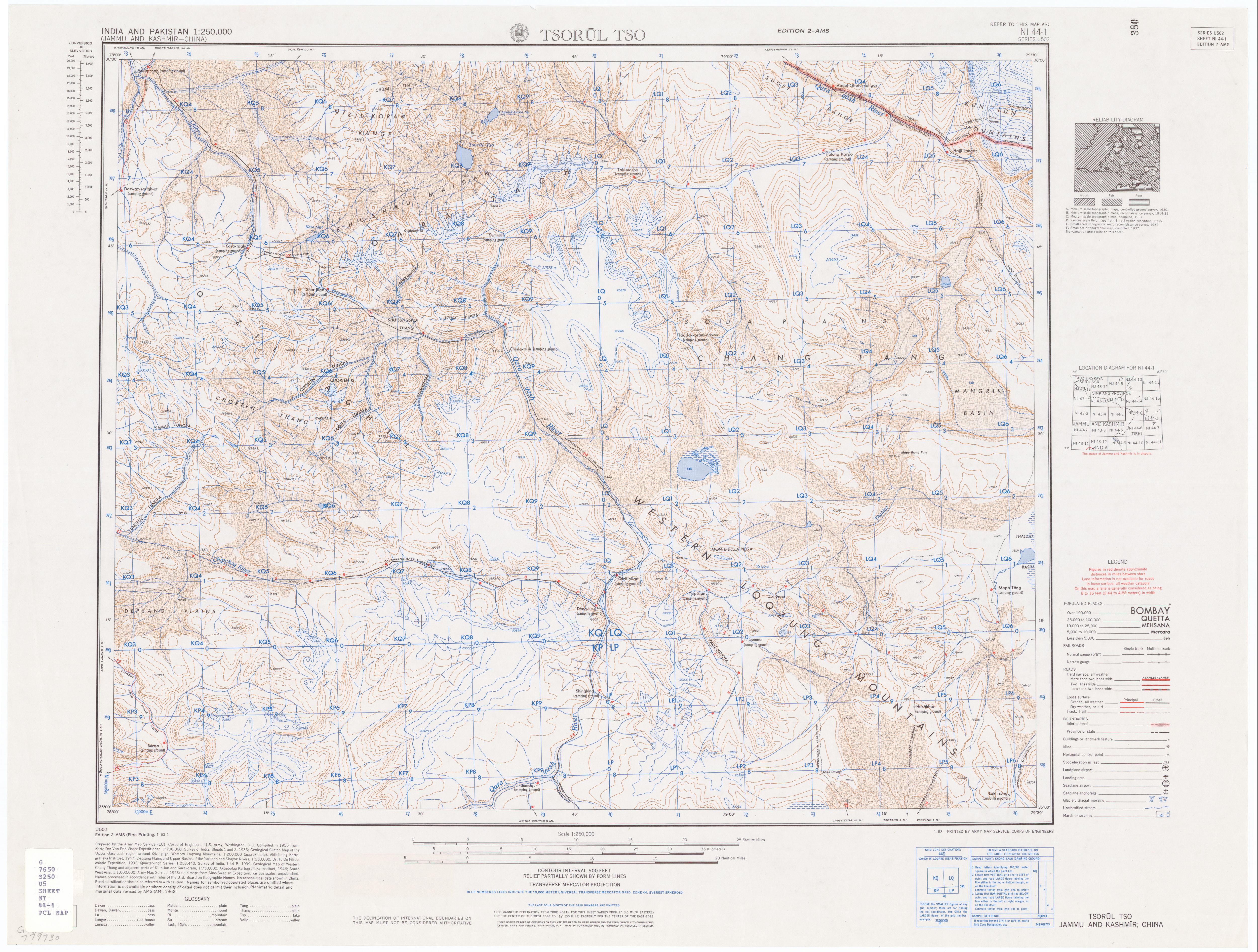
* The Chip Chap River rises at the eastern edge of the Depsang Plains, flows around them to the north in a generally westward direction, and joins the Shyok near its source, from the northeast.<ref name="Negi1991" />{{rp|pp=56–57}}<ref name="AMSTsorulTso1955">{{cite map | title = Tsorul Tso | publisher = Army Map Service, Corps of Engineers, U.S. Army | date = 1955 | series = India and Pakistan 1:250,000 | sheet = NI 44-1 | scale = 1:250,000 | url = https://maps.lib.utexas.edu/maps/ams/india/ni-44-01.jpg | access-date = 23 January 2026 | language = English}}</ref><ref name="AMSChulung1955" /> | |||
File: | * The Galwan River originates in western Aksai Chin, flows generally westward, and merges with the Shyok roughly halfway between its source and its major bend, from the east.<ref name="Negi1991" />{{rp|p=63}}<ref name="AMSShyok1955" /> | ||
</ | * The Chang Chenmo River rises near Lanak La Pass in Aksai Chin, flows north of the Chang Chenmo Range in a westward direction, and enters the Shyok a little upstream of its major bend, from the east.<ref name="Negi1991" />{{rp|p=53}}<ref name="Sharma2017">{{cite book | first = Raghav Sharan | last = Sharma | title = The Unfought War of 1962: An Appraisal | url = https://books.google.com/books?id=ntNBDwAAQBAJ&pg=PT39 | date = 6 December 2017 | publisher = Taylor & Francis | isbn = 9781351056366 | page = 39 | quote = The tributary originates from Lanak la under Chinese possession.}}</ref><ref name="AMSShyok1955" /> | ||
Downstream of the major bend, the Shyok has two main tributaries that originate in the eastern and central Karakoram and flow into its right bank generally from the north:<ref name="SurveyIndia1923" /> | |||
* The Nubra River comes from the Siachen Glacier in the eastern Karakoram and flows south-southeastward between the Saltoro Range to the west and the Rimo Muztagh and Saser Muztagh ranges to the east. It joins the Shyok near the village of Diskit, from the north-northwest.<ref name="BritannicaSiachen">{{cite encyclopedia | title = Siachen Glacier | encyclopedia = Encyclopædia Britannica | language = English | url = https://www.britannica.com/place/Siachen-Glacier | access-date = January 23, 2026}}</ref><ref name="Kale">{{cite book | url = https://books.google.com/books?id=t_MsBAAAQBAJ&pg=PA106 | title = Landscapes and Landforms of India | last = Kale | first = Vishwas S. | date = 2014-05-23 | publisher = Springer | isbn = 9789401780292 | page = 106 | language = en}}</ref><ref name="Negi1991" />{{rp|p=106}}<ref name="AMSChulung1955" /><ref name="AMSLeh1955" /> | |||
[[File:Shoyok and Nubra Valley map.jpg|right|thumb|Map-style sign showing points of interest near the confluence of the Shyok and Nubra Rivers]] | |||
* The Hushe River originates from the Gondogoro Glacier in the central Karakoram, flows generally southward, and enters the Shyok near the town of Khaplu, having been joined shortly before by the Saltoro River.<ref name="Negi1991" />{{rp|p=74}}<ref name="AMSMundik1955" /> | |||
== Basin and hydrology == | |||
The Shyok basin primarily drains part of the southern slopes of the central Karakoram, the southern slopes of the eastern Karakoram, part of Aksai Chin, and part of the northern slopes of the Ladakh Range.<ref name="Ahmad2018">{{cite journal | last1 = Ahmad | first1 = I. | last2 = Ahmad | first2 = Z. | last3 = Munir | first3 = S. | last4 = Rehman | first4 = Obaid Ur | last5 = Ali | first5 = S. R. | last6 = Shabbir | first6 = Y. | title = Characterization of Upper Indus Basin based on DEM Hypsometric Analysis | journal = The Nucleus | volume = 55 | issue = 1 | date = 13 April 2018 | pages = 8–16 | doi = 10.71330/thenucleus.2018.315 | language = English | url = http://www.thenucleuspak.org.pk/index.php/Nucleus/article/view/315 | access-date = 9 February 2026 }}</ref> It covers approximately {{convert|33465|km2|sqmi|abbr=on}}, distributed across India (54%), Pakistan (28%) and China (18%).<ref name="Farooq2023">{{cite journal | last1 = Farooq | first1 = Muhammad Umar | last2 = Kharal | first2 = Muhammad Ashiq | last3 = Bogacki | first3 = Wolfgang | last4 = Ismail | first4 = Muhammad Fraz | last5 = Mehmood | first5 = Asif | title = Estimation of component-wise runoff contribution using temperature index approach, in a snow- and glacier-fed transboundary Shyok River catchment of the Upper Indus Basin | journal = Arabian Journal of Geosciences | volume = 16 | issue = 8 | year = 2023 | page = 460 | doi = 10.1007/s12517-023-11583-y | bibcode = 2023ArJG...16..460F | language = English | url = https://link.springer.com/article/10.1007/s12517-023-11583-y | url-access = limited | quote = Shyok River is a transboundary stream that has a catchment area of 33,465 km2 over three countries; Pakistan 28%, India 54%, and China 18%.| doi-access = free }}</ref> | |||
The Shyok is fed approximately 49% by glacier melt, 39% by snowmelt and 12% by rainfall.<ref name="Farooq2023" /> Its discharge and sediment transport regime is predominantly glacial and nival, with a peak in summer, during the melt season, and a trough in winter.<ref name="Tarar2018">{{cite journal | last1 = Tarar | first1 = Zeeshan Riaz | last2 = Ahmad | first2 = Sajid Rashid | last3 = Ahmad | first3 = Iftikhar | last4 = Majid | first4 = Zahra | title = Detection of Sediment Trends Using Wavelet Transforms in the Upper Indus River | journal = Water | volume = 10 | issue = 7 | year = 2018 | page = 918 | doi = 10.3390/w10070918 | doi-access = free | bibcode = 2018Water..10..918T | language = English }}</ref> Over the period 1983–2015, its mean discharge at the Yugo gauging station, near where it joins the Indus River, was {{val|1041|u=m3/s|fmt=commas}}, with a minimum of {{val|859|u=m3/s|fmt=commas}} and a maximum of {{val|1199|u=m3/s|fmt=commas}}.<ref name="Tarar2018" /> Over the same period and at the same station, the suspended sediment concentration showed notable seasonal and interannual variability, ranging from {{val|10|u=mg/L|fmt=commas}} to {{val|35600|u=mg/L|fmt=commas}}.<ref name="Tarar2018" /> | |||
== Geology == | |||
The Shyok flows through the geologically significant Shyok Suture Zone, a complex ophiolitic mélange representing a former Cretaceous–Paleogene back‑arc basin situated between the Kohistan–Ladakh arc and the Karakoram terrane.<ref name="Upadhyay2022">{{cite journal | last1 = Upadhyay | first1 = Rajeev Umar | last2 = Gautam | first2 = Saurabh | last3 = Awatar | first3 = Ram | title = Discovery of an Entrapped Early Permian (ca. 299 Ma) Peri-Gondwanic Sliver in the Cretaceous Shyok Suture of Northern Ladakh, India: Diverse Implications | journal = GSA Today | volume = 32 | issue = 1 | year = 2022 | pages = 4–9 | doi = 10.1130/GSATG481A.1 | bibcode = 2022GSAT...32a...4U | language = English | url = https://www.geosociety.org/GSA/GSA/GSAToday/science/G481A/article.aspx| doi-access = free }}</ref><ref name="Upadhyay1997">{{cite journal | last1 = Upadhyay | first1 = Rajeev | title = Tectonics and sedimentation in the passive margin, trench, fore-arc and backarc areas of the Indus Suture Zone in Ladakh and Karakorum: a review | journal = Geodinamica Acta | year = 1997 | volume = 10 | issue = 1 | pages = 1–11 | doi = 10.1080/09853111.1997.11105289 | bibcode = 1997GeoAc..10....1S | language = English | url = https://www.academia.edu/62448058 | url-access = limited}}</ref><ref name="Martin2025">{{cite journal | last1 = Martin | first1 = C. R. | last2 = Van Buer | first2 = N. J. | last3 = Matchette-Downes | first3 = H. | last4 = Mueller | first4 = P. A. | last5 = Cruz-Uribe | first5 = A. M. | last6 = van Tongeren | first6 = J. A. | last7 = Hanchar | first7 = J. M. | last8 = Upadhyay | first8 = R. | last9 = Jagoutz | first9 = O. | title = The geology of the Shyok suture zone: evidence for Cretaceous extension of the southern Eurasian margin and Eocene India–Eurasia collision | journal = Journal of the Geological Society | volume = 182 | year = 2025 | issue = 2 | article-number = jgs2024-082 | doi = 10.1144/jgs2024-082 | bibcode = 2025JGSoc.182...82M | language = English | url = https://www.lyellcollection.org/doi/abs/10.1144/jgs2024-082 | url-access = limited}}</ref><ref name="Robertson2002">{{cite journal | last1 = Robertson | first1 = Alastair H. F. | last2 = Collins | first2 = Alan S. | title = Shyok Suture Zone, N Pakistan: late Mesozoic Tertiary evolution of a critical suture separating the oceanic Ladakh Arc from the Asian continental margin | journal = Journal of Asian Earth Sciences | volume = 20 | issue = 3 | year = 2002 | pages = 309–351 | doi = 10.1016/S1367-9120(01)00041-4 | bibcode = 2002JAESc..20..309R | language = English | url = https://ui.adsabs.harvard.edu/search/q=author%3A%22Robertson%2C%20Alastair%20H.%20F.%22&sort=date%20desc%2C%20bibcode%20desc&p_=0 | url-access = limited}}</ref><ref name="Chandra2023">{{cite journal | last1 = Chandra | first1 = Rakesh | last2 = Kowser | first2 = Nazia | last3 = Brookfield | first3 = Michael E | last4 = Satyanarayanan | first4 = Manavalan | last5 = Stöckli | first5 = Daniel | title = Nature of the Shyok (Northern) Suture Zone between India and Asia: petrology, geochemistry and origin of the Tirit granitoids and associated dykes (Nubra Valley Ladakh Himalaya, NW India) | journal = Geological Magazine | volume = 160 | issue = 5 | year = 2023 | pages = 1020–1039 | doi = 10.1017/S0016756823000134 | bibcode = 2023GeoM..160.1020C | language = English | url = https://www.cambridge.org/core/journals/geological-magazine/article/abs/nature-of-the-shyok-northern-suture-zone-between-india-and-asia-petrology-geochemistry-and-origin-of-the-tirit-granitoids-and-associated-dykes-nubra-valley-ladakh-himalaya-nw-india/F5D327C944AF1AF807BC1A378E49D640 | url-access = limited}}</ref> The central portion of this suture comprises Jurassic fore‑arc ophiolite sequences overlain by Cretaceous volcanic and sedimentary rocks deposited under extensional tectonics between approximately 115 Ma and 72 Ma.<ref name="Martin2025" /><ref name="Thakur1990">{{cite journal | last1 = Thakur | first1 = V. C. | title = Indus tsangpo suture zone in ladakh—its tectonostratigraphy and tectonics | journal = Journal of Earth System Science | volume = 99 | year = 1990 | issue = 2 | pages = 169–185 | doi = 10.1007/BF02839388 | bibcode = 1990InEPS..99..169T | language = English | url = https://link.springer.com/article/10.1007/bf02839388 | url-access = limited}}</ref><ref name="Gokarn2002">{{cite journal | last1 = Gokarn | first1 = S. G. | last2 = Gupta | first2 = Gautam | last3 = Rao | first3 = C. K. | last4 = Selvaraj | first4 = C. | title = Electrical structure across the Indus Tsangpo suture and Shyok suture zones in NW Himalaya using magnetotelluric studies | journal = Geophysical Research Letters | volume = 29 | issue = 8 | year = 2002 | page = 1251 | doi = 10.1029/2001GL014325 | bibcode = 2002GeoRL..29.1251G | language = English | url = https://agupubs.onlinelibrary.wiley.com/doi/full/10.1029/2001GL014325}}</ref><ref name="Saktura2021">{{cite journal | last1 = Saktura | first1 = Wanchese M. | last2 = Buckman | first2 = Solomon | last3 = Nutman | first3 = Allen P. | last4 = Bennett | first4 = Vickie C. | title = Late Jurassic Changmar Complex from the Shyok ophiolite, NW Himalaya: a prelude to the Ladakh Arc | journal = Geological Magazine | volume = 158 | issue = 2 | year = 2021 | pages = 239–260 | doi = 10.1017/S0016756820000400 | bibcode = 2021GeoM..158..239S | language = English | url = https://www.cambridge.org/core/journals/geological-magazine/article/abs/late-jurassic-changmar-complex-from-the-shyok-ophiolite-nw-himalaya-a-prelude-to-the-ladakh-arc/B7684261AB66BD4656BE1551A9FF0E26 | url-access = limited}}</ref> Within the mélange, pervasively deformed metasedimentary units and Paleozoic-era pebbly mudstones—interpreted as glacial‑marine deposits—are found, preserving Gondwanan signatures.<ref name="Gokarn2002" /><ref name="Thakur1981">{{cite journal | last1 = Thakur | first1 = V. C. | last2 = Virdi | first2 = N. S. | last3 = Rai | first3 = Hakim | last4 = Gupta | first4 = K. R. | title = A Note on the Geology of Nubra-Shyok Area of Ladakh, Kashmir, Himalaya | journal = Journal of the Geological Society of India | volume = 22 | year = 1981 | issue = 1 | pages = 46–50 | doi = 10.17491/jgsi/1981/220106 | bibcode = 1981JGSI...22...46T | language = English | url = https://www.academia.edu/72231572 | url-access = limited}}</ref><ref name="Borneman2015">{{cite journal | last1 = Borneman | first1 = Nathaniel L. | last2 = Hodges | first2 = Kip V. | last3 = van Soest | first3 = Matthijs C. | last4 = Bohon | first4 = Wendy | last5 = Wartho | first5 = Jo-Anne | last6 = Cronk | first6 = Stephanie S. | last7 = Ahmad | first7 = Talat | title = Age and structure of the Shyok suture in the Ladakh region of northwestern India: Implications for slip on the Karakoram fault system | journal = Tectonics | volume = 34 | issue = 10 | year = 2015 | pages = 2011–2033 | doi = 10.1002/2015TC003933 | bibcode = 2015Tecto..34.2011B | language = English | url = https://agupubs.onlinelibrary.wiley.com/doi/10.1002/2015TC003933}}</ref><ref name="Paul2024">{{cite journal | last1 = Paul | first1 = Abdul Qayoom | last2 = Bahuguna | first2 = Harish | last3 = Kumar | first3 = Parveen | title = A glaciotectonic landform in the Shyok valley, Trans-Himalayan Karakoram Range, India | journal = Journal of Glaciology | volume = 70 | issue = e44 | year = 2024 | article-number = e44 | doi = 10.1017/jog.2024.22 | bibcode = 2024JGlac..70E..44P | language = English | url = https://www.cambridge.org/core/journals/journal-of-glaciology/article/glaciotectonic-landform-in-the-shyok-valley-transhimalayan-karakoram-range-india/2D5CCC7C7CCD0C13F4F85F431EE050D5| doi-access = free }}</ref> The region’s tectonic architecture is further imprinted by the active [[Karakoram fault system]], which bisects the Shyok Valley and exhibits pronounced dextral-oblique shear fabrics affecting ophiolitic, granitic, and sedimentary lithologies.<ref name="Upadhyay2022" /><ref name="Upadhyay1997" /><ref name="Borneman2015" /> | |||
== Valley == | |||
The Shyok flows through a rocky gorge carved into the Karakoram, with broad semiarid valleys in places that allow limited vegetation and agriculture.<ref name="Britannica" /><ref name="Paul2024" /> The valley floor descends from {{cvt|5000|m|abbr=on}} at the snout of the Rimo Glacier to {{cvt|2314|m|abbr=on}} at the river’s confluence with the Indus at the village of Keris, near Skardu. In its lower reaches, seasonal meltwaters inundate the floodplain, supporting irrigated fruit orchards—apricots, walnuts, apples—and small villages.<ref name="Britannica" /><ref name="LadakhTravelMart">{{cite web | title = Shyok Valley Ladakh | url = https://www.ladakhtravelmart.com/ladakh/shyok-valley | website = Ladakh Travel Mart | date = 22 October 2022 | access-date = June 8, 2025 | language = English}}</ref> During winter, the river often freezes solid, providing a natural passage between the Nubra Valley and Khaplu.<ref name="Cunningham1854" /><ref name="LadakhTravelMart" /> | |||
== History == | |||
During the 19th century, the Shyok and its valley became increasingly documented as part of British efforts to map the remote frontier regions of Ladakh and [[Baltistan]].<ref name="Dutta2019">{{cite book | last1 = Dutta | first1 = Sutapa | last2 = Mukherjee | first2 = Nilanjana | title = Mapping India, Transitions and Transformations, 18th–19th Century | publisher = Taylor & Francis | year = 2019 | isbn = 9781000186406 | language = English | url = https://books.google.com/books?id=VUagDwAAQBAJ | url-access = limited}}</ref> Survey teams from the [[Survey of India]]—which conducted extensive frontier surveys following the [[Treaty of Amritsar (1846)]]—charted parts of the Shyok and its tributaries. These expeditions laid the groundwork for modern cartographic understanding of the western [[Himalayas|Himalaya]] and Karakoram ranges.<ref name="Gazetteer1890">{{cite book | title = Gazetteer of Kashmir and Ladak | publisher = Superintendent of Government Printing, Calcutta | year = 1890 | pages = 749–750 | language = English | url = https://archive.org/details/in.ernet.dli.2015.43256 }}</ref> | |||
The Shyok Valley also held historical significance as a segment of trade and travel routes connecting Leh with Baltistan and western [[Tibet]]. Caravans moving between Central Asia and the Indian subcontinent frequently navigated its upper reaches, making use of natural passes and riverine paths.<ref name="Warikoo2009">{{cite book | last = Warikoo | first = Kulbhushan | chapter = India’s Gateway to Central Asia: Trans-Himalayan Trade and Cultural Movements Through Kashmir and Ladakh, 1846–1947 | editor = Kulbhushan Warikoo | title = Himalayan Frontiers of India: Historical, Geo-Political and Strategic Perspectives | publisher = Routledge | year = 2009 | isbn = 9780415468398 |language = English | url = https://books.google.com/books?id=w_Z8AgAAQBAJ&pg=PA1 | url-access = limited | quote = Those traders and passersby who opted to travel to Yarkand in winter would cross Digar La and follow the narrow and winding valleys of the Shyok river. This river, which was frozen during winter, was to be crossed and re-crossed several times.}}</ref><ref name="Trotter1878">{{cite journal | last = Trotter | first = Henry | title = On the Geographical Results of the Mission to Kashghar, under Sir T. Douglas Forsyth in 1873–74 | journal = Journal of the Royal Geographical Society of London | volume = 48 | year = 1878 | pages = 173–234 | publisher = Royal Geographical Society | doi = 10.2307/1798763 | jstor = 1798763 | url = https://www.jstor.org/stable/1798763 | url-access = registration | language = English}}</ref><ref name="Gazetteer1890" /><ref name="Hayward1870">{{cite journal | last = Hayward | first = George W. | title = Journey from Leh to Yarkand and Kashgar, and Exploration of the Sources of the Yarkand River | journal = Journal of the Royal Geographical Society of London | volume = 40 | year = 1870 | pages = 33–166 | issn = 0266-6235 | doi = 10.2307/1798640 | jstor = 1798640 | url = https://www.jstor.org/stable/1798640 | language = English| url-access = subscription }}</ref> This strategic utility continued into the colonial period, when the British occasionally used these routes for communications and patrols along the mountain frontiers. | |||
[[File:Leh-Yarkand Routes through Shyok and Nubra Valleys 1878.png|right|thumb|Leh-Yarkand routes through the Shyok and Nubra Valleys on an 1878 British map]] | |||
In the 20th and 21st centuries, the river has taken on renewed strategic importance due to its proximity to contested border zones—specifically near the [[Line of Actual Control]] (LAC) with China and the [[Line of Control]] (LoC) with Pakistan. Infrastructure such as the [[Darbuk–Shyok–DBO Road|Darbuk–Shyok–Daulat Beg Oldi]] (DS–DBO) road has been built along the river’s banks, enhancing military logistics in the region adjacent to the Siachen Glacier and Aksai Chin.<ref name="Subramanian2020">{{cite news | last = Subramanian | first = Nirupama | date= June 11, 2020 | title = Explained: The strategic road to DBO | url = https://indianexpress.com/article/explained/lac-stand-off-india-china-darbuk-shyok-daulat-beg-oldie-dsdbo-road-6452997/ | url-access = limited | work = The Indian Express | language = English | url-status = live | archive-url = https://web.archive.org/web/20200611003958/https://indianexpress.com/article/explained/lac-stand-off-india-china-darbuk-shyok-daulat-beg-oldie-dsdbo-road-6452997/ | archive-date = June 11, 2020 | access-date = June 10, 2025 }}</ref><ref name="Banerjee2019">{{cite news | last = Banerjee | first = Ajay | date= April 22, 2019 | title = India completes vital Ladakh road | url = https://www.tribuneindia.com/news/archive/nation/india-completes-vital-ladakh-road-762332 | work = The Tribune (India) | language = English | url-status = live | archive-url = https://web.archive.org/web/20200609194834/https://www.tribuneindia.com/news/archive/nation/india-completes-vital-ladakh-road-762332 | archive-date = June 9, 2020 | access-date = June 10, 2025 }}</ref> | |||
==Tourism== | |||
The Shyok Valley provides access to the Nubra Valley, a popular destination in Ladakh. Key attractions along the Shyok include the sand dunes and Bactrian camel rides near the village of [[Hundar, India|Hundar]] (also spelled Hunder), as well as the [[Diskit Monastery]] and its annual Diskit [[Gustor Festival]].<ref name="LadakhTourismDpt">{{cite web | title = Tourism - The Administration of Union Territory of Ladakh - India | url = https://ladakh.gov.in/tourism/ | website = Administration of Union Territory of Ladakh | language = English | access-date = June 12, 2025}}</ref><ref name="LehLadakhTourism">{{cite web | title = Shyok Valley | url = https://www.lehladakhtourism.com/shyok-valley/ | website = Leh Ladakh Tourism | language = English | access-date = June 12, 2025}}</ref><ref name="LehLadakhKashmir">{{cite web | title = Shyok Valley | url = https://www.lehladakhkashmir.in/destinations/shyok-valley/ | website = Leh Ladakh Kashmir Travels | language = English | access-date = June 12, 2025}}</ref> | |||
==See also== | ==See also== | ||
* [[ | * [[Geography of Ladakh]] | ||
* [[ | * [[Geography of Gilgit-Baltistan]] | ||
* [[ | * [[List of rivers of India]] | ||
* [[List of rivers of Pakistan]] | |||
* [[Daulat Beg Oldi]] | |||
* [[Khardung La]] | |||
* [[Ladakh Range]] | |||
==References== | ==References== | ||
{{Reflist}} | |||
== | == Further reading == | ||
{{ | * {{cite book | last = Hedin | first = Sven Anders | title = Southern Tibet: Discoveries in Former Times Compared with My Own Researches in 1906–1908 | volume = 7 | publisher = Lithographic Institute of the General Staff of the Swedish Army | year = 1916 | language = English | url = https://archive.org/details/southerntibetdis07hedi}} | ||
* {{cite book | last = Kapadia | first = Harish | title = Across Peaks & Passes in Ladakh, Zanskar & East Karakoram | publisher = Indus Publishing Company | year = 1999 | isbn = 9788173871009 | language = English | url = https://books.google.com/books?id=pl5qHu_K45kC&pg=PA230 | url-access = limited}} | |||
==External links== | ==External links== | ||
{{Commons category}} | {{Commons category}} | ||
<!-- including sources/references --> | <!-- including sources/references --> | ||
*[ | * [https://maps.lib.utexas.edu/maps/ams/india/ Index of U.S. Army Map Service topographic maps of India (1955)] – includes sheets covering the Shyok River region | ||
*[ | * [https://www.harishkapadia.com/climbs-explorations/east-karakoram/on-death-trail-shyok/ On Death Trail – Shyok], a travelogue and exploration account by [[Harish Kapadia]] | ||
*[http://www. | * [http://www.kultur-in-asien.de/Ladakh/nubra.htm Photo galleries of the Shyok and Nubra Valleys] (in German) | ||
{{Hydrography of Ladakh}} | |||
{{Ladakh}} | |||
{{Gilgit-Baltistan}} | |||
[[Category:International rivers of Asia]] | [[Category:International rivers of Asia]] | ||
[[Category:Rivers of Ladakh]] | [[Category:Rivers of Ladakh]] | ||
[[Category:Rivers of Gilgit-Baltistan]] | [[Category:Rivers of Gilgit-Baltistan]] | ||
[[Category:Karakoram]] | |||
Latest revision as of 20:26, 24 March 2026
| Shyok River | |
|---|---|
 The Shyok River near Khaplu, Gilgit-Baltistan, Pakistan | |
 Course of the Shyok River | |
| Location | |
| Countries | India, Pakistan |
| Territories | Ladakh, Gilgit-Baltistan |
| Physical characteristics | |
| Source | Rimo Glacier |
| • location | Ladakh, India |
| • coordinates | 35°21′10″N 77°37′05″E / 35.3527°N 77.6180°E |
| • elevation | 5,000 m (16,000 ft) |
| Mouth | Indus River |
• location | Gilgit-Baltistan, Pakistan |
• coordinates | 35°13′43″N 75°55′02″E / 35.2286°N 75.9172°E |
• elevation | 2,314 m (7,592 ft) |
| Length | 550 km (340 mi) |
| Basin size | 33,465 km2 (12,921 sq mi) |
| Discharge | |
| • location | Yugo gauging station, Gilgit-Baltistan, Pakistan |
| • average | 1041 m3/sec |
| • minimum | 859 m3/sec |
| • maximum | 1199 m3/sec |
| Basin features | |
| Progression | Template:RIndus |
| River system | Indus Basin |
| Tributaries | |
| • left | Chip Chap River, Galwan River, Chang Chenmo River |
| • right | Nubra River, Hushe River |
The Shyok River (sometimes spelled Shayok) is a major tributary of the Indus River that flows through northern Ladakh in India and into Gilgit-Baltistan in Pakistan. Originating from the Rimo Glacier in the eastern Karakoram, it runs for about 550 km (340 mi) before joining the Indus near Skardu. Its basin, covering 33,465 km2 (12,921 sq mi), extends across three countries: India, Pakistan, and China. Its major tributaries include the Chip Chap, Galwan, Chang Chenmo, Nubra, and Hushe rivers.
Name and etymology[edit | edit source]
At least three hypotheses have been formulated regarding the origin of the river's name, Shyok, also spelled Shayok.
In 1854, Alexander Cunningham mentioned that the river took its name from the village of Shyok, which he spelled Shayok, located along its course,[1] but he did not substantiate this statement or provide etymological information about the village’s name.
In 1977, Friedrich A. Peter observed that Shyok was a misspelling of the Tibetan name Shayog (Tibetan: ཤ་གཡོག་, Wylie: sha-gyog). And he identified the name Shayog as being formed by the syllables shag (Tibetan: ཤག་, ‘gravel’) and gyog (Tibetan: གཡོག་, ‘to spread’) and meaning ‘gravel spreader’, alluding to the vast quantities of gravel deposited by the river floods.[2]
In 1992, Harish Kapadia argued that many geographical names along the historic trade route in the upper Shyok valley were of Yarkandi origin, the Turkic dialect spoken by travellers from Yarkand in Central Asia. He interpreted Shyok as meaning ‘river of death’, from the Yarkandi sheo (‘death’), and related this interpretation to the river's deadly floods.[3]
The three hypotheses differ in their linguistic and historical contexts, and do not allow for a clear preference among them.
Course[edit | edit source]
The Shyok rises from the Rimo Glacier in the eastern Karakoram,[4] with its source located in Ladakh, India,[5]: and flows for approximately 550 km (340 mi) through Ladakh and then Gilgit-Baltistan, Pakistan, where it joins the Indus River.[6] Its general course is south-southeastward at first,[7] then it makes a major V-shaped bend,[5]: and continues west-northwestward.[1]
The river originates at the snout of the Rimo Glacier in the Rimo Muztagh, a subrange of the eastern Karakoram.[4][8] Its source is located west of the Depsang Plains,[5]:[7] at approximately 35°21′10″N 77°37′05″E / 35.3527°N 77.6180°E and 5,000 m (16,000 ft) elevation,[9] in northern Ladakh, India.[5]: Near its source, it is joined by the Chip Chap River, which can be regarded as part of its headwaters.[5]:[8]

From the Chip Chap confluence to its major bend, the river flows generally south-southeastward,[7] between the Rimo Muztagh and Saser Muztagh ranges to the west and Aksai Chin to the east.[7][8][10] About midway along this reach, it receives the Galwan River,[5]:[10] and a little upstream of the bend, it is joined by the Chang Chenmo River.[4][10] At the Chang Chenmo Range, it forms a major V-shaped bend, reversing its direction to the northwest, a distinctive feature.[5]:[7]
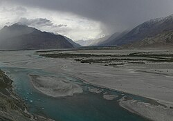
After the bend, and as it approaches the confluence with the Nubra River, the valley widens and the river becomes braided.[1][11] It receives the Nubra near the village of Diskit.[7][11]

From the Nubra confluence to that with the Hushe River, the river flows generally west-northwestward,[1][7] between the Saltoro Range to the north and the Ladakh Range to the south.[11] Some distance downstream of the Nubra confluence, the valley narrows and, near the hamlet of Yagulung (also known as Changmar), turns into a gorge.[1][11] Farther downstream, the river crosses from Ladakh, India, into Gilgit-Baltistan, Pakistan.[6] The valley widens and the river becomes braided again shortly before the Hushe confluence.[12] Near the town of Khaplu, it is joined by the Hushe.[5]:[12]
From the Hushe confluence to its mouth, where it joins the Indus, the river flows generally westward, between the Masherbrum Range to the north and the Ladakh Range to the south.[12] The mouth is located near the village of Keris,[1][12] at approximately 35°13′43″N 75°55′02″E / 35.2286°N 75.9172°E and 2,314 m (7,592 ft) elevation,[9] in eastern Gilgit-Baltistan, Pakistan.[6]
Tributaries[edit | edit source]

Upstream of its major V-shaped bend, the Shyok has three main tributaries that originate in Aksai Chin and flow into its left bank generally from the east:[7]
- The Chip Chap River rises at the eastern edge of the Depsang Plains, flows around them to the north in a generally westward direction, and joins the Shyok near its source, from the northeast.[5]:[13][8]
- The Galwan River originates in western Aksai Chin, flows generally westward, and merges with the Shyok roughly halfway between its source and its major bend, from the east.[5]:[10]
- The Chang Chenmo River rises near Lanak La Pass in Aksai Chin, flows north of the Chang Chenmo Range in a westward direction, and enters the Shyok a little upstream of its major bend, from the east.[5]:[14][10]
Downstream of the major bend, the Shyok has two main tributaries that originate in the eastern and central Karakoram and flow into its right bank generally from the north:[7]
- The Nubra River comes from the Siachen Glacier in the eastern Karakoram and flows south-southeastward between the Saltoro Range to the west and the Rimo Muztagh and Saser Muztagh ranges to the east. It joins the Shyok near the village of Diskit, from the north-northwest.[15][16][5]:[8][11]

- The Hushe River originates from the Gondogoro Glacier in the central Karakoram, flows generally southward, and enters the Shyok near the town of Khaplu, having been joined shortly before by the Saltoro River.[5]:[12]
Basin and hydrology[edit | edit source]
The Shyok basin primarily drains part of the southern slopes of the central Karakoram, the southern slopes of the eastern Karakoram, part of Aksai Chin, and part of the northern slopes of the Ladakh Range.[17] It covers approximately 33,465 km2 (12,921 sq mi), distributed across India (54%), Pakistan (28%) and China (18%).[18]
The Shyok is fed approximately 49% by glacier melt, 39% by snowmelt and 12% by rainfall.[18] Its discharge and sediment transport regime is predominantly glacial and nival, with a peak in summer, during the melt season, and a trough in winter.[19] Over the period 1983–2015, its mean discharge at the Yugo gauging station, near where it joins the Indus River, was Lua error in package.lua at line 80: module 'Module:Val/units' not found., with a minimum of Lua error in package.lua at line 80: module 'Module:Val/units' not found. and a maximum of Lua error in package.lua at line 80: module 'Module:Val/units' not found..[19] Over the same period and at the same station, the suspended sediment concentration showed notable seasonal and interannual variability, ranging from Lua error in package.lua at line 80: module 'Module:Val/units' not found. to Lua error in package.lua at line 80: module 'Module:Val/units' not found..[19]
Geology[edit | edit source]
The Shyok flows through the geologically significant Shyok Suture Zone, a complex ophiolitic mélange representing a former Cretaceous–Paleogene back‑arc basin situated between the Kohistan–Ladakh arc and the Karakoram terrane.[20][21][22][23][24] The central portion of this suture comprises Jurassic fore‑arc ophiolite sequences overlain by Cretaceous volcanic and sedimentary rocks deposited under extensional tectonics between approximately 115 Ma and 72 Ma.[22][25][26][27] Within the mélange, pervasively deformed metasedimentary units and Paleozoic-era pebbly mudstones—interpreted as glacial‑marine deposits—are found, preserving Gondwanan signatures.[26][28][29][30] The region’s tectonic architecture is further imprinted by the active Karakoram fault system, which bisects the Shyok Valley and exhibits pronounced dextral-oblique shear fabrics affecting ophiolitic, granitic, and sedimentary lithologies.[20][21][29]
Valley[edit | edit source]
The Shyok flows through a rocky gorge carved into the Karakoram, with broad semiarid valleys in places that allow limited vegetation and agriculture.[6][30] The valley floor descends from 5,000 m (16,000 ft) at the snout of the Rimo Glacier to 2,314 m (7,592 ft) at the river’s confluence with the Indus at the village of Keris, near Skardu. In its lower reaches, seasonal meltwaters inundate the floodplain, supporting irrigated fruit orchards—apricots, walnuts, apples—and small villages.[6][31] During winter, the river often freezes solid, providing a natural passage between the Nubra Valley and Khaplu.[1][31]
History[edit | edit source]
During the 19th century, the Shyok and its valley became increasingly documented as part of British efforts to map the remote frontier regions of Ladakh and Baltistan.[32] Survey teams from the Survey of India—which conducted extensive frontier surveys following the Treaty of Amritsar (1846)—charted parts of the Shyok and its tributaries. These expeditions laid the groundwork for modern cartographic understanding of the western Himalaya and Karakoram ranges.[33]
The Shyok Valley also held historical significance as a segment of trade and travel routes connecting Leh with Baltistan and western Tibet. Caravans moving between Central Asia and the Indian subcontinent frequently navigated its upper reaches, making use of natural passes and riverine paths.[34][35][33][36] This strategic utility continued into the colonial period, when the British occasionally used these routes for communications and patrols along the mountain frontiers.

In the 20th and 21st centuries, the river has taken on renewed strategic importance due to its proximity to contested border zones—specifically near the Line of Actual Control (LAC) with China and the Line of Control (LoC) with Pakistan. Infrastructure such as the Darbuk–Shyok–Daulat Beg Oldi (DS–DBO) road has been built along the river’s banks, enhancing military logistics in the region adjacent to the Siachen Glacier and Aksai Chin.[37][38]
Tourism[edit | edit source]
The Shyok Valley provides access to the Nubra Valley, a popular destination in Ladakh. Key attractions along the Shyok include the sand dunes and Bactrian camel rides near the village of Hundar (also spelled Hunder), as well as the Diskit Monastery and its annual Diskit Gustor Festival.[39][40][41]
See also[edit | edit source]
- Geography of Ladakh
- Geography of Gilgit-Baltistan
- List of rivers of India
- List of rivers of Pakistan
- Daulat Beg Oldi
- Khardung La
- Ladakh Range
References[edit | edit source]
- ↑ 1.0 1.1 1.2 1.3 1.4 1.5 1.6 Cunningham, Alexander (1854). Ladák: Physical, Statistical, and Historical; with Notices of the Surrounding Countries. London: W.H. Allen and Co. pp. 94–96.
- ↑ Peter, Friedrich A. (1977). "Glossary of Place Names in Western Tibet". The Tibet Journal. 2 (2). Library of Tibetan Works and Archives: 26–27. JSTOR 43299854.
- ↑ Kapadia, Harish (1992). "Lots in a Name". The Himalayan Journal. 48. Archived from the original on 18 August 2019. Retrieved 25 May 2025.
Shyok ('the river of death', Sheo: death)
- ↑ 4.0 4.1 4.2 Kaul, Hriday Nath (1998). Rediscovery of Ladakh. Indus Publishing Company. pp. 30–31. ISBN 9788173870866.
- ↑ 5.00 5.01 5.02 5.03 5.04 5.05 5.06 5.07 5.08 5.09 5.10 5.11 5.12 Negi, Sharad Singh (1991). Himalayan Rivers, Lakes, and Glaciers. Indus Publishing Company. ISBN 9788185182612.
- ↑ 6.0 6.1 6.2 6.3 6.4 "Shyok River". Encyclopædia Britannica. Retrieved 23 May 2025.
- ↑ 7.0 7.1 7.2 7.3 7.4 7.5 7.6 7.7 7.8 India and Adjacent Countries: Sheet 52 – Leh (Map) (Published 1923 ed.). 1:1,000,000. Survey of India. 1916. Retrieved 28 May 2025.
- ↑ 8.0 8.1 8.2 8.3 8.4 Chulung (Map). 1:250,000. India and Pakistan 1:250,000. Army Map Service, Corps of Engineers, U.S. Army. 1955. Sheet NI 43-4. Retrieved 28 May 2025.
- ↑ 9.0 9.1 Google Earth imagery (Map). Google. Retrieved 24 November 2025.
- ↑ 10.0 10.1 10.2 10.3 10.4 Shyok (Map). 1:250,000. India and Pakistan 1:250,000. Army Map Service, Corps of Engineers, U.S. Army. 1955. Sheet NI 44-5. Retrieved 28 May 2025.
- ↑ 11.0 11.1 11.2 11.3 11.4 Leh (Map). 1:250,000. India and Pakistan 1:250,000. Army Map Service, Corps of Engineers, U.S. Army. 1955. Sheet NI 43-8. Retrieved 7 June 2025.
- ↑ 12.0 12.1 12.2 12.3 12.4 Mundik (Map). 1:250,000. India and Pakistan 1:250,000. Army Map Service, Corps of Engineers, U.S. Army. 1955. Sheet NI 43-3. Retrieved 7 June 2025.
- ↑ Tsorul Tso (Map). 1:250,000. India and Pakistan 1:250,000. Army Map Service, Corps of Engineers, U.S. Army. 1955. Sheet NI 44-1. Retrieved 23 January 2026.
- ↑ Sharma, Raghav Sharan (6 December 2017). The Unfought War of 1962: An Appraisal. Taylor & Francis. p. 39. ISBN 9781351056366.
The tributary originates from Lanak la under Chinese possession.
- ↑ "Siachen Glacier". Encyclopædia Britannica. Retrieved 23 January 2026.
- ↑ Kale, Vishwas S. (23 May 2014). Landscapes and Landforms of India. Springer. p. 106. ISBN 9789401780292.
- ↑ Ahmad, I.; Ahmad, Z.; Munir, S.; Rehman, Obaid Ur; Ali, S. R.; Shabbir, Y. (13 April 2018). "Characterization of Upper Indus Basin based on DEM Hypsometric Analysis". The Nucleus. 55 (1): 8–16. doi:10.71330/thenucleus.2018.315. Retrieved 9 February 2026.
{{cite journal}}: Check|doi=value (help) - ↑ 18.0 18.1 Farooq, Muhammad Umar; Kharal, Muhammad Ashiq; Bogacki, Wolfgang; Ismail, Muhammad Fraz; Mehmood, Asif (2023). "Estimation of component-wise runoff contribution using temperature index approach, in a snow- and glacier-fed transboundary Shyok River catchment of the Upper Indus Basin". Arabian Journal of Geosciences. 16 (8): 460. Bibcode:2023ArJG...16..460F. doi:10.1007/s12517-023-11583-y.
Shyok River is a transboundary stream that has a catchment area of 33,465 km2 over three countries; Pakistan 28%, India 54%, and China 18%.
- ↑ 19.0 19.1 19.2 Tarar, Zeeshan Riaz; Ahmad, Sajid Rashid; Ahmad, Iftikhar; Majid, Zahra (2018). "Detection of Sediment Trends Using Wavelet Transforms in the Upper Indus River". Water. 10 (7): 918. Bibcode:2018Water..10..918T. doi:10.3390/w10070918.
- ↑ 20.0 20.1 Upadhyay, Rajeev Umar; Gautam, Saurabh; Awatar, Ram (2022). "Discovery of an Entrapped Early Permian (ca. 299 Ma) Peri-Gondwanic Sliver in the Cretaceous Shyok Suture of Northern Ladakh, India: Diverse Implications". GSA Today. 32 (1): 4–9. Bibcode:2022GSAT...32a...4U. doi:10.1130/GSATG481A.1.
- ↑ 21.0 21.1 Upadhyay, Rajeev (1997). "Tectonics and sedimentation in the passive margin, trench, fore-arc and backarc areas of the Indus Suture Zone in Ladakh and Karakorum: a review". Geodinamica Acta. 10 (1): 1–11. Bibcode:1997GeoAc..10....1S. doi:10.1080/09853111.1997.11105289.
- ↑ 22.0 22.1 Martin, C. R.; Van Buer, N. J.; Matchette-Downes, H.; Mueller, P. A.; Cruz-Uribe, A. M.; van Tongeren, J. A.; Hanchar, J. M.; Upadhyay, R.; Jagoutz, O. (2025). "The geology of the Shyok suture zone: evidence for Cretaceous extension of the southern Eurasian margin and Eocene India–Eurasia collision". Journal of the Geological Society. 182 (2) jgs2024-082. Bibcode:2025JGSoc.182...82M. doi:10.1144/jgs2024-082.
- ↑ Robertson, Alastair H. F.; Collins, Alan S. (2002). "Shyok Suture Zone, N Pakistan: late Mesozoic Tertiary evolution of a critical suture separating the oceanic Ladakh Arc from the Asian continental margin". Journal of Asian Earth Sciences. 20 (3): 309–351. Bibcode:2002JAESc..20..309R. doi:10.1016/S1367-9120(01)00041-4.
- ↑ Chandra, Rakesh; Kowser, Nazia; Brookfield, Michael E; Satyanarayanan, Manavalan; Stöckli, Daniel (2023). "Nature of the Shyok (Northern) Suture Zone between India and Asia: petrology, geochemistry and origin of the Tirit granitoids and associated dykes (Nubra Valley Ladakh Himalaya, NW India)". Geological Magazine. 160 (5): 1020–1039. Bibcode:2023GeoM..160.1020C. doi:10.1017/S0016756823000134.
- ↑ Thakur, V. C. (1990). "Indus tsangpo suture zone in ladakh—its tectonostratigraphy and tectonics". Journal of Earth System Science. 99 (2): 169–185. Bibcode:1990InEPS..99..169T. doi:10.1007/BF02839388.
- ↑ 26.0 26.1 Gokarn, S. G.; Gupta, Gautam; Rao, C. K.; Selvaraj, C. (2002). "Electrical structure across the Indus Tsangpo suture and Shyok suture zones in NW Himalaya using magnetotelluric studies". Geophysical Research Letters. 29 (8): 1251. Bibcode:2002GeoRL..29.1251G. doi:10.1029/2001GL014325.
- ↑ Saktura, Wanchese M.; Buckman, Solomon; Nutman, Allen P.; Bennett, Vickie C. (2021). "Late Jurassic Changmar Complex from the Shyok ophiolite, NW Himalaya: a prelude to the Ladakh Arc". Geological Magazine. 158 (2): 239–260. Bibcode:2021GeoM..158..239S. doi:10.1017/S0016756820000400.
- ↑ Thakur, V. C.; Virdi, N. S.; Rai, Hakim; Gupta, K. R. (1981). "A Note on the Geology of Nubra-Shyok Area of Ladakh, Kashmir, Himalaya". Journal of the Geological Society of India. 22 (1): 46–50. Bibcode:1981JGSI...22...46T. doi:10.17491/jgsi/1981/220106.
- ↑ 29.0 29.1 Borneman, Nathaniel L.; Hodges, Kip V.; van Soest, Matthijs C.; Bohon, Wendy; Wartho, Jo-Anne; Cronk, Stephanie S.; Ahmad, Talat (2015). "Age and structure of the Shyok suture in the Ladakh region of northwestern India: Implications for slip on the Karakoram fault system". Tectonics. 34 (10): 2011–2033. Bibcode:2015Tecto..34.2011B. doi:10.1002/2015TC003933.
- ↑ 30.0 30.1 Paul, Abdul Qayoom; Bahuguna, Harish; Kumar, Parveen (2024). "A glaciotectonic landform in the Shyok valley, Trans-Himalayan Karakoram Range, India". Journal of Glaciology. 70 (e44) e44. Bibcode:2024JGlac..70E..44P. doi:10.1017/jog.2024.22.
- ↑ 31.0 31.1 "Shyok Valley Ladakh". Ladakh Travel Mart. 22 October 2022. Retrieved 8 June 2025.
- ↑ Dutta, Sutapa; Mukherjee, Nilanjana (2019). Mapping India, Transitions and Transformations, 18th–19th Century. Taylor & Francis. ISBN 9781000186406.
- ↑ 33.0 33.1 Gazetteer of Kashmir and Ladak. Superintendent of Government Printing, Calcutta. 1890. pp. 749–750.
- ↑ Warikoo, Kulbhushan (2009). "India's Gateway to Central Asia: Trans-Himalayan Trade and Cultural Movements Through Kashmir and Ladakh, 1846–1947". In Kulbhushan Warikoo (ed.). Himalayan Frontiers of India: Historical, Geo-Political and Strategic Perspectives. Routledge. ISBN 9780415468398.
Those traders and passersby who opted to travel to Yarkand in winter would cross Digar La and follow the narrow and winding valleys of the Shyok river. This river, which was frozen during winter, was to be crossed and re-crossed several times.
- ↑ Trotter, Henry (1878). "On the Geographical Results of the Mission to Kashghar, under Sir T. Douglas Forsyth in 1873–74". Journal of the Royal Geographical Society of London. 48. Royal Geographical Society: 173–234. doi:10.2307/1798763. JSTOR 1798763.
- ↑ Hayward, George W. (1870). "Journey from Leh to Yarkand and Kashgar, and Exploration of the Sources of the Yarkand River". Journal of the Royal Geographical Society of London. 40: 33–166. doi:10.2307/1798640. ISSN 0266-6235. JSTOR 1798640.
- ↑ Subramanian, Nirupama (11 June 2020). "Explained: The strategic road to DBO". The Indian Express. Archived from the original on 11 June 2020. Retrieved 10 June 2025.
- ↑ Banerjee, Ajay (22 April 2019). "India completes vital Ladakh road". The Tribune (India). Archived from the original on 9 June 2020. Retrieved 10 June 2025.
- ↑ "Tourism - The Administration of Union Territory of Ladakh - India". Administration of Union Territory of Ladakh. Retrieved 12 June 2025.
- ↑ "Shyok Valley". Leh Ladakh Tourism. Retrieved 12 June 2025.
- ↑ "Shyok Valley". Leh Ladakh Kashmir Travels. Retrieved 12 June 2025.
Further reading[edit | edit source]
- Hedin, Sven Anders (1916). Southern Tibet: Discoveries in Former Times Compared with My Own Researches in 1906–1908. Vol. 7. Lithographic Institute of the General Staff of the Swedish Army.
- Kapadia, Harish (1999). Across Peaks & Passes in Ladakh, Zanskar & East Karakoram. Indus Publishing Company. ISBN 9788173871009.
External links[edit | edit source]
- Index of U.S. Army Map Service topographic maps of India (1955) – includes sheets covering the Shyok River region
- On Death Trail – Shyok, a travelogue and exploration account by Harish Kapadia
- Photo galleries of the Shyok and Nubra Valleys (in German)
| History |
| ||||||||||||||||||
|---|---|---|---|---|---|---|---|---|---|---|---|---|---|---|---|---|---|---|---|
| Administration | |||||||||||||||||||
| Geography |
| ||||||||||||||||||
| Human settlements | |||||||||||||||||||
| Culture |
| ||||||||||||||||||
| Tourism and wildlife |
| ||||||||||||||||||
| Transport |
| ||||||||||||||||||
| Infrastructure |
| ||||||||||||||||||
| See also |
| ||||||||||||||||||