


>InternetArchiveBot Rescuing 1 sources and tagging 0 as dead.) #IABot (v2.0.8.1 |
robot: Update article (please report if you notice any mistake or error in this edit) |
||
| Line 1: | Line 1: | ||
{{About|the district|its eponymous headquarters|Anantapur}} | {{About|the district|its eponymous headquarters|Anantapur}}{{pp-move-dispute|small=yes}} | ||
{{Use Indian English|date=August 2016}} | {{Use Indian English|date=August 2016}} | ||
{{Use dmy dates|date=August 2016}} | {{Use dmy dates|date=August 2016}} | ||
{{Infobox settlement | {{Infobox settlement | ||
| name | | name = Anantapuram district | ||
| other_name | | other_name = | ||
| settlement_type | | settlement_type = [[List of districts of Andhra Pradesh|District]] of [[Andhra Pradesh]] | ||
| official_name | | official_name = Anantapuramu district | ||
| image_skyline | | image_skyline = {{Photomontage | ||
|size = 250 | |||
|photo1a = Chinthalavenkataramana Swami Temple.jpg | |||
| | |photo1b = Anantapur Clock tower at night.jpg | ||
| | |photo2a = 15th century Bugga Ramalingeswara temple, Tadipatri, Andhra Pradesh, India - 193.jpg | ||
| | |photo2b = Gooty Granary and Store House.jpg | ||
| | |photo3a = HILLS ANANTAPUR AP - panoramio.jpg | ||
| | |||
| | |||
}} | }} | ||
| government_footnotes | | image_caption = Clockwise from top-left: [[Chintalarayaswami Temple]], Anantapur Clock Tower, Granary at [[Gooty Fort]], Hills near Reddipalle, [[Bugga Ramalingeswara temple]] | ||
| government_type | | etymology = {{te|Anantasagara}} (''Big Tank'') | ||
| governing_body | | nickname = | ||
| leader_party | | image_map = Anantapur in Andhra Pradesh (India).svg | ||
| leader_title | | map_caption = | ||
| leader_name | | pushpin_map = | ||
| leader_title1 | | pushpin_map_caption = | ||
| leader_name1 | | pushpin_label = <!-- only necessary if "name" or "official_name" are too long --> | ||
| pushpin_label_position = right | |||
| coordinates = {{coord|14|42|N|77|36|E|type:adm3rd_region:IN_dim:200000|display=inline,title}} | |||
| coordinates_footnotes = <!-- for references: use<ref>tags --> | |||
| subdivision_type = Country | |||
| subdivision_name = {{IND}} | |||
| subdivision_type1 = [[States and union territories of India|State]] | |||
| subdivision_name1 = {{flagicon image|Andhraseal.png}}[[Andhra Pradesh]] | |||
| subdivision_type2 = [[List of regions in India|Region]] | |||
| subdivision_name2 = [[Rayalaseema]] | |||
| established_title = <!-- Founded --> | |||
| established_date = <!-- requires established_title= --> | |||
| founder = | |||
| named_for = Big Tank | |||
| seat_type = Headquarters | |||
| seat = [[Anantapur]] | |||
| parts_type = Administrative Divisions | |||
| parts = {{bulleted list| | |||
| [[List of revenue divisions in Andhra Pradesh|3 Revenue divisions]] | |||
| [[List of mandals in Andhra Pradesh|31 Mandals]] | |||
}} | |||
| government_footnotes = | |||
| government_type = | |||
| governing_body = | |||
| leader_party = | |||
| leader_title = [[District collector]] | |||
| leader_name = Smt K.Nagalakshmi | |||
| leader_title1 = [[List of constituencies of the Lok Sabha|Lok Sabha]] | |||
| leader_name1 = {{Collapsible list | |||
| title = Lok Sabha list | | title = Lok Sabha list | ||
| title_style = | | title_style = | ||
| Line 51: | Line 58: | ||
| 2 = [[Hindupur (Lok Sabha constituency)|Hindupur]] | | 2 = [[Hindupur (Lok Sabha constituency)|Hindupur]] | ||
}} | }} | ||
| leader_title2 | | leader_title2 = [[Member of Legislative Assembly (India)|Assembly]] | ||
| leader_name2 | | leader_name2 = {{Collapsible list | ||
| title = Assembly list | | title = Assembly list | ||
| title_style = | | title_style = | ||
| Line 58: | Line 65: | ||
| list_style = text-align:left;display:none; | | list_style = text-align:left;display:none; | ||
| 1 = [[Anantapur Urban (Assembly constituency)|Anantapur]] | | 1 = [[Anantapur Urban (Assembly constituency)|Anantapur]] | ||
| 2 | | 2 = [[Guntakal (Assembly constituency)|Guntakal]] | ||
| 3 = [[Kalyandurg (Assembly constituency)|Kalyandurg]] | |||
| | | 4 = [[Raptadu (Assembly constituency)|Raptadu]] | ||
| 5 = [[Rayadurg (Assembly constituency)|Rayadurg]] | |||
| 6 = [[Singanamala (SC) (Assembly constituency)|Singanamala (SC)]] | |||
| | | 7 = [[Tadpatri (Assembly constituency)|Tadipatri]] | ||
| 8 = [[Uravakonda (Assembly constituency)|Uravakonda]] | |||
| | |||
| | |||
| | |||
| | |||
}} | }} | ||
| unit_pref | | unit_pref = Metric | ||
| area_footnotes | | area_footnotes =<ref name="census">{{cite web |title=District Census Hand Book – Anantapur |url=http://www.censusindia.gov.in/2011census/dchb/2822_PART_B_DCHB_ANANTAPUR.pdf |website=[[Census of India]] |publisher=[[Registrar General and Census Commissioner of India]] |access-date=14 June 2019 }}</ref> | ||
| | | area_total_km2 = 10,205 | ||
| elevation_footnotes = <!-- for references: use<ref>tags --> | |||
| elevation_m = | |||
| elevation_point = <!-- for denoting the measurement point --> | |||
| population_as_of = 2011 | |||
| population_footnotes =<ref name="demographics"/> | |||
| population_total = 22,41,105 | |||
| elevation_footnotes | | pop_est_as_of = | ||
| elevation_m | | pop_est_footnotes = | ||
| elevation_point | | population_est = | ||
| population_as_of | | population_rank = | ||
| population_footnotes | | population_density_km2 = auto | ||
| population_total | | population_urban_footnotes =<ref name="census" />{{rp|19}} | ||
| pop_est_as_of | | population_urban = | ||
| pop_est_footnotes | | population_rural_footnotes =<ref name="census" />{{rp|19}} | ||
| population_est | | population_rural = | ||
| population_rank | | population_density_rank = | ||
| population_density_km2 | | population_blank1_title = Households | ||
| population_urban_footnotes | | population_blank1 = | ||
| population_urban | | population_blank2_title = Sex ratio | ||
| population_rural_footnotes | | population_blank2 = 977 (females per 1000 males) | ||
| population_rural | | population_demonym = <!-- demonym, e.g. Liverpudlian for someone from Liverpool --> | ||
| population_density_rank | | population_note = | ||
| population_blank1_title | | demographics_type1 = Languages | ||
| population_blank1 | | demographics1_footnotes = <!-- for references: use<ref>tags --> | ||
| population_blank2_title | | demographics1_title1 = Official | ||
| population_blank2 | | demographics1_info1 = [[Telugu language|Telugu]] | ||
| population_demonym | | demographics_type2 = [[Literacy in India|Literacy]] | ||
| population_note | | demographics2_footnotes = <!-- for references: use<ref>tags --> | ||
| demographics_type1 | | demographics2_title1 = Literates | ||
| demographics1_footnotes | | demographics2_info1 = | ||
| demographics1_title1 | | demographics3_footnotes = <!-- for references: use<ref>tags --> | ||
| demographics1_info1 | | timezone1 = [[Indian Standard Time|IST]] | ||
| demographics_type2 | | utc_offset1 = +5:30 | ||
| demographics2_footnotes | | postal_code_type = [[Postal Index Number]] | ||
| demographics2_title1 | | postal_code = 515xxx | ||
| demographics2_info1 | | area_code_type = | ||
| demographics3_footnotes | | area_codes = +91–8554 | ||
| timezone1 | | geocode = | ||
| utc_offset1 | | iso_code = [[ISO 3166-2:IN|IN-AP]] | ||
| postal_code_type | | registration_plate_type = [[Vehicle registration plates of India|Vehicle registration]] | ||
| postal_code | | registration_plate = AP-02 (former) [[List of Regional Transport Office districts in India|AP–39]] (from 30 January 2019)<ref>{{cite news |title=New 'AP 39' code to register vehicles in Andhra Pradesh launched |url=https://www.newindianexpress.com/cities/vijayawada/2019/jan/31/new-ap-39-code-to-register-vehicles-in-state-launched-1932417.html |access-date=9 June 2019 |work=The New Indian Express |date=31 January 2019 |location=Vijayawada|url-status=live |archive-url=https://web.archive.org/web/20201121042200/https://www.newindianexpress.com/cities/vijayawada/2019/jan/31/new-ap-39-code-to-register-vehicles-in-state-launched-1932417.html |archive-date=21 November 2020 }}</ref> | ||
| area_code_type | | website = {{URL|https://ananthapuramu.ap.gov.in/}} | ||
| area_codes | | footnotes = | ||
| geocode | |||
| iso_code | |||
| registration_plate_type | |||
| registration_plate | |||
| website | |||
| footnotes | |||
}} | }} | ||
'''Anantapur district''' (officially: '''Anantapuramu district'''<ref>{{cite news|title=Anantapur district to be renamed Anantapuram|url=https://www.thehindu.com/todays-paper/tp-national/tp-andhrapradesh/anantapur-district-to-be-renamed-anantapuram/article4604677.ece|access-date=5 June 2017|work=The Hindu|language=en|url-status=live|archive-url=https://web.archive.org/web/20130414170226/http://www.thehindu.com/todays-paper/tp-national/tp-andhrapradesh/anantapur-district-to-be-renamed-anantapuram/article4604677.ece|archive-date=14 April 2013}}</ref>) is one of the four districts in the [[Rayalaseema]] region of the [[States and union territories of India|Indian state]] of [[Andhra Pradesh]]. The district headquarters is located at [[Anantapur]] city. It is one of the driest places in [[South India]].<ref>{{cite news |title=Anantapur Assembly Constituency : Triangular contest on the cards |url=https://www.thehansindia.com/posts/index/Andhra-Pradesh/2019-01-20/Anantapur-Assembly-Constituency-Triangular-contest-on-the-cards/478338 |access-date=14 June 2019 |work=thehansindia.com |date=20 January 2019|url-status=live |archive-url=https://web.archive.org/web/20190724152958/https://www.thehansindia.com/posts/index/Andhra-Pradesh/2019-01-20/Anantapur-Assembly-Constituency-Triangular-contest-on-the-cards/478338 |archive-date=24 July 2019 }}</ref> {{As of|2011}} [[census of India]], it is the largest district in the state by area and with a population of 4,083,315, it is the eighth most populous district.<ref name="census" />{{rp|19}} | |||
'''Anantapur district''' (officially: '''Anantapuramu district'''<ref>{{cite news | |||
== Etymology == | == Etymology == | ||
| Line 138: | Line 130: | ||
== Geography == | == Geography == | ||
It is the largest district of Andhra Pradesh | It is one of the largest district of Andhra Pradesh district in spanning an area of {{convert|10,205|km2|sqmi}},<ref name='Reference Annual'>{{cite book |editor-last1=Srivastava |editor-first=Dayawanti |display-editors=etal | title = India 2010: A Reference Annual | chapter = States and Union Territories: Andhra Pradesh: Government | edition = 54th | publisher = Additional Director General, Publications Division, [[Ministry of Information and Broadcasting (India)]], [[Government of India]] | year = 2010 | location = New Delhi, India | pages = 1111–1112 | isbn = 978-81-230-1617-7}}<!--| access-date = 11 October 2011 --></ref> comparatively equivalent to Japan's [[Shikoku Island]].<ref name='Islands'>{{cite web |url=http://islands.unep.ch/Tiarea.htm | title = Island Directory Tables: Islands by Land Area | access-date = 11 October 2011 | date = 18 February 1998 | publisher = [[United Nations Environment Program]] | quote =Shikoku 18,545km2| url-status = live | archive-url=https://web.archive.org/web/20210208011525/http://islands.unep.ch/Tiarea.htm | archive-date = 8 February 2021 }}</ref> It is bounded on the north by [[Kurnool district]] and [[Nandyal district]] , on the east by [[Kadapa district]], and South by [[Sri Sathya Sai district]] and on the southwest and west by [[Karnataka]] state.<ref>{{cite web|title=Historical Background |url=http://anantapur.gov.in/html/district-profile.htm |url-status=dead |archive-url=https://web.archive.org/web/20130515233608/http://www.anantapur.gov.in/html/district-profile.htm |archive-date=15 May 2013 }}</ref> It is part of [[Rayalaseema]] region on the state. Its northern and central portions are a high [[plateau]], generally undulating, with large [[granite]] rocks or low hill ranges rising occasionally above its surface. In the southern portion of the district the surface is more hilly, the plateau there rising to {{convert|2000|ft|m|abbr=on}}. above the sea.<ref name="EB1911">{{EB1911|inline=y|wstitle=Anantapur|volume=1|page=913}}</ref> Six rivers flow within the district: [[Penner River|Penna]], [[Chithravathi]], [[Vedavathi]], Papagni, [[Swarnamukhi]], and Thadakaleru. The district receives an average annual rainfall of 381 millimetres. Anantapur district mostly falls under the rainshadow region of the [[Western Ghats]], with a [[Hot semi-arid]] climate. [[Red soil]] and [[vertisol]] are the most common soils. The driest parts of [[India]] after the [[Thar desert]] are in this region, as well as adjoining [[Chitradurga district]] and [[Ballari district]] of [[Karnataka]], and parts of [[Kurnool district]] and [[Kadapa district]]. | ||
Anantapur city is {{cvt|485|km}} from [[Vijayawada]], {{cvt|354|km}} from [[Hyderabad]], and {{cvt|200|km}} from the neighbouring state capital of [[Bangalore|Bengaluru]]. Anantapur connects Hyderabad and Bangalore through [[National Highway 44 (India) (new numbering)|National Highway 7]]. There is an airport in the district located in [[Puttaparthi]], known as [[Sri Sathya Sai Airport]]; however this airport currently has no scheduled service. [[Bangalore International Airport|Kempegowda International Airport]], Bengaluru is nearest commercial airport to Anantapur District. | Anantapur city is {{cvt|485|km}} from [[Vijayawada]], {{cvt|354|km}} from [[Hyderabad]], and {{cvt|200|km}} from the neighbouring state capital of [[Bangalore|Bengaluru]]. Anantapur connects Hyderabad and Bangalore through [[National Highway 44 (India) (new numbering)|National Highway 7]]. There is an airport in the district located in [[Puttaparthi]], known as [[Sri Sathya Sai Airport]]; however this airport currently has no scheduled service. [[Bangalore International Airport|Kempegowda International Airport]], Bengaluru is nearest commercial airport to Anantapur District. | ||
== Demographics == | == Demographics == | ||
{{As of|2011}} [[2011 census of India|census of India]], Anantapur district has a population of 4,081,148 with 9,68,160 households, ranking it as the 7th most populous district in the state. It is the largest district in the state with an area of {{Convert|19130|km2|abbr=on}}.<ref name="census" /> Anantapur has a [[sex ratio]] of 977 [[Women in India|females]] for every 1000 males, and a [[Literacy in India|literacy rate]] of 64.28%.<ref>{{cite web|title=Census 2011|url=http://www.anantapuramu.ap.gov.in/Cencus.apo|website=Official website of Anantapuram district|access-date=19 March 2016|archive-url=https://web.archive.org/web/20160314143548/http://www.anantapuramu.ap.gov.in/Cencus.apo|archive-date=14 March 2016|url-status=dead}}</ref> Urban population in the district is 28.9% of total population.{{historical populations|11=1901|12=10,25,322|13=1911|14=10,53,449|15=1921|16=10,40,166|17=1931|18=11,38,081|19=1941|20=12,73,079|21=1951|22=14,83,591|23=1961|24=17,67,464|25=1971|26=21,15,321|27=1981|28=25,48,012|29=1991|30=31,80,863|31=2001|32=36,40,478|33=2011|34=40,81,148|percentages=pagr|footnote=source:<ref>[http://www.censusindia.gov.in/2011census/PCA/A2_Data_Table.html Decadal Variation In Population Since 1901]</ref>|align=middle}} | {{As of|2011}} [[2011 census of India|census of India]], Anantapur district has a population of 4,081,148 with 9,68,160 households, ranking it as the 7th most populous district in the state. It is the largest district in the state with an area of {{Convert|19130|km2|abbr=on}}.<ref name="census" /> Anantapur has a [[sex ratio]] of 977 [[Women in India|females]] for every 1000 males, and a [[Literacy in India|literacy rate]] of 64.28%.<ref>{{cite web|title=Census 2011|url=http://www.anantapuramu.ap.gov.in/Cencus.apo|website=Official website of Anantapuram district|access-date=19 March 2016|archive-url=https://web.archive.org/web/20160314143548/http://www.anantapuramu.ap.gov.in/Cencus.apo|archive-date=14 March 2016|url-status=dead}}</ref> Urban population in the district is 28.9% of total population. | ||
After bifurcation Anantapur district had a population of 22,41,105. Scheduled Castes and Scheduled Tribes make up 3,34,142 (14.91%) and 70,161 (3.13%) of the population respectively.<ref name="demographics">{{cite web |title=District Census Hand Book - Anantapur|url=https://censusindia.gov.in/2011census/dchb/2822_PART_A_DCHB_ANANTAPUR.pdf|website=[[Census of India]] |publisher=[[Registrar General and Census Commissioner of India]]}}</ref>{{rp|78-83}} | |||
{{bar box | |||
|title=Religions in Anantapur district (2011)<ref>{{cite web|year=2011|title=Population by Religion - Andhra Pradesh|url=https://censusindia.gov.in/2011census/C-01/DDW28C-01%20MDDS.XLS|website=censusindia.gov.in|publisher=Office of the Registrar General & Census Commissioner, India}}</ref> | |||
|titlebar=#Fcd116 | |||
|left1=Religion | |||
|right1=Percent | |||
|float=left | |||
|bars= | |||
{{bar percent|[[Hindus]]|darkorange|88.45}} | |||
{{bar percent|[[Muslims]]|green|10.37}} | |||
{{bar percent|[[Telugu Christians|Christians]]|dodgerblue|0.69}} | |||
{{bar percent|Other or not stated|black|0.49}} | |||
|caption=Distribution of religions | |||
}} | |||
At the time of the 2011 census, 84.59% of the population spoke [[Telugu language|Telugu]], 9.64% [[Urdu]], 3.03% [[Kannada]] and 1.42% [[Lambadi]] as their first language.<ref>{{cite web |title=Table C-16 Population by Mother Tongue: Andhra Pradesh |url=https://www.censusindia.gov.in/2011census/C-16.html |website=[[Census of India]] |publisher=[[Registrar General and Census Commissioner of India]]}}</ref> | |||
{{historical populations|11=1901|12=10,25,322|13=1911|14=10,53,449|15=1921|16=10,40,166|17=1931|18=11,38,081|19=1941|20=12,73,079|21=1951|22=14,83,591|23=1961|24=17,67,464|25=1971|26=21,15,321|27=1981|28=25,48,012|29=1991|30=31,80,863|31=2001|32=36,40,478|33=2011|34=40,81,148|percentages=pagr|footnote=source:<ref>[http://www.censusindia.gov.in/2011census/PCA/A2_Data_Table.html Decadal Variation In Population Since 1901]</ref>|align=middle}} | |||
== Economy == | == Economy == | ||
| Line 160: | Line 172: | ||
[[Solar thermal power plant]] of 50 [[Megawatt|MW]] was commissioned at this village under [[Jawaharlal Nehru National Solar Mission]] which was named as Megha Solar Plant. It is one of the 7 solar thermal plants in the country.<ref>{{cite web|title=Megha Solar Plant|url=http://www.nrel.gov/csp/solarpaces/project_detail.cfm/projectID=264|publisher=National Renewable Energy Laboratory|access-date=29 April 2015|archive-url=https://web.archive.org/web/20150428074707/http://www.nrel.gov/csp/solarpaces/project_detail.cfm/projectID=264|archive-date=28 April 2015|url-status=dead|df=dmy-all}}</ref><ref>{{cite news|title=Anantapur Gets Solar Power Plant|url=https://www.newindianexpress.com/states/telangana/2014/nov/14/Anantapur-Gets-Solar-Power-Plant-682217.html|access-date=29 April 2015|work=The New Indian Express|date=14 November 2014|location=Hyderabad|url-status=live|archive-url=https://web.archive.org/web/20200927075349/https://www.newindianexpress.com/states/telangana/2014/nov/14/Anantapur-Gets-Solar-Power-Plant-682217.html|archive-date=27 September 2020}}</ref> | [[Solar thermal power plant]] of 50 [[Megawatt|MW]] was commissioned at this village under [[Jawaharlal Nehru National Solar Mission]] which was named as Megha Solar Plant. It is one of the 7 solar thermal plants in the country.<ref>{{cite web|title=Megha Solar Plant|url=http://www.nrel.gov/csp/solarpaces/project_detail.cfm/projectID=264|publisher=National Renewable Energy Laboratory|access-date=29 April 2015|archive-url=https://web.archive.org/web/20150428074707/http://www.nrel.gov/csp/solarpaces/project_detail.cfm/projectID=264|archive-date=28 April 2015|url-status=dead|df=dmy-all}}</ref><ref>{{cite news|title=Anantapur Gets Solar Power Plant|url=https://www.newindianexpress.com/states/telangana/2014/nov/14/Anantapur-Gets-Solar-Power-Plant-682217.html|access-date=29 April 2015|work=The New Indian Express|date=14 November 2014|location=Hyderabad|url-status=live|archive-url=https://web.archive.org/web/20200927075349/https://www.newindianexpress.com/states/telangana/2014/nov/14/Anantapur-Gets-Solar-Power-Plant-682217.html|archive-date=27 September 2020}}</ref> | ||
[[Tadipatri]] region in Anantapur is an industrialised town famous for Granite and Cement production. Ultra Tech Cements a unit of Industrial major [[Larsen & Toubro]] has a major Cement production unit near the town. | [[Tadipatri]] region in Anantapur is an industrialised town famous for Granite and Cement production. Ultra Tech Cements a unit of Industrial major [[Larsen & Toubro]] has a major Cement production unit near the town. | ||
| Line 171: | Line 181: | ||
'''Religious tourism''' | '''Religious tourism''' | ||
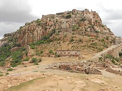
[[ | The '''Gooty Fort''', also known as '''Ravadurg''', is a ruined fort located on a hill in the [[Gooty]] town of Anantapur [[Andhra Pradesh]], India. The word Gooty (locally pronounced "Gutti") is derived from the town's original name, Gowthampuri. It is one of the centrally protected [[Monuments of National Importance]]. | ||
== Administrative divisions == | |||
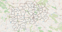
[[File:Anantapuram Revenue Divisions.png|alt=Guntakal Revenue Division|thumb|Anantapur District Revenue Divisions and Mandals]] | |||
The District has three Revenue Divisions: [[Anantapuramu revenue division|Anantapur]], [[Guntakal revenue division|Guntakal]] and [[Kalyandurg revenue division|Kalyandurg]]. These revenue divisions are further divided into 31 [[mandal]]s.<ref name="census" />{{rp|14}} | |||
The District has | |||
The mandals of the district are listed in the following table: | The mandals of the district are listed in the following table: | ||
{| class="wikitable" | {| class="wikitable" | ||
|- | |- | ||
! | ! # !! [[Anantapur revenue division|Anantapur Division]] !! [[Guntakal revenue division|Guntakal division]]!! [[Kalyandurg revenue division|Kalyandurg Division]] | ||
|- | |||
| 1 || [[Anantapur, Andhra Pradesh|Anantapur]] || [[Uravakonda]]|| [[Rayadurg]] | |||
|- | |- | ||
| | | 2 || [[Tadipatri]]|| [[Vidapanakal]]|| [[D.Hirehal]] | ||
|- | |- | ||
| | | 3 || [[Kudair]]|| [[Vajrakarur]]|| [[Kanekal]] | ||
|- | |- | ||
| | | 4 || [[Raptadu]]|| [[Guntakal]]|| [[Bommanahal]] | ||
|- | |- | ||
| | | 5 || [[Peddapappur]]|| [[Gooty]]|| [[Gummagatta]] | ||
|- | |- | ||
| | | 6 || [[Singanamala]]|| [[Pamidi]]|| [[Kalyandurg]] | ||
|- | |- | ||
| | | 7 || [[Garladinne]]|| [[Yadiki]]|| [[Brahmasamudram]] | ||
|- | |- | ||
| | | 8 || [[Putlur]]|| [[Peddavadugur]]|| [[Settur]] | ||
|- | |- | ||
| | | 9 || [[Yellanur]]|| {{CEmpty}} || [[Kundurpi]] | ||
|- | |- | ||
| | | 10 || [[Narpala]]|| {{CEmpty}} || [[Kambadur]] | ||
|- | |- | ||
| | | 11 || [[Bukkarayasamudram]]|| {{CEmpty}} || [[Beluguppa]] | ||
|- | |- | ||
| | | 12 || [[Atmakur, Anantapur district|Atmakur]]|| {{CEmpty}} || {{CEmpty}} | ||
|} | |||
==Parliament segments== | |||
[[Anantapur (Lok Sabha constituency)]], [[Hindupur (Lok Sabha constituency)]] | |||
==Assembly segments== | |||
Anantapur and Hindupur Lok Sabha constituency comprises the following Legislative Assembly segments:<ref name="ceo">{{cite web|url=http://eci.nic.in/eci_main/CurrentElections/CONSOLIDATED_ORDER%20_ECI%20.pdf|title=Delimitation of Parliamentary and Assembly Constituencies Order, 2008|publisher=The Election Commission of India|page=31}}</ref> | |||
{|class="wikitable" width="500px" | |||
!width="200px"|Name | |||
!width="100px" style="font-size:75%"|Reserved for ([[Dalit|SC]]/[[Adivasi|ST]]/None) | |||
|- | |- | ||
|[[Raptadu (Assembly constituency)|Raptadu]] | |||
|None | |||
|- | |- | ||
|[[Rayadurg (Assembly constituency)|Rayadurg]] | |||
|None | |||
|- | |- | ||
|[[Uravakonda (Assembly constituency)|Uravakonda]] | |||
| | |None | ||
|- | |- | ||
|[[Guntakal (Assembly constituency)|Guntakal]] | |||
|None | |||
|- | |- | ||
|[[Tadpatri (Assembly constituency)|Tadpatri]] | |||
|None | |||
|- | |- | ||
|[[Singanamala (Assembly constituency)|Singanamala]] | |||
|SC | |||
|- | |- | ||
|[[Anantapur Urban (Assembly constituency)|Anantapur Urban]] | |||
|None | |||
|- | |- | ||
|[[Kalyandurg (Assembly constituency)|Kalyandurg]] | |||
|None | |||
|} | |} | ||
| Line 313: | Line 341: | ||
== Towns in District == | == Towns in District == | ||
The Following are the towns in old district. | |||
The Following are the towns in district. | |||
{| class="wikitable" | {| class="wikitable" | ||
| Line 390: | Line 364: | ||
Population | Population | ||
!1971 Census | !1971 Census | ||
Population | |||
!1961 Census | |||
Population | |||
!1951 Census | |||
Population | Population | ||
|- | |- | ||
|1 | |1 | ||
|[[ | |[[Anantapur Municipal Corporation|Anantapur]] | ||
|Municipal Corporation | |Municipal Corporation | ||
|1869 | |1869 | ||
|50 | |50 | ||
| | |3,40,613 | ||
| | |2,52,298 | ||
| | |1,74,924 | ||
| | |1,19,531 | ||
|80,069 | |80,069 | ||
|52,280 | |||
|31,952 | |||
|- | |- | ||
|2 | |2 | ||
| Line 408: | Line 388: | ||
|1920 | |1920 | ||
|38 | |38 | ||
| | |1,51,677 | ||
| | |1,25,074 | ||
| | |1,04,651 | ||
|55,901 | |55,901 | ||
|42,595 | |42,595 | ||
|32,455 | |||
|24,438 | |||
|- | |- | ||
|3 | |3 | ||
| Line 419: | Line 401: | ||
|1948 | |1948 | ||
|37 | |37 | ||
| | |1,28,142 | ||
| | |1,17,103 | ||
|107,592 | |107,592 | ||
|84,599 | |84,599 | ||
|66,320 | |66,320 | ||
|48,083 | |||
|31,341 | |||
|- | |- | ||
|4 | |4 | ||
| Line 430: | Line 414: | ||
|1964 | |1964 | ||
|40 | |40 | ||
| | |1,21,874 | ||
| | |1,03,357 | ||
|78,961 | |78,961 | ||
|50,969 | |50,969 | ||
|30,876 | |30,876 | ||
|20,405 | |||
|14,703 | |||
|- | |- | ||
|5 | |5 | ||
| Line 441: | Line 427: | ||
|1920 | |1920 | ||
|36 | |36 | ||
| | |1,20,990 | ||
|86,843 | |86,843 | ||
|71,068 | |71,068 | ||
|53,920 | |53,920 | ||
|31,618 | |31,618 | ||
|23,129 | |||
|19,369 | |||
|- | |- | ||
|6 | |6 | ||
| Line 452: | Line 440: | ||
|1964 | |1964 | ||
|36 | |36 | ||
| | |98,096 | ||
|76,252 | |76,252 | ||
|63,378 | |63,378 | ||
|52,774 | |52,774 | ||
|33,810 | |33,810 | ||
|24,307 | |||
|20,354 | |||
|- | |- | ||
|7 | |7 | ||
| Line 468: | Line 458: | ||
|32,745 | |32,745 | ||
|26,154 | |26,154 | ||
|23,779 | |||
|19,738 | |||
|- | |- | ||
|8 | |8 | ||
| Line 479: | Line 471: | ||
|29,302 | |29,302 | ||
|21,706 | |21,706 | ||
|19,507 | |||
|15,437 | |||
|- | |- | ||
|9 | |9 | ||
| Line 485: | Line 479: | ||
|2012 | |2012 | ||
|24 | |24 | ||
| | |39,855 | ||
|29,266 | |29,266 | ||
|23,106 | |23,106 | ||
|17,049 | |17,049 | ||
|13,260 | |13,260 | ||
|10,256 | |||
|8,163 | |||
|- | |- | ||
|10 | |10 | ||
|[[Puttaparthi]] | |[[Puttaparthi]] | ||
| | |Municipality | ||
Grade- | |||
|2011 | |2011 | ||
|20 | |20 | ||
| | |64,342 | ||
| | |29768 | ||
| 11,000 | |||
| 9543 | |||
| 3467 | |||
| - | |||
| - | |||
|- | |- | ||
|11 | |11 | ||
| Line 510: | Line 512: | ||
|17,030 | |17,030 | ||
|12,373 | |12,373 | ||
|9, | |9,267 | ||
|7,993 | |||
|6,880 | |||
|- | |- | ||
|12 | |12 | ||
| Line 522: | Line 526: | ||
|14,615 | |14,615 | ||
|10,963 | |10,963 | ||
| - | |||
| - | |||
|- | |- | ||
|13 | |13 | ||
| Line 533: | Line 539: | ||
|13,182 | |13,182 | ||
|10,600 | |10,600 | ||
| - | |||
| - | |||
|} | |} | ||
| Line 541: | Line 549: | ||
!Civic Status of Town | !Civic Status of Town | ||
!2011 Census | !2011 Census | ||
Population | |||
!2001 Census | |||
Population | |||
!1991 Census | |||
Population | |||
!1981 Census | |||
Population | |||
!1971 Census | |||
Population | |||
!1961 Census | |||
Population | |||
!1951 Census | |||
Population | Population | ||
|- | |- | ||
| Line 547: | Line 567: | ||
|Census Town | |Census Town | ||
|35,565 | |35,565 | ||
|31,856 | |||
|27,679 | |||
|21,754 | |||
|19,754 | |||
|17,926 | |||
|16,662 | |||
|- | |- | ||
|2 | |2 | ||
| Line 552: | Line 578: | ||
|Grama Panchayat | |Grama Panchayat | ||
|15,441 | |15,441 | ||
| - | |||
| - | |||
| - | |||
| - | |||
| - | |||
| - | |||
|- | |- | ||
|3 | |3 | ||
| Line 557: | Line 589: | ||
|Grama Panchayat | |Grama Panchayat | ||
|10,944 | |10,944 | ||
| - | |||
| - | |||
| - | |||
| - | |||
| - | |||
| - | |||
|- | |- | ||
|4 | |4 | ||
| Line 562: | Line 600: | ||
|Grama Panchayat | |Grama Panchayat | ||
|7,387 | |7,387 | ||
| - | |||
| - | |||
| - | |||
| - | |||
| - | |||
| - | |||
|- | |- | ||
|5 | |5 | ||
| Line 567: | Line 611: | ||
|Grama Panchayat | |Grama Panchayat | ||
|4,986 | |4,986 | ||
| - | |||
| - | |||
| - | |||
| - | |||
| - | |||
| - | |||
|} | |} | ||
| Line 587: | Line 637: | ||
== Education == | == Education == | ||
The primary and secondary school education is imparted by government, aided and private schools, under the ''School Education Department'' of the state.<ref>{{cite web|title=School Education Department |url=http://rmsaap.nic.in/Notification_TSG_2015.pdf |publisher=School Education Department, Government of Andhra Pradesh |access-date=7 November 2016 |url-status=dead |archive-url=https://web.archive.org/web/20160319051231/http://rmsaap.nic.in/Notification_TSG_2015.pdf |archive-date=19 March 2016 }}</ref><ref>{{cite web|title=The Department of School Education – Official AP State Government Portal |url=http://www.ap.gov.in/department/organizations/school-education/ |website= | The primary and secondary school education is imparted by government, aided and private schools, under the ''School Education Department'' of the state.<ref>{{cite web|title=School Education Department |url=http://rmsaap.nic.in/Notification_TSG_2015.pdf |publisher=School Education Department, Government of Andhra Pradesh |access-date=7 November 2016 |url-status=dead |archive-url=https://web.archive.org/web/20160319051231/http://rmsaap.nic.in/Notification_TSG_2015.pdf |archive-date=19 March 2016 }}</ref><ref>{{cite web|title=The Department of School Education – Official AP State Government Portal |url=http://www.ap.gov.in/department/organizations/school-education/ |website=ap.gov.in |access-date=7 November 2016 |url-status=dead |archive-url=https://web.archive.org/web/20161107155331/http://www.ap.gov.in/department/organizations/school-education/ |archive-date=7 November 2016 }}</ref> As per the school information report for the academic year 2015–16, there are a total of 5,024 schools. They include, 28 government, 3,435 mandal and zilla parishads, 4 residential, 1,154 private, 25 model, 62 Kasturba Gandhi Balika Vidyalaya (KGBV), 261 municipal and 55 other types of schools.<ref>{{cite web|title=School Information Report |url=http://cse.ap.gov.in/DSE/totalSchoolReport.xls# |website=Commissionerate of School Education |publisher=Government of Andhra Pradesh |access-date=8 November 2016 |url-status=dead |archive-url=https://web.archive.org/web/20161108154343/http://cse.ap.gov.in/DSE/totalSchoolReport.xls |archive-date=8 November 2016 }}</ref> The total number of students enrolled in primary, upper primary and high schools of the district are 563,710.<ref name="Student Information Report">{{cite web|title=Student Information Report|url=http://cse.ap.gov.in/DSE/districtStudentReport.do|website=Commissionerate of School Education|publisher=Child info 2015–16, District School Education – Andhra Pradesh|access-date=8 November 2016|archive-url=https://web.archive.org/web/20150522011144/http://cse.ap.gov.in/DSE/districtStudentReport.do|archive-date=22 May 2015|url-status=dead|df=dmy-all}}</ref> The total number of students enrolled in primary, upper primary and high schools of the district are 563,266.<ref name="Student Information Report" /> | ||
Anantapur is an important education centre with many prominent educational, schools, colleges and universities situated in the district. Anantapur city has become a major hub with many education institutions situated in its vicinity. Some of the institutions include [[Sri Krishnadevaraya University]], [[Jawaharlal Nehru Technological University, Anantapur|JNTU Ananthapur]], [[Sri Sathya Sai University]], [[Government Medical College, Anantapur|Government Medical College]], Government polytechnic anantapur, [[Srinivasa Ramanujan Institute of Technology]], [[Government Polytechnic Hindupur]]. Gates Institute of Technology. Central University of Andhra Pradesh, | Anantapur is an important education centre with many prominent educational, schools, colleges and universities situated in the district. Anantapur city has become a major hub with many education institutions situated in its vicinity. Some of the institutions include [[Sri Krishnadevaraya University]], [[Jawaharlal Nehru Technological University, Anantapur|JNTU Ananthapur]], [[Sri Sathya Sai University]], [[Government Medical College, Anantapur|Government Medical College]], Government polytechnic anantapur, [[Srinivasa Ramanujan Institute of Technology]], [[Government Polytechnic Hindupur]]. Gates Institute of Technology. Central University of Andhra Pradesh, | ||
| Line 593: | Line 643: | ||
== Temples == | == Temples == | ||
The following sixty five temples under the management of Endowments Department<ref>{{ | The following sixty five temples under the management of Endowments Department<ref>{{cite web|url=https://tms.ap.gov.in/binfo|title=Trust Boards Abstract|website=AP Temples Portal, Government of Andhra Pradesh|access-date=24 July 2018}}</ref> | ||
== References == | == References == | ||
Revision as of 17:53, 1 July 2022
Anantapuram district | |
|---|---|
| Anantapuramu district | |
     Clockwise from top-left: Chintalarayaswami Temple, Anantapur Clock Tower, Granary at Gooty Fort, Hills near Reddipalle, Bugga Ramalingeswara temple | |
| Etymology: Telugu: Anantasagara (Big Tank) | |
.svg) | |
| Coordinates: 14°42′N 77°36′E / 14.700°N 77.600°E | |
| Country |  India India |
| State | File:Andhraseal.pngAndhra Pradesh |
| Region | Rayalaseema |
| Named for | Big Tank |
| Headquarters | Anantapur |
| Administrative Divisions | |
| Government | |
| • District collector | Smt K.Nagalakshmi |
| • Lok Sabha | Lok Sabha list
|
| • Assembly | Assembly list
|
| Area | |
| • Total | 10,205 km2 (3,940 sq mi) |
| Population (2011)[2] | |
| • Total | 2,241,105 |
| • Density | 220/km2 (570/sq mi) |
| • Sex ratio | 977 (females per 1,000 males) |
| Languages | |
| • Official | Telugu |
| Literacy | |
| Time zone | UTC+5:30 (IST) |
| Postal Index Number | 515xxx |
| Area codes | +91–8554 |
| ISO 3166 code | IN-AP |
| Vehicle registration | AP-02 (former) AP–39 (from 30 January 2019)[3] |
| Website | ananthapuramu |
Anantapur district (officially: Anantapuramu district[4]) is one of the four districts in the Rayalaseema region of the Indian state of Andhra Pradesh. The district headquarters is located at Anantapur city. It is one of the driest places in South India.[5] As of 2011[update] census of India, it is the largest district in the state by area and with a population of 4,083,315, it is the eighth most populous district.[1]:19
Etymology
The name Anantapur was named after a big tank called Anantasagara.[citation needed] It existed during reign of Vijayanagara Empire, which was named after Ananthamma, wife of Bukkaraya, one of the founders of the empire.[6]
History
Gooty fort was a stronghold of the Marathas, but was taken from them by Hyder Ali. In 1789 it was ceded by his son Tipu Sultan to the Nizam of Hyderabad, and in 1800 the nizam ceded the surrounding districts to the British in payment for a subsidiary British force.[7] In 1882, Anantapuram district was formed by carving out from Bellary district.[8]
Geography
It is one of the largest district of Andhra Pradesh district in spanning an area of 10,205 square kilometres (3,940 sq mi),[9] comparatively equivalent to Japan's Shikoku Island.[10] It is bounded on the north by Kurnool district and Nandyal district , on the east by Kadapa district, and South by Sri Sathya Sai district and on the southwest and west by Karnataka state.[11] It is part of Rayalaseema region on the state. Its northern and central portions are a high plateau, generally undulating, with large granite rocks or low hill ranges rising occasionally above its surface. In the southern portion of the district the surface is more hilly, the plateau there rising to 2,000 ft (610 m). above the sea.[7] Six rivers flow within the district: Penna, Chithravathi, Vedavathi, Papagni, Swarnamukhi, and Thadakaleru. The district receives an average annual rainfall of 381 millimetres. Anantapur district mostly falls under the rainshadow region of the Western Ghats, with a Hot semi-arid climate. Red soil and vertisol are the most common soils. The driest parts of India after the Thar desert are in this region, as well as adjoining Chitradurga district and Ballari district of Karnataka, and parts of Kurnool district and Kadapa district.
Anantapur city is 485 km (301 mi) from Vijayawada, 354 km (220 mi) from Hyderabad, and 200 km (120 mi) from the neighbouring state capital of Bengaluru. Anantapur connects Hyderabad and Bangalore through National Highway 7. There is an airport in the district located in Puttaparthi, known as Sri Sathya Sai Airport; however this airport currently has no scheduled service. Kempegowda International Airport, Bengaluru is nearest commercial airport to Anantapur District.
Demographics
As of 2011[update] census of India, Anantapur district has a population of 4,081,148 with 9,68,160 households, ranking it as the 7th most populous district in the state. It is the largest district in the state with an area of 19,130 km2 (7,390 sq mi).[1] Anantapur has a sex ratio of 977 females for every 1000 males, and a literacy rate of 64.28%.[12] Urban population in the district is 28.9% of total population.
After bifurcation Anantapur district had a population of 22,41,105. Scheduled Castes and Scheduled Tribes make up 3,34,142 (14.91%) and 70,161 (3.13%) of the population respectively.[2]:78–83
At the time of the 2011 census, 84.59% of the population spoke Telugu, 9.64% Urdu, 3.03% Kannada and 1.42% Lambadi as their first language.[14]
| Year | Pop. | ±% p.a. |
|---|---|---|
| 1901 | 1,025,322 | — |
| 1911 | 1,053,449 | +0.27% |
| 1921 | 1,040,166 | −0.13% |
| 1931 | 1,138,081 | +0.90% |
| 1941 | 1,273,079 | +1.13% |
| 1951 | 1,483,591 | +1.54% |
| 1961 | 1,767,464 | +1.77% |
| 1971 | 2,115,321 | +1.81% |
| 1981 | 2,548,012 | +1.88% |
| 1991 | 3,180,863 | +2.24% |
| 2001 | 3,640,478 | +1.36% |
| 2011 | 4,081,148 | +1.15% |
| source:[15] | ||
Economy
The Gross District Domestic Product (GDDP) of the district is ₹35,838 crore (US$5.0 billion) and it contributes 6.8% to the Gross State Domestic Product (GSDP). For the FY 2013–14, the per capita income at current prices was ₹69,562 (US$980). The primary, secondary and tertiary sectors of the district contribute ₹9,944 crore (US$1.4 billion), ₹7,752 crore (US$1.1 billion) and ₹18,142 crore (US$2.5 billion) respectively to the GDDP.[16]
Agriculture and allied services Paddy and Groundnut are major agricultural crops in the district. When it comes to horticulture Banana and Papaya are heavily cultivated.
Industries Industries like Constructions, Manufactures and Electricity are major contributors for GVA.[16] Anantapur has a major potential for development of industry due to its strategic location between Bengaluru – Chennai and Bengaluru – Hyderabad routes and availability of vast tracts of land. In 2006 the Indian government named Anantapur one of the country's 250 most backward districts (out of a total of 640).[17] It is one of the thirteen districts in Andhra Pradesh currently receiving funds from the Backward Regions Grant Fund Programme (BRGF).[17]
Minerals Anantapur is a major producer of Dolomite and Iron Ore minerals.
Power plants Solar thermal power plant of 50 MW was commissioned at this village under Jawaharlal Nehru National Solar Mission which was named as Megha Solar Plant. It is one of the 7 solar thermal plants in the country.[18][19]
Tadipatri region in Anantapur is an industrialised town famous for Granite and Cement production. Ultra Tech Cements a unit of Industrial major Larsen & Toubro has a major Cement production unit near the town.
Agriculture
The economy is principally agrarian with a developing industrial sector. Anantapur receives very less rainfall due to its location in the rain shadow area of Indian Peninsula. Prominent crops include groundnut, sunflower, rice, cotton, maize, chillies, sesame, and sugarcane. Silk trade, limestone quarrying, iron and diamond mining. Anantapur town is known as Groundnut City in reference to the neighbouring Bengaluru being called as Garden City.
Religious tourism
The Gooty Fort, also known as Ravadurg, is a ruined fort located on a hill in the Gooty town of Anantapur Andhra Pradesh, India. The word Gooty (locally pronounced "Gutti") is derived from the town's original name, Gowthampuri. It is one of the centrally protected Monuments of National Importance.
Administrative divisions

The District has three Revenue Divisions: Anantapur, Guntakal and Kalyandurg. These revenue divisions are further divided into 31 mandals.[1]:14
The mandals of the district are listed in the following table:
Parliament segments
Anantapur (Lok Sabha constituency), Hindupur (Lok Sabha constituency)
Assembly segments
Anantapur and Hindupur Lok Sabha constituency comprises the following Legislative Assembly segments:[20]
| Name | Reserved for (SC/ST/None) |
|---|---|
| Raptadu | None |
| Rayadurg | None |
| Uravakonda | None |
| Guntakal | None |
| Tadpatri | None |
| Singanamala | SC |
| Anantapur Urban | None |
| Kalyandurg | None |
Erstwhile Talukas in District
| S.No. | Erstwhile Talukas in 1971 | Newly formed Talukas in 1978 | Newly formed Mandals in 1985 |
|---|---|---|---|
| 1. | Anantapuram | Anantapuram | Anantapuram, Kudair, Atmakur, Raptadu, Garladinne [part] |
| Singanamala [12] | Singanamala, B.K. Samudram, Narpala, Garladinne [part] | ||
| 2 | Gooty | Gooty | Gooty, Guntakal, Pamidi, Peddavadugur |
| 3 | Urvakonda | Urvakonda | Urvakonda [part], Vidapanakal, Vajrakarur |
| 4 | Rayadurgam | Rayadurgam | Rayadurgam, D.Hirehal, Gummagatta |
| Kanekallu [13] | Kanekallu, Bommanahal, Urvakonda [part] | ||
| 5 | Kalyanadurgam | Kalyanadurgam | Kalyanadurgam, Belugappa |
| Kambadur [14] | Kambadur, Kundurpi, Settur, Brahmasamudram | ||
| 6 | Penukonda | Penukonda | Penukonda, Roddam, Somanandipalle |
| Puttaparthi [Satya Sai Taluka] [15] | Puttaparthi, Bukkapatnam, Kothacheruvu | ||
| 7 | Madakasira | Madakasira | Madakasira, Rolla, Agali, Gudibanda, Amarapuram |
| 8 | Hindupuram | Hindupuram | Hindupuram, Parigi, Gorantla, Lepakshi, Chilamathur |
| 9 | Kadiri | Kadiri | Kadiri, Nallacheruvu, Tanakal, Gandlapenta, Talapula, Nambulipulikunta |
| Nallamada [16] | Nallamada, Obula devara Cheruvu, Amadagur, Mudigubba | ||
| 10 | Dharmavaram | Dharmavaram | Dharmavaram, Bathalapalle, Tadimarri |
| Chennekothapalle [17] | Chennekothapalle, Kanaganapalle, Ramagiri | ||
| 11 | Tadipatri | Tadipatri | Tadipatri, Yadiki, Yallanuru, Putlur, Peddapappur |
Towns in District
The Following are the towns in old district.
| S.No. | Town | Civic Status of Town | Municipality
Formation Year |
No. of
Wards |
2011 Census
Population |
2001 Census
Population |
1991 Census
Population |
1981 Census
Population |
1971 Census
Population |
1961 Census
Population |
1951 Census
Population |
|---|---|---|---|---|---|---|---|---|---|---|---|
| 1 | Anantapur | Municipal Corporation | 1869 | 50 | 3,40,613 | 2,52,298 | 1,74,924 | 1,19,531 | 80,069 | 52,280 | 31,952 |
| 2 | Hindupur | Municipality Selection Grade | 1920 | 38 | 1,51,677 | 1,25,074 | 1,04,651 | 55,901 | 42,595 | 32,455 | 24,438 |
| 3 | Guntakal | Municipality Selection Grade | 1948 | 37 | 1,28,142 | 1,17,103 | 107,592 | 84,599 | 66,320 | 48,083 | 31,341 |
| 4 | Dharmavaram | Municipality Selection Grade | 1964 | 40 | 1,21,874 | 1,03,357 | 78,961 | 50,969 | 30,876 | 20,405 | 14,703 |
| 5 | Tadipatri | Municipality Special Grade | 1920 | 36 | 1,20,990 | 86,843 | 71,068 | 53,920 | 31,618 | 23,129 | 19,369 |
| 6 | Kadiri | Municipality Special Grade | 1964 | 36 | 98,096 | 76,252 | 63,378 | 52,774 | 33,810 | 24,307 | 20,354 |
| 7 | Rayadurgam | Municipality Grade - 2 | 1963 | 32 | 61,749 | 54,125 | 40,848 | 32,745 | 26,154 | 23,779 | 19,738 |
| 8 | Gooty | Municipality Grade - 3 | 2011 | 25 | 48,658 | 43,389 | 37,814 | 29,302 | 21,706 | 19,507 | 15,437 |
| 9 | Kalyanadurgam | Municipality Grade - 3 | 2012 | 24 | 39,855 | 29,266 | 23,106 | 17,049 | 13,260 | 10,256 | 8,163 |
| 10 | Puttaparthi | Municipality
Grade- |
2011 | 20 | 64,342 | 29768 | 11,000 | 9543 | 3467 | - | - |
| 11 | Penukonda | Nagar Panchayat | 2020 | 20 | 27,382 | 23,910 | 17,030 | 12,373 | 9,267 | 7,993 | 6,880 |
| 12 | Pamidi | Nagar Panchayat | 2012 | 20 | 26,886 | 22,585 | 19,697 | 14,615 | 10,963 | - | - |
| 13 | Madakasira | Nagar Panchayat | 2011 | 20 | 21,464 | 19,432 | 16,762 | 13,182 | 10,600 | - | - |
| S.No. | Town | Civic Status of Town | 2011 Census
Population |
2001 Census
Population |
1991 Census
Population |
1981 Census
Population |
1971 Census
Population |
1961 Census
Population |
1951 Census
Population |
|---|---|---|---|---|---|---|---|---|---|
| 1 | Urvakonda | Census Town | 35,565 | 31,856 | 27,679 | 21,754 | 19,754 | 17,926 | 16,662 |
| 2 | Kambadur | Grama Panchayat | 15,441 | - | - | - | - | - | - |
| 3 | Nallamada | Grama Panchayat | 10,944 | - | - | - | - | - | - |
| 4 | Chennekothapalle | Grama Panchayat | 7,387 | - | - | - | - | - | - |
| 5 | Singanamala | Grama Panchayat | 4,986 | - | - | - | - | - | - |
| S.No. | Town | Civic Status of Town | 2011 Census
Population |
|---|---|---|---|
| 1 | Somandepalle | Census Town | 18,895 |
Transport
The total road length of state highways in the district is 1,298 km (807 mi), the longest in the state.[21] It has a total Rail Network of which 340 km (210 mi) is Broad gauge and 249 km (155 mi) is Meter gauge. The major railways stations are Guntakal Junction, Dharmavaram Junction, Gooty Junction,Rayadurg Junction, Penukonda Junction, Sathya Sai Prasanthi Nilayam, Hindupur.
Education
The primary and secondary school education is imparted by government, aided and private schools, under the School Education Department of the state.[22][23] As per the school information report for the academic year 2015–16, there are a total of 5,024 schools. They include, 28 government, 3,435 mandal and zilla parishads, 4 residential, 1,154 private, 25 model, 62 Kasturba Gandhi Balika Vidyalaya (KGBV), 261 municipal and 55 other types of schools.[24] The total number of students enrolled in primary, upper primary and high schools of the district are 563,710.[25] The total number of students enrolled in primary, upper primary and high schools of the district are 563,266.[25]
Anantapur is an important education centre with many prominent educational, schools, colleges and universities situated in the district. Anantapur city has become a major hub with many education institutions situated in its vicinity. Some of the institutions include Sri Krishnadevaraya University, JNTU Ananthapur, Sri Sathya Sai University, Government Medical College, Government polytechnic anantapur, Srinivasa Ramanujan Institute of Technology, Government Polytechnic Hindupur. Gates Institute of Technology. Central University of Andhra Pradesh, Dalavai Chalapathi Rao
Temples
The following sixty five temples under the management of Endowments Department[26]
References
- ↑ 1.0 1.1 1.2 1.3 1.4 1.5 "District Census Hand Book – Anantapur" (PDF). Census of India. Registrar General and Census Commissioner of India. Retrieved 14 June 2019.
- ↑ 2.0 2.1 "District Census Hand Book - Anantapur" (PDF). Census of India. Registrar General and Census Commissioner of India.
- ↑ "New 'AP 39' code to register vehicles in Andhra Pradesh launched". The New Indian Express. Vijayawada. 31 January 2019. Archived from the original on 21 November 2020. Retrieved 9 June 2019.
- ↑ "Anantapur district to be renamed Anantapuram". The Hindu. Archived from the original on 14 April 2013. Retrieved 5 June 2017.
- ↑ "Anantapur Assembly Constituency : Triangular contest on the cards". thehansindia.com. 20 January 2019. Archived from the original on 24 July 2019. Retrieved 14 June 2019.
- ↑ "There is history behind names of places". The Hindu. 30 March 2009. Archived from the original on 7 April 2021. Retrieved 14 June 2019.
- ↑ 7.0 7.1
 One or more of the preceding sentences incorporates text from a publication now in the public domain: Chisholm, Hugh, ed. (1911). "Anantapur". Encyclopædia Britannica. Vol. 1 (11th ed.). Cambridge University Press. p. 913.
- ↑ Rayudu, C. S. (1 January 1991). Rural Credit in India: A Study of Andhra Pradesh. Mittal Publications. p. 2. ISBN 9788170992486.
- ↑ Srivastava, Dayawanti; et al., eds. (2010). "States and Union Territories: Andhra Pradesh: Government". India 2010: A Reference Annual (54th ed.). New Delhi, India: Additional Director General, Publications Division, Ministry of Information and Broadcasting (India), Government of India. pp. 1111–1112. ISBN 978-81-230-1617-7.
- ↑ "Island Directory Tables: Islands by Land Area". United Nations Environment Program. 18 February 1998. Archived from the original on 8 February 2021. Retrieved 11 October 2011.
Shikoku 18,545km2
- ↑ "Historical Background". Archived from the original on 15 May 2013.
- ↑ "Census 2011". Official website of Anantapuram district. Archived from the original on 14 March 2016. Retrieved 19 March 2016.
- ↑ "Population by Religion - Andhra Pradesh". censusindia.gov.in. Office of the Registrar General & Census Commissioner, India. 2011.
- ↑ "Table C-16 Population by Mother Tongue: Andhra Pradesh". Census of India. Registrar General and Census Commissioner of India.
- ↑ Decadal Variation In Population Since 1901
- ↑ 16.0 16.1 "Economy of Anantapur District". Andhra Pradesh Economic Development Board. Retrieved 25 April 2017.
- ↑ 17.0 17.1 Ministry of Panchayati Raj (8 September 2009). "A Note on the Backward Regions Grant Fund Programme" (PDF). National Institute of Rural Development. Archived from the original (PDF) on 5 April 2012. Retrieved 27 September 2011.
- ↑ "Megha Solar Plant". National Renewable Energy Laboratory. Archived from the original on 28 April 2015. Retrieved 29 April 2015.
- ↑ "Anantapur Gets Solar Power Plant". The New Indian Express. Hyderabad. 14 November 2014. Archived from the original on 27 September 2020. Retrieved 29 April 2015.
- ↑ "Delimitation of Parliamentary and Assembly Constituencies Order, 2008" (PDF). The Election Commission of India. p. 31.
- ↑ "Existing State Highways" (PDF). Andhra Pradesh Road Development Corporation. Government of Andhra Pradesh. p. 1. Archived from the original (PDF) on 20 September 2018. Retrieved 11 May 2019.
- ↑ "School Education Department" (PDF). School Education Department, Government of Andhra Pradesh. Archived from the original (PDF) on 19 March 2016. Retrieved 7 November 2016.
- ↑ "The Department of School Education – Official AP State Government Portal". ap.gov.in. Archived from the original on 7 November 2016. Retrieved 7 November 2016.
- ↑ "School Information Report". Commissionerate of School Education. Government of Andhra Pradesh. Archived from the original on 8 November 2016. Retrieved 8 November 2016.
- ↑ 25.0 25.1 "Student Information Report". Commissionerate of School Education. Child info 2015–16, District School Education – Andhra Pradesh. Archived from the original on 22 May 2015. Retrieved 8 November 2016.
- ↑ "Trust Boards Abstract". AP Temples Portal, Government of Andhra Pradesh. Retrieved 24 July 2018.
External links
Places adjacent to Anantapur district | |
|---|---|


