



WikiDwarfBOT (talk | contribs) Cleanup: Source modification. Information added. |
Improved wording and formatting |
||
| Line 1: | Line 1: | ||
{{short description|City and state capital of Meghalaya, India}} | {{short description|City and state capital of Meghalaya, India}} | ||
{{Distinguish|Shilong (disambiguation){{!}}Shilong}} | {{Distinguish|Shilong (disambiguation){{!}}Shilong}} | ||
{{ | {{Copy edit|date=May 2025}} | ||
{{Use dmy dates|date= | {{Use Indian English|date=December 2025}} | ||
{{Use dmy dates|date=December 2025}} | |||
{{Infobox settlement | {{Infobox settlement | ||
| name | | name = Shillong | ||
| native_name | | native_name = | ||
| other_name | | other_name = | ||
| settlement_type | | settlement_type = City | ||
| image_skyline = | | image_skyline = {{multiple image | ||
{{multiple image | |||
| border = infobox | | border = infobox | ||
| total_width = 260 | | total_width = 260 | ||
| Line 15: | Line 15: | ||
| perrow = 1/2/2/1 | | perrow = 1/2/2/1 | ||
| image2 = Shillong.jpg | | image2 = Shillong.jpg | ||
| image1 = Elephant Falls II.jpg | | image1 = Elephant Falls II, Shillong.jpg | ||
| image3 = Laitlum Canyon (3).jpg | | image3 = Laitlum Canyon (3).jpg | ||
| image4 =Mary Help of Christians Cathedral, Shillong – Front Side (2).jpg | | image4 = Mary Help of Christians Cathedral, Shillong – Front Side (2).jpg | ||
| image5 =Ward's Lake.jpg | | image5 = Ward's Lake, Shillong.jpg | ||
| image6 = | | image6 = Shillong City.jpg | ||
| spacing = 1 | | spacing = 1 | ||
| position = centre | | position = centre | ||
| color = white | | color = white | ||
}} | }} | ||
| image_alt | | image_alt = | ||
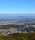
| image_caption | | image_caption = Clockwise from top left to right:<br/> [[Elephant Falls]], Laitlum Canyon, [[Ward's Lake]], Panorama of Police Bazar in Shillong, [[Mary Help of Christians Cathedral, Shillong|The Cathedral of Mary Help of Christians]], A view of Shillong | ||
| image_map | | image_map = | ||
| map_caption | | map_caption = Map of Shillong | ||
| nickname | | nickname = Scotland of the East | ||
| map_alt | | map_alt = | ||
| pushpin_map | | pushpin_map = India Meghalaya#India | ||
| pushpin_label_position | | pushpin_label_position = left | ||
| pushpin_map_alt | | pushpin_map_alt = | ||
| pushpin_map_caption | | pushpin_map_caption = Location of Shillong in Meghalaya | ||
| coordinates | | coordinates = {{coord|25|34|56|N|91|53|40|E|display=inline,title}} | ||
| subdivision_type | | subdivision_type = Country | ||
| subdivision_name | | subdivision_name = {{IND}} | ||
| subdivision_type1 | | subdivision_type1 = State | ||
| subdivision_type2 | | subdivision_type2 = [[List of districts of India|District]] | ||
| subdivision_name1 | | subdivision_name1 = [[Meghalaya]] | ||
| subdivision_name2 | | subdivision_name2 = [[East Khasi Hills]] | ||
| established_title | | established_title = <!-- Established --> | ||
| established_date | | established_date = | ||
| founder | | founder = | ||
| named_for | | named_for = Lei Shyllong (Deity) | ||
| governing_body | | governing_body = Shillong Municipal Board | ||
| leader_title | | leader_title = Director | ||
| leader_name | | leader_name = P.K. Boro | ||
| leader_title2 | | leader_title2 = [[Member of Parliament#India|MP]] | ||
| leader_name2 | | leader_name2 = | ||
| unit_pref | | unit_pref = Metric | ||
| area_footnotes | | area_footnotes = | ||
| area_total_km2 | | area_total_km2 = 64.36 | ||
| area_rank | | area_rank = | ||
| elevation_footnotes | | elevation_footnotes = | ||
| elevation_m | | elevation_m = 1495-1965 | ||
| elevation_ft | | elevation_ft = 4908-6449 | ||
| population_total | | population_total = 143,229 | ||
| population_as_of | | population_as_of = 2011 | ||
| population_footnotes | | population_footnotes = <ref name="Census2011Gov"/> | ||
| population_density_km2 | | population_density_km2 = auto | ||
| population_metro | | population_metro = 354,759 | ||
| population_rank | | population_rank = | ||
| population_demonym | | population_demonym = Shillongite and Nong-Shillong/Nongsor | ||
| demographics_type1 | | demographics_type1 = [[Language]] | ||
| demographics1_title1 | | demographics1_title1 = Official | ||
| demographics1_info1 | | demographics1_info1 = [[Indian English|English]]<ref name="langoff">{{cite web|title=52nd Report of the Commissioner for Linguistic Minorities in India|url=http://nclm.nic.in/shared/linkimages/NCLM52ndReport.pdf|website=nclm.nic.in|publisher=[[Ministry of Minority Affairs]]|access-date=27 June 2019|url-status=dead|archive-url=https://web.archive.org/web/20170525141614/http://nclm.nic.in/shared/linkimages/NCLM52ndReport.pdf|archive-date=25 May 2017}}</ref><ref>{{cite web |title=About Us {{!}} Official Website of Meghalaya State Designated Agency, Government of Meghalaya, India |url=https://msda.nic.in/about-us |website=msda.nic.in |access-date=24 November 2021}}</ref> | ||
| demographics1_title2 | | demographics1_title2 = Associate official | ||
| demographics1_info2 | | demographics1_info2 = [[Khasi language|Khasi]], [[Garo language|Garo]]<ref>{{cite news |title=Meghalaya govt working for inclusion of Khasi, Garo languages |url=https://www.business-standard.com/article/pti-stories/meghalaya-govt-working-for-inclusion-of-khasi-garo-languages-118091400921_1.html |work=Business Standard India |agency=PTI |date=14 September 2018 |access-date=24 November 2021}}</ref> | ||
| timezone1 | | timezone1 = [[Indian Standard Time|IST]] | ||
| utc_offset1 | | utc_offset1 = +5:30 | ||
| postal_code_type | | postal_code_type = [[Postal Index Number|PIN]] | ||
| postal_code | | postal_code = 793 001 – 793 102 | ||
| area_code | | area_code = 0364 | ||
| area_code_type | | area_code_type = Telephone code | ||
| registration_plate | | registration_plate = ML-05 | ||
| website | | website = {{URL|eastkhasihills.gov.in}} | ||
| footnotes | | footnotes = | ||
| blank_name | | blank_name = [[Köppen climate classification|Climate]] | ||
| blank_info | | blank_info = [[Oceanic climate#Subtropical highland variety (Cfb, Cwb)|Cwb]] | ||
}} | }} | ||
'''Shillong''' ({{IPAc-en|lang|pron|ʃ|ɪ|ˈ|l|ɒ|ŋ}}<ref>{{cite web |url=http://dictionary.reference.com/browse/Shillong |title=Define Shillong |publisher=Dictionary.com |access-date=31 October 2013 }}</ref><ref>{{cite web |url=http://www.thefreedictionary.com/Shillong |title=Definition of Shillong |publisher=The Free Dictionary |access-date=31 October 2013 }}</ref>) is a [[hill station]] and the capital of [[Meghalaya]], | '''Shillong''' ({{IPAc-en|lang|pron|ʃ|ɪ|ˈ|l|ɒ|ŋ}},<ref>{{cite web |url=http://dictionary.reference.com/browse/Shillong |title=Define Shillong |publisher=Dictionary.com |access-date=31 October 2013 }}</ref><ref>{{cite web |url=http://www.thefreedictionary.com/Shillong |title=Definition of Shillong |publisher=The Free Dictionary |access-date=31 October 2013 }}</ref> {{IPA|kha|ʃɨlːɔːŋ|lang}}) is a [[hill station]] and the capital of [[Meghalaya]], [[India]]. It is the headquarters of the [[East Khasi Hills district]]. Shillong is the [[list of most populous cities in India|330th most populous city in India]] with a population of 143,229 according to the 2011 census.<ref>{{Cite web|url=http://www.census2011.co.in/city.php|title=List of Most populated cities of India|website=www.census2011.co.in|access-date=25 December 2019}}</ref> It is said that the rolling hills around the town reminded the [[British Empire|British]] of [[Scotland]]. Hence, they would refer to it as the "Scotland of the East".<ref>{{cite news|last1=Rao|first1=Sachin|title=Travel: Shillong, India – 'Scotland of the east'|url=http://www.scotsman.com/news/travel-shillong-india-scotland-of-the-east-1-3481504|access-date=19 February 2017|work=The Scotsman|language=en}}</ref> | ||
Shillong has steadily grown in size since it was made the civil station of the [[Khasi Hills|Khasi]] and [[Jaintia Hills]] in 1864 by the British. In 1874, on the formation of [[Assam]] as the Chief Commissioner's Province, | Shillong has steadily grown in size since it was made the civil station of the [[Khasi Hills|Khasi]] and [[Jaintia Hills]] in 1864 by the [[British Raj|British]]. In 1874, on the formation of [[Assam]] as the Chief Commissioner's Province, Shillong was chosen as the headquarters of the new administration because of its convenient location between the [[Brahmaputra]] and [[Surma River|Surma]] valleys, and more so because the climate of Shillong was much cooler than that of tropical India.<ref>{{Cite web |url=https://www.britannica.com/place/Shillong |title=Shillong {{!}} India |website=Encyclopædia Britannica |access-date=16 July 2019}}</ref> Shillong remained the capital of [[undivided Assam]] until the creation of the new state of Meghalaya on 21 January 1972, when Shillong became the capital of Meghalaya, and Assam moved its capital to [[Dispur]] in [[Guwahati]]. | ||
==Etymology== | |||
Shillong derives its name from Lei Shyllong, a powerful deity believed to reside on the Shillong Peak, which overlooks the city.<ref>{{cite web |title=Shillong: Destination for Higher Learning |url=https://megeducation.gov.in/edu_dept/pages/shillong.html |website=Department of Education, Government of Meghalaya |access-date=21 March 2026}}</ref> | |||
==History== | ==History== | ||
Shillong was capital | {{refimprove section|date=August 2023}} | ||
Shillong was the capital of composite [[Assam]] during the British regime and for a quarter century in independent India until a separate State of [[Meghalaya]] was formed in 1972. David Scott, the British civil servant of the [[East India Company]], was the Agent of the Governor-General North East Frontier<ref>{{Cite thesis |last=Barooah |first=Niroda Kumar |title=David Scott on the North-East Frontier of India and in Assam |date=1964 |url=https://soas-repository.worktribe.com/output/380911 |doi=10.25501/SOAS.00034126 |publisher=SOAS University of London}}</ref>. During the [[First Anglo-Burmese War]], the British authorities felt the need for a road to connect [[Sylhet]] and Assam. The route was to traverse across the Khasi and Jaintia Hills. David Scott overcame the difficulties his administration faced from the opposition of the Khasi Syiems – their chiefs and people. Impressed by the favourable cool climate of [[Khasi Hills]], they negotiated with the Syiem of Sohra in 1829 for a sanatorium for the British. Thus began the consolidation of British interests in the Khasi-Jaintia Hills. | |||
In early 1829, a [[Khasi people|Khasis]] confederation mounted a serious uprising against British occupation. But by January 1833, their leader [[Tirot Sing]] surrendered to David Scott and was detained in Dacca (present-day [[Dhaka]]). A political agent was posted in Sohra, also known as [[Cherrapunjee]]. | |||
But the British did not like the climate and facilities of Sohra, and they moved to Shillong. "Ïewduh" is the biggest market in Shillong. The name "Shillong" was later adopted, as the location of the new town was below the Shillong Peak. | |||
In 1874, a separate Chief Commissionership was formed with Shillong as the seat of administration. The new administration included [[Sylhet]], now a part of [[Bangladesh]]. Also included in the Chief Commissionership were the [[Naga Hills]] (present-day [[Nagaland]]), [[Lushai Hills]] (present-day [[Mizoram]]), as well as the Khasi, Jaintia, and Garo Hills. Shillong was the capital of composite Assam till 1969, when the autonomous state of Meghalaya was formed. In January 1972, Meghalaya was made a full-fledged state.<ref>{{cite book|last1=Syiemlieh|first1=David R.|title=Reflections From Shillong: Speeches of M.M. Jacob (Volume 3)|date=2005|publisher=Daya Books|isbn=8189233297}}</ref> | |||
Shillong was | The Shillong Municipal Board dates back to 1878, when a proclamation was issued constituting Shillong and its suburbs, including the villages of Mawkhar and Laban, into a station under the Bengal Municipal Act of 1876. Inclusion of the villages of Mawkhar (S.E. Mawkhar, Jaiaw, and part of Jhalupara and Mawprem) and Laban (Lumparing, Madan laban, Kench's Trace and Rilbong) within the Municipality of Shillong was agreed to by Haiñ Manik Syiem of Mylliem under the agreement of 15 November 1878.<ref>{{cite web|url=http://smb.gov.in/history.html |title=Shillong Municipal Board – History |publisher=Shillong Municipal Board|access-date=21 May 2014}}</ref> But, there is no trace of Shillong in the British era maps dating back to 1878, up to 1900. | ||
The [[1897 Assam earthquake|great earthquake]] of 12 June 1897 of [[moment magnitude scale|moment magnitude]] 8.1 killed 27 from Shillong and destroyed much of the town.{{fact|date=January 2026}} | |||
==Geography== | ==Geography== | ||
| Line 100: | Line 106: | ||
Shillong is at {{Coord|25.57|N|91.88|E|}}. It lies on the [[Shillong Plateau]], the only major uplifted structure in the northern Indian shield.<ref>Bilham, R. and P. England, Plateau pop-up during the great 1897 Assam earthquake. ''Nature''(Lond),410, 806–809, 2001</ref> The city lies in the centre of the plateau and is surrounded by hills, three of which are revered in Khasi tradition: Lum Sohpetbneng, Lum Diengiei, and Lum Shyllong. | Shillong is at {{Coord|25.57|N|91.88|E|}}. It lies on the [[Shillong Plateau]], the only major uplifted structure in the northern Indian shield.<ref>Bilham, R. and P. England, Plateau pop-up during the great 1897 Assam earthquake. ''Nature''(Lond),410, 806–809, 2001</ref> The city lies in the centre of the plateau and is surrounded by hills, three of which are revered in Khasi tradition: Lum Sohpetbneng, Lum Diengiei, and Lum Shyllong. | ||
Shillong is just {{convert|100|km|mi|abbr=on}} from [[Guwahati]], which can be accessed by road along [[NH 40]], a journey of about 2 hours 30 minutes through lush green hills and the [[Umiam lake]] in between. | Shillong is just {{convert|100|km|mi|abbr=on}} from [[Guwahati]], which can be accessed by road along [[NH 40]], a journey of about 2 hours 30 minutes through lush green hills and the [[Umiam lake]] in between.{{fact|date=January 2026}} | ||
===Smart Cities Mission=== | ===Smart Cities Mission=== | ||
Shillong has been selected as the 100th city to receive funding under the centre's flagship "Smart Cities Mission" [[Atal Mission for Rejuvenation and Urban Transformation]] | Shillong has been selected as the 100th city to receive funding under the centre's flagship "Smart Cities Mission" [[Atal Mission for Rejuvenation and Urban Transformation]] (AMRUT). In January 2016, 20 cities were announced under the Smart Cities Mission, followed by 13 cities in May 2016, 27 cities in September 2016, 30 cities in June 2017, and 9 cities in January this year. The total proposed investment in the finally selected 100 cities under the Smart Cities Mission would be {{INR}} 2,050,180 million. Under the scheme, each city will get {{INR}} 5000 million from the centre for implementing various projects.{{fact|date=January 2026}} | ||
===Climate=== | ===Climate=== | ||
| Line 125: | Line 131: | ||
}} | }} | ||
Weather conditions in Shillong are typically pleasant | Weather conditions in Shillong are typically pleasant and pollution-free. In the summer, the temperature varies from {{convert|23|C|F}}. In the winter, the temperature varies from {{convert|4|C|F}}.{{fact|date=January 2026}} | ||
Under [[Köppen climate classification|Köppen's climate classification]] the city features a [[subtropical highland climate]] (Cwb). Its summers are cool and very rainy, while its winters are cool yet dry. Shillong is subject to vagaries of the [[Monsoon of South Asia|monsoon]]. The monsoons arrive in June and it rains almost until the end of October. | Under [[Köppen climate classification|Köppen's climate classification]], the city features a [[subtropical highland climate]] (Cwb). Its summers are cool and very rainy, while its winters are cool yet dry. Shillong is subject to vagaries of the [[Monsoon of South Asia|monsoon]]. The monsoons arrive in June and it rains almost until the end of October.{{fact|date=January 2026}} | ||
Shillong is ranked among top 10 Indian cities with the cleanest air and best [[Air quality index|AQI]] in 2024.<ref>{{Cite news |last=Gupta |first=Cherry |date=21 November 2024 |title=India's top 10 cities with the best air quality in 2024: Global cities' AQI insights revealed |url=https://indianexpress.com/article/trending/top-10-listing/top-10-indian-cities-with-best-air-quality-index-aqi-2024-9680798/ |work=The Indian Express |access-date=1 December 2024}}</ref> | |||
{{Weather box | {{Weather box | ||
| location = Shillong (C.S.O) | | location = Shillong (C.S.O) 1991–2020, extremes 1902–present | ||
| metric first = Yes | | metric first = Yes | ||
| single line = Yes | | single line = Yes | ||
| Line 140: | Line 148: | ||
| Jun record high C = 29.5 | | Jun record high C = 29.5 | ||
| Jul record high C = 28.2 | | Jul record high C = 28.2 | ||
| Aug record high C = | | Aug record high C = 29.5 | ||
| Sep record high C = | | Sep record high C = 29.9 | ||
| Oct record high C = 27.8 | | Oct record high C = 27.8 | ||
| Nov record high C = | | Nov record high C = 25.1 | ||
| Dec record high C = | | Dec record high C = 23.2 | ||
|year record high C = 30.2 | |year record high C = 30.2 | ||
| Jan high C = | | Jan high C = 15.2 | ||
| Feb high C = 17. | | Feb high C = 17.5 | ||
| Mar high C = 21. | | Mar high C = 21.4 | ||
| Apr high C = 23. | | Apr high C = 23.4 | ||
| May high C = 23. | | May high C = 23.7 | ||
| Jun high C = 24. | | Jun high C = 24.2 | ||
| Jul high C = | | Jul high C = 24.2 | ||
| Aug high C = 24. | | Aug high C = 24.4 | ||
| Sep high C = 23. | | Sep high C = 23.7 | ||
| Oct high C = 21. | | Oct high C = 21.9 | ||
| Nov high C = 19. | | Nov high C = 19.3 | ||
| Dec high C = 16. | | Dec high C = 16.4 | ||
|year high C = 21. | | year high C = 21.2 | ||
| Jan low C = 5. | | Jan low C = 5.7 | ||
| Feb low C = 7.5 | | Feb low C = 7.5 | ||
| Mar low C = 11. | | Mar low C = 11.2 | ||
| Apr low C = | | Apr low C = 14.1 | ||
| May low C = 15. | | May low C = 15.6 | ||
| Jun low C = 17.4 | | Jun low C = 17.4 | ||
| Jul low C = 17.9 | | Jul low C = 17.9 | ||
| Aug low C = 17.7 | | Aug low C = 17.7 | ||
| Sep low C = 16. | | Sep low C = 16.8 | ||
| Oct low C = 14. | | Oct low C = 14.2 | ||
| Nov low C = 10. | | Nov low C = 10.4 | ||
| Dec low C = 7.2 | | Dec low C = 7.2 | ||
|year low C = | | year low C = 12.9 | ||
| Jan record low C = -0.9 | | Jan record low C = -0.9 | ||
| Feb record low C = -2.4 | | Feb record low C = -2.4 | ||
| Line 186: | Line 194: | ||
|year record low C = -3.3 | |year record low C = -3.3 | ||
| rain colour = green | | rain colour = green | ||
| Jan rain mm = | | Jan rain mm = 12.6 | ||
| Feb rain mm = | | Feb rain mm = 15.4 | ||
| Mar rain mm = | | Mar rain mm = 42.7 | ||
| Apr rain mm = | | Apr rain mm = 131.4 | ||
| May rain mm = | | May rain mm = 244.5 | ||
| Jun rain mm = | | Jun rain mm = 423.7 | ||
| Jul rain mm = | | Jul rain mm = 402.0 | ||
| Aug rain mm = | | Aug rain mm = 328.4 | ||
| Sep rain mm = | | Sep rain mm = 270.1 | ||
| Oct rain mm = | | Oct rain mm = 197.2 | ||
| Nov rain mm = | | Nov rain mm = 24.7 | ||
| Dec rain mm = | | Dec rain mm = 7.2 | ||
|year rain mm = | | year rain mm = 2099.9 | ||
| Jan rain days = 1.6 | | Jan rain days = 1.6 | ||
| Feb rain days = | | Feb rain days = 1.9 | ||
| Mar rain days = 4. | | Mar rain days = 4.0 | ||
| Apr rain days = 9. | | Apr rain days = 9.9 | ||
| May rain days = | | May rain days = 16.1 | ||
| Jun rain days = 18. | | Jun rain days = 18.0 | ||
| Jul rain days = 17. | | Jul rain days = 17.3 | ||
| Aug rain days = | | Aug rain days = 17.3 | ||
| Sep rain days = | | Sep rain days = 14.5 | ||
| Oct rain days = 8.4 | | Oct rain days = 8.4 | ||
| Nov rain days = | | Nov rain days = 1.5 | ||
| Dec rain days = | | Dec rain days = 0.7 | ||
| year rain days = | | year rain days = 111.3 | ||
|time day = 17:30 [[Indian Standard Time|IST]] | |time day = 17:30 [[Indian Standard Time|IST]] | ||
| Jan humidity = | | Jan humidity = 86 | ||
| Feb humidity = 76 | | Feb humidity = 76 | ||
| Mar humidity = | | Mar humidity = 67 | ||
| Apr humidity = 72 | | Apr humidity = 72 | ||
| May humidity = 81 | | May humidity = 81 | ||
| Jun humidity = | | Jun humidity = 85 | ||
| Jul humidity = | | Jul humidity = 86 | ||
| Aug humidity = | | Aug humidity = 87 | ||
| Sep humidity = 90 | | Sep humidity = 90 | ||
| Oct humidity = 90 | | Oct humidity = 90 | ||
| Nov humidity = 88 | | Nov humidity = 88 | ||
| Dec humidity = 89 | | Dec humidity = 89 | ||
| year humidity = | | year humidity = 83 | ||
| Jan sun = 223.2 | | Jan sun = 223.2 | ||
| Feb sun = 223.2 | | Feb sun = 223.2 | ||
| Line 252: | Line 260: | ||
| Decd sun = 7.6 | | Decd sun = 7.6 | ||
|yeard sun = 5.8 | |yeard sun = 5.8 | ||
|source 1 = [[India Meteorological Department]] (sun 1971–2000)<ref name=IMDnormals> | |source 1 = [[India Meteorological Department]] (sun 1971–2000)<ref>{{cite web | ||
| url = https://imdpune.gov.in/library/public/Climatological%20Tables%201991-2020.pdf | |||
| title = Climatological Tables of Observatories in India 1991-2020 | |||
| publisher = [[India Meteorological Department]] | |||
| access-date = 8 April 2024 | |||
}}</ref><ref name=IMDnormals> | |||
{{cite web | {{cite web | ||
| archive-url = https://web.archive.org/web/20200205040301/http://imdpune.gov.in/library/public/1981-2010%20CLIM%20NORMALS%20%28STATWISE%29.pdf | | archive-url = https://web.archive.org/web/20200205040301/http://imdpune.gov.in/library/public/1981-2010%20CLIM%20NORMALS%20%28STATWISE%29.pdf | ||
| Line 287: | Line 300: | ||
| publisher = India Meteorological Department | | publisher = India Meteorological Department | ||
| access-date = 5 February 2020}}</ref> | | access-date = 5 February 2020}}</ref> | ||
}} | |||
==Demographics== | |||
{{Pie chart | |||
|thumb = Right | |||
|caption = Religions in Shillong City (2011)<ref name="Religion">{{cite web |title=C-1 Population By Religious Community - Shillong |url=https://www.censusindia.gov.in/2011census/C-01/DDW17C-01%20MDDS.XLS |website=censusindia.gov.in |access-date=24 November 2021}}</ref> | |||
|label1 = [[Christianity]] | |||
|value1 = 46.49 | |||
|color1 = DodgerBlue | |||
|label2 = [[Hinduism]] | |||
|value2 = 41.95 | |||
|color2 = DarkOrange | |||
|label3 = [[Tribal religion]] | |||
|value3 = 4.5 | |||
|color3 = Chartreuse | |||
|label4 = [[Islam]] | |||
|value4 = 4.89 | |||
|color4 = Green | |||
|label5 = [[Sikhism]] | |||
|value5 = 1.14 | |||
|color5 = DarkKhaki | |||
|label6 = [[Buddhism]] | |||
|value6 = 0.74 | |||
|color6 = Gold | |||
|label8 = Not Stated | |||
|value8 = 0.16 | |||
|color8 = Black | |||
|label7 = [[Jainism]] | |||
|value7 = 0.13 | |||
|color7 = Brown | |||
}} | }} | ||
{{Pie chart | {{Pie chart | ||
|thumb = | |thumb = left | ||
|caption = Languages spoken across Shillong city (2011)<ref name=Language2011>{{cite web|url=https://censusindia.gov.in/2011census/C-16T/DDW-C16-TOWN-STMT-MDDS-1700.XLSX|title=C-16 Population By Mother Tongue|website=censusindia.gov.in|access-date=24 November 2021}}</ref> | |caption = Languages spoken across Shillong city (2011)<ref name=Language2011>{{cite web|url=https://censusindia.gov.in/2011census/C-16T/DDW-C16-TOWN-STMT-MDDS-1700.XLSX|title=C-16 Population By Mother Tongue|website=censusindia.gov.in|access-date=24 November 2021}}</ref> | ||
|label1 = [[Khasi language|Khasi]] | |label1 = [[Khasi language|Khasi]] | ||
| Line 345: | Line 364: | ||
}} | }} | ||
As of the [[2011 Census of India]], Shillong had a total population of 143,229, of which 70,135 were males and 73,094 were females. As per 2011 language census report, 67,154 of the city's population speak [[Khasi language|Khasi]] as their native language,<ref>{{cite news |last1=Singh |first1=Bikash | date=13 December 2018 |url=https://economictimes.indiatimes.com/news/politics-and-nation/khasi-students-union-expresses-opposition-to-the-citizenship-amendment-bill/articleshow/67070938.cms | title=Khasi Students Union expresses opposition to the Citizenship (Amendment) Bill | newspaper=The Economic Times |access-date=24 May 2023}}</ref><ref>{{cite news |url=https://theshillongtimes.com/2019/12/01/khasi-population-in-city-not-more-than-50-pc-ksu/ |title=Khasi population in city not more than 50 pc: KSU |date=December 2019 |newspaper=Shillong Times |access-date=24 May 2023}}</ref> 28,984 speak [[Bengali language|Bengali]], 15,559 speak [[Hindi]], 14,085 speak [[Nepali language|Nepali]], 4,069 speak [[Assamese language|Assamese]], 2,632 speak [[Punjabi language|Punjabi]], 3,580 speak [[Garo language|Garo]], 1,088 speak [[Urdu]] and 6,115 speak other languages.<ref name=Language2011/> | As of the [[2011 Census of India]], Shillong had a total population of 143,229, of which 70,135 were males, and 73,094 were females. As per 2011 language census report, 67,154 of the city's population speak [[Khasi language|Khasi]] as their native language,<ref>{{cite news |last1=Singh |first1=Bikash | date=13 December 2018 |url=https://economictimes.indiatimes.com/news/politics-and-nation/khasi-students-union-expresses-opposition-to-the-citizenship-amendment-bill/articleshow/67070938.cms | title=Khasi Students Union expresses opposition to the Citizenship (Amendment) Bill | newspaper=The Economic Times |access-date=24 May 2023}}</ref><ref>{{cite news |url=https://theshillongtimes.com/2019/12/01/khasi-population-in-city-not-more-than-50-pc-ksu/ |title=Khasi population in city not more than 50 pc: KSU |date=December 2019 |newspaper=Shillong Times |access-date=24 May 2023}}</ref> 28,984 speak [[Bengali language|Bengali]], 15,559 speak [[Hindi]], 14,085 speak [[Nepali language|Nepali]], 4,069 speak [[Assamese language|Assamese]], 2,632 speak [[Punjabi language|Punjabi]], 3,580 speak [[Garo language|Garo]], 1,088 speak [[Urdu]] and 6,115 speak other languages.<ref name=Language2011/> 14,317 were aged 0 to 6 years. The literacy rate was 83.5% or 119,642 people: 84.8% for males and 82.3% females. The effective [[Literacy|literacy rate]] of people aged 7 years and older was 92.8%, 94.8% for males, and 90.9% for females. The [[Scheduled Castes and Scheduled Tribes]] population was 1,551 and 73,307, respectively. Shillong had 31,025 households in 2011.<ref name="Census2011Gov">{{cite web |title=Census of India: Shillong |url=http://www.censusindia.gov.in/pca/SearchDetails.aspx?Id=315259 |access-date=30 December 2019 |website=www.censusindia.gov.in}}</ref> As per the 1971 census (before creation of Meghalaya state in 1972), non-tribals constituted 58.53% of the population of Shillong.<ref>{{cite web |last=Myrboh |first=Batskhem |date=9 February 2019 |url=https://raiot.in/on-non-tribal-migration-in-meghalaya/#:~:text=As%20per%20the%201971%20Census,of%20the%20population%20of%20Shillong |title=On Non Tribal Migration in Meghalaya |work=RAIOT |access-date=24 May 2023}}</ref> | ||
==Governance and politics== | |||
===Civic administration=== | |||
Shillong is administered by the Shillong Municipal Board, which originated in 1878 and became a municipality in 1909 under the Meghalaya Municipal Act of 1973.<ref>{{cite web |title=Shillong Municipal Board |url=https://smb.gov.in/#about |website=smb.gov.in |access-date=19 December 2025}}</ref> The area that is covered by the Municipal Board is 25 square kilometres, and there are currently 27 wards.<ref>{{Cite web |title=Shillong Municipal Board |url=https://smb.gov.in/other_menu/whos_who.html |website=smb.gov.in |access-date=19 December 2025}}</ref> | |||
| | |||
| | |||
| | |||
| | |||
}} | |||
[[File:Cathedral of Mary Help of Christians, Shillong 1.jpeg|thumb| The [[Mary Help of Christians Cathedral, Shillong]], is one of the largest Church in India]] | [[File:Cathedral of Mary Help of Christians, Shillong 1.jpeg|thumb| The [[Mary Help of Christians Cathedral, Shillong]], is one of the largest Church in India]] | ||
According to 2011 census, [[Christianity]] is the dominant religion in the city, practised by 46.49% of the population, followed by [[Hinduism]] at 41.95%, [[Islam]] 4.89%, and to a lesser degree, that is, 2.01% includes [[Sikhism]], [[Buddhism]] and [[Jainism]]. An ancient indigenous religion of the Khasi and Jaintia tribes is still followed by 4.5% of the population.<ref name="Religion"/> The Shillong metropolitan region, which includes the towns of [[Laitumkhrah]], [[Lawsohtun]], [[Madanrting]], [[Mawlai]], Mawpat, Nongkseh, [[Nongmynsong]], [[Nongthymmai]], [[Pynthorumkhrah]], [[Shillong Cantonment]], Umlyngka and Umpling, | According to 2011 census, [[Christianity]] is the dominant religion in the city, practised by 46.49% of the population, followed by [[Hinduism]] at 41.95%, [[Islam]] 4.89%, and to a lesser degree, that is, 2.01% includes [[Sikhism]], [[Buddhism]] and [[Jainism]]. An ancient indigenous religion of the Khasi and Jaintia tribes is still followed by 4.5% of the population.<ref name="Religion"/> The Shillong metropolitan region, which includes the towns of [[Laitumkhrah]], [[Lawsohtun]], [[Madanrting]], [[Mawlai]], Mawpat, Nongkseh, [[Nongmynsong]], [[Nongthymmai]], [[Pynthorumkhrah]], [[Shillong Cantonment]], Umlyngka, and Umpling, | ||
had a population of 354,759, 12% of which | had a population of 354,759, 12% of which was under six years of age. The literacy rate in the metro region was 91%.<ref name="2011census metro">{{cite web|title=Shillong Metropolitan Urban Region Population 2011 Census|url=http://www.census2011.co.in/census/metropolitan/176-shillong.html|website=www.census2011.co.in}}</ref> | ||
==Places of interest== | ==Places of interest== | ||
Tourist sites in and around the city include:<ref>{{cite web|last=Meghalaya Tourism|title=Attractions and Activities in Shillong|url=https://www.meghalayatourism.in/destinations/shillong/ | Tourist sites in and around the city include:<ref>{{cite web|last=Meghalaya Tourism|title=Attractions and Activities in Shillong|url=https://www.meghalayatourism.in/destinations/shillong/|access-date=|publisher=Meghalaya Tourism}}</ref>{{better source needed|reason=Unreliable blog-type source|date=August 2019}} | ||
*'''[[Elephant Falls]]''': 12 km on the outskirts of the city, the mountain stream descends through three successive falls set in dells of fern covered rocks.<ref>{{Cite web|url=http://megtourism.gov.in/waterfalls.html|title=Waterfalls of Meghalaya: Department of Tourism, Government of Meghalaya|website=megtourism.gov.in|access-date=3 February 2020|archive-date=26 January 2020|archive-url=https://web.archive.org/web/20200126060253/http://www.megtourism.gov.in/waterfalls.html|url-status=dead}}</ref> | *'''[[Elephant Falls]]''': 12 km on the outskirts of the city, the mountain stream descends through three successive falls set in dells of fern covered rocks.<ref>{{Cite web|url=http://megtourism.gov.in/waterfalls.html|title=Waterfalls of Meghalaya: Department of Tourism, Government of Meghalaya|website=megtourism.gov.in|access-date=3 February 2020|archive-date=26 January 2020|archive-url=https://web.archive.org/web/20200126060253/http://www.megtourism.gov.in/waterfalls.html|url-status=dead}}</ref> | ||
*'''Ka Phan Nonglait Park''': The park stretches over a kilometre and has an adjacent mini zoo. | *'''Ka Phan Nonglait Park''': The park stretches over a kilometre and has an adjacent mini zoo. | ||
*'''[[Ward's Lake]]''': Known locally as Nan-Polok. It is an artificial lake with garden and boating facilities, built during the colonial era. | *'''[[Ward's Lake]]''': Known locally as Nan-Polok. It is an artificial lake with garden and boating facilities, built during the colonial era. | ||
*'''Shillong Golf Course''': | *'''Shillong Golf Course''': A group of British civil service officers introduced golf to Shillong in 1898 by constructing a nine-hole course. The present 18-hole course was inaugurated in 1924. It was set in a valley at an altitude of 5,200 ft in 1898 as a nine-hole course and later converted into an 18-hole course in 1924 by Captain Jackson and [[C. K. Rhodes]]. | ||
*'''Motphran''': The "Monument of France" which is locally known as "Motphran" was erected in memory of the 26th Khasi Labour Corps who served under the British in France during World War I | *'''Motphran''': The "Monument of France", which is locally known as "Motphran" was erected in memory of the 26th Khasi Labour Corps who served under the British in France during World War I. | ||
*'''Shillong Peak''': A picnic spot, 10 | *'''Shillong Peak''': A picnic spot, 10 km from the city, 1966 m above sea level, offers a panoramic view of the scenic countryside and is the highest point in the state. Obeisance is paid to U Shyllong at the sanctum sanctorum at the peak's summit every springtime, by the religious priest of Khyrim/Mylliem State. | ||
*''' | *'''Ever Living Museum:''' Founded by Kyntiewbor War and located in Mawshbuit, Shillong. It is an ethnographic museum that exhibits the culture of the Khasi, Jaintia, and Garo communities of Meghalaya. This museum showcases an extensive collection of artefacts, including traditional weapons, musical instruments, and bamboo crafts. It also houses a "stone museum" displaying various rocks, gemstones, fossils, etc. Alongside a vibrant garden which is full of indigenous orchids, herbal plants, and fruits.<ref>{{Cite web |title=Discover Meghalaya - Land of Clouds |url=https://www.meghalayatourism.in/explore/destinations/by-region/khasi-hills/ever-living-museum/ |access-date=19 December 2025 |website=www.meghalayatourism.in}}</ref> | ||
*'''Don Bosco Centre for Indigenous Cultures''': The Don Bosco Museum is part of DBCIC (Don Bosco Centre for Indigenous Cultures). DBCIC comprises research on cultures, publications, training, animation programmes and the museum, which is a place of knowledge-sharing on the cultures of the northeast in particular, and of culture in general | *'''Don Bosco Centre for Indigenous Cultures''': The Don Bosco Museum is part of DBCIC (Don Bosco Centre for Indigenous Cultures). DBCIC comprises research on cultures, publications, training, animation programmes, and the museum, which is a place of knowledge-sharing on the cultures of the northeast in particular, and of culture in general. | ||
*'''State Museum''': Located at the State Central Library complex | *'''State Museum''': Located at the State Central Library complex | ||
*'''[[Cathedral of Mary Help of Christians]]''' is in Don Bosco Square | *'''[[Cathedral of Mary Help of Christians]]''' is in Don Bosco Square | ||
*'''Bishop and Beadon Falls''': Both cascade down the same escarpment into a deep valley | *'''Bishop and Beadon Falls''': Both cascade down the same escarpment into a deep valley | ||
*'''Spread Eagle Falls''': 3 km from polo grounds | *'''Spread Eagle Falls''': 3 km from polo grounds | ||
*'''[[Sweet Falls]]''': Sweet Falls (also called "Weitdem, | *'''[[Sweet Falls]]''': Sweet Falls (also called "Weitdem", in the native dialect) is a waterfall located about 5 km from the Happy Valley and is about 96 m in height. | ||
*'''Crinoline Falls''': Near Phan Nonglait Park | *'''Crinoline Falls''': Near Phan Nonglait Park | ||
*'''Umiam Lake:''' En-route Guwahati to Shillong | |||
<gallery mode="packed" heights="134"> | <gallery mode="packed" heights="134"> | ||
| Line 405: | Line 398: | ||
File:Lady Hydari Park.jpg|Lady Hydari Park | File:Lady Hydari Park.jpg|Lady Hydari Park | ||
File:Shillong borapani lake.jpg|Shillong Barapani Lake | File:Shillong borapani lake.jpg|Shillong Barapani Lake | ||
File: | File:Shillong City from Don Bosco Museum.jpg|Shillong City view from Don Bosco Museum | ||
File:Umiam Lake, Shillong, Meghalaya.jpg | |||
</gallery> | </gallery> | ||
== | ==Transport== | ||
[[File: | Although well connected by road, Shillong has neither rail connections nor a proper air connection. [[Umroi Airport]] located {{convert|30|km|miles|0}} from the city centre has only limited flights. | ||
===Roadways=== | |||
[[File:Shillong Bypass road.jpg|thumb|right|200px|Shillong [[Bypass (road)|Bypass road]]]] | |||
Shillong is | Shillong is well-connected by roads with all major northeastern states.{{fact|date=January 2026}} Three major National Highways pass through: | ||
*[[National Highway 6 (India)]] – Connected to [[Guwahati]], [[Tripura]] and [[Mizoram]] | |||
*[[National Highway 106 (India)]] - Connected to [[Nongstoin]] | |||
*[[National Highway 206 (India)]] - Connected to [[Dawki]] | |||
* '''Shillong-Silchar highway''' - connected to [[Silchar]]: {{convert|166.8|km|abbr=on}} from Mawlyngkhung near Shillong to Panchgram on [[National Highway 6 (India)|NH-6]] near Silchar, will cut travel time between the two cities from 8.5 hours to 5 hours and act as a continuation of [[Kaladan Multi-Modal Transit Transport Project]] offering a new Rs 22,864 crore high-speed highway between the North-East and Kolkata bypassing Bangladesh, executed by the National Highways and Infrastructure Development Corporation Limited (NHIDCL) and expected to be completed by 2030.<ref name=const1>{{cite news |last1=Mishra |first1=Dheraj |date=18 May 2025 |title=New North-East link to Kolkata will be via sea, giving Bangladesh a miss |url=https://indianexpress.com/article/india/new-north-east-link-to-kolkata-will-be-via-sea-giving-bangladesh-a-miss-10011504/ |work=The Indian Express |access-date=18 May 2025}}</ref> | |||
Private bus operators, as well as state transport buses from other states, come to and from Shillong daily. Taxi services are also available to destination like [[Guwahati]], [[Agartala]], [[Kohima]], [[Dimapur]], [[Aizawl]] and other North Eastern towns and cities. | |||
The Shillong Bypass ''(pictured)'' is a two-lane road that stretches across {{convert|47.06|km|miles|1}}, connecting Umiam (NH-40) to Jorabat (NH-44), which then leads to other northeastern Indian states of [[Mizoram]] and [[Tripura]]. The project was estimated to have cost around {{INRConvert|220|c}} and was completed in a span of two years (2011–2013).<ref>{{cite news|url=https://economictimes.indiatimes.com/news/economy/infrastructure/gadkari-to-inaugurate-shillong-bypass/articleshow/47109056.cms|title=Gadkari to inaugurate Shillong Bypass|work=[[The Economic Times]]|publisher=[[The Times Group]]|date=30 April 2015|access-date=1 May 2015}}</ref><ref>{{cite web|url=https://in.news.yahoo.com/gadkari-inaugurate-shillong-bypass-today-030615157.html|title=Gadkari to inaugurate Shillong bypass today|author=ANI|publisher=[[Yahoo! News]]|date=1 May 2015|access-date=1 May 2015}}</ref> | |||
===Airways=== | |||
[[File:Shillong Airport terminal building 4.jpg|thumb|[[Shillong Airport]]]] | |||
Shillong is served by the [[Shillong Airport]], which is located about 30 km away at Umroi. The airport has daily flights to and from [[Netaji Subhas Chandra Bose International Airport|Kolkata]].<ref>{{Cite news|url=https://timesofindia.indiatimes.com/city/kolkata/three-new-flights-to-raipur-shillong/articleshow/69349771.cms|title=Three new flights to Raipur, Shillong from Kolkata | Kolkata News|website=The Times of India|date=16 May 2019 }}</ref> It also have flights to and from [[Lilabari Airport|Lilabari]], [[Delhi]], [[Silchar]], [[Agartala]], [[Imphal]], [[Dimapur]], [[Dibrugarh]] and [[Guwahati]].<ref>{{Cite web |last=Flightradar24 |title=Live Flight Tracker - Real-Time Flight Tracker Map |url=https://www.flightradar24.com/airport/shl/arrivals |access-date=23 March 2023 |website=Flightradar24 |language=en}}</ref> Presently Indigo, Alliance Air and SpiceJet are operating regular services from the airport.<ref>{{Cite news |agency=PTI |date=8 October 2021|title=Boom: Umroi Airport caters to 10,000+ fliers in 3 months|url=https://theshillongtimes.com/2021/10/08/boom-umroi-airport-caters-to-10000-fliers-in-3-months/|access-date=19 November 2021|website=The Shillong Times|language=en-US}}</ref><ref>{{Cite web |agency=Press Trust of India |date=25 February 2023 |title=SpiceJet introduces direct flight service from Delhi to Shillong |url=https://www.business-standard.com/article/current-affairs/spicejet-introduces-direct-flight-service-from-delhi-to-shillong-123022500406_1.html |access-date=23 March 2023 |work=Business Standard}}</ref> | |||
===Railways=== | |||
Teteliya-Byrnihat line, {{cvt|22|km}} long, from Guwahati's suburb Tetelia to [[Byrnihat]] near Shillong in Meghalaya is likely to be completed by March 2026.<ref name=railne1/> From Byrnihat it will be extended further to Shillong in future.<ref name=railne1>[https://www.financialexpress.com/infrastructure/railways/north-east-to-get-better-indian-railways-connectivity-5-major-rail-projects-lined-up-details-here/2027372/ North East to get better Indian Railways connectivity! 5 major rail projects lined up] {{Webarchive|url=https://web.archive.org/web/20200719103230/https://www.financialexpress.com/infrastructure/railways/north-east-to-get-better-indian-railways-connectivity-5-major-rail-projects-lined-up-details-here/2027372/ |date=19 July 2020 }}, Financial Express, 17 July 2020.</ref> | |||
| | |||
| [[ | |||
| | |||
| | |||
==Education== | ==Education== | ||
[[File: | [[File:Indian Institute of Management, Shillong 2008.jpg|thumb|right|[[Indian Institute of Management Shillong|Indian Institute of Management]]]] | ||
{{See also|List of educational institutions in Shillong}} | {{See also|List of educational institutions in Shillong}} | ||
<!---♦♦♦ Only add an institute to this list if it already has its own article on the English Wikipedia ♦♦♦---> | |||
<!---♦♦♦ Please keep the list in alphabetical order ♦♦♦---> | |||
=== Autonomous institutions === | === Autonomous institutions === | ||
* [[North Eastern Indira Gandhi Regional Institute of Health and | * [[North Eastern Indira Gandhi Regional Institute of Health and Medical Sciences]] | ||
* [[Indian Institute of Management Shillong | * [[Indian Institute of Management Shillong]] | ||
* [[National Institute of Technology Meghalaya]] | * [[National Institute of Technology Meghalaya]] | ||
* [[National Institute of Fashion Technology Shillong|National Institute of Fashion Technology, Shillong | * [[National Institute of Fashion Technology Shillong]]<ref>{{cite news |title=National Institute of Fashion Technology (NIFT), Shillong: Accreditation & Awards, Ranking, Fees |url=https://bestcolleges.indiatoday.in/college-details/11/national-institute-of-fashion-technology-nift-shillong |work=India Today |access-date=12 November 2023}}</ref> | ||
* [[North Eastern Institute of Ayurveda and Homeopathy]] | * [[North Eastern Institute of Ayurveda and Homeopathy]] | ||
* [[Institute of Hotel Management]] | * [[Institute of Hotel Management]]<ref>{{cite web |title=Institute of Hotel Management - Shillong Meghalaya - Central IHMs |url=https://nchm.nic.in/index.php/node/671 |website=nchm.nic.in |access-date=12 November 2023}}</ref> | ||
===General degree colleges=== | ===General degree colleges=== | ||
| Line 469: | Line 455: | ||
* [[North Eastern Indira Gandhi Regional Institute of Health and Medical Sciences]] | * [[North Eastern Indira Gandhi Regional Institute of Health and Medical Sciences]] | ||
=== | ===Law schools=== | ||
====Central Universities | * [[National Law University]], Meghalaya<ref>{{cite news |title=1st NLU Meg- NHRC National Law Moot Court Competition (Prizes Worth Rs. 1.5 L) [Offline; March 15-17] |url=https://www.livelaw.in/lawschool/moot-courts/nlu-meghalya-nhrc-national-law-moot-court-competition-245588 |access-date=18 April 2024 |work=Live Law |date=31 December 2023 |language=en}}</ref> | ||
===Central Universities=== | |||
* [[English and Foreign Languages University]] | * [[English and Foreign Languages University]] | ||
* [[North Eastern Hill University]] (NEHU) | * [[North Eastern Hill University]] (NEHU) | ||
* [[Indira Gandhi National Open University]] (IGNOU) | * [[Indira Gandhi National Open University]] (IGNOU)<ref>{{cite news |title=IGNOU Shillong Regional Centre {{!}} Admission, Courses & Contact Details |url=https://ignou.icnn.in/ignou-shillong-regional-centre/ |access-date=12 November 2023 |work=ICNN News |date=8 November 2023 |language=en}}</ref> | ||
===Private Universities=== | |||
* [[Martin Luther Christian University]] | * [[Martin Luther Christian University]] | ||
* [[William Carey University, Meghalaya]] | * [[William Carey University, Meghalaya]] | ||
==Media== | ==Media== | ||
Local media in Shillong is strong. There are a number of theatres, newspapers, magazines, local radio and television stations. | Local media in Shillong is strong. There are a number of theatres, newspapers, magazines, local radio and television stations. | ||
===Cinema=== | ===Cinema=== | ||
| Line 495: | Line 482: | ||
===Communication services=== | ===Communication services=== | ||
Fixed telephone lines are available. Internet services are available both wired and wireless broadband. It is also well covered in mobile networks with all major cellular providers like [[Bharti Airtel|Airtel]], [[Vodafone Idea]], [[BSNL]] and [[Jio]] are available here. | Fixed telephone lines are available. Internet services are available both wired and wireless broadband. It is also well covered in mobile networks with all major cellular providers like [[Bharti Airtel|Airtel]], [[Vodafone Idea]], [[BSNL]] and [[Jio]] are available here. | ||
==Sport== | |||
[[File:Polo basketball court.jpg|thumb|right|Polo basketball court]] | |||
Shillong is one of the capital cities in [[Northeast India]] to produce three football clubs that participate in the [[I-League]], namely, [[Rangdajied United FC]], [[Royal Wahingdoh FC]] and [[Shillong Lajong FC]]. All three have their home stadium at [[Jawaharlal Nehru Stadium, Shillong|Jawaharlal Nehru Stadium]]. Royal Wahingdoh FC was adjudged 2nd [[runners-up]] in the [[2014–15 I-League|2014–15 season of I-League]].<ref>{{Cite web|url=https://i-league.org/matchday/points-table/|title=Points Table | Hero I-League|access-date=25 December 2019}}</ref> | |||
The Shillong Golf Course is one of the oldest golf course in the country and is surrounded by pine and rhododendron trees. | |||
Among people of the Khasi tribe of Meghalaya, archery has been both a sport, a form of defence for several centuries and gambling (teer). While modern customs have replaced many of traditional aspects of the culture here, a pervasive fascination for archery remains. Shillong teer is an authorised game that is subject to regulations established by the Meghalaya Amusement and Betting Tax Act. The Khasi Hills Archery Sports Association is in charge of managing this lottery event.<ref>{{cite news |last=Ramadurai|first=Charukesi |date=16 May 2018 |url=http://www.bbc.com/travel/story/20180515-in-india-gambling-with-bows-and-arrows |title=In India, gambling with bows and arrows |work=BBC |access-date=17 March 2022}}</ref> | |||
Binningstar Lyngkhoi from Shillong is a national marathon runner and represented India in the last 2010 Commonwealth Games. He is the fastest marathoner in India with a timing of 2:18 hours. | |||
{| class="wikitable" | |||
|- | |||
! Club !! Sport !! League !! Stadium | |||
|- | |||
| [[Shillong Lajong FC]] | |||
| [[Association football|Football]] | |||
| [[I-League]] | |||
| [[Jawaharlal Nehru Stadium, Shillong]] | |||
|- | |||
| [[Rangdajied United F.C.]] | |||
| [[Association football|Football]] | |||
| [[I-League]] | |||
| [[Jawaharlal Nehru Stadium, Shillong]] | |||
|- | |||
| [[Ryntih FC]] | |||
| [[Association football|Football]] | |||
| [[I-League 2|I-League 2nd Division]] | |||
| [[Jawaharlal Nehru Stadium, Shillong]] | |||
|} | |||
==Headquarters Eastern Air Command, Indian Air Force== | ==Headquarters Eastern Air Command, Indian Air Force== | ||
HQ Eastern Air Command (HQ, EAC) was shifted to Shillong on 10 | HQ Eastern Air Command (HQ, EAC) was shifted to Shillong on 10 June 1963 from [[Kolkata]] and housed in the old buildings located at Nonglyer village at Upper Shillong, some {{cvt|10|km}} from (Lower) Shillong, but at a greater altitude of around {{convert|6,000|ft|order=flip}} [[AMSL]]. Initially a British military base, it was taken over by No. 58 Gorkha Regiment of the Indian Army post Independence in 1947. The Regiment was redeployed after the [[Sino-Indian War]] of 1962, making way for the IAF to step in. Only helicopters can operate from HQ, EAC, using a {{convert|12.7|ha|adj=on}} helipad.<ref>{{Cite web|url=http://indianairforce.nic.in/show_command.php?pg_id=22&page_type=command&comm_id=1|title=EASTERN AIR COMMAND|access-date=25 December 2019}}</ref> | ||
EAC controls air operations in the eastern sector which include West Bengal, Assam, Mizoram and the other eastern states bordering Bangladesh, Burma, and Tibet. EAC comprises permanent airbases at Chabua, Gauhati, Bagdogra, Barrackpore, Hashimara, Jorhat, Kalaikunda and Tezpur with forward airbases at Agartala, Culcutta, Panagarh and Shillong.<ref>{{cite web|url=http://www.bharat-rakshak.com/IAF/Units/Commands/295-Eastern-Air-Command.html|title=Eastern Air Command (EAC) – Bharat Rakshak: Indian Air Force|first=Shillong.|last=Meghalaya|access-date=11 January 2016|archive-date=13 September 2019|archive-url=https://web.archive.org/web/20190913120012/http://www.bharat-rakshak.com/IAF/units/commands/295-eastern-air-command.html|url-status=dead}}</ref> | EAC controls air operations in the eastern sector which include West Bengal, Assam, Mizoram and the other eastern states bordering Bangladesh, Burma, and Tibet. EAC comprises permanent airbases at Chabua, Gauhati, Bagdogra, Barrackpore, Hashimara, Jorhat, Kalaikunda and Tezpur with forward airbases at Agartala, Culcutta, Panagarh and Shillong.<ref>{{cite web|url=http://www.bharat-rakshak.com/IAF/Units/Commands/295-Eastern-Air-Command.html|title=Eastern Air Command (EAC) – Bharat Rakshak: Indian Air Force|first=Shillong.|last=Meghalaya|access-date=11 January 2016|archive-date=13 September 2019|archive-url=https://web.archive.org/web/20190913120012/http://www.bharat-rakshak.com/IAF/units/commands/295-eastern-air-command.html|url-status=dead}}</ref> | ||
==Neighbourhoods== | ==Neighbourhoods== | ||
{{wide image|Shillong City.jpg|400px|Panorama of Police Bazar which is an important economic | {{wide image|Shillong City.jpg|400px|Panorama of Police Bazar which is an important economic centre and major commercial hub of Shillong|align-cap=center}} | ||
Historic neighbourhoods of Shillong include Mawkhar, Jaiaw, Riatsamthiah, Umsohsun, Wahingdoh, Khyndailad (Police Bazar), Mawlai, Laitumkhrah, Laban, Malki, Nongthymmai and Polo. | Historic neighbourhoods of Shillong include Mawkhar, Jaiaw, Riatsamthiah, Umsohsun, Wahingdoh, Khyndailad (Police Bazar), Mawlai, Laitumkhrah, Laban, Malki, Nongthymmai and Polo. | ||
==Notable people== | ==Notable people== | ||
{{Further|Category:People associated with Shillong}} | {{Further|Category:People associated with Shillong|Category:People from Shillong}} | ||
==See also== | ==See also== | ||
| Line 515: | Line 533: | ||
==External links== | ==External links== | ||
* | *{{Wikivoyage inline}} | ||
* [https://Shillong.com Shillong.com] | |||
{{Commons category}} | |||
{{Wikiquote}} | |||
{{North East India}}{{State and Union Territory capitals of India}} | {{North East India}}{{State and Union Territory capitals of India}} | ||
{{Meghalaya}} | {{Meghalaya}} | ||
Latest revision as of 19:42, 21 March 2026
 | This article may require copy editing for grammar, style, cohesion, tone, or spelling. (May 2025) |
Shillong | |
|---|---|
City | |
Clockwise from top left to right: Elephant Falls, Laitlum Canyon, Ward's Lake, Panorama of Police Bazar in Shillong, The Cathedral of Mary Help of Christians, A view of Shillong | |
| Nickname: Scotland of the East | |
  Shillong Location of Shillong in Meghalaya  Shillong Shillong (India) | |
| Coordinates: 25°34′56″N 91°53′40″E / 25.58222°N 91.89444°E | |
| Country |  India India |
| State | Meghalaya |
| District | East Khasi Hills |
| Named for | Lei Shyllong (Deity) |
| Government | |
| • Body | Shillong Municipal Board |
| • Director | P.K. Boro |
| Area | |
| • City | 64.36 km2 (24.85 sq mi) |
| Elevation | 1,495−1,965 m (4,908−6,449 ft) |
| Population (2011)[1] | |
| • City | 143,229 |
| • Density | 2,200/km2 (5,800/sq mi) |
| • Metro | 354,759 |
| Demonym(s) | Shillongite and Nong-Shillong/Nongsor |
| Language | |
| • Official | English[2][3] |
| • Associate official | Khasi, Garo[4] |
| Time zone | UTC+5:30 (IST) |
| PIN | 793 001 – 793 102 |
| Telephone code | 0364 |
| Vehicle registration | ML-05 |
| Climate | Cwb |
| Website | eastkhasihills |


.jpg)
.jpg)


Shillong (English: /ʃɪˈlɒŋ/,[5][6] Khasi: [ʃɨlːɔːŋ]) is a hill station and the capital of Meghalaya, India. It is the headquarters of the East Khasi Hills district. Shillong is the 330th most populous city in India with a population of 143,229 according to the 2011 census.[7] It is said that the rolling hills around the town reminded the British of Scotland. Hence, they would refer to it as the "Scotland of the East".[8]
Shillong has steadily grown in size since it was made the civil station of the Khasi and Jaintia Hills in 1864 by the British. In 1874, on the formation of Assam as the Chief Commissioner's Province, Shillong was chosen as the headquarters of the new administration because of its convenient location between the Brahmaputra and Surma valleys, and more so because the climate of Shillong was much cooler than that of tropical India.[9] Shillong remained the capital of undivided Assam until the creation of the new state of Meghalaya on 21 January 1972, when Shillong became the capital of Meghalaya, and Assam moved its capital to Dispur in Guwahati.
Etymology[edit | edit source]
Shillong derives its name from Lei Shyllong, a powerful deity believed to reside on the Shillong Peak, which overlooks the city.[10]
History[edit | edit source]
 | This section needs more citations. (August 2023) |
Shillong was the capital of composite Assam during the British regime and for a quarter century in independent India until a separate State of Meghalaya was formed in 1972. David Scott, the British civil servant of the East India Company, was the Agent of the Governor-General North East Frontier[11]. During the First Anglo-Burmese War, the British authorities felt the need for a road to connect Sylhet and Assam. The route was to traverse across the Khasi and Jaintia Hills. David Scott overcame the difficulties his administration faced from the opposition of the Khasi Syiems – their chiefs and people. Impressed by the favourable cool climate of Khasi Hills, they negotiated with the Syiem of Sohra in 1829 for a sanatorium for the British. Thus began the consolidation of British interests in the Khasi-Jaintia Hills.
In early 1829, a Khasis confederation mounted a serious uprising against British occupation. But by January 1833, their leader Tirot Sing surrendered to David Scott and was detained in Dacca (present-day Dhaka). A political agent was posted in Sohra, also known as Cherrapunjee.
But the British did not like the climate and facilities of Sohra, and they moved to Shillong. "Ïewduh" is the biggest market in Shillong. The name "Shillong" was later adopted, as the location of the new town was below the Shillong Peak.
In 1874, a separate Chief Commissionership was formed with Shillong as the seat of administration. The new administration included Sylhet, now a part of Bangladesh. Also included in the Chief Commissionership were the Naga Hills (present-day Nagaland), Lushai Hills (present-day Mizoram), as well as the Khasi, Jaintia, and Garo Hills. Shillong was the capital of composite Assam till 1969, when the autonomous state of Meghalaya was formed. In January 1972, Meghalaya was made a full-fledged state.[12]
The Shillong Municipal Board dates back to 1878, when a proclamation was issued constituting Shillong and its suburbs, including the villages of Mawkhar and Laban, into a station under the Bengal Municipal Act of 1876. Inclusion of the villages of Mawkhar (S.E. Mawkhar, Jaiaw, and part of Jhalupara and Mawprem) and Laban (Lumparing, Madan laban, Kench's Trace and Rilbong) within the Municipality of Shillong was agreed to by Haiñ Manik Syiem of Mylliem under the agreement of 15 November 1878.[13] But, there is no trace of Shillong in the British era maps dating back to 1878, up to 1900.
The great earthquake of 12 June 1897 of moment magnitude 8.1 killed 27 from Shillong and destroyed much of the town.[citation needed]
Geography[edit | edit source]

Shillong is at 25°34′N 91°53′E / 25.57°N 91.88°E. It lies on the Shillong Plateau, the only major uplifted structure in the northern Indian shield.[14] The city lies in the centre of the plateau and is surrounded by hills, three of which are revered in Khasi tradition: Lum Sohpetbneng, Lum Diengiei, and Lum Shyllong.
Shillong is just 100 km (62 mi) from Guwahati, which can be accessed by road along NH 40, a journey of about 2 hours 30 minutes through lush green hills and the Umiam lake in between.[citation needed]
Smart Cities Mission[edit | edit source]
Shillong has been selected as the 100th city to receive funding under the centre's flagship "Smart Cities Mission" Atal Mission for Rejuvenation and Urban Transformation (AMRUT). In January 2016, 20 cities were announced under the Smart Cities Mission, followed by 13 cities in May 2016, 27 cities in September 2016, 30 cities in June 2017, and 9 cities in January this year. The total proposed investment in the finally selected 100 cities under the Smart Cities Mission would be ₹ 2,050,180 million. Under the scheme, each city will get ₹ 5000 million from the centre for implementing various projects.[citation needed]
Climate[edit | edit source]
| Shillong | ||||||||||||||||||||||||||||||||||||||||||||||||||||||||||||
|---|---|---|---|---|---|---|---|---|---|---|---|---|---|---|---|---|---|---|---|---|---|---|---|---|---|---|---|---|---|---|---|---|---|---|---|---|---|---|---|---|---|---|---|---|---|---|---|---|---|---|---|---|---|---|---|---|---|---|---|---|
| Climate chart (explanation) | ||||||||||||||||||||||||||||||||||||||||||||||||||||||||||||
| ||||||||||||||||||||||||||||||||||||||||||||||||||||||||||||
| ||||||||||||||||||||||||||||||||||||||||||||||||||||||||||||
Weather conditions in Shillong are typically pleasant and pollution-free. In the summer, the temperature varies from 23 °C (73 °F). In the winter, the temperature varies from 4 °C (39 °F).[citation needed]
Under Köppen's climate classification, the city features a subtropical highland climate (Cwb). Its summers are cool and very rainy, while its winters are cool yet dry. Shillong is subject to vagaries of the monsoon. The monsoons arrive in June and it rains almost until the end of October.[citation needed]
Shillong is ranked among top 10 Indian cities with the cleanest air and best AQI in 2024.[15]
| Climate data for Shillong (C.S.O) 1991–2020, extremes 1902–present | |||||||||||||
|---|---|---|---|---|---|---|---|---|---|---|---|---|---|
| Month | Jan | Feb | Mar | Apr | May | Jun | Jul | Aug | Sep | Oct | Nov | Dec | Year |
| Record high °C (°F) | 24.9 (76.8) |
26.1 (79.0) |
28.1 (82.6) |
30.2 (86.4) |
29.5 (85.1) |
29.5 (85.1) |
28.2 (82.8) |
29.5 (85.1) |
29.9 (85.8) |
27.8 (82.0) |
25.1 (77.2) |
23.2 (73.8) |
30.2 (86.4) |
| Average high °C (°F) | 15.2 (59.4) |
17.5 (63.5) |
21.4 (70.5) |
23.4 (74.1) |
23.7 (74.7) |
24.2 (75.6) |
24.2 (75.6) |
24.4 (75.9) |
23.7 (74.7) |
21.9 (71.4) |
19.3 (66.7) |
16.4 (61.5) |
21.2 (70.2) |
| Average low °C (°F) | 5.7 (42.3) |
7.5 (45.5) |
11.2 (52.2) |
14.1 (57.4) |
15.6 (60.1) |
17.4 (63.3) |
17.9 (64.2) |
17.7 (63.9) |
16.8 (62.2) |
14.2 (57.6) |
10.4 (50.7) |
7.2 (45.0) |
12.9 (55.2) |
| Record low °C (°F) | −0.9 (30.4) |
−2.4 (27.7) |
2.7 (36.9) |
6.6 (43.9) |
8.5 (47.3) |
10.0 (50.0) |
12.3 (54.1) |
10.0 (50.0) |
10.7 (51.3) |
6.7 (44.1) |
−0.5 (31.1) |
−3.3 (26.1) |
−3.3 (26.1) |
| Average rainfall mm (inches) | 12.6 (0.50) |
15.4 (0.61) |
42.7 (1.68) |
131.4 (5.17) |
244.5 (9.63) |
423.7 (16.68) |
402.0 (15.83) |
328.4 (12.93) |
270.1 (10.63) |
197.2 (7.76) |
24.7 (0.97) |
7.2 (0.28) |
2,099.9 (82.67) |
| Average rainy days | 1.6 | 1.9 | 4.0 | 9.9 | 16.1 | 18.0 | 17.3 | 17.3 | 14.5 | 8.4 | 1.5 | 0.7 | 111.3 |
| Average relative humidity (%) (at 17:30 IST) | 86 | 76 | 67 | 72 | 81 | 85 | 86 | 87 | 90 | 90 | 88 | 89 | 83 |
| Mean monthly sunshine hours | 223.2 | 223.2 | 232.5 | 219.0 | 170.5 | 108.0 | 99.2 | 108.5 | 102.0 | 176.7 | 216.0 | 235.6 | 2,114.4 |
| Mean daily sunshine hours | 7.2 | 7.9 | 7.5 | 7.3 | 5.5 | 3.6 | 3.2 | 3.5 | 3.4 | 5.7 | 7.2 | 7.6 | 5.8 |
| Source: India Meteorological Department (sun 1971–2000)[16][17][18][19][20] | |||||||||||||
Demographics[edit | edit source]
- Christianity (46.5%)
- Hinduism (42.0%)
- Tribal religion (4.50%)
- Islam (4.89%)
- Sikhism (1.14%)
- Buddhism (0.74%)
- Jainism (0.13%)
- Not Stated (0.16%)
As of the 2011 Census of India, Shillong had a total population of 143,229, of which 70,135 were males, and 73,094 were females. As per 2011 language census report, 67,154 of the city's population speak Khasi as their native language,[23][24] 28,984 speak Bengali, 15,559 speak Hindi, 14,085 speak Nepali, 4,069 speak Assamese, 2,632 speak Punjabi, 3,580 speak Garo, 1,088 speak Urdu and 6,115 speak other languages.[22] 14,317 were aged 0 to 6 years. The literacy rate was 83.5% or 119,642 people: 84.8% for males and 82.3% females. The effective literacy rate of people aged 7 years and older was 92.8%, 94.8% for males, and 90.9% for females. The Scheduled Castes and Scheduled Tribes population was 1,551 and 73,307, respectively. Shillong had 31,025 households in 2011.[1] As per the 1971 census (before creation of Meghalaya state in 1972), non-tribals constituted 58.53% of the population of Shillong.[25]
Governance and politics[edit | edit source]
Civic administration[edit | edit source]
Shillong is administered by the Shillong Municipal Board, which originated in 1878 and became a municipality in 1909 under the Meghalaya Municipal Act of 1973.[26] The area that is covered by the Municipal Board is 25 square kilometres, and there are currently 27 wards.[27]

According to 2011 census, Christianity is the dominant religion in the city, practised by 46.49% of the population, followed by Hinduism at 41.95%, Islam 4.89%, and to a lesser degree, that is, 2.01% includes Sikhism, Buddhism and Jainism. An ancient indigenous religion of the Khasi and Jaintia tribes is still followed by 4.5% of the population.[21] The Shillong metropolitan region, which includes the towns of Laitumkhrah, Lawsohtun, Madanrting, Mawlai, Mawpat, Nongkseh, Nongmynsong, Nongthymmai, Pynthorumkhrah, Shillong Cantonment, Umlyngka, and Umpling, had a population of 354,759, 12% of which was under six years of age. The literacy rate in the metro region was 91%.[28]
Places of interest[edit | edit source]
Tourist sites in and around the city include:[29][better source needed]
- Elephant Falls: 12 km on the outskirts of the city, the mountain stream descends through three successive falls set in dells of fern covered rocks.[30]
- Ka Phan Nonglait Park: The park stretches over a kilometre and has an adjacent mini zoo.
- Ward's Lake: Known locally as Nan-Polok. It is an artificial lake with garden and boating facilities, built during the colonial era.
- Shillong Golf Course: A group of British civil service officers introduced golf to Shillong in 1898 by constructing a nine-hole course. The present 18-hole course was inaugurated in 1924. It was set in a valley at an altitude of 5,200 ft in 1898 as a nine-hole course and later converted into an 18-hole course in 1924 by Captain Jackson and C. K. Rhodes.
- Motphran: The "Monument of France", which is locally known as "Motphran" was erected in memory of the 26th Khasi Labour Corps who served under the British in France during World War I.
- Shillong Peak: A picnic spot, 10 km from the city, 1966 m above sea level, offers a panoramic view of the scenic countryside and is the highest point in the state. Obeisance is paid to U Shyllong at the sanctum sanctorum at the peak's summit every springtime, by the religious priest of Khyrim/Mylliem State.
- Ever Living Museum: Founded by Kyntiewbor War and located in Mawshbuit, Shillong. It is an ethnographic museum that exhibits the culture of the Khasi, Jaintia, and Garo communities of Meghalaya. This museum showcases an extensive collection of artefacts, including traditional weapons, musical instruments, and bamboo crafts. It also houses a "stone museum" displaying various rocks, gemstones, fossils, etc. Alongside a vibrant garden which is full of indigenous orchids, herbal plants, and fruits.[31]
- Don Bosco Centre for Indigenous Cultures: The Don Bosco Museum is part of DBCIC (Don Bosco Centre for Indigenous Cultures). DBCIC comprises research on cultures, publications, training, animation programmes, and the museum, which is a place of knowledge-sharing on the cultures of the northeast in particular, and of culture in general.
- State Museum: Located at the State Central Library complex
- Cathedral of Mary Help of Christians is in Don Bosco Square
- Bishop and Beadon Falls: Both cascade down the same escarpment into a deep valley
- Spread Eagle Falls: 3 km from polo grounds
- Sweet Falls: Sweet Falls (also called "Weitdem", in the native dialect) is a waterfall located about 5 km from the Happy Valley and is about 96 m in height.
- Crinoline Falls: Near Phan Nonglait Park
- Umiam Lake: En-route Guwahati to Shillong
-

-
 Mary Help of Christians Cathedral
 -

-
 Lady Hydari Park
 -
 Shillong Barapani Lake
 -
 Shillong City view from Don Bosco Museum
 -


Transport[edit | edit source]
Although well connected by road, Shillong has neither rail connections nor a proper air connection. Umroi Airport located 30 kilometres (19 mi) from the city centre has only limited flights.
Roadways[edit | edit source]

Shillong is well-connected by roads with all major northeastern states.[citation needed] Three major National Highways pass through:
- National Highway 6 (India) – Connected to Guwahati, Tripura and Mizoram
- National Highway 106 (India) - Connected to Nongstoin
- National Highway 206 (India) - Connected to Dawki
- Shillong-Silchar highway - connected to Silchar: 166.8 km (103.6 mi) from Mawlyngkhung near Shillong to Panchgram on NH-6 near Silchar, will cut travel time between the two cities from 8.5 hours to 5 hours and act as a continuation of Kaladan Multi-Modal Transit Transport Project offering a new Rs 22,864 crore high-speed highway between the North-East and Kolkata bypassing Bangladesh, executed by the National Highways and Infrastructure Development Corporation Limited (NHIDCL) and expected to be completed by 2030.[32]
Private bus operators, as well as state transport buses from other states, come to and from Shillong daily. Taxi services are also available to destination like Guwahati, Agartala, Kohima, Dimapur, Aizawl and other North Eastern towns and cities.
The Shillong Bypass (pictured) is a two-lane road that stretches across 47.06 kilometres (29.2 mi), connecting Umiam (NH-40) to Jorabat (NH-44), which then leads to other northeastern Indian states of Mizoram and Tripura. The project was estimated to have cost around ₹220 crore (US$31 million) and was completed in a span of two years (2011–2013).[33][34]
Airways[edit | edit source]

Shillong is served by the Shillong Airport, which is located about 30 km away at Umroi. The airport has daily flights to and from Kolkata.[35] It also have flights to and from Lilabari, Delhi, Silchar, Agartala, Imphal, Dimapur, Dibrugarh and Guwahati.[36] Presently Indigo, Alliance Air and SpiceJet are operating regular services from the airport.[37][38]
Railways[edit | edit source]
Teteliya-Byrnihat line, 22 km (14 mi) long, from Guwahati's suburb Tetelia to Byrnihat near Shillong in Meghalaya is likely to be completed by March 2026.[39] From Byrnihat it will be extended further to Shillong in future.[39]
Education[edit | edit source]

Autonomous institutions[edit | edit source]
- North Eastern Indira Gandhi Regional Institute of Health and Medical Sciences
- Indian Institute of Management Shillong
- National Institute of Technology Meghalaya
- National Institute of Fashion Technology Shillong[40]
- North Eastern Institute of Ayurveda and Homeopathy
- Institute of Hotel Management[41]
General degree colleges[edit | edit source]
- Lady Keane College
- Raid Laban College
- St. Edmund's College
- Sankardev College
- Seng Khasi College
- Shillong College
- Shillong Commerce College
- Synod College
- Women's College, Shillong
Law college[edit | edit source]
Medical College[edit | edit source]
Law schools[edit | edit source]
- National Law University, Meghalaya[42]
Central Universities[edit | edit source]
- English and Foreign Languages University
- North Eastern Hill University (NEHU)
- Indira Gandhi National Open University (IGNOU)[43]
Private Universities[edit | edit source]
Media[edit | edit source]
Local media in Shillong is strong. There are a number of theatres, newspapers, magazines, local radio and television stations.
Cinema[edit | edit source]
Cinemas in Shillong include Bijou Cinema Hall, Gold Cinema and Anjalee Cinema Hall (also called Galleria Anjalee Cinema).[44]
Print media[edit | edit source]
Newspapers are published for Shillong both in Khasi and English. Prominent English dailies published here include Shillong Times, Meghalaya Guardian, Highland Post, Meghalaya Times and The Sentinel. Khasi dailies like U Mawphor, U Nongsaiñ Hima Peitngor, Kynjat Shaiamong others are published here. Weekly newspaper are "Salonsar" and "Dongmusa". There are magazines like "Iing Khristan" (100 years of publication), "Pateng Mynta" in Khasi and "Youth Today" and "Eastern Panorama" in English.
Electronic media[edit | edit source]
The radio industry has expanded with a number of private and government-owned FM channels being introduced. State-owned Doordarshan transmits terrestrial television channels. Apart from these few weekly news channels like Peitngor Cable News (PCN), Ri Khasi Channel, Batesi and T7 are broadcast weekly on the local cable networks.
Communication services[edit | edit source]
Fixed telephone lines are available. Internet services are available both wired and wireless broadband. It is also well covered in mobile networks with all major cellular providers like Airtel, Vodafone Idea, BSNL and Jio are available here.
Sport[edit | edit source]

Shillong is one of the capital cities in Northeast India to produce three football clubs that participate in the I-League, namely, Rangdajied United FC, Royal Wahingdoh FC and Shillong Lajong FC. All three have their home stadium at Jawaharlal Nehru Stadium. Royal Wahingdoh FC was adjudged 2nd runners-up in the 2014–15 season of I-League.[45]
The Shillong Golf Course is one of the oldest golf course in the country and is surrounded by pine and rhododendron trees.
Among people of the Khasi tribe of Meghalaya, archery has been both a sport, a form of defence for several centuries and gambling (teer). While modern customs have replaced many of traditional aspects of the culture here, a pervasive fascination for archery remains. Shillong teer is an authorised game that is subject to regulations established by the Meghalaya Amusement and Betting Tax Act. The Khasi Hills Archery Sports Association is in charge of managing this lottery event.[46]
Binningstar Lyngkhoi from Shillong is a national marathon runner and represented India in the last 2010 Commonwealth Games. He is the fastest marathoner in India with a timing of 2:18 hours.
Headquarters Eastern Air Command, Indian Air Force[edit | edit source]
HQ Eastern Air Command (HQ, EAC) was shifted to Shillong on 10 June 1963 from Kolkata and housed in the old buildings located at Nonglyer village at Upper Shillong, some 10 km (6.2 mi) from (Lower) Shillong, but at a greater altitude of around 1,800 metres (6,000 ft) AMSL. Initially a British military base, it was taken over by No. 58 Gorkha Regiment of the Indian Army post Independence in 1947. The Regiment was redeployed after the Sino-Indian War of 1962, making way for the IAF to step in. Only helicopters can operate from HQ, EAC, using a 12.7-hectare (31-acre) helipad.[47]
EAC controls air operations in the eastern sector which include West Bengal, Assam, Mizoram and the other eastern states bordering Bangladesh, Burma, and Tibet. EAC comprises permanent airbases at Chabua, Gauhati, Bagdogra, Barrackpore, Hashimara, Jorhat, Kalaikunda and Tezpur with forward airbases at Agartala, Culcutta, Panagarh and Shillong.[48]
Neighbourhoods[edit | edit source]
Historic neighbourhoods of Shillong include Mawkhar, Jaiaw, Riatsamthiah, Umsohsun, Wahingdoh, Khyndailad (Police Bazar), Mawlai, Laitumkhrah, Laban, Malki, Nongthymmai and Polo.
Notable people[edit | edit source]
See also[edit | edit source]
References[edit | edit source]
- ↑ 1.0 1.1 "Census of India: Shillong". www.censusindia.gov.in. Retrieved 30 December 2019.
- ↑ "52nd Report of the Commissioner for Linguistic Minorities in India" (PDF). nclm.nic.in. Ministry of Minority Affairs. Archived from the original (PDF) on 25 May 2017. Retrieved 27 June 2019.
- ↑ "About Us | Official Website of Meghalaya State Designated Agency, Government of Meghalaya, India". msda.nic.in. Retrieved 24 November 2021.
- ↑ "Meghalaya govt working for inclusion of Khasi, Garo languages". Business Standard India. PTI. 14 September 2018. Retrieved 24 November 2021.
- ↑ "Define Shillong". Dictionary.com. Retrieved 31 October 2013.
- ↑ "Definition of Shillong". The Free Dictionary. Retrieved 31 October 2013.
- ↑ "List of Most populated cities of India". www.census2011.co.in. Retrieved 25 December 2019.
- ↑ Rao, Sachin. "Travel: Shillong, India – 'Scotland of the east'". The Scotsman. Retrieved 19 February 2017.
- ↑ "Shillong | India". Encyclopædia Britannica. Retrieved 16 July 2019.
- ↑ "Shillong: Destination for Higher Learning". Department of Education, Government of Meghalaya. Retrieved 21 March 2026.
- ↑ Barooah, Niroda Kumar (1964). David Scott on the North-East Frontier of India and in Assam (Thesis). SOAS University of London. doi:10.25501/SOAS.00034126.
- ↑ Syiemlieh, David R. (2005). Reflections From Shillong: Speeches of M.M. Jacob (Volume 3). Daya Books. ISBN 8189233297.
- ↑ "Shillong Municipal Board – History". Shillong Municipal Board. Retrieved 21 May 2014.
- ↑ Bilham, R. and P. England, Plateau pop-up during the great 1897 Assam earthquake. Nature(Lond),410, 806–809, 2001
- ↑ Gupta, Cherry (21 November 2024). "India's top 10 cities with the best air quality in 2024: Global cities' AQI insights revealed". The Indian Express. Retrieved 1 December 2024.
- ↑ "Climatological Tables of Observatories in India 1991-2020" (PDF). India Meteorological Department. Retrieved 8 April 2024.
- ↑ "Station: Shillong (C.S.O) Climatological Table 1981–2010" (PDF). Climatological Normals 1981–2010. India Meteorological Department. January 2015. pp. 701–702. Archived from the original (PDF) on 5 February 2020. Retrieved 5 February 2020.
- ↑ "Extremes of Temperature & Rainfall for Indian Stations (Up to 2012)" (PDF). India Meteorological Department. December 2016. p. M157. Archived from the original (PDF) on 5 February 2020. Retrieved 5 February 2020.
- ↑ "Table 3 Monthly mean duration of Sun Shine (hours) at different locations in India" (PDF). Daily Normals of Global & Diffuse Radiation (1971–2000). India Meteorological Department. December 2016. p. M-3. Archived from the original (PDF) on 5 February 2020. Retrieved 5 February 2020.
- ↑ "Shillong Climatological Table 1971–2000". India Meteorological Department. Retrieved 5 February 2020.
- ↑ 21.0 21.1 "C-1 Population By Religious Community - Shillong". censusindia.gov.in. Retrieved 24 November 2021.
- ↑ 22.0 22.1 "C-16 Population By Mother Tongue". censusindia.gov.in. Retrieved 24 November 2021.
- ↑ Singh, Bikash (13 December 2018). "Khasi Students Union expresses opposition to the Citizenship (Amendment) Bill". The Economic Times. Retrieved 24 May 2023.
- ↑ "Khasi population in city not more than 50 pc: KSU". Shillong Times. December 2019. Retrieved 24 May 2023.
- ↑ Myrboh, Batskhem (9 February 2019). "On Non Tribal Migration in Meghalaya". RAIOT. Retrieved 24 May 2023.
- ↑ "Shillong Municipal Board". smb.gov.in. Retrieved 19 December 2025.
- ↑ "Shillong Municipal Board". smb.gov.in. Retrieved 19 December 2025.
- ↑ "Shillong Metropolitan Urban Region Population 2011 Census". www.census2011.co.in.
- ↑ Meghalaya Tourism. "Attractions and Activities in Shillong". Meghalaya Tourism.
- ↑ "Waterfalls of Meghalaya: Department of Tourism, Government of Meghalaya". megtourism.gov.in. Archived from the original on 26 January 2020. Retrieved 3 February 2020.
- ↑ "Discover Meghalaya - Land of Clouds". www.meghalayatourism.in. Retrieved 19 December 2025.
- ↑ Mishra, Dheraj (18 May 2025). "New North-East link to Kolkata will be via sea, giving Bangladesh a miss". The Indian Express. Retrieved 18 May 2025.
- ↑ "Gadkari to inaugurate Shillong Bypass". The Economic Times. The Times Group. 30 April 2015. Retrieved 1 May 2015.
- ↑ ANI (1 May 2015). "Gadkari to inaugurate Shillong bypass today". Yahoo! News. Retrieved 1 May 2015.
- ↑ "Three new flights to Raipur, Shillong from Kolkata | Kolkata News". The Times of India. 16 May 2019.
- ↑ Flightradar24. "Live Flight Tracker - Real-Time Flight Tracker Map". Flightradar24. Retrieved 23 March 2023.
{{cite web}}: CS1 maint: numeric names: authors list (link) - ↑ "Boom: Umroi Airport caters to 10,000+ fliers in 3 months". The Shillong Times. PTI. 8 October 2021. Retrieved 19 November 2021.
- ↑ "SpiceJet introduces direct flight service from Delhi to Shillong". Business Standard. Press Trust of India. 25 February 2023. Retrieved 23 March 2023.
- ↑ 39.0 39.1 North East to get better Indian Railways connectivity! 5 major rail projects lined up Archived 19 July 2020 at the Wayback Machine, Financial Express, 17 July 2020.
- ↑ "National Institute of Fashion Technology (NIFT), Shillong: Accreditation & Awards, Ranking, Fees". India Today. Retrieved 12 November 2023.
- ↑ "Institute of Hotel Management - Shillong Meghalaya - Central IHMs". nchm.nic.in. Retrieved 12 November 2023.
- ↑ "1st NLU Meg- NHRC National Law Moot Court Competition (Prizes Worth Rs. 1.5 L) [Offline; March 15-17]". Live Law. 31 December 2023. Retrieved 18 April 2024.
- ↑ "IGNOU Shillong Regional Centre | Admission, Courses & Contact Details". ICNN News. 8 November 2023. Retrieved 12 November 2023.
- ↑ "Shillong gets its first multiplex". The Shillong Times. 30 January 2015. Retrieved 4 April 2015.
- ↑ "Points Table | Hero I-League". Retrieved 25 December 2019.
- ↑ Ramadurai, Charukesi (16 May 2018). "In India, gambling with bows and arrows". BBC. Retrieved 17 March 2022.
- ↑ "EASTERN AIR COMMAND". Retrieved 25 December 2019.
- ↑ Meghalaya, Shillong. "Eastern Air Command (EAC) – Bharat Rakshak: Indian Air Force". Archived from the original on 13 September 2019. Retrieved 11 January 2016.
External links[edit | edit source]
| State symbols | |
|---|---|
| Topics | |
| Administration | |
| Divisions |
|
| Districts | |
| Municipalities | |

- Pages using the JsonConfig extension
- Pages using multiple image with unknown parameters
- Pages with Khasi IPA
- Articles needing additional references from August 2023
- Shillong
- Geography of Meghalaya
- Hill stations in Meghalaya
- East Khasi Hills district
- Cities and towns in East Khasi Hills district
- Tourism in Northeast India
- 1864 establishments in India