

imported>Sumasa Picture Added, #WPWP |
brief add references additionally |
||
| (One intermediate revision by one other user not shown) | |||
| Line 1: | Line 1: | ||
{{About|the | {{Short description|City in West Bengal, India}} | ||
{{About|the city in West Bengal, India|its namesake subdivision|Katwa subdivision|its namesake community development block|Katwa I |another namesake community development block|Katwa II}} | |||
{{Other uses}} | {{Other uses}} | ||
{{Use dmy dates|date=April 2018}} | {{Use dmy dates|date=April 2018}} | ||
{{Use Indian English|date=April 2018}} | {{Use Indian English|date=April 2018}} | ||
{{Infobox settlement | {{Infobox settlement | ||
| name | | name = Katwa | ||
| native_name_lang = | |||
| native_name_lang | | other_name = | ||
| other_name | | settlement_type = Town | ||
| settlement_type | | image_skyline = | ||
| image_skyline | | image_alt = | ||
| image_alt | | image_caption = Ajay River Katwa | ||
| image_caption | | nickname = | ||
| nickname | | pushpin_map = India West Bengal#India3 | ||
| pushpin_map | | pushpin_label_position = left | ||
| pushpin_label_position | | pushpin_map_alt = | ||
| pushpin_map_alt | | pushpin_map_caption = Location in West Bengal, India | ||
| pushpin_map_caption | | coordinates = {{coord|23.65|N|88.13|E|region:IN-WB|display=inline,title}} | ||
| coordinates | | subdivision_type = Country | ||
| subdivision_type | | subdivision_name = {{flag|India}} | ||
| subdivision_name | | subdivision_type1 = [[States and territories of India|State]] | ||
| subdivision_type1 | | subdivision_name1 = [[West Bengal]] | ||
| subdivision_name1 | | subdivision_type2 = [[List of districts of India|District]] | ||
| subdivision_type2 | | subdivision_name2 = [[Purba Bardhaman district|Purba Bardhaman]] | ||
| subdivision_name2 | | established_title = <!-- Established --> | ||
| established_title | | established_date = | ||
| established_date | | founder = | ||
| founder | | named_for = | ||
| named_for | | government_type = [[Municipal Corporations in India|Municipality]] | ||
| government_type | | governing_body = Katwa Municipality | ||
| governing_body | | leader_title = Chairman | ||
| leader_title | | leader_name = Samir Kumar Saha | ||
| leader_name | | leader_title1 = Vice Chairman | ||
| leader_title1 | | leader_name1 = Lakhindar Mandal | ||
| | | leader_title2 = MP | ||
| | | leader_name2 = Sunil Mondal | ||
| | | leader_title3 = MLA | ||
| unit_pref | | leader_name3 = Rabindranath Chatterjee | ||
| area_footnotes | | unit_pref = Metric | ||
| area_total_km2 | | area_footnotes = <ref name='Katwa Town'>{{cite web|title=Katwa City|url=https://katwamunicipality.info/administrator/}}</ref> | ||
| | | area_total_km2 = 7.93 | ||
| elevation_footnotes | | area_metro_km2 = | ||
| elevation_m | | elevation_footnotes = | ||
| population_footnotes | | elevation_m = 21 | ||
| population_total | | population_footnotes = <ref name="Katwa Town" /> | ||
| population_as_of | | population_total = 81615 | ||
| population_rank | | population_metro = | ||
| population_density_km2 | | population_as_of = 2011 | ||
| population_demonym | | population_rank = | ||
| demographics_type1 | | population_density_km2 = auto | ||
| demographics1_title1 | | population_demonym = | ||
| demographics1_info1 | | demographics_type1 = Languages | ||
| timezone1 | | demographics1_title1 = Official | ||
| utc_offset1 | | demographics1_info1 = [[Bengali language|Bengali]], [[English language|English]] | ||
| postal_code_type | | timezone1 = [[Indian Standard Time|IST]] | ||
| postal_code | | utc_offset1 = +5:30 | ||
| area_code_type | | postal_code_type = [[Postal Index Number|PIN]] | ||
| area_code | | postal_code = 713130 | ||
| registration_plate | | area_code_type = Telephone code | ||
| blank1_name_sec1 | | area_code = +91 3453 | ||
| blank1_info_sec1 | | registration_plate = WB 75 | ||
| blank2_name_sec1 | | blank1_name_sec1 = [[Lok Sabha]] constituency | ||
| blank2_info_sec1 | | blank1_info_sec1 = [[Bardhaman Purba (Lok Sabha constituency)|Bardhaman Purba]] | ||
| website | | blank2_name_sec1 = [[Vidhan Sabha]] constituency | ||
| footnotes | | blank2_info_sec1 = [[Katwa (Vidhan Sabha constituency)|Katwa]] | ||
| website = {{URL|purbabardhaman.gov.in/}} | |||
| footnotes = | |||
}} | }} | ||
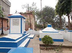
[[File:Tomb of William Carrey Junior at Katwa 07.jpg|thumb|Tomb of William Carrey Junior at Katwa]] | [[File:Tomb of William Carrey Junior at Katwa 07.jpg|thumb|Tomb of William Carrey Junior at Katwa]] | ||
'''Katwa''' is a town and | '''Katwa''' is a sub-divisional town and railway junction in [[Purba Bardhaman district]] of the Indian [[States and territories of India|state]] of [[West Bengal]]. It is the headquarters of the [[Katwa subdivision]]. The town was built at the confluence of the Ganga and Ajay rivers. Katwa is a border city of three districts; [[Purba Bardhaman]] District, [[Nadia District]] and [[Murshidabad District]]. | ||
==Geography== | ==Geography== | ||
| Line 94: | Line 97: | ||
===Location=== | ===Location=== | ||
Katwa is located at {{Coord|23.65|N|88.13|E}}. It has an average elevation of {{convert|21|m|ft|abbr=on}}. It is situated between the [[Ajay River]] and the [[Hooghly River]] and so bounded by water to the east, west and north. | Katwa is located at {{Coord|23.65|N|88.13|E}}. It has an average elevation of {{convert|21|m|ft|abbr=on}}. It is situated between the [[Ajay River]] and the [[Hooghly River]] and so is bounded by water to the east, west, and north. | ||
===Police station=== | ===Police station=== | ||
Katwa police station has jurisdiction over Katwa and [[Dainhat]] municipalities, and [[Katwa I]] and [[Katwa II]] CD Blocks. The area covered is 351.03 km<sup>2</sup>.<ref name=handbook2014>{{cite web | url = http://wbpspm.gov.in/publications/District%20Statistical%20Handbook | title = District Statistical Handbook 2014 Bardhaman | work = Tables 2.1, 2.2 | publisher = Department of Statistics and Programme Implementation, Government of West Bengal | access-date = 23 September 2018 }}</ref><ref>{{cite web | url = https://purbabardhamanpolice.org/ps | title = Purba Bardhaman District Police | work = Police Station | publisher = West Bengal Police | access-date = 23 September 2018 | archive-url = https://web.archive.org/web/20180927234333/http://purbabardhamanpolice.org/ps | archive-date = 27 September 2018 | url-status = | Katwa police station has jurisdiction over Katwa and [[Dainhat]] municipalities, and [[Katwa I]] and [[Katwa II]] CD Blocks. The area covered is 351.03 km<sup>2</sup>.<ref name=handbook2014>{{cite web | url = http://wbpspm.gov.in/publications/District%20Statistical%20Handbook | title = District Statistical Handbook 2014 Bardhaman | work = Tables 2.1, 2.2 | publisher = Department of Statistics and Programme Implementation, Government of West Bengal | access-date = 23 September 2018 | archive-date = 21 January 2019 | archive-url = https://web.archive.org/web/20190121045803/http://www.wbpspm.gov.in/publications/District%20Statistical%20Handbook | url-status = dead }}</ref><ref>{{cite web | url = https://purbabardhamanpolice.org/ps | title = Purba Bardhaman District Police | work = Police Station | publisher = West Bengal Police | access-date = 23 September 2018 | archive-url = https://web.archive.org/web/20180927234333/http://purbabardhamanpolice.org/ps | archive-date = 27 September 2018 | url-status = usurped }}</ref> | ||
===Urbanisation=== | ===Urbanisation=== | ||
88.44% of the population of Katwa subdivision live in | 88.44% of the population of the Katwa subdivision live in rural areas. Only 11.56% of the population live in the urban areas.<ref>{{cite web | url = http://wbpspm.gov.in/publications/District%20Statistical%20Handbook | title = District Statistical Handbook 2014 Bardhaman | work = Table 2.2 | publisher = Department of Statistics and Programme Implementation, Government of West Bengal | access-date = 25 January 2019 | archive-date = 21 January 2019 | archive-url = https://web.archive.org/web/20190121045803/http://www.wbpspm.gov.in/publications/District%20Statistical%20Handbook | url-status = dead }}</ref> The map alongside presents some of the notable locations in the subdivision. All places marked on the map are linked in the larger full-screen map. | ||
==History== | ==History== | ||
Katwa (Skt. Kātādvīpa) has been proposed as the "Katadupa" mentioned by [[Pliny the Elder]] (circa 24-74 CE), marking it as the city by which flows the River Amystis, taken to imply the Ajay River.<ref>{{cite book |last1=Dasgupta |first1=Biplab |title=European Trade and Colonial Conquest |year=2005 |publisher=Anthem Press |isbn=978-1-84331-029-7 |pages=338–339 |url=https://books.google.com/books?id=YRRnRK8lEYEC&pg=PA339 |language=en}}</ref> | Katwa (Skt. Kātādvīpa) has been proposed as the "Katadupa" mentioned by [[Pliny the Elder]] (circa 24-74 CE), marking it as the city by which flows the River Amystis, taken to imply the Ajay River.<ref>{{cite book |last1=Dasgupta |first1=Biplab |title=European Trade and Colonial Conquest |year=2005 |publisher=Anthem Press |isbn=978-1-84331-029-7 |pages=338–339 |url=https://books.google.com/books?id=YRRnRK8lEYEC&pg=PA339 |language=en}}</ref> | ||
The small town has a historical background of five hundred years. The earliest name of Katwa was Indranee Pargana. Later the name was changed to Kantak Nagari. In January 1510, Sri Sri [[Chaitanya Mahaprabhu]] received "[[Diksha]]" from his guru | The small town has a historical background of five hundred years. The earliest name of Katwa was Indranee Pargana. Later the name was changed to Kantak Nagari. In January 1510, Sri Sri [[Chaitanya Mahaprabhu]] received "[[Diksha]]" from his guru Kesava Bharati at the site of the current Sri Gauranga Bari Temple in Katwa.<ref>{{Cite web|url=https://vaniquotes.org/wiki/Kesava_Bharati_offered_the_sannyasa_order_to_Sri_Caitanya_Mahaprabhu_in_the_year_1432_sakabda_(A.D._1510)_in_Katwa|title=Kesava Bharati offered the sannyasa order to Sri Caitanya Mahaprabhu in the year 1432 sakabda (A.D. 1510) in Katwa - Vaniquotes|website=vaniquotes.org|language=en|access-date=2018-01-23}}</ref><ref>{{Cite web|url=http://www.iskcondesiretree.com/profiles/blogs/sri-gauranga-bari-temple-at-katwa-where-lord-caitanya-took-sannya|title=Sri Gauranga Bari Temple at Katwa – Where Lord Caitanya took sannyasa|website=www.iskcondesiretree.com|date=17 March 2016 |language=en|access-date=2018-01-23}}</ref> Since then, this small township has been a sacred place for [[Vaishnavism|Vaishnavites]]. | ||
The location of the town at the confluence of two navigable rivers, [[Ajay River|Ajay]] and [[Hooghly River|Bhagirathi]], made the town strategically important. Katwa was considered the gateway to [[Murshidabad]], the erstwhile capital of the [[Bengal Subah|subah of Bengal]].<ref name=":1">{{Cite journal|last=Roy|first=Tuhin|title=Unacknowledged Urbanisation and Dynamics of Urban Mobility: An Experience of Katwa Town, District: Burdwan, West Bengal, India|url=http://www.sncwgs.ac.in/wp-content/uploads/2015/05/Unacknowledged-Urbanisation-and-Dynamics-of-Urban-Mobility.pdf|journal=Quest: Multidisciplinary Journal of Humanities and Social Sciences|volume=3|pages=5}}</ref> Nawab [[Murshid Quli Khan]], Nawab of Bengal, first established a ''chowki'' at Katwa during his reign (1717-1727).<ref name=":1" /> Between 1742 and 1751, Katwa was invaded by the [[Bargi]]s (break-away Maratha groups) several times, as part of the [[Maratha invasions of Bengal]].<ref name=":0">{{Cite book|title=Land of Two Rivers|last=Sengupta|first=Nitish|publisher=Penguin Books|year=2011|isbn=9780143416784|pages=158–162; 170}}</ref><ref>{{Cite news|url=https://bonerjea.org/2015/09/10/bargi-the-maratha-plunder-menace-of-bengal/|title=Bargi: The Maratha Plunder Menace In Bengal|date=2015-09-10|work=Señor Bonerjea|access-date=2018-01-23|language=en-US|archive-url=https://web.archive.org/web/20160819152235/https://bonerjea.org/2015/09/10/bargi-the-maratha-plunder-menace-of-bengal/|archive-date=19 August 2016|url-status=dead}}</ref> It was the site of the [[First Battle of Katwa]] (1742) and the [[Second Battle of Katwa]] (1745), with Nawab [[Alivardi Khan]] of [[Nawabs of Bengal and Murshidabad|Bengal]] defeating the Marathas both times. In the [[Battle of Plassey]] (1757), on 19 June 1757, Katwa was the last Nawabi garrison conquered by British forces before heading to [[Palashi|Plassey]]. [[Robert Clive]] held a council of war in Katwa on 21 June 1757, where the decision was taken to cross the [[Hooghly River]] to Plassey.<ref name=":0" /><ref name=":6">{{Cite book|url=https://archive.org/details/decisivebattleso00malluoft|page=[https://archive.org/details/decisivebattleso00malluoft/page/52 52]|quote= | The location of the town at the confluence of two navigable rivers, [[Ajay River|Ajay]] and [[Hooghly River|Bhagirathi]], made the town strategically important. Katwa was considered the gateway to [[Murshidabad]], the erstwhile capital of the [[Bengal Subah|subah of Bengal]].<ref name=":1">{{Cite journal|last=Roy|first=Tuhin|title=Unacknowledged Urbanisation and Dynamics of Urban Mobility: An Experience of Katwa Town, District: Burdwan, West Bengal, India|url=http://www.sncwgs.ac.in/wp-content/uploads/2015/05/Unacknowledged-Urbanisation-and-Dynamics-of-Urban-Mobility.pdf|journal=Quest: Multidisciplinary Journal of Humanities and Social Sciences|volume=3|pages=5|archive-date=5 December 2021|access-date=23 January 2018|archive-url=https://web.archive.org/web/20211205163920/http://www.sncwgs.ac.in/wp-content/uploads/2015/05/Unacknowledged-Urbanisation-and-Dynamics-of-Urban-Mobility.pdf|url-status=dead}}</ref> Nawab [[Murshid Quli Khan]], Nawab of Bengal, first established a ''chowki'' at Katwa during his reign (1717-1727).<ref name=":1" /> Between 1742 and 1751, Katwa was invaded by the [[Bargi]]s (break-away Maratha groups) several times, as part of the [[Maratha invasions of Bengal]].<ref name=":0">{{Cite book|title=Land of Two Rivers|last=Sengupta|first=Nitish|publisher=Penguin Books|year=2011|isbn=9780143416784|pages=158–162; 170}}</ref><ref>{{Cite news|url=https://bonerjea.org/2015/09/10/bargi-the-maratha-plunder-menace-of-bengal/|title=Bargi: The Maratha Plunder Menace In Bengal|date=2015-09-10|work=Señor Bonerjea|access-date=2018-01-23|language=en-US|archive-url=https://web.archive.org/web/20160819152235/https://bonerjea.org/2015/09/10/bargi-the-maratha-plunder-menace-of-bengal/|archive-date=19 August 2016|url-status=dead}}</ref> It was the site of the [[First Battle of Katwa]] (1742) and the [[Second Battle of Katwa]] (1745), with Nawab [[Alivardi Khan]] of [[Nawabs of Bengal and Murshidabad|Bengal]] defeating the Marathas both times. In the [[Battle of Plassey]] (1757), on 19 June 1757, Katwa was the last Nawabi garrison conquered by British forces before heading to [[Palashi|Plassey]]. [[Robert Clive]] held a council of war in Katwa on 21 June 1757, where the decision was taken to cross the [[Hooghly River]] to Plassey.<ref name=":0" /><ref name=":6">{{Cite book|url=https://archive.org/details/decisivebattleso00malluoft|page=[https://archive.org/details/decisivebattleso00malluoft/page/52 52]|quote=Mir Qasim battle katwa.|title=The Decisive Battles of India, from 1746 to 1849 Inclusive|last=Malleson|first=George Bruce|date=1885|publisher=Allen|language=en}}</ref> On 19 July 1763, Katwa was once again the scene of action during the [[Third Battle of Katwa]], where British troops fought and defeated a contingent of troops loyal to [[Mir Qasim|Nawab Mir Qasim]].<ref name=":6" /> | ||
Under the aegis of the [[East India Company|British East India Company]], Katwa became an urban settlement, encouraged by the presence of missionaries such as William Carey Jr., the son of [[William Carey (missionary)|William Carey]].<ref>{{Cite web|url=http://jbrannan.pagesperso-orange.fr/robinson.htm|title=William Robinson|website=jbrannan.pagesperso-orange.fr|access-date=2018-01-23}}</ref><ref>{{Cite book|url=https://archive.org/details/MN41587ucmf_5|title=What I owe to Christ [microform]|last=Andrews|first=C. F. (Charles Freer)|date=c. 1932|publisher=New York, Cincinnati [etc.] : The Abingdon press|others=Internet Archive|quote='Religion flourishes at Katwa more than at any other station in the Mission.' (p. 277)}}</ref> By the 1800s, Katwa had become a thriving trading town with the principal economic activity being the riverine trade in salt.<ref name=":2">{{Cite journal|last=Roy|first=Tuhin|title=Unacknowledged Urbanisation and Dynamics of Urban Mobility: An Experience of Katwa Town, District: Burdwan, West Bengal, India|url=http://www.sncwgs.ac.in/wp-content/uploads/2015/05/Unacknowledged-Urbanisation-and-Dynamics-of-Urban-Mobility.pdf|journal=Quest: Multidisciplinary Journal of Humanities and Social Sciences|volume=3|pages=13–14}}</ref> The modern town of Katwa was established in 1850 | Under the aegis of the [[East India Company|British East India Company]], Katwa became an urban settlement, encouraged by the presence of missionaries such as William Carey Jr., the son of [[William Carey (missionary)|William Carey]].<ref>{{Cite web|url=http://jbrannan.pagesperso-orange.fr/robinson.htm|title=William Robinson|website=jbrannan.pagesperso-orange.fr|access-date=2018-01-23}}</ref><ref>{{Cite book|url=https://archive.org/details/MN41587ucmf_5|title=What I owe to Christ [microform]|last=Andrews|first=C. F. (Charles Freer)|date=c. 1932|publisher=New York, Cincinnati [etc.] : The Abingdon press|others=Internet Archive|quote='Religion flourishes at Katwa more than at any other station in the Mission.' (p. 277)}}</ref> By the 1800s, Katwa had become a thriving trading town with the principal economic activity being the riverine trade in salt.<ref name=":2">{{Cite journal|last=Roy|first=Tuhin|title=Unacknowledged Urbanisation and Dynamics of Urban Mobility: An Experience of Katwa Town, District: Burdwan, West Bengal, India|url=http://www.sncwgs.ac.in/wp-content/uploads/2015/05/Unacknowledged-Urbanisation-and-Dynamics-of-Urban-Mobility.pdf|journal=Quest: Multidisciplinary Journal of Humanities and Social Sciences|volume=3|pages=13–14|archive-date=5 December 2021|access-date=23 January 2018|archive-url=https://web.archive.org/web/20211205163920/http://www.sncwgs.ac.in/wp-content/uploads/2015/05/Unacknowledged-Urbanisation-and-Dynamics-of-Urban-Mobility.pdf|url-status=dead}}</ref> The modern town of Katwa was established in 1850 when it was granted the status of a subdivisional town under the 10th Act of Municipal Rules.<ref name=":2" /> The Municipality of Katwa as a governing entity was established on 1 April 1869.<ref>{{Cite journal|last=Peterson|first=J.C.K.|date=1997|title=Bengal District Gazetteers - Burdwan|url=http://bardhaman.nic.in/distgazet/ch13.pdf|publisher=Government of West Bengal|pages=218}}</ref> The urbanization of Katwa received a further boost with the construction of railroads in the early 20th century: [[Barharwa–Azimganj–Katwa loop|Katwa-Azimganj]] (constructed in 1903), Katwa-Bandel (1912), [[McLeod's Light Railways#Burdwan-Katwa Railway|Katwa-Bardhaman]] (1915), [[McLeod's Light Railways#Ahmedpur-Katwa Railway|Katwa-Ahmedpur]] (1917). | ||
==Demographics== | ==Demographics== | ||
As per the [[2011 Census of India]] Katwa had a total population of 81,615, of which 41,350 (51%) were males and 40,265 (49%) were females. | As per the [[2011 Census of India]], Katwa had a total population of 81,615, of which 41,350 (51%) were males and 40,265 (49%) were females. The population below 6 years was 6,799. The total number of literates in Katwa was 65,187 (79.87% of the population over 6 years).<ref>{{cite web| url = http://censusindia.gov.in/pca/pcadata/Houselisting-housing-WB.html |title = 2011 Census - Primary Census Abstract Data Tables | work= West Bengal – District-wise |publisher= Registrar General and Census Commissioner, India | access-date = 10 March 2017 }}</ref> | ||
In 2011, the population breakdown by religion was: Hindus (66,899), Muslims (14,488), Sikhs (50), Christians (44), | In 2011, the population breakdown by religion was: Hindus (66,899), Muslims (14,488), Sikhs (50), Christians (44), Buddhists (9), Jains (4), and Unspecified/Not Stated (121).<ref>{{Cite web|url=http://www.censusindia.gov.in/2011census/C-01.html|title=Census of India 2011. C-01 Population By Religious Community (India & States/UTs/District/Sub-Distt/Town Level)|access-date=22 January 2017}}</ref>{{Bar box|title=Religion in Katwa|titlebar=#ddd|float=right|bars={{bar percent|[[Hindu]]|Orange|81.97}} | ||
{{bar percent|[[Muslim]]|Green|17.75}} | {{bar percent|[[Muslim]]|Green|17.75}} | ||
{{bar percent|[[Christians|Christian]]|Blue|0.06}} | {{bar percent|[[Christians|Christian]]|Blue|0.06}} | ||
{{bar percent|Others|Yellow|0.22}}}}Katwa has a total area of 8.53 | {{bar percent|Others|Yellow|0.22}}}}Katwa has a total area of 8.53 km<sup>2</sup> with a population density of 9,681/km<sup>2</sup>.<ref>[http://bardhaman.nic.in/census/popdensity.html#uui Population data on urban units of Bardhaman]</ref> A steady flow of refugees from East Pakistan increased the population of the area in the fifties.<ref>Chattopadhyay, Akkori, ''Bardhaman Jelar Itihas O Lok Sanskriti'' (History and folklore of Bardhaman District.), {{in lang|bn}}, Vol I, p57, Radical Impression. {{ISBN|81-85459-36-3}}</ref> | ||
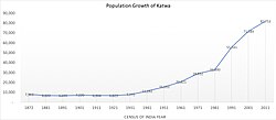
[[File:Katwa Population Growth.jpg|thumb|Population Growth of Katwa (1872-2011)]] | [[File:Katwa Population Growth.jpg|thumb|Population Growth of Katwa (1872-2011)]] | ||
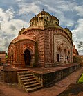
[[File:Krishnachandra Temple WLM2016.jpg|thumb|Krishnachandra Temple, Katwa]] | [[File:Krishnachandra Temple WLM2016.jpg|thumb|Krishnachandra Temple, Katwa]] | ||
==Economy== | ==Economy== | ||
The economy of Katwa is based on agriculture and agro-related trades. The fertile soil of the surrounding areas is enriched by the alluvium from the Hooghly, Ajay and Damodar rivers.<ref>{{Cite web|url=http://bardhaman.nic.in/geography.html|title=Geography : Burdwan District|website=bardhaman.nic.in|access-date=2018-02-09}}</ref> The major crops | The economy of Katwa is based on agriculture and agro-related trades. The fertile soil of the surrounding areas is enriched by the alluvium from the Hooghly, Ajay and Damodar rivers.<ref>{{Cite web|url=http://bardhaman.nic.in/geography.html|title=Geography : Burdwan District|website=bardhaman.nic.in|access-date=2018-02-09}}</ref> The major crops farmed in the countryside surrounding Katwa include rice, jute, mustard, sugarcane, tea, coffee and various tropical vegetables.<ref>{{Cite web|url=http://www.bardhamanonline.in/city-guide/business-and-economy-of-bardhaman|title=Business and Economy of Bardhaman, Industries in Bardhaman|website=www.bardhamanonline.in|access-date=2018-02-09}}</ref> Katwa is an essential center for marketing the region's agricultural products and for providing retail and consumer services to the surrounding population.<ref name=":2" /> Industries are limited to cottage industries and small-scale agro-related industries, e.g. rice mills, jute products, etc. | ||
Within the urban area, as of 2011, 0.81% of workers are employed in the primary (agricultural) sector, 5.96% of workers are employed in the secondary (manufacturing) sector, and 93.70% of workers are employed in the tertiary (services) sector.<ref name=":1" /> | Within the urban area, as of 2011, 0.81% of workers are employed in the primary (agricultural) sector, 5.96% of workers are employed in the secondary (manufacturing) sector, and 93.70% of workers are employed in the tertiary (services) sector.<ref name=":1" /> | ||
| Line 130: | Line 133: | ||
===Tourism=== | ===Tourism=== | ||
Areas of tourism interest in the town include: | Areas of tourism interest in the town include: | ||
* Sri Gauranga Bari Temple: where Sri Sri [[Chaitanya Mahaprabhu]] received "[[Diksha]]" from his guru | * Sri Gauranga Bari Temple: where Sri Sri [[Chaitanya Mahaprabhu]] received "[[Diksha]]" from his guru Kesava Bharati.<ref name=":4">{{Cite news|url=http://www.indiatravelcompanion.com/west_bengal/katwa|title=West Bengal : Katwa|work=IndiaTravelCompanion.com|access-date=2018-02-11|archive-date=11 February 2018|archive-url=https://web.archive.org/web/20180211131556/http://www.indiatravelcompanion.com/west_bengal/katwa|url-status=dead}}</ref><ref name=":5">{{Cite web|url=http://bardhaman.nic.in/tourism/tourism.htm|title=Tourism : Burdwan District|website=bardhaman.nic.in|access-date=2018-02-11}}</ref> | ||
* Madhaitala Ashram: the [[ashram]] was visited by Jagai and Madhai, two famous disciples of Sri Chaitanya Mahaprabhu, and remains a center of [[Gaudiya Vaishnavism|Gaudiya Vaishnav]] culture.<ref name=":4" /><ref name=":5" /> | * Madhaitala Ashram: the [[ashram]] was visited by Jagai and Madhai, two famous disciples of Sri Chaitanya Mahaprabhu, and remains a center of [[Gaudiya Vaishnavism|Gaudiya Vaishnav]] culture.<ref name=":4" /><ref name=":5" /> | ||
* Shah Alam's [[Dargah]]: a building of archaeological interest built in the early-18th century by [[Murshid Quli Khan|Nawab Murshid Quli Khan]], Nawab of Bengal.<ref name=":5" /> | * Shah Alam's [[Dargah]]: a building of archaeological interest built in the early-18th century by [[Murshid Quli Khan|Nawab Murshid Quli Khan]], Nawab of Bengal.<ref name=":5" /> | ||
| Line 136: | Line 139: | ||
==Human resources== | ==Human resources== | ||
===Library=== | |||
* Katwa Sub-Divisional Library<ref>{{Cite web|url=http://www.wbpublibnet.gov.in/townlib/districts/bardhamaan/katwa-sub-divisional-library.html|title=Town Library Automation » Katwa Sub-Divisional Library|website=www.wbpublibnet.gov.in|language=en-US|access-date=2018-02-09|archive-url=https://web.archive.org/web/20180209182322/http://www.wbpublibnet.gov.in/townlib/districts/bardhamaan/katwa-sub-divisional-library.html|archive-date=9 February 2018|url-status=dead}}</ref> | * Katwa Sub-Divisional Library<ref>{{Cite web|url=http://www.wbpublibnet.gov.in/townlib/districts/bardhamaan/katwa-sub-divisional-library.html|title=Town Library Automation » Katwa Sub-Divisional Library|website=www.wbpublibnet.gov.in|language=en-US|access-date=2018-02-09|archive-url=https://web.archive.org/web/20180209182322/http://www.wbpublibnet.gov.in/townlib/districts/bardhamaan/katwa-sub-divisional-library.html|archive-date=9 February 2018|url-status=dead}}</ref> | ||
===Public health=== | ===Public health=== | ||
Katwa Sub-Divisional Hospital is a 250-bed public facility providing secondary healthcare to [[Katwa subdivision|Katwa sub-divisional]] area.<ref>{{Cite web|url=https://www.wbhealth.gov.in/pages/search_hospitals|title=Welcome to WB HEALTH Portal|website=www.wbhealth.gov.in|access-date=2018-02-09}}</ref> There are a number of private nursing centers that serve the town, as well.<ref name=":2" /> | Katwa Sub-Divisional Hospital is a 250-bed public facility providing secondary healthcare to [[Katwa subdivision|Katwa sub-divisional]] area.<ref>{{Cite web|url=https://www.wbhealth.gov.in/pages/search_hospitals|title=Welcome to WB HEALTH Portal|website=www.wbhealth.gov.in|access-date=2018-02-09|archive-date=9 February 2018|archive-url=https://web.archive.org/web/20180209122242/https://www.wbhealth.gov.in/pages/search_hospitals|url-status=dead}}</ref> There are a number of private nursing centers that serve the town, as well.<ref name=":2" /> | ||
Anandaniketan Society for Mental Health Care is a not for profit | Anandaniketan Society for Mental Health Care is a not-for-profit organization situated five kilometers outside of Katwa, providing residential care to 350 children, adolescents, and adults who have physical, mental, and/or intellectual disabilities.<ref>{{Cite web|url=http://www.equalhealth.org.au/view/anandaniketan|title=Anandaniketan|website=www.equalhealth.org.au|access-date=2018-02-09|archive-url=https://web.archive.org/web/20180210062039/http://www.equalhealth.org.au/view/anandaniketan|archive-date=10 February 2018|url-status=dead}}</ref> | ||
===Public safety=== | ===Public safety=== | ||
Purba Bardhaman District Police's Katwa Police Station has jurisdiction over Katwa and [[Dainhat]] municipality areas and [[Katwa I]] and [[Katwa II]] CD Blocks. The area covered is 351.03 km<sup>2</sup>.<ref>{{cite web|url=http://www.dospiwb.org.in/site.php|title=District Statistical Handbook 2014 Burdwan|work=Table 2.1|publisher=Department of Statistics and Programme Implementation, Government of West Bengal|archive-url=https://web.archive.org/web/20170729135056/http://www.dospiwb.org.in/site.php|archive-date=29 July 2017|url-status= | Purba Bardhaman District Police's Katwa Police Station has jurisdiction over Katwa and [[Dainhat]] municipality areas and [[Katwa I]] and [[Katwa II]] CD Blocks. The area covered is 351.03 km<sup>2</sup>.<ref>{{cite web|url=http://www.dospiwb.org.in/site.php|title=District Statistical Handbook 2014 Burdwan|work=Table 2.1|publisher=Department of Statistics and Programme Implementation, Government of West Bengal|archive-url=https://web.archive.org/web/20170729135056/http://www.dospiwb.org.in/site.php|archive-date=29 July 2017|url-status=usurped|access-date=26 February 2017}}</ref><ref>{{cite web|url=http://burdwanpolice.org/ps|title=Burdwan District Police|work=Police Station|publisher=West Bengal Police|access-date=26 February 2017|archive-url=https://web.archive.org/web/20170221010007/http://burdwanpolice.org/ps|archive-date=21 February 2017|url-status=dead}}</ref> | ||
==Culture== | ==Culture== | ||
| Line 192: | Line 166: | ||
=== Kartik Larai === | === Kartik Larai === | ||
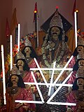
[[File:সাত ভাই কার্তিক ঠাকুরের থাকা.jpg|thumb|Kartik Puja at Katwa]] | [[File:সাত ভাই কার্তিক ঠাকুরের থাকা.jpg|thumb|Kartik Puja at Katwa]] | ||
Katwa and its surrounding areas are especially well known for their | Katwa and its surrounding areas are especially well known for their peaceful Kartik Puja, colloquially known as ''Kartik Larai'' (''Larai'' means "battle" in Bengali).<ref name=":3">{{Cite news|url=http://www.sangbadpratidin.in/katwa-celebrates-kartik-puja-devotees-throng-pandals/|title=কেন আজও ন্যাংটো কার্তিকের পুজো হয় কাটোয়ায়?|work=Sangbad Pratidin|access-date=2018-02-08|language=bn|archive-url=https://web.archive.org/web/20180220203424/http://www.sangbadpratidin.in/katwa-celebrates-kartik-puja-devotees-throng-pandals/|archive-date=20 February 2018|url-status=dead}}</ref><ref>{{Cite web|url=http://bengali.news18.com/news/kartik-puja-celebration-at-katwa-157717.html|title=আলোয় সেজেছে রাস্তা, কার্তিক পুজোকে ঘিরে জমজমাট কাটোয়া– News18 Bengali|website=bengali.news18.com|date=17 November 2017 |access-date=2018-02-08}}</ref> The object of worship is the boy-faced deity, [[Kartikeya|Kartik]] in reference to the youth of the deity. In the greater Katwa area, over 250 separate organizations organize pujas and joyfully compete with each other over the sophistication of the theme or the sculpture of the deity.<ref name=":3" /><ref>{{Cite news|url=http://www.anandabazar.com/district/bardhaman/new-theme-at-kartik-puja-and-chou-nach-1.514629|title=কার্তিকের থিমে কুরুক্ষেত্র, ছৌ|work=Anandabazar Patrika|access-date=2018-02-08|language=bn}}</ref> After the day of the puja, the deities are paraded in carnival throughout town on their way to be ritually submerged in the nearby Hooghly River. The processions usually feature religious music and dancing, leading to a town-wide, festival-like ambiance (jovially named ''ladai'' or battle) enjoyed by all participants and spectators.<ref name=":3" /> | ||
==Transportation== | ==Transportation== | ||
===Railway=== | ===Railway=== | ||
[[File:Katwa railway station IMG 20200212 224729.jpg|thumb|Katwa railway station]] | [[File:Katwa railway station IMG 20200212 224729.jpg|thumb|Katwa railway station]] | ||
[[Katwa railway station|Katwa Junction]] is a railway junction on {{Track gauge|5ft6in|lk=on}} [[broad gauge]] railway line from [[Howrah railway station]] to [[New Jalpaiguri railway station]] via [[Azimganj Junction railway station]]. | [[Katwa railway station|Katwa Junction]] is a railway junction on {{Track gauge|5ft6in|lk=on}} [[broad gauge]] railway line from [[Howrah railway station]] to [[New Jalpaiguri railway station]] via [[Azimganj Junction railway station]]. Although Katwa is a railway junction, the number of trains running through this station is less. | ||
The [[McLeod's Light Railways#Burdwan-Katwa Railway|Bardhaman-Katwa line]], after conversion from narrow gauge to electrified broad gauge, was opened to the public on 12 January 2018.<ref>{{cite web| url = http://www.anandabazar.com/district/bardhaman/katwa-burdwan-broad-gauge-trains-started-at-last-1.739229 |title = Baro rail Katwae, jamlo bhidr (Big railway in Katwa, crowd gathers) | work= Bengali |publisher= Ananda Bazar Patrika, 13 January 2018 | access-date = 13 January 2018}}</ref> | The [[McLeod's Light Railways#Burdwan-Katwa Railway|Bardhaman-Katwa line]], after conversion from narrow gauge to electrified broad gauge, was opened to the public on 12 January 2018.<ref>{{cite web| url = http://www.anandabazar.com/district/bardhaman/katwa-burdwan-broad-gauge-trains-started-at-last-1.739229 |title = Baro rail Katwae, jamlo bhidr (Big railway in Katwa, crowd gathers) | work= Bengali |publisher= Ananda Bazar Patrika, 13 January 2018 | access-date = 13 January 2018}}</ref> | ||
| Line 212: | Line 179: | ||
===Waterway=== | ===Waterway=== | ||
Katwa is the site of a floating terminal on [[National Waterway 1]] consisting of a pontoon placed on | Katwa is the site of a floating terminal on [[National Waterway 1]] consisting of a pontoon placed on the waterfront with a berth of 30 m (98 ft). | ||
==Government and politics== | ==Government and politics== | ||
The town of Katwa is divided into twenty | The town of Katwa is divided into twenty administrative wards.<ref>{{Cite web|url=http://aitcofficial.org/aitc/number-of-wards-to-be-increased-in-26-municipalities-in-bengal/|title=Number of wards to be increased in 26 municipalities in Bengal: All India Trinamool Congress|website=aitcofficial.org|language=en-US|access-date=2018-02-09}}</ref> Each ward elects a councilor to the governing body, Katwa Municipality.<ref>{{Cite web|url=https://www.wbdma.gov.in/HTM/DIS/MUNI_ULB_Katwa.htm|title=Official Web Site of Department of Municipal Affairs, Govt of West Bengal|website=www.wbdma.gov.in|access-date=2018-02-09|archive-url=https://web.archive.org/web/20180219075211/http://wbdma.gov.in/HTM/DIS/MUNI_ULB_Katwa.htm|archive-date=19 February 2018|url-status=dead}}</ref> Municipal elections are held every five years, with the most recent election held in 2022.<ref>{{Cite book|title=The Kolkata Gazette: West Bengal State Election Commission Notification|publisher=Government of West Bengal|year=2015|location=Kolkata|pages=343}}</ref> | ||
==See also== | ==See also== | ||
* [[Katwa (Lok Sabha constituency)]] | * [[Katwa (Lok Sabha constituency)]] | ||
==References== | ==References== | ||
Latest revision as of 11:59, 20 April 2026
Katwa | |
|---|---|
Town | |
Location in West Bengal, India   Katwa Katwa (India) | |
| Coordinates: 23°39′N 88°08′E / 23.65°N 88.13°E | |
| Country |  India India |
| State | West Bengal |
| District | Purba Bardhaman |
| Government | |
| • Type | Municipality |
| • Body | Katwa Municipality |
| • Chairman | Samir Kumar Saha |
| • Vice Chairman | Lakhindar Mandal |
| • MP | Sunil Mondal |
| • MLA | Rabindranath Chatterjee |
| Area | |
| • Total | 7.93 km2 (3.06 sq mi) |
| Elevation | 21 m (69 ft) |
| Population (2011)[1] | |
| • Total | 81,615 |
| • Density | 10,000/km2 (27,000/sq mi) |
| Languages | |
| • Official | Bengali, English |
| Time zone | UTC+5:30 (IST) |
| PIN | 713130 |
| Telephone code | +91 3453 |
| Vehicle registration | WB 75 |
| Lok Sabha constituency | Bardhaman Purba |
| Vidhan Sabha constituency | Katwa |
| Website | purbabardhaman |

Katwa is a sub-divisional town and railway junction in Purba Bardhaman district of the Indian state of West Bengal. It is the headquarters of the Katwa subdivision. The town was built at the confluence of the Ganga and Ajay rivers. Katwa is a border city of three districts; Purba Bardhaman District, Nadia District and Murshidabad District.
Geography[edit | edit source]
Lua error in Module:OSM_Location_map at line 1984: attempt to index field 'wikibase' (a nil value).
Location[edit | edit source]
Katwa is located at 23°39′N 88°08′E / 23.65°N 88.13°E. It has an average elevation of 21 m (69 ft). It is situated between the Ajay River and the Hooghly River and so is bounded by water to the east, west, and north.
Police station[edit | edit source]
Katwa police station has jurisdiction over Katwa and Dainhat municipalities, and Katwa I and Katwa II CD Blocks. The area covered is 351.03 km2.[2][3]
Urbanisation[edit | edit source]
88.44% of the population of the Katwa subdivision live in rural areas. Only 11.56% of the population live in the urban areas.[4] The map alongside presents some of the notable locations in the subdivision. All places marked on the map are linked in the larger full-screen map.
History[edit | edit source]
Katwa (Skt. Kātādvīpa) has been proposed as the "Katadupa" mentioned by Pliny the Elder (circa 24-74 CE), marking it as the city by which flows the River Amystis, taken to imply the Ajay River.[5]
The small town has a historical background of five hundred years. The earliest name of Katwa was Indranee Pargana. Later the name was changed to Kantak Nagari. In January 1510, Sri Sri Chaitanya Mahaprabhu received "Diksha" from his guru Kesava Bharati at the site of the current Sri Gauranga Bari Temple in Katwa.[6][7] Since then, this small township has been a sacred place for Vaishnavites.
The location of the town at the confluence of two navigable rivers, Ajay and Bhagirathi, made the town strategically important. Katwa was considered the gateway to Murshidabad, the erstwhile capital of the subah of Bengal.[8] Nawab Murshid Quli Khan, Nawab of Bengal, first established a chowki at Katwa during his reign (1717-1727).[8] Between 1742 and 1751, Katwa was invaded by the Bargis (break-away Maratha groups) several times, as part of the Maratha invasions of Bengal.[9][10] It was the site of the First Battle of Katwa (1742) and the Second Battle of Katwa (1745), with Nawab Alivardi Khan of Bengal defeating the Marathas both times. In the Battle of Plassey (1757), on 19 June 1757, Katwa was the last Nawabi garrison conquered by British forces before heading to Plassey. Robert Clive held a council of war in Katwa on 21 June 1757, where the decision was taken to cross the Hooghly River to Plassey.[9][11] On 19 July 1763, Katwa was once again the scene of action during the Third Battle of Katwa, where British troops fought and defeated a contingent of troops loyal to Nawab Mir Qasim.[11]
Under the aegis of the British East India Company, Katwa became an urban settlement, encouraged by the presence of missionaries such as William Carey Jr., the son of William Carey.[12][13] By the 1800s, Katwa had become a thriving trading town with the principal economic activity being the riverine trade in salt.[14] The modern town of Katwa was established in 1850 when it was granted the status of a subdivisional town under the 10th Act of Municipal Rules.[14] The Municipality of Katwa as a governing entity was established on 1 April 1869.[15] The urbanization of Katwa received a further boost with the construction of railroads in the early 20th century: Katwa-Azimganj (constructed in 1903), Katwa-Bandel (1912), Katwa-Bardhaman (1915), Katwa-Ahmedpur (1917).
Demographics[edit | edit source]
As per the 2011 Census of India, Katwa had a total population of 81,615, of which 41,350 (51%) were males and 40,265 (49%) were females. The population below 6 years was 6,799. The total number of literates in Katwa was 65,187 (79.87% of the population over 6 years).[16]
In 2011, the population breakdown by religion was: Hindus (66,899), Muslims (14,488), Sikhs (50), Christians (44), Buddhists (9), Jains (4), and Unspecified/Not Stated (121).[17]
Katwa has a total area of 8.53 km2 with a population density of 9,681/km2.[18] A steady flow of refugees from East Pakistan increased the population of the area in the fifties.[19]


Economy[edit | edit source]
The economy of Katwa is based on agriculture and agro-related trades. The fertile soil of the surrounding areas is enriched by the alluvium from the Hooghly, Ajay and Damodar rivers.[20] The major crops farmed in the countryside surrounding Katwa include rice, jute, mustard, sugarcane, tea, coffee and various tropical vegetables.[21] Katwa is an essential center for marketing the region's agricultural products and for providing retail and consumer services to the surrounding population.[14] Industries are limited to cottage industries and small-scale agro-related industries, e.g. rice mills, jute products, etc.
Within the urban area, as of 2011, 0.81% of workers are employed in the primary (agricultural) sector, 5.96% of workers are employed in the secondary (manufacturing) sector, and 93.70% of workers are employed in the tertiary (services) sector.[8]
The Katwa Super Thermal Power Station is a super critical (660MW x2) 1320 MW coal-fired power plant currently in planning stage by NTPC at Srikhanda Village, 8 km from Katwa.[22]
Tourism[edit | edit source]
Areas of tourism interest in the town include:
- Sri Gauranga Bari Temple: where Sri Sri Chaitanya Mahaprabhu received "Diksha" from his guru Kesava Bharati.[23][24]
- Madhaitala Ashram: the ashram was visited by Jagai and Madhai, two famous disciples of Sri Chaitanya Mahaprabhu, and remains a center of Gaudiya Vaishnav culture.[23][24]
- Shah Alam's Dargah: a building of archaeological interest built in the early-18th century by Nawab Murshid Quli Khan, Nawab of Bengal.[24]
Human resources[edit | edit source]
Library[edit | edit source]
- Katwa Sub-Divisional Library[25]
Public health[edit | edit source]
Katwa Sub-Divisional Hospital is a 250-bed public facility providing secondary healthcare to Katwa sub-divisional area.[26] There are a number of private nursing centers that serve the town, as well.[14]
Anandaniketan Society for Mental Health Care is a not-for-profit organization situated five kilometers outside of Katwa, providing residential care to 350 children, adolescents, and adults who have physical, mental, and/or intellectual disabilities.[27]
Public safety[edit | edit source]
Purba Bardhaman District Police's Katwa Police Station has jurisdiction over Katwa and Dainhat municipality areas and Katwa I and Katwa II CD Blocks. The area covered is 351.03 km2.[28][29]
Culture[edit | edit source]
The dominant culture of Katwa is identical to that of most of West Bengal and is deeply influenced by Hindu Bengali culture. Some of the popular festivals in Katwa include:
- Poyla Boishakh or Bengali New Year (14/15 April)
- Rath Yatra (July)
- Mahalaya (September/October)
- Durga Puja (September/October)
- Lakshmi Puja (October)
- Kali Puja (October/November) and Deepawali
- Kartik Larai (November)
- Saraswati Puja (February/March)
- Dol Purnima or Dol Yatra (February/March)
- Gaura-purnima, the birthday of Chaitanya Mahaprabhu (February/March)
- Muharram
Kartik Larai[edit | edit source]

Katwa and its surrounding areas are especially well known for their peaceful Kartik Puja, colloquially known as Kartik Larai (Larai means "battle" in Bengali).[30][31] The object of worship is the boy-faced deity, Kartik in reference to the youth of the deity. In the greater Katwa area, over 250 separate organizations organize pujas and joyfully compete with each other over the sophistication of the theme or the sculpture of the deity.[30][32] After the day of the puja, the deities are paraded in carnival throughout town on their way to be ritually submerged in the nearby Hooghly River. The processions usually feature religious music and dancing, leading to a town-wide, festival-like ambiance (jovially named ladai or battle) enjoyed by all participants and spectators.[30]
Transportation[edit | edit source]
Railway[edit | edit source]

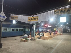
Katwa Junction is a railway junction on 5 ft 6 in (1,676 mm) broad gauge railway line from Howrah railway station to New Jalpaiguri railway station via Azimganj Junction railway station. Although Katwa is a railway junction, the number of trains running through this station is less.
The Bardhaman-Katwa line, after conversion from narrow gauge to electrified broad gauge, was opened to the public on 12 January 2018.[33]
The Ahmedpur-Katwa Railway line has been converted from narrow gauge to broad gauge which provides access to Rampurhat Junction railway station.[34]
Waterway[edit | edit source]
Katwa is the site of a floating terminal on National Waterway 1 consisting of a pontoon placed on the waterfront with a berth of 30 m (98 ft).
Government and politics[edit | edit source]
The town of Katwa is divided into twenty administrative wards.[35] Each ward elects a councilor to the governing body, Katwa Municipality.[36] Municipal elections are held every five years, with the most recent election held in 2022.[37]
See also[edit | edit source]
References[edit | edit source]
- ↑ 1.0 1.1 "Katwa City".
- ↑ "District Statistical Handbook 2014 Bardhaman". Tables 2.1, 2.2. Department of Statistics and Programme Implementation, Government of West Bengal. Archived from the original on 21 January 2019. Retrieved 23 September 2018.
- ↑ "Purba Bardhaman District Police". Police Station. West Bengal Police. Archived from the original on 27 September 2018. Retrieved 23 September 2018.
- ↑ "District Statistical Handbook 2014 Bardhaman". Table 2.2. Department of Statistics and Programme Implementation, Government of West Bengal. Archived from the original on 21 January 2019. Retrieved 25 January 2019.
- ↑ Dasgupta, Biplab (2005). European Trade and Colonial Conquest. Anthem Press. pp. 338–339. ISBN 978-1-84331-029-7.
- ↑ "Kesava Bharati offered the sannyasa order to Sri Caitanya Mahaprabhu in the year 1432 sakabda (A.D. 1510) in Katwa - Vaniquotes". vaniquotes.org. Retrieved 23 January 2018.
- ↑ "Sri Gauranga Bari Temple at Katwa – Where Lord Caitanya took sannyasa". www.iskcondesiretree.com. 17 March 2016. Retrieved 23 January 2018.
- ↑ 8.0 8.1 8.2 Roy, Tuhin. "Unacknowledged Urbanisation and Dynamics of Urban Mobility: An Experience of Katwa Town, District: Burdwan, West Bengal, India" (PDF). Quest: Multidisciplinary Journal of Humanities and Social Sciences. 3: 5. Archived from the original (PDF) on 5 December 2021. Retrieved 23 January 2018.
- ↑ 9.0 9.1 Sengupta, Nitish (2011). Land of Two Rivers. Penguin Books. pp. 158–162, 170. ISBN 9780143416784.
- ↑ "Bargi: The Maratha Plunder Menace In Bengal". Señor Bonerjea. 10 September 2015. Archived from the original on 19 August 2016. Retrieved 23 January 2018.
- ↑ 11.0 11.1 Malleson, George Bruce (1885). The Decisive Battles of India, from 1746 to 1849 Inclusive. Allen. p. 52.
Mir Qasim battle katwa.
- ↑ "William Robinson". jbrannan.pagesperso-orange.fr. Retrieved 23 January 2018.
- ↑ Andrews, C. F. (Charles Freer) (c. 1932). What I owe to Christ [microform]. Internet Archive. New York, Cincinnati [etc.] : The Abingdon press.
'Religion flourishes at Katwa more than at any other station in the Mission.' (p. 277)
- ↑ 14.0 14.1 14.2 14.3 Roy, Tuhin. "Unacknowledged Urbanisation and Dynamics of Urban Mobility: An Experience of Katwa Town, District: Burdwan, West Bengal, India" (PDF). Quest: Multidisciplinary Journal of Humanities and Social Sciences. 3: 13–14. Archived from the original (PDF) on 5 December 2021. Retrieved 23 January 2018.
- ↑ Peterson, J.C.K. (1997). "Bengal District Gazetteers - Burdwan" (PDF). Government of West Bengal: 218.
{{cite journal}}: Cite journal requires|journal=(help) - ↑ "2011 Census - Primary Census Abstract Data Tables". West Bengal – District-wise. Registrar General and Census Commissioner, India. Retrieved 10 March 2017.
- ↑ "Census of India 2011. C-01 Population By Religious Community (India & States/UTs/District/Sub-Distt/Town Level)". Retrieved 22 January 2017.
- ↑ Population data on urban units of Bardhaman
- ↑ Chattopadhyay, Akkori, Bardhaman Jelar Itihas O Lok Sanskriti (History and folklore of Bardhaman District.), (in Bengali), Vol I, p57, Radical Impression. ISBN 81-85459-36-3
- ↑ "Geography : Burdwan District". bardhaman.nic.in. Retrieved 9 February 2018.
- ↑ "Business and Economy of Bardhaman, Industries in Bardhaman". www.bardhamanonline.in. Retrieved 9 February 2018.
- ↑ Majumdar, Arkamoy Dutta (12 April 2017). "NTPC puts Katwa power project on hold". livemint.com/. Retrieved 23 January 2018.
- ↑ 23.0 23.1 "West Bengal : Katwa". IndiaTravelCompanion.com. Archived from the original on 11 February 2018. Retrieved 11 February 2018.
- ↑ 24.0 24.1 24.2 "Tourism : Burdwan District". bardhaman.nic.in. Retrieved 11 February 2018.
- ↑ "Town Library Automation » Katwa Sub-Divisional Library". www.wbpublibnet.gov.in. Archived from the original on 9 February 2018. Retrieved 9 February 2018.
- ↑ "Welcome to WB HEALTH Portal". www.wbhealth.gov.in. Archived from the original on 9 February 2018. Retrieved 9 February 2018.
- ↑ "Anandaniketan". www.equalhealth.org.au. Archived from the original on 10 February 2018. Retrieved 9 February 2018.
- ↑ "District Statistical Handbook 2014 Burdwan". Table 2.1. Department of Statistics and Programme Implementation, Government of West Bengal. Archived from the original on 29 July 2017. Retrieved 26 February 2017.
- ↑ "Burdwan District Police". Police Station. West Bengal Police. Archived from the original on 21 February 2017. Retrieved 26 February 2017.
- ↑ 30.0 30.1 30.2 "কেন আজও ন্যাংটো কার্তিকের পুজো হয় কাটোয়ায়?". Sangbad Pratidin (in Bengali). Archived from the original on 20 February 2018. Retrieved 8 February 2018.
- ↑ "আলোয় সেজেছে রাস্তা, কার্তিক পুজোকে ঘিরে জমজমাট কাটোয়া– News18 Bengali". bengali.news18.com. 17 November 2017. Retrieved 8 February 2018.
- ↑ "কার্তিকের থিমে কুরুক্ষেত্র, ছৌ". Anandabazar Patrika (in Bengali). Retrieved 8 February 2018.
- ↑ "Baro rail Katwae, jamlo bhidr (Big railway in Katwa, crowd gathers)". Bengali. Ananda Bazar Patrika, 13 January 2018. Retrieved 13 January 2018.
- ↑ Eastern Railway. "Introduction of Barddhaman-Balgona EMU Special Train with effect from 11.2.2014". The Times of India. Archived from the original on 18 June 2015. Retrieved 27 April 2018.
- ↑ "Number of wards to be increased in 26 municipalities in Bengal: All India Trinamool Congress". aitcofficial.org. Retrieved 9 February 2018.
- ↑ "Official Web Site of Department of Municipal Affairs, Govt of West Bengal". www.wbdma.gov.in. Archived from the original on 19 February 2018. Retrieved 9 February 2018.
- ↑ The Kolkata Gazette: West Bengal State Election Commission Notification. Kolkata: Government of West Bengal. 2015. p. 343.


