

>InternetArchiveBot Rescuing 1 sources and tagging 0 as dead.) #IABot (v2.0.8 |
m expanded content |
||
| Line 1: | Line 1: | ||
{{refimprove|date=July 2023}} | |||
{{Use dmy dates|date=June 2018}} | {{Use dmy dates|date=June 2018}} | ||
{{Use Indian English|date=June 2018}} | {{Use Indian English|date=June 2018}} | ||
{{Infobox settlement | {{Infobox settlement | ||
| name | | name = Chakdaha | ||
| native_name | | native_name = | ||
| native_name_lang | | native_name_lang = | ||
| other_name | | other_name = | ||
| nickname | | nickname = | ||
| settlement_type | | settlement_type = City | ||
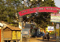
| image_skyline | | image_skyline = Chakdaha Railway Station Road - Chakdaha Chowrasta - NH-34 - Nadia 2014-11-28 9921.JPG | ||
| image_alt | | image_alt = | ||
| image_caption | | image_caption = Chakdaha Chowrasta | ||
| pushpin_map | | pushpin_map = India West Bengal#India | ||
| pushpin_label_position | | pushpin_label_position = right | ||
| pushpin_map_alt | | pushpin_map_alt = | ||
| pushpin_map_caption | | pushpin_map_caption = Location in West Bengal, India | ||
| coordinates | | coordinates = {{coord|23.08|N|88.52|E|display=inline,title}} | ||
| subdivision_type | | subdivision_type = Country | ||
| subdivision_name | | subdivision_name = {{flag|India}} | ||
| subdivision_type1 | | subdivision_type1 = [[States and territories of India|State]] | ||
| subdivision_name1 | | subdivision_name1 = [[West Bengal]] | ||
| subdivision_type2 | | subdivision_type2 = [[List of districts of India|District]] | ||
| subdivision_name2 | | subdivision_name2 = [[Nadia district|Nadia]] | ||
| established_title | | established_title = <!-- Established --> | ||
| established_date | | established_date = | ||
| founder | | founder = | ||
| named_for | | named_for = | ||
| government_type | | government_type = [[Municipal Corporations in India|Municipality]] | ||
| governing_body | | governing_body = Chakdaha Municipality | ||
| leader_title | | leader_title = MLA | ||
| leader_name | | leader_name = Bankim Chandra Ghosh | ||
| unit_pref | | unit_pref = Metric | ||
| area_footnotes | | area_footnotes = <ref name='Chakdaha Municipality'>{{cite web|title=Chakdah Municipality|url=http://chakdahamunicipality.in/panel/profile|access-date=25 November 2020|archive-date=7 October 2022|archive-url=https://web.archive.org/web/20221007165842/http://chakdahamunicipality.in/panel/profile|url-status=dead}}</ref> | ||
| area_rank | | area_rank = | ||
| area_total_km2 | | area_total_km2 = 15.36 | ||
| elevation_footnotes | | elevation_footnotes = | ||
| elevation_m | | elevation_m = 11 | ||
| population_total | | population_total = 95203 | ||
| population_as_of | | population_as_of = 2011 | ||
| population_rank | | population_rank = | ||
| population_density_km2 | | population_density_km2 = auto | ||
| population_demonym | | population_demonym = | ||
| population_footnotes | | population_footnotes = <ref name='Chakdaha Municipality'/> | ||
| population_metro | | population_metro = 132855 | ||
| demographics_type1 | | demographics_type1 = Languages | ||
| demographics1_title1 | | demographics1_title1 = Official | ||
| demographics1_info1 | | demographics1_info1 = [[Bengali language|Bengali]], [[English language|English]] | ||
| timezone1 | | timezone1 = [[Indian Standard Time|IST]] | ||
| utc_offset1 | | utc_offset1 = +5:30 | ||
| postal_code_type | | postal_code_type = [[Postal Index Number|PIN]] | ||
| postal_code | | postal_code = 741222 | ||
| registration_plate | | registration_plate = | ||
| blank1_name_sec1 | | blank1_name_sec1 = [[Lok Sabha]] constituency | ||
| blank1_info_sec1 | | blank1_info_sec1 = [[Ranaghat (Lok Sabha constituency)|Ranaghat]] | ||
| blank2_name_sec1 | | blank2_name_sec1 = [[Vidhan Sabha]] constituency | ||
| blank2_info_sec1 | | blank2_info_sec1 = [[Chakdaha (Vidhan Sabha constituency)|Chakdaha]] | ||
| | | footnotes = | ||
}} | }} | ||
| Line 103: | Line 104: | ||
In the 2011 census, Chakdaha [[Urban Agglomeration]] had a population of 132,855, out of which 67,135 were male, and 65,720 were female. The population of children aged 0–5 was 9,829. The effective literacy rate for those aged 7 and above was 90.95 per cent with male literacy being 93.96% and female literacy being 87.88%.<ref>{{cite web| url = http://www.censusindia.gov.in/2011-prov-results/paper2/data_files/India2/Table_3_PR_UA_Citiees_1Lakh_and_Above.pdf | title = Urban Agglomerations/Cities having population 1 lakh and above |work= Provisional Population Totals, Census of India 2011 |access-date = 2011-10-21 }}</ref> | In the 2011 census, Chakdaha [[Urban Agglomeration]] had a population of 132,855, out of which 67,135 were male, and 65,720 were female. The population of children aged 0–5 was 9,829. The effective literacy rate for those aged 7 and above was 90.95 per cent with male literacy being 93.96% and female literacy being 87.88%.<ref>{{cite web| url = http://www.censusindia.gov.in/2011-prov-results/paper2/data_files/India2/Table_3_PR_UA_Citiees_1Lakh_and_Above.pdf | title = Urban Agglomerations/Cities having population 1 lakh and above |work= Provisional Population Totals, Census of India 2011 |access-date = 2011-10-21 }}</ref> | ||
{{see also|List of cities in West Bengal}} | {{see also|List of cities in West Bengal}} | ||
{{bar box|width = 300px | |||
|barwidth = 250px |cellpadding="0" | |||
|title=Religion in Chakadaha Municipality | |||
|titlebar=#Fcd116 | |||
|left1=Religion | |||
|right1=Percent | |||
|float=right | |||
|bars= | |||
{{bar percent|[[Hinduism in West Bengal|Hinduism]]|DarkOrange|98.76}} | |||
{{bar percent|[[Islam in West Bengal|Islam]]|green|0.87}} | |||
{{bar percent|[[Christianity in West Bengal|Christianity]]|dodgerblue|0.05}} | |||
{{bar percent|Other or not stated|black|0.32}} | |||
}} | |||
The following municipality and census towns were part of Chakdaha Urban Agglomeration in 2011 census: Chakdaha (M), [[Parbbatipur]] (CT), [[Gopalpur, Nadia|Gopalpur]] (CT), [[Belgharia, Nadia|Belgharia]] (CT), [[Punglia]] (CT) and [[Lalpur, Nadia|Lalpur (P)]] (CT).<ref>{{cite web| url = http://censusindia.gov.in/2011-prov-results/paper2/data_files/India2/Table_4_PR_UAs_1Lakh_and_Above_Appendix.pdf | title= Provisional Population Totals, Census of India 2011 | work= Constituents of Urban Agglomeration Having Population Above 1 Lakh |publisher= Census of India 2011 | access-date = 18 October 2020}}</ref> | The following municipality and census towns were part of Chakdaha Urban Agglomeration in 2011 census: Chakdaha (M), [[Parbbatipur]] (CT), [[Gopalpur, Nadia|Gopalpur]] (CT), [[Belgharia, Nadia|Belgharia]] (CT), [[Punglia]] (CT) and [[Lalpur, Nadia|Lalpur (P)]] (CT).<ref>{{cite web| url = http://censusindia.gov.in/2011-prov-results/paper2/data_files/India2/Table_4_PR_UAs_1Lakh_and_Above_Appendix.pdf | title= Provisional Population Totals, Census of India 2011 | work= Constituents of Urban Agglomeration Having Population Above 1 Lakh |publisher= Census of India 2011 | access-date = 18 October 2020}}</ref> | ||
== | ==Education== | ||
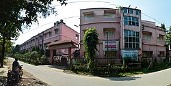
[[File:Chakdaha College - Nadia 2013-10-20 3775-3783.JPG|thumb|[[Chakdaha College]]]] | |||
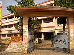
[[File:RAMLAL ACADEMY CHAKDAHA - panoramio.jpg|thumb|Ramlal Academy]] | |||
* [[Chakdaha College]], established in 1979, is affiliated to the [[University of Kalyani]].<ref>{{cite web | url = http://www.chakdahacollege.ac.in/ | title = Chakdaha College | publisher = CC |access-date = 26 May 2017}}</ref><ref>{{cite web | url = http://www.collegeadmission.in/ChakdahaCollege/Chakdaha_College.shtml | title = Chakdaha College | publisher = College Admission |access-date = 26 May 2017}}</ref> | |||
* [https://www.rlacademy.in/ Chakdaha Ramlal Academy], established in 1907, is controlled by Department of Education. It offers classes from 5 to 12 (HS). Presumably the Middle English School in the 19th century appeared as ‘Benimadhab Institution’, a High English School in 1907 to the west of Chakdaha Railway Station, in the land of Sinha family of Kanthalpuli. In the year 1910 the school got a vital change and named Chakdaha Ramlal Academy to commemorate the name of ‘Ramlal Singha’ who donated nearly ten thousand rupees.<ref>{{Cite web |title=Chakdaha Ramlal Academy(H.S.) |url=https://www.rlacademy.in/about.php |access-date=2025-07-21 |website=www.rlacademy.in}}</ref> | |||
[[Chakdaha College]], established in 1979, is affiliated to the [[University of Kalyani]]. | |||
<ref>{{cite web | url = http://www.chakdahacollege.ac.in/ | title = Chakdaha College | publisher = CC |access-date = 26 May 2017}}</ref><ref>{{cite web | url = http://www.collegeadmission.in/ChakdahaCollege/Chakdaha_College.shtml | title = Chakdaha College | publisher = College Admission |access-date = 26 May 2017}}</ref> | |||
==Healthcare== | ==Healthcare== | ||
Chakdah State General Hospital is | [[File:CHAKDAHA HOSPITAL - panoramio (1).jpg|thumb|Chakdaha State General hospital]] | ||
Chakdah State General Hospital is a 500 beds general hospital.<ref name=medical>{{cite web | url = https://www.wbhealth.gov.in/ | title = Health & Family Welfare Department | work = Health Statistics | publisher = Government of West Bengal | access-date = 30 May 2017 | archive-date = 28 October 2021 | archive-url = https://web.archive.org/web/20211028134305/https://qphs.fs.quoracdn.net/main-qimg-99a499ee367f0c1530476c81086270c8 | url-status = dead }}</ref> | |||
== Culture == | == Culture == | ||
=== Entertainment and sports === | === Entertainment and sports === | ||
Cultural programs are mostly held in the '''Sampriti Manch''' and '''Chakdaha Pouro Mukto Mancha.''' Each winter, one large cultural program (better known as melas) takes place in Chakdaha. Since 2014 'Chakdaha Book Fair' has been established. Flower Exhibition is one of the popular events in this town. | Cultural programs are mostly held in the '''Sampriti Manch''' and '''Chakdaha Pouro Mukto Mancha.''' Each winter, one large cultural program (better known as melas) takes place in Chakdaha. Since 2014 'Chakdaha Book Fair' has been established. Flower Exhibition is one of the popular events in this town.{{cn|date=November 2025}} | ||
{{ | |||
==Notable people== | |||
* [[Jhulan Goswami]], former Indian woman cricketer<ref>{{Cite web|url=https://www.cricbuzz.com/profiles/9073/jhulan-goswami|title=Jhulan Goswami Profile - ICC Ranking, Age, Career Info & Stats|website=Cricbuzz}}</ref><ref>{{Cite web|url=https://www.cricbuzz.com/cricket-news/94510/jhulan-goswami-becomes-leading-wicket-taker-in-odis|title=Jhulan Goswami becomes leading wicket-taker in ODIs|website=Cricbuzz}}</ref> | |||
==See also== | ==See also== | ||
[[Chakdaha (Community development block)]] | *[[Chakdaha (Community development block)]] | ||
==References== | ==References== | ||
Latest revision as of 01:29, 10 November 2025
 | This article needs more citations. (July 2023) |
Chakdaha | |
|---|---|
City | |
 Chakdaha Chowrasta | |
Location in West Bengal, India   Chakdaha Chakdaha (India) | |
| Coordinates: 23°05′N 88°31′E / 23.08°N 88.52°E | |
| Country |  India India |
| State | West Bengal |
| District | Nadia |
| Government | |
| • Type | Municipality |
| • Body | Chakdaha Municipality |
| • MLA | Bankim Chandra Ghosh |
| Area | |
| • City | 15.36 km2 (5.93 sq mi) |
| Elevation | 11 m (36 ft) |
| Population (2011)[1] | |
| • City | 95,203 |
| • Density | 6,200/km2 (16,000/sq mi) |
| • Metro | 132,855 |
| Languages | |
| • Official | Bengali, English |
| Time zone | UTC+5:30 (IST) |
| PIN | 741222 |
| Lok Sabha constituency | Ranaghat |
| Vidhan Sabha constituency | Chakdaha |
Chakdaha is a city and a municipality in the Kalyani subdivision of the Nadia district, located in the state of West Bengal, India.[2]
Geography[edit | edit source]
Lua error in Module:OSM_Location_map at line 1984: attempt to index field 'wikibase' (a nil value).
Location[edit | edit source]
Chakdaha is a prominent urban local body in the district of Nadia, one of the southern districts of West Bengal.[3] Chakdaha's location is 23°05′N 88°31′E / 23.08°N 88.52°E.[4] It has an average elevation of 11 meters (36 feet) and is 62 km north of the state capital, Kolkata. It is on National Highway 12 (old number NH 34), an approximate 2-hour drive from Kolkata via the National Highway NH12. Regular public transport operates from Madhyamgram (near Kolkata) to Chakdaha, with low-cost buses running every 20 minutes during the day time.
Area overview[edit | edit source]
Nadia district is part of the large alluvial plain formed by the Ganges-Bhagirathi system. The Kalyani subdivision has the Bhagirathi/ Hooghly on the west. Topographically, Kalyani subdivision is a part of the Ranaghat-Chakdaha Plain, the low-lying area found in the south-eastern part of the district.[5] The smallest subdivision in the district, area-wise, has the highest level of urbanisation in the district. 76.73% of the population lives in urban areas and 23.27% lives in the rural areas.[6]
Note: The map alongside presents some of the notable locations in the subdivision. All places marked in the map are linked in the larger full screen map. All the four subdivisions are presented with maps on the same scale – the size of the maps vary as per the area of the subdivision.
Police station[edit | edit source]
Chadaha's police station has jurisdiction over the Chakdah municipal town and the Chakdaha CD Block.[7][8] The total area covered by the police station is 351.19 km2, and the population covered is 458,834 (2001 census).[9]
Demographics[edit | edit source]
In the 2011 census, Chakdaha Urban Agglomeration had a population of 132,855, out of which 67,135 were male, and 65,720 were female. The population of children aged 0–5 was 9,829. The effective literacy rate for those aged 7 and above was 90.95 per cent with male literacy being 93.96% and female literacy being 87.88%.[10]
The following municipality and census towns were part of Chakdaha Urban Agglomeration in 2011 census: Chakdaha (M), Parbbatipur (CT), Gopalpur (CT), Belgharia (CT), Punglia (CT) and Lalpur (P) (CT).[11]
Education[edit | edit source]


- Chakdaha College, established in 1979, is affiliated to the University of Kalyani.[12][13]
- Chakdaha Ramlal Academy, established in 1907, is controlled by Department of Education. It offers classes from 5 to 12 (HS). Presumably the Middle English School in the 19th century appeared as ‘Benimadhab Institution’, a High English School in 1907 to the west of Chakdaha Railway Station, in the land of Sinha family of Kanthalpuli. In the year 1910 the school got a vital change and named Chakdaha Ramlal Academy to commemorate the name of ‘Ramlal Singha’ who donated nearly ten thousand rupees.[14]
Healthcare[edit | edit source]
.jpg)
Chakdah State General Hospital is a 500 beds general hospital.[15]
Culture[edit | edit source]
Entertainment and sports[edit | edit source]
Cultural programs are mostly held in the Sampriti Manch and Chakdaha Pouro Mukto Mancha. Each winter, one large cultural program (better known as melas) takes place in Chakdaha. Since 2014 'Chakdaha Book Fair' has been established. Flower Exhibition is one of the popular events in this town.[citation needed]
Notable people[edit | edit source]
- Jhulan Goswami, former Indian woman cricketer[16][17]
See also[edit | edit source]
References[edit | edit source]
- ↑ 1.0 1.1 "Chakdah Municipality". Archived from the original on 7 October 2022. Retrieved 25 November 2020.
- ↑ "District Wise List of Statutory Towns". Census of India 2001, Urban Frame. Directorate of Census Operations, West Bengal. Archived from the original on 27 September 2007. Retrieved 6 October 2007.
- ↑ "Chakdaha Municipality". chakdahamunicipality.in.
- ↑ "Maps, Weather, and Airports for Chakdaha, India". www.fallingrain.com.
- ↑ "District Census Handbook, Nadia, 2011, Series 20, Part XII A" (PDF). Pages 13,14. Directorate of Census Operations, West Bengal. Retrieved 17 October 2020.
- ↑ "District Statistical Handbook 2014 Nadia". Table 2.2, 2.4(a). Department of Planning and Statistics, Government of West Bengal. Retrieved 17 October 2020.
- ↑ "District Statistical Handbook 2014 Nadia". Table 2.1. Department of Planning and Statistics, Government of West Bengal. Retrieved 7 October 2020.
- ↑ "Nadia District Police". Police Unit. West Bengal Police. Archived from the original on 28 May 2017. Retrieved 17 May 2017.
- ↑ "Chakdaha Police Station Details". Nadia Police. Archived from the original on 29 March 2016. Retrieved 17 May 2017.
- ↑ "Urban Agglomerations/Cities having population 1 lakh and above" (PDF). Provisional Population Totals, Census of India 2011. Retrieved 21 October 2011.
- ↑ "Provisional Population Totals, Census of India 2011" (PDF). Constituents of Urban Agglomeration Having Population Above 1 Lakh. Census of India 2011. Retrieved 18 October 2020.
- ↑ "Chakdaha College". CC. Retrieved 26 May 2017.
- ↑ "Chakdaha College". College Admission. Retrieved 26 May 2017.
- ↑ "Chakdaha Ramlal Academy(H.S.)". www.rlacademy.in. Retrieved 21 July 2025.
- ↑ "Health & Family Welfare Department". Health Statistics. Government of West Bengal. Archived from the original on 28 October 2021. Retrieved 30 May 2017.
- ↑ "Jhulan Goswami Profile - ICC Ranking, Age, Career Info & Stats". Cricbuzz.
- ↑ "Jhulan Goswami becomes leading wicket-taker in ODIs". Cricbuzz.
Cities, towns and locations in Nadia District | |||||||||
|---|---|---|---|---|---|---|---|---|---|
| Cities, municipal and census towns |
| ||||||||
| Locations other than cities and towns |
| ||||||||
| Related topics | |||||||||


