Berhampur Airport
This article needs additional citations for verification. (January 2014) |
Berhampur Airport | |||||||||||
|---|---|---|---|---|---|---|---|---|---|---|---|
| Summary | |||||||||||
| Airport type | Public | ||||||||||
| Operator | Public Works Department | ||||||||||
| Location | Berhampur, Odisha (India) | ||||||||||
| Coordinates | 19°17′51″N 084°52′37″E / 19.29750°N 84.87694°ECoordinates: 19°17′51″N 084°52′37″E / 19.29750°N 84.87694°E | ||||||||||
| Map | |||||||||||
| Runways | |||||||||||
| |||||||||||
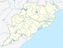
Berhampur Airport, also known as Rangeilunda airstrip (IATA: BMP, ICAO: VEBM), is located 9 km east of Berhampur (also known as Brahmapur) in Odisha, India. The airstrip was built by the British during World War II and is adjacent to the Berhampur University.
Rangeilunda airstrip is spread over 40 acres and is under the control of the State Public Works Department. The runway is 750 meters (around 2461 ft) long and is periodically maintained by the state government of Odisha.[1] There is a suitable helipad too.
The runway is used by the defence establishment, State Government, Private companies and VIPs to reach Berhampur and other places in south Odisha. The State's second flying training Institute is coming up at the airport.[2][3]
The civic authority in consultation with the Town and Country Planning Organisation has developed a Comprehensive Development Plan for the expansion of the city which also includes a new greenfield airport at a different location other than the present airstrip as the Airport Authority of India has express concerns over expansion obstacles that would be faced by the authorities if in case of expansion.
References[edit]
- ↑ Patnaik, Sunil (2012). "The Telegraph - Calcutta (Kolkata) | Odisha | Rangeilunda flying club takes off". telegraphindia.com. Calcutta, India. Retrieved 27 April 2012.
the present runway is 750-meter
- ↑ Patnaik, Sunil (2012). "The Telegraph - Calcutta (Kolkata) | Orissa | First flight takes off from Gopalpur". telegraphindia.com. Calcutta, India. Retrieved 27 April 2012.
Rangeilunda as the second flying club in Orissa
- ↑ "Gopalpur-on-sea put on air map, IBN Live News". ibnlive.in.com. 2012. Archived from the original on 7 February 2013. Retrieved 27 April 2012.
signing of a memorandum of understanding with the state government in 2008 to operate the institute
External links[edit]

