Nuagaon Airport
Bolangir Airstrip | |||||||||||
|---|---|---|---|---|---|---|---|---|---|---|---|
| Summary | |||||||||||
| Airport type | Public/Private | ||||||||||
| Owner | Government of Odisha | ||||||||||
| Serves | Balangir | ||||||||||
| Location | Tusura, Balangir district, Odisha | ||||||||||
| Elevation AMSL | 656 ft / 200 m | ||||||||||
| Coordinates | 20°30′41″N 83°26′50″E / 20.51139°N 83.44722°ECoordinates: 20°30′41″N 83°26′50″E / 20.51139°N 83.44722°E | ||||||||||
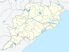
| Map | |||||||||||
| Runways | |||||||||||
| |||||||||||
Bolangir Airstrip (ICAO: VE36) is a private/public airstrip located at Tusura in the Balangir district of Odisha. Nearest airport/airstrip to this airstrip is Utkela Airstrip in Bhawanipatna, Odisha.[3][4]There are plans to upgrade the facility and use it as a flight school.[5]
References[edit]
- ↑ "Nuagaon - India". World Airport Codes.
- ↑ "Great Circle Mapper".
- ↑ "List of airports in Odisha, India (excluding heliports and closed airports)". Our Airports.
- ↑ "Nuagaon Airport code and information". airportdatabase.net.
- ↑ "Airstrip for flight training". www.telegraphindia.com.
