This article has multiple issues. Please help improve it or discuss these issues on the talk page. (Learn how and when to remove these template messages)
|
Etah | |
|---|---|
City | |
 Etah Location in Uttar Pradesh, India | |
| Coordinates: 27°38′N 78°40′E / 27.63°N 78.67°E | |
| Country | |
| State | Uttar Pradesh |
| District | Etah |
| Founded by | King Dil Sukh Rai Bahadur |
| Government | |
| • Etah (Lok Sabha constituency )MP | Rajveer Singh (BJP) |
| Population (2011) | |
| • Total | 131,023 |
| Languages | |
| • Official | Hindi |
| Time zone | UTC+5:30 (IST) |
| Vehicle registration | UP-82 |
| Website | http://etah.nic.in/ |
Etah is a municipality and the headquarters of the Etah District of the Uttar Pradesh state in India. Etah district is a part of the Aligarh Division and is located at the midpoint of the Kanpur-Delhi Highway Known as G.T.Road.[1] The nearest cities are Aligarh and Agra,[2] and the nearest Railway Station is Etah Railway Station situated on railway road.
Etymology[edit | edit source]
According to one story, a person who was lost here dug into the land and struck a brick (einth), which led to the name Einta which later became Etah.[1]
In another story, the town gets its name from the Yadavs who were called 'Aintha' by the king of Awagarh, which meant 'to respond aggressively.[1]' The area was therefore called Aintha, which was later mispronounced as Etah.[1]
History[edit | edit source]
This section needs expansion with: Post-Raj history. You can help by adding to it. (December 2019) |
Etah was an early seat of an Aryan civilization, and the surrounding country is mentioned by Xuanzang, the Chinese Buddhist pilgrim of the 7th century, as rich in temples and monasteries. After the repression of Buddhism before the 8th century and an intermediate period of tribalism, it was controlled by Yadavs during the course of their migration eastward. With the rest of upper India it passed under the sway of Mahmud of Ghazni in 1017, and from that point forward followed the fortunes of the Muslim empire. At the end of the 18th century, it formed part of the territory over which Wazir Ali Khan had made himself ruler. It then passed to the British Raj in 1801 under the treaty of Lucknow.[3]
Geography[edit | edit source]
Etah is located at 27°38′N 78°40′E / 27.63°N 78.67°E.[4] It has an average elevation of 170 metres (557 feet).The upper and lower Ganga Canal flow through Etah.
Demographics[edit | edit source]
As of the 2011 census, Etah's urban agglomeration had a population of 131,023 with 69,446 males and 61,577 females. The literacy rate was 85.62%.[5] 11,786 of the population are of scheduled castes, while 65 are of scheduled tribes.[2] The local languages are Brajbhasha and Kannauji.
Government and politics[edit | edit source]
Etah city is governed by a type of municipality called the Etah Nagar Palika Parishad.[6][7] The city covers an area of 13.49 km2 and is divided into 25 wards for the purpose of administration.[2][8] The municipality is headed by the municipal commissioner or president[9][10] and represented by one Member of Parliament (MP) in the Lok Sabha, currently Rajveer Singh, and MP Rajya Sabha. The incumbent is Harnath Singh Yadav. The Member of Legislative Assembly (MLA) representing the city is Vipin David.[11]
Civic Amenities[edit | edit source]
The masterplan of the city (1984-2001) was created by the U.P. Town and Country Planning Department.[12] The U.P. Jal Nigam is the body responsible for water supply,[13] and electricity is provided by the Dakshinanchal Vidyut Vitran Nigam Ltd., the southern discom of the Uttar Pradesh state government.[14]
A thermal power project of 1320 MW has been proposed at Malawan, approximately 15 km from Etah, and Ministry of Environment has cleared the project. Land acquisition work has been completed and construction is scheduled to be completed in 2021.[citation needed]
Culture[edit | edit source]

Etah lies in the cultural region of Braj. Etah is a developing city and has been the district headquarters since British rule. The Padav maidan (open field) is the name of a field used by the army, and every year this field is used for Ram-Lila at Dussehra in the months of September and October and for exhibitions from December to February.
Amir Khusro was born in Patiyali, Kasganj and is considered as one of the best poets of Urdu.[1]
Dress[edit | edit source]
The people of Etah dress in a variety of traditional and Western styles. Traditional styles of dress include colourful draped garments such as sari, dhoti or lungi and tailored clothes such as shalwar kameez and kurta-pyjama. Men often sport head gear like topi or pagri. Sherwani is a more formal male dress and is frequently worn along with chooridar on festive occasions. European-style trousers and shirts are also common.
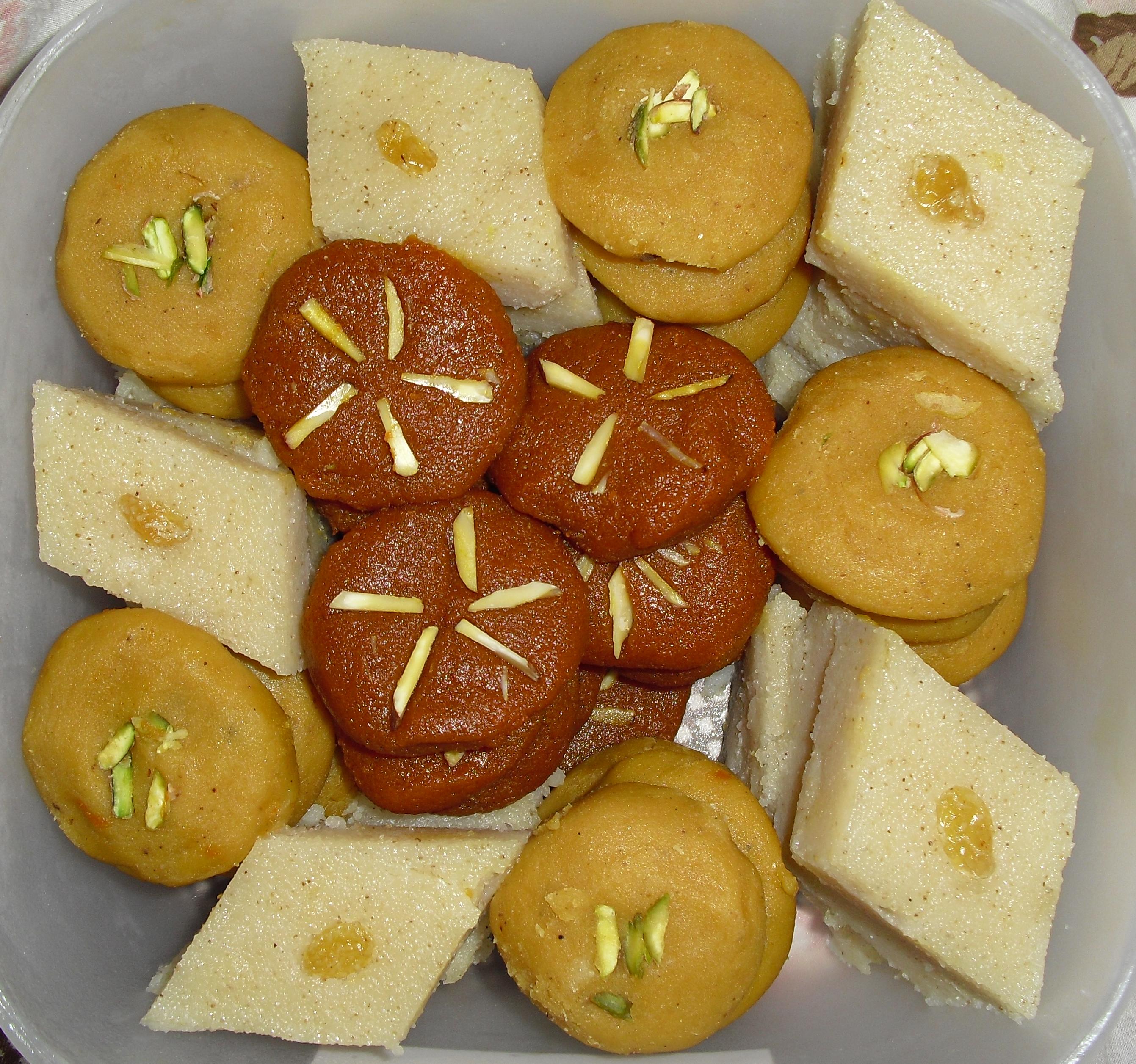
Food[edit | edit source]
Etah's food consists of the cuisine prepared in the state of Uttar Pradesh, India. It consists of Mughlai cuisine and both vegetarian and non-vegetarian foods.[clarification needed] Dum biryani, kababs, and kormas are some of the dishes made in this region.
-
 Assorted halva including sooji, chana, and gajar halva
 -
 Paratha served with tea
 -
 Puri with accompaniments
 -
 Chicken Dum Biryani
 -
 Navratan korma
 -
 Chicken curry with chapati
 -
-


Transport[edit | edit source]
The opening of a railway line in Etah was done by the first president of India, Rajendra Prasad, in 1959[15], and the train runs from Etah to Tundla. The Etah–Agra Fort Passenger Special started running from Etah to Agra, when railway ministry approved the survey for direct trains to New Delhi, Agra and Aligarh.[16][17]
Religion[edit | edit source]
Dargah Hazrat Makhdoom Abdul Ghafur Shah Safvi is situated at holi gate. Hazrat was the Great Sufi of the silsila e chishtiya and safviya-khadimiya and Haji Mohammad Islam Safvi is the sajjada nashin of dargah sharif at present time.[18][19][verification needed].
The 148-year-old Kailash Mandir at Etah was built by King Dil Sukh Rai Bahadur.[citation needed] Noah Kera village was known for marriage of Lord Sri Krishna with Rukmini.[citation needed]. Bhooteshwar is a place for Hindu bodies to be cremated.
Economy[edit | edit source]
Agriculture[edit | edit source]

Etah's primary economy is centered around agriculture. The area is situated between Ganga and Yamuna (Doaab) which is highly fertile (Alluvial soil). Farmers harvest three crops each year as irrigation is available year-round. Major agricultural products are rice, wheat, barley, jowar, bajra, and maize, and the soil is also suitable for the cultivation of tobacco.
References[edit | edit source]
- ↑ 1.0 1.1 1.2 1.3 1.4 "Official Website of Nagar Palika Parishad, Etah / Etah City / History of Etah City". 17 September 2019. Archived from the original on 17 September 2019. Retrieved 17 September 2020.
- ↑ 2.0 2.1 2.2 "Uttar Pradesh, Town Amenities (Excel - Row 901)". Censusindia.gov.in. 2011. Retrieved 14 September 2020.
- ↑
 One or more of the preceding sentences incorporates text from a publication now in the public domain: Chisholm, Hugh, ed. (1911). "Etah". Encyclopædia Britannica. Vol. 9 (11th ed.). Cambridge University Press. p. 803.
- ↑ Falling Rain Genomics, Inc – Etah. Fallingrain.com. Retrieved on 2014-01-02.
- ↑ "Urban Agglomerations/Cities having population 1 lakh and above" (PDF). Provisional Population Totals, Census of India 2011. Retrieved 7 July 2012.
- ↑ "NAGAR PALIKA PARISHAD ETAH | District Etah, Government of Uttarpradesh | India". Retrieved 14 September 2020.
- ↑ "Official Website of Nagar Palika Parishad, Etah". 5 September 2019. Archived from the original on 5 September 2019. Retrieved 17 September 2020.
- ↑ "Official Website of Nagar Palika Parishad, Etah / About us / Mohalla & Wards covered by ETAH NPP". 11 September 2019. Archived from the original on 11 September 2019. Retrieved 14 September 2020.
- ↑ "AMRUT Contact Details of Heads" (PDF). Amrut.gov.in. Retrieved 14 September 2020.
- ↑ "Swachh Volunteering - MoHUA" (PDF). Retrieved 14 September 2020.
- ↑ "बिजली की समस्या को लेकर सड़क पर उतरा अन्नदाता". Amar Ujala (in हिन्दी). Retrieved 14 September 2020.
- ↑ "Official Website of Town And Country Planning Department, Uttar Pradesh, India. / Etah (Etah)". uptownplanning.gov.in. Retrieved 14 September 2020.
- ↑ "424 लाख रुपये से अर्बन क्षेत्रों में दुरुस्त होगी पेयजल समस्या". Amar Ujala (in हिन्दी). Retrieved 14 September 2020.
- ↑ "Facing electricity trouble in Uttar Pradesh? Dial these numbers". The Financial Express. 2 July 2018. Retrieved 14 September 2020.
- ↑ Chauhan, Arvind (5 July 2015). "A train that halts at the wave of a hand". The Times of India. Retrieved 1 October 2020.
- ↑ "Etah Railway Station (ETAH) : Station Code, Time Table, Map, Enquiry". www.ndtv.com. Retrieved 1 October 2020.
- ↑ "North Eastern Railway".
- ↑ "मारहरा में उर्स कासमी में विदेशी जायरीन आने शुरू". Hindustan (in हिन्दी). Retrieved 1 October 2020.
- ↑ "Dargah Hazrat Makhdum Abdul Ghafoor Shah Safvi". Just Dial.