



imported>MB cleanup |
m cleanup lead as per guidelines as per guidelines |
||
| Line 1: | Line 1: | ||
{{Use dmy dates|date= | {{Use dmy dates|date=October 2024}} | ||
{{Use Indian English|date=October 2024}} | |||
{{Infobox settlement | {{Infobox settlement | ||
| name | | name = Lonavala | ||
| native_name | | native_name = | ||
| native_name_lang | | native_name_lang = | ||
| other_name | | other_name = | ||
| settlement_type | | settlement_type = Hill station | ||
| image_skyline | | image_skyline = {{multiple image | ||
| | | border = infobox | ||
| | | total_width = 300 | ||
| nickname | | image_style = | ||
| image_map | | perrow = 1/2/2/2/2 | ||
| map_alt | | image1 = Mumbai Pune Expressway2.jpg | ||
| map_caption | | caption1 = [[Mumbai–Pune Expressway]] | ||
| pushpin_map | | image2 = Tiger Point Lonavala.jpg{{!}}Tiger Point | ||
| pushpin_label_position | | caption2 = Tiger Point | ||
| pushpin_map_alt | | image3 = Lions Point - India.jpg{{!}}Lions Point | ||
| pushpin_map_caption | | caption3 = Lions Point | ||
| coordinates | | image4 = Bhaja Caves 1.jpg{{!}}Bhaja Caves | ||
| subdivision_type | | caption4 = [[Bhaja Caves]] | ||
| subdivision_name | | image5 = ...sanctum sanctorum..... (24519395033).jpg{{!}} | ||
| subdivision_type1 | | caption5 = [[Karla Caves]] | ||
| subdivision_name1 | | image6 = Dukesnose.jpg{{!}} | ||
| subdivision_type2 | | caption6 = Dukes Nose | ||
| subdivision_name2 | | image7 = Khandala ghat during rains.jpg{{!}}Khandala ghat | ||
| unit_pref | | caption7 = Khandala Ghat | ||
| area_footnotes | }} | ||
| area_rank | | nickname = | ||
| area_total_km2 | | image_map = | ||
| elevation_footnotes | | map_alt = | ||
| elevation_m | | map_caption = | ||
| population_total | | pushpin_map = India Maharashtra#India#Asia | ||
| population_as_of | | pushpin_label_position = | ||
| population_rank | | pushpin_map_alt = | ||
| population_density_km2 | | pushpin_map_caption = | ||
| population_demonym | | coordinates = {{coord|18.74806|N|73.40722|E|display=inline,title}} | ||
| population_footnotes | | subdivision_type = Country | ||
| demographics_type1 | | subdivision_name = {{flag|India}} | ||
| demographics1_title1 | | subdivision_type1 = [[States and territories of India|State]] | ||
| demographics1_info1 | | subdivision_name1 = [[Maharashtra]] | ||
| timezone1 | | subdivision_type2 = [[List of districts of India|District]] | ||
| utc_offset1 | | subdivision_name2 = [[Pune district|Pune]] | ||
| postal_code_type | | unit_pref = Metric | ||
| postal_code | | area_footnotes = | ||
| area_code_type | | area_rank = | ||
| area_code | | area_total_km2 = 38 | ||
| registration_plate | | elevation_footnotes = | ||
| elevation_m = 624 | |||
| population_total = 57698 | |||
| population_as_of = 2011 | |||
| population_rank = | |||
| population_density_km2 = 1464 | |||
| population_demonym = | |||
| population_footnotes = | |||
| demographics_type1 = Languages | |||
| demographics1_title1 = Official | |||
| demographics1_info1 = [[Marathi language|Marathi]] | |||
| timezone1 = [[Indian Standard Time|IST]] | |||
| utc_offset1 = +5:30 | |||
| postal_code_type = [[Postal Index Number|PIN]] | |||
| postal_code = 410401 | |||
| area_code_type = Telephone code | |||
| area_code = 02114 | |||
| registration_plate = MH-12, MH-14 | |||
}} | }} | ||
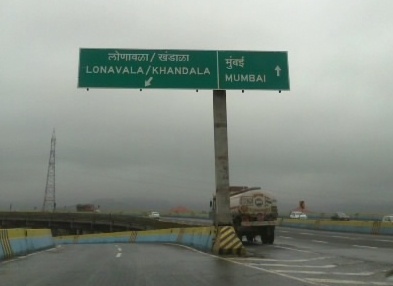
'''Lonavala''' | '''Lonavala-Khandala'''<ref>{{cite news|title=Lonavala, Khandala railway stations to run on clean energy |url=https://www.deccanherald.com/india/lonavala-khandala-railway-stations-to-run-on-clean-energy-861470.html|date=15 July 2020|newspaper=Deccan Herald|quote=Lonavala and Khandala belt, as a hill station, is one of the most popular tourist spots among Indians and now Lonavala station and its adjoining railway premises will completely run on clean and green energy.}}</ref> is a [[hill station]] and a [[municipal council]] in the [[Pune district]], [[Maharashtra]]. It is about {{Convert|64|km|mi|abbr=in}} west of [[Pune]] and {{Convert|96|km|mi|abbr=in}} to the east of [[Mumbai]]. It is known for its production of the hard candy ''[[chikki]]'' and is also a major stop on the railway line connecting Mumbai and Pune. From the Pune suburbs, local trains are available from [[Pune Junction]]. The [[Mumbai-Pune Expressway]] and the [[National Highway 48 (India)|Mumbai-Pune national highway]] both pass through Lonavala. | ||
Lonavala is also home to INS ''Shivaji'' (formerly HMIS ''Shivaji'') | Lonavala is also home to [[INS Shivaji|INS ''Shivaji'']] (formerly HMIS ''Shivaji''), the [[Indian Navy]]'s premier technical training institute. On 16 February 1945, the Establishment was commissioned as HMIS Shivaji and since then, the premier Technical Training Establishment of the Indian Navy trains officers.<ref>{{Cite web|url=https://www.indiannavy.nic.in/insshivaji/node/391|title = WELCOME TO INDIAN NAVAL SHIP SHIVAJI | insshivaji}}</ref> | ||
The | ==History== | ||
[[File:India; a stretch of railway in the Western Ghats mountain ra Wellcome V0037521.jpg|thumb|left|A view of [[Western Ghats]] in Lonavala, 1881]] | |||
Present day Lonavala was a part of the [[Seuna (Yadava) dynasty]]. Later, the [[Mughals]] realised the strategic importance of the region and kept the region for an extended time. The forts in the region and the "''Mavala''" warriors played an important role in the history of the [[Maratha Empire]] and that of the [[Peshwa]]s. | |||
In 1871, the Lonavala and [[Khandala]] hill stations were established by Lord Elphinstone, who was the Governor of [[Bombay Presidency]] at the time.<ref>{{cite web|url=http://www.mumbai.org.uk/excursions/lonavala.html|title=Lonavla, India|publisher=Mumbai.org.uk|access-date=2010-01-31}}</ref> | |||
== | ==Politics== | ||
The President of Lonavala Municipal Council is Smt. Surekha Nandkumar Jadhav and the Vice president is Shri. Sanjay Mohan Ghone. | |||
==Demographics== | |||
{{As of|2011}} India [[census]],<ref name=census2011>{{cite web|url=http://www.census2011.co.in/data/town/802810-lonavala.html|title=Lonavala Population Census 2011|last=Govt. of India|work=Census of India|access-date=18 February 2017}}</ref> Lonavala had a population of 57,698. Males constituted 53.47% of the population and females 46.53%. The sex ratio in Lonavala is 870, lower than the state average of 929. Lonavala has a literacy rate of 89.33%, which is higher than the state average of 82.34%. The Male literacy rate is 93.4%, and the female literacy rate is 84.57%. 10.37% of the total population in Lonavala is of children under 6 years of age. | |||
== | ===Religion=== | ||
At the time of the [[2011 Census of India]], 75.18% of the population of Lonavala followed [[Hinduism]], 10.13% [[Islam]], 8.75% [[Buddhism]], 2.67% [[Jainism]], 2.32% [[Christianity]] and the remaining 0.96% of the population followed other religions or stated no religion.<ref name=census2011/> | |||
{{Pie chart | |||
|thumb=right | |||
|caption=Religion in Lonavala (2011)<ref name=census2011/> | |||
= | |label1 = [[Hinduism]] |value1 = 75.18 |color1=darkorange | ||
|label2 = [[Islam]] |value2 = 10.13 |color2 = Green | |||
|label3 = [[Buddhism]] |value3 = 8.75 |color3 = yellow | |||
|label4 = [[Jainism]] |value4 = 2.67 |color4 = pink | |||
|label5 = [[Christianity]] |value5 = 2.32 |color5 = blue | |||
|label6 = Other or not stated |value6 = 0.96 |color6 = grey | |||
}} | |||
==Climate== | ==Climate== | ||
Lonavala has an extreme version of tropical wet and dry climate which barely is borderline with a humid subtropical climate (CWa) due to the January mean temperature being shy of 18.9°C. It has an extreme wet and dry climate because it's quite dry during the dry months (mid October to may) while it's extremely wet from June to September. July and August rainfall values are higher than most well known cities annual rainfall.{{Citation needed|date=October 2024}} | |||
{{Weather box | {{Weather box | ||
|location = Lonavla | |location = Lonavla | ||
| Line 85: | Line 114: | ||
|Nov high C = 30.1 | |Nov high C = 30.1 | ||
|Dec high C = 26.8 | |Dec high C = 26.8 | ||
|Jan mean C = 18.9 | |||
|Feb mean C = 20.8 | |||
|Mar mean C = 24.1 | |||
|Apr mean C = 28.7 | |||
|May mean C = 29.6 | |||
|Jun mean C = 27.3 | |||
|Jul mean C = 24.4 | |||
|Aug mean C = 22.9 | |||
|Sep mean C = 24.3 | |||
|Oct mean C = 24.8 | |||
|Nov mean C = 22.3 | |||
|Dec mean C = 19.1 | |||
|Jan low C = 9.9 | |Jan low C = 9.9 | ||
|Feb low C = 11.4 | |Feb low C = 11.4 | ||
| Line 124: | Line 167: | ||
===By train=== | ===By train=== | ||
{{Further| | {{Further|Lonavala railway station}} | ||
Lonavala is well-connected by train. Local trains run from Pune at 2-hour intervals. Those originating from Mumbai along the [[Central line (Mumbai Suburban Railway)|central line]] have [[Khopoli]] as their last station. Buses are available at regular intervals to complete the remaining 15 km of the journey to Lonavla from Khopoli bus station. | Lonavala is well-connected by train. Local trains run from Pune at 2-hour intervals. Those originating from Mumbai along the [[Central line (Mumbai Suburban Railway)|central line]] have [[Khopoli]] as their last station. Buses are available at regular intervals to complete the remaining 15 km of the journey to Lonavla from Khopoli bus station. It takes 2.5 hours by train from Mumbai and 1 to 1.5 hour from Pune. All trains, travelling between Mumbai and Pune, halt at Lonavala. Before the push-pull technology, trains from Mumbai used to halt at Karjat in [[Raigad district|Raigad District]] to attach [[bank engine|banker locomotives]] before the train started the journey up the [[Western Ghats]] to reach Lonavala.<ref>{{Cite news|url=https://www.thehindu.com/news/cities/mumbai/karjat-commuters-oppose-new-technology-on-intercity-express/article27892659.ece|title=Karjat commuters oppose new technology on Intercity Express|last=Mahale|first=Ajeet|date=2019-06-13|work=The Hindu|access-date=2019-10-21|language=en-IN|issn=0971-751X}}</ref> | ||
It takes 2.5 hours by train from Mumbai and 1 to 1.5 hour from Pune. All trains, travelling between Mumbai and Pune, halt at Lonavala. Before the push-pull technology, trains from Mumbai used to halt at Karjat in [[Raigad district|Raigad District]] to attach [[bank | |||
===By air=== | ===By air=== | ||
The city of Aamby Valley, which lies near to Lonavala, has its own private airport. The nearest commercial airports are [[Pune International Airport]] at 64 km and [[Chhatrapati Shivaji Maharaj International Airport|second nearest commercial airport is D.B Patil international airport in Navi Mumbai, that is 65 km and Chhatrapati Shivaji Maharaj International Airport]] at 104 km.<ref>{{cite web|url=http://www.maharashtratourism.net/hill-stations/lonavla-and-khandala.html|title=Lonavla and Khandala|publisher=Maharashtra Tourism|access-date=2010-01-31}}</ref> A [[seaplane]] service is also available between [[Juhu]] and Pawana Dam, which is 14 km away from Lonavala.<ref>{{cite news | url=https://timesofindia.indiatimes.com/city/mumbai/First-seaplane-service-from-Mumbai-takes-off-for-Lonavala/articleshow/40868277.cms | title=First seaplane service from Mumbai takes off for Lonavala | first=Nergish | last=Sunavala | date=25 August 2014 | newspaper=The Times of India | access-date=1 December 2018 }}</ref> | |||
== | ==Skywalk== | ||
{{anchor|Sky}} | |||
'''Lonavala Tiger Point Skywalk''' is a 125 meter long, 6 meter wide, horseshoe-shaped glass-bridge skywalk costing Rs 909 cr at Tiger Point in Lonavala being constructed under [[parvatmala]] project.Lonavala Skywalk project also includes 5000 sqm rooftop cafe, 1000 seat amphitheatre, adventure sports, parking for 2000 motor bikes and 1600 cars. The road from A1 Chakki to the skybridge will also be widened into 11 km long elevated toll-free expressway between [[Mulshi]] and Lonavala. The construction will commence in 2025 and will be completed by June 2027.<ref name=lonv1>[https://timesofindia.indiatimes.com/city/pune/125-metre-long-glass-skywalk-at-lonavala-to-be-ready-in-2-years/articleshow/118489094.cms 125 m long glass bridge skywalk at Tiger Point Lonavala], Times of India, 22 Feb 2025.</ref> | |||
== Tourism == | |||
=== Rajmachi Point === | === Rajmachi Point === | ||
[[Rajmachi|Rajmachi Point]] is located about 6.5 km from Lonavala. This point commands a view of Shivaji Maharaj's fort, Rajmachi (Royal terrakouioce), and the surrounding valley. Regular State Transport buses ply between Rajmachi Point and Lonavala from the State Transport Bus Stand. The Vaghjai Dari is also located here. | [[Rajmachi|Rajmachi Point]] is located about 6.5 km from Lonavala. This point commands a view of Shivaji Maharaj's fort, Rajmachi (Royal terrakouioce), and the surrounding valley. Regular State Transport buses ply between Rajmachi Point and Lonavala from the State Transport Bus Stand. The Vaghjai Dari is also located here. | ||
=== Rajmachi Fort === | === Rajmachi Fort === | ||
| Line 149: | Line 191: | ||
=== Della Adventure Park === | === Della Adventure Park === | ||
Della Adventure Park is India's largest adventure park situated in Lonavala hill station. | [[Della Adventure Park]] is India's largest adventure park situated in Lonavala hill station. The park is spread over an area of 36 acres. It is located at about 3,000 feet height above [[mean sea level|MSL]]. Della Adventure Park offers close to 52 adventure activities. | ||
=== Lonavala Lake === | === Lonavala Lake === | ||
Lonavala Lake is surrounded by natural scenery, about 1.6 km from the town. The lake dries up during the winter and summer months offering an expanse of green grass that is used by walkers and joggers.<ref>{{cite web| title= Google Maps|url=https:// | Lonavala Lake is surrounded by natural scenery, about 1.6 km from the town. The lake dries up during the winter and summer months offering an expanse of green grass that is used by walkers and joggers.<ref>{{cite web| title= Google Maps|url=https://www.google.com/maps/place/Lonavala+Lake/@18.7412776,73.3920943,15z/data=!3m1!4b1!4m5!3m4!1s0x3be8016ca25d36d9:0xfef709609f19abd1!8m2!3d18.7417874!4d73.3996038}}</ref> This place attracts tourists for its street food,{{citation needed|date=April 2018}} including [[convenience food]] items like smoked corn on the cob, shaved ice (gola), vada pav, chaat, and hot ginger tea. | ||
=== Duke's Nose === | === Duke's Nose === | ||
Duke's Nose stands 12 km from Lonavla, clearly visible from the highway while driving towards Mumbai. This landmark in Khandala is visited by hikers.{{citation needed|date=April 2018}} Also known locally as ''Naagphani'' (Cobra's Hood), the cliff owes its name to the Duke of Wellington, whose ample nose it resembles.<ref>https://www.tripadvisor.in/Attraction_Review-g1156430-d1203670-Reviews-Nagphani_Duke_s_Nose-Khandala_Lonavala_Pune_District_Maharashtra.html</ref> | Duke's Nose stands 12 km from Lonavla, clearly visible from the highway while driving towards Mumbai. This landmark in Khandala is visited by hikers.{{citation needed|date=April 2018}} Also known locally as ''Naagphani'' (Cobra's Hood), the cliff owes its name to the Duke of Wellington, whose ample nose it resembles.<ref>{{Cite web|url=https://www.tripadvisor.in/Attraction_Review-g1156430-d1203670-Reviews-Nagphani_Duke_s_Nose-Khandala_Lonavala_Pune_District_Maharashtra.html|title = Nagphani (Duke's Nose) (Khandala) - 2022 What to Know Before You Go (With Photos)}}</ref> | ||
=== Tiger's Leap === | === Tiger's Leap === | ||
| Line 162: | Line 204: | ||
Tiger's Leap also known as '''Tiger's Point''' is a cliff-top with a sheer drop of over 650 m, giving an extensive view. Buses are available up to [[INS Shivaji]] and the remaining distance of about 1.6 km has to be covered on foot. Legend has it that while being chased by a tiger once, the [[Maratha Empire]] king [[Shivaji]] jumped into a ditch on the hill and the tiger leaped off it into the valley giving it the name of tiger's leap. | Tiger's Leap also known as '''Tiger's Point''' is a cliff-top with a sheer drop of over 650 m, giving an extensive view. Buses are available up to [[INS Shivaji]] and the remaining distance of about 1.6 km has to be covered on foot. Legend has it that while being chased by a tiger once, the [[Maratha Empire]] king [[Shivaji]] jumped into a ditch on the hill and the tiger leaped off it into the valley giving it the name of tiger's leap. | ||
Just around the tiger's leap, there is a small waterfall active only during the monsoon. It serves the purpose of relaxing in the water better than Bushi | Just around the tiger's leap, there is a small waterfall active only during the monsoon. It serves the purpose of relaxing in the water better than Bushi Dam, as the force of the fall is higher. Also, after the brief steep descent, the fall becomes a stream with a fair amount of force to go all the way down to the base of the Tiger's Leap. Adventurers can trek down the stream whilst intermittently stepping back on land where the water current is too strong and the fall is steep. | ||
=== Karla Caves === | === Karla Caves === | ||
[[Karla Caves]], located near Lonavala, is a complex of cave shrines built by Buddhist monks around 3rd to 2nd century B.C. A temple of Goddess Ekvira Devi is also present here.<ref>{{cite web| title=Ekveera Aai Tu Dongaravari Najar Hai Tuji Kolyavari|url=http://mandarmala.blogspot.in/2012/01/ekveera-aai-tu-dongaravari-najar-hai.html}}</ref> | [[Karla Caves]], located near Lonavala, is a complex of cave shrines built by Buddhist monks around 3rd to 2nd century B.C. A temple of Goddess Ekvira Devi is also present here.<ref>{{cite web| title=Ekveera Aai Tu Dongaravari Najar Hai Tuji Kolyavari|date=21 January 2012|url=http://mandarmala.blogspot.in/2012/01/ekveera-aai-tu-dongaravari-najar-hai.html}}</ref> | ||
=== [[Lohagad]] Fort === | === [[Lohagad]] Fort === | ||
| Line 174: | Line 216: | ||
=== [[Bhushi Dam]] === | === [[Bhushi Dam]] === | ||
A waterfall near the dam is located between Lonavala and I.N.S. Shivaji. Buses running on the I.N.S. Shivaji Road stop here.<ref>http://www.amazingmaharashtra.com/2012/09/bhushi-dam-lonavala.html</ref> | A waterfall near the dam is located between Lonavala and I.N.S. Shivaji. Buses running on the I.N.S. Shivaji Road stop here.<ref>{{Cite web|url=http://www.amazingmaharashtra.com/2012/09/bhushi-dam-lonavala.html|title=Amazing Maharashtra: BHUSHI DAM LONAVALA}}</ref> | ||
=== Lion Point === | === Lion Point === | ||
| Line 180: | Line 222: | ||
=== Narayani Dham === | === Narayani Dham === | ||
[[File:Narayani Dham lonavala.jpg|thumb|Narayani Dham Temple ]] | |||
Narayani Dham is a temple constructed in 2002 in honor of the Hindu Goddess [[Narayani Mata|Narayani]]. It is at a distance of 2 km from the Lonavla railway station. The temple has idols of Durga Mata, Salasar Balaji (Hanuman) and Ganapati housed in a marble structure. | Narayani Dham is a temple constructed in 2002 in honor of the Hindu Goddess [[Narayani Mata|Narayani]]. It is at a distance of 2 km from the Lonavla railway station. The temple has idols of Durga Mata, Salasar Balaji (Hanuman) and Ganapati housed in a marble structure. | ||
| Line 186: | Line 229: | ||
=== Shooting Point === | === Shooting Point === | ||
Another viewpoint in the town of Khandala (Bazaar peth), provides views of the Rajmachi Fort and the valley. Also the home for the St. Mary's villa. | Another viewpoint in the town of Khandala (Bazaar peth), provides views of the Rajmachi Fort and the valley. Also the home for the St. Mary's villa.{{Clarify|date=October 2024}} | ||
=== [[Kataldhar Lonavla]] === | |||
Kataldhar is a waterfall neer Rajmachi Fort off the Rajmachi Trekking route.<ref>{{Cite web |title=Kataldhar waterfall near Lonavala @699 |url=https://www.trekhievers.com/tours/kataldhar-waterfall |access-date=2022-08-13 |website=Trekhievers |language=en}}</ref> | |||
== Education == | == Education == | ||
| Line 192: | Line 238: | ||
<!--If these entities have articles written about them, we should link to those articles, otherwise they should be removed as non-notable as we do in any list. [--Cyphoidbomb 09.25.14]--> | <!--If these entities have articles written about them, we should link to those articles, otherwise they should be removed as non-notable as we do in any list. [--Cyphoidbomb 09.25.14]--> | ||
Some major educational institutes in Lonavala are: | Some major educational institutes in Lonavala are: | ||
* Sinhgad Institute of | * Sinhgad Institute of Technology Lonavala | ||
* The Cathedral Vidya School, Lonavala | * The Cathedral Vidya School, Lonavala | ||
* Ryewood International School, Lonavala | * Ryewood International School, Lonavala | ||
* Gurukul High School (boarding school) | * Gurukul High School (boarding school) | ||
* Auxilium Convent School | * Auxilium Convent School | ||
* Don Bosco School and Junior | * Don Bosco School and Junior College, Lonavala | ||
* Adv. Bapusaheb Bhonde High School, Lonavala | * Adv. Bapusaheb Bhonde High School, Lonavala | ||
* Samundra Institute of Maritime Studies (SIMS) | * Samundra Institute of Maritime Studies (SIMS) | ||
* Kohinoor Business School-Kohinoor Global Campus | * Kohinoor Business School-Kohinoor Global Campus | ||
* DC High School and Jr. College | * DC High School and Jr. College | ||
* Dr. B.N. Purandare Vidyalay High School | * Dr. B. N. Purandare Vidyalay High School | ||
* Institute For Future Education Entrepreneurship And Leadership | * Institute For Future Education Entrepreneurship And Leadership | ||
* V.P.S. HighSchool | * V. P. S. HighSchool | ||
* D.P. Mehata Jr College | * D.P. Mehata Jr College | ||
* [[Kaivalyadhama Health and Yoga Research Center]] | * [[Kaivalyadhama Health and Yoga Research Center]] | ||
| Line 211: | Line 257: | ||
* Kaivalya Vidya Niketan, Kaivalyadhama Lonavala. CBSE Board | * Kaivalya Vidya Niketan, Kaivalyadhama Lonavala. CBSE Board | ||
* The Great Eastern Institute Of Maritime Studies, Lonavala | * The Great Eastern Institute Of Maritime Studies, Lonavala | ||
* | * Society of Saint Mary Virgin in India, Shanti Sadan School Lonavala<ref>{{cite web |url=http://www.csmvonline.org.uk/overseas.htm/ |title=Wantage Overseas |access-date=2015-01-26 |url-status=dead |archive-url=https://web.archive.org/web/20150317170150/http://www.csmvonline.org.uk/overseas.htm |archive-date=2015-03-17 }}</ref> | ||
==Gallery== | ==Gallery== | ||
| Line 219: | Line 265: | ||
File:Tiger point-Lonavla.JPG|Tiger point during the rainy season | File:Tiger point-Lonavla.JPG|Tiger point during the rainy season | ||
File:Bhushi Dam - Lonavala.jpg|Bhushi Dam - Lonavala | File:Bhushi Dam - Lonavala.jpg|Bhushi Dam - Lonavala | ||
File:Tombstone of Jesuits German Priests 01.JPG|Tombstone of Jesuits German Priests 01 | |||
</gallery> | </gallery> | ||
==See also== | |||
*[[Lonavala chikki]] | |||
==References== | ==References== | ||
| Line 225: | Line 275: | ||
==External links== | ==External links== | ||
{{ | * {{Official}} | ||
*{{wikivoyage-inline|Lonavla}} | {{Wikisource1911Enc|Lonauli}} | ||
* {{Commons category inline}} | |||
* {{wikivoyage-inline|Lonavla}} | |||
{{Pune district topics}} | {{Pune district topics}} | ||
{{Authority control}} | {{Authority control}} | ||
[[Category:Cities and towns in Pune district]] | [[Category:Cities and towns in Pune district]] | ||
[[Category:Hill stations in Maharashtra]] | [[Category:Hill stations in Maharashtra]] | ||
[[Category:Tourism in Maharashtra]] | [[Category:Tourism in Maharashtra]] | ||
[[Category:Lonavala-Khandala]] | [[Category:Lonavala-Khandala]] | ||
Latest revision as of 07:16, 15 January 2026
Lonavala | |
|---|---|
Hill station | |
  Lonavala  Lonavala  Lonavala | |
| Coordinates: 18°44′53″N 73°24′26″E / 18.74806°N 73.40722°E | |
| Country |  India India |
| State | Maharashtra |
| District | Pune |
| Area | |
| • Total | 38 km2 (15 sq mi) |
| Elevation | 624 m (2,047 ft) |
| Population (2011) | |
| • Total | 57,698 |
| • Density | 1,464/km2 (3,790/sq mi) |
| Languages | |
| • Official | Marathi |
| Time zone | UTC+5:30 (IST) |
| PIN | 410401 |
| Telephone code | 02114 |
| Vehicle registration | MH-12, MH-14 |


.jpg)


Lonavala-Khandala[1] is a hill station and a municipal council in the Pune district, Maharashtra. It is about 64 km (40 miles) west of Pune and 96 km (60 miles) to the east of Mumbai. It is known for its production of the hard candy chikki and is also a major stop on the railway line connecting Mumbai and Pune. From the Pune suburbs, local trains are available from Pune Junction. The Mumbai-Pune Expressway and the Mumbai-Pune national highway both pass through Lonavala.
Lonavala is also home to INS Shivaji (formerly HMIS Shivaji), the Indian Navy's premier technical training institute. On 16 February 1945, the Establishment was commissioned as HMIS Shivaji and since then, the premier Technical Training Establishment of the Indian Navy trains officers.[2]
History[edit | edit source]

Present day Lonavala was a part of the Seuna (Yadava) dynasty. Later, the Mughals realised the strategic importance of the region and kept the region for an extended time. The forts in the region and the "Mavala" warriors played an important role in the history of the Maratha Empire and that of the Peshwas. In 1871, the Lonavala and Khandala hill stations were established by Lord Elphinstone, who was the Governor of Bombay Presidency at the time.[3]
Politics[edit | edit source]
The President of Lonavala Municipal Council is Smt. Surekha Nandkumar Jadhav and the Vice president is Shri. Sanjay Mohan Ghone.
Demographics[edit | edit source]
As of 2011[update] India census,[4] Lonavala had a population of 57,698. Males constituted 53.47% of the population and females 46.53%. The sex ratio in Lonavala is 870, lower than the state average of 929. Lonavala has a literacy rate of 89.33%, which is higher than the state average of 82.34%. The Male literacy rate is 93.4%, and the female literacy rate is 84.57%. 10.37% of the total population in Lonavala is of children under 6 years of age.
Religion[edit | edit source]
At the time of the 2011 Census of India, 75.18% of the population of Lonavala followed Hinduism, 10.13% Islam, 8.75% Buddhism, 2.67% Jainism, 2.32% Christianity and the remaining 0.96% of the population followed other religions or stated no religion.[4]
Climate[edit | edit source]
Lonavala has an extreme version of tropical wet and dry climate which barely is borderline with a humid subtropical climate (CWa) due to the January mean temperature being shy of 18.9°C. It has an extreme wet and dry climate because it's quite dry during the dry months (mid October to may) while it's extremely wet from June to September. July and August rainfall values are higher than most well known cities annual rainfall.[citation needed]
| Climate data for Lonavla | |||||||||||||
|---|---|---|---|---|---|---|---|---|---|---|---|---|---|
| Month | Jan | Feb | Mar | Apr | May | Jun | Jul | Aug | Sep | Oct | Nov | Dec | Year |
| Average high °C (°F) | 27.9 (82.2) |
30.3 (86.5) |
33.6 (92.5) |
37.8 (100.0) |
35.9 (96.6) |
31.6 (88.9) |
26.7 (80.1) |
24.5 (76.1) |
28.6 (83.5) |
31.4 (88.5) |
30.1 (86.2) |
26.8 (80.2) |
30.4 (86.8) |
| Daily mean °C (°F) | 18.9 (66.0) |
20.8 (69.4) |
24.1 (75.4) |
28.7 (83.7) |
29.6 (85.3) |
27.3 (81.1) |
24.4 (75.9) |
22.9 (73.2) |
24.3 (75.7) |
24.8 (76.6) |
22.3 (72.1) |
19.1 (66.4) |
23.9 (75.1) |
| Average low °C (°F) | 9.9 (49.8) |
11.4 (52.5) |
14.6 (58.3) |
19.6 (67.3) |
23.4 (74.1) |
23.0 (73.4) |
22.1 (71.8) |
21.3 (70.3) |
19.9 (67.8) |
18.2 (64.8) |
14.4 (57.9) |
11.5 (52.7) |
17.4 (63.4) |
| Average precipitation mm (inches) | 4 (0.2) |
2 (0.1) |
3 (0.1) |
18 (0.7) |
67 (2.6) |
666 (26.2) |
1,733 (68.2) |
1,147 (45.2) |
495 (19.5) |
111 (4.4) |
16 (0.6) |
3 (0.1) |
4,265 (167.9) |
| Source: weather2stay | |||||||||||||
Tourism[edit | edit source]
Lonavala and the adjacent Khandala are twin hill stations 622 metres (2,041 ft) above sea level, in the Sahyadri ranges that demarcate the Deccan Plateau and the Konkan coast. The hill stations sprawl over an approximate area of 38 square kilometres (15 sq mi). Tourism peaks during the monsoon season. The name Lonavala is derived from the words 'leni' which means caves and 'avali' which means series. i.e. 'a series of Caves' which is a reference to the many caves like Karla Caves, Bhaja Caves and Bedsa that are close to Lonavala. A trip to Lonavala and Khandala can be combined with sight-seeing visits of Karla, Bhaja and Bedsa caves and also the two fortresses, Lohagad and Visapur. Another place of interest is the Tungi fort, one of the forts captured by Malik Ahmad near the village of Karjat and was known for its natural strength.[5] The Andharban trek begins from village Pimpri, passes through dense forests, valleys and waterfalls and ends in Bhira.
Transport[edit | edit source]

By road[edit | edit source]
Lonavala is on the Mumbai-Pune Expressway and is well-connected to several towns of Khopoli, Karjat, Talegaon Dabhade, etc.
By train[edit | edit source]
Lonavala is well-connected by train. Local trains run from Pune at 2-hour intervals. Those originating from Mumbai along the central line have Khopoli as their last station. Buses are available at regular intervals to complete the remaining 15 km of the journey to Lonavla from Khopoli bus station. It takes 2.5 hours by train from Mumbai and 1 to 1.5 hour from Pune. All trains, travelling between Mumbai and Pune, halt at Lonavala. Before the push-pull technology, trains from Mumbai used to halt at Karjat in Raigad District to attach banker locomotives before the train started the journey up the Western Ghats to reach Lonavala.[6]
By air[edit | edit source]
The city of Aamby Valley, which lies near to Lonavala, has its own private airport. The nearest commercial airports are Pune International Airport at 64 km and second nearest commercial airport is D.B Patil international airport in Navi Mumbai, that is 65 km and Chhatrapati Shivaji Maharaj International Airport at 104 km.[7] A seaplane service is also available between Juhu and Pawana Dam, which is 14 km away from Lonavala.[8]
Skywalk[edit | edit source]
Lonavala Tiger Point Skywalk is a 125 meter long, 6 meter wide, horseshoe-shaped glass-bridge skywalk costing Rs 909 cr at Tiger Point in Lonavala being constructed under parvatmala project.Lonavala Skywalk project also includes 5000 sqm rooftop cafe, 1000 seat amphitheatre, adventure sports, parking for 2000 motor bikes and 1600 cars. The road from A1 Chakki to the skybridge will also be widened into 11 km long elevated toll-free expressway between Mulshi and Lonavala. The construction will commence in 2025 and will be completed by June 2027.[9]
Tourism[edit | edit source]
Rajmachi Point[edit | edit source]
Rajmachi Point is located about 6.5 km from Lonavala. This point commands a view of Shivaji Maharaj's fort, Rajmachi (Royal terrakouioce), and the surrounding valley. Regular State Transport buses ply between Rajmachi Point and Lonavala from the State Transport Bus Stand. The Vaghjai Dari is also located here.
Rajmachi Fort[edit | edit source]
Rajmachi Fort is a historic fort close to Lonavala and attracts a lot of trekkers during the monsoon season. The fort also comprises two other forts - Shrivardhan Fort and Manaranjan Fort. Besides, the fort is known for the fireflies that lit up the surroundings in night
Ryewood Park & Shivaji Udyan[edit | edit source]
This is an extensive garden situated in Lonavla. The garden has a number of tall trees - some of which are very old.[citation needed] There is an old Shiva temple in the park.
Valvan Dam[edit | edit source]
Valvan Dam is a Britisher-built garden and is more than a century old. This dam has a garden at the foot of its wall and is 2 km from the town.[citation needed] The dam supplies water to the Khopoli power station at the foothills of the Sahyadris for generating electricity. The Kundali River feeds into the dam's reservoir.
Della Adventure Park[edit | edit source]
Della Adventure Park is India's largest adventure park situated in Lonavala hill station. The park is spread over an area of 36 acres. It is located at about 3,000 feet height above MSL. Della Adventure Park offers close to 52 adventure activities.
[edit | edit source]
Lonavala Lake is surrounded by natural scenery, about 1.6 km from the town. The lake dries up during the winter and summer months offering an expanse of green grass that is used by walkers and joggers.[10] This place attracts tourists for its street food,[citation needed] including convenience food items like smoked corn on the cob, shaved ice (gola), vada pav, chaat, and hot ginger tea.
Duke's Nose[edit | edit source]
Duke's Nose stands 12 km from Lonavla, clearly visible from the highway while driving towards Mumbai. This landmark in Khandala is visited by hikers.[citation needed] Also known locally as Naagphani (Cobra's Hood), the cliff owes its name to the Duke of Wellington, whose ample nose it resembles.[11]
Tiger's Leap[edit | edit source]

Tiger's Leap also known as Tiger's Point is a cliff-top with a sheer drop of over 650 m, giving an extensive view. Buses are available up to INS Shivaji and the remaining distance of about 1.6 km has to be covered on foot. Legend has it that while being chased by a tiger once, the Maratha Empire king Shivaji jumped into a ditch on the hill and the tiger leaped off it into the valley giving it the name of tiger's leap.
Just around the tiger's leap, there is a small waterfall active only during the monsoon. It serves the purpose of relaxing in the water better than Bushi Dam, as the force of the fall is higher. Also, after the brief steep descent, the fall becomes a stream with a fair amount of force to go all the way down to the base of the Tiger's Leap. Adventurers can trek down the stream whilst intermittently stepping back on land where the water current is too strong and the fall is steep.
Karla Caves[edit | edit source]
Karla Caves, located near Lonavala, is a complex of cave shrines built by Buddhist monks around 3rd to 2nd century B.C. A temple of Goddess Ekvira Devi is also present here.[12]
Lohagad Fort[edit | edit source]
A robust climb of about 11.2 km from Malavali railway station takes you to the 'Iron Fort', once a formidable battle-station of Shivaji. The fort commands a view of the surrounding hills and hamlets.
Visapur Fort[edit | edit source]
Adjacent to the Lohagad fort lies the visapur fort which is part of the Lohagad-Visapur fortification. Visapur Fort is larger and at a higher elevation than its twin- Lohagad. It was built during 1713-1720 CE by Balaji Vishwanath.
Bhushi Dam[edit | edit source]
A waterfall near the dam is located between Lonavala and I.N.S. Shivaji. Buses running on the I.N.S. Shivaji Road stop here.[13]
Lion Point[edit | edit source]
This is a viewpoint midway between Bhushi Dam and Aamby Valley which overlooks a deep valley and mountains known for its roasted corn and onion fritters. This point does not have any lions but is named so because it is associated with the Lions Club of Lonavala.
Narayani Dham[edit | edit source]

Narayani Dham is a temple constructed in 2002 in honor of the Hindu Goddess Narayani. It is at a distance of 2 km from the Lonavla railway station. The temple has idols of Durga Mata, Salasar Balaji (Hanuman) and Ganapati housed in a marble structure.
Tungarli Dam[edit | edit source]
This lake and Dam comes to life during the Monsoon season, where some people climb the mountain top to the Dam. This dam was built during the British era and features a serene surrounding of trees and hillocks.
Shooting Point[edit | edit source]
Another viewpoint in the town of Khandala (Bazaar peth), provides views of the Rajmachi Fort and the valley. Also the home for the St. Mary's villa.[clarification needed]
[edit | edit source]
Kataldhar is a waterfall neer Rajmachi Fort off the Rajmachi Trekking route.[14]
Education[edit | edit source]
Template:Directory Some major educational institutes in Lonavala are:
- Sinhgad Institute of Technology Lonavala
- The Cathedral Vidya School, Lonavala
- Ryewood International School, Lonavala
- Gurukul High School (boarding school)
- Auxilium Convent School
- Don Bosco School and Junior College, Lonavala
- Adv. Bapusaheb Bhonde High School, Lonavala
- Samundra Institute of Maritime Studies (SIMS)
- Kohinoor Business School-Kohinoor Global Campus
- DC High School and Jr. College
- Dr. B. N. Purandare Vidyalay High School
- Institute For Future Education Entrepreneurship And Leadership
- V. P. S. HighSchool
- D.P. Mehata Jr College
- Kaivalyadhama Health and Yoga Research Center
- Kendriya Vidyalaya, INS Shivaji, Lonavala
- Sadhana Institute, Old Khandala Road, Lonavala
- Kaivalya Vidya Niketan, Kaivalyadhama Lonavala. CBSE Board
- The Great Eastern Institute Of Maritime Studies, Lonavala
- Society of Saint Mary Virgin in India, Shanti Sadan School Lonavala[15]
Gallery[edit | edit source]
-
 A waterfall on the way to Lonavala.
 -
 View of Western ghats, from Rajmachi
 -
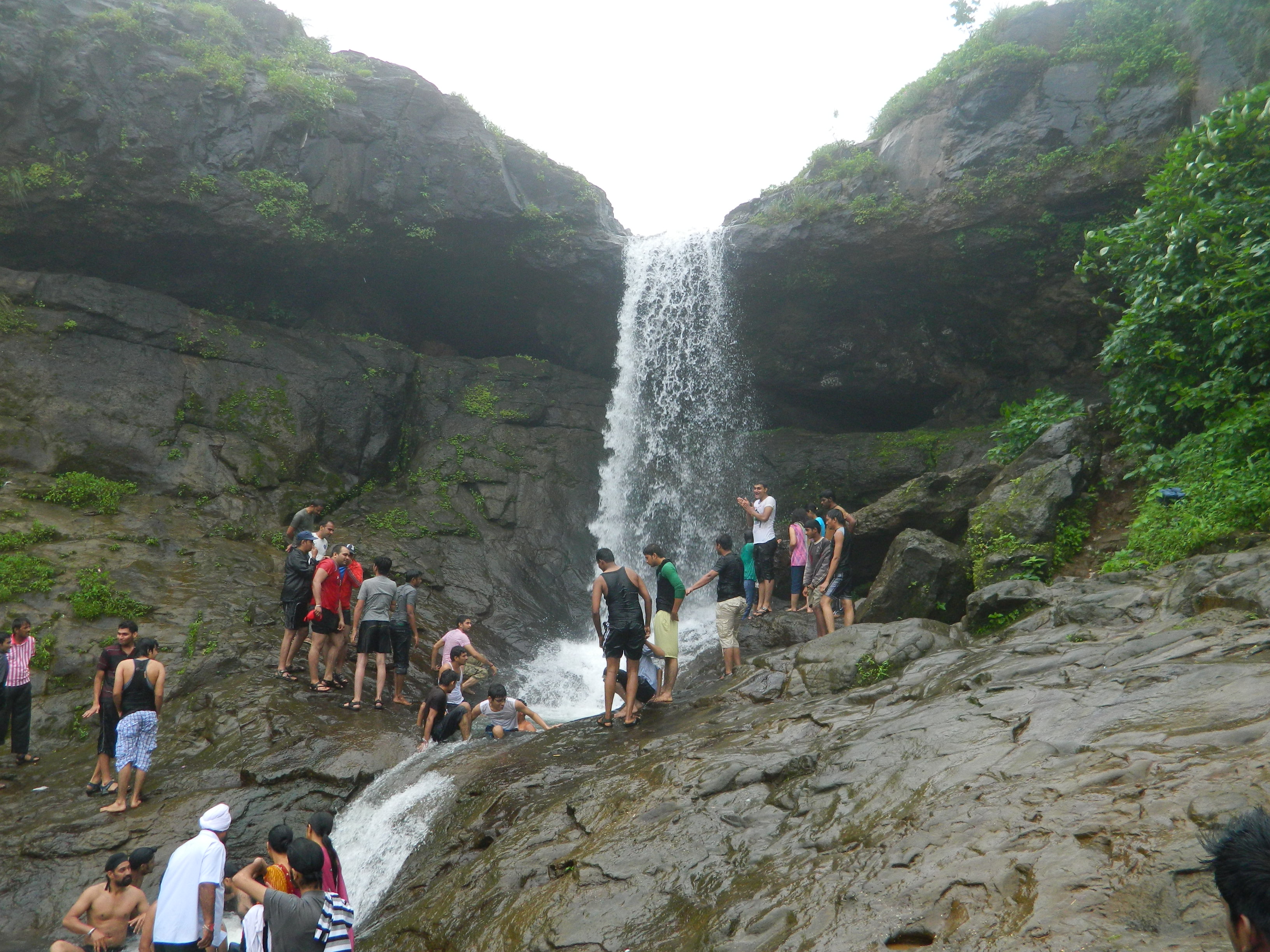 Tiger point during the rainy season
 -
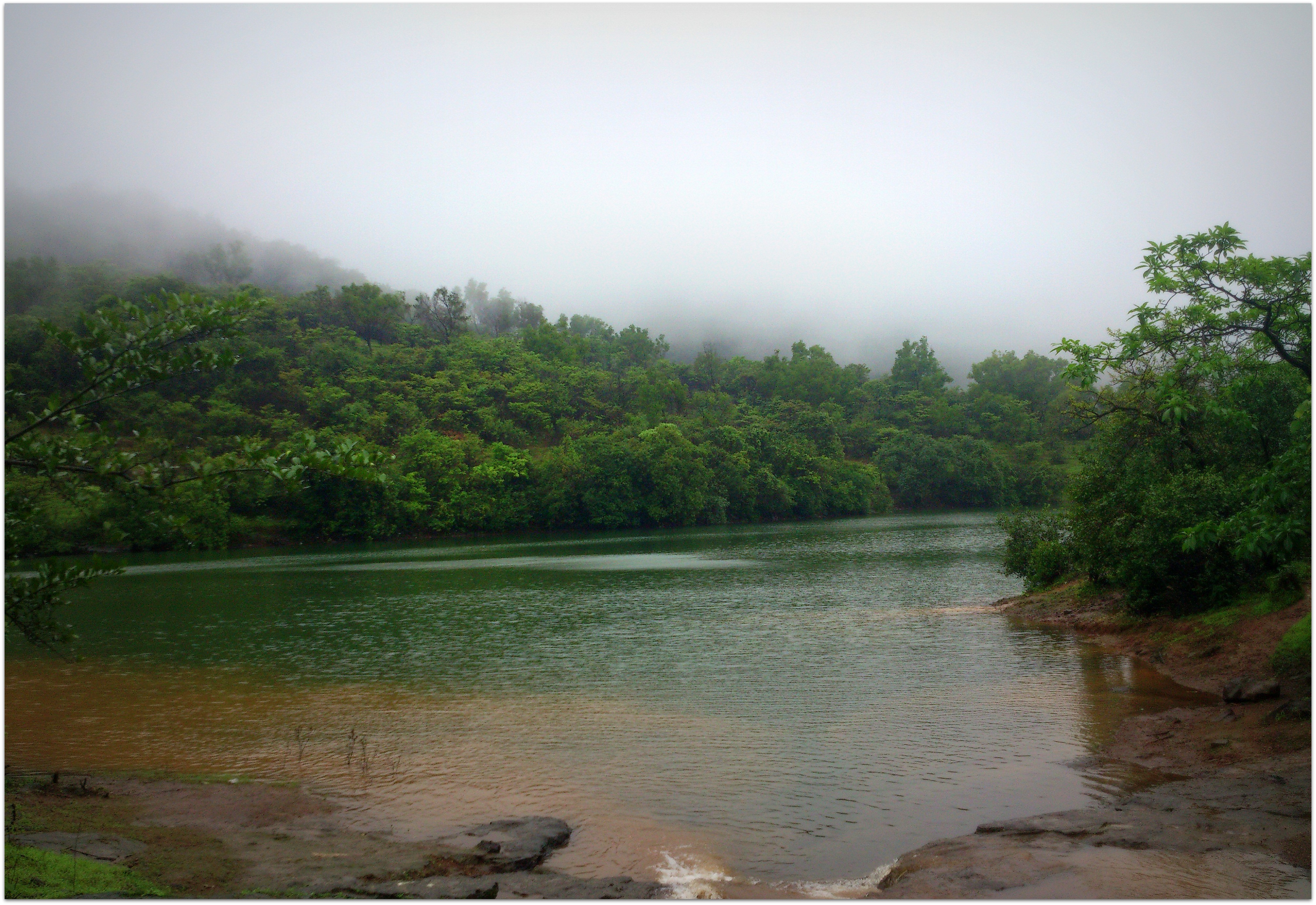 Bhushi Dam - Lonavala
 -
 Tombstone of Jesuits German Priests 01


See also[edit | edit source]
References[edit | edit source]
- ↑ "Lonavala, Khandala railway stations to run on clean energy". Deccan Herald. 15 July 2020.
Lonavala and Khandala belt, as a hill station, is one of the most popular tourist spots among Indians and now Lonavala station and its adjoining railway premises will completely run on clean and green energy.
- ↑ "WELCOME TO INDIAN NAVAL SHIP SHIVAJI | insshivaji".
- ↑ "Lonavla, India". Mumbai.org.uk. Retrieved 31 January 2010.
- ↑ 4.0 4.1 4.2 Govt. of India. "Lonavala Population Census 2011". Census of India. Retrieved 18 February 2017.
- ↑ "Tungi fort". NIC Raigad-Alibaug.
- ↑ Mahale, Ajeet (13 June 2019). "Karjat commuters oppose new technology on Intercity Express". The Hindu. ISSN 0971-751X. Retrieved 21 October 2019.
- ↑ "Lonavla and Khandala". Maharashtra Tourism. Retrieved 31 January 2010.
- ↑ Sunavala, Nergish (25 August 2014). "First seaplane service from Mumbai takes off for Lonavala". The Times of India. Retrieved 1 December 2018.
- ↑ 125 m long glass bridge skywalk at Tiger Point Lonavala, Times of India, 22 Feb 2025.
- ↑ "Google Maps".
- ↑ "Nagphani (Duke's Nose) (Khandala) - 2022 What to Know Before You Go (With Photos)".
- ↑ "Ekveera Aai Tu Dongaravari Najar Hai Tuji Kolyavari". 21 January 2012.
- ↑ "Amazing Maharashtra: BHUSHI DAM LONAVALA".
- ↑ "Kataldhar waterfall near Lonavala @699". Trekhievers. Retrieved 13 August 2022.
- ↑ "Wantage Overseas". Archived from the original on 17 March 2015. Retrieved 26 January 2015.
External links[edit | edit source]
{{URL|example.com|optional display text}}
Pune district topics | ||||||||||||||||||
|---|---|---|---|---|---|---|---|---|---|---|---|---|---|---|---|---|---|---|
| History |
| |||||||||||||||||
| Geography |
| |||||||||||||||||
| Cities and towns |
| |||||||||||||||||
| Transport | ||||||||||||||||||
| Culture | ||||||||||||||||||
| Constituencies |
| |||||||||||||||||
