




WikiDwarfBOT (talk | contribs) Cleanup: Source modification. Information added. |
Pendu Mania (talk | contribs) No edit summary |
||
| Line 1: | Line 1: | ||
{{other uses}} | {{other uses}} | ||
{{Use dmy dates|date= | {{Use dmy dates|date=February 2026}} | ||
{{Use Indian English|date= | {{Use Indian English|date=February 2026}} | ||
<!-- See [[ | <!-- See [[Bharatpedia:WikiProject Indian cities]] for details -->{{Infobox settlement | ||
| name = Almora | | name = Almora | ||
| other_name = | | other_name = | ||
| nicknames = Cultural Capital of Kumaon, Heart of Kumaon | | nicknames = Cultural Capital of Kumaon, Heart of Kumaon | ||
| settlement_type = | | settlement_type = City | ||
| image_skyline = Almora Uttarakhand India 2013.jpg | | image_skyline = Almora Uttarakhand India 2013.jpg | ||
| image_alt = Almora City | | image_alt = Almora City | ||
| Line 28: | Line 28: | ||
| founder = Balo Kalyan Chand | | founder = Balo Kalyan Chand | ||
| named_for = | | named_for = | ||
| | | government_type = [[Municipal Corporations in India|Municipal Corporation]] | ||
| | | governing_body = [[Almora Municipal Corporation]] | ||
| | | leader_title = [[Mayor]] | ||
| | | leader_name = Ajay Verma | ||
| leader_party = [[Bharatiya Janata Party|BJP]] | |||
| leader_title2 = [[Member of Parliament, Lok Sabha|Lok Sabha MP]] | |||
| leader_name2 = [[Ajay Tamta]] ([[Bharatiya Janata Party|BJP]]) | |||
| leader_title3 = [[Uttarakhand Legislative Assembly|MLA]] | |||
| leader_name3 = [[Manoj Tiwari (Uttarakhand politician)|Manoj Tiwari]] ([[Indian National Congress|INC]]) | |||
| leader_title4 = [[Municipal Commissioner (India)|Municipal Commissioner]] | |||
| leader_name4 = Seema Vishwakarma, [[Indian Administrative Service|IAS]] | |||
| unit_pref = Metric | | unit_pref = Metric | ||
| area_footnotes = | | area_footnotes = | ||
| area_rank = | | area_rank = | ||
| area_total_km2 = 16.60 | | area_total_km2 = 16.60 | ||
| elevation_footnotes = | | elevation_footnotes = | ||
| elevation_m = 1642 | | elevation_m = 1642 | ||
| population_total = 35513 | | population_total = 35513 | ||
| population_as_of = 2011 | | population_as_of = 2011 | ||
| population_density_km2 = auto | | population_density_km2 = auto | ||
| population_demonym = Almoran (English) | | population_demonym = Almoran (English) | ||
| Line 54: | Line 59: | ||
| utc_offset1 = +5:30 | | utc_offset1 = +5:30 | ||
| postal_code_type = [[Postal Index Number|PIN]] | | postal_code_type = [[Postal Index Number|PIN]] | ||
| postal_code = 263601<ref name="pincode">{{cite web|url=https://pin-code.net/in-loc/almora-pin-code/194543/ |title=Almora Pin Code |publisher=pin-code.net |access-date=2 November 2020}}</ref> | | postal_code = 263601<ref name="pincode">{{cite web |url=https://pin-code.net/in-loc/almora-pin-code/194543/ |title=Almora Pin Code |publisher=pin-code.net |access-date=2 November 2020 |archive-date=2 November 2020 |archive-url=https://web.archive.org/web/20201102173941/https://pin-code.net/in-loc/almora-pin-code/194543/ |url-status=dead }}</ref> | ||
| area_code_type = Telephone code | | area_code_type = Telephone code | ||
| area_code = 91-5962 | | area_code = 91-5962 | ||
| Line 71: | Line 76: | ||
| footnotes = | | footnotes = | ||
}} | }} | ||
Almora was founded in 1568.<ref>{{cite book |last1=Trivedi |first1=Vijaya R. |title=Autonomy of Uttarakhand |publisher=Mohit Publications |year=1995 |isbn=9788174450081 |page=33 |language=en}}</ref> by King [[Chand kings #List of Chand Kings|Kalyan Chand]];<ref>{{cite book |last1=Sharma |first1=Man Mohan |title=Through the valley of gods: travels in the central Himalayas |publisher=Vision Books |page=99 |language=en}}</ref><ref>{{cite book |last1=Bhattacherje |first1=S. B. |title=Encyclopaedia of Indian Events & Dates |date=May 2009 |publisher=Sterling Publishers Pvt. Ltd. |isbn=9788120740747 |page=55 |language=en}}</ref><ref>{{cite book |last1=Tyagi |first1=Nutan |url=https://archive.org/details/hillresortsofuph0000tyag |title=Hill Resorts of U.P. Himalaya,: A Geographical Study |publisher=Indus Publishing |year=1991 |isbn=9788185182629 |page=[https://archive.org/details/hillresortsofuph0000tyag/page/76 76] |language=en |url-access=registration}}</ref> however, there are accounts of human settlements in the hills and surrounding region in the Hindu epic [[Mahabharata]]<ref>{{cite book |last1=Debroy |first1=Bibek |title=The Mahabharata: Volume 3 |date=July 2012 |publisher=Penguin Books India |isbn=9780143100157 |page=20 |language=en}}</ref> (8th and 9th century BCE<ref>{{cite book |last1=Brockington |first1=J. L. |title=The Sanskrit Epics |date=1998 |publisher=BRILL |isbn=9004102604 |page=26 |language=en}}</ref>). Almora was the seat of [[Chand kings]] that ruled over the [[Kumaon Kingdom]]. It is considered the cultural heart of the [[Kumaon division|Kumaon]] region of Uttarakhand. | '''Almora''' ([[Kumaoni language|Kumaoni]]: ''{{translit|kfy|Almāḍ }}'') is a [[municipal corporation]] and a [[cantonment]] town in the state of [[Uttarakhand]], India. It is the administrative headquarters of [[Almora district]].<ref name=Madan>{{cite book|title=India through the ages|url=https://archive.org/details/indiathroughages00mada|last=Gopal|first=Madan|year= 1990| page=[https://archive.org/details/indiathroughages00mada/page/174 174]|editor=K.S. Gautam|publisher=Publication Division, Ministry of Information and Broadcasting, Government of India}}</ref> Almora is located on a ridge at the southern edge of the [[Kumaon Hills]] of the [[Himalaya range]]. The [[Kosi River|Koshi]] (Kaushiki) and Suyal (Salmale) rivers flow along the city and snow-capped Himalayas can be seen in the background. | ||
Almora was founded in 1568.<ref>{{cite book |last1=Trivedi |first1=Vijaya R. |title=Autonomy of Uttarakhand |publisher=Mohit Publications |year=1995 |isbn=9788174450081 |page=33 |language=en}}</ref> by King [[Chand kings#List of Chand Kings|Kalyan Chand]];<ref>{{cite book |last1=Sharma |first1=Man Mohan |title=Through the valley of gods: travels in the central Himalayas |publisher=Vision Books |page=99 |language=en}}</ref><ref>{{cite book |last1=Bhattacherje |first1=S. B. |title=Encyclopaedia of Indian Events & Dates |date=May 2009 |publisher=Sterling Publishers Pvt. Ltd. |isbn=9788120740747 |page=55 |language=en}}</ref><ref>{{cite book |last1=Tyagi |first1=Nutan |url=https://archive.org/details/hillresortsofuph0000tyag |title=Hill Resorts of U.P. Himalaya,: A Geographical Study |publisher=Indus Publishing |year=1991 |isbn=9788185182629 |page=[https://archive.org/details/hillresortsofuph0000tyag/page/76 76] |language=en |url-access=registration}}</ref> however, there are accounts of human settlements in the hills and surrounding region in the Hindu epic [[Mahabharata]]<ref>{{cite book |last1=Debroy |first1=Bibek |title=The Mahabharata: Volume 3 |date=July 2012 |publisher=Penguin Books India |isbn=9780143100157 |page=20 |language=en}}</ref> (8th and 9th century BCE<ref>{{cite book |last1=Brockington |first1=J. L. |title=The Sanskrit Epics |date=1998 |publisher=BRILL |isbn=9004102604 |page=26 |language=en}}</ref>). Almora was the seat of [[Chand kings]] that ruled over the [[Kumaon Kingdom]]. It is considered the cultural heart of the [[Kumaon division|Kumaon]] region of Uttarakhand. | |||
According to the provisional results of the [[2011 Census | According to the provisional results of the [[2011 Census of India]], Almora had a population of about 179,000.{{citation needed|date=October 2021}} Nestled within higher peaks of the Himalaya, Almora enjoys a year-round mild temperate climate. There are 11 blocks in Almora district.{{citation needed|date=October 2021}} | ||
==Etymology== | ==Etymology== | ||
Almora got its name from Bhilmora, a kind of [[sorrel]] (although some have tried to derive it from Berberis "kilmora"<ref>{{cite book|last1=Kohli|first1=M. S.|title=Mountains of India: Tourism, Adventure and Pilgrimage|publisher=Indus Publishing|isbn=9788173871351|language=en|page=146|year=2002}}</ref><ref>{{cite book|last1=Shah|first1=Giriraj|title=Abode of gods: Uttarakhand|publisher=Cosmo Publications|language=en|page=113}}</ref>), a short plant commonly found there<ref>{{cite web|title=Almora District|url=http://www.mapsofindia.com/maps/uttaranchal/districts/almora.htm|website=www.mapsofindia.com|access-date=31 August 2016}}</ref> which was used for washing the utensils of the sun temple at [[Katarmal]]. The people bringing the Bhilmora/kilmora were called Bhilmori/Kilmori and later "Almori" and the place came to be known as "Almora".<ref>{{cite news|last1=Vathsala|first1=V P|title=On the hills of Almora|url=http://www.deccanherald.com/content/572222/on-hills-almora.html|access-date=31 August 2016|work=Deccan Herald|date=25 September 2016}}</ref><ref>{{cite web|title=Himalayan Region, Almora - BHOR|url=http://bhor.org/himalayan-region-almora/|access-date=2 September 2016|archive-url=https://web.archive.org/web/20180811135049/http://bhor.org/himalayan-region-almora/|archive-date=11 August 2018|url-status=dead}}</ref> | Almora got its name from Bhilmora, a kind of [[sorrel]] (although some have tried to derive it from Berberis "kilmora"<ref>{{cite book|last1=Kohli|first1=M. S.|title=Mountains of India: Tourism, Adventure and Pilgrimage|publisher=Indus Publishing|isbn=9788173871351|language=en|page=146|year=2002}}</ref><ref>{{cite book|last1=Shah|first1=Giriraj|title=Abode of gods: Uttarakhand|publisher=Cosmo Publications|language=en|page=113}}</ref>), a short plant commonly found there<ref>{{cite web|title=Almora District|url=http://www.mapsofindia.com/maps/uttaranchal/districts/almora.htm|website=www.mapsofindia.com|access-date=31 August 2016}}</ref> which was used for washing the utensils of the sun temple at [[Katarmal]]. The people bringing the Bhilmora/kilmora were called Bhilmori/Kilmori and later "Almori" and the place came to be known as "Almora".<ref>{{cite news|last1=Vathsala|first1=V P|title=On the hills of Almora|url=http://www.deccanherald.com/content/572222/on-hills-almora.html|access-date=31 August 2016|work=Deccan Herald|date=25 September 2016}}</ref><ref>{{cite web|title=Himalayan Region, Almora - BHOR|url=http://bhor.org/himalayan-region-almora/|access-date=2 September 2016|archive-url=https://web.archive.org/web/20180811135049/http://bhor.org/himalayan-region-almora/|archive-date=11 August 2018|url-status=dead}}</ref> | ||
When king Bhishm Chand laid the foundation of the town, he had initially named it Alamnagar. Prior to that, Almora was known as 'Rajapur' during the early phase of Chand rule.<ref>{{cite book|last1=Riddick|first1=John F.|title=The History of British India: A Chronology|publisher=Greenwood Publishing Group|isbn=9780313322808|language=en|year=2006}}</ref><ref>{{cite web|last1=Agarwal|first1=Rohit|title=Top 8 Places To Visit In Almora|url=http://www.transindiatravels.com/uttarakhand/almora/tourist-places-visit-in-almora/|access-date=1 September 2016}}</ref><ref name=about>{{cite web|last1=Dehradun|first1=NIC, Uttarakhand State Unit|title=About us: District of Almora, Uttarakhand, India|url=http://almora.nic.in/pages/display/59-about-us|website=almora.nic.in|access-date=1 September 2017|archive-url=https://web.archive.org/web/20170903023333/http://almora.nic.in/pages/display/59-about-us|archive-date=3 September 2017|url-status=dead | When king Bhishm Chand laid the foundation of the town, he had initially named it Alamnagar. Prior to that, Almora was known as 'Rajapur' during the early phase of Chand rule.<ref>{{cite book|last1=Riddick|first1=John F.|title=The History of British India: A Chronology|publisher=Greenwood Publishing Group|isbn=9780313322808|language=en|year=2006}}</ref><ref>{{cite web|last1=Agarwal|first1=Rohit|title=Top 8 Places To Visit In Almora|url=http://www.transindiatravels.com/uttarakhand/almora/tourist-places-visit-in-almora/|access-date=1 September 2016}}</ref><ref name=about>{{cite web|last1=Dehradun|first1=NIC, Uttarakhand State Unit|title=About us: District of Almora, Uttarakhand, India|url=http://almora.nic.in/pages/display/59-about-us|website=almora.nic.in|access-date=1 September 2017|archive-url=https://web.archive.org/web/20170903023333/http://almora.nic.in/pages/display/59-about-us|archive-date=3 September 2017|url-status=dead}}</ref> The name 'Rajpur' is also mentioned over a number of ancient copper plates.<ref name=about /> There is still a place called Rajpur in Almora. | ||
==History== | ==History== | ||
Almora was founded in 1568<ref>{{cite web|title= Almora History - kmvn Resources and Information.|url= http://www.kmvn.org/aboutkumaontouristsspots.aspx#almora|website= www.kmvn.org|access-date= 31 August 2016|archive-date= 14 October 2008|archive-url= https://web.archive.org/web/20081014123309/http://www.kmvn.org/aboutkumaontouristsspots.aspx#almora|url-status= dead}}</ref> by Kalyan Chand during the rule of the [[Chand dynasty]].<ref>{{cite web|title=Almora Travel and Tourism Guide|url=http://travel.india.com/almora/|website=Travel India|access-date=1 September 2016}}</ref> Prior to that the region was under the control of [[Katyuri kings|Katyuri | Almora was founded in 1568<ref>{{cite web|title= Almora History - kmvn Resources and Information.|url= http://www.kmvn.org/aboutkumaontouristsspots.aspx#almora|website= www.kmvn.org|access-date= 31 August 2016|archive-date= 14 October 2008|archive-url= https://web.archive.org/web/20081014123309/http://www.kmvn.org/aboutkumaontouristsspots.aspx#almora|url-status= dead}}</ref> by Kalyan Chand during the rule of the [[Chand dynasty]].<ref>{{cite web|title=Almora Travel and Tourism Guide|url=http://travel.india.com/almora/|website=Travel India|access-date=1 September 2016}}</ref> Prior to that the region was under the control of [[Katyuri kings|Katyuri king]] Bhaichaldeo who donated a part of Almora to Sri Chand Tiwari. | ||
[[File:Almora, | [[File:Ancient Cave Paintings at Lakhudiyar, Almora District, Uttarakhand India - 1.jpeg|left|thumb|Ancient Paintings at [[Lakhudiyar Caves]]]] | ||
According to local tradition, the earliest inhabitants in Almora were Tewaris who were required to supply [[Sorrel]] daily for cleansing the vessels of the sun temple at Katarmal.<ref name="dchb">{{cite book|title=District Census Handbook|publisher=Directorate of Census Operations, Uttarakhand|location=Dehradun|page=8|url=http://www.censusindia.gov.in/2011census/dchb/0509_PART_B_DCHB_ALMORA.pdf|access-date=31 August 2016}}</ref>{{rp|8}} Ancient lore mentioned in [[Vishnu Purana]] and [[Mahabharata]] present primordial accounts of human settlements in the city.<ref name="dchb" />{{rp|8}} The [[Sakas]], the [[Nagas (ancient people)|Nagas]], the [[Kiratas]], the [[Khasas]] and the [[Hunas]] are credited to be the most ancient tribes.<ref name="dchb" />{{rp|8}} The [[Kauravas]] and [[Pandavas]] of the Hastinapur royal family were the next important princes from the plains who are said to have affected the conquest of these parts.<ref name = past>{{cite book|last1=Aggarwal|first1=J. C.|last2=Agrawal|first2=S. P.|title=Uttarakhand: Past, Present, and Future|publisher=Concept Publishing Company|isbn=9788170225720|language=en|year=1995}}</ref>{{rp|166}} After the [[Mahabharata war]] the district seems to have remained for some time under the sway of the kings of [[Hastinapur]] whose authority was never more than nominal.<ref name = past />{{rp|166}} The actual rulers were the local chiefs of whom the Kulindas (or Kunindas) were probably strong in the southern and western part of the city.<ref name="dchb" />{{rp|8}} The [[Khasas]] were another ancient people who belonged to an early [[Aryan]] stock and were widely scattered in those times.<ref name = past />{{rp|167}} They gave this region the name Khasadesha or Khasamandala.<ref name="dchb" />{{rp|8}}<ref name = past />{{rp|167}} | According to local tradition, the earliest inhabitants in Almora were Tewaris who were required to supply [[Sorrel]] daily for cleansing the vessels of the sun temple at Katarmal.<ref name="dchb">{{cite book|title=District Census Handbook|publisher=Directorate of Census Operations, Uttarakhand|location=Dehradun|page=8|url=http://www.censusindia.gov.in/2011census/dchb/0509_PART_B_DCHB_ALMORA.pdf|access-date=31 August 2016}}</ref>{{rp|8}} Ancient lore mentioned in [[Vishnu Purana]] and [[Mahabharata]] present primordial accounts of human settlements in the city.<ref name="dchb" />{{rp|8}} The [[Sakas]], the [[Nagas (ancient people)|Nagas]], the [[Kiratas]], the [[Khasas]] and the [[Hunas]] are credited to be the most ancient tribes.<ref name="dchb" />{{rp|8}} The [[Kauravas]] and [[Pandavas]] of the Hastinapur royal family were the next important princes from the plains who are said to have affected the conquest of these parts.<ref name = past>{{cite book|last1=Aggarwal|first1=J. C.|last2=Agrawal|first2=S. P.|title=Uttarakhand: Past, Present, and Future|publisher=Concept Publishing Company|isbn=9788170225720|language=en|year=1995}}</ref>{{rp|166}} After the [[Mahabharata war]] the district seems to have remained for some time under the sway of the kings of [[Hastinapur]] whose authority was never more than nominal.<ref name = past />{{rp|166}} The actual rulers were the local chiefs of whom the Kulindas (or Kunindas) were probably strong in the southern and western part of the city.<ref name="dchb" />{{rp|8}} The [[Khasas]] were another ancient people who belonged to an early [[Aryan]] stock and were widely scattered in those times.<ref name = past />{{rp|167}} They gave this region the name Khasadesha or Khasamandala.<ref name="dchb" />{{rp|8}}<ref name = past />{{rp|167}} | ||
[[File:Almora | [[File:Malla Mahal, Almora.jpg|thumb|The Malla Mahal at Almora fort complex - the residence of the [[Chand kings]]]] | ||
The next age was probably a period of many petty states rivalling each other for supremacy, which culminated in the inauguration of the noted and enduring dynasty of the Chands. Earlier than this, the [[Katyuri kings|Katyuris]] are recorded as the dominant clans in copper and stone engravings.<ref>{{cite book|title=Census of India, 1981: Uttar Pradesh. Series 22|publisher=Controller of Publications|page=1|url=https://books.google.com/books?id=V6ZHAAAAYAAJ|access-date=4 September 2016|language=en|year=1982}}</ref> The Chand dynasty from their inception in 953 A.D. to their ouster in the late 18th century present a saga of strife, with a horrifying series of wars with the rulers of [[Garhwal Kingdom|Garhwal]] culminating in the destruction of this prosperous land and establishment of inglorious Gurkha rule. This dynasty was peculiar in that it made Almora the seat of strongest hill power in 1563 A.D.<ref>{{cite book|last1=Saraswati|first1=Baidyanath|title=The Cultural Dimension of Ecology|publisher=Indira Gandhi National Centre for the Arts|isbn=9788124601020|language=en|date=January 1998}}</ref> From that time onwards, the limits of the kingdom of Kumaon extended over the entire tracts of the districts of Almora and [[Nainital]]. Towards the end of the 17th century, the Chand Rajas again attacked the Garhwal kingdom, and in 1688, King Udyot Chand erected several temples at Almora, including Tripur Sundari, Udyot Chandeshwer and Parbateshwer, to mark his victory over Garhwal and Doti. The Parbateshwar temple was renamed twice, eventually becoming the present Nanda Devi temple. | The next age was probably a period of many petty states rivalling each other for supremacy, which culminated in the inauguration of the noted and enduring dynasty of the Chands. Earlier than this, the [[Katyuri kings|Katyuris]] are recorded as the dominant clans in copper and stone engravings.<ref>{{cite book|title=Census of India, 1981: Uttar Pradesh. Series 22|publisher=Controller of Publications|page=1|url=https://books.google.com/books?id=V6ZHAAAAYAAJ|access-date=4 September 2016|language=en|year=1982}}</ref> The Chand dynasty from their inception in 953 A.D. to their ouster in the late 18th century present a saga of strife, with a horrifying series of wars with the rulers of [[Garhwal Kingdom|Garhwal]] culminating in the destruction of this prosperous land and establishment of inglorious Gurkha rule. This dynasty was peculiar in that it made Almora the seat of strongest hill power in 1563 A.D.<ref>{{cite book|last1=Saraswati|first1=Baidyanath|title=The Cultural Dimension of Ecology|publisher=Indira Gandhi National Centre for the Arts|isbn=9788124601020|language=en|date=January 1998}}</ref> From that time onwards, the limits of the kingdom of Kumaon extended over the entire tracts of the districts of Almora and [[Nainital]]. Towards the end of the 17th century, the Chand Rajas again attacked the Garhwal kingdom, and in 1688, King Udyot Chand erected several temples at Almora, including Tripur Sundari, Udyot Chandeshwer and Parbateshwer, to mark his victory over Garhwal and Doti. The Parbateshwar temple was renamed twice, eventually becoming the present Nanda Devi temple. | ||
[[File: | [[File:Almora Bazaar. c1860.jpg|thumb|left|Almora Bazaar, c. 1860]] | ||
In 1791, the Gorkhas of Nepal while expanding their kingdom westwards across the Kali River, invaded and overran Almora.<ref name="dchb" />{{rp|8}}<ref name="hamilton">{{cite book|last1=Hamilton|first1=Francis|last2=Buchanan|first2=Francis Hamilton|title=An Account of the Kingdom of Nepal: And of the Territories Annexed to this Dominion by the House of Gorkha|publisher=A. Constable|url=https://books.google.com/books?id=7bYRAAAAYAAJ&q=The+name+Rajapur+is+also+mentioned+over+a+number+of+ancient+copper+plates|access-date=2 September 2016|language=en|year=1819}}</ref> In the meantime, the British were engaged in preventing the Gorkhas from over-running the whole of the northern frontier.<ref>{{cite book|last1=Lamb|first1=Alastair|title=British India and Tibet, 1766-1910|date=1986|publisher=Routledge & Kegan Paul|location=London|isbn=0710208723|edition=2nd, rev.}}</ref> The Gorkha rule lasted for twenty-four years. Due to their repeated intrusion into British territories in the Terai from 1800 onwards, [[Lord Moira]], the Governor-General of India, decided to attack Almora in December 1814,<ref>{{cite book|last1=Cross|first1=John Pemble; foreword by J.P.|title=Britain's Gurkha War : the invasion of Nepal, 1814-16|date=2008|publisher=Frontline|location=London|isbn=978-1-84832-520-3|edition=[Rev. ed.]}}</ref> marking the beginning of the [[Anglo-Gorkha war]]. The war that broke out in 1814<ref>{{cite book|last1=Naravane|first1=M.S.|title=Battles of the honourable East India Company : making of the Raj|date=2006|publisher=A. P. H. Pub. Corp.|location=New Delhi|isbn=978-81-313-0034-3}}</ref><ref>{{cite book|last1=Gould|first1=Tony|title=Imperial warriors : Britain and the Gurkhas|date=2000|publisher=Granta Books|location=London|isbn=1-86207-365-1}}</ref> resulted in the defeat of the Gorkhas and subsequently led to the signing of the [[Treaty of Sugauli]] in 1816.<ref>{{cite book|last1=Martin|first1=Robert Montgomery|title=The History of the Indian Empire|publisher=Mayur Publications|language=en}}</ref>{{rp|594}}<ref>{{cite book|title=Summary of the operations in India: with their results : from 30 April 1814 to 31 Jan. 1823|date=1824|publisher=Marquis of Hastings}}</ref> According to the treaty, Nepal had to cede all those territories which the Gorkhas had annexed to the [[British East India Company]]. After the war, the old Lal Mandi fort, near Almora was renamed ‘Fort Moira’. | In 1791, the Gorkhas of Nepal while expanding their kingdom westwards across the Kali River, invaded and overran Almora.<ref name="dchb" />{{rp|8}}<ref name="hamilton">{{cite book|last1=Hamilton|first1=Francis|last2=Buchanan|first2=Francis Hamilton|title=An Account of the Kingdom of Nepal: And of the Territories Annexed to this Dominion by the House of Gorkha|publisher=A. Constable|url=https://books.google.com/books?id=7bYRAAAAYAAJ&q=The+name+Rajapur+is+also+mentioned+over+a+number+of+ancient+copper+plates|access-date=2 September 2016|language=en|year=1819}}</ref> In the meantime, the British were engaged in preventing the Gorkhas from over-running the whole of the northern frontier.<ref>{{cite book|last1=Lamb|first1=Alastair|title=British India and Tibet, 1766-1910|date=1986|publisher=Routledge & Kegan Paul|location=London|isbn=0710208723|edition=2nd, rev.}}</ref> The Gorkha rule lasted for twenty-four years. Due to their repeated intrusion into British territories in the Terai from 1800 onwards, [[Lord Moira]], the Governor-General of India, decided to attack Almora in December 1814,<ref>{{cite book|last1=Cross|first1=John Pemble; foreword by J.P.|title=Britain's Gurkha War : the invasion of Nepal, 1814-16|date=2008|publisher=Frontline|location=London|isbn=978-1-84832-520-3|edition=[Rev. ed.]}}</ref> marking the beginning of the [[Anglo-Gorkha war]]. The war that broke out in 1814<ref>{{cite book|last1=Naravane|first1=M.S.|title=Battles of the honourable East India Company : making of the Raj|date=2006|publisher=A. P. H. Pub. Corp.|location=New Delhi|isbn=978-81-313-0034-3}}</ref><ref>{{cite book|last1=Gould|first1=Tony|title=Imperial warriors : Britain and the Gurkhas|date=2000|publisher=Granta Books|location=London|isbn=1-86207-365-1}}</ref> resulted in the defeat of the Gorkhas and subsequently led to the signing of the [[Treaty of Sugauli]] in 1816.<ref>{{cite book|last1=Martin|first1=Robert Montgomery|title=The History of the Indian Empire|publisher=Mayur Publications|language=en}}</ref>{{rp|594}}<ref>{{cite book|title=Summary of the operations in India: with their results : from 30 April 1814 to 31 Jan. 1823|date=1824|publisher=Marquis of Hastings}}</ref> According to the treaty, Nepal had to cede all those territories which the Gorkhas had annexed to the [[British East India Company]]. After the war, the old Lal Mandi fort, near Almora was renamed ‘Fort Moira’. | ||
Unlike neighbouring hill stations such as [[Nainital]] and [[Shimla]], which were developed by the [[British East India Company|British]],<ref>{{Harv|Barron|1844}}</ref><ref>{{cite book|last1=Murphy|first1=C. W.|title=A guide to Naini Tal and Kumaun, etc|date=1906|location=Allahbad, United Provinces}}</ref><ref>{{cite book | author=Vipin Pubby | title=Shimla Then and Now | url=https://books.google.com/books?id=UrZ-ibfhMyMC&pg=PA17 | access-date=16 August 2013 | year=1996 | publisher=Indus Publishing | isbn=978-81-7387-046-0}}</ref> Almora was developed long before by the Chand kings.<ref>{{cite book|last1=Dowling|first1=Julie|title=Indian Hill Stations: Shimla, Mussoorie and Almora|publisher=Blurb, Incorporated|isbn=9781320872096|language=en}}</ref> The place where the present cantonment is located was formerly known as Lalmandi.<ref name=about /><ref>{{cite book|title=Geographical Review of India|publisher=Geographical Society of India|page=250|url=https://books.google.com/books?id=uME5AAAAIAAJ|access-date=4 September 2016|language=en|year=1980}}</ref><ref>{{cite news|title=Yatra India - Almora|url=http://www.jagranyatra.com/2010/04/uttarakhand-kumayun-hill-station-eco-tourism/|access-date=1 September 2016|work=www.jagranyatra.com|archive-url=https://web.archive.org/web/20160917222324/http://www.jagranyatra.com/2010/04/uttarakhand-kumayun-hill-station-eco-tourism/|archive-date=17 September 2016|url-status=dead | Unlike neighbouring hill stations such as [[Nainital]] and [[Shimla]], which were developed by the [[British East India Company|British]],<ref>{{Harv|Barron|1844}}</ref><ref>{{cite book|last1=Murphy|first1=C. W.|title=A guide to Naini Tal and Kumaun, etc|date=1906|location=Allahbad, United Provinces}}</ref><ref>{{cite book | author=Vipin Pubby | title=Shimla Then and Now | url=https://books.google.com/books?id=UrZ-ibfhMyMC&pg=PA17 | access-date=16 August 2013 | year=1996 | publisher=Indus Publishing | isbn=978-81-7387-046-0}}</ref> Almora was developed long before by the Chand kings.<ref>{{cite book|last1=Dowling|first1=Julie|title=Indian Hill Stations: Shimla, Mussoorie and Almora|date=16 March 2015 |publisher=Blurb, Incorporated|isbn=9781320872096|language=en}}</ref> The place where the present cantonment is located was formerly known as Lalmandi.<ref name=about /><ref>{{cite book|title=Geographical Review of India|publisher=Geographical Society of India|page=250|url=https://books.google.com/books?id=uME5AAAAIAAJ|access-date=4 September 2016|language=en|year=1980}}</ref><ref>{{cite news|title=Yatra India - Almora|url=http://www.jagranyatra.com/2010/04/uttarakhand-kumayun-hill-station-eco-tourism/|access-date=1 September 2016|work=www.jagranyatra.com|archive-url=https://web.archive.org/web/20160917222324/http://www.jagranyatra.com/2010/04/uttarakhand-kumayun-hill-station-eco-tourism/|archive-date=17 September 2016|url-status=dead}}</ref> Presently where the collectorate exists, the 'Malla Mahal' (Upper Court) of the Chand kings was located.<ref name=about /><ref>{{cite web|title=Almora district, Uttarakhand|url=http://www.exammaterial.com/almora-districtuttarakhand/|access-date=1 September 2016|date=25 May 2016|archive-url=https://web.archive.org/web/20171210180259/http://www.exammaterial.com/almora-districtuttarakhand/|archive-date=10 December 2017|url-status=dead}}</ref> The site of the present District Hospital used to be 'Talla Mahal' (Lower Court) of the Chand rulers.<ref name=about /><ref name="kumar">{{cite book|last1=Kumar|first1=Kireet|last2=Rawat|first2=D. S.|title=Water Management in Himalayan Ecosystem: A Study of Natural Springs of Almora|publisher=Indus Publishing|isbn=9788173870477|language=en|year=1996}}</ref> Almora had a population of 8,596 in 1901,<ref>{{cite book|last1=Pradesh|first1=India Director of Census Operations, Uttar|title=District Census Handbook: Almora|date=1971|language=en}}</ref> falling to 8,359 in 1921.<ref>{{cite encyclopedia |year=1930 |title=Almora |encyclopedia=[[Encyclopaedia Britannica]] |edition=14|volume=1|page=673 |language=en}}</ref> | ||
==Geography== | ==Geography== | ||
===Location=== | ===Location=== | ||
[[File:Kosi River valley near Almora, Uttarakhand, India.jpg|thumb|Kosi River valley near Almora, Uttarakhand, India]] | [[File:Kosi River valley near Almora, Uttarakhand, India.jpg|thumb|Kosi River valley near Almora, Uttarakhand, India]] | ||
Almora is located at {{Coord|29.5971|N|79.6591|E|}}<ref>{{cite web|title=Maps, Weather, and Airports for Almora, India|url=http://www.fallingrain.com/world/IN/39/Almora.html|website=www.fallingrain.com|access-date=31 August 2016}}</ref> in [[Almora district]] in [[Uttarakhand]]. It is situated 365 km north-east the [[India|national]] capital [[New Delhi]] and 415 km south-east of the state capital [[Dehradun]]. It lies in the revenue Division [[Kumaon Division|Kumaon]]<ref>{{cite book|title=Kumaon Himalaya|publisher=Shree Almora Book Depot|isbn=9788190020992|url=https://books.google.com/books?id=pWs-AgAACAAJ&q=almora|language=en}}</ref> and is located 63 km north of [[Nainital]], the administrative headquarters of Kumaon.<ref>{{cite web|title=Kumaon Information|url=http://indiaguide.trailofview.com/trail/Traveling_in_Kumaon|access-date=1 September 2016}}{{Dead link|date=October 2018 |bot=InternetArchiveBot |fix-attempted=yes }}</ref> It has an average elevation of {{convert|1,604|m|abbr=on}} above mean sea level. | Almora is located at {{Coord|29.5971|N|79.6591|E|}}<ref>{{cite web|title=Maps, Weather, and Airports for Almora, India|url=http://www.fallingrain.com/world/IN/39/Almora.html|website=www.fallingrain.com|access-date=31 August 2016}}</ref> in [[Almora district]] in [[Uttarakhand]]. It is situated 365 km north-east the [[India|national]] capital [[New Delhi]] and 415 km south-east of the state capital [[Dehradun]]. It lies in the revenue Division [[Kumaon Division|Kumaon]]<ref>{{cite book|title=Kumaon Himalaya|publisher=Shree Almora Book Depot|isbn=9788190020992|url=https://books.google.com/books?id=pWs-AgAACAAJ&q=almora|language=en}}</ref> and is located 63 km north of [[Nainital]], the administrative headquarters of Kumaon.<ref>{{cite web|title=Kumaon Information|url=http://indiaguide.trailofview.com/trail/Traveling_in_Kumaon|access-date=1 September 2016}}{{Dead link|date=October 2018 |bot=InternetArchiveBot |fix-attempted=yes }}</ref> It has an average elevation of {{convert|1,604|m|abbr=on}} above mean sea level. | ||
Almora is situated on a ridge at the southern edge of the Kumaon Hills<ref name=about /> of the Central Himalaya range in the shape of a horse saddle shaped hillock. The eastern portion of the ridge is known as Talifat<ref>{{Cite web|url=https://www.uttarakhandtourism.net/almora.htm|title=Talifat Almora|website=A1 Tour and travels|archive-url=https://web.archive.org/web/20110430122431/http://www.uttarakhandtourism.net/almora.htm|archive-date=2011 | Almora is situated on a ridge at the southern edge of the Kumaon Hills<ref name=about /> of the Central Himalaya range in the shape of a horse saddle shaped hillock. The eastern portion of the ridge is known as Talifat<ref>{{Cite web|url=https://www.uttarakhandtourism.net/almora.htm|title=Talifat Almora|website=A1 Tour and travels|archive-url=https://web.archive.org/web/20110430122431/http://www.uttarakhandtourism.net/almora.htm|archive-date=30 April 2011|url-status=dead}}</ref> and the western one is known as Selifat.<ref name=about /> The Almora Market is situated at the top of the ridge, where the two jointly terminate.<ref name=about /> It is surrounded by thick forests of pine, deodar and fir trees. Flowing alongside the city are the [[Kosi River|Koshi]] (Kaushiki) and Suyal (Salmale) rivers. The snow-capped Himalayas can be seen in the background. | ||
===Climate=== | ===Climate=== | ||
[[File:Almora after rain sunlight.jpg|thumb|View of Almora after rains]] | [[File:Almora after rain sunlight.jpg|thumb|left|View of Almora after rains]] | ||
The climate of Almora is characterised by relatively high temperatures and evenly distributed precipitation throughout the year. The main seasons are summer from March to June, the [[monsoon]] season from July to October and winter from November to February. In summer, Almora is largely under the influence of moist, maritime airflow from the western side of the subtropical anticyclonic cells over low-latitude ocean waters. Temperatures are high and can lead to warm, oppressive nights. Summers are usually somewhat wetter than winters, with much of the rainfall coming from convectional thunderstorm activity; tropical cyclones also enhance warm-season rainfall in some regions. The coldest month is usually quite mild, although frosts are not uncommon, and winter precipitation is derived primarily from frontal cyclones along the polar front. The [[Köppen climate classification]] subtype for this climate is ''Cwa'' (Humid Subtropical Climate).<ref>{{cite web|title=Climate: Almora - Temperature, Climate graph, Climate table - Climate-Data.org|url=http://en.climate-data.org/location/24758/|website=en.climate-data.org|access-date=31 August 2016}}</ref> | The climate of Almora is characterised by relatively high temperatures and evenly distributed precipitation throughout the year. The main seasons are summer from March to June, the [[monsoon]] season from July to October, and winter from November to February. In summer, Almora is largely under the influence of moist, maritime airflow from the western side of the subtropical anticyclonic cells over low-latitude ocean waters. Temperatures are high and can lead to warm, oppressive nights. Summers are usually somewhat wetter than winters, with much of the rainfall coming from convectional thunderstorm activity; tropical cyclones also enhance warm-season rainfall in some regions. The coldest month is usually quite mild, although frosts are not uncommon, and winter precipitation is derived primarily from frontal cyclones along the polar front. The [[Köppen climate classification]] subtype for this climate is ''Cwa'' (Humid Subtropical Climate).<ref>{{cite web|title=Climate: Almora - Temperature, Climate graph, Climate table - Climate-Data.org|url=http://en.climate-data.org/location/24758/|website=en.climate-data.org|access-date=31 August 2016}}</ref> | ||
The average temperature for the year in Almora is {{convert|23.5|°C|°F|disp=or}}.<ref name="clim">{{cite web|title=Almora, India Köppen Climate Classification|url=http://www.weatherbase.com/weather/weather-summary.php3?s=596054&cityname=Almora%2C+Uttarakhand%2C+India&units=|website=Weatherbase|access-date=31 August 2016}}</ref> This information is as per the Abaal Institute. The warmest month, on average, is June with an average temperature of {{convert|31.1|°C|°F|disp=or}}.<ref name="clim" /> The coolest month on average is January, with an average temperature of {{convert|13.3|°C|°F|disp=or}}.<ref name="clim" /> The average amount of precipitation for the year in Almora is {{convert|1132.5|mm|in|2|disp=or}}.<ref name="clim" /> The month with the most precipitation on average is August with {{convert|330.3|mm|in|2|disp=or}} of precipitation.<ref name="clim" /> The month with the least precipitation on average is November with an average of {{convert|4.6|mm|in|2|disp=or}}.<ref name="clim" /> There are an average of 46.8 days of precipitation, with the most precipitation occurring in August with 11.9 days and the least precipitation occurring in November with 0.6 days.<ref name="clim" /> | The average temperature for the year in Almora is {{convert|23.5|°C|°F|disp=or}}.<ref name="clim">{{cite web|title=Almora, India Köppen Climate Classification|url=http://www.weatherbase.com/weather/weather-summary.php3?s=596054&cityname=Almora%2C+Uttarakhand%2C+India&units=|website=Weatherbase|access-date=31 August 2016}}</ref> This information is as per the Abaal Institute. The warmest month, on average, is June with an average temperature of {{convert|31.1|°C|°F|disp=or}}.<ref name="clim" /> The coolest month on average is January, with an average temperature of {{convert|13.3|°C|°F|disp=or}}.<ref name="clim" /> The average amount of precipitation for the year in Almora is {{convert|1132.5|mm|in|2|disp=or}}.<ref name="clim" /> The month with the most precipitation on average is August with {{convert|330.3|mm|in|2|disp=or}} of precipitation.<ref name="clim" /> The month with the least precipitation on average is November with an average of {{convert|4.6|mm|in|2|disp=or}}.<ref name="clim" /> There are an average of 46.8 days of precipitation, with the most precipitation occurring in August with 11.9 days and the least precipitation occurring in November with 0.6 days.<ref name="clim" /> | ||
| Line 116: | Line 118: | ||
| metric first = yes | | metric first = yes | ||
| single line = yes | | single line = yes | ||
| location = Almora | | location = Almora | ||
| Jan mean C = 8.9 | |||
| Jan mean C | | Feb mean C = 11.1 | ||
| Feb mean C | | Mar mean C = 15.6 | ||
| Mar mean C | | Apr mean C = 20.0 | ||
| Apr mean C | | May mean C = 22.8 | ||
| May mean C | | Jun mean C = 23.3 | ||
| Jun mean C | | Jul mean C = 22.2 | ||
| Jul mean C | | Aug mean C = 22.8 | ||
| Aug mean C | | Sep mean C = 22.2 | ||
| Sep mean C | | Oct mean C = 18.9 | ||
| Oct mean C | | Nov mean C = 15.0 | ||
| Nov mean C | | Dec mean C = 11.1 | ||
| Dec mean C | | year mean C = | ||
| year mean C = | | Jan high C = 13.9 | ||
| Feb high C = 16.1 | |||
|Jan high C= | | Mar high C = 20.6 | ||
|Feb high C= | | Apr high C = 25.6 | ||
|Mar high C= | | May high C = 28.3 | ||
|Apr high C= | | Jun high C = 27.8 | ||
|May high C= | | Jul high C = 25.6 | ||
|Jun high C= | | Aug high C = 25.6 | ||
|Jul high C= | | Sep high C = 25.0 | ||
|Aug high C= | | Oct high C = 23.3 | ||
|Sep high C= | | Nov high C = 20.0 | ||
|Oct high C= | | Dec high C = 16.1 | ||
|Nov high C= | | year high C = | ||
|Dec high C= | | Jan low C = 5.6 | ||
|year high C= | | Feb low C = 7.2 | ||
| Mar low C = 10.6 | |||
| Jan low C | | Apr low C = 15.0 | ||
| Feb low C | | May low C = 17.8 | ||
| Mar low C | | Jun low C = 18.9 | ||
| Apr low C | | Jul low C = 20.0 | ||
| May low C | | Aug low C = 20.0 | ||
| Jun low C | | Sep low C = 18.9 | ||
| Jul low C | | Oct low C = 15.0 | ||
| Aug low C | | Nov low C = 10.6 | ||
| Sep low C | | Dec low C = 7.2 | ||
| Oct low C | | year low C = | ||
| Nov low C | | precipitation colour = green | ||
| Dec low C | | Jan precipitation mm = 20.2 | ||
| year low C = | | Feb precipitation mm = 27.7 | ||
| Mar precipitation mm = 17.8 | |||
| precipitation colour = | | Apr precipitation mm = 17.5 | ||
| Jan precipitation mm | | May precipitation mm = 30.5 | ||
| Feb precipitation mm | | Jun precipitation mm = 115.0 | ||
| Mar precipitation mm | | Jul precipitation mm = 258.5 | ||
| Apr precipitation mm | | Aug precipitation mm = 236.8 | ||
| May precipitation mm | | Sep precipitation mm = 128.8 | ||
| Jun precipitation mm | | Oct precipitation mm = 23.8 | ||
| Jul precipitation mm | | Nov precipitation mm = 3.3 | ||
| Aug precipitation mm | | Dec precipitation mm = 8.8 | ||
| Sep precipitation mm | | source = https://weatherspark.com/y/110033/Average-Weather-in-Almora-India-Year-Round | ||
| Oct precipitation mm | |||
| Nov precipitation mm | |||
| Dec precipitation | |||
|source | |||
}} | }} | ||
===Flora and fauna=== | ===Flora and fauna=== | ||
[[File: Forests and Valley of Uttarakhand India (2).jpg|thumb|Forests in Almora over hills]] | [[File: Forests and Valley of Uttarakhand India (2).jpg|thumb|Forests in Almora over hills]] | ||
Due to the significant variation in elevation, the region's vegetation is remarkably diverse, with 4000 species of plants represented. The species can be broadly classified into tropical, Himalayan sub-tropical, and (sub-)alpine. The alpine and sub-alpine zones are considered to host the largest number of medicinal plants.{{citation needed|date=January 2025}} | |||
The sub-alpine zones of Almora and outskirts are a natural sanctuary for [[leopard]], [[ | The sub-alpine zones of Almora and its outskirts are a natural sanctuary for [[leopard]]s, [[langur]]s, [[Himalayan black bear]]s, [[Southern red muntjac|kakars]], and [[goral]]s, while the high-altitude zones are home to [[musk deer]], [[snow leopard]]s, [[blue sheep]], thar, and others. The entire area hosts a wide variety of bird species, including the [[peacock]], grey quail, [[Black francolin|black francolin/kala titar]], [[whistling thrush]], [[Chukar partridge|chakor]], [[monal]], [[cheer pheasant]], kokla, and [[Kalij pheasant]]. | ||
==Demographics== | ==Demographics== | ||
| Line 262: | Line 217: | ||
}} | }} | ||
{{As of|2011|alt=As of the [[2011 India census]]}}, Almora has a population of 35,513 of which 18,306 are males, while 17,207 are females.<ref name=dchb />{{rp|20}} Out of the total population, The Almora Municipal | {{As of|2011|alt=As of the [[2011 India census]]}}, Almora has a population of 35,513 of which 18,306 are males, while 17,207 are females.<ref name=dchb />{{rp|20}} Out of the total population, The Almora Municipal Corporation has a population of 34,122,<ref name="mb2011">{{cite web|title=Almora City Population Census 2011 - Uttarakhand|url=http://www.census2011.co.in/data/town/800327-almora.html|website=www.census2011.co.in|access-date=1 September 2016}}</ref> while The Almora Cantonment Board has a population of 1,391.<ref name="c2011">{{cite web|title=Almora City Population Census 2011 - Uttarakhand|url=http://www.census2011.co.in/data/town/800326-almora-uttarakhand.html|website=www.census2011.co.in|access-date=2 September 2016}}</ref> The population of children in the age range of 0–6 years is 3,081, which is 8.67% of the total population of Almora.<ref name=dchb />{{rp|20}} The literacy rate of Almora city is 86.19%,<ref name=dchb />{{rp|21}} higher than the state average of 78.82%. Male literacy is around 88.06%, while the female literacy rate is 84.21%.<ref name=dchb />{{rp|21}} Almora had a population of 32,358 according to the [[2001 Census of India]].<ref name=census>{{cite web|url=http://www.censusindia.net/results/town.php?stad=A&state5=999|archive-url=https://web.archive.org/web/20040616075334/http://www.censusindia.net/results/town.php?stad=A&state5=999|archive-date=16 June 2004|title= Census of India 2001: Data from the 2001 Census, including cities, villages and towns (Provisional)|access-date=1 November 2008|publisher= Census Commission of India}}</ref> | ||
The earliest known reference to the population of Almora occurs in the book 'The Kingdom of Nepal' by [[Francis Hamilton Buchanan|Francis Hamilton]]. During his visit to [[Fatehgarh]], Hamilton was told by Pt. Hariballav Pande that there were around a thousand houses in Almora during the Gorkha rule.<ref name="hamilton" />{{rp|297}} Mr. G.W. Traill, the second commissioner of the [[Kumaon division]], has written that there were 742 houses in Almora in 1821, in which 1,369 men, 1,178 women, and 968 children lived, and thus the total population of the town was 3,505.<ref name="pande">{{cite book|last1=Pande|first1=Badri Datt|title=History of Kumaun : English version of "Kumaun Ka Itihas"|date=1993|publisher=Shyam Prakashan|location=Almora|isbn=81-85865-01-9}}</ref>{{rp|115}} | The earliest known reference to the population of Almora occurs in the book 'The Kingdom of Nepal' by [[Francis Hamilton Buchanan|Francis Hamilton]]. During his visit to [[Fatehgarh]], Hamilton was told by Pt. Hariballav Pande that there were around a thousand houses in Almora during the Gorkha rule.<ref name="hamilton" />{{rp|297}} Mr. G.W. Traill, the second commissioner of the [[Kumaon division]], has written that there were 742 houses in Almora in 1821, in which 1,369 men, 1,178 women, and 968 children lived, and thus the total population of the town was 3,505.<ref name="pande">{{cite book|last1=Pande|first1=Badri Datt|title=History of Kumaun : English version of "Kumaun Ka Itihas"|date=1993|publisher=Shyam Prakashan|location=Almora|isbn=81-85865-01-9}}</ref>{{rp|115}} | ||
[[Hinduism]] is practised by 90.84% of the total population and is the majority religion of Almora. [[Islam]] is | [[Hinduism]] is practised by 90.84% of the total population and is the majority religion of Almora. [[Islam]] is practised by 7.54% of people and is the largest minority religion. Other religions like [[Sikhism]], [[Christianity]] and [[Buddhism]] are also practised by a small number of people. Hindi and Sanskrit are the official languages of the state while Kumaoni is the mother tongue of the majority. | ||
The [[municipal board]] (Nagar Palika Parishad) of Almora was established in 1864. It was upgraded to Nagar Nigam in 2024. The Almora Nagar Nigam has a population of 34,122 of which 17,358 are males while 16,764 are females as per the report released by Census India 2011.<ref name="mb2011" /> The population of children within the age range of 0–6 is 2950 which is 8.65% of the total population of Almora (NPP).<ref name="mb2011" /> In Almora Nagar Nigam, the female sex ratio is of 966 against the state average of 963.<ref name="mb2011" /> Moreover, the child sex ratio in Almora is around 857 compared to Uttarakhand's state average of 890.<ref name="mb2011" /> Literacy rate of Almora city is 94.51% higher than state average of 78.82%.<ref name="mb2011" /> In Almora, male literacy is around 96.84% while the female literacy rate is 92.13%.<ref name="mb2011" /> Schedule Caste (SC) constitutes 16.38% while Schedule Tribe (ST) were 1% of total population in Almora (NN).<ref name="mb2011" /> Out of total population, 10,057 were engaged in work or business activity. Of this 7,901 were males while 2,156 were females.<ref name="mb2011" /> Of the total 10,057 working population, 93.25% were engaged in main work while 6.75% of total workers were engaged in marginal work.<ref name="mb2011" /> Almora Nagar Nigam has total administration over 8,014 houses to which it supplies basic amenities like water and sewerage. Almora as of 2025 is divided into 40 wards for which elections are held every 5 years. | |||
===Temples=== | ===Temples=== | ||
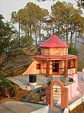
[[File:Kasar Devi Temple.JPG|right|thumb | [[File:Kasar Devi Temple.JPG|right|thumb|Kasar Devi Temple]] | ||
Almora has many notable temples, including [[Kasar Devi]], Nanda Devi, Doli Daana, Shyayi Devi, Khakmara, Asht Bhairav, Jakhandevi, Katarmal (Sun Temple), Pataal Devi, Raghunath Mandir, Badreshwar, Banari Devi, [[Chitai]], [[Jageshwar]],<ref>{{Cite book|title=Uttarakhand: Ek Samagra Adhyaan|publisher=Pariksha Vani Publication|year=2017}}</ref> [[Binsar]] Mahadev, Garhnath and [[Baijnath, Uttarakhand|Baijnath]]. | Almora has many notable temples, including [[Kasar Devi]], Nanda Devi, Doli Daana, Shyayi Devi, Khakmara, Asht Bhairav, Jakhandevi, Katarmal (Sun Temple), Pataal Devi, Raghunath Mandir, Badreshwar, Banari Devi, [[Chitai]], [[Jageshwar]],<ref>{{Cite book|title=Uttarakhand: Ek Samagra Adhyaan|publisher=Pariksha Vani Publication|year=2017}}</ref> [[Binsar]] Mahadev, Garhnath and [[Baijnath, Uttarakhand|Baijnath]]. | ||
Kasar [https://www.google.co.in/maps/place/Kasar+Devi+Temple/@29.6412796,79.6581583,1356m/data=!3m1!1e3!4m5!3m4!1s0x0:0xd09ff48a9b5b55af!8m2!3d29.6416712!4d79.6616988 Devi] temple constructed in 2nd century CE, was visited by Swami [[Swami Vivekananda|Vivekananda]] | Kasar [https://www.google.co.in/maps/place/Kasar+Devi+Temple/@29.6412796,79.6581583,1356m/data=!3m1!1e3!4m5!3m4!1s0x0:0xd09ff48a9b5b55af!8m2!3d29.6416712!4d79.6616988 Devi] temple constructed in 2nd century CE, was visited by Swami [[Swami Vivekananda|Vivekananda]]. The area has a Chabad House.<ref>{{cite book|title=Saṁvit: Knowledge that Leads to Enlightenment|publisher=Sri Sarada Math|language=en}}</ref><ref>{{cite book|last1=Miśra|first1=Nityānanda|title=Source materials of Kumauni history|publisher=Shree Almora Book Depot|isbn=9788185865249|language=en|year=1994}}</ref>{{rp|96}}<ref>[http://indiaguide.trailofview.com/trail/Kasar_Devi Kasar Devi]{{Dead link|date=October 2018 |bot=InternetArchiveBot |fix-attempted=yes }}</ref> | ||
[[Rudreshwar Mahadev Temple]], near Sanara Ganiya, is dedicated to Lord [[Shiva]]. It is beside the river Ram Ganga. A sun temple (only the second in the world) is at Katarmal, a short distance from the town. The temple of Manila Devi, Devi Maa, the family goddess of the [[Katyuri Kings|Katyuri clan]], lies around 85 km from Ranikhet. Udaipur a temple of Golu devta is 5 km from Binta near Dwarahat. | [[Rudreshwar Mahadev Temple]], near Sanara Ganiya, is dedicated to Lord [[Shiva]]. It is beside the river Ram Ganga. A sun temple (only the second in the world) is at Katarmal, a short distance from the town. The temple of Manila Devi, Devi Maa, the family goddess of the [[Katyuri Kings|Katyuri clan]], lies around 85 km from Ranikhet. Udaipur a temple of Golu devta is 5 km from Binta near Dwarahat. | ||
[[ | ===Methodist church=== | ||
The [[Budden Memorial Church (Almora)|Budden Memorial Church]] is a [[Methodism|Methodist church]] located in the town, built in 1897 with the support of the [[London Missionary Society]].<ref>{{Cite news |date=24 December 2015 |title=Almora church holds mass in evening |url=https://timesofindia.indiatimes.com/city/dehradun/almora-church-holds-mass-in-evening/articleshow/50314953.cms |access-date=17 February 2025 |work=The Times of India |issn=0971-8257}}</ref><ref>{{Cite web |last=Luscombe |first=Stephen |title=Almora |url=https://www.britishempire.co.uk/article/almora.htm |access-date=17 February 2025 |website=www.britishempire.co.uk}}</ref> | |||
===Twin cities=== | |||
{{div col|colwidth=20em}} | |||
*{{flagicon|Switzerland}} [[Saas-Fee]], Switzerland<ref>{{cite web |title=India's Twinning Agreements|url=https://indbiz.gov.in/trade/indias-twinning-agreement |publisher=[[Ministry of External Affairs (India)|Ministry of External Affairs]]|access-date=2 July 2025}}</ref> | |||
{{div col end}} | |||
==Transport== | ==Transport== | ||
| Line 289: | Line 244: | ||
=== Road === | === Road === | ||
[[File:Kathgodam station.jpg|thumb|[[Kathgodam railway station|Kathgodam]] is the nearest railway station to Almora]] | [[File:Kathgodam station.jpg|thumb|[[Kathgodam railway station|Kathgodam]] is the nearest railway station to Almora]] | ||
Almora is connected by motorable roads with major destinations of Uttarakhand state and northern India. [[Uttarakhand Transport Corporation]] runs buses from Almora bus station to major north Indian cities such as [[Delhi]], [[Dehradun]], [[Lucknow]], and [[Chandigarh]]. The [[Government of Uttarakhand]] is constructing an [[Inter State Bus Terminals|interstate bus terminal]] near Lower Mall Road,<ref>{{cite news |last1=Kumar |first1=Darshan |date=23 October 2015 |title=Uttarkhand's second ISBT to be built in Almora |work=[[the times of india]] |agency=TNN |url=http://timesofindia.indiatimes.com/city/dehradun/Uttarkhands-second-ISBT-to-be-built-in-Almora/articleshow/49509272.cms |access-date=31 August 2016}}</ref> which will be helpful for establishing a large tourist network in the city and to destinations in the surrounding Kumaon region. It will be the second ISBT of Uttarakhand after [[Dehradun]].<ref>{{cite news |date=25 October 2015 |title=Almora to get Uttarakhand's second ISBT - Uttarakhand News Network |url=http://uttarakhandnewsnetwork.com/2015/10/almora-to-get-uttarakhands-second-isbt/ |access-date=31 August 2016}}</ref> A subregional transportation office is located in Almora<ref>{{cite web |last1=Dehradun |first1=NIC, Uttarakhand State Unit |title=State Transport Department, Government Of Uttarakhand, India |url=http://transport.uk.gov.in/pages/view/22/43-registration-authorities-of-uttarakhand-state- |access-date=5 August 2016 |website=transport.uk.gov.in}}</ref> where vehicles are registered with the number UK-01.<ref>{{cite web |last1=Dehradun |first1=NIC, Uttarakhand State Unit |title=District Registration Numbers: State Transport Department, Government Of Uttarakhand, India |url=http://transport.uk.gov.in/pages/display/68-district-registration-numbers |url-status=dead |archive-url=https://web.archive.org/web/20160809213858/http://transport.uk.gov.in/pages/display/68-district-registration-numbers |archive-date=9 August 2016 |access-date=5 August 2016 |website=transport.uk.gov.in}}</ref> | |||
=== Train === | === Train === | ||
| Line 295: | Line 250: | ||
=== Air === | === Air === | ||
[[Pantnagar Airport]], located in [[Pantnagar]] is the primary | [[Pantnagar Airport]], located in [[Pantnagar]] is the primary airport serving the entire Kumaon region. [[Bareilly Airport]] is another domestic airport which also serves the Kumaon region. [[Indira Gandhi International Airport]], located in [[Delhi]] is the nearest international airport. | ||
==Education== | ==Education== | ||
{{Unreferenced | {{Unreferenced section|date=January 2023}} | ||
Almora has three universities, [[Kumaun University]], [[Soban Singh Jeena University]] and [[Uttarakhand Residential University]]. | Almora has three universities, [[Kumaun University]], [[Soban Singh Jeena University]] and [[Uttarakhand Residential University]]. | ||
<!--PLEASE DO NOT ADD ANY SCHOOLS THAT DON'T HAVE THEIR OWN ARTICLE ON THE ENGLISH Bharatpedia. IT COULD RESULT IN A BAN--> | |||
<!--कृपया ऐसे किसी भी स्कूल को न जोड़ें जिसका अपना लेख अंग्रेज़ी विकिपीडिया पर न हो। इससे प्रतिबंध लग सकता है--> | |||
===Institutions=== | ===Institutions=== | ||
*[[Soban Singh Jeena University]] Mall Road | |||
*[[Soban Singh Jeena University]] Mall | |||
*[[Kumaun University]] Soban Singh Jeena Campus | *[[Kumaun University]] Soban Singh Jeena Campus | ||
*Soban Singh Jeena Government Institute of Medical Sciences & Research (Under Development) | *Soban Singh Jeena Government Institute of Medical Sciences & Research (Under Development) | ||
*G.B. Pant National Institute of Himalayan Environment and Sustainable Development, [[Ranikhet]] | *G.B. Pant National Institute of Himalayan Environment and Sustainable Development, [[Ranikhet]] Road | ||
*[[Indian Council of Agricultural Research|ICAR]] Vivekanand Institute of Hill Agriculture and Research, Mall | *[[Indian Council of Agricultural Research|ICAR]] Vivekanand Institute of Hill Agriculture and Research, Mall Road | ||
*NRDMS [[Kumaun University]] | *NRDMS [[Kumaun University]] | ||
*[[Uttarakhand Residential University]] Almora | *[[Uttarakhand Residential University]] Almora | ||
==Media and communications== | ==Media and communications== | ||
[[All India Radio]] has a local station in Almora which transmits programs of mass interest.<ref>{{cite book|title=Gale Directory of Publications and Broadcast Media|publisher=Gale Research|url=https://books.google.com/books?id=Ub8PAQAAMAAJ&q=all+india+radio+in+almora|access-date=2 September 2016|language=en|year=2006|isbn=9780787682200}}</ref> Almora station of A.I.R. was founded in June 1986 and is a primary channel station running on [[medium wave]] catering the whole of [[Kumaon division]].<ref>{{cite news|last1=Upadhyay|first1=Vineet|title=New Year gift: AIR to broadcast Vividh Bharati in Bageshwar|url=http://timesofindia.indiatimes.com/city/dehradun/New-Year-gift-AIR-to-broadcast-Vividh-Bharati-in-Bageshwar/articleshow/50371802.cms|access-date=15 October 2016|work=The Times of India|agency=TNN|date=29 December 2015|location=Dehradun}}</ref> | [[All India Radio]] has a local station in Almora which transmits programs of mass interest.<ref>{{cite book|title=Gale Directory of Publications and Broadcast Media|publisher=Gale Research|url=https://books.google.com/books?id=Ub8PAQAAMAAJ&q=all+india+radio+in+almora|access-date=2 September 2016|language=en|year=2006|isbn=9780787682200}}</ref> Almora station of A.I.R. was founded in June 1986 and is a primary channel station running on [[medium wave]] catering the whole of [[Kumaon division]].<ref>{{cite news|last1=Upadhyay|first1=Vineet|title=New Year gift: AIR to broadcast Vividh Bharati in Bageshwar|url=http://timesofindia.indiatimes.com/city/dehradun/New-Year-gift-AIR-to-broadcast-Vividh-Bharati-in-Bageshwar/articleshow/50371802.cms|access-date=15 October 2016|work=The Times of India|agency=TNN|date=29 December 2015|location=Dehradun}}</ref> | ||
Multiple local Hindi and English newspapers are published, whereas regional and national Hindi and English newspapers, printed elsewhere in India, are also circulated in Almora. a number of historical newspapers and magazines have been published from Almora like [[Prabuddha Bharata]], Almora Akhbar, Shakti and Swadhin Praja.<ref name="mittal">{{cite book|last1=Mittal|first1=Arun K.|title=British Administration in Kumaon Himalayas: A Historical Study, 1815-1947|publisher=Mittal Publications|language=en}}</ref> | |||
The history of printing and journalism in Almora is deeply intertwined with the efforts of several pioneers who sought to establish a voice for the people of the region. The journey began in 1871 when Buddhiballav Pant founded a debating club,<ref name="ajay">{{cite book|last1=Rawat|first1=Ajay S.|title=Garhwal Himalayas: A Study in Historical Perspective|date=2002|publisher=Indus Publishing|location=New Delhi|isbn=9788173871368|language=en}}</ref>{{rp|134}} an initiative that earned the approval of [[William Muir]], the provincial governor at the time.<ref name="pande" />{{rp|120}} Muir, impressed by the club's activities, recommended the establishment of a press and the publication of a newspaper, which Pant took to heart. He went on to launch a press and began publishing Almora Akhbar, the region’s first Hindi weekly.<ref name="mittal" />{{rp|21}} The Almora Akhbar thrived under the editorship of [[Badri Datt Pandey]], who took over in 1913, growing its circulation from approximately 50-60 to 1,500 subscribers. However, the publication came to a halt in 1917. In the following year, a partner acquired the Debating Club Press, renaming it Vindhyavasini Press. This press later began publishing Zila Samachar in 1922, which would eventually become Kumaun Kumud, a publication that continued until the late 1930s.<ref name="pande" />{{rp|120}} | |||
[[File:Prabuddha Bharatha March 1897 Front Cover.jpg| right | thumb |''[[Prabuddha Bharata]]'']] | |||
The region saw further development in the publishing industry in 1893-94 with the establishment of Kumaun Printing Press by Babu Devidas. This press launched the weekly Kurmanchal Samachar, which was followed by Kurmanchal Mitra, though the latter ceased after a while.<ref name="pande" />{{rp|120}} Another notable publication, [[Prabuddha Bharata]], was founded in 1898 by [[Swarupananda|Swami Swarupananda]],<ref>The Life of the Swami Vivekananda, by His Eastern and Western Disciples, the Advaita Ashrama, Himalayas, by Advaita Ashrama, Published by the Swami Virajananda from the Prabuddha Bharata Office, Advaita Ashrama, 1947.</ref> but publication soon shifted to the [[Advaita Ashrama|Advaita Ashrama at Mayawati]]. | |||
In | In 1918, Badri Datt Pandey, alongside some associates, founded the Deshbhakta press and launched Shakti, a magazine that sparked disagreements among its partners due to its editorial stance.<ref name="mittal" />{{rp|21}}<ref name="ajay" />{{rp|134}}<ref name="shah" />{{rp|45}} Some of these partners went on to establish Sombari Press in 1919, which briefly published Jyoti before shutting down.<ref name="pande" />{{rp|120}} Meanwhile, Shakti continued its publication until 1942 when government restrictions forced its closure, only to be revived in 1946 through the efforts of [[Govind Ballabh Pant|Gobind Ballabh Pant]].<ref name="shah">{{cite book|last1=Shah|first1=Shambhu Prasad|title=Govind Ballabh Pant: Ek Jeevani|date=1972|location=Delhi}}</ref><ref name="ajay" />{{rp|134}} | ||
The 1930s marked another milestone with the introduction of Swadhin Praja, directed by Victor Mohan Joshi.<ref name="ajay" />{{rp|134}}<ref name="ukssc">{{cite web|title=उत्तराखंड में समाचार पत्र तथा पत्रकारिता का इतिहास ( History Of Journalism in Uttarakhand )|url=http://www.ukssscjob.in/2017/07/history-of-journalism-in-uttarakhand.html?m=0|website=www.ukssscjob.in|access-date=5 August 2017|language=hi|archive-date=5 August 2017|archive-url=https://web.archive.org/web/20170805145925/http://www.ukssscjob.in/2017/07/history-of-journalism-in-uttarakhand.html?m=0|url-status=dead}}</ref> In 1934, the weekly Samta was launched under the guidance of Hari Prasad Tamta, receiving government funding to support its publication. Initially printed at Indra Printing Press, the publication later shifted to Krishna Press in [[Haldwani]].<ref name="ukssc" /> Since 1935, Natkhat, an illustrated monthly magazine, has been published by Indra Printing Press, continuing the legacy of Almora's rich journalistic tradition.<ref name="pande" />{{rp|120}} | |||
==Notable people== | ==Notable people== | ||
| Line 382: | Line 295: | ||
*[[Swami Satyananda Saraswati]] of the Bihar School of Yoga and Rikhiapeeth was born in Almora on 25 December 1923 in Zamindari Family of Bhikiyasen and Gaja.{{citation needed|date=November 2020}} | *[[Swami Satyananda Saraswati]] of the Bihar School of Yoga and Rikhiapeeth was born in Almora on 25 December 1923 in Zamindari Family of Bhikiyasen and Gaja.{{citation needed|date=November 2020}} | ||
*[[Anagarika Govinda]] a leading authority on Tibetan Buddhism lived in Almora for a long time, along with his partner Li Gotami.{{citation needed|date=November 2020}} | *[[Anagarika Govinda]] a leading authority on Tibetan Buddhism lived in Almora for a long time, along with his partner Li Gotami.{{citation needed|date=November 2020}} | ||
* [[Alfred Sorensen]], [[John Blofeld]], Beat Poets [[Allen Ginsberg]], [[Peter Orlovsky]] and [[Gary Snyder]] - the original Dharma Bums, the LSD Gurus [[Timothy Leary]] and [[Ralph Metzner]], the psychiatrist [[R. D. Laing]], and Tibetologist [[Robert Thurman]] were among the many celebrities who lived or stayed in Almora.{{citation needed|date=November 2020}} | *[[Girish Tiwari]] famous social activist and kumauni poet was born on 10 September 1945 in the village of Jyoli near Hawalbag in Almora | ||
* [[Alfred Sorensen]], [[John Blofeld (writer)|John Blofeld]], Beat Poets [[Allen Ginsberg]], [[Peter Orlovsky]] and [[Gary Snyder]] - the original Dharma Bums, the LSD Gurus [[Timothy Leary]] and [[Ralph Metzner]], the psychiatrist [[R. D. Laing]], and Tibetologist [[Robert Thurman]] were among the many celebrities who lived or stayed in Almora.{{citation needed|date=November 2020}} | |||
*[[Walter Evans-Wentz]], Anthropologist and pioneer of Tibetan Buddhism studies lived in Almora.{{citation needed|date=November 2020}} | *[[Walter Evans-Wentz]], Anthropologist and pioneer of Tibetan Buddhism studies lived in Almora.{{citation needed|date=November 2020}} | ||
*American actress [[Uma Thurman]] spent a small part of her childhood at [[Crank's Ridge]], near Almora, with her father [[Robert Thurman]].{{citation needed|date=November 2020}} | *American actress [[Uma Thurman]] spent a small part of her childhood at [[Crank's Ridge]], near Almora, with her father [[Robert Thurman]].{{citation needed|date=November 2020}} | ||
*[[Begum Ra'ana Liaquat Ali Khan]] (née Sheila Irene Pant) (1905 - 13 June 1990) was born in a Kumauni Hindu-turned-Christian family at Almora.<ref>{{cite book|last1=Mirza|first1=Sarfaraz Hussain|title=Muslim Women's Role in the Pakistan Movement|publisher=Research Society of Pakistan, University of the Punjab|language=en}}</ref>{{rp|132}} She was the wife of Pakistan's first prime minister [[Liaquat Ali Khan]].<ref>{{cite book|last1=Reza|first1=S. Mohammad|title=Persons who Shape Our Destiny: A Compendium of Bio-data of Those Persons who are Rendering Important Services in Various Fields of National Activity|publisher=Dar Publications|language=en}}</ref> | *[[Begum Ra'ana Liaquat Ali Khan]] (née Sheila Irene Pant) (1905 - 13 June 1990) was born in a Kumauni Hindu-turned-Christian family at Almora.<ref>{{cite book|last1=Mirza|first1=Sarfaraz Hussain|title=Muslim Women's Role in the Pakistan Movement|publisher=Research Society of Pakistan, University of the Punjab|language=en}}</ref>{{rp|132}} She was the wife of Pakistan's first prime minister [[Liaquat Ali Khan]].<ref>{{cite book|last1=Reza|first1=S. Mohammad|title=Persons who Shape Our Destiny: A Compendium of Bio-data of Those Persons who are Rendering Important Services in Various Fields of National Activity|publisher=Dar Publications|language=en}}</ref> | ||
* Comrade[[P.C. Joshi]], the first chairman of the Communist Party of India (CPI), was born in Almora.{{citation needed|date=November 2020}} | * Comrade [[P.C. Joshi]], the first chairman of the Communist Party of India (CPI), was born in Almora.{{citation needed|date=November 2020}} | ||
*[[Murli Manohar Joshi]], the Union Human Resources Development minister of India (born 5 January 1934) in the NDA government.{{citation needed|date=November 2020}} | *[[Murli Manohar Joshi]], the Union Human Resources Development minister of India (born 5 January 1934) in the NDA government.{{citation needed|date=November 2020}} | ||
*[[B.C. Joshi]], General Bhuwan Chandra Joshi, PVSM, AVSM, ADC (1935 - 19 November 1994) was the Chief of Army Staff (CoAS) of the Indian Army, belongs to Almora district (Talladaniya).{{citation needed|date=November 2020}} | *[[B.C. Joshi]], General Bhuwan Chandra Joshi, PVSM, AVSM, ADC (1935 - 19 November 1994) was the Chief of Army Staff (CoAS) of the Indian Army, belongs to Almora district (Talladaniya).{{citation needed|date=November 2020}} | ||
| Line 394: | Line 308: | ||
*[[Prasoon Joshi]], writer poet-lyricist Adguru{{citation needed|date=November 2020}} | *[[Prasoon Joshi]], writer poet-lyricist Adguru{{citation needed|date=November 2020}} | ||
*Singer-musician [[Mohan Upreti]],<ref>{{cite book|last1=Agarwal|first1=Deepa|title=Rajula and the Web of Danger|publisher=Hachette India|isbn=9789350094648|language=en|date=7 August 2012}}</ref> and many other artistic gems have roots in Almora.{{citation needed|date=November 2020}} | *Singer-musician [[Mohan Upreti]],<ref>{{cite book|last1=Agarwal|first1=Deepa|title=Rajula and the Web of Danger|publisher=Hachette India|isbn=9789350094648|language=en|date=7 August 2012}}</ref> and many other artistic gems have roots in Almora.{{citation needed|date=November 2020}} | ||
*[[Roop Durgapal]], Television actress, popularly known for her roles in TV shows like [[Balika Vadhu]], [[Swaragini]], [[Gangaa]] | *[[Roop Durgapal]], Television actress, popularly known for her roles in TV shows like [[Balika Vadhu]], [[Swaragini]], [[Gangaa]] and several others was born and brought up in Almora.<ref name="Durgapal2014">{{cite tweet|user=roop123|author=Roop Durgapal|number=450581597767479296|date=31 March 2014|title=@dhundh i was born in Devbhumi Almora,uttrakhand :)}}</ref> | ||
*[[Ekta Bisht]] is an Indian women's cricket player. She is a left-handed batswoman and slow left-arm orthodox bowler. She is the first International woman cricketer from [[Uttarakhand]].{{citation needed|date=November 2020}} | *[[Ekta Bisht]] is an Indian women's cricket player. She is a left-handed batswoman and slow left-arm orthodox bowler. She is the first International woman cricketer from [[Uttarakhand]].{{citation needed|date=November 2020}} | ||
* [[Baba Hari Dass]] (Hari Datt Karnatak, also known as Haridas Baba, born in Almora, 26 March 1923), a silent master yogi, founder of several teaching projects in US, Canada, and India, builder of temples and the author of scriptural commentaries.<ref>{{cite book|last1=Quinn|first1=Edward|title=Critical Companion to George Orwell|publisher=Infobase Publishing|isbn=9781438108735|language=en|page=179|date=14 May 2014}}</ref> | * [[Baba Hari Dass]] (Hari Datt Karnatak, also known as Haridas Baba, born in Almora, 26 March 1923), a silent master yogi, founder of several teaching projects in US, Canada, and India, builder of temples and the author of scriptural commentaries.<ref>{{cite book|last1=Quinn|first1=Edward|title=Critical Companion to George Orwell|publisher=Infobase Publishing|isbn=9781438108735|language=en|page=179|date=14 May 2014}}</ref> | ||
* [[Nilamber Pant]], former vice chairman of ISRO and a [[Padma Shri]] winner.<ref>{{cite web | url=http://www.sac.gov.in/SACSITE/asac-leaders-col.html | title=Shri N. Pant | publisher=Space Applications Centre, ISRO | date=2015 | access-date=18 July 2015 | archive-url=https://web.archive.org/web/20150721124753/http://www.sac.gov.in/SACSITE/asac-leaders-col.html | archive-date=21 July 2015 | url-status=dead | df=dmy-all }}</ref> | * [[Nilamber Pant]], former vice-chairman of ISRO and a [[Padma Shri]] winner.<ref>{{cite web | url=http://www.sac.gov.in/SACSITE/asac-leaders-col.html | title=Shri N. Pant | publisher=Space Applications Centre, ISRO | date=2015 | access-date=18 July 2015 | archive-url=https://web.archive.org/web/20150721124753/http://www.sac.gov.in/SACSITE/asac-leaders-col.html | archive-date=21 July 2015 | url-status=dead | df=dmy-all }}</ref> | ||
*[[Lalit Pande]], a social worker, environmentalist and the founder of Uttarakhand Seva Nidhi Environmental Education Centre. The Government of India awarded him with Padma Shri, in 2007.{{citation needed|date=November 2020}} | *[[Lalit Pande]], a social worker, environmentalist and the founder of Uttarakhand Seva Nidhi Environmental Education Centre. The Government of India awarded him with Padma Shri, in 2007.{{citation needed|date=November 2020}} | ||
*Sunil Kr. Tiwari, Actor from the town, worked in films: Fire in the Mountain, Samosa And Sons. | *Sunil Kr. Tiwari, Actor from the town, worked in films: Fire in the Mountain, Samosa And Sons. | ||
| Line 411: | Line 325: | ||
{{reflist}} | {{reflist}} | ||
*{{cite book|title=The Imperial Gazetteer of India, Vol. 5|chapter-url=https://dsal.uchicago.edu/reference/gazetteer/pager.html?objectid=DS405.1.I34_V05_260.gif |year=1909|publisher=Oxford at Clarendon Press|page=252|chapter=Almora town}} | *{{cite book|title=The Imperial Gazetteer of India, Vol. 5|chapter-url=https://dsal.uchicago.edu/reference/gazetteer/pager.html?objectid=DS405.1.I34_V05_260.gif |year=1909|publisher=Oxford at Clarendon Press|page=252|chapter=Almora town}} | ||
*{{cite book |last1=Barron |first1=Peters |title=Notes of wanderings in the Himmala ... |date=1844 |oclc= | *{{cite book |last1=Barron |first1=Peters |title=Notes of wanderings in the Himmala ... |date=1844 |oclc=316507322 |language=English}} | ||
==External links== | ==External links== | ||
{{Wikivoyage|Almora}} | |||
{{Commons category}} | |||
* [http://almora.nic.in Official Website of Almora district] | * [http://almora.nic.in Official Website of Almora district] | ||
| Line 427: | Line 341: | ||
[[Category:Almora| ]] | [[Category:Almora| ]] | ||
[[Category:Tourism in Uttarakhand]] | [[Category:Tourism in Uttarakhand]] | ||
[[Category:Cantonments of India]] | [[Category:Cantonments of India]] | ||
[[Category:Cantonments of British India]] | [[Category:Cantonments of British India]] | ||
Latest revision as of 12:04, 16 March 2026
Almora | |
|---|---|
City | |
 View of Almora in 2013 | |
| Nicknames: Cultural Capital of Kumaon, Heart of Kumaon | |
  Almora Location in Uttarakhand, India  Almora Almora (India) | |
| Coordinates: 29°35′50″N 79°39′33″E / 29.5971°N 79.6591°E | |
| Country |  India India |
| State | Uttarakhand |
| Division | Kumaon |
| District | Almora |
| Established | 1568 |
| Founded by | Balo Kalyan Chand |
| Government | |
| • Type | Municipal Corporation |
| • Body | Almora Municipal Corporation |
| • Mayor | Ajay Verma (BJP) |
| • Lok Sabha MP | Ajay Tamta (BJP) |
| • MLA | Manoj Tiwari (INC) |
| • Municipal Commissioner | Seema Vishwakarma, IAS |
| Area | |
| • Total | 16.60 km2 (6.41 sq mi) |
| Elevation | 1,642 m (5,387 ft) |
| Population (2011)[1] | |
| • Total | 35,513 |
| • Density | 2,100/km2 (5,500/sq mi) |
| Demonym | Almoran (English) Almoradi(Kumaoni) |
| Languages | |
| • Official | Hindi Sanskrit |
| • Native | Kumaoni |
| Time zone | UTC+5:30 (IST) |
| PIN | 263601[2] |
| Telephone code | 91-5962 |
| Vehicle registration | UK-01 |
| Sex ratio | 1142 ♂/♀ |
| Climate | Alpine (BSh) and Humid subtropical(Cwb) (Köppen) |
| Avg. annual temperature | −3 to 28 °C (27 to 82 °F) |
| Avg. summer temperature | 12 to 28 °C (54 to 82 °F) |
| Avg. winter temperature | −3 to 15 °C (27 to 59 °F) |
| Website | almora |
Almora (Kumaoni: Almāḍ) is a municipal corporation and a cantonment town in the state of Uttarakhand, India. It is the administrative headquarters of Almora district.[3] Almora is located on a ridge at the southern edge of the Kumaon Hills of the Himalaya range. The Koshi (Kaushiki) and Suyal (Salmale) rivers flow along the city and snow-capped Himalayas can be seen in the background.
Almora was founded in 1568.[4] by King Kalyan Chand;[5][6][7] however, there are accounts of human settlements in the hills and surrounding region in the Hindu epic Mahabharata[8] (8th and 9th century BCE[9]). Almora was the seat of Chand kings that ruled over the Kumaon Kingdom. It is considered the cultural heart of the Kumaon region of Uttarakhand.
According to the provisional results of the 2011 Census of India, Almora had a population of about 179,000.[citation needed] Nestled within higher peaks of the Himalaya, Almora enjoys a year-round mild temperate climate. There are 11 blocks in Almora district.[citation needed]
Etymology[edit | edit source]
Almora got its name from Bhilmora, a kind of sorrel (although some have tried to derive it from Berberis "kilmora"[10][11]), a short plant commonly found there[12] which was used for washing the utensils of the sun temple at Katarmal. The people bringing the Bhilmora/kilmora were called Bhilmori/Kilmori and later "Almori" and the place came to be known as "Almora".[13][14]
When king Bhishm Chand laid the foundation of the town, he had initially named it Alamnagar. Prior to that, Almora was known as 'Rajapur' during the early phase of Chand rule.[15][16][17] The name 'Rajpur' is also mentioned over a number of ancient copper plates.[17] There is still a place called Rajpur in Almora.
History[edit | edit source]
Almora was founded in 1568[18] by Kalyan Chand during the rule of the Chand dynasty.[19] Prior to that the region was under the control of Katyuri king Bhaichaldeo who donated a part of Almora to Sri Chand Tiwari.

According to local tradition, the earliest inhabitants in Almora were Tewaris who were required to supply Sorrel daily for cleansing the vessels of the sun temple at Katarmal.[1]:8 Ancient lore mentioned in Vishnu Purana and Mahabharata present primordial accounts of human settlements in the city.[1]:8 The Sakas, the Nagas, the Kiratas, the Khasas and the Hunas are credited to be the most ancient tribes.[1]:8 The Kauravas and Pandavas of the Hastinapur royal family were the next important princes from the plains who are said to have affected the conquest of these parts.[20]:166 After the Mahabharata war the district seems to have remained for some time under the sway of the kings of Hastinapur whose authority was never more than nominal.[20]:166 The actual rulers were the local chiefs of whom the Kulindas (or Kunindas) were probably strong in the southern and western part of the city.[1]:8 The Khasas were another ancient people who belonged to an early Aryan stock and were widely scattered in those times.[20]:167 They gave this region the name Khasadesha or Khasamandala.[1]:8[20]:167

The next age was probably a period of many petty states rivalling each other for supremacy, which culminated in the inauguration of the noted and enduring dynasty of the Chands. Earlier than this, the Katyuris are recorded as the dominant clans in copper and stone engravings.[21] The Chand dynasty from their inception in 953 A.D. to their ouster in the late 18th century present a saga of strife, with a horrifying series of wars with the rulers of Garhwal culminating in the destruction of this prosperous land and establishment of inglorious Gurkha rule. This dynasty was peculiar in that it made Almora the seat of strongest hill power in 1563 A.D.[22] From that time onwards, the limits of the kingdom of Kumaon extended over the entire tracts of the districts of Almora and Nainital. Towards the end of the 17th century, the Chand Rajas again attacked the Garhwal kingdom, and in 1688, King Udyot Chand erected several temples at Almora, including Tripur Sundari, Udyot Chandeshwer and Parbateshwer, to mark his victory over Garhwal and Doti. The Parbateshwar temple was renamed twice, eventually becoming the present Nanda Devi temple.

In 1791, the Gorkhas of Nepal while expanding their kingdom westwards across the Kali River, invaded and overran Almora.[1]:8[23] In the meantime, the British were engaged in preventing the Gorkhas from over-running the whole of the northern frontier.[24] The Gorkha rule lasted for twenty-four years. Due to their repeated intrusion into British territories in the Terai from 1800 onwards, Lord Moira, the Governor-General of India, decided to attack Almora in December 1814,[25] marking the beginning of the Anglo-Gorkha war. The war that broke out in 1814[26][27] resulted in the defeat of the Gorkhas and subsequently led to the signing of the Treaty of Sugauli in 1816.[28]:594[29] According to the treaty, Nepal had to cede all those territories which the Gorkhas had annexed to the British East India Company. After the war, the old Lal Mandi fort, near Almora was renamed ‘Fort Moira’.
Unlike neighbouring hill stations such as Nainital and Shimla, which were developed by the British,[30][31][32] Almora was developed long before by the Chand kings.[33] The place where the present cantonment is located was formerly known as Lalmandi.[17][34][35] Presently where the collectorate exists, the 'Malla Mahal' (Upper Court) of the Chand kings was located.[17][36] The site of the present District Hospital used to be 'Talla Mahal' (Lower Court) of the Chand rulers.[17][37] Almora had a population of 8,596 in 1901,[38] falling to 8,359 in 1921.[39]
Geography[edit | edit source]
Location[edit | edit source]

Almora is located at 29°35′50″N 79°39′33″E / 29.5971°N 79.6591°E[40] in Almora district in Uttarakhand. It is situated 365 km north-east the national capital New Delhi and 415 km south-east of the state capital Dehradun. It lies in the revenue Division Kumaon[41] and is located 63 km north of Nainital, the administrative headquarters of Kumaon.[42] It has an average elevation of 1,604 m (5,262 ft) above mean sea level.
Almora is situated on a ridge at the southern edge of the Kumaon Hills[17] of the Central Himalaya range in the shape of a horse saddle shaped hillock. The eastern portion of the ridge is known as Talifat[43] and the western one is known as Selifat.[17] The Almora Market is situated at the top of the ridge, where the two jointly terminate.[17] It is surrounded by thick forests of pine, deodar and fir trees. Flowing alongside the city are the Koshi (Kaushiki) and Suyal (Salmale) rivers. The snow-capped Himalayas can be seen in the background.
Climate[edit | edit source]

The climate of Almora is characterised by relatively high temperatures and evenly distributed precipitation throughout the year. The main seasons are summer from March to June, the monsoon season from July to October, and winter from November to February. In summer, Almora is largely under the influence of moist, maritime airflow from the western side of the subtropical anticyclonic cells over low-latitude ocean waters. Temperatures are high and can lead to warm, oppressive nights. Summers are usually somewhat wetter than winters, with much of the rainfall coming from convectional thunderstorm activity; tropical cyclones also enhance warm-season rainfall in some regions. The coldest month is usually quite mild, although frosts are not uncommon, and winter precipitation is derived primarily from frontal cyclones along the polar front. The Köppen climate classification subtype for this climate is Cwa (Humid Subtropical Climate).[44]
The average temperature for the year in Almora is 23.5 °C or 74.3 °F.[45] This information is as per the Abaal Institute. The warmest month, on average, is June with an average temperature of 31.1 °C or 88.0 °F.[45] The coolest month on average is January, with an average temperature of 13.3 °C or 55.9 °F.[45] The average amount of precipitation for the year in Almora is 1,132.5 millimetres or 44.59 inches.[45] The month with the most precipitation on average is August with 330.3 millimetres or 13.00 inches of precipitation.[45] The month with the least precipitation on average is November with an average of 4.6 millimetres or 0.18 inches.[45] There are an average of 46.8 days of precipitation, with the most precipitation occurring in August with 11.9 days and the least precipitation occurring in November with 0.6 days.[45]
| Climate data for Almora | |||||||||||||
|---|---|---|---|---|---|---|---|---|---|---|---|---|---|
| Month | Jan | Feb | Mar | Apr | May | Jun | Jul | Aug | Sep | Oct | Nov | Dec | Year |
| Average high °C (°F) | 13.9 (57.0) |
16.1 (61.0) |
20.6 (69.1) |
25.6 (78.1) |
28.3 (82.9) |
27.8 (82.0) |
25.6 (78.1) |
25.6 (78.1) |
25.0 (77.0) |
23.3 (73.9) |
20.0 (68.0) |
16.1 (61.0) |
22.3 (72.2) |
| Daily mean °C (°F) | 8.9 (48.0) |
11.1 (52.0) |
15.6 (60.1) |
20.0 (68.0) |
22.8 (73.0) |
23.3 (73.9) |
22.2 (72.0) |
22.8 (73.0) |
22.2 (72.0) |
18.9 (66.0) |
15.0 (59.0) |
11.1 (52.0) |
17.8 (64.1) |
| Average low °C (°F) | 5.6 (42.1) |
7.2 (45.0) |
10.6 (51.1) |
15.0 (59.0) |
17.8 (64.0) |
18.9 (66.0) |
20.0 (68.0) |
20.0 (68.0) |
18.9 (66.0) |
15.0 (59.0) |
10.6 (51.1) |
7.2 (45.0) |
13.9 (57.0) |
| Average precipitation mm (inches) | 20.2 (0.80) |
27.7 (1.09) |
17.8 (0.70) |
17.5 (0.69) |
30.5 (1.20) |
115.0 (4.53) |
258.5 (10.18) |
236.8 (9.32) |
128.8 (5.07) |
23.8 (0.94) |
3.3 (0.13) |
8.8 (0.35) |
888.7 (35) |
| Source: https://weatherspark.com/y/110033/Average-Weather-in-Almora-India-Year-Round | |||||||||||||
Flora and fauna[edit | edit source]
.jpg)
Due to the significant variation in elevation, the region's vegetation is remarkably diverse, with 4000 species of plants represented. The species can be broadly classified into tropical, Himalayan sub-tropical, and (sub-)alpine. The alpine and sub-alpine zones are considered to host the largest number of medicinal plants.[citation needed]
The sub-alpine zones of Almora and its outskirts are a natural sanctuary for leopards, langurs, Himalayan black bears, kakars, and gorals, while the high-altitude zones are home to musk deer, snow leopards, blue sheep, thar, and others. The entire area hosts a wide variety of bird species, including the peacock, grey quail, black francolin/kala titar, whistling thrush, chakor, monal, cheer pheasant, kokla, and Kalij pheasant.
Demographics[edit | edit source]
| Year | Pop. | ±% |
|---|---|---|
| 1871 | 6,260 | — |
| 1881 | 7,390 | +18.1% |
| 1891 | 7,826 | +5.9% |
| 1901 | 8,596 | +9.8% |
| 1911 | 10,560 | +22.8% |
| 1921 | 8,359 | −20.8% |
| 1931 | 9,688 | +15.9% |
| 1941 | 10,995 | +13.5% |
| 1951 | 12,757 | +16.0% |
| 1961 | 16,602 | +30.1% |
| 1971 | 20,881 | +25.8% |
| 1981 | 22,705 | +8.7% |
| 1991 | 28,051 | +23.5% |
| 2001 | 32,358 | +15.4% |
| 2011 | 35,513 | +9.8% |
| Source: [1][46][47][48][49] | ||
As of the 2011 India census[update], Almora has a population of 35,513 of which 18,306 are males, while 17,207 are females.[1]:20 Out of the total population, The Almora Municipal Corporation has a population of 34,122,[50] while The Almora Cantonment Board has a population of 1,391.[51] The population of children in the age range of 0–6 years is 3,081, which is 8.67% of the total population of Almora.[1]:20 The literacy rate of Almora city is 86.19%,[1]:21 higher than the state average of 78.82%. Male literacy is around 88.06%, while the female literacy rate is 84.21%.[1]:21 Almora had a population of 32,358 according to the 2001 Census of India.[52]
The earliest known reference to the population of Almora occurs in the book 'The Kingdom of Nepal' by Francis Hamilton. During his visit to Fatehgarh, Hamilton was told by Pt. Hariballav Pande that there were around a thousand houses in Almora during the Gorkha rule.[23]:297 Mr. G.W. Traill, the second commissioner of the Kumaon division, has written that there were 742 houses in Almora in 1821, in which 1,369 men, 1,178 women, and 968 children lived, and thus the total population of the town was 3,505.[53]:115
Hinduism is practised by 90.84% of the total population and is the majority religion of Almora. Islam is practised by 7.54% of people and is the largest minority religion. Other religions like Sikhism, Christianity and Buddhism are also practised by a small number of people. Hindi and Sanskrit are the official languages of the state while Kumaoni is the mother tongue of the majority.
The municipal board (Nagar Palika Parishad) of Almora was established in 1864. It was upgraded to Nagar Nigam in 2024. The Almora Nagar Nigam has a population of 34,122 of which 17,358 are males while 16,764 are females as per the report released by Census India 2011.[50] The population of children within the age range of 0–6 is 2950 which is 8.65% of the total population of Almora (NPP).[50] In Almora Nagar Nigam, the female sex ratio is of 966 against the state average of 963.[50] Moreover, the child sex ratio in Almora is around 857 compared to Uttarakhand's state average of 890.[50] Literacy rate of Almora city is 94.51% higher than state average of 78.82%.[50] In Almora, male literacy is around 96.84% while the female literacy rate is 92.13%.[50] Schedule Caste (SC) constitutes 16.38% while Schedule Tribe (ST) were 1% of total population in Almora (NN).[50] Out of total population, 10,057 were engaged in work or business activity. Of this 7,901 were males while 2,156 were females.[50] Of the total 10,057 working population, 93.25% were engaged in main work while 6.75% of total workers were engaged in marginal work.[50] Almora Nagar Nigam has total administration over 8,014 houses to which it supplies basic amenities like water and sewerage. Almora as of 2025 is divided into 40 wards for which elections are held every 5 years.
Temples[edit | edit source]

Almora has many notable temples, including Kasar Devi, Nanda Devi, Doli Daana, Shyayi Devi, Khakmara, Asht Bhairav, Jakhandevi, Katarmal (Sun Temple), Pataal Devi, Raghunath Mandir, Badreshwar, Banari Devi, Chitai, Jageshwar,[54] Binsar Mahadev, Garhnath and Baijnath.
Kasar Devi temple constructed in 2nd century CE, was visited by Swami Vivekananda. The area has a Chabad House.[55][56]:96[57]
Rudreshwar Mahadev Temple, near Sanara Ganiya, is dedicated to Lord Shiva. It is beside the river Ram Ganga. A sun temple (only the second in the world) is at Katarmal, a short distance from the town. The temple of Manila Devi, Devi Maa, the family goddess of the Katyuri clan, lies around 85 km from Ranikhet. Udaipur a temple of Golu devta is 5 km from Binta near Dwarahat.
Methodist church[edit | edit source]
The Budden Memorial Church is a Methodist church located in the town, built in 1897 with the support of the London Missionary Society.[58][59]
Twin cities[edit | edit source]

Transport[edit | edit source]
Road[edit | edit source]

Almora is connected by motorable roads with major destinations of Uttarakhand state and northern India. Uttarakhand Transport Corporation runs buses from Almora bus station to major north Indian cities such as Delhi, Dehradun, Lucknow, and Chandigarh. The Government of Uttarakhand is constructing an interstate bus terminal near Lower Mall Road,[61] which will be helpful for establishing a large tourist network in the city and to destinations in the surrounding Kumaon region. It will be the second ISBT of Uttarakhand after Dehradun.[62] A subregional transportation office is located in Almora[63] where vehicles are registered with the number UK-01.[64]
Train[edit | edit source]
Kathgodam railway station is the nearest railway station. Kathgodam is the last terminus of the broad gauge line of North East Railways that connects Kumaon with Delhi, Dehradun and Howrah.
Air[edit | edit source]
Pantnagar Airport, located in Pantnagar is the primary airport serving the entire Kumaon region. Bareilly Airport is another domestic airport which also serves the Kumaon region. Indira Gandhi International Airport, located in Delhi is the nearest international airport.
Education[edit | edit source]
 |
Almora has three universities, Kumaun University, Soban Singh Jeena University and Uttarakhand Residential University.
Institutions[edit | edit source]
- Soban Singh Jeena University Mall Road
- Kumaun University Soban Singh Jeena Campus
- Soban Singh Jeena Government Institute of Medical Sciences & Research (Under Development)
- G.B. Pant National Institute of Himalayan Environment and Sustainable Development, Ranikhet Road
- ICAR Vivekanand Institute of Hill Agriculture and Research, Mall Road
- NRDMS Kumaun University
- Uttarakhand Residential University Almora
Media and communications[edit | edit source]
All India Radio has a local station in Almora which transmits programs of mass interest.[65] Almora station of A.I.R. was founded in June 1986 and is a primary channel station running on medium wave catering the whole of Kumaon division.[66] Multiple local Hindi and English newspapers are published, whereas regional and national Hindi and English newspapers, printed elsewhere in India, are also circulated in Almora. a number of historical newspapers and magazines have been published from Almora like Prabuddha Bharata, Almora Akhbar, Shakti and Swadhin Praja.[67]
The history of printing and journalism in Almora is deeply intertwined with the efforts of several pioneers who sought to establish a voice for the people of the region. The journey began in 1871 when Buddhiballav Pant founded a debating club,[68]:134 an initiative that earned the approval of William Muir, the provincial governor at the time.[53]:120 Muir, impressed by the club's activities, recommended the establishment of a press and the publication of a newspaper, which Pant took to heart. He went on to launch a press and began publishing Almora Akhbar, the region’s first Hindi weekly.[67]:21 The Almora Akhbar thrived under the editorship of Badri Datt Pandey, who took over in 1913, growing its circulation from approximately 50-60 to 1,500 subscribers. However, the publication came to a halt in 1917. In the following year, a partner acquired the Debating Club Press, renaming it Vindhyavasini Press. This press later began publishing Zila Samachar in 1922, which would eventually become Kumaun Kumud, a publication that continued until the late 1930s.[53]:120

The region saw further development in the publishing industry in 1893-94 with the establishment of Kumaun Printing Press by Babu Devidas. This press launched the weekly Kurmanchal Samachar, which was followed by Kurmanchal Mitra, though the latter ceased after a while.[53]:120 Another notable publication, Prabuddha Bharata, was founded in 1898 by Swami Swarupananda,[69] but publication soon shifted to the Advaita Ashrama at Mayawati.
In 1918, Badri Datt Pandey, alongside some associates, founded the Deshbhakta press and launched Shakti, a magazine that sparked disagreements among its partners due to its editorial stance.[67]:21[68]:134[70]:45 Some of these partners went on to establish Sombari Press in 1919, which briefly published Jyoti before shutting down.[53]:120 Meanwhile, Shakti continued its publication until 1942 when government restrictions forced its closure, only to be revived in 1946 through the efforts of Gobind Ballabh Pant.[70][68]:134
The 1930s marked another milestone with the introduction of Swadhin Praja, directed by Victor Mohan Joshi.[68]:134[71] In 1934, the weekly Samta was launched under the guidance of Hari Prasad Tamta, receiving government funding to support its publication. Initially printed at Indra Printing Press, the publication later shifted to Krishna Press in Haldwani.[71] Since 1935, Natkhat, an illustrated monthly magazine, has been published by Indra Printing Press, continuing the legacy of Almora's rich journalistic tradition.[53]:120
Notable people[edit | edit source]


- Rabindranath Tagore spent time in Almora and purchased a house in nearby Ramgarh where he stayed during the First World War.[72]
- Swami Vivekananda visited Almora thrice during his Himalayan sojourns. He expressed great eagerness in making an Ashrama in the bosom of Himalayas for the practice of pure Advaita Vedanta.[73]
- Jawaharlal Nehru was in the Almora jail for a short time during the freedom struggle.[74][75]
- Govind Ballabh Pant (10 September 1887 – 7 March 1961), noted freedom fighter, first chief minister of Uttar Pradesh and later Home Minister of India, was born in Almora.[76][77]
- Uday Shankar's dance school was established at Almora in the late 1930s.[78] Ravi Shankar, BabaAlauddin Khan, Ali Akbar Khan, Annapurna Devi,[79] Amala Shankar et al. were some of the celebrities among people who became famous later and learnt to dance and act here like Guru Dutt, Zohra Sehgal.
- Sumitranandan Pant, (20 May 1900 – 28 December 1977) a modern Hindi poet, was born at Kausani village of Bageshwar, in the hills of Kumaon.[citation needed]
- Bhairab Dutt Pande, former cabinet secretary of India and governor of West Bengal, Punjab was a resident of Almora.[citation needed]
- Sir Ronald Ross, winner in 1902 of Nobel Prize for Physiology or Medicine for his path-breaking discovery in malaria parasite, was born here in 1857.[80]
- Manohar Shyam Joshi the eminent Hindi writer and Indian TV's soap opera pioneer was from an Almora family of Galli village.[81]
- Swami Satyananda Saraswati of the Bihar School of Yoga and Rikhiapeeth was born in Almora on 25 December 1923 in Zamindari Family of Bhikiyasen and Gaja.[citation needed]
- Anagarika Govinda a leading authority on Tibetan Buddhism lived in Almora for a long time, along with his partner Li Gotami.[citation needed]
- Girish Tiwari famous social activist and kumauni poet was born on 10 September 1945 in the village of Jyoli near Hawalbag in Almora
- Alfred Sorensen, John Blofeld, Beat Poets Allen Ginsberg, Peter Orlovsky and Gary Snyder - the original Dharma Bums, the LSD Gurus Timothy Leary and Ralph Metzner, the psychiatrist R. D. Laing, and Tibetologist Robert Thurman were among the many celebrities who lived or stayed in Almora.[citation needed]
- Walter Evans-Wentz, Anthropologist and pioneer of Tibetan Buddhism studies lived in Almora.[citation needed]
- American actress Uma Thurman spent a small part of her childhood at Crank's Ridge, near Almora, with her father Robert Thurman.[citation needed]
- Begum Ra'ana Liaquat Ali Khan (née Sheila Irene Pant) (1905 - 13 June 1990) was born in a Kumauni Hindu-turned-Christian family at Almora.[82]:132 She was the wife of Pakistan's first prime minister Liaquat Ali Khan.[83]
- Comrade P.C. Joshi, the first chairman of the Communist Party of India (CPI), was born in Almora.[citation needed]
- Murli Manohar Joshi, the Union Human Resources Development minister of India (born 5 January 1934) in the NDA government.[citation needed]
- B.C. Joshi, General Bhuwan Chandra Joshi, PVSM, AVSM, ADC (1935 - 19 November 1994) was the Chief of Army Staff (CoAS) of the Indian Army, belongs to Almora district (Talladaniya).[citation needed]
- Devendra Kumar Joshi former chief of Naval Staff, Admiral D. K. Joshi, PVSM, AVSM, ADC, YSM (born: 4 July 1954) in Almora[citation needed]
- Shivani, Hindi writer was from Almora[84]
- Munshi Hari Pradasd Tamta was the first industrialist of the Kumaon region. He was a social activist. He is remembered for his work of uplifting the downtrodden and the society. He was also an MLA from the Gonda constituency and Chairman of Almora municipal corporation. His life-size statue is kept in the Lt Col Joshi at Chaudhan Pata Almora to give him respect and honour.[citation needed]
- Prasoon Joshi, writer poet-lyricist Adguru[citation needed]
- Singer-musician Mohan Upreti,[85] and many other artistic gems have roots in Almora.[citation needed]
- Roop Durgapal, Television actress, popularly known for her roles in TV shows like Balika Vadhu, Swaragini, Gangaa and several others was born and brought up in Almora.[86]
- Ekta Bisht is an Indian women's cricket player. She is a left-handed batswoman and slow left-arm orthodox bowler. She is the first International woman cricketer from Uttarakhand.[citation needed]
- Baba Hari Dass (Hari Datt Karnatak, also known as Haridas Baba, born in Almora, 26 March 1923), a silent master yogi, founder of several teaching projects in US, Canada, and India, builder of temples and the author of scriptural commentaries.[87]
- Nilamber Pant, former vice-chairman of ISRO and a Padma Shri winner.[88]
- Lalit Pande, a social worker, environmentalist and the founder of Uttarakhand Seva Nidhi Environmental Education Centre. The Government of India awarded him with Padma Shri, in 2007.[citation needed]
- Sunil Kr. Tiwari, Actor from the town, worked in films: Fire in the Mountain, Samosa And Sons.
- Lakshya Sen, India's highest ranked men's singles badminton player [as of 6-Apr-22], who has won several medals including at World Championship, All England Open, and Youth Olympics.
Further reading[edit | edit source]
- Rivett-Carnac, J. H. (1879). Archaeological notes on ancient sculpturings on rocks in Kumaon, India. Calcutta : G.H. Rouse.
- Upreti, Ganga Dutt (1894). Proverbs & folklore of Kumaun and Garhwal. Lodiana Mission Press.
- Oakley, E Sherman (1905). Holy Himalaya; the religion, traditions, and scenery of Himalayan province (Kumaon and Garwhal). Oliphant Anderson & Ferrier, London.
- of Kumaon, Raja Rudradeva; (Ed. with English tr. Haraprasada Shastri) (1910). Syanika sastra: or A Book on Hawking. Asiatic Society, Calcutta.
References[edit | edit source]
- ↑ 1.00 1.01 1.02 1.03 1.04 1.05 1.06 1.07 1.08 1.09 1.10 1.11 District Census Handbook (PDF). Dehradun: Directorate of Census Operations, Uttarakhand. p. 8. Retrieved 31 August 2016.
- ↑ "Almora Pin Code". pin-code.net. Archived from the original on 2 November 2020. Retrieved 2 November 2020.
- ↑ Gopal, Madan (1990). K.S. Gautam (ed.). India through the ages. Publication Division, Ministry of Information and Broadcasting, Government of India. p. 174.
- ↑ Trivedi, Vijaya R. (1995). Autonomy of Uttarakhand. Mohit Publications. p. 33. ISBN 9788174450081.
- ↑ Sharma, Man Mohan. Through the valley of gods: travels in the central Himalayas. Vision Books. p. 99.
- ↑ Bhattacherje, S. B. (May 2009). Encyclopaedia of Indian Events & Dates. Sterling Publishers Pvt. Ltd. p. 55. ISBN 9788120740747.
- ↑ Tyagi, Nutan (1991). Hill Resorts of U.P. Himalaya,: A Geographical Study. Indus Publishing. p. 76. ISBN 9788185182629.
- ↑ Debroy, Bibek (July 2012). The Mahabharata: Volume 3. Penguin Books India. p. 20. ISBN 9780143100157.
- ↑ Brockington, J. L. (1998). The Sanskrit Epics. BRILL. p. 26. ISBN 9004102604.
- ↑ Kohli, M. S. (2002). Mountains of India: Tourism, Adventure and Pilgrimage. Indus Publishing. p. 146. ISBN 9788173871351.
- ↑ Shah, Giriraj. Abode of gods: Uttarakhand. Cosmo Publications. p. 113.
- ↑ "Almora District". www.mapsofindia.com. Retrieved 31 August 2016.
- ↑ Vathsala, V P (25 September 2016). "On the hills of Almora". Deccan Herald. Retrieved 31 August 2016.
- ↑ "Himalayan Region, Almora - BHOR". Archived from the original on 11 August 2018. Retrieved 2 September 2016.
- ↑ Riddick, John F. (2006). The History of British India: A Chronology. Greenwood Publishing Group. ISBN 9780313322808.
- ↑ Agarwal, Rohit. "Top 8 Places To Visit In Almora". Retrieved 1 September 2016.
- ↑ 17.0 17.1 17.2 17.3 17.4 17.5 17.6 17.7 Dehradun, NIC, Uttarakhand State Unit. "About us: District of Almora, Uttarakhand, India". almora.nic.in. Archived from the original on 3 September 2017. Retrieved 1 September 2017.
{{cite web}}: CS1 maint: multiple names: authors list (link) - ↑ "Almora History - kmvn Resources and Information". www.kmvn.org. Archived from the original on 14 October 2008. Retrieved 31 August 2016.
- ↑ "Almora Travel and Tourism Guide". Travel India. Retrieved 1 September 2016.
- ↑ 20.0 20.1 20.2 20.3 Aggarwal, J. C.; Agrawal, S. P. (1995). Uttarakhand: Past, Present, and Future. Concept Publishing Company. ISBN 9788170225720.
- ↑ Census of India, 1981: Uttar Pradesh. Series 22. Controller of Publications. 1982. p. 1. Retrieved 4 September 2016.
- ↑ Saraswati, Baidyanath (January 1998). The Cultural Dimension of Ecology. Indira Gandhi National Centre for the Arts. ISBN 9788124601020.
- ↑ 23.0 23.1 Hamilton, Francis; Buchanan, Francis Hamilton (1819). An Account of the Kingdom of Nepal: And of the Territories Annexed to this Dominion by the House of Gorkha. A. Constable. Retrieved 2 September 2016.
- ↑ Lamb, Alastair (1986). British India and Tibet, 1766-1910 (2nd, rev. ed.). London: Routledge & Kegan Paul. ISBN 0710208723.
- ↑ Cross, John Pemble; foreword by J.P. (2008). Britain's Gurkha War : the invasion of Nepal, 1814-16 ([Rev. ed.] ed.). London: Frontline. ISBN 978-1-84832-520-3.
{{cite book}}: CS1 maint: multiple names: authors list (link) - ↑ Naravane, M.S. (2006). Battles of the honourable East India Company : making of the Raj. New Delhi: A. P. H. Pub. Corp. ISBN 978-81-313-0034-3.
- ↑ Gould, Tony (2000). Imperial warriors : Britain and the Gurkhas. London: Granta Books. ISBN 1-86207-365-1.
- ↑ Martin, Robert Montgomery. The History of the Indian Empire. Mayur Publications.
- ↑ Summary of the operations in India: with their results : from 30 April 1814 to 31 Jan. 1823. Marquis of Hastings. 1824.
- ↑ (Barron 1844)
- ↑ Murphy, C. W. (1906). A guide to Naini Tal and Kumaun, etc. Allahbad, United Provinces.
{{cite book}}: CS1 maint: location missing publisher (link) - ↑ Vipin Pubby (1996). Shimla Then and Now. Indus Publishing. ISBN 978-81-7387-046-0. Retrieved 16 August 2013.
- ↑ Dowling, Julie (16 March 2015). Indian Hill Stations: Shimla, Mussoorie and Almora. Blurb, Incorporated. ISBN 9781320872096.
- ↑ Geographical Review of India. Geographical Society of India. 1980. p. 250. Retrieved 4 September 2016.
- ↑ "Yatra India - Almora". www.jagranyatra.com. Archived from the original on 17 September 2016. Retrieved 1 September 2016.
- ↑ "Almora district, Uttarakhand". 25 May 2016. Archived from the original on 10 December 2017. Retrieved 1 September 2016.
- ↑ Kumar, Kireet; Rawat, D. S. (1996). Water Management in Himalayan Ecosystem: A Study of Natural Springs of Almora. Indus Publishing. ISBN 9788173870477.
- ↑ Pradesh, India Director of Census Operations, Uttar (1971). District Census Handbook: Almora.
{{cite book}}: CS1 maint: multiple names: authors list (link) - ↑ "Almora". Encyclopaedia Britannica. Vol. 1 (14 ed.). 1930. p. 673.
- ↑ "Maps, Weather, and Airports for Almora, India". www.fallingrain.com. Retrieved 31 August 2016.
- ↑ Kumaon Himalaya. Shree Almora Book Depot. ISBN 9788190020992.
- ↑ "Kumaon Information". Retrieved 1 September 2016.[permanent dead link]
- ↑ "Talifat Almora". A1 Tour and travels. Archived from the original on 30 April 2011.
- ↑ "Climate: Almora - Temperature, Climate graph, Climate table - Climate-Data.org". en.climate-data.org. Retrieved 31 August 2016.
- ↑ 45.0 45.1 45.2 45.3 45.4 45.5 45.6 "Almora, India Köppen Climate Classification". Weatherbase. Retrieved 31 August 2016.
- ↑ District Census Handbook, 1951-61. Census of India.
- ↑ Pradesh, India Director of Census Operations, Uttar; Sinha, Dharmendra Mohan (1971). District Census Handbook: Series 21, Uttar Pradesh.
{{cite book}}: CS1 maint: multiple names: authors list (link) - ↑ GISTNIC, Almora. 1991.
- ↑ Almora: A Gazetteer (1911). SSDN Publishers & Distributors. 2014. ISBN 9789381176962.
- ↑ 50.00 50.01 50.02 50.03 50.04 50.05 50.06 50.07 50.08 50.09 "Almora City Population Census 2011 - Uttarakhand". www.census2011.co.in. Retrieved 1 September 2016.
- ↑ "Almora City Population Census 2011 - Uttarakhand". www.census2011.co.in. Retrieved 2 September 2016.
- ↑ "Census of India 2001: Data from the 2001 Census, including cities, villages and towns (Provisional)". Census Commission of India. Archived from the original on 16 June 2004. Retrieved 1 November 2008.
- ↑ 53.0 53.1 53.2 53.3 53.4 53.5 Pande, Badri Datt (1993). History of Kumaun : English version of "Kumaun Ka Itihas". Almora: Shyam Prakashan. ISBN 81-85865-01-9.
- ↑ Uttarakhand: Ek Samagra Adhyaan. Pariksha Vani Publication. 2017.
- ↑ Saṁvit: Knowledge that Leads to Enlightenment. Sri Sarada Math.
- ↑ Miśra, Nityānanda (1994). Source materials of Kumauni history. Shree Almora Book Depot. ISBN 9788185865249.
- ↑ Kasar Devi[permanent dead link]
- ↑ "Almora church holds mass in evening". The Times of India. 24 December 2015. ISSN 0971-8257. Retrieved 17 February 2025.
- ↑ Luscombe, Stephen. "Almora". www.britishempire.co.uk. Retrieved 17 February 2025.
- ↑ "India's Twinning Agreements". Ministry of External Affairs. Retrieved 2 July 2025.
- ↑ Kumar, Darshan (23 October 2015). "Uttarkhand's second ISBT to be built in Almora". the times of india. TNN. Retrieved 31 August 2016.
- ↑ "Almora to get Uttarakhand's second ISBT - Uttarakhand News Network". 25 October 2015. Retrieved 31 August 2016.
- ↑ Dehradun, NIC, Uttarakhand State Unit. "State Transport Department, Government Of Uttarakhand, India". transport.uk.gov.in. Retrieved 5 August 2016.
{{cite web}}: CS1 maint: multiple names: authors list (link) - ↑ Dehradun, NIC, Uttarakhand State Unit. "District Registration Numbers: State Transport Department, Government Of Uttarakhand, India". transport.uk.gov.in. Archived from the original on 9 August 2016. Retrieved 5 August 2016.
{{cite web}}: CS1 maint: multiple names: authors list (link) - ↑ Gale Directory of Publications and Broadcast Media. Gale Research. 2006. ISBN 9780787682200. Retrieved 2 September 2016.
- ↑ Upadhyay, Vineet (29 December 2015). "New Year gift: AIR to broadcast Vividh Bharati in Bageshwar". The Times of India. Dehradun. TNN. Retrieved 15 October 2016.
- ↑ 67.0 67.1 67.2 Mittal, Arun K. British Administration in Kumaon Himalayas: A Historical Study, 1815-1947. Mittal Publications.
- ↑ 68.0 68.1 68.2 68.3 Rawat, Ajay S. (2002). Garhwal Himalayas: A Study in Historical Perspective. New Delhi: Indus Publishing. ISBN 9788173871368.
- ↑ The Life of the Swami Vivekananda, by His Eastern and Western Disciples, the Advaita Ashrama, Himalayas, by Advaita Ashrama, Published by the Swami Virajananda from the Prabuddha Bharata Office, Advaita Ashrama, 1947.
- ↑ 70.0 70.1 Shah, Shambhu Prasad (1972). Govind Ballabh Pant: Ek Jeevani. Delhi.
{{cite book}}: CS1 maint: location missing publisher (link) - ↑ 71.0 71.1 "उत्तराखंड में समाचार पत्र तथा पत्रकारिता का इतिहास ( History Of Journalism in Uttarakhand )". www.ukssscjob.in (in हिन्दी). Archived from the original on 5 August 2017. Retrieved 5 August 2017.
- ↑ Radhakrishnan, Dr S. (January 1992). Rabindranath Tagore: A Centenary. Sahitya Akademi. p. 255. ISBN 9788172013325.
- ↑ Chattopadhyaya, Rajagopal (1999). Swami Vivekananda in India: A Corrective Biography. Motilal Banarsidass. p. 237. ISBN 9788120815865.
- ↑ Moraes, Frank (January 2007). Jawaharlal Nehru. Jaico Publishing House. p. 260. ISBN 9788179926956.
- ↑ Nehru, Jawaharlal. Selected Works of Jawaharlal Nehru. Jawaharlal Nehru Memorial Fund. p. 261. ISBN 9780195677270.
- ↑ Pant, Govind Ballabh (2002). Selected Works of Govind Ballabh Pant. Oxford University Press. p. 239. ISBN 9780195656374.
- ↑ Rau, M. Chalapathi. Govind Ballabh Pant, his life and times. Allied. p. 3.
- ↑ Purkayastha, P. (29 October 2014). Indian Modern Dance, Feminism and Transnationalism. Springer. ISBN 9781137375179.
- ↑ Bondyopadhyay, Swapan Kumar (April 2005). Annapurna Devi: An Unheard Melody. Roli Books Private Limited. ISBN 9788174368553.
- ↑ Senn, Stephen (20 November 2003). Dicing with Death: Chance, Risk and Health. Cambridge University Press. p. 178. ISBN 9780521540230.
- ↑ Dutt, Kartik Chandra (1999). Who's who of Indian Writers, 1999: A-M. Sahitya Akademi. p. 531. ISBN 9788126008735.
- ↑ Mirza, Sarfaraz Hussain. Muslim Women's Role in the Pakistan Movement. Research Society of Pakistan, University of the Punjab.
- ↑ Reza, S. Mohammad. Persons who Shape Our Destiny: A Compendium of Bio-data of Those Persons who are Rendering Important Services in Various Fields of National Activity. Dar Publications.
- ↑ Ramaswamy, Vijaya (January 2003). Re-searching Indian women. Manohar. p. 140. ISBN 9788173044960.
- ↑ Agarwal, Deepa (7 August 2012). Rajula and the Web of Danger. Hachette India. ISBN 9789350094648.
- ↑ Roop Durgapal [@roop123] (31 March 2014). "@dhundh i was born in Devbhumi Almora,uttrakhand :)" (Tweet) – via Twitter.
{{cite web}}: CS1 maint: numeric names: authors list (link) - ↑ Quinn, Edward (14 May 2014). Critical Companion to George Orwell. Infobase Publishing. p. 179. ISBN 9781438108735.
- ↑ "Shri N. Pant". Space Applications Centre, ISRO. 2015. Archived from the original on 21 July 2015. Retrieved 18 July 2015.
- "Almora town". The Imperial Gazetteer of India, Vol. 5. Oxford at Clarendon Press. 1909. p. 252.
- Barron, Peters (1844). Notes of wanderings in the Himmala ... OCLC 316507322.

External links[edit | edit source]
State of Uttarakhand | |||||||||||||||||
|---|---|---|---|---|---|---|---|---|---|---|---|---|---|---|---|---|---|
| Government |  | ||||||||||||||||
| History |
| ||||||||||||||||
| Geography and Ecology |
| ||||||||||||||||
| Demographics |
| ||||||||||||||||
| Administrative divisions |
| ||||||||||||||||
| Politics | |||||||||||||||||
| Tourism |
| ||||||||||||||||
| Sports | |||||||||||||||||
| Other topics | |||||||||||||||||
| Districts |
| ||||||||||||||||
| Major cities | |||||||||||||||||