


Kamal Guha (talk | contribs) |
m enhanced intro for accuracy additionally and cleaned formatting |
||
| Line 1: | Line 1: | ||
{{About|the district|its eponymous headquarters|Anantapur}} | {{About|the district|its eponymous headquarters|Anantapur}} | ||
{{Use Indian English|date= | {{Use Indian English|date=January 2024}} | ||
{{Use dmy dates|date= | {{Use dmy dates|date=January 2024}} | ||
{{Infobox settlement | {{Infobox settlement | ||
| name = | | name = Anantapur district | ||
| other_name = | | other_name = | ||
| settlement_type = [[List of districts of Andhra Pradesh|District]] of [[Andhra Pradesh]] | | settlement_type = [[List of districts of Andhra Pradesh|District]] of [[Andhra Pradesh]] | ||
| official_name = | | official_name = Ananthapuramu district | ||
| image_skyline | | image_skyline = 15th century Bugga Ramalingeswara temple, Tadipatri, Andhra Pradesh, India - 193.jpg | ||
| image_caption = [[Bugga Ramalingeswara temple]] in Tadipatri | |||
| etymology = {{Langx|te|Anantasagara}} (''Big Tank'') | |||
| image_caption = | |||
| etymology = {{te|Anantasagara}} (''Big Tank'') | |||
| nickname = | | nickname = | ||
| image_map = Anantapur in Andhra Pradesh (India).svg | | image_map = Anantapur in Andhra Pradesh (India).svg | ||
| mapframe = yes | |||
| mapframe-zoom = 7 | |||
| mapframe-wikidata = yes | |||
| map_caption = | | map_caption = | ||
| pushpin_map = | | pushpin_map = | ||
| Line 24: | Line 20: | ||
| pushpin_label = <!-- only necessary if "name" or "official_name" are too long --> | | pushpin_label = <!-- only necessary if "name" or "official_name" are too long --> | ||
| pushpin_label_position = right | | pushpin_label_position = right | ||
| coordinates = {{coord|14 | | coordinates = {{coord|14.678|77.607|type:adm3rd_region:IN_dim:200000|display=inline,title}} | ||
| coordinates_footnotes = <!-- for references: use<ref>tags --> | | coordinates_footnotes = <!-- for references: use<ref>tags --> | ||
| subdivision_type = Country | | subdivision_type = Country | ||
| subdivision_name = {{IND}} | | subdivision_name = {{IND}} | ||
| subdivision_type1 = [[States and union territories of India|State]] | | subdivision_type1 = [[States and union territories of India|State]] | ||
| subdivision_name1 = {{ | | subdivision_name1 = {{Flag icon image|Emblem of Andhra Pradesh.svg}} [[Andhra Pradesh]] | ||
| subdivision_type2 = [[List of regions in India|Region]] | | subdivision_type2 = [[List of regions in India|Region]] | ||
| subdivision_name2 = [[Rayalaseema]] | | subdivision_name2 = [[Rayalaseema]] | ||
| established_title = | | established_title = Established | ||
| established_date = | | established_date = 1882 | ||
| established_title1 = Reorganised | |||
| established_date1 = 4 April 2022 | |||
| founder = | | founder = | ||
| named_for = Big Tank | | named_for = Big Tank | ||
| Line 48: | Line 46: | ||
| leader_party = | | leader_party = | ||
| leader_title = [[District collector]] | | leader_title = [[District collector]] | ||
| leader_name = | | leader_name = M.Gauthami | ||
| leader_title1 = [[List of constituencies of the Lok Sabha|Lok Sabha]] | | leader_title1 = [[List of constituencies of the Lok Sabha|Lok Sabha]] | ||
| leader_name1 = {{Collapsible list | | leader_name1 = {{Collapsible list | ||
| Line 74: | Line 72: | ||
}} | }} | ||
| unit_pref = Metric | | unit_pref = Metric | ||
| area_footnotes =<ref name=" | | area_footnotes =<ref name="apreorg-2022"/> | ||
| area_total_km2 = | | area_total_km2 = 10205 | ||
| elevation_footnotes = <!-- for references: use<ref>tags --> | | elevation_footnotes = <!-- for references: use<ref>tags --> | ||
| elevation_m = | | elevation_m = | ||
| elevation_point = <!-- for denoting the measurement point --> | | elevation_point = <!-- for denoting the measurement point --> | ||
| population_as_of = 2011 | | population_as_of = 2011 | ||
| population_footnotes =<ref name="demographics"/> | | population_footnotes =<ref name="apreorg-2022"/><ref name="demographics">{{cite web |title=District Census Hand Book - Anantapur|url=https://censusindia.gov.in/2011census/dchb/2822_PART_A_DCHB_ANANTAPUR.pdf|website=[[Census of India]] |publisher=[[Registrar General and Census Commissioner of India]]}}</ref> | ||
| population_total = 22,41,105 | | population_total = 22,41,105 | ||
| pop_est_as_of = | | pop_est_as_of = | ||
| Line 87: | Line 85: | ||
| population_rank = | | population_rank = | ||
| population_density_km2 = auto | | population_density_km2 = auto | ||
| population_urban_footnotes = | | population_urban_footnotes = | ||
| population_urban = | | population_urban = | ||
| population_rural_footnotes = | | population_rural_footnotes = | ||
| population_rural = | | population_rural = | ||
| population_density_rank = | | population_density_rank = | ||
| Line 116: | Line 114: | ||
| iso_code = [[ISO 3166-2:IN|IN-AP]] | | iso_code = [[ISO 3166-2:IN|IN-AP]] | ||
| registration_plate_type = [[Vehicle registration plates of India|Vehicle registration]] | | registration_plate_type = [[Vehicle registration plates of India|Vehicle registration]] | ||
| registration_plate = AP-02 (former) [[List of Regional Transport Office districts in India|AP–39]] (from 30 January 2019)<ref>{{cite news |title=New 'AP 39' code to register vehicles in Andhra Pradesh launched |url=https://www.newindianexpress.com/cities/vijayawada/2019/jan/31/new-ap-39-code-to-register-vehicles-in-state-launched-1932417.html |access-date=9 June 2019 |work=The New Indian Express |date=31 January 2019 |location=Vijayawada|url-status= | | registration_plate = AP-02 (former) [[List of Regional Transport Office districts in India|AP–39]] (from 30 January 2019)<ref>{{cite news |title=New 'AP 39' code to register vehicles in Andhra Pradesh launched |url=https://www.newindianexpress.com/cities/vijayawada/2019/jan/31/new-ap-39-code-to-register-vehicles-in-state-launched-1932417.html |access-date=9 June 2019 |work=The New Indian Express |date=31 January 2019 |location=Vijayawada|url-status=dead |archive-url=https://web.archive.org/web/20201121042200/https://www.newindianexpress.com/cities/vijayawada/2019/jan/31/new-ap-39-code-to-register-vehicles-in-state-launched-1932417.html |archive-date=21 November 2020 }}</ref> | ||
| website = {{URL|https://ananthapuramu.ap.gov.in/}} | | website = {{URL|https://ananthapuramu.ap.gov.in/}} | ||
| footnotes = | | footnotes = | ||
}} | }} | ||
'''Anantapur district''', officially '''Ananthapuramu district''',<ref>{{cite web|title=Ananthapuramu district|url=https://ananthapuramu.ap.gov.in/|language=en}}</ref> is one of the eight districts in the [[Rayalaseema]] region of the [[States and union territories of India|Indian state]] of [[Andhra Pradesh]]. The district headquarters is located in [[Anantapur]] city. It is one of the driest places in [[South India]].<ref>{{cite news |title=Anantapur Assembly Constituency : Triangular contest on the cards |url=https://www.thehansindia.com/posts/index/Andhra-Pradesh/2019-01-20/Anantapur-Assembly-Constituency-Triangular-contest-on-the-cards/478338 |access-date=14 June 2019 |work=thehansindia.com |date=20 January 2019|url-status=live |archive-url=https://web.archive.org/web/20190724152958/https://www.thehansindia.com/posts/index/Andhra-Pradesh/2019-01-20/Anantapur-Assembly-Constituency-Triangular-contest-on-the-cards/478338 |archive-date=24 July 2019 }}</ref> In the year 2022, as part of re-organisation of districts, [[Sri Sathya Sai district]] was carved out.<ref name="apreorg-2022">{{Cite web |url=https://www.sakshipost.com/news/andhrapradesh/heres-how-new-ap-map-looks-after-districts-reorganization-153041 |title=Here's how new ap map looks after districts reorganisation |date=3 April 2022 |access-date=17 April 2023}}</ref> | |||
'''Anantapur district''' | |||
== Etymology == | == Etymology == | ||
The name | The name Ananthapuramu was named after a reservoir called ''Anantasagaram'', a big tank, which means "Endless Ocean". The villages of [[Ananthasagaram]] and [[Bukkarayasamudram]] were constructed by Chikkappa Wadeyar, the minister of [[Bukka Raya I]]. Some authorities assert that Anaantasagaram was named after ''Ananthamma'', wife of [[Bukka Raya I]], one of the founders of the [[Vijayanagar empire]].<ref>{{cite news |title=There is history behind names of places |url=https://www.thehindu.com/todays-paper/tp-national/tp-andhrapradesh/There-is-history-behind-names-of-places/article16650971.ece |access-date=14 June 2019 |work=The Hindu |date=30 March 2009 |language=en-IN|url-status=live |archive-url=https://web.archive.org/web/20210407174439/https://www.thehindu.com/todays-paper/tp-national/tp-andhrapradesh/There-is-history-behind-names-of-places/article16650971.ece |archive-date=7 April 2021 }}</ref> | ||
, while some contend that it must have been known after Anantarasa Chikkavodeya himself, as Bukka-Raya had no queen by that name. | |||
== History == | == History == | ||
[[Gooty | The region comprising present-day Anantapur district has a rich and layered history, with its earliest significance emerging as a hub for [[Buddhism|Buddhist]] culture and trade. From the 3rd century BCE to the 3rd century CE, the area around Anantapur was part of ancient trade routes. Archaeological evidence suggests that [[Gooty]] was a known Buddhist site, and the district lay along ancient trade and pilgrimage routes that connected [[Vengi]] to other Buddhist establishments.<ref name=":0">{{Cite journal |last=Ramachandran |first=T. N. |title=NĀGĀRJUNAKONDA |url=https://ignca.gov.in/Asi_data/84090.pdf |journal=Director General Archaeological Survey of India |pages=9}}</ref> | ||
The region's strategic importance is underscored by the [[Gooty Fort]], one of the oldest hill forts in India. Following the decline of Buddhism, the region fell under the control of successive [[Hindus|Hindu]] dynasties, including the [[Eastern Chalukyas|Chalukyas]], and the [[Vijayanagara Empire]]. During the Vijayanagara period, the area was administered by [[Nayaka dynasties]]. After the fall of Vijayanagara in [[Battle of Talikota|1565]], the area was controlled by various Nayaka clans. In the 18th century, Gooty Fort became a strategic stronghold of the [[Maratha Empire|Marathas]] before being captured by [[Hyder Ali]]. In 1789 it was ceded by his son [[Tipu Sultan]] to the [[Nizam of Hyderabad]]. In 1800 the Nizam ceded the surrounding districts to the British in payment for a subsidiary British force.<ref name="EB1911">{{EB1911|inline=y|wstitle=Anantapur|volume=1|page=913}}</ref> | |||
In 1882, Anantapuram district was formed by carving out from [[Bellary district]].<ref>{{Cite book|url=https://books.google.com/books?id=oodpONCDB1kC|title=Rural Credit in India: A Study of Andhra Pradesh|last=Rayudu|first=C. S.|date=1 January 1991|publisher=Mittal Publications|isbn=9788170992486|page=2|language=en}}</ref> Revenue mandals of Kadiri, Mudigubba, Nallamada, N.P.Kunta, Talupula, Nallacheruvu, O.D.Cheruvu, Tanakal, Amadagur and Gandlapenta (previous Kadiri Taluk) from erstwhile YSR Kadapa District were added in the year 1910. In the year 1956, the revenue mandals of Rayadurg, D.Hirehal, Kanekal, Bommanahal and Gummagatta of Bellary District were added, with the formation of Andhra Pradesh. | |||
{{As of|2011}} [[census of India]], it was the largest district in the state by area and had a population of 2,241,105. As per the Gazette notification No.122 dt 26 January 2022 (G.O.Rt.No.55, Revenue (Land-IV), 25 January 2022), [[Sri Sathya Sai district]] was formed from Ananthapuramu district.{{Sfn|CPO|2022|p=1}} | |||
{{historical populations|11=1901|12=10,25,322|13=1911|14=10,53,449|15=1921|16=10,40,166|17=1931|18=11,38,081|19=1941|20=12,73,079|21=1951|22=14,83,591|23=1961|24=17,67,464|25=1971|26=21,15,321|27=1981|28=25,48,012|29=1991|30=31,80,863|31=2001|32=36,40,478|33=2011|34=40,81,148|percentages=pagr|footnote=source:<ref>[http://www.censusindia.gov.in/2011census/PCA/A2_Data_Table.html Decadal Variation In Population Since 1901]</ref>|align=middle}} | |||
{{As of|2011}} [[2011 census of India|census of India]], the undivided Anantapuramu district has a population of 4,081,148 with 9,68,160 households, ranking it as the 7th most populous district in the state.<ref name="census" /> It is the largest district in the state with an area of {{Convert|19130|km2|abbr=on}}.<ref name="census">{{cite web |title=District Census Hand Book – Anantapur |url=https://censusindia.gov.in/nada/index.php/catalog/160/download/290/DH_2011_2822_PART_A_DCHB_ANANTAPUR.pdf|website=[[Census of India]] |publisher=[[Registrar General and Census Commissioner of India]]}}</ref> Anantapur has a [[sex ratio]] of 977 [[Women in India|females]] for every 1000 males, and a [[Literacy in India|literacy rate]] of 64.28%. Urban population in the district is 28.9% of total population.<ref name="census" /> | |||
The Gross District Domestic Product (GDDP) of the undivided district for FY 2013-14 is {{INRConvert|35838|c|abbr=on}} and it contributes 6.8% to the [[Gross State Domestic Product of Indian states|Gross State Domestic Product (GSDP)]]. For the FY 2013–14, the [[per capita income]] at current prices was {{INRConvert|69562}}. The [[Primary sector of the economy|primary]], [[secondary sector of the economy|secondary]] and [[tertiary sector of the economy|tertiary sectors]] of the district contribute {{INRConvert|9944|c|abbr=on}}, {{INRConvert|7752|c|abbr=on}} and {{INRConvert|18142|c|abbr=on}} respectively to the GDDP.<ref name="apedb">{{cite web|title=Economy of Anantapur District|url=http://apedb.gov.in/infrastrctr.html|website=Andhra Pradesh Economic Development Board|access-date=25 April 2017}}</ref> | |||
== Geography == | == Geography == | ||
It is one of the largest districts of Andhra Pradesh spanning an area of {{convert|10,205|km2|sqmi}}.<ref name="apreorg-2022"/> It is bounded on the north by [[Kurnool district]] and [[Nandyal district]], on the east by [[Kadapa district]], and south by [[Sri Sathya Sai district]] and on the southwest and west by [[Chitradurga district]] and [[Bellary district]] in [[Karnataka]] state.{{Sfn|CPO|2022|p=1}} It is part of [[Rayalaseema]] region on the state. | |||
It is one of the largest | |||
The northern part of the district has large areas of black cotton soil, while the southern part has mainly poor red soil.{{Sfn|CPO|2022|p=1}} There are two major hill ranges namely Mutchukota hills Nagasamudram hills, accounting for 70% of forest area.{{Sfn|CPO|2022|p=2}} | |||
[[Penner River|Penna]], [[Chithravathi]], Pedda Hagari, Chinna Hagari, Thadakaleru and Pandameru are the main rivers. | |||
The average elevation is about 1300 feet above the mean sea level. The annual normal rainfall of the district is 508.2 mm. Thus it secures least rainfall when compared to other parts of Andhra Pradesh.{{Sfn|CPO|2022|p=2}} | |||
== Demographics == | == Demographics == | ||
{{bar box | {{bar box | ||
|title= | |title=Religion in Anantapuramu district based on the 2011 Census<ref>{{cite web|year=2011|title=Population by Religion - Andhra Pradesh|url=https://censusindia.gov.in/2011census/C-01/DDW28C-01%20MDDS.XLS|website=censusindia.gov.in|publisher=Office of the Registrar General & Census Commissioner, India}}</ref> | ||
|titlebar=#Fcd116 | |titlebar=#Fcd116 | ||
|left1=Religion | |left1=Religion | ||
| Line 147: | Line 154: | ||
|float=left | |float=left | ||
|bars= | |bars= | ||
{{bar percent|[[ | {{bar percent|[[Hinduism]]|darkorange|88.45}} | ||
{{bar percent|[[ | {{bar percent|[[Islam]]|green|10.37}} | ||
{{bar percent|[[Telugu Christians| | {{bar percent|[[Telugu Christians|Christianity]]|blue|0.69}} | ||
{{bar percent|Other or not stated|black|0.49}} | {{bar percent|Other or not stated|black|0.49}} | ||
}} | }} | ||
Based on the 2011 census, the district had a population of 2,241,105, of which 753,354 (33.62%) lived in urban areas. The district had a sex ratio of 978 females per 1000 males. Scheduled Castes and Scheduled Tribes make up 3,34,142 (14.91%) and 70,161 (3.13%) of the population respectively.<ref name="census"/>{{rp|78–83}} Hinduism is the major religion with 88.45% followers, while Islam has 10.37%. | |||
{{ | {{Pie chart | ||
|caption = Languages of Anantapuram district based on the 2011 Census<ref name="language"/> | |||
|label1 = [[Telugu language|Telugu]] |value1 = 84.59 |color1 = steelblue | |||
|label2 = [[Urdu language|Urdu]] |value2 = 9.64 |color2 = green | |||
|label3 = [[Kannada]] |value3 = 3.03 |color3 = darkslateblue | |||
|label4 = [[Lambadi]] |value4 = 1.42 |color4 = khaki | |||
|label5 = Others |value5 = 1.32 |color5 = grey | |||
}} | |||
Based on the 2011 census, 84.59% of the population spoke [[Telugu language|Telugu]], 9.64% [[Urdu language|Urdu]], 3.03% [[Kannada language|Kannada]] and 1.42% [[Lambadi language|Lambadi]] as their first language.<ref name="language">{{Cite web |title=Table C-16 Population by Mother Tongue: Andhra Pradesh |url=https://censusindia.gov.in/nada/index.php/catalog/10193/download/13305/DDW-C16-STMT-MDDS-2800.XLSX |website=[[Census of India]] |publisher=[[Registrar General and Census Commissioner of India]]}}</ref> | |||
[[ | |||
== Administrative divisions == | == Administrative divisions == | ||
[[File: | [[File:Ananthapuramu.png|alt=Guntakal Revenue Division|thumb|Map of mandals of Anantapuramu district]] | ||
==Politics== | |||
There are two parliamentary constituencies in the district namely, [[Anantapur Lok Sabha constituency|Anantapuram Parliament constituency]], [[Hindupur Lok Sabha constituency|Hindupuram parliament constituency]](partial). | |||
Legislative assembly constituencies in the district are given below.<ref name="ceo">{{cite web|url=http://eci.nic.in/eci_main/CurrentElections/CONSOLIDATED_ORDER%20_ECI%20.pdf|title=Delimitation of Parliamentary and Assembly Constituencies Order, 2008|publisher=The Election Commission of India|page=31}}</ref> | |||
{|class="wikitable sortable" | |||
!width="50px" style="font-size:75%"|Constituency number | |||
!Name | |||
!style="font-size:75%"|Reserved for<br/>([[Dalit|SC]]/[[Adivasi|ST]]/None) | |||
!Parliament | |||
|- | |- | ||
| | |155 | ||
|[[Raptadu Assembly constituency|Raptadu]] | |||
|[[Raptadu | |||
|None | |None | ||
|[[Hindupur Lok Sabha constituency|Hindupuram]] | |||
|- | |- | ||
|[[Rayadurg | |148 | ||
|[[Rayadurg Assembly constituency|Rayadurgam]] | |||
|None | |None | ||
| rowspan="7" |[[Anantapur Lok Sabha constituency|Anantapuram]] | |||
|- | |- | ||
|[[Uravakonda | |149 | ||
|[[Uravakonda Assembly constituency|Uravakonda]] | |||
|None | |None | ||
|- | |- | ||
|[[Guntakal | |150 | ||
|[[Guntakal Assembly constituency|Guntakallu]] | |||
|None | |None | ||
|- | |- | ||
|[[Tadpatri | |151 | ||
|[[Tadpatri Assembly constituency|Tadpatri]] | |||
|None | |None | ||
|- | |- | ||
|[[Singanamala | |152 | ||
|SC | |[[Singanamala Assembly constituency|Singanamala]] | ||
|[[Dalit|SC]] | |||
|- | |- | ||
|[[Anantapur Urban | |153 | ||
|[[Anantapur Urban Assembly constituency|Anantapuram Urban]] | |||
|None | |None | ||
|- | |- | ||
|[[Kalyandurg | |154 | ||
|[[Kalyandurg Assembly constituency|Kalyandurgam]] | |||
|None | |None | ||
|} | |} | ||
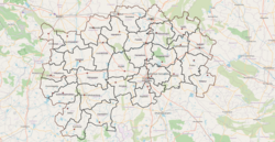
The district is divided into 3 revenue divisions: [[Anantapuramu revenue division|Anantapuramu]], [[Guntakal revenue division|Guntakal]] and [[Kalyandurg revenue division|Kalyandurg]], which are further subdivided into a total of 32 [[Tehsil|mandal]]s, each headed by a sub-collector.<ref name="census" />{{rp|14}} | |||
| | |||
| | |||
| | |||
== | === Mandals === | ||
The list of 31 mandals in Anantapuramu district, divided into 3 revenue divisions, is given below. | |||
{{Div col}} | |||
# [[Anantapuramu revenue division]] | |||
## [[Anantapur Urban mandal|Anantapur Urban]] | |||
## [[Anantapur Rural mandal|Anantapur Rural]] | |||
## [[Atmakur mandal, Anantapur district|Atmakur]] | |||
## [[Bukkaraya Samudram mandal|Bukkaraya Samudram]] | |||
## [[Garladinne mandal|Garladinne]] | |||
## [[Kudair mandal|Kudair]] | |||
## [[Narpala mandal|Narpala]] | |||
## [[Peddapappur mandal|Peddapappur]] | |||
## [[Putlur mandal|Putlur]] | |||
## [[Raptadu mandal|Raptadu]] | |||
## [[Singanamala mandal|Singanamala]] | |||
## [[Tadipatri mandal|Tadipatri]] | |||
## [[Yellanur mandal|Yellanur]] | |||
# [[Guntakal revenue division]] | |||
## [[Gooty mandal|Gooty]] | |||
## [[Guntakal mandal|Guntakal]] | |||
## [[Pamidi mandal|Pamidi]] | |||
## [[Peddavadugur mandal|Peddavadugur]] | |||
## [[Uravakonda mandal|Uravakonda]] | |||
## [[Vajrakarur mandal|Vajrakarur]] | |||
## [[Vidapanakal mandal|Vidapanakal]] | |||
## [[Yadiki mandal|Yadiki]] | |||
# [[Kalyandurg revenue division]] | |||
## [[Beluguppa mandal|Beluguppa]] | |||
## [[Bommanahal mandal|Bommanahal]] | |||
## [[Brahmasamudram mandal|Brahmasamudram]] | |||
## [[D.Hirehal mandal|D.Hirehal]] | |||
## [[Gummagatta mandal|Gummagatta]] | |||
## [[Kalyandurg mandal|Kalyandurg]] | |||
## [[Kambadur mandal|Kambadur]] | |||
## [[Kanekal mandal|Kanekal]] | |||
## [[Kundurpi mandal|Kundurpi]] | |||
## [[Rayadurgam mandal|Rayadurgam]] | |||
## [[Settur mandal|Settur]] | |||
{{Div col end}} | |||
== Cities and towns == | |||
{| class="wikitable" | There are one municipal corporation, five municipalities,<ref>{{Cite web |url=https://ananthapuramu.ap.gov.in/municipal-corporation-and-municipalities/ |title=Municipal corporation and municipalities |access-date=19 April 2023 |website=Ananthapuram district}}</ref> and one nagar panchayat in the district. | ||
|+ | {{Srn}} | ||
Municipal Bodies in Anantapuramu District | {| class="wikitable sortable static-row-numbers" | ||
|+Municipal Bodies in Anantapuramu District | |||
!Town | !Town | ||
!Civic Status of Town | !Civic Status of Town | ||
! | !Population (2011) | ||
|- | |- | ||
|[[Anantapur Municipal Corporation|Anantapur]] | |||
|[[Anantapur]] | |||
|Municipal Corporation | |Municipal Corporation | ||
|3,40,613 | |3,40,613 | ||
|- | |- | ||
|[[Guntakal]] | |[[Guntakal]] | ||
|Municipality Selection Grade | |Municipality Selection Grade | ||
|1,28,142 | |1,28,142 | ||
|- | |- | ||
|[[Tadipatri]] | |[[Tadipatri]] | ||
|Municipality Special Grade | |Municipality Special Grade | ||
|1,20,990 | |1,20,990 | ||
|- | |- | ||
|[[Rayadurgam]] | |||
|[[ | |||
|Municipality Grade - 2 | |Municipality Grade - 2 | ||
|61,749 | |61,749 | ||
|- | |- | ||
|[[Gooty]] | |[[Gooty]] | ||
|Municipality Grade - 3 | |Municipality Grade - 3 | ||
|48,658 | |48,658 | ||
|- | |- | ||
|[[Kalyandurg|Kalyanadurg]] | |||
|[[Kalyandurg| | |||
|Municipality Grade - 3 | |Municipality Grade - 3 | ||
|39,855 | |39,855 | ||
|- | |- | ||
|[[Pamidi]] | |[[Pamidi]] | ||
|Nagar Panchayat | |Nagar Panchayat | ||
|26,886 | |26,886 | ||
|} | |} | ||
== Economy == | |||
''' Agriculture''' | |||
The [[economy]] is principally [[Agriculture|agrarian]] with a developing industrial sector. The district receives very less rainfall due to its location in the rain shadow area of Indian Peninsula. Prominent crops include groundnut, sunflower, [[rice]], [[cotton]], [[maize]], [[Chili pepper|chillies]], [[sesame]], [[sugarcane]] and [[silk]]{{Sfn|CPO|2022|p=16}}{{Sfn|CPO|2022|p=62}} | |||
'''Industries''' | |||
Industries like [[construction]]s, [[manufactures]] and [[electricity]] are major contributors for [[Gross value added|GVA]].<ref name="apedb" /> | |||
'''Minerals''' | |||
Gold, diamonds, limestone, iron ore, quartz,asbestos, dolomite, barytes, steatite, granite, and clay are found in the district.{{Sfn|CPO|2022|p=7-10}} | |||
'''Power plants''' | |||
[[Solar thermal power plant]] of 50 [[Megawatt|MW]] was commissioned at Nagalapuram village in Peddavadaguru mandal of the district occupying an area of 600 acres under [[Jawaharlal Nehru National Solar Mission]] which was named as Megha Solar Plant. It is one of the 7 solar thermal plants in the country.<ref>{{cite web|title=Megha Solar Plant|url=http://www.nrel.gov/csp/solarpaces/project_detail.cfm/projectID=264|publisher=National Renewable Energy Laboratory|access-date=29 April 2015|archive-url=https://web.archive.org/web/20150428074707/http://www.nrel.gov/csp/solarpaces/project_detail.cfm/projectID=264|archive-date=28 April 2015|url-status=dead}}</ref><ref>{{cite news|title=Anantapur Gets Solar Power Plant|url=https://www.newindianexpress.com/states/telangana/2014/nov/14/anantapur-gets-solar-power-plant-682217.html|access-date=29 April 2015|work=The New Indian Express|date=14 November 2014|location=Hyderabad|url-status=live|archive-url=https://web.archive.org/web/20200927075349/https://www.newindianexpress.com/states/telangana/2014/nov/14/Anantapur-Gets-Solar-Power-Plant-682217.html|archive-date=27 September 2020}}</ref> | |||
| | |||
| | |||
| | |||
|16 | |||
| | |||
| | |||
| | |||
| | |||
| | |||
| - | |||
| | |||
| | |||
| | |||
| | |||
| - | |||
| - | |||
| - | |||
| - | |||
| | |||
|- | |||
| - | |||
| | |||
| | |||
| | |||
| | |||
| - | |||
| - | |||
[[Tadipatri]] region in Anantapur is an industrialised town famous for granite and cement production. Ultra Tech cements a unit of industrial major [[Larsen & Toubro]] has a major cement production unit near the town.{{Sfn|CPO|2022|p=10}} | |||
| | |||
| | |||
|} | |||
== Transport == | == Transport == | ||
[[National Highway 44 (India)]] passes through the district via Anantapur. The major railway stations are {{rws|Guntakal Junction}}, {{rws|Gooty Junction}} and {{rws|Rayadurg Junction}}. [[Bangalore International Airport|Kempegowda International Airport]], Bengaluru is the nearest international airport at 190 km from the district headquarters. Other small-scale domestic airports are there in neighbouring districts of [[Kurnool Airport|Kurnool]] and [[Kadapa Airport|Kadapa]] which are around 150 km and 200 km away respectively. | |||
== Education == | == Education == | ||
As per the year 2019-20, there were 3085 schools, 143 junior colleges, 42 degree colleges. There is 1 medical college, 14 engineering colleges, 23 ITI, 11 polytechnic and 18 degree colleges.{{Sfn|CPO|2022|p=17}} | |||
Some of the institutions include [[Sri Krishnadevaraya University]], [[Jawaharlal Nehru Technological University, Anantapur|JNTU Ananthapur]], [[Sri Sathya Sai University]], [[Government Medical College, Anantapur|Government Medical College]], Government polytechnic anantapur, Srinivasa Ramanujan Institute of Technology, [[Government Polytechnic Hindupur]], Gates Institute of Technology, Central University of Andhra Pradesh, | |||
==Tourism== | |||
[[File:Gooty Fort.JPG|thumb|[[Gooty Fort]]]] | |||
[[File:Penna Ahobilam, Uravakonda, Anantapur (125425) Fotor.jpg|thumb| Lakshmi Narasimhaswamy temple, [[Penna Ahobilam]]]] | |||
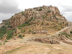
[[Gooty Fort]] is a historical fort on a hill dating to 11th century. It is at a distance of 52 kms from Anantapur. Penna Ahobilam is famous for Lakshmi Narasimhaswamy temple. It is at a distance of 36 km from Anantapur.{{Sfn|CPO|2022|p=13}} | |||
== Notable people == | |||
[[Neelam Sanjiva Reddy]] born in Illur village, Garladinne mandal, rose to became President of India after serving in other roles such as Lok sabha speaker, chief minister of Andhra Pradesh and central minister. [[T. Nagi Reddy]] born in Tarimela village of Singanamala mandal. He was a freedom fighter and popular communist leader. | |||
== References == | == References == | ||
{{Reflist}} | {{Reflist}} | ||
===Books=== | |||
{{Cite book|author=CPO|title=District handbook of statistics - 2020, Anantapur district |year=2022|url=https://cdn.s3waas.gov.in/s333e8075e9970de0cfea955afd4644bb2/uploads/2022/04/2022040612.pdf |access-date=19 April 2023}} | |||
== External links == | == External links == | ||
{{ | {{Sister project links| wikt=no | commons=Category:Anantapur district | b=no | n=no | q=no | s=no | v=no | voy=no | species=no | d=Q15212}} | ||
* [https:// | |||
* [https://overpass-turbo.eu/map.html?Q=%2F*%0AShow%20Mandals%20with%20English%20labels%20for%20Andhra%20Pradesh%0A*%2F%0A%5Bout%3Ajson%5D%5Btimeout%3A25%5D%3B%0Aarea%5Bname%3D%22Andhra%20Pradesh%22%5D-%3E.b%3B%0Arel(area.b)%5Bname%3D%22Anantapur%22%5D%3B%0Amap_to_area%20-%3E%20.searchArea%3B%0A(%0A%20%20relation%5B%22admin_level%22%3D%226%22%5D(area.searchArea)%3B%0A)%3B%0A%2F%2F%20print%20results%0Aout%20body%20geom%3B%0A%0A%0A%0A%0A%0A%7B%7Bstyle%3A%20%0A%20%20node%2Cway%2Crelation%20%7B%0A%20%20%20%20text%3Aeval(%27tag(%22name%22)%27)%3B%0A%7D%0A%20%7D%7D Mandals of Anantapuram district - Interactive Overpass-turbo OSM map] | |||
* {{Official website}} | |||
{{Geographic location | {{Geographic location | ||
|Centre = Anantapur district | |Centre = Anantapur district | ||
|North = [[Kurnool district]] | |North = [[Kurnool district]], [[Nandyal district]] | ||
|Northeast = | |Northeast = | ||
|East = [[ | |East = [[Kadapa district]] | ||
|Southeast = | |Southeast = | ||
|South = [[ | |South = [[Sri Sathya Sai district]], [[Karnataka]] | ||
|Southwest = [[Tumkur district]], [[Karnataka]] | |Southwest = [[Tumkur district]], [[Karnataka]] | ||
|West = [[Chitradurga district]], [[Karnataka]] | |West = [[Chitradurga district]], [[Karnataka]] | ||
| Line 760: | Line 363: | ||
}} | }} | ||
{{Districts of Andhra Pradesh}} | |||
{{Anantapur district}} | {{Anantapur district}} | ||
{{Authority control}} | {{Authority control}} | ||
Latest revision as of 14:23, 28 March 2026
Anantapur district | |
|---|---|
| Ananthapuramu district | |
 Bugga Ramalingeswara temple in Tadipatri | |
| Etymology: Telugu: Anantasagara (Big Tank) | |
.svg) | |
| Coordinates: 14°40′41″N 77°36′25″E / 14.678°N 77.607°E | |
| Country |  India India |
| State | Template:Flag icon image Andhra Pradesh |
| Region | Rayalaseema |
| Established | 1882 |
| Reorganised | 4 April 2022 |
| Named for | Big Tank |
| Headquarters | Anantapur |
| Administrative Divisions | |
| Government | |
| • District collector | M.Gauthami |
| • Lok Sabha | Lok Sabha list
|
| • Assembly | Assembly list
|
| Area | |
| • Total | 10,205 km2 (3,940 sq mi) |
| Population | |
| • Total | 2,241,105 |
| • Density | 220/km2 (570/sq mi) |
| • Sex ratio | 977 (females per 1,000 males) |
| Languages | |
| • Official | Telugu |
| Literacy | |
| Time zone | UTC+5:30 (IST) |
| Postal Index Number | 515xxx |
| Area codes | +91–8554 |
| ISO 3166 code | IN-AP |
| Vehicle registration | AP-02 (former) AP–39 (from 30 January 2019)[3] |
| Website | ananthapuramu |
Anantapur district, officially Ananthapuramu district,[4] is one of the eight districts in the Rayalaseema region of the Indian state of Andhra Pradesh. The district headquarters is located in Anantapur city. It is one of the driest places in South India.[5] In the year 2022, as part of re-organisation of districts, Sri Sathya Sai district was carved out.[1]
Etymology[edit | edit source]
The name Ananthapuramu was named after a reservoir called Anantasagaram, a big tank, which means "Endless Ocean". The villages of Ananthasagaram and Bukkarayasamudram were constructed by Chikkappa Wadeyar, the minister of Bukka Raya I. Some authorities assert that Anaantasagaram was named after Ananthamma, wife of Bukka Raya I, one of the founders of the Vijayanagar empire.[6] , while some contend that it must have been known after Anantarasa Chikkavodeya himself, as Bukka-Raya had no queen by that name.
History[edit | edit source]
The region comprising present-day Anantapur district has a rich and layered history, with its earliest significance emerging as a hub for Buddhist culture and trade. From the 3rd century BCE to the 3rd century CE, the area around Anantapur was part of ancient trade routes. Archaeological evidence suggests that Gooty was a known Buddhist site, and the district lay along ancient trade and pilgrimage routes that connected Vengi to other Buddhist establishments.[7]
The region's strategic importance is underscored by the Gooty Fort, one of the oldest hill forts in India. Following the decline of Buddhism, the region fell under the control of successive Hindu dynasties, including the Chalukyas, and the Vijayanagara Empire. During the Vijayanagara period, the area was administered by Nayaka dynasties. After the fall of Vijayanagara in 1565, the area was controlled by various Nayaka clans. In the 18th century, Gooty Fort became a strategic stronghold of the Marathas before being captured by Hyder Ali. In 1789 it was ceded by his son Tipu Sultan to the Nizam of Hyderabad. In 1800 the Nizam ceded the surrounding districts to the British in payment for a subsidiary British force.[8]
In 1882, Anantapuram district was formed by carving out from Bellary district.[9] Revenue mandals of Kadiri, Mudigubba, Nallamada, N.P.Kunta, Talupula, Nallacheruvu, O.D.Cheruvu, Tanakal, Amadagur and Gandlapenta (previous Kadiri Taluk) from erstwhile YSR Kadapa District were added in the year 1910. In the year 1956, the revenue mandals of Rayadurg, D.Hirehal, Kanekal, Bommanahal and Gummagatta of Bellary District were added, with the formation of Andhra Pradesh. As of 2011[update] census of India, it was the largest district in the state by area and had a population of 2,241,105. As per the Gazette notification No.122 dt 26 January 2022 (G.O.Rt.No.55, Revenue (Land-IV), 25 January 2022), Sri Sathya Sai district was formed from Ananthapuramu district.[10]
| Year | Pop. | ±% p.a. |
|---|---|---|
| 1901 | 1,025,322 | — |
| 1911 | 1,053,449 | +0.27% |
| 1921 | 1,040,166 | −0.13% |
| 1931 | 1,138,081 | +0.90% |
| 1941 | 1,273,079 | +1.13% |
| 1951 | 1,483,591 | +1.54% |
| 1961 | 1,767,464 | +1.77% |
| 1971 | 2,115,321 | +1.81% |
| 1981 | 2,548,012 | +1.88% |
| 1991 | 3,180,863 | +2.24% |
| 2001 | 3,640,478 | +1.36% |
| 2011 | 4,081,148 | +1.15% |
| source:[11] | ||
As of 2011[update] census of India, the undivided Anantapuramu district has a population of 4,081,148 with 9,68,160 households, ranking it as the 7th most populous district in the state.[12] It is the largest district in the state with an area of 19,130 km2 (7,390 sq mi).[12] Anantapur has a sex ratio of 977 females for every 1000 males, and a literacy rate of 64.28%. Urban population in the district is 28.9% of total population.[12]
The Gross District Domestic Product (GDDP) of the undivided district for FY 2013-14 is ₹35,838 crore (US$5.0 billion) and it contributes 6.8% to the Gross State Domestic Product (GSDP). For the FY 2013–14, the per capita income at current prices was ₹69,562 (US$980). The primary, secondary and tertiary sectors of the district contribute ₹9,944 crore (US$1.4 billion), ₹7,752 crore (US$1.1 billion) and ₹18,142 crore (US$2.5 billion) respectively to the GDDP.[13]
Geography[edit | edit source]
It is one of the largest districts of Andhra Pradesh spanning an area of 10,205 square kilometres (3,940 sq mi).[1] It is bounded on the north by Kurnool district and Nandyal district, on the east by Kadapa district, and south by Sri Sathya Sai district and on the southwest and west by Chitradurga district and Bellary district in Karnataka state.[10] It is part of Rayalaseema region on the state.
The northern part of the district has large areas of black cotton soil, while the southern part has mainly poor red soil.[10] There are two major hill ranges namely Mutchukota hills Nagasamudram hills, accounting for 70% of forest area.[14]
Penna, Chithravathi, Pedda Hagari, Chinna Hagari, Thadakaleru and Pandameru are the main rivers. The average elevation is about 1300 feet above the mean sea level. The annual normal rainfall of the district is 508.2 mm. Thus it secures least rainfall when compared to other parts of Andhra Pradesh.[14]
Demographics[edit | edit source]
Based on the 2011 census, the district had a population of 2,241,105, of which 753,354 (33.62%) lived in urban areas. The district had a sex ratio of 978 females per 1000 males. Scheduled Castes and Scheduled Tribes make up 3,34,142 (14.91%) and 70,161 (3.13%) of the population respectively.[12]:78–83 Hinduism is the major religion with 88.45% followers, while Islam has 10.37%.
Based on the 2011 census, 84.59% of the population spoke Telugu, 9.64% Urdu, 3.03% Kannada and 1.42% Lambadi as their first language.[16]
Administrative divisions[edit | edit source]

Politics[edit | edit source]
There are two parliamentary constituencies in the district namely, Anantapuram Parliament constituency, Hindupuram parliament constituency(partial).
Legislative assembly constituencies in the district are given below.[17]
| Constituency number | Name | Reserved for (SC/ST/None) |
Parliament |
|---|---|---|---|
| 155 | Raptadu | None | Hindupuram |
| 148 | Rayadurgam | None | Anantapuram |
| 149 | Uravakonda | None | |
| 150 | Guntakallu | None | |
| 151 | Tadpatri | None | |
| 152 | Singanamala | SC | |
| 153 | Anantapuram Urban | None | |
| 154 | Kalyandurgam | None |
The district is divided into 3 revenue divisions: Anantapuramu, Guntakal and Kalyandurg, which are further subdivided into a total of 32 mandals, each headed by a sub-collector.[12]:14
Mandals[edit | edit source]
The list of 31 mandals in Anantapuramu district, divided into 3 revenue divisions, is given below.
Cities and towns[edit | edit source]
There are one municipal corporation, five municipalities,[18] and one nagar panchayat in the district.
| Town | Civic Status of Town | Population (2011) |
|---|---|---|
| Anantapur | Municipal Corporation | 3,40,613 |
| Guntakal | Municipality Selection Grade | 1,28,142 |
| Tadipatri | Municipality Special Grade | 1,20,990 |
| Rayadurgam | Municipality Grade - 2 | 61,749 |
| Gooty | Municipality Grade - 3 | 48,658 |
| Kalyanadurg | Municipality Grade - 3 | 39,855 |
| Pamidi | Nagar Panchayat | 26,886 |
Economy[edit | edit source]
Agriculture
The economy is principally agrarian with a developing industrial sector. The district receives very less rainfall due to its location in the rain shadow area of Indian Peninsula. Prominent crops include groundnut, sunflower, rice, cotton, maize, chillies, sesame, sugarcane and silk[19][20]
Industries Industries like constructions, manufactures and electricity are major contributors for GVA.[13]
Minerals Gold, diamonds, limestone, iron ore, quartz,asbestos, dolomite, barytes, steatite, granite, and clay are found in the district.[21]
Power plants Solar thermal power plant of 50 MW was commissioned at Nagalapuram village in Peddavadaguru mandal of the district occupying an area of 600 acres under Jawaharlal Nehru National Solar Mission which was named as Megha Solar Plant. It is one of the 7 solar thermal plants in the country.[22][23]
Tadipatri region in Anantapur is an industrialised town famous for granite and cement production. Ultra Tech cements a unit of industrial major Larsen & Toubro has a major cement production unit near the town.[24]
Transport[edit | edit source]
National Highway 44 (India) passes through the district via Anantapur. The major railway stations are Guntakal Junction, Gooty Junction and Rayadurg Junction. Kempegowda International Airport, Bengaluru is the nearest international airport at 190 km from the district headquarters. Other small-scale domestic airports are there in neighbouring districts of Kurnool and Kadapa which are around 150 km and 200 km away respectively.
Education[edit | edit source]
As per the year 2019-20, there were 3085 schools, 143 junior colleges, 42 degree colleges. There is 1 medical college, 14 engineering colleges, 23 ITI, 11 polytechnic and 18 degree colleges.[25]
Some of the institutions include Sri Krishnadevaraya University, JNTU Ananthapur, Sri Sathya Sai University, Government Medical College, Government polytechnic anantapur, Srinivasa Ramanujan Institute of Technology, Government Polytechnic Hindupur, Gates Institute of Technology, Central University of Andhra Pradesh,
Tourism[edit | edit source]

_Fotor.jpg)
Gooty Fort is a historical fort on a hill dating to 11th century. It is at a distance of 52 kms from Anantapur. Penna Ahobilam is famous for Lakshmi Narasimhaswamy temple. It is at a distance of 36 km from Anantapur.[26]
Notable people[edit | edit source]
Neelam Sanjiva Reddy born in Illur village, Garladinne mandal, rose to became President of India after serving in other roles such as Lok sabha speaker, chief minister of Andhra Pradesh and central minister. T. Nagi Reddy born in Tarimela village of Singanamala mandal. He was a freedom fighter and popular communist leader.
References[edit | edit source]
- ↑ 1.0 1.1 1.2 1.3 "Here's how new ap map looks after districts reorganisation". 3 April 2022. Retrieved 17 April 2023.
- ↑ "District Census Hand Book - Anantapur" (PDF). Census of India. Registrar General and Census Commissioner of India.
- ↑ "New 'AP 39' code to register vehicles in Andhra Pradesh launched". The New Indian Express. Vijayawada. 31 January 2019. Archived from the original on 21 November 2020. Retrieved 9 June 2019.
- ↑ "Ananthapuramu district".
- ↑ "Anantapur Assembly Constituency : Triangular contest on the cards". thehansindia.com. 20 January 2019. Archived from the original on 24 July 2019. Retrieved 14 June 2019.
- ↑ "There is history behind names of places". The Hindu. 30 March 2009. Archived from the original on 7 April 2021. Retrieved 14 June 2019.
- ↑ Ramachandran, T. N. "NĀGĀRJUNAKONDA" (PDF). Director General Archaeological Survey of India: 9.
- ↑
 One or more of the preceding sentences incorporates text from a publication now in the public domain: Chisholm, Hugh, ed. (1911). "Anantapur". Encyclopædia Britannica. Vol. 1 (11th ed.). Cambridge University Press. p. 913.
- ↑ Rayudu, C. S. (1 January 1991). Rural Credit in India: A Study of Andhra Pradesh. Mittal Publications. p. 2. ISBN 9788170992486.
- ↑ 10.0 10.1 10.2 CPO 2022, p. 1.
- ↑ Decadal Variation In Population Since 1901
- ↑ 12.0 12.1 12.2 12.3 12.4 "District Census Hand Book – Anantapur" (PDF). Census of India. Registrar General and Census Commissioner of India.
- ↑ 13.0 13.1 "Economy of Anantapur District". Andhra Pradesh Economic Development Board. Retrieved 25 April 2017.
- ↑ 14.0 14.1 CPO 2022, p. 2.
- ↑ "Population by Religion - Andhra Pradesh". censusindia.gov.in. Office of the Registrar General & Census Commissioner, India. 2011.
- ↑ 16.0 16.1 "Table C-16 Population by Mother Tongue: Andhra Pradesh". Census of India. Registrar General and Census Commissioner of India.
- ↑ "Delimitation of Parliamentary and Assembly Constituencies Order, 2008" (PDF). The Election Commission of India. p. 31.
- ↑ "Municipal corporation and municipalities". Ananthapuram district. Retrieved 19 April 2023.
- ↑ CPO 2022, p. 16.
- ↑ CPO 2022, p. 62.
- ↑ CPO 2022, p. 7-10.
- ↑ "Megha Solar Plant". National Renewable Energy Laboratory. Archived from the original on 28 April 2015. Retrieved 29 April 2015.
- ↑ "Anantapur Gets Solar Power Plant". The New Indian Express. Hyderabad. 14 November 2014. Archived from the original on 27 September 2020. Retrieved 29 April 2015.
- ↑ CPO 2022, p. 10.
- ↑ CPO 2022, p. 17.
- ↑ CPO 2022, p. 13.
Books[edit | edit source]
CPO (2022). District handbook of statistics - 2020, Anantapur district (PDF). Retrieved 19 April 2023.
External links[edit | edit source]
- Mandals of Anantapuram district - Interactive Overpass-turbo OSM map
{{URL|example.com|optional display text}}
Places adjacent to Anantapur district | |
|---|---|


