

No edit summary |
m expand details based on references and corrected details to improve readability |
||
| Line 1: | Line 1: | ||
{{short description|District in Uttar Pradesh, India | |||
Purvanchal}} | |||
{{Use dmy dates|date=February 2021}} | {{Use dmy dates|date=February 2021}} | ||
{{Infobox settlement | {{Infobox settlement | ||
| name | | name = Sonbhadra district | ||
| settlement_type | | settlement_type = [[List of districts of Uttar Pradesh|District]] of [[Uttar Pradesh]] | ||
| total_type | | total_type = Total | ||
| native_name | | native_name = Sonanchal | ||
| image_map | | image_skyline = View from the top of Vijay Garh Fort.jpg | ||
| map_caption | | image_caption = View from [[Vijaygarh Fort]] | ||
| coordinates | | image_map = India Uttar Pradesh districts 2012 Sonbhadra.svg | ||
| coor_pinpoint | | map_caption = Location of Sonbhadra district in Uttar Pradesh | ||
| subdivision_type | | coordinates = | ||
| subdivision_name | | coor_pinpoint = Robertsganj | ||
| subdivision_type1 | | subdivision_type = Country | ||
| subdivision_name1 | | subdivision_name = {{flag|India}} | ||
| subdivision_type2 | | subdivision_type1 = [[States and union territories of India|State]] | ||
| subdivision_name2 | | subdivision_name1 = [[Uttar Pradesh]] | ||
| established_title | | subdivision_type2 = [[Administrative divisions of India|Division]] | ||
| established_date | | subdivision_name2 = [[Mirzapur division|Mirzapur]] | ||
| seat_type | | established_title = Established | ||
| seat | | established_date = 4 March 1989 | ||
| named_for = [[Son River]] | | seat_type = Headquarters | ||
| parts_type | | seat = [[Robertsganj]] | ||
| parts_style | | named_for = [[Son River]] | ||
| p1 | | parts_type = [[Tehsils of India|Tehsils]] | ||
| area_total_km2 | | parts_style = para | ||
| area_footnotes | | p1 = {{hlist|[[Robertsganj]]|[[Ghorawal]]|[[Dudhi]]|[[Obra, Uttar Pradesh|Obra]]}} | ||
| population_as_of | | area_total_km2 = 6,788 | ||
| population_total | | area_footnotes = | ||
| population_footnotes | | population_as_of = 2011 | ||
| population_urban | | population_total = 1,862,559 | ||
| population_density_km2 | | population_footnotes = | ||
| demographics_type1 | | population_urban = | ||
| | | population_density_km2 = auto | ||
| | | demographics_type1 = [[Language]] | ||
| | | demographics1_title1 = Official | ||
| | | demographics1_info1 = [[Hindi language|Hindi]]<ref name="langoff">{{cite web|title=52nd Report of the Commissioners for Linguistic Minorities in India |url=http://nclm.nic.in/shared/linkimages/NCLM52ndReport.pdf|website=nclm.nic.in|publisher=[[Ministry of Minority Affairs]]|access-date=26 December 2018|url-status=dead|archive-url=https://web.archive.org/web/20170525141614/http://nclm.nic.in/shared/linkimages/NCLM52ndReport.pdf|archive-date=25 May 2017}}</ref> | ||
| leader_title | | demographics1_title2 = Additional official | ||
| leader_name | | demographics1_info2 = [[Urdu]]<ref name="langoff"/> | ||
| leader_title1 | | demographics1_title3 = Regional | ||
| leader_name1 | | demographics1_info3 = [[Bhojpuri language|Bhojpuri]] | ||
| leader_title2 | | demographics_type2 = Demographics | ||
| leader_name2 | | demographics2_title1 = [[Literacy in India|Literacy]] | ||
| leader_title3 | | demographics2_info1 = 64% | ||
| leader_name3 | | demographics2_title2 = [[Sex ratio]] | ||
| timezone1 | | demographics2_info2 = 918/1000 | ||
| utc_offset1 | | demographics2_title3 = [[Scheduled Castes]] | ||
| registration_plate | | demographics2_info3 = {{percent and number|421661|1862559|2}} | ||
| blank_name_sec1 | | demographics2_title4 = [[Scheduled Tribes]] | ||
| blank_info_sec1 | | demographics2_info4 = {{percent and number|385018|1862559|2}} | ||
| blank_name_sec2 | | leader_title = [[District Magistrate]] | ||
| blank_info_sec2 | | leader_name = Badrinath Singh, [[Indian Administrative Service|IAS]] | ||
| website | | leader_title1 = [[Superintendent of police (India)|Superintendent of Police]] | ||
| official_name | | leader_name1 = Abhishek Verma | ||
, [[Indian Police Service|IPS]] | |||
| leader_title2 = | |||
| leader_name2 = | |||
| leader_title3 = | |||
| leader_name3 = | |||
| timezone1 = [[Indian Standard Time|IST]] | |||
| utc_offset1 = +05:30 | |||
| registration_plate = UP-64 | |||
| blank_name_sec1 = [[Roads in India|Major highways]] | |||
| blank_info_sec1 = {{hlist|[[National Highway 39 (India)|NH-39]]|[[List of state highways in Uttar Pradesh|SH-5A]]|[[List of state highways in Uttar Pradesh|SH-5]]}} | |||
| blank_name_sec2 = | |||
| blank_info_sec2 = | |||
| website = {{URL|https://sonbhadra.nic.in/}} | |||
| official_name = Sonebhadra | |||
}} | }} | ||
'''Sonbhadra''' or '' | '''Sonbhadra district''' (also known as '''Sonebhadra''') or '''Sonanchal''' is the second largest district by area of [[Uttar Pradesh]] after [[Lakhimpur Kheri]]. The district headquarters is in the town of [[Robertsganj]]. | ||
Sonbhadra | Sonbhadra is also known as the "Energy Capital of India" for hosting multiple power plants.Sonbhadra district is located in south eastern Uttar Pradesh.<ref name="India's energy capital">{{cite web | author = Catch News| title =Sonbhadra Singrauli has all the ingredients Energy capital of India| url = http://www.catchnews.com/india-news/sonbhadra-singrauli-belt-is-called-india-s-power-capital-but-may-be-headed-for-a-disaster-1465284694.html | access-date = 7 June 2016 }}</ref> | ||
Sonbhadra lies between [[Vindhya]] and [[Kaimur hills]], and its topology and natural environment prompted | Sonbhadra lies between [[Vindhya]] and [[Kaimur hills]], and its topology and natural environment prompted the first Prime Minister of India [[Jawaharlal Nehru]] to refer to Sonbhadra as the "Switzerland of India".<ref name="Switzerland of India">{{cite web|work= Hindustan Times|title= Once hailed by PM Nehru for its beauty, 'India's Switzerland' lacks access to power, water, healthcare|url= https://m.hindustantimes.com/lucknow/once-hailed-by-pm-nehru-for-its-beauty-india-s-switzerland-lacks-access-to-power-water-healthcare/story-ezbhu8K8Dyt2ZDlHyjAVUL.html|access-date= 7 July 2018|date= 7 July 2018|author=Sudhir Kumar |quote=Country's first Prime Minister Jawaharlal Nehru was so taken up by the natural beauty of the region that he once described Sonbhadra as the "Switzerland of India."}}</ref> | ||
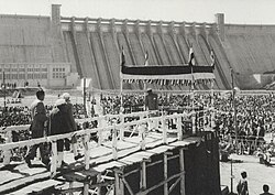
[[File:Jawaharlal Nehru at Rihand Dam.jpg|thumb|right|[[Jawaharlal Nehru]] at inauguration of [[Rihand Dam]]]] | [[File:Jawaharlal Nehru at Rihand Dam.jpg|thumb|right|[[Jawaharlal Nehru]] at inauguration of [[Rihand Dam]]]] | ||
In 2018 Uttar Pradesh's chief minister [[Yogi Adityanath]] recognised Sonbhadra as a tourist hub in Purvanchal region and further promoted by Uttar Pradesh Tourism Department.<ref>{{cite news |title=Develop Sonbhadra as a tourism hub: Yogi |url=https://www.hindustantimes.com/lucknow/develop-sonbhadra-as-a-tourism-hub-yogi/story-gHNwDMRu2Gpk57NYbJfVwM.html |access-date=14 April 2021 |work=Hindustan Times |date=13 September 2018 | In 2018 Uttar Pradesh's chief minister [[Yogi Adityanath]] recognised Sonbhadra as a tourist hub in Purvanchal region and further promoted by Uttar Pradesh Tourism Department.<ref>{{cite news |title=Develop Sonbhadra as a tourism hub: Yogi |url= https://www.hindustantimes.com/lucknow/develop-sonbhadra-as-a-tourism-hub-yogi/story-gHNwDMRu2Gpk57NYbJfVwM.html |access-date=14 April 2021 |work=Hindustan Times |date=13 September 2018}}</ref> | ||
In February 2020, a [[Press Trust of India]] (PTI) news report incorrectly claimed that [[Geological Survey of India]] (GSI) | In February 2020, a [[Press Trust of India]] (PTI) news report incorrectly claimed that the [[Geological Survey of India]] (GSI) had found {{convert|3,000|tonne}} of gold deposits in Sonbhadra district. PTI later stated on Twitter that the GSI had told PTI that there had been no such discovery of large gold deposits in the district.<ref>{{Cite tweet |user=PTI_News |author-link=Press Trust of India |number=1231221168125857792 |title=Geological Survey of India tells PTI there has been no discovery of gold deposits estimated to be around 3,000 tonnes in Uttar Pradesh's Sonbhadra district, as claimed by district mining official |date=22 February 2020|access-date=22 February 2020}}</ref><ref>{{Cite news |url= https://www.thehindu.com/news/national/other-states/no-discovery-of-around-3000-tonne-gold-deposits-in-ups-sonbhadra-says-gsi/article30888796.ece |title=No discovery of around 3,000-tonne gold deposits in U.P.'s Sonbhadra: GSI |date=22 February 2020 |work=The Hindu| access-date=23 February 2020 |agency=PTI}}</ref> | ||
==History== | ==History== | ||
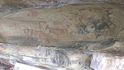
The Valley of [[Son River|Son]] and [[Belan River|Belan]] Rivers abounds in caves which were the earliest dwellings of the primeval inhabitants. This area had been the centre of activities of pre-historic | The Valley of [[Son River|Son]] and [[Belan River|Belan]] Rivers abounds in caves which were the earliest dwellings of the primeval inhabitants. This area had been the centre of activities of pre-historic humans which is evident from the rock paintings (pre-historic cave art) found in abundance in this region. These paintings are of the periods ranging from [[Mesolithic]] to [[Paleolithic]] ages.<ref name="Sonbhadra: Of Cave Paintings And Fossil Parks" /> | ||
[[File:Panchmukhi rock 1.jpg|thumb|Cave Paintings at [[Churk|Panchmukhi Hill]], [[Robertsganj]] in Sonbhadra]] | [[File:Panchmukhi rock 1.jpg|thumb|Cave Paintings at [[Churk|Panchmukhi Hill]], [[Robertsganj]] in Sonbhadra]] | ||
[[Sonbhadra]], whose ancient name was Gramputra or [[Shivdwar|Gupt Kashi]], was built by the ancient king Putrak for his queen Paatali.<ref name="Foundation day of Sonbhadra">{{cite web | author = Patrika| title =Foundation day of Sonbhadra History| url = https://m.patrika.com/sonbhadra-news/foundation-day-of-sonbhadra-1523331/| access-date = 4 March 2018 | |||
}}</ref> It is said that '[[Bhar]]s' had settlements along with [[Chero]], Searis and [[Kharwar]] communities in the district up to fifth century there was the rule of <nowiki>''Chandel Rajput''</nowiki> kings on [[Vijaygarh Fort]]. This district was famous as second [[Varanasi|Kashi]] during 11th to 13th centuries. In the 9th century B.C., the Brahmadutt dynasty was subdivided by Nagas. [[Kushan Empire|Kushan]] and [[Nāga|Naga]]s also held supremacy over this region before the advent of the [[Gupta Empire|Gupta period]]. After the death of [[Harsha|Harshvardhan]] in the latter half of the 7th century, it remained under the control of the [[Gurjara-Pratihara dynasty|Gurjara-Pratihar]]s till 1025 before they were driven out by [[Mahmud of Ghazni]]. This area was under the administration of various Governors of [[Mughal emperors]]. Some of the forts such as [[Agori Fort]] were under the control of Madan Shah. | |||
===The forts located in the district=== | ===The forts located in the district=== | ||
| Line 82: | Line 93: | ||
The heroine of Famous Novel [[Chandrakanta (novel)|Chandrakanta]] written by [[Devaki Nandan Khatri]] was the princess of [[Vijaygarh]] and the daughter of king Jay Singh. | The heroine of Famous Novel [[Chandrakanta (novel)|Chandrakanta]] written by [[Devaki Nandan Khatri]] was the princess of [[Vijaygarh]] and the daughter of king Jay Singh. | ||
=== | ===History of kingdoms in the region === | ||
[[Agori Fort|Agori]] Barhar an impartible estate | [[Agori Fort|Agori]] Barhar was an impartible estate. It originally comprised parts of the present districts of Sonbhadra and part of Mirzapur district. It was divided into two parganas of [[Agori Fort|Agori]] and Barhar. Chandel Rajput Raja Paramardideva of [[Mahoba]], ancestor of the family and contemporary of Raja [[Prithviraj III]] of Delhi, who attacked Mahoba as the Raja was the ally of Raja Jaichand of Kannauj, and occupied it for a time. Raja Paramardi Deva fled for his life with his friends and family, and though Mahoba was re-occupied by the Raja with the help of Jaichand of Kannauj, the glory of the capital never returned. During this time one of the sons of Raja Paramardi Deva, called Ashajit, fled eastwards in the turmoil that followed. His sons or grand sons called Barimal and Bharimal, captured [[Agori Fort|Agori]] from the Kaharwar Raja and made themselves the independent rulers of [[Agori Fort|Agori]] and Barhar. The elder brother Barimal took the kingdom of Agori and Barhar, and the younger brother Bharimal became the ruler of Bardi state ruled by Chandel -Rajput. | ||
Another jagirdari in sonbhadra in [[Vijaygarh Fort|Vijaygarh]].it was also ruled by Chandel Dynasty after that by [[Narayan dynasty]]. | |||
==Geography== | ==Geography== | ||
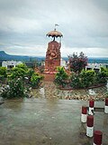
[[File:Eco point Robertsganj.jpg|thumb|upright|[[Son View Point]]]] | [[File:Eco point Robertsganj.jpg|thumb|upright|[[Son View Point]]]] | ||
The northern part of the district lies on a plateau of the [[Vindhya Range]], and is drained by tributaries of the Ganges including the [[Belan River|Belan]] and [[Karmanasa River|Karmanasha]] rivers. South of the steep escarpment of the [[Kaimur Range]] is the valley of the [[Son River]], which flows through the district from west to east. The southern portion of the district is hilly, interspersed with fertile stream valleys. The [[Rihand River]], which rises to the south in the highlands of [[Surguja district]] of [[Chhattisgarh]], flows north to join the Son in the center of the district. The [[Govind Ballabh Pant Sagar]], a reservoir on the [[Rihand]], lies partly in the district and partly in [[Madhya Pradesh]]. East of the Rihand, the [[Kanhar River]], which originates in [[Chhattisgarh]], flows north to join the Son | The district lies in the extreme south-east of the state, and is bounded by [[Mirzapur district]] to the northwest, [[Chandauli district]] to the north, [[Kaimur district|Kaimur]] and [[Rohtas district|Rohtas]] districts of Bihar state to the north-east, [[Garhwa district]] of [[Jharkhand]] state to the east, [[Balrampur district, Chhattisgarh|Balrampur District]] of [[Chhattisgarh]] state to the south, and [[Singrauli district]] of [[Madhya Pradesh]] state to the west. The northern part of the district lies on a plateau of the [[Vindhya Range]], and is drained by tributaries of the Ganges including the [[Belan River|Belan]] and [[Karmanasa River|Karmanasha]] rivers. South of the steep escarpment of the [[Kaimur Range]] is the valley of the [[Son River]], which flows through the district from west to east. The southern portion of the district is hilly, interspersed with fertile stream valleys. The [[Rihand River]], which rises to the south in the highlands of [[Surguja district]] of [[Chhattisgarh]], flows north to join the Son in the center of the district. The [[Govind Ballabh Pant Sagar]], a reservoir on the [[Rihand]], lies partly in the district and partly in [[Madhya Pradesh]]. East of the Rihand, the [[Kanhar River]], which originates in [[Chhattisgarh]], flows north to join the Son. | ||
===Climate=== | ===Climate=== | ||
| Line 105: | Line 112: | ||
==Economy== | ==Economy== | ||
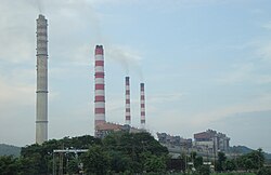
[[File:SSTPS.jpg|thumb|[[Singrauli Super Thermal Power Station]] at [[Shaktinagar, Uttar Pradesh|Shaktinagar]] in Sonbhadra]] | [[File:SSTPS.jpg|thumb|[[Singrauli Super Thermal Power Station]] at [[Shaktinagar, Uttar Pradesh|Shaktinagar]] in Sonbhadra]] | ||
The district has many electrical power stations around [[Govind Ballabh Pant Sagar]]. [[NTPC Limited|NTPC]] has | The district has many electrical power stations around [[Govind Ballabh Pant Sagar]]. [[NTPC Limited|NTPC]] has two coal-based thermal power plants, being [[Singrauli Super Thermal Power Station]] at [[Shaktinagar, Uttar Pradesh|Shaktinagar]] and [[Rihand Thermal Power Station]] at Rihand Nagar. Other power stations are at [[Anpara]] ([[UPRVUNL]]), [[Obra, Uttar Pradesh|Obra]] (UPRVUNL), [[Renusagar]] ([[Hindalco]]) and [[Pipri]]-Hydro (UPRVUNL). [[Northern Coalfields]] (a branch of [[Coal India Limited]]) has its headquarters and many coal mines in this region. | ||
[[Hindalco]] has a major aluminium plant at Renukut. Owing to the limestone hills, initially one cement factory was established at Churk in 1956. Another cement factory started at Dala in 1971, with an ancillary unit at Chunar from 1980. A big dam constructed at [[Pipri]] in 1961 is named [[Rihand Dam]]; | [[Hindalco]] has a major aluminium plant at Renukut. Owing to the limestone hills, initially one cement factory was established at Churk in 1956. Another cement factory started at Dala in 1971, with an ancillary unit at Chunar from 1980. A big dam constructed at [[Pipri]] in 1961 is named [[Rihand Dam]]; a small dam was constructed at Obra in 1968.{{citation needed|date=October 2018}} | ||
The [[Birla group]] set up an aluminum plant at Renukut. The company set up its own power plant at Renusagar in 1967 and started a company in Renukut called HiTech Carbon. Another industrial group initiated a company in Renukut named Grasim Industries Limited, which produces chemicals and later it started own power plant at Renukut in 1998.{{citation needed|date=October 2018}} | The [[Birla group]] set up an aluminum plant at Renukut. The company set up its own power plant at Renusagar in 1967 and started a company in Renukut called HiTech Carbon. Another industrial group initiated a company in Renukut named Grasim Industries Limited, which produces chemicals and later it started own power plant at Renukut in 1998.{{citation needed|date=October 2018}} | ||
In 2006 the [[Ministry of Panchayati Raj]] named Sonbhadra one of the country's 250 [[Poverty in India|most backward districts]] (out of a total of [[Districts of India|640]]).<ref name=brgf/> It is one of the 34 districts in Uttar Pradesh currently receiving funds from the Backward Regions Grant Fund Programme (BRGF).<ref name=brgf>{{cite web|author=Ministry of Panchayati Raj|date=8 September 2009|title=A Note on the Backward Regions Grant Fund Programme|publisher=National Institute of Rural Development|url=http://www.nird.org.in/brgf/doc/brgf_BackgroundNote.pdf|access-date=27 September 2011|url-status=dead|archive-url=https://web.archive.org/web/20120405033402/http://www.nird.org.in/brgf/doc/brgf_BackgroundNote.pdf|archive-date=5 April 2012}}</ref> | In 2006 the [[Ministry of Panchayati Raj]] named Sonbhadra as one of the country's 250 [[Poverty in India|most backward districts]] (out of a total of [[Districts of India|640]]).<ref name=brgf/> It is one of the 34 districts in Uttar Pradesh currently receiving funds from the Backward Regions Grant Fund Programme (BRGF).<ref name=brgf>{{cite web|author=Ministry of Panchayati Raj|date=8 September 2009|title=A Note on the Backward Regions Grant Fund Programme|publisher=National Institute of Rural Development|url=http://www.nird.org.in/brgf/doc/brgf_BackgroundNote.pdf|access-date=27 September 2011|url-status=dead|archive-url=https://web.archive.org/web/20120405033402/http://www.nird.org.in/brgf/doc/brgf_BackgroundNote.pdf|archive-date=5 April 2012}}</ref> | ||
==Tourist attraction== | ==Tourist attraction== | ||
| Line 154: | Line 161: | ||
* [[Robertsganj railway station|Sonbhadra Railway Station]] | * [[Robertsganj railway station|Sonbhadra Railway Station]] | ||
*[[Chopan]] Railway station | *[[Chopan]] Railway station | ||
*[[Renukoot]] Railway station near Rihand Dam | *[[Renukoot]] Railway station near Rihand Dam | ||
*[[Anpara]] Railway station | *[[Anpara]] Railway station | ||
*[[Singrauli]] Railway station | *[[Singrauli]] Railway station (in [[Madhya Pradesh]]) | ||
*[[Shaktinagar, Uttar Pradesh|Shaktinagar]] Railway station | *[[Shaktinagar, Uttar Pradesh|Shaktinagar]] Railway station | ||
*[[Varanasi]] Railway station | *[[Varanasi]] Railway station | ||
| Line 165: | Line 171: | ||
===By road=== | ===By road=== | ||
Robertsganj, the headquarters of Sonbhadra, is located about {{cvt|88|km}} from the city of [[Varanasi]] which has the nearest airport. Robertsganj is well connected to [[Lucknow]], [[Allahabad]], [[Varanasi]], [[Mirzapur]], [[Gorakhpur]], [[Faizabad]], [[Ambikapur, India|Ambikapur]] [[Sasaram]] & [[Garhwa]] by road. Buses are available at all hours of the day from Varanasi and it normally takes {{fract|2|1|2}} hours to cover the distance. The highway connecting Varanasi and Waidhan passes through the district. Though this is not a national highway it is a very busy road because of the towns Dalla, Renukot, Anpara, Shaktinagar which are sufficiently commercialized areas. National Thermal Power corporation is in Shaktinagar and also | Robertsganj, the headquarters of Sonbhadra, is located about {{cvt|88|km}} from the city of [[Varanasi]] which has the nearest airport. Robertsganj is well connected to [[Lucknow]], [[Allahabad]], [[Varanasi]], [[Mirzapur]], [[Gorakhpur]], [[Faizabad]], [[Ambikapur, India|Ambikapur]] [[Sasaram]] & [[Garhwa]] by road. Buses are available at all hours of the day from Varanasi and it normally takes {{fract|2|1|2}} hours to cover the distance. The highway connecting Varanasi and Waidhan passes through the district. Though this is not a national highway it is a very busy road because of the towns Dalla, Renukot, Anpara, Shaktinagar which are sufficiently commercialized areas. National Thermal Power corporation is in Shaktinagar and also Northern Coalfields limited (a subsidiary company of Coal India Ltd) has different projects like Singrauli, Khadia, Jayant, Dudhichua, amlori, Kakri etc. These areas have several major coal mines which cater a big part of the coal need of the state. [[Churk]] a nearby town is situated around {{cvt|10|km}}, where [[Jaypee Group]] is establishing a thermal power project. One of the main reasons this road is always busy is due to daily transport of around 1000 trucks of grits and sand. | ||
==Demographics== | ==Demographics== | ||
{{historical populations|11=1901|12=2,41,964|13=1911|14=2,39,431|15=1921|16=2,39,230|17=1931|18=2,60,445|19=1941|20=2,97,288|21=1951|22=3,36,065|23=1961|24=4,43,174|25=1971|26=5,80,593|27=1981|28=8,00,717|29=1991|30=11,04,210|31=2001|32=15,04,852|33=2011|34=18,62,559|percentages=pagr| | {{historical populations|11=1901|12=2,41,964|13=1911|14=2,39,431|15=1921|16=2,39,230|17=1931|18=2,60,445|19=1941|20=2,97,288|21=1951|22=3,36,065|23=1961|24=4,43,174|25=1971|26=5,80,593|27=1981|28=8,00,717|29=1991|30=11,04,210|31=2001|32=15,04,852|33=2011|34=18,62,559|percentages=pagr|source=Census of India<ref>{{cite web|url=http://www.censusindia.gov.in/2011census/PCA/A2_Data_Table.html |title=Decadal Variation In Population Since 1901}}</ref>|align=center}} | ||
{{bar box | |||
|title=Religions in Sonbhadra district (2011)<ref name="religion">{{Cite web|date=2011|title=Table C-01 Population by Religion: Uttar Pradesh|url=https://censusindia.gov.in/nada/index.php/catalog/11394/download/14507/DDW09C-01%20MDDS.XLS|website=censusindia.gov.in|publisher=[[Registrar General and Census Commissioner of India]]}}</ref> | |||
|titlebar=#Fcd116 | |||
|left1=Religion | |||
|right1=Percent | |||
|float=left | |||
|bars= | |||
{{bar percent|[[Hinduism]]|darkorange|93.35}} | |||
{{bar percent|[[Islam in Uttar Pradesh|Islam]]|green|5.56}} | |||
{{bar percent|Other or not stated|black|1.09}} | |||
}} | |||
According to the [[2011 census of India|2011 census]] Sonbhadra district has a [[Demographics of India|population]] of 1,862,559, of which male and female were 971,344 and 891,215 respectively.<ref name=districtcensus>{{cite web |year=2011 |title=District Census Handbook: Sonbhadra|url=https://censusindia.gov.in/nada/index.php/catalog/1294/download/4190/DH_2011_0969_PART_A_DCHB_SONBHADRA.pdf|access-date= |website=censusindia.gov.in |publisher=[[Registrar General and Census Commissioner of India]]}}</ref> roughly equal to the nation of [[Kosovo]]<ref name="cia">{{cite web | title = Country Comparison: Population | url = https://www.cia.gov/library/publications/the-world-factbook/rankorder/2119rank.html | archive-url = https://web.archive.org/web/20070613004507/https://www.cia.gov/library/publications/the-world-factbook/rankorder/2119rank.html | url-status = dead | archive-date = 13 June 2007 | access-date = 1 October 2011 |work=The World Factbook |publisher = Central Intelligence Agency | quote = Kosovo 1,825,632 July 2011 est.}}</ref> or the US state of [[West Virginia]].<ref>{{cite web|url=http://2010.census.gov/2010census/data/apportionment-pop-text.php|title=2010 Resident Population Data|publisher=U. S. Census Bureau|access-date=30 September 2011| quote = West Virginia 1,852,994}}</ref> This gives it a ranking of 254th in India (out of a total of [[Districts of India|640]]).<ref name=districtcensus/> The district has a population density of {{convert|270|PD/sqkm|PD/sqmi}}.<ref name=districtcensus/> Its [[Family planning in India|population growth rate]] over the decade 2001-2011 was 27.27%. 16.88% of the population lives in urban areas. Scheduled Castes and Scheduled Tribes make up 22.64% and 20.67% of the population respectively.<ref name=districtcensus/> | |||
===Sex ratio and child population=== | ===Sex ratio and child population=== | ||
| Line 182: | Line 200: | ||
{{pie chart | {{pie chart | ||
|thumb = right | |thumb = right | ||
|caption = Languages in Sonbhadra | |caption = Languages in Sonbhadra district (2011)<ref name="languages"/> | ||
|value1 = 83.91 | |label1 = [[Hindi]] |value1 = 83.91 |color1 = orange | ||
| | |label2 = [[Bhojpuri language|Bhojpuri]] |value2 = 14.57 |color2 = gold | ||
| | |label3 = Others |value3 = 1.52 |color3 = grey | ||
|value2 = 14.57 | |||
| | |||
| | |||
|value3 = | |||
|color3 | |||
}} | }} | ||
= | At the time of the [[2011 Census of India]], 83.91% of the population in the district spoke [[Hindi]] and 14.57% spoke [[Bhojpuri language|Bhojpuri]] as their first language. Around 5,000 people in the district speak [[Gondi language|Gondi]] and 1,800 [[Kurukh language|Kurukh]], both tribal languages.<ref name="languages">{{Cite web |title=Table C-16 Population by Mother Tongue: Uttar Pradesh|url=https://censusindia.gov.in/nada/index.php/catalog/10224/download/13336/DDW-C16-STMT-MDDS-0900.XLSX|website=www.censusindia.gov.in|publisher=[[Registrar General and Census Commissioner of India]]}}</ref> [[Bagheli language|Bagheli]] is major language in southern part of district while in Northern part, [[Bhojpuri language|Bhojpuri]] is spoken. | ||
{{ | |||
|title= | |||
| | |||
| | |||
| | |||
===Sonbhadra District urban population=== | ===Sonbhadra District urban population=== | ||
| Line 224: | Line 221: | ||
*[[Pakaudi Lal Kol]] | *[[Pakaudi Lal Kol]] | ||
'''Artists''' | '''Artists''' | ||
*[[Vivek Mushran]] Bollywood actor | *[[Vivek Mushran]] Bollywood actor | ||
*[[Srikant Dwivedi]] Mr. India 2017, Bollywood actor | |||
*[[Anurag Kashyap]] Film director | *[[Anurag Kashyap]] Film director | ||
*[[Abhinav Kashyap]] Film director | *[[Abhinav Kashyap]] Film director | ||
*[[Indian Idol#Summary|Saumya Mishra]] Indian Idol season 9 contestant (Singer) | *[[Indian Idol#Summary|Saumya Mishra]] Indian Idol season 9 contestant (Singer) | ||
*[[ | *[[Vartika Jha]] Dancer, Choreographer and Actress, second runner up of [[Dance Plus (season 4)]] | ||
*[[Mohammed Hanif Khan Shastri]] Indian Sanskrit Scholar, The [[Government of India]] awarded civilian award [[Padma Shri]] (Literature & Education) in 2019 | |||
==References== | ==References== | ||
Latest revision as of 08:39, 11 January 2026
Sonbhadra district
Sonanchal | |
|---|---|
| Sonebhadra | |
 View from Vijaygarh Fort | |
 Location of Sonbhadra district in Uttar Pradesh | |
| Country |  India India |
| State | Uttar Pradesh |
| Division | Mirzapur |
| Established | 4 March 1989 |
| Named for | Son River |
| Headquarters | Robertsganj |
| Tehsils | |
| Government | |
| • District Magistrate | Badrinath Singh, IAS |
| • Superintendent of Police | Abhishek Verma , IPS |
| Area | |
| • Total | 6,788 km2 (2,621 sq mi) |
| Population (2011) | |
| • Total | 1,862,559 |
| • Density | 270/km2 (710/sq mi) |
| Language | |
| • Official | Hindi[1] |
| • Additional official | Urdu[1] |
| • Regional | Bhojpuri |
| Demographics | |
| • Literacy | 64% |
| • Sex ratio | 918/1000 |
| • Scheduled Castes | Template:Percent and number |
| • Scheduled Tribes | Template:Percent and number |
| Time zone | UTC+05:30 (IST) |
| Vehicle registration | UP-64 |
| Major highways | |
| Website | sonbhadra |
Sonbhadra district (also known as Sonebhadra) or Sonanchal is the second largest district by area of Uttar Pradesh after Lakhimpur Kheri. The district headquarters is in the town of Robertsganj. Sonbhadra is also known as the "Energy Capital of India" for hosting multiple power plants.Sonbhadra district is located in south eastern Uttar Pradesh.[2]
Sonbhadra lies between Vindhya and Kaimur hills, and its topology and natural environment prompted the first Prime Minister of India Jawaharlal Nehru to refer to Sonbhadra as the "Switzerland of India".[3]

In 2018 Uttar Pradesh's chief minister Yogi Adityanath recognised Sonbhadra as a tourist hub in Purvanchal region and further promoted by Uttar Pradesh Tourism Department.[4]
In February 2020, a Press Trust of India (PTI) news report incorrectly claimed that the Geological Survey of India (GSI) had found 3,000 tonnes (3,300 tons) of gold deposits in Sonbhadra district. PTI later stated on Twitter that the GSI had told PTI that there had been no such discovery of large gold deposits in the district.[5][6]
History[edit | edit source]
The Valley of Son and Belan Rivers abounds in caves which were the earliest dwellings of the primeval inhabitants. This area had been the centre of activities of pre-historic humans which is evident from the rock paintings (pre-historic cave art) found in abundance in this region. These paintings are of the periods ranging from Mesolithic to Paleolithic ages.[7]

Sonbhadra, whose ancient name was Gramputra or Gupt Kashi, was built by the ancient king Putrak for his queen Paatali.[8] It is said that 'Bhars' had settlements along with Chero, Searis and Kharwar communities in the district up to fifth century there was the rule of ''Chandel Rajput'' kings on Vijaygarh Fort. This district was famous as second Kashi during 11th to 13th centuries. In the 9th century B.C., the Brahmadutt dynasty was subdivided by Nagas. Kushan and Nagas also held supremacy over this region before the advent of the Gupta period. After the death of Harshvardhan in the latter half of the 7th century, it remained under the control of the Gurjara-Pratihars till 1025 before they were driven out by Mahmud of Ghazni. This area was under the administration of various Governors of Mughal emperors. Some of the forts such as Agori Fort were under the control of Madan Shah.
The forts located in the district[edit | edit source]
- Agori Fort
- Vijaygarh Fort
- Sodhrigarh Durg
The heroine of Famous Novel Chandrakanta written by Devaki Nandan Khatri was the princess of Vijaygarh and the daughter of king Jay Singh.
History of kingdoms in the region[edit | edit source]
Agori Barhar was an impartible estate. It originally comprised parts of the present districts of Sonbhadra and part of Mirzapur district. It was divided into two parganas of Agori and Barhar. Chandel Rajput Raja Paramardideva of Mahoba, ancestor of the family and contemporary of Raja Prithviraj III of Delhi, who attacked Mahoba as the Raja was the ally of Raja Jaichand of Kannauj, and occupied it for a time. Raja Paramardi Deva fled for his life with his friends and family, and though Mahoba was re-occupied by the Raja with the help of Jaichand of Kannauj, the glory of the capital never returned. During this time one of the sons of Raja Paramardi Deva, called Ashajit, fled eastwards in the turmoil that followed. His sons or grand sons called Barimal and Bharimal, captured Agori from the Kaharwar Raja and made themselves the independent rulers of Agori and Barhar. The elder brother Barimal took the kingdom of Agori and Barhar, and the younger brother Bharimal became the ruler of Bardi state ruled by Chandel -Rajput.
Another jagirdari in sonbhadra in Vijaygarh.it was also ruled by Chandel Dynasty after that by Narayan dynasty.
Geography[edit | edit source]

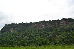
The district lies in the extreme south-east of the state, and is bounded by Mirzapur district to the northwest, Chandauli district to the north, Kaimur and Rohtas districts of Bihar state to the north-east, Garhwa district of Jharkhand state to the east, Balrampur District of Chhattisgarh state to the south, and Singrauli district of Madhya Pradesh state to the west. The northern part of the district lies on a plateau of the Vindhya Range, and is drained by tributaries of the Ganges including the Belan and Karmanasha rivers. South of the steep escarpment of the Kaimur Range is the valley of the Son River, which flows through the district from west to east. The southern portion of the district is hilly, interspersed with fertile stream valleys. The Rihand River, which rises to the south in the highlands of Surguja district of Chhattisgarh, flows north to join the Son in the center of the district. The Govind Ballabh Pant Sagar, a reservoir on the Rihand, lies partly in the district and partly in Madhya Pradesh. East of the Rihand, the Kanhar River, which originates in Chhattisgarh, flows north to join the Son.
Climate[edit | edit source]
Sonbhadra has a relatively subtropical climate with high variation between summer and winter temperatures. The average temperature is 30 to 46 °C (86 to 115 °F) in the summer and 2 to 15 °C (36 to 59 °F) in the winter. The weather is pleasant in rainy season from July to October.
Ecology[edit | edit source]
The portion of the district north of the Son River lies in the Lower Gangetic plains moist deciduous forests ecoregion. The portion south of the Son lies in the Chhota Nagpur dry deciduous forests ecoregion.
Kaimoor Wildlife Sanctuary lies mostly within the district, reaching generally east and west along the spine of the Kaimur Range, and extending to the Son River at its eastern end.
Economy[edit | edit source]

The district has many electrical power stations around Govind Ballabh Pant Sagar. NTPC has two coal-based thermal power plants, being Singrauli Super Thermal Power Station at Shaktinagar and Rihand Thermal Power Station at Rihand Nagar. Other power stations are at Anpara (UPRVUNL), Obra (UPRVUNL), Renusagar (Hindalco) and Pipri-Hydro (UPRVUNL). Northern Coalfields (a branch of Coal India Limited) has its headquarters and many coal mines in this region.
Hindalco has a major aluminium plant at Renukut. Owing to the limestone hills, initially one cement factory was established at Churk in 1956. Another cement factory started at Dala in 1971, with an ancillary unit at Chunar from 1980. A big dam constructed at Pipri in 1961 is named Rihand Dam; a small dam was constructed at Obra in 1968.[citation needed]
The Birla group set up an aluminum plant at Renukut. The company set up its own power plant at Renusagar in 1967 and started a company in Renukut called HiTech Carbon. Another industrial group initiated a company in Renukut named Grasim Industries Limited, which produces chemicals and later it started own power plant at Renukut in 1998.[citation needed]
In 2006 the Ministry of Panchayati Raj named Sonbhadra as one of the country's 250 most backward districts (out of a total of 640).[9] It is one of the 34 districts in Uttar Pradesh currently receiving funds from the Backward Regions Grant Fund Programme (BRGF).[9]
Tourist attraction[edit | edit source]

Historical places[edit | edit source]

- Vijaygarh Fort
- Agori Fort
- Veer Lorik Patthar
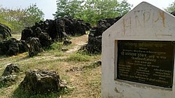
- Cave Paintings of Son and Belan Valley, Sonbhadra[7]
Nature[edit | edit source]

- Salkhan Fossil Park
- Mukkha Fall
- Son View Point, Robertsganj
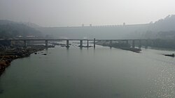
- Rihand Dam
- Dhanraul Dam
- Kaimoor Wildlife Sanctuary
Temples[edit | edit source]


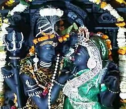
- Shivdwar
- Renukeshwar Mahadev Temple
- Vandevi Temple
- Jwaladevi Temple, Shaktinagar
- Maa Vaishnav Shaktipeeth Dalla
- ambedkar park
Transport[edit | edit source]
By air[edit | edit source]
- Muirpur Airport at Muirpur, an operational airstrip and proposed airport, currently used by chartered and private planes near Renukut
- Varanasi International Airport in Varanasi. Flights are available to all major Indian cities including Delhi, Mumbai, Kolkata, Lucknow, Agra, Bangalore, Chennai, Patna, Khajuraho, Hyderabad, Gaya, etc. International connections are Bangkok, Colombo, Hong Kong and Kathmandu from Varanasi International Airport.
By train[edit | edit source]
- Mirzapur Railway Station
- Sonbhadra Railway Station
- Chopan Railway station
- Renukoot Railway station near Rihand Dam
- Anpara Railway station
- Singrauli Railway station (in Madhya Pradesh)
- Shaktinagar Railway station
- Varanasi Railway station
- Dudhi Railway station
The city is connected by rail to Delhi, Allahabad, Ranchi and Patna. Some notable trains passing through the district are Muri express (Jammu Tawi - Delhi - Tata Nagar), Jharkhand Swarna Jayanti Express/12873(Hatia - Kanpur - Delhi), Triveni Express (Bareilly - Lucknow - Shaktinagar/Singrauli/barwadih) Bhopal Express (Bhopal-Howrah) weekly and Shaktipunj Express/11448(Howrah-Bokaro - Chopan- Jabalpur). Intercity Express/03346 (Singrauli- Chopan-Varanasi).
By road[edit | edit source]
Robertsganj, the headquarters of Sonbhadra, is located about 88 km (55 mi) from the city of Varanasi which has the nearest airport. Robertsganj is well connected to Lucknow, Allahabad, Varanasi, Mirzapur, Gorakhpur, Faizabad, Ambikapur Sasaram & Garhwa by road. Buses are available at all hours of the day from Varanasi and it normally takes Template:Fract hours to cover the distance. The highway connecting Varanasi and Waidhan passes through the district. Though this is not a national highway it is a very busy road because of the towns Dalla, Renukot, Anpara, Shaktinagar which are sufficiently commercialized areas. National Thermal Power corporation is in Shaktinagar and also Northern Coalfields limited (a subsidiary company of Coal India Ltd) has different projects like Singrauli, Khadia, Jayant, Dudhichua, amlori, Kakri etc. These areas have several major coal mines which cater a big part of the coal need of the state. Churk a nearby town is situated around 10 km (6.2 mi), where Jaypee Group is establishing a thermal power project. One of the main reasons this road is always busy is due to daily transport of around 1000 trucks of grits and sand.
Demographics[edit | edit source]
| Year | Pop. | ±% p.a. |
|---|---|---|
| 1901 | 241,964 | — |
| 1911 | 239,431 | −0.11% |
| 1921 | 239,230 | −0.01% |
| 1931 | 260,445 | +0.85% |
| 1941 | 297,288 | +1.33% |
| 1951 | 336,065 | +1.23% |
| 1961 | 443,174 | +2.81% |
| 1971 | 580,593 | +2.74% |
| 1981 | 800,717 | +3.27% |
| 1991 | 1,104,210 | +3.27% |
| 2001 | 1,504,852 | +3.14% |
| 2011 | 1,862,559 | +2.16% |
| Source: Census of India[10] | ||
According to the 2011 census Sonbhadra district has a population of 1,862,559, of which male and female were 971,344 and 891,215 respectively.[12] roughly equal to the nation of Kosovo[13] or the US state of West Virginia.[14] This gives it a ranking of 254th in India (out of a total of 640).[12] The district has a population density of 270 inhabitants per square kilometre (700/sq mi).[12] Its population growth rate over the decade 2001-2011 was 27.27%. 16.88% of the population lives in urban areas. Scheduled Castes and Scheduled Tribes make up 22.64% and 20.67% of the population respectively.[12]
Sex ratio and child population[edit | edit source]
Sonbhadra has a sex ratio of 996 females for every 1000 males. In census enumeration, data regarding child undeg age six were also collected for districts Sonbhadra. There were total 323,092 children under age six against 302,834 of 2001 census. Of total 323,092 male and female were 167,870 and 155,222 respectively. Child sex ratio as per census 2011 was 925 compared to 956 of census 2001. In 2011, children under age six formed 17.35 percent of Sonbhadra District compared to 20.69 percent of 2001. There was net change of -3.34 percent in this compared to previous census.[12]
Literacy rate[edit | edit source]
literacy rate of 64%. Male and female literacy were 74.92% and 52.14% respectively. Total literate in Sonbhadra District were 985,708 of which male and female were 601,988 and 383,720 respectively.[12]
Language[edit | edit source]
At the time of the 2011 Census of India, 83.91% of the population in the district spoke Hindi and 14.57% spoke Bhojpuri as their first language. Around 5,000 people in the district speak Gondi and 1,800 Kurukh, both tribal languages.[15] Bagheli is major language in southern part of district while in Northern part, Bhojpuri is spoken.
Sonbhadra District urban population[edit | edit source]
Out of the total Sonbhadra population for 2011 census, 16.88 percent lives in urban regions of district. In total 314,342 people lives in urban areas of which males are 167,999 and females are 146,343. Sex Ratio in urban region of Sonbhadra district is 871 as per 2011 census data. Similarly child sex ratio in Sonbhadra district was 868 in 2011 census. Child population (0-6) in urban region was 38,169 of which males and females were 20,434 and 17,735. This child population figure of Sonbhadra district is 12.16% of total urban population.there are 11.7% urban people belong to scheduled casts and 3.2% urban people belong to scheduled tribes.
Average literacy rate in Sonbhadra Urban as per census 2011 is 84.31% of which males and females are 90.73% and 76.93% literates respectively.
Notable people[edit | edit source]
Politicians
Artists
- Vivek Mushran Bollywood actor
- Srikant Dwivedi Mr. India 2017, Bollywood actor
- Anurag Kashyap Film director
- Abhinav Kashyap Film director
- Saumya Mishra Indian Idol season 9 contestant (Singer)
- Vartika Jha Dancer, Choreographer and Actress, second runner up of Dance Plus (season 4)
- Mohammed Hanif Khan Shastri Indian Sanskrit Scholar, The Government of India awarded civilian award Padma Shri (Literature & Education) in 2019
References[edit | edit source]
- ↑ 1.0 1.1 "52nd Report of the Commissioners for Linguistic Minorities in India" (PDF). nclm.nic.in. Ministry of Minority Affairs. Archived from the original (PDF) on 25 May 2017. Retrieved 26 December 2018.
- ↑ Catch News. "Sonbhadra Singrauli has all the ingredients Energy capital of India". Retrieved 7 June 2016.
- ↑ Sudhir Kumar (7 July 2018). "Once hailed by PM Nehru for its beauty, 'India's Switzerland' lacks access to power, water, healthcare". Hindustan Times. Retrieved 7 July 2018.
Country's first Prime Minister Jawaharlal Nehru was so taken up by the natural beauty of the region that he once described Sonbhadra as the "Switzerland of India."
- ↑ "Develop Sonbhadra as a tourism hub: Yogi". Hindustan Times. 13 September 2018. Retrieved 14 April 2021.
- ↑ Press Trust of India [@PTI_News] (22 February 2020). "Geological Survey of India tells PTI there has been no discovery of gold deposits estimated to be around 3,000 tonnes in Uttar Pradesh's Sonbhadra district, as claimed by district mining official" (Tweet). Retrieved 22 February 2020 – via Twitter.
- ↑ "No discovery of around 3,000-tonne gold deposits in U.P.'s Sonbhadra: GSI". The Hindu. PTI. 22 February 2020. Retrieved 23 February 2020.
- ↑ 7.0 7.1 Charu Chaudhary. "Sonbhadra: Of Cave Paintings And Fossil Parks". Retrieved 3 July 2020.
- ↑ Patrika. "Foundation day of Sonbhadra History". Retrieved 4 March 2018.
- ↑ 9.0 9.1 Ministry of Panchayati Raj (8 September 2009). "A Note on the Backward Regions Grant Fund Programme" (PDF). National Institute of Rural Development. Archived from the original (PDF) on 5 April 2012. Retrieved 27 September 2011.
- ↑ "Decadal Variation In Population Since 1901".
- ↑ "Table C-01 Population by Religion: Uttar Pradesh". censusindia.gov.in. Registrar General and Census Commissioner of India. 2011.
- ↑ 12.0 12.1 12.2 12.3 12.4 12.5 "District Census Handbook: Sonbhadra" (PDF). censusindia.gov.in. Registrar General and Census Commissioner of India. 2011.
- ↑ "Country Comparison: Population". The World Factbook. Central Intelligence Agency. Archived from the original on 13 June 2007. Retrieved 1 October 2011.
Kosovo 1,825,632 July 2011 est.
- ↑ "2010 Resident Population Data". U. S. Census Bureau. Retrieved 30 September 2011.
West Virginia 1,852,994
- ↑ 15.0 15.1 "Table C-16 Population by Mother Tongue: Uttar Pradesh". www.censusindia.gov.in. Registrar General and Census Commissioner of India.
External links[edit | edit source]
Places adjacent to Sonbhadra district | ||||||||||
|---|---|---|---|---|---|---|---|---|---|---|
| ||||||||||


