

imported>Challiyan Length converter |
m Removed empty portal template using script |
||
| (One intermediate revision by one other user not shown) | |||
| Line 27: | Line 27: | ||
| website = | | website = | ||
}} | }} | ||
[[File:Munnar Temple - Om Saravana Bhavan - മൂന്നാർ - ഓം ശരവണ ഭവൻ.JPG|thumbnail|Om Saravana Bhavan Temple at Munnar in Idukki, Kerala]] | [[File:Munnar Temple - Om Saravana Bhavan - മൂന്നാർ - ഓം ശരവണ ഭവൻ.JPG|thumbnail|Om Saravana Bhavan Temple at Munnar in Idukki, Kerala]] | ||
'''Mattupetty Dam''' (Madupetty Dam), near [[Munnar]] in [[Idukki District]], is a storage [[ | '''Mattupetty Dam''' (Madupetty Dam), near [[Munnar]] in [[Idukki District]], is a storage concrete [[gravity dam]] built in the mountains of [[Kerala]], [[India]] to conserve water for [[hydroelectricity]].<ref>{{cite web|title=Munnar|url=http://www.keralatourism.org/destination/destination.php?id=306|website=Keralatourism.org|access-date=21 June 2012|archive-url=https://web.archive.org/web/20140118183559/http://www.keralatourism.org/destination/destination.php?id=306|archive-date=18 January 2014|url-status=dead}}</ref> Construction of the dam was led by E.U. Philipose, Superintending Engineer, Kerala State Electricity Board. It has been a vital source of power and huge revenue for [[Idukki District]]. The large amount of perennially available water allows wild animals and birds to flourish.<ref>{{cite web | ||
|url=http://www.narmada.org/archive/hindu/files/hindu.19991116.13160614.htm | |url=http://www.narmada.org/archive/hindu/files/hindu.19991116.13160614.htm | ||
|title=Keyword is planning | |title=Keyword is planning | ||
|website=Narmada.org | |website=Narmada.org | ||
|access-date=2007-03-28 | |access-date=2007-03-28 | ||
}}</ref> The height of the dam is {{Convert|83.35| m}} and the length is {{Convert|237.74|m}}. Taluks through which release flow are [[Udumbanchola|Udumpanchola]], [[Devikulam taluk|Devikulam]], [[Kothamangalam]], [[Muvattupuzha Taluk|Muvattupuzha]], [[Kunnathunad | }}</ref> The height of the dam is {{Convert|83.35| m}} and the length is {{Convert|237.74|m}}. Taluks through which release flow are [[Udumbanchola|Udumpanchola]], [[Devikulam taluk|Devikulam]], [[Kothamangalam]], [[Muvattupuzha Taluk|Muvattupuzha]], [[Kunnathunad]]u, [[Aluva]], [[Kodungallur|Kodungalloor]] and [[Paravur Taluk|Paravur]] | ||
==Specifications== | ==Specifications== | ||
*Latitude : 10⁰ 06′ 23 ” N | *Latitude : 10⁰ 06′ 23 ” N | ||
| Line 44: | Line 44: | ||
*River : Muthirapuzha | *River : Muthirapuzha | ||
*Release from Dam to river : Muthirapuzha | *Release from Dam to river : Muthirapuzha | ||
*Type of Dam : Concrete | *Type of Dam : Free-Fall Gravity | ||
* Classification : HH ( | *Construction : Rebar-Reinforced Concrete | ||
* Classification : HH ( High Height) | |||
* Full Reservoir Level ( FRL): EL 1599.59 m | * Full Reservoir Level ( FRL): EL 1599.59 m | ||
* Full Reservoir Level ( FRL) : EL 1599.59 m | * Full Reservoir Level ( FRL) : EL 1599.59 m | ||
| Line 53: | Line 54: | ||
*Spillway : Ogee type- 3 Nos. Radial gates, each of size 6.70 x 4.95 m | *Spillway : Ogee type- 3 Nos. Radial gates, each of size 6.70 x 4.95 m | ||
Munnar is located near the confluence of the mountain streams of Muthirappuzha River, Chanduvarai River and Kundale River. | |||
Munnar is located near the confluence of the mountain streams of Muthirappuzha River, Chanduvarai River and Kundale River. | |||
The reservoir is also known to be one of the visiting grounds of elephants in the region. | The reservoir is also known to be one of the visiting grounds of elephants in the region. | ||
| Line 72: | Line 72: | ||
==See also== | ==See also== | ||
{{stack| | {{stack|}} | ||
* [[List of dams and reservoirs in India]] | * [[List of dams and reservoirs in India]] | ||
==References== | ==References== | ||
{{Reflist}} | {{Reflist}} | ||
{{ | ==External links== | ||
* {{YouTube|id=HkA6RCSv9Yc|title= Mattupetti small hydro electric project}}, Kerela State Electricity Board Ltd. | |||
{{Tourism in Kerala}} | {{Tourism in Kerala}} | ||
| Line 88: | Line 89: | ||
[[Category:Dams completed in 1953]] | [[Category:Dams completed in 1953]] | ||
[[Category:1953 establishments in India]] | [[Category:1953 establishments in India]] | ||
[[Category:20th-century architecture in India]] | |||
{{Idukki-geo-stub}} | {{Idukki-geo-stub}} | ||
{{India-dam-stub}} | {{India-dam-stub}} | ||
Latest revision as of 16:30, 14 August 2023
| Mattupetty Dam മാട്ടുപെട്ടി അണക്കെട്ട് | |
|---|---|
 | |
  Location of Mattupetty Dam മാട്ടുപെട്ടി അണക്കെട്ട് in India  Mattupetty Dam (Kerala) Mattupetty Dam (India) | |
| Location | Munnar, Kerala, India |
| Coordinates | 10°06′22″N 77°07′26″E / 10.106°N 77.124°E |
| Construction began | 1949 |
| Opening date | 1953 |
| Construction cost | ₹2.2 crore (US$310,000) |
| Operator(s) | Government of Kerala |
| Reservoir | |
| Creates | Mattupetty |
| Total capacity | 55.4 Million Cubic Meter |
| Catchment area | 105 Square kilometer |
| Surface area | 323.75 Hectare |
| Power Station | |
| Hydraulic head | 46.6 meter |

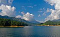
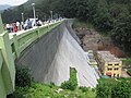
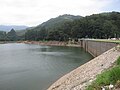
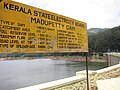
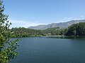
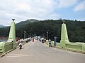
Mattupetty Dam (Madupetty Dam), near Munnar in Idukki District, is a storage concrete gravity dam built in the mountains of Kerala, India to conserve water for hydroelectricity.[1] Construction of the dam was led by E.U. Philipose, Superintending Engineer, Kerala State Electricity Board. It has been a vital source of power and huge revenue for Idukki District. The large amount of perennially available water allows wild animals and birds to flourish.[2] The height of the dam is 83.35 metres (273.5 ft) and the length is 237.74 metres (780.0 ft). Taluks through which release flow are Udumpanchola, Devikulam, Kothamangalam, Muvattupuzha, Kunnathunadu, Aluva, Kodungalloor and Paravur
Specifications[edit | edit source]
- Latitude : 10⁰ 06′ 23 ” N
- Longitude: 77⁰ 07′ 26” E
- Panchayath : Madupetty
- Village : KDH Village
- District : Idukki
- River Basin : Muthirapuzha
- River : Muthirapuzha
- Release from Dam to river : Muthirapuzha
- Type of Dam : Free-Fall Gravity
- Construction : Rebar-Reinforced Concrete
- Classification : HH ( High Height)
- Full Reservoir Level ( FRL): EL 1599.59 m
- Full Reservoir Level ( FRL) : EL 1599.59 m
- Storage at FRL : 55.23 Mm3
- Height from deepest foundation : 83.35 m
- Length : 237.74 m
- Spillway : Ogee type- 3 Nos. Radial gates, each of size 6.70 x 4.95 m
Munnar is located near the confluence of the mountain streams of Muthirappuzha River, Chanduvarai River and Kundale River.
The reservoir is also known to be one of the visiting grounds of elephants in the region.
Gallery[edit | edit source]
-
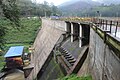 Maduppetty dam
 -
-

-

-
-
-
-
-


See also[edit | edit source]
References[edit | edit source]
- ↑ "Munnar". Keralatourism.org. Archived from the original on 18 January 2014. Retrieved 21 June 2012.
- ↑ "Keyword is planning". Narmada.org. Retrieved 28 March 2007.
External links[edit | edit source]
- Mattupetti small hydro electric project at YouTube, Kerela State Electricity Board Ltd.


 | This article related to a location in Idukki district, Kerala, India is a stub. You can help Bharatpedia by expanding it. |
 | This article about a dam, floodgate or canal in India is a stub. You can help Bharatpedia by expanding it. |