Adasimla | |
|---|---|
Village | |
Location in West Bengal, India  Adasimla Adasimla (India) | |
| Coordinates: 22°07′53″N 87°32′05″E / 22.1315°N 87.5346°E | |
| Country | |
| State | West Bengal |
| District | Paschim Medinipur |
| Population (2011) | |
| • Total | 4,622 |
| Languages | |
| • Official | Bengali, English |
| Time zone | UTC+5:30 (IST) |
| PIN | 721467 |
| Telephone/STD code | 03228 |
| Lok Sabha constituency | Ghatal |
| Vidhan Sabha constituency | Sabang |
| Website | paschimmedinipur |
Adasimla is a village in the Sabang CD block in the Kharagpur subdivision of the Paschim Medinipur district in the state of West Bengal, India.
Geography[edit | edit source]
Lua error in Module:OSM_Location_map at line 1984: attempt to index field 'wikibase' (a nil value).
Location[edit | edit source]
Adasimla is located at 22°07′53″N 87°32′05″E / 22.1315°N 87.5346°E.
Area overview[edit | edit source]
Kharagpur subdivision, shown partly in the map alongside, mostly has alluvial soils, except in two CD blocks in the west – Kharagpur I and Keshiary, which mostly have lateritic soils. Around 74% of the total cultivated area is cropped more than once.[1]With a density of population of 787 per km2nearly half of the district’s population resides in this subdivision. 14.33% of the population lives in urban areas and 86.67% lives in the rural areas.[2]
Note: The map alongside presents some of the notable locations in the subdivision. All places marked in the map are linked in the larger full screen map.
Demographics[edit | edit source]
According to the 2011 Census of India, Adasimla had a total population of 4,622, of which 2,383 (52%) were males and 2,239 (48%) were females. There were 516 persons in the age range of 0–6 years. The total number of literate persons in Adasimla was 3,486 (84.90% of the population over 6 years).[3]
Education[edit | edit source]
Adasimla Deshapran HS School is a Bengali-medium coeducational institution established in 1965. It has facilities for teaching from class V to class XII. It has a library with 1,180 books and a playground. [4]
Adasimla picture gallery[edit | edit source]
-
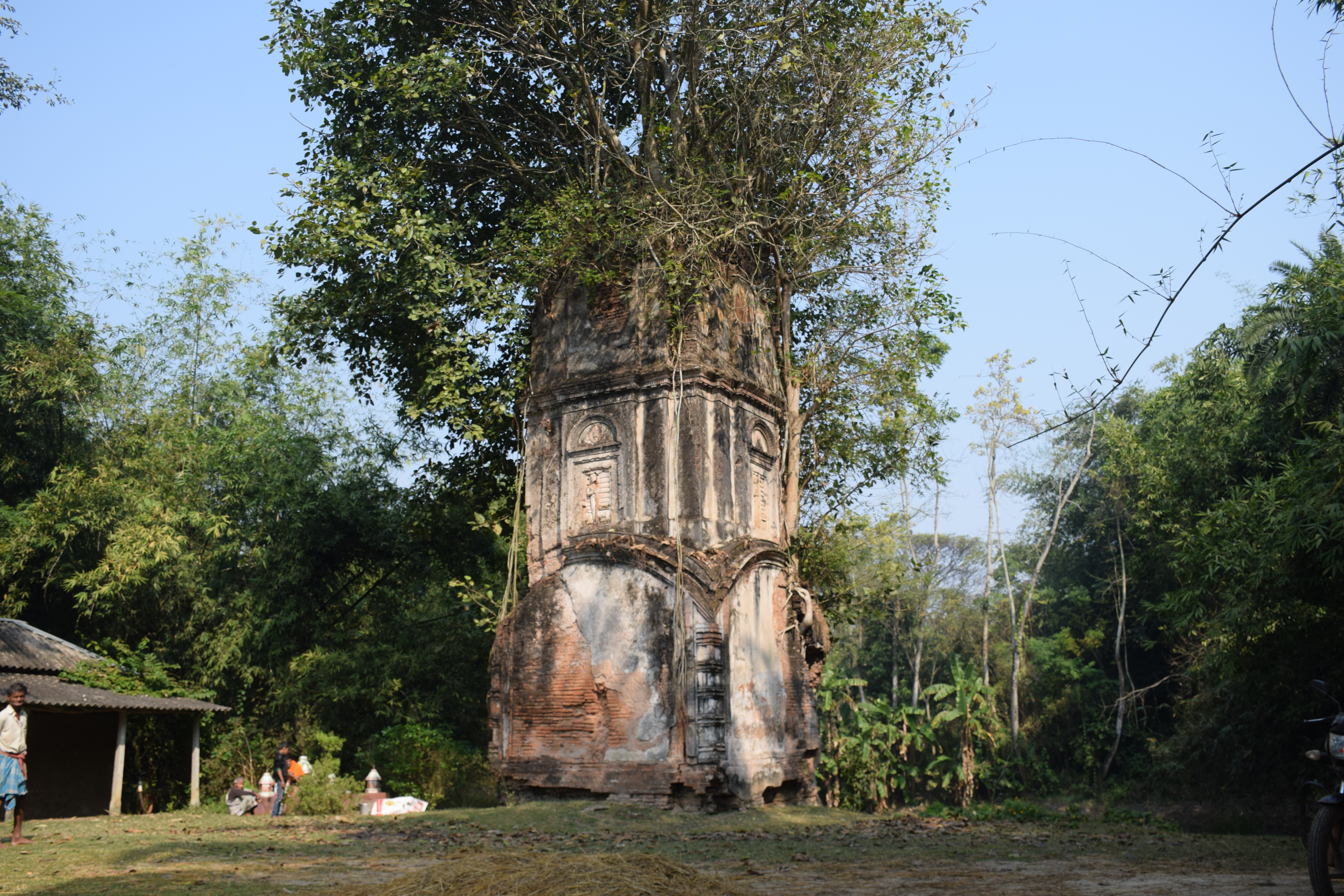 Ek Ratna Rudreshwara temple
 -
Rudreshwara temple decoration

The pictures are a part of Wiki Explores Purba Medinipur programme, an initiative by West Bengal Wikimedians User Group
References[edit | edit source]
- ↑ "District Human Development Report Paschim Medinipur, 2011". page 27-28. Department of Planning and Statistics, Government of West Bengal. Retrieved 10 September 2020.
- ↑ "District Statistical Handbook Paschim Medinipur, 2013". Table 2.2, 2.4 (a). Department of Planning and Statistics. Retrieved 10 September 2020.
- ↑ "CD block Wise Primary Census Abstract Data(PCA)". West Bengal – District-wise CD blocks. Registrar General and Census, India. Retrieved 19 August 2020.
- ↑ "Adasimla Deshapran HS U Pry". Schools.org. Retrieved 19 August 2020.