


robot: Update article (please report if you notice any mistake or error in this edit) |
No edit summary |
||
| Line 2: | Line 2: | ||
{{Use Indian English|date=July 2020}} | {{Use Indian English|date=July 2020}} | ||
{{Infobox settlement | {{Infobox settlement | ||
| name | | name = Tiruchirappalli district | ||
| other_name | | other_name = | ||
| settlement_type | | settlement_type = [[List of districts of Tamil Nadu|District]] of [[Tamil Nadu]] | ||
| image_skyline | | image_skyline = {{Photomontage | ||
| image_alt | |size = 250 | ||
| image_caption | |photo1a = Ranganathaswamy temple tiruchirappalli.jpg | ||
| image_map | |photo1b = Upper Anaicut.JPG | ||
|photo2a = Mutharasanallur1.jpg | |||
|photo2b = River kaveri in musiri,tamilnadu.jpg | |||
|photo3a = My city Rockfort.5.jpg | |||
}} | |||
| image_alt = | |||
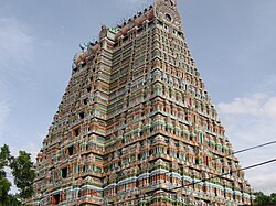
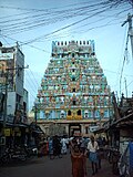
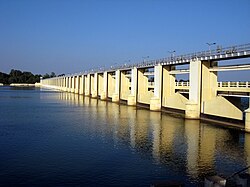
| image_caption = Clockwise from top-left: [[Ranganathaswamy Temple, Srirangam|Ranganathaswamy Temple]] in [[Srirangam]], [[Upper Anaicut]], [[Kaveri]] in [[Musiri]], view of [[Tiruchirappalli]] from [[Tiruchirappalli Rock Fort|Rockfort]], ponds in [[Mutharasanallur]] | |||
| image_map = Tiruchirappalli in Tamil Nadu (India).svg | |||
| image_map1 = {{maplink |frame=yes | |||
|frame-width=275 |frame-height=275 |frame-align=center | |frame-width=275 |frame-height=275 |frame-align=center | ||
|text= '''Thiruchirappalli district''' | |text= '''Thiruchirappalli district''' | ||
| Line 17: | Line 25: | ||
|type2=line|id2=Q1445|stroke-width2=1|stroke-colour2=#0000ff|title2=Tamil Nadu | |type2=line|id2=Q1445|stroke-width2=1|stroke-colour2=#0000ff|title2=Tamil Nadu | ||
}} | }} | ||
| map_alt | | map_alt = | ||
| map_caption | | map_caption = Location in Tamil Nadu | ||
| coordinates | | coordinates = {{coord|10|47|N|78|41|E|display=inline,title}} | ||
| subdivision_type | | subdivision_type = Country | ||
| subdivision_name | | subdivision_name = {{flag|India}} | ||
| subdivision_type1 | | subdivision_type1 = [[States and territories of India|State]] | ||
| subdivision_name1 | | subdivision_name1 = [[File:TamilNadu Logo.svg|22px]] [[Tamil Nadu]] | ||
| subdivision_type2 | | subdivision_type2 = Metro | ||
| subdivision_name2 | | subdivision_name2 = <!-- for neighbourhoods/suburbs only --> | ||
| subdivision_type3 | | subdivision_type3 = Municipal corporations | ||
| subdivision_name3 | | subdivision_name3 = [[Tiruchirappalli]] | ||
| subdivision_type4 | | subdivision_type4 = Municipalities | ||
| subdivision_name4 | | subdivision_name4 = [[Thuraiyur]], [[Manapparai]], [[Thuvakudi]], [[Lalgudi]], [[Musiri]] | ||
| subdivision_type5 | | subdivision_type5 = Town panchayats<ref>{{cite web |title=List of Town Panchayats |url=https://www.tn.gov.in/dtp/townpanchayats.pdf |website=Commissionerate of Town Panchayats |publisher=National Informatics Centre |access-date=5 February 2022 |pages=12–13 }}</ref> | ||
| subdivision_name5 | | subdivision_name5 = [[Balakrishnampatti]], [[Kallakudi]], [[Kattuputhur]], [[Koothappar]], [[Manachanallur]], [[Mettupalayam, Tiruchirappalli district|Mettupalayam]], [[Ponnampatti]], [[Poovalur]], [[Pullambadi]], [[South Kannanur]], [[Sirugamani]], [[Thathaiyangarpet]], [[Thottiyam]], [[Uppiliapuram]], [[Pettavaithalai]], [[Vairichettipalayam]] | ||
| subdivision_type6 | | subdivision_type6 = [[Administrative divisions of India|divisions]] | ||
| subdivision_name6 | | subdivision_name6 = [[Tiruchirappalli division]], [[Lalgudi division]], [[Musiri division]], [[Srirangam division]] | ||
| established_title | | established_title = <!-- Established --> | ||
| established_date | | established_date = | ||
| founder | | founder = | ||
| Named_for | | Named_for = | ||
| parts_type | | parts_type = [[Taluka]]s | ||
| parts | | parts = [[Lalgudi taluk]], [[Manachanallur taluk]], [[Manapparai taluk]], [[Marungapuri taluk]], [[Musiri taluk]], [[Srirangam taluk]], [[Thiruverumbur taluk]], [[Thottiyam taluk]], [[Thuraiyur taluk]], [[Tiruchirappalli taluk|Tiruchirappalli West taluk]], [[Tiruchirappalli East taluk]] | ||
| seat_type | | seat_type = Headquarters | ||
| seat | | seat = [[Tiruchirapalli]] | ||
| government_type | | government_type = | ||
| governing_body | | governing_body = | ||
| leader_title1 | | leader_title1 = Collector | ||
| leader_name1 | | leader_name1 = V. Saravanan, [[Indian Administrative Service|IAS]] | ||
| leader_title2 | | leader_title2 = Superintendent of Police | ||
| leader_name2 | | leader_name2 = S. Selvanagarathinam, [[Indian Police Service|IPS]] | ||
| leader_title3 | | leader_title3 = Assistant Collector | ||
| leader_name3 | | leader_name3 = J. E. Padmaja, [[Indian Administrative Service|IAS]]<ref>{{Cite web|url=https://www.tn.gov.in/contact_directory/district_administration/27|title=District Administration | Tamil Nadu Government Portal}}</ref> | ||
| unit_pref | | unit_pref = Metric | ||
| area_footnotes | | area_footnotes = | ||
| area_rank | | area_rank = 10th | ||
| area_total_km2 | | area_total_km2 = 4403.83 | ||
| elevation_footnotes | | elevation_footnotes = | ||
| elevation_m | | elevation_m = 88 | ||
| population_total | | population_total = 2,722,290 | ||
| population_as_of | | population_as_of = 2011 | ||
| population_rank | | population_rank = 6th | ||
| population_density_km2 | | population_density_km2 = auto | ||
| population_demonym | | population_demonym = | ||
| population_footnotes | | population_footnotes = | ||
| demographics_type1 | | demographics_type1 = Languages | ||
| demographics1_title1 | | demographics1_title1 = Official | ||
| demographics1_info1 | | demographics1_info1 = [[Tamil language|Tamil]] | ||
| timezone1 | | timezone1 = [[Indian Standard Time|IST]] | ||
| utc_offset1 | | utc_offset1 = +5:30 | ||
| postal_code_type | | postal_code_type = [[Postal Index Number|PIN]] | ||
| postal_code | | postal_code = 620 xxx and 621 xxx | ||
| area_code_type | | area_code_type = Telephone code | ||
| area_code | | area_code = 0431 | ||
| iso_code | | iso_code = [[ISO 3166-2:IN|<!-- ISO 3166-2 -->]] | ||
| registration_plate | | registration_plate = TN-45, TN-48, TN-81<ref>[http://www.tn.gov.in/sta/a2.pdf www.tn.gov.in]</ref> | ||
| blank1_name_sec1 | | blank1_name_sec1 = [[IUCN protected area categories|IUCN category]] | ||
| blank1_info_sec1 | | blank1_info_sec1 = <!-- for protected areas only --> | ||
| blank2_name_sec1 | | blank2_name_sec1 = Central location: | ||
| blank2_info_sec1 | | blank2_info_sec1 = {{coord|10|47|N|78|41|E}} | ||
| website | | website = {{URL|https://tiruchirappalli.nic.in}} | ||
| footnotes | | footnotes = | ||
| official_name | | official_name = | ||
}} | }} | ||
'''Tiruchirappalli | '''Tiruchirappalli district''' is [[List of districts of Tamil Nadu|one of the 38 districts]], located along the [[Kaveri River]], in [[Tamil Nadu]], India. The headquarters of the district is the city of [[Tiruchirappalli]]. | ||
During the [[British Raj]], the district was referred to as [[Trichinopoly District (Madras Presidency)|Trichinopoly]], and was a district of the [[Madras Presidency]]; it was renamed upon India's declaration of independence in 1947. The district is spread over an area of {{Convert|4,404|km2}} and had a population of 2,722,290 in 2011. | During the [[British Raj]], the district was referred to as [[Trichinopoly District (Madras Presidency)|Trichinopoly]], and was a district of the [[Madras Presidency]]; it was renamed upon India's declaration of independence in 1947. The district is spread over an area of {{Convert|4,404|km2}} and had a population of 2,722,290 in 2011. | ||
| Line 90: | Line 97: | ||
[[File:Trichy11.jpg|thumb|left|Kaveri river and Rockfort at Tiruchirapalli]] | [[File:Trichy11.jpg|thumb|left|Kaveri river and Rockfort at Tiruchirapalli]] | ||
Tiruchirappalli district lies almost at the exact centre of Tamil Nadu. The district has an area of 4,404 square kilometres. It is bounded in the north by [[ | Tiruchirappalli district lies almost at the exact centre of Tamil Nadu. The district has an area of 4,404 square kilometres. It is bounded in the north by [[Salem district]], Northwest by [[Namakkal district]], in the Northeast by [[Perambalur District]], East by [[Ariyalur district]] and [[Thanjavur District]], in the southeast by [[Pudukkottai district]] and [[Sivagangai district]], in the south by [[Madurai district]], in the southwest by [[Dindigul district]] and, in the west by [[Karur district]]. The district shares its borders with 10 other districts, the highest for any district in the state. The [[Kaveri]] river flows through the length of the district and is the principal source of irrigation and drinking water.{{citation needed|date=July 2020}} | ||
[[Kolli Hills]] form the boundary of Tiruchirapalli and [[Namakkal]] districts and [[Pachaimalai Hills]] form the Boundary of [[Salem district|Salem]] and [[Perambalur]] district with Tiruchirapalli district in the North and North East. | [[Kolli Hills]] form the boundary of Tiruchirapalli and [[Namakkal]] districts and [[Pachaimalai Hills]] form the Boundary of [[Salem district|Salem]] and [[Perambalur]] district with Tiruchirapalli district in the North and North East.{{citation needed|date=December 2022}} | ||
The North most and South most parts of the district are hilly, central part of the district is [[Kaveri]] plains. Trichy district is | The North most and South most parts of the district are hilly, central part of the district is [[Kaveri]] plains. Trichy district is diverse in landscape, mixture of Fertile, Delta, Valleys, Hilly areas, Semi Arid Zones. Central part of the district is fertile due to river [[Kaveri]] flowing through this district, by splitting the district into North and South. North Central and South Central part of the district is Semi arid and drought prone area, receives less rainfall. Evergreen [[Pachaimalai Hills]] and [[Kolli Hills]] form the Stunning and Enchanting Valley in between these two hills. Falls and Streams from these two hills fills up the lakes in valley areas and makes the land irrigated and Fertile. | ||
[[Pachaimalai Hills]] receives high rain fall than average during both [[Northeast Monsoon]] as well as [[Southwest Monsoon]], which makes these hills Greener throughout the year and gives a cool climate.{{citation needed|date=December 2022}} | |||
==Demographics== | ==Demographics== | ||
{{historical populations|11=1901|12=8,07,320|13=1911|14=8,76,070|15=1921|16=9,12,177|17=1931|18=9,18,342|19=1941|20=10,35,927|21=1951|22=11,84,158|23=1961|24=13,04,039|25=1971|26=16,50,768|27=1981|28=19,00,566|29=1991|30=21,96,473|31=2001|32=24,18,366|33=2011|34=27,22,290|percentages=pagr|footnote=source:<ref>[http://www.censusindia.gov.in/2011census/PCA/A2_Data_Table.html Decadal Variation In Population Since 1901]</ref>|align= | {{historical populations|11=1901|12=8,07,320|13=1911|14=8,76,070|15=1921|16=9,12,177|17=1931|18=9,18,342|19=1941|20=10,35,927|21=1951|22=11,84,158|23=1961|24=13,04,039|25=1971|26=16,50,768|27=1981|28=19,00,566|29=1991|30=21,96,473|31=2001|32=24,18,366|33=2011|34=27,22,290|percentages=pagr|footnote=source:<ref>[http://www.censusindia.gov.in/2011census/PCA/A2_Data_Table.html Decadal Variation In Population Since 1901]</ref>|align=none|cols=3}} | ||
According to [[2011 census of India|2011 census]], Tiruchirappalli district had a population of 2,722,290 with a sex-ratio of 1,013 females for every 1,000 males, much above the national average of 929.<ref name="dashboard">{{cite web|title=Census Info 2011 Final population totals|url=http://www.censusindia.gov.in/2011census/censusinfodashboard/index.html|publisher=Office of The Registrar General and Census Commissioner, Ministry of Home Affairs, Government of India|year=2013|access-date=26 January 2014}}</ref> A total of 272,456 were under the age of six, constituting 139,946 males and 132,510 females. [[Scheduled Castes and Scheduled Tribes]] accounted for 17.14% and 0.67% of the population respectively. The average literacy of the district was 74.9%, compared to the national average of 72.99%.<ref name="dashboard"/> The district had a total of 698,404 households. There were a total of 1,213,979 workers, comprising 161,657 cultivators, 319,720 main agricultural labourers, 25,174 in house hold industries, 575,778 other workers, 131,650 marginal workers, 9,012 marginal cultivators, 59,062 marginal agricultural labourers, 5,212 marginal workers in household industries and 58,364 other marginal workers.<ref name=2011census>{{cite web|title=Census Info 2011 Final population totals - Tiruchirappalli district|url=http://www.censusindia.gov.in/pca/SearchDetails.aspx?Id=689752|publisher=Office of The Registrar General and Census Commissioner, Ministry of Home Affairs, Government of India|year=2013|access-date=26 January 2014}}</ref> | |||
According to [[2011 census of India|2011 census]], Tiruchirappalli district had a population of 2,722,290 with a sex-ratio of 1,013 females for every 1,000 males, much above the national average of 929. 49.15% of the population lives in urban areas.<ref name="dashboard">{{cite web|title=Census Info 2011 Final population totals|url=http://www.censusindia.gov.in/2011census/censusinfodashboard/index.html|publisher=Office of The Registrar General and Census Commissioner, Ministry of Home Affairs, Government of India|year=2013|access-date=26 January 2014}}</ref> A total of 272,456 were under the age of six, constituting 139,946 males and 132,510 females. [[Scheduled Castes and Scheduled Tribes]] accounted for 17.14% and 0.67% of the population respectively. The average literacy of the district was 74.9%, compared to the national average of 72.99%.<ref name="dashboard"/> The district had a total of 698,404 households. There were a total of 1,213,979 workers, comprising 161,657 cultivators, 319,720 main agricultural labourers, 25,174 in house hold industries, 575,778 other workers, 131,650 marginal workers, 9,012 marginal cultivators, 59,062 marginal agricultural labourers, 5,212 marginal workers in household industries and 58,364 other marginal workers.<ref name=2011census>{{cite web|title=Census Info 2011 Final population totals - Tiruchirappalli district|url=http://www.censusindia.gov.in/pca/SearchDetails.aspx?Id=689752|publisher=Office of The Registrar General and Census Commissioner, Ministry of Home Affairs, Government of India|year=2013|access-date=26 January 2014}}</ref> | |||
{{bar box | |||
|title=Religions in Tiruchirappalli district (2011)<ref name="religion">{{Cite web |date=2011 |title=Table C-01 Population by Religion: Tamil Nadu |url=https://censusindia.gov.in/nada/index.php/catalog/11392/download/14505/DDW33C-01%20MDDS.XLS |website=censusindia.gov.in |publisher=[[Registrar General and Census Commissioner of India]]}}</ref> | |||
|titlebar=#Fcd116 | |||
|left1=Religion | |||
|right1=Percent | |||
|float=right | |||
|bars= | |||
{{bar percent|[[Hinduism in Tamil Nadu|Hinduism]]|darkorange|83.73}} | |||
{{bar percent|[[Christianity in Tamil Nadu|Christianity]]|purple|9.04}} | |||
{{bar percent|[[Tamil Muslim|Islam]]|green|7.01}} | |||
{{bar percent|Other or not stated|black|0.22}} | |||
}} | |||
{{stack|{{Pie chart | |||
|caption = Languages of Tiruchirappalli district (2011)<ref name="language"/> | |||
|label1 = [[Tamil language|Tamil]] |value1 = 96.67 |color1 = royalblue | |||
|label2 = [[Telugu language|Telugu]] |value2 = 2.08 |color2 = steelblue | |||
|label3 = Others |value3 = 1.25 |color3 = gray | |||
|thumb=right | |||
}}}} | |||
At the time of the 2011 census, 95.67% of the population spoke [[Tamil language|Tamil]], 2.08% [[Telugu language|Telugu]] .<ref name="language">{{Cite web |title=Table C-16 Population by Mother Tongue: Tamil Nadu |url=https://censusindia.gov.in/nada/index.php/catalog/10222/download/13334/DDW-C16-STMT-MDDS-3300.XLSX |website=[[Census of India]] |publisher=[[Registrar General and Census Commissioner of India]]}}</ref> | |||
== Politics == | |||
{{transcluded section|source=16th Tamil Nadu Assembly}} | |||
{{#section:16th Tamil Nadu Assembly|MLA Header}} | |||
{{#section:16th Tamil Nadu Assembly|Tiruchirappalli district}} | |||
|} | |||
==Taluks== | ==Taluks== | ||
| Line 126: | Line 163: | ||
*[[Manapparai]] town | *[[Manapparai]] town | ||
*[[Thuvakudi]] town | *[[Thuvakudi]] town | ||
*[[Lalgudi]] town | *[[Lalgudi]] town | ||
*[[Musiri]] town | |||
*[[Manachanallur]] town panchayat | *[[Manachanallur]] town panchayat | ||
*[[Thottiyam]] town panchayat | *[[Thottiyam]] town panchayat | ||
*[[Uppiliapuram]] Town panchayat | *[[Uppiliapuram]] Town panchayat | ||
*Thandalaiputhur panchayat | *[[Samayapuram|S. Kannanur (samayaburam)]] town Panchayat | ||
*[[Tha. Pettai]] town Panchayat | |||
*[[pullambadi]] town Panchayat | |||
*[[kaatuputhur]] town Panchayat | |||
*[[jiyaburam]] Panchayat | |||
*[[pettavaithalai]] Panchayat | |||
*[[Thandalaiputhur]] panchayat | |||
*[[Navalurkottapattu|Navalurkuttapattu]] panchayat | *[[Navalurkottapattu|Navalurkuttapattu]] panchayat | ||
*[[Mettupalayam, Tiruchirappalli district|Mettupalayam]] panchayat | *[[Mettupalayam, Tiruchirappalli district|Mettupalayam]] panchayat | ||
| Line 156: | Line 200: | ||
[[File:Trichii02.JPG|thumb|Upper Anaicut or Mukkombu]] | [[File:Trichii02.JPG|thumb|Upper Anaicut or Mukkombu]] | ||
The major rivers are the [[River Kaveri]] and the River Kollidam. | The major rivers are the [[River Kaveri]] and the River Kollidam. | ||
The important rivers across city is Koraiyar, Uyyakondan and Kudamuruti rivers. | The important rivers across city is Koraiyar, Uyyakondan and Kudamuruti rivers.{{citation needed|date=December 2022}} | ||
==Agriculture== | ==Agriculture== | ||
The district has a large cattle and poultry population with agriculture workers in the smaller villages like [[Kalpalayathanpatti]]. | The district has a large cattle and poultry population with agriculture workers in the smaller villages like [[Kalpalayathanpatti]]. | ||
The rivers [[Kaveri]] and [[Kollidam]] start branching out to form the Kaveri delta irrigating vast tracts of land in the district. The major crops are rice (vast tracts); [[sugarcane]] (vast tracts); banana/plantain; [[coconut]]; [[cotton]] (small tracts); [[betel]]; [[ | The rivers [[Kaveri]] and [[Kollidam]] start branching out to form the Kaveri delta irrigating vast tracts of land in the district. The major crops are rice (vast tracts); [[sugarcane]] (vast tracts); banana/plantain; [[coconut]]; [[cotton]] (small tracts); [[betel]]; [[maize]]; and [[Peanut|groundnut]]. | ||
Trichirapalli district is well known for all varieties of [[Banana]] Cultivation. Banana research centre is located in Tiruchirapalli Agricultural University. National Research Centre for [[Banana]], [[Indian Council of Agricultural Research|ICAR]] NRB is also located in Trichy. | |||
Tiruchirapalli district is well known for [[Sugarcane]] Plantation also, Agriculture Research Centre for [[Sugarcane]] is located in | |||
[[Sirugamani]]. | |||
Hill Jackfruit, [[Cassava]], mountain crops are grown in the [[Pachaimalai Hills]] of | [[Coffee]], Hill Jackfruit, [[Cassava]], mountain crops are grown in the [[Pachaimalai Hills]] of Tiruchirapalli district. | ||
== Divya Desam Temples == | == Divya Desam Temples == | ||
Latest revision as of 09:27, 28 March 2026


.svg)

Tiruchirappalli district is one of the 38 districts, located along the Kaveri River, in Tamil Nadu, India. The headquarters of the district is the city of Tiruchirappalli.
During the British Raj, the district was referred to as Trichinopoly, and was a district of the Madras Presidency; it was renamed upon India's declaration of independence in 1947. The district is spread over an area of 4,404 square kilometres (1,700 sq mi) and had a population of 2,722,290 in 2011.
Geography[edit | edit source]

Tiruchirappalli district lies almost at the exact centre of Tamil Nadu. The district has an area of 4,404 square kilometres. It is bounded in the north by Salem district, Northwest by Namakkal district, in the Northeast by Perambalur District, East by Ariyalur district and Thanjavur District, in the southeast by Pudukkottai district and Sivagangai district, in the south by Madurai district, in the southwest by Dindigul district and, in the west by Karur district. The district shares its borders with 10 other districts, the highest for any district in the state. The Kaveri river flows through the length of the district and is the principal source of irrigation and drinking water.[citation needed]
Kolli Hills form the boundary of Tiruchirapalli and Namakkal districts and Pachaimalai Hills form the Boundary of Salem and Perambalur district with Tiruchirapalli district in the North and North East.[citation needed]
The North most and South most parts of the district are hilly, central part of the district is Kaveri plains. Trichy district is diverse in landscape, mixture of Fertile, Delta, Valleys, Hilly areas, Semi Arid Zones. Central part of the district is fertile due to river Kaveri flowing through this district, by splitting the district into North and South. North Central and South Central part of the district is Semi arid and drought prone area, receives less rainfall. Evergreen Pachaimalai Hills and Kolli Hills form the Stunning and Enchanting Valley in between these two hills. Falls and Streams from these two hills fills up the lakes in valley areas and makes the land irrigated and Fertile.
Pachaimalai Hills receives high rain fall than average during both Northeast Monsoon as well as Southwest Monsoon, which makes these hills Greener throughout the year and gives a cool climate.[citation needed]
Demographics[edit | edit source]
|
|
| |||||||||||||||||||||||||||||||||||||||||||||
| source:[4] | |||||||||||||||||||||||||||||||||||||||||||||||
According to 2011 census, Tiruchirappalli district had a population of 2,722,290 with a sex-ratio of 1,013 females for every 1,000 males, much above the national average of 929. 49.15% of the population lives in urban areas.[5] A total of 272,456 were under the age of six, constituting 139,946 males and 132,510 females. Scheduled Castes and Scheduled Tribes accounted for 17.14% and 0.67% of the population respectively. The average literacy of the district was 74.9%, compared to the national average of 72.99%.[5] The district had a total of 698,404 households. There were a total of 1,213,979 workers, comprising 161,657 cultivators, 319,720 main agricultural labourers, 25,174 in house hold industries, 575,778 other workers, 131,650 marginal workers, 9,012 marginal cultivators, 59,062 marginal agricultural labourers, 5,212 marginal workers in household industries and 58,364 other marginal workers.[6]
At the time of the 2011 census, 95.67% of the population spoke Tamil, 2.08% Telugu .[8]
Politics[edit | edit source]
| District | No. | Constituency | Name | Party | Alliance | Remarks | ||
|---|---|---|---|---|---|---|---|---|
Taluks[edit | edit source]
.jpg)
In 2013, Tiruchirappalli district went from nine taluks to eleven taluks.[9]
- Thuraiyur taluk
- Manapparai taluk
- Marungapuri taluk
- Srirangam taluk
- Tiruchirappalli West taluk
- Tiruchirappalli East taluk
- Thiruverumbur taluk
- Lalgudi taluk
- Manachanallur taluk
- Musiri taluk
- Thottiyam taluk
Urban centres[edit | edit source]

Tiruchirappalli District consists of the following urban centres:
- Trichy City

- Thuraiyur town
- Manapparai town
- Thuvakudi town
- Lalgudi town
- Musiri town
- Manachanallur town panchayat
- Thottiyam town panchayat
- Uppiliapuram Town panchayat
- S. Kannanur (samayaburam) town Panchayat
- Tha. Pettai town Panchayat
- pullambadi town Panchayat
- kaatuputhur town Panchayat
- jiyaburam Panchayat
- pettavaithalai Panchayat
- Thandalaiputhur panchayat
- Navalurkuttapattu panchayat
- Mettupalayam panchayat
- B.Mettur panchayat
- Balakrishnampatti panchayat
- Thataiyagarpettai panchayat
- mangalam panchayat
Major industries[edit | edit source]
- Bharat Heavy Electricals Limited (BHEL)
- High Energy Projectile Factory (HEPF)
- Golden Rock Railway Workshop
- Ordnance Factory Tiruchirappalli
- Light and heavy engineering
- Leather Tanneries
- Food Processing
- Sugar Mills
- (Traditional) Cigar Making (village) Industries
- Hosiery and garments (to a small extent)
- IT/BPO
- Manufacturing of Synthetic Stones for Jewelry
Natural resources and water bodies[edit | edit source]

The major rivers are the River Kaveri and the River Kollidam. The important rivers across city is Koraiyar, Uyyakondan and Kudamuruti rivers.[citation needed]
Agriculture[edit | edit source]
The district has a large cattle and poultry population with agriculture workers in the smaller villages like Kalpalayathanpatti.
The rivers Kaveri and Kollidam start branching out to form the Kaveri delta irrigating vast tracts of land in the district. The major crops are rice (vast tracts); sugarcane (vast tracts); banana/plantain; coconut; cotton (small tracts); betel; maize; and groundnut.
Trichirapalli district is well known for all varieties of Banana Cultivation. Banana research centre is located in Tiruchirapalli Agricultural University. National Research Centre for Banana, ICAR NRB is also located in Trichy.
Tiruchirapalli district is well known for Sugarcane Plantation also, Agriculture Research Centre for Sugarcane is located in
Sirugamani.
Coffee, Hill Jackfruit, Cassava, mountain crops are grown in the Pachaimalai Hills of Tiruchirapalli district.
Divya Desam Temples[edit | edit source]
The first five divya desam temples are located in tiruchirappalli district.
- Srirangam Ranganathaswamy Temple (1st Divya Desam)
- Azhagiya Manavala Perumal Temple (2nd Divya Desam)
- Uthamar Kovil (3rd Divya Desam)
- Pundarikakshan Perumal Temple (4th Divya Desam)
- Sundararaja Perumal temple (5th Divya Desam)
References[edit | edit source]
- ↑ "List of Town Panchayats" (PDF). Commissionerate of Town Panchayats. National Informatics Centre. pp. 12–13. Retrieved 5 February 2022.
- ↑ "District Administration | Tamil Nadu Government Portal".
- ↑ www.tn.gov.in
- ↑ Decadal Variation In Population Since 1901
- ↑ 5.0 5.1 "Census Info 2011 Final population totals". Office of The Registrar General and Census Commissioner, Ministry of Home Affairs, Government of India. 2013. Retrieved 26 January 2014.
- ↑ "Census Info 2011 Final population totals - Tiruchirappalli district". Office of The Registrar General and Census Commissioner, Ministry of Home Affairs, Government of India. 2013. Retrieved 26 January 2014.
- ↑ "Table C-01 Population by Religion: Tamil Nadu". censusindia.gov.in. Registrar General and Census Commissioner of India. 2011.
- ↑ 8.0 8.1 "Table C-16 Population by Mother Tongue: Tamil Nadu". Census of India. Registrar General and Census Commissioner of India.
- ↑ "Residents question move to locate Marungapuri taluk office at Kallupatti". The Hindu. 21 June 2013.
External links[edit | edit source]
Places adjacent to Tiruchirappalli district | |
|---|---|


| Taluks |  | ||||
|---|---|---|---|---|---|
| Cities and towns | |||||
| Revenue |
| ||||

