

imported>Vatsmaxed m →top: replace, replaced: Indian road network → Roads in India |
m enhance structure further and cleaned formatting |
||
| Line 1: | Line 1: | ||
{{Infobox settlement | {{Infobox settlement | ||
| name | | name = Shivpuri district | ||
| settlement_type | | settlement_type = [[List of districts of Madhya Pradesh|District]] of [[Madhya Pradesh]] | ||
| total_type | | total_type = Total | ||
| native_name | | native_name = | ||
| image_skyline | | image_skyline = {{Photomontage | ||
| | |size = 250 | ||
| | |photo1a = Chhatari.JPG | ||
| | |photo1b = Mahua Nagara mandir, Shiva temple number 2, Madhya Pradesh 055.jpg | ||
| | |photo2a = 0111621 Surya Temple, Sesai Madhya Pradesh 006.jpg | ||
| | |photo2b = 0111721 Terahi Hindu monastery and temples, Madhya Pradesh 077.jpg | ||
|photo3a = Madhav Natioinal Park.JPG | |||
| | |||
}} | }} | ||
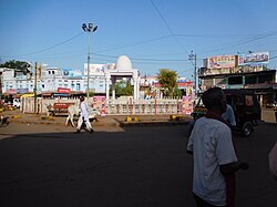
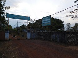
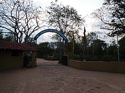
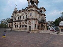
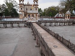
'''Shivpuri | | image_caption = Clockwise from top-left: Chhatri in [[Shivpuri]], Mahua Nagara Mandir, temples in Terahi, [[Madhav National Park]], Surya Mandir, Sesai | ||
| image_map = MP Shivpuri district map.svg | |||
| map_caption = Location of Shivpuri district in Madhya Pradesh | |||
| coordinates = | |||
| coor_pinpoint = Shivpuri | |||
| subdivision_type = Country | |||
| subdivision_name = {{flag|India}} | |||
| subdivision_type1 = [[States and union territories of India|State]] | |||
| subdivision_name1 = [[Madhya Pradesh]] | |||
| subdivision_type2 = Division | |||
| subdivision_name2 = [[Gwalior division|Gwalior]] | |||
| established_title = Established | |||
| established_date = | |||
| seat_type = Headquarters | |||
| seat = [[Shivpuri]] | |||
| parts_type = [[Tehsils of India|Tehsils]] | |||
| parts_style = para | |||
| p1 = 10 | |||
| area_total_km2 = 10,666 | |||
| area_footnotes = | |||
| population_as_of = 2011 | |||
| population_total = 1,726,050 | |||
| population_footnotes = | |||
| population_urban = | |||
| population_density_km2 = auto | |||
| demographics_type1 = Demographics | |||
| demographics1_title1 = [[Literacy in India|Literacy]] | |||
| demographics1_info1 = 63.73 per cent | |||
| demographics1_title2 = Sex ratio | |||
| demographics1_info2 = 877 females over 1000 males | |||
| leader_title = | |||
| leader_name = | |||
| leader_title1 = | |||
| leader_name1 = | |||
| leader_title2 = | |||
| leader_name2 = | |||
| timezone1 = [[Indian Standard Time|IST]] | |||
| utc_offset1 = +05:30 | |||
| registration_plate = | |||
| blank_name_sec1 = [[Roads in India|Major highways]] | |||
| blank_info_sec1 = NH3 and NH25 | |||
| blank_name_sec2 = Average annual precipitation | |||
| blank_info_sec2 = July to September mm | |||
| website = {{URL|https://shivpuri.nic.in}} | |||
}} | |||
'''Shivpuri district''' ({{IPA|hi|ʃɪʋpʊɾiː}}) is a [[Districts of Madhya Pradesh|district]] of [[Madhya Pradesh]] [[States and territories of India|state]] of [[India]]. The town of [[Shivpuri]] is the district headquarters. [[National Highway 3 (India)|National Highway 3]] (NH-3) runs through the district.<ref name="About-Us-Shivpuri">{{Cite web|title=About Us |publisher=Shivpuri District |url=http://shivpuri.nic.in/about_us.html |archive-url=https://web.archive.org/web/20150109223240/http://shivpuri.nic.in/about_us.html |archive-date=9 January 2015 |url-status=dead }}</ref> | |||
==History== | ==History== | ||
Most of present-day Shivpuri District formed | Most of present-day Shivpuri District formed Narwar District of the erstwhile [[princely state]] of [[Gwalior]], with Shivpuri as administrative headquarters of the district. After India's independence in 1947, the princely states acceded to the [[Government of India]], and Shivpuri District acquired its present boundaries with the addition of the small princely state of [[Khaniadhana]] in the southeast of the district, portions of [[Datia]] state in the northeast, and most of [[Pauri]] estate in the northwest. Shivpuri District became part of the new state of [[Madhya Bharat]], which was merged into Madhya Pradesh in 1956. | ||
==Geography== | ==Geography== | ||
The district is bounded on the south by [[Guna district]], on the north by [[Morena district|Morena]], [[Gwalior district|Gwalior]] and [[Datia district|Datia]] districts, on the east by [[Jhansi district]] of [[Uttar Pradesh]] and on the west by [[Kota district]] of [[Rajasthan]].<ref name="About-Us-Shivpuri" /> | The district is bounded on the south by [[Ashoknagar district|Ashoknagar]] and [[Guna district|Guna districts]], on the north by [[Morena district|Morena]], [[Gwalior district|Gwalior]] and [[Datia district|Datia]] districts, on the east by [[Jhansi district]] of [[Uttar Pradesh]] and on the west by [[Kota district]] of [[Rajasthan]].<ref name="About-Us-Shivpuri" /> | ||
The district sits on the [[Malwa Plateau]] of the [[Deccan Traps]] with many small hill tops originally covered with deciduous forests.<ref name="About-Us-Shivpuri" /><ref>{{Cite journal|last1=Kale |first=Manish |display-authors=etal |year=2004 |title=Biomass equations of dominant species of dry deciduous forest in Shivpuri district, Madhya Pradesh |journal=Current Science |volume=87 |issue=5 |pages=683–687 |jstor=24109067 }}</ref> Other than Shivpuri, the major towns are [[Karera]] and | The district sits on the [[Malwa Plateau]] of the [[Deccan Traps]] with many small hill tops originally covered with deciduous forests.<ref name="About-Us-Shivpuri" /><ref>{{Cite journal|last1=Kale |first=Manish |display-authors=etal |year=2004 |title=Biomass equations of dominant species of dry deciduous forest in Shivpuri district, Madhya Pradesh |journal=Current Science |volume=87 |issue=5 |pages=683–687 |jstor=24109067 }}</ref> Other than Shivpuri, the major towns are [[Karera]] and Akoda ({{Coord|24|52|07|N|77|11|22|E|display=inline}}). | ||
The large bodies of water in the district are the [[Madikheda Reservoir]] and the Mohini Pickup Reservoir near [[Narwar]]. The principle river is the [[Sind River (Yamuna)|Sind River]] which arises in southern Badarwas Tehsil, flows north-northeastwards through the central and northeastern parts of the district and enters the Yamuna at Kanjausa. The district drainage is all within the large [[Yamuna river|Yamuna basin]], but falls into four [[Drainage basin|sub-basins]] drained respectively by tributaries of (1) the Parwati River (Parvati) which flows west to east and forms part of the northern boundary of the district being dammed for the Kaketo Reservoir and Harsi Reservoir<ref>{{Cite book|last1=Jaiswal |first1=Rahul |display-authors=etal |year=2016 |title=Demand-Supply Analysis for Irrigation Management in a Command |series=Symposium on Hydrology, 22–23 December 2015, New Delhi, India |url=https://www.researchgate.net/publication/ | The large bodies of water in the district are the [[Madikheda Reservoir]] and the Mohini Pickup Reservoir near [[Narwar]]. The principle river is the [[Sind River (Yamuna)|Sind River]] which arises in southern Badarwas Tehsil, flows north-northeastwards through the central and northeastern parts of the district and enters the Yamuna at Kanjausa. The district drainage is all within the large [[Yamuna river|Yamuna basin]], but falls into four [[Drainage basin|sub-basins]] drained respectively by tributaries of (1) the Parwati River (Parvati) which flows west to east and forms part of the northern boundary of the district being dammed for the Kaketo Reservoir and Harsi Reservoir<ref>{{Cite book|last1=Jaiswal |first1=Rahul |display-authors=etal |year=2016 |title=Demand-Supply Analysis for Irrigation Management in a Command |series=Symposium on Hydrology, 22–23 December 2015, New Delhi, India |url=https://www.researchgate.net/publication/287993398 }}</ref> and flowing into the Sind just upstream of the mouth of the Mahuar; (2) the [[Kuno River]] which flows from southeast to northwest into the [[Chambal River|Chambal]] and forms part of the western boundary of the district; (3) the [[Betwa River]] which flows from southwest to northeast and forms part of the eastern boundary of the district; and (4) the Mahuar River itself (with its main tributary the Paroch Nadi) which arises in Pichor Tehsil, flows from south to north, enters Karera Tehsil at the village of Bardi, crosses Narwar Tehsil and enters the Sind just northeast (downstream) of Senhra Khurd.<ref>{{Cite web|title=District Groundwater Booklet: Shivpuri District, Madhya Pradesh |year=2013 |publisher=Central Ground Water Board: North Central Region, Ministry of Water Resources, Government of India |url=http://cgwb.gov.in/District_Profile/MP/Shivpuri.pdf |archive-url=https://web.archive.org/web/20181123171712/http://cgwb.gov.in/District_Profile/MP/Shivpuri.pdf |archive-date=23 November 2018 |url-status=live }}</ref> | ||
==Administrative divisions== | ==Administrative divisions== | ||
Shivpuri District is divided into eight [[tehsil]]s, and further subdivided into 614 [[panchayat]]s and 1459 villages (of which 1409 are revenue villages, 133 are deserted and 15 are forest villages).<ref>{{Cite web|title=District Administration |publisher=Shivpuri District |url=http://shivpuri.nic.in/district_admin.html |archive-url=https://web.archive.org/web/20150109194416/http://shivpuri.nic.in/district_admin.html |archive-date=9 January 2015 |url-status=dead }}</ref> | Shivpuri District is divided into eight [[tehsil]]s, and further subdivided into 614 [[Panchayati raj in India|panchayat]]s and 1459 villages (of which 1409 are revenue villages, 133 are deserted and 15 are forest villages).<ref>{{Cite web|title=District Administration |publisher=Shivpuri District |url=http://shivpuri.nic.in/district_admin.html |archive-url=https://web.archive.org/web/20150109194416/http://shivpuri.nic.in/district_admin.html |archive-date=9 January 2015 |url-status=dead }}</ref> | ||
* [[Shivpuri|Shivpuri Tehsil]] | * [[Shivpuri|Shivpuri Tehsil]] | ||
* [[Pohari | * [[Pohari|Pohari Tehsil]] | ||
* [[Kolaras|Kolaras Tehsil]] | * [[Kolaras|Kolaras Tehsil]] | ||
* [[Badarwas|Badarwas Tehsil]] | * [[Badarwas|Badarwas Tehsil]] | ||
* [[Karera|Karera Tehsil]] | * [[Karera|Karera Tehsil]] | ||
* [[Narwar|Narwar Tehsil]] | * [[Narwar|Narwar Tehsil]] | ||
* [[ | * [[Pichhore Assembly constituency|Pichore Tehsil]] | ||
* [[ | * [[Khaniyadhana |Khaniyadana Tehsil]] | ||
* [[Bairad|Bairad Tehsil]] | * [[Bairad|Bairad Tehsil]] | ||
* [[Rannod|Rannod Tehsil]] | |||
==Economy== | ==Economy== | ||
| Line 78: | Line 86: | ||
==Demographics== | ==Demographics== | ||
{{historical populations|11=1901|12=3,70,430|13=1911|14=4,15,279|15=1921|16=3,76,315|17=1931|18=4,02,032|19=1941|20=4,46,215|21=1951|22=4,62,864|23=1961|24=5,42,978|25=1971|26=6,58,949|27=1981|28=8,43,110|29=1991|30=11,03,790|31=2001|32=14,06,031|33=2011|34=17,26,050|percentages=pagr|footnote=source:<ref>{{cite web |title=Table A-02 Decadal Variation in Population Since 1901: Madhya Pradesh |url=https://censusindia.gov.in/nada/index.php/catalog/43356/download/47048/23%20A-2%20Madhya%20Pradesh.pdf |website=census.gov.in|publisher=[[Registrar General and Census Commissioner of India]]}}</ref>|align=center}} | |||
{{ | {{bar box | ||
|title=Religions in Shivpuri district (2011)<ref name="Religion">{{cite web |title=Table C-01 Population By Religion: Madhya Pradesh |url=https://censusindia.gov.in/nada/index.php/catalog/11381/download/14494/DDW23C-01%20MDDS.XLS |website=census.gov.in|publisher=[[Registrar General and Census Commissioner of India]]}}</ref> | |||
|titlebar=#FCD116 | |||
|left1=Religion | |||
|right1=Percent | |||
|float=left | |||
|bars= | |||
{{bar percent|[[Hinduism]]|darkorange|95.52}} | |||
{{bar percent|[[Islam]]|green|2.97}} | |||
{{bar percent|[[Jainism]]|brown|0.71}} | |||
{{bar percent|[[Sikhism]]|darkkhaki|0.41}} | |||
{{bar percent|Other or not stated|black|0.38}} | |||
}} | |||
According to the [[2011 census of India|2011 census]] Shivpuri district has a [[Demographics of India|population]] of 1,726,050,<ref name=districtcensus>{{Cite web |date=2011 |title=District Census Handbook: Shivpuri |url=https://censusindia.gov.in/nada/index.php/catalog/758/download/2682/DH_2011_2306_PART_A_DCHB_SHIVPURI.pdf |website=[[Census of India]] |publisher=[[Registrar General and Census Commissioner of India]]}}</ref> roughly equal to the nation of [[The Gambia]]<ref name="cia">{{cite web | author = US Directorate of Intelligence | title = Country Comparison:Population | url = https://www.cia.gov/library/publications/the-world-factbook/rankorder/2119rank.html | archive-url = https://web.archive.org/web/20070613004507/https://www.cia.gov/library/publications/the-world-factbook/rankorder/2119rank.html | url-status = dead | archive-date = June 13, 2007 | access-date = 2011-10-01 | quote = Gambia, The 1,797,860 July 2011 est.}}</ref> or the US state of [[Nebraska]].<ref>{{cite web|url=http://2010.census.gov/2010census/data/apportionment-pop-text.php|title=2010 Resident Population Data|publisher=U. S. Census Bureau|access-date=2011-09-30| quote =Nebraska 1,826,341}}</ref> This gives it a ranking of 280th in India (out of a total of [[Districts of India|640]]).<ref name=districtcensus/> The district has a population density of {{convert|168|PD/sqkm|PD/sqmi}}.<ref name="districtcensus" /> Its [[Family planning in India|population growth rate]] over the decade 2001-2011 was 22.74%.<ref name="districtcensus" /> Shivpuri has a [[sex ratio]] of 877 [[Women in India|females]] for every 1000 males,<ref name="districtcensus" /> and a [[Literacy in India|literacy rate]] of 63.73%. 17.12% of the population live in urban areas. Scheduled Castes and Tribes make up 18.63% and 13.20% of the population respectively.<ref name="districtcensus" /> | |||
{{Pie chart | |||
|caption = Languages of Shivpuri district (2011)<ref name="language"/> | |||
|label1 = [[Hindi]] |value1 = 96.52 |color1 = orange | |||
|label2 = [[Bundeli language|Bundeli]] |value2 = 2.33 |color2 = tomato | |||
|label3 = Others |value3 = 1.15 |color3 = grey | |||
}} | |||
At the time of the [[2011 Census of India]], 96.52% of the population in the district spoke [[Hindi]] and 2.33% [[Bundeli language|Bundeli]] as their first language.<ref name="language">{{Cite web |url=https://censusindia.gov.in/nada/index.php/catalog/10211/download/13323/DDW-C16-STMT-MDDS-2300.XLSX |title=Table C-16 Population by Mother Tongue: Madhya Pradesh |website=censusindia.gov.in|publisher=[[Registrar General and Census Commissioner of India]]}}</ref> | |||
==Places== | ==Places== | ||
===Narwar=== | ===Narwar=== | ||
[[Narwar]] is a town of historical importance<ref>{{Cite book|last1=Sharma |first1=Rakesh Kumar |last2=Misra |first2=Om Prakash |year=2003 |chapter=Archaeological Background |title=Archaeological Excavations in Central India: Madhya Pradesh and Chhattisgarh |url=https://books.google.com/books?id=o0ISjDDWJwQC&pg=PA16 |location=New Delhi |publisher=Mittal Publications |page=16 |isbn=978-81-7099-874-7 }}</ref> just east of the [[Sind River (Yamuna)|Sind River]], situated 41 km north of the town of Shivpuri. Narwar is known for its medieval fortress, [[Narwar Fort]], and for rice cultivation. | [[Narwar]] is a town of historical importance<ref>{{Cite book|last1=Sharma |first1=Rakesh Kumar |last2=Misra |first2=Om Prakash |year=2003 |chapter=Archaeological Background |title=Archaeological Excavations in Central India: Madhya Pradesh and Chhattisgarh |chapter-url=https://books.google.com/books?id=o0ISjDDWJwQC&pg=PA16 |location=New Delhi |publisher=Mittal Publications |page=16 |isbn=978-81-7099-874-7 }}</ref> just east of the [[Sind River (Yamuna)|Sind River]], situated 41 km north of the town of Shivpuri. Narwar is known for its medieval fortress, [[Narwar Fort]], and for rice cultivation. | ||
===Madhav Chauk=== | ===Madhav Chauk=== | ||
| Line 106: | Line 132: | ||
There are many [[Scindia]] Chatri (memorials) of royals of Scindia Rajvansh ornate marble is a fine example of workmanship. | There are many [[Scindia]] Chatri (memorials) of royals of Scindia Rajvansh ornate marble is a fine example of workmanship. | ||
[[File:Chhatari (Shivpuri) a memorials.JPG|thumb|Chhatari (Shivpuri) a memorials]] Its campus is on Chhatari Road which leads from Do Battai Chauraha to Bhadaiya Kund. There is a memorial of dowager queen Maharani Sakhya Raje Scindia at the entrance of the campus, in a fusion of Hindu and Islamic architectural styles, with their shikhara type spires and Maratha Rajput and Mughal pavilions. A tank is created in front of this memorial. The memorial of Madhav Rav Scindhia is built across the tank facing | [[File:Chhatari (Shivpuri) a memorials.JPG|thumb|Chhatari (Shivpuri) a memorials]] Its campus is on Chhatari Road which leads from Do Battai Chauraha to Bhadaiya Kund. There is a memorial of dowager queen Maharani Sakhya Raje Scindia at the entrance of the campus, in a fusion of Hindu and Islamic architectural styles, with their shikhara type spires and Maratha Rajput and Mughal pavilions. A tank is created in front of this memorial. The memorial of Madhav Rav Scindhia is built across the tank facing towards Maharani Sakhya Raje Scindhia.[[File:Chhatari (Tank).JPG|thumb|Chhatari (Tank)]] One side of the tank a temple is established of Lord Ram with Seeta, Lakshman and other side a temple is established of Radha- Krishna. All memorials and temples are built by [[Jyotiraditya Scindia|Scindhia]] Maharaja Princes of Gwalior. | ||
Management of Chhatari is under control of a [[Mahadaji Shinde|ScindiaTrust]].<ref>http://shivpuri.nic.in/Tourism.html</ref> | Management of Chhatari is under control of a [[Mahadaji Shinde|ScindiaTrust]].<ref>{{cite web |url=http://shivpuri.nic.in/Tourism.html |url-status=dead |archive-url=https://web.archive.org/web/20150109201922/http://shivpuri.nic.in/Tourism.html |archive-date=2015-01-09 |title=An official website of SHIVPURI district of MADHYA PRADESH,INDIA}}</ref> | ||
== | ==Villages== | ||
<!---♦♦♦ Only add a location to this list if they already have their own article on the English Wikipedia ♦♦♦---> | |||
* | <!---♦♦♦ Please keep the list in alphabetical order ♦♦♦---> | ||
*[[Thakurpura]] | |||
==Notable people== | ==Notable people== | ||
*[[Madhavrao Scindia]], Indian politician and Maharaja of Scindia Rajvansh [[Gwalior State]]. | *[[Madhavrao Scindia]], Indian politician and Maharaja of Scindia Rajvansh [[Gwalior State]]. | ||
*[[Yashodhara Raje Scindia]], | *[[Yashodhara Raje Scindia]], member of the legislative assembly from Shivpuri. | ||
==Gallery== | ==Gallery== | ||
Latest revision as of 20:48, 29 January 2026
Shivpuri district | |
|---|---|
     Clockwise from top-left: Chhatri in Shivpuri, Mahua Nagara Mandir, temples in Terahi, Madhav National Park, Surya Mandir, Sesai | |
 Location of Shivpuri district in Madhya Pradesh | |
| Country |  India India |
| State | Madhya Pradesh |
| Division | Gwalior |
| Headquarters | Shivpuri |
| Tehsils | 10 |
| Area | |
| • Total | 10,666 km2 (4,118 sq mi) |
| Population (2011) | |
| • Total | 1,726,050 |
| • Density | 160/km2 (420/sq mi) |
| Demographics | |
| • Literacy | 63.73 per cent |
| • Sex ratio | 877 females over 1000 males |
| Time zone | UTC+05:30 (IST) |
| Major highways | NH3 and NH25 |
| Average annual precipitation | July to September mm |
| Website | shivpuri |
Shivpuri district (Hindi pronunciation: [ʃɪʋpʊɾiː]) is a district of Madhya Pradesh state of India. The town of Shivpuri is the district headquarters. National Highway 3 (NH-3) runs through the district.[1]
History[edit | edit source]
Most of present-day Shivpuri District formed Narwar District of the erstwhile princely state of Gwalior, with Shivpuri as administrative headquarters of the district. After India's independence in 1947, the princely states acceded to the Government of India, and Shivpuri District acquired its present boundaries with the addition of the small princely state of Khaniadhana in the southeast of the district, portions of Datia state in the northeast, and most of Pauri estate in the northwest. Shivpuri District became part of the new state of Madhya Bharat, which was merged into Madhya Pradesh in 1956.
Geography[edit | edit source]
The district is bounded on the south by Ashoknagar and Guna districts, on the north by Morena, Gwalior and Datia districts, on the east by Jhansi district of Uttar Pradesh and on the west by Kota district of Rajasthan.[1]
The district sits on the Malwa Plateau of the Deccan Traps with many small hill tops originally covered with deciduous forests.[1][2] Other than Shivpuri, the major towns are Karera and Akoda (24°52′07″N 77°11′22″E / 24.86861°N 77.18944°E).
The large bodies of water in the district are the Madikheda Reservoir and the Mohini Pickup Reservoir near Narwar. The principle river is the Sind River which arises in southern Badarwas Tehsil, flows north-northeastwards through the central and northeastern parts of the district and enters the Yamuna at Kanjausa. The district drainage is all within the large Yamuna basin, but falls into four sub-basins drained respectively by tributaries of (1) the Parwati River (Parvati) which flows west to east and forms part of the northern boundary of the district being dammed for the Kaketo Reservoir and Harsi Reservoir[3] and flowing into the Sind just upstream of the mouth of the Mahuar; (2) the Kuno River which flows from southeast to northwest into the Chambal and forms part of the western boundary of the district; (3) the Betwa River which flows from southwest to northeast and forms part of the eastern boundary of the district; and (4) the Mahuar River itself (with its main tributary the Paroch Nadi) which arises in Pichor Tehsil, flows from south to north, enters Karera Tehsil at the village of Bardi, crosses Narwar Tehsil and enters the Sind just northeast (downstream) of Senhra Khurd.[4]
Administrative divisions[edit | edit source]
Shivpuri District is divided into eight tehsils, and further subdivided into 614 panchayats and 1459 villages (of which 1409 are revenue villages, 133 are deserted and 15 are forest villages).[5]
- Shivpuri Tehsil
- Pohari Tehsil
- Kolaras Tehsil
- Badarwas Tehsil
- Karera Tehsil
- Narwar Tehsil
- Pichore Tehsil
- Khaniyadana Tehsil
- Bairad Tehsil
- Rannod Tehsil
Economy[edit | edit source]
In 2006 the Ministry of Panchayati Raj named Shivpuri one of the country's 250 most backward districts (out of a total of 640).[6] It is one of the 24 districts in Madhya Pradesh currently receiving funds from the Backward Regions Grant Fund Programme (BRGF).[6]
Demographics[edit | edit source]
| Year | Pop. | ±% p.a. |
|---|---|---|
| 1901 | 370,430 | — |
| 1911 | 415,279 | +1.15% |
| 1921 | 376,315 | −0.98% |
| 1931 | 402,032 | +0.66% |
| 1941 | 446,215 | +1.05% |
| 1951 | 462,864 | +0.37% |
| 1961 | 542,978 | +1.61% |
| 1971 | 658,949 | +1.95% |
| 1981 | 843,110 | +2.50% |
| 1991 | 1,103,790 | +2.73% |
| 2001 | 1,406,031 | +2.45% |
| 2011 | 1,726,050 | +2.07% |
| source:[7] | ||
According to the 2011 census Shivpuri district has a population of 1,726,050,[9] roughly equal to the nation of The Gambia[10] or the US state of Nebraska.[11] This gives it a ranking of 280th in India (out of a total of 640).[9] The district has a population density of 168 inhabitants per square kilometre (440/sq mi).[9] Its population growth rate over the decade 2001-2011 was 22.74%.[9] Shivpuri has a sex ratio of 877 females for every 1000 males,[9] and a literacy rate of 63.73%. 17.12% of the population live in urban areas. Scheduled Castes and Tribes make up 18.63% and 13.20% of the population respectively.[9]
At the time of the 2011 Census of India, 96.52% of the population in the district spoke Hindi and 2.33% Bundeli as their first language.[12]
Places[edit | edit source]
Narwar[edit | edit source]
Narwar is a town of historical importance[13] just east of the Sind River, situated 41 km north of the town of Shivpuri. Narwar is known for its medieval fortress, Narwar Fort, and for rice cultivation.
Madhav Chauk[edit | edit source]
Madhav Chauk is a main market of town in Shivpuri. All marketing facilities are available here.

Madhav National Park[edit | edit source]

Madhav National Park is located between Agra-Mumbai and Jhansi-Shivpuri road. Its area is 157.58 square kilometers. The park is open to visitors throughout the year. Blackbuck, Indian gazelle and chital Knil large number of cows, sambar, Chausinga, black buck, sloth bears, leopards and other inhabitants of the park. The park has a varied terrain of forested hills and flat grasslands around the lake. It is rich in biodiversity. Sakhya Sagar and Madhav Sagar lakes, created on Manier River in 1918, are two important biodiversity support systems in the national park. The Sailing Club situated on Sakhya Sagar at the entrance of the National park is a place of scenic beauty.
Tourist Village[edit | edit source]

Shivpuri Tourism Center. Shivpuri is the center of attraction for tourists throughout the year, but Shivpuri attracts tourists after the first rain. Tourist Village is located here to stay for tourist near Picnic Spot Bhadaiya Kund.
Chhatari[edit | edit source]
There are many Scindia Chatri (memorials) of royals of Scindia Rajvansh ornate marble is a fine example of workmanship.
_a_memorials.JPG)
Its campus is on Chhatari Road which leads from Do Battai Chauraha to Bhadaiya Kund. There is a memorial of dowager queen Maharani Sakhya Raje Scindia at the entrance of the campus, in a fusion of Hindu and Islamic architectural styles, with their shikhara type spires and Maratha Rajput and Mughal pavilions. A tank is created in front of this memorial. The memorial of Madhav Rav Scindhia is built across the tank facing towards Maharani Sakhya Raje Scindhia.
.JPG)
One side of the tank a temple is established of Lord Ram with Seeta, Lakshman and other side a temple is established of Radha- Krishna. All memorials and temples are built by Scindhia Maharaja Princes of Gwalior.
Management of Chhatari is under control of a ScindiaTrust.[14]
Villages[edit | edit source]
Notable people[edit | edit source]
- Madhavrao Scindia, Indian politician and Maharaja of Scindia Rajvansh Gwalior State.
- Yashodhara Raje Scindia, member of the legislative assembly from Shivpuri.
Gallery[edit | edit source]
-
 Do Batti Chauraha, Shivpuri
 -
 Ban Ganga Dham Shivpuri
 -
 Mohineshwar Dham Mandir, Shivpuri
 -
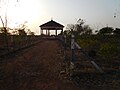 Nagada Ghar
 -
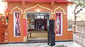 Chintaharan Mandir
 -
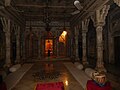 Chhatari (interior)
 -
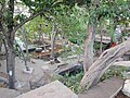 Bhadaiya Kund, Shivpuri
 -
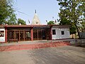 Mohineshwar Dham Mandir
 -
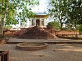 Shiv Temple on Chatari Road, Shivpuri, M.P.
 -
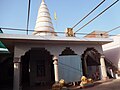 Shanti Nath Jinalaya
 -
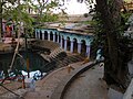 Bhadaiya Kund (main view)
 -
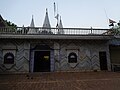 Ban Ganga Dham Temple (front) Shivpuri


.JPG)


.JPG)
_Shivpuri.JPG)
References[edit | edit source]
- ↑ 1.0 1.1 1.2 "About Us". Shivpuri District. Archived from the original on 9 January 2015.
- ↑ Kale, Manish; et al. (2004). "Biomass equations of dominant species of dry deciduous forest in Shivpuri district, Madhya Pradesh". Current Science. 87 (5): 683–687. JSTOR 24109067.
- ↑ Jaiswal, Rahul; et al. (2016). Demand-Supply Analysis for Irrigation Management in a Command. Symposium on Hydrology, 22–23 December 2015, New Delhi, India.
- ↑ "District Groundwater Booklet: Shivpuri District, Madhya Pradesh" (PDF). Central Ground Water Board: North Central Region, Ministry of Water Resources, Government of India. 2013. Archived (PDF) from the original on 23 November 2018.
- ↑ "District Administration". Shivpuri District. Archived from the original on 9 January 2015.
- ↑ 6.0 6.1 Ministry of Panchayati Raj (September 8, 2009). "A Note on the Backward Regions Grant Fund Programme" (PDF). National Institute of Rural Development. Archived from the original (PDF) on April 5, 2012. Retrieved September 27, 2011.
- ↑ "Table A-02 Decadal Variation in Population Since 1901: Madhya Pradesh" (PDF). census.gov.in. Registrar General and Census Commissioner of India.
- ↑ "Table C-01 Population By Religion: Madhya Pradesh". census.gov.in. Registrar General and Census Commissioner of India.
- ↑ 9.0 9.1 9.2 9.3 9.4 9.5 "District Census Handbook: Shivpuri" (PDF). Census of India. Registrar General and Census Commissioner of India. 2011.
- ↑ US Directorate of Intelligence. "Country Comparison:Population". Archived from the original on June 13, 2007. Retrieved 2011-10-01.
Gambia, The 1,797,860 July 2011 est.
- ↑ "2010 Resident Population Data". U. S. Census Bureau. Retrieved 2011-09-30.
Nebraska 1,826,341
- ↑ 12.0 12.1 "Table C-16 Population by Mother Tongue: Madhya Pradesh". censusindia.gov.in. Registrar General and Census Commissioner of India.
- ↑ Sharma, Rakesh Kumar; Misra, Om Prakash (2003). "Archaeological Background". Archaeological Excavations in Central India: Madhya Pradesh and Chhattisgarh. New Delhi: Mittal Publications. p. 16. ISBN 978-81-7099-874-7.
- ↑ "An official website of SHIVPURI district of MADHYA PRADESH,INDIA". Archived from the original on 2015-01-09.
External links[edit | edit source]
Places adjacent to Shivpuri district | |
|---|---|


