



>FrescoBot m Bot: link syntax |
Cornelius R (talk | contribs) minor add page for clarity and corrected details |
||
| Line 1: | Line 1: | ||
{{ | {{about|the census town in Jharkhand|1 its namesake administrative subdivision|Ghatshila subdivision|2 its name sake assembly constituency|Ghatsila (Vidhan Sabha constituency)|3 its namesake community development block|Ghatshila block}} | ||
{{too many sections|date=January 2018}} | {{too many sections|date=January 2018}} | ||
{{Use dmy dates|date=February 2025}} | |||
{{Use Indian English|date=February 2025}} | |||
{{Infobox settlement | {{Infobox settlement | ||
| name | | name = Ghatshila | ||
| native_name | | native_name = {{native_name|hi|Ghātshilā}} | ||
| native_name_lang | | native_name_lang = | ||
| other_name | | other_name = | ||
| settlement_type | | settlement_type = Town | ||
| image_skyline | | image_skyline = {{Multiple image | ||
| | | border = infobox | ||
| total_width = 300px | |||
| | | image_style = border:1; | ||
| | | perrow = 2/1/1/1 | ||
| | | image1 = Rankini Temple, Ghatshila.jpg | ||
| | | image2 = Jama masjid maubhandar ghatshila.jpg | ||
| image3 = | |||
| | | image4 = | ||
| | |||
| | |||
}} | }} | ||
| image_alt = | |||
| image_caption = Rankini Temple, Ghatshila (left), Jama Masjid Maubhandar (right) | |||
| nickname = Copper City | |||
| pushpin_map = India Jharkhand#India3 | |||
| pushpin_label_position = | |||
| pushpin_map_alt = | |||
| pushpin_map_caption = Location in Jharkhand, India | |||
| coordinates = {{coord|22.5801|N|86.4543|E|display=inline,title}} | |||
| subdivision_type = Country | |||
| subdivision_name = {{flag|India}} | |||
| subdivision_type1 = [[States and territories of India|State]] | |||
| subdivision_type2 = [[List of districts of India|District]] | |||
| subdivision_name1 = {{flagicon image|Government banner of Jharkhand.png}} [[Jharkhand]] | |||
| subdivision_name2 = [[East Singhbhum district|East Singhbhum]] | |||
| established_title = <!-- Established --> | |||
| established_date = | |||
| founder = | |||
| named_for = | |||
| government_type = | |||
| governing_body = | |||
| unit_pref = Metric | |||
| area_footnotes = | |||
| area_total_km2 = | |||
| area_rank = | |||
| elevation_footnotes = | |||
| elevation_m = 103 | |||
| population_total = 40,624 | |||
| population_as_of = 2011 | |||
| population_footnotes = | |||
| population_density_km2 = auto | |||
| population_rank = Class III | |||
| population_demonym = | |||
| demographics_type1 = Demographics | |||
| demographics1_title1 = Literacy rate | |||
| demographics1_info1 = 85.03% | |||
| demographics1_title2 = Official language | |||
| demographics1_info2 = [[Hindi]]<ref name="NCLM52nd">{{cite web |url = http://www.nclm.nic.in/shared/linkimages/NCLM52ndReport.pdf |title = Report of the Commissioner for linguistic minorities: 52nd report (July 2014 to June 2015) |pages = 43–44 |publisher = Commissioner for Linguistic Minorities, Ministry of Minority Affairs, Government of India |access-date = 16 February 2016 |df = dmy-all |archive-url = https://web.archive.org/web/20161115133948/http://nclm.nic.in/shared/linkimages/NCLM52ndReport.pdf |archive-date = 15 November 2016}}</ref> | |||
| demographics1_title3 = Most spoken language | |||
| demographics1_info3 = [[Bengali language|Bengali]] | |||
| timezone1 = [[Indian Standard Time|IST]] | |||
| utc_offset1 = +5:30 | |||
| postal_code_type = [[Postal Index Number|PIN]] | |||
| postal_code = 832303 | |||
| area_code_type = Telephone/[[Subscriber trunk dialling|STD]] code | |||
| area_code = 0657 | |||
| registration_plate = JH 05 | |||
| blank1_name_sec1 = Literacy | |||
| blank1_info_sec1 = 85.03% | |||
| blank2_name_sec1 = [[Lok Sabha]] constituency | |||
| blank2_info_sec1 = [[Jamshedpur (Lok Sabha constituency)|Jamshedpur]] | |||
| blank3_name_sec1 = [[Vidhan Sabha]] constituency | |||
| blank3_info_sec1 = [[Ghatsila (Vidhan Sabha constituency)|Ghatsila]] | |||
| website = {{URL|jamshedpur.nic.in/}} | |||
}} | |||
'''Ghatshila''' is a small town in the [[Ghatshila block|Ghatshila]] [[Community development blocks in India|CD block]] in the [[Ghatshila subdivision]] of the [[East Singhbhum district]], in the Indian state of [[Jharkhand]]. | |||
== History == | == History == | ||
{{Main|Dhalbhum#History}} | |||
According to legends, the royal family of the Kingdom of [[Dhalbhum]] were originally the members of the primitive [[Bhumij people|Bhumij]] race, who was selected by the other Bhumij chiefs as their feudal ruler.<ref>{{Cite book |last=J |first=Reid |url=https://books.google.com/books?id=hPk2AQAAMAAJ&q=dhalbhum+bhumij |title=Final Report on the Survey and Settlement of Pargana Dhalbhum in the District of Singhbhum, 1906 to 1911 |date=1912 |publisher=Bengal Secretariat Book Departmentôt |language=en}}</ref> The zamindars later became Hinduised, and adopted the title 'Dhal' or 'Dhabal Deo'. These families kept up a sort of semi-royal state and dignified their heir-apparent and those in immediate succession with title of honour, which denotes precedence. Thus, in the Dhal dynasty of Dhalbhum, the oldest son of the ruling king (Rajah) took the title of Jubraj (Yuvraj), the second that of Hikkim, the third of Bara Thakur, the fourth that of Kuar, the fifth that of Musib and the rest Babu. | |||
The area of the kingdom of Dhalbhum was approximately {{convert|1200|sqmi|km2|adj=on}}. Raja Jaganath constructed the ''Rankini Mandir'' at [[ | The area of the kingdom of Dhalbhum was approximately {{convert|1200|sqmi|km2|adj=on}}. Raja Jaganath constructed the ''Rankini Mandir'' at [[Galudih]]. But due to some problem, he shifted the Kali temple along with all the associates and other people to Ghatsila and built up a temple of goddess [[Kali]], beside Ghatshila police station which is known as ''Rankini Mata''. | ||
Ghatshila was the administrative capital of Dhalbhum | Ghatshila was the administrative capital of Dhalbhum. Ghatshila has several palaces, schools and administrative buildings constructed by the rulers of Dhalbhum zamindari. | ||
=== Rebellions === | |||
{{See also|Chuar Rebellion}} | |||
== | ====Ghatshila Raj==== | ||
After several attempts in 1765, the British invaded the Dhalbhum and Ghatshila areas in 1767. The Raja of Ghatshila resisted along with his countrymen, but was later arrested and his nephew Jagannath Dhal was appointed as the new ruler. In 1767, Jagannath Singh Patar, a zamindar of Dampara (Ghatshila) in [[Dhalbhum]], revolted against the enhanced revenue taxes of the British East India Company. This revolt is well known as [[Chuar Rebellion|Chuar rebellion]], the first revolt against [[East India Company|British East India Company]] in [[Bengal Presidency]].<ref>{{Cite book |last=बणणवाल |first=अदर्ण सनी |url=https://books.google.com/books?id=2LA0EAAAQBAJ |title=झारखंड का संपूणण आततहास (प्रागैततहातसक काल से वतणमान तक) |publisher=Nitya Publications |isbn=978-93-90390-59-5 |language=hi}}</ref><ref>{{Cite book |last=Singh |first=K. S. |url=https://books.google.com/books?id=vhh_mgEACAAJ |title=Tribal Movements in India: Visions of Dr. K.S. Singh |date=2012 |publisher=Manohar Publishers & Distributors |isbn=978-81-7304-972-9 |language=en}}</ref> | |||
Inspired by the Dampara zamindar Jagannath Patar, the Raja declared himself as an independent ruler of Dhalbhum and refused to pay taxes to the British. Captain Morgan was sent to Ghatshila, Raja Jagannath was removed from his throne and made Baikunth Dhal (Nemu Dhal) the king. Unhappy with the decision, Raja Jagannath Dhal revolted. In which the ''Rajah'' of [[Jhargram]] and Dampara sardar Jagannath Patar, assisted him. The English Company sent Lieutenant Rook and Charles Magan to suppress the rebellion. In 1777, the British re-proclaimed Jagannath Dhal as the king, after which the rebellion was quelled.<ref>{{Cite book |last=Das |first=Binod Sankar |url=https://books.google.com/books?id=fsEBAAAAMAAJ |title=Civil Rebellion in the Frontier Bengal, 1760-1805 |date=1973 |publisher=Punthi Pustak |language=en}}</ref><ref>{{Cite book |last=Sen |first=Sailendra Nath |url=https://books.google.com/books?id=ToZDAAAAYAAJ |title=History of Modern India, 1765-1950 |date=1979 |publisher=Wiley Eastern |isbn=978-0-85226-812-4 |language=en}}</ref> | |||
== Geography == | == Geography == | ||
{{OSM Location map | |||
| width=350| height=420| zoom=9 | |||
| coord={{coord|22|35|0|N|86|25|0|E}}| float=right|caption='''Cities, towns and locations in East Singhbhum district in Kolhan Division''' (Locations around Jamshedpur are shown in the Jamshedpur Urban Agglomeration map - see [[Bagbera Colony#Geography|Bagbera Colony]] page)<br />M: municipality, R: rural/ urban centre, CT: census town, T: tourist centre<br />Owing to space constraints in the small map, the actual locations in a larger map may vary slightly | |||
|mark-coord1={{coord|22|16|42|N|86|43|29|E}} | label-pos1=left|label1=Baharagora | numbered1=R| mark-title1=[[Baharagora]] (R)|label-color1=#800000 |label-size1=11| mark-size1=12|shape1=l-circle|shape-color1= #C40000|shape-outline1=white|label-offset-x1=2 | |||
|mark-coord2={{coord|22|30|58|N|86|33|15|E}} | label-pos2=right|label2= Dhalbhumgarh| numbered2=R| mark-title2=[[Dhalbhumgarh]] (R) | |||
|mark-coord3={{coord|22|57|24|N|86|17|43|E}} | label-pos3=right|label3= Boram| numbered3=R| mark-title3=[[Boram, Purvi Singhbhum]] (R) | |||
|mark-coord4={{coord|22|27|20|N|86|26|19|E}} | label-pos4=left|label4= Dumaria | numbered4=R| mark-title4=[[Dumaria, Purvi Singhbhum]] (R) | |||
|mark-coord5={{coord|22|20|25|N|86|32|44|E}} | label-pos5=bottom|label5= Gurbandha | numbered5=R| mark-title5=[[Gurbandha]] (R) | |||
|mark-coord6={{coord|22|37|19|N|86|9|30|E}} | label-pos6=top|label6= Hata| numbered6=R| mark-title6=[[Hata, Purvi Singhbhum]] (R) | |||
|mark-coord7={{coord|22|28|0|N|86|35|11|E}} | label-pos7=left|label7= Kokpara| numbered7=R| mark-title7=[[Kokpara]] (R) | |||
|mark-coord8={{coord|22|40|0|N|86|24|58|E}} | label-pos8=right|label8= Mahulia| numbered8=R| mark-title8=[[Mahulia]] (R) | |||
|mark-coord9={{coord|22|54|54|N|86|23|8|E}} | label-pos9=right|label9= Patamda| numbered9=R| mark-title9=[[Patamda]] (R) | |||
|mark-coord10={{coord|22|37|19|N|86|12|47|E}} | label-pos10= right|label10= Potka| numbered10=R| mark-title10=[[Potka]] (R) | |||
|mark-coord11={{coord|22|47|33|N|86|11|3|E}} | label-pos11=top|label11=Jamshedpur| numbered11=M| mark-title11= [[Jamshedpur]] (M) |label-color11=#800000 | |||
|mark-coord12={{coord|22|28|48|N|86|43|12|E}} | label-pos12=bottom|label12=Chakuliya| numbered12=M| mark-title12= [[Chakuliya]] (M) |label-color12=#800000 | |||
|mark-coord13={{coord|22|38|33|N|86|29|28|E}} | label-pos13=right|label13= Burudi| numbered13=T| mark-title13=[[Burudi]] (T) |shape-color13= #74C365 | |||
|mark-coord14={{coord|22|38|47|N|86|24|16|E}} | label-pos14=bottom|label14= Galudih | numbered14=T| mark-title14=[[Galudih]] (T) |shape-color14= #74C365 | |||
|mark-coord15={{coord|22|35|16|N|86|28|27|E}} | label-pos15=bottom|label15= Ghatshila| numbered15=CT| mark-title15=Ghatshila (CT) |shape-color15=black| label-size15=13|label-color15=black <!-- make the subject of the article stand out with black colours --> | |||
|mark-coord16={{coord|22|36|36|N|86|8|18|E}} | label-pos16=bottom|label16=Haludpukur| numbered16=CT| mark-title16=[[Haludpukur]] (CT|shape-color16= #A40000 | |||
|mark-coord17={{coord|22|39|40|N|86|21|36|E}} | label-pos17= top|label17=Jadugora| numbered17=CT| mark-title17=[[Jadugora]] (CT) |shape-color17= #A40000 | |||
|mark-coord18={{coord|22|30|22|N|86|27|13|E}} | label-pos18 top|label18=Musabani| numbered18=CT| mark-title18=[[Musabani]] (CT) |shape-color18= #A40000 | |||
|mark-coord19={{coord|22|21|40|N|86|36|20|E}} |label19= Subarnarekha |labela19= River |label-color19 = #77A1CB| label-angle19= 65| label-pos19=top| label-size19=10| mark-size19=0| mark-title19 =none | |||
|mark-coord20={{coord|22|41|0|N|86|6|20|E}} |label20= Kharkhai |labela20= River |label-color20 = #77A1CB| label-angle20= -55| label-pos20=top| label-size20=10| mark-size20=0| mark-title20 =none | |||
|mark-coord21={{coord|22|54|0|N|86|12|0|E}} | label-pos21= top|label21= Dalma |labela21= Wildlife|labelb21= Sanctuary | numbered21=T| mark-title21= [[Dalma Wildlife Sanctuary]] (T) |shape-color21= #74C365 | |||
|arc-coordA={{coord|23|1|0|N|86|30|0|E}}|arc-textA= WEST BENGAL| arc-text-colorA=hard grey| arc-angleA= 20| arc-gapA=4.5| arc-radiusA=0.4 | |||
|arc-coordB={{coord|22|16|0|N|86|15|0|E}}|arc-textB= ODISHA| arc-text-colorB=hard grey| arc-angleB= 0| arc-gapB=6.5| arc-radiusB=0.4}} | |||
===Location=== | |||
Ghatshila is located at {{Coord|22.60|N|86.48|E|}}.<ref>{{cite web|url=http://www.fallingrain.com/world/IN/38/Ghatsila.html|title=Maps, Weather, and Airports for Ghatsila, India|website=www.fallingrain.com}}</ref> It has an average elevation of {{convert|103|m|ft|abbr=on}}. | Ghatshila is located at {{Coord|22.60|N|86.48|E|}}.<ref>{{cite web|url=http://www.fallingrain.com/world/IN/38/Ghatsila.html|title=Maps, Weather, and Airports for Ghatsila, India|website=www.fallingrain.com}}</ref> It has an average elevation of {{convert|103|m|ft|abbr=on}}. | ||
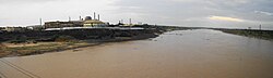
[[File:Subarnarekha river from copper mines.jpg|thumb|Subarnarekha river at Ghatshila|174x174px]] | [[File:Subarnarekha river from copper mines.jpg|thumb|Subarnarekha river at Ghatshila|174x174px]] | ||
It is 45 km from [[Jamshedpur]]. The town is located on the bank of the [[Subarnarekha River]], and it is situated in a forested area. It contains a railway station on the main line of the [[South Eastern Railway zone|South Eastern Railway]]. Ghatsila was formerly the headquarters of the kingdom of [[Dhalbhum]]. | |||
Ghatsila has its diversity with dams, falls, rivers, forest, mountains and valley. The scenes are breathtaking especially at sunset. It has a township as well as a village touch. There are areas where people still do farming for a living; these areas are untouched and unexplored. | Ghatsila has its diversity with dams, falls, rivers, forest, mountains and valley. The scenes are breathtaking especially at sunset. It has a township as well as a village touch. There are areas where people still do farming for a living; these areas are untouched and unexplored. | ||
There is a [[community development block in India|community development block]] named Ghatshila, which has its headquarters at Ghatshila. This block was established on 4 May 1962. | There is a [[community development block in India|community development block]] named [[Ghatshila block]], which has its headquarters at Ghatshila. This block was established on 4 May 1962. | ||
===Area overview=== | |||
The area shown in the map “forms a part of the [[Chota Nagpur Plateau]] and is a hilly upland tract”. The main rivers draining the district are the [[Subarnarekha River|Subarnarekha]] and the [[Kharkai River|Kharkai]].<ref>{{cite web| url = https://www.censusindia.gov.in/2011census/dchb/DCHB_A/20/2012_PART_A_DCHB_PURBI%20SINGHBHUM.pdf |title = District Census Handbook, Purbi Singhbhum, Series 21, Part XII A| work= Page 7: Natural Divisions |publisher= Directorate of Census Operations Jharkhand | access-date = 25 December 2021}}</ref> The area lying between Jamshedpur and Ghatshila is the main industrial mining zone. The rest of the district is primarily agricultural. In the district, as of 2011, 56.9% of the population lives in the rural areas and a high 43.1% lives in the urban areas.<ref>{{cite web| url = https://www.censusindia.gov.in/2011census/dchb/DCHB_A/20/2012_PART_A_DCHB_PURBI%20SINGHBHUM.pdf |title = District Census Handbook, Purbi Singhbhum, Series 21, Part XII A| work= Page 9: Industrialisation, Page 22: Census findings – Population and its Distribution |publisher= Directorate of Census Operations Jharkhand | access-date = 25 December 2021}}</ref> | |||
<small>Note: The map alongside presents some of the notable locations in the district. All places marked in the map are linked in the larger full screen map.</small> | |||
==Civic administration== | |||
There is a police station at Ghatshila.<ref>{{cite web | url = https://jhpolice.gov.in/east-singhbhum | title = District Police Profile – East Singhbhum | publisher = Jharkhand Police | access-date = 21 December 2021 | archive-date = 22 June 2022 | archive-url = https://web.archive.org/web/20220622213448/https://www.jhpolice.gov.in/east-singhbhum | url-status = dead }}</ref> | |||
== Demographics == | |||
According to the [[2011 Census of India]], Ghatshila had a total population of 40,624, of which 20,912 (51%) were males and 17,912 (49%) were females. Population in the age range 0–6 years was 4,292. The total number of literate persons in Ghatshila was 30,892 (85.03% of the population over 6 years).<ref>{{cite web| url = https://www.censusindia.gov.in/2011census/dchb/2012_PART_B_DCHB_PURBI%20SINGHBHUM.pdf |title = District Census Handbook, Purbi Singhbhum, Series 21, Part XII B| work= Location code: 363618, Pages 26-27 : District primary census abstract, 2011 census |publisher= Directorate of Census Operations Jharkhand | access-date = 18 December 2021}}</ref> | |||
(*For language details see [[Ghatshila block#Language and religion]]) | |||
{{As of|2001}} India [[census]],<ref>{{cite web|url=http://www.censusindia.net/results/town.php?stad=A&state5=999|archiveurl=https://web.archive.org/web/20040616075334/http://www.censusindia.net/results/town.php?stad=A&state5=999|archivedate=16 June 2004|title= Census of India 2001: Data from the 2001 Census, including cities, villages and towns (Provisional)|accessdate=1 November 2008|publisher= Census Commission of India}}</ref> Ghatshila had a population of 37,850. Males constitute 53% of the population and females 47%. Ghatshila has an average literacy rate of 73%, higher than the national average of 59.5%: male literacy is 79%, and female literacy is 65%. In Ghatshila, 11% of the population is under 6 years of age. | |||
===Religion=== | |||
{{Pie chart|caption=Religion in Ghatshila (2011).|label1=Hinduism|value1=76.66|color1=orange|label2=Islam|value2=11.56|color2=green|label3=Sikhism|value3=2.28|color3=Beige|label4=Christianity|value4=1.62|color4=blue|label5=Other religions/Not stated|value5=7.87|color5=silver}} | |||
Hinduism is the dominant religion in Ghatshila, followed by 76.66% of the population. Islam is a significant minority, followed by 11.56% of the population. Other religions with a significant number of adherents include Sikhism (2.28%) and Christianity (1.62%).<ref>{{Cite web|title=Census of India Website : Office of the Registrar General & Census Commissioner, India|url=https://censusindia.gov.in/|access-date=20 December 2021|website=censusindia.gov.in}}</ref> | |||
===Languages=== | |||
{{Pie chart | |||
|thumb = right | |||
|caption = Languages spoken in Ghatshila town (2011)<ref>[https://censusindia.gov.in/2011census/C-16T/DDW-C16-TOWN-STMT-MDDS-2000.XLSX 2011 census data] censusindia.gov.in</ref> | |||
|label2 = [[Hindi language|Hindi]] | |||
|value2 = 22.68 | |||
|color2 = yellow | |||
|label1 = [[Bengali language|Bengali]] | |||
|value1 = 50.64 | |||
|color1 = red | |||
|label3 = [[Urdu language|Urdu]] | |||
|value3 = 7.59 | |||
|color3 = brown | |||
|label4 = [[Santali language|Santali]] | |||
|value4 = 6.40 | |||
|color4 = orange | |||
|label5 = [[Odia language|Odia]] | |||
|value5 = 5.24 | |||
|color5 = teal | |||
|label6 = Others | |||
|value6 = 7.45 | |||
|color6 = blue | |||
}} | |||
According to 2011 census, Bengali was the most spoken language in Ghatshila town with 20,572 speakers followed by Hindi at 9,215, Urdu at 3,085, Santali at 2,602 and Odia at 2,130.<ref>{{cite web | url = https://view.officeapps.live.com/op/view.aspx?src=https%3A%2F%2Fcensusindia.gov.in%2F2011census%2FC-16%2FDDW-C16-STMT-MDDS-2000.XLSX&wdOrigin=BROWSELINK | title = C-16 Population by Mother Tongue| work= Census of India 2011| publisher = Registrar General and Census Commissioner of India| access-date = 6 December 2021}}</ref> | |||
==Infrastructure== | |||
According to the ''District Census Handbook 2011, Purbi Singhbhum'', Ghatshila covered an area of {{cvt|15.97|km2}}. It has an annual rainfall of {{cvt|1,030.2 |mm}}. Among the civic amenities, it had {{cvt|24|km|}} of roads with both closed and open drains, the protected water supply involved hand pump, tap water from treated sources, overhead tank. It had 8,153 domestic electric connections, 116 road lighting points. Among the medical facilities, it had 1 hospital (with 70 beds), 20 dispensaries, 20 health centres, 1 family welfare centre, 1 maternity and child welfare centre, 2 nursing homes, 1 veterinary hospital, 25 medicine shops. Among the educational facilities it had 16 primary schools, 5 middle schools, 4 secondary schools, 3 senior secondary schools, the nearest general degree college at [[Jamshedpur]], {{cvt|12|km}} away. It had 1 non-formal education centre (Sarva Shiksha Abhiyan), Among social, cultural and recreational facilities, it had 1 stadium, 1 cinema theatre, 1 auditorium/ community hall, 2 public libraries, 2 reading rooms. An important commodity it produced was copper. It had the branch offices of 3 nationalised banks, 1 private commercial bank, 1 cooperative bank, 1 agricultural credit society.<ref>{{cite web| url = https://www.censusindia.gov.in/2011census/dchb/DCHB_A/20/2012_PART_A_DCHB_PURBI%20SINGHBHUM.pdf |title = District Census Handbook, Purbi Singhbhum, Series 21, Part XII A| work= Pages 863-871 |publisher= Directorate of Census Operations Jharkhand | access-date = 14 December 2021}}</ref> | |||
== Economy == | === Economy === | ||
[[File:HCL COPPER SMELTER GHATSILA - panoramio.jpg|thumb|left|400px|HCL copper smelter]] | |||
[[Hindustan Copper Limited]] is located at Moubhandar, a mile away. This is the chief employer or indirect source of income for the people of Ghatshila, Moubhandar, [[Musabani]] and nearby villages. Ghatshila is best known for these mines because they are Asia's first copper mines{{Citation needed|date=December 2009}} and the world's second deepest mines{{Citation needed|date=December 2009}}. | [[Hindustan Copper Limited]] is located at Moubhandar, a mile away. This is the chief employer or indirect source of income for the people of Ghatshila, Moubhandar, [[Musabani]] and nearby villages. Ghatshila is best known for these mines because they are Asia's first copper mines{{Citation needed|date=December 2009}} and the world's second deepest mines{{Citation needed|date=December 2009}}. | ||
== Transport == | === Transport === | ||
[[File:Ghatshila_Railway_Station_full_view.jpg|thumb|Ghatshila railway station]] | [[File:Ghatshila_Railway_Station_full_view.jpg|thumb|Ghatshila railway station]] | ||
Ghatshila is connected to most of the important stations in Bihar and Jharkhand through rail and road network. [[Jamshedpur]] is at a distance of 45 km (by road) and 37 km (by railroad) west of this town. Most of the trains running from [[Kharagpur]] that goes to west towards Jamshedpur, have a stoppage here. Distance between Ghatsila and Kharagpur is about 98 km. | Ghatshila is connected to most of the important stations in Bihar and Jharkhand through rail and road network. [[Jamshedpur]] is at a distance of 45 km (by road) and 37 km (by railroad) west of this town. Most of the trains running from [[Kharagpur]] that goes to west towards Jamshedpur, have a stoppage here. Distance between Ghatsila and Kharagpur is about 98 km. | ||
;Railway | |||
It is a railway station on the [[Asansol–Tatanagar–Kharagpur line|Kharagpur-Tatanagar section]] of Howrah–Mumbai track, 215 km from Howrah. Notable trains which stop here are [[Ispat Express]] (train no. 12781/12782), Kurla–Howrah Express (train no. 18030/18029), Steel Express (train no. 12813/12814). It is well connected to 3 metros in India namely Mumbai (by Bombay Express), Kolkata (many trains starting from 6 o'clock in the morning by Steel Express to midnight at 1.15 by Samleshwari Exp) and New Delhi (by Neelachal Express, Purushottam Express and Utkal Express). There are many local Passenger trains connecting Jamshedpur and Kharagpur with Ghatshila. | It is a railway station on the [[Asansol–Tatanagar–Kharagpur line|Kharagpur-Tatanagar section]] of Howrah–Mumbai track, 215 km from Howrah. Notable trains which stop here are [[Ispat Express]] (train no. 12781/12782), Kurla–Howrah Express (train no. 18030/18029), Steel Express (train no. 12813/12814). It is well connected to 3 metros in India namely Mumbai (by Bombay Express), Kolkata (many trains starting from 6 o'clock in the morning by Steel Express to midnight at 1.15 by Samleshwari Exp) and New Delhi (by Neelachal Express, Purushottam Express and Utkal Express). There are many local Passenger trains connecting Jamshedpur and Kharagpur with Ghatshila. | ||
;Road | |||
It is about 240 km from [[Kolkata]]. Those | It is about 240 km from [[Kolkata]]. Those travelling from Kolkata first have to take NH 6 to Baharagora and then take the road to Jamshedpur. Buses plying between Kharagpur and Jamshedpur pass through Ghatshila. Buses plying from Bhubaneswar or Kolkata to Jamshedpur or Ranchi also pass through Ghatshila. By road Jamshedpur is 45 km away. There are many buses connecting Ghatsila to Jamshedpur daily, from morning 6 o'clock to evening 5 o'clock. There are two routes connecting Jamshedpur to Ghatsila, one route through NH33 and another route through Jadugoda. | ||
=== Education === | |||
There are large number of schools and colleges which help a large number of youths to get their primary education in the town itself which has also helped in increasing the literacy rate of Ghatshila to 85.03%. Some of the prominent schools and colleges are listed below. | |||
;Schools | |||
* Kendriya Vidyalaya Surda, Ghatshila | |||
* Irvine Adventist School, Gopalpur | |||
* Sant Nandalal Smriti Vidya Mandir | |||
* St. Joseph's Convent School at Tumandungri, Musaboni | |||
* Shivlal +2 High School, Musaboni | |||
* St. Joseph's Convent School (Kashida) | |||
* Gyandeep Public School | |||
* J.C School at College Road | |||
* Saraswati Shishu Vidyamandir | |||
* Sri Sri Vidyamandir at Kasidah | |||
* Marwadi Hindi High School | |||
* St. Paul High School | |||
* The Oxford Convent at Dahigora | |||
* Loreto Convent Public School | |||
* Holy Heart School | |||
;Colleges | |||
* Ghatsila College | |||
* Ghatsila Women's College at Kasidah | |||
== Media == | == Media == | ||
Radio Station: 100.1 MHz (Akashvani Ghatshila)<ref>{{Cite web|url=http://www.asiawaves.net|title=Radio and Television Broadcasting in Asia|last=Davies|first=Alan G.|website=www.asiawaves.net|language=en|access-date=2017 | Radio Station: 100.1 MHz (Akashvani Ghatshila)<ref>{{Cite web|url=http://www.asiawaves.net|title=Radio and Television Broadcasting in Asia|last=Davies|first=Alan G.|website=www.asiawaves.net|language=en|access-date=24 October 2017}}</ref> | ||
== Sports == | == Sports == | ||
| Line 100: | Line 253: | ||
* Gandhi Maidan at Harijan basti | * Gandhi Maidan at Harijan basti | ||
* Football Ground in Moubhandar | * Football Ground in Moubhandar | ||
* Basuki Singh Cricket Ground | |||
Moubhandar Sports Club organises a cricket tournament every December. The tournament is named after the memory of Late. Basuki Singh. Basuki Singh Memorial cricket tournament is quite famous in Ghatsila. | Moubhandar Sports Club organises a cricket tournament every December. The tournament is named after the memory of Late. Basuki Singh. Basuki Singh Memorial cricket tournament is quite famous in Ghatsila. | ||
* Bardih Ground in Kashida | * Bardih Ground in Kashida | ||
| Line 105: | Line 259: | ||
==Festivals== | ==Festivals== | ||
Ghatsila has a very diverse culture and a number of community live here peacefully. Many festivals are celebrated here. Some of the | Ghatsila has a very diverse culture and a number of community live here peacefully. Many festivals are celebrated here. Some of the | ||
* Sagun Sohrai | * Sagun Sohrai | ||
* Durga | * [[Durga Puja]] | ||
* Ganesh Puja | * [[Ganesh Puja]] | ||
* Baha Bonga | * Baha Bonga | ||
* Makar Porob | * [[Makar Sankranti|Makar Porob]] | ||
* Dipawali (Diwali) | * Dipawali (Diwali) | ||
* Sohrai | |||
* Mage Porob | |||
* Saraswati Puja | * Saraswati Puja | ||
* Laxmi Puja | * Laxmi Puja | ||
There are many other festivals also. | There are many other festivals also. | ||
== Tourism == | == Tourism == | ||
Some of the places of interest | Some of the places of interest are:<ref>{{Cite web|url=https://tourism.jharkhand.gov.in/|title=Welcome :: Jharkhand Tourism Development Corporation Ltd.|website=tourism.jharkhand.gov.in|access-date=12 October 2021|archive-date=19 October 2021|archive-url=https://web.archive.org/web/20211019233643/https://tourism.jharkhand.gov.in/|url-status=dead}}</ref> | ||
* Subarnarekha River, Moubhandar, Ghatshila - riverfront | |||
* Subarnarekha River | |||
* Chota Pul at Swarnarekha River | * Chota Pul at Swarnarekha River | ||
* Fuldungri Pahar at Phuldungri, Ghatshila | |||
* Famous Bengali Writer Bibhuti Bhushan Bandhopadhayay's Cottage at Dahigora, Ghatshila and Library at college road, Ghatshila | |||
* Ramkrishna Math, Dahigora, Ghatshila | |||
* Brahmarshi Jagadananda sanyas ashram, Dahigora, Ghatshila | |||
* Ghatsila Rajbari, Rajstate | |||
* Shivdas Ghosh Children's Park, Tamukpal | |||
* Rankini Mandir, Ghatshila | |||
* Ghatsila City Centre, college road, Ghatsila | |||
Near North | |||
* [[Burudi|Burudi Dam]] | |||
* Dharagiri Fall | |||
Near East | |||
* Amadubi-Panijiya Rural Tourism Centre, Panijiya, Jharkhand 832302 | |||
* | Near West | ||
* | * Rankini Mandir, Jadugoda, Rohinibera | ||
* | * [[Galudih|Galudih Barrage]], Ulda, Jharkhand 832304 | ||
* Birsa Fun City Waterpark, Karanja, Jharkhand 832304 | |||
==References== | ==References== | ||
| Line 159: | Line 304: | ||
==External links== | ==External links== | ||
{{Wikivoyage | {{Wikivoyage inline}} | ||
{{Kolhan Division}} | {{Kolhan Division}} | ||
{{Authority control}} | {{Authority control}} | ||
[[Category:Cities and towns in East Singhbhum district]] | [[Category:Cities and towns in East Singhbhum district]] | ||
Latest revision as of 15:58, 29 March 2026
 | This article may have too many section headers dividing up its content. (January 2018) |
Ghatshila
Ghātshilā (Hindi) | |
|---|---|
Town | |
Rankini Temple, Ghatshila (left), Jama Masjid Maubhandar (right) | |
| Nickname: Copper City | |
  Ghatshila Location in Jharkhand, India  Ghatshila Ghatshila (India) | |
| Coordinates: 22°34′48″N 86°27′15″E / 22.5801°N 86.4543°E | |
| Country |  India India |
| State |  Jharkhand Jharkhand |
| District | East Singhbhum |
| Elevation | 103 m (338 ft) |
| Population (2011) | |
| • Total | 40,624 |
| • Rank | Class III |
| Demographics | |
| • Literacy rate | 85.03% |
| • Official language | Hindi[1] |
| • Most spoken language | Bengali |
| Time zone | UTC+5:30 (IST) |
| PIN | 832303 |
| Telephone/STD code | 0657 |
| Vehicle registration | JH 05 |
| Literacy | 85.03% |
| Lok Sabha constituency | Jamshedpur |
| Vidhan Sabha constituency | Ghatsila |
| Website | jamshedpur |


Ghatshila is a small town in the Ghatshila CD block in the Ghatshila subdivision of the East Singhbhum district, in the Indian state of Jharkhand.
History[edit | edit source]
According to legends, the royal family of the Kingdom of Dhalbhum were originally the members of the primitive Bhumij race, who was selected by the other Bhumij chiefs as their feudal ruler.[2] The zamindars later became Hinduised, and adopted the title 'Dhal' or 'Dhabal Deo'. These families kept up a sort of semi-royal state and dignified their heir-apparent and those in immediate succession with title of honour, which denotes precedence. Thus, in the Dhal dynasty of Dhalbhum, the oldest son of the ruling king (Rajah) took the title of Jubraj (Yuvraj), the second that of Hikkim, the third of Bara Thakur, the fourth that of Kuar, the fifth that of Musib and the rest Babu.
The area of the kingdom of Dhalbhum was approximately 1,200-square-mile (3,100 km2). Raja Jaganath constructed the Rankini Mandir at Galudih. But due to some problem, he shifted the Kali temple along with all the associates and other people to Ghatsila and built up a temple of goddess Kali, beside Ghatshila police station which is known as Rankini Mata.
Ghatshila was the administrative capital of Dhalbhum. Ghatshila has several palaces, schools and administrative buildings constructed by the rulers of Dhalbhum zamindari.
Rebellions[edit | edit source]
Ghatshila Raj[edit | edit source]
After several attempts in 1765, the British invaded the Dhalbhum and Ghatshila areas in 1767. The Raja of Ghatshila resisted along with his countrymen, but was later arrested and his nephew Jagannath Dhal was appointed as the new ruler. In 1767, Jagannath Singh Patar, a zamindar of Dampara (Ghatshila) in Dhalbhum, revolted against the enhanced revenue taxes of the British East India Company. This revolt is well known as Chuar rebellion, the first revolt against British East India Company in Bengal Presidency.[3][4]
Inspired by the Dampara zamindar Jagannath Patar, the Raja declared himself as an independent ruler of Dhalbhum and refused to pay taxes to the British. Captain Morgan was sent to Ghatshila, Raja Jagannath was removed from his throne and made Baikunth Dhal (Nemu Dhal) the king. Unhappy with the decision, Raja Jagannath Dhal revolted. In which the Rajah of Jhargram and Dampara sardar Jagannath Patar, assisted him. The English Company sent Lieutenant Rook and Charles Magan to suppress the rebellion. In 1777, the British re-proclaimed Jagannath Dhal as the king, after which the rebellion was quelled.[5][6]
Geography[edit | edit source]
Lua error in Module:OSM_Location_map at line 1984: attempt to index field 'wikibase' (a nil value).
Location[edit | edit source]
Ghatshila is located at 22°36′N 86°29′E / 22.60°N 86.48°E.[7] It has an average elevation of 103 m (338 ft).

It is 45 km from Jamshedpur. The town is located on the bank of the Subarnarekha River, and it is situated in a forested area. It contains a railway station on the main line of the South Eastern Railway. Ghatsila was formerly the headquarters of the kingdom of Dhalbhum.
Ghatsila has its diversity with dams, falls, rivers, forest, mountains and valley. The scenes are breathtaking especially at sunset. It has a township as well as a village touch. There are areas where people still do farming for a living; these areas are untouched and unexplored.
There is a community development block named Ghatshila block, which has its headquarters at Ghatshila. This block was established on 4 May 1962.
Area overview[edit | edit source]
The area shown in the map “forms a part of the Chota Nagpur Plateau and is a hilly upland tract”. The main rivers draining the district are the Subarnarekha and the Kharkai.[8] The area lying between Jamshedpur and Ghatshila is the main industrial mining zone. The rest of the district is primarily agricultural. In the district, as of 2011, 56.9% of the population lives in the rural areas and a high 43.1% lives in the urban areas.[9]
Note: The map alongside presents some of the notable locations in the district. All places marked in the map are linked in the larger full screen map.
Civic administration[edit | edit source]
There is a police station at Ghatshila.[10]
Demographics[edit | edit source]
According to the 2011 Census of India, Ghatshila had a total population of 40,624, of which 20,912 (51%) were males and 17,912 (49%) were females. Population in the age range 0–6 years was 4,292. The total number of literate persons in Ghatshila was 30,892 (85.03% of the population over 6 years).[11]
(*For language details see Ghatshila block#Language and religion)
As of 2001[update] India census,[12] Ghatshila had a population of 37,850. Males constitute 53% of the population and females 47%. Ghatshila has an average literacy rate of 73%, higher than the national average of 59.5%: male literacy is 79%, and female literacy is 65%. In Ghatshila, 11% of the population is under 6 years of age.
Religion[edit | edit source]
- Hinduism (76.7%)
- Islam (11.6%)
- Sikhism (2.28%)
- Christianity (1.62%)
- Other religions/Not stated (7.87%)
Hinduism is the dominant religion in Ghatshila, followed by 76.66% of the population. Islam is a significant minority, followed by 11.56% of the population. Other religions with a significant number of adherents include Sikhism (2.28%) and Christianity (1.62%).[13]
Languages[edit | edit source]
According to 2011 census, Bengali was the most spoken language in Ghatshila town with 20,572 speakers followed by Hindi at 9,215, Urdu at 3,085, Santali at 2,602 and Odia at 2,130.[15]
Infrastructure[edit | edit source]
According to the District Census Handbook 2011, Purbi Singhbhum, Ghatshila covered an area of 15.97 km2 (6.17 sq mi). It has an annual rainfall of 1,030.2 mm (40.56 in). Among the civic amenities, it had 24 km (15 mi) of roads with both closed and open drains, the protected water supply involved hand pump, tap water from treated sources, overhead tank. It had 8,153 domestic electric connections, 116 road lighting points. Among the medical facilities, it had 1 hospital (with 70 beds), 20 dispensaries, 20 health centres, 1 family welfare centre, 1 maternity and child welfare centre, 2 nursing homes, 1 veterinary hospital, 25 medicine shops. Among the educational facilities it had 16 primary schools, 5 middle schools, 4 secondary schools, 3 senior secondary schools, the nearest general degree college at Jamshedpur, 12 km (7.5 mi) away. It had 1 non-formal education centre (Sarva Shiksha Abhiyan), Among social, cultural and recreational facilities, it had 1 stadium, 1 cinema theatre, 1 auditorium/ community hall, 2 public libraries, 2 reading rooms. An important commodity it produced was copper. It had the branch offices of 3 nationalised banks, 1 private commercial bank, 1 cooperative bank, 1 agricultural credit society.[16]
Economy[edit | edit source]

Hindustan Copper Limited is located at Moubhandar, a mile away. This is the chief employer or indirect source of income for the people of Ghatshila, Moubhandar, Musabani and nearby villages. Ghatshila is best known for these mines because they are Asia's first copper mines[citation needed] and the world's second deepest mines[citation needed].
Transport[edit | edit source]

Ghatshila is connected to most of the important stations in Bihar and Jharkhand through rail and road network. Jamshedpur is at a distance of 45 km (by road) and 37 km (by railroad) west of this town. Most of the trains running from Kharagpur that goes to west towards Jamshedpur, have a stoppage here. Distance between Ghatsila and Kharagpur is about 98 km.
- Railway
It is a railway station on the Kharagpur-Tatanagar section of Howrah–Mumbai track, 215 km from Howrah. Notable trains which stop here are Ispat Express (train no. 12781/12782), Kurla–Howrah Express (train no. 18030/18029), Steel Express (train no. 12813/12814). It is well connected to 3 metros in India namely Mumbai (by Bombay Express), Kolkata (many trains starting from 6 o'clock in the morning by Steel Express to midnight at 1.15 by Samleshwari Exp) and New Delhi (by Neelachal Express, Purushottam Express and Utkal Express). There are many local Passenger trains connecting Jamshedpur and Kharagpur with Ghatshila.
- Road
It is about 240 km from Kolkata. Those travelling from Kolkata first have to take NH 6 to Baharagora and then take the road to Jamshedpur. Buses plying between Kharagpur and Jamshedpur pass through Ghatshila. Buses plying from Bhubaneswar or Kolkata to Jamshedpur or Ranchi also pass through Ghatshila. By road Jamshedpur is 45 km away. There are many buses connecting Ghatsila to Jamshedpur daily, from morning 6 o'clock to evening 5 o'clock. There are two routes connecting Jamshedpur to Ghatsila, one route through NH33 and another route through Jadugoda.
Education[edit | edit source]
There are large number of schools and colleges which help a large number of youths to get their primary education in the town itself which has also helped in increasing the literacy rate of Ghatshila to 85.03%. Some of the prominent schools and colleges are listed below.
- Schools
- Kendriya Vidyalaya Surda, Ghatshila
- Irvine Adventist School, Gopalpur
- Sant Nandalal Smriti Vidya Mandir
- St. Joseph's Convent School at Tumandungri, Musaboni
- Shivlal +2 High School, Musaboni
- St. Joseph's Convent School (Kashida)
- Gyandeep Public School
- J.C School at College Road
- Saraswati Shishu Vidyamandir
- Sri Sri Vidyamandir at Kasidah
- Marwadi Hindi High School
- St. Paul High School
- The Oxford Convent at Dahigora
- Loreto Convent Public School
- Holy Heart School
- Colleges
- Ghatsila College
- Ghatsila Women's College at Kasidah
Media[edit | edit source]
Radio Station: 100.1 MHz (Akashvani Ghatshila)[17]
Sports[edit | edit source]
To enhance the mental and physical wellness sports play a crucial role. There are ample number of sports clubs and grounds distributed over the town. Some of them are enlisted below:
- Moubhandar Sports Club - Hindustan Copper Limited Ground at Moubhandar
- Golf Ground at Moubhandar
- Rajstate Ground at Rajstate
- Dakbunglow Ground at Dakbunglow Road
- Gandhi Maidan at Harijan basti
- Football Ground in Moubhandar
- Basuki Singh Cricket Ground
Moubhandar Sports Club organises a cricket tournament every December. The tournament is named after the memory of Late. Basuki Singh. Basuki Singh Memorial cricket tournament is quite famous in Ghatsila.
- Bardih Ground in Kashida
- Circus Maidan Ground
Festivals[edit | edit source]
Ghatsila has a very diverse culture and a number of community live here peacefully. Many festivals are celebrated here. Some of the
- Sagun Sohrai
- Durga Puja
- Ganesh Puja
- Baha Bonga
- Makar Porob
- Dipawali (Diwali)
- Sohrai
- Mage Porob
- Saraswati Puja
- Laxmi Puja
There are many other festivals also.
Tourism[edit | edit source]
Some of the places of interest are:[18]
- Subarnarekha River, Moubhandar, Ghatshila - riverfront
- Chota Pul at Swarnarekha River
- Fuldungri Pahar at Phuldungri, Ghatshila
- Famous Bengali Writer Bibhuti Bhushan Bandhopadhayay's Cottage at Dahigora, Ghatshila and Library at college road, Ghatshila
- Ramkrishna Math, Dahigora, Ghatshila
- Brahmarshi Jagadananda sanyas ashram, Dahigora, Ghatshila
- Ghatsila Rajbari, Rajstate
- Shivdas Ghosh Children's Park, Tamukpal
- Rankini Mandir, Ghatshila
- Ghatsila City Centre, college road, Ghatsila
Near North
- Burudi Dam
- Dharagiri Fall
Near East
- Amadubi-Panijiya Rural Tourism Centre, Panijiya, Jharkhand 832302
Near West
- Rankini Mandir, Jadugoda, Rohinibera
- Galudih Barrage, Ulda, Jharkhand 832304
- Birsa Fun City Waterpark, Karanja, Jharkhand 832304
References[edit | edit source]
- ↑ "Report of the Commissioner for linguistic minorities: 52nd report (July 2014 to June 2015)" (PDF). Commissioner for Linguistic Minorities, Ministry of Minority Affairs, Government of India. pp. 43–44. Archived from the original (PDF) on 15 November 2016. Retrieved 16 February 2016.
- ↑ J, Reid (1912). Final Report on the Survey and Settlement of Pargana Dhalbhum in the District of Singhbhum, 1906 to 1911. Bengal Secretariat Book Departmentôt.
- ↑ बणणवाल, अदर्ण सनी. झारखंड का संपूणण आततहास (प्रागैततहातसक काल से वतणमान तक) (in हिन्दी). Nitya Publications. ISBN 978-93-90390-59-5.
- ↑ Singh, K. S. (2012). Tribal Movements in India: Visions of Dr. K.S. Singh. Manohar Publishers & Distributors. ISBN 978-81-7304-972-9.
- ↑ Das, Binod Sankar (1973). Civil Rebellion in the Frontier Bengal, 1760-1805. Punthi Pustak.
- ↑ Sen, Sailendra Nath (1979). History of Modern India, 1765-1950. Wiley Eastern. ISBN 978-0-85226-812-4.
- ↑ "Maps, Weather, and Airports for Ghatsila, India". www.fallingrain.com.
- ↑ "District Census Handbook, Purbi Singhbhum, Series 21, Part XII A" (PDF). Page 7: Natural Divisions. Directorate of Census Operations Jharkhand. Retrieved 25 December 2021.
- ↑ "District Census Handbook, Purbi Singhbhum, Series 21, Part XII A" (PDF). Page 9: Industrialisation, Page 22: Census findings – Population and its Distribution. Directorate of Census Operations Jharkhand. Retrieved 25 December 2021.
- ↑ "District Police Profile – East Singhbhum". Jharkhand Police. Archived from the original on 22 June 2022. Retrieved 21 December 2021.
- ↑ "District Census Handbook, Purbi Singhbhum, Series 21, Part XII B" (PDF). Location code: 363618, Pages 26-27 : District primary census abstract, 2011 census. Directorate of Census Operations Jharkhand. Retrieved 18 December 2021.
- ↑ "Census of India 2001: Data from the 2001 Census, including cities, villages and towns (Provisional)". Census Commission of India. Archived from the original on 16 June 2004. Retrieved 1 November 2008.
- ↑ "Census of India Website : Office of the Registrar General & Census Commissioner, India". censusindia.gov.in. Retrieved 20 December 2021.
- ↑ 2011 census data censusindia.gov.in
- ↑ "C-16 Population by Mother Tongue". Census of India 2011. Registrar General and Census Commissioner of India. Retrieved 6 December 2021.
- ↑ "District Census Handbook, Purbi Singhbhum, Series 21, Part XII A" (PDF). Pages 863-871. Directorate of Census Operations Jharkhand. Retrieved 14 December 2021.
- ↑ Davies, Alan G. "Radio and Television Broadcasting in Asia". www.asiawaves.net. Retrieved 24 October 2017.
- ↑ "Welcome :: Jharkhand Tourism Development Corporation Ltd". tourism.jharkhand.gov.in. Archived from the original on 19 October 2021. Retrieved 12 October 2021.
Ghatsila Tourist Information Center