| Kharkai River | |
|---|---|
| Location | |
| Country | India |
| State | Odisha, Jharkhand |
| Physical characteristics | |
| Source | |
| • location | Simlipal Massif, India |
| • coordinates | 22°4′N 86°23′E / 22.067°N 86.383°E |
| • elevation | 928 m (3,045 ft) |
| Mouth | |
• location | Subarnarekha River, India |
• coordinates | 22°50′15″N 86°9′37″E / 22.83750°N 86.16028°E |
• elevation | 134 m (440 ft) |
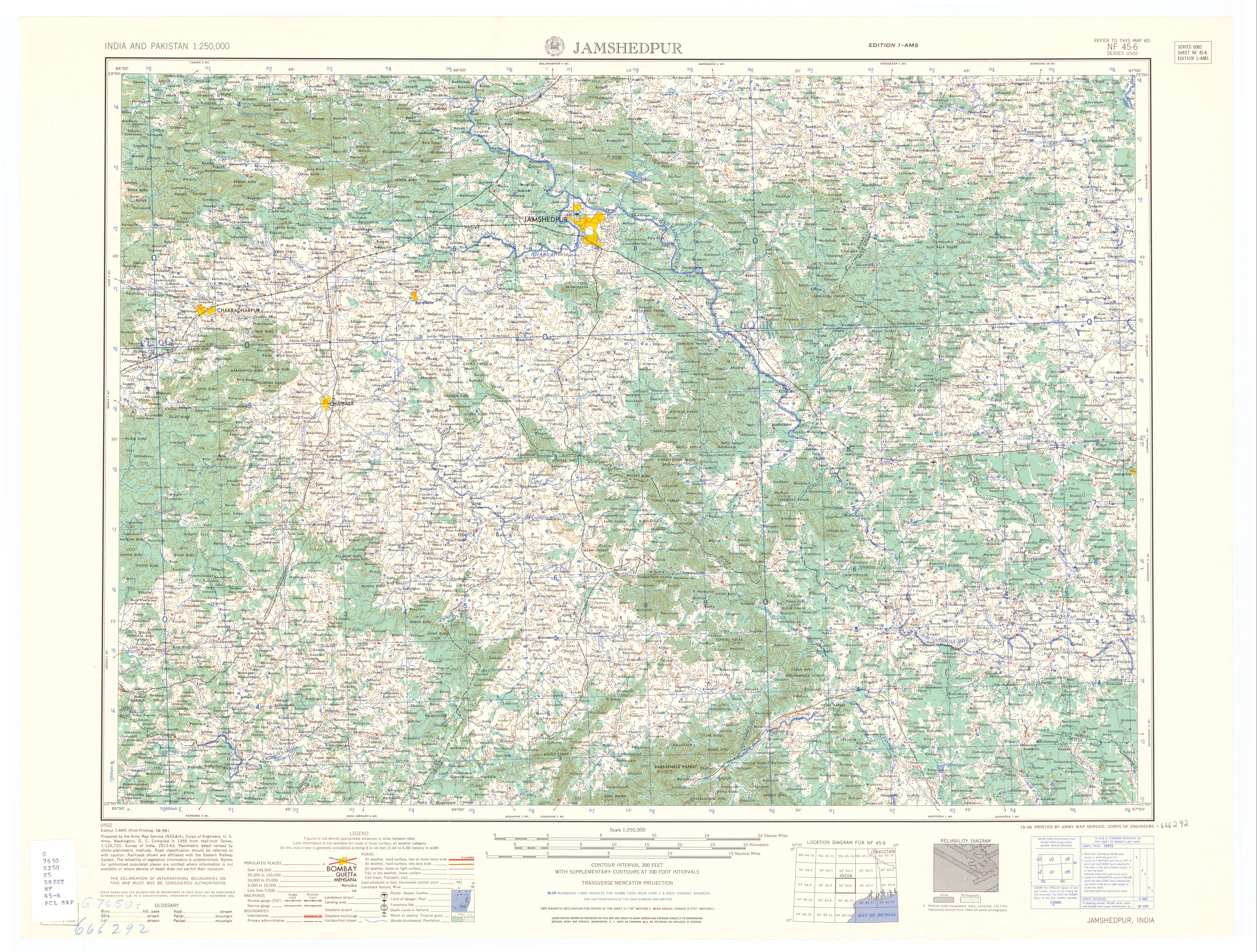
The Kharkai River is a river in eastern India. It is one of the major tributaries of the Subarnarekha River. It flows through Adityapur region of Jamshedpur
It arises in Mayurbhanj district, Odisha, on the north slopes of Darbarmela Parbat and the western slopes of Tungru Pahar,[1] of the Simlipal Massif.[2] It flows past Rairangpur and heads north to about Saraikela[3] and then east, entering the Subarnarekha in northwestern Jamshedpur. Its tributaries in Orissa include the Kardkai, on the left; the Kandria, Nusa and Barhai on the right; and the Karanjia on the left.[1] For about 9 kilometres (6 mi) below the junction with the Karanjia, the Kharkai forms the boundary between Odisha and Jharkhand State.[1] After entering Jharkhand its tributaries include the Torlo and Ili Gara on the left.[1] Its last major tributary is the Sanjai,[4] entering from the left, 17 kilometres (11 mi), as the river flows, above its mouth.[1]
The valley of the lower Kharkai is quite wide and rice is the primary crop.[4] Iron ore is mined in the mountains of the headwaters of the Kharkai, and there is a steel plant at Jamshedpur.[3] The Kharkai Dam is located at Ichha, Odisha.[5]
Name[edit | edit source]
Some think that Kharkāi is derived from the Sanskrit word Kharakāyā meaning "fast flowing river" (khara means "fast" and kāyā means "body").[citation needed]
Notes[edit | edit source]
- ↑ 1.0 1.1 1.2 1.3 1.4 Jamshedpur quadrandle, NF-45-6, October 1959, India and Pakistan 1:250,000, Series U502, U.S. Army Map Service
- ↑ "Himalaya and Ganges Plain" Plate 30 The Times Comprehensive Atlas of the World (2008 edition) Times Books, London, ISBN 978-0-00-723670-1
- ↑ 3.0 3.1 Karan, Pradyumna P. (July 1953) "Economic Regions of Chota Nagpur, Bihar, India" Economic Geography 29(3): pp. 216-250, page 236
- ↑ 4.0 4.1 Karan, Pradyumna P. (July 1953) "Economic Regions of Chota Nagpur, Bihar, India" Economic Geography 29(3): pp. 216-250, page 248
- ↑ Gupta, Amit and Majumdar, Pinaki (19 June 2008) "Record rain in steel city, flash floods in districts" The Telegraph (Calcutta, India)
This article related to a location in Jharkhand is a stub. You can help Bharatpedia by expanding it. |