

Kamal Guha (talk | contribs) |
Legalwiki68 (talk | contribs) fixed issues |
||
| Line 1: | Line 1: | ||
{{Use dmy dates|date=August 2016}} | {{Use dmy dates|date=August 2016}} | ||
{{Use Indian English|date=June 2016}} | {{Use Indian English|date=June 2016}} | ||
{{Infobox settlement | {{Infobox settlement | ||
| name | | name = Palakollu | ||
| native_name | | native_name = పాలకొల్లు | ||
| native_name_lang | | native_name_lang = te | ||
| other_name | | other_name = Palakol, Palacole | ||
| settlement_type = City | |||
| settlement_type | | image_skyline = CompleteTempleComplex.jpg | ||
| image_skyline | | imagesize = 250px | ||
| image_alt = Sri Ksheera Rama Lingeswara Swamy Temple at Palakollu | |||
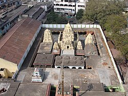
| | | image_caption = [[Ksheerarama|Ksheera Ramalingeswara Swamy Temple]] | ||
| pushpin_map = India Andhra Pradesh#India | |||
| pushpin_map_caption = Location in Andhra Pradesh, India | |||
| coordinates = {{coord|16.5167|N|81.7300|E|display=inline,title}} | |||
| subdivision_type = Country | |||
| subdivision_name = {{IND}} | |||
| subdivision_type1 = State | |||
| subdivision_name1 = [[Andhra Pradesh]] | |||
| subdivision_type2 = Region | |||
| subdivision_name2 = [[Coastal Andhra]] | |||
| image_alt | | subdivision_type3 = District | ||
| image_caption | | subdivision_name3 = [[West Godavari district]] | ||
| established_title = Municipality constituted | |||
| established_date = 1 April 1919 | |||
| government_type = Nagar Palika | |||
| governing_body = [[Palakollu Municipality]] (PMC); [[Eluru Urban Development Authority]] (EUDA) | |||
| pushpin_map | | unit_pref = Metric | ||
| area_total_km2 = 19.49 | |||
| area_footnotes = <ref name="DCHB-WestGodavari">{{cite web | |||
|title=District Census Handbook – West Godavari: Primary Census Abstract (Town) | |||
|url=http://censusindia.gov.in/2011census/dchb/2815_PART_B_DCHB_WEST%20GODAVARI.pdf | |||
| pushpin_map_caption | |website=Census of India | ||
| coordinates | |publisher=Directorate of Census Operations, Andhra Pradesh | ||
| subdivision_type | |year=2011 | ||
| subdivision_name | |pages=22–23, 54–55 | ||
| subdivision_type1 | |access-date=27 August 2025 | ||
| subdivision_name1 | }}</ref> | ||
| subdivision_type2 | | elevation_m = 1.5 | ||
| subdivision_name2 | | population_total = 81,199 | ||
| subdivision_type3 | | population_as_of = 2011 | ||
| subdivision_name3 | | population_density_km2 = auto | ||
| established_title | | population_footnotes = <ref name="DCHB-WestGodavari" /> | ||
| established_date | | demographics_type1 = Languages | ||
| demographics1_title1 = Official | |||
| demographics1_info1 = [[Telugu language|Telugu]] | |||
| government_type | | timezone1 = IST | ||
| governing_body | | utc_offset1 = +5:30 | ||
| postal_code_type = PIN | |||
| postal_code = 534250–534267 | |||
| | | area_code_type = Telephone code | ||
| | | area_code = 08814 | ||
| registration_plate = AP 37 | |||
| area_footnotes | | website = {{URL|http://palakol.cdma.ap.gov.in/}} | ||
| | |||
| population_total | |||
| population_as_of | |||
| population_density_km2 | |||
| population_footnotes | |||
| | |||
| demographics1_title1 | |||
| demographics1_info1 | |||
| timezone1 | |||
| utc_offset1 | |||
| postal_code_type | |||
| postal_code | |||
| area_code_type | |||
| area_code | |||
| registration_plate | |||
| website | |||
}} | }} | ||
'''Palakollu''' is a city and the administrative headquarters of [[Palakollu Mandal]] in the [[Narasapuram revenue division]] of [[West Godavari district]], [[Andhra Pradesh]], India.<ref>{{cite web | |||
'''Palakollu''' is a city | |title=About Palacole Municipality | ||
|url=https://cdma.ap.gov.in/en/about-palacole-municipality | |||
|website=CDMA Andhra Pradesh | |||
|publisher=Government of Andhra Pradesh | |||
|access-date=27 August 2025 | |||
}}</ref> Located in the [[Coastal Andhra]] region, the city's municipal area spans {{convert|19.49|km2|sqmi}}.<ref name="DCHB-WestGodavari" /> | |||
Palakollu is | As per the 2011 [[Census of India]], Palakollu (municipality plus outgrowth) had a population of 81,199.<ref name="DCHB-WestGodavari" /> Palakollu is also noted for [[Ksheerarama]], one of the five [[Pancharama Kshetras]].<ref>{{cite web | ||
|title=Religious Tourism – West Godavari District | |||
|url=https://westgodavari.ap.gov.in/religioustourism/ | |||
|website=Government of Andhra Pradesh | |||
|access-date=27 August 2025 | |||
}}</ref> | |||
== Etymology == | == Etymology == | ||
Palakollu has historically been referred to by other names – "Upamanyapuram", "Ksheerapuri", "Palakolanu", and in English writings "Palacole" – which are mentioned in traditions associated with the local Sri Ksheera Ramalingeswara Swamy (Ksheerarama) temple.<ref>{{cite web |title=Palakollu City – Etymology |url=https://areaprofiler.gov.in/aboutUsIntgeratedPES.do?stateCode=28&lbCode=6066&languageId=1 |website=AreaProfiler (Government of India) |access-date=27 August 2025}}</ref> | |||
== History == | |||
Palakollu (historically also written as Palakol) is referred to in sources by several earlier names, including Kṣīrārāma, Kṣīrapuram, Palakolanu, and Upamanyapuram.<ref>[https://books.google.com/books?id=hYrXAAAAMAAJ&q=palakolanu Pañchārāmas in Medieval Āndhradēśa] – Google Books search showing the historical toponym “Palakolanu”.</ref> | |||
Palakol | |||
<ref>[https://books.google.com/books?id=hYrXAAAAMAAJ&q=palakolanu Pañchārāmas in | |||
In 1613, the Dutch established a trading factory at Palakollu as part of the Dutch Coromandel network; the post dealt in textiles, lamp oil, timber, roof tiles, and bricks and was temporarily abandoned in 1730.<ref name="Bowrey">{{cite book |last=Bowrey |first=Thomas |editor-last=Temple |editor-first=Richard Carnac |title=A Geographical Account of Countries Round the Bay of Bengal, 1669–1679 |url=https://archive.org/details/ageographicalac00bowrgoog |year=1895 |publisher=Hakluyt Society |page=105}}</ref> By the terms following the 1783 Treaty of Paris, the town passed to British control, with the Dutch continuing to rent it until 1804; it was restored to the Dutch in 1818 and finally ceded to the British again in 1824.<ref name="Bowrey" /> | |||
Palakollu is associated with the concept of Trilinga Deśam in regional tradition and is home to Kṣīrārāma (Sri Ksheera Rama Lingeswara Swamy Temple), one of the five Pancharama Kshetras dedicated to Shiva; the presiding deity is locally known as Ksheera Ramalingeswara Swamy.<ref>[https://books.google.com/books?id=BRsoAAAAYAAJ&pg=RA2-PA15 Readings in Indian History. Selected and Edited by Sir William Wilson Hunter] (1899), p. 15 (Google Books scan).</ref> | |||
<ref>[https://books.google.com/books?id=BRsoAAAAYAAJ&pg=RA2-PA15 | |||
===Under the Qutb Shahi reign=== | === Under the Qutb Shahi reign === | ||
====Textile | ==== Textile industry center ==== | ||
During the | During the Golkonda Qutb Shahi period (16th–17th centuries), the Palakollu region participated in the Coromandel textile economy, producing cotton goods such as calicoes and blankets, including dyed fabrics routed via [[Machilipatnam]] for coastal and inland markets.<ref name="joshi">{{cite journal |last=Joshi |first=P. M. |title=Textile Industry and Trade of the Kingdom of Golkonda |journal=Proceedings of the Indian History Congress |date=1941 |volume=5 |pages=609–617 |jstor=44304839}}</ref> A severe drought affecting the Krishna and Godavari deltas circa 1770, together with late‑18th‑century headwinds and 19th‑century competition from English mill‑made textiles, contributed to contraction in regional handloom activity noted in contemporary Dutch records.<ref name="joshi" /><ref name="subrah1990">{{cite journal |last=Subrahmanyam |first=Sanjay |title=Rural Industry and Commercial Agriculture in Late Seventeenth‑Century South‑Eastern India |journal=Past & Present |year=1990 |issue=126 |pages=76–114 |doi=10.1093/past/126.1.76 |jstor=650810}}</ref> | ||
====Fabric | ==== Fabric and ironwork ==== | ||
Regional industrial linkages included nearby [[Narasapuram]] shipbuilding; scarcity of iron timbering in the Godavari delta limited ship construction to ancillary work, fostering ancillary ironwork such as nails and tools in and around Palakollu that supplied maritime yards.<ref name="subrah1988">{{cite journal |last=Subrahmanyam |first=Sanjay |title=A Note on Narsapur Peta: A “Syncretic” Shipbuilding Centre in South India, 1570–1700 |journal=Journal of the Economic and Social History of the Orient |year=1988 |volume=31 |issue=3 |pages=305–311 |doi=10.2307/3632014 |jstor=3632014}}</ref> | |||
== Geography == | == Geography == | ||
Palakollu is located at {{Coord|16.5167|N|81.7300|E|}}.<ref>{{cite web|url=http://www.fallingrain.com/world/IN/02/Palakollu.html| | Palakollu is located at {{Coord|16.5167|N|81.7300|E|display=inline}} in West Godavari district, Andhra Pradesh, India.<ref name="fallingrain_Palakollu"/> The town stands at an average elevation of about {{convert|5|m|ft|sigfig=2}} above mean sea level on predominantly flat, deltaic terrain.<ref name="fallingrain_Palakollu">{{cite web |title=Palakollu, India – Maps and weather |url=http://www.fallingrain.com/world/IN/02/Palakollu.html |website=FallingRain |access-date=27 August 2025}}</ref> | ||
=== Climate === | === Climate === | ||
Palakollu has a tropical climate | Palakollu has a tropical savanna climate (Köppen–Geiger Aw), with hot, humid summers and most annual precipitation falling during the monsoon months from June to October.<ref name="climate-data_24239"/> Long‑term averages indicate a mean annual temperature of about 27.9 °C and annual rainfall around 1,208 mm; May is typically the warmest month and October the wettest.<ref name="climate-data_24239">{{cite web |title=Palakollu climate: temperature and rainfall |url=https://en.climate-data.org/location/24239/ |website=Climate‑Data.org |access-date=27 August 2025}}</ref> | ||
{{Palakollu | {{Weather box | ||
|location= Palakollu | |||
|metric first= Y | |||
|single line= Y | |||
|open = Y | |||
|Jan high C= 27.7 | |||
|Feb high C= 30 | |||
|Mar high C= 32.8 | |||
|Apr high C= 35 | |||
|May high C= 37 | |||
|Jun high C= 36.3 | |||
|Jul high C= 32.4 | |||
|Aug high C= 32.2 | |||
|Sep high C= 32 | |||
|Oct high C= 31 | |||
|Nov high C= 28.8 | |||
|Dec high C= 27.6 | |||
|Jan mean C=23.4 | |||
|Feb mean C=25.4 | |||
|Mar mean C=27.8 | |||
|Apr mean C=30.5 | |||
|May mean C=32.4 | |||
|Jun mean C=31.8 | |||
|Jul mean C=29 | |||
|Aug mean C=28.9 | |||
|Sep mean C=28.8 | |||
|Oct mean C=27.8 | |||
|Nov mean C=25.4 | |||
|Dec mean C=23.5 | |||
|Jan low C= 19.2 | |||
|Feb low C= 20.9 | |||
|Mar low C= 22.8 | |||
|Apr low C= 26 | |||
|May low C= 27.8 | |||
|Jun low C= 27.3 | |||
|Jul low C= 25.6 | |||
|Aug low C= 25.6 | |||
|Sep low C= 25.6 | |||
|Oct low C= 24.6 | |||
|Nov low C= 21.1 | |||
|Dec low C= 19.4 | |||
|precipitation colour = green | |||
|Jan precipitation mm = 1 | |||
|Feb precipitation mm = 6 | |||
|Mar precipitation mm = 4 | |||
|Apr precipitation mm = 7 | |||
|May precipitation mm = 41 | |||
|Jun precipitation mm = 145 | |||
|Jul precipitation mm = 266 | |||
|Aug precipitation mm = 190 | |||
|Sep precipitation mm = 191 | |||
|Oct precipitation mm = 286 | |||
|Nov precipitation mm = 52 | |||
|Dec precipitation mm = 19 | |||
|year precipitation mm = 1208 | |||
|Jan precipitation days = 1.2 | |||
|Feb precipitation days = 0.2 | |||
|Mar precipitation days = 0.2 | |||
|Apr precipitation days = 0.4 | |||
|May precipitation days = 1.6 | |||
|Jun precipitation days = 3.0 | |||
|Jul precipitation days = 6.1 | |||
|Aug precipitation days = 6.4 | |||
|Sep precipitation days = 5.4 | |||
|Oct precipitation days = 8.7 | |||
|Nov precipitation days = 9.1 | |||
|Dec precipitation days = 3.7 | |||
|year precipitation days = 46.0 | |||
|source= Climate‑Data.org<ref name="climate-data_24239"/> | |||
}} | |||
== Culture == | == Culture == | ||
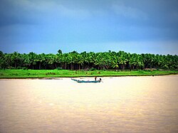
[[File:Konaseema.jpg|right|thumbnail|Palakollu near Konaseema]] | [[File:Konaseema.jpg|right|thumbnail|Palakollu near the Konaseema delta region]] | ||
Palakollu ki cultural life ka kendr Sri Ksheera Rama Lingeswara Swamy Temple (Ksheerarama) hai, jo [[Pancharama Kshetras]] me se ek mana jata hai aur yahan parakramik darshanon ke saath teerth yatra hoti rehti hai.<ref name="ap_religioustourism">{{cite web |title=Religious Tourism – West Godavari District |url=https://westgodavari.ap.gov.in/religioustourism/ |website=Government of Andhra Pradesh |access-date=27 August 2025}}</ref> Mandir me Maha Shivaratri jaise bade tyohaar vishesh bhav se manaye jate hain, jisse sthaniya paramparaon aur bhakti samaroho ka pradarshan hota hai.<ref>{{cite web |title=Sri Ksheera Rama Temple – Palakollu |url=https://www.trawell.in/andhra/rajahmundry/sri-ksheera-rama-temple-palakollu |website=Trawell.in |access-date=27 August 2025}}</ref> | |||
[[File:CompleteTempleComplex.jpg|thumb|200px|Sri Ksheera Rama Lingeswara Swamy Temple]] | |||
Konaseema kshetra ke nadi‑delta aur backwater paridrishya se prabhavit Palakollu me dharmik paryatan ke saath sthaley utsav aur rivaazon ka ayojan hota rehta hai, jismein parivarik aur samudayik bhagidari drishyamaan hoti hai.<ref name="ap_religioustourism"/> | |||
[[File: | |||
== Administration == | |||
=== Municipality === | |||
===Municipality=== | |||
{{Main|Palakollu Municipality}} | {{Main|Palakollu Municipality}} | ||
[[File:Palakollu Municipality logo.jpg|right| | [[File:Palakollu Municipality logo.jpg|right|thumb|Palakollu Municipality official logo]] | ||
The [[Palakollu Municipality|Palakollu Municipal Council]] (PMC) is the | The [[Palakollu Municipality|Palakollu Municipal Council]] (PMC) is the local self-government of the town. It was constituted as a municipality on 1 April 1919. The civic body's jurisdiction covers {{convert|19.49|km2|mi2|abbr=on}} and comprises 32 municipal wards, each represented by an elected councillor.<ref name="citi charter">{{cite web |title=Citizen's charter |url=http://palakol.cdma.ap.gov.in/sites/default/files/palakol_cdma_ap_gov_in/orgcharts/Organization%20Chart%2024.12.2016%20NEW%20new.pdf |publisher=Palakollu Municipal Council |access-date=27 August 2025}}</ref> The elected council is headed by a municipal chairperson as presiding officer, while executive functions are vested in the municipal commissioner appointed by the state government.<ref name="citi charter" /> | ||
PMC's functions include construction and maintenance of roads and drains; town planning and building regulation; upkeep of municipal markets and parks; solid waste management; registration of births and deaths; issuance of trade licences; property tax administration; and delivery of community welfare services such as maternal and child health and early childhood education.<ref name="citi charter" /> | |||
The municipality was constituted in 1919 and was graded as a third‑grade municipality in 1952 before being upgraded to first grade in August 1965.<ref name="About Palakollu Municipality">{{cite web |title=About Palakollu Municipality |url=http://palakol.cdma.ap.gov.in/en/about-palacole-municipality |publisher=Palakollu Municipality |access-date=27 August 2025}}</ref> On 1 January 2019, the [[Eluru Urban Development Authority]] (EUDA) was created under the Andhra Pradesh Metropolitan Region and Urban Development Authorities Act, 2016; Palakollu Municipality was brought within EUDA's planning jurisdiction thereafter.{{cn|date=August 2025}} | |||
= | [[Palakollu (Assembly constituency)]] is a legislative assembly constituency of Andhra Pradesh. Historical municipal leadership has included long‑serving chairpersons; specific tenures and projects require citations for verification.{{cn|date=August 2025}} | ||
=== E‑governance services === | |||
The Government of Andhra Pradesh operates [[Mee Seva (Andhra Pradesh)|MeeSeva]] centres to deliver citizen services locally and online, including digitally signed certificates (income, residence), land records, and other registrations with records stored in state databases.<ref>{{cite web |url=https://ap.meeseva.gov.in/DeptPortal/UserInterface/LoginForm.aspx |title=Andhra Pradesh State Portal – MeeSeva Services |website=ap.meeseva.gov.in |access-date=27 August 2025}}</ref><ref>{{cite news |title=AP to offer 331 Mee Seva services by Oct |url=http://www.thehindubusinessline.com/news/national/ap-to-offer-331-mee-seva-services-by-oct/article4598834.ece |work=The Hindu Business Line |date=9 April 2013 |access-date=27 August 2025}}</ref> | |||
=== Healthcare=== | === Healthcare === | ||
Palakollu functions as a healthcare node for surrounding mandals in West Godavari district. The [[Government General Hospital]] serves Palakollu and nearby areas, alongside private multi‑specialty and single‑specialty clinics.{{cn|date=August 2025}} | |||
=== Politics === | |||
===Politics=== | |||
{{Main|Palakollu (Assembly constituency)}} | {{Main|Palakollu (Assembly constituency)}} | ||
Palakollu Assembly constituency | Palakollu Assembly constituency forms part of the [[Narasapuram (Lok Sabha constituency)]]. Constituency boundaries and reservations are defined by the Delimitation of Parliamentary and Assembly Constituencies Order, 2008.<ref>{{cite web |title=Delimitation of Parliamentary and Assembly Constituencies Order, 2008 |url=http://eci.nic.in/eci_main/CurrentElections/CONSOLIDATED_ORDER%20_ECI%20.pdf |publisher=Election Commission of India |pages=20, 30 |access-date=27 August 2025}}</ref> | ||
|publisher=Election Commission of India|access-date= | |||
== Demographics == | == Demographics == | ||
{{ | {{Historical population | ||
|1901 | | 1901 | 10848 | ||
|1911 | | 1911 | 12953 | ||
|1921 | | 1921 | 14535 | ||
|1931 | | 1931 | 16906 | ||
|1941 | | 1941 | 19869 | ||
|1951 | | 1951 | 23037 | ||
|1961 | | 1961 | 28481 | ||
|1971 | | 1971 | 36196 | ||
|1981 | | 1981 | 46146 | ||
|1991 | | 1991 | 56969 | ||
|2001 | | 2001 | 76308 | ||
|2011 | | 2011 | 81199 | ||
| | | source = [[Census of India]]<ref name="censusindia1"/><ref name="census2011"/> | ||
}} | }} | ||
[[File: | |||
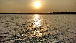
As of the 2011 [[ | [[File:River during sunset (Andhra Pradesh, 2016).jpg|thumb|Palakollu]] | ||
As of the 2011 [[Census of India]], the town had a population of 81,199; 40,103 males and 41,096 females — a sex ratio of 1,024 females per 1,000 males.<ref name="censusindia1"/> Children aged 0–6 years numbered 7,318 (3,743 boys and 3,575 girls; child sex ratio 955).<ref name="censusindia1"/> The average literacy rate stands at 76.95%, above the then state average of 73.00%.<ref name="censusindia1"/><ref name="aplit2014"/><ref name=population/> | |||
=== Language and religion === | === Language and religion === | ||
Telugu is the official language of administration and public instruction in Palakollu; other languages are used within minority communities.<ref name="censusindia1"/> | |||
According to the 2011 census, the religious | |||
According to the 2011 census, the religious composition of Palakollu was: Hindus (95.64%), Muslims (2.11%), Christians (1.97%), Jains (40 people), Sikhs (10 people), Buddhists (3 people); 143 people did not state a religion.<ref name="census2011r"/> | |||
{{Bar box | {{Bar box | ||
|float = right | |float = right | ||
|title = Religion in Palakollu (2011)<ref | |title = Religion in Palakollu (2011)<ref name="census2011r"/> | ||
|titlebar= #ddd | |titlebar= #ddd | ||
|bars = | |bars = | ||
| Line 227: | Line 233: | ||
== Economy == | == Economy == | ||
Palakollu's economy is primarily agri-based, with food processing, rice milling, trading, and services supporting the town's role as a commercial centre for surrounding Godavari delta mandals.<ref name="ap_agriculture">{{cite web |title=AGRICULTURE |url=https://westgodavari.ap.gov.in/departments/agriculture/ |website=Government of Andhra Pradesh – West Godavari District |access-date=27 August 2025}}</ref> The town and nearby mandals also participate in coir-related activities and small-scale manufacturing aligned with delta agriculture and cottage industries.<ref name="apiic_industrial-clusters">{{cite web |title=Industrial Clusters |url=https://apiic.in/industrial-clusters/ |website=Andhra Pradesh Industrial Infrastructure Corporation (APIIC) |access-date=27 August 2025}}</ref> | |||
'''Industries''' | '''Industries''' | ||
Small and cottage enterprises operate alongside agro-processing, including coir and allied units documented in regional industrial cluster plans for West Godavari district.<ref name="apiic_industrial-clusters"/> Rice milling remains a significant activity in the Godavari delta, supplying local markets and distribution networks serving coastal Andhra Pradesh.<ref name="ap_agriculture"/> | |||
'''Aquaculture''' | |||
Aquaculture and inland fisheries are major occupations in the West Godavari region, including areas around Palakollu, with district programmes supporting marine, brackish, and inland fishery resources.<ref>{{cite web |title=FISHERIES |url=https://westgodavari.ap.gov.in/fisheries/ |website=Government of Andhra Pradesh – West Godavari District |access-date=27 August 2025}}</ref> Seasonal fishing in the Godavari estuary includes the prized pulasa (hilsa), noted in regional coverage for its local economic importance and seasonality.<ref>{{cite news |last=Murali Sankar |first=K. N. |title=Pulasa fishermen wait for Pushkaram to end |url=https://www.thehindu.com/news/national/andhra-pradesh/pulasa-fishermen-wait-for-pushkaram-to-end/article7453925.ece |work=The Hindu |date=23 July 2015 |access-date=27 August 2025}}</ref> | |||
== Tourism == | |||
Palakollu draws visitors for pilgrimage and regional excursions in the Godavari delta, notably to the Sri Kshiraramalingeswara Swamy Temple and nearby coastal and backwater destinations in West Godavari district.<ref name="ap_tourist-places-2">{{cite web |title=Tourist Places – West Godavari District |url=https://westgodavari.ap.gov.in/tourist-places-2/ |website=Government of Andhra Pradesh |access-date=27 August 2025}}</ref> | |||
Perupalem Beach on the Bay of Bengal is a popular coastal outing listed among the district's tourist places and is commonly visited on day trips from Palakollu.<ref name="ap_tourist-places-2"/> In the backwaters of the Vasishta Godavari within the broader Konaseema region, resort stays are marketed for river-facing leisure and cultural experiences near Palakollu; the operator notes Palakollu as a nearby urban center for access.<ref>{{cite web |title=Palavelli Boutique Resorts – Konaseema |url=http://www.palavelliresorts.com/konaseemaresorts/index.php |website=Palavelli Boutique Resorts |access-date=27 August 2025}}</ref> | |||
The Sri Kshiraramalingeswara Swamy Temple (Ksheerarama) in Palakollu is highlighted by district tourism as a key heritage and pilgrimage site.<ref name="ap_tourist-places-2"/> | |||
The | |||
== Transport == | == Transport == | ||
{{ | Palakollu is connected to regional destinations by road and rail, with onward air access via [[Rajahmundry Airport]].<ref>{{cite web |title=Rajahmundry airport tops in occupancy rates |url=https://www.deccanchronicle.com/nation/current-affairs/100816/rajahmundry-airport-tops-in-occupancy-rates.html |website=Deccan Chronicle |date=10 August 2016 |access-date=27 August 2025}}</ref><ref name="indianrailways_1404647822154">{{cite web |title=Divisional information – Vijayawada Division |url=http://www.scr.indianrailways.gov.in/cris/uploads/files/1404647822154-Division%20profile.pdf |publisher=South Central Railway, Indian Railways |access-date=27 August 2025}}</ref> | ||
{{ | |||
=== Roadways === | === Roadways === | ||
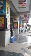
[[File:Palakollu bus station phase 1 platforms.jpg|thumb|Palakollu bus station phase 1 platforms|left]] | [[File:Palakollu bus station phase 1 platforms.jpg|thumb|Palakollu bus station phase 1 platforms|left]] | ||
The municipal road network in Palakollu totals {{convert|78.80|km|mi|abbr=on}} across urban roads administered by the civic body.<ref>{{cite web |title=Details of Roads in each ULB of Andhra Pradesh |url=http://centralapp.cdma.ap.gov.in:8080/CDMAAPTaxesInfo/RoadDetails.jsp |website=Commissioner and Directorate of Municipal Administration |publisher=Municipal Administration & Urban Development Department, Government of Andhra Pradesh |archive-url=https://web.archive.org/web/20160801101300/http://centralapp.cdma.ap.gov.in:8080/CDMAAPTaxesInfo/RoadDetails.jsp |archive-date=1 August 2016 |url-status=dead |access-date=27 August 2025}}</ref> | |||
=== Railways === | === Railways === | ||
{{Main|Palakollu railway station}} | {{Main|Palakollu railway station}} | ||
[[File:Palakollu Railway Station Entrance.jpg|thumb|Palakollu Railway Station entrance|right]] | [[File:Palakollu Railway Station Entrance.jpg|thumb|Palakollu Railway Station entrance|right]] | ||
Palakollu | Palakollu railway station lies under the [[Vijayawada railway division]] and is classified as a B‑category station in the [[South Central Railway zone]].<ref>{{cite web |title=Statement showing Category‑wise number of stations |url=http://www.indianrailways.gov.in/StationRedevelopment/AI&ACategoryStns.pdf |publisher=Indian Railways |page=2 |access-date=27 August 2025}}</ref><ref name="indianrailways_1404647822154"/> The station is situated on the [[Bhimavaram–Narasapuram branch line]] and has been the subject of capacity works including additional platforms reported during the 2010s.<ref>{{cite news |title=Railway station to have two more platforms |url=http://www.thehindu.com/todays-paper/tp-national/tp-andhrapradesh/railway-station-to-have-two-more-platforms/article3941115.ece |work=The Hindu |date=26 September 2012 |access-date=27 August 2025}}</ref> | ||
=== Waterways === | === Waterways === | ||
[[National Waterway 4 (India)|National Waterway 4]] | [[National Waterway 4 (India)|National Waterway 4]] (notified 24 November 2008) links inland waterways across Telangana, Andhra Pradesh, Tamil Nadu, and the Union territory of Puducherry, including reaches of the [[Godavari River|Godavari]] and [[Krishna River|Krishna]] and the [[Buckingham Canal]].<ref>{{cite web |title=National Waterways – Declaration |url=http://shipping.nic.in/writereaddata/mainlinkfile/File337.htm |archive-url=http://webarchive.loc.gov/all/20090410022602/http://www.shipping.nic.in/writereaddata/mainlinkfile/File337.htm |archive-date=10 April 2009 |publisher=Ministry of Shipping, Government of India |access-date=27 August 2025}}</ref> Development of NW‑4 was assigned to the [[Inland Waterways Authority of India]] with works and timelines announced by the central government in 2010.<ref>{{cite web |title=Development Authority for Inland Waterways in India |url=http://pib.nic.in/release/release.asp?relid=63957 |publisher=Press Information Bureau, Government of India |date=2 August 2010 |access-date=27 August 2025}}</ref> | ||
=== Airways === | === Airways === | ||
[[Rajahmundry Airport]] | [[Rajahmundry Airport]] (approximately 70 km by road) serves Palakollu with scheduled domestic flights; a new terminal became operational in May 2012, and runway extension works were undertaken to accommodate larger aircraft types.<ref>{{cite news |title=Rajahmundry airport terminal operational |url=http://www.thehindubusinessline.com/economy/logistics/article3429120.ece |work=The Hindu Business Line |date=17 May 2012 |access-date=27 August 2025}}</ref><ref>{{cite news |title=Gearing up for big planes by 2018 |url=http://www.thehindu.com/news/cities/Vijayawada/Rajahmundry-gearing-up-for-big-planes-by-2018/article15422036.ece |work=The Hindu |date=October 2016 |access-date=27 August 2025}}</ref> | ||
==Education== | == Education == | ||
Palakollu | Palakollu serves as an education hub for surrounding rural areas and towns in the West Godavari region, with municipal and state-run institutions alongside private schools and colleges.<ref name="ap_schooleducation">{{cite web |title=School Education Department – West Godavari District |url=https://westgodavari.ap.gov.in/schooleducation/ |website=Government of Andhra Pradesh |access-date=27 August 2025}}</ref> As per the 2011 Census of India, the town recorded an average literacy rate of 83.90%, with 63,097 literates (32,397 males; 30,700 females).<ref>{{cite web |title=Primary Census Abstract, 2011 – West Godavari (Town-level) |url=https://censusindia.gov.in/ |website=Census of India |access-date=27 August 2025}}</ref> | ||
Primary and secondary education is provided by government, aided, and private schools under the School Education Department of Andhra Pradesh.<ref>{{cite web |title=RMSA – Notification (School Education Department, AP) |url=http://rmsaap.nic.in/Notification_TSG_2015.pdf |website=Rashtriya Madhyamik Shiksha Abhiyan (RMSA) |publisher=Government of Andhra Pradesh |format=PDF |archive-url=https://web.archive.org/web/20161021012956/http://rmsaap.nic.in/Notification_TSG_2015.pdf |archive-date=21 October 2016 |url-status=dead |access-date=27 August 2025}}</ref> The Palakollu Municipal Corporation lists its network of municipal schools and related civic education services for the urban area.<ref>{{cite web |title=Palakol Municipal Corporation – Schools |url=http://palakol.cdma.ap.gov.in/en/palakol-municipal-corporation-schools |website=palakol.cdma.ap.gov.in |access-date=27 August 2025}}</ref> According to state school information reporting for the mid‑2010s, the urban area had on the order of 150–160 recognized schools across government, residential, private, and municipal managements.<ref>{{cite web |title=School Information Report (Consolidated) |url=http://cse.ap.gov.in/DSE/totalSchoolReport.xls |website=Commissioner of School Education, Andhra Pradesh |archive-url=https://web.archive.org/web/20161108154343/http://cse.ap.gov.in/DSE/totalSchoolReport.xls |archive-date=8 November 2016 |url-status=dead |access-date=27 August 2025}}</ref> | |||
Instruction is in | Instruction is commonly offered in Telugu and English, with Urdu available in select schools subject to state/CBSE affiliations and local demand.<ref name="ap_schooleducation"/> | ||
Palakollu and its vicinity host several higher‑education institutions spanning arts, science, commerce, engineering, and professional programs, including D.N.R. Educational Institutions and the Jogaiah Institute of Technology & Sciences (JITS).<ref>{{cite web |title=Sri D.N.R. Govt. Degree College for Women – History |url=https://www.sridnrgdcw.ac.in/page.php?menu=college-profile&slug=history |website=Sri D.N.R. Govt. Degree College for Women, Palakollu |access-date=27 August 2025}}</ref><ref>{{cite web |title=Jogaiah Institute of Technology and Sciences, Palakole |url=https://engineering.careers360.com/jogaiah-institute-of-technology-and-sciences-palakole |website=Careers360 |access-date=27 August 2025}}</ref> | |||
== See also == | == See also == | ||
| Line 289: | Line 280: | ||
== References == | == References == | ||
{{Reflist|24em}} | {{Reflist|24em|refs= | ||
<ref name="censusindia1">{{cite web | |||
|title=District Census Handbook – West Godavari: Primary Census Abstract (Town) | |||
|url=http://censusindia.gov.in/2011census/dchb/2815_PART_B_DCHB_WEST%20GODAVARI.pdf | |||
|website=Census of India | |||
|publisher=Directorate of Census Operations, Andhra Pradesh | |||
|year=2011 | |||
|pages=54–55 | |||
|access-date=27 August 2025 | |||
}}</ref> | |||
<ref name="census2011">{{cite web | |||
|title=Town amenities and demographic tables – Andhra Pradesh (DCHB) | |||
|url=http://www.censusindia.gov.in/2011census/dchb/DCHB.html | |||
|website=Census of India | |||
|publisher=Office of the Registrar General & Census Commissioner, India | |||
|access-date=27 August 2025 | |||
}} ''On this page, select “Andhra Pradesh” from the download menu; data for “Palacole (M + OG)” are in the downloadable file.''</ref> | |||
<ref name="census2011r">{{cite web | |||
|title=C‑1 Population by Religious Community (2011) | |||
|url=http://www.censusindia.gov.in/2011census/c-01.html | |||
|website=Census of India | |||
|publisher=Office of the Registrar General & Census Commissioner, India | |||
|archive-url=https://web.archive.org/web/20150913045700/http://www.censusindia.gov.in/2011census/C-01.html | |||
|archive-date=13 September 2015 | |||
|access-date=27 August 2025 | |||
}} ''On this page, select “Andhra Pradesh” from the download menu; data for “Palacole (M + OG)” are in the downloadable file.''</ref> | |||
<ref name=population>{{cite web | |||
|title=Andhra Pradesh (India): Districts, Cities, Towns and Outgrowth Wards – Population Statistics in Maps and Charts | |||
|url=http://www.citypopulation.de/php/india-andhrapradesh.php | |||
|website=citypopulation.de | |||
|access-date=27 August 2025 | |||
}}</ref> | |||
<ref name="aplit2014">{{cite web | |||
|title=Literacy of Andhra Pradesh (Census 2011) | |||
|url=http://www.ap.gov.in/AP%20State%20Statistical%20Abstract%20May%202014/2%20AP%20Demography.pdf | |||
|website=AP State Statistical Abstract 2014 | |||
|publisher=Government of Andhra Pradesh | |||
|format=PDF | |||
|archive-url=https://web.archive.org/web/20140714213923/http://www.ap.gov.in/AP%20State%20Statistical%20Abstract%20May%202014/2%20AP%20Demography.pdf | |||
|archive-date=14 July 2014 | |||
|url-status=dead | |||
|access-date=27 August 2025 | |||
}}</ref> | |||
}} | |||
== External links == | == External links == | ||
{{Wikivoyage|Palakollu}} | {{Wikivoyage|Palakollu}} | ||
{{commons category|Palakollu}} | {{commons category|Palakollu}} | ||
<!--See Bharatpedia policy on external links ([[BP:EL]]) before adding any links here--> | |||
<!--======================== {{No more links}} ============================ | |||
<!--See | | PLEASE BE CAUTIOUS IN ADDING MORE LINKS TO THIS ARTICLE. Bharatpedia is not a collection of links nor should it be used for advertising. | ||
<!--======================== {{No more links}} ============================ | |||
| PLEASE BE CAUTIOUS IN ADDING MORE LINKS TO THIS ARTICLE. | |||
| Excessive or inappropriate links WILL BE DELETED. | | | Excessive or inappropriate links WILL BE DELETED. | | ||
| See [[ | | See [[Bharatpedia:External links]] & [[Bharatpedia:Spam]] for details. | | ||
| If there are already plentiful links, please propose additions or replacements on this article's discussion page, or submit your link to the relevant category at the Open Directory Project (dmoz.org) and link back to that category using the {{dmoz}} template. | | If there are already plentiful links, please propose additions or replacements on this article's discussion page, or submit your link to the relevant category at the Open Directory Project (dmoz.org) and link back to that category using the {{dmoz}} template. | ||
|==={{No more links}}=========--> | |==={{No more links}}=========--> | ||
| Line 310: | Line 342: | ||
|South = [[Narasapuram]]<br />[[Bay of Bengal]] | |South = [[Narasapuram]]<br />[[Bay of Bengal]] | ||
}} | }} | ||
{{Navboxes | |||
|title =Articles related to Palakollu | |||
|list = | |||
{{Major Cities of Andhra Pradesh}} | {{Major Cities of Andhra Pradesh}} | ||
{{Municipalities of Andhra Pradesh}} | {{Municipalities of Andhra Pradesh}} | ||
{{West Godavari district}} | {{Cities and towns in West Godavari district}} | ||
}} | |||
{{Subject bar |portal1=Asia|portal2=Geography |portal3=India |commons=yes |commons-search=Category:Palakollu, India |n=yes |n-search=Category:Palakollu |wikt=yes |b=yes |q=yes |s=yes |v=yes |voy=yes |d=yes }} | {{Subject bar |portal1=Asia|portal2=Geography |portal3=India |commons=yes |commons-search=Category:Palakollu, India |n=yes |n-search=Category:Palakollu |wikt=yes |b=yes |q=yes |s=yes |v=yes |voy=yes |d=yes }} | ||
{{Authority control}} | {{Authority control}} | ||
| Line 320: | Line 355: | ||
[[Category:Cities in Andhra Pradesh]] | [[Category:Cities in Andhra Pradesh]] | ||
[[Category:Mandal headquarters in West Godavari district]] | [[Category:Mandal headquarters in West Godavari district]] | ||
Latest revision as of 08:38, 30 January 2026
Palakollu
పాలకొల్లు Palakol, Palacole | |
|---|---|
City | |
 | |
  Palakollu Location in Andhra Pradesh, India  Palakollu Palakollu (India) | |
| Coordinates: 16°31′00″N 81°43′48″E / 16.5167°N 81.7300°E | |
| Country |  India India |
| State | Andhra Pradesh |
| Region | Coastal Andhra |
| District | West Godavari district |
| Municipality constituted | 1 April 1919 |
| Government | |
| • Type | Nagar Palika |
| • Body | Palakollu Municipality (PMC); Eluru Urban Development Authority (EUDA) |
| Area | |
| • Total | 19.49 km2 (7.53 sq mi) |
| Elevation | 1.5 m (4.9 ft) |
| Population (2011)[1] | |
| • Total | 81,199 |
| • Density | 4,200/km2 (11,000/sq mi) |
| Languages | |
| • Official | Telugu |
| Time zone | UTC+5:30 (IST) |
| PIN | 534250–534267 |
| Telephone code | 08814 |
| Vehicle registration | AP 37 |
| Website | palakol |
Palakollu is a city and the administrative headquarters of Palakollu Mandal in the Narasapuram revenue division of West Godavari district, Andhra Pradesh, India.[2] Located in the Coastal Andhra region, the city's municipal area spans 19.49 square kilometres (7.53 sq mi).[1]
As per the 2011 Census of India, Palakollu (municipality plus outgrowth) had a population of 81,199.[1] Palakollu is also noted for Ksheerarama, one of the five Pancharama Kshetras.[3]
Etymology[edit | edit source]
Palakollu has historically been referred to by other names – "Upamanyapuram", "Ksheerapuri", "Palakolanu", and in English writings "Palacole" – which are mentioned in traditions associated with the local Sri Ksheera Ramalingeswara Swamy (Ksheerarama) temple.[4]
History[edit | edit source]
Palakollu (historically also written as Palakol) is referred to in sources by several earlier names, including Kṣīrārāma, Kṣīrapuram, Palakolanu, and Upamanyapuram.[5]
In 1613, the Dutch established a trading factory at Palakollu as part of the Dutch Coromandel network; the post dealt in textiles, lamp oil, timber, roof tiles, and bricks and was temporarily abandoned in 1730.[6] By the terms following the 1783 Treaty of Paris, the town passed to British control, with the Dutch continuing to rent it until 1804; it was restored to the Dutch in 1818 and finally ceded to the British again in 1824.[6]
Palakollu is associated with the concept of Trilinga Deśam in regional tradition and is home to Kṣīrārāma (Sri Ksheera Rama Lingeswara Swamy Temple), one of the five Pancharama Kshetras dedicated to Shiva; the presiding deity is locally known as Ksheera Ramalingeswara Swamy.[7]
Under the Qutb Shahi reign[edit | edit source]
Textile industry center[edit | edit source]
During the Golkonda Qutb Shahi period (16th–17th centuries), the Palakollu region participated in the Coromandel textile economy, producing cotton goods such as calicoes and blankets, including dyed fabrics routed via Machilipatnam for coastal and inland markets.[8] A severe drought affecting the Krishna and Godavari deltas circa 1770, together with late‑18th‑century headwinds and 19th‑century competition from English mill‑made textiles, contributed to contraction in regional handloom activity noted in contemporary Dutch records.[8][9]
Fabric and ironwork[edit | edit source]
Regional industrial linkages included nearby Narasapuram shipbuilding; scarcity of iron timbering in the Godavari delta limited ship construction to ancillary work, fostering ancillary ironwork such as nails and tools in and around Palakollu that supplied maritime yards.[10]
Geography[edit | edit source]
Palakollu is located at 16°31′00″N 81°43′48″E / 16.5167°N 81.7300°E in West Godavari district, Andhra Pradesh, India.[11] The town stands at an average elevation of about 5 metres (16 ft) above mean sea level on predominantly flat, deltaic terrain.[11]
Climate[edit | edit source]
Palakollu has a tropical savanna climate (Köppen–Geiger Aw), with hot, humid summers and most annual precipitation falling during the monsoon months from June to October.[12] Long‑term averages indicate a mean annual temperature of about 27.9 °C and annual rainfall around 1,208 mm; May is typically the warmest month and October the wettest.[12]
| Month | Jan | Feb | Mar | Apr | May | Jun | Jul | Aug | Sep | Oct | Nov | Dec | Year |
|---|---|---|---|---|---|---|---|---|---|---|---|---|---|
| Average high °C (°F) | 27.7 (81.9) |
30 (86) |
32.8 (91.0) |
35 (95) |
37 (99) |
36.3 (97.3) |
32.4 (90.3) |
32.2 (90.0) |
32 (90) |
31 (88) |
28.8 (83.8) |
27.6 (81.7) |
31.9 (89.5) |
| Daily mean °C (°F) | 23.4 (74.1) |
25.4 (77.7) |
27.8 (82.0) |
30.5 (86.9) |
32.4 (90.3) |
31.8 (89.2) |
29 (84) |
28.9 (84.0) |
28.8 (83.8) |
27.8 (82.0) |
25.4 (77.7) |
23.5 (74.3) |
27.9 (82.2) |
| Average low °C (°F) | 19.2 (66.6) |
20.9 (69.6) |
22.8 (73.0) |
26 (79) |
27.8 (82.0) |
27.3 (81.1) |
25.6 (78.1) |
25.6 (78.1) |
25.6 (78.1) |
24.6 (76.3) |
21.1 (70.0) |
19.4 (66.9) |
23.8 (74.9) |
| Average precipitation mm (inches) | 1 (0.0) |
6 (0.2) |
4 (0.2) |
7 (0.3) |
41 (1.6) |
145 (5.7) |
266 (10.5) |
190 (7.5) |
191 (7.5) |
286 (11.3) |
52 (2.0) |
19 (0.7) |
1,208 (47.6) |
| Average precipitation days | 1.2 | 0.2 | 0.2 | 0.4 | 1.6 | 3.0 | 6.1 | 6.4 | 5.4 | 8.7 | 9.1 | 3.7 | 46.0 |
| Source: Climate‑Data.org[12] | |||||||||||||
Culture[edit | edit source]

Palakollu ki cultural life ka kendr Sri Ksheera Rama Lingeswara Swamy Temple (Ksheerarama) hai, jo Pancharama Kshetras me se ek mana jata hai aur yahan parakramik darshanon ke saath teerth yatra hoti rehti hai.[13] Mandir me Maha Shivaratri jaise bade tyohaar vishesh bhav se manaye jate hain, jisse sthaniya paramparaon aur bhakti samaroho ka pradarshan hota hai.[14]
Konaseema kshetra ke nadi‑delta aur backwater paridrishya se prabhavit Palakollu me dharmik paryatan ke saath sthaley utsav aur rivaazon ka ayojan hota rehta hai, jismein parivarik aur samudayik bhagidari drishyamaan hoti hai.[13]
Administration[edit | edit source]
Municipality[edit | edit source]

The Palakollu Municipal Council (PMC) is the local self-government of the town. It was constituted as a municipality on 1 April 1919. The civic body's jurisdiction covers 19.49 km2 (7.53 sq mi) and comprises 32 municipal wards, each represented by an elected councillor.[15] The elected council is headed by a municipal chairperson as presiding officer, while executive functions are vested in the municipal commissioner appointed by the state government.[15]
PMC's functions include construction and maintenance of roads and drains; town planning and building regulation; upkeep of municipal markets and parks; solid waste management; registration of births and deaths; issuance of trade licences; property tax administration; and delivery of community welfare services such as maternal and child health and early childhood education.[15]
The municipality was constituted in 1919 and was graded as a third‑grade municipality in 1952 before being upgraded to first grade in August 1965.[16] On 1 January 2019, the Eluru Urban Development Authority (EUDA) was created under the Andhra Pradesh Metropolitan Region and Urban Development Authorities Act, 2016; Palakollu Municipality was brought within EUDA's planning jurisdiction thereafter.[citation needed]
Palakollu (Assembly constituency) is a legislative assembly constituency of Andhra Pradesh. Historical municipal leadership has included long‑serving chairpersons; specific tenures and projects require citations for verification.[citation needed]
E‑governance services[edit | edit source]
The Government of Andhra Pradesh operates MeeSeva centres to deliver citizen services locally and online, including digitally signed certificates (income, residence), land records, and other registrations with records stored in state databases.[17][18]
Healthcare[edit | edit source]
Palakollu functions as a healthcare node for surrounding mandals in West Godavari district. The Government General Hospital serves Palakollu and nearby areas, alongside private multi‑specialty and single‑specialty clinics.[citation needed]
Politics[edit | edit source]
Palakollu Assembly constituency forms part of the Narasapuram (Lok Sabha constituency). Constituency boundaries and reservations are defined by the Delimitation of Parliamentary and Assembly Constituencies Order, 2008.[19]
Demographics[edit | edit source]
| Year | Pop. | ±% |
|---|---|---|
| 1901 | 10,848 | — |
| 1911 | 12,953 | +19.4% |
| 1921 | 14,535 | +12.2% |
| 1931 | 16,906 | +16.3% |
| 1941 | 19,869 | +17.5% |
| 1951 | 23,037 | +15.9% |
| 1961 | 28,481 | +23.6% |
| 1971 | 36,196 | +27.1% |
| 1981 | 46,146 | +27.5% |
| 1991 | 56,969 | +23.5% |
| 2001 | 76,308 | +33.9% |
| 2011 | 81,199 | +6.4% |
| Source: Census of India[20][21] | ||
.jpg)
As of the 2011 Census of India, the town had a population of 81,199; 40,103 males and 41,096 females — a sex ratio of 1,024 females per 1,000 males.[20] Children aged 0–6 years numbered 7,318 (3,743 boys and 3,575 girls; child sex ratio 955).[20] The average literacy rate stands at 76.95%, above the then state average of 73.00%.[20][22][23]
Language and religion[edit | edit source]
Telugu is the official language of administration and public instruction in Palakollu; other languages are used within minority communities.[20]
According to the 2011 census, the religious composition of Palakollu was: Hindus (95.64%), Muslims (2.11%), Christians (1.97%), Jains (40 people), Sikhs (10 people), Buddhists (3 people); 143 people did not state a religion.[24]
Economy[edit | edit source]
Palakollu's economy is primarily agri-based, with food processing, rice milling, trading, and services supporting the town's role as a commercial centre for surrounding Godavari delta mandals.[25] The town and nearby mandals also participate in coir-related activities and small-scale manufacturing aligned with delta agriculture and cottage industries.[26]
Industries Small and cottage enterprises operate alongside agro-processing, including coir and allied units documented in regional industrial cluster plans for West Godavari district.[26] Rice milling remains a significant activity in the Godavari delta, supplying local markets and distribution networks serving coastal Andhra Pradesh.[25]
Aquaculture Aquaculture and inland fisheries are major occupations in the West Godavari region, including areas around Palakollu, with district programmes supporting marine, brackish, and inland fishery resources.[27] Seasonal fishing in the Godavari estuary includes the prized pulasa (hilsa), noted in regional coverage for its local economic importance and seasonality.[28]
Tourism[edit | edit source]
Palakollu draws visitors for pilgrimage and regional excursions in the Godavari delta, notably to the Sri Kshiraramalingeswara Swamy Temple and nearby coastal and backwater destinations in West Godavari district.[29]
Perupalem Beach on the Bay of Bengal is a popular coastal outing listed among the district's tourist places and is commonly visited on day trips from Palakollu.[29] In the backwaters of the Vasishta Godavari within the broader Konaseema region, resort stays are marketed for river-facing leisure and cultural experiences near Palakollu; the operator notes Palakollu as a nearby urban center for access.[30]
The Sri Kshiraramalingeswara Swamy Temple (Ksheerarama) in Palakollu is highlighted by district tourism as a key heritage and pilgrimage site.[29]
Transport[edit | edit source]
Palakollu is connected to regional destinations by road and rail, with onward air access via Rajahmundry Airport.[31][32]
Roadways[edit | edit source]

The municipal road network in Palakollu totals 78.80 km (48.96 mi) across urban roads administered by the civic body.[33]
Railways[edit | edit source]

Palakollu railway station lies under the Vijayawada railway division and is classified as a B‑category station in the South Central Railway zone.[34][32] The station is situated on the Bhimavaram–Narasapuram branch line and has been the subject of capacity works including additional platforms reported during the 2010s.[35]
Waterways[edit | edit source]
National Waterway 4 (notified 24 November 2008) links inland waterways across Telangana, Andhra Pradesh, Tamil Nadu, and the Union territory of Puducherry, including reaches of the Godavari and Krishna and the Buckingham Canal.[36] Development of NW‑4 was assigned to the Inland Waterways Authority of India with works and timelines announced by the central government in 2010.[37]
Airways[edit | edit source]
Rajahmundry Airport (approximately 70 km by road) serves Palakollu with scheduled domestic flights; a new terminal became operational in May 2012, and runway extension works were undertaken to accommodate larger aircraft types.[38][39]
Education[edit | edit source]
Palakollu serves as an education hub for surrounding rural areas and towns in the West Godavari region, with municipal and state-run institutions alongside private schools and colleges.[40] As per the 2011 Census of India, the town recorded an average literacy rate of 83.90%, with 63,097 literates (32,397 males; 30,700 females).[41]
Primary and secondary education is provided by government, aided, and private schools under the School Education Department of Andhra Pradesh.[42] The Palakollu Municipal Corporation lists its network of municipal schools and related civic education services for the urban area.[43] According to state school information reporting for the mid‑2010s, the urban area had on the order of 150–160 recognized schools across government, residential, private, and municipal managements.[44]
Instruction is commonly offered in Telugu and English, with Urdu available in select schools subject to state/CBSE affiliations and local demand.[40] Palakollu and its vicinity host several higher‑education institutions spanning arts, science, commerce, engineering, and professional programs, including D.N.R. Educational Institutions and the Jogaiah Institute of Technology & Sciences (JITS).[45][46]
See also[edit | edit source]
References[edit | edit source]
- ↑ 1.0 1.1 1.2 1.3 "District Census Handbook – West Godavari: Primary Census Abstract (Town)" (PDF). Census of India. Directorate of Census Operations, Andhra Pradesh. 2011. pp. 22–23, 54–55. Retrieved 27 August 2025.
- ↑ "About Palacole Municipality". CDMA Andhra Pradesh. Government of Andhra Pradesh. Retrieved 27 August 2025.
- ↑ "Religious Tourism – West Godavari District". Government of Andhra Pradesh. Retrieved 27 August 2025.
- ↑ "Palakollu City – Etymology". AreaProfiler (Government of India). Retrieved 27 August 2025.
- ↑ Pañchārāmas in Medieval Āndhradēśa – Google Books search showing the historical toponym “Palakolanu”.
- ↑ 6.0 6.1 Bowrey, Thomas (1895). Temple, Richard Carnac (ed.). A Geographical Account of Countries Round the Bay of Bengal, 1669–1679. Hakluyt Society. p. 105.
- ↑ Readings in Indian History. Selected and Edited by Sir William Wilson Hunter (1899), p. 15 (Google Books scan).
- ↑ 8.0 8.1 Joshi, P. M. (1941). "Textile Industry and Trade of the Kingdom of Golkonda". Proceedings of the Indian History Congress. 5: 609–617. JSTOR 44304839.
- ↑ Subrahmanyam, Sanjay (1990). "Rural Industry and Commercial Agriculture in Late Seventeenth‑Century South‑Eastern India". Past & Present (126): 76–114. doi:10.1093/past/126.1.76. JSTOR 650810.
- ↑ Subrahmanyam, Sanjay (1988). "A Note on Narsapur Peta: A "Syncretic" Shipbuilding Centre in South India, 1570–1700". Journal of the Economic and Social History of the Orient. 31 (3): 305–311. doi:10.2307/3632014. JSTOR 3632014.
- ↑ 11.0 11.1 "Palakollu, India – Maps and weather". FallingRain. Retrieved 27 August 2025.
- ↑ 12.0 12.1 12.2 "Palakollu climate: temperature and rainfall". Climate‑Data.org. Retrieved 27 August 2025.
- ↑ 13.0 13.1 "Religious Tourism – West Godavari District". Government of Andhra Pradesh. Retrieved 27 August 2025.
- ↑ "Sri Ksheera Rama Temple – Palakollu". Trawell.in. Retrieved 27 August 2025.
- ↑ 15.0 15.1 15.2 "Citizen's charter" (PDF). Palakollu Municipal Council. Retrieved 27 August 2025.
- ↑ "About Palakollu Municipality". Palakollu Municipality. Retrieved 27 August 2025.
- ↑ "Andhra Pradesh State Portal – MeeSeva Services". ap.meeseva.gov.in. Retrieved 27 August 2025.
- ↑ "AP to offer 331 Mee Seva services by Oct". The Hindu Business Line. 9 April 2013. Retrieved 27 August 2025.
- ↑ "Delimitation of Parliamentary and Assembly Constituencies Order, 2008" (PDF). Election Commission of India. pp. 20, 30. Retrieved 27 August 2025.
- ↑ 20.0 20.1 20.2 20.3 20.4 "District Census Handbook – West Godavari: Primary Census Abstract (Town)" (PDF). Census of India. Directorate of Census Operations, Andhra Pradesh. 2011. pp. 54–55. Retrieved 27 August 2025.
- ↑ "Town amenities and demographic tables – Andhra Pradesh (DCHB)". Census of India. Office of the Registrar General & Census Commissioner, India. Retrieved 27 August 2025. On this page, select “Andhra Pradesh” from the download menu; data for “Palacole (M + OG)” are in the downloadable file.
- ↑ "Literacy of Andhra Pradesh (Census 2011)" (PDF). AP State Statistical Abstract 2014. Government of Andhra Pradesh. Archived from the original (PDF) on 14 July 2014. Retrieved 27 August 2025.
- ↑ "Andhra Pradesh (India): Districts, Cities, Towns and Outgrowth Wards – Population Statistics in Maps and Charts". citypopulation.de. Retrieved 27 August 2025.
- ↑ 24.0 24.1 "C‑1 Population by Religious Community (2011)". Census of India. Office of the Registrar General & Census Commissioner, India. Archived from the original on 13 September 2015. Retrieved 27 August 2025. On this page, select “Andhra Pradesh” from the download menu; data for “Palacole (M + OG)” are in the downloadable file.
- ↑ 25.0 25.1 "AGRICULTURE". Government of Andhra Pradesh – West Godavari District. Retrieved 27 August 2025.
- ↑ 26.0 26.1 "Industrial Clusters". Andhra Pradesh Industrial Infrastructure Corporation (APIIC). Retrieved 27 August 2025.
- ↑ "FISHERIES". Government of Andhra Pradesh – West Godavari District. Retrieved 27 August 2025.
- ↑ Murali Sankar, K. N. (23 July 2015). "Pulasa fishermen wait for Pushkaram to end". The Hindu. Retrieved 27 August 2025.
- ↑ 29.0 29.1 29.2 "Tourist Places – West Godavari District". Government of Andhra Pradesh. Retrieved 27 August 2025.
- ↑ "Palavelli Boutique Resorts – Konaseema". Palavelli Boutique Resorts. Retrieved 27 August 2025.
- ↑ "Rajahmundry airport tops in occupancy rates". Deccan Chronicle. 10 August 2016. Retrieved 27 August 2025.
- ↑ 32.0 32.1 "Divisional information – Vijayawada Division" (PDF). South Central Railway, Indian Railways. Retrieved 27 August 2025.
- ↑ "Details of Roads in each ULB of Andhra Pradesh". Commissioner and Directorate of Municipal Administration. Municipal Administration & Urban Development Department, Government of Andhra Pradesh. Archived from the original on 1 August 2016. Retrieved 27 August 2025.
- ↑ "Statement showing Category‑wise number of stations" (PDF). Indian Railways. p. 2. Retrieved 27 August 2025.
- ↑ "Railway station to have two more platforms". The Hindu. 26 September 2012. Retrieved 27 August 2025.
- ↑ "National Waterways – Declaration". Ministry of Shipping, Government of India. Archived from the original on 10 April 2009. Retrieved 27 August 2025.
- ↑ "Development Authority for Inland Waterways in India". Press Information Bureau, Government of India. 2 August 2010. Retrieved 27 August 2025.
- ↑ "Rajahmundry airport terminal operational". The Hindu Business Line. 17 May 2012. Retrieved 27 August 2025.
- ↑ "Gearing up for big planes by 2018". The Hindu. October 2016. Retrieved 27 August 2025.
- ↑ 40.0 40.1 "School Education Department – West Godavari District". Government of Andhra Pradesh. Retrieved 27 August 2025.
- ↑ "Primary Census Abstract, 2011 – West Godavari (Town-level)". Census of India. Retrieved 27 August 2025.
- ↑ "RMSA – Notification (School Education Department, AP)" (PDF). Rashtriya Madhyamik Shiksha Abhiyan (RMSA). Government of Andhra Pradesh. Archived from the original (PDF) on 21 October 2016. Retrieved 27 August 2025.
- ↑ "Palakol Municipal Corporation – Schools". palakol.cdma.ap.gov.in. Retrieved 27 August 2025.
- ↑ "School Information Report (Consolidated)". Commissioner of School Education, Andhra Pradesh. Archived from the original on 8 November 2016. Retrieved 27 August 2025.
- ↑ "Sri D.N.R. Govt. Degree College for Women – History". Sri D.N.R. Govt. Degree College for Women, Palakollu. Retrieved 27 August 2025.
- ↑ "Jogaiah Institute of Technology and Sciences, Palakole". Careers360. Retrieved 27 August 2025.
External links[edit | edit source]
Places adjacent to Palakollu | |
|---|---|


Lua error in Module:Sister_project_links at line 463: attempt to index field 'wikibase' (a nil value).