



m Removed empty portal template using script |
typo fix |
||
| Line 1: | Line 1: | ||
{{Use dmy dates|date=March 2016}} | {{Use dmy dates|date=March 2016}} | ||
{{use Indian English|date=March 2016}} | {{use Indian English|date=March 2016}} | ||
| Line 8: | Line 7: | ||
{{Infobox settlement | {{Infobox settlement | ||
| name = Karla | | name = Karla | ||
| other_name = | | other_name = | ||
| native_name_lang = | | native_name_lang = | ||
| settlement_type = Town | | settlement_type = Town | ||
| image_skyline = Gomateshwara_Statue,_Karkala.jpg | | image_skyline = | ||
| | {{multiple image | ||
| border = infobox | |||
| total_width = 300 | |||
| image_style = | |||
| perrow = 2/1 | |||
| caption_align = center | |||
| image1 = Gomateshwara_Statue,_Karkala.jpg | |||
| caption1 = [[Gommateshwara statue, Karkala|Gommateshwar]] | |||
}} | |||
| nickname = Jain pilgrimage center | | nickname = Jain pilgrimage center | ||
| pushpin_map = | | mapframe = yes | ||
| pushpin_label_position = | | mapframe-zoom = 6 | ||
| pushpin_map_alt = | | map_alt = | ||
| pushpin_map_caption = | | map_caption = Karkala in Karnataka | ||
| pushpin_map = | |||
| pushpin_label_position = | |||
| pushpin_map_alt = | |||
| pushpin_map_caption = | |||
| coordinates = {{coord|13.2|N|74.983|E|display=inline,title}} | | coordinates = {{coord|13.2|N|74.983|E|display=inline,title}} | ||
| subdivision_type = Country | | subdivision_type = Country | ||
| subdivision_name = {{flag|India}} | | subdivision_name = {{flag|India}} | ||
| subdivision_type1 = [[States and territories of India|State]] | | subdivision_type1 = [[States and territories of India|State]] | ||
| subdivision_type2 | | subdivision_type2 = [[List of districts of India|District]] | ||
| subdivision_name1 = [[Karnataka]] | | subdivision_name1 = [[Karnataka]] | ||
| subdivision_name2 = [[ | | subdivision_name2 = [[Udupi district|Udupi]] | ||
| | |||
| established_title = Settled | | established_title = Settled | ||
| established_date = 1912 | | established_date = 1912 | ||
| unit_pref = Metric | | unit_pref = Metric | ||
| area_total_km2 = 23.06 | | area_total_km2 = 23.06 | ||
| Line 38: | Line 44: | ||
| population_as_of = 2011 | | population_as_of = 2011 | ||
| population_density_km2 = 1089.16 | | population_density_km2 = 1089.16 | ||
| timezone1 = [[Indian Standard Time|IST]] | | timezone1 = [[Indian Standard Time|IST]] | ||
| utc_offset1 = +5:30 | | utc_offset1 = +5:30 | ||
| Line 47: | Line 51: | ||
| area_code_type = Telephone code | | area_code_type = Telephone code | ||
| registration_plate = KA-20 | | registration_plate = KA-20 | ||
| blank_name = {{nowrap|[[Official language]]}} | |||
| blank_info = [[Kannada]]<ref>{{cite web |url=http://nclm.nic.in/shared/linkimages/NCLM50thReport.pdf |title=50th Report of the Commissioner for Linguistic Minorities in India (July 2012 to June 2013) |access-date=14 January 2015 |url-status=dead |archive-url=https://web.archive.org/web/20160708012438/http://nclm.nic.in/shared/linkimages/NCLM50thReport.pdf |archive-date=8 July 2016}}</ref> | |||
| blank1_name_sec1 = [[Human sex ratio|Sex ratio]] | | blank1_name_sec1 = [[Human sex ratio|Sex ratio]] | ||
| blank1_info_sec1 = 1.11 [[male|♂]]/[[female|♀]] | | blank1_info_sec1 = 1.11 [[male|♂]]/[[female|♀]] | ||
| website = {{URL|www.karkalatown.gov.in}} | | website = {{URL|www.karkalatown.mrc.gov.in}} | ||
| footnotes = | | footnotes = | ||
}} | |||
'''Karkala''' ({{IPA|kn|kɑːɾkəɭə|lang}}) ({{IPA|tcy|kɑːɾlə|lang}}) is a town and the headquarters of eponymous Karkala taluk in the [[Udupi district]] of [[Karnataka]] state in [[India]]. It is well known as an important center of [[Jainism]], with several ancient basadis (Jain temples) and the iconic 42-foot monolithic statue of [[Bahubali]] (Gommateshwara) dating back to the 15th century. Karkala lies near the foothills of the [[Western Ghats]], and has a number of natural and historical landmarks, and is a major tourist and transit destination due to its strategic location along the way to [[Hebri]], [[Sringeri]], [[Kalasa]], [[Horanadu]], [[Udupi]], [[Kollur, Udupi district|Kollur]], [[Subramanya, Karnataka|Subrahmanya]] and [[Dharmasthala]]. | |||
''' | |||
== Etymology == | |||
Black granite is abundant in the area, and | Black granite is abundant in the area, and used widely in the local architecture. Hence, the name of the town is derived from ''kari-kal'', meaning black stone. There is still a place called as ''Kariya Kall'' in the city which means 'Black Rock' in [[Tulu language|Tulu]] and [[Kannada language|Kannada]] languages. The name 'Kariya Kall/ ಕರಿಯಕಲ್ಲ್ changed to 'Karikal/ಕರಿಕಲ್' and eventually to 'Karkal/ಕರ್ಕಲ್/ಕಾರ್ಕಳ್'. However, some studies assert that the original name was 'Kari Kola' meaning 'elephant lake' in [[Tulu language|Tulu]] and [[Kannada language|Kannada]] languages, which today is known as 'Anekere'. The current official name "Karkala" is in use since the times of the British, while it is still referred to as "Karla" by the local Tulu population. | ||
== | == History == | ||
{{Main|Gommateshwara statue, Karkala|Chaturmukha Basadi}} | {{Main|Gommateshwara statue, Karkala|Chaturmukha Basadi}} | ||
[[ | {{ more citations needed|date= July 2023}} | ||
Karkala dates back to the beginning of the 10th century. The town was called ''Pandya Nagari'' during the period of [[Jain]] rule.<ref>{{Cite web |last=DHNS |title=A legacy filled with culture |url=https://www.deccanherald.com/india/karnataka/a-legacy-filled-culture-2150317 |access-date=2024-08-10 |website=Deccan Herald |language=en}}</ref> | |||
The Alupas were the first to rule | [[File:Chaturmukha_Basadi.jpg|thumb|[[Chaturmukha Basadi]]]] | ||
[[File:Anekere Chaturmukha basadi.jpg|thumb|Kere Basadi]] | |||
[[File:Anekere Chaturmukha basadi complex.jpg|thumb|Anekere kere basadi ({{translation|Elephant lake, Lake Temple}}]] | |||
[[File:St. Lawrence Shrine (Karkala).jpg|thumb|St. Lawrence Shrine Basilica]] | |||
The [[Alupa Dynasty|Alupas]] were the first to rule the region who were Originally [[Jain]] rulers, and their rule was followed by the [[Santara dynasty|Santaras]], who were the feudatories of Alupas for many years. The town attained political and cultural importance from the time of the Kalasa-Karkala [[Monarchy|kingdom]] that was established by King Bhairava between 13th and 16th centuries.<ref>{{Cite book |last=Ramesh |first=K. V. |url=https://books.google.com/books?id=eKs5AQAAIAAJ&q=history+of+karkala |title=A History of South Kanara: From the Earliest Times to the Fall of Vijayanagara |date=1970 |publisher=Karnatak University |pages=189 |language=en}}</ref> | |||
The royal family of | The royal family of Karkala rose to prominence from the time of the rule of the [[Hoysalas]]. During the [[Vijayanagara]] period this family reached new heights of glory as their kingdom extended over a wider area comprising [[Sringeri]], [[Koppa, India|Koppa]], [[Balehonnur]] and [[Mudigere]] in [[Chikamagalur]] and most of the [[Karkala taluk]]. | ||
King Veera Bhairava constructed the [[Jain temples|basadis]] at Karkala and endowed land and money to numerous temples and [[Jain temples|basadis]]. Ramanatha and Veerapandya were his two sons and Ramanatha died early during his father's time. So In his memory, a scenic lake called Ramasamudra was created, which still survives to this day. | |||
King Veera Pandya, at the insistence of his Guru Lalitakeerti, the pontiff of | King Veera Pandya, at the insistence of his Guru Lalitakeerti, the pontiff of Karkala Jaina Math, installed a large statue of Bahubali on the rocky hill of Karkala. The date of the installation has been ascertained as 13 February 1432.<ref>{{Cite book |last=Rice |first=Edward P. |url=https://books.google.com/books?id=2fhCH-NRatUC&dq=history+of+karkala&pg=PA19 |title=A History of Kannada Literature |date=1982 |publisher=Asian Educational Services |isbn=978-81-206-0063-8 |pages=19 |language=en}}</ref><ref>{{Cite book |last=Francis |first=W. |url=https://books.google.com/books?id=vERnljM1uiEC&dq=history+of+karkala&pg=PA514 |title=Gazetteer of South India |date=1989 |publisher=Mittal Publications |pages=376 |language=en}}</ref> He also installed the Brahmadeva Pillar in front of the statue in 1436. His successor, Abinava Pandya installed a carving of manastambha in front of the Neminatha [[Jain temples|Basadis]] in Hiriyangadi in 1457 AD. An intricately carved 54-foot-high (16 m) pillar stands in front of the [[Jain temples|Basadis]]. | ||
Abhinava Pandya's successor was Pandya VI, who is attributed to the construction of the Kere [[Jain temples|Basadis]] in the middle of a lake called [[Anekere]] in 1545 AD.<ref>{{Cite book |url=https://books.google.com/books?id=8IbXAAAAMAAJ&q=anekere+basadi+in+karkala |title=Jinmanjari: Contemporary Jaina Reflections |date=1998 |publisher=Bramhi Society |page=19 |language=en}}</ref> Immadi Bhairava (Bhairava II), who ruled after him, constructed the [[Chaturmukha Basadi]] on top of a small rocky hill in 1586 AD. This [[Jain temples|Basadis]] has four identical entrances from the four directions leading to the Garbagriha and hence is popularly known as Chaturmukha or Four-Faced. It is also referred to as Tribhuvana Tilaka Jina Chaityalaya and Ratnaraya Dhama in some inscriptions. The [[Chaturmukha Basadi]] is built in the form of a square hall with a lofty doorway and pillared porticos on each of its four sides along with a pillared verandah. The roof is flat and is made of massive granite slabs. It has life size statues of three Jain Theerthankaras on each side and small images of 24 [[Tirthankara]]. In all, there are 108 pillars inside and outside the temple. | |||
There are 18 [[Jain temples|Basadis]] of antiquity, including Mahaveera [[Jain temples|Basadi]], Chandranathaswamy [[Jain temples|Basadi]], Adinathaswamy [[Jain temples|Basadi]], Ananthanatha [[Jain temples|Basadi]], Guru [[Jain temples|Basadi]], and Padmavati [[Jain temples|Basadi]]. However, the rulers of Karkala were tolerant towards other religions, with temples of other religions being constructed, including the temples of Anantashayana and Venkataramana, Mahamaya Mukhyaprana, and Sri Aadi-Shakthi Veerabhadra Swamy. | |||
After the rule of the Pandyas, the region was annexed by [[Tippu Sultan]], and thereafter passed on to British rule. The St Lawrence Church was built in 1845 in a village called Nitte (Attur hamlet) where people of all religions congregate every year in January for the feast of St Lawrence.{{Citation needed|date=September 2023}} | |||
==Landmarks== | |||
Karkala is an important pilgrimage location for [[Jain]]s. There are several [[Hindu]] temples, [[Jain]] [[Jain temples|Basadis]], [[mosque]]s, [[Church (building)|church]]es, and lakes in Karkala. | |||
[[File:Bus Stand in Karkala.jpg|thumb|right|Bus stand, Karkala]] | |||
Karkala has famous educational institutions like NITTE College, Bhuvanendra College, Christ King Educational institutions, and Jnanasudha Educational College. | |||
[[File:Taluk Office, Karkala.jpg|thumb|right|Taluk Office, Karkala]] | |||
ASI protected sites<ref>[http://asibengalurucircle.in/udupi ASI Bengaluru Circle - Udupi district]{{Dead link|date=March 2025 |bot=InternetArchiveBot |fix-attempted=yes }}</ref> in Karkala are: | |||
* Ananthapadmanabha Temple, Ananthashayana | * Ananthapadmanabha Temple, Ananthashayana | ||
* [[Chaturmukha Basadi]] | * [[Chaturmukha Basadi]] | ||
* Gommateshwara | * [[Gommateshwara statue, Karkala|Gommateshwara Statue]] | ||
* [[Manasthamba]] | |||
* Hiriyangadi | |||
* [[Sri Venkataramana Temple, Karkala]] | |||
* [[St. Lawrence Shrine Basilica|St. Lawrence Shrine]] | |||
* [[Parashurama Theme Park, Karkala]] | |||
== Geography == | == Geography == | ||
Karla is located at {{coord|13.2|N|74.98|E|}}.<ref>[ | Karla is located at {{coord|13.2|N|74.98|E|}}.<ref>[https://www.fallingrain.com/world/IN/19/Karkal.html Falling Rain Genomics, Inc - Karkal]</ref> It has an average elevation of 81 metres (265 feet). | ||
[[File:Anekere Lake, Karkala.jpg|thumb|right|Anekere Lake, Karkala]] | |||
It has a large number of picturesque lakes, such as: | |||
* Ramasamudra Lake, | |||
* Kamala Kere, | |||
* NagarBavi, | |||
* Anekere, | |||
* Sigadi Kere, | |||
* Matadha Kere, | |||
* Shivathi Kere | |||
* Jogina Kere. | |||
Situated at the foothills of the Western Ghats, Karkala has an undulating landscape, dotted with black granite outcrops, while the western part of the town is predominantly coastal plains that stretch about 25 km west towards the Arabian Sea. | |||
===Meteorological details=== | |||
[[File:Karkala chaturmukha basadi.jpg|center|thumb|718x718px|Karkala scenic view (Chaturmukha Jain Basadi)]] | |||
[[File:Karkala chaturmukha basadi.jpg|center|thumb|718x718px|Karkala | |||
{{Weather box | {{Weather box | ||
| width = auto | | width = auto | ||
| Line 323: | Line 261: | ||
| source = | | source = | ||
}} | }} | ||
== Demographics == | == Demographics == | ||
{{As of|2001}} India [[census]],<ref>{{cite web|url=http://www.censusindia.net/results/town.php?stad=A&state5=999|archive-url=https://web.archive.org/web/20040616075334/http://www.censusindia.net/results/town.php?stad=A&state5=999|archive-date=2004-06-16|title= Census of India 2001: Data from the 2001 Census, including cities, villages and towns | {{Pie chart | ||
|thumb = right | |||
|caption = Religion in Moodabidri (2011) | |||
|label1 = [[Hinduism]] | |||
|value1 = 76.50 | |||
|color1 = Orange | |||
|label2 = [[Islam]] | |||
|value2 = 14.90 | |||
|color2 = Green | |||
|label3 = [[Christianity]] | |||
|value3 = 5.87 | |||
|color3 = DodgerBlue | |||
|label4 = [[Jainism]] | |||
|value4 = 2.60 | |||
|color4 = white | |||
|label5 = [[Sikhism]] | |||
|value5 = 0.03 | |||
|color5 = DarkKhaki | |||
|label6 = [[Buddhism]] | |||
|value6 = 0.02 | |||
|color6 = Yellow | |||
|label7 = Other or not stated | |||
|value7 = 0.08 | |||
|color7 = Black | |||
}} | |||
{{As of|2001}} India [[census]],<ref>{{cite web|url=http://www.censusindia.net/results/town.php?stad=A&state5=999|archive-url=https://web.archive.org/web/20040616075334/http://www.censusindia.net/results/town.php?stad=A&state5=999|archive-date=2004-06-16|title= Census of India 2001: Data from the 2001 Census, including cities, villages and towns (Provisional)|access-date=2008-11-01|publisher= Census Commission of India}}</ref> Karkala town had a population of 25,118. Males constitute 51% of the population and females 49%. Karkala has an average literacy rate of 82%, higher than the national average of 59.5%: male literacy is 85%, and female literacy is 79%. In Karkala, 9% of the population is under six years of age. According to recent statistics by town municipality, 25,635 people currently reside in this town, while as per the recent statistics Karkala [[taluk]] has a population of 2.10 Lacs (previous 2001 census is 2,04,571). | |||
Hinduism is the largest religion in Karkala, with [[Sthanika Brahmin]]s, | Hinduism is the largest religion in Karkala, with [[Sthanika Brahmin]]s, Rama kshathriya, [[Bunt (community)|Bunt]]s, [[Sapaliga]]/Sapalya, [[Billava]]s, [[Ganiga]]s, Rajapura Saraswat Brahmins (RSB), [[Goud Saraswat Brahmin]]s (GSBs), [[Chitpavan]] Brahmins,Shivalli Brahmins, Vishwakarma Brahmins, [[Devadiga]] and [[Mogaveera]] forming the major communities. There is also a significant Roman Catholic and Protestant Christian presence, and sunni Hanafi Muslim communities settled in the town, Muslims Of Karkala Speak [[Urdu]] as their mother tongue.<ref name="sch93">{{harvnb|South Kanara District Gazetteer|1973|p=93|Ref=sc}}</ref> | ||
<ref name="sch93">{{harvnb|South Kanara District Gazetteer|1973|p=93|Ref=sc}}</ref> | ==Culture and tradition== | ||
==Culture== | |||
{{unreferenced section |date= August 2018}} | {{unreferenced section |date= August 2018}} | ||
The people follow [[Tuluva]] culture. Distinctive features of | The people of Karkala follow the [[Tuluva]] culture. Distinctive features of this culture include rituals of [[Bhuta Kola]], [[Nagaradhane]] and [[Yakshagana]]. Tuluva New Year is called Bisu. | ||
[[Pilivesha|Pilinalike]] or Tiger Dance is a unique form of folk dance in Tulu Nadu. The tiger is considered as the mount of Goddess [[Durga]], and the dance is performed during the Dasara and Krishna Janmashthami festivals. Bhuta Kola or spirit worship is practised across the region, usually at night, invoking the spirits via an oracle, accompanied by traditional music and practices. | |||
The most popular local sport is [[Kambula]], or buffalo racing, which is conducted in paddy fields. Koridakatta ([[Cockfighting]]) is another sport for village people. The Tuluva people have a high regard for nature and snakes in particular, so Nagaradhane, or snake worship, is also practised with the belief that the Naga Devatha (Snake God) will protect their communities. | |||
== Language == | |||
Karkala is a multilingual town. [[Tulu language|Tulu]] is the native language of the people, while the official language is [[Kannada language|Kannada]]. [[Konkani Language|Konkani]] and [[Dakhni language|Dakhni]] are also widely spoken in the town. | |||
== Administration and transportation == | |||
Being a part of Udupi district, Karkala is in the Udupi-Chikkamagalur Lok Sabha Constituency.The Karkala Town Municipal Council (ಕಾರ್ಕಳ ಪುರಸಭೆ) is the municipal corporation of the town, responsible for all public works and development. | |||
The | Roadways are the main mode of transportation in Karkala. The town is well connected to Udupi, Moodabidri and Padubidri, and to Sringeri and Kalasa on the Western Ghats. The main roadways serving Karkala are: | ||
*National Highway NH 169 (Solapur—Mangalore) | |||
*Karnataka State Highway SH 1 (Karkala-Padubidri) which connects to National Highway 66 at Padubidri | |||
*Karnataka State Highway SH 37 (Karkala-Bailur-Manipal-Udupi) | |||
*Karnataka State Highway SH 1 (Karkala-Hebri) | |||
The nearest railhead is at [[Udupi]] while the airport closest to Karkala is at [[Bajpe]] in [[Mangalore]]. There is an extensive public transport system connecting Karkala to Udupi and Mangalore. | |||
==Photo gallery== | ==Photo gallery== | ||
<gallery> | <gallery> | ||
Image:Karkala anathapadmanabha temple.jpg| Ananthapadmanabha Temple, Karla | Image:Karkala anathapadmanabha temple.jpg|Ananthapadmanabha Temple, Karla | ||
Image:Chaturmukha Basadi.jpg| Chaturmukha Basadi | Image:Chaturmukha Basadi.jpg|Chaturmukha Basadi | ||
Image:Karkala 1.jpg|Padmavati Basadi | Image:Karkala 1.jpg|Padmavati Basadi | ||
File: | File:Koti Chennaya Theme Park Karkala 39.jpg|Gururaya basadi, Karkala | ||
File: | File:Anekere lake (cropped).jpg|Anekere Basadi at the center of pond in Karla | ||
File:Veeramaruti temple, Karkala.JPG|Veeramaruthi Temple, Karla | File:Veeramaruti temple, Karkala.JPG|Veeramaruthi Temple, Karla | ||
File:St Laurence chrurch view.JPG|St lawrence Church, Karla | File:St Laurence chrurch view.JPG|St lawrence Church, Karla | ||
| Line 405: | Line 328: | ||
==See also== | ==See also== | ||
{{Portal|Religion|India}} | |||
== References == | == References == | ||
{{Reflist}} | {{Reflist}} | ||
===Works cited=== | |||
* {{cite book |year=1973 |title=South Kanara District Gazetteer |series=Karnataka State Gazetteer |volume=12 |chapter-url=http://gazetteer.kar.nic.in/data/gazetteer/postind/11_1973_3.pdf |pages=86–125 |chapter=People |publisher=Gazetteer Department (Government of Karnataka) |access-date=26 October 2008 |ref=sc |archive-date=25 March 2009 |archive-url=https://web.archive.org/web/20090325022809/http://gazetteer.kar.nic.in/data/gazetteer/postind/11_1973_3.pdf |url-status=dead}} | |||
==External links== | ==External links== | ||
{{Commons category}} | {{Commons category}} | ||
* [https://nammakambala.com/karkala/ About Karkala] | |||
* [http://www.thehindu.com/news/national/karnataka/mahamastakabhisheka-devotees-throng-karkala/article7145382.ece Mahamastakabhisheka] | * [http://www.thehindu.com/news/national/karnataka/mahamastakabhisheka-devotees-throng-karkala/article7145382.ece Mahamastakabhisheka] | ||
* [http://www.karkalagommateshwara.com/ | * [http://www.karkalagommateshwara.com/ All about The Mahamastakabhisheka of Lord Bahubali at Karkala, 21-31 January 2015] | ||
* [https | * [https://karkala.org All about Karkala] | ||
* [https://web.archive.org/web/20170925155102/http://www.karkala.gsb.in/ Info about Padutirupathi] | * [https://web.archive.org/web/20170925155102/http://www.karkala.gsb.in/ Info about Padutirupathi] | ||
* [https://web.archive.org/web/20071215021457/http://www.hindu.com/mag/2007/06/24/stories/2007062450190700.htm News Topic about Karkala] | * [https://web.archive.org/web/20071215021457/http://www.hindu.com/mag/2007/06/24/stories/2007062450190700.htm News Topic about Karkala] | ||
* [http://atturstlawrence.com/ St. Lawrence Church, Attur, Karkala] | * [http://atturstlawrence.com/ St. Lawrence Church, Attur, Karkala] {{Webarchive|url=https://web.archive.org/web/20120115021449/http://atturstlawrence.com/ |date=15 January 2012 }} | ||
* [http://www.padutirupathi.org Shree Venkataramana Temple (Kannada Website)] | * [http://www.padutirupathi.org Shree Venkataramana Temple (Kannada Website)] {{Webarchive|url=https://web.archive.org/web/20190122172735/http://www.padutirupathi.org/ |date=22 January 2019 }} | ||
* [ | * [https://www.padutirupathi.in Shree Venkataramana Temple (English Website)] | ||
{{Localities in Karkala}} | {{Localities in Karkala}} | ||
Latest revision as of 06:42, 14 March 2026
 | This article has multiple issues. Please help improve it or discuss these issues on the talk page. (Learn how and when to remove these template messages)
|

Karla | |
|---|---|
Town | |
| Nickname: Jain pilgrimage center | |
| Coordinates: 13°12′00″N 74°58′59″E / 13.2°N 74.983°E | |
| Country |  India India |
| State | Karnataka |
| District | Udupi |
| Settled | 1912 |
| Area | |
| • Total | 23.06 km2 (8.90 sq mi) |
| Elevation | 80 m (260 ft) |
| Population (2011) | |
| • Total | 25,824 |
| • Density | 1,089.16/km2 (2,820.9/sq mi) |
| Time zone | UTC+5:30 (IST) |
| PIN | 574 104 |
| Telephone code | 91-(0)8258 |
| Vehicle registration | KA-20 |
| Official language | Kannada[1] |
| Sex ratio | 1.11 ♂/♀ |
| Website | www |

Karkala (Kannada: [kɑːɾkəɭə]) (Tulu: [kɑːɾlə]) is a town and the headquarters of eponymous Karkala taluk in the Udupi district of Karnataka state in India. It is well known as an important center of Jainism, with several ancient basadis (Jain temples) and the iconic 42-foot monolithic statue of Bahubali (Gommateshwara) dating back to the 15th century. Karkala lies near the foothills of the Western Ghats, and has a number of natural and historical landmarks, and is a major tourist and transit destination due to its strategic location along the way to Hebri, Sringeri, Kalasa, Horanadu, Udupi, Kollur, Subrahmanya and Dharmasthala.
Etymology[edit | edit source]
Black granite is abundant in the area, and used widely in the local architecture. Hence, the name of the town is derived from kari-kal, meaning black stone. There is still a place called as Kariya Kall in the city which means 'Black Rock' in Tulu and Kannada languages. The name 'Kariya Kall/ ಕರಿಯಕಲ್ಲ್ changed to 'Karikal/ಕರಿಕಲ್' and eventually to 'Karkal/ಕರ್ಕಲ್/ಕಾರ್ಕಳ್'. However, some studies assert that the original name was 'Kari Kola' meaning 'elephant lake' in Tulu and Kannada languages, which today is known as 'Anekere'. The current official name "Karkala" is in use since the times of the British, while it is still referred to as "Karla" by the local Tulu population.
History[edit | edit source]
 | This article needs more citations. (July 2023) |
Karkala dates back to the beginning of the 10th century. The town was called Pandya Nagari during the period of Jain rule.[2]


.jpg)
The Alupas were the first to rule the region who were Originally Jain rulers, and their rule was followed by the Santaras, who were the feudatories of Alupas for many years. The town attained political and cultural importance from the time of the Kalasa-Karkala kingdom that was established by King Bhairava between 13th and 16th centuries.[3]
The royal family of Karkala rose to prominence from the time of the rule of the Hoysalas. During the Vijayanagara period this family reached new heights of glory as their kingdom extended over a wider area comprising Sringeri, Koppa, Balehonnur and Mudigere in Chikamagalur and most of the Karkala taluk.
King Veera Bhairava constructed the basadis at Karkala and endowed land and money to numerous temples and basadis. Ramanatha and Veerapandya were his two sons and Ramanatha died early during his father's time. So In his memory, a scenic lake called Ramasamudra was created, which still survives to this day.
King Veera Pandya, at the insistence of his Guru Lalitakeerti, the pontiff of Karkala Jaina Math, installed a large statue of Bahubali on the rocky hill of Karkala. The date of the installation has been ascertained as 13 February 1432.[4][5] He also installed the Brahmadeva Pillar in front of the statue in 1436. His successor, Abinava Pandya installed a carving of manastambha in front of the Neminatha Basadis in Hiriyangadi in 1457 AD. An intricately carved 54-foot-high (16 m) pillar stands in front of the Basadis.
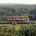
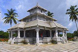
Abhinava Pandya's successor was Pandya VI, who is attributed to the construction of the Kere Basadis in the middle of a lake called Anekere in 1545 AD.[6] Immadi Bhairava (Bhairava II), who ruled after him, constructed the Chaturmukha Basadi on top of a small rocky hill in 1586 AD. This Basadis has four identical entrances from the four directions leading to the Garbagriha and hence is popularly known as Chaturmukha or Four-Faced. It is also referred to as Tribhuvana Tilaka Jina Chaityalaya and Ratnaraya Dhama in some inscriptions. The Chaturmukha Basadi is built in the form of a square hall with a lofty doorway and pillared porticos on each of its four sides along with a pillared verandah. The roof is flat and is made of massive granite slabs. It has life size statues of three Jain Theerthankaras on each side and small images of 24 Tirthankara. In all, there are 108 pillars inside and outside the temple.
There are 18 Basadis of antiquity, including Mahaveera Basadi, Chandranathaswamy Basadi, Adinathaswamy Basadi, Ananthanatha Basadi, Guru Basadi, and Padmavati Basadi. However, the rulers of Karkala were tolerant towards other religions, with temples of other religions being constructed, including the temples of Anantashayana and Venkataramana, Mahamaya Mukhyaprana, and Sri Aadi-Shakthi Veerabhadra Swamy.
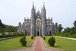
After the rule of the Pandyas, the region was annexed by Tippu Sultan, and thereafter passed on to British rule. The St Lawrence Church was built in 1845 in a village called Nitte (Attur hamlet) where people of all religions congregate every year in January for the feast of St Lawrence.[citation needed]
Landmarks[edit | edit source]
Karkala is an important pilgrimage location for Jains. There are several Hindu temples, Jain Basadis, mosques, churches, and lakes in Karkala.

Karkala has famous educational institutions like NITTE College, Bhuvanendra College, Christ King Educational institutions, and Jnanasudha Educational College.

ASI protected sites[7] in Karkala are:
- Ananthapadmanabha Temple, Ananthashayana
- Chaturmukha Basadi
- Gommateshwara Statue
- Manasthamba
- Hiriyangadi
- Sri Venkataramana Temple, Karkala
- St. Lawrence Shrine
- Parashurama Theme Park, Karkala
Geography[edit | edit source]
Karla is located at 13°12′N 74°59′E / 13.2°N 74.98°E.[8] It has an average elevation of 81 metres (265 feet).

It has a large number of picturesque lakes, such as:
- Ramasamudra Lake,
- Kamala Kere,
- NagarBavi,
- Anekere,
- Sigadi Kere,
- Matadha Kere,
- Shivathi Kere
- Jogina Kere.
Situated at the foothills of the Western Ghats, Karkala has an undulating landscape, dotted with black granite outcrops, while the western part of the town is predominantly coastal plains that stretch about 25 km west towards the Arabian Sea.
Meteorological details[edit | edit source]

| Climate data for Karkala, India (Karkala) | |||||||||||||
|---|---|---|---|---|---|---|---|---|---|---|---|---|---|
| Month | Jan | Feb | Mar | Apr | May | Jun | Jul | Aug | Sep | Oct | Nov | Dec | Year |
| Record high °C (°F) | 38 (100) |
38 (100) |
42 (108) |
41 (106) |
41 (106) |
37 (99) |
32 (90) |
33 (91) |
33 (91) |
36 (97) |
35 (95) |
35 (95) |
41 (106) |
| Average high °C (°F) | 31 (88) |
33 (91) |
34 (93) |
34 (93) |
34 (93) |
30 (86) |
28 (82) |
28 (82) |
30 (86) |
30 (86) |
31 (88) |
30 (86) |
34 (93) |
| Average low °C (°F) | 22 (72) |
24 (75) |
26 (79) |
28 (82) |
28 (82) |
27 (81) |
26 (79) |
25 (77) |
25 (77) |
25 (77) |
24 (75) |
22 (72) |
22 (72) |
| Record low °C (°F) | 17 (63) |
16 (61) |
19 (66) |
23 (73) |
23 (73) |
23 (73) |
23 (73) |
23 (73) |
20 (68) |
20 (68) |
18 (64) |
17 (63) |
16 (61) |
| Average rainfall mm (inches) | 9 (0.4) |
9 (0.4) |
19 (0.7) |
39 (1.5) |
99 (3.9) |
663 (26.1) |
629 (24.8) |
288 (11.3) |
153 (6.0) |
133 (5.2) |
57 (2.2) |
19 (0.7) |
2,117 (83.3) |
| Source: MSN Weather | |||||||||||||
Demographics[edit | edit source]
As of 2001[update] India census,[9] Karkala town had a population of 25,118. Males constitute 51% of the population and females 49%. Karkala has an average literacy rate of 82%, higher than the national average of 59.5%: male literacy is 85%, and female literacy is 79%. In Karkala, 9% of the population is under six years of age. According to recent statistics by town municipality, 25,635 people currently reside in this town, while as per the recent statistics Karkala taluk has a population of 2.10 Lacs (previous 2001 census is 2,04,571).
Hinduism is the largest religion in Karkala, with Sthanika Brahmins, Rama kshathriya, Bunts, Sapaliga/Sapalya, Billavas, Ganigas, Rajapura Saraswat Brahmins (RSB), Goud Saraswat Brahmins (GSBs), Chitpavan Brahmins,Shivalli Brahmins, Vishwakarma Brahmins, Devadiga and Mogaveera forming the major communities. There is also a significant Roman Catholic and Protestant Christian presence, and sunni Hanafi Muslim communities settled in the town, Muslims Of Karkala Speak Urdu as their mother tongue.[10]
Culture and tradition[edit | edit source]
|
The people of Karkala follow the Tuluva culture. Distinctive features of this culture include rituals of Bhuta Kola, Nagaradhane and Yakshagana. Tuluva New Year is called Bisu.
Pilinalike or Tiger Dance is a unique form of folk dance in Tulu Nadu. The tiger is considered as the mount of Goddess Durga, and the dance is performed during the Dasara and Krishna Janmashthami festivals. Bhuta Kola or spirit worship is practised across the region, usually at night, invoking the spirits via an oracle, accompanied by traditional music and practices.
The most popular local sport is Kambula, or buffalo racing, which is conducted in paddy fields. Koridakatta (Cockfighting) is another sport for village people. The Tuluva people have a high regard for nature and snakes in particular, so Nagaradhane, or snake worship, is also practised with the belief that the Naga Devatha (Snake God) will protect their communities.
Language[edit | edit source]
Karkala is a multilingual town. Tulu is the native language of the people, while the official language is Kannada. Konkani and Dakhni are also widely spoken in the town.
Administration and transportation[edit | edit source]
Being a part of Udupi district, Karkala is in the Udupi-Chikkamagalur Lok Sabha Constituency.The Karkala Town Municipal Council (ಕಾರ್ಕಳ ಪುರಸಭೆ) is the municipal corporation of the town, responsible for all public works and development.
Roadways are the main mode of transportation in Karkala. The town is well connected to Udupi, Moodabidri and Padubidri, and to Sringeri and Kalasa on the Western Ghats. The main roadways serving Karkala are:
- National Highway NH 169 (Solapur—Mangalore)
- Karnataka State Highway SH 1 (Karkala-Padubidri) which connects to National Highway 66 at Padubidri
- Karnataka State Highway SH 37 (Karkala-Bailur-Manipal-Udupi)
- Karnataka State Highway SH 1 (Karkala-Hebri)
The nearest railhead is at Udupi while the airport closest to Karkala is at Bajpe in Mangalore. There is an extensive public transport system connecting Karkala to Udupi and Mangalore.
Photo gallery[edit | edit source]
-
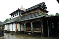 Ananthapadmanabha Temple, Karla
 -
Chaturmukha Basadi
-
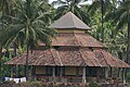 Padmavati Basadi
 -
 Gururaya basadi, Karkala
 -
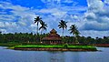 Anekere Basadi at the center of pond in Karla
 -
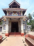 Veeramaruthi Temple, Karla
 -
 St lawrence Church, Karla
 -
 Venkataramana Temple, Karla
 -
 The Deepadhaari at Venkataramana Temple, Karla


.jpg)


See also[edit | edit source]

References[edit | edit source]
- ↑ "50th Report of the Commissioner for Linguistic Minorities in India (July 2012 to June 2013)" (PDF). Archived from the original (PDF) on 8 July 2016. Retrieved 14 January 2015.
- ↑ DHNS. "A legacy filled with culture". Deccan Herald. Retrieved 10 August 2024.
- ↑ Ramesh, K. V. (1970). A History of South Kanara: From the Earliest Times to the Fall of Vijayanagara. Karnatak University. p. 189.
- ↑ Rice, Edward P. (1982). A History of Kannada Literature. Asian Educational Services. p. 19. ISBN 978-81-206-0063-8.
- ↑ Francis, W. (1989). Gazetteer of South India. Mittal Publications. p. 376.
- ↑ Jinmanjari: Contemporary Jaina Reflections. Bramhi Society. 1998. p. 19.
- ↑ ASI Bengaluru Circle - Udupi district[permanent dead link]
- ↑ Falling Rain Genomics, Inc - Karkal
- ↑ "Census of India 2001: Data from the 2001 Census, including cities, villages and towns (Provisional)". Census Commission of India. Archived from the original on 16 June 2004. Retrieved 1 November 2008.
- ↑ South Kanara District Gazetteer 1973, p. 93
Works cited[edit | edit source]
- "People" (PDF). South Kanara District Gazetteer. Karnataka State Gazetteer. Vol. 12. Gazetteer Department (Government of Karnataka). 1973. pp. 86–125. Archived from the original (PDF) on 25 March 2009. Retrieved 26 October 2008.
External links[edit | edit source]
- About Karkala
- Mahamastakabhisheka
- All about The Mahamastakabhisheka of Lord Bahubali at Karkala, 21-31 January 2015
- All about Karkala
- Info about Padutirupathi
- News Topic about Karkala
- St. Lawrence Church, Attur, Karkala Archived 15 January 2012 at the Wayback Machine
- Shree Venkataramana Temple (Kannada Website) Archived 22 January 2019 at the Wayback Machine
- Shree Venkataramana Temple (English Website)