
WikiDwarfBOT (talk | contribs) robot: add new article |
DessieIqj504 (talk | contribs) Revised and enhanced article content |
||
| Line 1: | Line 1: | ||
{{Short description|Town in Puducherry, India}} | |||
{{For|other uses of Mahé|Mahé (disambiguation){{!}}Mahé}} | {{For|other uses of Mahé|Mahé (disambiguation){{!}}Mahé}} | ||
{{Use Indian English|date=November 2013}} | {{Use Indian English|date=November 2013}} | ||
{{Use dmy dates|date=May 2020}} | {{Use dmy dates|date=May 2020}} | ||
{{Infobox settlement | {{Infobox settlement | ||
| name | | name = Mahé | ||
| other_name | | other_name = Mayyazhi | ||
<!--Do not add Malayalam, Tamil, Telugu or Hindi name as per WP:INDICSCRIPT-->| settlement_type | <!--Do not add Malayalam, Tamil, Telugu or Hindi name as per WP:INDICSCRIPT-->| settlement_type = Municipality in puducherry | ||
| image_skyline | | image_skyline = | ||
| image_alt | | image_alt = | ||
| image_caption | | image_caption = An image of Mahe Walkway | ||
| nickname | | nickname = | ||
| pushpin_map | | pushpin_map = India Kerala#India | ||
| pushpin_label_position | | pushpin_label_position = left | ||
| pushpin_map_alt | | pushpin_map_alt = | ||
| pushpin_map_caption | | pushpin_map_caption = Location of Mahe surrounded by Kerala | ||
| coordinates | | coordinates = {{Coord|11|42|4|N|75|32|12|E|type:city_region:IN-PY|display=inline,title}} | ||
| subdivision_type | | subdivision_type = Country | ||
| subdivision_name | | subdivision_name = India | ||
| subdivision_type1 | | subdivision_type1 = Region | ||
| subdivision_type2 | | subdivision_type2 = [[List of districts of India|District]] | ||
| subdivision_name1 | | subdivision_name1 = [[Puducherry (union territory)|Puducherry]] | ||
| subdivision_name2 | | subdivision_name2 = [[Mahé district|Mahé]] | ||
| established_title | | established_title = <!-- Established --> | ||
| established_date | | established_date = | ||
| founder | | founder = | ||
| named_for | | named_for = | ||
| government_type | | government_type = [[Municipality]] | ||
| governing_body | | governing_body = [[Mahé Municipality]]<br>''(Mairie de Mahé)'' | ||
| unit_pref | | unit_pref = Metric | ||
| area_footnotes | | area_footnotes = | ||
| area_total_km2 | | area_total_km2 = 10 | ||
| area_rank | | area_rank = | ||
| elevation_footnotes | | elevation_footnotes = | ||
| elevation_m | | elevation_m = | ||
| population_total | | population_total = 41,816 (approx) | ||
| population_as_of | | population_as_of = 2011 | ||
| population_footnotes | | population_footnotes = | ||
| population_density_km2 | | population_density_km2 = 4,646 | ||
| population_rank | | population_rank = | ||
| population_demonym | | population_demonym = | ||
| demographics_type1 | | demographics_type1 = Languages | ||
| demographics1_title1 | | demographics1_title1 = Official | ||
| demographics1_title2 | | demographics1_info1 = [[Malayalam]] | ||
| timezone1 | | demographics1_title2 = Additional | ||
| utc_offset1 | | demographics1_info2 = [[English language|English]], [[French language|French]] | ||
| postal_code_type | | timezone1 = [[Indian Standard Time|IST]] | ||
| postal_code | | utc_offset1 = +5:30 | ||
| area_code | | postal_code_type = [[Postal Index Number|PIN]] | ||
| area_code_type | | postal_code = 673 310 | ||
| registration_plate | | area_code = 91 (0) 490 | ||
| unemployment_rate | | area_code_type = Telephone code | ||
| blank1_name_sec1 | | registration_plate = PY-03 | ||
| blank1_info_sec1 | | unemployment_rate = | ||
| blank1_name_sec2 | | blank1_name_sec1 = [[Human sex ratio|Sex ratio]] | ||
| blank1_info_sec2 | | blank1_info_sec1 = 1,000 [[male|♂]]/1,184[[female|♀]] | ||
| website | | blank1_name_sec2 = [[Climate of India|Climate]] | ||
| blank1_info_sec2 = [[Tropical monsoon climate]] {{small|([[Köppen climate classification|Köppen]])}} | |||
| blank2_name_sec1 | | website = {{URL|mahe.gov.in}} | ||
| blank2_info_sec1 | | blank2_name_sec1 = Literacy | ||
| blank3_name_sec1 | | blank2_info_sec1 = 97.87% | ||
| blank3_info_sec1 | | blank3_name_sec1 = [[Vidhan Sabha]] constituency | ||
| blank3_info_sec1 = 1 | |||
}} | }} | ||
Formerly part of [[French India]], | '''Mahé''' ({{IPA|en|mɑːˈheɪ, ˈmɑːhiː|lang}}, {{ipa|fr|mɑˈe|lang}}), also known as '''Mayyazhi''' ({{IPA|ml|mɐjːɐɻi|lang|}}), is a municipality and small town in the [[Mahe district]] of the [[Puducherry (union territory)|Puducherry Union Territory]]. It is situated at the mouth of the [[Mahe River]] and is surrounded by the State of [[Kerala]]. [[Kannur district|The district of Kannur]] surrounds Mahe on three sides and [[Kozhikode district]] on one side. | ||
Formerly part of [[French India]], Mahe now forms a municipality in [[Mahe district]], one of the four districts of the [[Union territory|Union Territory]] of [[Puducherry (union territory)|Puducherry]]. Mahe has one [[Member of the Legislative Assembly|representative]] in the [[Puducherry Legislative Assembly]]. | |||
==Etymology== | ==Etymology== | ||
The name '' | The name ''Mahe'' derives from ''Mayyazhi'', the name given to the local river and region in the [[Malayalam]] language.<ref>{{Cite web |title=History {{!}} Mahe {{!}} India |url=https://mahe.gov.in/history/ |access-date=2024-02-16 |language=en-US}}</ref> The original spelling found on French documents{{which|date=February 2021}} from the early 1720s is ''Mayé'', with ''Mahe'' and ''Mahie'' also found on documents, maps and geographical dictionaries until the early 19th century when the spelling ''Mahe'' became the norm. Therefore, the belief that the name of the town was given in honour of [[Bertrand-François Mahé de La Bourdonnais|Bertrand Francois Mahe de La Bourdonnais]] (1699–1753), whose later fame derived in good part from his association with India, including his capture of Maye in 1741, is incorrect.<ref>H. Castonnet des Fosses, "L’Inde avant Dupleix", ''Revue de l’Anjou'', Angers, July–August 1886, p. 91, note 1.</ref> | ||
Another claim that the spelling | Another claim that the spelling ''Mahe'' was officially adopted by the leader of the expedition that retook the city in 1726 in recognition of La Bourdonnais' role at the time is also unlikely.<ref>The detailed accounts of the expedition barely mention young La Bourdonnais' role.</ref> It is probable that the resemblance of Maye not to mention Mahe, with La Bourdonnais' family name prompted later generations to assume that the famous Frenchman was somehow directly or indirectly associated with the name to the town or the spelling of the name.{{citation needed|date=October 2021}} | ||
==History== | ==History== | ||
{{See also|French India}} | {{See also|French India}} | ||
Before the arrival of European trading companies to the [[Indian subcontinent]], this area was part of Kolathu Nadu which comprised [[ | Before the arrival of European trading companies to the [[Indian subcontinent]], this area was part of [[Kolathunadu|Kolathu Nadu]] which comprised [[Tulu Nadu]], [[Chirakkal, Kannur|Chirakkal]] and [[Kadathanadu]]. The [[French Indies Company|French East India Company]] constructed a fort on the site of Mahe in 1724, in accordance with an accord concluded between André Mollandin and Raja Vazhunnavar of [[Vatakara]] three years earlier. In 1741, Mahe de La Bourdonnais retook the town after a short period of occupation by the [[Marathi people|Marathas]]. | ||
In 1761 the British captured | In 1761, the British captured Mahe and the settlement was handed over to the Rajah of Kadathanadu. The British restored Mahe to the French as a part of the 1763 Treaty of Paris. In 1779, the Anglo-French war broke out, resulting in the French loss of Mahe. In 1783, the British agreed to restore to the French their settlements in India, and Mahe was handed over to the French in 1785.<ref>{{cite web|url=http://mahe.gov.in/mws/leftmenupages/history.html|title=History of Mahe|access-date=28 April 2013|url-status=dead|archive-url=https://web.archive.org/web/20131230232052/http://mahe.gov.in/mws/leftmenupages/history.html|archive-date=30 December 2013}}</ref> | ||
[[File:Plan de Mahe avec les attaques de Bayanor souverain du lieu.jpg|thumb|300px| | [[File:Plan de Mahe avec les attaques de Bayanor souverain du lieu.jpg|thumb|300px|Mahe in 1726. Map made after taking possession of the place and the war against the Indian king of the region supported by the British.]] | ||
[[File:Mahe FrIndia Map 1900.jpg|thumb|Map 1900.]] | [[File:Mahe FrIndia Map 1900.jpg|thumb|Map 1900.]] | ||
On the outbreak of the [[French Revolutionary Wars]] in 1793, a British force under [[James Hartley (Indian Army officer)|James Hartley]] captured | On the outbreak of the [[French Revolutionary Wars]] in 1793, a British force under [[James Hartley (Indian Army officer)|James Hartley]] captured Mahe. In 1816, the British restored Mahe to the French as a part of the 1814 Treaty of Paris, after the conclusion of the [[Napoleonic Wars]]. Mayyazhi remained under French jurisdiction as a small French colony, an enclave within [[British Raj|British India]], during the long span that began in 1816. After the [[Indian Independence Act 1947|independence of India]] the area continued to be French-ruled until 13 June 1954, when a long anti-colonial struggle culminated in its joining the Indian Union. | ||
After the French left, | After the French left, Mahe became a district of [[Puducherry (union territory)|Puducherry]] Union Territory. The area of Mahe begins from Mayyazhi Puzha in the north to Azhiyoor at the south. Mahe consists of Mahe town and Naluthara, which includes four villages: Pandakkal, Pallur, Chalakara and Chembra. The ruler of [[Kingdom of Mysore]] from the 1760s, [[Hyder Ali]] (ca 1722–1782), gifted Naluthara to the French as a token of appreciation for the assistance they provided in the war. | ||
===Liberation of | ===Liberation of Mahe=== | ||
Gandhians like [[I. K. Kumaran]] led the struggle for union with India in | Gandhians like [[I. K. Kumaran]] led the struggle for union with India in Mahe after Indian independence in 1947. The municipal office of the French administration was attacked on 21 October 1948 at 9:00 PM. The French national flag was removed and the Indian national flag was hoisted on the municipal building (''Mairie'' in French). On 26 October, a French navy ship anchored in Mahe and the French regained control of Mahe. The ship left Mahe on 31 October. Communists tried to capture Cherukallayi enclave in April 1954. Two Indians were killed during the struggle. The Indian flag was hoisted in the Naluthura enclave on 1 May. The freedom fighters conducted an embargo on Mahe from June that year. On 14 July 1954, the Mahajanasabha organized a march into Mahe, which was liberated on 16 July 1954.<ref>{{cite web |url=http://www.calicutnet.com/yourtown/mahe/history.htm |title = History. Mahe (Mayyazhi). Your Town - CalicutNet.com.}}</ref><ref>{{cite web |url=http://pib.nic.in/feature/feyr98/fe0898/f1808986.html |title = Untitled Page}}</ref><ref>{{Cite web |last=Mahotsav |first=Amrit |title=I.K. Kumaran |url=https://amritmahotsav.nic.in/unsung-heroes-detail.htm?13292 |access-date=2024-02-16 |website=Azadi Ka Amrit Mahotsav, Ministry of Culture, Government of India |language=English}}</ref> | ||
[[File:Pondicherry pro-merger activism 1954.jpg|thumb|left|Freedom fighters in | [[File:Pondicherry pro-merger activism 1954.jpg|thumb|left|Freedom fighters in Mahe, 1954]] | ||
==Demographics== | ==Demographics== | ||
As of the 2011 India census,<ref>{{cite web|url=http://www.censusindia.net/results/town.php?stad=A&state5=999|archive-url=https://web.archive.org/web/20040616075334/http://www.censusindia.net/results/town.php?stad=A&state5=999|archive-date=2004-06-16|title= Census of India 2001: Data from the 2001 Census, including cities, villages and towns (Provisional)|access-date=2008-11-01|publisher= Census Commission of India}}</ref> Mahe had a population of 41,816, predominantly [[Malayalis]]. Males constitute 46.5% of the population with Females constituting the remaining 54.5%. Mahe has an average literacy rate of 97.87%; male and female literacy were 98.63% and 97.25%, respectively. Both the Sex ratio (1184 females per 1000 male) and the literacy rates in Mahe are relatively higher compared to the rest of the nation. The national Sex ratio is 940 females per male and the literacy rate is at 74.04 per cent. | |||
In | In Mahe, 10.89% of the population consists of children under six years of age. In the 2011 census, the overall child sex ratio was 978 girls per 1000 boys compared to the previous figure of 910 girls per 1000 boys in the 2001 census data. In 2011, children under 6 formed 10.89 percent of Mahe District compared to 11.34 percent in 2001. There was an overall net decrease of 0.45 percent between 2001 and 2011. | ||
The share of [[Hindus]] in population is 66.8% (27,940) and [[Muslims]] are 30.7% (12,856) as per [[2011 | The share of [[Hindus]] in the population is 66.8% (27,940) and [[Muslims]] are 30.7% (12,856) as per the [[2011 census of India]]. Christians account for 2.29% (958) of the population. | ||
===Locationwise distribution=== | ===Locationwise distribution=== | ||
| Line 102: | Line 105: | ||
==Culture== | ==Culture== | ||
The culture and geography of this area are like almost all of those in the Malabar Coast of [[Kerala]]. There are only very few [[French language]] speakers in the town ( | The culture and geography of this area are like almost all of those in the Malabar Coast of [[Kerala]]. There are only very few [[French language]] speakers in the town (fewer than 100). Only a few influences of French remain in the area. These are mostly reflected in architecture and a few old buildings. {{Citation needed|date=January 2025}} | ||
The major | The major festivals of this region are [[Vishu]], [[Onam]] and Eid. The major language is [[Malayalam]]. The population also includes [[Arabic]] speakers. The major religion is [[Hinduism]], practised by 66.8% of the populace. | ||
The few places that upheld the rich French culture once prevalent in the area are:<ref>{{Cite news|last=Sathyendran|first=Nita|date=2019-05-08|title=The French connection in Mahe|language=en-IN|work=The Hindu|url=https://www.thehindu.com/society/history-and-culture/mahes-colonial-legacy-has-given-it-a-distinctive-character-and-place-in-history/article27065899.ece|access-date=2021-04-16|issn=0971-751X}}</ref> | The few places that upheld the rich French culture once prevalent in the area are:<ref>{{Cite news|last=Sathyendran|first=Nita|date=2019-05-08|title=The French connection in Mahe|language=en-IN|work=The Hindu|url=https://www.thehindu.com/society/history-and-culture/mahes-colonial-legacy-has-given-it-a-distinctive-character-and-place-in-history/article27065899.ece|access-date=2021-04-16|issn=0971-751X}}</ref> | ||
* [[St. Teresa's Shrine, Mahé|St. Teresa's Shrine, Mahe]] (built in 1736) | |||
* Statue of Marianne commemorating the [[French Revolution]] (situated in Tagore Park) | |||
* The Government House | |||
* The River Walk | |||
* [[Mahe Lighthouse]] | |||
* The St. George Fort in [[Cherukallayi]] | |||
==Climate== | ==Climate== | ||
Mahe has a [[tropical monsoon climate]] ([[Köppen climate classification|Köppen]] ''Am''), typical for the Kerala and Karnataka coast. There is a dry season from December to March, but the location on the windward side of the Western Ghats means that during the westerly monsoon season the region receives exceedingly heavy rainfall, reaching up to {{convert|1080|mm|in|0|disp=or}} in July. | |||
{{Weather box | {{Weather box | ||
|metric first=yes | |metric first=yes | ||
|single line=yes | |single line=yes | ||
|location= | |location= Mahe, Puducherry, India | ||
|temperature colour=pastel | |temperature colour=pastel | ||
|Jan high C = 31.6 | |Jan high C = 31.6 | ||
| Line 172: | Line 170: | ||
==Transport== | ==Transport== | ||
Mahe’s nearest airport is the recently commenced [[Kannur International Airport]], [[Mattanur]], at a distance of {{convert|40|km|abbr=off}}. The next nearest airport is the [[Kozhikode International Airport]], [[Karipur]], at a distance of {{convert|85|km|abbr=off}}. | |||
The nearest Railway Station is [[Mahe railway station]], where a few local and express trains stop. The nearest major railway stations, where several long distance trains stop, are [[Thalassery]], [[Kannur]], [[Mangalore]] and [[Vatakara]]. | The nearest Railway Station is [[Mahe railway station]], where a few local and express trains stop. The nearest major railway stations, where several long-distance trains stop, are [[Thalassery]], [[Kannur]], [[Mangalore]] and [[Vatakara]]. | ||
There are a few [[Puducherry Road Transport Corporation]] buses that operate in Mahe. Otherwise bulk of [[ | There are a few [[Puducherry Road Transport Corporation]] buses that operate in Mahe. Otherwise, the bulk of [[public transport]], including private buses based in [[Malabar District|Malabar]] and [[auto rickshaw|auto rickshaws]], is managed by the [[Kerala State Road Transport Corporation]]. | ||
==Administration== | ==Administration== | ||
[[Mahe municipality | [[Mahe municipality]] is the seat of the local administration of Mahe. The Mahe municipal area comprises {{convert|9|km2|sqmi|abbr=off}} with one Assembly Constituency, i.e. Mahe. The municipal council was established in 1978. The Regional Administrator or Regional Executive Officer is used to exercise the power of the chairman and [[Chair (officer)|Vice-Chairman]] in the capacity of Special Officer of Mahe Municipal Council. Civic elections were held during 2006 after nearly 30 years. Based on the elections, the chairman and 15 councillors of Mahe Municipality were sworn in. | ||
===Divisions=== | ===Divisions=== | ||
# | '''Mahe Pocket''' | ||
# [[Cherukallayi]] | #Mahe Town (Parakkal, Choodikotta, Manjakkal, Valavil, Mundock) | ||
# [[Chalakkara]] | ''' Cherukallayi Pocket''' | ||
# [[Chembra]] | #[[Cherukallayi]] | ||
# [[Palloor]] | '''[[Naluthara]] Pocket''' | ||
# [[Pandakkal]] | #[[Chalakkara]] (Chalakkara South and a part of Chalakkara North) | ||
#[[Chembra]] (A part of Chalakkara North) | |||
#[[Palloor]] | |||
#[[Edayilpeedika]] (a narrow strip of land between Palloor and Pandakkkal, often considered as a part of Pandakkal) | |||
#[[Pandakkal]] | |||
===Wards=== | ===Wards=== | ||
Mahe Municipality consists of 15 wards. | |||
'' | ''Mahe Pocket'' | ||
# [[Mundock]] | # [[Mundock]] | ||
# [[Manjakkal]] | # [[Manjakkal]] | ||
| Line 198: | Line 200: | ||
# [[Parakkal]] | # [[Parakkal]] | ||
# [[Valavil]] | # [[Valavil]] | ||
''Cherukallayi Pocket'' | |||
# Cherukallayi | |||
''Naluthara Pocket'' | ''Naluthara Pocket'' | ||
# Pandakkal North | # Pandakkal North | ||
# Pandakkal Central | # Pandakkal Central | ||
# Pandakkal South | # Pandakkal South (including Edayilpeedika) | ||
# Palloor North-East | # Palloor North-East | ||
# Palloor North-West | # Palloor North-West | ||
# Palloor South-West | # Palloor South-West | ||
# Palloor South-East | # Palloor South-East | ||
# Chalakkara North | # Chalakkara North (including Chembra) | ||
# Chalakkara South | # Chalakkara South | ||
==Education== | ==Education== | ||
[[Mahatma Gandhi Government Arts College]], | [[Mahatma Gandhi Government Arts College]], Mahe, was established in 1970 by [[I. K. Kumaran]]. The Mahe Co-operative College of Teacher Education was established in 2005 and is part of the Mahe Co-operative Centre for Information Technology Ltd.<ref>[http://pondicherry-today.com/system/html/eng/Mahe%20Co-operative%20College.html Mahe Co-operative College of Teacher Education (MCCTE).]{{dead link|date=January 2018 |bot=InternetArchiveBot |fix-attempted=yes }} Pondicherry Today. Retrieved 9 August 2012.</ref><ref>{{Cite web |url=http://www.maheco-operativecollege.com/index.html |title=Mahe Co-operative College of Teacher Education (MCCTE). Retrieved 9 August 2012. |access-date=9 August 2012 |archive-url=https://web.archive.org/web/20111001192404/http://www.maheco-operativecollege.com/index.html |archive-date=1 October 2011 |url-status=dead}}</ref> Other institutions include Mahe Co-operative College of Higher Education & Technology, Mahe Institute of Dental Sciences & Hospital, Rajiv Gandhi Government Ayurveda College, [[Indira Gandhi Polytechnic College, Mahe]] and Rajiv Gandhi Govt Industrial Training Institute, Mahe. | ||
The Pondicherry University Community College has a regional centre in Mahe.<ref>{{Cite web|title=Community College (Mahe) – Pondicherry University|url=https://www.pondiuni.edu.in/department/community-college-mahe-centre/|access-date=2021-06-13|language=en-US}}</ref> | The Pondicherry University Community College has a regional centre in Mahe.<ref>{{Cite web|title=Community College (Mahe) – Pondicherry University|url=https://www.pondiuni.edu.in/department/community-college-mahe-centre/|access-date=2021-06-13|language=en-US}}</ref> | ||
There is a [[Jawahar Navodaya Vidyalaya, Mahe|Jawahar Navodaya Vidyalaya (JNV Mahe)]] at Pandakkal. | There is a [[Jawahar Navodaya Vidyalaya, Mahe|Jawahar Navodaya Vidyalaya (JNV Mahe)]] at Pandakkal. | ||
There are four | There are four higher secondary schools, three high schools, two middle schools and eight lower primary schools functioning in Mahe. The higher secondary schools are affiliated with the Board of Higher Secondary Education in Kerala and the high schools are affiliated with the state’s Board of Secondary Education. Out of the three high schools, one is a French Medium, the examinations of which are conducted by the Deputy Director of French Education, Govt. of Puducherry. | ||
==Notable people== | ==Notable people== | ||
* [[M. Mukundan]], [[Malayalam]] novelist and fiction writer. | |||
* [[M. Mukundan]], [[Malayalam]] novelist and fiction writer. | * [[M. Night Shyamalan]], Indian American film director and screenwriter. | ||
* [[ | * [[I. K. Kumaran]], leader of the French Indian Liberation Movement and the first administrator of free Mahe. | ||
* [[ | * [[V. N. Purushothaman]], the last mayor and the first chairman of the Mahe municipality. | ||
* [[ | |||
==In popular culture== | ==In popular culture== | ||
*[[M. | *[[M. Mukundan]]'s novel [[Mayyazhippuzhayude Theerangalil]] (transl. ''On the Banks of the River Mayyazhi'') describes the political and social background of Mahe. | ||
*1992 Malayalam feature film [[Daivathinte Vikrithikal]], directed by [[Lenin Rajendran]] | *The 1992 Malayalam feature film [[Daivathinte Vikrithikal]], directed by [[Lenin Rajendran]], based on the novel of the same name by M. Mukundan, is set in the ex-French colony of Mayyazhi (Mahe). | ||
==See also== | ==See also== | ||
| Line 255: | Line 238: | ||
* [[Chandannagar]] | * [[Chandannagar]] | ||
* [[French India]] | * [[French India]] | ||
* [[French East India Company]] | * [[French Indies Company|French East India Company]] | ||
* [[French people in India]] | * [[French people in India]] | ||
* [[Indira Gandhi Polytechnic College, Mahe|Indira Gandhi Polytechnic College]] | * [[Indira Gandhi Polytechnic College, Mahe|Indira Gandhi Polytechnic College]] | ||
| Line 283: | Line 266: | ||
==External links== | ==External links== | ||
{{commons category|Mahé, India}} | |||
{{Wikivoyage|Mahe (India)}} | |||
* Mahe District Website - https://mahe.gov.in | * Mahe District Website - https://mahe.gov.in | ||
*Mahatma Gandhi Government Arts College, Mahe - [https://mggacmahe.ac.in Official website] | * Mahatma Gandhi Government Arts College, Mahe - [https://mggacmahe.ac.in Official website] | ||
* | * | ||
* | * | ||
| Line 302: | Line 285: | ||
{{DEFAULTSORT:Mahe, India}} | {{DEFAULTSORT:Mahe, India}} | ||
[[Category:Geography of Kannur district]] | [[Category:Geography of Kannur district]] | ||
[[Category:Cities and towns in Mahe district]] | [[Category:Cities and towns in Mahe district]] | ||
[[Category:Geography of Puducherry]] | [[Category:Geography of Puducherry]] | ||
Latest revision as of 06:44, 13 December 2025
Mahé
Mayyazhi | |
|---|---|
Municipality in puducherry | |
  Mahé Location of Mahe surrounded by Kerala  Mahé Mahé (India) | |
| Coordinates: 11°42′4″N 75°32′12″E / 11.70111°N 75.53667°E | |
| Country | India |
| Region | Puducherry |
| District | Mahé |
| Government | |
| • Type | Municipality |
| • Body | Mahé Municipality (Mairie de Mahé) |
| Area | |
| • Total | 10 km2 (4 sq mi) |
| Population (2011) | |
| • Total | 41,816 (approx) |
| • Density | 4,646/km2 (12,030/sq mi) |
| Languages | |
| • Official | Malayalam |
| • Additional | English, French |
| Time zone | UTC+5:30 (IST) |
| PIN | 673 310 |
| Telephone code | 91 (0) 490 |
| Vehicle registration | PY-03 |
| Sex ratio | 1,000 ♂/1,184♀ |
| Literacy | 97.87% |
| Vidhan Sabha constituency | 1 |
| Climate | Tropical monsoon climate (Köppen) |
| Website | mahe |
Mahé (en, Template:Ipa), also known as Mayyazhi (ml), is a municipality and small town in the Mahe district of the Puducherry Union Territory. It is situated at the mouth of the Mahe River and is surrounded by the State of Kerala. The district of Kannur surrounds Mahe on three sides and Kozhikode district on one side.
Formerly part of French India, Mahe now forms a municipality in Mahe district, one of the four districts of the Union Territory of Puducherry. Mahe has one representative in the Puducherry Legislative Assembly.
Etymology[edit | edit source]
The name Mahe derives from Mayyazhi, the name given to the local river and region in the Malayalam language.[1] The original spelling found on French documents[which?] from the early 1720s is Mayé, with Mahe and Mahie also found on documents, maps and geographical dictionaries until the early 19th century when the spelling Mahe became the norm. Therefore, the belief that the name of the town was given in honour of Bertrand Francois Mahe de La Bourdonnais (1699–1753), whose later fame derived in good part from his association with India, including his capture of Maye in 1741, is incorrect.[2]
Another claim that the spelling Mahe was officially adopted by the leader of the expedition that retook the city in 1726 in recognition of La Bourdonnais' role at the time is also unlikely.[3] It is probable that the resemblance of Maye not to mention Mahe, with La Bourdonnais' family name prompted later generations to assume that the famous Frenchman was somehow directly or indirectly associated with the name to the town or the spelling of the name.[citation needed]
History[edit | edit source]
Before the arrival of European trading companies to the Indian subcontinent, this area was part of Kolathu Nadu which comprised Tulu Nadu, Chirakkal and Kadathanadu. The French East India Company constructed a fort on the site of Mahe in 1724, in accordance with an accord concluded between André Mollandin and Raja Vazhunnavar of Vatakara three years earlier. In 1741, Mahe de La Bourdonnais retook the town after a short period of occupation by the Marathas.
In 1761, the British captured Mahe and the settlement was handed over to the Rajah of Kadathanadu. The British restored Mahe to the French as a part of the 1763 Treaty of Paris. In 1779, the Anglo-French war broke out, resulting in the French loss of Mahe. In 1783, the British agreed to restore to the French their settlements in India, and Mahe was handed over to the French in 1785.[4]


On the outbreak of the French Revolutionary Wars in 1793, a British force under James Hartley captured Mahe. In 1816, the British restored Mahe to the French as a part of the 1814 Treaty of Paris, after the conclusion of the Napoleonic Wars. Mayyazhi remained under French jurisdiction as a small French colony, an enclave within British India, during the long span that began in 1816. After the independence of India the area continued to be French-ruled until 13 June 1954, when a long anti-colonial struggle culminated in its joining the Indian Union.
After the French left, Mahe became a district of Puducherry Union Territory. The area of Mahe begins from Mayyazhi Puzha in the north to Azhiyoor at the south. Mahe consists of Mahe town and Naluthara, which includes four villages: Pandakkal, Pallur, Chalakara and Chembra. The ruler of Kingdom of Mysore from the 1760s, Hyder Ali (ca 1722–1782), gifted Naluthara to the French as a token of appreciation for the assistance they provided in the war.
Liberation of Mahe[edit | edit source]
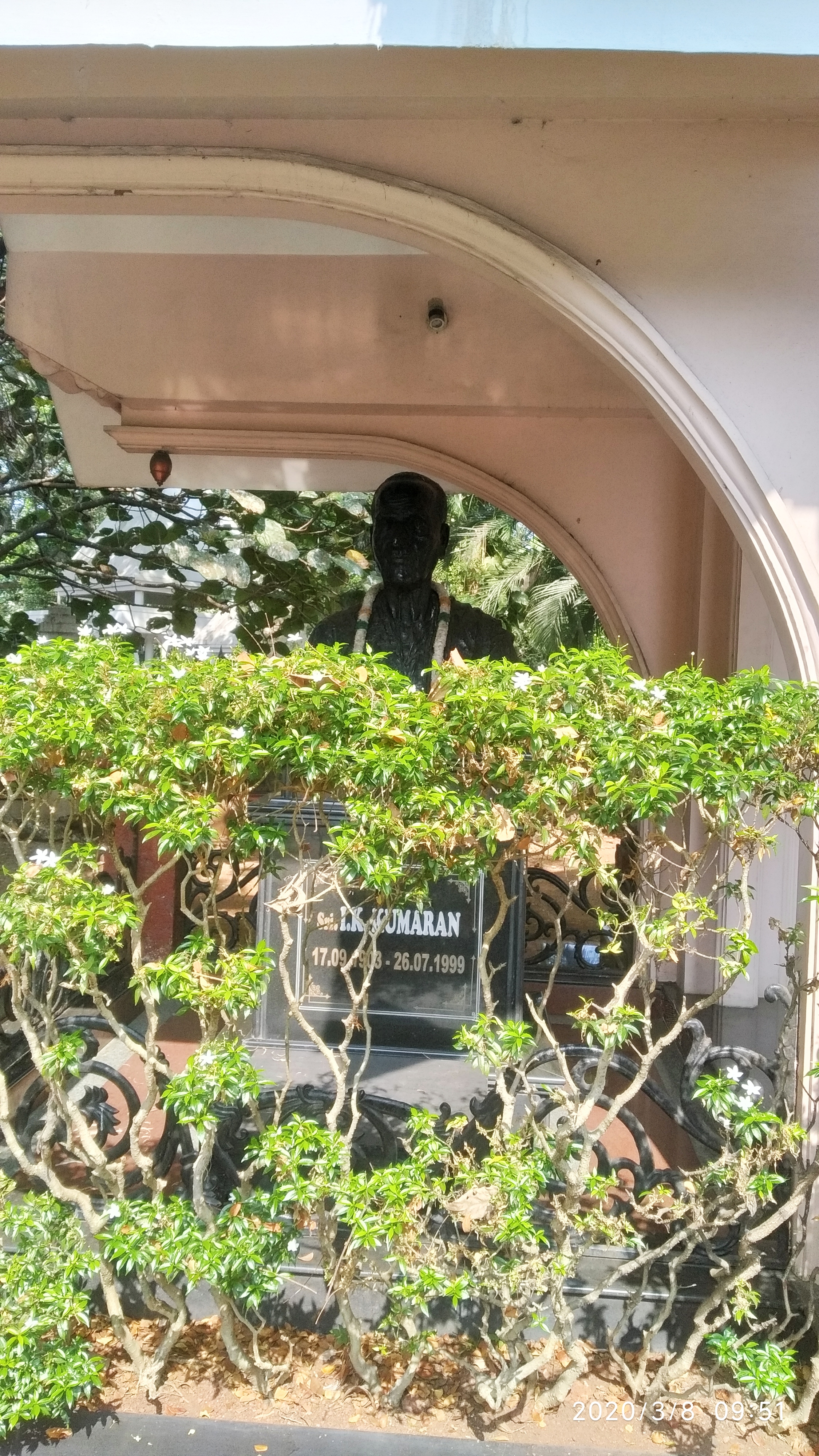
Gandhians like I. K. Kumaran led the struggle for union with India in Mahe after Indian independence in 1947. The municipal office of the French administration was attacked on 21 October 1948 at 9:00 PM. The French national flag was removed and the Indian national flag was hoisted on the municipal building (Mairie in French). On 26 October, a French navy ship anchored in Mahe and the French regained control of Mahe. The ship left Mahe on 31 October. Communists tried to capture Cherukallayi enclave in April 1954. Two Indians were killed during the struggle. The Indian flag was hoisted in the Naluthura enclave on 1 May. The freedom fighters conducted an embargo on Mahe from June that year. On 14 July 1954, the Mahajanasabha organized a march into Mahe, which was liberated on 16 July 1954.[5][6][7]

Demographics[edit | edit source]
As of the 2011 India census,[8] Mahe had a population of 41,816, predominantly Malayalis. Males constitute 46.5% of the population with Females constituting the remaining 54.5%. Mahe has an average literacy rate of 97.87%; male and female literacy were 98.63% and 97.25%, respectively. Both the Sex ratio (1184 females per 1000 male) and the literacy rates in Mahe are relatively higher compared to the rest of the nation. The national Sex ratio is 940 females per male and the literacy rate is at 74.04 per cent.
In Mahe, 10.89% of the population consists of children under six years of age. In the 2011 census, the overall child sex ratio was 978 girls per 1000 boys compared to the previous figure of 910 girls per 1000 boys in the 2001 census data. In 2011, children under 6 formed 10.89 percent of Mahe District compared to 11.34 percent in 2001. There was an overall net decrease of 0.45 percent between 2001 and 2011.
The share of Hindus in the population is 66.8% (27,940) and Muslims are 30.7% (12,856) as per the 2011 census of India. Christians account for 2.29% (958) of the population.
Locationwise distribution[edit | edit source]
- Mahe 10630
- Chalakara 6855
- Pandakal 8944
- Palloor 14250
- Cherukallayi 1255
Culture[edit | edit source]
The culture and geography of this area are like almost all of those in the Malabar Coast of Kerala. There are only very few French language speakers in the town (fewer than 100). Only a few influences of French remain in the area. These are mostly reflected in architecture and a few old buildings. [citation needed]
The major festivals of this region are Vishu, Onam and Eid. The major language is Malayalam. The population also includes Arabic speakers. The major religion is Hinduism, practised by 66.8% of the populace.
The few places that upheld the rich French culture once prevalent in the area are:[9]
- St. Teresa's Shrine, Mahe (built in 1736)
- Statue of Marianne commemorating the French Revolution (situated in Tagore Park)
- The Government House
- The River Walk
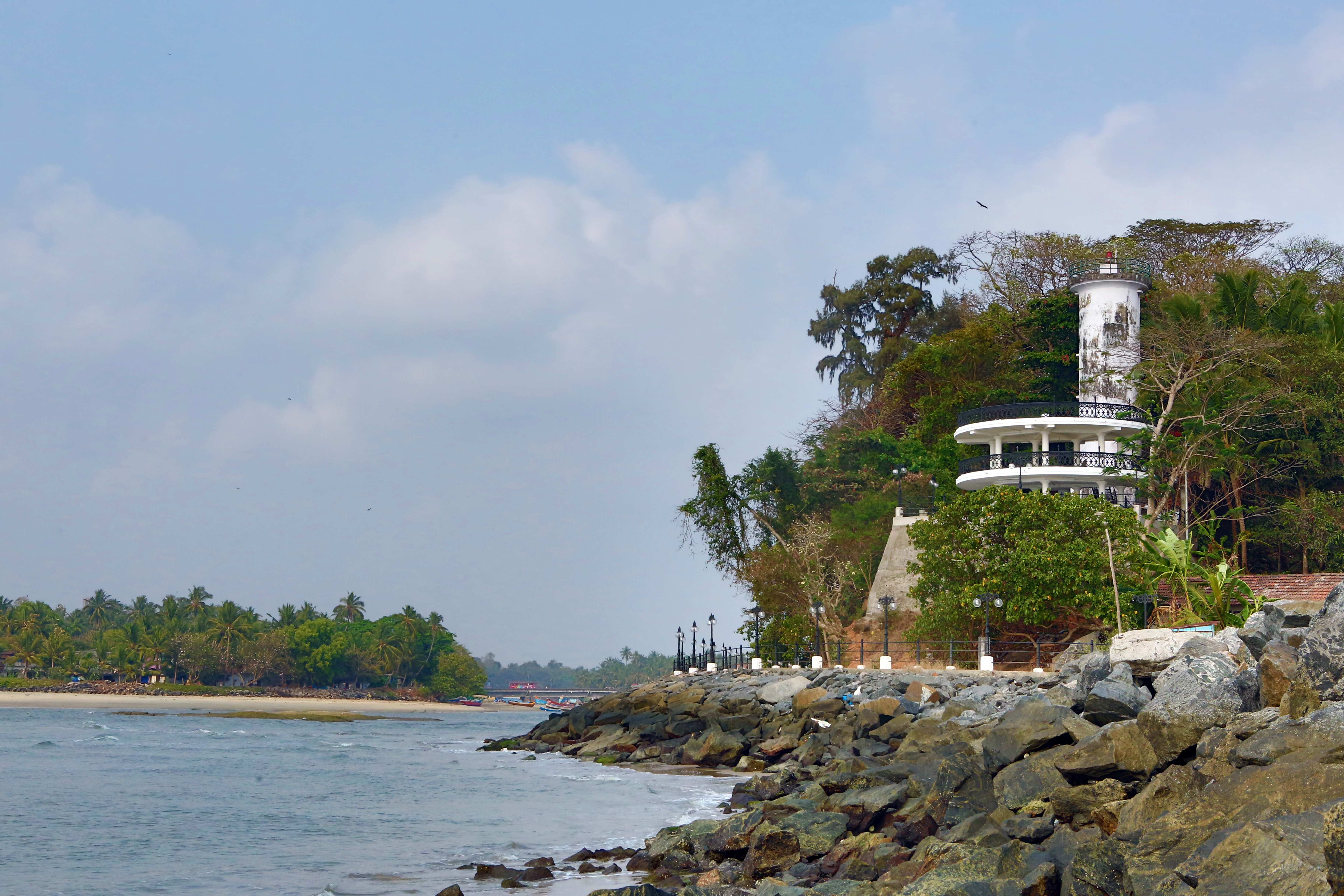
- Mahe Lighthouse
- The St. George Fort in Cherukallayi
Climate[edit | edit source]
Mahe has a tropical monsoon climate (Köppen Am), typical for the Kerala and Karnataka coast. There is a dry season from December to March, but the location on the windward side of the Western Ghats means that during the westerly monsoon season the region receives exceedingly heavy rainfall, reaching up to 1,080 millimetres or 43 inches in July.
| Climate data for Mahe, Puducherry, India | |||||||||||||
|---|---|---|---|---|---|---|---|---|---|---|---|---|---|
| Month | Jan | Feb | Mar | Apr | May | Jun | Jul | Aug | Sep | Oct | Nov | Dec | Year |
| Average high °C (°F) | 31.6 (88.9) |
32.0 (89.6) |
33.0 (91.4) |
33.2 (91.8) |
32.7 (90.9) |
29.6 (85.3) |
28.3 (82.9) |
28.7 (83.7) |
29.5 (85.1) |
30.4 (86.7) |
31.0 (87.8) |
31.4 (88.5) |
31.0 (87.8) |
| Average low °C (°F) | 21.8 (71.2) |
22.9 (73.2) |
24.6 (76.3) |
25.8 (78.4) |
25.7 (78.3) |
23.9 (75.0) |
23.4 (74.1) |
23.6 (74.5) |
23.7 (74.7) |
23.8 (74.8) |
23.3 (73.9) |
22.0 (71.6) |
23.7 (74.7) |
| Average rainfall mm (inches) | 3 (0.1) |
4 (0.2) |
13 (0.5) |
76 (3.0) |
295 (11.6) |
905 (35.6) |
1,083 (42.6) |
539 (21.2) |
274 (10.8) |
237 (9.3) |
106 (4.2) |
22 (0.9) |
3,557 (140) |
| Source: Climate-Data.org[10] | |||||||||||||
Transport[edit | edit source]
Mahe’s nearest airport is the recently commenced Kannur International Airport, Mattanur, at a distance of 40 kilometres (25 miles). The next nearest airport is the Kozhikode International Airport, Karipur, at a distance of 85 kilometres (53 miles).
The nearest Railway Station is Mahe railway station, where a few local and express trains stop. The nearest major railway stations, where several long-distance trains stop, are Thalassery, Kannur, Mangalore and Vatakara.
There are a few Puducherry Road Transport Corporation buses that operate in Mahe. Otherwise, the bulk of public transport, including private buses based in Malabar and auto rickshaws, is managed by the Kerala State Road Transport Corporation.
Administration[edit | edit source]
Mahe municipality is the seat of the local administration of Mahe. The Mahe municipal area comprises 9 square kilometres (3.5 square miles) with one Assembly Constituency, i.e. Mahe. The municipal council was established in 1978. The Regional Administrator or Regional Executive Officer is used to exercise the power of the chairman and Vice-Chairman in the capacity of Special Officer of Mahe Municipal Council. Civic elections were held during 2006 after nearly 30 years. Based on the elections, the chairman and 15 councillors of Mahe Municipality were sworn in.
Divisions[edit | edit source]
Mahe Pocket
- Mahe Town (Parakkal, Choodikotta, Manjakkal, Valavil, Mundock)
Cherukallayi Pocket
Naluthara Pocket
- Chalakkara (Chalakkara South and a part of Chalakkara North)
- Chembra (A part of Chalakkara North)
- Palloor
- Edayilpeedika (a narrow strip of land between Palloor and Pandakkkal, often considered as a part of Pandakkal)
- Pandakkal
Wards[edit | edit source]
Mahe Municipality consists of 15 wards.
Mahe Pocket
Cherukallayi Pocket
- Cherukallayi
Naluthara Pocket
- Pandakkal North
- Pandakkal Central
- Pandakkal South (including Edayilpeedika)
- Palloor North-East
- Palloor North-West
- Palloor South-West
- Palloor South-East
- Chalakkara North (including Chembra)
- Chalakkara South
Education[edit | edit source]
Mahatma Gandhi Government Arts College, Mahe, was established in 1970 by I. K. Kumaran. The Mahe Co-operative College of Teacher Education was established in 2005 and is part of the Mahe Co-operative Centre for Information Technology Ltd.[11][12] Other institutions include Mahe Co-operative College of Higher Education & Technology, Mahe Institute of Dental Sciences & Hospital, Rajiv Gandhi Government Ayurveda College, Indira Gandhi Polytechnic College, Mahe and Rajiv Gandhi Govt Industrial Training Institute, Mahe.
The Pondicherry University Community College has a regional centre in Mahe.[13]
There is a Jawahar Navodaya Vidyalaya (JNV Mahe) at Pandakkal. There are four higher secondary schools, three high schools, two middle schools and eight lower primary schools functioning in Mahe. The higher secondary schools are affiliated with the Board of Higher Secondary Education in Kerala and the high schools are affiliated with the state’s Board of Secondary Education. Out of the three high schools, one is a French Medium, the examinations of which are conducted by the Deputy Director of French Education, Govt. of Puducherry.
Notable people[edit | edit source]
- M. Mukundan, Malayalam novelist and fiction writer.
- M. Night Shyamalan, Indian American film director and screenwriter.
- I. K. Kumaran, leader of the French Indian Liberation Movement and the first administrator of free Mahe.
- V. N. Purushothaman, the last mayor and the first chairman of the Mahe municipality.
In popular culture[edit | edit source]
- M. Mukundan's novel Mayyazhippuzhayude Theerangalil (transl. On the Banks of the River Mayyazhi) describes the political and social background of Mahe.
- The 1992 Malayalam feature film Daivathinte Vikrithikal, directed by Lenin Rajendran, based on the novel of the same name by M. Mukundan, is set in the ex-French colony of Mayyazhi (Mahe).
See also[edit | edit source]
- Mahe (Union Territory Assembly constituency)
- Chandannagar
- French India
- French East India Company
- French people in India
- Indira Gandhi Polytechnic College
- Mahatma Gandhi Government Arts College, Mahe
- Municipal Administration in French India
- Bertrand-François Mahé de La Bourdonnais
- Malabar (Northern Kerala)
- St. Teresa's Shrine
- Treaty establishing De Jure Cession of French Establishments in India
- Yanam
Image gallery[edit | edit source]
-
 Morning in Mahe
 -
 Mahe Light House
 -
 Mahe Town Hall
 -
 Mahe in 1867
 -
 Mahe Church, 1940
 -
 Kallappally Mosque
 -
 Keezhur Monument
 -
 Statue of freedom fighter Kumaran


References[edit | edit source]
- ↑ "History | Mahe | India". Retrieved 16 February 2024.
- ↑ H. Castonnet des Fosses, "L’Inde avant Dupleix", Revue de l’Anjou, Angers, July–August 1886, p. 91, note 1.
- ↑ The detailed accounts of the expedition barely mention young La Bourdonnais' role.
- ↑ "History of Mahe". Archived from the original on 30 December 2013. Retrieved 28 April 2013.
- ↑ "History. Mahe (Mayyazhi). Your Town - CalicutNet.com".
- ↑ "Untitled Page".
- ↑ Mahotsav, Amrit. "I.K. Kumaran". Azadi Ka Amrit Mahotsav, Ministry of Culture, Government of India. Retrieved 16 February 2024.
- ↑ "Census of India 2001: Data from the 2001 Census, including cities, villages and towns (Provisional)". Census Commission of India. Archived from the original on 16 June 2004. Retrieved 1 November 2008.
- ↑ Sathyendran, Nita (8 May 2019). "The French connection in Mahe". The Hindu. ISSN 0971-751X. Retrieved 16 April 2021.
- ↑ "CLIMATE: MAHE", Climate-Data.org. Web: [1].
- ↑ Mahe Co-operative College of Teacher Education (MCCTE).[permanent dead link] Pondicherry Today. Retrieved 9 August 2012.
- ↑ "Mahe Co-operative College of Teacher Education (MCCTE). Retrieved 9 August 2012". Archived from the original on 1 October 2011. Retrieved 9 August 2012.
- ↑ "Community College (Mahe) – Pondicherry University". Retrieved 13 June 2021.
External links[edit | edit source]
- Mahe District Website - https://mahe.gov.in
- Mahatma Gandhi Government Arts College, Mahe - Official website
- . Encyclopædia Britannica (11th ed.). 1911.