



Kamal Guha (talk | contribs) Correction |
m Article updated with improved flow |
||
| Line 15: | Line 15: | ||
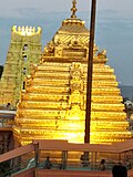
| image_caption = Clockwise from top-left: Lower temple, [[Ahobilam]], [[Belum Caves]], [[Yaganti temple|Yaganti Umamaheshwara Temple]], Shivanandishwara Temple in Kadamala Kalva, [[Srisailam Dam|Srisailam Reservoir]] | | image_caption = Clockwise from top-left: Lower temple, [[Ahobilam]], [[Belum Caves]], [[Yaganti temple|Yaganti Umamaheshwara Temple]], Shivanandishwara Temple in Kadamala Kalva, [[Srisailam Dam|Srisailam Reservoir]] | ||
| image_map = Nandyal in Andhra Pradesh (India).svg | | image_map = Nandyal in Andhra Pradesh (India).svg | ||
| | | mapframe = yes | ||
| mapframe-zoom = 7 | |||
| mapframe-wikidata = yes | |||
| map_caption = Location of Nandyal district in Andhra Pradesh | | map_caption = Location of Nandyal district in Andhra Pradesh | ||
| subdivision_type = Country | | subdivision_type = Country | ||
| subdivision_name = {{Ind}} | | subdivision_name = {{Ind}} | ||
| subdivision_type1 = [[States and union territories of India|State]] | | subdivision_type1 = [[States and union territories of India|State]] | ||
| subdivision_name1 = {{ | | subdivision_name1 = {{Flag icon image|Emblem of Andhra Pradesh.svg}} [[Andhra Pradesh]] | ||
| subdivision_type2 = [[list of regions in India|Region]] | | subdivision_type2 = [[list of regions in India|Region]] | ||
| subdivision_name2 = [[Rayalaseema]] | | subdivision_name2 = [[Rayalaseema]] | ||
| Line 27: | Line 29: | ||
| parts_type = Administrative Divisions | | parts_type = Administrative Divisions | ||
| parts = {{bulleted list| | | parts = {{bulleted list| | ||
| [[List of revenue divisions in Andhra Pradesh| | | [[List of revenue divisions in Andhra Pradesh|4 revenue divisions]] | ||
| [[List of mandals of Andhra Pradesh|29 Mandals]] | | [[List of mandals of Andhra Pradesh|29 Mandals]] | ||
| 449 [[villages]] | | 449 [[villages]] | ||
| Line 37: | Line 39: | ||
| leader_party = | | leader_party = | ||
| leader_title = [[District magistrate (India)|District collector]] | | leader_title = [[District magistrate (India)|District collector]] | ||
| leader_name = | | leader_name =Rajakumari Ganiya, I.A.S.<ref>{{Cite web | title=District Nandyal, Government of Andhra Pradesh {{!}} Sacred District-Nandi Alayalu {{!}} India | url=https://nandyal.ap.gov.in/ | access-date=2025-08-30 | website=nandyal.ap.gov.in}}</ref> | ||
| total_type = Total | | total_type = Total | ||
| area_total_km2 = 9681 | | area_total_km2 = 9681 | ||
| area_footnotes = {{Sfn|CPO|2022|p=1}} | | area_footnotes ={{Sfn|CPO|2022|p=1}} | ||
| population_as_of = 2011 | | population_as_of = 2011 | ||
| population_total = 17,81,777 | | population_total = 17,81,777 | ||
| population_footnotes = {{Sfn|CPO|2022|p=1}} | | population_footnotes ={{Sfn|CPO|2022|p=1}} | ||
| population_density_km2 = auto | | population_density_km2 = auto | ||
| timezone1 = [[Indian Standard Time|IST]] | | timezone1 = [[Indian Standard Time|IST]] | ||
| Line 54: | Line 55: | ||
| coordinates = {{coord|15.5|78.5|display=title,inline}} | | coordinates = {{coord|15.5|78.5|display=title,inline}} | ||
}} | }} | ||
'''Nandyal district''' is a [[district]] in the Indian state of [[Andhra Pradesh]] with [[Nandyal]] as its administrative headquarters, it was formed on 4 April 2022 to become one of the resultant [[List of districts of Andhra Pradesh|26 districts]]. It is part of the [[Rayalaseema]] region. The district consists of [[Nandyal revenue division]] and a newly formed [[Dhone revenue division]], [[Banaganapalle revenue division]] and [[Atmakur revenue division, Nandyal district|Atmakur revenue division]] from [[Kurnool district]]. | |||
'''Nandyal district''' is a [[district]] in the Indian state of [[Andhra Pradesh]] with [[Nandyal]] as its administrative headquarters, it was formed on 4 April 2022 to become one of the resultant [[List of districts of Andhra Pradesh|26 districts]]. It is part of the [[Rayalaseema]] region. The district consists of [[Nandyal revenue division]] and a newly formed [[Dhone revenue division]] and [[Atmakur revenue division]] from [[Kurnool district]]. | |||
== Etymology == | == Etymology == | ||
| Line 62: | Line 62: | ||
==History== | ==History== | ||
[[Belum Caves]] are geologically and historically important caves in the district. There are indications that Jain and Buddhist monks were occupying these caves centuries ago. Many Buddhists relics were found inside the caves. These relics are now housed in Museum at [[Anantapur]]. Archaeological survey of India (ASI) found remnants of vessels and other artifacts of pre-Buddhist era and has dated the remnants of vessels found in the caves to 4500 BC.<ref name="show">[http://www.showcaves.com/english/in/showcaves/Belum.html] Show Caves of India: Belum Caves</ref> | [[Belum Caves]] are geologically and historically important caves in the district. There are indications that Jain and Buddhist monks were occupying these caves centuries ago. Many Buddhists relics were found inside the caves. These relics are now housed in Museum at [[Anantapur]]. Archaeological survey of India (ASI) found remnants of vessels and other artifacts of pre-Buddhist era and has dated the remnants of vessels found in the caves to 4500 BC.<ref name="show">[http://www.showcaves.com/english/in/showcaves/Belum.html] Show Caves of India: Belum Caves</ref> | ||
Earlier in the 14th century there was a king named Nandanamaharaju. This place got the name "Nandi Temple" after that king built the Nava Nandula around it. In time, this place got the name "Nandyala". | |||
== Geography == | == Geography == | ||
This district is bounded on the north by [[Krishna]] rivers as well as [[Mahabubnagar district]] of [[Telangana]] State, on the south by [[Kadapa district]] and [[Anantapur district|Anantapur]] Districts on the west by the [[Kurnool district]] and on the east by [[ | This district is bounded on the north by [[Krishna]] rivers as well as [[Mahabubnagar district]] of [[Telangana]] State, on the south by [[Kadapa district]] and [[Anantapur district|Anantapur]] Districts on the west by the [[Kurnool district]] and on the east by [[Markapuram district]].{{Sfn|CPO|2022|p=1}} | ||
Nallamala and Erramala are the two major mountain ranges which run in parallel from north to south of the district running in parallel from north to south. The Erramalas divide the district into two parts.The eastern part of the district lies between Erramalas and Nallamalas. It has mainly black cotton soil. Krishna and Kunderu are the main rivers. Kunderu also known as Kumudvathi originates on the western side of Erramala hills. It flows towards south through Midthur, Gadivemula, Nandyal,Gospadu, Koilakuntla, Dornipadu and Chagalamarri mandals before entering [[YSR district|YSR District]].{{Sfn|CPO|2022|p=1}} | Nallamala and Erramala are the two major mountain ranges which run in parallel from north to south of the district running in parallel from north to south. The Erramalas divide the district into two parts.The eastern part of the district lies between Erramalas and Nallamalas. It has mainly black cotton soil. Krishna and Kunderu are the main rivers. Kunderu also known as Kumudvathi originates on the western side of Erramala hills. It flows towards south through Midthur, Gadivemula, Nandyal, Gospadu, Koilakuntla, Dornipadu and Chagalamarri mandals before entering [[YSR district|YSR District]].{{Sfn|CPO|2022|p=1}} | ||
Forest of the district covers an area of 3,08,607 hectares. It is about 32% of the district. It is confined to hilly areas of Nallamala and Erramala and part of Velikonda hills. Tamarind and Beedi leaves are forest's minor produce. Tigers and panthers are the main wild animals. Partridges, peacocks, red jungle foul are some of the birds in the forest. Nagarjuna Sagar – Srisailam wildlife Sanctuary with an area of 46.815 hectares is created in the north of Nallamalas to protect wildlife. Project Tiger was started near Srisailam with an area of 3,568 sq.km. As per 2003 census, there were 64 Tigers and 78 Panthers.{{Sfn|CPO|2022|p=1}} | Forest of the district covers an area of 3,08,607 hectares. It is about 32% of the district. It is confined to hilly areas of Nallamala and Erramala and part of Velikonda hills. Tamarind and Beedi leaves are forest's minor produce. Tigers and panthers are the main wild animals. Partridges, peacocks, red jungle foul are some of the birds in the forest. Nagarjuna Sagar – Srisailam wildlife Sanctuary with an area of 46.815 hectares is created in the north of Nallamalas to protect wildlife. Project Tiger was started near Srisailam with an area of 3,568 sq.km. As per 2003 census, there were 64 Tigers and 78 Panthers.{{Sfn|CPO|2022|p=1}} | ||
| Line 101: | Line 102: | ||
== Administrative divisions == | == Administrative divisions == | ||
[[File:Nandyal District Revenue Divisions.png|alt=Nandyal district revenue divisions|thumb|269x269px|Nandyal district revenue divisions]] | [[File:Nandyal District Revenue Divisions.png|alt=Nandyal district revenue divisions|thumb|269x269px|Nandyal district revenue divisions]] | ||
The district has | The district has four revenue divisions, namely Atmakur, Banaganapalle, Nandyal and Dhone, each headed by a sub collector. These revenue divisions are divided into 29 [[Tehsil|mandals]].{{Sfn|CPO|2022|p=XVII}}<ref>{{Cite news|last=Raghavendra|first=V.|date=26 January 2022|title=With creation of 13 new districts, AP now has 26 districts|work=[[The Hindu]]|url=https://www.thehindu.com/news/national/andhra-pradesh/with-creation-of-13-new-districts-ap-now-has-26-districts/article38327788.ece|url-status=live|access-date=26 January 2022|archive-url=https://web.archive.org/web/20220126110443/https://www.thehindu.com/news/national/andhra-pradesh/with-creation-of-13-new-districts-ap-now-has-26-districts/article38327788.ece|archive-date=26 January 2022|issn=0971-751X}}</ref><ref>{{Cite web|date=26 January 2022|title=AP issues draft gazette notification on 26 districts|url=https://www.deccanchronicle.com/nation/current-affairs/260122/ap-issues-draft-gazette-notification-inviting-objections-to-having-26.html|url-status=live|archive-url=https://web.archive.org/web/20220129231708/https://www.deccanchronicle.com/nation/current-affairs/260122/ap-issues-draft-gazette-notification-inviting-objections-to-having-26.html|archive-date=29 January 2022|access-date=11 February 2022|website=[[Deccan Chronicle]]|language=en}}</ref><ref>{{Cite web|date=30 March 2022|title=New districts to come into force on April 4|url=https://www.thehindu.com/news/national/andhra-pradesh/new-districts-to-come-into-force-on-april-4/article65274658.ece|access-date=31 March 2022|website=[[The Hindu]]|language=en}}</ref><ref>{{Cite web|date=31 March 2022|title=కొత్త జిల్లా తాజా స్వరూపం|url=https://www.eenadu.net/telugu-news/ap-top-news/general/2501/122062849|access-date=31 March 2022|website=[[Eenadu.net]]|language=te}}</ref> | ||
=== Mandals === | === Mandals === | ||
There are 10 mandals in Atmakur division,5 mandals in Banaganapalle division, 3 mandals in Dhone division and 12 mandals in Nandyal division. | |||
{{Div col|colwidth=14em|rules=yes|gap=2em}} | |||
# [[Atmakur revenue division, Nandyal district|Atmakur revenue division]] | |||
## [[Atmakur, Nandyal district|Atmakur]] | |||
## [[Bandi Atmakur mandal|Bandi Atmakur]] | |||
## [[Jupadu Bunglow mandal|Jupadu Bunglow]] | |||
## [[Kothapalle mandal|Kothapalle]] | |||
## [[Miduthuru mandal|Miduthuru]] | |||
## [[Nandikotkur mandal|Nandikotkur]] | |||
## [[Pagidyala mandal|Pagidyala]] | |||
## [[Pamulapadu mandal|Pamulapadu]] | |||
## [[Srisailam mandal|Srisailam]] | |||
## [[Velugodu mandal|Velugodu]] | |||
# [[Banaganapalle revenue division]] | |||
## [[Banaganapalli mandal|Banaganapalli]] | |||
## [[Kolimigundla mandal|Kolimigundla]] | |||
## [[Koilkuntla mandal|Koilkuntla]] | |||
## [[Owk mandal|Owk]] | |||
## [[Sanjamala mandal|Sanjamala]] | |||
# [[Dhone revenue division]] | |||
## [[Bethamcherla]] | |||
## [[Dhone mandal|Dhone]] | |||
## [[Peapully mandal|Peapully]] | |||
# [[Nandyal revenue division]] | |||
## [[Allagadda mandal|Allagadda]] | |||
## [[Chagalamarri mandal|Chagalamarri]] | |||
| | ## [[Dornipadu mandal|Dornipadu]] | ||
## [[Gadivemula mandal|Gadivemula]] | |||
| | ## [[Gospadu mandal|Gospadu]] | ||
## [[Mahanandi mandal|Mahanandi]] | |||
## [[Nandyal Urban mandal|Nandyal Urban]] | |||
## [[Nandyal Rural mandal|Nandyal Rural]] | |||
| | ## [[Panyam mandal|Panyam]] | ||
## [[Rudravaram mandal|Rudravaram]] | |||
| | ## Sirivella | ||
## [[Uyyalawada mandal|Uyyalawada]] | |||
| | {{Div end}} | ||
| | |||
| | |||
| | |||
| | |||
| | |||
| | |||
| | |||
| | |||
| | |||
| | |||
| | |||
| | |||
==Cities and towns == | ==Cities and towns == | ||
The district has of 6 municipalities namely [[Nandyal]], [[Dhone]], Atmakur, Allagadda, Bethamcherla and [[Nandikotkur]].{{Sfn|CPO|2022|p=XVII}} | The district has of 6 municipalities namely [[Nandyal]], [[Dhone]], Atmakur, Allagadda, Bethamcherla and [[Nandikotkur]].{{Sfn|CPO|2022|p=XVII}} | ||
{| class="wikitable static-row-numbers static-row-header-hash" | {| class="wikitable static-row-numbers static-row-header-hash" | ||
|+ | |+Cities and towns in Nandyal district | ||
Cities and towns in Nandyal district | |||
!City / Town | !City / Town | ||
!Civic status of city/town | !Civic status of city/town | ||
| Line 248: | Line 159: | ||
|- | |- | ||
|[[Dhone]] | |[[Dhone]] | ||
|Grade - | |Grade - 2 Municipality | ||
|Dhone | |Dhone | ||
| | |59,272 | ||
|- | |- | ||
|[[Nandikotkur]] | |[[Nandikotkur]] | ||
| Line 265: | Line 176: | ||
|Grade - 2 Municipality | |Grade - 2 Municipality | ||
|Nandyal | |Nandyal | ||
| | |42,545 | ||
|- | |- | ||
|[[Bethamcherla]] | |[[Bethamcherla]] | ||
| Line 271: | Line 182: | ||
|Dhone | |Dhone | ||
|38,994 | |38,994 | ||
|- | |||
|[[Banaganapalle]] | |||
|Major Grama Panchayat | |||
|Banaganapalle | |||
|36,056 | |||
|- | |||
|[[Koilakuntla]] | |||
|Major Grama Panchayat | |||
|Banaganapalle | |||
|36,105 | |||
|- | |||
|[[Srisailam]] | |||
|Grama Panchayat | |||
|Atmakur | |||
|23,257 | |||
|} | |} | ||
== Politics == | == Politics == | ||
There are one parliamentary and six assembly constituencies in Nandyal district. The parliamentary constituencies are | There are one parliamentary and six assembly constituencies in Nandyal district. The parliamentary constituencies are | ||
[[Nandyal (Lok Sabha constituency)|Nandyal]] | [[Nandyal (Lok Sabha constituency)|Nandyal]]. | ||
Until 2008 Koilakuntla was Headquarter of Koilakuntla Assembly Constituency after 2009 elections Banaganapalle became new Assembly Constituency in the place of Koilakuntla. | |||
The assembly constituencies are given below.<ref>{{cite web|url=http://ceoandhra.nic.in/Right%20to%20Infn.Act/annex1.htm|title=District-wise Assembly-Constituencies|work=ceoandhra.nic.in}}</ref> | The assembly constituencies are given below.<ref>{{cite web|url=http://ceoandhra.nic.in/Right%20to%20Infn.Act/annex1.htm|title=District-wise Assembly-Constituencies|work=ceoandhra.nic.in}}</ref> | ||
{|class="wikitable sortable" | {|class="wikitable sortable" | ||
| Line 318: | Line 244: | ||
[[File:Srisailam.jpg|thumb|Srisailam]] | [[File:Srisailam.jpg|thumb|Srisailam]] | ||
[[File:15th century Yaganti Umamahesvara temple, Andhra Pradesh India - 117.jpg|right|thumb|[[Yaganti temple|Yaganti]] Nandi]] | [[File:15th century Yaganti Umamahesvara temple, Andhra Pradesh India - 117.jpg|right|thumb|[[Yaganti temple|Yaganti]] Nandi]] | ||
[[Srisailam]] is the abode of [[Mallikarjuna Temple, Srisailam|Brahmaramba Mallikarjuna Swamy]]. The deity is in natural stone formation in the shape of ''lingam''. It is one of the twelve ''Jyotirlingams'' in the country. The temple was built in 14th century. | 1) [[Srisailam]] is the abode of [[Mallikarjuna Temple, Srisailam|Brahmaramba Mallikarjuna Swamy]]. The deity is in natural stone formation in the shape of ''lingam''. It is one of the twelve ''Jyotirlingams'' in the country. The temple was built in 14th century. | ||
[[Mahanandi|Mahanandiswara temple]] dates back to the 7th century. Nearby pushkarani has crystal clear water. | |||
[[Mahanandi|2) Mahanandiswara temple]] dates back to the 7th century. Nearby pushkarani has crystal clear water. | |||
3) [[Ahobilam]] Sri Navanarasimha Swami Temple (Nine Forms of Lord Narasimha) is in upper [[Ahobilam]]. The temple of Prahladavarada is in lower Ahobilam. It is one of the 108 Vaishnava Divya deshams in Andhra Pradesh After Tirumala Sri Venkateshwara Swami Temple. | |||
4)[[Yaganti temple|Yaganti]] is the home of Uma Maheswara Swamy. There is a huge Nandi statue with size of 15’ X 10’ X 8’. | |||
5) [[Nandavaram]] Sri Chowdeswari devi temple is there in Nandavaram village. | |||
6)[[Belum caves]] discovered in 1982 are the second largest natural caves in India after Meghalaya caves. These caves have 3 well like cavities. These are longer than Borra Caves in Vizag district. These have long passages, spacious chambers and fresh water siphons. | |||
7) [[Rollapadu Wildlife Sanctuary]] is of interest for bird watchers.{{Sfn|CPO|2022|p=III-VIII}}<ref>{{Cite book |title=AP Tourism E-Brochure Nandyal district |url=https://aptourism.gov.in/media-data/brouchers/39-10a4458b472ed3c796fd09024ce115630432e371.pdf|access-date=2023-06-28 |year=2023 }}</ref><ref>{{Cite web |url=https://nandyal.ap.gov.in/places-of-interest/ |title=Places of interest - Nandyal district |access-date=2023-04-18 |website=Nandyal district}}</ref> | |||
== Notable people == | == Notable people == | ||
[[Pendekanti Venkatasubbaiah]], who served as central minister and governor was born at Sanjamala. | #[[Potuluri Veerabrahmam]] Swami was a 16th century saint and guruvu, he had written kalagnanam(future predictions book)at Ravvalakonda near [[Banaganapalli]] and he told in his kalagnanam that [[Yaganti]] Monolithik Nandi statue is growing day by day and one day it kicks up its leg and do sounds loudly, then kaliyugam will end. | ||
#[[Pendekanti Venkatasubbaiah]], who served as central minister and governor was born at Sanjamala, He won 6 times as a Member of parliament from Nandyal lok sabha constituency, who had contested for MLA from [[Koilakuntla]] Assembly constituency but didn't won, before he become as Member of parliament. | |||
# [[Uyyalawada Narasimha Reddy]], who fought the British for the first time, was born in Nandyal District Rupanagudi village of Uyyalawada mandal, of [[Koilakuntla]] Taluka in 19th century, and he has executed hanging by Britishers at jurreru river near [[Koilakuntla]] town. | |||
#[[SPY Reddy]] who contested as an MP and won 3 times, did good to Nandyala. | |||
#[[Bhuma Nagireddy]] garu and Shri Bhuma Shobhanagireddy garu did good to Nandyala and Allagadda. | |||
#[[Buggana Rajendranath Reddy]] garu has won as MLA from [[Dhone]] assembly constituency for two times, and worked as Finance minister of Andhra Pradesh, he has done many development works for [[Bethamcherla]] mandal of [[Nandyala district]]. | |||
#[[B.V.Subbareddy]] who was born at [[koilakuntla]], served First Deputy CM of Andhra Pradesh And Second Speaker of Assembly, He won as MLA from [[Koilakuntla]] Assembly constituency many times from Madras presidency time. | |||
#Sri[[Budda Vengal Reddy]] who also Known as kaliyuga Dhanakarna won gold medal from Victoria queen. | |||
== References == | == References == | ||
{{Reflist}} | {{Reflist}} | ||
===Books=== | ===Books=== | ||
{{Cite book |url=https://cdn.s3waas.gov.in/s319b650660b253761af189682e03501dd/uploads/2022/04/2022040474.pdf|title=District Hand Book of Statistics – 2020, Nandyal district (Compiled as per the new district boundary)|year=2022|author=CPO}} | {{Cite book |url=https://cdn.s3waas.gov.in/s319b650660b253761af189682e03501dd/uploads/2022/04/2022040474.pdf|title=District Hand Book of Statistics – 2020, Nandyal district (Compiled as per the new district boundary)|year=2022|author=CPO}} | ||
| Line 333: | Line 278: | ||
* {{Official website}} | * {{Official website}} | ||
* [https://overpass-turbo.eu/map.html?Q=%2F*%0AShow%20Mandals%20with%20English%20labels%20for%20Andhra%20Pradesh%0A*%2F%0A%5Bout%3Ajson%5D%5Btimeout%3A25%5D%3B%0Aarea%5Bname%3D%22Andhra%20Pradesh%22%5D-%3E.b%3B%0Arel(area.b)%5Bname%3D%22Nandyal%22%5D%3B%0Amap_to_area%20-%3E%20.searchArea%3B%0A(%0A%20%20relation%5B%22admin_level%22%3D%226%22%5D(area.searchArea)%3B%0A)%3B%0A%2F%2F%20print%20results%0Aout%20body%20geom%3B%0A%0A%0A%0A%0A%0A%7B%7Bstyle%3A%20%0A%20%20node%2Cway%2Crelation%20%7B%0A%20%20%20%20text%3Aeval(%27tag(%22name%22)%27)%3B%0A%7D%0A%20%7D%7D Mandals of Nandyal district - an interactive overpass-turbo OSM map] | * [https://overpass-turbo.eu/map.html?Q=%2F*%0AShow%20Mandals%20with%20English%20labels%20for%20Andhra%20Pradesh%0A*%2F%0A%5Bout%3Ajson%5D%5Btimeout%3A25%5D%3B%0Aarea%5Bname%3D%22Andhra%20Pradesh%22%5D-%3E.b%3B%0Arel(area.b)%5Bname%3D%22Nandyal%22%5D%3B%0Amap_to_area%20-%3E%20.searchArea%3B%0A(%0A%20%20relation%5B%22admin_level%22%3D%226%22%5D(area.searchArea)%3B%0A)%3B%0A%2F%2F%20print%20results%0Aout%20body%20geom%3B%0A%0A%0A%0A%0A%0A%7B%7Bstyle%3A%20%0A%20%20node%2Cway%2Crelation%20%7B%0A%20%20%20%20text%3Aeval(%27tag(%22name%22)%27)%3B%0A%7D%0A%20%7D%7D Mandals of Nandyal district - an interactive overpass-turbo OSM map] | ||
{{clear}} | {{clear}} | ||
{{Nandyal district}} | |||
{{Geographic location | {{Geographic location | ||
|Centre = Nandyal district | |Centre = Nandyal district | ||
|North = [[ | |North = [[Nagarkurnool district]], [[Telangana]] | ||
|East = [[ | |East = [[Markapuram district]] | ||
|Southeast = [[Kadapa district]] | |Southeast = [[Kadapa district]] | ||
|South = [[Anantapur district]] | |South = [[Anantapur district]] | ||
|West = [[Kurnool district]] | |West = [[Kurnool district]] | ||
}} | }} | ||
{{Districts of Andhra Pradesh}} | {{Districts of Andhra Pradesh}} | ||
{{Authority control}} | {{Authority control}} | ||
Latest revision as of 17:44, 7 March 2026
Nandyal district | |
|---|---|
    .jpg) Clockwise from top-left: Lower temple, Ahobilam, Belum Caves, Yaganti Umamaheshwara Temple, Shivanandishwara Temple in Kadamala Kalva, Srisailam Reservoir | |
.svg) Location of Nandyal district in Andhra Pradesh | |
| Coordinates: 15°30′N 78°30′E / 15.5°N 78.5°E | |
| Country |  India India |
| State | Template:Flag icon image Andhra Pradesh |
| Region | Rayalaseema |
| Formed | 4 April 2022 |
| Founded by | Government of Andhra Pradesh |
| Headquarters | Nandyal |
| Administrative Divisions | |
| Government | |
| • District collector | Rajakumari Ganiya, I.A.S.[1] |
| Area | |
| • Total | 9,681 km2 (3,738 sq mi) |
| Population (2011)[2] | |
| • Total | 1,781,777 |
| • Density | 180/km2 (480/sq mi) |
| Time zone | UTC+05:30 (IST) |
| Website | nandyal |
Nandyal district is a district in the Indian state of Andhra Pradesh with Nandyal as its administrative headquarters, it was formed on 4 April 2022 to become one of the resultant 26 districts. It is part of the Rayalaseema region. The district consists of Nandyal revenue division and a newly formed Dhone revenue division, Banaganapalle revenue division and Atmakur revenue division from Kurnool district.
Etymology[edit | edit source]
The district derived its name from its headquarters Nandyal.
History[edit | edit source]
Belum Caves are geologically and historically important caves in the district. There are indications that Jain and Buddhist monks were occupying these caves centuries ago. Many Buddhists relics were found inside the caves. These relics are now housed in Museum at Anantapur. Archaeological survey of India (ASI) found remnants of vessels and other artifacts of pre-Buddhist era and has dated the remnants of vessels found in the caves to 4500 BC.[3] Earlier in the 14th century there was a king named Nandanamaharaju. This place got the name "Nandi Temple" after that king built the Nava Nandula around it. In time, this place got the name "Nandyala".
Geography[edit | edit source]
This district is bounded on the north by Krishna rivers as well as Mahabubnagar district of Telangana State, on the south by Kadapa district and Anantapur Districts on the west by the Kurnool district and on the east by Markapuram district.[2]
Nallamala and Erramala are the two major mountain ranges which run in parallel from north to south of the district running in parallel from north to south. The Erramalas divide the district into two parts.The eastern part of the district lies between Erramalas and Nallamalas. It has mainly black cotton soil. Krishna and Kunderu are the main rivers. Kunderu also known as Kumudvathi originates on the western side of Erramala hills. It flows towards south through Midthur, Gadivemula, Nandyal, Gospadu, Koilakuntla, Dornipadu and Chagalamarri mandals before entering YSR District.[2]
Forest of the district covers an area of 3,08,607 hectares. It is about 32% of the district. It is confined to hilly areas of Nallamala and Erramala and part of Velikonda hills. Tamarind and Beedi leaves are forest's minor produce. Tigers and panthers are the main wild animals. Partridges, peacocks, red jungle foul are some of the birds in the forest. Nagarjuna Sagar – Srisailam wildlife Sanctuary with an area of 46.815 hectares is created in the north of Nallamalas to protect wildlife. Project Tiger was started near Srisailam with an area of 3,568 sq.km. As per 2003 census, there were 64 Tigers and 78 Panthers.[2]
Rollapadu village of Midthur mandal is famous for the spotting of the great Indian Bustard (Batta Meka) an endangered bird. A bird sanctuary with an area of 1,600 hectares was established to protect this species.[2]
Demographics[edit | edit source]
Based on the 2011 census Nandyal district had a population of 1,781,777, of which 385,185 (21.62%) live in urban areas. Nandyal district has a sex ratio of 985 females per 1000 males. Scheduled Castes and Scheduled Tribes make up 322,825 (18.12%) and 52,784 (2.96%) of the population respectively.[5]:77–81
Based on the 2011 census, 81.08% of the population spoke Telugu and 17.25% Urdu as their first language.[6]
Administrative divisions[edit | edit source]

The district has four revenue divisions, namely Atmakur, Banaganapalle, Nandyal and Dhone, each headed by a sub collector. These revenue divisions are divided into 29 mandals.[7][8][9][10][11]
Mandals[edit | edit source]
There are 10 mandals in Atmakur division,5 mandals in Banaganapalle division, 3 mandals in Dhone division and 12 mandals in Nandyal division.
Cities and towns[edit | edit source]
The district has of 6 municipalities namely Nandyal, Dhone, Atmakur, Allagadda, Bethamcherla and Nandikotkur.[7]
| City / Town | Civic status of city/town | Revenue Division | 2011 Census
population |
|---|---|---|---|
| Nandyal | Special Grade Municipality | Nandyal | 211,424 |
| Dhone | Grade - 2 Municipality | Dhone | 59,272 |
| Nandikotkur | Grade - 2 Municipality | Atmakur | 46,593 |
| Atmakur | Grade - 3 Municipality | Atmakur | 45,703 |
| Allagadda | Grade - 2 Municipality | Nandyal | 42,545 |
| Bethamcherla | Nagar Panchayat | Dhone | 38,994 |
| Banaganapalle | Major Grama Panchayat | Banaganapalle | 36,056 |
| Koilakuntla | Major Grama Panchayat | Banaganapalle | 36,105 |
| Srisailam | Grama Panchayat | Atmakur | 23,257 |
Politics[edit | edit source]
There are one parliamentary and six assembly constituencies in Nandyal district. The parliamentary constituencies are Nandyal. Until 2008 Koilakuntla was Headquarter of Koilakuntla Assembly Constituency after 2009 elections Banaganapalle became new Assembly Constituency in the place of Koilakuntla. The assembly constituencies are given below.[12]
| Constituency number | Name | Reserved for (SC/ST/None) |
Parliament |
|---|---|---|---|
| 134 | Allagadda | None | Nandyal |
| 135 | Srisailam | None | |
| 136 | Nandikotkur | SC | |
| 139 | Nandyal | None | |
| 140 | Banaganapalle | None | |
| 141 | Dhone | None | |
| 138 | Panyam (partially) | None |
Tourism[edit | edit source]


1) Srisailam is the abode of Brahmaramba Mallikarjuna Swamy. The deity is in natural stone formation in the shape of lingam. It is one of the twelve Jyotirlingams in the country. The temple was built in 14th century.
2) Mahanandiswara temple dates back to the 7th century. Nearby pushkarani has crystal clear water.
3) Ahobilam Sri Navanarasimha Swami Temple (Nine Forms of Lord Narasimha) is in upper Ahobilam. The temple of Prahladavarada is in lower Ahobilam. It is one of the 108 Vaishnava Divya deshams in Andhra Pradesh After Tirumala Sri Venkateshwara Swami Temple.
4)Yaganti is the home of Uma Maheswara Swamy. There is a huge Nandi statue with size of 15’ X 10’ X 8’.
5) Nandavaram Sri Chowdeswari devi temple is there in Nandavaram village.
6)Belum caves discovered in 1982 are the second largest natural caves in India after Meghalaya caves. These caves have 3 well like cavities. These are longer than Borra Caves in Vizag district. These have long passages, spacious chambers and fresh water siphons.
7) Rollapadu Wildlife Sanctuary is of interest for bird watchers.[13][14][15]
Notable people[edit | edit source]
- Potuluri Veerabrahmam Swami was a 16th century saint and guruvu, he had written kalagnanam(future predictions book)at Ravvalakonda near Banaganapalli and he told in his kalagnanam that Yaganti Monolithik Nandi statue is growing day by day and one day it kicks up its leg and do sounds loudly, then kaliyugam will end.
- Pendekanti Venkatasubbaiah, who served as central minister and governor was born at Sanjamala, He won 6 times as a Member of parliament from Nandyal lok sabha constituency, who had contested for MLA from Koilakuntla Assembly constituency but didn't won, before he become as Member of parliament.
- Uyyalawada Narasimha Reddy, who fought the British for the first time, was born in Nandyal District Rupanagudi village of Uyyalawada mandal, of Koilakuntla Taluka in 19th century, and he has executed hanging by Britishers at jurreru river near Koilakuntla town.
- SPY Reddy who contested as an MP and won 3 times, did good to Nandyala.
- Bhuma Nagireddy garu and Shri Bhuma Shobhanagireddy garu did good to Nandyala and Allagadda.
- Buggana Rajendranath Reddy garu has won as MLA from Dhone assembly constituency for two times, and worked as Finance minister of Andhra Pradesh, he has done many development works for Bethamcherla mandal of Nandyala district.
- B.V.Subbareddy who was born at koilakuntla, served First Deputy CM of Andhra Pradesh And Second Speaker of Assembly, He won as MLA from Koilakuntla Assembly constituency many times from Madras presidency time.
- SriBudda Vengal Reddy who also Known as kaliyuga Dhanakarna won gold medal from Victoria queen.
References[edit | edit source]
- ↑ "District Nandyal, Government of Andhra Pradesh | Sacred District-Nandi Alayalu | India". nandyal.ap.gov.in. Retrieved 30 August 2025.
- ↑ 2.0 2.1 2.2 2.3 2.4 2.5 CPO 2022, p. 1.
- ↑ [1] Show Caves of India: Belum Caves
- ↑ "Population by Religion - Andhra Pradesh". censusindia.gov.in. Registrar General and Census Commissioner of India. 2011.
- ↑ "District Census Hand Book – Kurnool" (PDF). Census of India. Registrar General and Census Commissioner of India.
- ↑ 6.0 6.1 "Table C-16 Population by Mother Tongue: Andhra Pradesh". Census of India. Registrar General and Census Commissioner of India.
- ↑ 7.0 7.1 CPO 2022, p. XVII.
- ↑ Raghavendra, V. (26 January 2022). "With creation of 13 new districts, AP now has 26 districts". The Hindu. ISSN 0971-751X. Archived from the original on 26 January 2022. Retrieved 26 January 2022.
- ↑ "AP issues draft gazette notification on 26 districts". Deccan Chronicle. 26 January 2022. Archived from the original on 29 January 2022. Retrieved 11 February 2022.
- ↑ "New districts to come into force on April 4". The Hindu. 30 March 2022. Retrieved 31 March 2022.
- ↑ "కొత్త జిల్లా తాజా స్వరూపం". Eenadu.net (in తెలుగు). 31 March 2022. Retrieved 31 March 2022.
- ↑ "District-wise Assembly-Constituencies". ceoandhra.nic.in.
- ↑ CPO 2022, p. III-VIII.
- ↑ AP Tourism E-Brochure Nandyal district (PDF). 2023. Retrieved 28 June 2023.
- ↑ "Places of interest - Nandyal district". Nandyal district. Retrieved 18 April 2023.
Books[edit | edit source]
CPO (2022). District Hand Book of Statistics – 2020, Nandyal district (Compiled as per the new district boundary) (PDF).
External links[edit | edit source]
{{URL|example.com|optional display text}}- Mandals of Nandyal district - an interactive overpass-turbo OSM map
| District headquarters |  | |
|---|---|---|
| Revenue division | ||
| Mandal | ||
| Mandal headquarters | ||
| Cities and towns | ||
| See also | ||
| Templates of other districts | ||
Places adjacent to Nandyal district | |
|---|---|


