

Updated and refined page content |
CleanupBot (talk | contribs) m Robot: Replacing encoded entity with character |
||
| Line 23: | Line 23: | ||
}} | }} | ||
| image_alt = | | image_alt = | ||
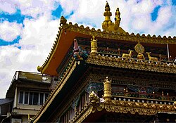
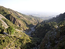
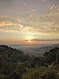
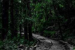
| image_caption = | | image_caption = <div style="background:#CEE0F2;"> '''From top, left to right:<br />''' Skyline of Dharamsala, [[Mcleodganj]] during winter, [[Triund]], [[Bhagsu]]nag Temple, [[Kalachakra]] Temple, [[Himachal Pradesh Cricket Association Stadium|HPCA Stadium]]</div> | ||
| nickname = Dhasa | | nickname = Dhasa | ||
| pushpin_map = India Himachal Pradesh#India | | pushpin_map = India Himachal Pradesh#India | ||
| Line 37: | Line 37: | ||
| established_title = | | established_title = | ||
| established_date = | | established_date = | ||
| named_for = Derives its name from an old Hindu sanctuary, called ''Dharamsàla'' which once stood there. | | named_for = Derives its name from an old Hindu sanctuary, called ''Dharamsàla'' which once stood there.<ref>{{cite web |url=https://cdn.s3waas.gov.in/s348aedb8880cab8c45637abc7493ecddd/uploads/2018/03/2018032931.pdf#page=104 |title=Gazetteer of the Kangra District |date=1883–1884 |publisher=Calcutta Central Press}}</ref> | ||
| seat_type = [[Himachal Pradesh Legislative Assembly|Member of legislative Assembly]] | | seat_type = [[Himachal Pradesh Legislative Assembly|Member of legislative Assembly]] | ||
| seat = Sudhir Sharma | | seat = Sudhir Sharma<ref>{{Cite web|url=https://hpvidhansabha.nic.in/Member/Details/491|title=Details {{!}} eVidhan- Himachal Pradesh|website=hpvidhansabha.nic.in}}</ref> | ||
| government_type = [[Municipal corporation (India)|Municipal Corporation]] | | government_type = [[Municipal corporation (India)|Municipal Corporation]] | ||
| governing_body = Dharamshala Municipal Corporation | | governing_body = Dharamshala Municipal Corporation<ref>{{cite web |url=https://edharamshala.in/ |title=Home |website=edharamshala.in}}</ref> | ||
| unit_pref = Metric | | unit_pref = Metric | ||
| area_footnotes = | | area_footnotes = | ||
| Line 50: | Line 50: | ||
| population_total = 53,543 | | population_total = 53,543 | ||
| population_as_of = 2024 | | population_as_of = 2024 | ||
| population_footnotes = | | population_footnotes = <ref>{{Cite web |url=https://edharamshala.in/Content/Demographics |title=Demographics – MCD-Dashboard-Document Management System}}</ref> | ||
| population_density_km2 = auto | | population_density_km2 = auto | ||
| population_rank = [[List of cities in Himachal Pradesh by population|2nd in HP]] | | population_rank = [[List of cities in Himachal Pradesh by population|2nd in HP]] | ||
| Line 68: | Line 68: | ||
| demographics1_info1 = [[Hindi language|Hindi]] | | demographics1_info1 = [[Hindi language|Hindi]] | ||
| demographics1_title2 = Native | | demographics1_title2 = Native | ||
| demographics1_info2 = [[Western Pahari|Pahari]] [[Kangri language|(Palampuri Kangri)]] | | demographics1_info2 = [[Western Pahari|Pahari]] [[Kangri language|(Palampuri Kangri)]]<ref>{{cite web| website=Literary Herald |title=Language and dialect of Himachal Pradesh |url=https://tlhjournal.com/uploads/products/35.shradha-shandil-article.pdf?utm_}}</ref> | ||
| leader_title = Mayor | | leader_title = Mayor | ||
| leader_name = Onkar Singh Nehria | | leader_name = Onkar Singh Nehria | ||
}} | }} | ||
'''Dharamshala''' ({{IPAc-en|ˈ|d|ɑːr|ə|m|ʃ|ɑː|l|ə}}, {{IPA|hi|d̪ʱərmʃaːlaː|lang}}; also spelled '''Dharamsala''') is a town in the [[India]]n state of [[Himachal Pradesh]]. It serves as the [[List of countries with multiple capitals#Subnational and supernational capitals|winter capital]] of the state and the [[Public administration|administrative headquarters]] of the [[Kangra district]] since 1855. | '''Dharamshala''' ({{IPAc-en|ˈ|d|ɑːr|ə|m|ʃ|ɑː|l|ə}}, {{IPA|hi|d̪ʱərmʃaːlaː|lang}}; also spelled '''Dharamsala''') is a town in the [[India]]n state of [[Himachal Pradesh]]. It serves as the [[List of countries with multiple capitals#Subnational and supernational capitals|winter capital]] of the state and the [[Public administration|administrative headquarters]] of the [[Kangra district]] since 1855.<ref>{{Cite web |title=Notification, Government of Himachal Pradesh |url=https://himachal.nic.in/WriteReadData/l892s/21_l892s/Dharamshala-50740507.pdf}}</ref><ref>{{Cite web |url=https://indianexpress.com/article/india/its-official-dharamshala-is-second-capital-of-himachal-pradesh-4551546/ |title=It's official, Dharamshala is second capital of Himachal Pradesh |date=2 March 2017}}</ref><ref name=hillpost2017>{{Cite web |url=http://www.hillpost.in/2017/01/dharamshala-declared-second-capital-of-himachal/107991/ |title=Dharamshala Declared Second Capital of Himachal |first=Arvind |last=Sharma |website=hillpost.in |date=20 January 2017 |access-date=17 May 2019}}</ref> The town also hosts the [[14th Dalai Lama]] and the [[Central Tibetan Administration|Tibetan government-in-exile]]. Dharamshala was a [[municipal council]] until 2015, when it was upgraded to a [[Dharamshala Municipal Corporation|municipal corporation]]. | ||
The town is located in the [[Kangra Valley]], in the shadow of the [[Dhauladhar]] range of the [[Himalayas]] at an altitude of {{convert|1457|m}}. References to Dharamshala and its surrounding areas are found in ancient [[Hindu scripture]]s such as [[Rig Veda]] and [[Mahabharata]]. The region was under [[Mughal Empire|Mughal]] influence before it was captured by the [[Sikh Empire]] in 1785. The [[East India Company]] captured the region for the British following the [[First Anglo-Sikh War]] of 1846, from when it became part of [[Punjab Province (British India)|the British Indian province of the Punjab]]. Post [[Independence of India|Indian Independence]] in 1947, it remained as a small hill station. In 1960, the [[Central Tibetan Administration]] was moved to Dharamshala when the 14th Dalai Lama established the Tibetan administration-in-exile after [[Dalai Lama's escape from China|he had to flee Tibet]]. | The town is located in the [[Kangra Valley]], in the shadow of the [[Dhauladhar]] range of the [[Himalayas]] at an altitude of {{convert|1457|m}}. References to Dharamshala and its surrounding areas are found in ancient [[Hindu scripture]]s such as [[Rig Veda]] and [[Mahabharata]]. The region was under [[Mughal Empire|Mughal]] influence before it was captured by the [[Sikh Empire]] in 1785. The [[East India Company]] captured the region for the British following the [[First Anglo-Sikh War]] of 1846, from when it became part of [[Punjab Province (British India)|the British Indian province of the Punjab]]. Post [[Independence of India|Indian Independence]] in 1947, it remained as a small hill station. In 1960, the [[Central Tibetan Administration]] was moved to Dharamshala when the 14th Dalai Lama established the Tibetan administration-in-exile after [[Dalai Lama's escape from China|he had to flee Tibet]]. | ||
In 2015 Dharamshala was included in the Smart Cities Mission | In 2015 Dharamshala was included in the Smart Cities Mission<ref>{{Cite web |title=Smart Cities |url=https://smartcities.gov.in/about-the-mission}}</ref><ref>{{Cite web |title=Dharamshala Smart City |url=https://smartcities.gov.in/node/111}}</ref> and hence will soon have smart solutions implemented for infrastructure and clean environment. | ||
Dharamshala can be viewed as a twin settlement. Upper Dharamshala, located at an elevation of approximately 1,830 metres, is home to the official residence and headquarters of the 14th Dalai Lama. This area, which includes the well-known suburbs of [[McLeod Ganj]] and Forsyth Ganj, still reflects a distinctly colonial character, echoing its British-era legacy. In contrast, Lower Dharamshala, situated at around 1,380 metres, has evolved into a bustling commercial hub, serving as the town's primary centre for trade and business. | Dharamshala can be viewed as a twin settlement. Upper Dharamshala, located at an elevation of approximately 1,830 metres, is home to the official residence and headquarters of the 14th Dalai Lama. This area, which includes the well-known suburbs of [[McLeod Ganj]] and Forsyth Ganj, still reflects a distinctly colonial character, echoing its British-era legacy. In contrast, Lower Dharamshala, situated at around 1,380 metres, has evolved into a bustling commercial hub, serving as the town's primary centre for trade and business.<ref name="HPTDC">{{Cite web |title=Dharamshala – Himachal Pradesh Tourism Development Corporation (HPTDC) |url=https://hptdc.in/index.php/dharamshala/ |website=hptdc.in |access-date=26 May 2025}}</ref> | ||
The economy of the region is highly dependent on [[agriculture]] and [[tourism]]. The town is now a major hill station and spiritual centre. | The economy of the region is highly dependent on [[agriculture]] and [[tourism]]. The town is now a major hill station and spiritual centre. | ||
As of 2024, Dharamshala is the second most populous city in Himachal Pradesh, with a population of approximately 53,543, ranking only after the state capital, [[Shimla]]. | As of 2024, Dharamshala is the second most populous city in Himachal Pradesh, with a population of approximately 53,543, ranking only after the state capital, [[Shimla]].<ref>{{cite web |title=About Us |url=https://edharamshala.in/Content/AboutUs |website=Dharamshala Municipal Corporation |access-date=22 Jun 2025}}</ref><ref>{{cite web| url = http://www.censusindia.gov.in/2011-prov-results/paper2/data_files/India2/Table_3_PR_UA_Citiees_1Lakh_and_Above.pdf | title = Urban Agglomerations/Cities having population 1 lakh and above |work= Provisional Population Totals, Census of India 2011 | publisher = |accessdate = 2012-07-07 }}</ref> | ||
==Etymology== | ==Etymology== | ||
''Dharamshala'' ([[Devanagari]]: धर्मशाला; [[ITRANS]]: Dharmashala; [[IAST]]: Dharmaśālā) is a [[Hindi]] word derived from [[Sanskrit]] that is a compound of the words ''[[dharma]]'' (धर्म) and ''shālā'' (शाला), literally 'House or place of Dharma'. In common usage, the word refers to a shelter or rest house for spiritual pilgrims. | ''Dharamshala'' ([[Devanagari]]: धर्मशाला; [[ITRANS]]: Dharmashala; [[IAST]]: Dharmaśālā) is a [[Hindi]] word derived from [[Sanskrit]] that is a compound of the words ''[[dharma]]'' (धर्म) and ''shālā'' (शाला), literally 'House or place of Dharma'. In common usage, the word refers to a shelter or rest house for spiritual pilgrims.<ref>{{cite web|url=https://www.merriam-webster.com/dictionary/dharmsala|title=Dharmsala, meaning|publisher=Merriam Webster|access-date=22 October 2023}}</ref> When permanent settlements were established in the region, there was one such rest house from which the settlement took its name.<ref name="dsal.uchicago.edu">{{cite book |chapter-url=https://dsal.uchicago.edu/reference/gazetteer/pager.html?objectid=DS405.1.I34_V11_307.gif |title=The Imperial Gazetteer of India |chapter=Dharmsala |volume=XI |pages=301–302 |location=Oxford |publisher=Clarendon Press |year=1908 |via=Digital South Asia Library}}</ref> | ||
Due to a lack of uniform observance of conventions for Hindi [[transcription (linguistics)|transcription]] and [[Devanagari transliteration|transliteration of the script used]] to write it, [[Devanagari]], the name of the town has been variously [[romanised]] in English and other languages as ''Dharamshala'', ''Dharamsala'', ''Dharmshala'' and ''Dharmsala''. | Due to a lack of uniform observance of conventions for Hindi [[transcription (linguistics)|transcription]] and [[Devanagari transliteration|transliteration of the script used]] to write it, [[Devanagari]], the name of the town has been variously [[romanised]] in English and other languages as ''Dharamshala'', ''Dharamsala'', ''Dharmshala'' and ''Dharmsala''.<ref name="dsal.uchicago.edu"/> These four permutations result from two variables: the transcription of the word धर्म (dharma)—particularly the second syllable (र्म) and that of the third syllable (शा). A strict transliteration of धर्म as written would be 'dharma' {{IPA|[ˈdʱərmə]}}. In the modern spoken Hindi of the region, there is a common [[Metathesis (linguistics)|metathesis]] in which the vowel and consonant sounds in the second syllable of certain words (including धर्म) are transposed, which changes 'dharma' to 'dharam' pronounced somewhere between {{IPA|[ˈdʱərəm]}} and {{IPA|[ˈdʱərm]}}. Regarding the third syllable, the Devanagari श corresponds to the English ''sh'' sound, {{IPAblink|ʃ}} and thus शाला is transcribed in English as 'shala'. Therefore, the most accurate phonetic transcription of the Hindi धर्मशाला into Roman script for common (non-technical) English usage is either 'Dharamshala' or, less commonly, 'Dharmshala', both of which render the ''sh'' ({{IPA|/ʃ/}}) sound of ''श'' in English as 'sh' to convey the correct native pronunciation, 'Dharam''sh''ala' {{IPA|[dʱərəmˈʃaːlaː]}} or 'Dharm''sh''ala' ({{IPA|[dʱərmˈʃaːlaː]}}). Regardless of spelling variations, the correct native pronunciation is with the ''sh'' sound ({{IPA|/ʃ/}}).<ref name="multiconverter">[http://tdil-dc.in/san/transliteration/table.html Mapping table with 7 methods] of Harvard-Kyoto, ITRANS, Velthuis, SLP, WX-system and IAST, Devanagari used by [http://tdil-dc.in/san/transliteration/index_dit.html ILTP-DC for Sanskrit]. [http://tdil-dc.in/san/transliteration/index_dit.html Sanskrit transliteration tool. Convert from one scheme to another]. Maintained by the 'Indian Language Technology Proliferation and deployment centre' (ILTP-DC) of the government of India. Works with 7 systems: Harvard-Kyoto, ITRANS, Velthuis, SLP, WX-system, and IAST, Devanagari.</ref> | ||
==History== | ==History== | ||
===Early history=== | ===Early history=== | ||
References to Dharamshala and its surrounding areas are found in ancient [[Hindu scripture]]s such as [[Rig Veda]] and [[Mahabharata]]. | References to Dharamshala and its surrounding areas are found in ancient [[Hindu scripture]]s such as [[Rig Veda]] and [[Mahabharata]].<ref name="HP">{{Cite web|url=https://hpkangra.nic.in/history/|title=History of Kangra|access-date=22 October 2023|publisher=Government of Himachal Pradesh}}</ref> There are mentions of the region by [[Pāṇini]] in 4th century BC and by [[China|Chinese]] traveller [[Heun Tsang|Xuanzang]] during the reign of king [[Harshavardhana]] in 7th century AD.<ref>{{cite book|title=Buddhist Western Himalaya: A politico-religious history|first=Omacanda|last=Hāṇḍā|year=2001|page=43|publisher=Indus Publishing Company|isbn=81-85182-03-5}}</ref> The indigenous people of the Dharamshala area (and the surrounding region) are the [[Gaddis]], a predominantly [[Hindu]] group who traditionally lived a nomadic or semi-nomadic [[transhumance|transhumant]] lifestyle.<ref>{{cite news|url=https://www.livemint.com/Leisure/Wzkj0Wad8pumyLNu5nkfGK/A-journey-with-Gaddi-pastoralists.html |title=A journey with Gaddi Pastoralists|date=6 October 2016|newspaper=Live Mint|access-date=20 October 2023}}</ref> | ||
The region was subject to attacks from Mughal rulers [[Mahmud of Ghazni]] in 1009 and [[Firuz Shah Tughlaq]] in 1360. In 1566, [[Akbar]] captured the region and brought it under the Mughal rule. As the Mughal rule disintegrated, [[Sikh Empire|Sikh]] chieftain [[Jai Singh Kanheya|Jai Singh]] brought the region to his control and gave it to [[Sansar Chand]] of the Katoch dynasty, legitimate [[Rajput]] prince in 1785. [[Gurkhas]] invaded and captured the region in 1806 before being defeated by [[Ranjit Singh]] in 1809. The Katoch dynasty was reduced to the status of [[jagirdar]]s under the treaty of Jawalamukhi signed between Chand and Singh in 1810. Post the death of Chand, Ranjit Singh annexed the region into the Sikh empire. | The region was subject to attacks from Mughal rulers [[Mahmud of Ghazni]] in 1009 and [[Firuz Shah Tughlaq]] in 1360. In 1566, [[Akbar]] captured the region and brought it under the Mughal rule. As the Mughal rule disintegrated, [[Sikh Empire|Sikh]] chieftain [[Jai Singh Kanheya|Jai Singh]] brought the region to his control and gave it to [[Sansar Chand]] of the Katoch dynasty, legitimate [[Rajput]] prince in 1785. [[Gurkhas]] invaded and captured the region in 1806 before being defeated by [[Ranjit Singh]] in 1809. The Katoch dynasty was reduced to the status of [[jagirdar]]s under the treaty of Jawalamukhi signed between Chand and Singh in 1810. Post the death of Chand, Ranjit Singh annexed the region into the Sikh empire.<ref name="HP"/> | ||
===British occupation=== | ===British occupation=== | ||
The [[East India Company]] captured the region following the [[First Anglo-Sikh War]] of 1846. Under the [[British Raj]], the regions were part of [[Punjab Province (British India)|the undivided British Indian province of the Punjab]], and were ruled by the [[List of governors of Punjab (British India)|governors of Punjab]] from [[Lahore]]. | The [[East India Company]] captured the region following the [[First Anglo-Sikh War]] of 1846. Under the [[British Raj]], the regions were part of [[Punjab Province (British India)|the undivided British Indian province of the Punjab]], and were ruled by the [[List of governors of Punjab (British India)|governors of Punjab]] from [[Lahore]].<ref name="dsal.uchicago.edu"/> In 1860, the 66th [[Gurkha]] [[Light Infantry]] was moved from [[Kangra, Himachal Pradesh|Kangra]] to Dharamshala, which was at first made a subsidiary [[cantonment]].<ref>{{cite web|url=http://www.mcllo.com|title=Mcledoganj Information|publisher=mcllo.com|access-date=22 October 2023}}</ref><ref name="dsal.uchicago.edu"/> The Battalion was later renamed [[1st Gurkha Rifles]].<ref>{{cite book |last=Parker |first=John |title=The Gurkhas: The Inside Story of the World's Most Feared Soldiers |publisher=Headline Book Publishing |location=London |date=2005|isbn=978-0-7553-1415-7|page=45}}</ref> Dharamshala became a popular [[hill station]] in the British Raj era.<ref name="dsal.uchicago.edu"/> The [[1905 Kangra earthquake]] devastated the Kangra Valley, destroying the cantonment, much of the infrastructure of the region, and killing nearly 20,000 people: 1,625 at Dharmasala, including 15 foreigners and 112 of the Gurkha garrison.<ref name="dsal.uchicago.edu"/> Many of the Gurkhas were part of the [[Indian National Army]] founded by [[Netaji Subhas Chandra Bose]] taking part in the [[Indian Independence movement]].{{citation needed|date=December 2025}} | ||
===Post independence=== | ===Post independence=== | ||
[[File:20170821 133842000 iOS.jpg|thumb|The architecture in Dharamsala has a Buddhist influence]] | [[File:20170821 133842000 iOS.jpg|thumb|The architecture in Dharamsala has a Buddhist influence]] | ||
Post [[Independence of India|Indian Independence]] in 1947, it remained as a small hill station. On 29 April 1959, the 14th [[Dalai Lama]] [[Tenzin Gyatso]] established the Tibetan administration-in-exile in [[Mussoorie]] when [[Dalai Lama's escape from China|he had to flee Tibet]]. | Post [[Independence of India|Indian Independence]] in 1947, it remained as a small hill station. On 29 April 1959, the 14th [[Dalai Lama]] [[Tenzin Gyatso]] established the Tibetan administration-in-exile in [[Mussoorie]] when [[Dalai Lama's escape from China|he had to flee Tibet]].<ref>{{cite news|url=https://www.dailypioneer.com/2016/state-editions/when-dalai-lamas-date-with-india-began-in-mussoorie-in-one-april.html |title=When Dalai lama's date with India began in Mussoorie in one April |first=Jaskiran |last=Chopra |newspaper=[[The Pioneer (India)]]|date=7 April 2016 |access-date=17 May 2019}}</ref> In May 1960, the [[Central Tibetan Administration]] was moved to Dharamshala when [[Jawaharlal Nehru]], then [[Prime Minister of India]] allowed him and his followers to settle in [[McLeod Ganj]] north of Dharamshala.<ref>{{Cite magazine |date=1959 |url=https://time.com/3742242/dalai-lama-1959/|title=How and Why the Dalai Lama Left Tibet|magazine=[[Time (magazine)|Time]]|access-date=22 October 2023}}</ref><ref>{{Cite book|title=Tears of Blood: A Cry for Tibet|last=Craig|first=Mary|publisher=Counterpoint|date=1999|isbn=978-1-5824-3025-6|location=Washington, D.C.|page=142|oclc=41431635}}</ref> There they established the "[[Government of Tibet in exile|government-in-exile]]" in 1960 and the [[Namgyal Monastery]].<ref>{{cite news|url=https://www.reuters.com/article/us-india-usa-tibet-idUSKBN18617F |title=U.S. lawmakers not backing down on human rights for Tibet, Pelosi says |first=Douglas |last=Busvine |work=[[Reuters]]|date=10 May 2017|access-date=17 May 2019}}</ref> In 1970, the Dalai Lama opened the [[Library of Tibetan Works and Archives]] which is one of the most important institutions for [[Tibetology]].<ref>{{Cite web|url=https://tibetanlibrary.org/contact/|title=Library of Tibetan Works and Archives|publisher=Tibetan Library|access-date=22 October 2023}}</ref> | ||
Several thousand [[Tibetan people|Tibetan]] exiles have now settled in the area where monasteries, temples, and schools have come up. It has become an important tourist destination with many hotels and restaurants, leading to growth in tourism and commerce. | Several thousand [[Tibetan people|Tibetan]] exiles have now settled in the area where monasteries, temples, and schools have come up. It has become an important tourist destination with many hotels and restaurants, leading to growth in tourism and commerce.<ref>{{Cite news |url=https://petzenia.com/blog/best-bird-watching-spots-india/ |title=Some of the Best Bird Watching Spots in India |date=4 December 2016 |work=Petzenia Blog |access-date=10 October 2017 |language=en-US |archive-date=10 October 2017 |archive-url=https://web.archive.org/web/20171010212346/https://petzenia.com/blog/best-bird-watching-spots-india/|url-status=dead }}</ref> In 2017, Dharamshala was made the winter capital of Himachal Pradesh with the legislative assembly located at [[Sidhbari]].<ref>{{cite news|url=https://www.ndtv.com/india-news/dharamsala-declared-second-capital-of-himachal-pradesh-1650683 |title=Dharamsala Declared Second Capital of Himachal Pradesh |publisher=[[NDTV India]]|date=19 January 2017|access-date=17 May 2019}}</ref> | ||
==Geography== | ==Geography== | ||
[[File:Dharamsala-valley.jpg|thumb|View of the [[Kangra Valley]] from Bhagsu Nag]] | [[File:Dharamsala-valley.jpg|thumb|View of the [[Kangra Valley]] from Bhagsu Nag]] | ||
[[File:Sunset in Dharamshala.jpg|thumb|Sunset from Maximus mall overlooking Dharamshala valley ]] | [[File:Sunset in Dharamshala.jpg|thumb|Sunset from Maximus mall overlooking Dharamshala valley ]] | ||
Dharamshala has an average elevation of {{cvt|1457|m|ft}}, covering an area of almost {{cvt|8.51|km2|sqmi}}. | Dharamshala has an average elevation of {{cvt|1457|m|ft}}, covering an area of almost {{cvt|8.51|km2|sqmi}}.<ref>{{cite report|title=Area of Dharamshala Town|url=http://himachal.nic.in/tcp/DevPlanDharamshala.pdf |url-status=dead |archive-url=https://web.archive.org/web/20120424075155/http://himachal.nic.in/tcp/DevPlanDharamshala.pdf|archive-date=24 April 2012}}</ref> Dharamsala is located in the [[Kangra Valley]], in the shadow of the [[Dhauladhar]] mountains. The town is divided into two distinct sections "Lower Dharamshala" and [[McLeod Ganj]] with a narrow road surrounded by [[pine]], [[Himalayas|Himalayan]] [[oak]], and [[rhododendron]] connecting the regions.<ref>{{cite book|title=India Forts, Palaces, the Himalaya|first1=Vanessa|last1=Betts|first2=Victoria|last2=McCulloch| year=2013|page=240|isbn=978-1-9072-6374-3|publisher=Footprint}}</ref> | ||
==Climate== | ==Climate== | ||
Dharamshala has a [[monsoon]] influenced, [[humid subtropical climate]] ([[Köppen climate classification|Köppen]]: ''Cwa''). Summer begins in early April and peaks in May when temperatures can reach {{cvt|36|°C}} and lasts until the start of June. From June to mid-September is the [[Monsoon of South Asia|monsoon season]], when up to {{cvt|3000|mm}} of rainfall can be experienced, making Dharamshala one of the wettest places in the state. Autumn is mild and lasts from October to the end of November. | Dharamshala has a [[monsoon]] influenced, [[humid subtropical climate]] ([[Köppen climate classification|Köppen]]: ''Cwa''). Summer begins in early April and peaks in May when temperatures can reach {{cvt|36|°C}} and lasts until the start of June. From June to mid-September is the [[Monsoon of South Asia|monsoon season]], when up to {{cvt|3000|mm}} of rainfall can be experienced, making Dharamshala one of the wettest places in the state. Autumn is mild and lasts from October to the end of November. | ||
Autumn temperatures average around {{cvt|16|-|17|°C}}. Winter starts in December and continues until late February. Snow and sleet are common during the winter in upper Dharamshala (including McLeodganj, Bhagsu Nag, and Naddi). Lower Dharamshala receives little frozen precipitation except for hail. Historically, the Dhauladhar mountains used to remain snow-covered all year long; however, in recent years they have been losing their snow blanket during dry spells. | Autumn temperatures average around {{cvt|16|-|17|°C}}. Winter starts in December and continues until late February. Snow and sleet are common during the winter in upper Dharamshala (including McLeodganj, Bhagsu Nag, and Naddi). Lower Dharamshala receives little frozen precipitation except for hail. Historically, the Dhauladhar mountains used to remain snow-covered all year long; however, in recent years they have been losing their snow blanket during dry spells.<ref>{{cite book|title=Climate Change and its Ecological Implications for the Western Himalaya|last=Chopra|first=V. L.|year=2013|page=145|isbn=978-9-3873-0735-3|publisher=Scientific Publishers}}</ref> | ||
{{Dharamshala weatherbox}} | {{Dharamshala weatherbox}} | ||
| Line 119: | Line 119: | ||
{{bar box | {{bar box | ||
|width=300px | |width=300px | ||
|title=Religions in Dharamsala | |title=Religions in Dharamsala<ref>{{Cite web |url=http://www.census2011.co.in/data/religion/district/230-kangra.html |title=Kangra District Religion Data – Census 2011}}</ref> | ||
|titlebar=#Fcd116 | |titlebar=#Fcd116 | ||
|left1=Religion | |left1=Religion | ||
| Line 130: | Line 130: | ||
{{bar percent|Others|Black|1.85}}}} | {{bar percent|Others|Black|1.85}}}} | ||
As of the [[2011 Census of India]], Dharamshala had a population of 30,764. In 2015, the area under the administration of the municipal body was expanded with a revised population of 53,543 in 10,992 households. | As of the [[2011 Census of India]], Dharamshala had a population of 30,764. In 2015, the area under the administration of the municipal body was expanded with a revised population of 53,543 in 10,992 households.<ref>{{Cite report|url=http://ud-hp.in/pdf/POPULATION%20AS%20PER%20CENSUS%202011.pdf|title=ULB Population Himachal Pradesh (2011 census)|publisher=Government of Himachal Pradesh|access-date=22 October 2023}}</ref> Males constituted 55% of the population and females 45%. Dharamshala has an average literacy rate of 87%, higher than the national average of 74.04%: male literacy is 90% and female literacy is 83%. 9% of the population is under 6 years of age with a [[sex ratio]] of 941.<ref>{{cite web |url=http://www.censusindia.net/results/town.php?stad=A&state5=999 |archive-url=https://web.archive.org/web/20040616075334/http://www.censusindia.net/results/town.php?stad=A&state5=999 |archive-date=16 June 2004 |title=Census of India 2001: Data from the 2011 Census, including cities, villages and towns (Provisional) |access-date=1 November 2008 |publisher=Census Commission of India}}</ref> [[Hinduism]] is the most followed religion followed by [[Buddhism]]. [[Hindi]] is the official language while other languages spoken include [[Gaddi language|Gaddi]], [[Kangri language|Kangri]], [[Punjabi Language|Punjabi]], [[English language|English]], [[Lhasa Tibetan]], [[Nepali language|Nepali]] and [[Pahari language|Pahari]].<ref>{{Cite web|title=Culture of Dharamsala - People, Language, Food, Art & Culture|url=https://www.ftd.travel/dharamsala-culture|access-date=14 May 2021|website=FTD travel|language=en-us}}</ref> | ||
==Administration and politics== | ==Administration and politics== | ||
Dharamshala became a [[municipal corporation]] in 2015; before that it had been a [[municipal council]]. | Dharamshala became a [[municipal corporation]] in 2015; before that it had been a [[municipal council]].<ref>{{Cite news |url=https://timesofindia.indiatimes.com/city/shimla/Dharamsala-Municipal-Council-upgraded-to-Municipal-Corporation/articleshow/49040526.cms|title=TOI article |website=[[The Times of India]]|date=21 September 2015|access-date=22 October 2023}}</ref> The corporation has 17 wards under its jurisdiction.<ref>{{Cite web|url=https://edharamshala.in/Content/Wards |title=Municipal Corporation Website – Wards |date=2 March 2020}}</ref> The current [[mayor]] is Onkar Singh Nehria of the [[Bharatiya Janata Party]] (BJP), elected in 2022.<ref>{{Cite news|title=BJP's Onkar Nehria is Dharamsala Mayor|url=https://www.tribuneindia.com/news/himachal/bjps-onkar-nehria-is-dharamsala-mayor-238557|access-date=22 October 2023|date=4 August 2022|newspaper=Tribune|language=en}}</ref> The town is part of the [[Dharamshala Assembly constituency]] that elects its member to the [[Himachal Pradesh Legislative Assembly]] and [[Kangra Lok Sabha constituency]] that elects its member to the [[Lok Sabha]], lower house of the [[Indian Parliament]].<ref>{{cite news |title=Sitting and previous MLAs from Dharamshala Assembly constituency |url=http://www.elections.in/himachal-pradesh/assembly-constituencies/dharamshala.html |work=Elections.in |access-date= 1 November 2017 }}</ref><ref>{{cite news|url=http://eci.nic.in/eci_main/CurrentElections/CONSOLIDATED_ORDER%20_ECI%20.pdf|title=Delimination of Parliamentary constituencies, 2008|work=Election commission of India|access-date=1 November 2017|url-status=dead|archive-url=https://web.archive.org/web/20171118160217/http://eci.nic.in/eci_main/CurrentElections/CONSOLIDATED_ORDER%20_ECI%20.pdf|archive-date=18 November 2017}}</ref> | ||
==Economy== | ==Economy== | ||
[[File:20170821 133215000 iOS.jpg|thumb|A trekking trail in Dharamsala]] | [[File:20170821 133215000 iOS.jpg|thumb|A trekking trail in Dharamsala]] | ||
The economy of the region is highly dependent on [[agriculture]] and [[tourism]]. The main crops grown in the valley are [[rice]], [[wheat]], and [[tea]]. Dharamshala has many tea plantations which produce the [[Kangra tea]] which has been granted [[geographical indication]] status. | The economy of the region is highly dependent on [[agriculture]] and [[tourism]]. The main crops grown in the valley are [[rice]], [[wheat]], and [[tea]]. Dharamshala has many tea plantations which produce the [[Kangra tea]] which has been granted [[geographical indication]] status.<ref>{{multiref2|1={{cite news |title=Kangra's cup of tea is losing its aroma |url=https://www.hindustantimes.com/india-news/kangra-s-cup-of-tea-is-losing-its-aroma/story-JmvDHitd4ehHaPyIPHb66H.html |newspaper=[[Hindustan Times]] |date=8 October 2017 |access-date=17 May 2019}} |2={{cite web |title=Our Story|url=https://www.dharmsala.com/pages/our-story |website=Dharmsala Tea Company|access-date=11 October 2018}} |3={{citation|title=State Wise Registration Details of GI Applications |publisher=Office of the Controller-General of Patents, Designs and Trademarks |page=1 |work=Geographical Indication Registry |url=http://ipindia.nic.in/girindia/treasures_protected/registered_GI_18November2015.pdf |archive-url=https://web.archive.org/web/20160201065403/http://ipindia.nic.in/girindia/treasures_protected/registered_GI_18November2015.pdf |archive-date= 1 February 2016}} }}</ref> | ||
Dharamshala is a major hill station and spiritual center. | Dharamshala is a major hill station and spiritual center.<ref>{{cite book|title=Intersections of Tourism, Migration, and Exile |date=2022 |isbn=9781-0-0082-1444 |publisher=Taylor & Francis|first1=Kathleen M. |last1=Adams |first2=Natalia |last2=Bloch}}</ref> It hosts a number of trekking trails across the [[Himalayas]] into the upper [[Ravi River|Ravi]] Valley and [[Chamba district]]. Trekking trails include [[Hiking|hikes]] to Indrahar Pass (4,342 meters or 14,245&nbsp;ft) Toral Pass ({{cvt|4575|m|disp=or}}), Bhimghasutri Pass ({{cvt|4580|m|disp=or}}), Dharamshala—Bleni Pass ({{cvt|3710|m|disp=or}}), Kareri Lake, Himani Chamunda, Thatarna and [[Triund]].<ref>{{cite book |url=https://books.google.com/books?id=kAMik_6LbwUC&pg=PA489 |title=The Rough Guide to India |publisher=Rough Guide Travel Guides |date=2003 |first=David |last=Abram |isbn=9781843530893 |via=[[Google Books]]}}</ref><ref>{{cite web |url=https://www.siddhiyoga.com/dharamsala-full-experience-beyond-yoga |title=Dharamsala: The Full Experience Beyond Yoga |first=Meera |last=Watts |website=siddhiyoga.com |date=17 April 2019|access-date=17 May 2019}}</ref> | ||
==Culture and attractions== | ==Culture and attractions== | ||
Dharamshala is home to the [[Tibetan government-in-exile]] and houses numerous culturally significant sites: | Dharamshala is home to the [[Tibetan government-in-exile]] and houses numerous culturally significant sites: | ||
* The Tibet Museum, located next to the Tsuglagkhang Complex in McLeod Ganj, displays rare photographs and archival materials chronicling Tibetan history, culture, and exile. It is managed by the Department of Information and International Relations of the Central Tibetan Administration. | * The Tibet Museum, located next to the Tsuglagkhang Complex in McLeod Ganj, displays rare photographs and archival materials chronicling Tibetan history, culture, and exile. It is managed by the Department of Information and International Relations of the Central Tibetan Administration.<ref>{{cite web |title=About the Tibet Museum |url=https://tibetmuseum.org |website=The Tibet Museum |access-date=29 May 2025}}</ref> | ||
* [[Himachal Pradesh Cricket Association Stadium]] is a [[cricket]] stadium | * [[Himachal Pradesh Cricket Association Stadium]] is a [[cricket]] stadium<ref>{{Cite web |title=Cricket ground, Dharamsala |url=http://himachal.us/2007/11/15/cricket-ground-dharamsala/3611/media/photo-news/rsood |url-status=usurped |archive-url=https://web.archive.org/web/20090807002500/http://himachal.us/2007/11/15/cricket-ground-dharamsala/3611/media/photo-news/rsood |archive-date=7 August 2009 |access-date=12 May 2009}}</ref> situated at an altitude of 1317m, it is one of the highest altitude cricket stadiums.<ref>{{Cite web |title=Himachal Pradesh Cricket Association |url=https://www.espncricinfo.com/cricket-grounds/himachal-pradesh-cricket-association-stadium-dharamsala-58056 |access-date=22 October 2023 |publisher=ESPN cricinfo}}</ref> It has a capacity of 23,000 and serves as the home ground to the [[Himachal Pradesh cricket team]] and [[Indian Premier League|IPL]] team [[Kings XI Punjab]].<ref>{{cite web |title=HotStar Live Cricket Match Online Today, IPL 2016 Live Streaming, Sony Six Live Telecast, Sony ESPN: ICC T20 World Cup 2016 Venues |url=http://www.t20wclivestream2016.in/p/icc-t20-world-cup-2016-venues.html |url-status=dead |archive-url=https://web.archive.org/web/20160201115131/http://www.t20wclivestream2016.in/p/icc-t20-world-cup-2016-venues.html |archive-date=1 February 2016 |publisher=t20wclivestream2016.in}}</ref><ref>{{cite web |title=HotStar Live Cricket Match Online Today, IPL 2016 Live Streaming, Sony Six Live Telecast, Sony ESPN: ICC T20 World Cup 2016 Schedule |url=http://www.t20wclivestream2016.in/p/icc-t20-world-cup-2016-schedule.html |url-status=dead |archive-url=https://web.archive.org/web/20160201114439/http://www.t20wclivestream2016.in/p/icc-t20-world-cup-2016-schedule.html |archive-date=1 February 2016 |access-date=13 January 2016 |publisher=t20wclivestream.in}}</ref> | ||
* [[Naddi]] Viewpoint, located ~3&nbsp;km from McLeod Ganj in Naddi village (2,000 m), offers panoramic views of the Dhauladhar range, especially at sunrise and sunset. It is popular for stargazing, short treks (e.g. to Triund), and a serene rural experience. | * [[Naddi]] Viewpoint, located ~3&nbsp;km from McLeod Ganj in Naddi village (2,000 m), offers panoramic views of the Dhauladhar range, especially at sunrise and sunset. It is popular for stargazing, short treks (e.g. to Triund), and a serene rural experience.<ref>{{cite web |title=Naddi View Point |url=https://www.topplacesindia.com/states/himachal-pradesh/attractions/naddi-viewpoint |website=TopPlacesIndia |access-date=29 May 2025}}</ref> | ||
* [[St. John in the Wilderness Church (Dharamshala)|St. John in the Wilderness Church]], a Neo-Gothic Protestant church built in 1852 at Forsyth Gunj, is surrounded by deodar forest and features Belgian stained-glass windows. The bell tower was replaced in 1915 after the 1905 Kangra earthquake. | * [[St. John in the Wilderness Church (Dharamshala)|St. John in the Wilderness Church]], a Neo-Gothic Protestant church built in 1852 at Forsyth Gunj, is surrounded by deodar forest and features Belgian stained-glass windows. The bell tower was replaced in 1915 after the 1905 Kangra earthquake.<ref>{{Cite web |title=Visit St John in the Wilderness Church in Dharamshala |url=https://www.incredibleindia.gov.in/en/himachal-pradesh/dharamshala/st-john-in-the-wilderness-church |access-date=2025-06-22 |website=Incredible India |language=en}}</ref> | ||
* [[Bhagsu|Bhagsu Nath Temple]], dedicated to Lord Shiva, lies ~2&nbsp;km above McLeod Ganj near Bhagsunag. The ancient temple complex includes sacred pools fed by Tiger‑head fountains and is associated with the Bhagsu Nag legend. | * [[Bhagsu|Bhagsu Nath Temple]], dedicated to Lord Shiva, lies ~2&nbsp;km above McLeod Ganj near Bhagsunag. The ancient temple complex includes sacred pools fed by Tiger‑head fountains and is associated with the Bhagsu Nag legend.<ref>{{cite web |title=Bhagsunath Temple |url=https://www.yatra.com/india-tourism/attractions-in-dharamshala/bhagsunath-temple |website=Yatra.com |access-date=29 May 2025}}</ref> | ||
* [[Hari Kothi]], a heritage bungalow in Kotwali Bazaar, was built in the early 20th century and has hosted figures like Swami Vivekananda and Annie Besant. Today, it functions as a boutique homestay. | * [[Hari Kothi]], a heritage bungalow in Kotwali Bazaar, was built in the early 20th century and has hosted figures like Swami Vivekananda and Annie Besant. Today, it functions as a boutique homestay.<ref>{{cite news |title=Hari Kothi: A House of History |url=https://www.tribuneindia.com/news/features/hari-kothi-house-of-history-367495 |work=The Tribune |access-date=29 May 2025}}</ref> | ||
* The McLeod Ganj tea gardens and surrounding hillside plantations are part of the Kangra Valley tea region, known for producing pale, sweet brew that has gained attention for its unique flavour in recent years. | * The McLeod Ganj tea gardens and surrounding hillside plantations are part of the Kangra Valley tea region, known for producing pale, sweet brew that has gained attention for its unique flavour in recent years.<ref>{{cite web |title=Tea Garden, Dharamshala |url=https://www.tripinvites.com/places/dharamshala/bhagsunath-temple/ |website=TripInvites |date=22 June 2021 |access-date=29 May 2025}}</ref> | ||
* [[Norbulingka Institute]], established in 1995 in Sidhpur near Dharamshala, preserves Tibetan arts and culture. It features workshops in thangka painting, woodcarving, and hosts the Seat of Happiness Temple. | * [[Norbulingka Institute]], established in 1995 in Sidhpur near Dharamshala, preserves Tibetan arts and culture. It features workshops in thangka painting, woodcarving, and hosts the Seat of Happiness Temple.<ref>{{Cite web |title=Norbulingka Institute - Preserving Tibetan Arts and Culture |url=https://india.norbulingka.org/ |access-date=2025-06-22 |website=Norbulingka Institute of Tibetan Culture (India) |language=en}}</ref> | ||
* [[Peepal Farm]], located near Dhanotu village (~30&nbsp;km from Dharamshala), is an animal rescue centre and organic farm that also promotes sustainable living. It offers volunteering opportunities in animal welfare and natural farming. | * [[Peepal Farm]], located near Dhanotu village (~30&nbsp;km from Dharamshala), is an animal rescue centre and organic farm that also promotes sustainable living. It offers volunteering opportunities in animal welfare and natural farming.<ref>{{cite web |title=About Peepal Farm |url=https://peepalfarm.org |website=Peepal Farm |access-date=29 May 2025}}</ref> | ||
* [[Kotwali Bazar|Kotwali Bazaar]], Traditional shopping streets are located here. Malls and multiplex cinemas are found on the National Highway Road in the Chilgari area, near Kotwali Bazaar and the main bus stand. [[Dharamshala International Film Festival|DIFF]] was established in 2012 to promote contemporary art, cinema and independent media practices in the Himalayan region. | * [[Kotwali Bazar|Kotwali Bazaar]], Traditional shopping streets are located here. Malls and multiplex cinemas are found on the National Highway Road in the Chilgari area, near Kotwali Bazaar and the main bus stand. [[Dharamshala International Film Festival|DIFF]] was established in 2012 to promote contemporary art, cinema and independent media practices in the Himalayan region.<ref>{{cite news |last=Ali Khan |first=Murtaza |date=9 November 2018 |title=The warmth of human stories |url=https://www.thehindu.com/entertainment/movies/the-warmth-of-human-stories/article25444062.ece |access-date=17 May 2019 |newspaper=[[The Hindu]]}}</ref> | ||
==Transport== | ==Transport== | ||
Dharamshala is well connected by road to major cities in North India. The [[Himachal Road Transport Corporation]] (HRTC) operates regular bus services, including luxury and superfast coaches to [[Shimla]], [[Delhi]], [[Chandigarh]], [[Pathankot]], [[Amritsar]] and [[Manali, Himachal Pradesh|Manali]]. Private operators and local taxis also provide service to nearby destinations within Kangra district and the wider Himachal Pradesh region. | Dharamshala is well connected by road to major cities in North India. The [[Himachal Road Transport Corporation]] (HRTC) operates regular bus services, including luxury and superfast coaches to [[Shimla]], [[Delhi]], [[Chandigarh]], [[Pathankot]], [[Amritsar]] and [[Manali, Himachal Pradesh|Manali]]. Private operators and local taxis also provide service to nearby destinations within Kangra district and the wider Himachal Pradesh region. | ||
A ropeway system called the Dharamshala Skyway, inaugurated in January 2022, connects Dharamshala with McLeod Ganj, significantly reducing travel time and easing traffic congestion on steep, narrow roads. | A ropeway system called the Dharamshala Skyway, inaugurated in January 2022, connects Dharamshala with McLeod Ganj, significantly reducing travel time and easing traffic congestion on steep, narrow roads.<ref>{{cite web |title=Dharamshala Skyway Inauguration |url=https://hprtc.in/ |website=Himachal Pradesh Ropeway and Rapid Transport Corporation Ltd |access-date=29 May 2025}}</ref> | ||
===Road=== | ===Road=== | ||
National Highway [[National Highway 503 (India)|NH 503]] starts from Dharmashala and connects the town to [[Hoshiarpur]] in [[Punjab, India|Punjab]] via Kangra. State highways link the town with [[National Highway 154 (India)|NH 154]] running from [[Pathankot]] to [[Mandi, Himachal Pradesh]]. | National Highway [[National Highway 503 (India)|NH 503]] starts from Dharmashala and connects the town to [[Hoshiarpur]] in [[Punjab, India|Punjab]] via Kangra. State highways link the town with [[National Highway 154 (India)|NH 154]] running from [[Pathankot]] to [[Mandi, Himachal Pradesh]].<ref>{{cite web|url=http://dorth.gov.in/writereaddata/sublinkimages/finaldoc6143316640.pdf|title=Rationalisation of Numbering Systems of National Highways|publisher=[[Department of Road Transport and Highways]]|access-date=3 April 2012|location=New Delhi|archive-url=https://web.archive.org/web/20160201124738/http://dorth.gov.in/writereaddata/sublinkimages/finaldoc6143316640.pdf|archive-date=1 February 2016|url-status=dead}}</ref> Dharamshala is well connected by road, with luxury buses regularly operating from major cities like [[Delhi]] and [[Shimla]]. The [[Himachal Road Transport Corporation|Himachal Pradesh Road Transport Corporation]] (HRTC) runs a daily luxury coach service between Delhi and Dharamshala. In addition, both public and private buses are available from the main Dharamshala Bus Stand, providing connectivity to various towns and cities across Himachal Pradesh and beyond.<ref name="HPTDC"/> | ||
==Air== | ==Air== | ||
The nearest airport is [[Kangra Airport]] (also known as Gaggal Airport, IATA: DHM), located about 15&nbsp;km southwest of Dharamshala. It offers direct flights to Delhi and Chandigarh, and seasonal services to other northern cities. The airport handled over 200,000 passengers in the 2023–24 financial year, according to the Airports Authority of India. | The nearest airport is [[Kangra Airport]] (also known as Gaggal Airport, IATA: DHM), located about 15&nbsp;km southwest of Dharamshala. It offers direct flights to Delhi and Chandigarh, and seasonal services to other northern cities. The airport handled over 200,000 passengers in the 2023–24 financial year, according to the Airports Authority of India.<ref>{{cite web |title=Traffic Summary: Kangra Airport |url=https://www.aai.aero/en/airports/kangra |website=Airports Authority of India |access-date=29 May 2025}}</ref> | ||
The nearest major international airport is [[Chandigarh International Airport]], approximately 250&nbsp;km away by road. | The nearest major international airport is [[Chandigarh International Airport]], approximately 250&nbsp;km away by road. | ||
==Rail== | ==Rail== | ||
While Dharamshala does not have a direct railway station, the nearest major railhead is [[Pathankot Junction]], about 85&nbsp;km away. The [[Kangra Valley Railway]], a narrow-gauge line built during the colonial era, connects Pathankot with Joginder Nagar. The closest station on this line to Dharamshala is [[Chamunda Marg]], located approximately 21&nbsp;km from the town. From Pathankot, taxis and buses are available for onward travel. | While Dharamshala does not have a direct railway station, the nearest major railhead is [[Pathankot Junction]], about 85&nbsp;km away. The [[Kangra Valley Railway]], a narrow-gauge line built during the colonial era, connects Pathankot with Joginder Nagar. The closest station on this line to Dharamshala is [[Chamunda Marg]], located approximately 21&nbsp;km from the town. From Pathankot, taxis and buses are available for onward travel.<ref>{{cite web |title=Kangra Valley Railway |url=https://www.irctc.co.in |website=IRCTC |access-date=29 May 2025}}</ref><ref>{{cite news |title=Toy Trains in Himachal: A Heritage Journey |url=https://www.thehindu.com/life-and-style/travel/heritage-toy-trains-in-himachal-pradesh/article66305847.ece |work=The Hindu |access-date=29 May 2025}}</ref> | ||
===Ropeway=== | ===Ropeway=== | ||
A {{cvt|1.8|km}} long ropeway called ''Dharamshala Skyway'' connecting Dharamshala and Mcleodganj via cable car was inaugurated in January 2022. | A {{cvt|1.8|km}} long ropeway called ''Dharamshala Skyway'' connecting Dharamshala and Mcleodganj via cable car was inaugurated in January 2022.<ref>{{cite news| url=https://www.outlookindia.com/national/now-you-can-take-a-cable-car-ride-between-dharamshala-and-mcleodganj-news-44794|title=Dharamshala Skywalk Inaugurated|date=21 January 2022|work=Outlook|access-date=22 October 2023}}</ref> | ||
==Education== | ==Education== | ||
<!---♦♦♦ Only add an institution to this list if it already has its own article on the English Wikipedia ♦♦♦---> | |||
<!---♦♦♦ Please keep the list in alphabetical order ♦♦♦---> | |||
*[[Central University of Himachal Pradesh]] | *[[Central University of Himachal Pradesh]] | ||
*[[Government College of Teacher Education Dharamsala]] | *[[Government College of Teacher Education Dharamsala]] | ||
==Notable people== | ==Notable people== | ||
<!---♦♦♦ Only add a person to this list if they already have their OWN article on the English Wikipedia ♦♦♦---> | |||
<!---♦♦♦ Please keep the list in alphabetical order by LAST NAME ♦♦♦---> | |||
*[[James Bruce, 8th Earl of Elgin]] | *[[James Bruce, 8th Earl of Elgin]] | ||
*[[Chandrarekha Dhadwal]] (born 1951), writer, poet, novelist and retired lecturer | *[[Chandrarekha Dhadwal]] (born 1951), writer, poet, novelist and retired lecturer | ||
Latest revision as of 23:33, 21 March 2026
Dharamshala
Dharamsala | |
|---|---|
Town | |
.jpg)    .jpg)  From top, left to right: Skyline of Dharamsala, Mcleodganj during winter, Triund, Bhagsunag Temple, Kalachakra Temple, HPCA Stadium | |
| Nickname: Dhasa | |
  Dharamshala Location within the Indian state of Himachal Pradesh  Dharamshala Location within India | |
| Coordinates: 32°12′55″N 76°19′07″E / 32.21528°N 76.31861°E | |
| Country |  India India |
| State | Himachal Pradesh |
| District | Kangra |
| Named for | Derives its name from an old Hindu sanctuary, called Dharamsàla which once stood there.[1] |
| Member of legislative Assembly | Sudhir Sharma[2] |
| Government | |
| • Type | Municipal Corporation |
| • Body | Dharamshala Municipal Corporation[3] |
| • Mayor | Onkar Singh Nehria |
| Area | |
| • Total | 81.60 km2 (31.51 sq mi) |
| Elevation | 1,457 m (4,780 ft) |
| Population (2024)[4] | |
| • Total | 53,543 |
| • Rank | 2nd in HP |
| • Density | 660/km2 (1,700/sq mi) |
| Languages | |
| • Official | Hindi |
| • Native | Pahari (Palampuri Kangri)[5] |
| Time zone | UTC+5:30 (IST) |
| PIN | 176 215 |
| Telephone code | +91- 01892 |
| Vehicle registration | HP- 39(RLA), 68(RTO), 01D/02D(Taxi) |
| Climate | Cwa |
| Website | edharamshala |
Dharamshala (/ˈdɑːrəmʃɑːlə/, Hindi: [d̪ʱərmʃaːlaː]; also spelled Dharamsala) is a town in the Indian state of Himachal Pradesh. It serves as the winter capital of the state and the administrative headquarters of the Kangra district since 1855.[6][7][8] The town also hosts the 14th Dalai Lama and the Tibetan government-in-exile. Dharamshala was a municipal council until 2015, when it was upgraded to a municipal corporation.
The town is located in the Kangra Valley, in the shadow of the Dhauladhar range of the Himalayas at an altitude of 1,457 metres (4,780 ft). References to Dharamshala and its surrounding areas are found in ancient Hindu scriptures such as Rig Veda and Mahabharata. The region was under Mughal influence before it was captured by the Sikh Empire in 1785. The East India Company captured the region for the British following the First Anglo-Sikh War of 1846, from when it became part of the British Indian province of the Punjab. Post Indian Independence in 1947, it remained as a small hill station. In 1960, the Central Tibetan Administration was moved to Dharamshala when the 14th Dalai Lama established the Tibetan administration-in-exile after he had to flee Tibet.
In 2015 Dharamshala was included in the Smart Cities Mission[9][10] and hence will soon have smart solutions implemented for infrastructure and clean environment.
Dharamshala can be viewed as a twin settlement. Upper Dharamshala, located at an elevation of approximately 1,830 metres, is home to the official residence and headquarters of the 14th Dalai Lama. This area, which includes the well-known suburbs of McLeod Ganj and Forsyth Ganj, still reflects a distinctly colonial character, echoing its British-era legacy. In contrast, Lower Dharamshala, situated at around 1,380 metres, has evolved into a bustling commercial hub, serving as the town's primary centre for trade and business.[11]
The economy of the region is highly dependent on agriculture and tourism. The town is now a major hill station and spiritual centre.
As of 2024, Dharamshala is the second most populous city in Himachal Pradesh, with a population of approximately 53,543, ranking only after the state capital, Shimla.[12][13]
Etymology[edit | edit source]
Dharamshala (Devanagari: धर्मशाला; ITRANS: Dharmashala; IAST: Dharmaśālā) is a Hindi word derived from Sanskrit that is a compound of the words dharma (धर्म) and shālā (शाला), literally 'House or place of Dharma'. In common usage, the word refers to a shelter or rest house for spiritual pilgrims.[14] When permanent settlements were established in the region, there was one such rest house from which the settlement took its name.[15]
Due to a lack of uniform observance of conventions for Hindi transcription and transliteration of the script used to write it, Devanagari, the name of the town has been variously romanised in English and other languages as Dharamshala, Dharamsala, Dharmshala and Dharmsala.[15] These four permutations result from two variables: the transcription of the word धर्म (dharma)—particularly the second syllable (र्म) and that of the third syllable (शा). A strict transliteration of धर्म as written would be 'dharma' [ˈdʱərmə]. In the modern spoken Hindi of the region, there is a common metathesis in which the vowel and consonant sounds in the second syllable of certain words (including धर्म) are transposed, which changes 'dharma' to 'dharam' pronounced somewhere between [ˈdʱərəm] and [ˈdʱərm]. Regarding the third syllable, the Devanagari श corresponds to the English sh sound, [ʃ] and thus शाला is transcribed in English as 'shala'. Therefore, the most accurate phonetic transcription of the Hindi धर्मशाला into Roman script for common (non-technical) English usage is either 'Dharamshala' or, less commonly, 'Dharmshala', both of which render the sh (/ʃ/) sound of श in English as 'sh' to convey the correct native pronunciation, 'Dharamshala' [dʱərəmˈʃaːlaː] or 'Dharmshala' ([dʱərmˈʃaːlaː]). Regardless of spelling variations, the correct native pronunciation is with the sh sound (/ʃ/).[16]
History[edit | edit source]
Early history[edit | edit source]
References to Dharamshala and its surrounding areas are found in ancient Hindu scriptures such as Rig Veda and Mahabharata.[17] There are mentions of the region by Pāṇini in 4th century BC and by Chinese traveller Xuanzang during the reign of king Harshavardhana in 7th century AD.[18] The indigenous people of the Dharamshala area (and the surrounding region) are the Gaddis, a predominantly Hindu group who traditionally lived a nomadic or semi-nomadic transhumant lifestyle.[19]
The region was subject to attacks from Mughal rulers Mahmud of Ghazni in 1009 and Firuz Shah Tughlaq in 1360. In 1566, Akbar captured the region and brought it under the Mughal rule. As the Mughal rule disintegrated, Sikh chieftain Jai Singh brought the region to his control and gave it to Sansar Chand of the Katoch dynasty, legitimate Rajput prince in 1785. Gurkhas invaded and captured the region in 1806 before being defeated by Ranjit Singh in 1809. The Katoch dynasty was reduced to the status of jagirdars under the treaty of Jawalamukhi signed between Chand and Singh in 1810. Post the death of Chand, Ranjit Singh annexed the region into the Sikh empire.[17]
British occupation[edit | edit source]
The East India Company captured the region following the First Anglo-Sikh War of 1846. Under the British Raj, the regions were part of the undivided British Indian province of the Punjab, and were ruled by the governors of Punjab from Lahore.[15] In 1860, the 66th Gurkha Light Infantry was moved from Kangra to Dharamshala, which was at first made a subsidiary cantonment.[20][15] The Battalion was later renamed 1st Gurkha Rifles.[21] Dharamshala became a popular hill station in the British Raj era.[15] The 1905 Kangra earthquake devastated the Kangra Valley, destroying the cantonment, much of the infrastructure of the region, and killing nearly 20,000 people: 1,625 at Dharmasala, including 15 foreigners and 112 of the Gurkha garrison.[15] Many of the Gurkhas were part of the Indian National Army founded by Netaji Subhas Chandra Bose taking part in the Indian Independence movement.[citation needed]
Post independence[edit | edit source]

Post Indian Independence in 1947, it remained as a small hill station. On 29 April 1959, the 14th Dalai Lama Tenzin Gyatso established the Tibetan administration-in-exile in Mussoorie when he had to flee Tibet.[22] In May 1960, the Central Tibetan Administration was moved to Dharamshala when Jawaharlal Nehru, then Prime Minister of India allowed him and his followers to settle in McLeod Ganj north of Dharamshala.[23][24] There they established the "government-in-exile" in 1960 and the Namgyal Monastery.[25] In 1970, the Dalai Lama opened the Library of Tibetan Works and Archives which is one of the most important institutions for Tibetology.[26]
Several thousand Tibetan exiles have now settled in the area where monasteries, temples, and schools have come up. It has become an important tourist destination with many hotels and restaurants, leading to growth in tourism and commerce.[27] In 2017, Dharamshala was made the winter capital of Himachal Pradesh with the legislative assembly located at Sidhbari.[28]
Geography[edit | edit source]


Dharamshala has an average elevation of 1,457 m (4,780 ft), covering an area of almost 8.51 km2 (3.29 sq mi).[29] Dharamsala is located in the Kangra Valley, in the shadow of the Dhauladhar mountains. The town is divided into two distinct sections "Lower Dharamshala" and McLeod Ganj with a narrow road surrounded by pine, Himalayan oak, and rhododendron connecting the regions.[30]
Climate[edit | edit source]
Dharamshala has a monsoon influenced, humid subtropical climate (Köppen: Cwa). Summer begins in early April and peaks in May when temperatures can reach 36 °C (97 °F) and lasts until the start of June. From June to mid-September is the monsoon season, when up to 3,000 mm (120 in) of rainfall can be experienced, making Dharamshala one of the wettest places in the state. Autumn is mild and lasts from October to the end of November.
Autumn temperatures average around 16–17 °C (61–63 °F). Winter starts in December and continues until late February. Snow and sleet are common during the winter in upper Dharamshala (including McLeodganj, Bhagsu Nag, and Naddi). Lower Dharamshala receives little frozen precipitation except for hail. Historically, the Dhauladhar mountains used to remain snow-covered all year long; however, in recent years they have been losing their snow blanket during dry spells.[31] Template:Dharamshala weatherbox
Demographics[edit | edit source]
As of the 2011 Census of India, Dharamshala had a population of 30,764. In 2015, the area under the administration of the municipal body was expanded with a revised population of 53,543 in 10,992 households.[33] Males constituted 55% of the population and females 45%. Dharamshala has an average literacy rate of 87%, higher than the national average of 74.04%: male literacy is 90% and female literacy is 83%. 9% of the population is under 6 years of age with a sex ratio of 941.[34] Hinduism is the most followed religion followed by Buddhism. Hindi is the official language while other languages spoken include Gaddi, Kangri, Punjabi, English, Lhasa Tibetan, Nepali and Pahari.[35]
Administration and politics[edit | edit source]
Dharamshala became a municipal corporation in 2015; before that it had been a municipal council.[36] The corporation has 17 wards under its jurisdiction.[37] The current mayor is Onkar Singh Nehria of the Bharatiya Janata Party (BJP), elected in 2022.[38] The town is part of the Dharamshala Assembly constituency that elects its member to the Himachal Pradesh Legislative Assembly and Kangra Lok Sabha constituency that elects its member to the Lok Sabha, lower house of the Indian Parliament.[39][40]
Economy[edit | edit source]

The economy of the region is highly dependent on agriculture and tourism. The main crops grown in the valley are rice, wheat, and tea. Dharamshala has many tea plantations which produce the Kangra tea which has been granted geographical indication status.[41]
Dharamshala is a major hill station and spiritual center.[42] It hosts a number of trekking trails across the Himalayas into the upper Ravi Valley and Chamba district. Trekking trails include hikes to Indrahar Pass (4,342 meters or 14,245 ft) Toral Pass (4,575 m or 15,010 ft), Bhimghasutri Pass (4,580 m or 15,030 ft), Dharamshala—Bleni Pass (3,710 m or 12,170 ft), Kareri Lake, Himani Chamunda, Thatarna and Triund.[43][44]
Culture and attractions[edit | edit source]
Dharamshala is home to the Tibetan government-in-exile and houses numerous culturally significant sites:
- The Tibet Museum, located next to the Tsuglagkhang Complex in McLeod Ganj, displays rare photographs and archival materials chronicling Tibetan history, culture, and exile. It is managed by the Department of Information and International Relations of the Central Tibetan Administration.[45]
- Himachal Pradesh Cricket Association Stadium is a cricket stadium[46] situated at an altitude of 1317m, it is one of the highest altitude cricket stadiums.[47] It has a capacity of 23,000 and serves as the home ground to the Himachal Pradesh cricket team and IPL team Kings XI Punjab.[48][49]
- Naddi Viewpoint, located ~3 km from McLeod Ganj in Naddi village (2,000 m), offers panoramic views of the Dhauladhar range, especially at sunrise and sunset. It is popular for stargazing, short treks (e.g. to Triund), and a serene rural experience.[50]
- St. John in the Wilderness Church, a Neo-Gothic Protestant church built in 1852 at Forsyth Gunj, is surrounded by deodar forest and features Belgian stained-glass windows. The bell tower was replaced in 1915 after the 1905 Kangra earthquake.[51]
- Bhagsu Nath Temple, dedicated to Lord Shiva, lies ~2 km above McLeod Ganj near Bhagsunag. The ancient temple complex includes sacred pools fed by Tiger‑head fountains and is associated with the Bhagsu Nag legend.[52]
- Hari Kothi, a heritage bungalow in Kotwali Bazaar, was built in the early 20th century and has hosted figures like Swami Vivekananda and Annie Besant. Today, it functions as a boutique homestay.[53]
- The McLeod Ganj tea gardens and surrounding hillside plantations are part of the Kangra Valley tea region, known for producing pale, sweet brew that has gained attention for its unique flavour in recent years.[54]
- Norbulingka Institute, established in 1995 in Sidhpur near Dharamshala, preserves Tibetan arts and culture. It features workshops in thangka painting, woodcarving, and hosts the Seat of Happiness Temple.[55]
- Peepal Farm, located near Dhanotu village (~30 km from Dharamshala), is an animal rescue centre and organic farm that also promotes sustainable living. It offers volunteering opportunities in animal welfare and natural farming.[56]
- Kotwali Bazaar, Traditional shopping streets are located here. Malls and multiplex cinemas are found on the National Highway Road in the Chilgari area, near Kotwali Bazaar and the main bus stand. DIFF was established in 2012 to promote contemporary art, cinema and independent media practices in the Himalayan region.[57]
Transport[edit | edit source]
Dharamshala is well connected by road to major cities in North India. The Himachal Road Transport Corporation (HRTC) operates regular bus services, including luxury and superfast coaches to Shimla, Delhi, Chandigarh, Pathankot, Amritsar and Manali. Private operators and local taxis also provide service to nearby destinations within Kangra district and the wider Himachal Pradesh region.
A ropeway system called the Dharamshala Skyway, inaugurated in January 2022, connects Dharamshala with McLeod Ganj, significantly reducing travel time and easing traffic congestion on steep, narrow roads.[58]
Road[edit | edit source]
National Highway NH 503 starts from Dharmashala and connects the town to Hoshiarpur in Punjab via Kangra. State highways link the town with NH 154 running from Pathankot to Mandi, Himachal Pradesh.[59] Dharamshala is well connected by road, with luxury buses regularly operating from major cities like Delhi and Shimla. The Himachal Pradesh Road Transport Corporation (HRTC) runs a daily luxury coach service between Delhi and Dharamshala. In addition, both public and private buses are available from the main Dharamshala Bus Stand, providing connectivity to various towns and cities across Himachal Pradesh and beyond.[11]
Air[edit | edit source]
The nearest airport is Kangra Airport (also known as Gaggal Airport, IATA: DHM), located about 15 km southwest of Dharamshala. It offers direct flights to Delhi and Chandigarh, and seasonal services to other northern cities. The airport handled over 200,000 passengers in the 2023–24 financial year, according to the Airports Authority of India.[60]
The nearest major international airport is Chandigarh International Airport, approximately 250 km away by road.
Rail[edit | edit source]
While Dharamshala does not have a direct railway station, the nearest major railhead is Pathankot Junction, about 85 km away. The Kangra Valley Railway, a narrow-gauge line built during the colonial era, connects Pathankot with Joginder Nagar. The closest station on this line to Dharamshala is Chamunda Marg, located approximately 21 km from the town. From Pathankot, taxis and buses are available for onward travel.[61][62]
Ropeway[edit | edit source]
A 1.8 km (1.1 mi) long ropeway called Dharamshala Skyway connecting Dharamshala and Mcleodganj via cable car was inaugurated in January 2022.[63]
Education[edit | edit source]
Notable people[edit | edit source]
- James Bruce, 8th Earl of Elgin
- Chandrarekha Dhadwal (born 1951), writer, poet, novelist and retired lecturer
- Tenzin Gyatso, 14th Dalai Lama
- Alfred W. Hallett, artist
- Kishan Kapoor, Member of Parliament
- Chandresh Kumari Katoch, former minister of cultural and external affairs government of India.
- Mehr Chand Mahajan (1889–1967), former Chief Justice of India
- Sudhir Sharma, politician.
- Sher Jung Thapa Indian Army
References[edit | edit source]
- ↑ "Gazetteer of the Kangra District" (PDF). Calcutta Central Press. 1883–1884.
- ↑ "Details | eVidhan- Himachal Pradesh". hpvidhansabha.nic.in.
- ↑ "Home". edharamshala.in.
- ↑ "Demographics – MCD-Dashboard-Document Management System".
- ↑ "Language and dialect of Himachal Pradesh" (PDF). Literary Herald.
- ↑ "Notification, Government of Himachal Pradesh" (PDF).
- ↑ "It's official, Dharamshala is second capital of Himachal Pradesh". 2 March 2017.
- ↑ Sharma, Arvind (20 January 2017). "Dharamshala Declared Second Capital of Himachal". hillpost.in. Retrieved 17 May 2019.
- ↑ "Smart Cities".
- ↑ "Dharamshala Smart City".
- ↑ 11.0 11.1 "Dharamshala – Himachal Pradesh Tourism Development Corporation (HPTDC)". hptdc.in. Retrieved 26 May 2025.
- ↑ "About Us". Dharamshala Municipal Corporation. Retrieved 22 June 2025.
- ↑ "Urban Agglomerations/Cities having population 1 lakh and above" (PDF). Provisional Population Totals, Census of India 2011. Retrieved 7 July 2012.
- ↑ "Dharmsala, meaning". Merriam Webster. Retrieved 22 October 2023.
- ↑ 15.0 15.1 15.2 15.3 15.4 15.5 "Dharmsala". The Imperial Gazetteer of India. Vol. XI. Oxford: Clarendon Press. 1908. pp. 301–302 – via Digital South Asia Library.
- ↑ Mapping table with 7 methods of Harvard-Kyoto, ITRANS, Velthuis, SLP, WX-system and IAST, Devanagari used by ILTP-DC for Sanskrit. Sanskrit transliteration tool. Convert from one scheme to another. Maintained by the 'Indian Language Technology Proliferation and deployment centre' (ILTP-DC) of the government of India. Works with 7 systems: Harvard-Kyoto, ITRANS, Velthuis, SLP, WX-system, and IAST, Devanagari.
- ↑ 17.0 17.1 "History of Kangra". Government of Himachal Pradesh. Retrieved 22 October 2023.
- ↑ Hāṇḍā, Omacanda (2001). Buddhist Western Himalaya: A politico-religious history. Indus Publishing Company. p. 43. ISBN 81-85182-03-5.
- ↑ "A journey with Gaddi Pastoralists". Live Mint. 6 October 2016. Retrieved 20 October 2023.
- ↑ "Mcledoganj Information". mcllo.com. Retrieved 22 October 2023.
- ↑ Parker, John (2005). The Gurkhas: The Inside Story of the World's Most Feared Soldiers. London: Headline Book Publishing. p. 45. ISBN 978-0-7553-1415-7.
- ↑ Chopra, Jaskiran (7 April 2016). "When Dalai lama's date with India began in Mussoorie in one April". The Pioneer (India). Retrieved 17 May 2019.
- ↑ "How and Why the Dalai Lama Left Tibet". Time. 1959. Retrieved 22 October 2023.
- ↑ Craig, Mary (1999). Tears of Blood: A Cry for Tibet. Washington, D.C.: Counterpoint. p. 142. ISBN 978-1-5824-3025-6. OCLC 41431635.
- ↑ Busvine, Douglas (10 May 2017). "U.S. lawmakers not backing down on human rights for Tibet, Pelosi says". Reuters. Retrieved 17 May 2019.
- ↑ "Library of Tibetan Works and Archives". Tibetan Library. Retrieved 22 October 2023.
- ↑ "Some of the Best Bird Watching Spots in India". Petzenia Blog. 4 December 2016. Archived from the original on 10 October 2017. Retrieved 10 October 2017.
- ↑ "Dharamsala Declared Second Capital of Himachal Pradesh". NDTV India. 19 January 2017. Retrieved 17 May 2019.
- ↑ Area of Dharamshala Town (PDF) (Report). Archived from the original (PDF) on 24 April 2012.
- ↑ Betts, Vanessa; McCulloch, Victoria (2013). India Forts, Palaces, the Himalaya. Footprint. p. 240. ISBN 978-1-9072-6374-3.
- ↑ Chopra, V. L. (2013). Climate Change and its Ecological Implications for the Western Himalaya. Scientific Publishers. p. 145. ISBN 978-9-3873-0735-3.
- ↑ "Kangra District Religion Data – Census 2011".
- ↑ ULB Population Himachal Pradesh (2011 census) (PDF) (Report). Government of Himachal Pradesh. Retrieved 22 October 2023.
- ↑ "Census of India 2001: Data from the 2011 Census, including cities, villages and towns (Provisional)". Census Commission of India. Archived from the original on 16 June 2004. Retrieved 1 November 2008.
- ↑ "Culture of Dharamsala - People, Language, Food, Art & Culture". FTD travel. Retrieved 14 May 2021.
- ↑ "TOI article". The Times of India. 21 September 2015. Retrieved 22 October 2023.
- ↑ "Municipal Corporation Website – Wards". 2 March 2020.
- ↑ "BJP's Onkar Nehria is Dharamsala Mayor". Tribune. 4 August 2022. Retrieved 22 October 2023.
- ↑ "Sitting and previous MLAs from Dharamshala Assembly constituency". Elections.in. Retrieved 1 November 2017.
- ↑ "Delimination of Parliamentary constituencies, 2008" (PDF). Election commission of India. Archived from the original (PDF) on 18 November 2017. Retrieved 1 November 2017.
- ↑ Template:Multiref2
- ↑ Adams, Kathleen M.; Bloch, Natalia (2022). Intersections of Tourism, Migration, and Exile. Taylor & Francis. ISBN 9781-0-0082-1444.
- ↑ Abram, David (2003). The Rough Guide to India. Rough Guide Travel Guides. ISBN 9781843530893 – via Google Books.
- ↑ Watts, Meera (17 April 2019). "Dharamsala: The Full Experience Beyond Yoga". siddhiyoga.com. Retrieved 17 May 2019.
- ↑ "About the Tibet Museum". The Tibet Museum. Retrieved 29 May 2025.
- ↑ "Cricket ground, Dharamsala". Archived from the original on 7 August 2009. Retrieved 12 May 2009.
- ↑ "Himachal Pradesh Cricket Association". ESPN cricinfo. Retrieved 22 October 2023.
- ↑ "HotStar Live Cricket Match Online Today, IPL 2016 Live Streaming, Sony Six Live Telecast, Sony ESPN: ICC T20 World Cup 2016 Venues". t20wclivestream2016.in. Archived from the original on 1 February 2016.
- ↑ "HotStar Live Cricket Match Online Today, IPL 2016 Live Streaming, Sony Six Live Telecast, Sony ESPN: ICC T20 World Cup 2016 Schedule". t20wclivestream.in. Archived from the original on 1 February 2016. Retrieved 13 January 2016.
- ↑ "Naddi View Point". TopPlacesIndia. Retrieved 29 May 2025.
- ↑ "Visit St John in the Wilderness Church in Dharamshala". Incredible India. Retrieved 22 June 2025.
- ↑ "Bhagsunath Temple". Yatra.com. Retrieved 29 May 2025.
- ↑ "Hari Kothi: A House of History". The Tribune. Retrieved 29 May 2025.
- ↑ "Tea Garden, Dharamshala". TripInvites. 22 June 2021. Retrieved 29 May 2025.
- ↑ "Norbulingka Institute - Preserving Tibetan Arts and Culture". Norbulingka Institute of Tibetan Culture (India). Retrieved 22 June 2025.
- ↑ "About Peepal Farm". Peepal Farm. Retrieved 29 May 2025.
- ↑ Ali Khan, Murtaza (9 November 2018). "The warmth of human stories". The Hindu. Retrieved 17 May 2019.
- ↑ "Dharamshala Skyway Inauguration". Himachal Pradesh Ropeway and Rapid Transport Corporation Ltd. Retrieved 29 May 2025.
- ↑ "Rationalisation of Numbering Systems of National Highways" (PDF). New Delhi: Department of Road Transport and Highways. Archived from the original (PDF) on 1 February 2016. Retrieved 3 April 2012.
- ↑ "Traffic Summary: Kangra Airport". Airports Authority of India. Retrieved 29 May 2025.
- ↑ "Kangra Valley Railway". IRCTC. Retrieved 29 May 2025.
- ↑ "Toy Trains in Himachal: A Heritage Journey". The Hindu. Retrieved 29 May 2025.
- ↑ "Dharamshala Skywalk Inaugurated". Outlook. 21 January 2022. Retrieved 22 October 2023.

External links[edit | edit source]
.png)
- Pages using the JsonConfig extension
- Pages with Hindi IPA
- Pages with plain IPA
- Dharamshala
- 1849 establishments in British India
- Cities and towns in Kangra district
- Hill stations in Himachal Pradesh
- Populated places established in 1849
- Tibetan Buddhist places
- Tibetan diaspora in India
- Smart cities in India
- Tourism in Himachal Pradesh