

>BrownHairedGirl m Removing from Category:Dams in Kerala per WP:SUBCAT using Cat-a-lot |
imported>Challiyan Length converter |
||
| Line 22: | Line 22: | ||
| plant_capacity = | | plant_capacity = | ||
| plant_annual_gen = | | plant_annual_gen = | ||
| location_map = India#India Kerala#India | | location_map = India#India Kerala#India | ||
| coordinates = {{coord|10.106|77.124|type:landmark_region:IN-KL|display=inline,title}} | | coordinates = {{coord|10.106|77.124|type:landmark_region:IN-KL|display=inline,title}} | ||
| extra = | | extra = | ||
| Line 34: | Line 34: | ||
|website=Narmada.org | |website=Narmada.org | ||
|access-date=2007-03-28 | |access-date=2007-03-28 | ||
}}</ref> | }}</ref> The height of the dam is {{Convert|83.35| m}} and the length is {{Convert|237.74|m}}. Taluks through which release flow are [[Udumbanchola|Udumpanchola]], [[Devikulam taluk|Devikulam]], [[Kothamangalam]], [[Muvattupuzha Taluk|Muvattupuzha]], [[Kunnathunad|Kunnathunadu]], [[Aluva]], [[Kodungallur|Kodungalloor]] and [[Paravur Taluk|Paravur]] | ||
==Specifications== | |||
*Latitude : 10⁰ 06′ 23 ” N | |||
*Longitude: 77⁰ 07′ 26” E | |||
*Panchayath : Madupetty | |||
*Village : KDH Village | |||
*District : Idukki | |||
*River Basin : Muthirapuzha | |||
*River : Muthirapuzha | |||
*Release from Dam to river : Muthirapuzha | |||
*Type of Dam : Concrete- gravity | |||
* Classification : HH ( high Height) | |||
* Full Reservoir Level ( FRL): EL 1599.59 m | |||
* Full Reservoir Level ( FRL) : EL 1599.59 m | |||
* Storage at FRL : 55.23 Mm3 | |||
* Height from deepest foundation : 83.35 m | |||
* Length : 237.74 m | |||
*Spillway : Ogee type- 3 Nos. Radial gates, each of size 6.70 x 4.95 m | |||
Munnar is located near the confluence of the mountain streams of Muthirappuzha River, Chanduvarai River and Kundale River. | |||
Munnar is located near the confluence of the mountain streams of Muthirappuzha River, Chanduvarai River and Kundale River. | |||
The reservoir is also known to be one of the visiting grounds of elephants in the region. | The reservoir is also known to be one of the visiting grounds of elephants in the region. | ||
| Line 42: | Line 60: | ||
==Gallery== | ==Gallery== | ||
<gallery widths="120px" heights="90px" perrow="5" align="center"> | <gallery widths="120px" heights="90px" perrow="5" align="center"> | ||
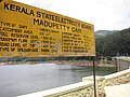
File:Madupetty.jpg|Maduppetty dam | |||
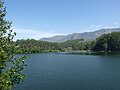
File:Mattupetty Dam reservoir, near Munnar, Kerala.jpg | File:Mattupetty Dam reservoir, near Munnar, Kerala.jpg | ||
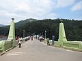
File:Mattupetti_Panorama-1.jpg | File:Mattupetti_Panorama-1.jpg | ||
| Line 55: | Line 74: | ||
{{stack|{{Portal|India|Water|Renewable energy}}}} | {{stack|{{Portal|India|Water|Renewable energy}}}} | ||
* [[List of dams and reservoirs in India]] | * [[List of dams and reservoirs in India]] | ||
*[https://www.youtube.com/watch?v=HkA6RCSv9Yc&list=RDCMUCAK0P7b-eQ7u5waz93Ld_Ww&index=4 Mattuppetty SHEP] | |||
==References== | ==References== | ||
Revision as of 20:47, 31 July 2021
| Mattupetty Dam മാട്ടുപെട്ടി അണക്കെട്ട് | |
|---|---|
 | |
  Location of Mattupetty Dam മാട്ടുപെട്ടി അണക്കെട്ട് in India  Mattupetty Dam (Kerala) Mattupetty Dam (India) | |
| Location | Munnar, Kerala, India |
| Coordinates | 10°06′22″N 77°07′26″E / 10.106°N 77.124°E |
| Construction began | 1949 |
| Opening date | 1953 |
| Construction cost | ₹2.2 crore (US$310,000) |
| Operator(s) | Government of Kerala |
| Reservoir | |
| Creates | Mattupetty |
| Total capacity | 55.4 Million Cubic Meter |
| Catchment area | 105 Square kilometer |
| Surface area | 323.75 Hectare |
| Power Station | |
| Hydraulic head | 46.6 meter |
Lua error in Module:OSM_Location_map at line 1984: attempt to index field 'wikibase' (a nil value).

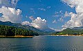
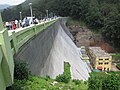
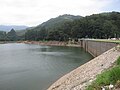
Mattupetty Dam (Madupetty Dam), near Munnar in Idukki District, is a storage Concrete Gravity dam built in the mountains of Kerala, India to conserve water for hydroelectricity.[1] It has been a vital source of power yielding along with other such dams, huge revenue to the states. The large amount of perennially available water allows wild animals and birds to flourish. However salinity caused by irrigation and water-logging are of concern to environmentalists.[2] The height of the dam is 83.35 metres (273.5 ft) and the length is 237.74 metres (780.0 ft). Taluks through which release flow are Udumpanchola, Devikulam, Kothamangalam, Muvattupuzha, Kunnathunadu, Aluva, Kodungalloor and Paravur
Specifications
- Latitude : 10⁰ 06′ 23 ” N
- Longitude: 77⁰ 07′ 26” E
- Panchayath : Madupetty
- Village : KDH Village
- District : Idukki
- River Basin : Muthirapuzha
- River : Muthirapuzha
- Release from Dam to river : Muthirapuzha
- Type of Dam : Concrete- gravity
- Classification : HH ( high Height)
- Full Reservoir Level ( FRL): EL 1599.59 m
- Full Reservoir Level ( FRL) : EL 1599.59 m
- Storage at FRL : 55.23 Mm3
- Height from deepest foundation : 83.35 m
- Length : 237.74 m
- Spillway : Ogee type- 3 Nos. Radial gates, each of size 6.70 x 4.95 m
Munnar is located near the confluence of the mountain streams of Muthirappuzha River, Chanduvarai River and Kundale River.
The reservoir is also known to be one of the visiting grounds of elephants in the region.
Gallery
-
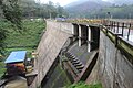 Maduppetty dam
 -
-

-

-
-
-
-
-


See also

References
- ↑ "Munnar". Keralatourism.org. Archived from the original on 18 January 2014. Retrieved 21 June 2012.
- ↑ "Keyword is planning". Narmada.org. Retrieved 28 March 2007.


 | This article related to a location in Idukki district, Kerala, India is a stub. You can help Bharatpedia by expanding it. |
 | This article about a dam, floodgate or canal in India is a stub. You can help Bharatpedia by expanding it. |