



m Removed empty portal template using script |
Shayne2017 (talk | contribs) small changes |
||
| Line 2: | Line 2: | ||
{{Use dmy dates|date=December 2020}} | {{Use dmy dates|date=December 2020}} | ||
{{Infobox dam | {{Infobox dam | ||
| name = Idukki | | name = Idukki Dam | ||
| name_official = | | name_official = | ||
| image = | | image = Idukki009.jpg | ||
| image_caption = | | image_caption = | ||
| image_alt = | | image_alt = | ||
| image_size = | | image_size = | ||
| location_map = | | location_map = Kerala | ||
| location_map_size = | | location_map_size = | ||
| location_map_caption = | | location_map_caption = | ||
| coordinates = {{coord|9|50|34|N|76|58|34|E|type:landmark|display=inline,title}} | | coordinates = {{coord|9|50|34|N|76|58|34|E|type:landmark|display=inline,title}} | ||
| country = | | country = [[India]] | ||
| location = [[Idukki]] | | location = [[Idukki]], [[Kerala]] | ||
| purpose = Power generation | | purpose = Power generation | ||
| status = O | | status = O | ||
| construction_began = | | construction_began = 1963 | ||
| opening = | | opening = {{Start date and age|1976|p=yes|br=yes}} | ||
| demolished = | | demolished = | ||
| cost = | | cost = | ||
| Line 23: | Line 23: | ||
| dam_type = Concrete, double curvature parabolic, thin arch. | | dam_type = Concrete, double curvature parabolic, thin arch. | ||
| dam_crosses = [[Periyar River]] | | dam_crosses = [[Periyar River]] | ||
| dam_height_foundation = | | dam_height_foundation = 169.16 meters | ||
| dam_height_thalweg = | | dam_height_thalweg = | ||
| dam_length = {{Convert|365.85|m|ft|0|abbr=on}} | | dam_length = {{Convert|365.85|m|ft|0|abbr=on}} | ||
| Line 34: | Line 34: | ||
| spillway_capacity = | | spillway_capacity = | ||
| res_name = | | res_name = | ||
| res_capacity_total = | | res_capacity_total = 1.996 km<sup>3</sup> (70.5 tmc ft) | ||
| res_capacity_active = {{Convert|1460|e6m3|acre.ft|0|abbr=on}} | | res_capacity_active = {{Convert|1460|e6m3|acre.ft|0|abbr=on}} (51.57 tmc ft) | ||
| res_capacity_inactive = {{Convert|536|e6m3|acre.ft|0|abbr=on}} | | res_capacity_inactive = {{Convert|536|e6m3|acre.ft|0|abbr=on}} (18.93 tmc ft) | ||
| res_catchment = {{Convert|649.3|km2|mi2|0|abbr=on}} | | res_catchment = {{Convert|649.3|km2|mi2|0|abbr=on}} | ||
| res_surface = {{Convert|60|km2|mi2|0|abbr=on}} | | res_surface = {{Convert|60|km2|mi2|0|abbr=on}} | ||
| Line 56: | Line 56: | ||
}} | }} | ||
The '''Idukki Dam''' is a double curvature [[ | The '''Idukki Dam''' is a double-curvature thin [[arch dam]] constructed across the [[Periyar River]] in a narrow gorge between two granite hills locally known as ''[[Kuravanmala|Kuravan]]'' and ''Kurathi,'' in [[Idukki]] district, in the state of [[Kerala]], [[India]]. It is constructed and owned by the [[Kerala State Electricity Board]]. It supports a 780 MW [[Moolamattom hydro power station|hydroelectric power station]] in [[Moolamattom]], which started generating power on 4 October 1975.<ref name="idukki_gov_in">{{cite web |title=Idukki Arch Dam |url=https://idukki.gov.in/tourist-place/idukki-arch-dam/ |publisher=Idukki District Administration}}</ref> At {{convert|168.91|m|ft}}, it is one of the highest [[arch dam]]s in [[Asia]]. The Indo-Canadian project was inaugurated by Prime Minister [[Indira Gandhi]] on February 17, 1976.<ref>{{Cite web|agency=TNN|date=Jul 13, 2020|title=Kerala: Moolamattam power plant generates 10,000 crore units {{!}} Kochi News - Times of India|url=https://timesofindia.indiatimes.com/city/kochi/moolamattam-power-plant-generates-10000cr-units/articleshow/76928909.cms|access-date=2021-07-23|website=The Times of India|language=en}}</ref> | ||
| | |||
| | |||
| url | |||
| access-date = | |||
}}</ref> | |||
This dam was constructed along with two other dams at [[Cheruthoni dam|Cheruthoni]] and Kulamavu. Together, the three dams have created an artificial lake that is {{cvt|60|km2|0}} in area. The stored water is used to produce electricity at the Moolamattom Power house, which is located inside nearby rocky caves | This dam was constructed along with two other dams at [[Cheruthoni dam|Cheruthoni]] and [[Kulamavu Dam|Kulamavu]]. Together, the three dams and Two saddle dams, [[Kulamavu Saddle Dam (Near Junction)]] and [[Kulamavu Saddle Dam (Right Bank)]] have created an artificial lake that is {{cvt|60|km2|0}} in area. The stored water is used to produce electricity at the Moolamattom Power house, which is located inside nearby rocky caves.<ref name="idukki_gov_in" /> | ||
[[ | |||
[[Narakakkanam Weir|Narakakkanam]], [[Azhutha Dam|Azhutha]], [[Vazhikadavu Weir|Vazhikkadavu]], [[Vadakkepuzha Weir|Vadakkepuzha]] and [[Kuttiar Weir|Kuttiar]] diversion schemes were later added to augment the Idukki reservoir. | |||
==History== | ==History== | ||
===Early surveys=== | ===Early surveys=== | ||
The idea of constructing a dam for power generation was first conceived in 1919 in a report submitted by Italian engineer Jacob to the Travancore government, which was rejected. | The idea of constructing a dam for power generation was first conceived in 1919 in a report submitted by Italian engineer Jacob to the Travancore government, which was rejected. As per history, Shri Chemban Karuvellayan Kolumban, the head of 'Oorali' tribe during 1922, showed the way to the Malankara Estate Superintendent W.J.John and his friend AC Thomas Edattu, who were on hunting trip to forests near the present Arch Dam. Upon hearing the legend of Kuravan and Kurathi Hills, Thomas impressed by the sight of water flow between the mountains; suggested the spot suitable for an [[Arch dam]].<ref>{{Cite news|url=https://www.thehindu.com/news/national/kerala/man-who-changed-the-course-of-a-river/article6721679.ece|title=Man who changed the course of a river|newspaper=The Hindu|date=24 December 2014|last1=Raman|first1=Giji K.}}</ref> In 1932, W.J.John submitted a report to the Government of Travancore on the possibility of constructing a dam at Idukki for Power Generation.<ref>{{cite web |title=Idukki Dam |url=https://www.keralatourism.org/munnar/idukki-dam.php |website=keralatourism.org |publisher=Department of Tourism, Government of Kerala}}</ref> In 1935, assembly member Shri.K.A.Narayana Pillai brought the Idukki project to the attention of Government of [[Travancore]]. Italian engineers Angelo Omedayo and Clantheyo Masele conducted a study in 1937 but things didn't go forward. | ||
In 1947, a preliminary investigation report was prepared and submitted by Sri. P. Joseph John, then The Chief Electrical Engineer to the Government of [[Travancore]]. It was during 1956 that the Central Water Commission conducted a detailed investigation based on the Government's request. The project report was prepared in 1961 and the [[Planning Commission (India)|Planning Commission]] accorded sanction for implementing the scheme in 1963. In 1964, under the leadership of Sri. E.U.Philipose, Superintending Engineer, preliminary works of the project were started.{{Citation needed|date=January 2024}} | |||
<gallery> | |||
In 1947, a preliminary investigation report was prepared and submitted by Sri. P. Joseph John, | File:WillowsPhilipose.jpg|E.U. Philipose, Superintending Engineer, Kerala State Electricity Board, in charge of the initial project work, with visiting Canadian Government dignitary, Mr and Mrs Fred Willows. | ||
File:KolumbanIdukkiDamSite.jpg|Tribal Chief, Chemban Vellayan Kolumban who pointed out Idukki arch dam site with Canadian Government dignitary Fred Willows | |||
File:IdukkiDamSite.jpg|Idukki Arch Dam Site prior to construction | |||
</gallery> | |||
===Construction=== | ===Construction=== | ||
The construction of this dam commenced on 30 April 1969. The project led by [[D. Babu Paul|Dr.D.Babu Paul IAS]], who was appointed as Project Coordinator, Idukki Hydel Project & District Collector with several engineers like Sri. C.V Mathews and Sri. M. Ramachandran, (Retired Chief Engineers, Kerala State Electricity Board). The [[Government of Canada]] aided the Project with long-term loans and grants. [[SNC-Lavalin]], Canada, a well-known firm of Consulting Engineers were advising and assisting Project Engineers under Canadian aid, while [[Hindustan Construction Company]] (a.k.a. HCC) of [[Walchand group]] won the bid for construction.<ref>{{cite web |title=Dams and Barrages |url=https://hccindia.com/products/dams-and-barrages |website=hccindia.com |publisher=Hindustan Construction Company}}</ref> | |||
The construction of this | |||
Storage of water in Idukki reservoir commenced in February, 1973. The inauguration of trial run of the first machine was celebrated on 4 October 1975. Commercial operation of the Power Station was Commissioned on 12 February 1976 by the then | Storage of water in Idukki reservoir commenced in February, 1973. The inauguration of trial run of the first machine was celebrated on 4 October 1975. Commercial operation of the Power Station was Commissioned on 12 February 1976 by the then Prime Minister Smt. [[Indira Gandhi]].<ref>{{Cite web|url=https://www.thenewsminute.com/article/building-idukki-dam-workers-hired-project-recall-struggle-85857|title = The building of Idukki dam: Workers hired for project recall the struggle|date = 2 August 2018}}</ref> | ||
==Features== | ==Features== | ||
Idukki Dam is {{cvt|168.91|m}} tall, constructed between | {{unreferenced section|date=November 2023}} | ||
[[File:IdukkiDamConcaveSide.jpg|thumb|180px|left|From below]] | |||
The Idukki Dam is {{cvt|168.91|m}} tall, constructed between two mountains, [[Kuravanmala]] ({{cvt|839|m}}) and Kurathimala ({{cvt|925|m}}).<ref>{{Cite web |title=Idukki Arch Dam |url=https://idukki.nic.in/en/tourist-place/idukki-arch-dam/ |website=Government of Kerala - Idukki District}}</ref> The length of the dam on its top is {{cvt|365.85|m}}. It has a width of {{cvt|7.62|m}} at the top and {{cvt|19.81|m}} at the bottom. The gross storage capacity of the dam is 1.996 cubic kms (70.50 tmc ft). About {{cvt|4,64,000|m3}} of concrete was used in the construction of the dam. This project is situated in [[Idukki]] District and its underground power house is located at [[Moolamattom]] which is about {{cvt|43|km}} from the dam. It is notable that the Idukki arch dam does not have any shutters. The reservoir water level is maintained by the shutters in the [[Cheruthoni dam]].<ref name=lim>{{cite web |title=Idukki Dam |url=https://dams.kseb.in/?p=108 |website=KSEB.in |publisher=KSEB Limited Dam Safety Organisation}}</ref> | |||
{{clear|left}} | |||
==Usage== | ==Usage== | ||
<mapframe text="Dams in the Periyar basin" width="300" height="300" zoom="9" latitude="9.8696" longitude="76.8399" align="right"> | |||
<mapframe text="Dams in Periyar" width=" | |||
[ | [ | ||
{ | { | ||
| Line 97: | Line 92: | ||
"properties": { | "properties": { | ||
"title": "[[Mullaperiyar Dam]]", | "title": "[[Mullaperiyar Dam]]", | ||
"description": "[[File:Mullapperiyardam.jpg |200px]]", | "description": "[[File:Mullapperiyardam.jpg|200px]]", | ||
"marker-symbol": "dam", | "marker-symbol": "dam", | ||
"marker-size": "large", | "marker-size": "large", | ||
| Line 130: | Line 125: | ||
"properties": { | "properties": { | ||
"title": "[[Kulamavu Dam]]", | "title": "[[Kulamavu Dam]]", | ||
"description": "[[File:View on Kulamavu Dam Reservoir.jpg |200px]]", | "description": "[[File:View on Kulamavu Dam Reservoir.jpg|200px]]", | ||
"marker-symbol": "dam", | "marker-symbol": "dam", | ||
"marker-size": "large", | "marker-size": "large", | ||
| Line 173: | Line 168: | ||
"properties": { | "properties": { | ||
"title": "[[Idamalayar Dam]]", | "title": "[[Idamalayar Dam]]", | ||
"description": "[[File:Idamalayar Dam.jpg |200px]]", | "description": "[[File:Idamalayar Dam.jpg|200px]]", | ||
"marker-symbol": "dam", | "marker-symbol": "dam", | ||
"marker-size": "large", | "marker-size": "large", | ||
| Line 184: | Line 179: | ||
"properties": { | "properties": { | ||
"title": "[[Anayirankal Dam]]", | "title": "[[Anayirankal Dam]]", | ||
"description": "[[File:Anayirankal dam.jpg |200px]]", | "description": "[[File:Anayirankal dam.jpg|200px]]", | ||
"marker-symbol": "dam", | "marker-symbol": "dam", | ||
"marker-size": "large", | "marker-size": "large", | ||
| Line 195: | Line 190: | ||
"properties": { | "properties": { | ||
"title": "[[Kundala Dam]]", | "title": "[[Kundala Dam]]", | ||
"description": "[[File:Kundala Dam and Lake.JPG |200px]]", | "description": "[[File:Kundala Dam and Lake.JPG|200px]]", | ||
"marker-symbol": "dam", | "marker-symbol": "dam", | ||
"marker-size": "large", | "marker-size": "large", | ||
| Line 206: | Line 201: | ||
"properties": { | "properties": { | ||
"title": "[[Bhoothathankettu]]", | "title": "[[Bhoothathankettu]]", | ||
"description": "[[File:Bhoothathankettu Dam.jpg |200px]]", | "description": "[[File:Bhoothathankettu Dam.jpg|200px]]", | ||
"marker-symbol": "dam", | "marker-symbol": "dam", | ||
"marker-size": "large", | "marker-size": "large", | ||
| Line 216: | Line 211: | ||
</mapframe> | </mapframe> | ||
===Power generation=== | |||
{{main|Moolamattom hydro power station}} | |||
The Project harnesses a major portion of the power potential of [[Periyar (river)|Periyar]], the largest river in [[Kerala]], by the creation of a reservoir of 2,000 M.cum (2 Billion Tonnes) capacity, diversion of waters thus impounded through a water conductor system consisting of a power tunnel and two underground pressure shafts to an underground power house situated in [[Moolamattom]]. The installed capacity of the Power House is 780 MW consisting of 6 Units of [[Pelton-type]] turbines with a power generation capacity of 130 MW each. The regulated waters of Periyar falls through a drop of about {{cvt|669.2|m}} while generating power in the underground power house. The generated power is given to two sub stations. One double circuit line to Kalamassery; one single circuit line to Tamil Nadu; one single circuit line to Pallom, 3 feeder bays for future.<ref name=lim/> | |||
===Irrigation=== | |||
The tail waters flowing to Kudayathurpuzha through tunnel and open channel is diverted for irrigation purposes in the [[Muvattupuzha]] Valley. | The tail waters flowing to Kudayathurpuzha through tunnel and open channel is diverted for irrigation purposes in the [[Muvattupuzha]] Valley. | ||
===Tourism=== | |||
Earlier, there was a blanket ban on public entry | Earlier, there was a blanket ban on public entry to the dam due to security reasons. Later, it was relaxed opening the dam for public for 10 days during the Onam and the Christmas seasons. The duration has been increased to one month since last year. Cameras and cell phones are not allowed inside the dam area. The entry fee is Rs. 25 for adults and Rs. 5 for children. The fee for 15-minute boating service for five persons is Rs. 600.<ref>{{cite news|title=Filled to its brim, Idukki dam woos tourists|url=http://www.thehindu.com/news/national/kerala/filled-to-its-brim-idukki-dam-woos-tourists/article5147668.ece|access-date=21 September 2013|newspaper=The Hindu}}</ref> | ||
Idukki valley is {{cvt|121|km}} away from [[Kottayam]], and is a small hill town surrounded by a spread of beautiful, wooded valleys and meandering streams. Idukki is a well known tourist center in Kerala. | Idukki valley is {{cvt|121|km}} away from [[Kottayam]], and is a small hill town surrounded by a spread of beautiful, wooded valleys and meandering streams. Idukki is a well known tourist center in Kerala. | ||
The Idukki Wildlife Sanctuary extends over the [[Thodupuzha]] and [[Udumbanchola]] taluks of [[Idukki district]], spread over {{cvt|77|km}} and is about {{cvt|450-748|m}} above sea level. The Idukki Reservoir formed by three dams - [[Cheruthoni]], Idukki and Kulamavu - extends to {{cvt|33|km}}. One can find elephants, bisons, sambar deer, wild dogs, jungle cats, tigers, wild boars etc. and a variety of snakes like cobra, viper, krait and a number of non-venomous snakes | The [[Idukki Wildlife Sanctuary]] extends over the [[Thodupuzha]] and [[Udumbanchola]] taluks of [[Idukki district]], spread over {{cvt|77|km}} and is about {{cvt|450-748|m}} above sea level. The Idukki Reservoir formed by three dams - [[Cheruthoni]], Idukki and Kulamavu - extends to {{cvt|33|km}}. One can find elephants, bisons, sambar deer, wild dogs, jungle cats, tigers, wild boars etc. and a variety of snakes like cobra, viper, krait and a number of non-venomous snakes. The birds of Idukki are Jungle fowl, myna, laughing thrush, black bulbul, peafowl, woodpecker, kingfisher, eagle etc.<ref>{{cite web |title=Idukki Wildlife Sanctuary |url=https://www.keralatourism.org/destination/idukki-wildlife-santuary/188 |website=keralatourism.org |publisher=Department of Tourism, Government of Kerala}}</ref> | ||
{{wide image|Idukki Reservoir Pano Calvary Mount Kerala Mar22 A7C 01220-23 Pano.jpg|800px|Idukki reservoir from Mount Calvary (dam beyond right edge)}} | |||
==See also== | ==See also== | ||
{{stack|}} | {{stack|{{Portal|India|Water|Renewable energy}}}} | ||
* [[2018 Kerala floods]] | * [[2018 Kerala floods]] | ||
* [[Kalvary Mount]] | |||
*[[List of dams and reservoirs in Kerala]] | *[[List of dams and reservoirs in Kerala]] | ||
* [[Kulamavu Dam]] | * [[Kulamavu Dam]] | ||
* [[Cheruthoni Dam]] | * [[Cheruthoni Dam]] | ||
* [[Kallar Dam]] | |||
* [[Erattayar Dam]] | |||
* [[Azhutha Dam]] | |||
* [[Vazhikadavu Weir]] | |||
* [[Vadakkepuzha Weir]] | |||
* [[Kuttiar Weir]] | |||
==References== | ==References== | ||
{{ | {{Reflist}} | ||
==External links== | ==External links== | ||
{{Commons category|Idukki Dam}} | {{Commons category|Idukki Dam}} | ||
* {{Structurae|id=20004966|title=Idukki Dam}} | * {{Structurae|id=20004966|title=Idukki Dam}} | ||
*[http://www.hinduonnet.com/2004/02/07/stories/2004020709440500.htm | *[https://www.youtube.com/watch?v=ye1xxCcEktw Idukki Dam shortfilm] | ||
*{{usurped|[https://web.archive.org/web/20070112200411/http://www.hinduonnet.com/2004/02/07/stories/2004020709440500.htm Idukki dam safe: Kadavoor]}} | |||
*[http://expert-eyes.org/deepak/idukki.html Idukki Hydroelectric Project] | *[http://expert-eyes.org/deepak/idukki.html Idukki Hydroelectric Project] | ||
*[http://www.timescontent.com/tss/showcase/preview-buy/129514/Feature/Idukki-Project-Hydro-Electricity-Pr.html Old Photos] | *[http://www.timescontent.com/tss/showcase/preview-buy/129514/Feature/Idukki-Project-Hydro-Electricity-Pr.html Old Photos] | ||
* https://idukki.gov.in/tourist-place/idukki-arch-dam/ | * [https://idukki.gov.in/tourist-place/idukki-arch-dam/ Idukki Arch Dam] | ||
*Interesting Facts about [https://www.myidukki.com/idukki-dam/ Idukki dam] | *Interesting Facts about [https://www.myidukki.com/idukki-dam/ Idukki dam] {{Webarchive|url=https://web.archive.org/web/20180522041946/https://www.myidukki.com/idukki-dam/ |date=22 May 2018 }} | ||
{{Power Plants of Kerala}} | {{Power Plants of Kerala}} | ||
| Line 258: | Line 262: | ||
[[Category:Arch dams]] | [[Category:Arch dams]] | ||
[[Category:Dams completed in 1973]] | [[Category:Dams completed in 1973]] | ||
[[Category:1973 establishments in Kerala]] | [[Category:1973 establishments in Kerala]] | ||
[[Category:Dams in Idukki district]] | [[Category:Dams in Idukki district]] | ||
[[Category:20th-century architecture in India]] | |||
Latest revision as of 16:30, 8 March 2026
| Idukki Dam | |
|---|---|
 | |
  Location of Idukki Dam in Kerala | |
| Country | India |
| Location | Idukki, Kerala |
| Coordinates | 9°50′34″N 76°58′34″E / 9.84278°N 76.97611°E |
| Purpose | Power generation |
| Status | Operational |
| Construction began | 1963 |
| Opening date | 1976 |
| Owner(s) | Kerala State Electricity Board |
| Dam and spillways | |
| Type of dam | Concrete, double curvature parabolic, thin arch. |
| Impounds | Periyar River |
| Height | 168.91 m (554 ft) |
| Height (foundation) | 169.16 meters |
| Length | 365.85 m (1,200 ft) |
| Dam volume | 450,000 m3 (16,000,000 cu ft) |
| Spillways | Nil |
| Reservoir | |
| Total capacity | 1.996 km3 (70.5 tmc ft) |
| Active capacity | 1,460×106 m3 (1,183,641 acre⋅ft) (51.57 tmc ft) |
| Inactive capacity | 536×106 m3 (434,542 acre⋅ft) (18.93 tmc ft) |
| Catchment area | 649.3 km2 (251 sq mi) |
| Surface area | 60 km2 (23 sq mi) |
| Normal elevation | 732.62 m (2,404 ft) |
| Power Station | |
| Commission date | 1975 |
| Turbines | 6 x 130 MW Pelton-type |
| Installed capacity | 780 MW |
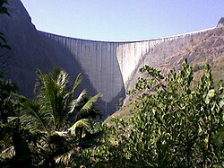
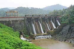
The Idukki Dam is a double-curvature thin arch dam constructed across the Periyar River in a narrow gorge between two granite hills locally known as Kuravan and Kurathi, in Idukki district, in the state of Kerala, India. It is constructed and owned by the Kerala State Electricity Board. It supports a 780 MW hydroelectric power station in Moolamattom, which started generating power on 4 October 1975.[1] At 168.91 metres (554.2 ft), it is one of the highest arch dams in Asia. The Indo-Canadian project was inaugurated by Prime Minister Indira Gandhi on February 17, 1976.[2]
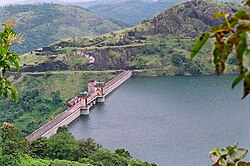
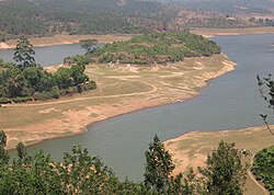
This dam was constructed along with two other dams at Cheruthoni and Kulamavu. Together, the three dams and Two saddle dams, Kulamavu Saddle Dam (Near Junction) and Kulamavu Saddle Dam (Right Bank) have created an artificial lake that is 60 km2 (23 sq mi) in area. The stored water is used to produce electricity at the Moolamattom Power house, which is located inside nearby rocky caves.[1]
Narakakkanam, Azhutha, Vazhikkadavu, Vadakkepuzha and Kuttiar diversion schemes were later added to augment the Idukki reservoir.
History[edit | edit source]
Early surveys[edit | edit source]
The idea of constructing a dam for power generation was first conceived in 1919 in a report submitted by Italian engineer Jacob to the Travancore government, which was rejected. As per history, Shri Chemban Karuvellayan Kolumban, the head of 'Oorali' tribe during 1922, showed the way to the Malankara Estate Superintendent W.J.John and his friend AC Thomas Edattu, who were on hunting trip to forests near the present Arch Dam. Upon hearing the legend of Kuravan and Kurathi Hills, Thomas impressed by the sight of water flow between the mountains; suggested the spot suitable for an Arch dam.[3] In 1932, W.J.John submitted a report to the Government of Travancore on the possibility of constructing a dam at Idukki for Power Generation.[4] In 1935, assembly member Shri.K.A.Narayana Pillai brought the Idukki project to the attention of Government of Travancore. Italian engineers Angelo Omedayo and Clantheyo Masele conducted a study in 1937 but things didn't go forward.
In 1947, a preliminary investigation report was prepared and submitted by Sri. P. Joseph John, then The Chief Electrical Engineer to the Government of Travancore. It was during 1956 that the Central Water Commission conducted a detailed investigation based on the Government's request. The project report was prepared in 1961 and the Planning Commission accorded sanction for implementing the scheme in 1963. In 1964, under the leadership of Sri. E.U.Philipose, Superintending Engineer, preliminary works of the project were started.[citation needed]
-
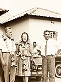 E.U. Philipose, Superintending Engineer, Kerala State Electricity Board, in charge of the initial project work, with visiting Canadian Government dignitary, Mr and Mrs Fred Willows.
 -
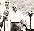 Tribal Chief, Chemban Vellayan Kolumban who pointed out Idukki arch dam site with Canadian Government dignitary Fred Willows
 -
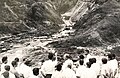 Idukki Arch Dam Site prior to construction


Construction[edit | edit source]
The construction of this dam commenced on 30 April 1969. The project led by Dr.D.Babu Paul IAS, who was appointed as Project Coordinator, Idukki Hydel Project & District Collector with several engineers like Sri. C.V Mathews and Sri. M. Ramachandran, (Retired Chief Engineers, Kerala State Electricity Board). The Government of Canada aided the Project with long-term loans and grants. SNC-Lavalin, Canada, a well-known firm of Consulting Engineers were advising and assisting Project Engineers under Canadian aid, while Hindustan Construction Company (a.k.a. HCC) of Walchand group won the bid for construction.[5]
Storage of water in Idukki reservoir commenced in February, 1973. The inauguration of trial run of the first machine was celebrated on 4 October 1975. Commercial operation of the Power Station was Commissioned on 12 February 1976 by the then Prime Minister Smt. Indira Gandhi.[6]
Features[edit | edit source]
 |

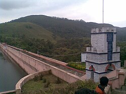
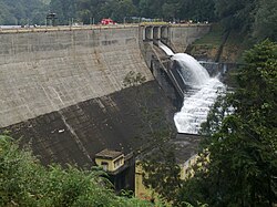
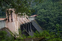
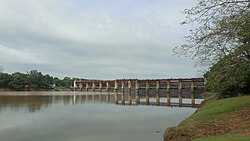
The Idukki Dam is 168.91 m (554.2 ft) tall, constructed between two mountains, Kuravanmala (839 m (2,753 ft)) and Kurathimala (925 m (3,035 ft)).[7] The length of the dam on its top is 365.85 m (1,200.3 ft). It has a width of 7.62 m (25.0 ft) at the top and 19.81 m (65.0 ft) at the bottom. The gross storage capacity of the dam is 1.996 cubic kms (70.50 tmc ft). About 464,000 m3 (16,400,000 cu ft) of concrete was used in the construction of the dam. This project is situated in Idukki District and its underground power house is located at Moolamattom which is about 43 km (27 mi) from the dam. It is notable that the Idukki arch dam does not have any shutters. The reservoir water level is maintained by the shutters in the Cheruthoni dam.[8]
Usage[edit | edit source]

Power generation[edit | edit source]
The Project harnesses a major portion of the power potential of Periyar, the largest river in Kerala, by the creation of a reservoir of 2,000 M.cum (2 Billion Tonnes) capacity, diversion of waters thus impounded through a water conductor system consisting of a power tunnel and two underground pressure shafts to an underground power house situated in Moolamattom. The installed capacity of the Power House is 780 MW consisting of 6 Units of Pelton-type turbines with a power generation capacity of 130 MW each. The regulated waters of Periyar falls through a drop of about 669.2 m (2,196 ft) while generating power in the underground power house. The generated power is given to two sub stations. One double circuit line to Kalamassery; one single circuit line to Tamil Nadu; one single circuit line to Pallom, 3 feeder bays for future.[8]
Irrigation[edit | edit source]
The tail waters flowing to Kudayathurpuzha through tunnel and open channel is diverted for irrigation purposes in the Muvattupuzha Valley.
Tourism[edit | edit source]
Earlier, there was a blanket ban on public entry to the dam due to security reasons. Later, it was relaxed opening the dam for public for 10 days during the Onam and the Christmas seasons. The duration has been increased to one month since last year. Cameras and cell phones are not allowed inside the dam area. The entry fee is Rs. 25 for adults and Rs. 5 for children. The fee for 15-minute boating service for five persons is Rs. 600.[9]
Idukki valley is 121 km (75 mi) away from Kottayam, and is a small hill town surrounded by a spread of beautiful, wooded valleys and meandering streams. Idukki is a well known tourist center in Kerala.
The Idukki Wildlife Sanctuary extends over the Thodupuzha and Udumbanchola taluks of Idukki district, spread over 77 km (48 mi) and is about 450–748 m (1,476–2,454 ft) above sea level. The Idukki Reservoir formed by three dams - Cheruthoni, Idukki and Kulamavu - extends to 33 km (21 mi). One can find elephants, bisons, sambar deer, wild dogs, jungle cats, tigers, wild boars etc. and a variety of snakes like cobra, viper, krait and a number of non-venomous snakes. The birds of Idukki are Jungle fowl, myna, laughing thrush, black bulbul, peafowl, woodpecker, kingfisher, eagle etc.[10]

See also[edit | edit source]

- 2018 Kerala floods
- Kalvary Mount
- List of dams and reservoirs in Kerala
- Kulamavu Dam
- Cheruthoni Dam
- Kallar Dam
- Erattayar Dam
- Azhutha Dam
- Vazhikadavu Weir
- Vadakkepuzha Weir
- Kuttiar Weir
References[edit | edit source]
- ↑ 1.0 1.1 "Idukki Arch Dam". Idukki District Administration.
- ↑ "Kerala: Moolamattam power plant generates 10,000 crore units | Kochi News - Times of India". The Times of India. TNN. 13 July 2020. Retrieved 23 July 2021.
- ↑ Raman, Giji K. (24 December 2014). "Man who changed the course of a river". The Hindu.
- ↑ "Idukki Dam". keralatourism.org. Department of Tourism, Government of Kerala.
- ↑ "Dams and Barrages". hccindia.com. Hindustan Construction Company.
- ↑ "The building of Idukki dam: Workers hired for project recall the struggle". 2 August 2018.
- ↑ "Idukki Arch Dam". Government of Kerala - Idukki District.
- ↑ 8.0 8.1 "Idukki Dam". KSEB.in. KSEB Limited Dam Safety Organisation.
- ↑ "Filled to its brim, Idukki dam woos tourists". The Hindu. Retrieved 21 September 2013.
- ↑ "Idukki Wildlife Sanctuary". keralatourism.org. Department of Tourism, Government of Kerala.
External links[edit | edit source]
- Idukki Dam at Structurae
- Idukki Dam shortfilm
- Idukki dam safe: Kadavoor[usurped]
- Idukki Hydroelectric Project
- Old Photos
- Idukki Arch Dam
- Interesting Facts about Idukki dam Archived 22 May 2018 at the Wayback Machine


