
No edit summary Tags: Mobile edit Mobile web edit |
m brief added layout as per guidelines and improved wording per sources |
||
| Line 1: | Line 1: | ||
{{ | {{short description|National park in Manipur, India}} | ||
{{Contains special characters|Meitei}} | |||
{{Use Indian English|date=February 2015}} | |||
{{Use dmy dates|date=February 2015}} | |||
{{Infobox protected area | {{Infobox protected area | ||
| name = Keibul Lamjao National Park | | name = Keibul Lamjao National Park | ||
| alt_name = | | alt_name = | ||
| iucn_category = II | | iucn_category = II | ||
| | | image = CervusEldiAMNH.jpg | ||
| | | image_alt = | ||
| | | image_caption = Endangered [[Sangai]] deer ({{lang|la|[[Cervus eldi eldi]]}}) | ||
| | | image_size = | ||
| map = India Manipur#India | | map = India Manipur#India | ||
| map_alt = | | map_alt = | ||
| map_caption = | | map_caption = | ||
| map_width = | | map_width = | ||
| relief = 1 | |||
| mapframe = Yes | |||
| location = [[Bishnupur District]], [[Manipur]], India | | location = [[Bishnupur District]], [[Manipur]], India | ||
| nearest_city = [[Moirang]], [[Imphal]] | | nearest_city = [[Moirang]], [[Imphal]] | ||
| Line 17: | Line 22: | ||
| area_km2 = 40 | | area_km2 = 40 | ||
| established = 28 March 1977 | | established = 28 March 1977 | ||
| visitation_num = | | visitation_num = | ||
| visitation_year = | | visitation_year = | ||
| governing_body = [[Government of India]], [[Government of Manipur]] | | governing_body = [[Government of India]], [[Government of Manipur]] | ||
| url = https://web.archive.org/web/20081015170951/http://manipurforest.gov.in/KeibulLamjao.htm | | url = https://web.archive.org/web/20081015170951/http://manipurforest.gov.in/KeibulLamjao.htm | ||
}} | }} | ||
The '''Keibul Lamjao National Park''' is a [[national park]] in the [[Bishnupur district]] of the state of [[Manipur]] in India. It is {{convert|40|km2|mi2|abbr=on|1}} in area, the only floating park in the world, | The '''Keibul Lamjao National Park''' ({{langx|mni|Keibul Lamjao Leipakki Lampak}}) is a [[national park]] in the [[Bishnupur district]] of the state of [[Manipur]] in [[Northeast India]]. It is {{convert|40|km2|mi2|abbr=on|1}} in area, the only floating national park in the world, and an integral part of [[Loktak Lake]].<ref>{{Cite web |date=2018-05-07 |title=The Floating Islands of India |url=https://earthobservatory.nasa.gov/images/92090/the-floating-islands-of-india |access-date=2023-03-13 |website=earthobservatory.nasa.gov |language=en |quote=The largest island is home to the Keibul Lamjao, the world's only floating national park. It serves as a habitat for the endangered brow-antlered sangai, or "dancing deer," whose hooves have adapted to the island's spongy ground. The park, covering 15 square miles (40 km2), was specifically created to preserve the deer, which were once thought to be extinct. |archive-date=13 March 2023 |archive-url=https://web.archive.org/web/20230313215727/https://earthobservatory.nasa.gov/images/92090/the-floating-islands-of-india |url-status=live }}</ref><ref>{{Cite web |last=McKechnie |first=Ben |title=The world's only floating national park |url=https://www.bbc.com/travel/article/20180411-the-worlds-only-floating-national-park |access-date=2023-03-13 |website=www.bbc.com |language=en |archive-date=13 March 2023 |archive-url=https://web.archive.org/web/20230313215724/https://www.bbc.com/travel/article/20180411-the-worlds-only-floating-national-park |url-status=live }}</ref> It is currently on the [[List of World Heritage Sites in India#Tentative list|tentative lists]] of the [[UNESCO World Heritage Site]]s, under the title ''"[[Keibul Lamjao Conservation Area (KLCA)]]"'', additionally covering the buffer of Loktak Lake (140 sq km) and [[Pumlenpat|Pumlen Pat]] (43 sq. km).<ref>{{Cite web |last=Centre |first=UNESCO World Heritage |title=Keibul Lamjao Conservation Area |url=https://whc.unesco.org/en/tentativelists/6086/ |access-date=2023-03-13 |website=UNESCO World Heritage Centre |language=en |archive-date=15 July 2017 |archive-url=https://web.archive.org/web/20170715011918/https://whc.unesco.org/en/tentativelists/6086 |url-status=live }}</ref><ref>{{Cite web |title=Keibul Lamjao Conservation Area {{!}} For UNESCO World Heritage Travellers |url=https://www.worldheritagesite.org/tentative/id/6086 |access-date=2023-03-13 |website=www.worldheritagesite.org |archive-date=30 November 2022 |archive-url=https://web.archive.org/web/20221130140021/https://www.worldheritagesite.org/tentative/id/6086 |url-status=live }}</ref> | ||
The national park is characterized by floating decomposed plant material locally called [[phumdi]]. It was created in 1966 as a [[wildlife sanctuary]] to preserve the natural habitat of the endangered [[Eld's deer]] (''Cervus eldi eldi''). In 1977, it was gazetted as | The national park is characterized by floating decomposed plant material locally called [[phumdi]]. It was created in 1966 as a [[wildlife sanctuary]] to preserve the natural habitat of the endangered [[Eld's deer]] (''Cervus eldi eldi''), which is the state animal of Manipur.<ref name="kimn">{{cite web |title=Symbols of Manipur- knowindia.gov.in |url=http://knowindia.gov.in/knowindia/national_symbols.php?id=16#man |archive-url=https://web.archive.org/web/20131112080035/http://knowindia.gov.in/knowindia/national_symbols.php?id=16#man |archive-date=12 November 2013 |access-date=15 August 2025}}</ref> In 1977, it was gazetted as national park.<ref name=keib>{{Cite web |url= http://manipurforest.gov.in/KeibulLamjao.htm |title= Keibul Lamjao National Park Forest Department, Government of Manipur |access-date= 2009-01-09 |archive-url= https://web.archive.org/web/20081015170951/http://manipurforest.gov.in/KeibulLamjao.htm |archive-date= 15 October 2008|df= dmy-all}}</ref><ref name =wemmer>{{Cite book |url=https://books.google.com/books?id=17Y-TL774RUC&pg=PA61 |title=Deer: status survey and conservation action plan |page=69 |access-date=2009-03-29 |author=Wemmer, Christen M. |author2=Moore, Donald |author3=Blouch, Raleigh |publisher=IUCN |year=1998 |isbn=2-8317-0454-5 }}{{Dead link|date=May 2023 |bot=InternetArchiveBot |fix-attempted=yes }}</ref> | ||
==History== | ==History== | ||
The brow-antlered deer, which was first discovered in Manipur in 1839 and named ''[[Cervus eldi eldi]]'' in 1844 in honour of Lt. Percy Eld – a British officer, was reported an [[List of extinct animals|extinct species]] in 1951. It was re–discovered in the Keibul Lamjao Park area by the environmentalist and photographer [[Edward Pritchard Gee|E.P. Gee]], which necessitated declaring this reserve park area as a national park to protect and conserve the deer now called Eld's deer's subspecies [[brow-antlered deer]] ( | The brow-antlered deer, which was first discovered in Manipur in 1839 and named ''[[Cervus eldi eldi]]'' in 1844 in honour of Lt. Percy Eld – a British officer, was reported an [[List of extinct animals|extinct species]] in 1951. It was re–discovered in the Keibul Lamjao Park area by the environmentalist and photographer [[Edward Pritchard Gee|E.P. Gee]], which necessitated declaring this reserve park area as a national park to protect and conserve the deer now called Eld's deer's subspecies [[brow-antlered deer]] ({{lang|la|Cervus eldi eldi}}) or {{lang|mni|[[Sangai]]}} in [[Meitei language]] (to distinguish it from the other two subspecies found in [[Burma]] and [[Thailand]] that are called {{lang|la|Cervus eldii thamin}} and {{lang|la|Cervus eldii siamensis}} and also in [[Cambodia]], [[China]], [[Laos]], [[Thailand]], [[Vietnam]] and [[Hainan]] Island). It has a pride of place in the folklore and culture of the Manipur state and is the state animal of Manipur. From a small herd of 14 deer in 1975, its population was reportedly 155 in 1995 and as per the latest wildlife census conducted in March 2016 its number rose to 260.<ref name = hindu>{{Cite news|url=http://www.hindu.com/mp/2005/11/05/stories/2005110500830200.htm|archive-url=https://web.archive.org/web/20060526225422/http://www.hindu.com/mp/2005/11/05/stories/2005110500830200.htm|archive-date=2006-05-26|title=Keibul Lamjao National Park|access-date=2009-03-29 | location=Chennai, India|work=[[The Hindu]]|date=2005-11-05}}</ref> | ||
==Geography and topography== | ==Geography and topography== | ||
The park is a [[swamp]] with floating mass of vegetation created by accrual of organic | The park is a [[swamp]] with floating mass of vegetation created by accrual of organic detritus and [[biomass]] with soil particles that has been thickened into a solid form called [[phumdi]]s, at the south–eastern side of the [[Loktak Lake]], which has been declared a [[Ramsar site]]. Two thirds to three fourths of the total park area is formed by phumdis.<ref name=zoo>{{Cite web|url=http://nationalzoo.si.edu/conservationandscience/endangeredspecies/eldsdeer/pdfs/2003_Elds_Deer_Workshop.pdf|title=Brow antlered deer (Cervus eldi eldi) in Keibul Lamjao National Park|access-date=2009-03-29|pages=19–23|author=Sinsit Singh|publisher=Khao Kheow Open Zoo, Chonburi, Thailand|date=2003-12-10|archive-url=https://web.archive.org/web/20110607204030/http://nationalzoo.si.edu/conservationandscience/endangeredspecies/eldsdeer/pdfs/2003_Elds_Deer_Workshop.pdf|archive-date=7 June 2011|df=dmy-all}}</ref> A waterway through the park provides year-round access by boats plying through the Loktak Lake, to the Pabot Hill in the north. The reserve area of the park which was {{convert|4000|ha|acre|abbr=on|1}} in March 1997 was reduced to {{convert|2160|ha|acre|abbr=on|1}} in April 1998, under pressure from the local villagers. The swamp encompasses three hills, namely, Pabot, Toya and Chingjao that provide a refuge for the large mammals during the [[monsoon]] season. The distinctive nature of the park is that it is "too deep to be [[marsh]], too shallow to be a lake".<ref name = invent>{{Cite web|url=http://envfor.nic.in/divisions/csurv/Wetland%20Inventory.pdf|title=Inventory of wetlands, Keibul Lamjao National Park|access-date=2009-03-26|publisher=Govt. of India|pages=314–318|archive-url=https://web.archive.org/web/20160303183104/http://envfor.nic.in/divisions/csurv/Wetland%20Inventory.pdf|archive-date=3 March 2016}}</ref> | ||
===Ownership rights=== | ===Ownership rights=== | ||
While the area on the periphery of the park is privately owned, the park itself is predominantly state-owned | While the area on the periphery of the park is privately owned, the park itself is predominantly state-owned.<ref name = invent/> | ||
==Hydrologic features== | ==Hydrologic features== | ||
Hydro–meteorological feature of the area is marked by the dominance of the Indian tropical [[monsoon]] with an average annual rainfall of {{convert|1183|mm|in|abbr=on|1}} with July and August as the wettest months and February and March as the driest. | Hydro–meteorological feature of the area is marked by the dominance of the Indian tropical [[monsoon]] with an average annual rainfall of {{convert|1183|mm|in|abbr=on|1}} with July and August as the wettest months and February and March as the driest. | ||
The size of the park varies with the seasons as it is formed of phumdis (morass of [[organic matter]]). The peripheral areas of the lake are grounded to the bed of the lake during the dry season but get almost substantially submerged for a few days during the monsoon season. It emerges and floats to the surface fully a few days later, separating from the ground; the depth of the Phumdi varies from {{convert|1|ft|m|abbr=on|1}} to {{convert|4|ft|m|abbr=on|1}} and during this period the animals in the park move to higher hilly areas. About twenty percent of its thickness floats on the lake, above the surface, which supports the weight of large [[mammal]]s.<ref name = invent/><ref>{{cite book|url=https://books.google.com/books?id=726qparJDBgC&q=Keibul+Lamjao+National+Park&pg=PA26|title=Threatened Deer|year=1978|pages =27–29|access-date=2009-03-29|publisher=International Union for Conservation of Nature and Natural Resources (IUCN) |isbn=2-88032-201-4}}</ref> | The size of the park varies with the seasons as it is formed of phumdis (morass of [[organic matter]]). The peripheral areas of the lake are grounded to the bed of the lake during the dry season but get almost substantially submerged for a few days during the monsoon season. It emerges and floats to the surface fully a few days later, separating from the ground; the depth of the Phumdi varies from {{convert|1|ft|m|abbr=on|1}} to {{convert|4|ft|m|abbr=on|1}} and during this period the animals in the park move to higher hilly areas. About twenty percent of its thickness floats on the lake, above the surface, which supports the weight of large [[mammal]]s.<ref name = invent/><ref>{{cite book|url=https://books.google.com/books?id=726qparJDBgC&q=Keibul+Lamjao+National+Park&pg=PA26|title=Threatened Deer|year=1978|pages=27–29|access-date=2009-03-29|publisher=International Union for Conservation of Nature and Natural Resources (IUCN)|isbn=2-88032-201-4|archive-date=4 November 2021|archive-url=https://web.archive.org/web/20211104170215/https://books.google.com/books?id=726qparJDBgC&q=Keibul+Lamjao+National+Park&pg=PA26|url-status=live}}</ref> | ||
;Weather | ;Weather | ||
| Line 49: | Line 53: | ||
===Aquatic flora=== | ===Aquatic flora=== | ||
Aquatic flora recorded in the park include ''[[Zizania latifolia]]'' (wild rice, ''ishing kambong''), ''[[ | Aquatic flora recorded in the park include ''[[Zizania latifolia]]'' (wild rice, ''ishing kambong''), ''[[Tripidium bengalense]]'', ''Eiranthus procerus'' (''singnang''), ''[[Dioscorea bulbifera]]'' (''phumha''), ''[[Cynodon dactylon]]'' (''tinthou''), ''[[Alpinia galanga]]'' (''pullei''), ''[[Eichhornia crassipes]]'' (''kabokang''), ''[[Hedychium coronarium]]'' (''loklei''), ''[[Nelumbo nucifera]]'' (''thambal'') and ''[[Phragmites]] karka'' (''tou'').<ref name = keib/><ref name = zoo/> | ||
Some of the above-listed flora had been recorded in two types of ''phumdis'' namely, the ''phumdi ataoba'' (floating) and the ''phumdi aruppa'' (sinking); [[reed bed|reeds]], [[grasses]], and other plants growing on a mat of dead and decaying vegetation floating on the lake surface form the ''ataoba'', while ''Phumdi aruppa'' has mats of vegetation which have sunk to the bottom of the lake and support a rich emergent growth of reeds and grasses. In a 1960 estimate, the ''phumdi'' vegetation had been structured into 45% ''Phragmites karka'', 25% ''Erianthus ravennae'' ([[Saccharum ravennae|elephant grass]]), 15% ''Saccharum munja'', 5% ''S. latifolium'', 5% ''Alpinia allughas'' and 2% ''Saccharum procerum'' and 3% other species, including ''Zizania latifolia''; ''Zizania latifolia'' is the plant much relished by the ''sangai deer''. ''Eichhornia crassipes'' was a recent species in the open water areas of the swamp in the midst of ''[[Polygonum]]'' (buckwheat) and ''[[Trapa]]'' (water caltrop or water chestnut). The three hills surrounding the park are now denuded of most of the vegetation. | Some of the above-listed flora had been recorded in two types of ''phumdis'' namely, the ''phumdi ataoba'' (floating) and the ''phumdi aruppa'' (sinking); [[reed bed|reeds]], [[grasses]], and other plants growing on a mat of dead and decaying vegetation floating on the lake surface form the ''ataoba'', while ''Phumdi aruppa'' has mats of vegetation which have sunk to the bottom of the lake and support a rich emergent growth of reeds and grasses. In a 1960 estimate, the ''phumdi'' vegetation had been structured into 45% ''Phragmites karka'', 25% ''Erianthus ravennae'' ([[Saccharum ravennae|elephant grass]]), 15% ''Saccharum munja'', 5% ''S. latifolium'', 5% ''Alpinia allughas'' and 2% ''Saccharum procerum'' and 3% other species, including ''Zizania latifolia''; ''Zizania latifolia'' is the plant much relished by the ''sangai deer''. ''Eichhornia crassipes'' was a recent species in the open water areas of the swamp in the midst of ''[[Polygonum]]'' (buckwheat) and ''[[Trapa]]'' (water caltrop or water chestnut). The three hills surrounding the park are now denuded of most of the vegetation. | ||
| Line 62: | Line 66: | ||
===Avifauna=== | ===Avifauna=== | ||
Prominent bird species recorded in the park are both migratory and resident. Some of them are the East Himalayan pied [[kingfisher]], [[black kite]], lesser sky-[[lark]], northern [[hill myna]], | Prominent bird species recorded in the park are both migratory and resident. Some of them are the East Himalayan pied [[kingfisher]], [[black kite]], lesser sky-[[lark]], northern [[hill myna]], [[Indian pied myna]], North Indian black [[drongo]]s, lesser eastern jungle [[crow]], yellow headed [[wagtail]], [[spotbill duck]], [[blue-winged teal]], ruddy [[shell duck]], threatened [[hooded crane]], Burmese sarus [[sarus crane]], [[white-breasted waterhen|Indian white-breasted waterhen]] and crimson-breasted pied [[woodpecker]].<ref name = keib/><ref name = zoo/> | ||
==Threats== | ==Threats== | ||
[[File:A Meitei popular cultural illustration of Sangai deer (Cervus eldi eldi) pleading to save him from being killed by human beings.jpg|thumb|300px|A [[Meitei culture|Meitei]] [[popular culture|popular cultural]] illustration of [[Sangai]] deer (the primary reason for the establishment of the Keibul Lamjao national park) pleading to save him from [[poaching|being killed by human beings]].]] | |||
Some of the identified threats to the park are elaborated below.<ref name = zoo/> | Some of the identified threats to the park are elaborated below.<ref name = zoo/> | ||
# The threats to the park are due to the permanent flooding of the park and its resultant effect on the thickness of | # The threats to the park are due to the permanent flooding of the park and its resultant effect on the thickness of [[phumdi]]s. The reason attributed for this is due to construction of the Ithai Barrage under the Loktak Multi-Purpose Project in 1983 where high level of water is maintained (between {{convert|768|m|ft|abbr=on|1}} and {{convert|768.5|m|ft|abbr=on|1}} ) during October to March – the dry months of the year. This has disturbed the natural cycle of floating and sinking of phumdis which used to be maintained in the park. Maintenance of high water level in the lake throughout the year for Loktak Multipurpose Project has broken this annual cycle and phumdis remain floating throughout the year during dry season and are no more available to phumdi vegetation. Therefore, the growth of vegetation on phumdis and their thickness are believed to be gradually decreasing. | ||
# Before the construction of the Loktak Hydro Electric Project, the [[phumdi]]s floated during flooding by backflow from the Khordak River and [[discharge (hydrology)|discharge]] from other streams and [[nala]]s and settled down on lake bed during dry season when water was drawn out through the same river. This resulted in enhancing of [[nutrient]]s and [[mineral]]s of the phumdi vegetation from the bottom of the lake during the dry period. But this cycle has been disturbed by the Loktak Hydro Electric project. One apprehension is that at some stage the phumdis may not be able to support the number of the Eld's deer or [[sangai]] deer. | |||
# The national park and the [[Loktak Lake]] have provided sustenance (through fishing, growing, and collection of vegetables of economic importance) to the people living in the peripheral villages and on the phumdis. The effect of maintaining permanently high water level is stated to be a serious threat to the phumdis and consequently to the people living on the lake/park's natural resources. | |||
# Earlier, there was only marshy land in the park area but after commissioning of the hydroelectric project two [[ecosystem]]s have emerged; one with [[water body]] covering one-third area and the other the ''[[phumdi]]s'', which covers two-thirds area. | |||
# Deteriorating [[water quality]] is indicated by the recorded [[pH]] values of 4 to 8.5. The reasons for poor quality are attributed to flow of | |||
##[[pollutant]]s from the towns draining into the lake, | |||
##use of [[agrochemicals]] for farming in the surrounding farmland, | |||
##accumulation of water on phumdi, | |||
##[[deforestation]] and subsequent [[soil erosion]] in the [[drainage basin|catchment area]] and | |||
##[[Decomposition|rotting]] vegetation. | |||
==Conservation measures== | |||
[[Conservation biology|Conservation]] measures suggested relate to development and implementation of a management plan giving priority to long term conservation, monitoring the condition of [[habitat]] and to take timely corrective measures by enforcing strict protection of core areas, particularly with reference to the water level due to the Loktak Hydro Electric Power Project. | |||
Some of the '''measures suggested''' and under implementation are elaborated as | |||
; Conservation measures implemented | # provide effective protection, | ||
# developing and maintaining high places with adequate protection and food material to provide protection to the animals in case of [[flash flood]], | |||
# increasing area under phumdis in the park, | |||
# preventing theft of phumdis and flow or part of phumdis towards northern side, | |||
# topping completely the collection of firewood, food and fodder, | |||
# creating an [[social environment|environment]] in which local people volunteer as natural custodian of sangai and other animals in the park, | |||
# to encourage [[ecotourism]] and nature education, | |||
# to undertake, aid, promote and co–ordinate research works, | |||
# capacity building, training, awareness and extension activities, | |||
# launching packaging and publicity campaign and | |||
# propagating [[ethnic]] information, exhibition and so forth.<ref name="wemmer" /><ref name="zoo" /> | |||
'''Conservation measures implemented''' | |||
The measures that have been implemented by the Forest Department of the Manipur Government are the following. | The measures that have been implemented by the Forest Department of the Manipur Government are the following. | ||
| Line 91: | Line 113: | ||
The park is approachable by road, rail and air through [[Imphal]], the capital of Manipur. By road it is {{convert|53|km|mi|abbr=on|1}} from Imphal and {{convert|522|km|mi|abbr=on|1}} from [[Guwahati]] ([[Assam]]) on the [[National Highway (India)|National Highway]] No. 53. Public and private transport ply on these roads. | The park is approachable by road, rail and air through [[Imphal]], the capital of Manipur. By road it is {{convert|53|km|mi|abbr=on|1}} from Imphal and {{convert|522|km|mi|abbr=on|1}} from [[Guwahati]] ([[Assam]]) on the [[National Highway (India)|National Highway]] No. 53. Public and private transport ply on these roads. | ||
The nearest rail head is at [[ | The nearest rail head is at [[Jiribam]] is a railhead on the Manipur border, which is {{convert|225|km|mi|abbr=on|1}} from Imphal.{{cn|date=January 2021}}. And Rani Gaidinliu station at [[Tamenglong]] is the nearest station which is {{convert|177|km|mi|abbr=on|1}} from Imphal and {{convert|188|km|mi|abbr=on|1}} from the national park. | ||
Resorts under the Classic Hotel for family and travel-loving couple are available in the Sendra island park which is 5-6 kilometers away from the National Park. Basic accommodation of a forest rest house without boarding facilities is available at Phubala and Sendra islands inside the park and at [[Moirang]] town {{convert|10|km|mi|abbr=on|1}} away from the park. Staying at Imphal which has better hotel facilities is a preferred option. | Resorts under the Classic Hotel for family and travel-loving couple are available in the Sendra island park which is 5-6 kilometers away from the National Park. Basic accommodation of a forest rest house without boarding facilities is available at Phubala and Sendra islands inside the park and at [[Moirang]] town {{convert|10|km|mi|abbr=on|1}} away from the park. Staying at Imphal which has better hotel facilities is a preferred option. | ||
| Line 100: | Line 122: | ||
== Films == | == Films == | ||
* ''The Return of Sangai'' ( | * ''The Return of Sangai'' ({{langx|mni|Sangai Hallakpa}}) is a documentary about Keibul Lamjao National Park and Sangai<ref>{{cite web |url=http://theindia.info/TheReturnOfSangai |archive-url=https://web.archive.org/web/20180122001035/http://theindia.info/TheReturnOfSangai |archive-date=22 January 2018 |title=The Return of Sangai |website=The India}}</ref> made by forest department [[Manipur]]. The film is available in both [[English language|English]] and [[Meitei language|Manipuri]]. | ||
==References== | ==References== | ||
| Line 106: | Line 128: | ||
== See also == | == See also == | ||
{{portal|Islands}} | |||
{{Commons category|Keibul Lamjao National Park}} | {{Commons category|Keibul Lamjao National Park}} | ||
{{Wikivoyage}} | |||
{{National Parks of India}} | {{National Parks of India}} | ||
[[Category:National parks in Manipur]] | [[Category:National parks in Manipur]] | ||
[[Category:Protected areas established in 1977]] | [[Category:Protected areas established in 1977]] | ||
| Line 116: | Line 138: | ||
[[Category:Floating islands]] | [[Category:Floating islands]] | ||
[[Category:1977 establishments in Manipur]] | [[Category:1977 establishments in Manipur]] | ||
[[Category:Islands of India]] | |||
[[Category:Uninhabited islands of India]] | |||
Latest revision as of 05:37, 23 February 2026
| Keibul Lamjao National Park | |
|---|---|
| Location | Bishnupur District, Manipur, India |
| Nearest city | Moirang, Imphal |
| Coordinates | 24°30′00″N 93°46′00″E / 24.50000°N 93.76667°E |
| Area | 40 km2 (15 sq mi) |
| Established | 28 March 1977 |
| Governing body | Government of India, Government of Manipur |
| web | |


The Keibul Lamjao National Park (Script error: The function "langx" does not exist.) is a national park in the Bishnupur district of the state of Manipur in Northeast India. It is 40 km2 (15.4 sq mi) in area, the only floating national park in the world, and an integral part of Loktak Lake.[1][2] It is currently on the tentative lists of the UNESCO World Heritage Sites, under the title "Keibul Lamjao Conservation Area (KLCA)", additionally covering the buffer of Loktak Lake (140 sq km) and Pumlen Pat (43 sq. km).[3][4]
The national park is characterized by floating decomposed plant material locally called phumdi. It was created in 1966 as a wildlife sanctuary to preserve the natural habitat of the endangered Eld's deer (Cervus eldi eldi), which is the state animal of Manipur.[5] In 1977, it was gazetted as national park.[6][7]
History[edit | edit source]
The brow-antlered deer, which was first discovered in Manipur in 1839 and named Cervus eldi eldi in 1844 in honour of Lt. Percy Eld – a British officer, was reported an extinct species in 1951. It was re–discovered in the Keibul Lamjao Park area by the environmentalist and photographer E.P. Gee, which necessitated declaring this reserve park area as a national park to protect and conserve the deer now called Eld's deer's subspecies brow-antlered deer (Cervus eldi eldi) or Sangai in Meitei language (to distinguish it from the other two subspecies found in Burma and Thailand that are called Cervus eldii thamin and Cervus eldii siamensis and also in Cambodia, China, Laos, Thailand, Vietnam and Hainan Island). It has a pride of place in the folklore and culture of the Manipur state and is the state animal of Manipur. From a small herd of 14 deer in 1975, its population was reportedly 155 in 1995 and as per the latest wildlife census conducted in March 2016 its number rose to 260.[8]
Geography and topography[edit | edit source]
The park is a swamp with floating mass of vegetation created by accrual of organic detritus and biomass with soil particles that has been thickened into a solid form called phumdis, at the south–eastern side of the Loktak Lake, which has been declared a Ramsar site. Two thirds to three fourths of the total park area is formed by phumdis.[9] A waterway through the park provides year-round access by boats plying through the Loktak Lake, to the Pabot Hill in the north. The reserve area of the park which was 4,000 ha (9,884.2 acres) in March 1997 was reduced to 2,160 ha (5,337.5 acres) in April 1998, under pressure from the local villagers. The swamp encompasses three hills, namely, Pabot, Toya and Chingjao that provide a refuge for the large mammals during the monsoon season. The distinctive nature of the park is that it is "too deep to be marsh, too shallow to be a lake".[10]
Ownership rights[edit | edit source]
While the area on the periphery of the park is privately owned, the park itself is predominantly state-owned.[10]
Hydrologic features[edit | edit source]
Hydro–meteorological feature of the area is marked by the dominance of the Indian tropical monsoon with an average annual rainfall of 1,183 mm (46.6 in) with July and August as the wettest months and February and March as the driest.
The size of the park varies with the seasons as it is formed of phumdis (morass of organic matter). The peripheral areas of the lake are grounded to the bed of the lake during the dry season but get almost substantially submerged for a few days during the monsoon season. It emerges and floats to the surface fully a few days later, separating from the ground; the depth of the Phumdi varies from 1 ft (0.3 m) to 4 ft (1.2 m) and during this period the animals in the park move to higher hilly areas. About twenty percent of its thickness floats on the lake, above the surface, which supports the weight of large mammals.[10][11]
- Weather
Temperatures vary from a maximum of 34.4 °C (93.9 °F) in summer to a minimum of 1.7 °C (35.1 °F) in winter. Humidity was a recorded high of 81% in August with a minimum of 49% in March.[citation needed]
Flora and fauna[edit | edit source]

The park, primarily composed of moist semi–evergreen forests, has a rich amalgam of aquatic, wetland and terrestrial ecosystem.[6] The grass land structure of the park is divided into three zones.[12]
Aquatic flora[edit | edit source]
Aquatic flora recorded in the park include Zizania latifolia (wild rice, ishing kambong), Tripidium bengalense, Eiranthus procerus (singnang), Dioscorea bulbifera (phumha), Cynodon dactylon (tinthou), Alpinia galanga (pullei), Eichhornia crassipes (kabokang), Hedychium coronarium (loklei), Nelumbo nucifera (thambal) and Phragmites karka (tou).[6][9]
Some of the above-listed flora had been recorded in two types of phumdis namely, the phumdi ataoba (floating) and the phumdi aruppa (sinking); reeds, grasses, and other plants growing on a mat of dead and decaying vegetation floating on the lake surface form the ataoba, while Phumdi aruppa has mats of vegetation which have sunk to the bottom of the lake and support a rich emergent growth of reeds and grasses. In a 1960 estimate, the phumdi vegetation had been structured into 45% Phragmites karka, 25% Erianthus ravennae (elephant grass), 15% Saccharum munja, 5% S. latifolium, 5% Alpinia allughas and 2% Saccharum procerum and 3% other species, including Zizania latifolia; Zizania latifolia is the plant much relished by the sangai deer. Eichhornia crassipes was a recent species in the open water areas of the swamp in the midst of Polygonum (buckwheat) and Trapa (water caltrop or water chestnut). The three hills surrounding the park are now denuded of most of the vegetation.
Fauna[edit | edit source]


Apart from the brow-antlered deer (Cervus eldi eldi), the flagship species of the park, other fauna found in the park were the following:[6][9][10]
- Mammals reported are the hog deer (C. porcinus), wild boar (Sus scrofa), large Indian civet (Viverra civetta), common otter (Lutra lutra), fox[which?], jungle cat (Felis chaus), Asian golden cat, bay bamboo rat, musk shrew, common shrew, flying fox and sambar (Cervus unicolor).
- Fishes include Channa striata, Channa punctatus, common carp, Wallago attu and pool barb.
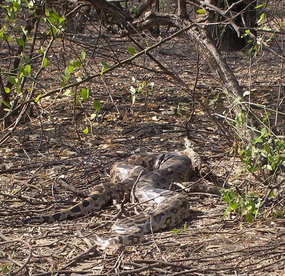
- Amphibians and reptiles include the keel back tortoise, viper, krait, cobra, water cobra, banded krait, Asian rat snake (beauty rat snake), python, Russel's viper (Daboia), checkered garter snake and common lizard (Viviparous lizard). Python molurus is also found in the park.
Avifauna[edit | edit source]
Prominent bird species recorded in the park are both migratory and resident. Some of them are the East Himalayan pied kingfisher, black kite, lesser sky-lark, northern hill myna, Indian pied myna, North Indian black drongos, lesser eastern jungle crow, yellow headed wagtail, spotbill duck, blue-winged teal, ruddy shell duck, threatened hooded crane, Burmese sarus sarus crane, Indian white-breasted waterhen and crimson-breasted pied woodpecker.[6][9]
Threats[edit | edit source]
_pleading_to_save_him_from_being_killed_by_human_beings.jpg)
Some of the identified threats to the park are elaborated below.[9]
- The threats to the park are due to the permanent flooding of the park and its resultant effect on the thickness of phumdis. The reason attributed for this is due to construction of the Ithai Barrage under the Loktak Multi-Purpose Project in 1983 where high level of water is maintained (between 768 m (2,519.7 ft) and 768.5 m (2,521.3 ft) ) during October to March – the dry months of the year. This has disturbed the natural cycle of floating and sinking of phumdis which used to be maintained in the park. Maintenance of high water level in the lake throughout the year for Loktak Multipurpose Project has broken this annual cycle and phumdis remain floating throughout the year during dry season and are no more available to phumdi vegetation. Therefore, the growth of vegetation on phumdis and their thickness are believed to be gradually decreasing.
- Before the construction of the Loktak Hydro Electric Project, the phumdis floated during flooding by backflow from the Khordak River and discharge from other streams and nalas and settled down on lake bed during dry season when water was drawn out through the same river. This resulted in enhancing of nutrients and minerals of the phumdi vegetation from the bottom of the lake during the dry period. But this cycle has been disturbed by the Loktak Hydro Electric project. One apprehension is that at some stage the phumdis may not be able to support the number of the Eld's deer or sangai deer.
- The national park and the Loktak Lake have provided sustenance (through fishing, growing, and collection of vegetables of economic importance) to the people living in the peripheral villages and on the phumdis. The effect of maintaining permanently high water level is stated to be a serious threat to the phumdis and consequently to the people living on the lake/park's natural resources.
- Earlier, there was only marshy land in the park area but after commissioning of the hydroelectric project two ecosystems have emerged; one with water body covering one-third area and the other the phumdis, which covers two-thirds area.
- Deteriorating water quality is indicated by the recorded pH values of 4 to 8.5. The reasons for poor quality are attributed to flow of
- pollutants from the towns draining into the lake,
- use of agrochemicals for farming in the surrounding farmland,
- accumulation of water on phumdi,
- deforestation and subsequent soil erosion in the catchment area and
- rotting vegetation.
Conservation measures[edit | edit source]
Conservation measures suggested relate to development and implementation of a management plan giving priority to long term conservation, monitoring the condition of habitat and to take timely corrective measures by enforcing strict protection of core areas, particularly with reference to the water level due to the Loktak Hydro Electric Power Project.
Some of the measures suggested and under implementation are elaborated as
- provide effective protection,
- developing and maintaining high places with adequate protection and food material to provide protection to the animals in case of flash flood,
- increasing area under phumdis in the park,
- preventing theft of phumdis and flow or part of phumdis towards northern side,
- topping completely the collection of firewood, food and fodder,
- creating an environment in which local people volunteer as natural custodian of sangai and other animals in the park,
- to encourage ecotourism and nature education,
- to undertake, aid, promote and co–ordinate research works,
- capacity building, training, awareness and extension activities,
- launching packaging and publicity campaign and
- propagating ethnic information, exhibition and so forth.[7][9]
Conservation measures implemented The measures that have been implemented by the Forest Department of the Manipur Government are the following.
- A perimeter fence of 2,281 m (7,483.6 ft) length in most vulnerable sections of the park to prevent people and domestic livestock from entering the reserve has been created
- A cattle-proof trench has been dug along 870 m (2,854.3 ft) of the boundary
- Seven canoes and four checkpoints are established at strategic places for security.
- Army helicopter has carried out census work.
- The park is under the supervision of full–time forest officials.
- Capacity building has been achieved by exclusive placement of an Assistant Conservator of Forests, an assistant veterinary surgeon, a ranger of forests, field assistant, three foresters, four forest guards and eight others for the park.
Visitor information[edit | edit source]
The park is approachable by road, rail and air through Imphal, the capital of Manipur. By road it is 53 km (32.9 mi) from Imphal and 522 km (324.4 mi) from Guwahati (Assam) on the National Highway No. 53. Public and private transport ply on these roads.
The nearest rail head is at Jiribam is a railhead on the Manipur border, which is 225 km (139.8 mi) from Imphal.[citation needed]. And Rani Gaidinliu station at Tamenglong is the nearest station which is 177 km (110.0 mi) from Imphal and 188 km (116.8 mi) from the national park.
Resorts under the Classic Hotel for family and travel-loving couple are available in the Sendra island park which is 5-6 kilometers away from the National Park. Basic accommodation of a forest rest house without boarding facilities is available at Phubala and Sendra islands inside the park and at Moirang town 10 km (6.2 mi) away from the park. Staying at Imphal which has better hotel facilities is a preferred option.
Visit to the park is ideal between 0600 and 1000 hrs in the morning and 1530 and 1800 hrs in the afternoon, when the sangai deer comes out to feed in herds. A boat trip along the labyrinthine boat routes passing through colourful water plants would be a good way to see the park. An adventurous trip would be to take a walk through the park but the phumdi is not a firm ground. Manipur Tourism Department arranges conducted day tours to the Loktak Lake and the Keibul Lamjao Park.[8]
Manipur is considered a sensitive border state. Earlier the Foreigners entering Manipur (including foreign citizens born in Manipur) was needed to possess a Restricted Area Permit, but now it has been lifted from the state. There is no permit required for foreigners coming to Manipur, they only need to register themselves in the established check points i.e. Imphal Airport and (Mao and Jiribam) for those coming by road.[citation needed]
Films[edit | edit source]
- The Return of Sangai (Script error: The function "langx" does not exist.) is a documentary about Keibul Lamjao National Park and Sangai[13] made by forest department Manipur. The film is available in both English and Manipuri.
References[edit | edit source]
- ↑ "The Floating Islands of India". earthobservatory.nasa.gov. 7 May 2018. Archived from the original on 13 March 2023. Retrieved 13 March 2023.
The largest island is home to the Keibul Lamjao, the world's only floating national park. It serves as a habitat for the endangered brow-antlered sangai, or "dancing deer," whose hooves have adapted to the island's spongy ground. The park, covering 15 square miles (40 km2), was specifically created to preserve the deer, which were once thought to be extinct.
- ↑ McKechnie, Ben. "The world's only floating national park". www.bbc.com. Archived from the original on 13 March 2023. Retrieved 13 March 2023.
- ↑ Centre, UNESCO World Heritage. "Keibul Lamjao Conservation Area". UNESCO World Heritage Centre. Archived from the original on 15 July 2017. Retrieved 13 March 2023.
- ↑ "Keibul Lamjao Conservation Area | For UNESCO World Heritage Travellers". www.worldheritagesite.org. Archived from the original on 30 November 2022. Retrieved 13 March 2023.
- ↑ "Symbols of Manipur- knowindia.gov.in". Archived from the original on 12 November 2013. Retrieved 15 August 2025.
- ↑ 6.0 6.1 6.2 6.3 6.4 "Keibul Lamjao National Park Forest Department, Government of Manipur". Archived from the original on 15 October 2008. Retrieved 9 January 2009.
- ↑ 7.0 7.1 Wemmer, Christen M.; Moore, Donald; Blouch, Raleigh (1998). Deer: status survey and conservation action plan. IUCN. p. 69. ISBN 2-8317-0454-5. Retrieved 29 March 2009.[permanent dead link]
- ↑ 8.0 8.1 "Keibul Lamjao National Park". The Hindu. Chennai, India. 5 November 2005. Archived from the original on 26 May 2006. Retrieved 29 March 2009.
- ↑ 9.0 9.1 9.2 9.3 9.4 9.5 Sinsit Singh (10 December 2003). "Brow antlered deer (Cervus eldi eldi) in Keibul Lamjao National Park" (PDF). Khao Kheow Open Zoo, Chonburi, Thailand. pp. 19–23. Archived from the original (PDF) on 7 June 2011. Retrieved 29 March 2009.
- ↑ 10.0 10.1 10.2 10.3 "Inventory of wetlands, Keibul Lamjao National Park" (PDF). Govt. of India. pp. 314–318. Archived from the original (PDF) on 3 March 2016. Retrieved 26 March 2009.
- ↑ Threatened Deer. International Union for Conservation of Nature and Natural Resources (IUCN). 1978. pp. 27–29. ISBN 2-88032-201-4. Archived from the original on 4 November 2021. Retrieved 29 March 2009.
- ↑ S.Serrao; J.C.Daniel (1991). Conservation in Developing Countries. Bombay Natural History Society. p. 412. ISBN 978-0-19-562652-0. Retrieved 26 March 2009.
- ↑ "The Return of Sangai". The India. Archived from the original on 22 January 2018.