

imported>MPGuy2824 →top: no need of honorifics in template |
rework details for consistency |
||
| (One intermediate revision by one other user not shown) | |||
| Line 1: | Line 1: | ||
{{more citations needed|date=September 2013}} | |||
{{Use dmy dates|date=April 2020}} | {{Use dmy dates|date=April 2020}} | ||
{{Use Indian English|date=August 2016}} | {{Use Indian English|date=August 2016}} | ||
{{Infobox settlement | {{Infobox settlement | ||
| name | | name = Tumakuru District | ||
| native_name | | native_name = | ||
| native_name_lang | | native_name_lang = kn | ||
| other_name | | other_name = | ||
| nicknames = Kalpataru Nadu (Coconut Country), | |||
| settlement_type | Shikshanika Nagari (City of Educational Institutions) | ||
| settlement_type = [[List of districts of Karnataka|District]] of [[Karnataka]] | |||
| image_skyline = {{Photomontage | |||
|size = 250 | |||
|photo1a = Shivagange near bengaluru.jpg | |||
|photo1b = Markonahalli dam (2).JPG | |||
|photo2a = Madhugiri Fort 1.JPG | |||
|photo2b = A profile of the Chennakeshava Temple at Aralaguppe.JPG | |||
|photo3a = View from Devarayanadurga (33897360691).jpg | |||
|photo3b = Guru Mandir - Mandargiri Hill.jpg | |||
| | |||
| | |||
| | |||
| | |||
| | |||
| | |||
| | |||
| | |||
| | |||
}} | }} | ||
'''Tumakuru | | image_alt = | ||
| image_caption = Clockwise from top-left: View from [[Shivagange]], [[Marconahalli|Markonahalli Reservoir]], [[Chennakeshava Temple, Aralaguppe|Chennakeshava Temple]] at Arlaguppe, [[Mandaragiri|Guru Mandir, Mandaragiri]], View from [[Devarayanadurga|Devarayanadurga Hill]], Madhugiri Fort | |||
| image_map = Tumkur in Karnataka (India).svg | |||
| image_map1 = | |||
| map_alt = | |||
| map_caption = Location in Karnataka | |||
| coordinates = {{coord|13.34|77.1|display=inline,title}} | |||
| subdivision_type = Country | |||
| subdivision_name = {{flag|India}} | |||
| subdivision_type1 = State | |||
| subdivision_name1 = {{flagicon image|Seal of Karnataka.svg|Emblem of Karnataka}}[[Karnataka]] | |||
| established_title = <!-- Established --> | |||
| established_date = | |||
| founder = | |||
| named_for = | |||
| parts_type = [[Taluka]]s | |||
| parts = [[Tumakuru]],<br /> [[Sira Taluk|Sira]],<br /> [[Gubbi]],<br /> [[Tiptur|Tipaturu]],<br /> [[Turuvekere]],<br /> [[Kunigal]],<br /> [[Madhugiri]],<br /> [[Pavagada]],<br /> [[Koratagere]],<br /> [[Chikkanayakanahalli]]. | |||
| seat_type = Headquarters | |||
| seat = [[Tumakuru]] | |||
| government_type = | |||
| governing_body = | |||
| leader_title1 = Deputy Commissioner and District Magistrate | |||
| leader_name1 = Subha Kalyan, I.A.S <ref>{{Cite web|url=https://tumkurzillapanchayat.gov.in/distadmin.html|title=District Administration|website=tumkurzillapanchayat.gov.in}}</ref><ref>{{Cite web|url=https://www.karnataka.gov.in/gokdirectory/en|title=Karnataka Government|website=www.karnataka.gov.in}}</ref> | |||
| leader_title2 = District In-charge Minister | |||
| leader_name2 = [[G. Parameshwara]] ([[Indian national congress|INC]]) <ref>{{Cite web|url=https://www.thenewsminute.com/article/karnataka-govt-announces-district-charge-ministers-cm-yediyurappa-retains-bengaluru-108995|title=Karnataka govt announces district in-charge ministers, CM Yediyurappa retains Bengaluru|date=16 September 2019|website=The News Minute}}</ref> | |||
| leader_title3 = President, Zilla Panchayat | |||
| leader_name3 = Latha Ravikumar ([[Janata Dal (Secular)|JDS]]) <ref>{{Cite web|url=https://www.thehindu.com/news/national/karnataka/jds-bags-president-post-in-tumakuru-zp/article8587385.ece|title=JD(S) bags president post in Tumakuru ZP|author=Staff Correspondent|date=12 May 2016|via=www.thehindu.com}}</ref> | |||
|leader_title4 = | |||
Superintendent of police | |||
|leader_name4 = Ashok K V , [[I.P.S]] | |||
| unit_pref = Metric | |||
| area_footnotes = <ref>{{Cite web|url=https://www.karnataka.com/districts/about-districts/|title=Districts in Karnataka|date=14 July 2013|website=Karnataka.com}}</ref> | |||
| area_rank = | |||
| area_total_km2 = 10,597 | |||
| elevation_footnotes = | |||
| elevation_m = | |||
| population_total = 2,678,980 | |||
| population_as_of = 2011 | |||
| population_rank = 150 in India | |||
| population_density_km2 = auto | |||
| population_demonym = | |||
| population_footnotes = | |||
| demographics_type1 = Languages | |||
| demographics1_title1 = Official | |||
| demographics1_info1 = [[Kannada]] | |||
| timezone1 = [[Indian Standard Time|IST]] | |||
| utc_offset1 = +5:30 | |||
| postal_code_type = [[Postal Index Number|PIN]] | |||
| postal_code = 572xxx | |||
| area_code_type = | |||
| area_code = | |||
| registration_plate = * Tumakuru KA 06 | |||
* Tipaturu KA 44 | |||
* Madhugiri KA 64 | |||
| website = {{URL|tumkur.nic.in}} | |||
| footnotes = | |||
| official_name = | |||
}} | |||
'''Tumakuru district''' is an [[List of districts of Karnataka|administrative district]] in the state of [[Karnataka]] in [[India]]. It is the second largest district in Karnataka by land area with an area of 10,598 km<sup>2</sup>,<ref>{{Cite web |title=National Portal of India |url=https://www.india.gov.in/ |access-date=2022-06-21 |website=www.india.gov.in}}</ref> and fourth largest by Population.<ref name="auto">{{Cite web |date=2016-01-31 |title=Most Populous Districts in Karnataka |url=https://www.worldlistmania.com/most-populous-districts-in-karnataka-state/ |access-date=2022-06-21 |website=WorldlistMania |language=en-US}}</ref> It is a one-and-a-half-hour drive from [[Bangalore|Bengaluru]], the state capital. The district is known for the production of coconuts and is also called as 'Kalpataru Nadu'.<ref name="Tumakuru sets a green example">{{Cite web|title=Tumakuru sets a green example|url=https://www.downtoearth.org.in/forests/tumakuru-sets-a-green-example-61113|access-date=2021-01-31|website=www.downtoearth.org.in}}</ref> It is the only discontiguous district in Karnataka ([[Pavagada]] Taluk has no geographical continuity with the rest of the district). | |||
As of census of 2011, the district has a population of 2,678,980, with a population density of 253 people /km<sup>2</sup>,<ref name="auto"/> the district has the literary rate of 75.14% and a sex ratio of 984 women/ 1000 men. Tumakuru district is surrounded by [[Chikkaballapura district]] and [[Bengaluru Rural District|Bengaluru Rural]] in East, [[Ramanagara district]] in South-East, [[Mandya district|Mandya]] and [[Hassan district|Hassan]] districts in South-West, [[Chikmagalur district]] in west, [[Chitradurga district]] in north-west and [[Sri Sathya Sai district]] and [[Anantapur district]] of [[Andhra Pradesh]] in North. | |||
== Transport == | |||
Tumkur provides connectivity to Banglore, Hassan, Chitradurga and Many more cities. The RTO Code of Tumkur is KA06<ref>{{Cite web |title=Transport Department,Karnataka |url=https://etc.karnataka.gov.in/General/rto_office.aspx |access-date=2024-06-05 |website=etc.karnataka.gov.in}}</ref> | |||
It consists chiefly of elevated land intersected by river valleys. A range of hills rising to nearly {{convert|4000|ft|m}} crosses it from north to south, forming the watershed between the systems of the [[Krishna River|Krishna]] and the [[Kaveri]]. The principal streams are the | ==History== | ||
[[Nidugal Cholas]] were ruled this region between 8th to 13th century.<ref>{{cite book |url=https://archive.org/details/shdgnga.the-cholas-of-nidugal-a-study/ |title=The Cholas of Nidugal a Study |author=Kavitha R|date=1993 |page=151 |publisher=Karnatak University}}</ref> | |||
The district was formed in 1832 during the days of British commissioner of Mysuru [[Mark Cubbon (army officer)|Sir Mark Cubbon]] as Chitaldroog Division including the area of present [[Chitradurga district|Chitradurga]] and Tumakuru districts headquartered at [[Tumkur|Tumakuru]]. [[Major General Richard Stewart Dobbs]] was the first collector of the district (term of office 1835–1861), who was key responsible for the establishment of Munro system of administration.<ref>{{Cite web|url=http://archive.org/details/reminiscencesli00dobbgoog|title=Reminiscences of Life in Mysore, South Africa, and Burmah|date=30 June 1882|publisher=G. Herbert|via=Internet Archive}}</ref> In the year 1862 Chitaldroog division was abolished and Tumakuru (Nandidroog division) and Chitradurga (Nagar Division) established as separate districts by [[Lewin Bentham Bowring]].<ref>http://www.tumkur.nic.in Tumakuru District Gazetteer</ref> The district occupies an area of 10,598 km<sup>2</sup> and had a population of 2,678,980, of which 19.62% were urban as of 2011.<ref>{{Cite web|title=Tumkur District Population, Karnataka, List of Taluks in Tumkur|url=https://www.censusindia2011.com/karnataka/tumkur-population.html|access-date=2021-01-31|website=Censusindia2011.com|language=en-US}}</ref><ref name="districtcensus">{{Cite web |date=2011 |title=District Census Handbook: Tumkur |url=https://censusindia.gov.in/nada/index.php/catalog/634/download/2184/DH_2011_2917_PART_A_DCHB_TUMKUR.pdf |website=censusindia.gov.in |publisher=[[Registrar General and Census Commissioner of India]]}}</ref> The district is known for the production of coconuts, called as 'Kalpataru Nadu'.<ref name="Tumakuru sets a green example"/> It is the only discontiguous district in Karnataka (Pavagada Taluk has no geographical continuity with the rest of the district). | |||
==Geography== | |||
Tumakuru district has ten talukas, [[List of constituencies of the Karnataka Legislative Assembly|eleven Assembly constituencies]]<ref>{{Cite web|title=Constituencies {{!}} District Tumkur, Government of Karnataka {{!}} India|url=https://tumkur.nic.in/en/constituencies/|access-date=2021-01-31|language=en-US}}</ref> and the district is shared among [[List of constituencies of the Lok Sabha|three Parliamentary constituencies]]. Tumakuru district shares border with ten districts, which is the highest in the state. The districts that share the border are Districts of [[Chitradurga district|Chitradurga]] towards north, [[Hassan district|Hassan]] and [[Chikmagalur district|Chikkamagaluru]] towards west, [[Mandya district|Mandya]] towards south-west, [[Ramanagara district|Ramanagara]] and [[Bengaluru Rural District|Bengaluru Rural]] towards south, [[Chikkaballapura district|Chikkaballapura]] towards east and [[Sri Sathya Sai district]] and [[Anantapur district]] ([[Andhra Pradesh]]) towards north-east. | |||
It consists chiefly of elevated land intersected by river valleys. A range of hills rising to nearly {{convert|4000|ft|m}} crosses it from north to south, forming the watershed between the systems of the [[Krishna River|Krishna]] and the [[Kaveri]]. The principal streams are the Jayamangali and the [[Shimsha]]. The mineral wealth of Tumakuru is considerable; iron is obtained in large quantities from the hillsides; and excellent building-stone is quarried. The slopes of the [[Devarayanadurga]] hills are clothed with forests.<ref name="EB1911">{{EB1911|inline=y|wstitle=Tumkur|volume=27|page=370}}</ref> Wildlife such as [[leopard]]s, [[dhole]], [[bear]]s and [[wild boar]] have been recorded here. Although, [[tiger]]s have been recorded from these forests as late as the 1950s, most recent reports are of stray sightings and need confirmation.<ref name=hindu>{{cite news|author=Staff Correspondent|title=Search on for tiger in Tumakuru district|url=http://www.hindu.com/2008/09/26/stories/2008092651350600.htm|archive-url=https://web.archive.org/web/20080929012707/http://www.hindu.com/2008/09/26/stories/2008092651350600.htm|url-status=dead|archive-date=29 September 2008|access-date=18 February 2011|newspaper=[[The Hindu]]|date=26 September 2008}}</ref> The annual rainfall averages 39 inches. | |||
==Demographics== | ==Demographics== | ||
{{historical populations|11=1901|12=6,71,801|13=1911|14=7,38,786|15=1921|16=7,76,825|17=1931|18=8,63,227|19=1941|20=9,55,809|21=1951|22=11,51,362|23=1961|24=13,67,402|25=1971|26=16,27,721|27=1981|28=19,77,854|29=1991|30=23,05,819|31=2001|32=25,84,711|33=2011|34=26,78,980|percentages=pagr|footnote=source:<ref>{{Cite web|url=https://www.censusindia.gov.in/2011census/PCA/A2_Data_Table.html|title=Census of India Website : Office of the Registrar General & Census Commissioner, India|website=www.censusindia.gov.in}}</ref>|align=center}} | |||
[[ | |||
According to the [[2011 census of India|2011 census]] | {{bar box | ||
|title=Religion in Tumakuru district (2011)<ref name="religion">{{Cite web |date=2011 |title=Table C-01 Population by Religion: Karnataka |url=https://censusindia.gov.in/nada/index.php/catalog/11378/download/14491/DDW29C-01%20MDDS.XLS |website=censusindia.gov.in |publisher=[[Registrar General and Census Commissioner of India]]}}</ref> | |||
|titlebar=#Fcd116 | |||
|left1=Religion | |||
|right1=Percent | |||
|float=left | |||
|bars= | |||
{{bar percent|[[Hinduism in Karnataka|Hinduism]]|darkorange|90.10}} | |||
{{bar percent|[[Islam]]|green|9.18}} | |||
{{bar percent|Other or not stated|black|0.72}} | |||
}} | |||
According to the [[2011 census of India|2011 census]] Tumakuru district has a [[Demographics of India|population]] of 2,678,980,<ref name="districtcensus"/> roughly equal to the nation of [[Kuwait]]<ref name="cia">{{cite web | author = US Directorate of Intelligence | title = Country Comparison:Population | url = https://www.cia.gov/library/publications/the-world-factbook/rankorder/2119rank.html | archive-url = https://web.archive.org/web/20070613004507/https://www.cia.gov/library/publications/the-world-factbook/rankorder/2119rank.html | url-status = dead | archive-date = 13 June 2007 | access-date = 1 October 2011 | quote = Kuwait 2,595,62}}</ref> or the US state of [[Nevada]].<ref>{{cite web|url=http://2010.census.gov/2010census/data/apportionment-pop-text.php|title=2010 Resident Population Data|publisher=U. S. Census Bureau|access-date=30 September 2011| quote =Nevada 2,700,551}}</ref> The district ranked 4th place in terms of population in Karnataka after Bengaluru, Belagavi and Mysuru. The district has a population density of 253 per square km.<ref name=districtcensus/> Its [[Family planning in India|population growth rate]] over the decade 2001–2011 was 3.74%.<ref name=districtcensus/> Tumkur has a [[sex ratio]] of 984 [[Women in India|females]] for every 1000 males,<ref name=districtcensus/> and a [[Literacy in India|literacy rate]] of 75.14%. 22.36% of the population lives in urban areas. Scheduled Castes and Scheduled Tribes make up 18.92% and 7.82% of the population respectively.<ref name=districtcensus/> | |||
===Language=== | |||
{{Pie chart | |||
|caption = Languages of Tumakuru district (2011)<ref name="languages"/> | |||
|label1 = [[Kannada]] |value1 = 84.95 |color1 = darkslateblue | |||
|label2 = [[Urdu]] |value2 = 9.03 |color2 = green | |||
|label3 = [[Telugu language|Telugu]] |value3 = 3.38 |color3 = steelblue | |||
|label4 = [[Lambadi]] |value4 = 1.07 |color4 = khaki | |||
|label5 = Others |value5 = 1.57 |color5 = grey | |||
|thumb=right | |||
}} | |||
At the time of the 2011 census, 84.95% of the population spoke [[Kannada]], 9.03% [[Urdu]], 3.38% [[Telugu language|Telugu]] and 1.07% [[Lambadi]], 1.57% other languages as their first language.<ref name="languages">{{Cite web |title=Table C-16 Population by Mother Tongue: Karnataka |url=https://censusindia.gov.in/nada/index.php/catalog/10208/download/13320/DDW-C16-STMT-MDDS-2900.XLSX |website=www.censusindia.gov.in |publisher=[[Registrar General and Census Commissioner of India]]}}</ref> | |||
==Description== | ==Description== | ||
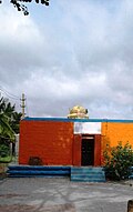
[[File:Lake Temple at Kunigal.jpg|thumb|left|upright|Kunigal Temple]] | |||
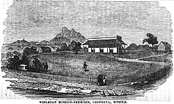
[[File:Wesleyan-Mission Premises, Coonghul, Mysore (VII, p.129, October 1950) - Copy.jpg|thumb|Tumkur in History]] | [[File:Wesleyan-Mission Premises, Coonghul, Mysore (VII, p.129, October 1950) - Copy.jpg|thumb|Tumkur in History]] | ||
The | The known history of Tumakuru district begins with the Gangas. The Ganga family ruled over the southern and eastern districts of the State from early in the Christian era to 1025 A.D. The earliest record of the Ganga family found in this district belongs to about 400 A.D. After the Gangas, Tumkur was ruled by the Rastrakutas and the Chalukyas. The Nolambas under these rulers ruled the area for a long time. The Cholas also ruled some parts of the district. The Vijayanagara Empire ruled supreme for the later part of the 13th to 17th century. During the 18th and 19th century, Tumkur was ruled by the Wodeyars of Mysore until Independence. | ||
The Tumakuru Town Municipality was set up by the British and Mysore Wodeyars in the 1916. Self-rule of the residents started after the setting up of the municipality. It was converted into a City Corporation only in 2010 by adding 22 villages adjoining the city. The population is {{formatnum:305877}} as per the 2011 census. | |||
==Economy== | |||
Tumakuru is now a middle class majority city, with a literacy rate of 80%, mainly traders, government employees, small and medium industrialists, self-employed individuals etc. The GDP of Tumkur is around 6045184 Rs lakh (2019–20) and the total collection of income tax in the last financial year was approximately 800 million. The aspirational level of the citizens is very high. Being an agrarian economy, the major plantation crops of Tumkur are coconuts and areca nuts. The major cash crops are paddy, ragi and groundnuts. Iron ore, manganese and granite are the major minerals found in Tumkur district. | |||
Owing to its proximity to Bangalore, besides being the gateway to Karnataka, being on the Chennai – Mumbai Industrial Corridor and the infrastructure that Tumkur provides, Tumkur has the potential to be the satellite city to decongest the State Capital of Bangalore. And also has been identified as National Investment and Manufacturing Zone (NIMZ). NIMZ of approx. 13500 acres and the HAL Helicopter manufacturing facility (Nr Gubbi) 610 acres will be developed as integrated industrial townships with state-of-the art infrastructure and land use on the basis of zoning; clean and energy efficient technology; necessary social infrastructure; skill development facilities, etc., for promoting world class manufacturing activity. Tumkur is home to 24 large scale industries with an investment of 9114.2 million and generating an employment for 6445 persons. The existing 15 medium scale industries and 23804 micro and small Industries employ 132994 persons and account for an investment of close to 7.90 billion. Also 2000 MW of Solar power plant on 11000 acres in Pavagada to cater to the power needs of Tumkur and adjoining districts. | |||
[[File:Siddapura. Yadiyur.jpg|thumb|left|upright|Siddapura, Yadiyur]] | |||
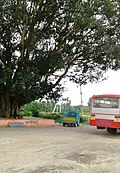
[[File:Bangalore Road. Kunigal.jpg|thumb|upright|Bangalore-Hassan Road]] | |||
Tumkur is a knowledge hub in the south interior Karnataka and boasts of its own Tumkur University, two medical colleges, five engineering colleges, 38-degree and post-graduate colleges, one dental college and many polytechnics, high schools and primary schools imparting top-level education to all classes of citizens. | |||
The Indian budget for 2014–15 held on 10 July 2014 had announced that Tumkur is one of the cities in south India to be developed as an "Industrial Smart" city. The city was selected as one among the 100 in the country shortlisted for the Smart City project. Tumkur is competing now to be one among the 20 to be taken up for development. The government of India has promised 1 billion each as a matching grant for five years and the local Body with assistance from the state government has to match another 1 billion. Thus, in five years development to the tune of 10 billion will happen in Smart City. The Tumkur District Chamber of Commerce and Industry under the leadership of Surendra Shah, President 2014–16 is striving for the district to be developed as a "Knowledge Industry New Destination city" (KIND). | |||
==Taluks== | |||
{{div col|small=yes}} | |||
* [[Chikkanayakana Halli|Chikkanayakanahalli]] | * [[Chikkanayakana Halli|Chikkanayakanahalli]] | ||
* [[Gubbi]] | * [[Gubbi]] | ||
| Line 114: | Line 154: | ||
* [[Sira, Karnataka|Sira]] | * [[Sira, Karnataka|Sira]] | ||
* [[Tiptur]] | * [[Tiptur]] | ||
* | * [[Tumakuru]] | ||
* [[Turuvekere]] | * [[Turuvekere]] | ||
{{div col end}} | |||
==Education== | ==Education== | ||
It is a good study center from primary education to higher education. It has its own university. Within this town, there are seven technology institutions, two medical institutions and one dental institution. | |||
The district is divided as two Educational district. i.e. Tumakuru (south) and other one is Tumakuru (north) Madhugiri Educational district. Where as Tumakuru (south) includes 6 taluks as Chikkanayakanahalli,Gubbi,Kunigal,Tiptur,Tumakuru and Turuvekere.And Tumkur (north) Madhugiri district includes 4 taluks namely koratagere, Madhugiri, Pavagada and Sira.Tumkur(south) considered as education hub nowadays. | |||
It consists 2085 Govt.Primary schools, 63 aided Primary schools, 267 unaided Primary schools and 1 kendriya vidyalaya, and total 2,417 primary schools, there are 147 Govt. High schools, 205 aided High schools, 123 unaided High schools, and 2 central govt. High schools in the Tumkur south dist.Tumkur north dist, there are 1291 Govt. primary, 9 aided Primary schools, 123 unaided Primary schools exists.Vice versa there are 113 Govt. high schools, 109 aided High schools, 57 unaided high schools facility available. | |||
=== Educational institutions in | === Educational institutions in Tumakuru === | ||
{{div col|small=yes}} | |||
* Sri Udaya Bharathi Educational and Charitable Institutions | |||
* Akshaya Group of Educational Institutions | * Akshaya Group of Educational Institutions | ||
* Aryabharathi group of Educational Institutions | * Aryabharathi group of Educational Institutions | ||
* Channabasaveshwara Group of Educational Institutions | * Channabasaveshwara Group of Educational Institutions | ||
* HMS Group of Educational Institutions | * HMS Group of Educational Institutions | ||
* Jain Group of Institutions | |||
* Kalpataru Group of Educational Institutions | * Kalpataru Group of Educational Institutions | ||
* Maruthi Group of Educational Institutions | * Maruthi Group of Educational Institutions | ||
* Sacred Heart Group of Educational Institutions | * Sacred Heart Group of Educational Institutions | ||
* Sarvodaya Group of Educational Institutions | * Sarvodaya Group of Educational Institutions | ||
* Shridevi Group of Educational Institutions | * Shridevi Group of Educational Institutions | ||
* Siddaganga Group of Educational Institutions | * Siddaganga Group of Educational Institutions | ||
* Sri Siddharatha Group of Educational Institutions | * Sri Siddharatha Group of Educational Institutions | ||
* Sri Vidyodaya Foundation | * Sri Vidyodaya Foundation Trust | ||
* St.Joseph's Group of Educational Institutions | * St.Joseph's Group of Educational Institutions | ||
* Varadaraja Group of Institutions | |||
* Vidya Group of Educational Institutions (managed by AspireTechno) | * Vidya Group of Educational Institutions (managed by AspireTechno) | ||
* Vidyanikethan Group of Institutions | * Vidyanikethan Group of Institutions | ||
* Vidyanidhi Group of Institutions | |||
* Vidyavahini Group of Educational Institutions | * Vidyavahini Group of Educational Institutions | ||
{{div col end}} | |||
* Global Educational And Charitable Trust- Global Shaheen College | |||
*Seshadripuram Pre-University College | |||
==Image gallery== | ==Image gallery== | ||
<gallery> | <gallery> | ||
File:Temple in Kunigal.jpg|Kunigal Temple | File:Temple in Kunigal.jpg|Kunigal Temple | ||
File:Small Temple.Kunigal.jpg|Shiva temple | File:Small Temple.Kunigal.jpg|Shiva temple | ||
File:Lakeside temple.Kunigal.jpg|Kunigal promenade | File:Lakeside temple.Kunigal.jpg|Kunigal promenade | ||
File:Kunigal Lake Road.jpg|Kunigal Lake | File:Kunigal Lake Road.jpg|Kunigal Lake | ||
File:Masjid Al Rayyan Tumakuru.jpg|Masjid Al Rayyan, Ring Road Tumkur City | |||
File:Jamia Masjid Sira 1.jpg|Jamia Masjid Sira | |||
File:Masjid e Aqsa, Tumkur - 04.jpg|Masjid e Aqsa, Tumkur City | |||
File:Minarets of Makka Masjid, Tumkur, India, built by Dr. Ahmed (2001).jpg|Makka Masjid, Barlane Tumkur City | |||
</gallery> | </gallery> | ||
== Top Tourist spots== | |||
* [[Mandaragiri]] | |||
* [[Siddaganga Matha]] | |||
* [[Devarayanadurga]] | |||
* [[Namada Chilume]] | |||
* [[Shimsha]] Markonahalli Dam | |||
* [[Madhugiri]] - Monolithic Hill, Fort | |||
* [[Pavagada Solar Park]] | |||
* [[Kunigal Stud Farm]] | |||
* [[Yedeyur]] | |||
* [[Goravanahalli Mahalakshmi Temple]] | |||
* [[Kasturi Rangappa Nayaka Fort]] | |||
* Kaidala Sree channakeshava temple | |||
* Nijagal Fort | |||
* [[Jayamangali Blackbuck Conservation Reserve]] | |||
* Siddara betta | |||
* [[Huliyurdurga]] | |||
* Borana kanive dam, Chikkanayakanahalli | |||
* Hutridurga, Kunigal | |||
==Notable people== | ==Notable people== | ||
===Social service=== | ===Social service=== | ||
*[[Sree Sree Shivakumara Swamiji]] | * [[Sree Sree Shivakumara Swamiji]] | ||
===Actors=== | ===Actors=== | ||
*[[Arjun Sarja]] | *[[Achyuth Kumar]], actor | ||
*[[ | *[[Arjun Sarja]], actor | ||
*[[ | *[[Ashika Ranganath]], actress | ||
*[[Manjula (Kannada actress)]] | *[[Jaggesh]], actor | ||
*[[ | *[[Komal Kumar]], actor and comedian | ||
*[[ | *[[Lohithaswa]] T.S actor, [[writer]] | ||
*[[ | *[[Manjula (Kannada actress)|Manjula]], actress | ||
*[[ | *[[Narasimharaju (Kannada actor)|Narasimharaju]], Indian theatre and film actor | ||
*[[ | *[[Pavan Wadeyar]], Kannada movie Director | ||
*[[Suman Ranganath]] | *[[Rangayana Raghu]], Actor and Comedian | ||
*[[ | *[[Tabla Nani]], actor and Comedian | ||
*[[ | *[[Sharath Lohithaswa]], actor | ||
*[[Siddhanth]], actor | |||
*[[Sudha Rani]], actress | |||
*[[Suman Ranganath]], actress | |||
*[[Umang Jain]], actress | |||
*[[Umashree]], actress | |||
===Arts=== | ===Arts=== | ||
*[[Gubbi Veeranna]] | * [[Gubbi Veeranna]], theater director | ||
*[[T. Sunandamma]] | * [[T. Sunandamma]], writer and humorist | ||
*[[Renuka Kesaramadu]] | * [[Renuka Kesaramadu]], painter and sculptor | ||
*[[Amarashilpi Jakanachari]] | * [[Amarashilpi Jakanachari]], sculptor | ||
*[[Baraguru Ramachandrappa]] | * [[Baraguru Ramachandrappa]], film director and writer | ||
*[[Chandrika Gururaj]] | * [[Chandrika Gururaj]], playback singer | ||
===Writers=== | ===Writers=== | ||
* [[K. B. Siddaiah]] | * [[K. B. Siddaiah]], professor, poet, and social activist | ||
===Athletes=== | ===Athletes=== | ||
*[[Poll Shyamsunder]] | * [[Poll Shyamsunder]], cricketer | ||
*[[Poll Ashokanand]] | * [[Poll Ashokanand]], cricketer | ||
===Politicians=== | ===Politicians=== | ||
*[[G. Parameshwara]] | * [[G. Parameshwara]], former Deputy Chief Minister of Karnataka | ||
*[[T. B. Jayachandra]] | * [[T. B. Jayachandra]], former Law Minister of Karnataka | ||
*[[G. S. Basavaraj]] | * [[G. S. Basavaraj]], Indian politician | ||
*[[S. Mallikarjunaiah]] | * [[S. Mallikarjunaiah]], Indian politician | ||
*[[K. Lakkappa]] | * [[K. Lakkappa]], Indian politician | ||
===Others=== | ===Others=== | ||
*[[C. P. Sadashivaiah]] | * [[C. P. Sadashivaiah]], agriculture scientist | ||
* | * [[Raja Ramanna]], physicist{{Circular reference|date=May 2017}} | ||
*[[M. S. Ramaiah]], | * [[M. S. Ramaiah]], founder of MSR group of institutions | ||
== | ==Towns and villages== | ||
<!---♦♦♦ Only add a location to this list if they already have their own article on the English Wikipedia ♦♦♦---> | |||
<!---♦♦♦ Please keep the list in alphabetical order ♦♦♦---> | |||
* [[Amruthur]] | * [[Amruthur]] | ||
* [[Bajagur]] | |||
* [[Hagalavadi]] | |||
* [[Kenkere]] | |||
* [[Kottanahalli]] | |||
* [[Mallasandra]] | * [[Mallasandra]] | ||
* [[ | * [[Marconahalli]] | ||
* [[Shravandanahalli]] | |||
* [[Yalachigere]] | * [[Yalachigere]] | ||
* [[ | |||
==See also== | |||
* [[Tumkur Lok Sabha constituency]] | |||
* [[Tumkur Rural Assembly constituency]] | |||
==References== | ==References== | ||
| Line 214: | Line 304: | ||
{{Authority control}} | {{Authority control}} | ||
[[Category:Districts of Karnataka]] | [[Category:Districts of Karnataka]] | ||
[[Category: | [[Category:Tumakuru district| ]] | ||
[[Category:1832 establishments in India]] | [[Category:1832 establishments in India]] | ||
Latest revision as of 13:41, 17 February 2026
 | This article needs more citations. (September 2013) |
Tumakuru District | |
|---|---|
 .JPG)   .jpg)  Clockwise from top-left: View from Shivagange, Markonahalli Reservoir, Chennakeshava Temple at Arlaguppe, Guru Mandir, Mandaragiri, View from Devarayanadurga Hill, Madhugiri Fort | |
| Nicknames: Kalpataru Nadu (Coconut Country),
Shikshanika Nagari (City of Educational Institutions) | |
.svg) Location in Karnataka | |
| Coordinates: 13°20′N 77°06′E / 13.34°N 77.1°E | |
| Country |  India India |
| State |  Karnataka Karnataka |
| Headquarters | Tumakuru |
| Talukas | Tumakuru, Sira, Gubbi, Tipaturu, Turuvekere, Kunigal, Madhugiri, Pavagada, Koratagere, Chikkanayakanahalli. |
| Government | |
| • Deputy Commissioner and District Magistrate | Subha Kalyan, I.A.S [1][2] |
| • District In-charge Minister | G. Parameshwara (INC) [3] |
| • President, Zilla Panchayat | Latha Ravikumar (JDS) [4] |
| • Superintendent of police | Ashok K V , I.P.S |
| Area | |
| • Total | 10,597 km2 (4,092 sq mi) |
| Population (2011) | |
| • Total | 2,678,980 |
| • Rank | 150 in India |
| • Density | 250/km2 (650/sq mi) |
| Languages | |
| • Official | Kannada |
| Time zone | UTC+5:30 (IST) |
| PIN | 572xxx |
| Vehicle registration |
|
| Website | tumkur |
Tumakuru district is an administrative district in the state of Karnataka in India. It is the second largest district in Karnataka by land area with an area of 10,598 km2,[6] and fourth largest by Population.[7] It is a one-and-a-half-hour drive from Bengaluru, the state capital. The district is known for the production of coconuts and is also called as 'Kalpataru Nadu'.[8] It is the only discontiguous district in Karnataka (Pavagada Taluk has no geographical continuity with the rest of the district).
As of census of 2011, the district has a population of 2,678,980, with a population density of 253 people /km2,[7] the district has the literary rate of 75.14% and a sex ratio of 984 women/ 1000 men. Tumakuru district is surrounded by Chikkaballapura district and Bengaluru Rural in East, Ramanagara district in South-East, Mandya and Hassan districts in South-West, Chikmagalur district in west, Chitradurga district in north-west and Sri Sathya Sai district and Anantapur district of Andhra Pradesh in North.
Transport[edit | edit source]
Tumkur provides connectivity to Banglore, Hassan, Chitradurga and Many more cities. The RTO Code of Tumkur is KA06[9]
History[edit | edit source]
Nidugal Cholas were ruled this region between 8th to 13th century.[10]
The district was formed in 1832 during the days of British commissioner of Mysuru Sir Mark Cubbon as Chitaldroog Division including the area of present Chitradurga and Tumakuru districts headquartered at Tumakuru. Major General Richard Stewart Dobbs was the first collector of the district (term of office 1835–1861), who was key responsible for the establishment of Munro system of administration.[11] In the year 1862 Chitaldroog division was abolished and Tumakuru (Nandidroog division) and Chitradurga (Nagar Division) established as separate districts by Lewin Bentham Bowring.[12] The district occupies an area of 10,598 km2 and had a population of 2,678,980, of which 19.62% were urban as of 2011.[13][14] The district is known for the production of coconuts, called as 'Kalpataru Nadu'.[8] It is the only discontiguous district in Karnataka (Pavagada Taluk has no geographical continuity with the rest of the district).
Geography[edit | edit source]
Tumakuru district has ten talukas, eleven Assembly constituencies[15] and the district is shared among three Parliamentary constituencies. Tumakuru district shares border with ten districts, which is the highest in the state. The districts that share the border are Districts of Chitradurga towards north, Hassan and Chikkamagaluru towards west, Mandya towards south-west, Ramanagara and Bengaluru Rural towards south, Chikkaballapura towards east and Sri Sathya Sai district and Anantapur district (Andhra Pradesh) towards north-east.
It consists chiefly of elevated land intersected by river valleys. A range of hills rising to nearly 4,000 feet (1,200 m) crosses it from north to south, forming the watershed between the systems of the Krishna and the Kaveri. The principal streams are the Jayamangali and the Shimsha. The mineral wealth of Tumakuru is considerable; iron is obtained in large quantities from the hillsides; and excellent building-stone is quarried. The slopes of the Devarayanadurga hills are clothed with forests.[16] Wildlife such as leopards, dhole, bears and wild boar have been recorded here. Although, tigers have been recorded from these forests as late as the 1950s, most recent reports are of stray sightings and need confirmation.[17] The annual rainfall averages 39 inches.
Demographics[edit | edit source]
| Year | Pop. | ±% p.a. |
|---|---|---|
| 1901 | 671,801 | — |
| 1911 | 738,786 | +0.95% |
| 1921 | 776,825 | +0.50% |
| 1931 | 863,227 | +1.06% |
| 1941 | 955,809 | +1.02% |
| 1951 | 1,151,362 | +1.88% |
| 1961 | 1,367,402 | +1.73% |
| 1971 | 1,627,721 | +1.76% |
| 1981 | 1,977,854 | +1.97% |
| 1991 | 2,305,819 | +1.55% |
| 2001 | 2,584,711 | +1.15% |
| 2011 | 2,678,980 | +0.36% |
| source:[18] | ||
According to the 2011 census Tumakuru district has a population of 2,678,980,[14] roughly equal to the nation of Kuwait[20] or the US state of Nevada.[21] The district ranked 4th place in terms of population in Karnataka after Bengaluru, Belagavi and Mysuru. The district has a population density of 253 per square km.[14] Its population growth rate over the decade 2001–2011 was 3.74%.[14] Tumkur has a sex ratio of 984 females for every 1000 males,[14] and a literacy rate of 75.14%. 22.36% of the population lives in urban areas. Scheduled Castes and Scheduled Tribes make up 18.92% and 7.82% of the population respectively.[14]
Language[edit | edit source]
At the time of the 2011 census, 84.95% of the population spoke Kannada, 9.03% Urdu, 3.38% Telugu and 1.07% Lambadi, 1.57% other languages as their first language.[22]
Description[edit | edit source]

_-_Copy.jpg)
The known history of Tumakuru district begins with the Gangas. The Ganga family ruled over the southern and eastern districts of the State from early in the Christian era to 1025 A.D. The earliest record of the Ganga family found in this district belongs to about 400 A.D. After the Gangas, Tumkur was ruled by the Rastrakutas and the Chalukyas. The Nolambas under these rulers ruled the area for a long time. The Cholas also ruled some parts of the district. The Vijayanagara Empire ruled supreme for the later part of the 13th to 17th century. During the 18th and 19th century, Tumkur was ruled by the Wodeyars of Mysore until Independence.
The Tumakuru Town Municipality was set up by the British and Mysore Wodeyars in the 1916. Self-rule of the residents started after the setting up of the municipality. It was converted into a City Corporation only in 2010 by adding 22 villages adjoining the city. The population is 305,877 as per the 2011 census.
Economy[edit | edit source]
Tumakuru is now a middle class majority city, with a literacy rate of 80%, mainly traders, government employees, small and medium industrialists, self-employed individuals etc. The GDP of Tumkur is around 6045184 Rs lakh (2019–20) and the total collection of income tax in the last financial year was approximately 800 million. The aspirational level of the citizens is very high. Being an agrarian economy, the major plantation crops of Tumkur are coconuts and areca nuts. The major cash crops are paddy, ragi and groundnuts. Iron ore, manganese and granite are the major minerals found in Tumkur district.
Owing to its proximity to Bangalore, besides being the gateway to Karnataka, being on the Chennai – Mumbai Industrial Corridor and the infrastructure that Tumkur provides, Tumkur has the potential to be the satellite city to decongest the State Capital of Bangalore. And also has been identified as National Investment and Manufacturing Zone (NIMZ). NIMZ of approx. 13500 acres and the HAL Helicopter manufacturing facility (Nr Gubbi) 610 acres will be developed as integrated industrial townships with state-of-the art infrastructure and land use on the basis of zoning; clean and energy efficient technology; necessary social infrastructure; skill development facilities, etc., for promoting world class manufacturing activity. Tumkur is home to 24 large scale industries with an investment of 9114.2 million and generating an employment for 6445 persons. The existing 15 medium scale industries and 23804 micro and small Industries employ 132994 persons and account for an investment of close to 7.90 billion. Also 2000 MW of Solar power plant on 11000 acres in Pavagada to cater to the power needs of Tumkur and adjoining districts.


Tumkur is a knowledge hub in the south interior Karnataka and boasts of its own Tumkur University, two medical colleges, five engineering colleges, 38-degree and post-graduate colleges, one dental college and many polytechnics, high schools and primary schools imparting top-level education to all classes of citizens.
The Indian budget for 2014–15 held on 10 July 2014 had announced that Tumkur is one of the cities in south India to be developed as an "Industrial Smart" city. The city was selected as one among the 100 in the country shortlisted for the Smart City project. Tumkur is competing now to be one among the 20 to be taken up for development. The government of India has promised 1 billion each as a matching grant for five years and the local Body with assistance from the state government has to match another 1 billion. Thus, in five years development to the tune of 10 billion will happen in Smart City. The Tumkur District Chamber of Commerce and Industry under the leadership of Surendra Shah, President 2014–16 is striving for the district to be developed as a "Knowledge Industry New Destination city" (KIND).
Taluks[edit | edit source]
Education[edit | edit source]
It is a good study center from primary education to higher education. It has its own university. Within this town, there are seven technology institutions, two medical institutions and one dental institution.
The district is divided as two Educational district. i.e. Tumakuru (south) and other one is Tumakuru (north) Madhugiri Educational district. Where as Tumakuru (south) includes 6 taluks as Chikkanayakanahalli,Gubbi,Kunigal,Tiptur,Tumakuru and Turuvekere.And Tumkur (north) Madhugiri district includes 4 taluks namely koratagere, Madhugiri, Pavagada and Sira.Tumkur(south) considered as education hub nowadays.
It consists 2085 Govt.Primary schools, 63 aided Primary schools, 267 unaided Primary schools and 1 kendriya vidyalaya, and total 2,417 primary schools, there are 147 Govt. High schools, 205 aided High schools, 123 unaided High schools, and 2 central govt. High schools in the Tumkur south dist.Tumkur north dist, there are 1291 Govt. primary, 9 aided Primary schools, 123 unaided Primary schools exists.Vice versa there are 113 Govt. high schools, 109 aided High schools, 57 unaided high schools facility available.
Educational institutions in Tumakuru[edit | edit source]
- Sri Udaya Bharathi Educational and Charitable Institutions
- Akshaya Group of Educational Institutions
- Aryabharathi group of Educational Institutions
- Channabasaveshwara Group of Educational Institutions
- HMS Group of Educational Institutions
- Jain Group of Institutions
- Kalpataru Group of Educational Institutions
- Maruthi Group of Educational Institutions
- Sacred Heart Group of Educational Institutions
- Sarvodaya Group of Educational Institutions
- Shridevi Group of Educational Institutions
- Siddaganga Group of Educational Institutions
- Sri Siddharatha Group of Educational Institutions
- Sri Vidyodaya Foundation Trust
- St.Joseph's Group of Educational Institutions
- Varadaraja Group of Institutions
- Vidya Group of Educational Institutions (managed by AspireTechno)
- Vidyanikethan Group of Institutions
- Vidyanidhi Group of Institutions
- Vidyavahini Group of Educational Institutions
- Global Educational And Charitable Trust- Global Shaheen College
- Seshadripuram Pre-University College
Image gallery[edit | edit source]
-
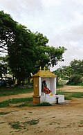 Kunigal Temple
 -
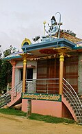 Shiva temple
 -
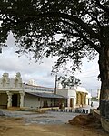 Kunigal promenade
 -
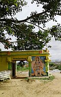 Kunigal Lake
 -
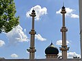 Masjid Al Rayyan, Ring Road Tumkur City
 -
 Jamia Masjid Sira
 -
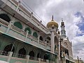 Masjid e Aqsa, Tumkur City
 -
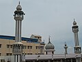 Makka Masjid, Barlane Tumkur City


.jpg)
Top Tourist spots[edit | edit source]
- Mandaragiri
- Siddaganga Matha
- Devarayanadurga
- Namada Chilume
- Shimsha Markonahalli Dam
- Madhugiri - Monolithic Hill, Fort
- Pavagada Solar Park
- Kunigal Stud Farm
- Yedeyur
- Goravanahalli Mahalakshmi Temple
- Kasturi Rangappa Nayaka Fort
- Kaidala Sree channakeshava temple
- Nijagal Fort
- Jayamangali Blackbuck Conservation Reserve
- Siddara betta
- Huliyurdurga
- Borana kanive dam, Chikkanayakanahalli
- Hutridurga, Kunigal
Notable people[edit | edit source]
Social service[edit | edit source]
Actors[edit | edit source]
- Achyuth Kumar, actor
- Arjun Sarja, actor
- Ashika Ranganath, actress
- Jaggesh, actor
- Komal Kumar, actor and comedian
- Lohithaswa T.S actor, writer
- Manjula, actress
- Narasimharaju, Indian theatre and film actor
- Pavan Wadeyar, Kannada movie Director
- Rangayana Raghu, Actor and Comedian
- Tabla Nani, actor and Comedian
- Sharath Lohithaswa, actor
- Siddhanth, actor
- Sudha Rani, actress
- Suman Ranganath, actress
- Umang Jain, actress
- Umashree, actress
Arts[edit | edit source]
- Gubbi Veeranna, theater director
- T. Sunandamma, writer and humorist
- Renuka Kesaramadu, painter and sculptor
- Amarashilpi Jakanachari, sculptor
- Baraguru Ramachandrappa, film director and writer
- Chandrika Gururaj, playback singer
Writers[edit | edit source]
- K. B. Siddaiah, professor, poet, and social activist
Athletes[edit | edit source]
- Poll Shyamsunder, cricketer
- Poll Ashokanand, cricketer
Politicians[edit | edit source]
- G. Parameshwara, former Deputy Chief Minister of Karnataka
- T. B. Jayachandra, former Law Minister of Karnataka
- G. S. Basavaraj, Indian politician
- S. Mallikarjunaiah, Indian politician
- K. Lakkappa, Indian politician
Others[edit | edit source]
- C. P. Sadashivaiah, agriculture scientist
- Raja Ramanna, physicist[circular reference]
- M. S. Ramaiah, founder of MSR group of institutions
Towns and villages[edit | edit source]
- Amruthur
- Bajagur
- Hagalavadi
- Kenkere
- Kottanahalli
- Mallasandra
- Marconahalli
- Shravandanahalli
- Yalachigere
See also[edit | edit source]
References[edit | edit source]
- ↑ "District Administration". tumkurzillapanchayat.gov.in.
- ↑ "Karnataka Government". www.karnataka.gov.in.
- ↑ "Karnataka govt announces district in-charge ministers, CM Yediyurappa retains Bengaluru". The News Minute. 16 September 2019.
- ↑ Staff Correspondent (12 May 2016). "JD(S) bags president post in Tumakuru ZP" – via www.thehindu.com.
{{cite web}}:|author=has generic name (help) - ↑ "Districts in Karnataka". Karnataka.com. 14 July 2013.
- ↑ "National Portal of India". www.india.gov.in. Retrieved 21 June 2022.
- ↑ 7.0 7.1 "Most Populous Districts in Karnataka". WorldlistMania. 31 January 2016. Retrieved 21 June 2022.
- ↑ 8.0 8.1 "Tumakuru sets a green example". www.downtoearth.org.in. Retrieved 31 January 2021.
- ↑ "Transport Department,Karnataka". etc.karnataka.gov.in. Retrieved 5 June 2024.
- ↑ Kavitha R (1993). The Cholas of Nidugal a Study. Karnatak University. p. 151.
- ↑ "Reminiscences of Life in Mysore, South Africa, and Burmah". G. Herbert. 30 June 1882 – via Internet Archive.
- ↑ http://www.tumkur.nic.in Tumakuru District Gazetteer
- ↑ "Tumkur District Population, Karnataka, List of Taluks in Tumkur". Censusindia2011.com. Retrieved 31 January 2021.
- ↑ 14.0 14.1 14.2 14.3 14.4 14.5 "District Census Handbook: Tumkur" (PDF). censusindia.gov.in. Registrar General and Census Commissioner of India. 2011.
- ↑ "Constituencies | District Tumkur, Government of Karnataka | India". Retrieved 31 January 2021.
- ↑
 One or more of the preceding sentences incorporates text from a publication now in the public domain: Chisholm, Hugh, ed. (1911). "Tumkur". Encyclopædia Britannica. Vol. 27 (11th ed.). Cambridge University Press. p. 370.
- ↑ Staff Correspondent (26 September 2008). "Search on for tiger in Tumakuru district". The Hindu. Archived from the original on 29 September 2008. Retrieved 18 February 2011.
{{cite news}}:|author=has generic name (help) - ↑ "Census of India Website : Office of the Registrar General & Census Commissioner, India". www.censusindia.gov.in.
- ↑ "Table C-01 Population by Religion: Karnataka". censusindia.gov.in. Registrar General and Census Commissioner of India. 2011.
- ↑ US Directorate of Intelligence. "Country Comparison:Population". Archived from the original on 13 June 2007. Retrieved 1 October 2011.
Kuwait 2,595,62
- ↑ "2010 Resident Population Data". U. S. Census Bureau. Retrieved 30 September 2011.
Nevada 2,700,551
- ↑ 22.0 22.1 "Table C-16 Population by Mother Tongue: Karnataka". www.censusindia.gov.in. Registrar General and Census Commissioner of India.
.png)