


Created page with "{{Use dmy dates|date=June 2020}} {{Use Indian English|date=June 2017}} {{Infobox settlement | name = Bekal Fort | official_name =..." |
robot: Create/update articles. If there is a mistake please report on my talk page. |
||
| (One intermediate revision by one other user not shown) | |||
| Line 8: | Line 8: | ||
| other_name = | | other_name = | ||
| settlement_type = | | settlement_type = | ||
| image_skyline = | | image_skyline = Bakel Fort Beach Kasaragod7.jpg | ||
| image_alt = | | image_alt = | ||
| image_caption = Bekal Fort in Kasargod, Kerala | | image_caption = Bekal Fort in Kasargod, Kerala | ||
| Line 36: | Line 36: | ||
| utc_offset1 = +5:30 | | utc_offset1 = +5:30 | ||
}} | }} | ||
'''Bekal Fort''' | '''Bekal Fort''' is a medieval fort built by Shivappa Nayaka of Keladi in 1650 AD, at [[Bekal]]. It is the largest fort in [[Kerala]], spreading over {{convert|40|acre|m2}}. | ||
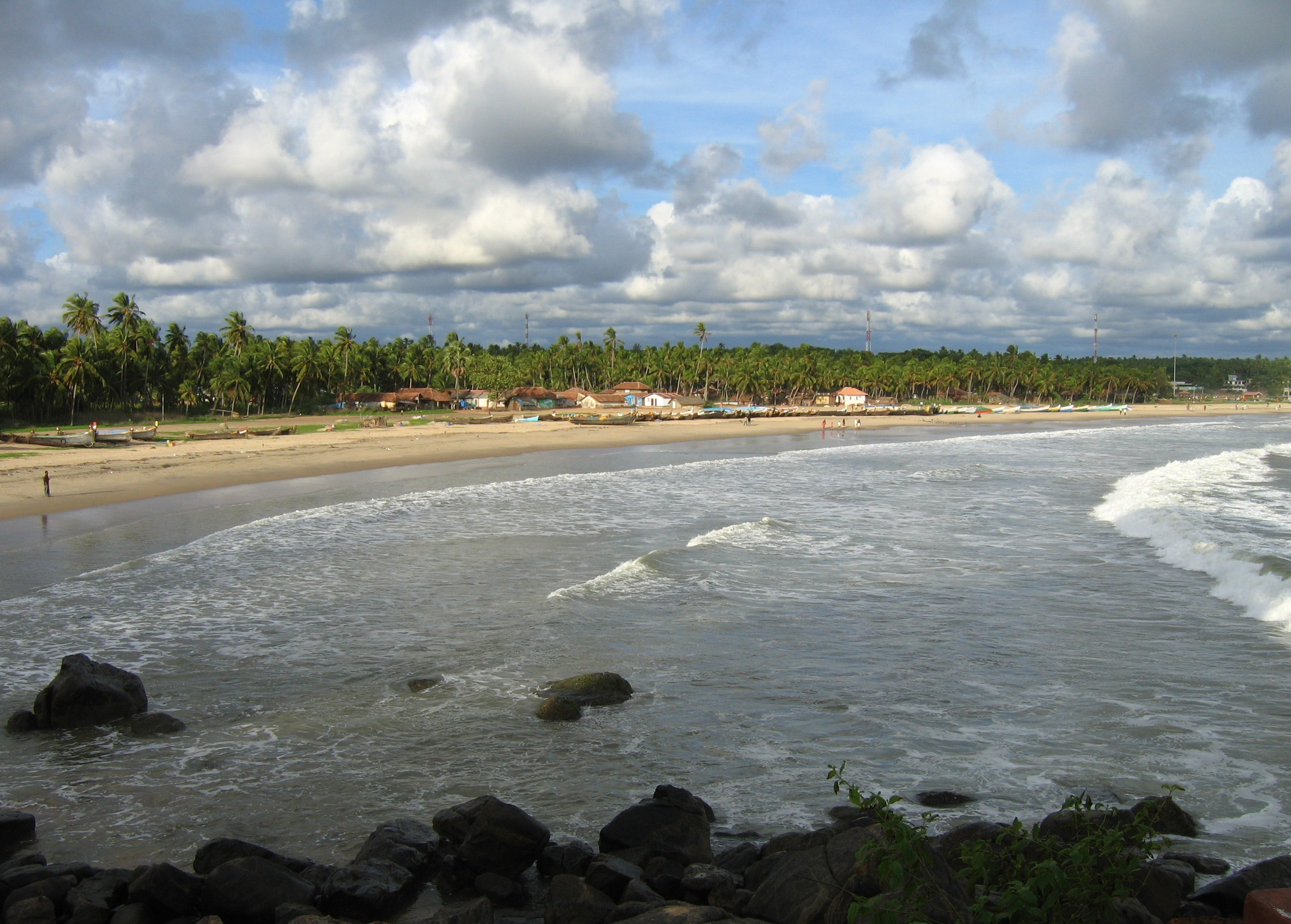
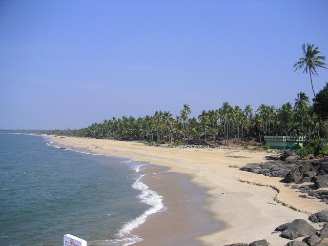
[[File:Bakel Fort Beach Kasaragod4.jpg|thumbnail|Bekal | [[File:Bakel Fort Beach Kasaragod4.jpg|thumbnail|Bekal Fort Beach, a popular beach in Kerala.]] | ||
[[File:Bakel fort from beach.jpg|thumb|View from beach]] | [[File:Bakel fort from beach.jpg|thumb|View from beach]] | ||
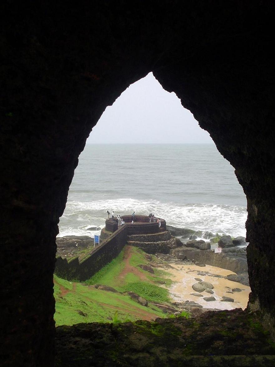
[[File:Bekalfortviewofsea.jpg|thumb|West view]] | [[File:Bekalfortviewofsea.jpg|thumb|West view]] | ||
| Line 51: | Line 51: | ||
An important feature is the water-tank, magazine and the flight of steps leading to an observation tower built by [[Tipu Sultan]].<ref name="khas" /> Standing at the centre of the fort, this offers views of the coastline and the towns of [[Kanhangad]], [[Pallikkara II|Pallikkara]], Bekal, Mavval, Kottikkulam, and Uduma. | An important feature is the water-tank, magazine and the flight of steps leading to an observation tower built by [[Tipu Sultan]].<ref name="khas" /> Standing at the centre of the fort, this offers views of the coastline and the towns of [[Kanhangad]], [[Pallikkara II|Pallikkara]], Bekal, Mavval, Kottikkulam, and Uduma. | ||
The fort's zigzag entrance and surrounding trenches reveal its defensive strategy. Holes on the outer walls are designed to defend the fort effectively from naval attacks. The upper holes meant for aiming at the farthest targets; lower holes below for striking as enemy nearer and the lowest holes to attacking enemy closest to the fort.<ref>https://www.keralatourism.org/destination/bekal-kasaragod/259/</ref> | The fort's zigzag entrance and surrounding trenches reveal its defensive strategy. Holes on the outer walls are designed to defend the fort effectively from naval attacks. The upper holes meant for aiming at the farthest targets; lower holes below for striking as enemy nearer and the lowest holes to attacking enemy closest to the fort.<ref>{{Cite web|url=https://www.keralatourism.org/destination/bekal-kasaragod/259/|title = Bekal Beach in Kasaragod}}</ref> | ||
Its solid construction resembles the [[Thalassery]] Fort and the St. Angelo Fort at [[Kannur]] built by the Dutch . | Its solid construction resembles the [[Thalassery]] Fort and the St. Angelo Fort at [[Kannur]] built by the Dutch . | ||
| Line 67: | Line 67: | ||
== Tourism == | == Tourism == | ||
India declared Bekal Fort a special tourism area in 1992<ref name=Deccan>{{cite news|title=Bastions of valour and victory|url=http://www.deccanherald.com/content/422339/bastions-valour-victory.html|access-date=19 January 2015|issue=Bangalore|work=Deccan Herald|date=29 July 2014}}</ref> and formed Bekal Tourism Development Corporation three years later to promote it.<ref>{{cite web|title=BEKAL|url=http://kasargod.nic.in/index_main.htm|access-date=20 May 2012|archive-url=https://web.archive.org/web/20120414141741/http://kasargod.nic.in/index_main.htm|archive-date=14 April 2012|url-status=dead}}</ref> The song 'Uyire' (Tamil) from the movie [[Bombay (film)|Bombay]] | India declared Bekal Fort a special tourism area in 1992<ref name=Deccan>{{cite news|title=Bastions of valour and victory|url=http://www.deccanherald.com/content/422339/bastions-valour-victory.html|access-date=19 January 2015|issue=Bangalore|work=Deccan Herald|date=29 July 2014}}</ref> and formed Bekal Tourism Development Corporation three years later to promote it.<ref>{{cite web|title=BEKAL|url=http://kasargod.nic.in/index_main.htm|access-date=20 May 2012|archive-url=https://web.archive.org/web/20120414141741/http://kasargod.nic.in/index_main.htm|archive-date=14 April 2012|url-status=dead}}</ref> The fort has been featured in the song 'Uyire' (Tamil) from the movie [[Bombay (film)|Bombay]] and the song ‘Dwadashiyil’ from the [[Malayalam]] movie [[Madhuranombarakattu]]. | ||
==Transportation== | ==Transportation== | ||
| Line 83: | Line 83: | ||
File:Bekal Fort watch tower view.jpg|A view of sea from watch tower | File:Bekal Fort watch tower view.jpg|A view of sea from watch tower | ||
</gallery> | </gallery> | ||
==In popular culture== | |||
The song 'Uyire Uyire' from the film [[Bombay (film)|Bombay]] was shot in Bekal Fort.<ref name="HT">{{cite news |last= Bari|first= Prachi|date=3 July 2010|title=Indian locations provide stunning backdrops for film shoots|url=https://www.thehindu.com/news/cities/chennai/Indian-locations-provide-stunning-backdrops-for-film-shoots/article16182372.ece|newspaper=The Hindu| access-date= 29 October 2022}}</ref> | |||
==See also== | ==See also== | ||
| Line 132: | Line 135: | ||
}} | }} | ||
{{Forts in India}} | |||
{{Waters of Kerala}} | |||
{{Kasaragod district}} | |||
{{Tourism in Kerala}} | |||
{{Coord|12|23|32|N|75|1|57|E|display=title}} | {{Coord|12|23|32|N|75|1|57|E|display=title}} | ||
Latest revision as of 16:51, 29 October 2022
Bekal Fort | |
|---|---|
| Bekal Fort | |
 Bekal Fort in Kasargod, Kerala | |
  Bekal Fort  Bekal Fort | |
| Coordinates: 12°22′00″N 75°03′00″E / 12.3667°N 75.05°E | |
| Country |  India India |
| State | Kerala |
| District | Kasargod District |
| Region | North Malabar (Kolathnadu) |
| Taluk | Hosdurg |
| Language | Malayalam |
| Nearest cities | Kanhangad, Kasargod, Kannur, Mangalore |
| Time zone | UTC+5:30 (IST) |
Bekal Fort is a medieval fort built by Shivappa Nayaka of Keladi in 1650 AD, at Bekal. It is the largest fort in Kerala, spreading over 40 acres (160,000 m2).


Structure[edit | edit source]
The fort appears to emerge from the sea. Almost three-quarters of its exterior is in contact with water. Bekal fort was not an administrative centre and does not include any palaces or mansions.
An important feature is the water-tank, magazine and the flight of steps leading to an observation tower built by Tipu Sultan.[1] Standing at the centre of the fort, this offers views of the coastline and the towns of Kanhangad, Pallikkara, Bekal, Mavval, Kottikkulam, and Uduma.
The fort's zigzag entrance and surrounding trenches reveal its defensive strategy. Holes on the outer walls are designed to defend the fort effectively from naval attacks. The upper holes meant for aiming at the farthest targets; lower holes below for striking as enemy nearer and the lowest holes to attacking enemy closest to the fort.[2]
Its solid construction resembles the Thalassery Fort and the St. Angelo Fort at Kannur built by the Dutch .
History[edit | edit source]
During the Perumal Age Bekal was a part of Mahodayapuram. Following the decline of Mahodayapuram Perumals, Bekal came under the sovereignty of the Mushika or Kolathiri or Chirakkal Royal Family in the 12th century.[3] The maritime importance of Bekal increased under the Kolathiris and Malabar became an important port town.
After the Battle of Talikota in 1565 feudatory chieftains including the Keladi Nayakas (Ikkeri Nayaks) became powerful in the region. Bekal served as a hub to first dominate, then later defend Malabar. The economic importance of this port town prompted the Nayakas to fortify Bekal subsequently. Hiriya Venkatappa Nayaka initiated the construction of the fort and it was completed in 1650 AD by Shivappa Nayaka. Chandragiri fort near Kasargod was also built during this period.[1]
The struggles between the Kolathiries and nayaks to hold this area ended when Hyder Ali conquered the Nayakas and Bekal fell into the hands of Mysore kings.[1]
It was an important military station for Tipu Sultan when he led a military expedition to capture Malabar. The coins and artefacts found in archaeological excavations at Bekal fort indicate the strong presence of Mysore Sultans. Tipu Sultan's death during the Fourth Anglo-Mysore War ended Mysorean control in 1799. The fort came under the British East India Company's control[1][4] and became the headquarters of the Bekal Taluk of South Canara District in Bombay presidency. The political and economic importance of Bekal and its port declined.
Nearby the Mukhyaprana Temple of Hanuman and ancient Muslim mosque bear testimony to the religious harmony that prevailed in the area.
Tourism[edit | edit source]
India declared Bekal Fort a special tourism area in 1992[5] and formed Bekal Tourism Development Corporation three years later to promote it.[6] The fort has been featured in the song 'Uyire' (Tamil) from the movie Bombay and the song ‘Dwadashiyil’ from the Malayalam movie Madhuranombarakattu.
Transportation[edit | edit source]
Local roads connect to Mangalore in the north and Calicut in the south. The nearest railway station is Bekal Fort Railway Station, Kanhangad Railway Station and Kotikulam Railway Station on Mangalore-Palakkad line. There are airports at Mangalore, Kannur and Calicut.

-
 A view of Bekalfort watch tower
 -
 A view of sea shore from Bekal fort
 -
 A view of sea shore from Bekal fort
 -
 A view of sea shore from Bekal fort
 -
 Cannonballs kept at Bekal fort
 -
 A view of sea shore from Bekal fort
 -
 A view of Bekal fort from its watch tower
 -
 A view of sea from watch tower


In popular culture[edit | edit source]
The song 'Uyire Uyire' from the film Bombay was shot in Bekal Fort.[7]
See also[edit | edit source]
- Mangalore
- Kasargod
- Kanhangad
- Hosdurg Fort
- Panathur
- Kannur Fort
- Thalassery Fort
- Mysorean invasion of Malabar
- SI-MET College of Nursing, Uduma
References[edit | edit source]
- ↑ 1.0 1.1 1.2 1.3 Kasargod: History & Society
- ↑ "Bekal Beach in Kasaragod".
- ↑ The Hindu, 22 Oct 2005
- ↑ Madras District Manual
- ↑ "Bastions of valour and victory". Deccan Herald. No. Bangalore. 29 July 2014. Retrieved 19 January 2015.
- ↑ "BEKAL". Archived from the original on 14 April 2012. Retrieved 20 May 2012.
- ↑ Bari, Prachi (3 July 2010). "Indian locations provide stunning backdrops for film shoots". The Hindu. Retrieved 29 October 2022.
- Sturrock, John (1894). History of the Tuluvas. Madras District Manual. Madras Gazette.
- C, Balan (2001). Kasargod: History & Society. District Panchayat, Kasargod.
- Prashanth G.N. (22 October 2005). "Fort by the Sea". The Hindu. Archived from the original on 8 January 2008.
- "Bekal Fort, Kasargod". Archaeological Survey of India.